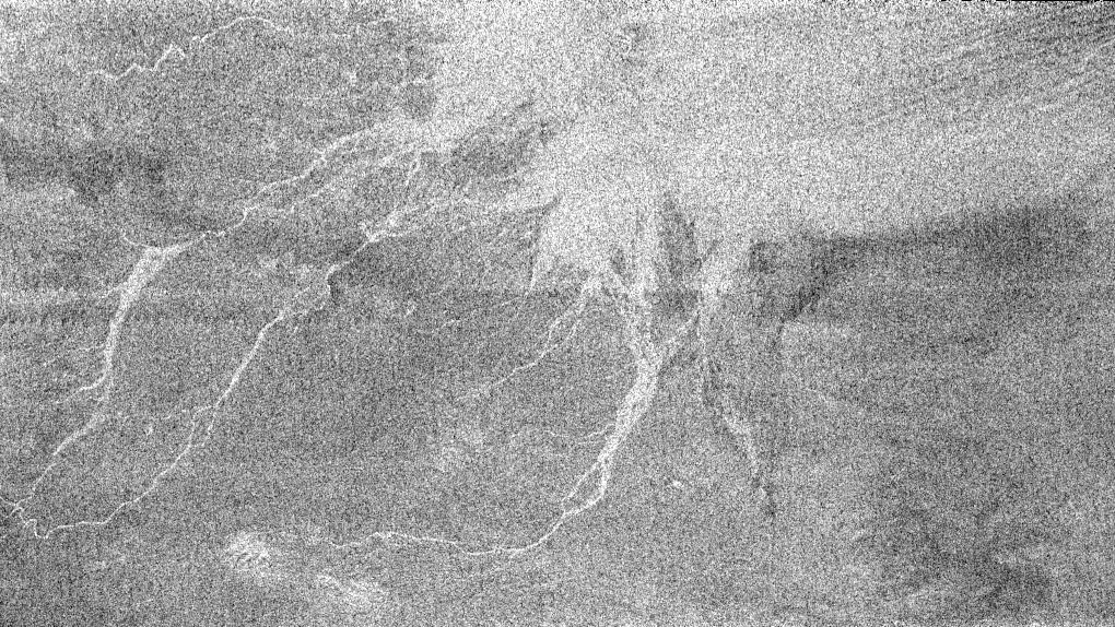
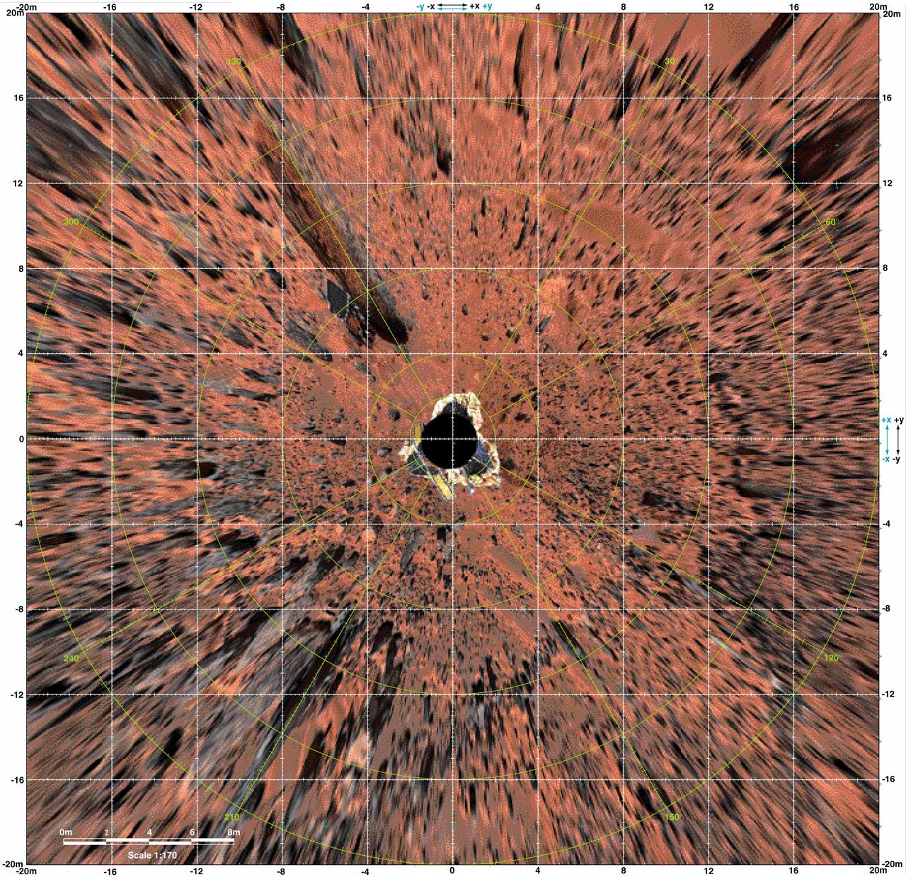
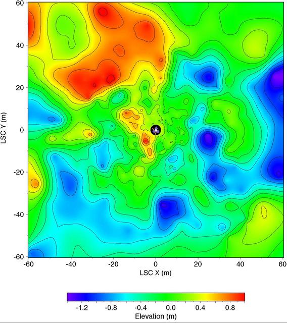
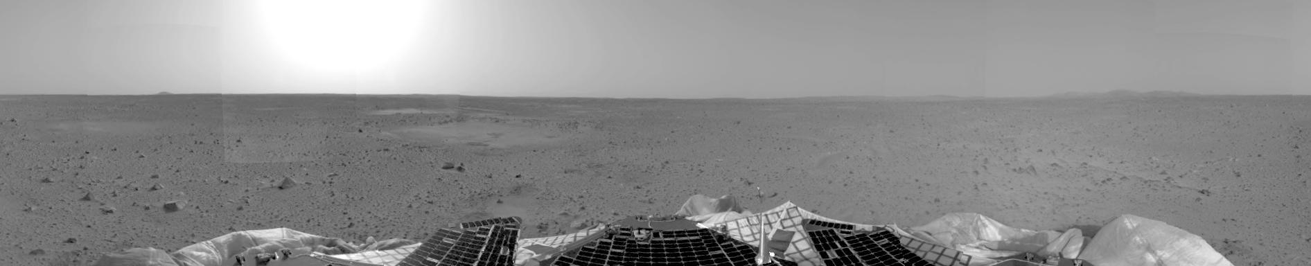
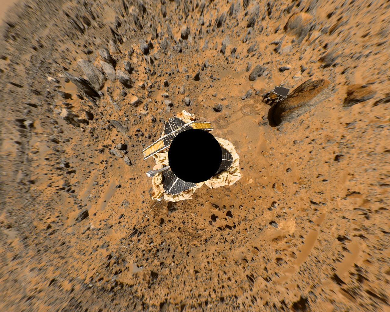
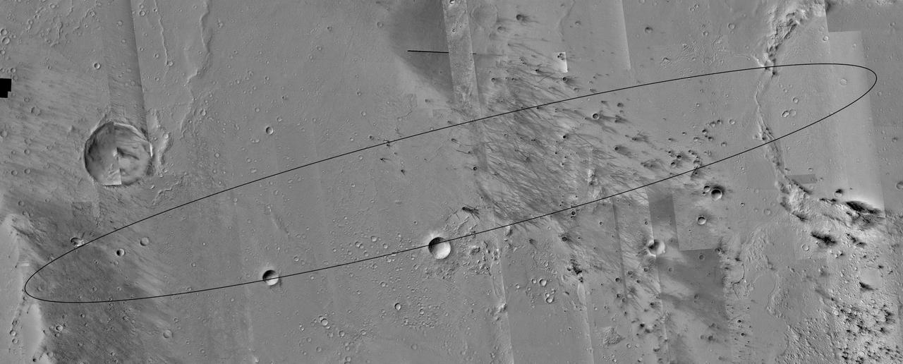
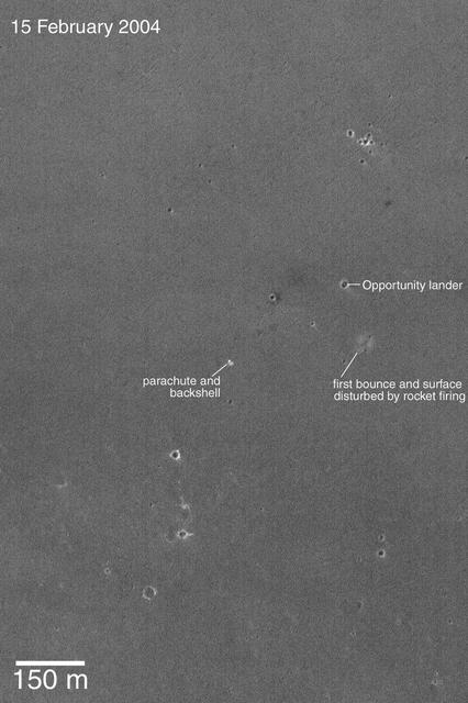
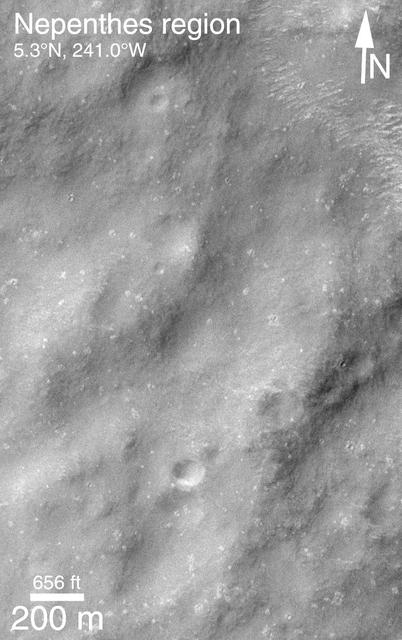
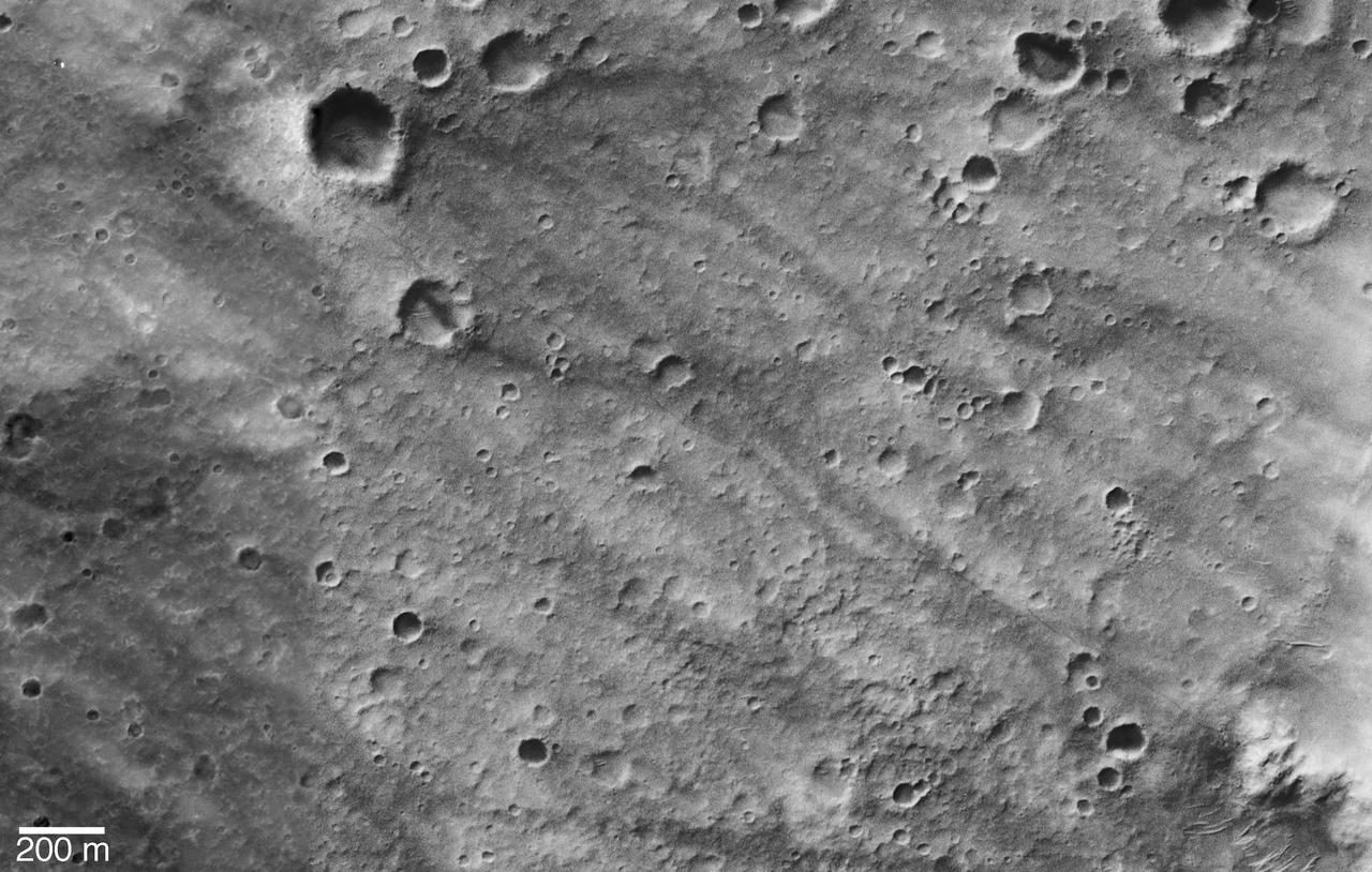
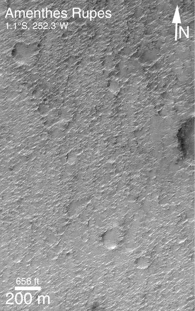
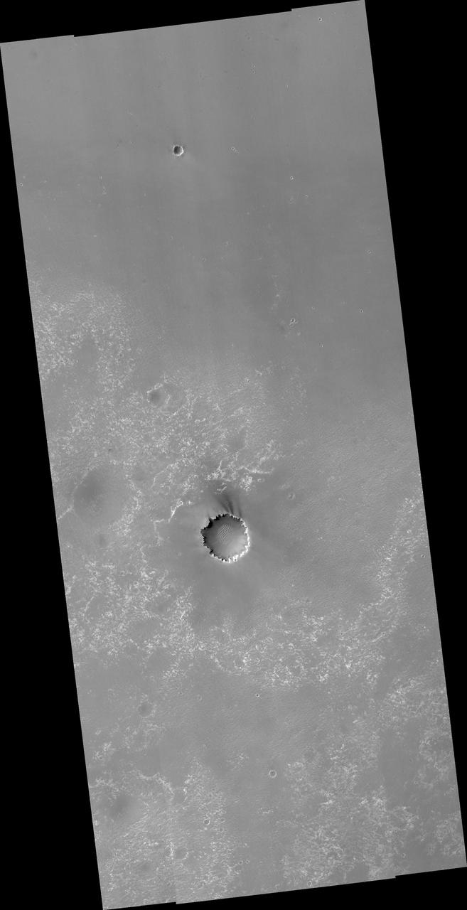
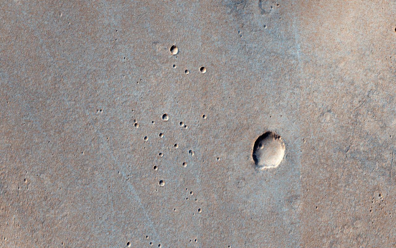
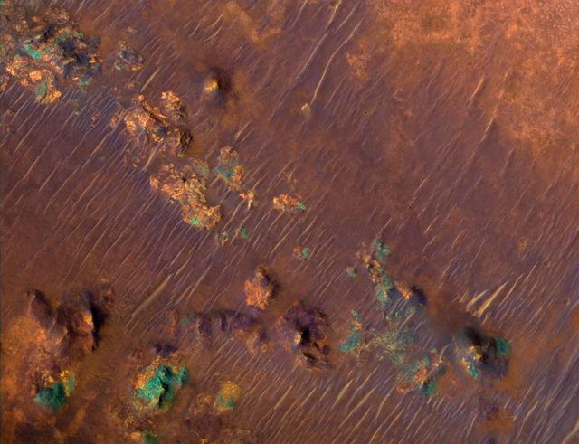
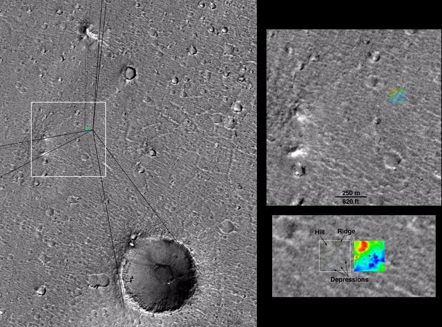
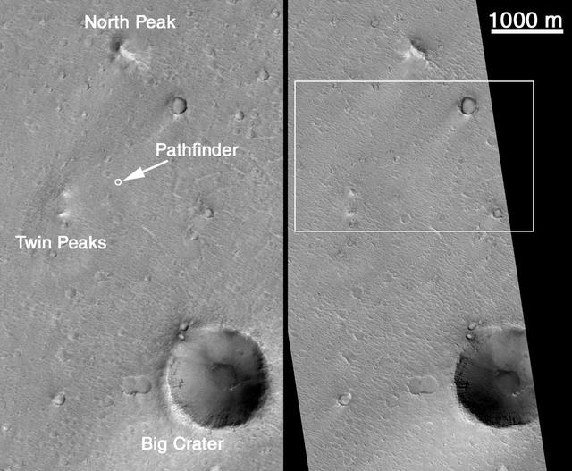
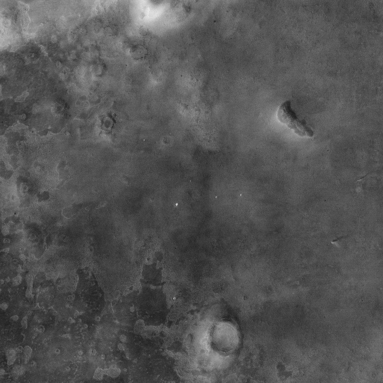
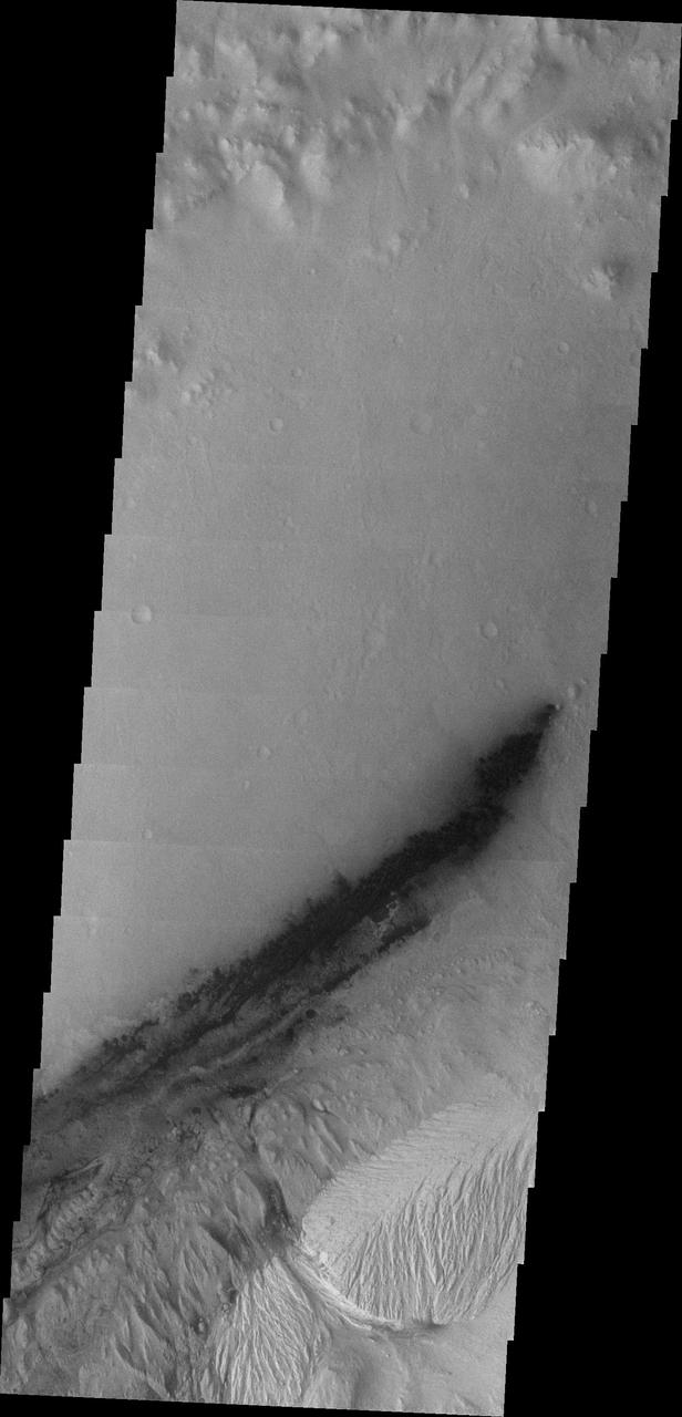
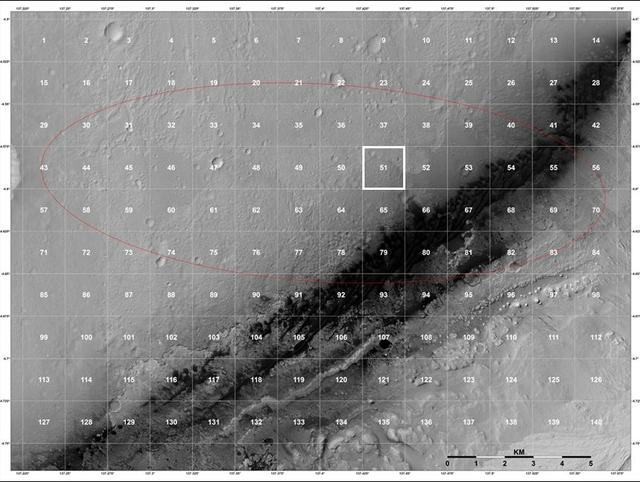
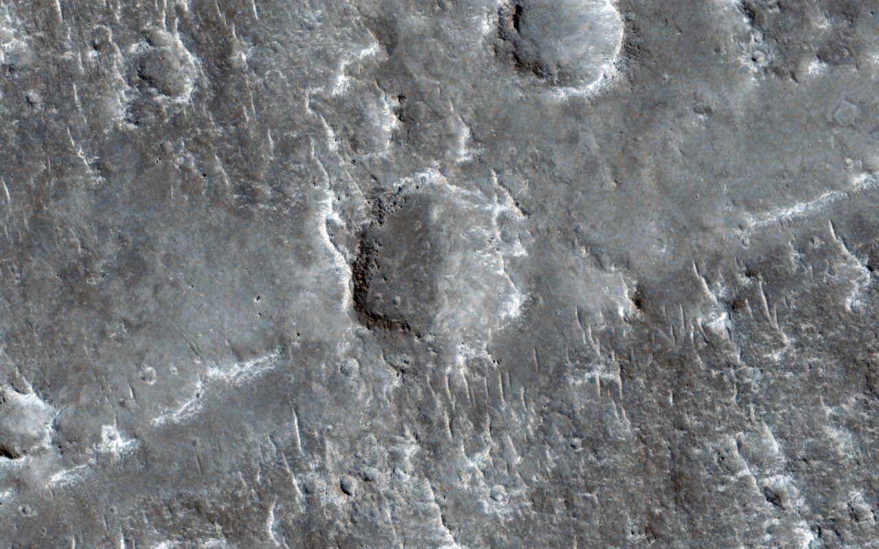
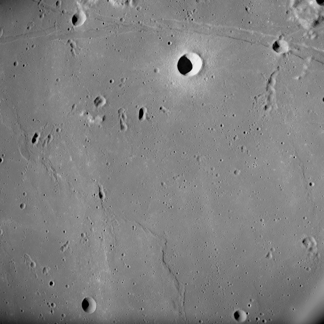
Region of Pathfinder Landing Site
Six Landing Sites on Mars
Huygen Landing Site
Huygen Landing Site
Mars Pathfinder Landing Site
Huygens Landing Site Animation
Huygens Landing Site Similarities
Pinpointing Huygens Landing Site
Pathfinder Landing Site in Color
Spectral Mapping of Landing Site
Huygens Landing Site
MPL LANDING SITE - DEM
MPL LANDING SITE CORRIDOR
Spirit Landing Site in Infrared
View from above Landing Site
Location of the NEAR Shoemaker Landing Site
Overhead View of Pathfinder Landing Site
Topographic Map of Pathfinder Landing Site
Mars Pathfinder Landing Site and Surroundings
Left Panorama of Spirit Landing Site
First Look at Spirit at Landing Site
Birdseye View of Pathfinder Landing Site
Mars 98 Polar landing site
Hematite Deposits at Opportunity Landing Site
Right Panorama of Spirit Landing Site
Orientation of Windtails at Pathfinder Landing Site
Overhead view of Pathfinder Landing Site
Mars Exploration Rover MER-A Spirit Landing Site
Mawrth Vallis, a Finalist Not Selected as a Landing Site for Curiosity
Rock and Soil Types at Pathfinder Landing Site
A Closer Hubble Encounter With Mars - Pathfinder Landing Site
Third MOC View of Opportunity Landing Site
MOC Providing Clues For Future Landing Site Selection
Mars Exploration Rover Landing Site at Gusev Crater
Titan Landing Site Seen From Cassini
Pathfinder Landing Site Observed by Mars Orbiter Camera
Wheel Tracks from Landing Site to Hills
First Best-Guess View of Huygens Landing Site
Eberswalde Crater, a Finalist Not Selected as Landing Site for Curiosity
MOC Providing Clues For Future Landing Site Selection
Mars Exploration Rover Landing Site at Meridiani Planum
Gale Crater, the Selected Landing Site for Curiosity
Gypsum Dunes North of Phoenix Landing Site
Latest Color View of Polar Landing Site
Phoenix Landing Site Indicated on Global View
Coordinate Map of Rocks at Pathfinder Landing Site
Wind Drifts at Viking 1 Landing Site
This annotated image depicts the backup landing site Site C chosen for ESA Rosetta spacecraft Philae lander.
Rosetta Lander Backup Landing Site
S72-01718 (July 1972) --- A photographic illustration of a full moon showing the location of the Apollo 17 landing site on the lunar nearside. The black dot pinpointing the landing site is in the Taurus-Littrow area at the southeastern edge of the Sea of Serenity. The coordinates of the landing point are 30 degrees 44 minutes 58 seconds east longitude and 20 degrees 9 minutes 50 seconds north latitude.
Photograph of Apollo 17 lunar landing site location
NASA Lunar Reconnaissance Orbiter first look at the Apollo landing sites.
LROC First Look at the Apollo Landing Sites
This image from NASA Mars Reconnaissance Orbiter spacecraft is of a landing site that the flattest, safest place on Mars: part of Meridiani Planum, close to where the Opportunity rover landed.  In March 2016, the European Space Agency in partnership with Roscosmos will launch the ExoMars Trace Gas Orbiter. This orbiter will also carry an Entry, Descent, and Landing Demonstration Module (EDM): a lander designed primarily to demonstrate the capability to land on Mars. The EDM will survive for only a few days, running on battery power, but will make a few environmental measurements.  The landing site is the flattest, safest place on Mars: part of Meridiani Planum, close to where the Opportunity rover landed. This image shows what this terrain is like: very flat and featureless. A full-resolution sample reveals the major surface features: small craters and wind ripples. HiRISE has been imaging the landing site region in advance of the landing, and will re-image the site after landing to identify the major pieces of hardware: heat shield, backshell with parachute, and the lander itself. The distribution of these pieces will provide information about the entry, descent and landing.  http://photojournal.jpl.nasa.gov/catalog/PIA20159
A Landing Site for ExoMars 2016
S72-01716 (July 1972) --- An oblique view of the Taurus-Littrow area on the lunar nearside, as photographed from the Apollo 15 spacecraft in lunar orbit. This is an enlarged view. The "X" marks the landing site of the scheduled Apollo 17 lunar landing mission. The overlay points out several features in the photograph. The coordinates of the Apollo 17 touchdown point are 30 degrees 44 minutes 58 seconds east longitude and 20 degrees 9 minutes 50 seconds north latitude.
Photograph of Apollo 17 lunar landing site location
An annotated mosaic from the Rosetta spacecraft shows Site J, the primary landing site on comet 67P/Churyumov-Gerasimenko for the mission Philae lander.
Rosetta Comet Landing Site Close Up
This annotated image depicts four of the five potential landing sites for ESA Rosetta mission Philae lander.
Four Rosetta Candidate Landing Sites
The area in and near the landing site selected for landing of NASA Mars Science Laboratory offers a diversity of possible targets for examination by the mission rover, Curiosity.
Attractions for Study in and near Curiosity Selected Landing Site
This 70mm frame, showintg the Apollo 17 Command/Service Modules (CSM) backdropped against the Taurus-Littrow landing site, was exposed from the lunar module (LM) prior to the LM's touchdown on the lunar surface.
Apollo 17 Command/Service Modules backdropped against lunar landing site
Mars Polar Lander Landing Site Noon-time Temperatures
Color Image of Nili Fossae Trough, a Candidate MSL Landing Site
Precise 3D Measurements of Objects at Apollo 14 Landing Site
Precise 3-D Measurements of Objects at Apollo 14 Landing Site
Proposed Mars Polar Lander Landing Site Global Perspective
Proposed Mars Polar Lander Landing Site Perspective View 3
Mars Exploration Rover MER-B Opportunity Landing Site
Mars Pathfinder First Anniversary Special -- Refined Landing Site Location
Spectrometer Images of Candidate Landing Sites for Next Mars Rover
More Than 60 Sites Considered for Next Mars Rover Landing
MOC Highest Resolution View of Mars Pathfinder Landing Site
Color Image of Layers in Holden Crater, a Candidate MSL Landing Site
Context Camera Spots Dust Devils at Phoenix Landing Site
Proposed Mars Polar Lander Landing Site Perspective View 1
Proposed Mars Polar Lander Landing Site Perspective View 2
Proposed Mars Polar Lander Landing Site Flat Map
HiRISE plays an important role in finding suitable landing sites for future rover missions. Scientists have narrowed down the candidate landing sites for the upcoming European ExoMars rover mission to two regions: the plains of Oxia and Mawrth Vallis.  Images covering these areas aid scientists in picking a location that will be both scientifically interesting and a safe place to land and operate. HiRISE pictures help to assess the risk for each particular location so that a final landing site can be selected.  If you look very closely, the image may appear hazy. This is due to additional dust lingering in the atmosphere from the massive summer global dust storm at the time we acquired this observation. ExoMars is due to launch to Mars in 2020.  https://photojournal.jpl.nasa.gov/catalog/PIA22805
An ExoMars Landing Site
AS10-27-3907 (18-26 May 1969) --- Apollo 10 westward view across Apollo Landing Site 3 in the Central Bay. Apollo Landing Site 3 is in the middle distance at the left margin of the pronounced ridge in the left half of the photograph. Bruce, the prominent crater, near the bottom of the scene, is about 6 kilometers (3.7 statute miles) in diameter. Topographic features on the surface of the Central Bay are accentuated by the low sun angle. Sun angles range from near 6 degrees at the bottom of the photograph to less than one degree at the top.
Apollo 10 view across Apollo Landing Site 3 in the Central Bay
This annotated image depicts two of the five potential landing sites for ESA Rosetta mission Philae lander.
Two Small-Lobe Landing Sites for Rosetta
This annotated image depicts the two potential landing sites for ESA Rosetta Philae lander that are on the comet larger lobe.
Two Large-Lobe Landing Sites for Rosetta
This image captured by NASA 2001 Mars Odyssey spacecraft shows Gale Crater, which contains the landing site of the Mars rover, Curiosity; the rover will have to navigate sand dunes to get to Mt. Sharp.
Curiosity Landing Site
S72-49761 (October 1972) --- An artist's concept illustrating the topographical layout of the Taurus-Littrow landing site of the Apollo 17 lunar landing mission. The Lunar Module touchdown point is in the center of the smooth area in the middle of the picture. The imposing mountain in the center is South Massif. A portion of North Massif is in the lower right corner of the photograph. Note the ridge-like feature extending from South Massif to North Massif. The southern portion of the ridge is called Lee Scarp and the northerly portion Lincoln Scarp. (This concept is by JSC artist Jerry Elmore).
Artist's concept of topographical layout of Taurus-Littrow landing site
AS11-37-5437 (20 July 1969) --- The approach to Apollo Landing Site 2 in southwestern Sea of Tranquility is seen in this photograph taken from the Apollo 11 Lunar Module (LM) in lunar orbit. When this picture was made, the LM was still docked to the Command and Service Modules (CSM). Site 2 is located just right of center at the edge of the darkness. The crater Maskelyne is the large one at the lower right. Hypatia Rille (U.S. 1) is at upper left, with the crater Moltke just to the right (north) of it. Sidewinder Rille and Diamondback Rille extend from left to right across the center of the picture. This view looks generally west.
View of approach to Apollo Landing Site 2 in southwestern Sea of Tranquility
This Mars view looks northeast from Nasa's Viking 1 and completes the 360 panorama of the landing site begun earlier with the spacecraft's other camera. A layer of haze can be seen in the Martian sky. Large dark boulders dominate the scene. The largest boulder (center) is about 3 meters (10 feet) wide and one meter (3 feet) high. Rocks in the foreground are lighter and appear mottled. The rocks may have been derived from lava flows or stream deposits which are visible on orbiter images. These deposits may have been redistributed by impact craters. The fine material visible between the rocks has dune morphology and appears to have been deposited by wind.  http://photojournal.jpl.nasa.gov/catalog/PIA00387
Northeast View from Viking Landing Site
This stereo anaglyph shows NASA Mars rover Curiosity where it landed on Mars within Gale Crater, at a site now called Bradbury Landing. You need 3-D glasses to view this image.
Curiosity at Bradbury Landing Site in 3-D
This image shows a possible landing site for the 2020 Mission: Jezero Crater, as seen by NASA Mars Reconnaissance Orbiter.  It's not only when trying to find a scientifically interesting place to land that the high-resolution images from HiRISE come in handy: it's also to identify potential hazards within a landing ellipse.  This is one of the trickier aspects of selecting landing sites on Mars: a place to do good science but also where the risks of landing are low. Jezero Crater is an ancient crater where clay minerals have been detected, and with a delta deposit indicating that water was once flowing into a lake. Since clays form the in presence of water, this crater would be a very good candidate for a lander to explore and build on what we've learned from the Mars Science Laboratory. Could some form of ancient life have existed here and for how long?  http://photojournal.jpl.nasa.gov/catalog/PIA19303
A Possible Landing Site for the 2020 Mission: Jezero Crater
This image is of Jezero Crater on Mars, the landing site for NASA's Mars 2020 mission. It was taken by instruments on NASA's Mars Reconnaissance Orbiter (MRO), which regularly takes images of potential landing sites for future missions.  On ancient Mars, water carved channels and transported sediments to form fans and deltas within lake basins. Examination of spectral data acquired from orbit show that some of these sediments have minerals that indicate chemical alteration by water. Here in Jezero Crater delta, sediments contain clays and carbonates.  https://photojournal.jpl.nasa.gov/catalog/PIA23239
Jezero Crater, Mars 2020's Landing Site
AS10-27-3908 (18-26 May 1969) --- An Apollo 10 photograph of the lunar nearside looking westward across Apollo Landing Site 3 in Central Bay. Bruce, the prominent crater in the lower right corner, is about 3.7 statute miles in diameter. Topographic features on the surface of Central Bay are accentuated by the low sun angle.
Apollo 10 view across Apollo Landing Site 3 in the Central Bay
AS14-69-9560 (February 1971) --- This 500mm vertical frame taken from the Apollo 14 spacecraft is of the Apollo 16 proposed landing site "Descartes".  The actual location of the target area is near the upper left.  This photograph was taken with a 56 degree sun angle.  The large bright crater is approximately one kilometer in diameter and has a distinctive ray pattern which serves as an excellent landmark.
View of Apollo 16 landing sites from Apollo 14 spacecraft
The geological context for the landing site of NASA Curiosity rover is visible in this image mosaic obtained by the High-Resolution Imaging Science Experiment HiRISE camera on NASA Mars Reconnaissance Orbiter.
Staking out Curiosity Landing Site
AS17-134-20435 (10 Dec. 1972) --- Wide-angle view of the Apollo 17 Taurus-Littrow lunar landing site. To the left in the background is the Lunar Module. To the right in the background is the Lunar Roving vehicle. An Apollo 17 crewmember is photographed between the two points. The shadow of the astronaut taking the photograph can be seen in the right foreground.
Wide-angle view of Apollo 17 lunar landing site
This color panorama shows a 360-degree view of the landing site of NASA Curiosity rover, including the highest part of Mount Sharp visible to the rover.
Landing Site Panorama, with the Heights of Mount Sharp
With NASA Mars Reconnaissance Orbiter HiRISE camera and its powerful resolution, other mission teams can request images of potential future landing sites on Mars.
A Possible Landing Site for NASA InSight Mission
This image is a mosaic of 24 orbits of the Navka region of Venus. The image is centered at about 10 degrees south latitude and 335 degrees east longitude. The image is about 400 km (240 miles) across. 'Behepa 8' marks the approximate landing site of the Soviet Venera 8 lander, which took measurements at the surface of Venus in 1972. The Venera 8 lander measured granitic or continental-like materials at the landing site. Magellan data reveals the landing site to lie in a region of plains cut by tectonic ridges and troughs. Volcanic domes and flows are seen throughout the region. Studying the regional setting of the Venera landing sites is important in linking information about surface composition to surface morphology seen in radar images. Resolution of the Magellan data is about 120 meters (400 feet).   http://photojournal.jpl.nasa.gov/catalog/PIA00460
Venus - Venera 8 Landing Site in Navka Region
This map of Mars shows the landing site for NASA's Perseverance rover in relation to those of previous successful Mars missions. The newest addition to the group, Perseverance is set to land in Jezero Crater on Feb. 18, 2021.  https://photojournal.jpl.nasa.gov/catalog/PIA24320
Mars Landing Sites, Including Perseverance (Illustration)
Elysium Planitia, a flat-smooth plain just north of the equator makes for the perfect location from which to study the deep Martian interior.  Interior Exploration using Seismic Investigations, Geodesy and Heat Transport, or InSight, is designed to study the deep interior of Mars. The mission seeks the fingerprints of the processes that formed the rocky planets of the solar system.  Its landing site, Elysium Planitia, was picked from 22 candidates, and is centered at about 4.5 degrees north latitude and 135.9 degrees east longitude; about 373 miles (600 kilometers) from Curiosity's landing site, Gale Crater. The locations of other Mars landers and rovers are labeled.  InSight's scientific success and safe landing depends on landing in a relatively flat area, with an elevation low enough to have sufficient atmosphere above the site for a safe landing. It also depends on landing in an area where rocks are few in number. Elysium Planitia has just the right surface for the instruments to be able to probe the deep interior, and its proximity to the equator ensures that the solar-powered lander is exposed to plenty of sunlight.  https://photojournal.jpl.nasa.gov/catalog/PIA22232
Measuring the Pulse of Mars
AS10-31-4537 (18-26 May 1969) --- This near vertical photograph taken from the Apollo 10 Command and Service Modules shows features typical of the Sea of Tranquility near Apollo Landing Site 2. HOLD PICTURE WITH PRONOUNCED LINEAR FEATURE PARALLEL TO LEFT MARGIN. The proposed landing area for Apollo 11 (Lunar Landing Site 2) is a relatively smooth maria area in the upper right quadrant of the photographed area. Apollo 10 traveled from the bottom to the top of the picture. The prominent linear feature at left is Hypatia Rille (called "U.S. 1" by the Apollo 10 crew). The prominent crater centered in Hypatia Rille at top left is Moltke AC (code name "Chuck Hole"). Moltke, the prominent crater to the right of Hypatia Rille, is centered near 24.2 degrees east longitude, and 0.6 degrees south latitude.
Apollo 10 photograph shows Sea of Tranquility near Apollo Landing Site 2
Out of more than 30 sites considered as possible landing targets for NASA Mars Science Laboratory mission, by November 2008 four of the most intriguing places on Mars rose to the final round of the site-selection process.
Four Finalist Landing Site Candidates for Mars Science Laboratory
This NASA Mars Odyssey image of NASA Viking 1 landing site was taken to commemorate the anniversaries of NASA Apollo 11 landing on the Moon and Viking 1 landing on Mars -- July 20, 1969 and July 20, 1976, respectively.
1st Manned Lunar Landing and 1st Robotic Mars Landing Commemorative Release: Viking 1 Landing Site in Chryse Planitia - Infrared Image
S69-38671 (July 1969) --- A photographic illustration comparing the size of Apollo Landing Site 2 with that of the metropolitan Houston, Texas area.  Site 2 is one of three Apollo 11 lunar landing sites.  This will be the landing site if Apollo 11 is launched on July 16, 1969, as scheduled.  Site 2 is located at 23 degrees 42 minutes 28 seconds east longitude and 0 degrees 42 minutes 50 seconds north latitude in southwestern Mare Tranquillitatis (Sea of Tranquility). (The white overlay is printed over a lunar surface photograph taken from Apollo 10 during its lunar orbit mission and is numbered AS10-31-4537.)
LUNAR LANDING - SITE 2 COMPARISONS
S71-44150 (February 1971) --- A vertical view of the Apollo 16 landing site located in the Descartes area on the lunar nearside. The overlay indicates the location of the proposed touchdown point for the Apollo 16 Lunar Module (LM). Descartes is located west of the Sea of Nectar and southwest of the Sea of Tranquility. This photograph was taken with a 500mm lens camera from lunar orbit by the Apollo 16 crew. Astronauts John W. Young, commander; and Charles M. Duke Jr., lunar module pilot; descended in the Apollo 16 LM "Orion" to explore the Descartes highlands landing site on the moon. Astronaut Thomas K. Mattingly II, command module pilot, remained with the Command and Service Modules (CSM) "Casper" in lunar orbit.
Vertical view of Apollo 16 landing site located Descartes area lunar nearside
Oxia Planum is broad clay-bearing surface between Mawrth and Ares Vallis that has been proposed as a future landing site on Mars. This image is from NASA Mars Reconnaissance Orbiter.
Possible Future Mars Landing Site in Oxia Planum
This 3D image from NASA Curiosity was taken from the rover Bradbury Landing site inside Gale Crater, Mars. Between the rover on the right, and its shadow on the left, looms the rover eventual target: Mount Sharp.
3-D View from Bradbury Landing Site
This image taken by NASA Mars Reconnaissance Orbiter covers part of a candidate landing site that appears to be a shallow depression with a deposit perhaps consisting of chlorides, like table salt.
Candidate Landing Site in Possible Salt Playa
This oblique, southward-looking view of Gale crater shows the mound of layered rocks that NASA Mars Science Laboratory will investigate. The mission selected landing site is just north of the mound inside the crater.
Context of Curiosity Landing Site in Gale Crater
This image from NASA Mars Reconnaissance Orbiter shows Nili Fossae region of Mars, one of the largest exposures of clay minerals, and a prime candidate landing site for Mars Science Laboratory rover, Curiosity.
Nili Fossae Trough, Candidate MSL Landing Site