
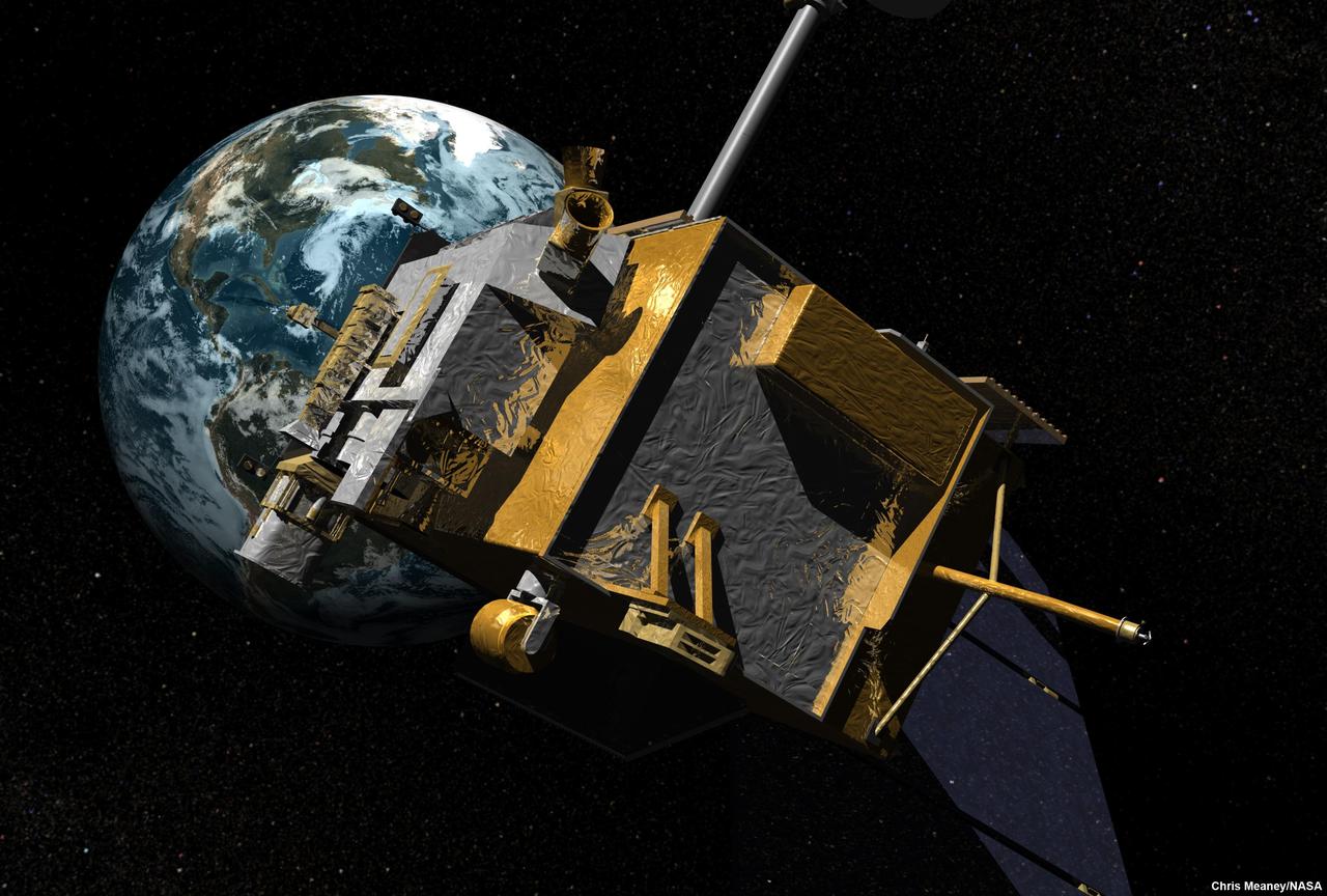
The Diviner instrument following integration to NASA Lunar Reconnaissance Orbiter. Diviner is one of seven instruments aboard the Lunar Reconnaissance Orbiter.
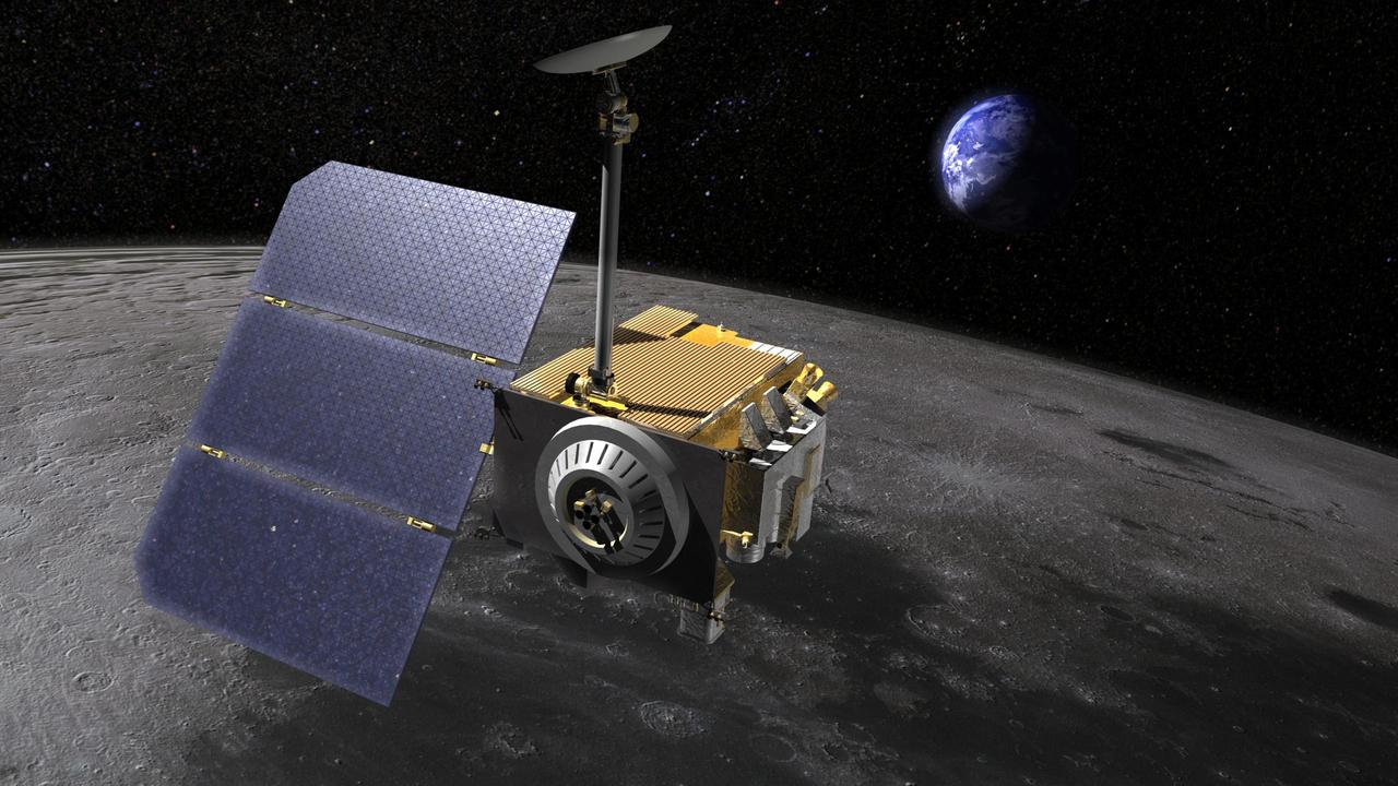
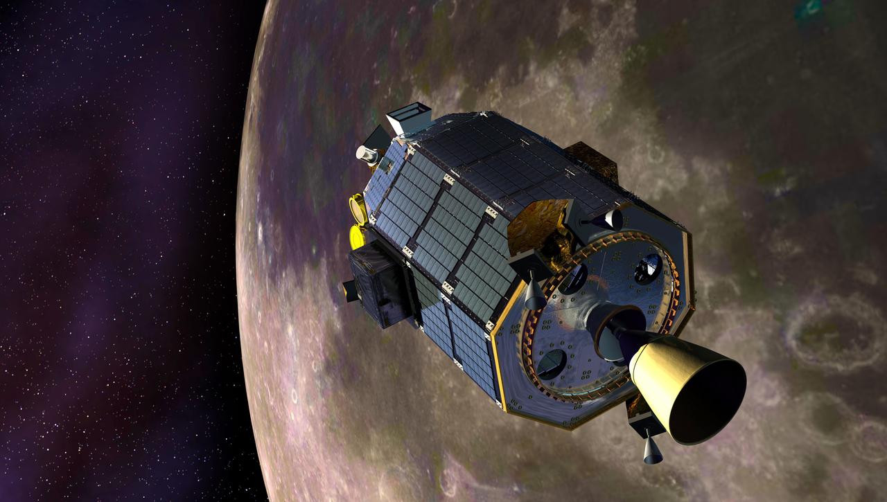
Artist rendering of the Lunar Reconnaissance Orbiter LRO, above the moon. LRO carries seven instruments that make comprehensive remote sensing observations of the moon and measurements of the lunar radiation environment. The LRO mission is managed by NASA Goddard for the Science Mission Directorate at NASA Headquarters in Washington. http://photojournal.jpl.nasa.gov/catalog/PIA18163
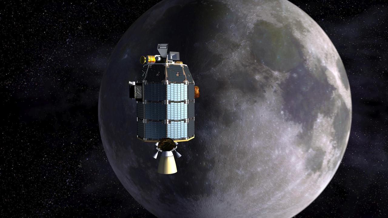
NASA is scheduled to launch the Lunar Reconnaissance Orbiter, an unmanned mission to comprehensively map the entire moon, on June 18, 2009.
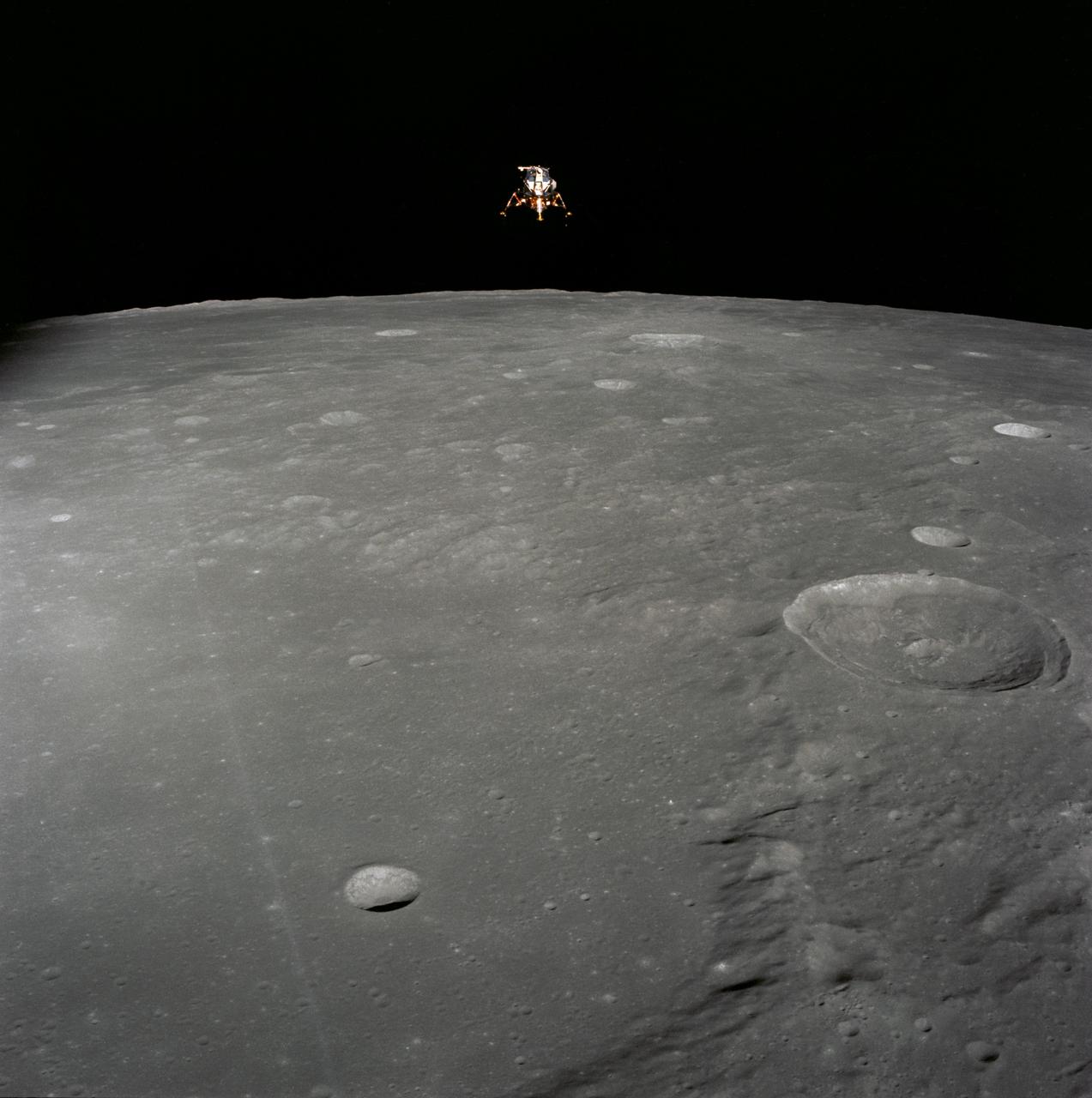
AS17-149-22857 (14 Dec. 1972) --- This 70mm view of the Lunar Module (LM) "Challenger" in lunar orbit before rendezvous with the Apollo 17 Command and Service Modules (CSM). While astronauts Eugene A. Cernan, commander, and Harrison H. Schmitt, lunar module pilot, descended in the Challenger to explore the Taurus-Littrow region of the moon, astronaut Ronald E. Evans, command module pilot, remained with the CSM "America" in lunar orbit.
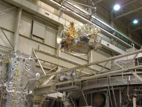
Loading the Lunar Reconnaissance Orbiter into the thermal vacuum chamber at Goddard Space Flight Center. Diviner is one of seven instruments aboard NASA LRO Mission.
AS12-51-7507 (19 Nov. 1969) --- The Apollo 12 Lunar Module (LM), in a lunar landing configuration, is photographed in lunar orbit from the Command and Service Modules (CSM). The coordinates of the center of the lunar surface shown in picture are 4.5 degrees west longitude and 7 degrees south latitude. The largest crater in the foreground is Ptolemaeus; and the second largest is Herschel. Aboard the LM were astronauts Charles Conrad Jr., commander; and Alan L. Bean, lunar module pilot. Astronaut Richard R. Gordon Jr., command module pilot, remained with the CSM in lunar orbit while Conrad and Bean descended in the LM to explore the surface of the moon. Photo credit: NASA
Small light colored area within the crater is Surveyor 1 on lunar surface photographed by Lunar Orbiter III. Published in the book "A Century at Langley" by Joseph Chambers. pg. 93 Moon Lunar Orbiter-Lunar Orbiter III: The hidden or dark side of the Moon was taken by Lunar Orbiter III During its mission to photograph potential lunar-landing sites for Apollo missions. -- Photograph published in Winds of Change, 75th Anniversary NASA publication (page 94), by James Schultz. Photo Number:67-H-328 is 1967-L-04026
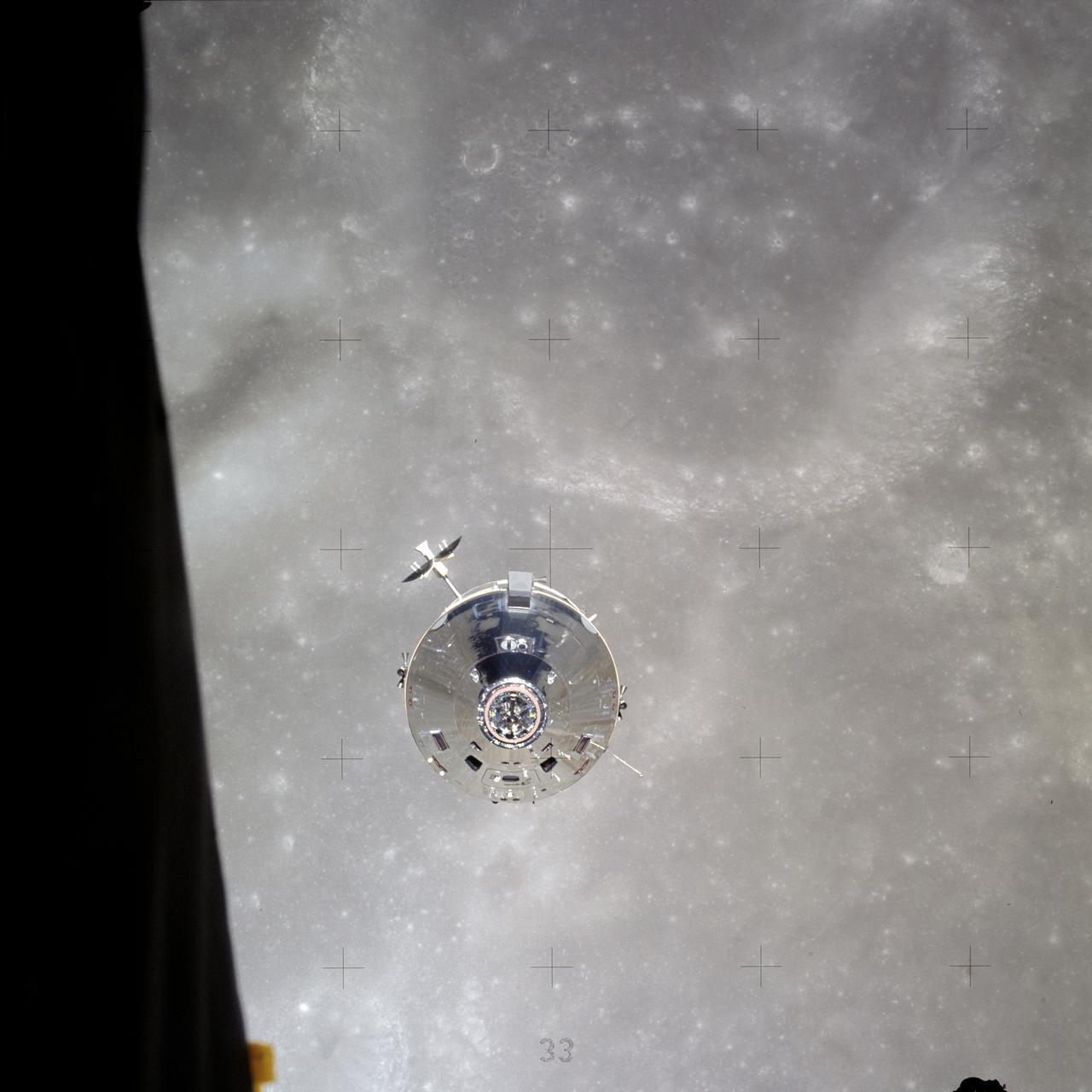
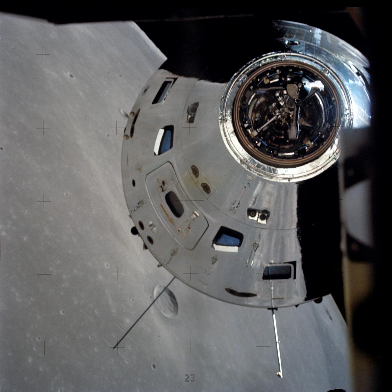
AS16-113-18282 (23 April 1972) --- The Apollo Command and Service Modules (CSM) "Casper" approaches the Lunar Module (LM) "Orion", from which this photograph was made. The two spacecraft are about to make their final rendezvous of the mission, on April 23, 1972. Astronauts John W. Young, commander, and Charles M. Duke Jr., lunar module pilot, aboard the LM, were returning to the CSM, in lunar orbit, after three successful days on the lunar surface. Astronaut Thomas K. (Ken) Mattingly II, command module pilot, remained with the CSM in lunar orbit, while Young and Duke descended in the LM to explore the Descartes region of the moon.
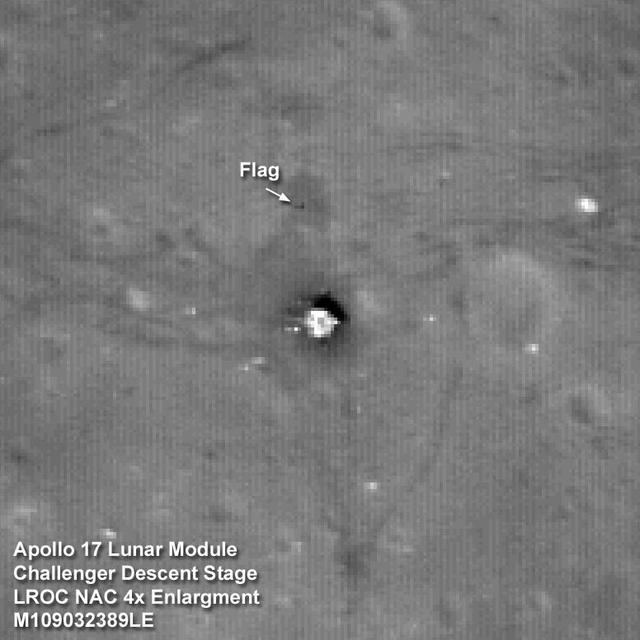
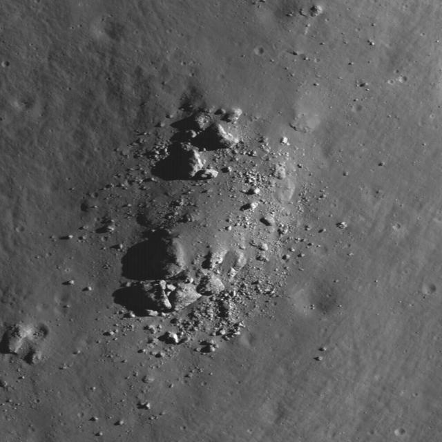
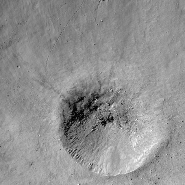
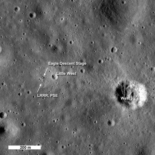
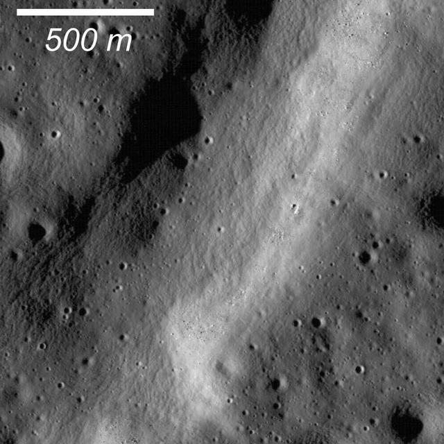
The Apollo 17 Lunar Module Challenger descent stage comes into focus in this image taken by NASA Lunar Reconnaissance Orbiter.
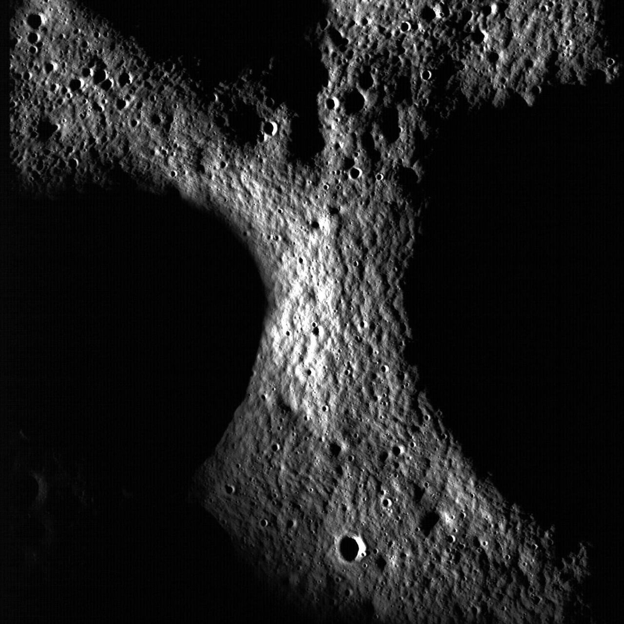
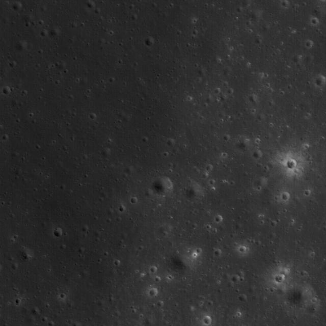
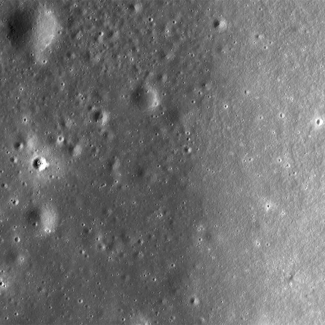
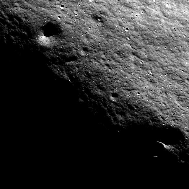
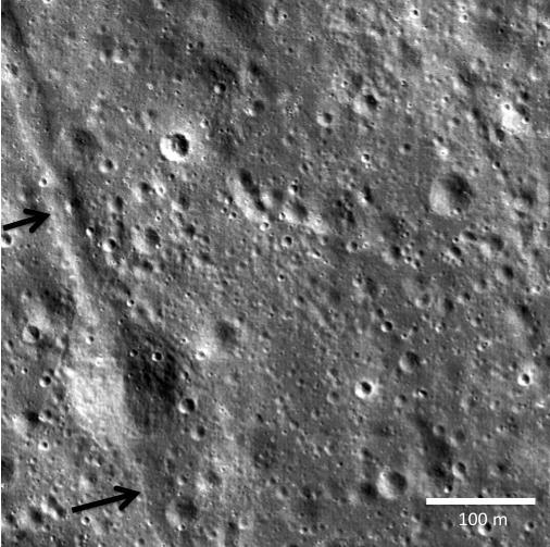
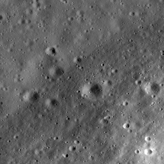
Close-up view of the lunar highlands, northeast of Clavius crater, taken by NASA Lunar Reconnaissance Orbiter.
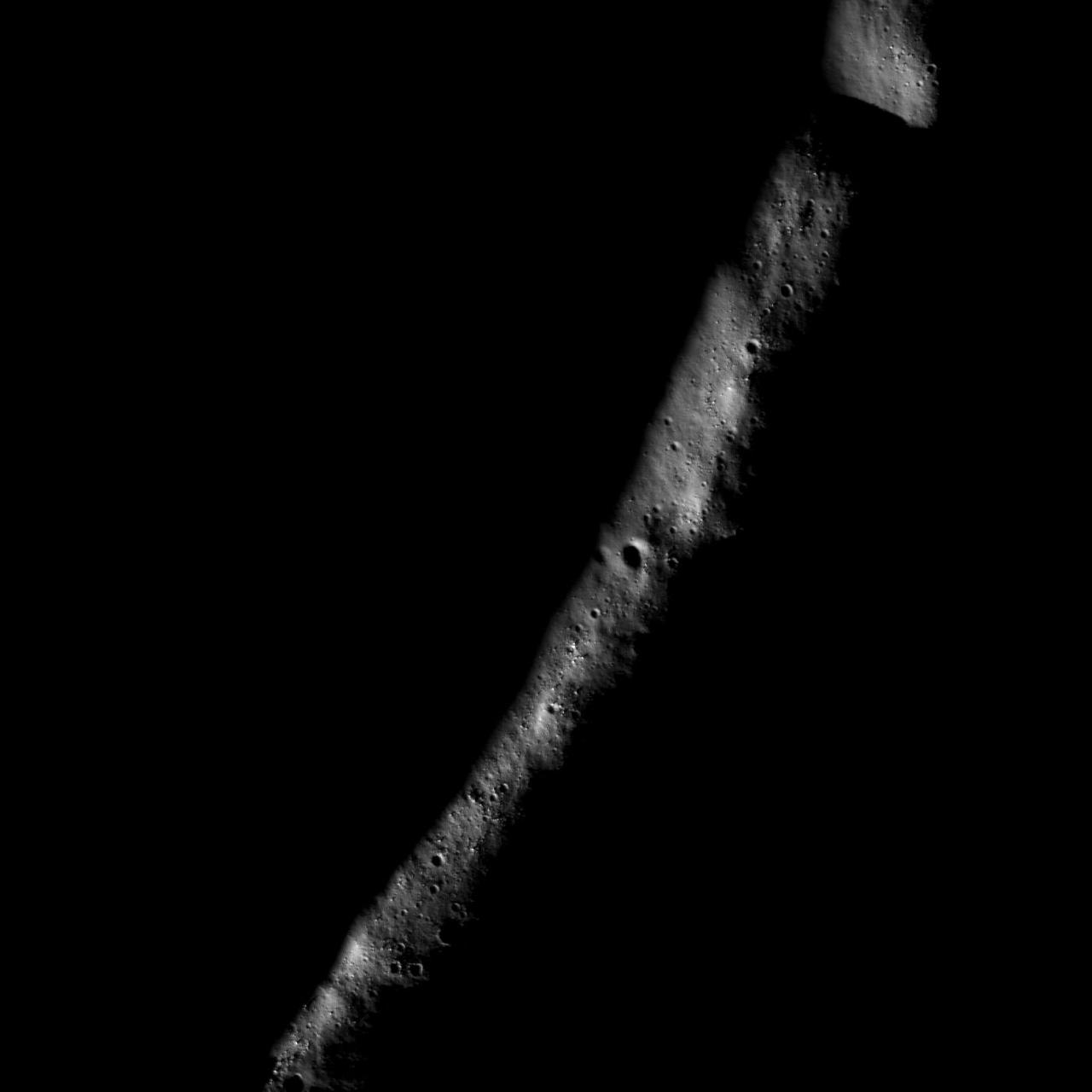
NASA Lunar Reconnaissance Orbiter shows a lobate scarp in the mare basalts of Aitken crater on the lunar farside arrows.
An artist's concept showing the Lunar Atmosphere and Dust Environment Explorer (LADEE) spacecraft is seen orbiting the moon as it prepares to fire its maneuvering thrusters to maintain a safe orbital altitude. Credit: NASA Ames / Dana Berry ----- What is LADEE? The Lunar Atmosphere and Dust Environment Explorer (LADEE) is designed to study the Moon's thin exosphere and the lunar dust environment. An "exosphere" is an atmosphere that is so thin and tenuous that molecules don't collide with each other. Studying the Moon's exosphere will help scientists understand other planetary bodies with exospheres too, like Mercury and some of Jupiter's bigger moons. The orbiter will determine the density, composition and temporal and spatial variability of the Moon's exosphere to help us understand where the species in the exosphere come from and the role of the solar wind, lunar surface and interior, and meteoric infall as sources. The mission will also examine the density and temporal and spatial variability of dust particles that may get lofted into the atmosphere. The mission also will test several new technologies, including a modular spacecraft bus that may reduce the cost of future deep space missions and demonstrate two-way high rate laser communication for the first time from the Moon. LADEE now is ready to launch when the window opens on Sept. 6, 2013. Read more: <a href="http://www.nasa.gov/ladee" rel="nofollow">www.nasa.gov/ladee </a> <b><a href="http://www.nasa.gov/audience/formedia/features/MP_Photo_Guidelines.html" rel="nofollow">NASA image use policy.</a></b> <b><a href="http://www.nasa.gov/centers/goddard/home/index.html" rel="nofollow">NASA Goddard Space Flight Center</a></b> enables NASA’s mission through four scientific endeavors: Earth Science, Heliophysics, Solar System Exploration, and Astrophysics. Goddard plays a leading role in NASA’s accomplishments by contributing compelling scientific knowledge to advance the Agency’s mission. <b>Follow us on <a href="http://twitter.com/NASA_GoddardPix" rel="nofollow">Twitter</a></b> <b>Like us on <a href="http://www.facebook.com/pages/Greenbelt-MD/NASA-Goddard/395013845897?ref=tsd" rel="nofollow">Facebook</a></b> <b>Find us on <a href="http://instagram.com/nasagoddard?vm=grid" rel="nofollow">Instagram</a></b>
NASA Lunar Reconnaissance Orbiter catches the edge of Mare Moscoviense.
NASA Lunar Reconnaissance Orbiter sees bright crater rays and boulders.

NASA Lunar Reconnaissance Orbiter looks at a terraced wall in Burg Crater.
This NASA Lunar Reconnaissance Orbiter shows boulders on a wrinkle ridge in Mare Crisium.
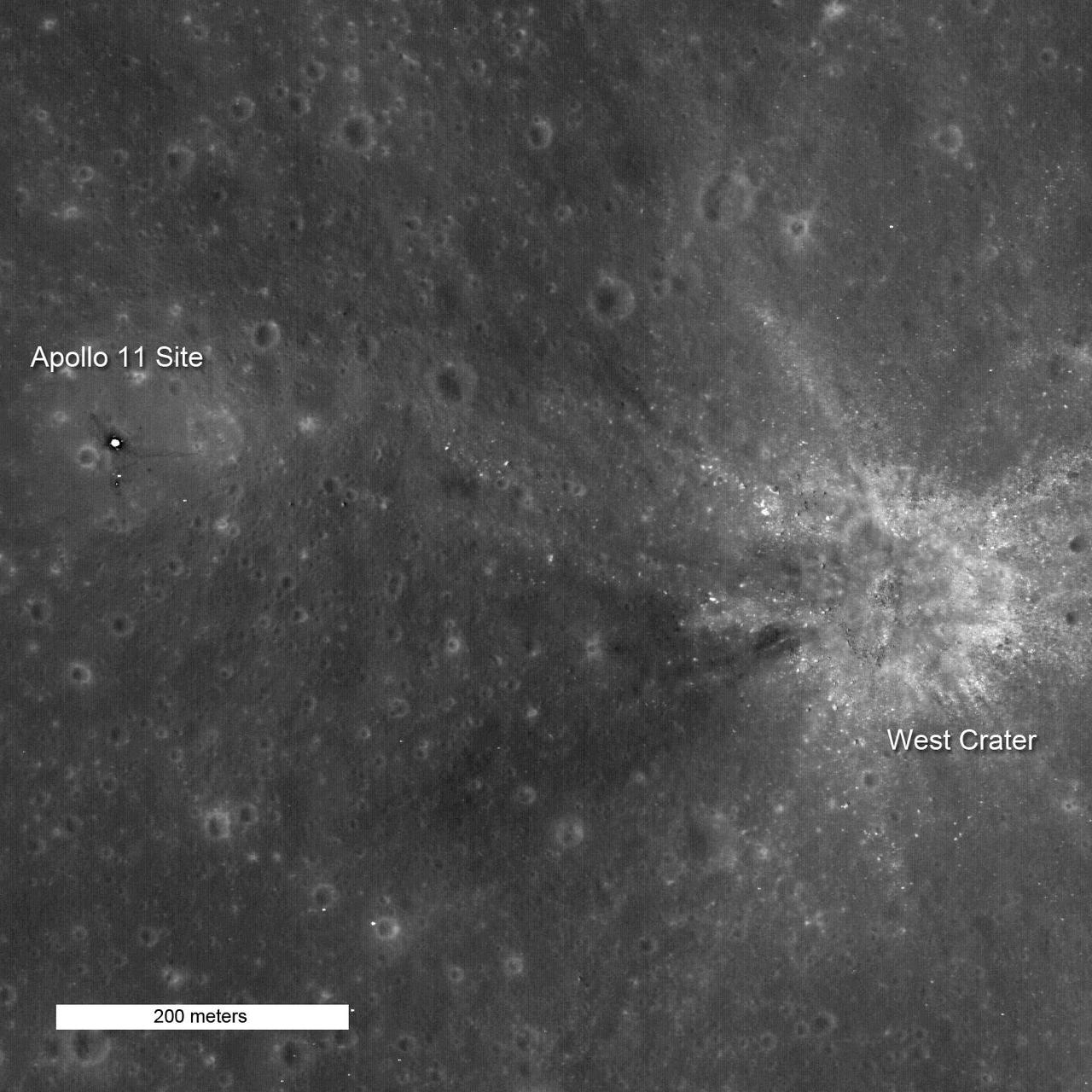
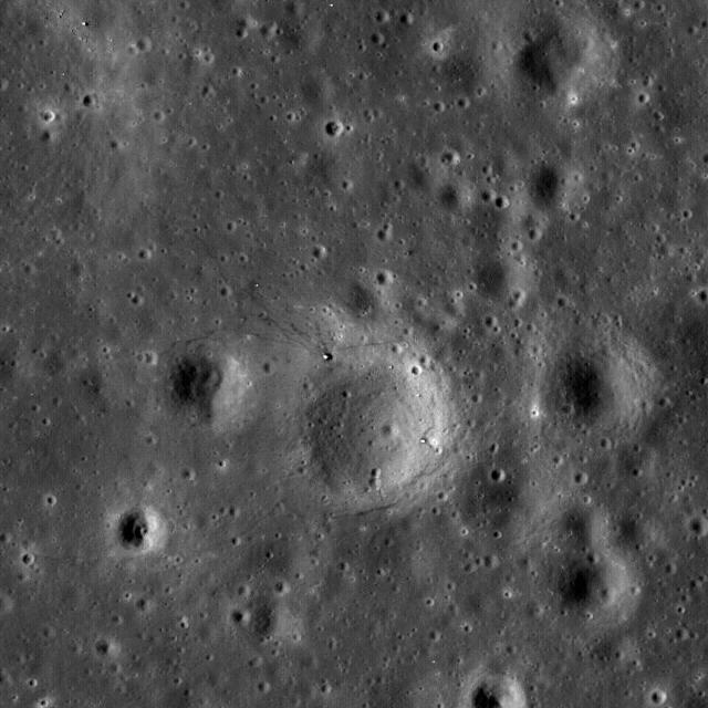
NASA Lunar Reconnaissance Orbiter captures high noon at Tranquility Base.
NASA Lunar Reconnaissance Orbiter first look at the Apollo landing sites.
NASA Lunar Reconnaissance Orbiter captured this image of the floor of a crater in the Mare Frigoris.
NASA Lunar Reconnaissance Orbiter shows highlands terrain inside the Dante Crater.
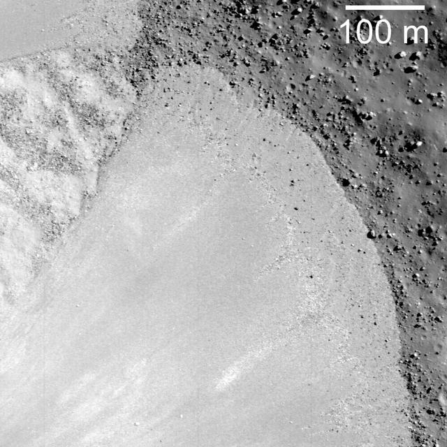
New view of the Apollo 12 landing site in Oceanus Procellarum imaged from NASA Lunar Reconnaissance Orbiter mapping orbit.
AS15-88-11974 (30 July 1971) --- A view of the Apollo 15 Command and Service Modules (CSM) in lunar orbit as photographed from the Lunar Module (LM) just after rendezvous. The lunar nearside is in the background. This view is looking southeast into the Sea of Fertility. The crater Taruntius is at the right center edge of the picture.
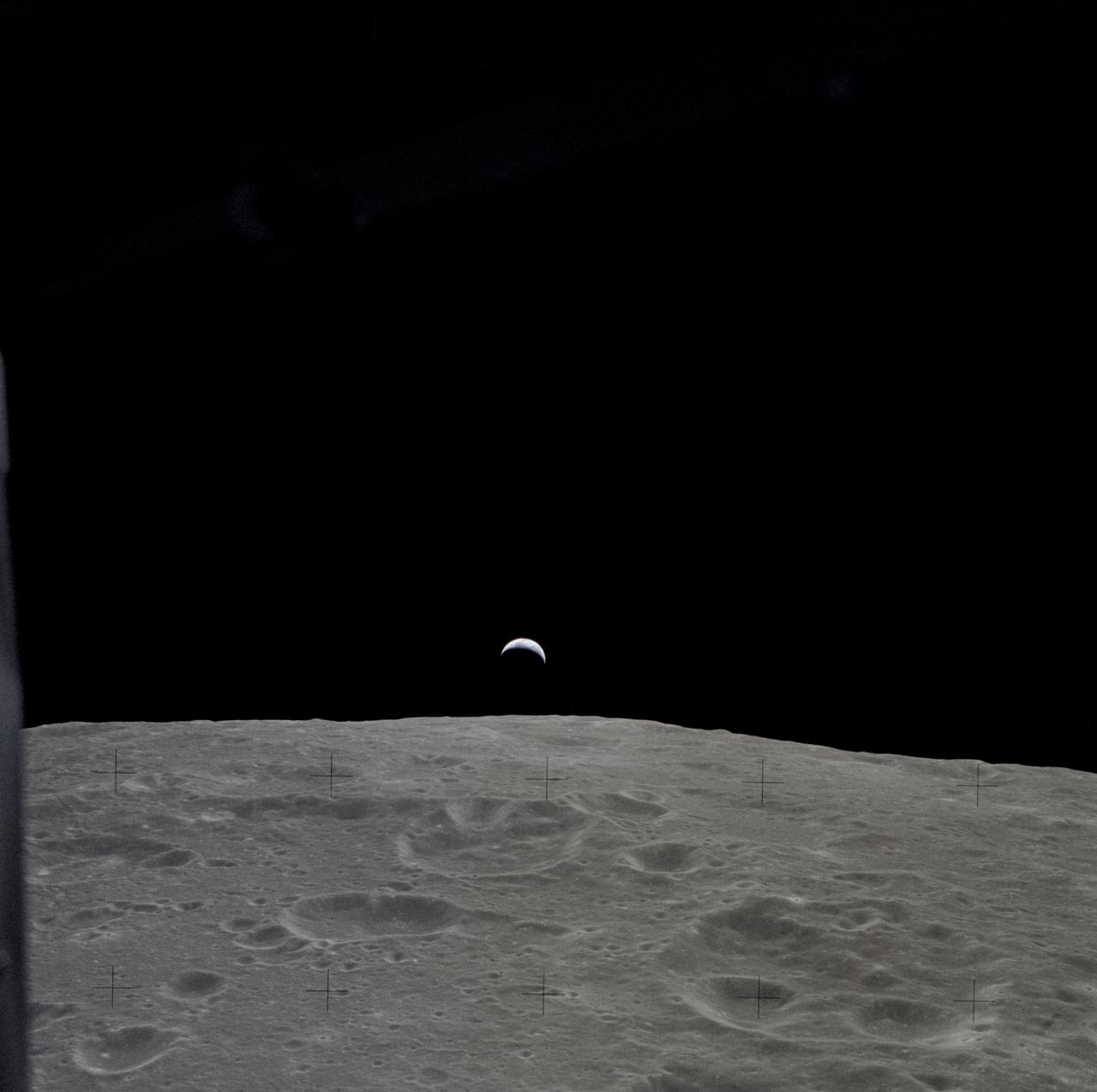
AS12-47-6891 (14-24 Nov. 1969) --- A partially illuminated Earth rises above the lunar horizon in this photograph taken from the Apollo 12 spacecraft in lunar orbit.
NASA Lunar Reconnaissance Orbiter spied a very subtle mare-highlands boundary in Mare Moscoviense on the lunar farside, near the center of the Constellation Program region of interest.
The unusual shapes of craters at the Flamsteed Constellation region of interest provide information about the thickness of the lunar regolith in this region in this image taken by NASA Lunar Reconnaissance Orbiter.
NASA Lunar Reconnaissance Orbiter looks near the northeast edge of the unusually large melt pond adjacent to the lunar far side crater King.
A junction between the rims of three craters on the floor of Peary crater near the lunar north pole is evident in this image taken by NASA Lunar Reconnaissance Orbiter.

AS11-37-5445 (20 July 1969) --- The Apollo 11 Command and Service Modules (CSM) are photographed from the Lunar Module (LM) in lunar orbit during the Apollo 11 lunar landing mission. The lunar surface below is in the north central Sea of Fertility. The coordinates of the center of the picture are 51 degrees east longitude and 1 degree north latitude. About half of the crater Taruntius G is visible in the lower left corner of the picture. Part of Taruntius H can be seen at lower right.
This is an artist depiction of NASA Lunar Atmosphere and Dust Environment Explorer LADEE observatory as it approaches lunar orbit. http://photojournal.jpl.nasa.gov/catalog/PIA18160
Moon Lunar Orbiter-Lunar Orbiter II: Display Transparencies Lunar Orbiter II from Washington Press Conference. Lunar Orbiter II's telephoto lens took this picture of the floor of the crater Copernicus. -- Photograph published in Winds of Change, 75th Anniversary NASA publication (page 94), by James Schultz.
Diverse textures on the floor of Saha E which could be the result of impact melt coating boulders and other deposits on the floor of the crater on the lunar farside in this image taken by NASA Lunar Reconnaissance Orbiter.
A bottleneck at the start of the lunar sinuous rille within Vallis Alpes formed several morphologic features including a lava pond, a breached dam, and an island in the rille in this image captured by NASA Lunar Reconnaissance Orbiter.
High-albedo marks on the lunar surface left by a boulder bouncing down the northeast wall of farside highlands crater Moore F in this image captured by NASA Lunar Reconnaissance Orbiter.
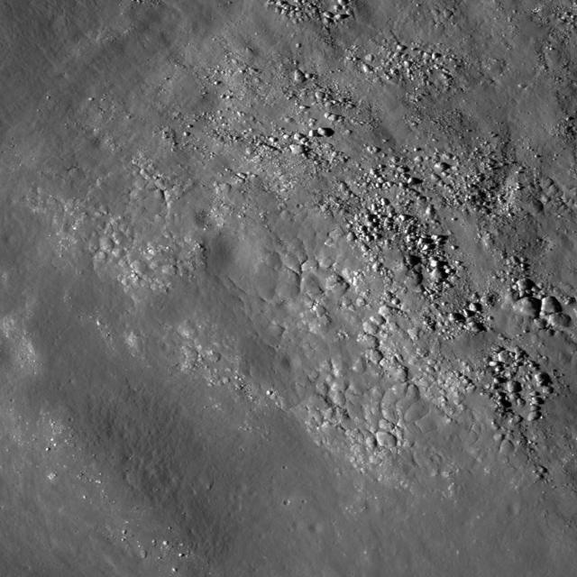
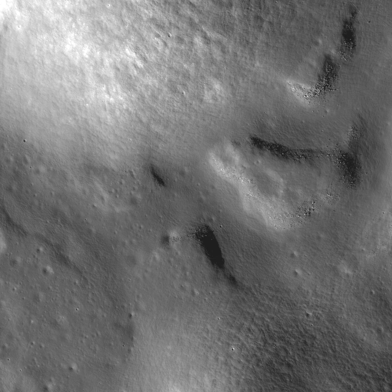
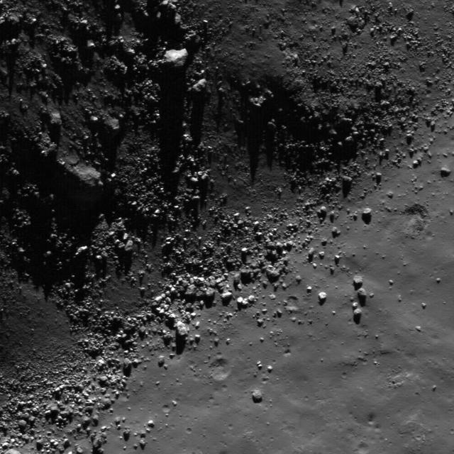
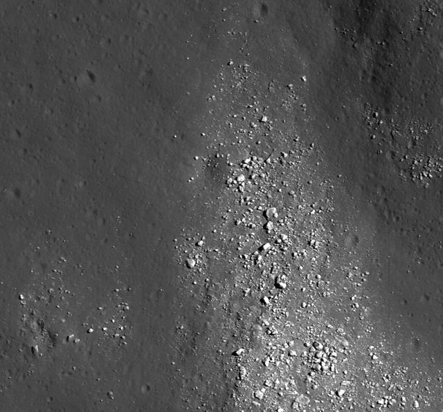
NASA Lunar Reconnaissance Orbiter spies many boulder trails are found on the lunar crater walls and basin massifs. Some of the trails are smooth and nearly straight while others are curvy or gouge into the surface.
High-albedo marks on the lunar surface left by a boulder bouncing down the northeast wall of farside highlands crater Moore F in this image captured by NASA Lunar Reconnaissance Orbiter.
Distinctive asymmetrical ejecta surrounding a 140 meter diameter crater in the lunar highlands as seen by NASA Lunar Reconnaissance Orbiter. Crater is located on the northeastern rim of the eroded pre-Nectarian crater Hommel.
This image from NASA Lunar Reconnaissance Orbiter shows dark materials excavated by later small impacts show up clearly on the bright ejecta of a small lunar crater to the west.
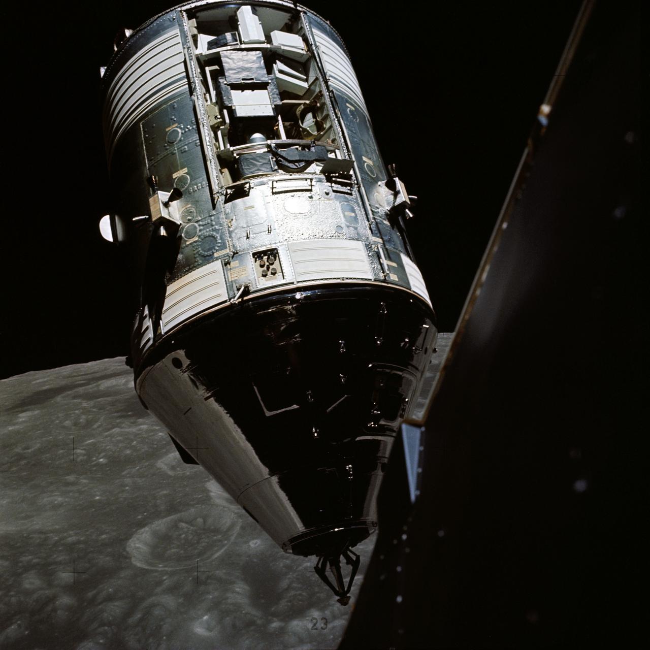
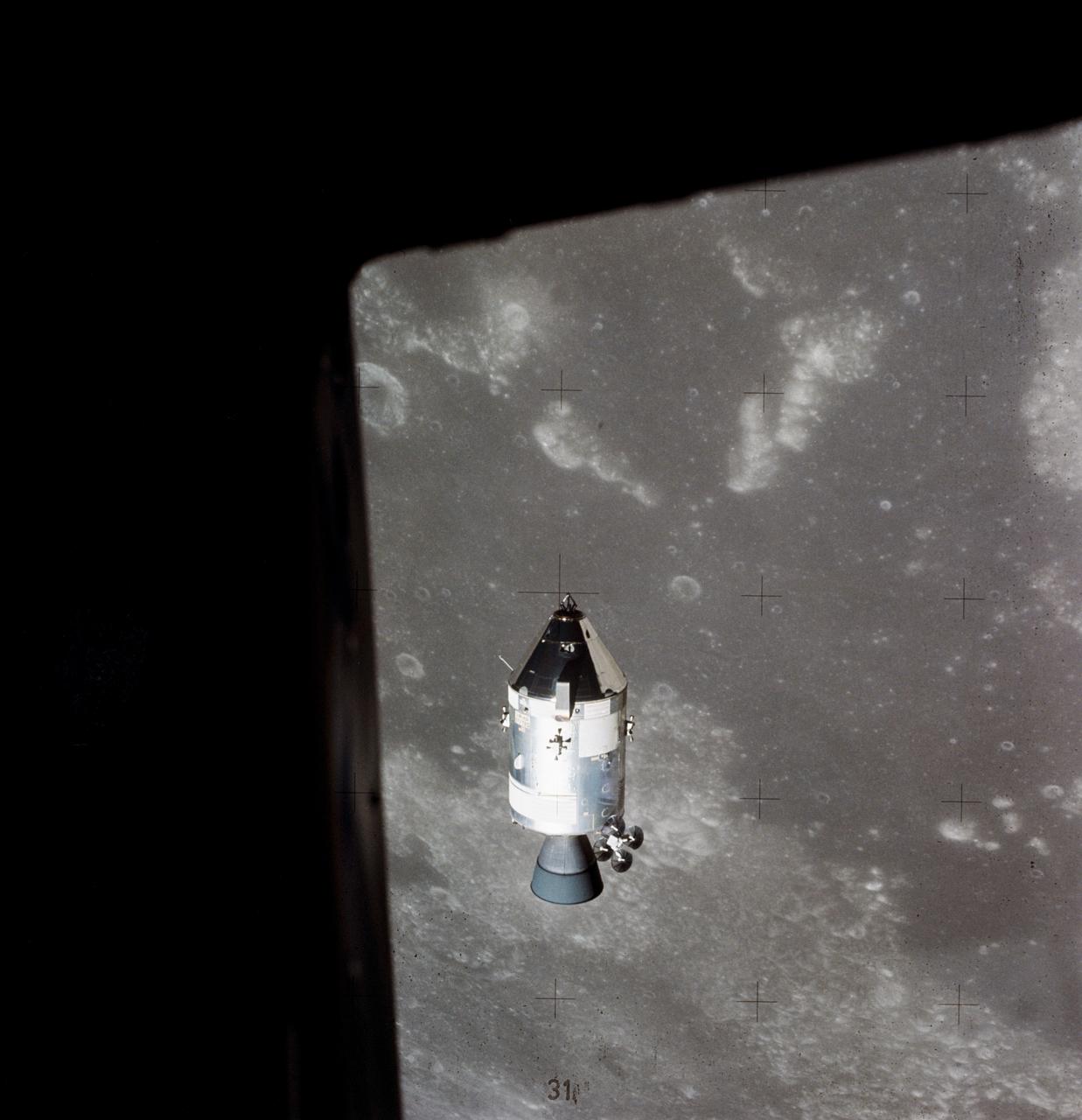
AS17-145-22254 (14 Dec. 1972) --- An excellent view of the Apollo 17 Command and Service Modules (CSM) photographed from the Lunar Module (LM) "Challenger" during rendezvous and docking maneuvers in lunar orbit. The LM ascent stage, with astronauts Eugene A. Cernan and Harrison H. Schmitt aboard, had just returned from the Taurus-Littrow landing site on the lunar surface. Astronaut Ronald E. Evans remained with the CSM in lunar orbit. Note the exposed Scientific Instrument Module (SIM) Bay in Sector 1 of the Service Module (SM). Three experiments are carried in the SIM bay: S-209 lunar sounder, S-171 infrared scanning spectrometer, and the S-169 far-ultraviolet spectrometer. Also mounted in the SIM bay are the panoramic camera, mapping camera and laser altimeter used in service module photographic tasks. A portion of the LM is on the right.
NASA Lunar Reconnaissance Orbiter sees hummocks and blocks on the ejecta blanket of Tsiolkovskiy crater.
This image taken by NASA Lunar Reconnaissance Orbiter shows a wide variety of geologic features on northwest of Plato crater.
This image from NASA Lunar Reconnaissance Orbiter shows a view of boulders, on the floor of Rutherfurd crater, about to disappear into the shadows of dusk.
NASA Lunar Reconnaissance Orbiter captures a northeast-trending wrinkle ridge cuts across the plains of Mare Imbrium.
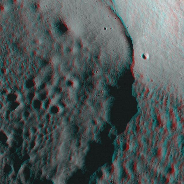
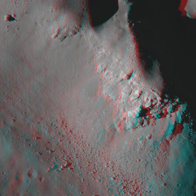
NASA Lunar Reconnaissance Orbiter looks at the Moon in 3D. 3D glasses are necessary to view this image.
This image taken by NASA Lunar Reconnaissance Orbiter shows the spectacularly preserved viscous flow on the NE rim of Byrgius A crater.
This image from NASA Lunar Reconnaissance Orbiter shows a view of boulders, on the floor of Rutherfurd crater, about to disappear into the shadows of dusk.
Cracks form in the impact melt sheet on the floor of Necho Crater in this image taken by NASA Lunar Reconnaissance Orbiter.
NASA Lunar Reconnaissance Orbiter looks at a mare-highlands boundary in northern Mare Frigoris.
Boulders perched on the summit of the central peak of Tsiolkovskiy crater are seen in this image from NASA Lunar Reconnaissance Orbiter.
NASA Lunar Reconnaissance Orbiter captured this image of the floor of a l.2-km diameter crater in the Mare Frigoris.
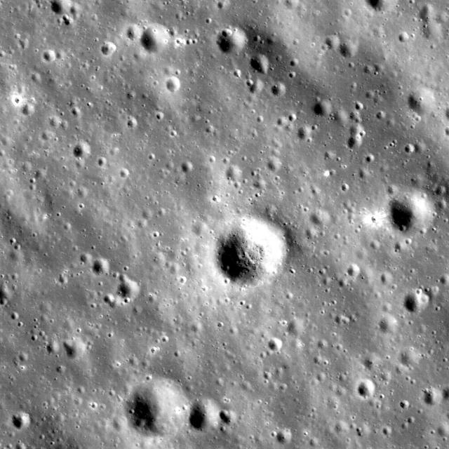
NASA Lunar Reconnaissance Orbiter takes a look at a fresh crater on the southwest rim of Metius B crater.
NASA Lunar Reconnaissance Orbiter captures a debris flow extending down the southwest wall of Janssen K crater.
NASA Lunar Reconnaissance Orbiter view of boulders on an outlying rampart of the complex central peak of Tsiolkovskiy crater.
NASA Lunar Reconnaissance Orbiter captured this image of the ejecta blanket and rim of Timocharis crater in southeastern Mare Imbrium.
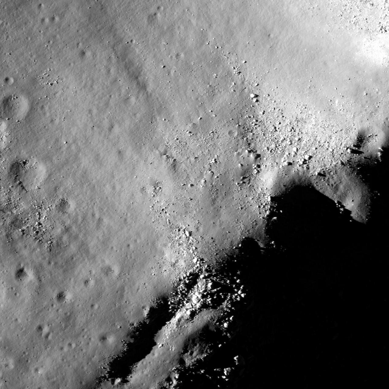
Boulders perched on the summit of the central peak of Tsiolkovskiy crater are seen in this image from NASA Lunar Reconnaissance Orbiter.
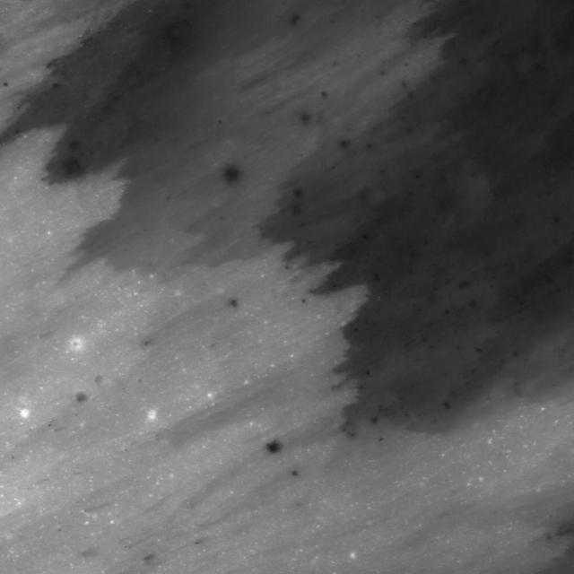
Several sequences were acquired by NASA Lunar Reconnaissance Orbiter looking across the illuminated limb to quantify scattered light.
Part of the vast pyroclastic deposit located on the Aristarchus plateau is visible in this image taken by NASA Lunar Reconnaissance Orbiter.
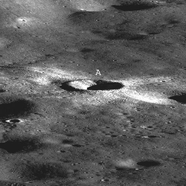
NASA Lunar Reconnaissance Orbiter showing a string of secondary craters from an impact crater to the north, probably Giordano Bruno.
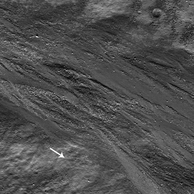
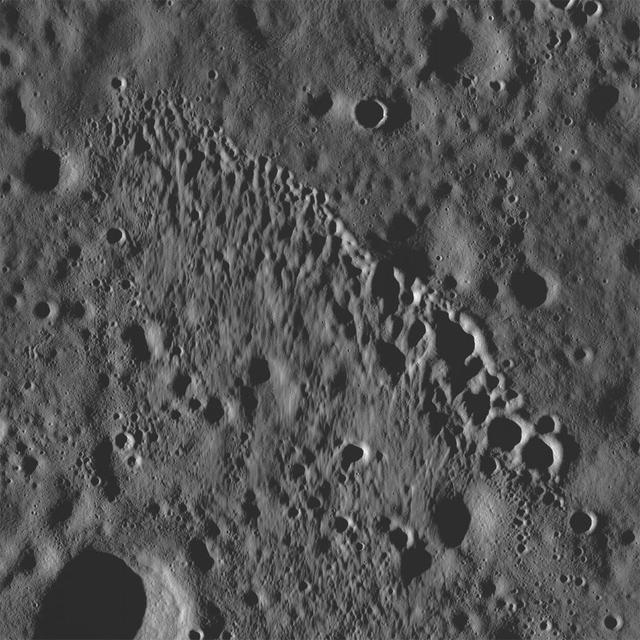
Landslide deposits seen on the steep interior slopes of Marius crater taken by NASA Lunar Reconnaissance Orbiter.
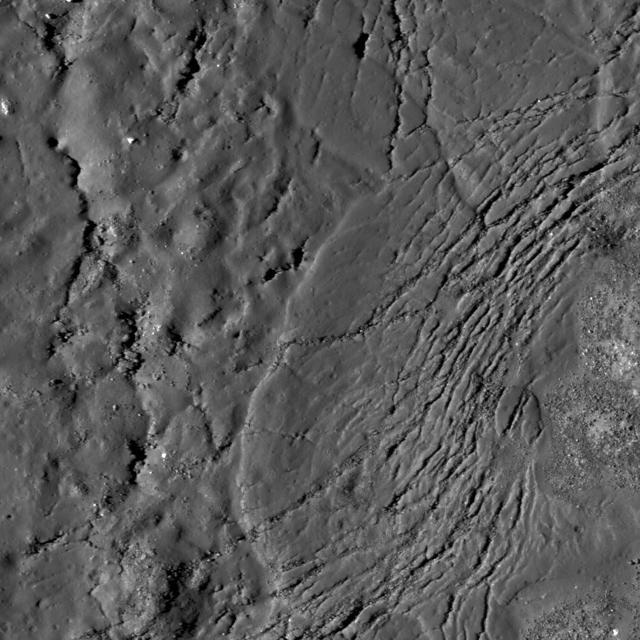
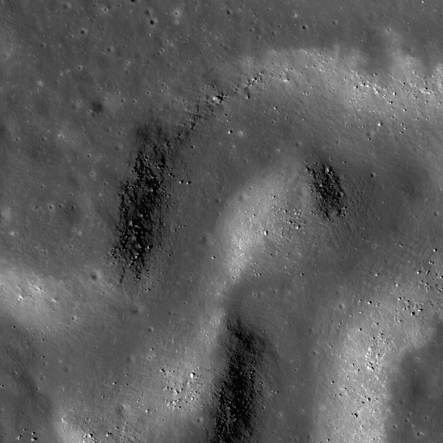
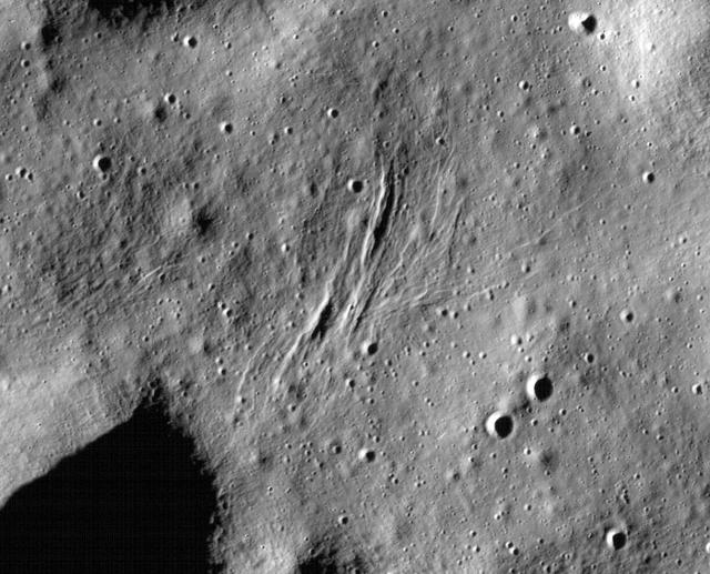
Many fractures on the Moon are seen in the floors of ancient, flat-floored highlands craters in this image taken by NASA Lunar Reconnaissance Orbiter.
Montes Pyrenaeus meets Mare Nectaris in this image taken by NASA Lunar Reconnaissance Orbiter.

NASA Lunar Reconnaissance Orbiter captured this image of the ejecta blanket and rim of Timocharis crater in southeastern Mare Imbrium.
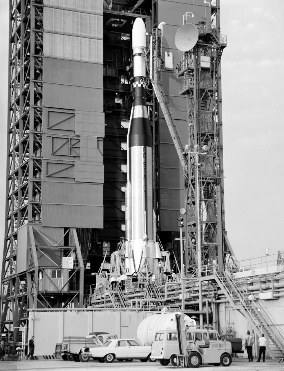
Lift off of Lunar Orbiter III from Complex 13.
AS17-145-22273 (7-19 Dec. 1972) --- In this view, taken from the Lunar Module (LM), the Command and Service Module (CSM) are seen preparing to rendezvous with the LM. Note the reflection of the lunar surface on the CSM. The CSM, is piloted by Ronald E. Evans; while astronauts Eugene A. Cernan, commander; and Harrison W. Schmitt, lunar module pilot, are onboard the LM, following their extravehicular activities (EVA) on the moon's surface. While astronauts Cernan and Schmitt descended in the LM "Challenger" to explore the Taurus-Littrow region of the moon, astronaut Evans remained with the CSM "America" in lunar orbit.
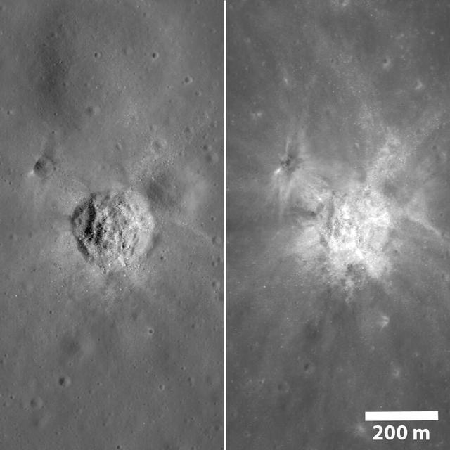
The same crater, as seen by NASA Lunar Reconnaissance Orbiter, under very different lighting. On the left the Sun was midway to the horizon and on the right the Sun was high, approaching noon.

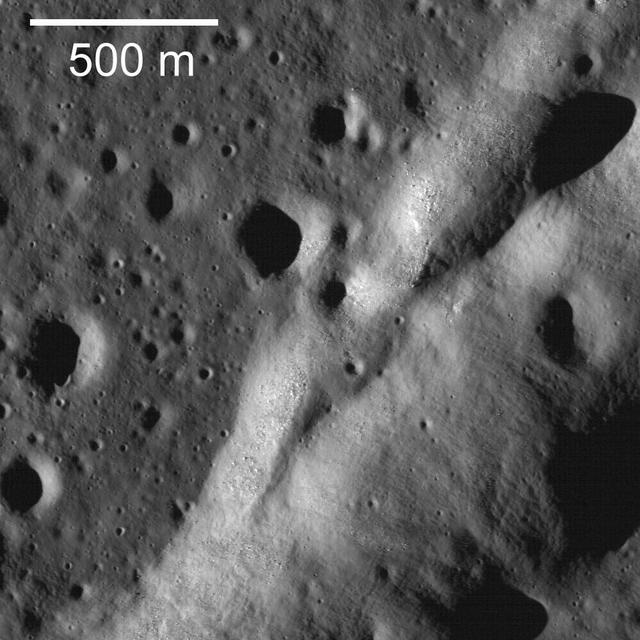
Boulders perched atop a wrinkle ridge in Mare Imbrium west of the Montes Teneriffe can be seen in this image taken by NASA Lunar Reconnaissance Orbiter.
NASA Lunar Reconnaissance Orbiter captured this anaglyph image is a close up view of Copernicus crater. 3D glasses are necessary to view this image.
A sinuous rille created by a lava flow snakes around the base of a massif in the Prinz-Harbinger region on the Moon in this image taken by NASA Lunar Reconnaissance Orbiter.
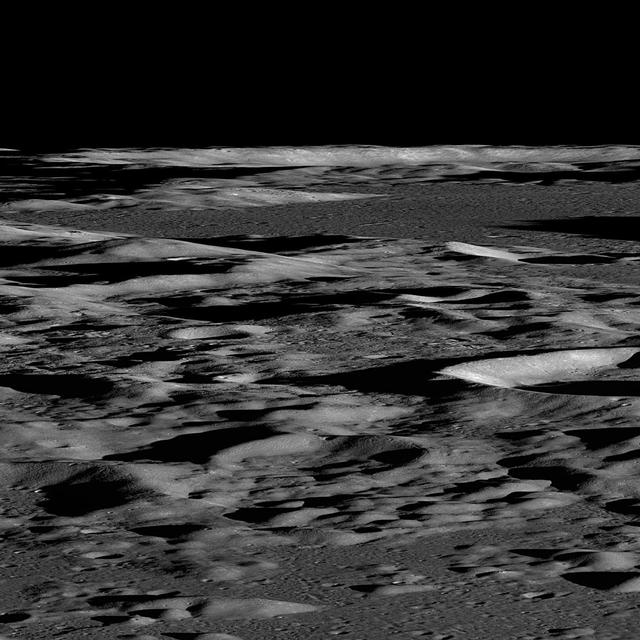
This is a synthetic perspective view looking south from the Apollo 16 landing area, topography is rendered naturally as seen by NASA Lunar Reconnaissance Orbiter.

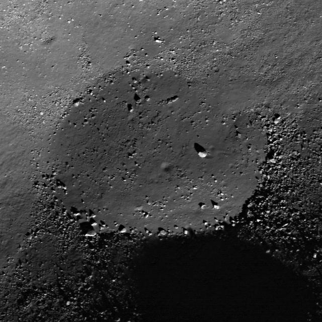
NASA Lunar Reconnaissance Orbiter shows boulders and impact melt line the floor of the 85-km crater Tycho, a potential site for future human exploration.
NASA Lunar Reconnaissance Orbiter shows a sinuous rille winding its way across a much larger rille in the heart of the Aristarchus Plateau.
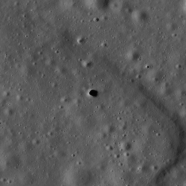
The Marius Hills pit is a possible skylight in a lava tube in an ancient volcanic region of the Moon called the Marius Hills. This image was taken by NASA Lunar Reconnaissance Orbiter.
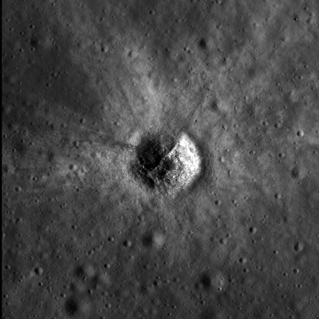
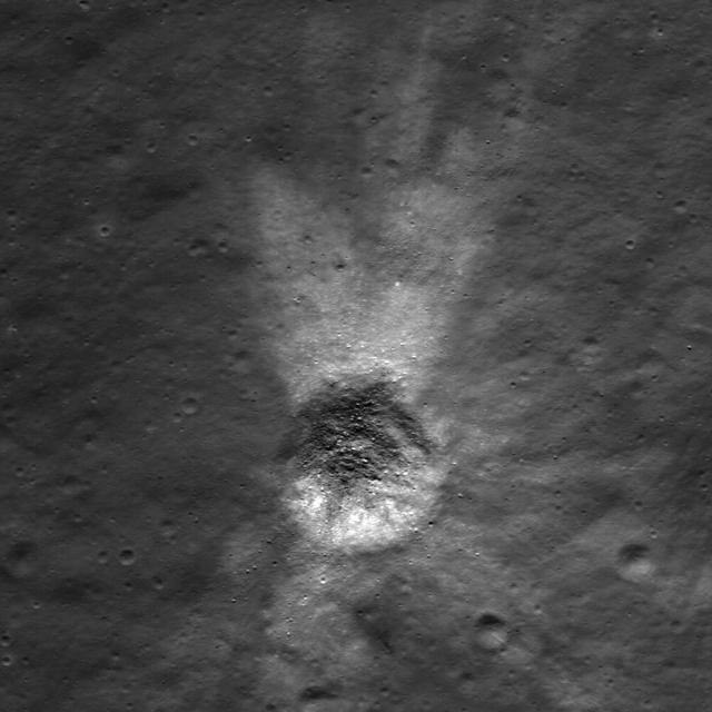
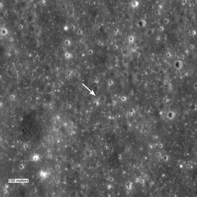
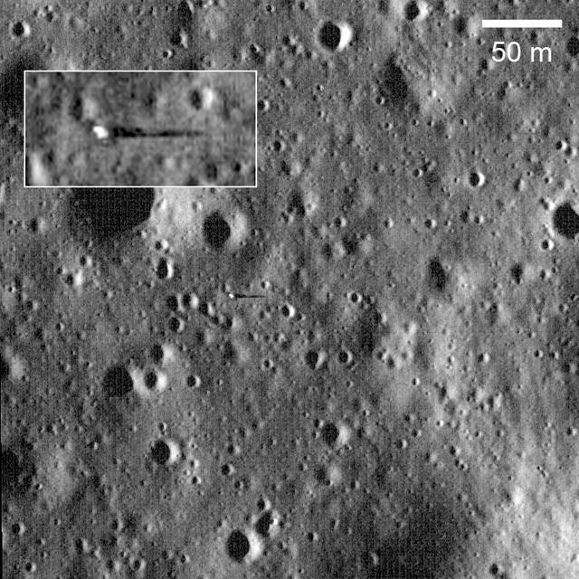
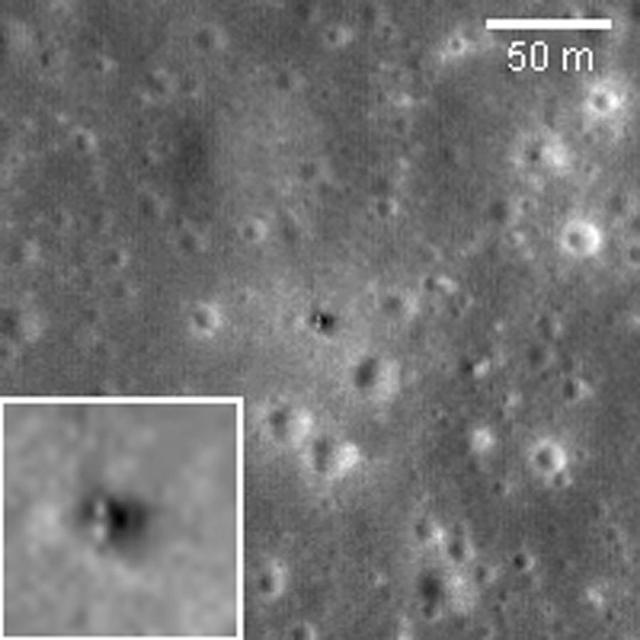
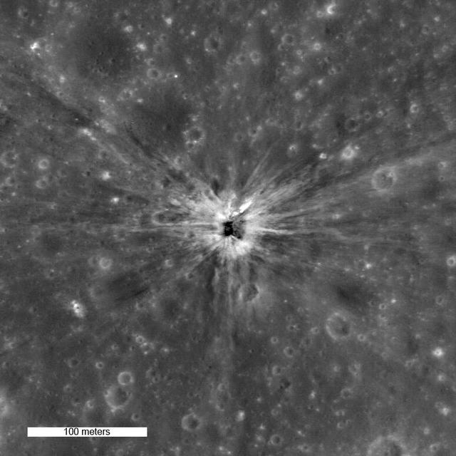
This image acquired by NASA Lunar Reconnaissance Orbiter shows a crater center of image formed by impact of the Apollo 14 Saturn IVB booster.

This image acquired by NASA Lunar Reconnaissance Orbiter shows a crater center of image formed by impact of the Apollo 14 Saturn IVB booster.
Overlapping petals of bright ejecta illustrate the complexity of ejecta emplacement, even in smaller impact events in image taken by NASA Lunar Reconnaissance Orbiter.
Surveyor 5 sitting in a 10-meter diameter crater. Surveyor 5 landed on Mare Tranquillitatis in September of 1967. This image was taken by NASA Lunar Reconnaissance Orbiter.
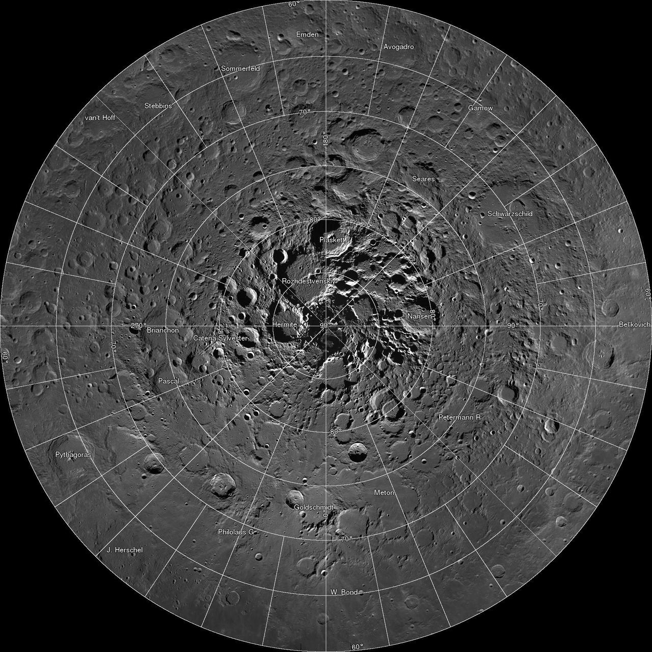
Scientists, using cameras aboard NASA Lunar Reconnaissance Orbiter LRO, have created the largest high resolution mosaic of our moon north polar region.

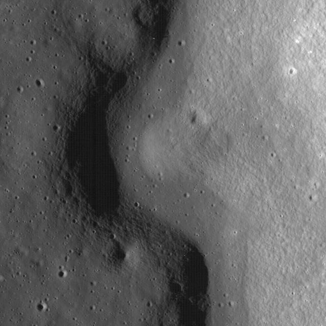
The linear rille Rima Ariadaeus is found on the nearside of the Moon, nestled between Mare Tranquillitatis and Mare Vaporum in this image taken by NASA Lunar Reconnaissance Orbiter.
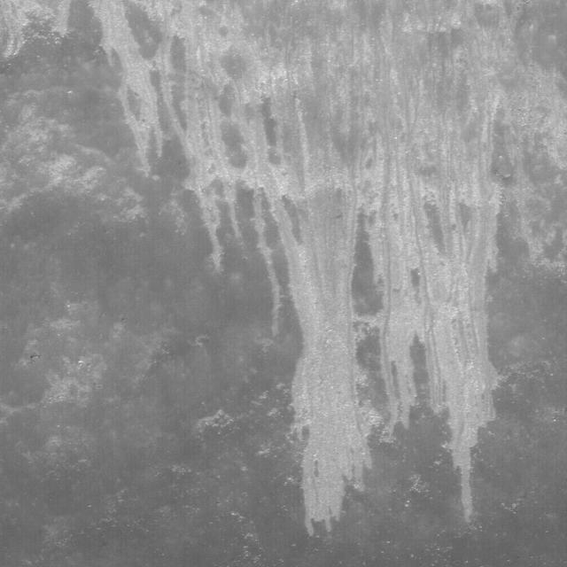
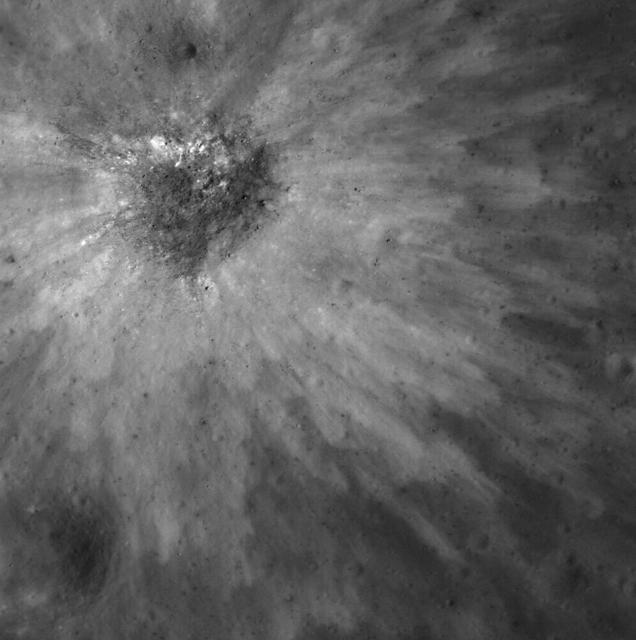
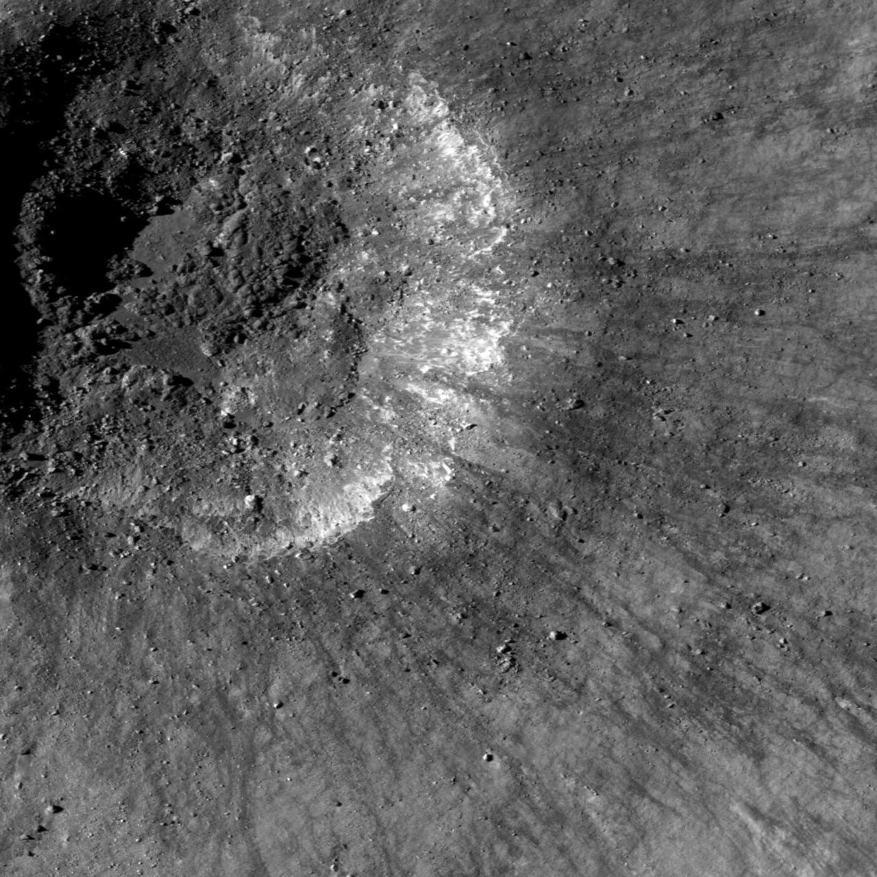
Frozen impact melt flows on the ejecta blanket of the young impact crater Giordano Bruno in this image from NASA Lunar Reconnaissance Orbiter.
Most mountains on the Earth are formed as plates collide and the crust buckles. Not so for the Moon, where mountains are formed as a result of impacts as seen by NASA Lunar Reconnaissance Orbiter.
This image taken by NASA Lunar Reconnaissance Orbiter shows the slopes of the Vallis Schröteri, Cobra Head are boulder-rich and display albedo variations -- bright to dark.

This image is a NASA Lunar Reconnaissance Orbiter closeup of a small fresh crater with very dark ejecta highlands near Rima Bode II.
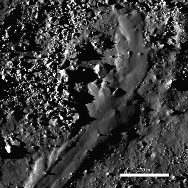
The lunar highlands exhibit rhythmic patterns thought to result from slow, downslope creep of the loose regolith soil. These subtle patterns are most easily seen when the Sun is low to the horizon in this image taken by NASA Lunar Reconnaissance Orbit
These graben - a kind of trench that is formed as a surface expands - were imaged near a region of the Moon called Mare Frigoris by NASA's Lunar Reconnaissance Orbiter (LRO). https://photojournal.jpl.nasa.gov/catalog/PIA23237
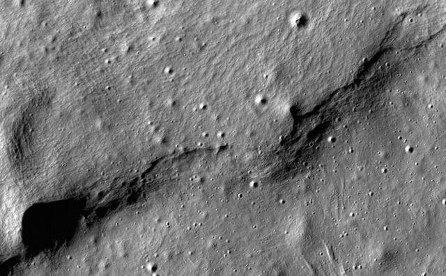
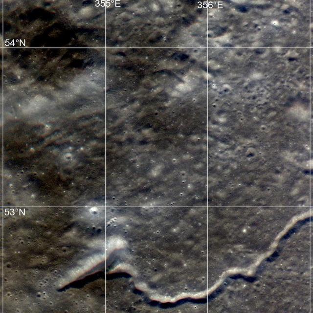
This image of lobate scarps - a kind of curved hill - was taken near a region of the Moon called Mare Frigoris by NASA's Lunar Reconnaissance Orbiter (LRO). https://photojournal.jpl.nasa.gov/catalog/PIA23236
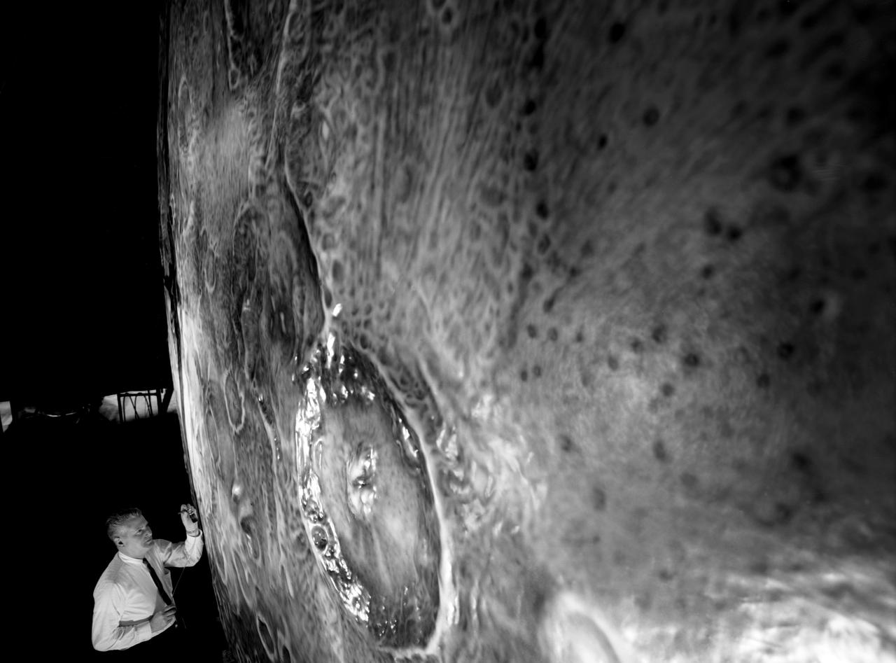
Artists used paintbrushes and airbrushes to recreate the lunar surface on each of the four models comprising the LOLA simulator. Project LOLA or Lunar Orbit and Landing Approach was a simulator built at Langley to study problems related to landing on the lunar surface. It was a complex project that cost nearly $2 million dollars. James Hansen wrote: "This simulator was designed to provide a pilot with a detailed visual encounter with the lunar surface; the machine consisted primarily of a cockpit, a closed-circuit TV system, and four large murals or scale models representing portions of the lunar surface as seen from various altitudes. The pilot in the cockpit moved along a track past these murals which would accustom him to the visual cues for controlling a spacecraft in the vicinity of the moon. Unfortunately, such a simulation--although great fun and quite aesthetic--was not helpful because flight in lunar orbit posed no special problems other than the rendezvous with the LEM, which the device did not simulate. Not long after the end of Apollo, the expensive machine was dismantled." (p. 379) Ellis J. White further described LOLA in his paper "Discussion of Three Typical Langley Research Center Simulation Programs," "Model 1 is a 20-foot-diameter sphere mounted on a rotating base and is scaled 1 in. = 9 miles. Models 2,3, and 4 are approximately 15x40 feet scaled sections of model 1. Model 4 is a scaled-up section of the Crater Alphonsus and the scale is 1 in. = 200 feet. All models are in full relief except the sphere." -- Published in James R. Hansen, Spaceflight Revolution: NASA Langley Research Center From Sputnik to Apollo, (Washington: NASA, 1995), p. 379; Ellis J. White, "Discussion of Three Typical Langley Research Center Simulation Programs," Paper presented at the Eastern Simulation Council (EAI's Princeton Computation Center), Princeton, NJ, October 20, 1966.

Sunlight gleams off NASA's Lunar Trailblazer in this artist's concept depicting the small satellite in lunar orbit. The spacecraft weighs only 440 pounds (200 kilograms) and measures 11.5 feet (3.5 meters) wide when its solar panels are fully deployed. https://photojournal.jpl.nasa.gov/catalog/PIA26429
One month after its first image of the Apollo 11 landing site was acquired, NASA Lunar Reconnaissance Orbiter passed over the site again providing a new view of the historic site.
Two small black arrows on today image taken by NASA Lunar Reconnaissance Orbiter show the location of a small graben 28 meters in width in a pyroclastic mantling deposit in the SW portion of Mare Humorum.
NASA Lunar Reconnaissance Orbiter captured this image close up view of Copernicus crater showing light-toned fractured bedrock exposed on the higher slopes on the central structural uplift.
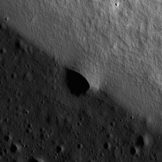
NASA Lunar Reconnaissance Orbiter shows a small portion of the rim of Erlanger crater. Much of its floor remains in permanent shadow due to its location near the north pole.
This image taken NASA Lunar Reconnaissance Orbiter is a high-resolution view of part of the floor of Riccioli Crater. The view is centered on the boundary between a spur of the crater central peak materials and volcanic lava flow deposits.
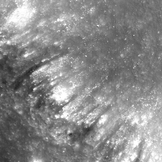
This is a view from NASA Lunar Reconnaissance Orbiter of a very young impact crater in Balmer basin. The dark streamers are impact melt splashes thrown out during the crater formation.
This NASA Lunar Reconnaissance Orbiter LRO image is of the summit crater of Hortensius Dome Phi. Summit craters of all the Hortensius Domes show no raised rims and are not circular, indicating they are analogous to volcanic calderas.
Surveyor 6 casting 18-meter long shadow with Sun just 8° above the horizon. Surveyor 6 Landed 10 November 1967 in Sinus Medii. This image was taken by NASA Lunar Reconnaissance Orbiter.
Graben are common extensional features on the Moon as well as the other terrestrial planets and icy satellites. This graben formed within a larger graben as captured by NASA Lunar Reconnaissance Orbiter.
Luna 16 was the first robotic mission to land on the Moon on basaltic plains of Mare Fecunditatis and return a sample to the Earth. It was launched by the Soviet Union on 12 September 1970. This image was taken by NASA Lunar Reconnaissance Orbiter.
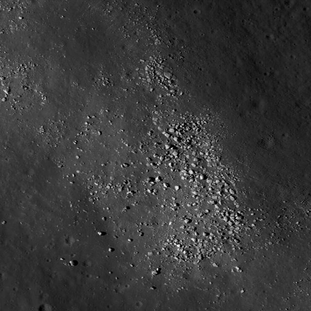
A subset of NAC Image M112162602L showing landslides bottom covering impact melt on the floor top of a fresh Copernican-age crater at the edge of Oceanus Procellarum and west of Balboa crater taken by NASA Lunar Reconnaissance Orbiter.
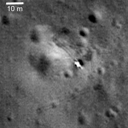
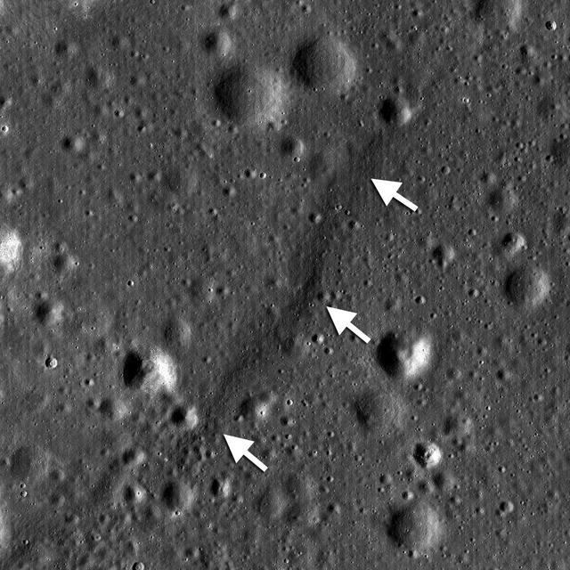
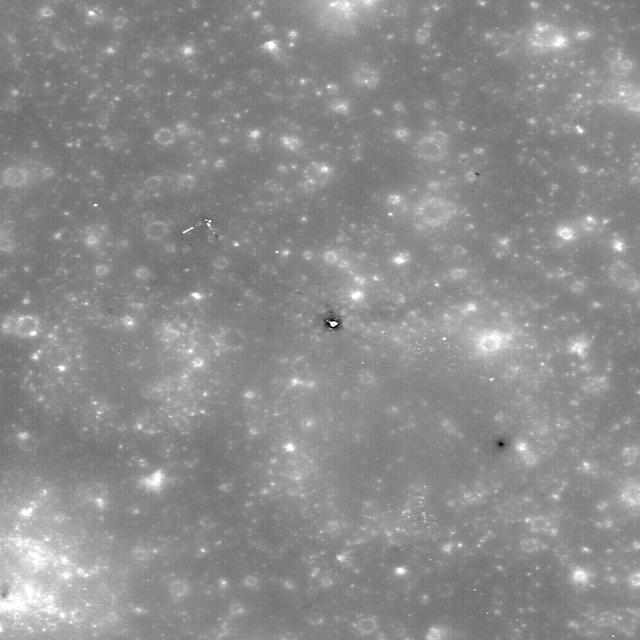
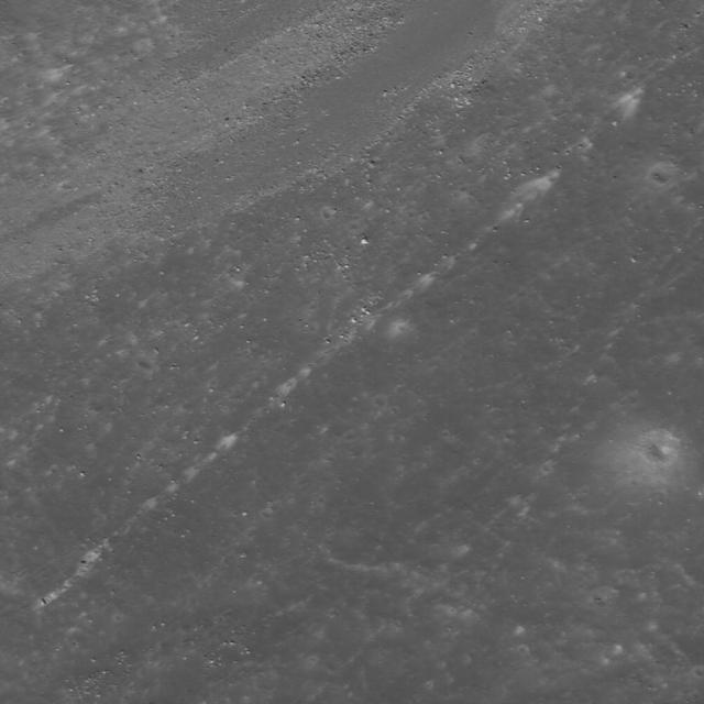
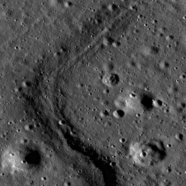
Luna 21 lander delivered the Lunokhod 2 rover to the floor of Le Monnier crater in January 1973. This image taken by NASA Lunar Reconnaissance Orbiter also shows the rover tracks.
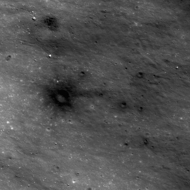
On April 14th 1970, the Apollo 13 Saturn IVB upper stage impacted the Moon North of Mare Cognitum, at -2.55° latitude, -27.88° East longitude. This image was taken by NASA Lunar Reconnaissance Orbiter.
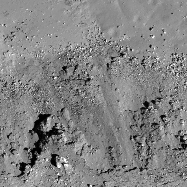
This high resolution image taken by NASA Lunar Reconnaissance Orbiter shows the floor of the Apollo Basin, a large 538 km diameter double-ringed impact crater in the southern hemisphere of the far side.