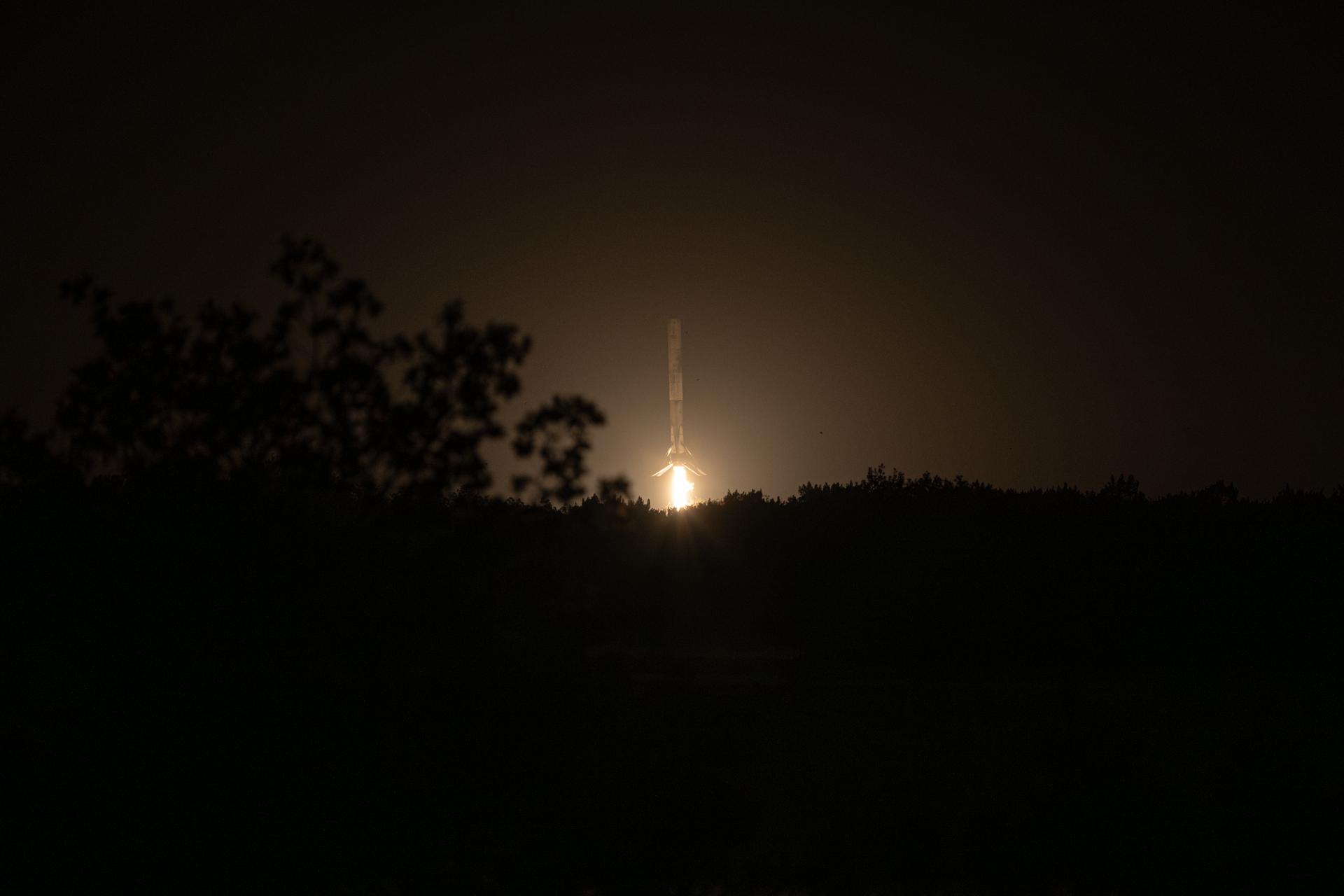
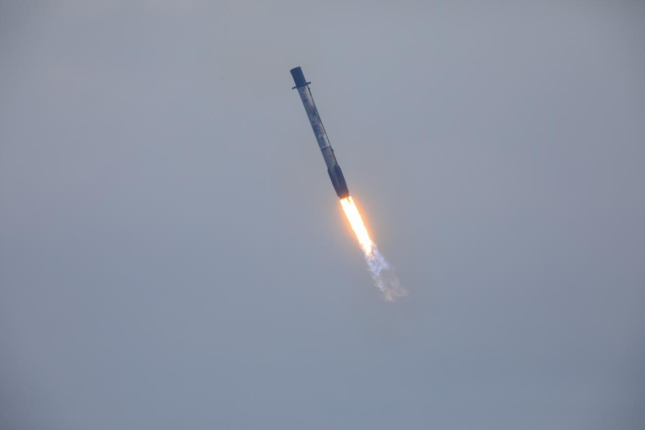
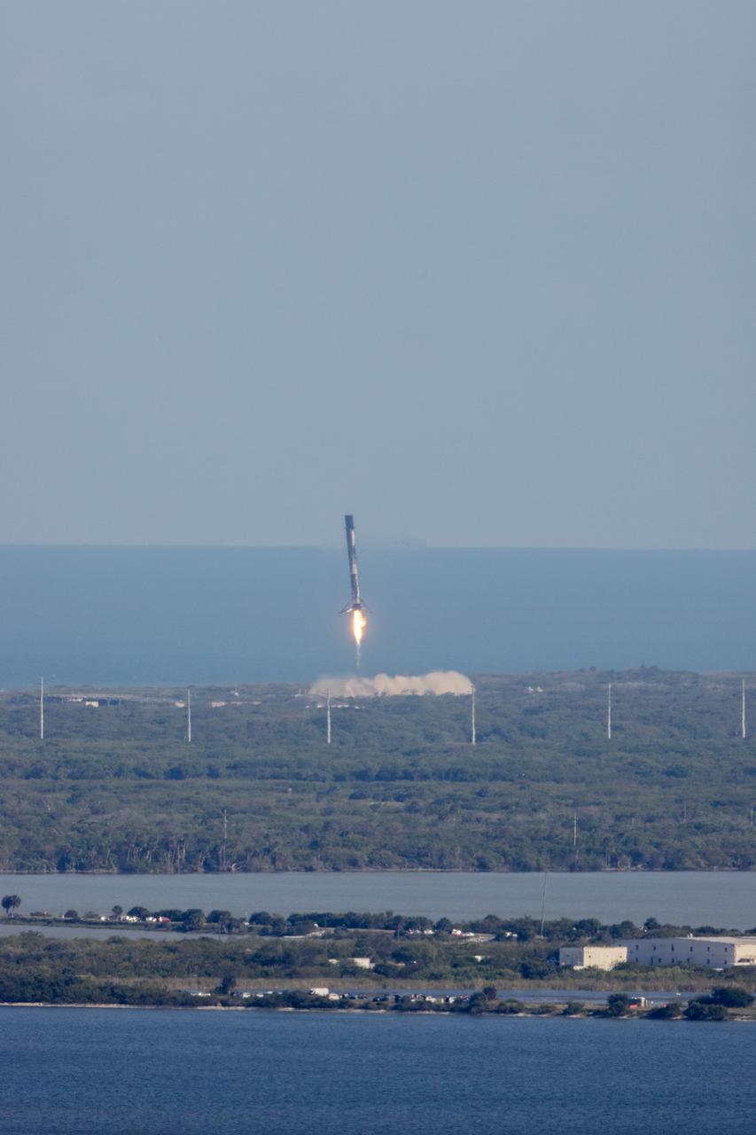
The first stage of a SpaceX Falcon 9 rocket lands at Landing Zone 40, Friday, Feb. 13, 2026, at Cape Canaveral Space Force Station in Florida. The Falcon 9 first stage supported the launch of NASA’s SpaceX Crew-12 mission to the International Space Station with NASA astronauts Jessica Meir, Jack Hathaway, ESA (European Space Agency) astronaut Sophie Adenot, and Roscosmos cosmonaut Andrey Fedyaev. NASA’s SpaceX Crew-12 mission is the twelfth crew rotation mission of the SpaceX Falcon 9 rocket and Dragon spacecraft to the International Space Station as part of the agency’s Commercial Crew Program. Meir, Hathaway, Adenot, and launched at 5:15 a.m. EST from Space Launch Complex 40 at the Cape Canaveral Space Force Station to begin their mission aboard the orbital outpost. Photo Credit: (NASA/John Kraus)
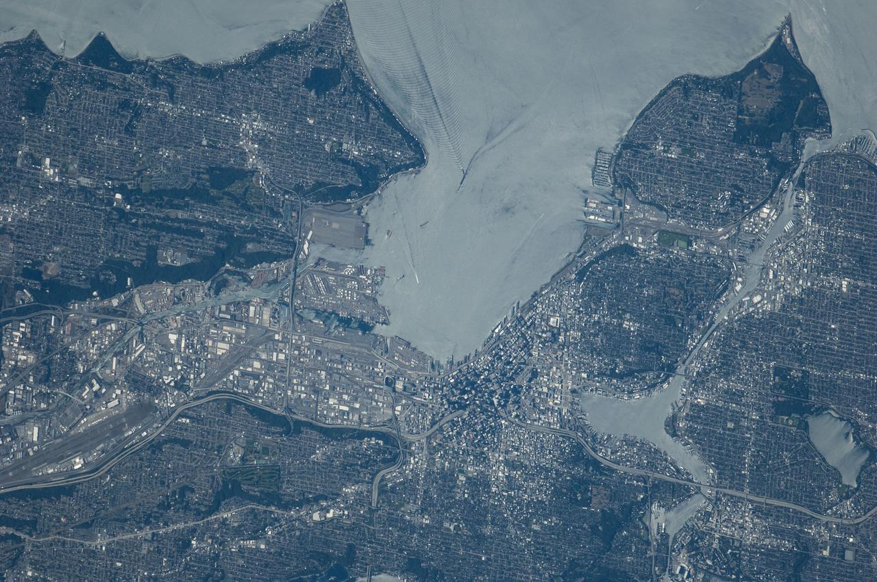
ISS040-E-124198 (6 Sept. 2014) --- Puget Sound is partly reflecting the sun in this detailed image taken by an Expedition 40 crew member on the International Space Station. Patterns of boat wakes are prominent in the sun’s partial reflection zone. The difference between the boat wakes in this view relates to the speed of the boat and the particular patterns (of several) that happen to be captured in the specific light reflection angles at the time the image was taken. The land areas show parts of Seattle. The darkest areas with rectangular grids are suburbs richly covered with trees. The broadly gray zones of the central city (bottom center) are brighter where structures are lower, as in the harbor zone (Harbor Island), and darker where the shadows of high-rise buildings downtown cast black shadows. Interstate Highway 5 bisects downtown.
Following liftoff of Northrup Grumman's 20th commercial resupply services mission for NASA, the first stage of a SpaceX Falcon 9 rocket returns to Landing Zone 1. Launch of Northrop Grumman's Cygnus resupply spacecraft atop Falcon 9 occurred at 12:07 p.m. EST on Tuesday, Jan. 30 from Launch Complex 40 at Cape Canaveral Space Force Station in Florida.
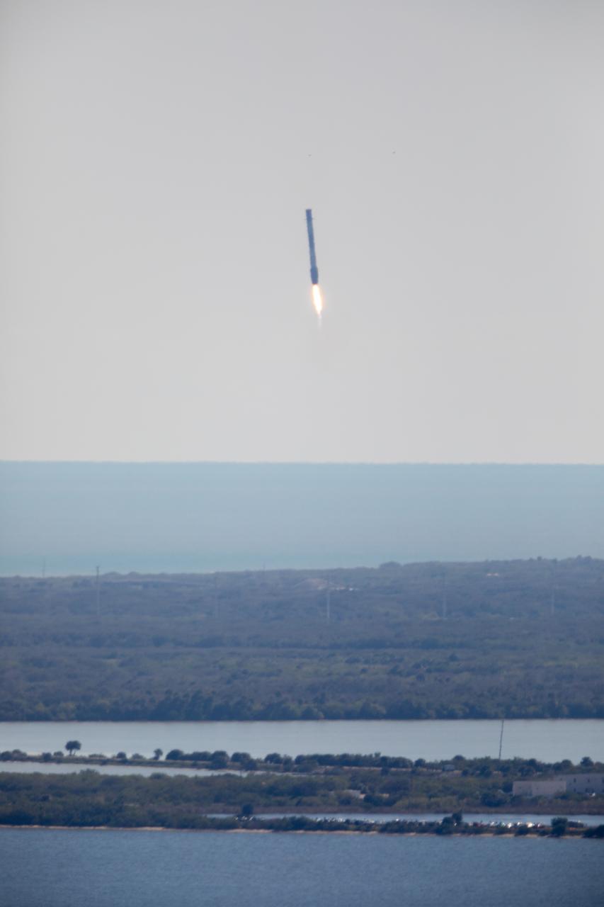
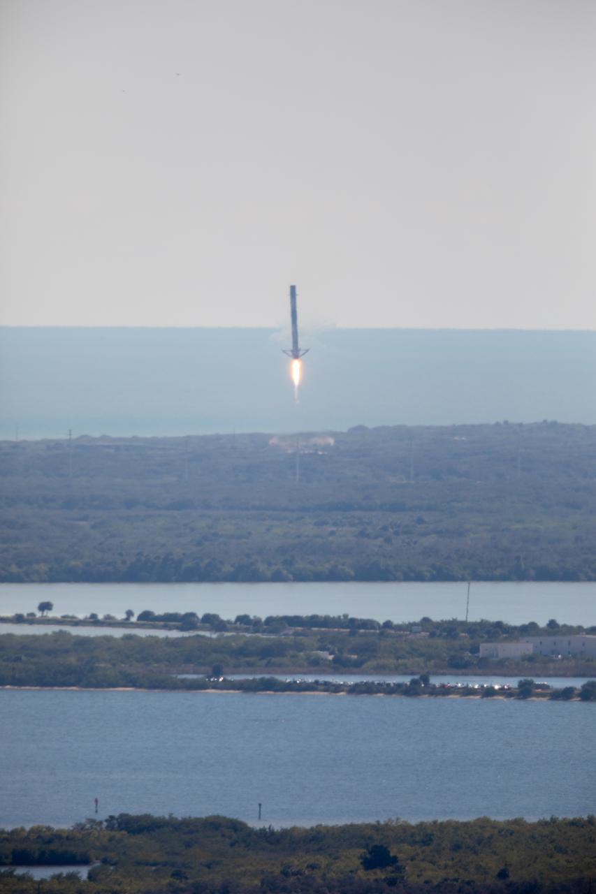
After boosting a SpaceX Dragon spacecraft on its way to the International Space Station for the company’s 18th Commercial Resupply Services mission, the first stage of the Falcon 9 rocket returns to Landing Zone 1 at Cape Canaveral Air Force Station in Florida on July 25, 2019. The rocket lifted off minutes earlier, at 6:01 p.m. EDT, from Space Launch Complex 40 at the Cape. The uncrewed Dragon spacecraft will deliver about 5,000 pounds of science and research, crew supplies and vehicle hardware to the orbiting laboratory.
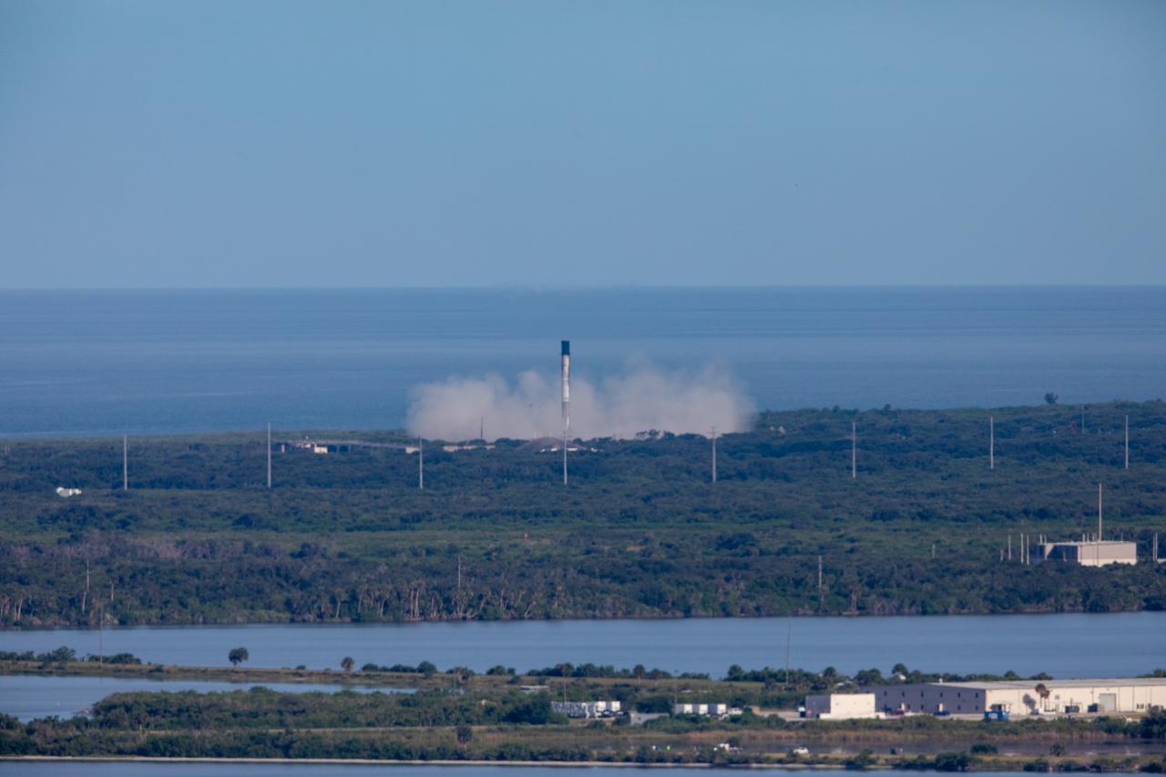
Following liftoff from Space Launch Complex 40 at Cape Canaveral Air Force Station, the first stage of a SpaceX Falcon 9 rocket returns to Landing Zone 1 at the Cape. At 1:16 p.m. EST, Dec. 5, 2018, a two-stage Falcon 9 launch vehicle began SpaceX's 16th Commercial Resupply Services mission carrying more than 5,600 pounds of research investigations and equipment, cargo and supplies that will support some of the hundreds of investigations aboard the International Space Station.
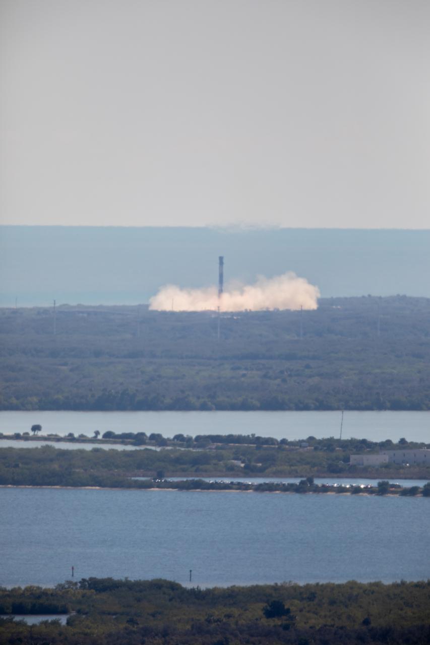
Following liftoff of Northrup Grumman's 20th commercial resupply services mission for NASA, the first stage of a SpaceX Falcon 9 rocket returns to Landing Zone 1. Launch of Northrop Grumman's Cygnus resupply spacecraft atop Falcon 9 occurred at 12:07 p.m. EST on Tuesday, Jan. 30 from Launch Complex 40 at Cape Canaveral Space Force Station in Florida.
Following liftoff of Northrup Grumman's 20th commercial resupply services mission for NASA, the first stage of a SpaceX Falcon 9 rocket returns to Landing Zone 1. Launch of Northrop Grumman's Cygnus resupply spacecraft atop Falcon 9 occurred at 12:07 p.m. EST on Tuesday, Jan. 30 from Launch Complex 40 at Cape Canaveral Space Force Station in Florida.
After boosting a SpaceX Dragon spacecraft on its way to the International Space Station for the company’s 18th Commercial Resupply Services mission, the first stage of the Falcon 9 rocket returns to Landing Zone 1 at Cape Canaveral Air Force Station in Florida on July 25, 2019. The rocket lifted off minutes earlier, at 6:01 p.m. EDT, from Space Launch Complex 40 at the Cape. The uncrewed Dragon spacecraft will deliver about 5,000 pounds of science and research, crew supplies and vehicle hardware to the orbiting laboratory.
A first-stage booster from SpaceX’s Falcon 9 rocket comes in for a successful landing at Landing Zone 1 at Cape Canaveral Space Force Station in Florida on Saturday, Sept. 28, 2024, just minutes after NASA’s SpaceX Crew-9 launch from Space Launch Complex-40. NASA astronaut Nick Hague and Roscosmos cosmonaut Aleksandr Gorbunov launched to the International Space Station aboard SpaceX’s Dragon spacecraft and Falcon 9 rocket at 1:17 p.m. EDT on the ninth crew rotation mission with SpaceX to the space station as part of the agency’s Commercial Crew Program.
A first-stage booster from SpaceX’s Falcon 9 rocket comes in for a successful landing at Landing Zone 1 at Cape Canaveral Space Force Station in Florida on Saturday, Sept. 28, 2024, just minutes after NASA’s SpaceX Crew-9 launch from Space Launch Complex-40. NASA astronaut Nick Hague and Roscosmos cosmonaut Aleksandr Gorbunov launched to the International Space Station aboard SpaceX’s Dragon spacecraft and Falcon 9 rocket at 1:17 p.m. EDT on the ninth crew rotation mission with SpaceX to the space station as part of the agency’s Commercial Crew Program.
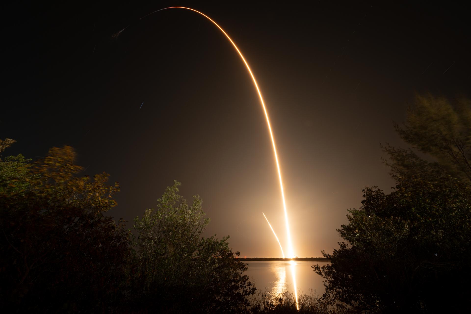
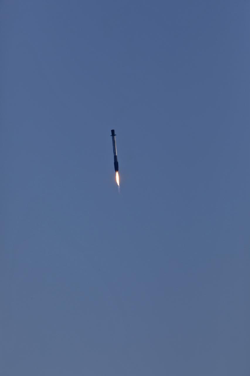
In this ten-minute long exposure photograph, a SpaceX Falcon 9 rocket carrying the company's Dragon spacecraft is launched on NASA’s SpaceX Crew-12 mission to the International Space Station with NASA astronauts Jessica Meir, Jack Hathaway, ESA (European Space Agency) astronaut Sophie Adenot, and Roscosmos cosmonaut Andrey Fedyaev, Friday, Feb. 13, 2026, from Cape Canaveral Space Force Station in Florida. Also visible in this image is the landing burn conducted by the first stage of the Falcon 9 rocket as it returned to Landing Zone 40 at Cape Canaveral Space Force Station. NASA’s SpaceX Crew-12 mission is the twelfth crew rotation mission of the SpaceX Falcon 9 rocket and Dragon spacecraft to the International Space Station as part of the agency’s Commercial Crew Program. Meir, Hathaway, Adenot, and launched at 5:15 a.m. EST from Space Launch Complex 40 at the Cape Canaveral Space Force Station to begin their mission aboard the orbital outpost. Photo Credit: (NASA/John Kraus)

ISS040-E-027042 (30 June 2014) --- Kulunda Steppe, Siberia in central Russia is featured in this image photographed by an Expedition 40 crew member on the International Space Station. The crew on the station called down to Houston to ask for an explanation of this strange pattern of spikes crossing the Kulunda Steppe in central Russia. The ?spikes? are a prominent visual feature (center) visible from the top of the ISS orbit (approximately 52 degrees north), the highest latitude flown over by the spacecraft. In fact these linear zones are gentle folds in the surface rocks of the area, lying slightly lower than the surrounding lighter-toned agricultural lands. The dark zones are forested with pines and dotted with salt-rich lakes. The image width (left to right edge) represents more than 300 kilometers ground distance, and the forested spikes are nearly that length. The green floodplain of the famous Ob River (right) is the westernmost of Siberia?s three great rivers (the others being the Yenisei and Lena). The Ob flows north (towards the top of the image) for another 2,000 kilometers to the Arctic Ocean. The city of Barnaul (population 612,000), a major center of industry, trade and culture in Siberia, lies on the banks of the river with riverboat, air and rail links to the rest of the country. A broader, winter image of the Kulunda geology and the Ob River can be seen here.
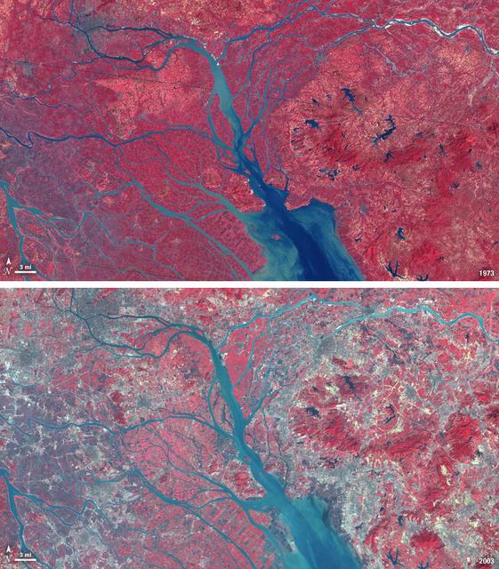
In 1979, China established two special economic zones around the Pearl River Delta, north of Hong Kong. This image, taken by Landsat 3 on October 19, 1973, shows that the region was rural when the zone was established. Plant-covered land, which is red in this false-color image, dominates the scene. Square grids are agriculture. By January 10, 2003, when Landsat 7 took this image, the Pearl River Delta was a densely populated urban corridor with several large cities. The urban areas are gray in this image. The region is a major manufacturing center with an economy the size of Taiwan’s. As of 2010, the Pearl River Economic Zone had a population of 36 million people. ---- NASA and the U.S. Department of the Interior through the U.S. Geological Survey (USGS) jointly manage Landsat, and the USGS preserves a 40-year archive of Landsat images that is freely available over the Internet. The next Landsat satellite, now known as the Landsat Data Continuity Mission (LDCM) and later to be called Landsat 8, is scheduled for launch in 2013. In honor of Landsat’s 40th anniversary in July 2012, the USGS released the LandsatLook viewer – a quick, simple way to go forward and backward in time, pulling images of anywhere in the world out of the Landsat archive. <b><a href="http://www.nasa.gov/audience/formedia/features/MP_Photo_Guidelines.html" rel="nofollow">NASA image use policy.</a></b> <b><a href="http://www.nasa.gov/centers/goddard/home/index.html" rel="nofollow">NASA Goddard Space Flight Center</a></b> enables NASA’s mission through four scientific endeavors: Earth Science, Heliophysics, Solar System Exploration, and Astrophysics. Goddard plays a leading role in NASA’s accomplishments by contributing compelling scientific knowledge to advance the Agency’s mission. <b>Follow us on <a href="http://twitter.com/NASA_GoddardPix" rel="nofollow">Twitter</a></b> <b>Like us on <a href="http://www.facebook.com/pages/Greenbelt-MD/NASA-Goddard/395013845897?ref=tsd" rel="nofollow">Facebook</a></b> <b>Find us on <a href="http://instagrid.me/nasagoddard/?vm=grid" rel="nofollow">Instagram</a></b>
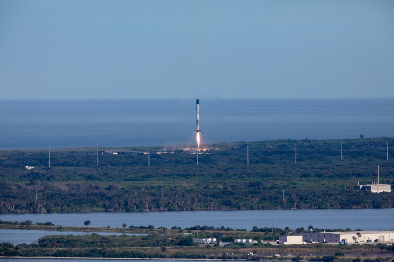
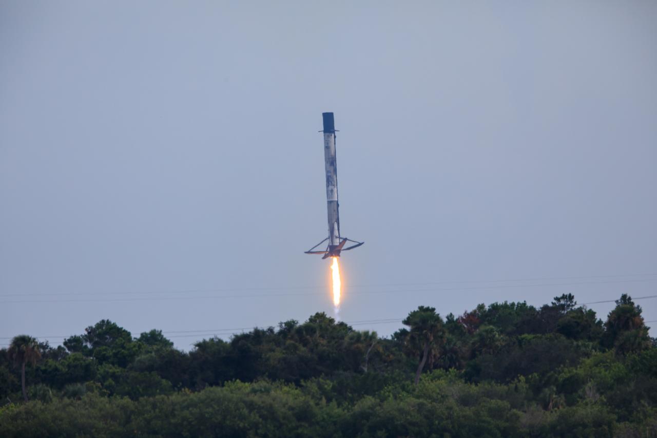
After boosting a SpaceX Dragon spacecraft on its way to the International Space Station for the company’s 30th Commercial Resupply Services mission for NASA, the first stage of the Falcon 9 rocket returns to Landing Zone 1 at Cape Canaveral Space Force Station (CCSFS) in Florida on Thursday, March 21, 2024. Dragon will deliver more than 6,200 pounds of cargo, including a variety of NASA and partner research including a look at plant metabolism in space and a set of new sensors for free-flying Astrobee robots to provide 3D mapping capabilities. Other studies include a fluid physics study that could benefit solar cell technology and a university project from CSA (Canadian Space Agency) that will monitor sea ice and ocean conditions. The spacecraft is expected to spend about a month attached to the orbiting outpost before it returns to Earth with research and return cargo, splashing down off the coast of Florida. Liftoff occurred at 4:55 p.m. EDT from Space Launch Complex 40 at CCSFS.
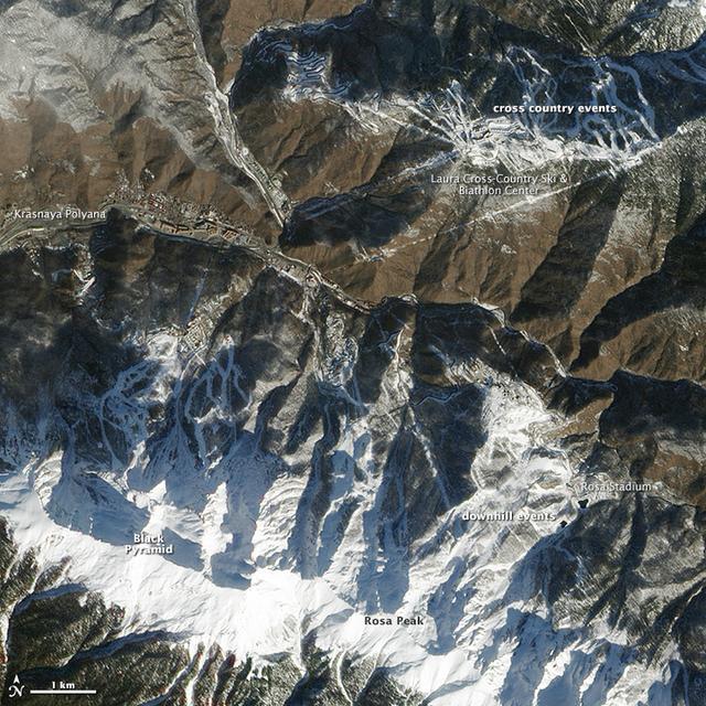
While Sochi is a coastal town on the Black Sea, the skiing events for the XXII Olympic Games are taking place about 40 kilometers (25 miles) inland. The venues are clustered around Krasnaya Polyana, a small town tucked between the Aibiga and Psekhako Ridges in the western Caucasus. This image—acquired by the Advanced Land Imager (ALI) on NASA’s Earth Observing-1 (EO-1) satellite on February 8, 2014—offers a view of the town and the ski facilities. The Rosa Khutor Alpine Center is the home to the downhill, snowboard, and freestyle events. The combined downhill skiing area measures about 20 kilometers (12 miles) in total, with the men’s downhill course stretching 3,500 meters (11,482 feet) and featuring a 1,075-meter (3,526 foot) change in elevation. The highest lift climbs to the summit of Rosa Peak, which rises 2,320 meters (7,612 feet). While not being used for the Olympics, the nearby Black Pyramid mountain has downhill skiing trails as well. The same steep slopes that make Rosa Peak good for skiing also elevate the risk of avalanches. To protect against falling snow, planners installed a series of gas pipes along the top of the ridge. The pipes emit bursts of oxygen and propane that create small, controlled avalanches. Event organizers also installed a series of earthen dams to steer snow away from infrastructure, and they have deployed two backhoes to the top of Aibiga Ridge to knock cornices away before they pose a risk. The Laura Cross-country Ski and Biathalon Center is located to the north on Psekhako Ridge. It includes two stadiums, each with their own start and finish zones, two track systems for skiing and biathlon, as well as shooting areas and warm-up zones. The center is named for the Laura River, a turbulent river that flows nearby. NASA Earth Observatory image by Jesse Allen and Robert Simmon, using EO-1 ALI data provided courtesy of the NASA EO-1 team. Caption by Adam Voiland. Instrument: EO-1 - ALI Read more: <a href="http://earthobservatory.nasa.gov/IOTD/view.php?id=83131&eocn=home&eoci=iotd_grid" rel="nofollow">earthobservatory.nasa.gov/IOTD/view.php?id=83131&eocn...</a> Credit: <b><a href="http://www.earthobservatory.nasa.gov/" rel="nofollow"> NASA Earth Observatory</a></b> <b><a href="http://www.nasa.gov/audience/formedia/features/MP_Photo_Guidelines.html" rel="nofollow">NASA image use policy.</a></b> <b><a href="http://www.nasa.gov/centers/goddard/home/index.html" rel="nofollow">NASA Goddard Space Flight Center</a></b> enables NASA’s mission through four scientific endeavors: Earth Science, Heliophysics, Solar System Exploration, and Astrophysics. Goddard plays a leading role in NASA’s accomplishments by contributing compelling scientific knowledge to advance the Agency’s mission. <b>Follow us on <a href="http://twitter.com/NASAGoddardPix" rel="nofollow">Twitter</a></b> <b>Like us on <a href="http://www.facebook.com/pages/Greenbelt-MD/NASA-Goddard/395013845897?ref=tsd" rel="nofollow">Facebook</a></b> <b>Find us on <a href="http://instagram.com/nasagoddard?vm=grid" rel="nofollow">Instagram</a></b>
High res here: <a href="http://www.flickr.com/photos/gsfc/12640339235/in/photostream/">www.flickr.com/photos/gsfc/12640339235/in/photostream/</a> While Sochi is a coastal town on the Black Sea, the skiing events for the XXII Olympic Games are taking place about 40 kilometers (25 miles) inland. The venues are clustered around Krasnaya Polyana, a small town tucked between the Aibiga and Psekhako Ridges in the western Caucasus. This image—acquired by the Advanced Land Imager (ALI) on NASA’s Earth Observing-1 (EO-1) satellite on February 8, 2014—offers a view of the town and the ski facilities. The Rosa Khutor Alpine Center is the home to the downhill, snowboard, and freestyle events. The combined downhill skiing area measures about 20 kilometers (12 miles) in total, with the men’s downhill course stretching 3,500 meters (11,482 feet) and featuring a 1,075-meter (3,526 foot) change in elevation. The highest lift climbs to the summit of Rosa Peak, which rises 2,320 meters (7,612 feet). While not being used for the Olympics, the nearby Black Pyramid mountain has downhill skiing trails as well. The same steep slopes that make Rosa Peak good for skiing also elevate the risk of avalanches. To protect against falling snow, planners installed a series of gas pipes along the top of the ridge. The pipes emit bursts of oxygen and propane that create small, controlled avalanches. Event organizers also installed a series of earthen dams to steer snow away from infrastructure, and they have deployed two backhoes to the top of Aibiga Ridge to knock cornices away before they pose a risk. The Laura Cross-country Ski and Biathalon Center is located to the north on Psekhako Ridge. It includes two stadiums, each with their own start and finish zones, two track systems for skiing and biathlon, as well as shooting areas and warm-up zones. The center is named for the Laura River, a turbulent river that flows nearby. NASA Earth Observatory image by Jesse Allen and Robert Simmon, using EO-1 ALI data provided courtesy of the NASA EO-1 team. Caption by Adam Voiland. Instrument: EO-1 - ALI Read more: <a href="http://earthobservatory.nasa.gov/IOTD/view.php?id=83131&eocn=home&eoci=iotd_grid" rel="nofollow">earthobservatory.nasa.gov/IOTD/view.php?id=83131&eocn...</a> Credit: <b><a href="http://www.earthobservatory.nasa.gov/" rel="nofollow"> NASA Earth Observatory</a></b> <b><a href="http://www.nasa.gov/audience/formedia/features/MP_Photo_Guidelines.html" rel="nofollow">NASA image use policy.</a></b> <b><a href="http://www.nasa.gov/centers/goddard/home/index.html" rel="nofollow">NASA Goddard Space Flight Center</a></b> enables NASA’s mission through four scientific endeavors: Earth Science, Heliophysics, Solar System Exploration, and Astrophysics. Goddard plays a leading role in NASA’s accomplishments by contributing compelling scientific knowledge to advance the Agency’s mission. <b>Follow us on <a href="http://twitter.com/NASAGoddardPix" rel="nofollow">Twitter</a></b> <b>Like us on <a href="http://www.facebook.com/pages/Greenbelt-MD/NASA-Goddard/395013845897?ref=tsd" rel="nofollow">Facebook</a></b> <b>Find us on <a href="http://instagram.com/nasagoddard?vm=grid" rel="nofollow">Instagram</a></b>
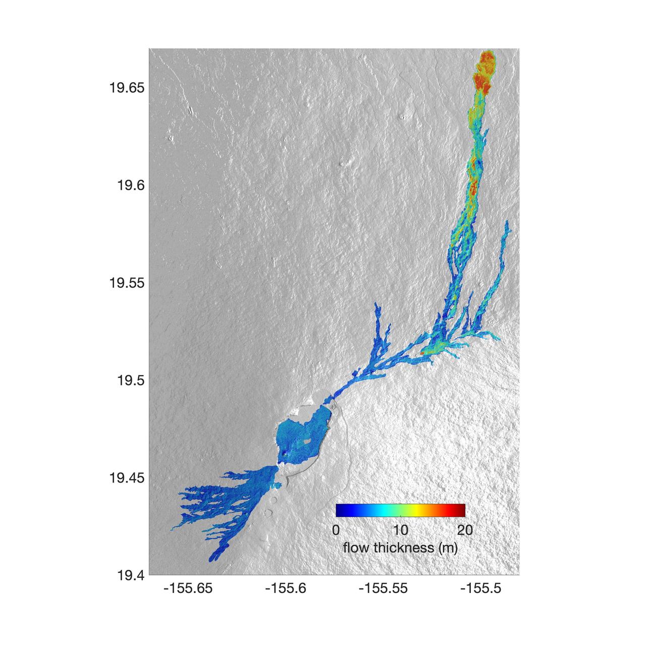
The world's largest active volcano – Hawaii's Mauna Loa – had been quiet for 38 years. But in 2022, the volcano began to stir, showing increased numbers of small earthquakes and subtle swelling of certain land surfaces in September. On November 27, fountains of lava began spurting from the mountain's Northeast Rift Zone and streams of molten rock flowed to the north. Ten days into the eruption, a NASA aircraft conducted its first flight over the erupting volcano. It carried NASA's Uninhabited Aerial Vehicle Synthetic Aperture Radar (UAVSAR) system, which was used to map the volcano's topography in fine detail with a Ka-band instrument called GLISTIN-A. Teams from NASA's Jet Propulsion Laboratory and the United States Geological Survey (USGS) used data from that sensor to map the thickness of those flows during a series of flights on December 7, 8, and 10. The map above shows the thickness of the lava flows during the flight on December 7, the day before USGS scientists noticed a significant decline in the pace of the eruption. A few days later, they declared the eruption had stopped. The map shows the thickness of the lava flows in the summit caldera, where the eruption began, and of lava flows on Mauna Loa's northeastern flank. The color variation from blue to orange indicates increasing lava flow thickness. A maximum thickness of roughly 25 meters (82 feet) is shown, though values exceeding 40 meters (131 feet) were observed in some areas. The thickening at the northern end of the flow is due to lava accumulating away from the vent, along with a flattening of the terrain at the saddle between the Mauna Loa and Mauna Kea volcanoes. By comparing to pre-eruption maps of this area's topography, including GLISTIN-A data collected in 2017, the USGS researchers were able to calculate the size and volume of the lava flow. Over the roughly 14-day eruption, Mauna Loa erupted more than 8.8 billion cubic feet (230 million cubic meters) along a lava flow that extended up to 16.5 miles (19.5 kilometers) from the vent, according to the USGS. The UAVSAR operates from a pod mounted beneath a crewed Gulfstream III jet from NASA's Armstrong Flight Research Center in California. Repeated topographic maps generated with each flight reveal the progression and thickening of lava with time – important information for scientific understanding of volcano processes and for emergency response. For the Mauna Loa science flights, the instrument suite featured an additional state-of-the-art imaging tool: the synthetic aperture radar-fusion optical short-wave infrared (SAR-Fusion Optical/SWIR) camera system. SAR-Fusion collects data over the same ground swath as GLISTIN-A to map land surface changes using optical/SWIR photogrammetry methods. GLISTIN-A was designed to provide all-weather, high-resolution surface topography not available through existing lidar or radar sensors. GLISTIN-A was originally demonstrated as a new radar technique for mapping ice surfaces. Science demonstration flights began in 2013 over alpine glaciers and sea ice in Alaska, and a floodplain in California. Its applications have since expanded to other areas, such as snow accumulation and volcano dynamics. The first time the instrument was deployed for volcano response was in 2018 during the three-month eruption of Kilauea. The success of that operation paved the way for deployment to Mauna Loa. https://photojournal.jpl.nasa.gov/catalog/PIA25526