Honolulu, on the island of Oahu, is a large and growing urban area. This stereoscopic image pair, combining a Landsat image with topography measured by NASA Shuttle Radar Topography Mission SRTM, shows how topography controls the urban pattern.
Stereo Pair, Honolulu, Oahu
This stereoscopic satellite image showing Miquelon and Saint Pierre Islands, located south of Newfoundland, Canada, was generated by draping NASA Landsat satellite image over a preliminary Shuttle Radar Topography Mission SRTM elevation model.
SRTM Stereo Pair with Landsat Overlay: Miquelon and Saint Pierre Islands
On January 26, 2001, the city of Bhuj suffered the most deadly earthquake in India history. This stereoscopic image was generated from NASA Landsat satellite and data from Shuttle Radar Topography Mission SRTM.
SRTM Stereo Pair: Bhuj, India, Two Weeks After Earthquake
This perspective view shows the city of Bhuj, India, in the foreground gray area after an earthquake in western India on January 26, 2001. This image was generated from NASA Landsat satellite and data from Shuttle Radar Topography Mission SRTM.
SRTM Perspective View with Landsat Overlay: Bhuj, India
After draining the northern flank of the Alps Mountains in Germany and Austria, the Danube River flows east as it enters this west-looking scene (upper right) and forms the border between Slovakia and Hungary. The river then leaves the border as it enters Hungary and transects the Transdanubian Mountains, which trend southwest to northeast. Upon exiting the mountains, the river turns southward, flowing past Budapest (purplish blue area) and along the western margin of the Great Hungarian Plain.  South and west of the Danube, the Transdanubian Mountains have at most only about 400 meters (about 1300 feet) of relief but they exhibit varied landforms, which include volcanic, tectonic, fluvial (river), and eolian (wind) features. A thick deposit of loess (dust deposits likely blown from ancient glacial outwash) covers much of this area, and winds from the northwest, funneled between the Alps and the Carpathian Mountains, are apparently responsible for a radial pattern of erosional streaks across the entire region.  This image was generated from a Landsat satellite image draped over an elevation model produced by the Shuttle Radar Topography Mission (SRTM). The view uses a 3-times vertical exaggeration to enhance topographic expression. The false colors of the scene result from displaying Landsat bands 1, 4, and 7 in blue, green, and red, respectively. Band 1 is visible blue light, but bands 4 and 7 are reflected infrared light. This band combination maximizes color contrasts between the major land cover types, namely vegetation (green), bare ground (red), and water (blue). Shading of the elevation model was used to further highlight the topographic features.  http://photojournal.jpl.nasa.gov/catalog/PIA04952
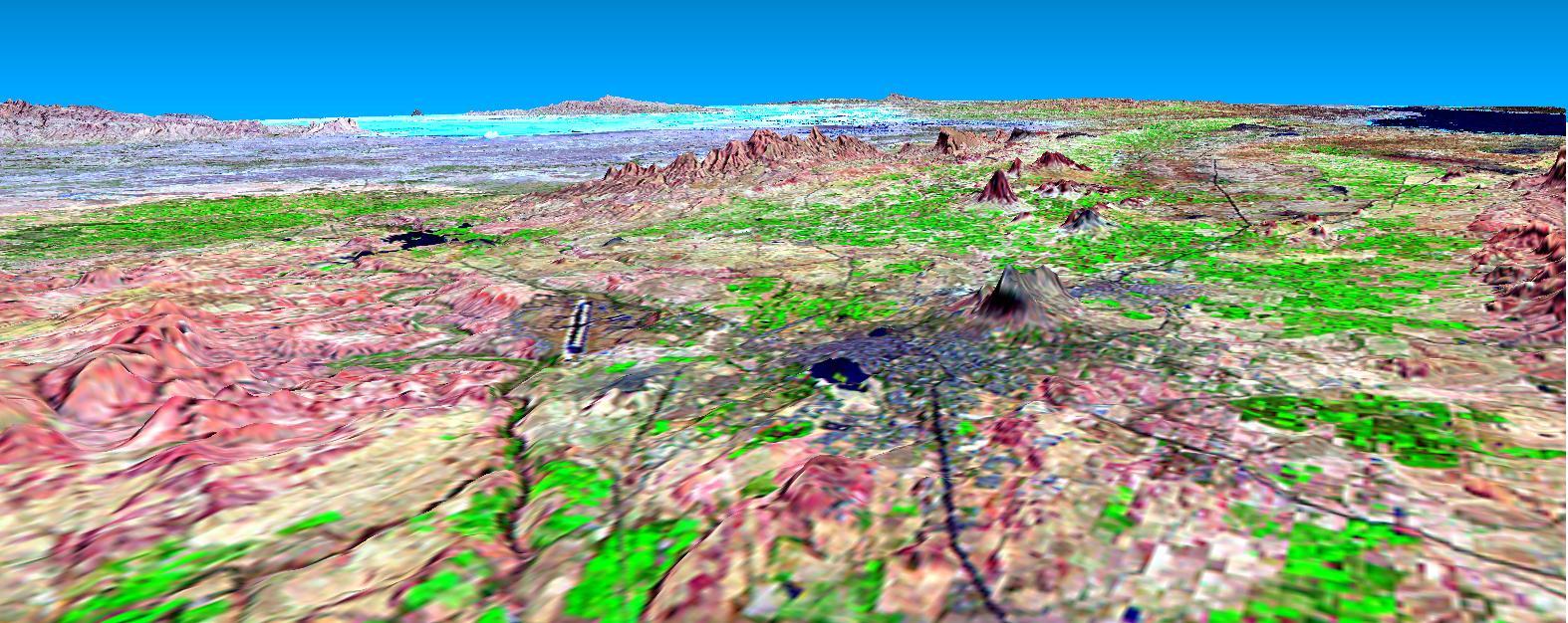
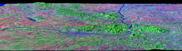
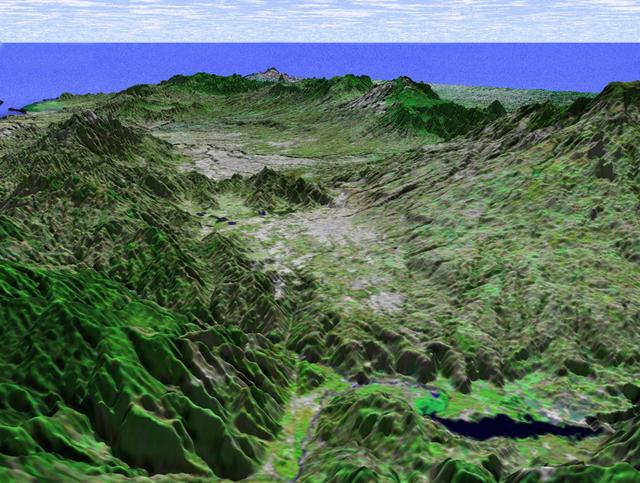
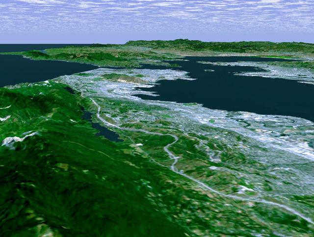
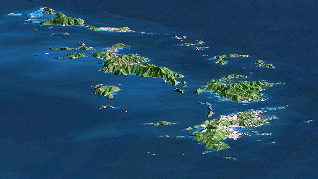
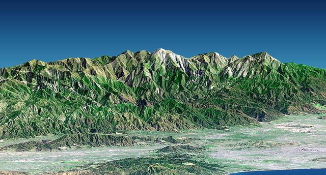
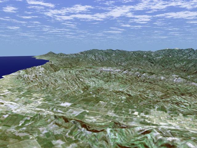
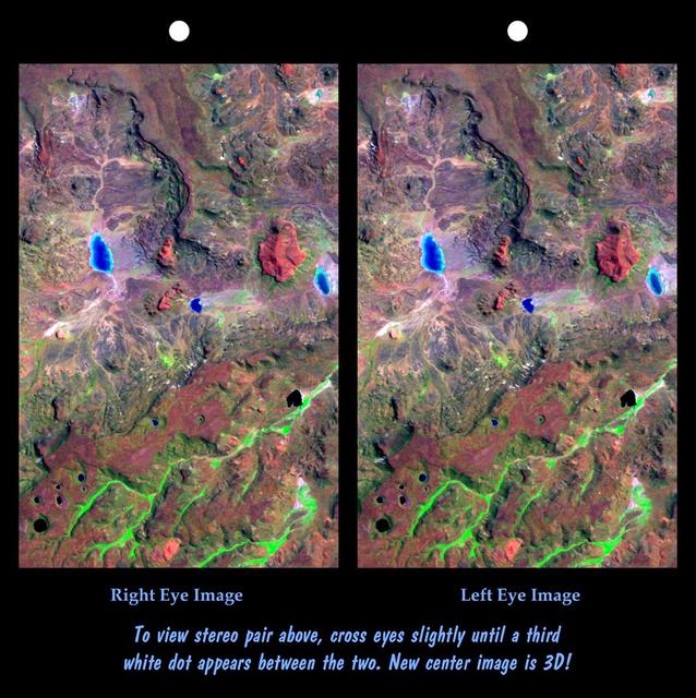
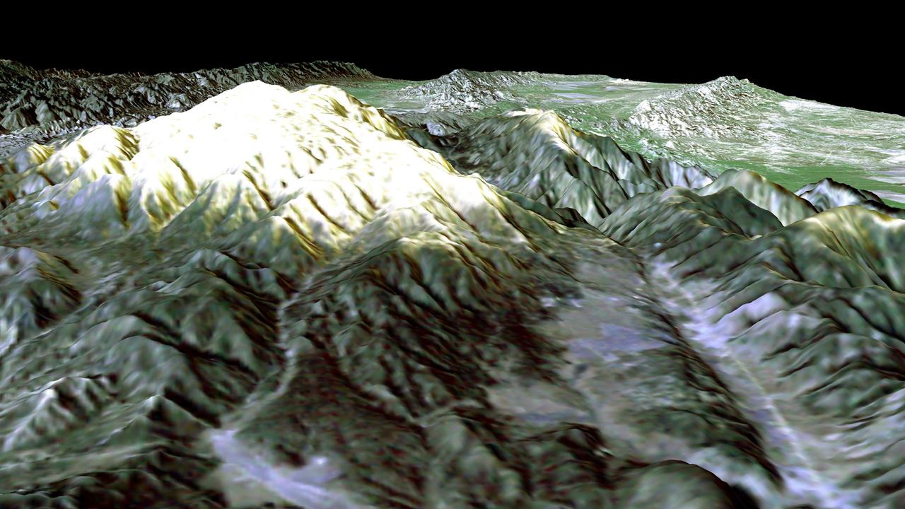
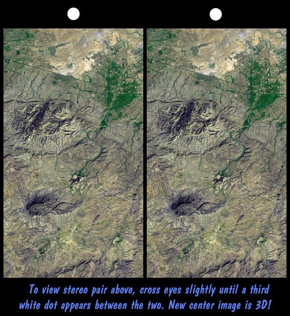
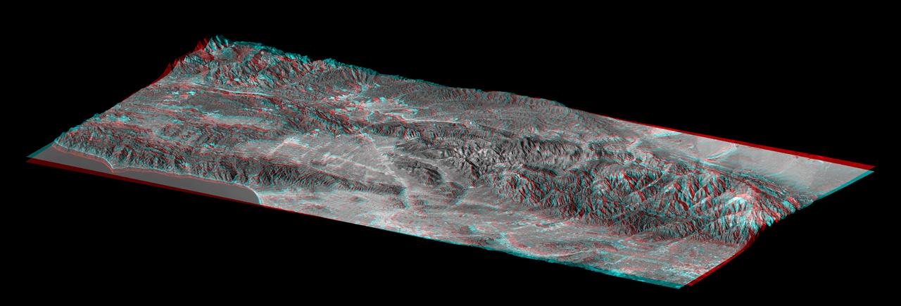
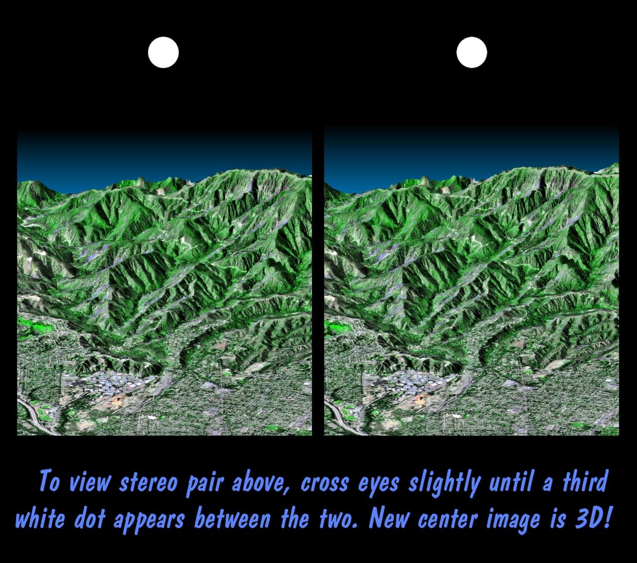
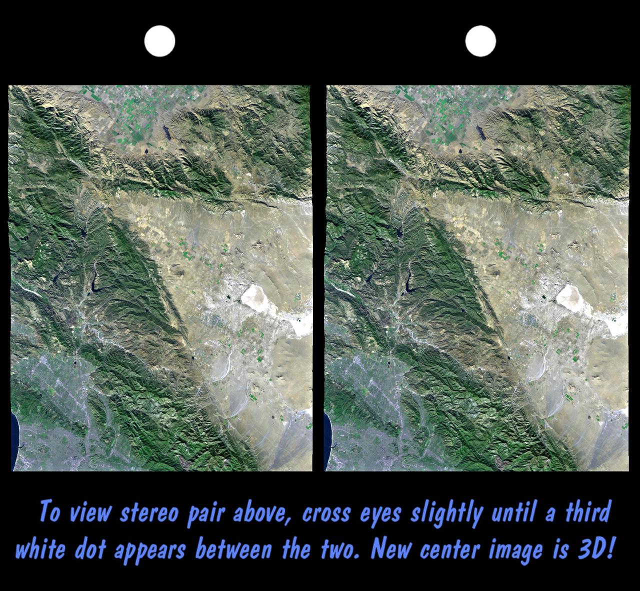
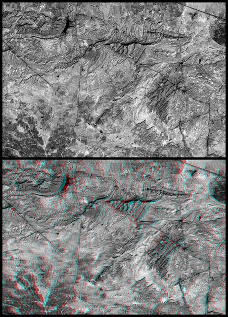
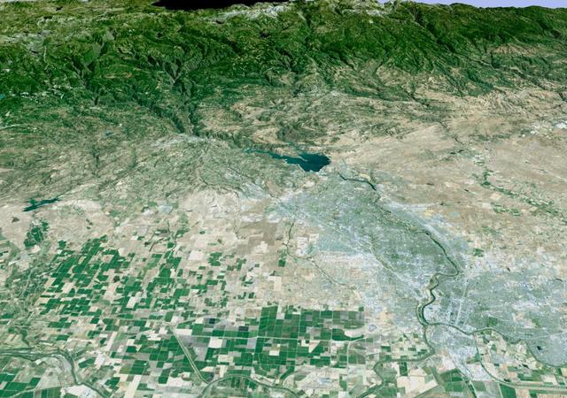
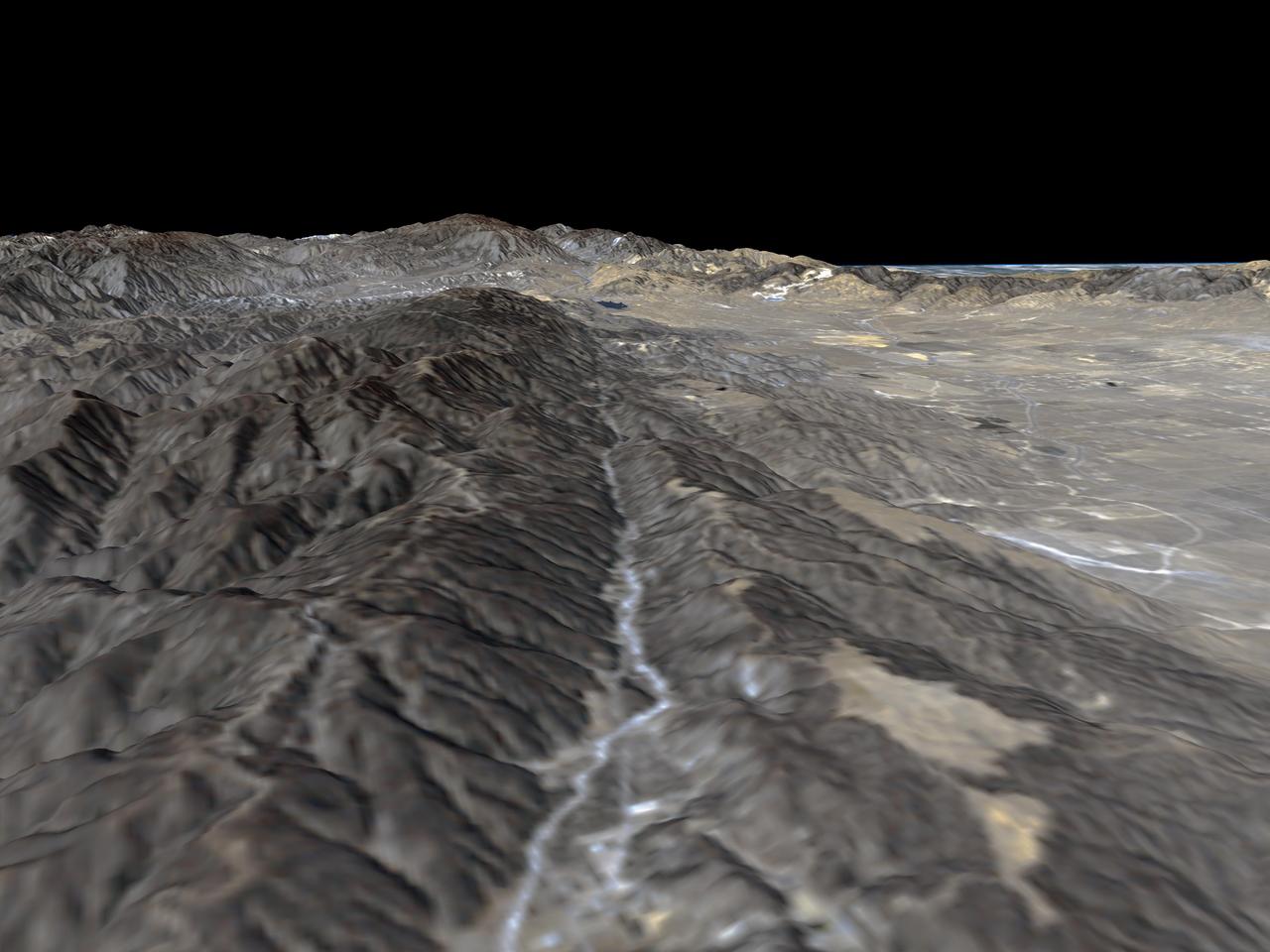
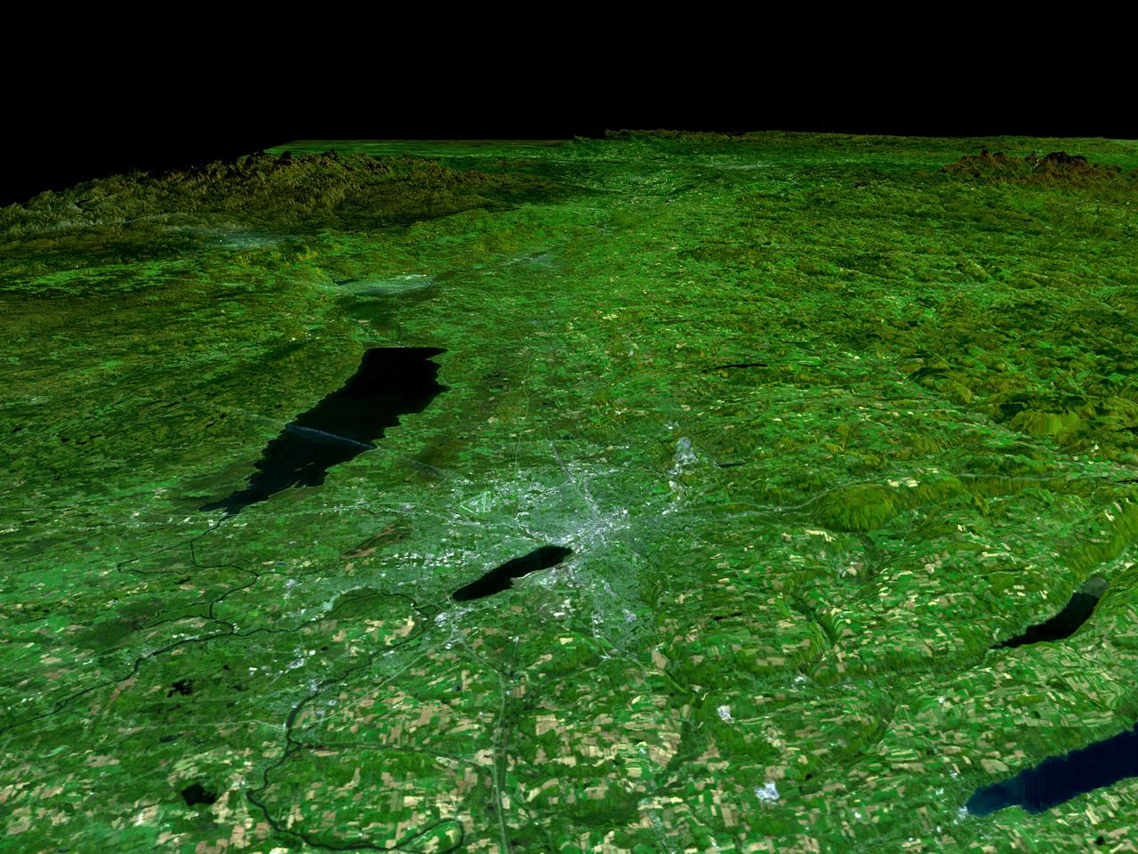
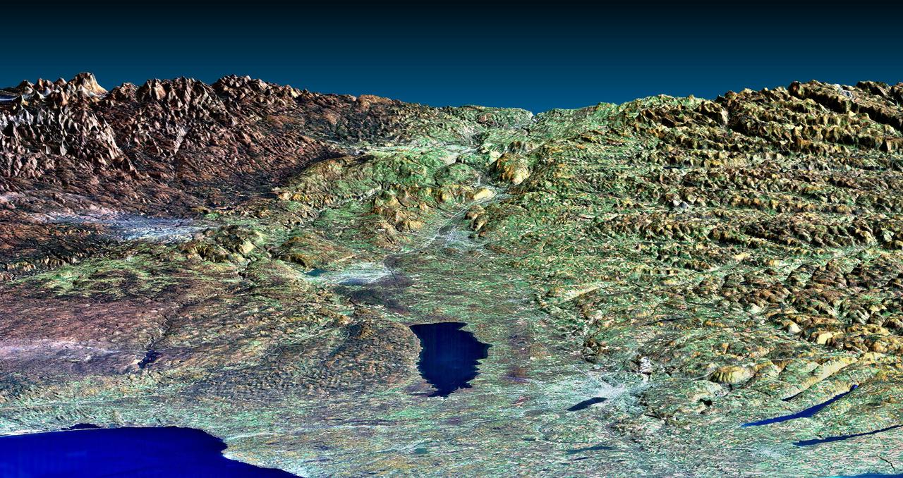
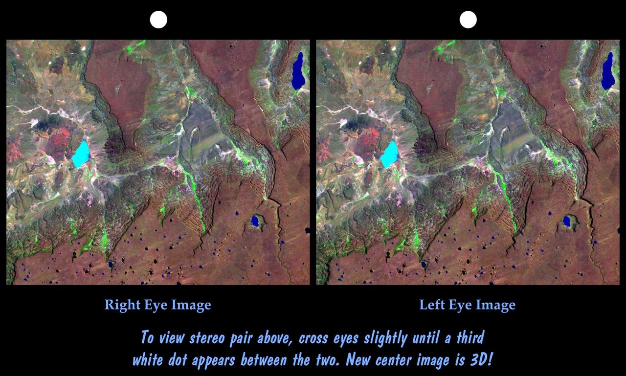
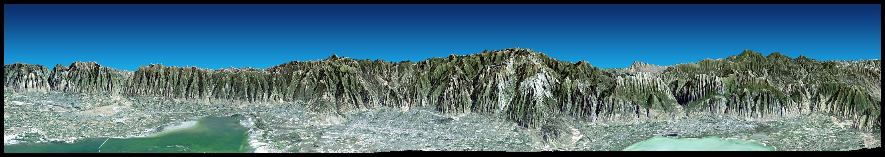
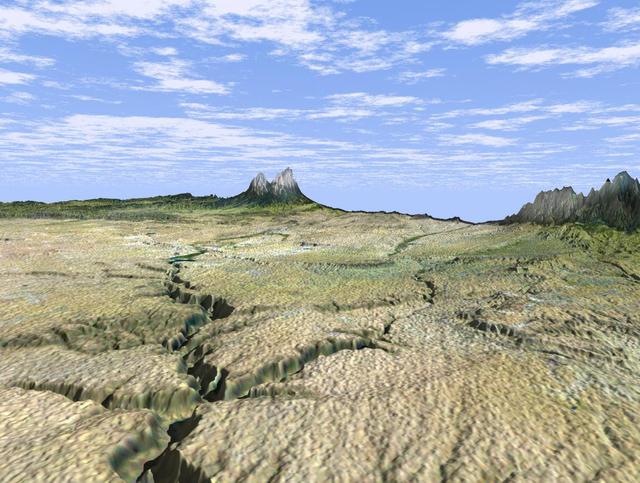
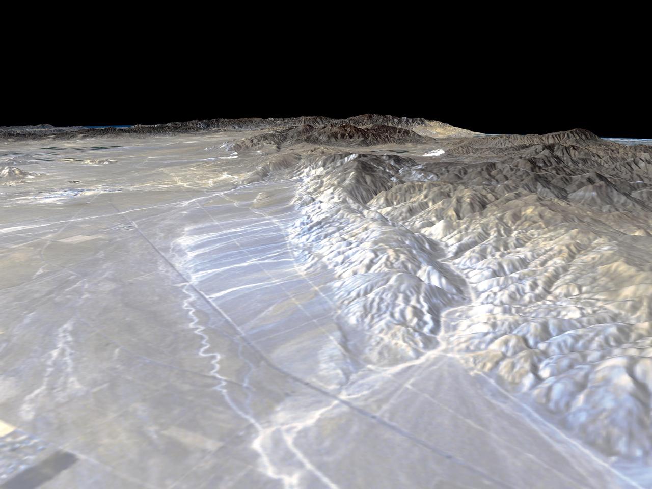
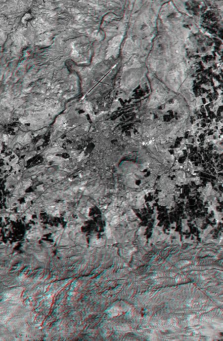
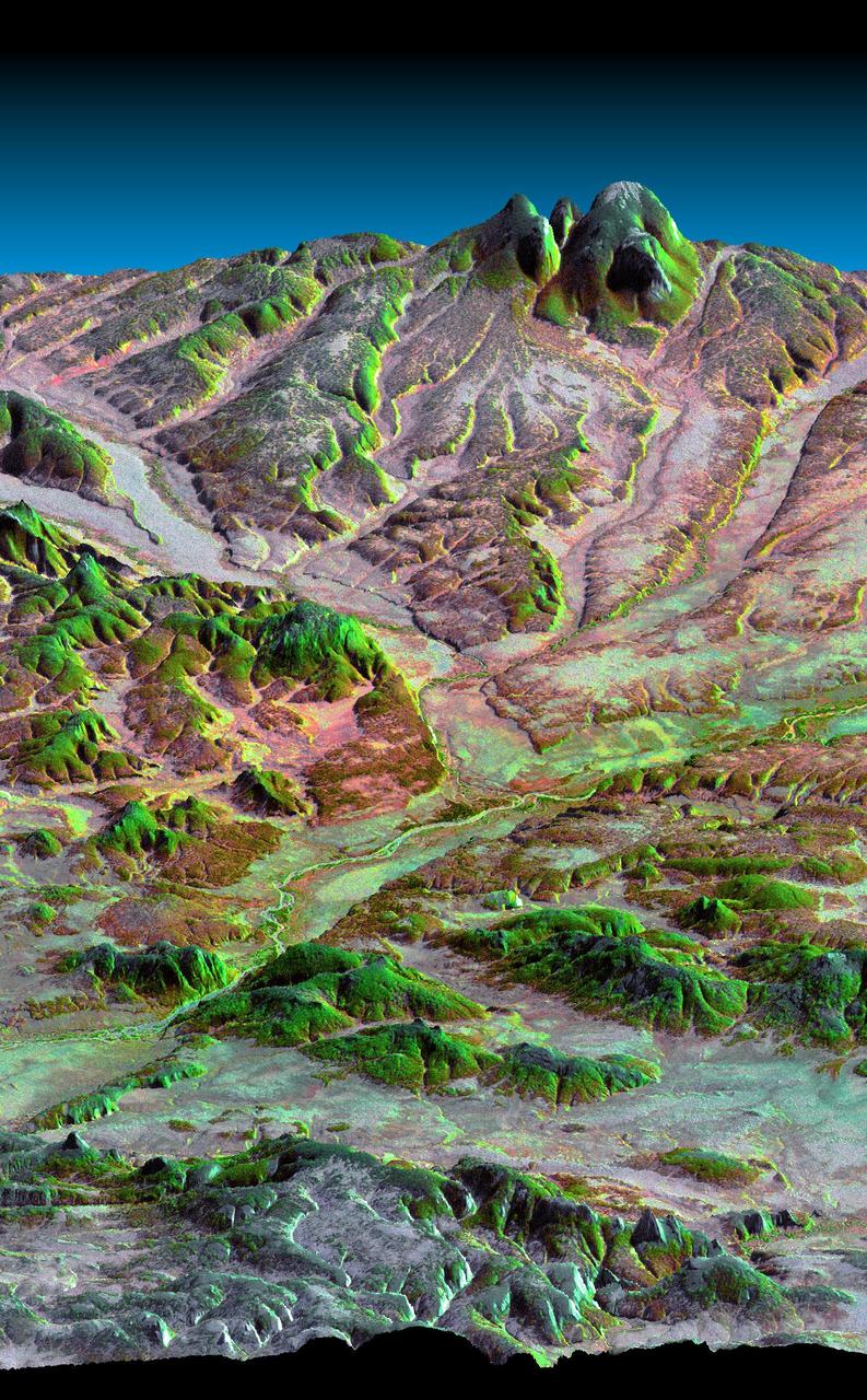
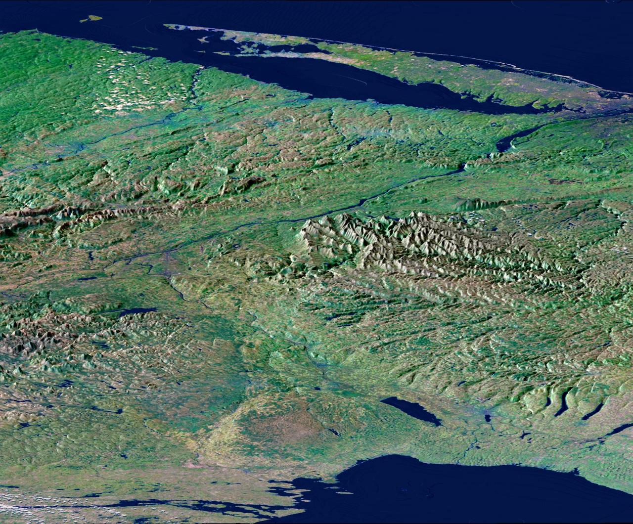
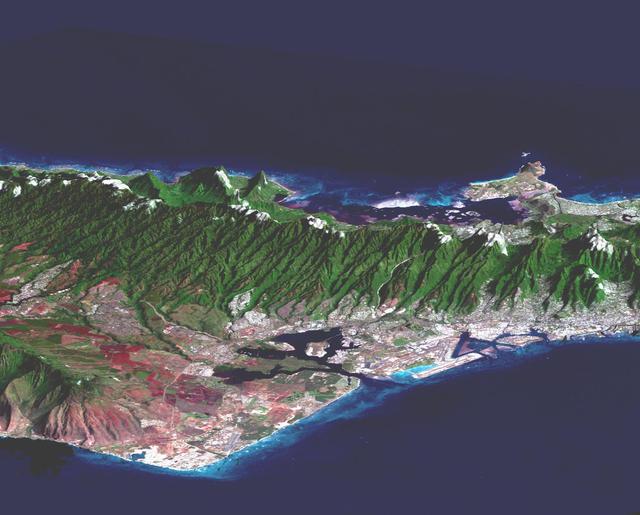
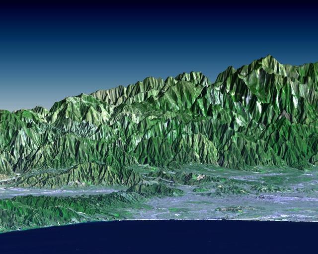
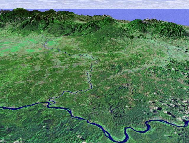
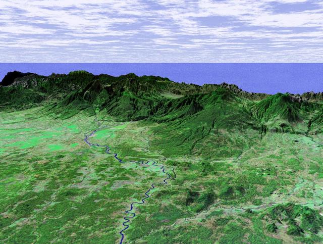
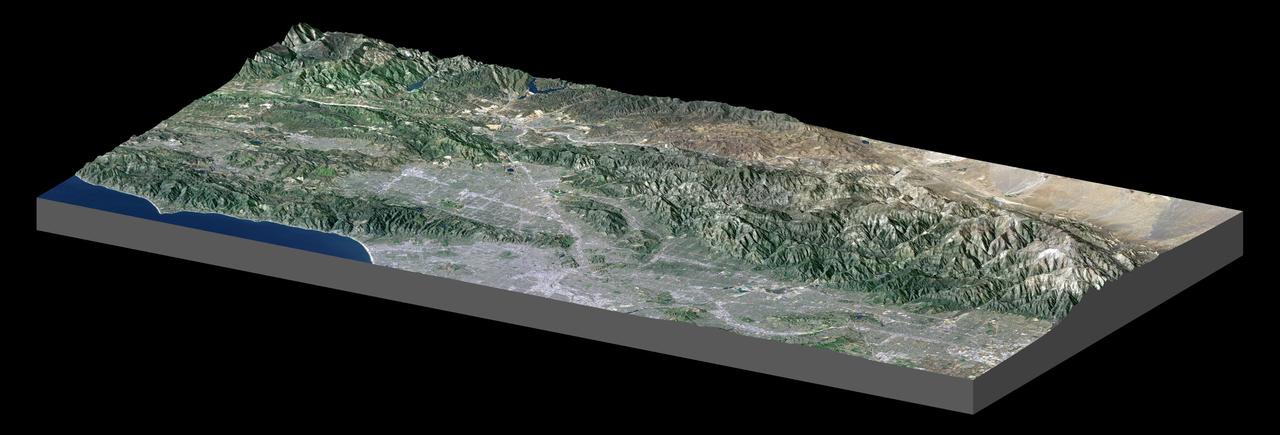
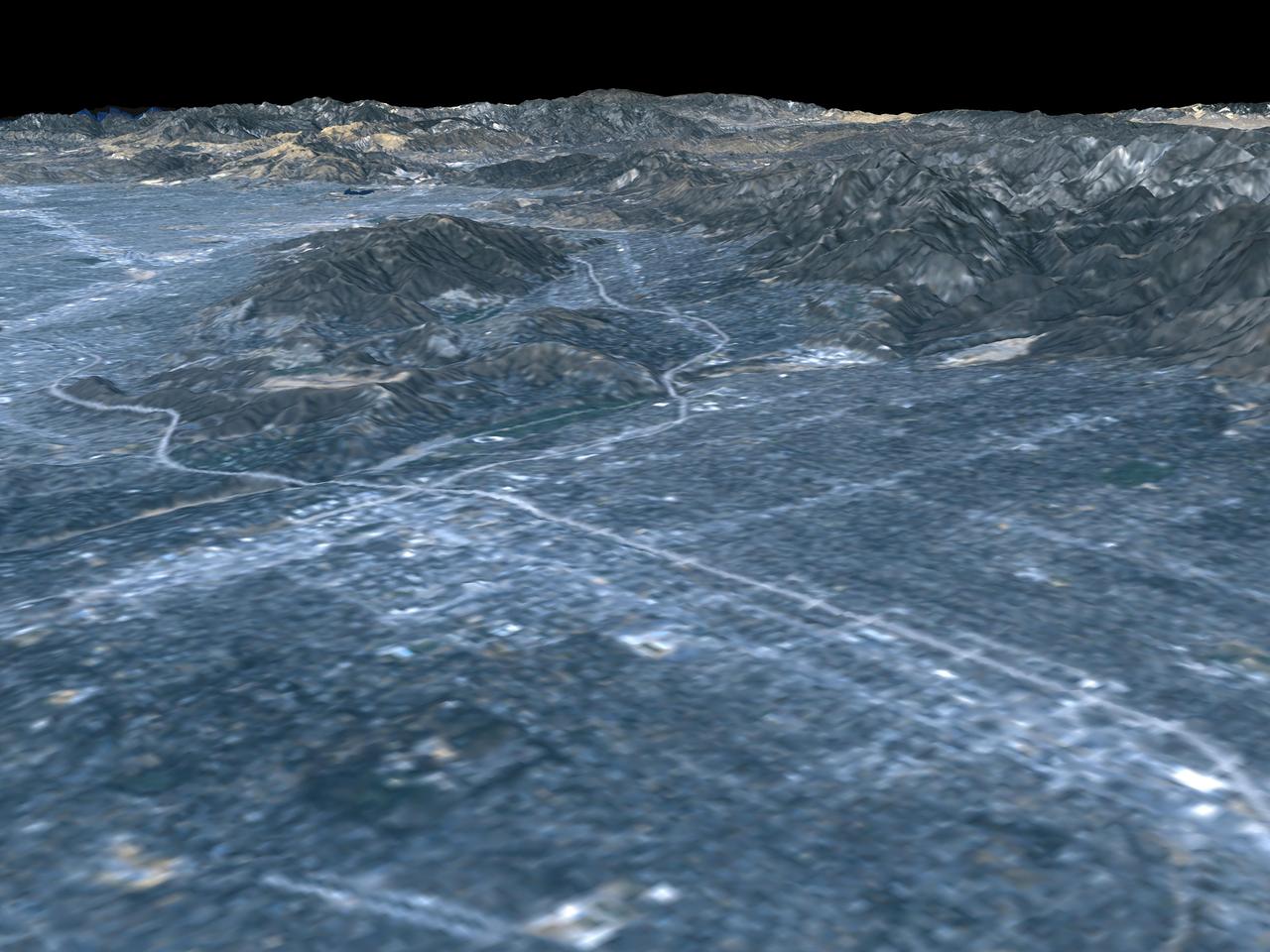
Budapest, Hungary, Perspective View, SRTM Elevation Model with Landsat Overlay
The prominent linear feature straight down the center of this perspective view is the San Andreas Fault in an image created with data from NASA shuttle Radar Topography Mission SRTM.
Perspective View, San Andreas Fault
The volcanic nature of Mount Shasta is clearly evident in this computer-generated perspective viewed from the northwest.
Perspective View with Landsat Overlay, Mount Shasta, Calif.
Most of the population of Utah lives just west of the Wasatch Mountains in the north central part of the state.
Perspective View with Landsat Overlay, Salt Lake City, Utah
Los Angeles, Calif., is one of the world largest metropolitan areas with a population of about 15 million people. The urban areas mostly cover the coastal plains and lie within the inland valleys.
Perspective View, SRTM / Landsat, Los Angeles, Calif
Mount San Antonio more commonly known as Mount Baldy crowns the San Gabriel Mountains northeast of Los Angeles, Calif., in this anaglyph from NASA Shuttle Radar Topography Mission. 3D glasses are necessary to view this image.
Anaglyph, Metro Los Angeles, Calif.: Malibu to Mount Baldy
This 3-D anaglyph shows an area on the western side of the volcanically active Kamchatka Peninsula, Russia as seen by the instrument onboard NASA Shuttle Radar Topography Mission. 3D glasses are necessary to view this image.
Anaglyph with Landsat Overlay, Kamchatka Peninsula, Russia
Rectangular fields of the agriculturally rich Santa Clara River Valley are visible in this perspective view generated by using data from the Shuttle Radar Topography Mission and an enhanced Landsat image.
SRTM Perspective View with Landsat Overlay: Santa Paula, and Santa Clara River Valley, California
The 2002 Winter Olympics are hosted by Salt Lake City at several venues within the city, in nearby cities, and within the adjacent Wasatch Mountains.
Perspective View with Landsat Overlay, Salt Lake City Olympics Venues, Utah
The city of Palm Springs nestles at the base of Mount San Jacinto in this computer-generated perspective viewed from the east.
Perspective View with Landsat Overlay, Palm Springs, Calif.
The 1,200-kilometer 800-mile San Andreas is the longest fault in California and one of the longest in North America as seen by NASA Shuttle Radar Topography Mission SRTM on February 16, 2000.
San Andreas Fault in the Carrizo Plain
This anaglyph, from NASA Shuttle Radar Topography Mission, is of Lake Palanskoye in northern Kamchatka. 3D glasses are necessary to view this image.
Anaglyph, Lake Palanskoye Landslide, Kamchatka Peninsula, Russia
Cape Town and the Cape of Good Hope, South Africa, appear on the left west of this anaglyph from NASA Shuttle Radar Topography Mission. 3D glasses are necessary to view this image.
Cape Town, South Africa, Anaglyph, Landsat Image over SRTM Elevation
This anaglyph, from NASA Shuttle Radar Topography Mission, is of Mount St Helens, Washington. 3D glasses are necessary to view this image.
Anaglyph, Mount St Helens, Washington State
San Joaquin, the name given to the southern portion of California vast Central Valley, as shown in this image acquired by NASA Shuttle Radar Topography Mission SRTM on February 16, 2000.
SRTM Perspective View with Landsat Overlay: San Joaquin Valley, California
This anaglyph, from NASA Shuttle Radar Topography Mission, is of Mount Meru, an active volcano located just 70 kilometers 44 miles west of Mount Kilimanjaro. 3D glasses are necessary to view this image.
Anaglyph with Landsat Overlay, Mount Meru, Tanzania
This anaglyph, from NASA Shuttle Radar Topography Mission, shows complexly eroded volcanic terrain in northern Patagonia, near El Cain, Argentina. 3D glasses are necessary to view this image.
Anaglyph: Patagonia, Argentina
This view of northern Patagonia, at Los Menucos, Argentina shows remnants of relatively young volcanoes built upon an eroded plain of much older and contorted volcanic, granitic, and sedimentary rocks.
Stereo Pair, Patagonia, Argentina
Los Angeles and vicinity seen from space, as viewed by NASA Landsat 7 satellite from an altitude of 437 miles on May 4, 2001.
Landsat with SRTM Shaded Relief, Los Angeles and Vicinity from Space
This perspective view acquired by NASA Shuttle Radar Topography Mission SRTM from data collected in the year 2000 shows Lakes Managua and Nicaragua near the Pacific coast of Nicaragua.
Perspective View with Landsat Overlay, Lakes Managua and Nicaragua
The Lake Palanskoye in northern Kamchatka was formed when a large landslide disrupted the drainage pattern, forming a natural dam.
Stereo Pair, Lake Palanskoye Landslide, Kamchatka Peninsula, Russia
This image is of Mt. Pinos and San Joaquin Valley, California. NASA Shuttle Radar Topography Mission SRTM acquired this data on February 16, 2000.
SRTM Perspective View with Landsat Overlay: Mt. Pinos and San Joaquin Valley, California
This image is of Ventura, California, one of this state oldest cities, and Lake Casitas, California. NASA Shuttle Radar Topography Mission SRTM acquired this data on February 16, 2000.
SRTM Perspective View with Landsat Overlay: Ventura, and Lake Casitas, California
On January 26, 2001 the Kachchh region in western India suffered the most deadly earthquake in India history.
SRTM Stereo Pair: Haro and Kas Hills, India
Caliente Range and Cuyama Valley, California, are shown in this image acquired by NASA Shuttle Radar Topography Mission SRTM on February 16, 2000.
SRTM Perspective View with Landsat Overlay: Caliente Range and Cuyama Valley, California
Mount San Antonio more commonly known as Mount Baldy crowns the San Gabriel Mountains northeast of Los Angeles in this computer-generated east-northeast perspective viewed from above the Malibu coastline.
Perspective View with Landsat Overlay, Metro Los Angeles, Calif.: Malibu to Mount Baldy
From Lake Ontario and the St. Lawrence River and extending to Long Island, this perspective view shows the varied topography of eastern New York State and parts of Massachusetts, Connecticut, Pennsylvania, New Jersey and Rhode Island.
Perspective View, New York State, Lake Ontario to Long Island
California state capitol, Sacramento, can be seen clustered along the American and Sacramento Rivers in this computer-generated perspective viewed from the west.
Perspective View with Landsat Overlay, Sacramento, Calif.
In addition to an elevation model of most of Earth landmass, NASA Shuttle Radar Topography Mission will produce C-band radar imagery of the same area.
SRTM Radar - Landsat Image Comparison, Patagonia, Argentina
This elevation anaglyph of Los Angeles and adjacent mountainous terrain was created by NASA Shuttle Radar Topography Mission. 3D glasses are necessary to view this image.
Library of Congress Model, Anaglyph
The prominent linear feature straight down the center of this perspective view is California famous San Andreas Fault. The image was created with data from NASA Shuttle Radar Topography Mission SRTM.
Perspective View, San Andreas Fault
This perspective view includes the city of Salalah, the second largest city in Oman. The city is located on the broad, generally bright coastal plain and includes areas of green irrigated crops.
Perspective View, Landsat Overlay, Salalah, Oman, Southern Arabian Peninsula
This anaglyph NASA Shuttle Radar Topography Mission, shows the Haro and Kas Hills of the Kachchh region in western India. 3D glasses are necessary to view this image.
SRTM Anaglyph: Haro and Kas Hills
This anaglyph, from NASA Shuttle Radar Topography Mission, shows Miquelon and Saint Pierre Islands, located south of Newfoundland, Canada. 3D glasses are necessary to view this image.
SRTM Anaglyph with Landsat Overlay: Miquelon and Saint Pierre Islands
Mount Meru is an active volcano located just 70 kilometers 44 mileswest of Mount Kilimanjaro.
Stereo Pair with Landsat Overlay, Mount Meru, Tanzania
This anaglyph, from NASA Shuttle Radar Topography Mission, is of Honolulu, on the island of Oahu .3D glasses are necessary to view this image.
Anaglyph, Landsat overlay Honolulu, Hawaii
The prominent linear feature straight down the center of this perspective view is the San Andreas Fault. This segment of the fault lies near the city of Palmdale, CA the flat area in the right half of the image about 60 kilometers north of Los Angeles.
Perspective view, Landsat overlay San Andreas Fault, Palmdale, California
Wheeler Ridge and vicinity, California, is a site of major tectonic activity, both historically and over recent geologic time.
SRTM Stereo Pair: Wheeler Ridge, California
This stereoscopic image pair is a perspective view that shows the western part of the city of Pasadena, California, looking north toward the San Gabriel Mountains. Portions of the cities of Altadena and La Canada Flintridge are also shown.
Stereo Pair, Pasadena, California
This prominent circular feature, known as the Richat Structure, in the Sahara desert of Mauritania is often noted by astronauts because it forms a conspicuous bull-eye on the otherwise rather featureless expanse of the desert.
Richat Structure, Mauritania
The cities of San Francisco and the East Bay are highlighted in this computer-generated perspective viewed from west of the Golden Gate.
Perspective View with Landsat Overlay, San Francisco Bay Area, Calif.
Malaspina Glacier in southeastern Alaska is considered the classic example of a piedmont glacier. Piedmont glaciers occur where valley glaciers exit a mountain range onto broad lowlands, are no longer laterally confined, and spread to become wide lobes.
Malaspina Glacier, Alaska
This image of the Santa Barbara, California, region provides a beautiful snapshot of the area rugged mountains and long and varied coastline.
SRTM Perspective View with Landsat Overlay: Santa Barbara Coastline, California
Los Angeles may be the world entertainment capital, but it is a difficult place to locate television and radio antennas. The metropolitan area spreads from the Pacific Ocean to upper and lower deserts, valleys, mountains, canyons and coastal plains.
SRTM Perspective View with Landsat Overlay: Santa Monica Bay to Mount Baden-Powell, California
The Nyiragongo volcano in the Congo erupted on January 17, 2002, and subsequently sent streams of lava into the city of Goma on the north shore of Lake Kivu.
Nyiragongo volcano, Congo, Pre-eruption Perspective View, SRTM / Landsat
The defining landmarks of San Francisco, its bay and the San Andreas Fault are clearly seen in this computer-generated perspective viewed from the south.
Perspective View with Landsat Overlay, San Francisco Bay Area, Calif.
This anaglyph, from NASA Shuttle Radar Topography Mission, shows Meseta de Somuncura, a semi-arid basalt plateau in northern Patagonia. 3D glasses are necessary to view this image.
SRTM Anaglyph: Meseta de Somuncura, Patagonia, Argentina Near Los Menucos
This anaglyph, from NASA Shuttle Radar Topography Mission, shows the city of Bhuj, India. 3D glasses are necessary to view this image.
SRTM Anaglyph: Bhuj, India, Two Weeks After Earthquake
The Meseta de Somuncura is a semi-arid basalt plateau in northern Patagonia. This view of the northwestern part of the plateau, near Los Menucos, Argentina, shows numerous depressions where the upper basalt layers are missing or collapsed.
SRTM Stereo Pair: Meseta de Somuncura, Patagonia, Argentina
This perspective view shows the capital city of San Jose, Costa Rica, in the right center of the image gray area.
SRTM Perspective View with Landsat Overlay: San Jose, Costa Rica
On May 18, 1980, Mount St. Helens catastrophically erupted, causing the worst volcanic disaster in the recorded history of the United States.
Stereo Pair, Mount St Helens, Washington State
This anaglyph, from NASA Shuttle Radar Topography Mission, is of the Nyiragongo volcano in the Congo. 3D glasses are necessary to view this image.
Nyiragongo volcano, Congo, Anaglyph, SRTM / Landsat
On January 26, 2001, the Kachchh region in western India suffered the most deadly earthquake in India history. Geologists traversed the region looking for ground surface disruptions, that could provide clues to the tectonic processes here.
SRTM Stereo Pair: Northwest of Bhuj, India
California Garlock Fault, marking the northwestern boundary of the Mojave Desert, lies at the foot of the mountains, running from the lower right to the top center of this image, which was created with data from NASA shuttle Radar Topography Mission.
Perspective View, Garlock Fault
This anaglyph NASA Shuttle Radar Topography Mission, shows the city of Bhuj, India. 3D glasses are necessary to view this image.
SRTM Anaglyph: Northwest of Bhuj, India
This anaglyph, from NASA Shuttle Radar Topography Mission, shows rugged terrain between Los Angeles and California central valley. 3D glasses are necessary to view this image.
SRTM Anaglyph with Landsat Overlay: Los Angeles to San Joaquin Valley, California
This three-dimensional perspective view, looking up the Tigil River, acquired by NASA Shuttle Radar Topography Mission SRTM from data collected on February 16, 2000, shows the western side of the volcanically active Kamchatka Peninsula, Russia.
Kamchatka Peninsula, Russia 3-D Perspective with Landsat Overlay
This anaglyph, from NASA Shuttle Radar Topography Mission, is of the coastal area in southernmost Oman; the Arabian Sea is on the right. 3D glasses are necessary to view this image.
Anaglyph, Landsat overlay, Southernmost Coastal Oman
This anaglyph, from NASA Shuttle Radar Topography Mission, is of Malaspina Glacier in southeastern Alaska. 3D glasses are necessary to view this image.
Malaspina Glacier, Alaska, Anaglyph with Landsat Overlay
This anaglyph, from NASA Shuttle Radar Topography Mission, is of Salt Lake City, Utah. 3D glasses are necessary to view this image.
Anaglyph, Salt Lake City, Utah
Santa Barbara, California, is often called America Riviera as seen in this image generated from NASA Shuttle Radar Topography Mission SRTM data on February 16, 2000.
SRTM Perspective View with Landsat Overlay: Santa Barbara, California
Basalt cliffs along the northwest edge of the Meseta de Somuncura plateau near Sierra Colorada, Argentina show an unusual and striking pattern of erosion.
Stereo Pair: Basalt Cliffs, Patagonia, Argentina
This anaglyph, from NASA Shuttle Radar Topography Mission, shows basalt cliffs along the northwest edge of the Meseta de Somuncura plateau near Sierra Colorada, Argentina. 3D glasses are necessary to view this image.
Anaglyph: Basalt Cliffs, Patagonia, Argentina
St. Thomas, St. John, Tortola, and Virgin Gorda are the four main islands lower left to upper right of this map-view anaglyph of the U.S. Virgin Islands and British Virgin Islands from NASA Shuttle Radar Topography Mission. 3D glasses are necessary.
Anaglyph with Landsat Virgin Islands, Caribbean
This anaglyph, from NASA Shuttle Radar Topography Mission, shows Wheeler Ridge and vicinity, California, a site of major tectonic activity. 3D glasses are necessary to view this image.
SRTM Anaglyph: Wheeler Ridge, California
The prominent circular feature seen here is known as the Richat Structure, in the Sahara desert of Mauritania. This anaglyph is from NASA Shuttle Radar Topography Mission. 3D glasses are necessary to view this image.
Richat Structure, Mauritania, Anaglyph, Landsat Image over SRTM Elevation
This perspective view shows the northern coastal plain of Costa Rica with the Cordillera Central, composed of a number of active and dormant volcanoes, rising in the background.
SRTM Perspective View with Landsat Overlay: Costa Rica Coastal Plain
Southern California dramatic topography plays acritical role in its climate, hydrology, ecology, agriculture, and habitability.
Perspective with Landsat Overlay: Mojave to Ventura, California
This perspective view taken in February 2000 from NASA Landsat and SRTM shows the Caribbean coastal plain of Costa Rica, with the Cordillera Central rising in the background.
Perspective View with Landsat Overlay, Costa Rica
Cape Town and the Cape of Good Hope, South Africa, appear in the foreground of this perspective view generated from a Landsat satellite image and elevation data from NASA Space Shuttle Endeavour.
Cape Town, South Africa, Perspective View, Landsat Image over SRTM Elevation
This view of northern Patagonia, near El Cain, Argentina shows complexly eroded volcanic terrain, with basalt mesas, sinkholes, landslide debris, playas, and relatively few integrated drainage channels.
Stereo Pair: Patagonia, Argentina
This anaglyph, from NASA Shuttle Radar Topography Mission, is of Wellington, the capital city of New Zealand, located on the shores of Port Nicholson, a natural harbor. 3D glasses are necessary to view this image.
Anaglyph, Landsat Overlay: Wellington, New Zealand
This 3-D perspective view looks south along the southeast coast of the North Island of New Zealand. The capital city of Wellington is off the right side of the image.
Perspective View with Landsat Overlaid Owahanga, New Zealand
In this image of Manhattan, acquired by NASA Shuttle Radar Topography Mission SRTM on February 12, 2000, the city skyscrapers appear as ghostly white spikes.
SRTM Perspective View with Landsat Overlay: Manhattan Island, New York
The Nyiragongo volcano in the Congo erupted on January 17, 2002, and subsequently sent streams of lava into the city of Goma on the north shore of Lake Kivu.
Nyiragongo Volcano, Congo, Map View with Lava, Landsat / ASTER / SRTM
This dramatic view looks west along the Cucharas River Canyon in Colorado toward the 4,152 meter 13,623 ft high Spanish Peaks, in the foothills of the Sangre De Cristo Mountains.
SRTM Perspective View with Landsat Overlay: Cucharas Canyon & Spanish Peaks, Colorado
Digital elevation models DEMs, such as those produced by NASA Shuttle Radar Topography Mission SRTM, allow user-controlled visualization of the Earth landforms that is not possible using satellite imagery alone.
Landsat - SRTM Shaded Relief Comparison, Los Angeles and Vicinity
This image shows Miquelon and Saint Pierre Islands, located south of Newfoundland, Canada. These islands, along with five smaller islands, are a self-governing territory of France. North is in the top right corner of the image.
3-D Perspective View, Miquelon and Saint Pierre Islands
Most of Los Angeles is visible in this computer-generated north-northeast perspective viewed from above the Pacific Ocean.
Perspective View with Landsat Overlay, Los Angeles Basin
This perspective view shows the city of Bhuj, India, in the foreground near the right side dark gray area. Bhuj and many other towns and cities nearby were almost completely destroyed by the January 26, 2001, earthquake in western India.
SRTM Perspective View with Landsat Overlay: Bhuj and Anjar, India
Antelope Valley is bounded by two of the most active faults in California: the Garlock fault, which fronts the distant mountains in this view, and the San Andreas fault, part of which is seen bounding the mountains in the left foreground.
Perspective with Landsat Overlay: Antelope Valley, California
Wellington, the capital city of New Zealand, is located on the shores of Port Nicholson, a natural harbor at the south end of North Island. The city was founded in 1840 by British emigrants and now has a regional population of more than 400,000 residents.
Stereo Pair: Wellington, New Zealand
The Meseta de Somuncura is a broad plateau capped by basalt. Near its western edge is evidence of multiple volcanic events and a complex erosion history.
Stereo Pair: Inverted Topography, Patagonia, Argentina
The San Fernando Valley lower right of center is part of Los Angeles and includes well over one million people. Two major disasters have occurred here in the last few decades: the 1971 Sylmar earthquake and the 1994 Northridge earthquake.
SRTM Perspective View with Landsat Overlay: San Fernando Valley, California
The influence of topography on the growth of the city of San Diego is seen clearly in this computer-generated perspective viewed from the south.
Perspective View with Landsat Overlay, San Diego, Calif.
This perspective view of upstate New York shows Lake Ontario in the lower left, the Adirondack Mountains in the upper left, and the Catskill Mountains on the right.
Perspective View, Syracuse, Oneida Lake, Utica, Upstate New York
This perspective view taken in February 2000 from NASA Landsat and SRTM shows the capital city of San Jose, Costa Rica, the gray area in the center of the image.
Perspective View with Landsat Overlay, San Jose, Costa Rica
In the lower center of this perspective view of upstate New York, the city of Syracuse hugs the southeastern banks top right side of Lake Onondaga, the smaller of the two dark features that dominate the scene.
SRTM Perspective View with Landsat Overlay: Syracuse, Oneida Lake, Upstate New York
From Lake Ontario and the St. Lawrence River and extending to Long Island, this perspective view shows the varied topography of eastern New York State and parts of Massachusetts, Connecticut, Pennsylvania, New Jersey and Rhode Island.
Perspective View, New York State, Long Island to Lake Ontario
Prominently displayed in this image, Mt. Pinos, at 2,692 meters 8,831 feet is the highest peak in the Los Padres National Forest.
SRTM Perspective View with Landsat Overlay: Mt. Pinos, California
This image shows a perspective view of the area around Pasadena, California, just north of Los Angeles. The cluster of hills surrounded by freeways on the left is the Verdugo Hills, which lie between the San Gabriel Valley and the San Fernando Valley.
Perspective View, Landsat Overlay Pasadena, California
The 2002 Winter Olympics are hosted by Salt Lake City at several venues within the city, in nearby cities, and within the adjacent Wasatch Mountains.
Stereo Pair, Salt Lake City, Utah
This image acquired by NASA Shuttle Radar Topography Mission SRTM from data collected on February 12, 2000 shows two islands, Miquelon and Saint Pierre, located south of Newfoundland, Canada.
3-D perspective of Saint Pierre and Miquelon Islands
NASA Shuttle Radar Topography Mission SRTM has produced the first high-resolution, near-global elevation dataset of Earth.
Library of Congress Model, Perspective View
This perspective view, acquired by NASA Shuttle Radar Topography Mission SRTM in Feb. 2000, shows the western part of the city of Pasadena, California, looking north towards the San Gabriel Mountains.
Pasadena, California Perspective View with Aerial Photo and Landsat Overlay
Bora Bora, Tahaa, and Raiatea top to bottom are Polynesian Islands about 220 kilometers 135 miles west-northwest of Tahiti in the South Pacific.
Bora Bora, Tahaa, and Raiatea, French Polynesia, Landsat and SIR-C Images Compared to SRTM Shaded Relief and Colored Height