Jovian Lightning and the Daytime Storm
Changing Lightning Storms on Jupiter
iss073e0330560 (June 20, 2025) --- Lightning illuminates the cloud tops of Tropical Storm Erick as it stormed across the Pacific coast of central Mexico at approximately 3:39 a.m. local time as the International Space Station orbited 258 miles above.
iss073e0330134 (June 20, 2025) --- Lightning illuminates the cloud tops of Tropical Storm Erick as it stormed across the Pacific coast of central Mexico at approximately 3:38 a.m. local time as the International Space Station orbited 258 miles above.
iss073e0332020 (June 20, 2025) --- Lightning illuminates the cloud tops of Tropical Storm Erick as it stormed across the Pacific coast of central Mexico at approximately 3:42 a.m. local time as the International Space Station orbited 258 miles above.

NASA Cassini spacecraft captured the first lightning flashes on Saturn. The storm that generated the lightning lasted from January to October 2009, making it the longest-lasting lightning storm known in the solar system.
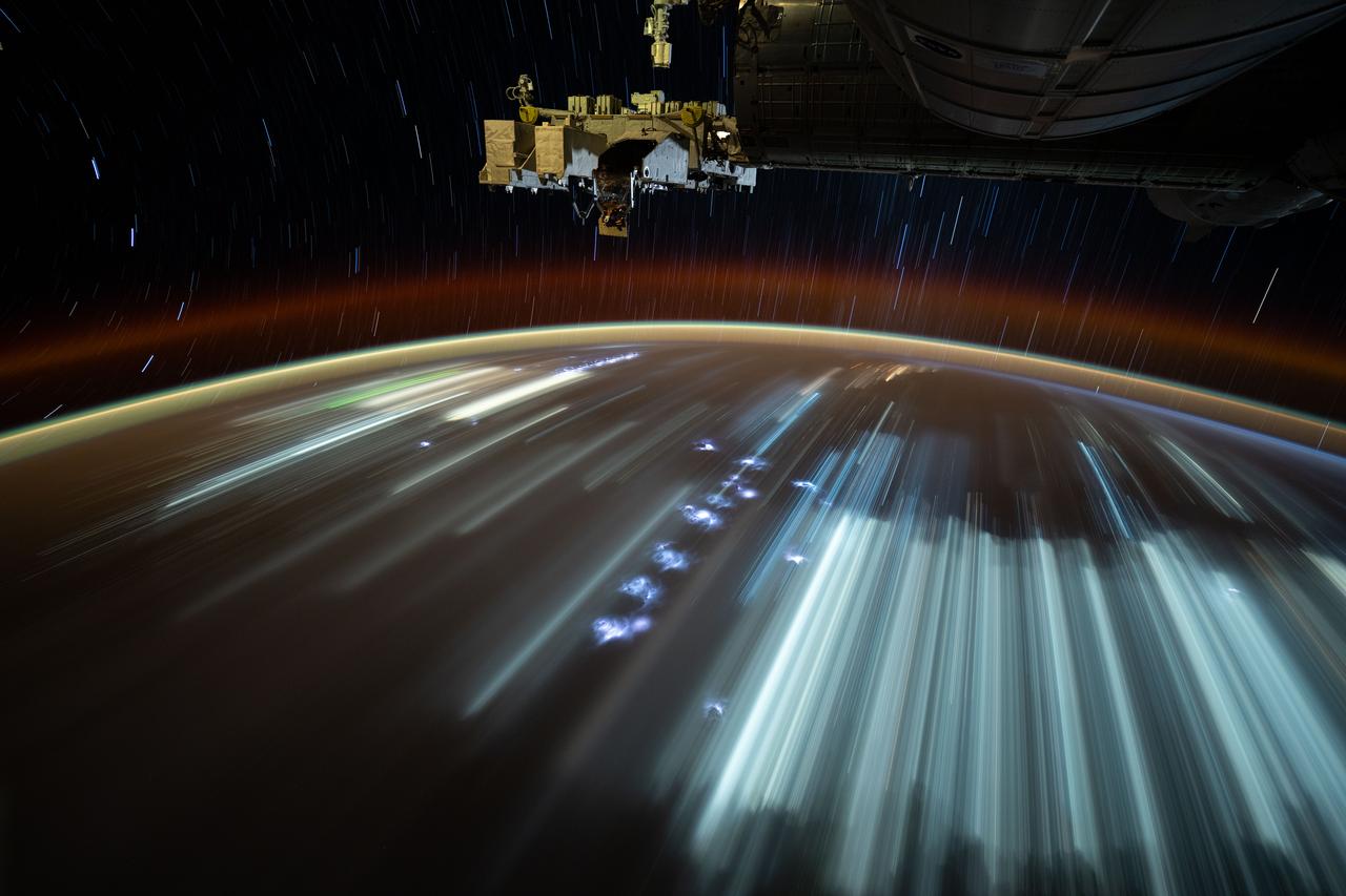
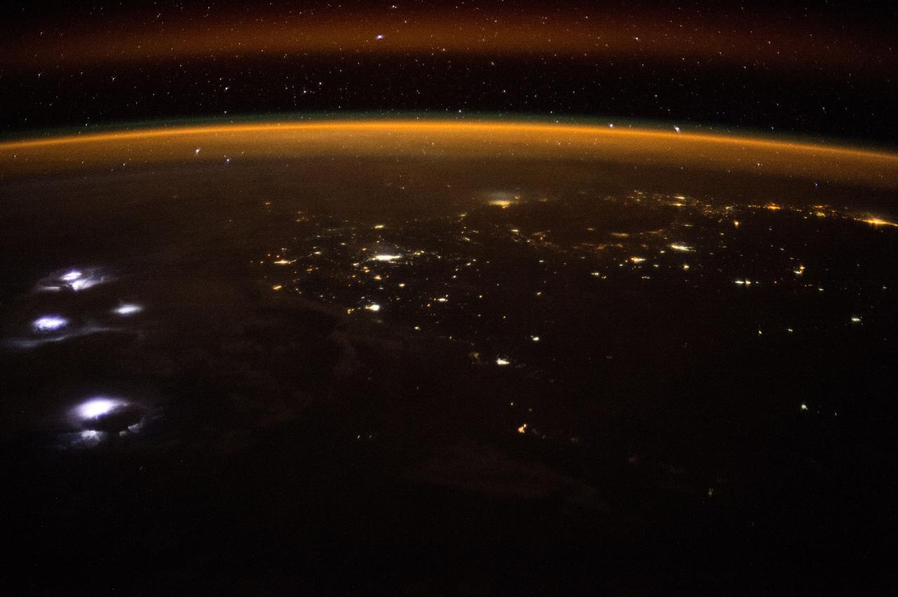
iss073e0251575 (June 20, 2025) --- This long-duration photograph was taken from the International Space Station orbiting 260 miles above the Indian Ocean off the coast of the Indonesian island of Java. City lights and lightning storms streak below star trails above Earth's atmopsheric glow.
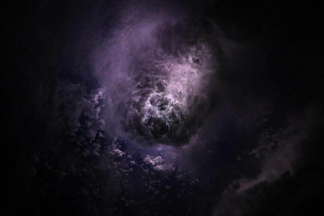
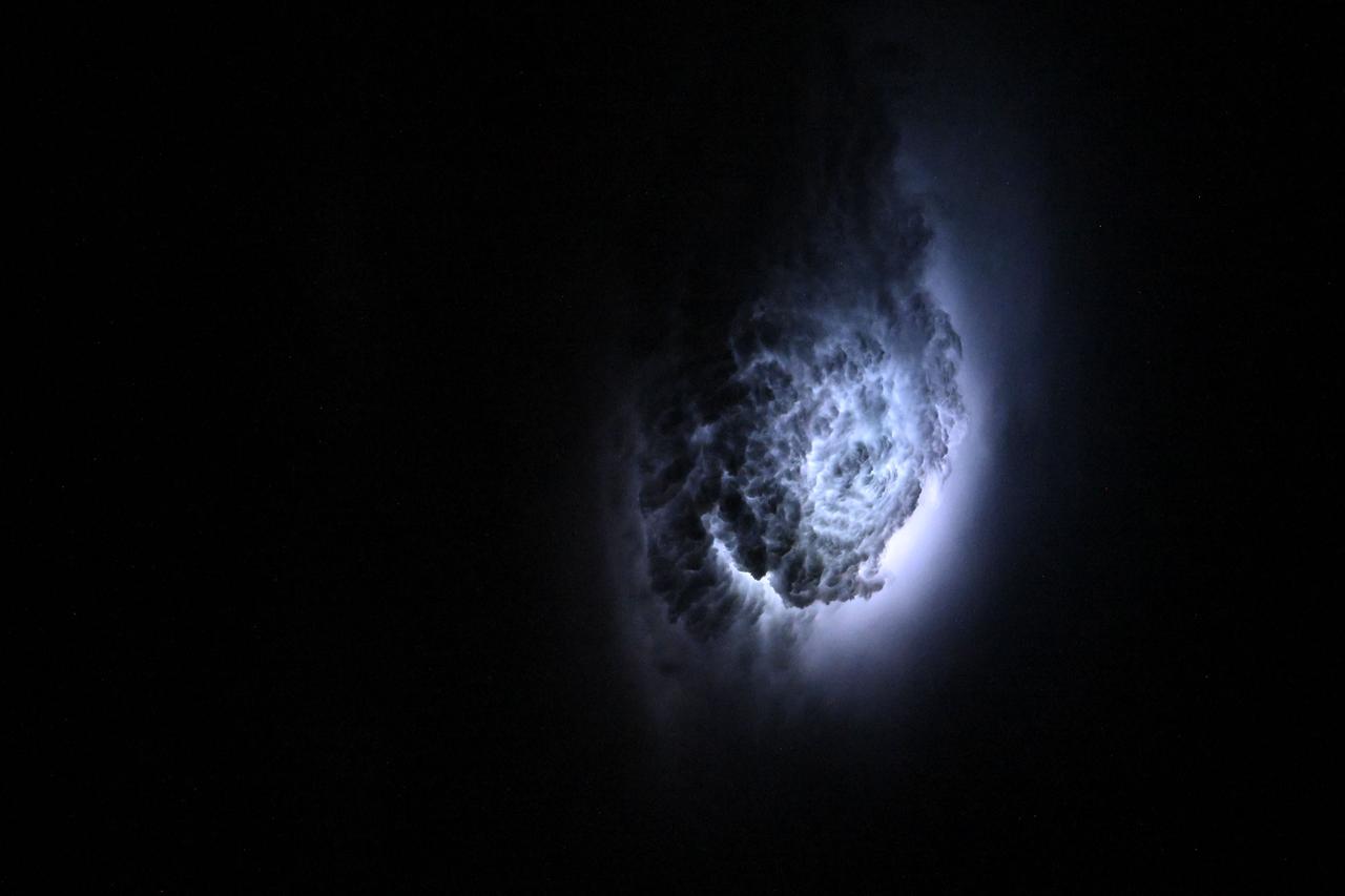
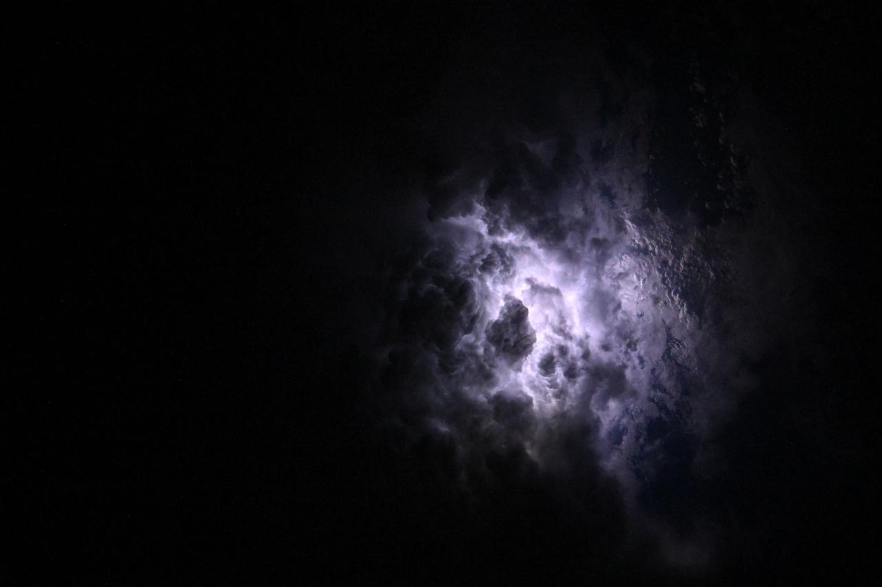
iss073e0080327 (May 15, 2025) --- This nebula-like formation is actually lightning illuminating the clouds during a storm off the coast of North Carolina in this photograph from the International Space Station as it orbited 260 miles above the Atlantic Ocean.
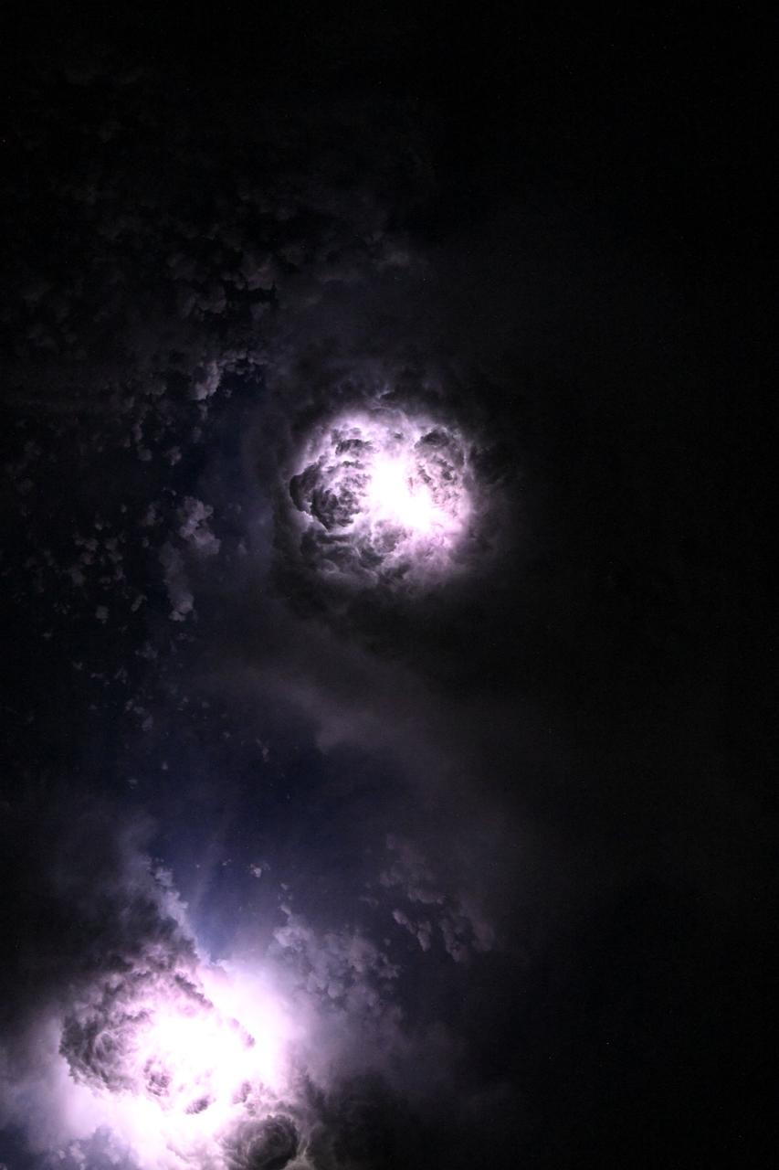
iss073e0081060 (May 15, 2025) --- This nebula-like formation is actually lightning illuminating the clouds during a storm off the coast of North Carolina in this photograph from the International Space Station as it orbited 260 miles above the Atlantic Ocean.
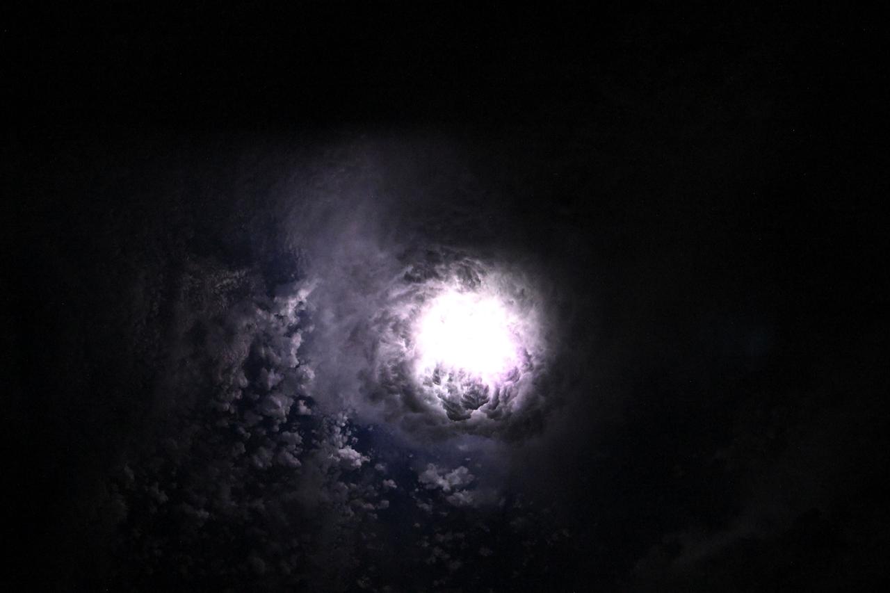
iss073e0080280 (May 15, 2025) --- This nebula-like formation is actually lightning illuminating the clouds during a storm off the coast of North Carolina in this photograph from the International Space Station as it orbited 260 miles above the Atlantic Ocean.
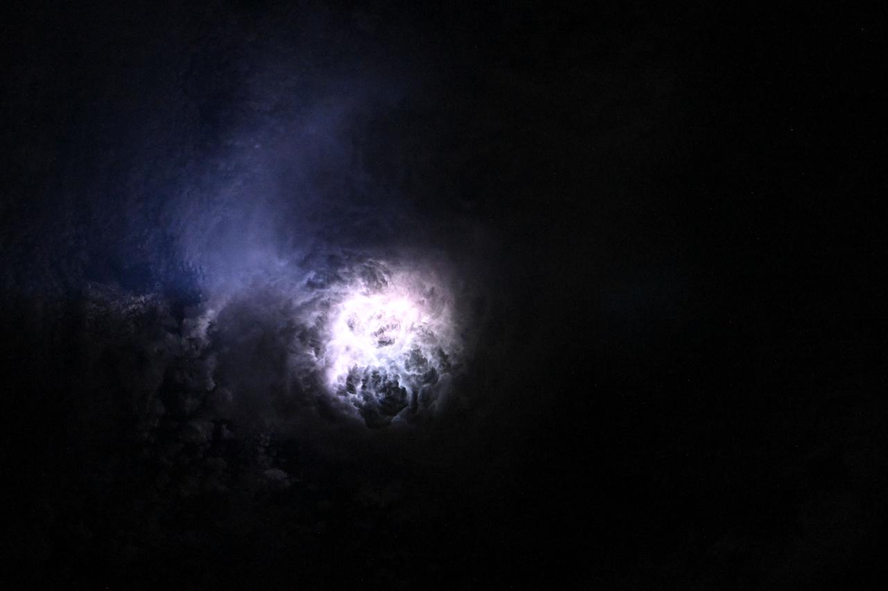
iss073e0080625 (May 15, 2025) --- This nebula-like formation is actually lightning illuminating the clouds during a storm off the coast of North Carolina in this photograph from the International Space Station as it orbited 260 miles above the Atlantic Ocean.
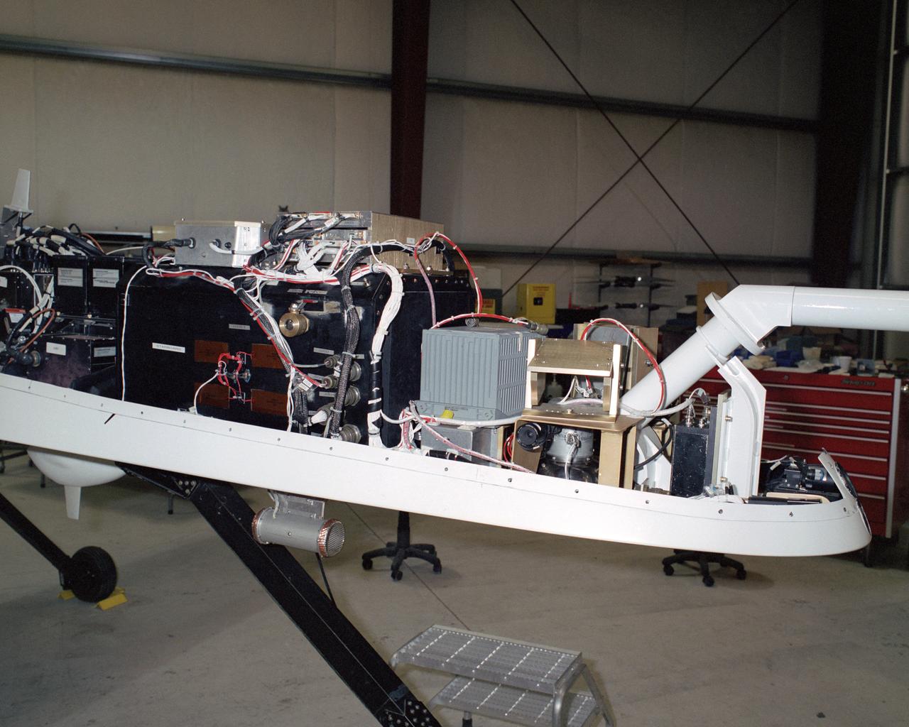
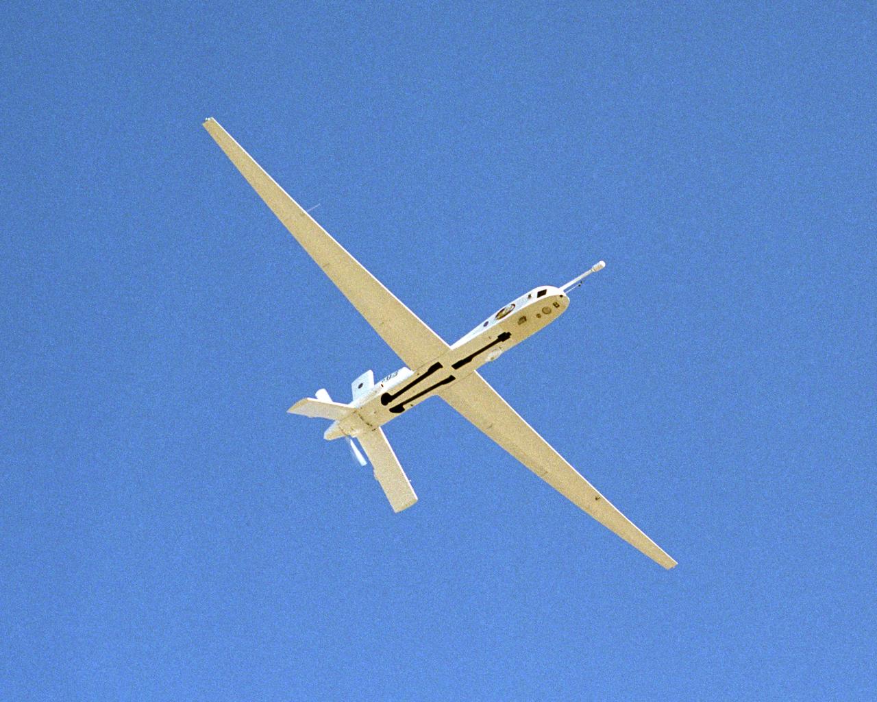
A NASA team studying the causes of electrical storms and their effects on our home planet achieved a milestone on August 21, 2002, completing the study's longest-duration research flight and monitoring four thunderstorms in succession. Based at the Naval Air Station Key West, Florida, researchers with the Altus Cumulus Electrification Study (ACES) used the Altus II remotely-piloted aircraft to study thunderstorms in the Atlantic Ocean off Key West and the west of the Everglades. Using special equipment aboard the Altus II, scientists in ACES will gather electric, magnetic, and optical measurements of the thunderstorms, gauging elements such as lightning activity and the electrical environment in and around the storms. With dual goals of gathering weather data safely and testing the adaptability of the uninhabited aircraft, the ACES study is a collaboration among the Marshall Space Flight Center, the University of Alabama in Huntsville, NASA's Goddard Space Flight Center in Greenbelt, Maryland, Pernsylvania State University in University Park, and General Atomics Aeronautical Systems, Inc.
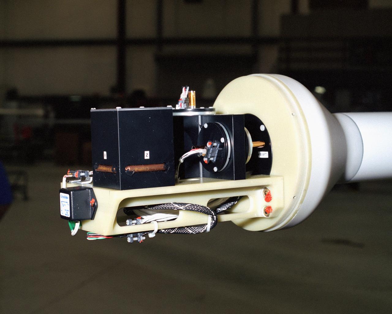
A NASA team studying the causes of electrical storms and their effects on our home planet achieved a milestone on August 21, 2002, completing the study's longest-duration research flight and monitoring four thunderstorms in succession. Based at the Naval Air Station Key West, Florida, researchers with the Altus Cumulus Electrification Study (ACES) used the Altus II remotely-piloted aircraft to study thunderstorms in the Atlantic Ocean off Key West and the west of the Everglades. Data obtained through sensors mounted to the aircraft will allow researchers in ACES to gauge elements such as lightning activity and the electrical environment in and around storms. By learning more about individual storms, scientists hope to better understand the global water and energy cycle, as well as climate variability. Contained in one portion of the aircraft is a three-axis magnetic search coil, which measures the AC magnetic field; a three-axis electric field change sensor; an accelerometer; and a three-axis magnetometer, which measures the DC magnetic field. With dual goals of gathering weather data safely and testing the adaptability of the uninhabited aircraft, the ACES study is a collaboration among the Marshall Space Flight Center, the University of Alabama in Huntsville, NASA's Goddard Space Flight Center in Greenbelt, Maryland, Pernsylvania State University in University Park, and General Atomics Aeronautical Systems, Inc.

iss073e0257211 (June 17, 2025) --- The city lights of Southeast Asia and lightning storms streak below the International Space Station as it orbited 259 miles above the Gulf of Thailand at approximately 3:17 a.m. local time.
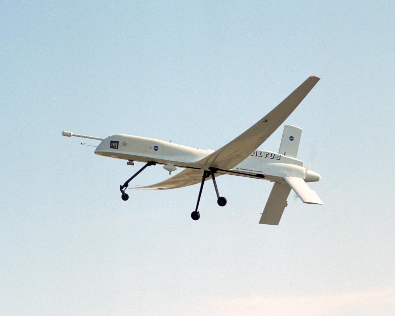
A NASA team studying the causes of electrical storms and their effects on our home planet achieved a milestone on August 21, 2002, completing the study's longest-duration research flight and monitoring four thunderstorms in succession. Based at the Naval Air Station Key West, Florida, researchers with the Altus Cumulus Electrification Study (ACES) used the Altus II remotely-piloted aircraft to study thunderstorms in the Atlantic Ocean off Key West and the west of the Everglades. The ACES lightning study used the Altus II twin turbo uninhabited aerial vehicle, built by General Atomics Aeronautical Systems, Inc. of San Diego. The Altus II was chosen for its slow flight speed of 75 to 100 knots (80 to 115 mph), long endurance, and high-altitude flight (up to 65,000 feet). These qualities gave the Altus II the ability to fly near and around thunderstorms for long periods of time, allowing investigations to be to be conducted over the entire life cycle of storms. The vehicle has a wing span of 55 feet and a payload capacity of over 300 lbs. With dual goals of gathering weather data safely and testing the adaptability of the uninhabited aircraft, the ACES study is a collaboration among the Marshall Space Flight Center, the University of Alabama in Huntsville, NASA,s Goddard Space Flight Center in Greenbelt, Maryland, Pernsylvania State University in University Park, and General Atomics Aeronautical Systems, Inc.
A NASA team studying the causes of electrical storms and their effects on our home planet achieved a milestone on August 21, 2002, completing the study's longest-duration research flight and monitoring four thunderstorms in succession. Based at the Naval Air Station Key West, Florida, researchers with the Altus Cumulus Electrification Study (ACES) used the Altus II remotely piloted aircraft to study thunderstorms in the Atlantic Ocean off Key West and the west of the Everglades. The ACES lightning study used the Altus II twin turbo uninhabited aerial vehicle, built by General Atomics Aeronautical Systems, Inc. of San Diego. The Altus II was chosen for its slow flight speed of 75 to 100 knots (80 to 115 mph), long endurance, and high-altitude flight (up to 65,000 feet). These qualities gave the Altus II the ability to fly near and around thunderstorms for long periods of time, allowing investigations to be conducted over the entire life cycle of storms. The vehicle has a wing span of 55 feet and a payload capacity of over 300 lbs. With dual goals of gathering weather data safely and testing the adaptability of the uninhabited aircraft, the ACES study is a collaboration among the Marshall Space Flight Center, the University of Alabama in Huntsville, NASA's Goddard Space Flight Center in Greenbelt, Maryland, Pernsylvania State University in University Park, and General Atomics Aeronautical Systems, Inc.
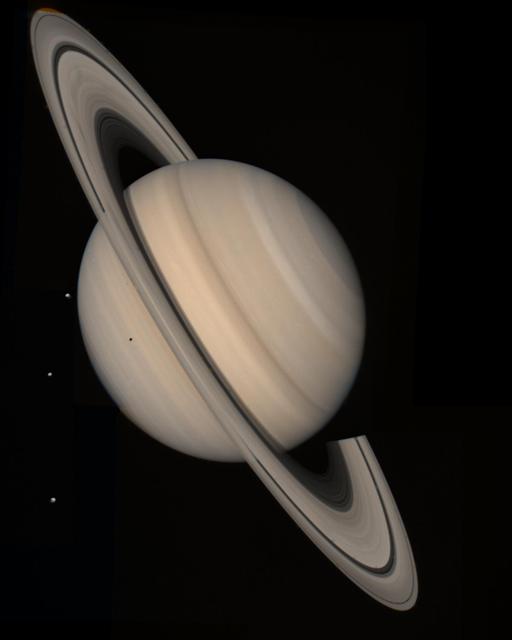
Saturn storms observed by NASA Voyager, Aug. 5, 2004. Voyager 1 and 2 observed radio signals from lightning which were interpreted as being from a persistent, low-latitude storm system.
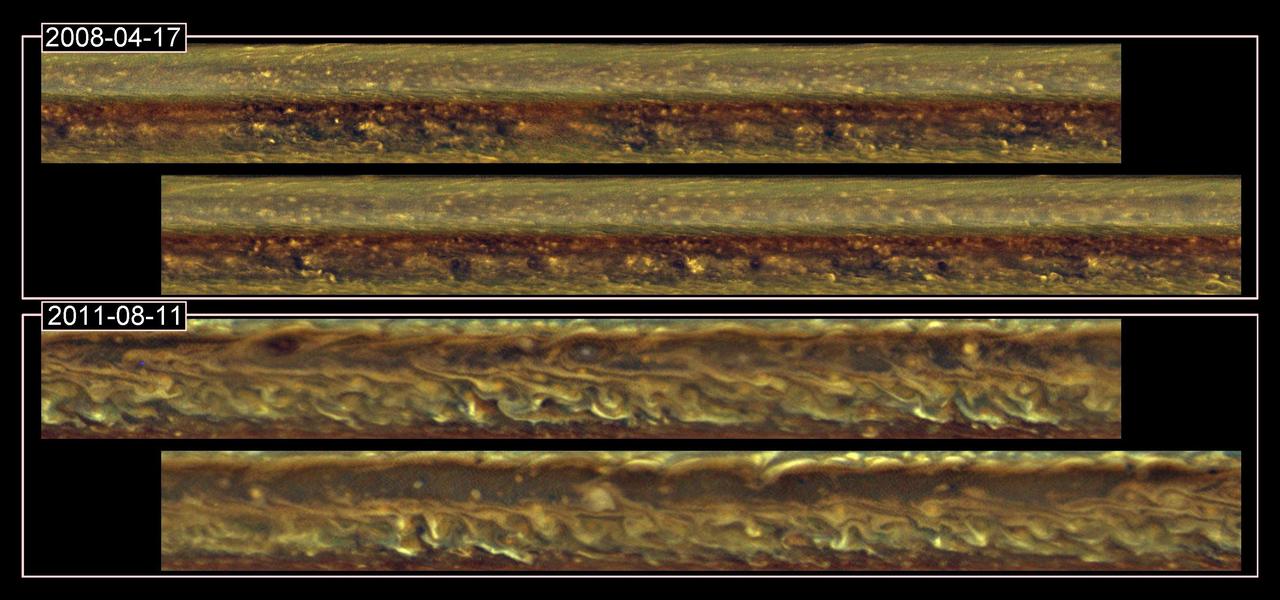
This set of images from NASA Cassini spacecraft shows cloud patterns in a band around Saturn before a monstrous thunder-and-lightning storm erupted and again after the head of the storm had disappeared.
These false-color mosaics from NASA Cassini spacecraft capture lightning striking within the huge storm that encircled Saturn northern hemisphere for much of 2011.
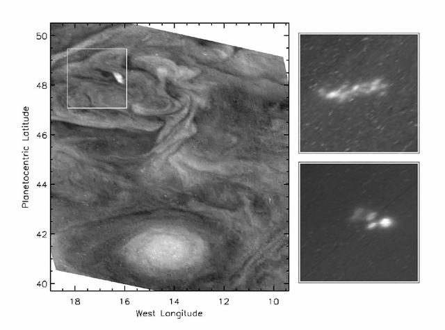
Day and night side narrow angle images taken on January 1, 2001 illustrating storms visible on the day side which are the sources of visible lightning when viewed on the night side. The images have been enhanced in contrast. Note the two day-side occurrences of high clouds, in the upper and lower parts of the image, are coincident with lightning storms seen on the darkside. The storms occur at 34.5 degrees and 23.5 degrees North latitude, within one degree of the latitudes at which similar lightning features were detected by the Galileo spacecraft. The images were taken at different times. The storms' longitudinal separation changes from one image to the next because the winds carrying them blow at different speeds at the two latitudes. http://photojournal.jpl.nasa.gov/catalog/PIA02878
The largest storm to ravage Saturn in decades started as a small spot seen in this image from NASA Cassini spacecraft on Dec. 5, 2010 -- the same day Cassini also detected frequent lightning signals.
This set of images from NASA Cassini mission shows the evolution of a massive thunder-and-lightning storm that circled all the way around Saturn and fizzled when it ran into its own tail.

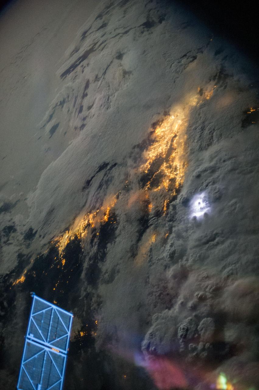
iss071e170351 (6/3/2024) --- NASA astronaut Matthew Dominick captured red sprites from space station. The bright red flashes in the center of this image are a little-understood phenomenon associated with powerful lightning events and appear high above the clouds in Earth’s upper atmosphere. Red sprites are one type of Transient Luminous Events, colorful bursts of energy that appear above storms due to lightning activity occurring in and below storms on Earth. Understanding processes occurring in Earth’s atmosphere can help improve climate modeling and monitoring.

iss071e620932 (Aug. 20, 2024) --- Lightning (at center) illuminates the storm clouds above China near the coast of the Taiwan Strait in this photograph from the International Space Station as it orbited 261 miles above the Asian nation.
iss067e270871 (Aug. 17, 2022) --- A cloudy, south Indian Ocean between Africa and Antarctica, with lightning storms near the horizon beneath the atmospheric glow, is pictured from the International Space Station as it orbited 271 miles above
Earth observation taken during a night pass by an Expedition 36 crew member on board the International Space Station (ISS). Per Twitter message: An impressive line of storms moving through Asia July 24. The lightning was amazing!

iss073e0415606 (June 21, 2025) --- The International Space Station soars 259 miles above Cambodia in this long-duration photograph revealing star trails, lightning storms, and the city lights of Southeast Asia streaking below.

A NASA team studying the causes of electrical storms and their effects on our home planet achieved a milestone on August 21, 2002, completing the study's longest-duration research flight and monitoring four thunderstorms in succession. Radio news media can talk with Dr. Richard Blakeslee, the project's principal investigator, and Tony Kim, project manager at the Marshall Space Flight Center (MSFC), about their results and how their work will help improve future weather forecasting ability. Based at the Naval Air Station Key West, Florida, researchers with the Altus Cumulus Electrification Study (ACES) used the Altus II remotely- piloted aircraft to study a thunderstorm in the Atlantic Ocean off Key West, two storms at the western edge of the Everglades, and a large storm over the northwestern corner of the Everglades. This photograph shows Tony Kim And Dr. Richard Blakeslee of MSFC testing aircraft sensors that would be used to measure the electric fields produced by thunderstorm as part of NASA's ACES. With dual goals of gathering weather data safely and testing the adaptability of the uninhabited aircraft, the ACES study is a collaboration among the MSFC, the University of Alabama in Huntsville, NASA's Goddard Space Flight Center in Greenbelt, Maryland, Pernsylvania State University in University Park, and General Atomics Aeronautical Systems, Inc.
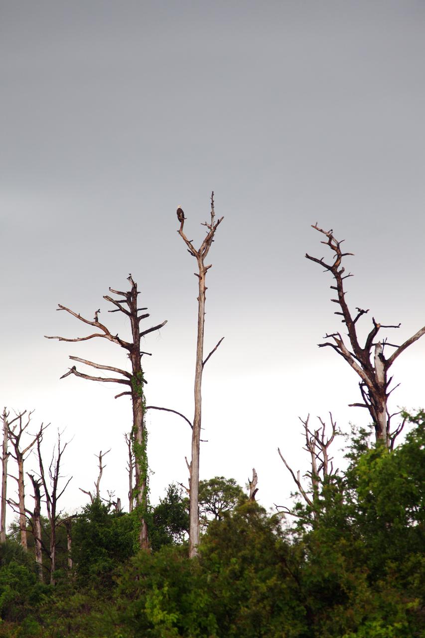
CAPE CANAVERAL, Fla. – A Bald Eagle takes advantage of a break in rain and perches on a tree at NASA's Kennedy Space Center in Florida. Severe storms associated with a frontal system are moving through Central Florida, producing strong winds, heavy rain, frequent lightning and even funnel clouds. Photo credit: NASA/Ben Smegelsky
ISS047e009593 (03/16/2016) --- Expedition 47 crew members aboard the International Space Station capture a view of lightning storms flashing in clouds over the Earth at night while an aurora provides a vivid outline to the Earth’s atmosphere above.
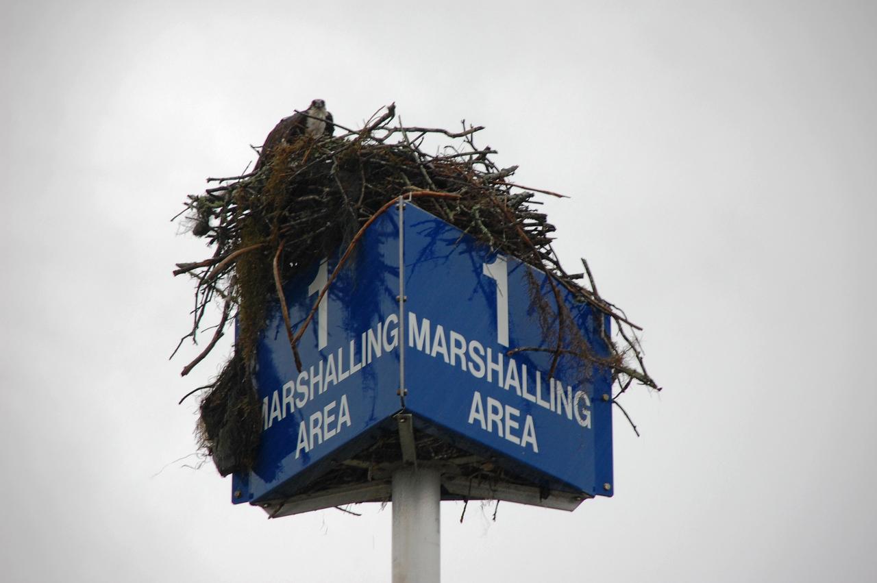
CAPE CANAVERAL, Fla. – An osprey wades in flooded grass near the Vehicle Assembly Building at NASA's Kennedy Space Center in Florida. Severe storms associated with a frontal system are moving through Central Florida, producing strong winds, heavy rain, frequent lightning and even funnel clouds. Photo credit: NASA/Ben Smegelsky
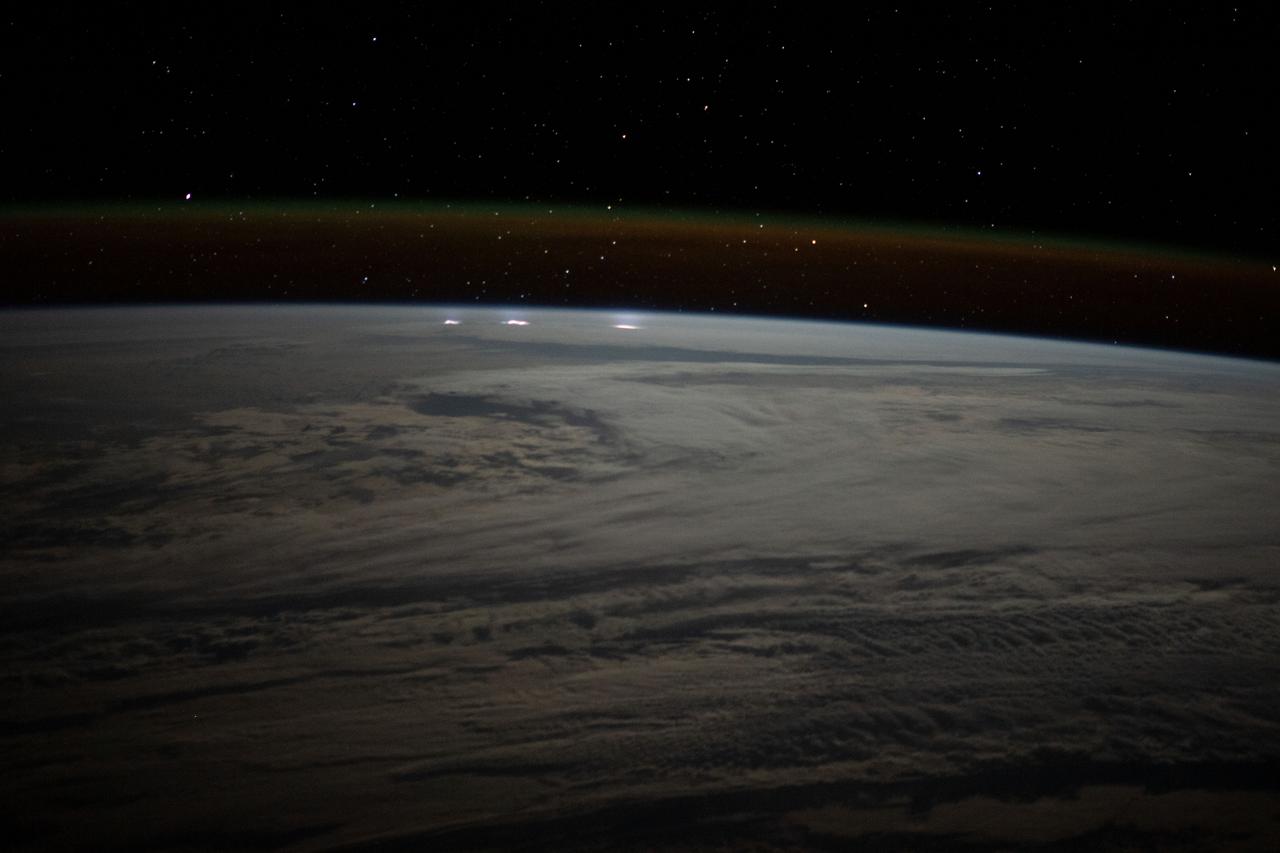
iss073e0380959 (June 18, 2025) --- Lightning illuminates the cloud tops of Category 1 Hurricane Erick as it stormed across the Pacific Ocean south of the Mexican state of Chiapas at approximately 3:42 a.m. local time as the International Space Station orbited 258 miles above.
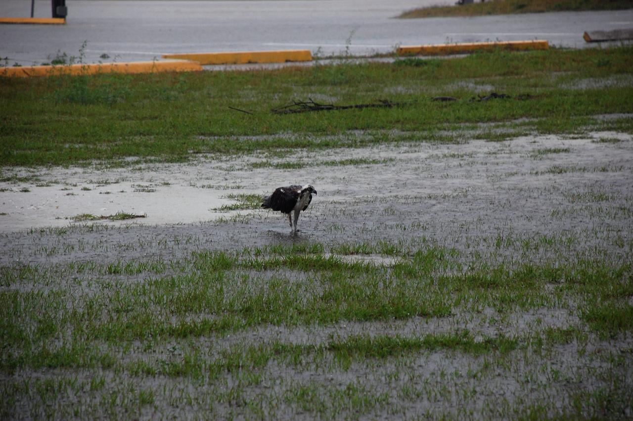
CAPE CANAVERAL, Fla. – An osprey wades in flooded grass near the Vehicle Assembly Building at NASA's Kennedy Space Center in Florida. Severe storms associated with a frontal system are moving through Central Florida, producing strong winds, heavy rain, frequent lightning and even funnel clouds. Photo credit: NASA/Ben Smegelsky
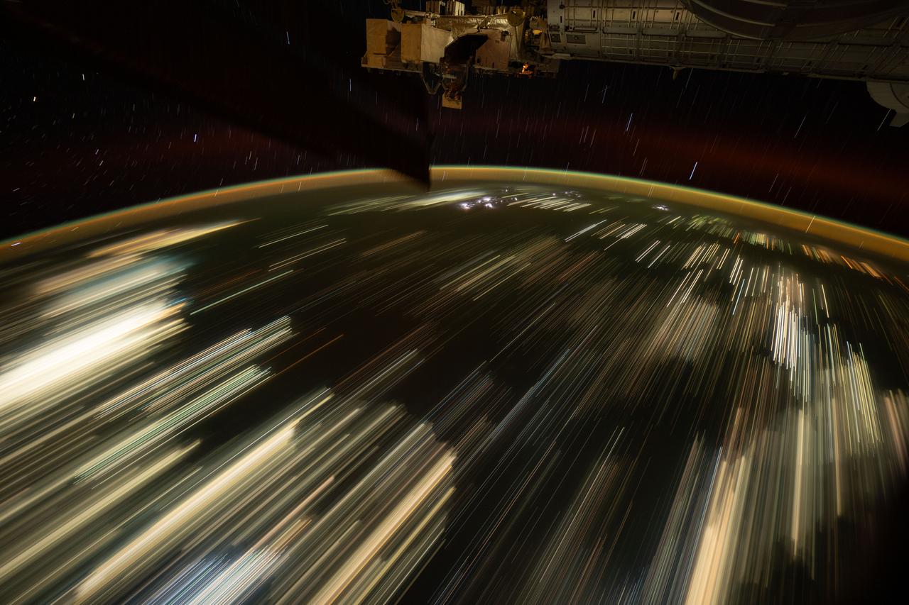
iss073e0134504 (May 22, 2025) --- This long-duration photograph taken from the International Space Station orbiting 259 miles above the South China Sea highlights the city lights of Southeast Asia streaking below, a lightning storm near the top of Earth's horizon, and star trails above an atmopsheric glow.
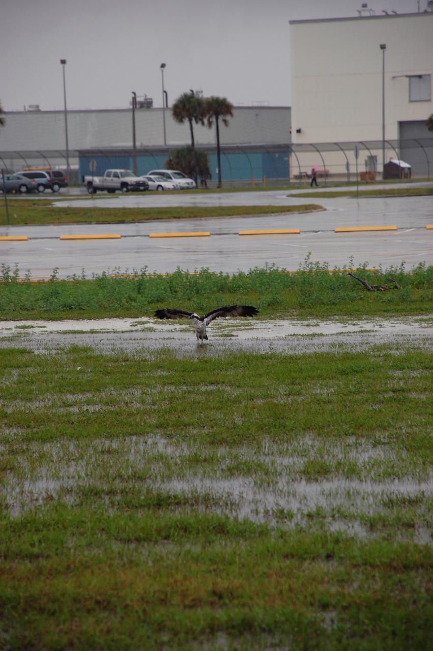
CAPE CANAVERAL, Fla. – An osprey wades in flooded grass near the Vehicle Assembly Building at NASA's Kennedy Space Center in Florida. Severe storms associated with a frontal system are moving through Central Florida, producing strong winds, heavy rain, frequent lightning and even funnel clouds. Photo credit: NASA/Ben Smegelsky
ISS047e007765 (03/14/2016) --- Using special cameras and Chronophotography aboard the International Space Station, crew members of Expedition 47 during Earth observations capture awesome beauty . This nighttime image shows an approaching lightning storm on the left. The gold and red aurora act as a frame to this display of natures wonders.
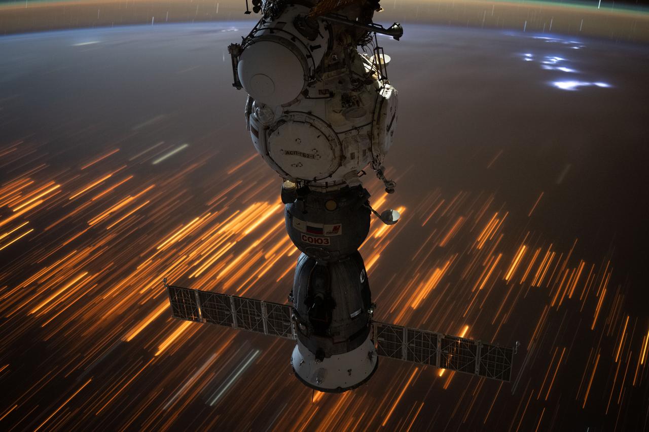
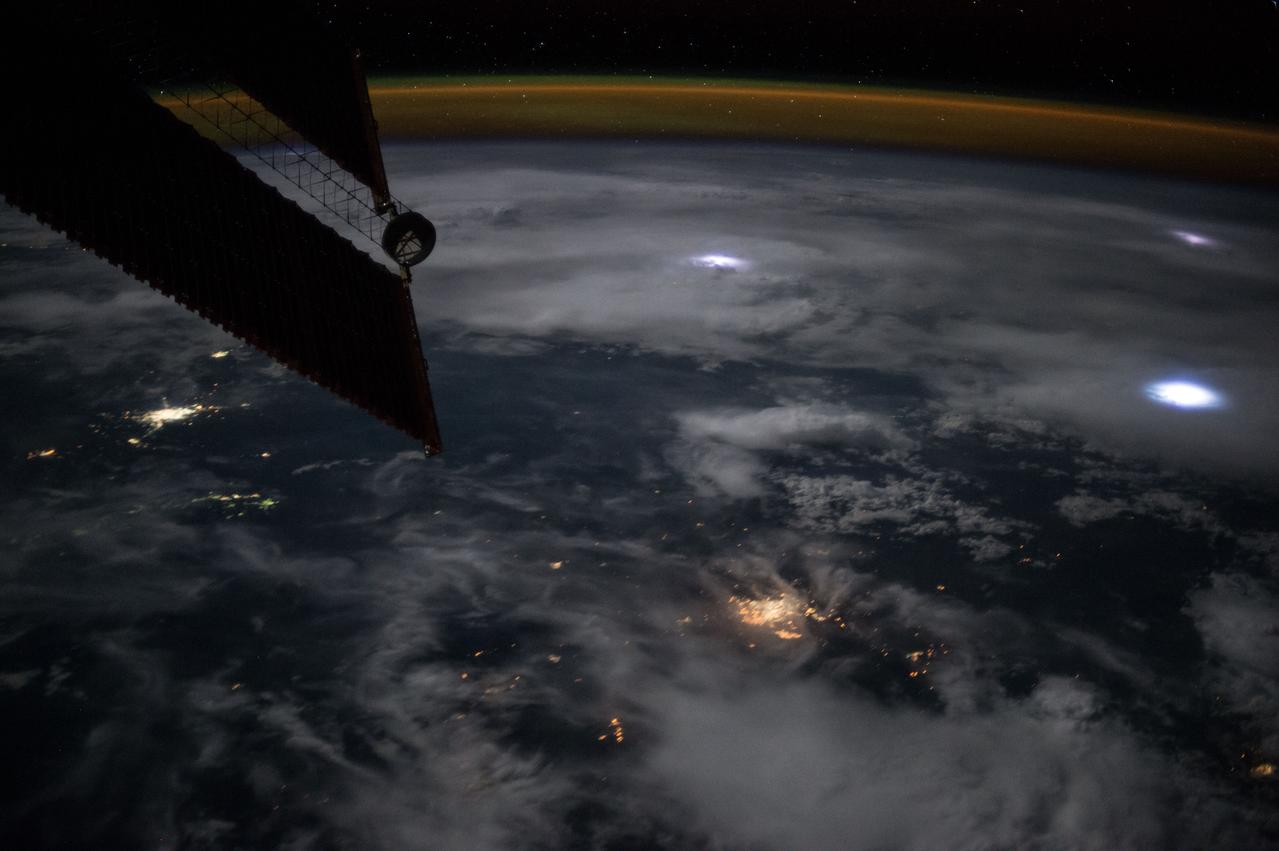
iss073e0422445 (July 29, 2025) --- The city lights of Sub-Saharan Africa streak below the International Space Station as it orbited 260 miles above the Tanzania-Zambia border in this long-duration photograph. At top right, lightning storms illuminate the cloud tops with the Soyuz MS-27 spacecraft docked to the Prichal module in the foreground.
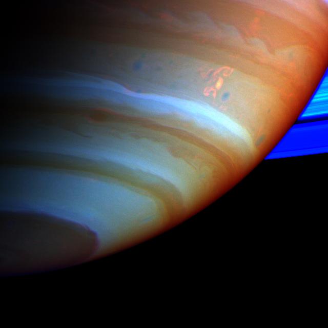
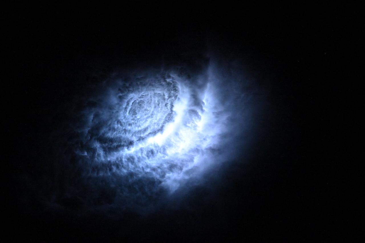
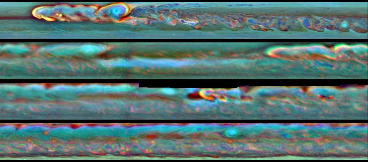
A large, bright and complex convective storm that appeared in Saturn's southern hemisphere in mid-September 2004 was the key in solving a long-standing mystery about the ringed planet. Saturn's atmosphere and its rings are shown here in a false color composite made from Cassini images taken in near infrared light through filters that sense different amounts of methane gas. Portions of the atmosphere with a large abundance of methane above the clouds are red, indicating clouds that are deep in the atmosphere. Grey indicates high clouds, and brown indicates clouds at intermediate altitudes. The rings are bright blue because there is no methane gas between the ring particles and the camera. The complex feature with arms and secondary extensions just above and to the right of center is called the Dragon Storm. It lies in a region of the southern hemisphere referred to as "storm alley" by imaging scientists because of the high level of storm activity observed there by Cassini in the last year. The Dragon Storm was a powerful source of radio emissions during July and September of 2004. The radio waves from the storm resemble the short bursts of static generated by lightning on Earth. Cassini detected the bursts only when the storm was rising over the horizon on the night side of the planet as seen from the spacecraft; the bursts stopped when the storm moved into sunlight. This on/off pattern repeated for many Saturn rotations over a period of several weeks, and it was the clock-like repeatability that indicated the storm and the radio bursts are related. Scientists have concluded that the Dragon Storm is a giant thunderstorm whose precipitation generates electricity as it does on Earth. The storm may be deriving its energy from Saturn's deep atmosphere. One mystery is why the radio bursts start while the Dragon Storm is below the horizon on the night side and end when the storm is on the day side, still in full view of the Cassini spacecraft. A possible explanation is that the lightning source lies to the east of the visible cloud, perhaps because it is deeper where the currents are eastward relative to those at cloud top levels. If this were the case, the lightning source would come up over the night side horizon and would sink down below the day side horizon before the visible cloud. This would explain the timing of the visible storm relative to the radio bursts. The Dragon Storm is of great interest for another reason. In examining images taken of Saturn's atmosphere over many months, imaging scientists found that the Dragon Storm arose in the same part of Saturn's atmosphere that had earlier produced large bright convective storms. In other words, the Dragon Storm appears to be a long-lived storm deep in the atmosphere that periodically flares up to produce dramatic bright white plumes which subside over time. One earlier sighting, in July 2004, was also associated with strong radio bursts. And another, observed in March 2004 and captured in a movie created from images of the atmosphere (PIA06082 and PIA06083) spawned three little dark oval storms that broke off from the arms of the main storm. Two of these subsequently merged with each other; the current to the north carried the third one off to the west, and Cassini lost track of it. Small dark storms like these generally get stretched out until they merge with the opposing currents to the north and south. These little storms are the food that sustains the larger atmospheric features, including the larger ovals and the eastward and westward currents. If the little storms come from the giant thunderstorms, then together they form a food chain that harvests the energy of the deep atmosphere and helps maintain the powerful currents. Cassini has many more chances to observe future flare-ups of the Dragon Storm, and others like it over the course of the mission. It is likely that scientists will come to solve the mystery of the radio bursts and observe storm creation and merging in the next 2 or 3 years. http://photojournal.jpl.nasa.gov/catalog/PIA06197
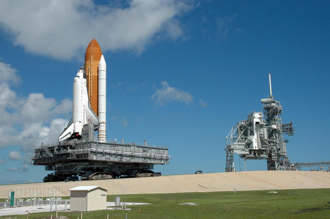
KENNEDY SPACE CENTER, FLA. - Moved by the crawler-transporter underneath, Space Shuttle Atlantis inches down the ramp from Launch Pad 39B as it rolls back to the Vehicle Assembly Building. At right is the rotating service structure in its open configuration and the fixed service structure with the 80-foot lightning mast on top. First motion off the pad was at 10:04 a.m. EDT. The rollback is a safety precaution as the area waits for the arrival of Tropical Storm Ernesto. The storm is forecast to be bringing 58-mph to 70-mph winds in the next 24 hours. The shuttle will be moved into high bay 2, on the southwest side of the VAB, for protection from the storm. Photo credit: NASA/Jack Pfaller

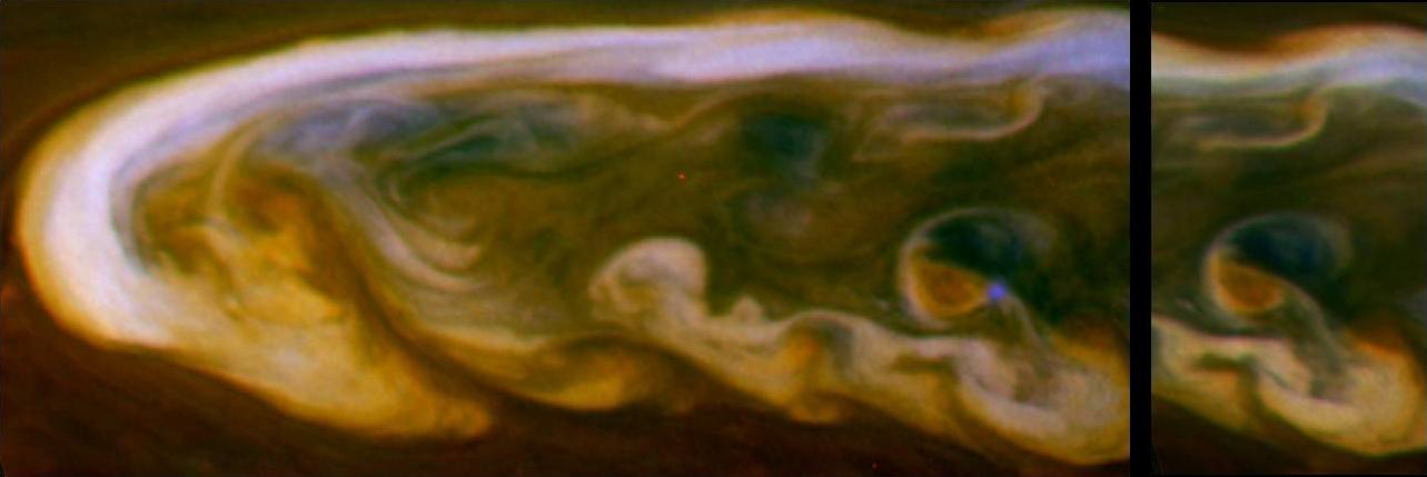
In this annotated, graphic of Jupiter, small, bright "pop-up" clouds rise above the surrounding features in this cyclonic Jovian storm system, dubbed the "Nautilus." The image at left, taken by the Hubble Space Telescope — which observed the storm — was taken on July 16, 2018. The Juno spacecraft's JunoCam captured the storm at higher resolution on July 16, 2018, during Juno's 13th science flyby of Jupiter. The image at right, a magnification of the JunoCam image, offers a closer view. Storms like these pop-up clouds are believed to be the tops of the extreme ammonia-water thunderclouds that produce "shallow lightning" and Jovian hailstones — or "mushballs" — high in Jupiter's atmosphere. The solar-powered Jupiter explorer launched on Aug. 5, 2011 and went into orbit around the gas giant on July 4, 2016. https://photojournal.jpl.nasa.gov/catalog/PIA24303

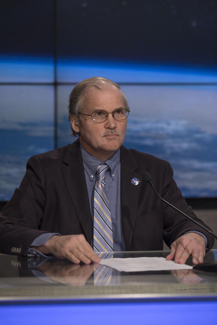
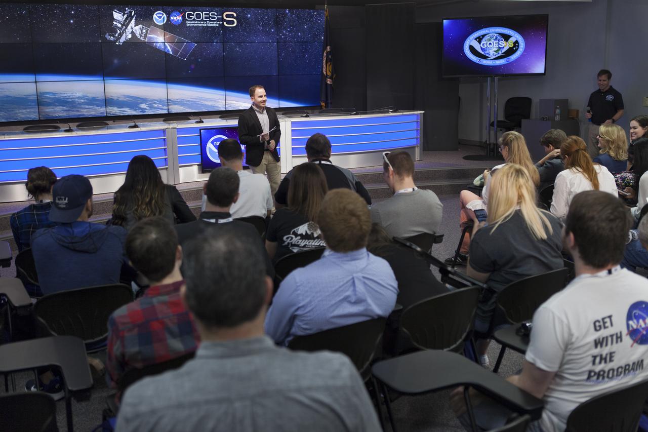
In the Kennedy Space Center's Press Site auditorium, Kristin Calhoun, a research scientist with NOAA's National Severe Storms Laboratory, speaks to members of the media at a mission briefing on National Oceanic and Atmospheric Administration's, or NOAA's, Geostationary Operational Environmental Satellite, or GOES-S. The spacecraft is the second satellite in a series of next-generation NOAA weather satellites. It will launch to a geostationary position over the U.S. to provide images of storms and help predict weather forecasts, severe weather outlooks, watches, warnings, lightning conditions and longer-term forecasting. GOES-S is slated to lift off at 5:02 p.m. EST on March 1, 2018 aboard a United Launch Alliance Atlas V rocket.

CAPE CANAVERAL, Fla. – An osprey takes advantage of a break in rain and ventures out of its nest near the Press Site at NASA's Kennedy Space Center in Florida. Severe storms associated with a frontal system are moving through Central Florida, producing strong winds, heavy rain, frequent lightning and even funnel clouds. Photo credit: NASA/Ben Smegelsky
A United Launch Alliance Atlas V rocket lifts off from Space Launch Complex 41 at Cape Canaveral Air Force Station carrying the NOAA Geostationary Operational Environmental Satellite, or GOES-S. Liftoff was at 5:02 p.m. EST. GOES-S is the second satellite in a series of next-generation weather satellites. It will launch to a geostationary position over the U.S. to provide images of storms and help predict weather forecasts, severe weather outlooks, watches, warnings, lightning conditions and longer-term forecasting.
CAPE CANAVERAL, Fla. – An osprey takes advantage of a break in rain and peers out of its nest near the Press Site at NASA's Kennedy Space Center in Florida. Severe storms associated with a frontal system are moving through Central Florida, producing strong winds, heavy rain, frequent lightning and even funnel clouds. Photo credit: NASA/Ben Smegelsky

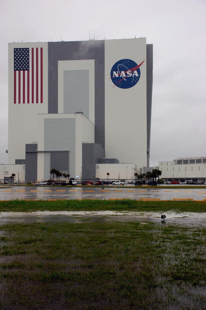
CAPE CANAVERAL, Fla. – At NASA's Kennedy Space Center in Florida, an ominous thunderstorm cloud hovers over the Vehicle Assembly Building in the Launch Complex 39 area. Severe storms associated with a frontal system are moving through Central Florida, producing strong winds, heavy rain, frequent lightning and even funnel clouds. Photo credit: NASA/Kim Shiflett
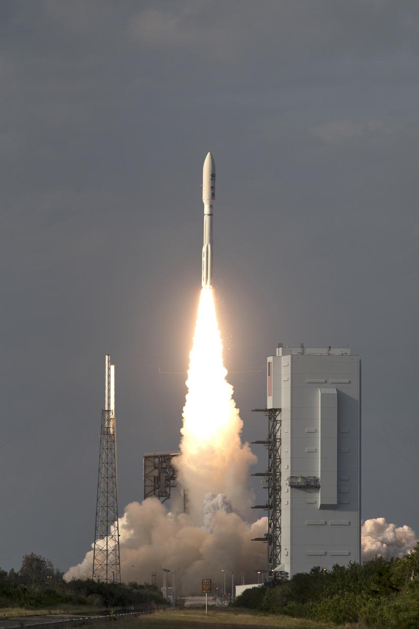
A United Launch Alliance Atlas V rocket lifts off from Space Launch Complex 41 at Cape Canaveral Air Force Station carrying the NOAA Geostationary Operational Environmental Satellite, or GOES-S. Liftoff was at 5:02 p.m. EST. GOES-S is the second satellite in a series of next-generation weather satellites. It will launch to a geostationary position over the U.S. to provide images of storms and help predict weather forecasts, severe weather outlooks, watches, warnings, lightning conditions and longer-term forecasting.
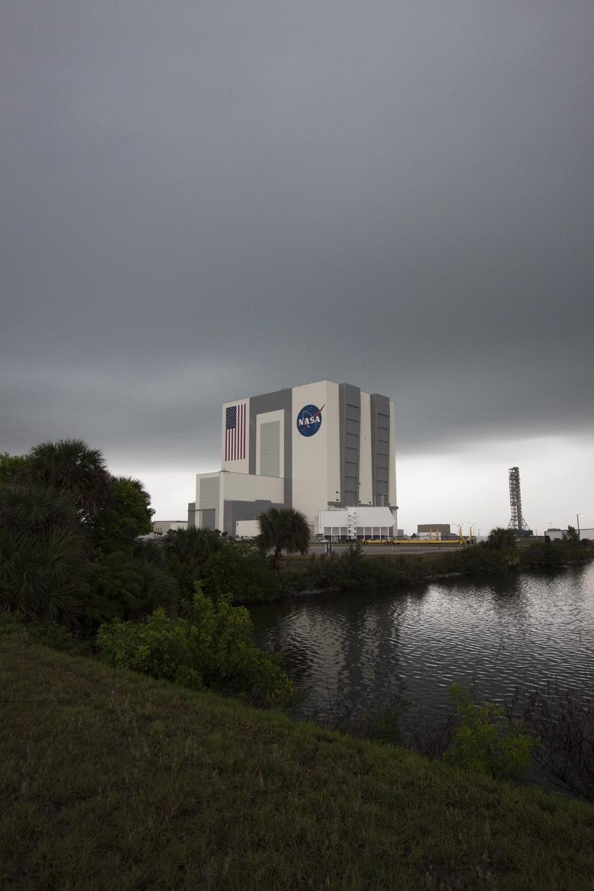
CAPE CANAVERAL, Fla. – At NASA's Kennedy Space Center in Florida, dark clouds hover over the Vehicle Assembly Building in the Launch Complex 39 area. Severe storms associated with a frontal system are moving through Central Florida, producing strong winds, heavy rain, frequent lightning and even funnel clouds. Photo credit: NASA/Jack Pfaller
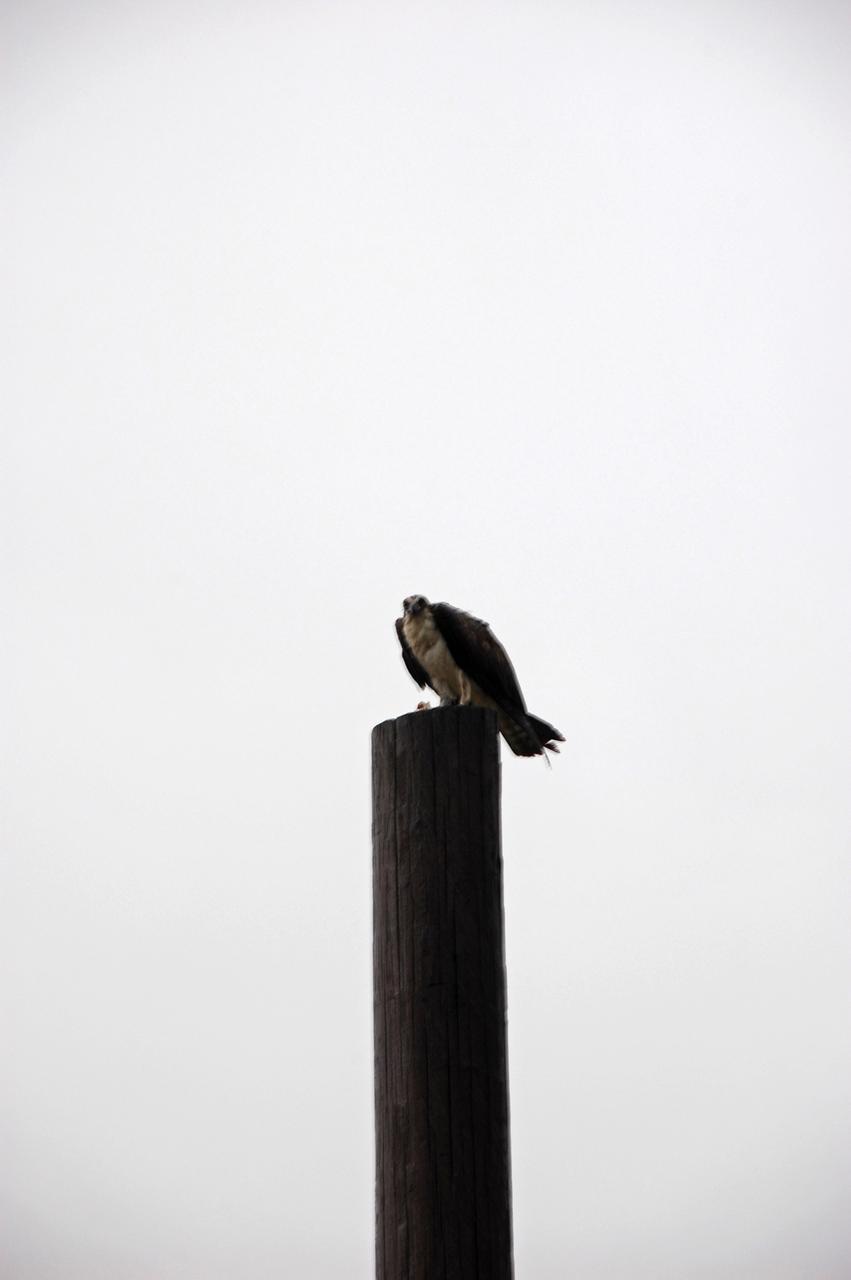
CAPE CANAVERAL, Fla. – An osprey takes advantage of a break in rain and perches on a pole near the Press Site at NASA's Kennedy Space Center in Florida. Severe storms associated with a frontal system are moving through Central Florida, producing strong winds, heavy rain, frequent lightning and even funnel clouds. Photo credit: NASA/Ben Smegelsky
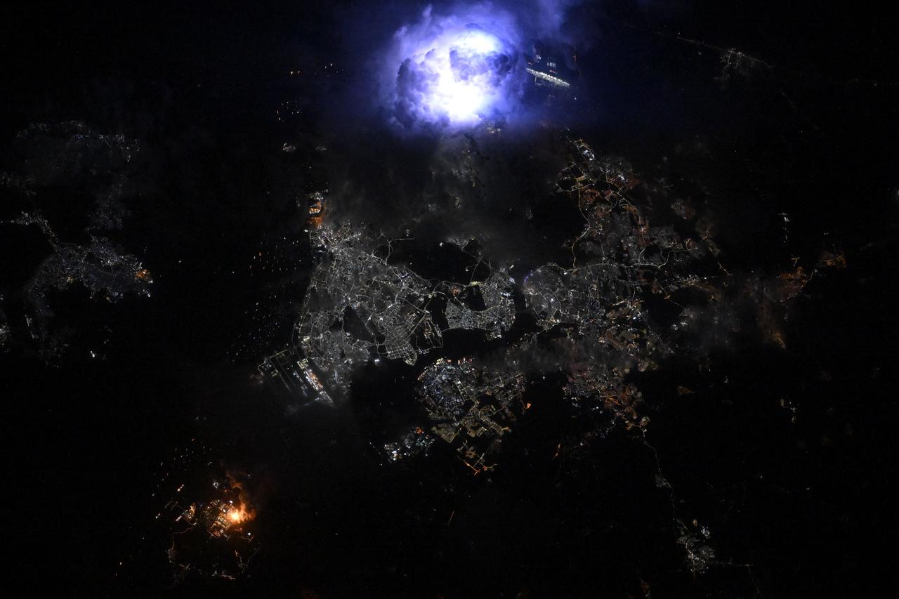
ISS036-E-022863 (21 July 2013) --- One of the crew members aboard the International Space Station photographed this night view of storm clouds over Southern California. Early morning lightning can be seen as a white blotch just to the right of center. The yellow colored area, beneath the grey clouds, which almost shines because of night lights, is part of the highly populated area of Los Angeles and San Diego.
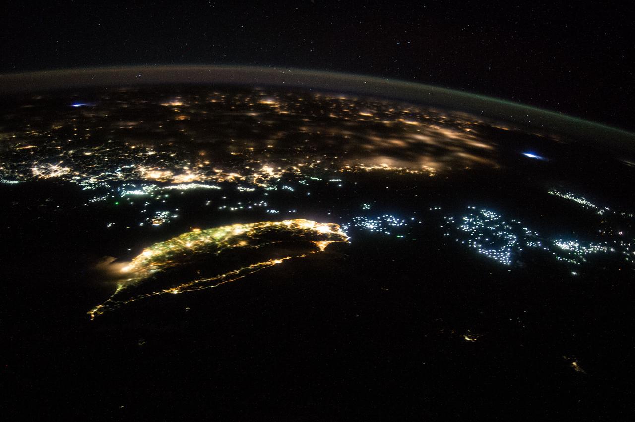
ISS040-E-081424 (27 July 2014) --- From an altitude of 223 nautical miles, one of the Expedition 40 crew members aboard the International Space Station on July 27, 2014 recorded this oblique night image of Taiwan (center foreground) and part of mainland China. Hundreds of fishing vessels, perhaps for harvesting both fish and squid as well as other forms of marine life, are seen in clusters throughout the panorama. Two lightning storms -- one on either side of the image -- are also visible.
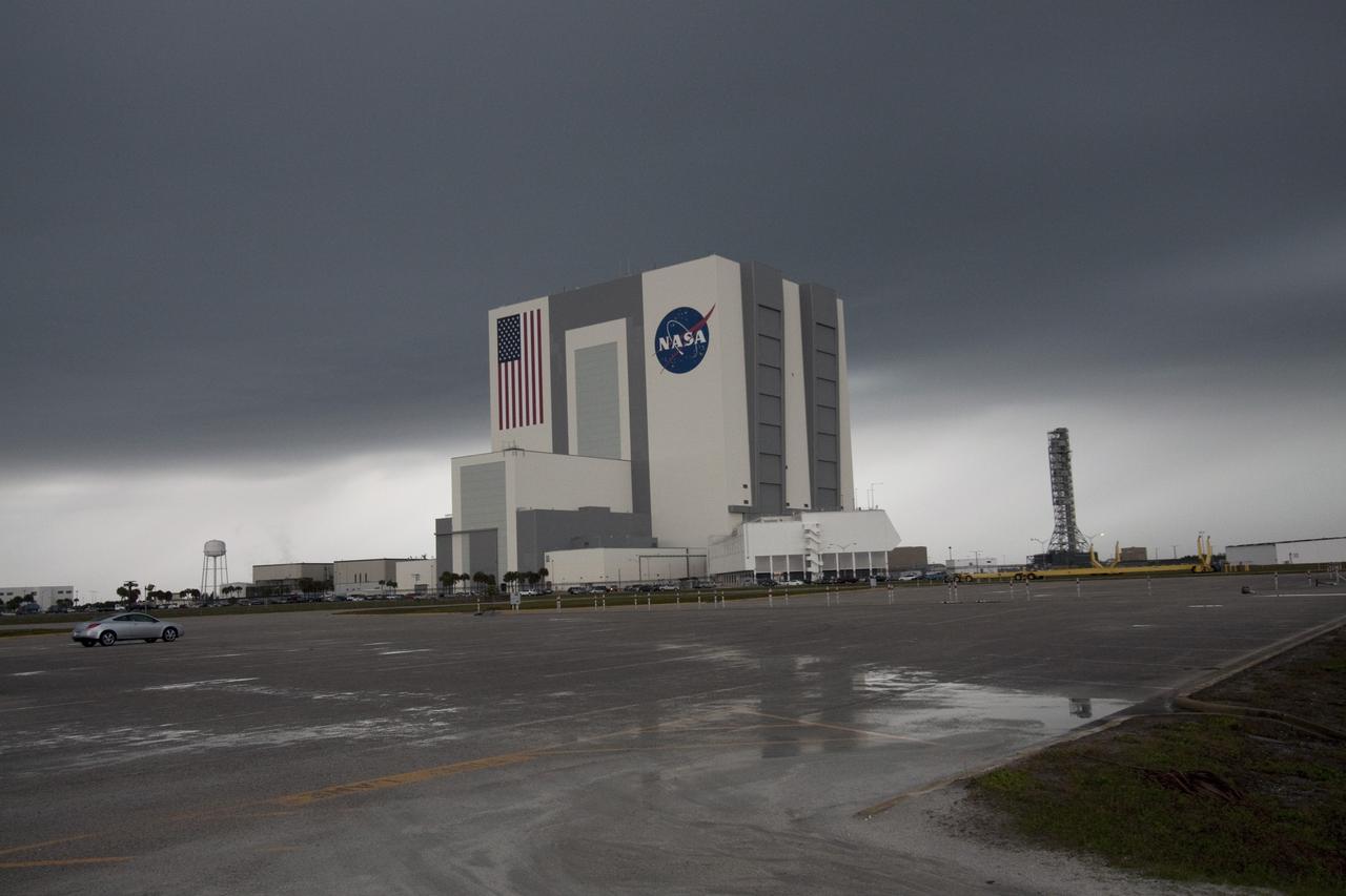
CAPE CANAVERAL, Fla. – At NASA's Kennedy Space Center in Florida, dark clouds hover over the Vehicle Assembly Building in the Launch Complex 39 area. Severe storms associated with a frontal system are moving through Central Florida, producing strong winds, heavy rain, frequent lightning and even funnel clouds. Photo credit: NASA/Jack Pfaller
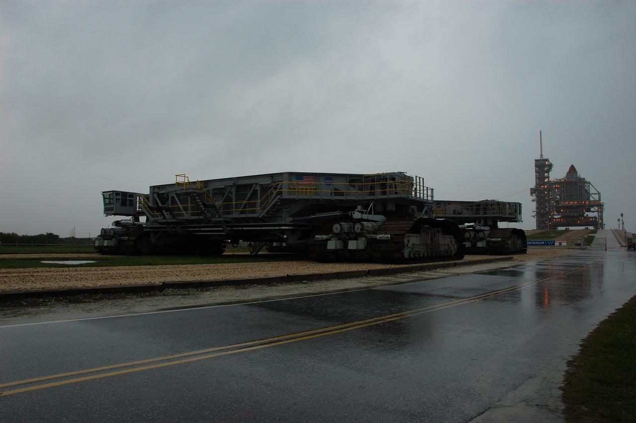
CAPE CANAVERAL, Fla. – Rain soaked Launch Pad 39A at NASA's Kennedy Space Center in Florida, where space shuttle Endeavour is poised to launch on its final mission, STS-134, to the International Space Station. Severe storms associated with a frontal system are moving through Central Florida, producing strong winds, heavy rain, frequent lightning and even funnel clouds. Photo credit: NASA/Ben Smegelsky
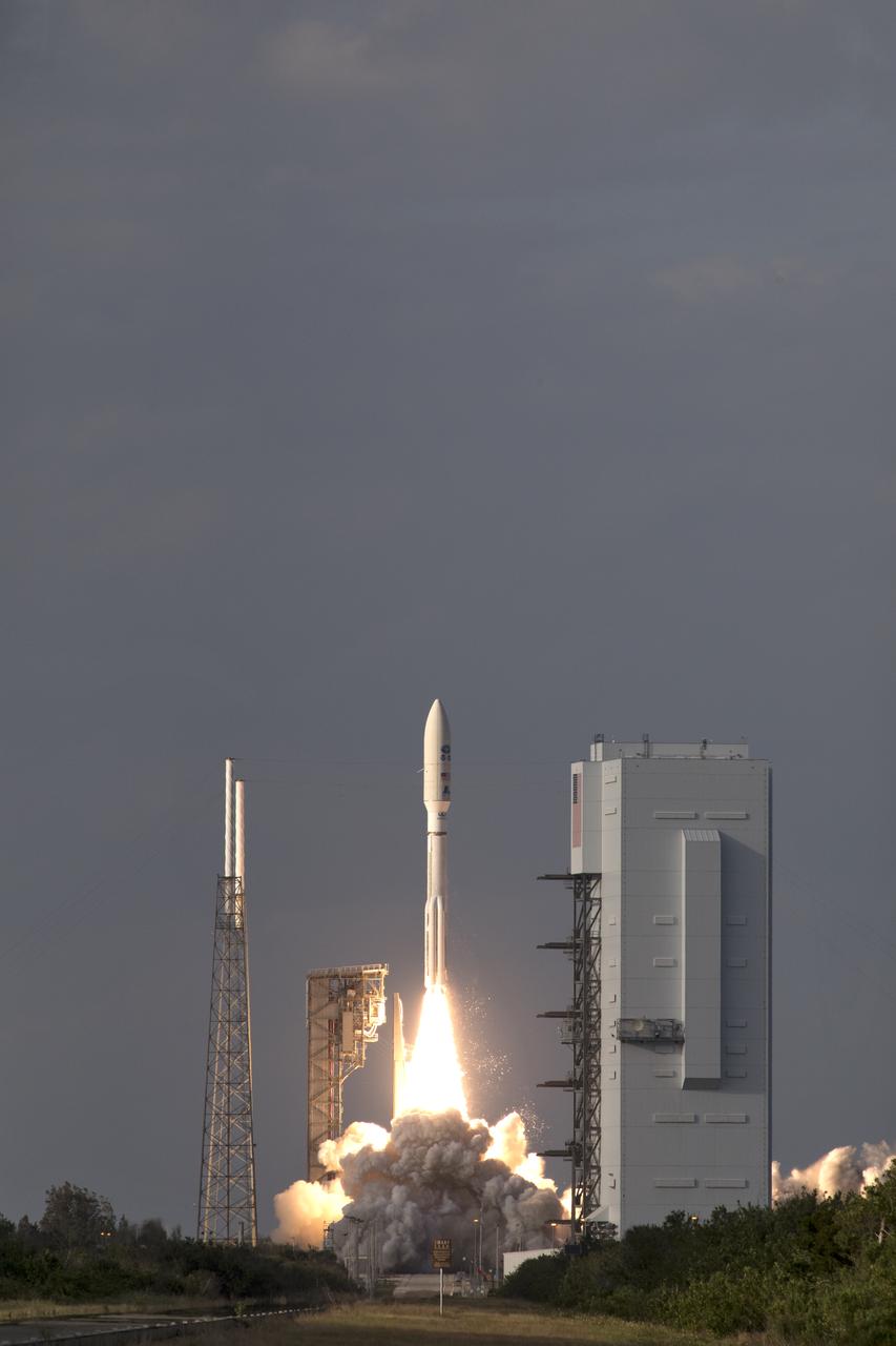
A United Launch Alliance Atlas V rocket lifts off from Space Launch Complex 41 at Cape Canaveral Air Force Station carrying the NOAA Geostationary Operational Environmental Satellite, or GOES-S. Liftoff was at 5:02 p.m. EST. GOES-S is the second satellite in a series of next-generation weather satellites. It will launch to a geostationary position over the U.S. to provide images of storms and help predict weather forecasts, severe weather outlooks, watches, warnings, lightning conditions and longer-term forecasting.

CAPE CANAVERAL, Fla. – Rain pounds Launch Pad 39A at NASA's Kennedy Space Center in Florida, where space shuttle Endeavour is poised to launch on its final mission, STS-134, to the International Space Station. Severe storms associated with a frontal system are moving through Central Florida, producing strong winds, heavy rain, frequent lightning and even funnel clouds. Photo credit: NASA/Ben Smegelsky
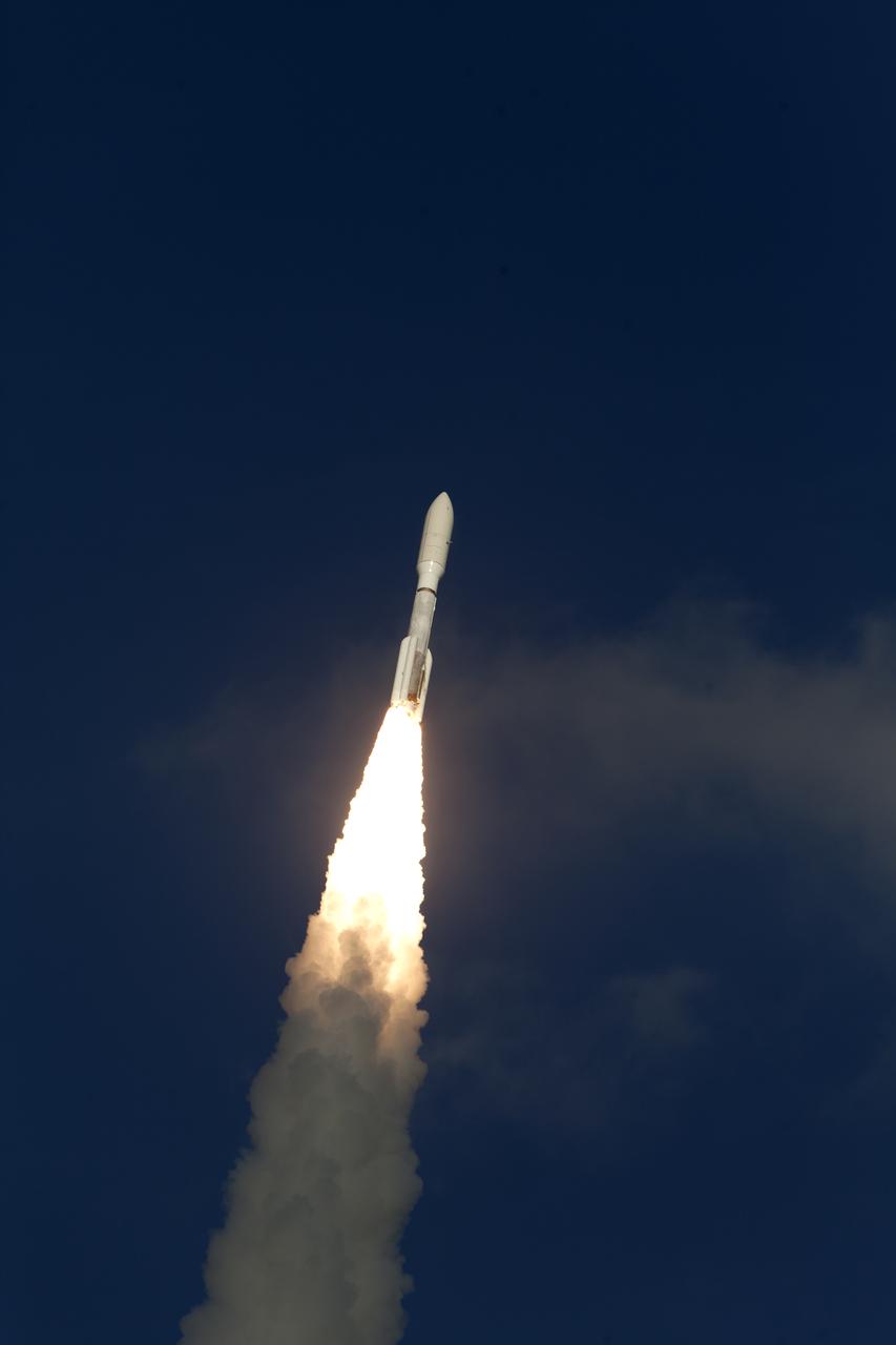
A United Launch Alliance Atlas V rocket lifts off from Space Launch Complex 41 at Cape Canaveral Air Force Station carrying the NOAA Geostationary Operational Environmental Satellite, or GOES-S. Liftoff was at 5:02 p.m. EST. GOES-S is the second satellite in a series of next-generation weather satellites. It will launch to a geostationary position over the U.S. to provide images of storms and help predict weather forecasts, severe weather outlooks, watches, warnings, lightning conditions and longer-term forecasting.

CAPE CANAVERAL, Fla. -- An ominous storm cloud hovers over Launch Complex 39 at NASA's Kennedy Space Center in Florida. The massive, 525-foot-tall facility at left is the Vehicle Assembly Building. Florida summers are known for their dynamic weather patterns with the start of the Atlantic hurricane season and the onset of afternoon thunderstorms that bring with them heavy rain, frequent lightning and occasionally even tornadoes. Photo credit: NASA/Jim Grossmann
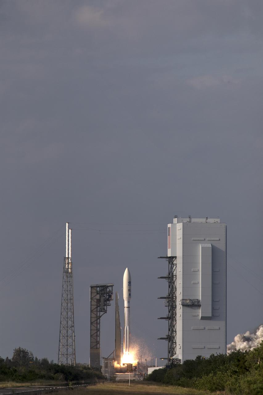
A United Launch Alliance Atlas V rocket lifts off from Space Launch Complex 41 at Cape Canaveral Air Force Station carrying the NOAA Geostationary Operational Environmental Satellite, or GOES-S. Liftoff was at 5:02 p.m. EST. GOES-S is the second satellite in a series of next-generation weather satellites. It will launch to a geostationary position over the U.S. to provide images of storms and help predict weather forecasts, severe weather outlooks, watches, warnings, lightning conditions and longer-term forecasting.

KENNEDY SPACE CENTER, FLA. - A powerful electrical storm created an eerie tapestry of light in the skies near Space Shuttle Launch Complex 39A in the hours preceding the launch of Challenger on mission STS-8 at 2:32 a.m. EDT today. Driving rains and the dazzling lightning display ceased after this photograh was taken by a remote camera set up by Sam Walton of United Press International and mission officials were able to proceed with the launch.

A United Launch Alliance Atlas V rocket lifts off from Space Launch Complex 41 at Cape Canaveral Air Force Station carrying the NOAA Geostationary Operational Environmental Satellite, or GOES-S. Liftoff was at 5:02 p.m. EST. GOES-S is the second satellite in a series of next-generation weather satellites. It will launch to a geostationary position over the U.S. to provide images of storms and help predict weather forecasts, severe weather outlooks, watches, warnings, lightning conditions and longer-term forecasting.
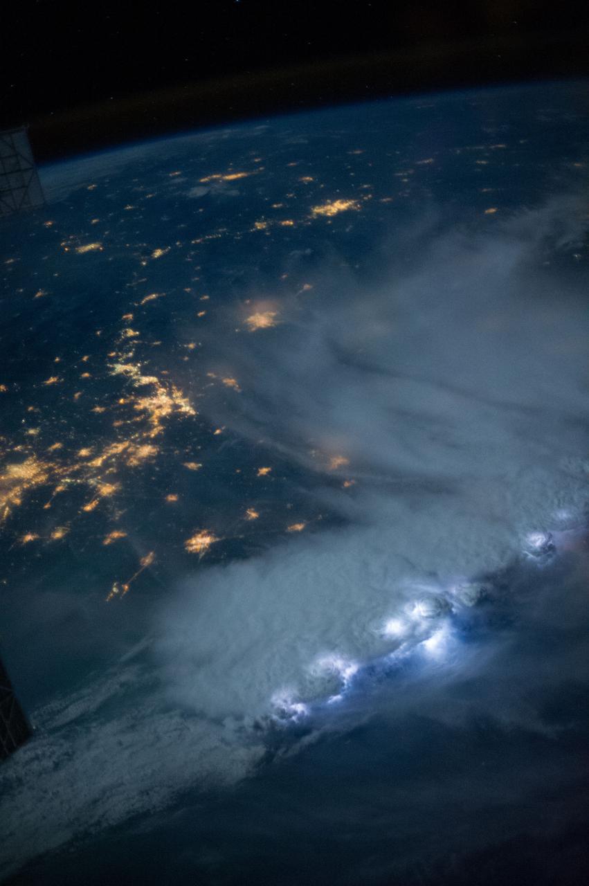
iss073e0300048 (June 15, 2025) --- Lightning (top center) is captured striking and illuminating the clouds during a storm over the Southeast Asian city-state of Singapore separated from the Malaysian city of Johor Bahru by the Johor Strait. Singapore's population is just over 6 million while Johor Bahru's is nearly 860,000. The International Space Station was orbiting 259 miles above the South China Sea at approximately 3:18 a.m. local time when this photograph was taken.
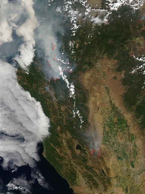
California has been hit hard the past few weeks with storms. Storms bring lightning and lightning strikes cause wildfires. Currently there are at least five fire complexes in the area including River, Fork, South, Route and Mad River. The Mad River complex is a series of seven lightning fires that started on July 30th, 2015 after a lightning storm moved through Northern California. After initial firefighters responded, 25 fires were reported and most of the fires were contained. Some additional fires might be detected from the original lightning storms in the upcoming days and will be attacked once they are found. Damage assessment is ongoing and crews will determine the extent of structures and equipment damaged or destroyed. The River Complex is managing a total of 5 fires due to fires merging together on the Shasta-Trinity and the Six Rivers National Forests. Winds from the west are expected to lift the inversion today resulting in active fire behavior. The Fork Complex consists of over 40 fires, all of which were ignited by lightning between July 29 and 31, 2015. These fires are still being identified, assessed, and prioritized. Updated acreage and information about specific fires will be published as it is known. Fire activity moderated throughout last night (8/4) with the smoke inversion layer remaining in place today. Hopefully this will create favorable conditions for fire crews to take direct fire attack on the fires edge, construct dozer line and scout for best firefighting locations on all fires in the complex. The South Complex consists of approximately nine known fires, five of which are currently over 100 acres. The fires are active and defense of structures and point protection are in progress. The weather is trapping smoke in the valley causing very poor air quality. As the smoke lifts the fire activity increases. Firefighters will continue to provide point protection on structures and to look for opportunities to build direct and indirect containment lines. The Route Complex currently stands at 12,164 acres from seven separate fires and is at 2% containment. The overall acreage has been reduced because the South Fire on the nearby South Complex is merging with the Johnson Fire in the Route Complex resulting in decreased and revised fire perimeter acreage. This natural-color satellite image collected by the Moderate Resolution Imaging Spectroradiometer (MODIS) aboard the Terra satellite shows smoke rising and drifting northwest from the various fire complexes. It was captured on August 04, 2015. Actively burning areas, detected by MODIS’s thermal bands, are outlined in red. NASA image courtesy Jeff Schmaltz, MODIS Rapid Response Team. <b><a href="http://www.nasa.gov/audience/formedia/features/MP_Photo_Guidelines.html" rel="nofollow">NASA image use policy.</a></b> <b><a href="http://www.nasa.gov/centers/goddard/home/index.html" rel="nofollow">NASA Goddard Space Flight Center</a></b> enables NASA’s mission through four scientific endeavors: Earth Science, Heliophysics, Solar System Exploration, and Astrophysics. Goddard plays a leading role in NASA’s accomplishments by contributing compelling scientific knowledge to advance the Agency’s mission. <b>Follow us on <a href="http://twitter.com/NASAGoddardPix" rel="nofollow">Twitter</a></b> <b>Like us on <a href="http://www.facebook.com/pages/Greenbelt-MD/NASA-Goddard/395013845897?ref=tsd" rel="nofollow">Facebook</a></b> <b>Find us on <a href="http://instagrid.me/nasagoddard/?vm=grid" rel="nofollow">Instagram</a></b>
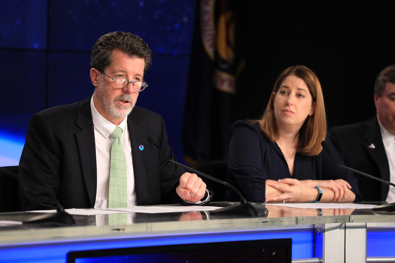
In the Kennedy Space Center's Press Site auditorium, Jim Roberts, a scientist with the Earth System Research Laboratory's Office of Atmospheric Research for NOAA, left, and Kristin Calhoun, a research scientist with NOAA's National Severe Storms Laboratory, speak to members of the media at a mission briefing on National Oceanic and Atmospheric Administration's, or NOAA's, Geostationary Operational Environmental Satellite, or GOES-S. The spacecraft is the second satellite in a series of next-generation NOAA weather satellites. It will launch to a geostationary position over the U.S. to provide images of storms and help predict weather forecasts, severe weather outlooks, watches, warnings, lightning conditions and longer-term forecasting. GOES-S is slated to lift off at 5:02 p.m. EST on March 1, 2018 aboard a United Launch Alliance Atlas V rocket.
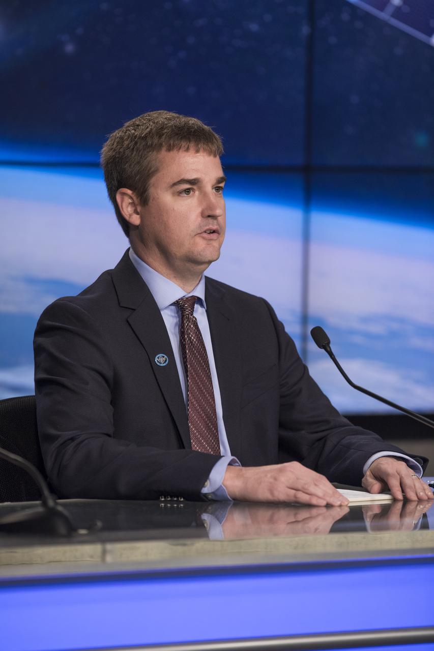
In the Kennedy Space Center's Press Site auditorium, Steve Cole of NASA Communications speaks to members of the media at a mission briefing on National Oceanic and Atmospheric Administration's, or NOAA's, Geostationary Operational Environmental Satellite, or GOES-S. The spacecraft is the second satellite in a series of next-generation NOAA weather satellites. It will launch to a geostationary position over the U.S. to provide images of storms and help predict weather forecasts, severe weather outlooks, watches, warnings, lightning conditions and longer-term forecasting. GOES-S is slated to lift off at 5:02 p.m. EST on March 1, 2018 aboard a United Launch Alliance Atlas V rocket.

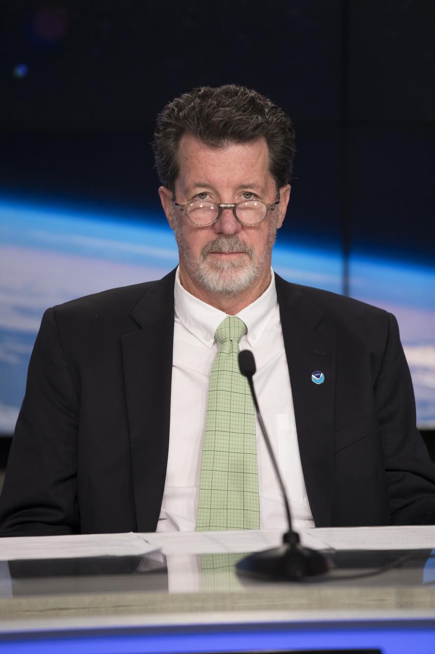
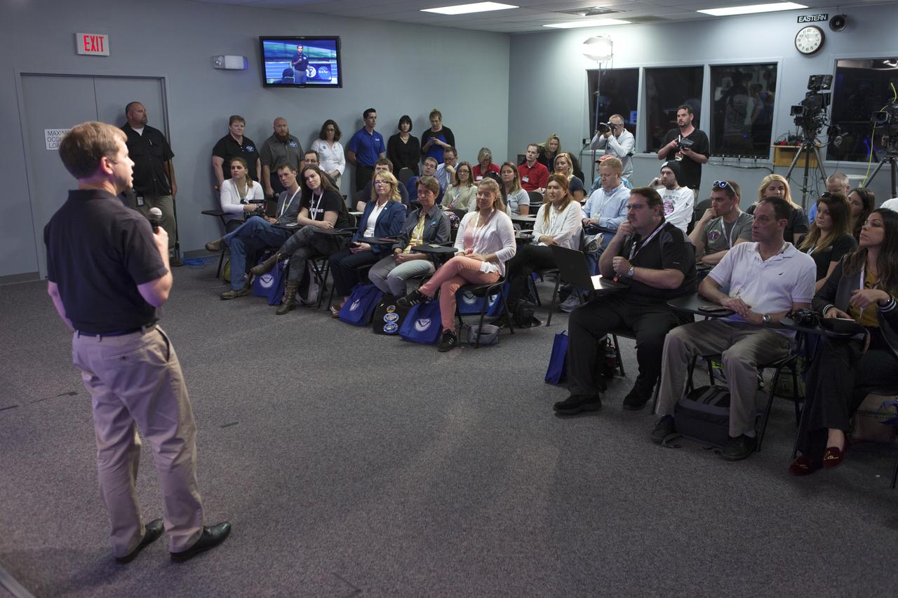
Tim Walsh, GOES-R System Program director for the National Oceanic and Atmospheric Administration, or NOAA, speaks to members of social media in the Kennedy Space Center’s Press Site auditorium. The briefing focused on the Geostationary Operational Environmental Satellite, or GOES-S, the second spacecraft in a series of next-generation NOAA weather satellites. It will launch to a geostationary position over the U.S. to provide images of storms and help predict weather forecasts, severe weather outlooks, watches, warnings, lightning conditions and longer-term forecasting. GOES-S is slated to lift off at 5:02 p.m. EST on March 1, 2018 aboard a United Launch Alliance Atlas V rocket.
In the Kennedy Space Center's Press Site auditorium, Jim Roberts, a scientist with the Earth System Research Laboratory's Office of Atmospheric Research for NOAA, speaks to members of the media at a mission briefing on National Oceanic and Atmospheric Administration's, or NOAA's, Geostationary Operational Environmental Satellite, or GOES-S. The spacecraft is the second satellite in a series of next-generation NOAA weather satellites. It will launch to a geostationary position over the U.S. to provide images of storms and help predict weather forecasts, severe weather outlooks, watches, warnings, lightning conditions and longer-term forecasting. GOES-S is slated to lift off at 5:02 p.m. EST on March 1, 2018 aboard a United Launch Alliance Atlas V rocket.
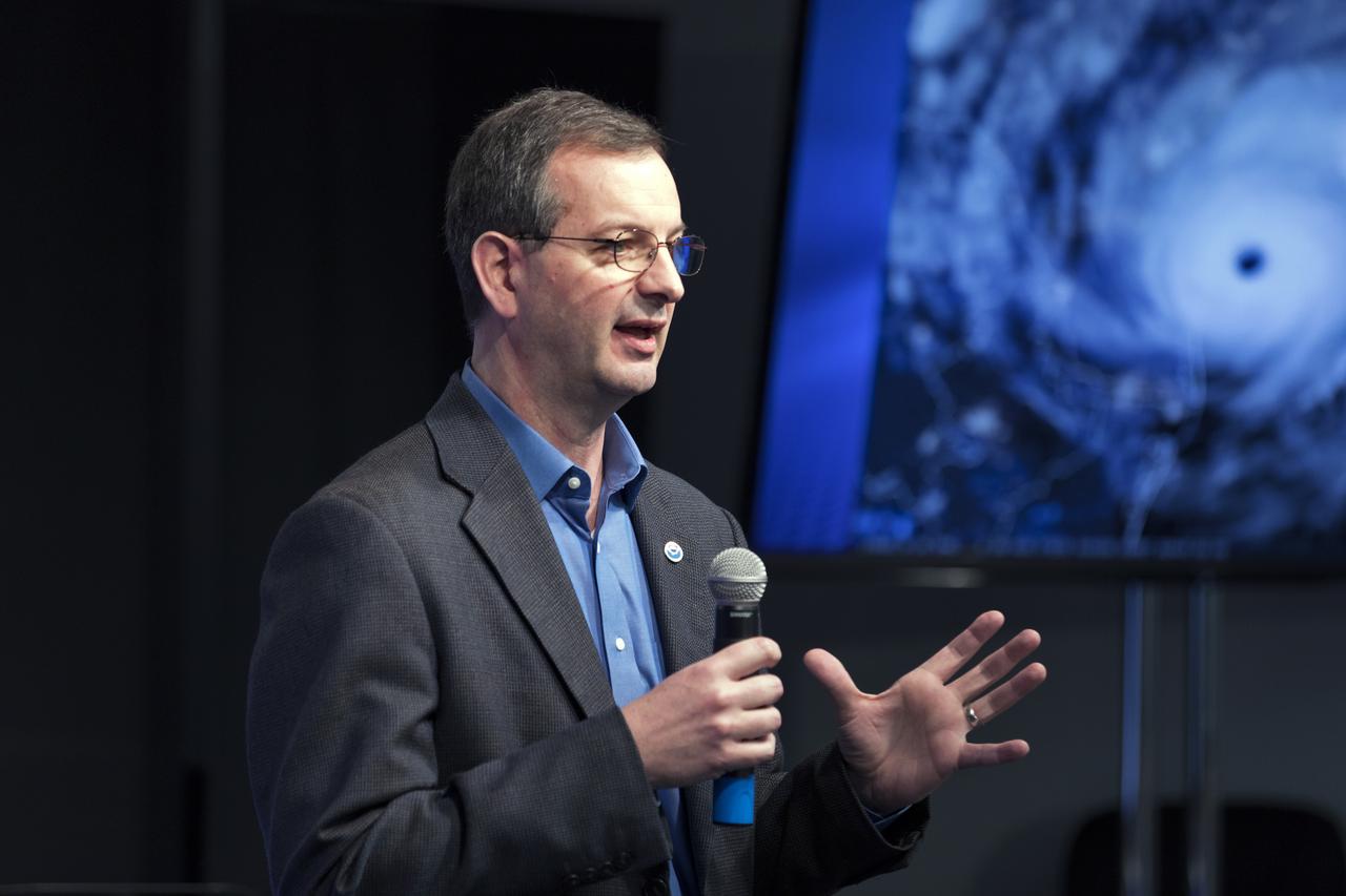
Joe Pica, director of the Office of Observations for the National Oceanic and Atmospheric Administration's, or NOAA’s, National Weather Service, speaks to members of social media in the Kennedy Space Center’s Press Site auditorium. The briefing focused on the Geostationary Operational Environmental Satellite, or GOES-S, the second spacecraft in a series of next-generation NOAA weather satellites. It will launch to a geostationary position over the U.S. to provide images of storms and help predict weather forecasts, severe weather outlooks, watches, warnings, lightning conditions and longer-term forecasting. GOES-S is slated to lift off at 5:02 p.m. EST on March 1, 2018 aboard a United Launch Alliance Atlas V rocket.

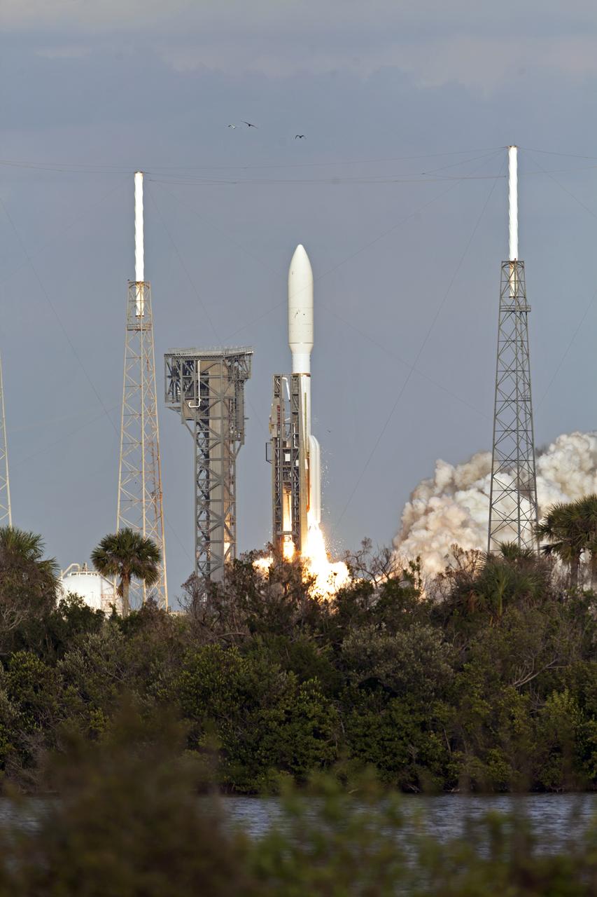
KENNEDY SPACE CENTER, FLA. - Railroad cars sit on a track that runs past the launch pad on Complex 41 (background) at Cape Canaveral Air Force Station in Florida. Waiting on the pad for launch is the Atlas V/New Horizons spacecraft, surrounded by four lightning masts. Two scheduled launch attempts were scrubbed Jan. 17 and Jan. 18 due to weather conditions: high surface winds in Florida the first day and a storm-related power outage at the spacecraft mission operations center in Maryland on the second day. A third launch attempt has been scheduled for Jan. 19.
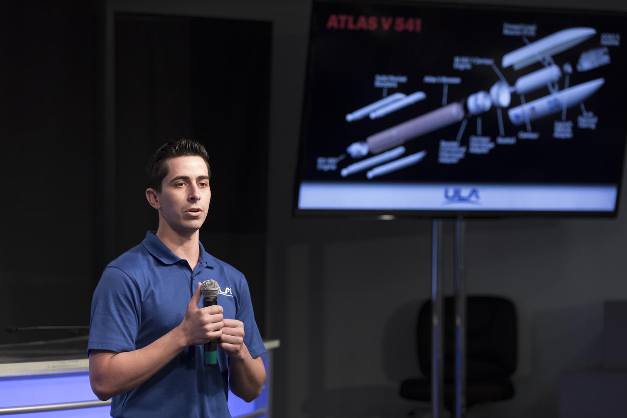
Gabriel Rodriguez-Mena, a United Launch Alliance systems test engineer, speaks to members of social media in the Kennedy Space Center’s Press Site auditorium. The briefing focused on the National Oceanic and Atmospheric Administration's, or NOAA's, Geostationary Operational Environmental Satellite, or GOES-S. The spacecraft is the second satellite in a series of next-generation NOAA weather satellites. It will launch to a geostationary position over the U.S. to provide images of storms and help predict weather forecasts, severe weather outlooks, watches, warnings, lightning conditions and longer-term forecasting. GOES-S is slated to lift off at 5:02 p.m. EST on March 1, 2018 aboard a United Launch Alliance Atlas V rocket.

In the Kennedy Space Center's Press Site auditorium, George Morrow, deputy director of NASA's Goddard Space Flight Center in Greenbelt, Maryland, speaks to members of the media at a mission briefing on National Oceanic and Atmospheric Administration's, or NOAA's, Geostationary Operational Environmental Satellite, or GOES-S. The spacecraft is the second satellite in a series of next-generation NOAA weather satellites. It will launch to a geostationary position over the U.S. to provide images of storms and help predict weather forecasts, severe weather outlooks, watches, warnings, lightning conditions and longer-term forecasting. GOES-S is slated to lift off at 5:02 p.m. EST on March 1, 2018 aboard a United Launch Alliance Atlas V rocket.
In the Kennedy Space Center's Press Site auditorium, Dan Lindsey, GOES-R senior scientific advisor for NOAA, speaks to members of the media at a mission briefing on National Oceanic and Atmospheric Administration's, or NOAA's, Geostationary Operational Environmental Satellite, or GOES-S. The spacecraft is the second satellite in a series of next-generation NOAA weather satellites. It will launch to a geostationary position over the U.S. to provide images of storms and help predict weather forecasts, severe weather outlooks, watches, warnings, lightning conditions and longer-term forecasting. GOES-S is slated to lift off at 5:02 p.m. EST on March 1, 2018 aboard a United Launch Alliance Atlas V rocket.
Tim Walsh, GOES-R System Program director for the National Oceanic and Atmospheric Administration, or NOAA, speaks to members of social media in the Kennedy Space Center’s Press Site auditorium. The briefing focused on the Geostationary Operational Environmental Satellite, or GOES-S, the second spacecraft in a series of next-generation NOAA weather satellites. It will launch to a geostationary position over the U.S. to provide images of storms and help predict weather forecasts, severe weather outlooks, watches, warnings, lightning conditions and longer-term forecasting. GOES-S is slated to lift off at 5:02 p.m. EST on March 1, 2018 aboard a United Launch Alliance Atlas V rocket.

In the Kennedy Space Center's Press Site auditorium, Louis Uccellini, director of the National Weather Service for NOAA, speaks to members of the media at a mission briefing on National Oceanic and Atmospheric Administration's, or NOAA's, Geostationary Operational Environmental Satellite, or GOES-S. The spacecraft is the second satellite in a series of next-generation NOAA weather satellites. It will launch to a geostationary position over the U.S. to provide images of storms and help predict weather forecasts, severe weather outlooks, watches, warnings, lightning conditions and longer-term forecasting. GOES-S is slated to lift off at 5:02 p.m. EST on March 1, 2018 aboard a United Launch Alliance Atlas V rocket
Jason Townsend, NASA's social media manager, speaks to members of social media in the Kennedy Space Center’s Press Site auditorium. The briefing focused on the National Oceanic and Atmospheric Administration's, or NOAA's, Geostationary Operational Environmental Satellite, or GOES-S. The spacecraft is the second satellite in a series of next-generation NOAA weather satellites. It will launch to a geostationary position over the U.S. to provide images of storms and help predict weather forecasts, severe weather outlooks, watches, warnings, lightning conditions and longer-term forecasting. GOES-S is slated to lift off at 5:02 p.m. EST on March 1, 2018 aboard a United Launch Alliance Atlas V rocket.
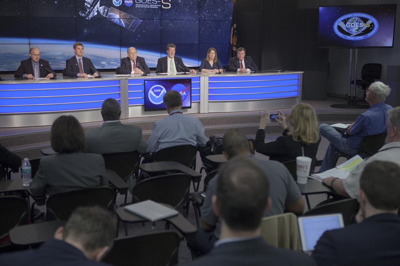
In the Kennedy Space Center's Press Site auditorium, members of the media participate in a mission briefing on National Oceanic and Atmospheric Administration's, or NOAA's, Geostationary Operational Environmental Satellite, or GOES-S. Briefing participants from left are: Steve Cole of NASA Communications; Dan Lindsey, GOES-R senior scientific advisor for NOAA; Louis Uccellini, director of the National Weather Service for NOAA; Jim Roberts, a scientist with the Earth System Research Laboratory's Office of Atmospheric Research for NOAA; Kristin Calhoun, a research scientist with NOAA's National Severe Storms Laboratory, and George Morrow, deputy director of NASA's Goddard Space Flight Center in Greenbelt, Maryland. GOES-S is the second satellite in a series of next-generation NOAA weather satellites. It will launch to a geostationary position over the U.S. to provide images of storms and help predict weather forecasts, severe weather outlooks, watches, warnings, lightning conditions and longer-term forecasting. GOES-S is slated to lift off at 5:02 p.m. EST on March 1, 2018 aboard a United Launch Alliance Atlas V rocket.
Mic Woltman, chief of the Fleet Systems Integration Branch of NASA's Launch Services Program, left, and Gabriel Rodriguez-Mena, a United Launch Alliance systems test engineer, speak to members of social media in the Kennedy Space Center’s Press Site auditorium. The briefing focused on the National Oceanic and Atmospheric Administration's, or NOAA's, Geostationary Operational Environmental Satellite, or GOES-S. The spacecraft is the second satellite in a series of next-generation NOAA weather satellites. It will launch to a geostationary position over the U.S. to provide images of storms and help predict weather forecasts, severe weather outlooks, watches, warnings, lightning conditions and longer-term forecasting. GOES-S is slated to lift off at 5:02 p.m. EST on March 1, 2018 aboard a United Launch Alliance Atlas V rocket.
KENNEDY SPACE CENTER, FLA. - Storm clouds fill the sky from Launch Pad 39B, at right, west beyond the Vehicle Assembly Building. Space Shuttle Atlantis still sits on the pad after a scrub was called Aug. 27 due to a concern with fuel cell 1. Towering above the shuttle is the 80-foot lightning mast. During the STS-115 mission, Atlantis' astronauts will deliver and install the 17.5-ton, bus-sized P3/P4 integrated truss segment on the station. The girder-like truss includes a set of giant solar arrays, batteries and associated electronics and will provide one-fourth of the total power-generation capability for the completed station. This mission is the 116th space shuttle flight, the 27th flight for orbiter Atlantis, and the 19th U.S. flight to the International Space Station. STS-115 is scheduled to last 11 days with a planned landing at KSC. Photo credit: NASA/Ken Thornsley
Pam Sullivan, NASA's GOES-R flight director, left, and A.J. Sandora, Lockheed Martin's GOES-R Series Mechanical Operations Assembly, Test and Launch Operations (ATLO) manager, speak to members of social media in the Kennedy Space Center’s Press Site auditorium. The briefing focused on the National Oceanic and Atmospheric Administration's, or NOAA's, Geostationary Operational Environmental Satellite, or GOES-S. The spacecraft is the second satellite in a series of next-generation NOAA weather satellites. It will launch to a geostationary position over the U.S. to provide images of storms and help predict weather forecasts, severe weather outlooks, watches, warnings, lightning conditions and longer-term forecasting. GOES-S is slated to lift off at 5:02 p.m. EST on March 1, 2018 aboard a United Launch Alliance Atlas V rocket.
KENNEDY SPACE CENTER, FLA. - Space Shuttle Atlantis rolls up the ramp to Launch Pad 39B atop the crawler-transporter. The crawler has a leveling system designed to keep the top of the space shuttle vertical while negotiating the 5-percent grade leading to the top of the launch pad. Also, a laser docking system provides almost pinpoint accuracy when the crawler and mobile launcher platform are positioned at the launch pad. At right are the open rotating service structure and the fixed service structure topped by the 80-foot lightning mast. The shuttle had been moved off the launch pad due to concerns about the impact of Tropical Storm Ernesto, expected within 24 hours. The forecast of lesser winds expected from Ernesto and its projected direction convinced Launch Integration Manager LeRoy Cain and Shuttle Launch Director Mike Leinbach to return the shuttle to the launch pad. Photo credit: NASA/Kim Shiflett

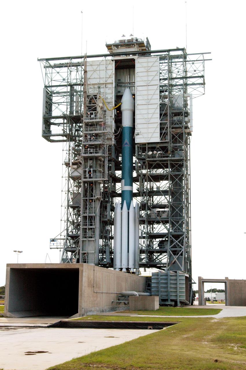
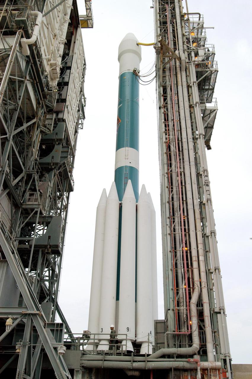
KENNEDY SPACE CENTER, FLA. - The Boeing Delta II rocket with the Mercury Surface, Space Environment, Geochemistry and Ranging (MESSENGER) spacecraft aboard is ready for launch on a seven-year journey to the planet Mercury. This is the second launch attempt in two days after the first attempt Aug. 2 was postponed due to lightning potential from residual clouds that were associated with Tropical Storm Alex. The launch of MESSENGER is rescheduled for this date at 2:15:56 a.m. EDT at the opening of a 12-second launch window. MESSENGER will fly by Earth, Venus and Mercury several times to burn off energy before making its final approach to the inner planet on March 18, 2011. MESSENGER was built for NASA by the Johns Hopkins University Applied Physics Laboratory in Laurel, Md.
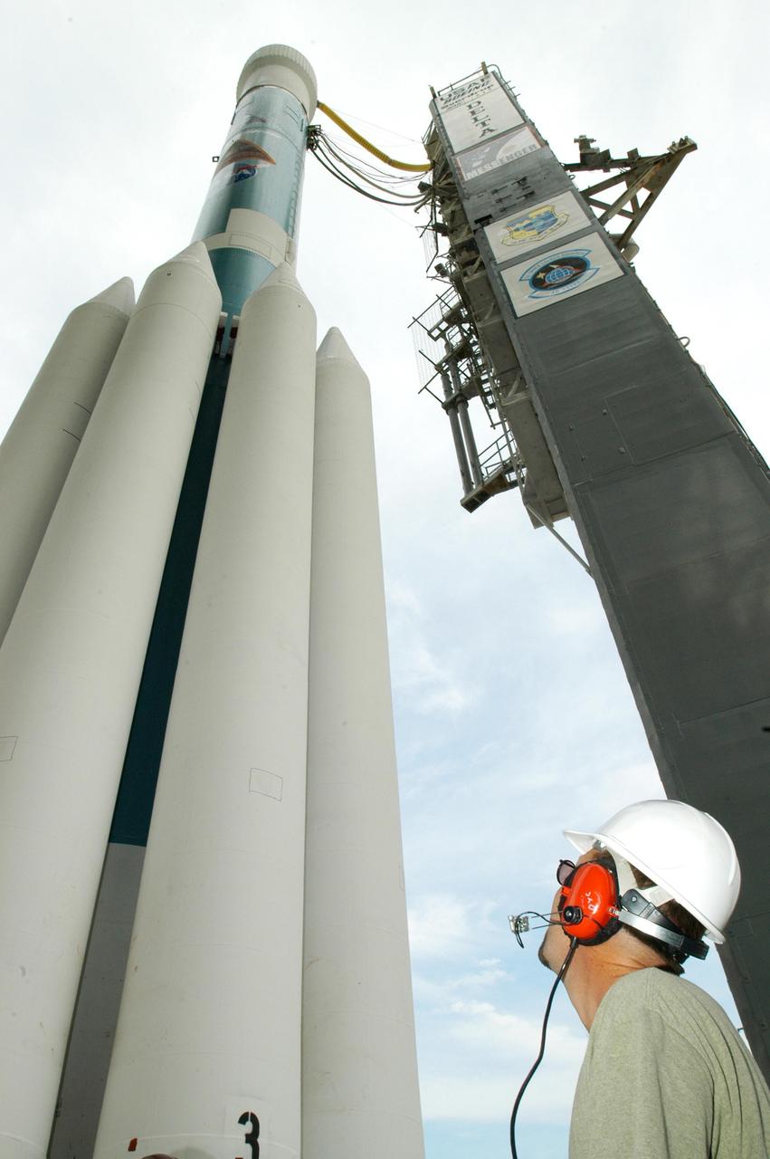
KENNEDY SPACE CENTER, FLA. - After rollback of the mobile service tower, the Boeing Delta II rocket with the Mercury Surface, Space Environment, Geochemistry and Ranging (MESSENGER) spacecraft aboard is ready for launch on a seven-year journey to the planet Mercury. This is the second launch attempt in two days after the first attempt Aug. 2 was postponed due to lightning potential from residual clouds that were associated with Tropical Storm Alex. The launch of MESSENGER is rescheduled for this date at 2:15:56 a.m. EDT at the opening of a 12-second launch window. MESSENGER will fly by Earth, Venus and Mercury several times to burn off energy before making its final approach to the inner planet on March 18, 2011. MESSENGER was built for NASA by the Johns Hopkins University Applied Physics Laboratory in Laurel, Md.
KENNEDY SPACE CENTER, FLA. - On Launch Pad 17-B, Cape Canaveral Air Force Station, the Boeing Delta II rocket with the Mercury Surface, Space Environment, Geochemistry and Ranging (MESSENGER) spacecraft aboard waits for rollback of the mobile service tower and a second launch attempt in two days. The first attempt Aug. 2 was postponed due to lightning potential from residual clouds that were associated with Tropical Storm Alex. The launch of MESSENGER on a seven-year journey to the planet Mercury is rescheduled for this date at 2:15:56 a.m. EDT at the opening of a 12-second launch window. MESSENGER will fly by Earth, Venus and Mercury several times to burn off energy before making its final approach to the inner planet on March 18, 2011. MESSENGER was built for NASA by the Johns Hopkins University Applied Physics Laboratory in Laurel, Md.
KENNEDY SPACE CENTER, FLA. - On Launch Pad 17-B, Cape Canaveral Air Force Station, the mobile service tower begins rolling back from the Boeing Delta II rocket with the Mercury Surface, Space Environment, Geochemistry and Ranging (MESSENGER) spacecraft aboard. This is the second launch attempt in two days after the first attempt Aug. 2 was postponed due to lightning potential from residual clouds that were associated with Tropical Storm Alex. The launch of MESSENGER on a seven-year journey to the planet Mercury is rescheduled for this date at 2:15:56 a.m. EDT at the opening of a 12-second launch window. MESSENGER will fly by Earth, Venus and Mercury several times to burn off energy before making its final approach to the inner planet on March 18, 2011. MESSENGER was built for NASA by the Johns Hopkins University Applied Physics Laboratory in Laurel, Md.

KENNEDY SPACE CENTER, FLA. - Framed by a blue hazy sky and bluer Atlantic Ocean, the Boeing Delta II rocket with the Mercury Surface, Space Environment, Geochemistry and Ranging (MESSENGER) spacecraft aboard is ready for launch on a seven-year journey to the planet Mercury. This is the second launch attempt in two days after the first attempt Aug. 2 was postponed due to lightning potential from residual clouds that were associated with Tropical Storm Alex. The launch of MESSENGER is rescheduled for this date at 2:15:56 a.m. EDT at the opening of a 12-second launch window. MESSENGER will fly by Earth, Venus and Mercury several times to burn off energy before making its final approach to the inner planet on March 18, 2011. MESSENGER was built for NASA by the Johns Hopkins University Applied Physics Laboratory in Laurel, Md.
KENNEDY SPACE CENTER, FLA. - Storm clouds gather behind Space Shuttle Atlantis on Launch Pad 39B. Atlantis was originally scheduled to launch on Aug. 27, but a scrub was called by mission managers due to a concern with fuel cell 1. Towering above the shuttle is the 80-foot lightning mast. During the STS-115 mission, Atlantis' astronauts will deliver and install the 17.5-ton, bus-sized P3/P4 integrated truss segment on the station. The girder-like truss includes a set of giant solar arrays, batteries and associated electronics and will provide one-fourth of the total power-generation capability for the completed station. This mission is the 116th space shuttle flight, the 27th flight for orbiter Atlantis, and the 19th U.S. flight to the International Space Station. STS-115 is scheduled to last 11 days with a planned landing at KSC. Photo credit: NASA/Ken Thornsley
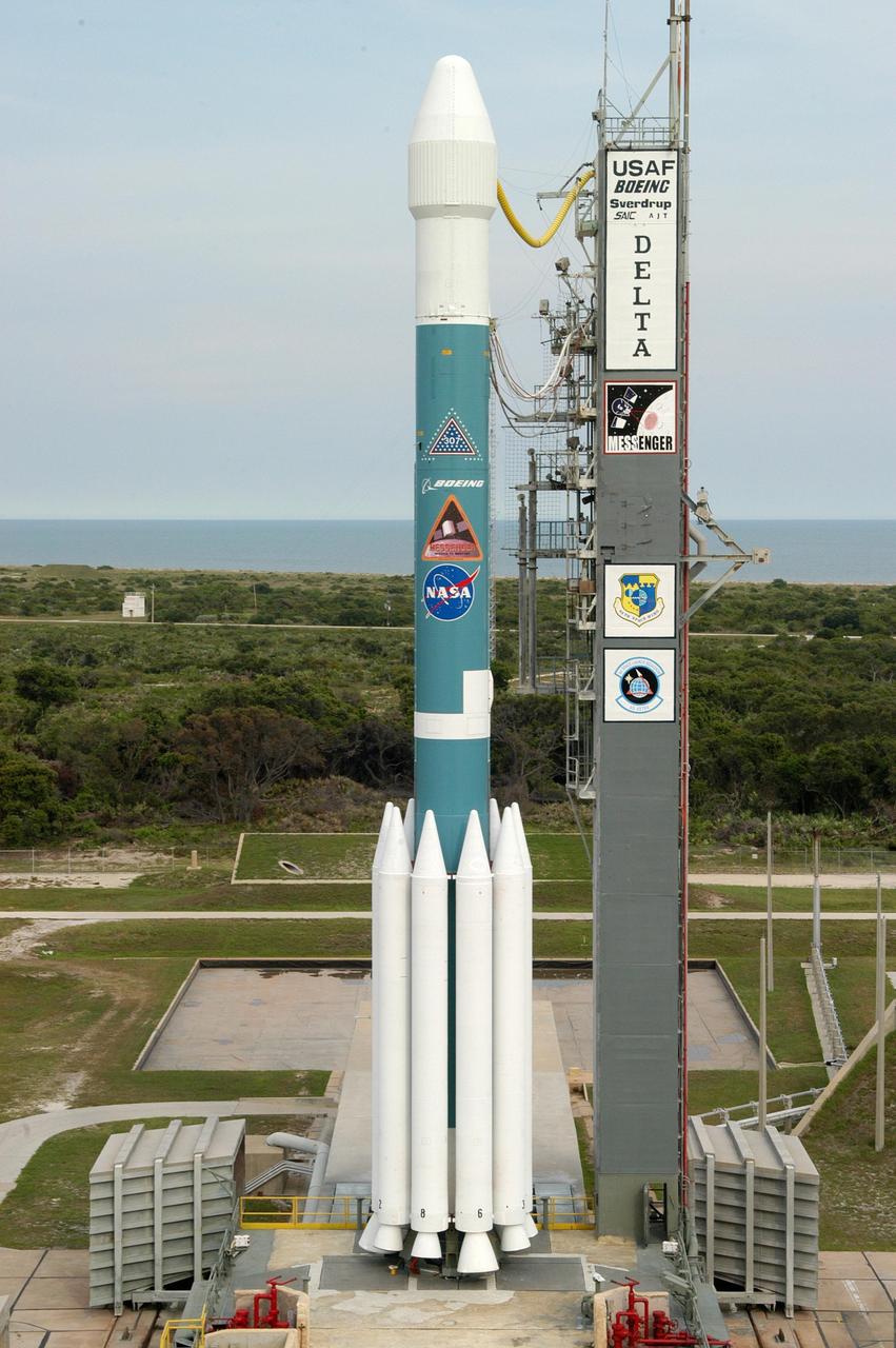
KENNEDY SPACE CENTER, FLA. - The Boeing Delta II rocket with the Mercury Surface, Space Environment, Geochemistry and Ranging (MESSENGER) spacecraft aboard is ready for launch on a seven-year journey to the planet Mercury. This is the second launch attempt in two days after the first attempt Aug. 2 was postponed due to lightning potential from residual clouds that were associated with Tropical Storm Alex. The launch of MESSENGER is rescheduled for this date at 2:15:56 a.m. EDT at the opening of a 12-second launch window. MESSENGER will fly by Earth, Venus and Mercury several times to burn off energy before making its final approach to the inner planet on March 18, 2011. MESSENGER was built for NASA by the Johns Hopkins University Applied Physics Laboratory in Laurel, Md.

A.J. Sandora, Lockheed Martin's GOES-R Series Mechanical Operations Assembly, Test and Launch Operations (ATLO) manager, speaks to members of social media in the Kennedy Space Center’s Press Site auditorium. The briefing focused on the National Oceanic and Atmospheric Administration's, or NOAA's, Geostationary Operational Environmental Satellite, or GOES-S. Built by Lockheed Martin Space Systems of Littleton, Colorado, the spacecraft is the second satellite in a series of next-generation NOAA weather satellites. It will launch to a geostationary position over the U.S. to provide images of storms and help predict weather forecasts, severe weather outlooks, watches, warnings, lightning conditions and longer-term forecasting. GOES-S is slated to lift off at 5:02 p.m. EST on March 1, 2018 aboard a United Launch Alliance Atlas V rocket.
CAPE CANAVERAL, Fla. – Weather conditions associated with lightning, as well as cumulus and anvil clouds, kept NASA's Radiation Belt Storm Probes, or RBSP, on Space Launch Complex 41 at Cape Canaveral Air Force Station in Florida. The twin probes are awaiting launch atop a United Launch Alliance Atlas V rocket. RBSP will explore changes in Earth's space environment caused by the sun -- known as "space weather" -- that can disable satellites, create power-grid failures and disrupt GPS service. The mission also will provide data on the fundamental radiation and particle acceleration processes throughout the universe. The launch is rescheduled for 4:05 a.m. EDT on Aug. 30, pending approval from the range. For more information on RBSP, visit http://www.nasa.gov/rbsp. Photo credit: NASA/Gary Thompson

KENNEDY SPACE CENTER, FLA. - A heavy bank of storm clouds gather behind Space Shuttle Atlantis on Launch Pad 39B. Atlantis was originally scheduled to launch Aug. 27, but a scrub was called by mission managers due to a concern with fuel cell 1. Towering above the shuttle is the 80-foot lightning mast. During the STS-115 mission, Atlantis' astronauts will deliver and install the 17.5-ton, bus-sized P3/P4 integrated truss segment on the station. The girder-like truss includes a set of giant solar arrays, batteries and associated electronics and will provide one-fourth of the total power-generation capability for the completed station. This mission is the 116th space shuttle flight, the 27th flight for orbiter Atlantis, and the 19th U.S. flight to the International Space Station. STS-115 is scheduled to last 11 days with a planned landing at KSC. Photo credit: NASA/Ken Thornsley
KENNEDY SPACE CENTER, FLA. - Storm clouds roll across Launch Pad 39B where Space Shuttle Atlantis still sits on the pad. Atlantis was originally scheduled to launch Aug. 27, but a scrub was called by mission managers due to a concern with fuel cell 1. Towering above the shuttle is the 80-foot lightning mast. During the STS-115 mission, Atlantis' astronauts will deliver and install the 17.5-ton, bus-sized P3/P4 integrated truss segment on the station. The girder-like truss includes a set of giant solar arrays, batteries and associated electronics and will provide one-fourth of the total power-generation capability for the completed station. This mission is the 116th space shuttle flight, the 27th flight for orbiter Atlantis, and the 19th U.S. flight to the International Space Station. STS-115 is scheduled to last 11 days with a planned landing at KSC. Photo credit: NASA/Ken Thornsley
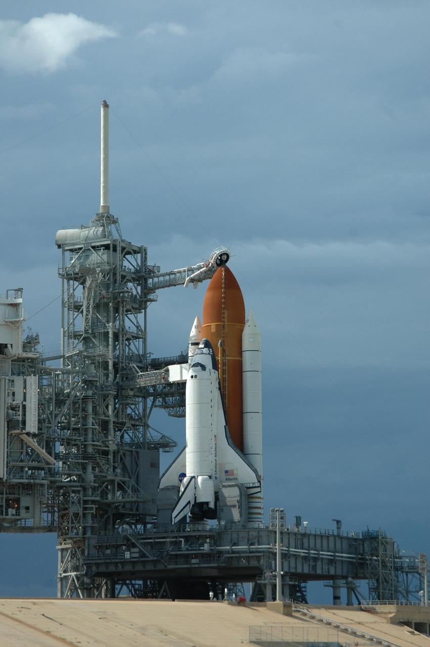
CAPE CANAVERAL, Fla. -- Storm clouds move over Launch Pad 39A at NASA's Kennedy Space Center in Florida, postponing the retraction of the pad's rotating service structure, which would reveal space shuttle Discovery. The structure provides weather protection and access to the shuttle while it awaits lift off on the pad. RSS "rollback," as it's called, will begin again after the lightning-producing clouds pass. Launch of Discovery on the STS-133 mission to the International Space Station is set for 3:29 p.m. on Nov. 4. During the 11-day mission, Discovery and its six crew members will deliver the Permanent Multipurpose Module, packed with supplies and critical spare parts, as well as Robonaut 2, to the orbiting laboratory. Discovery, which will fly its 39th mission, is scheduled to be retired following STS-133. This will be the 133rd Space Shuttle Program mission and the 35th shuttle voyage to the space station. For more information on STS-133, visit www.nasa.gov/mission_pages/shuttle/shuttlemissions/sts133/. Photo credit: NASA/Kim Shiflett
CAPE CANAVERAL, Fla. -- At NASA's Kennedy Space Center in Florida, the rotating service structure on Launch Pad 39A moves away from space shuttle Discovery. The structure provides weather protection and access to the shuttle while it awaits lift off on the pad. RSS "rollback," as it's called, was delayed for a few hours to allow a lightning-producing storm cloud to pass. Launch of Discovery on the STS-133 mission to the International Space Station is set for 3:29 p.m. on Nov. 4. During the 11-day mission, Discovery and its six crew members will deliver the Permanent Multipurpose Module, packed with supplies and critical spare parts, as well as Robonaut 2, to the orbiting laboratory. Discovery, which will fly its 39th mission, is scheduled to be retired following STS-133. This will be the 133rd Space Shuttle Program mission and the 35th shuttle voyage to the space station. For more information on STS-133, visit www.nasa.gov/mission_pages/shuttle/shuttlemissions/sts133/. Photo credit: NASA/Jack Pfaller
CAPE CANAVERAL, Fla. -- At NASA's Kennedy Space Center in Florida, space shuttle Discovery is visible on Launch Pad 39A following the retraction of the rotating service structure. The structure provides weather protection and access to the shuttle while it awaits lift off on the pad. RSS "rollback," as it's called, was delayed for a few hours to allow a lightning-producing storm cloud to pass. Launch of Discovery on the STS-133 mission to the International Space Station is set for 3:29 p.m. on Nov. 4. During the 11-day mission, Discovery and its six crew members will deliver the Permanent Multipurpose Module, packed with supplies and critical spare parts, as well as Robonaut 2, to the orbiting laboratory. Discovery, which will fly its 39th mission, is scheduled to be retired following STS-133. This will be the 133rd Space Shuttle Program mission and the 35th shuttle voyage to the space station. For more information on STS-133, visit www.nasa.gov/mission_pages/shuttle/shuttlemissions/sts133/. Photo credit: NASA/Jack Pfaller
CAPE CANAVERAL, Fla. – Lightning catenary masts stand ready to protect a Falcon 9 rocket if a storm should develop over Space Launch Complex-40 on Cape Canaveral Air Force Station in Florida following a wet dress rehearsal on March 1, which included loading the rocket with its propellants and a simulated countdown. Atop the rocket is a Dragon capsule. The new rocket and capsule were designed and manufactured by Space Exploration Technologies Corp., or SpaceX, for the company’s upcoming demonstration test flight for NASA’s Commercial Orbital Transportation Services, or COTS, program. Under COTS, NASA has partnered with two private companies to develop the capability to deliver cargo to the International Space Station. During the flight, SpaceX's Dragon capsule will conduct a series of checkout procedures that will test and prove its systems. These tests include rendezvous and berthing with the space station and are intended to lead to regular resupply missions to the station. Liftoff is targeted for April 30 at 12:22 p.m. EDT pending official approval at the Flight Readiness Review on April 16. For more information, visit www.nasa.gov/exploration/commercial/cargo/spacex_index.html. Photo credit: NASA/Cory Huston
CAPE CANAVERAL, Fla. -- Storm clouds move in over Launch Pad 39A at NASA's Kennedy Space Center in Florida, postponing the retraction of the pad's rotating service structure, which would reveal space shuttle Discovery. The structure provides weather protection and access to the shuttle while it awaits lift off on the pad. RSS "rollback," as it's called, will begin again after the lightning-producing clouds pass. Launch of Discovery on the STS-133 mission to the International Space Station is set for 3:29 p.m. on Nov. 4. During the 11-day mission, Discovery and its six crew members will deliver the Permanent Multipurpose Module, packed with supplies and critical spare parts, as well as Robonaut 2, to the orbiting laboratory. Discovery, which will fly its 39th mission, is scheduled to be retired following STS-133. This will be the 133rd Space Shuttle Program mission and the 35th shuttle voyage to the space station. For more information on STS-133, visit www.nasa.gov/mission_pages/shuttle/shuttlemissions/sts133/. Photo credit: NASA/Kim Shiflett

CAPE CANAVERAL, Fla. -- On Launch Pad 39A, preparations to move the pad's rotating service structure away from space shuttle Discovery stop as storm clouds move in over NASA's Kennedy Space Center in Florida. The structure provides weather protection and access to the shuttle while it awaits lift off on the pad. RSS "rollback," as it's called, will begin again after the lightning-producing clouds pass. Launch of Discovery on the STS-133 mission to the International Space Station is set for 3:29 p.m. on Nov. 4. During the 11-day mission, Discovery and its six crew members will deliver the Permanent Multipurpose Module, packed with supplies and critical spare parts, as well as Robonaut 2, to the orbiting laboratory. Discovery, which will fly its 39th mission, is scheduled to be retired following STS-133. This will be the 133rd Space Shuttle Program mission and the 35th shuttle voyage to the space station. For more information on STS-133, visit www.nasa.gov/mission_pages/shuttle/shuttlemissions/sts133/. Photo credit: NASA/Jack Pfaller
CAPE CANAVERAL, Fla. -- At NASA's Kennedy Space Center in Florida, the rotating service structure on Launch Pad 39A moves away from space shuttle Discovery. The structure provides weather protection and access to the shuttle while it awaits lift off on the pad. RSS "rollback," as it's called, was delayed for a few hours to allow a lightning-producing storm cloud to pass. Launch of Discovery on the STS-133 mission to the International Space Station is set for 3:29 p.m. on Nov. 4. During the 11-day mission, Discovery and its six crew members will deliver the Permanent Multipurpose Module, packed with supplies and critical spare parts, as well as Robonaut 2, to the orbiting laboratory. Discovery, which will fly its 39th mission, is scheduled to be retired following STS-133. This will be the 133rd Space Shuttle Program mission and the 35th shuttle voyage to the space station. For more information on STS-133, visit www.nasa.gov/mission_pages/shuttle/shuttlemissions/sts133/. Photo credit: NASA/Jack Pfaller
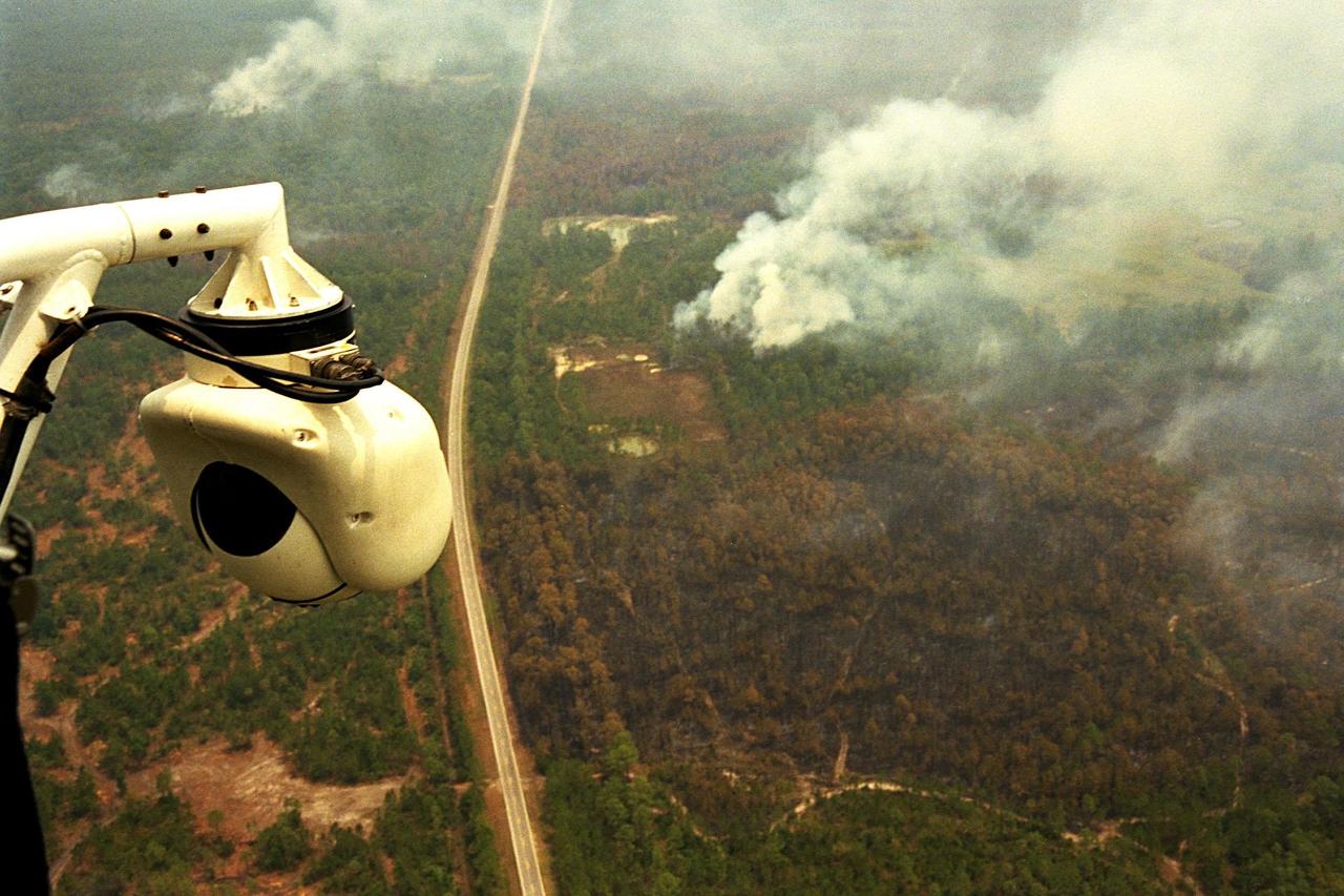
KENNEDY SPACE CENTER, FLA. -- A beach ball-sized infrared camera, part of the Forward Looking Infrared Radar (FLIR), has been mounted on the right siderail of NASA's Huey UH-1 helicopter and is being used to search for fires in Volusia County, Florida. The helicopter has also been outfitted with a portable global positioning satellite (GPS) system to support Florida's Division of Forestry as they fight the brush fires which have been plaguing the state as a result of extremely dry conditions and lightning storms. The FLIR also includes a real-time television monitor and recorder installed inside the helicopter. While the FLIR collects temperature data and images, the GPS system provides the exact coordinates of the fires being observed and transmits the data to the firefighters on the ground. The Kennedy Space Center (KSC) security team routinely uses the FLIR equipment prior to Shuttle launch and landing activities to ensure that the area surrounding the launch pad and runway are clear of unauthorized personnel. KSC's Base Operations Contractor, EG&G Florida, operates the NASA-owned helicopter
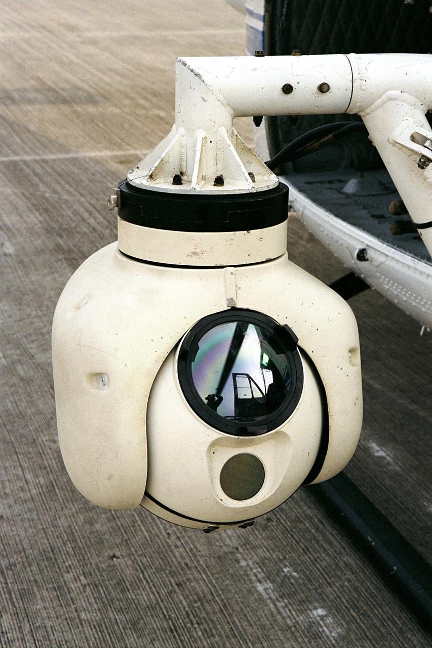
KENNEDY SPACE CENTER, FLA. -- A beach ball-sized infrared camera, part of the Forward Looking Infrared Radar (FLIR), has been mounted on the right siderail of NASA's Huey UH-1 helicopter. The helicopter has also been outfitted with a portable global positioning satellite (GPS) system to support Florida's Division of Forestry as they fight the brush fires which have been plaguing the state as a result of extremely dry conditions and lightning storms. The FLIR also includes a real-time television monitor and recorder installed inside the helicopter. While the FLIR collects temperature data and images, the GPS system provides the exact coordinates of the fires being observed and transmits the data to the firefighters on the ground. The Kennedy Space Center (KSC) security team routinely uses the FLIR equipment prior to Shuttle launch and landing activities to ensure that the area surrounding the launch pad and runway are clear of unauthorized personnel. KSC's Base Operations Contractor, EG&G Florida, operates the NASA-owned helicopter