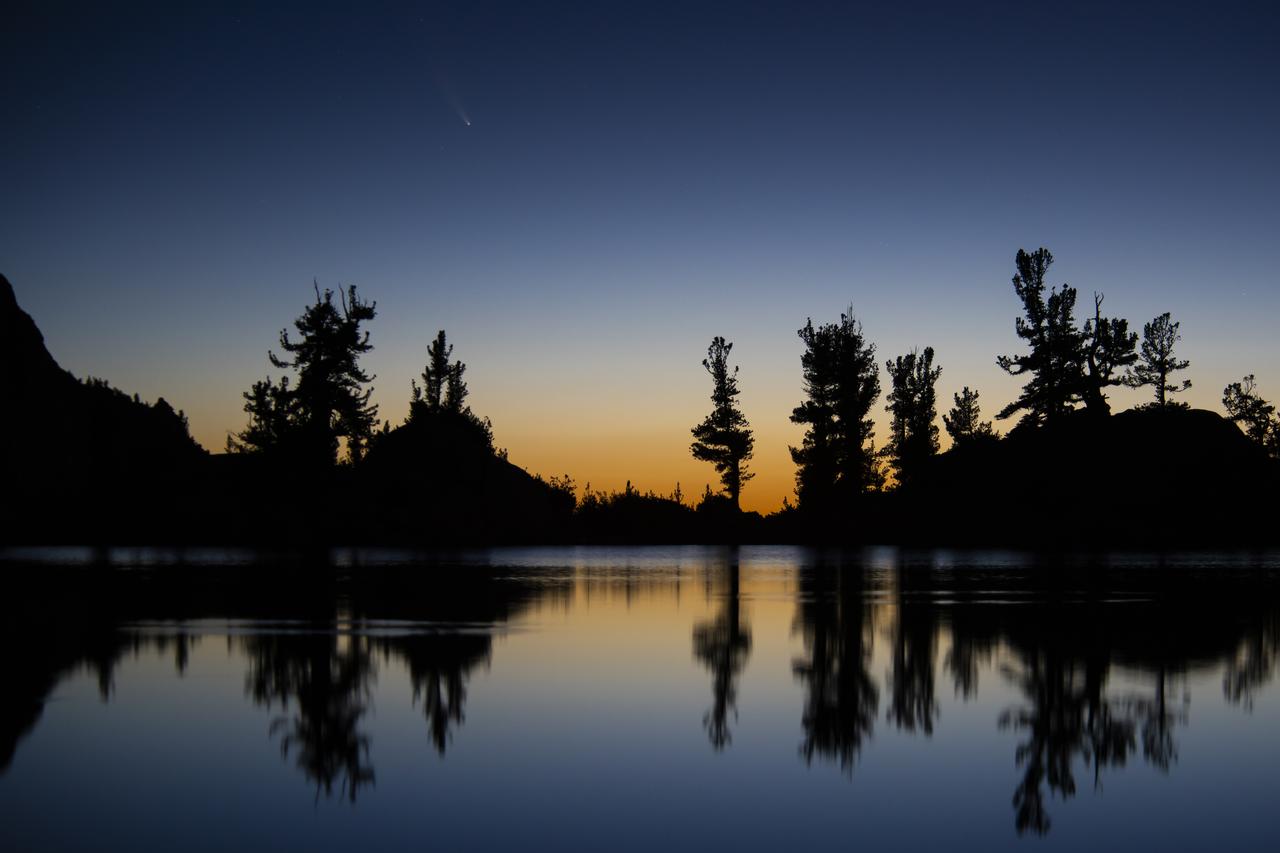
An image of the Comet C/2020 F3 NEOWISE (Comet NEOWISE) captured above the tree line of Lone Pine Lake, located on the Mount Whitney Trail in the Eastern Sierra Nevada Mountains in California. The photo was taken at 4:59 am on July 14, 2020. Visiting from the distant parts of the solar system, it’s characterized by a glowing tail and is visible during the month of July. The comet returns in 6,800 years.

ISS011-E-13889 (30 September 2005) --- Wasatch Range, Utah is featured in this image photographed by an Expedition 11 crewmember on the international space station. The Wasatch Range forms an impressive backdrop to the Salt Lake City metropolitan area, and is a frequent destination for hikers, backpackers, and skiers. The range is considered to be the westernmost part of the Rocky Mountains, and rises to elevations of approximately 3600 meters (12,000 feet) above sea level. This photograph, taken at the end of September, captures red- (maple trees) and gold-mantled (aspen trees) hill slopes along the western mountain front to the south of Salt Lake City. Other common tree species at these elevations include pine, fir, spruce, willow, birch, and oak. A portion of Draper City is visible in the left half of the image. The elevation of Lone Peak, visible at upper right, is approximately 3410 meters (11,253 feet).
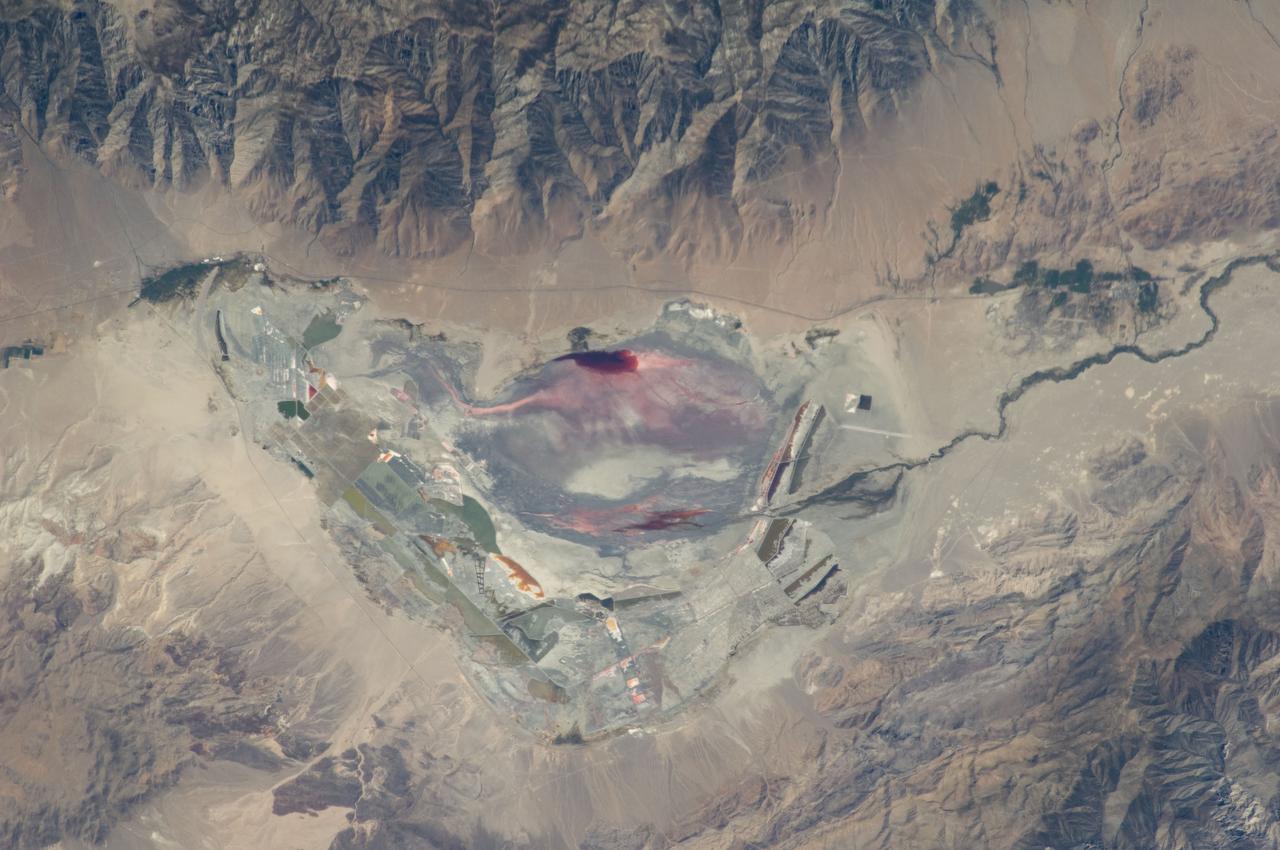
ISS028-E-035137 (30 Aug. 2011) --- Owens Lake in California is featured in this image photographed by an Expedition 28 crew member on the International Space Station. This photograph highlights the mostly dry bed of Owens Lake, located in the Owens River Valley between the Inyo Mountains and the Sierra Nevada. Shallow groundwater, springs, and seeps support minor wetlands and a central brine pool. Two bright red areas along the margins of the brine pool indicate the presence of halophilic, or salt-loving organisms known as Achaeans. Grey and white materials within the lake bed are exposed lakebed sediments and salt crusts. The towns of Olancha and Lone Pine are delineated by the presence of green vegetation indicating a more constant availability of water. According to scientists, the present-day Owens Lake was part of a much larger lake and river system that existed during the Pleistocene Epoch (approximately 3 million to approximately 12,000 years ago) along the current northeastern border of California with Nevada. Meltwater from alpine glaciers in the Sierra Nevada filled the regional valleys of the Basin and Range to form several glacial lakes that were ancestral to the now-dry lakebeds (or playas) of Owens, Searles Lake, and China Lake. While Searles and China Lakes dried out due to regional changes to a hotter and drier climate over thousands of years, Owens Lake became desiccated largely due to the diversion of Owens River water in the early 20th century to serve the needs of the City of Los Angeles, CA located 266 kilometers to the south. Following complete desiccation of the lakebed in 1926, significant amounts of windblown dust were produced ? indeed, the term ?Keeler fog? was coined by residents of the now largely abandoned town on the eastern side of Owens Lake due to the dust. In addition to adverse health effects on local residents, dust from Owens Lake has been linked to visibility reduction in nearby national parks, forests, and wilderness areas. Recently, efforts to control dust evolution from the lakebed have been undertaken by the City of Los Angeles.