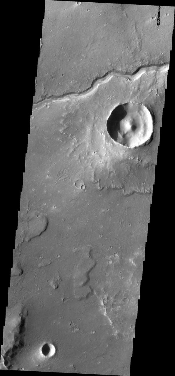
Lunae Planum
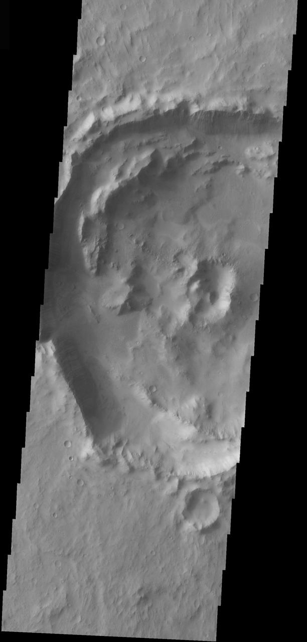
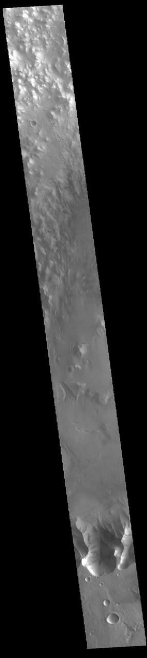
Central Peak Crater in Lunae Planum
This image by NASA Mars Odyssey spacecraft is within a region called Lunae Planum, west of NASA Viking 1 landing site, that marks the transition between the Tharsis rise, a giant volcanic complex, and the northern lowland plains.
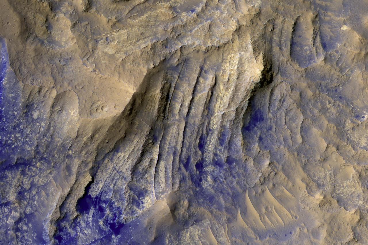
The layered bedrock in this image was brought from several kilometers of depth during the formation of this 44 kilometer wide crater in the volcanic plains of Lunae Planum. As these layers were exhumed and brought to nearly vertical orientations, faulting and fracturing occurred and breccia dikes formed. Breccias are rocks consisting of angular and sharp fragments, and a dike is a fracture that has been widened by forces pulling apart the rock while simultaneously filling it with rocky materials. Breccia dikes are a common feature in terrestrial craters and can now be recognized in brilliant preservation on Mars. http://photojournal.jpl.nasa.gov/catalog/PIA12178
The THEMIS VIS camera contains 5 filters. The data from different filters can be combined in multiple ways to create a false color image. These false color images may reveal subtle variations of the surface not easily identified in a single band image. Today's false color image shows part of Lunae Planum. The THEMIS VIS camera is capable of capturing color images of the Martian surface using five different color filters. In this mode of operation, the spatial resolution and coverage of the image must be reduced to accommodate the additional data volume produced from using multiple filters. To make a color image, three of the five filter images (each in grayscale) are selected. Each is contrast enhanced and then converted to a red, green, or blue intensity image. These three images are then combined to produce a full color, single image. Because the THEMIS color filters don't span the full range of colors seen by the human eye, a color THEMIS image does not represent true color. Also, because each single-filter image is contrast enhanced before inclusion in the three-color image, the apparent color variation of the scene is exaggerated. Nevertheless, the color variation that does appear is representative of some change in color, however subtle, in the actual scene. Note that the long edges of THEMIS color images typically contain color artifacts that do not represent surface variation. Orbit Number: 95001 Latitude: 18.596 Longitude: 295.651 Instrument: VIS Captured: 2023-05-15 16:32 https://photojournal.jpl.nasa.gov/catalog/PIA26137
Echus Chaos is a region of low hills located between Lunae Planum (to the right of this image) and Echus Palus (to the left of this image). This chaos terrain may have formed as the rocks that make up Lunae Planum slowly slid downhill into Echus Palus. As these rocks slid downhill, they broke up into large pieces that formed the hills that we see today. What caused this landslide is not well known, but it could have been due to large floods of water moving through Echus Palus, causing the edge of Lunae Planum to become soaked and fall apart. Ground shaking from movement along nearby faults or meteorite impacts may have also helped to make the edge of Lunae Planum unstable and collapse. https://photojournal.jpl.nasa.gov/catalog/PIA25556
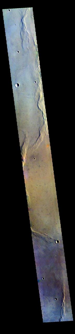
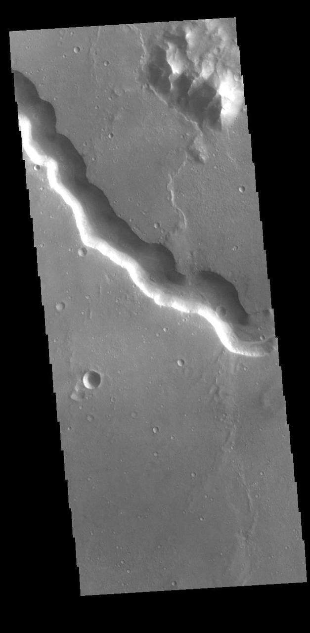
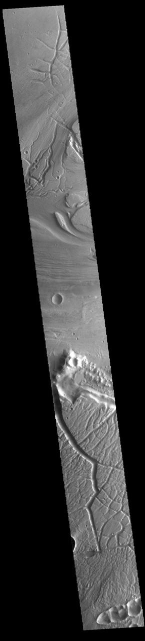
Today's VIS image shows a section of Bahram Vallis. This channel is located in northern Lunae Planum, south of Kasei Valles. Bharam Vallis drains from the higher elevations of Lunae Planum towards the Chryse Planitia basin. This channel is over 300km long (186miles). Orbit Number: 94826 Latitude: 21.4639 Longitude: 303.82 Instrument: VIS Captured: 2023-05-01 06:44 https://photojournal.jpl.nasa.gov/catalog/PIA26179
Today's VIS image shows a section of Bahram Vallis. This channel is located in northern Lunae Planum, south of Kasei Valles. Bharam Vallis drains from the higher elevations of Lunae Planum towards the Chryse Planitia basin. This channel is over 300km long (186miles). Orbit Number: 93965 Latitude: 20.1543 Longitude: 302.9 Instrument: VIS Captured: 2023-02-19 09:18 https://photojournal.jpl.nasa.gov/catalog/PIA25936
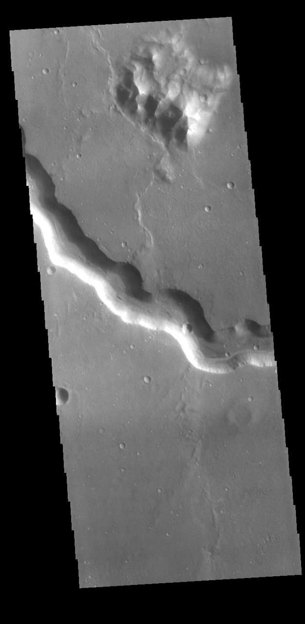
Today's VIS image shows a section of Bahram Vallis. This channel is located in northern Lunae Planum, south of Kasei Valles. Bharam Vallis drains from the higher elevations of Lunae Planum towards the Chryse Planitia basin. This channel is over 300km long (186miles). Orbit Number: 88175 Latitude: 20.6178 Longitude: 302.162 Instrument: VIS Captured: 2021-10-30 15:19 https://photojournal.jpl.nasa.gov/catalog/PIA25156
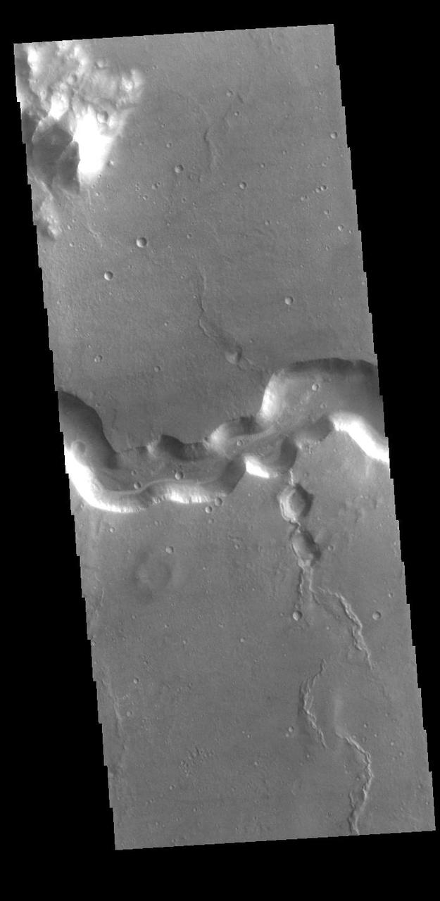
Today's VIS image shows a section of Bahram Vallis. This channel is located in northern Lunae Planum, south of Kasei Valles. Bharam Vallis drains from the higher elevations of Lunae Planum towards the Chryse Planitia basin. This channel is over 300km (186 miles) long. Orbit Number: 94564 Latitude: 20.5977 Longitude: 302.359 Instrument: VIS Captured: 2023-04-09 17:00 https://photojournal.jpl.nasa.gov/catalog/PIA26036
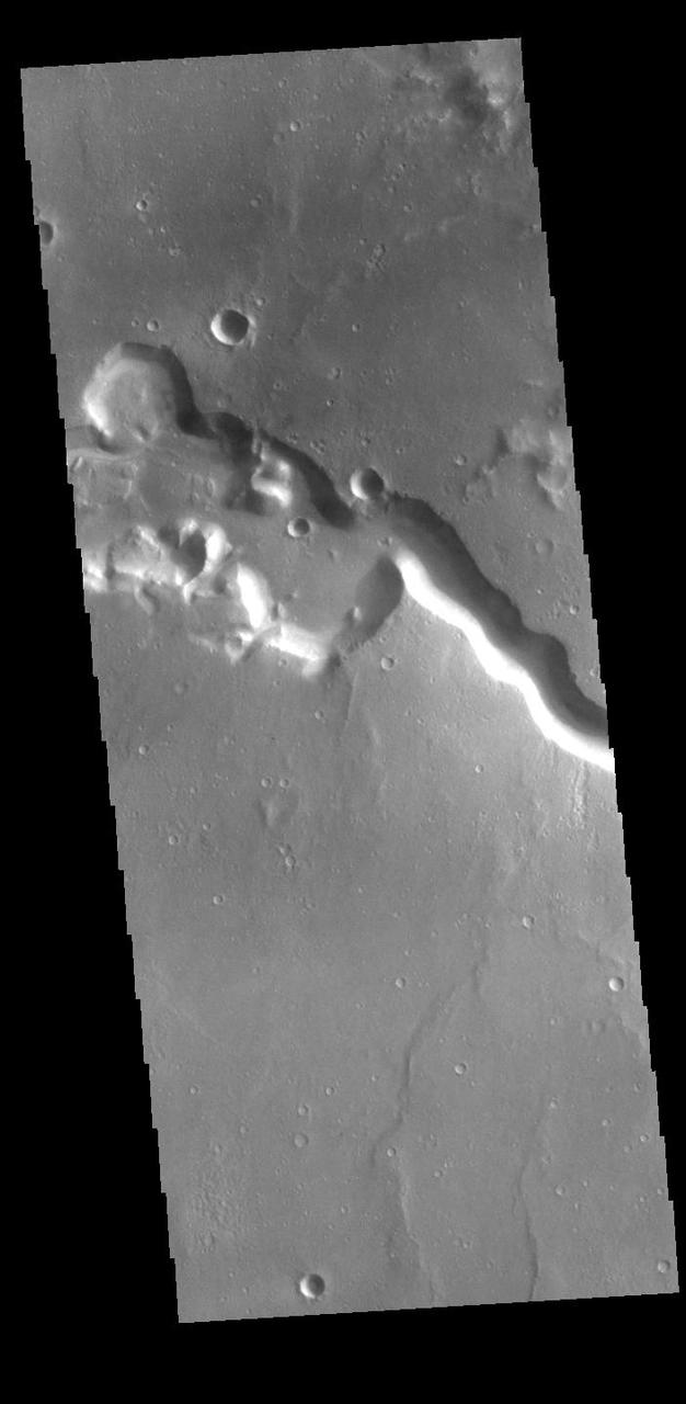
Today's VIS image shows a section of Bahram Vallis. This channel is located in northern Lunae Planum, south of Kasei Valles. Bharam Vallis drains from the higher elevations of Lunae Planum towards the Chryse Planitia basin. This channel is over 300km long (186miles). Orbit Number: 94876 Latitude: 21.1353 Longitude: 301.426 Instrument: VIS Captured: 2023-05-05 09:33 https://photojournal.jpl.nasa.gov/catalog/PIA26211
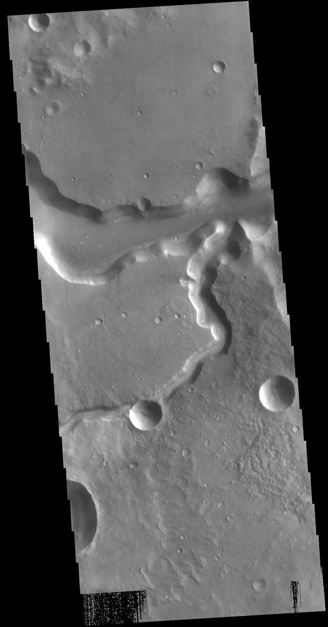
Today's VIS image shows a section of Bahram Vallis. This channel is located in northern Lunae Planum, south of Kasei Valles. Bharam Vallis drains from the higher elevations of Lunae Planum towards the Chryse Planitia basin. This channel is over 300km long (186miles). Orbit Number: 87576 Latitude: 20.3115 Longitude: 302.882 Instrument: VIS Captured: 2021-09-11 07:37 https://photojournal.jpl.nasa.gov/catalog/PIA25224
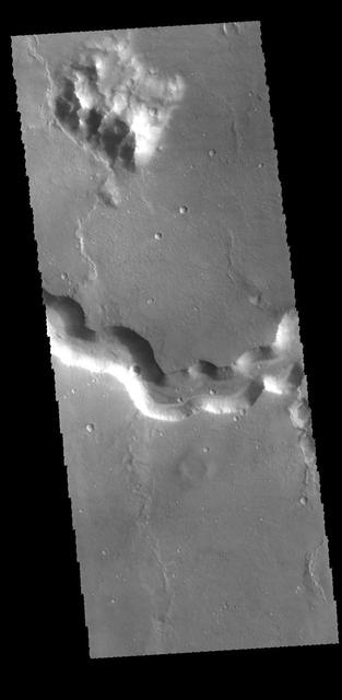
Today's VIS image shows a section of Bahram Vallis. This channel is located in northern Lunae Planum, south of Kasei Valles. Bharam Vallis drains from the higher elevations of Lunae Planum towards the Chryse Planitia basin. This channel is over 300km long (186miles). In this image Bahram Vallis enters Waspam Crater (right side of image) and then exits the crater (top right corner). Orbit Number: 81374 Latitude: 20.3853 Longitude: 303.032 Instrument: VIS Captured: 2020-04-18 15:46 https://photojournal.jpl.nasa.gov/catalog/PIA23956
Echus Chasma separates the Tharsis region from Lunae Planum. This image from NASA 2001 Mars Odyssey shows volcanic flow materials from Tharsis within the chasma.

Echus Chasma forms the boundary between the Tharsis volcanoes to the west and Lunae Planum to the east. This region is both tectonically fractured rocks top and volcanic flows middle and bottom. This image is from NASA 2001 Mars Odyssey spacecraft.
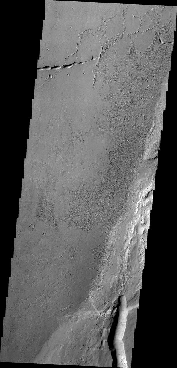
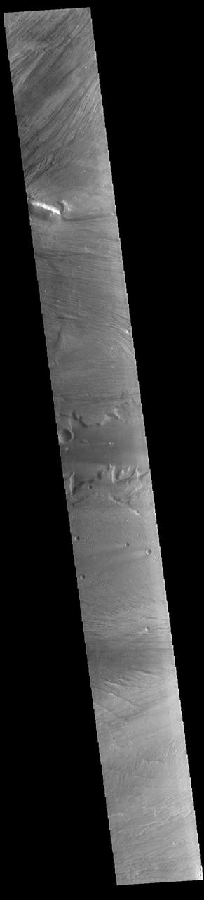
This NASA Mars Odyssey image is of the ridged plains of Lunae Planum in the northern hemisphere of Mars. Wrinkle ridges, a very common landform on Mars, Mercury, Venus, and the Moon, are found mostly along the eastern side of the image.
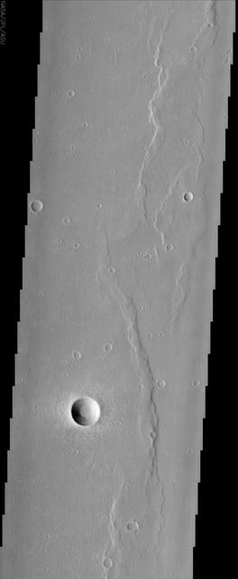
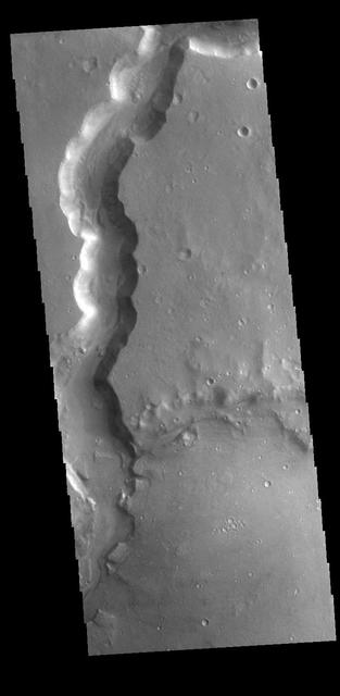
This VIS image shows a section of Bahram Vallis. Bahram Vallis is located on the northeastern margin of Lunae Planum. Orbit Number: 70146 Latitude: 20.6144 Longitude: 302.265 Instrument: VIS Captured: 2017-10-06 22:04 https://photojournal.jpl.nasa.gov/catalog/PIA22363
Today's VIS image shows a section of Bahram Vallis. This channel is located in northern Lunae Planum, south of Kasei Valles. Orbit Number: 71256 Latitude: 21.0762 Longitude: 301.486 Instrument: VIS Captured: 2018-01-06 08:51 https://photojournal.jpl.nasa.gov/catalog/PIA22379
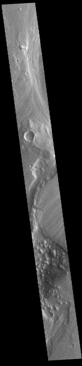
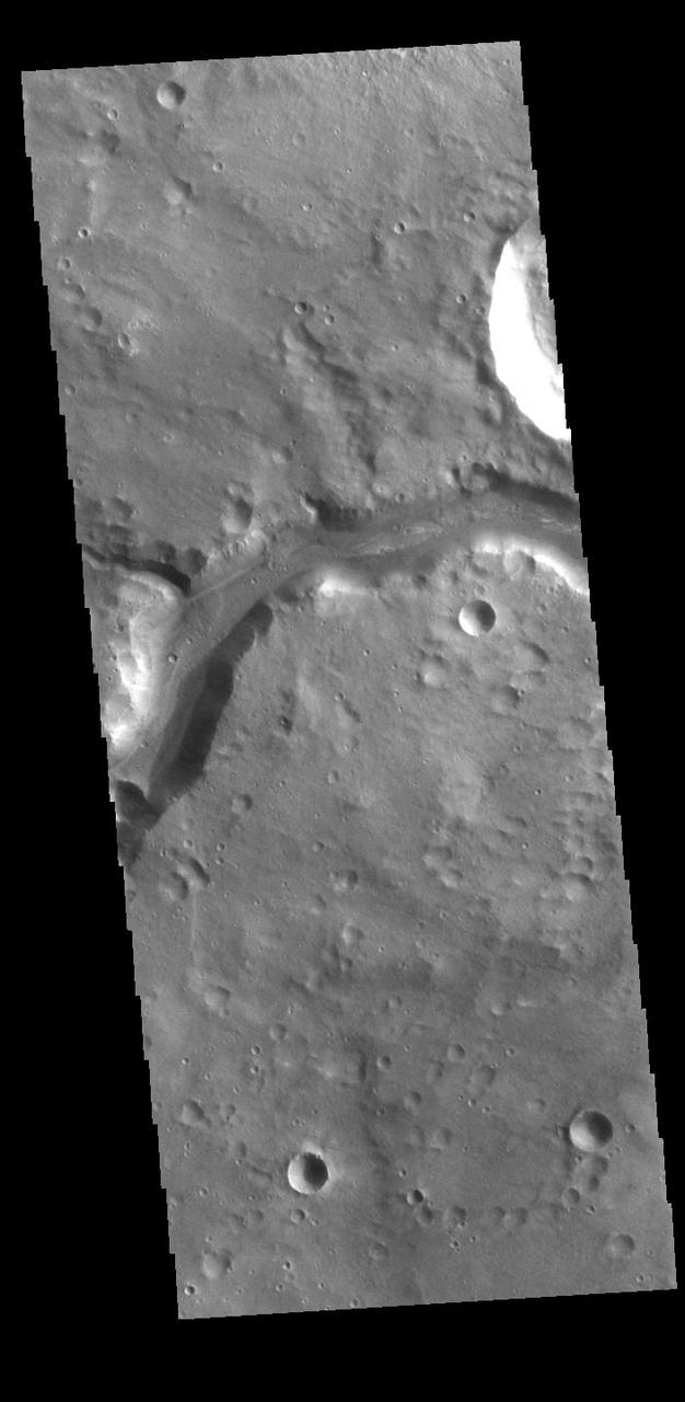
Today's VIS image shows part of Maja Valles, a large channel system in Lunae Planum. Maja Valles in 1600 km (1000 miles) long. Like most outflow channels in the region, Maja Valles arises from the Valles Marineris region and drains into Chryse Planitia. Maja Valles starts in Juventae Chasma. Orbit Number: 85617 Latitude: 4.08955 Longitude: 299.934 Instrument: VIS Captured: 2021-04-03 00:18 https://photojournal.jpl.nasa.gov/catalog/PIA24857
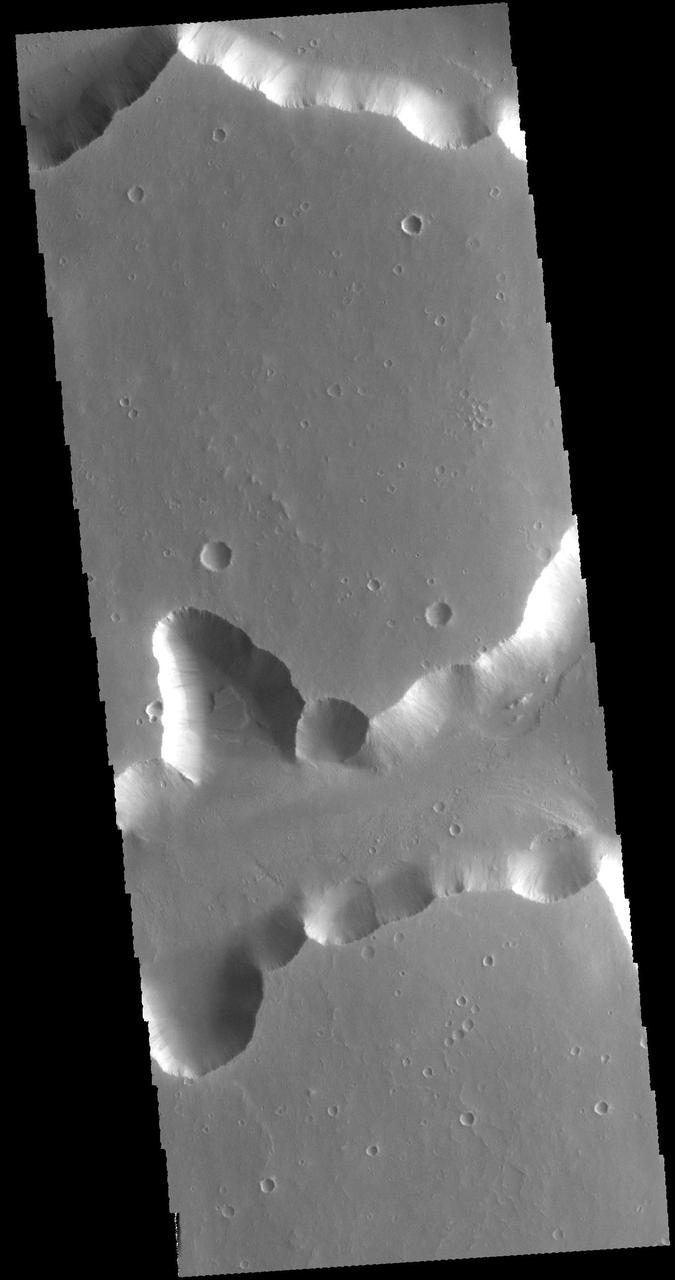
Today's VIS image shows part of the complex region of channels and craters between Lunae Planum and Xanthe Terra. This image is located just east of Maja Valles, the major outflow channel in this region. The large crater at the top of the image, with channels entering and exiting, is named Chia Crater. Orbit Number: 94377 Latitude: 0.364977 Longitude: 299.866 Instrument: VIS Captured: 2023-03-25 07:20 https://photojournal.jpl.nasa.gov/catalog/PIA26022
Today's VIS image shows a section of Bahram Vallis. This channel is located in northern Lunae Planum, south of Kasei Valles. Bharam Vallis drains from the higher elevations of Lunae Planum towards the Chryse Planitia basin. This channel is over 300km long (186miles). Orbit Number: 95138 Latitude: 20.0779 Longitude: 303.077 Instrument: VIS Captured: 2023-05-26 23:17 https://photojournal.jpl.nasa.gov/catalog/PIA26260
Between the Tharsis region and Lunae Planum lies Echus Chasma and the source of Kasei Vallis. Flows from the Tharsis volcanoes are buckled by tectonic forces forming mounds and fractures in the Chasma as seen in this image from NASA 2001 Mars Odyssey.
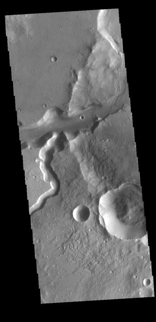
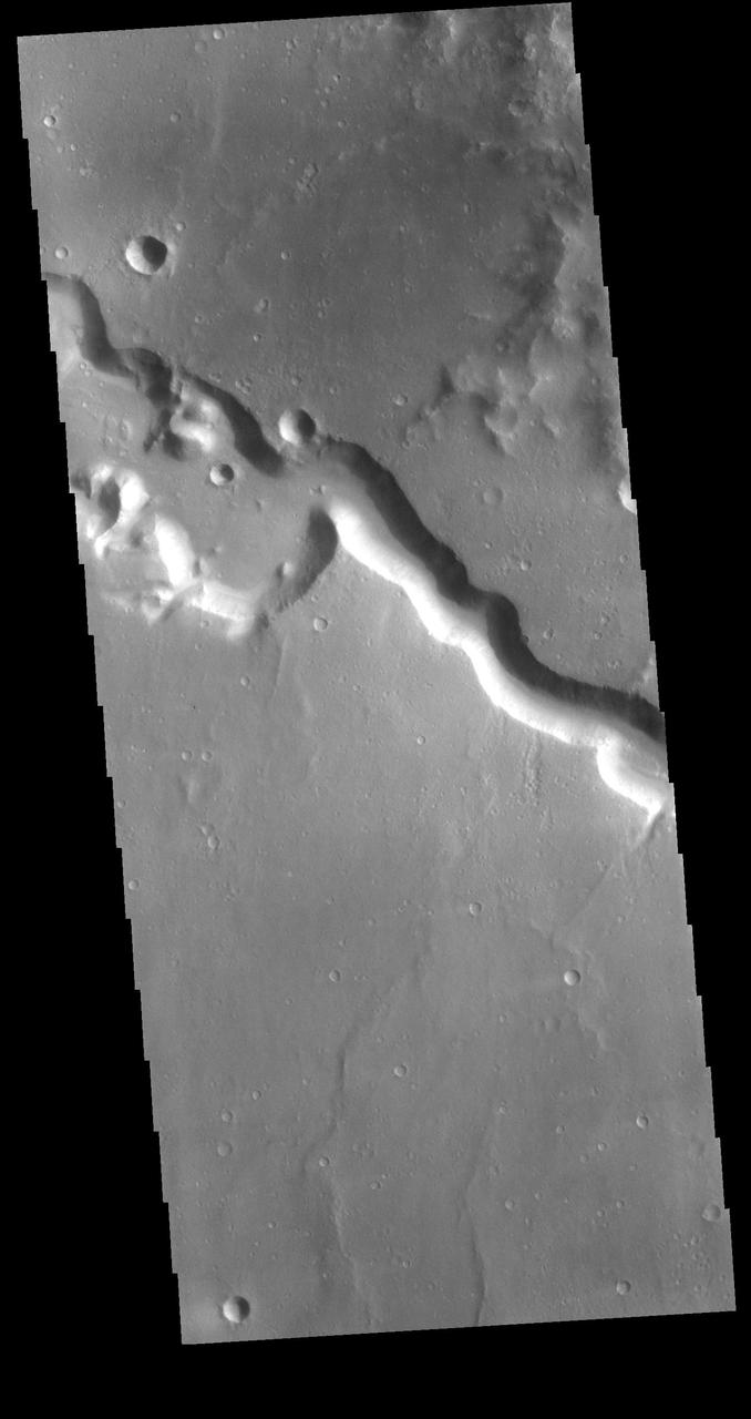
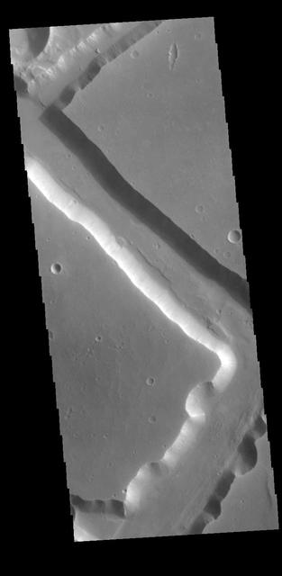
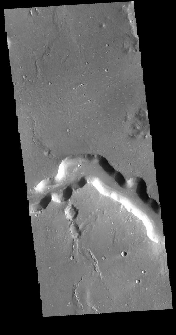
Bahram Vallis crosses this VIS image. Bharam Vallis drains from the the higher elevations of Lunae Planum into the Chryse Planitia basin. At the base of several of the scalloped channel wall sections deposits of material can be seen. Orbit Number: 77643 Latitude: 20.8706 Longitude: 303.262 Instrument: VIS Captured: 2019-06-16 10:30 https://photojournal.jpl.nasa.gov/catalog/PIA23363
Bahram Vallis crosses this VIS image. Bharam Vallis drains from the higher elevations of Lunae Planum into the Chryse Planitia basin. Bahram Vallis is 270km (167 miles) long, with an almost uniform width along most of the channel. Orbit Number: 86116 Latitude: 20.5906 Longitude: 302.116 Instrument: VIS Captured: 2021-05-14 02:29 https://photojournal.jpl.nasa.gov/catalog/PIA24222
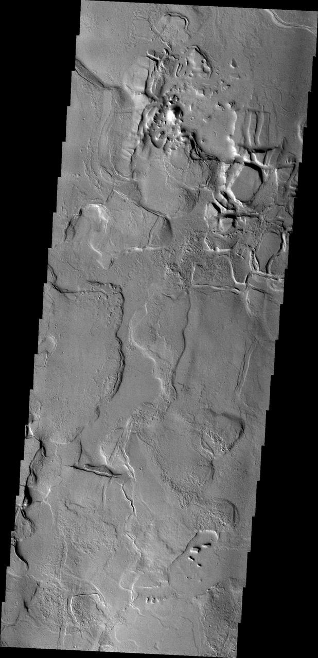
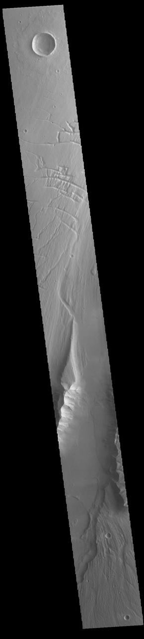
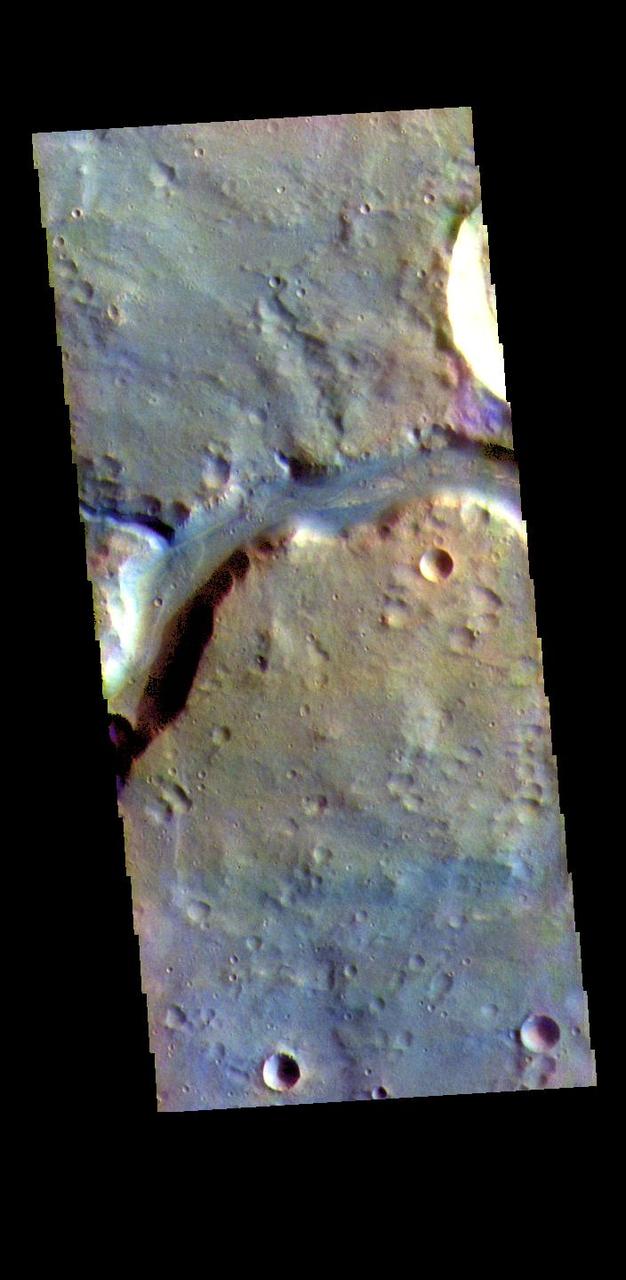
Located on the western margin of Lunae Planum, Sacra Fossae is a group of linear depressions. The right angle turns and uniform width seen in this VIS image indicate that these channels were formed by faulting rather than liquid flow. Two bounding faults with a down-dropped interior are called graben. Orbit Number: 71244 Latitude: 17.7623 Longitude: 288.309 Instrument: VIS Captured: 2018-01-05 09:06 https://photojournal.jpl.nasa.gov/catalog/PIA22373
The right angle intersections in this VIS image are some of the graben that form Sacra Fossae. The fossae are located on the margin of Lunae Planum near the beginning of Kasei Valles. Graben are depressions caused by parallel faults where a block of material drops down along the fault face. Orbit Number: 72616 Latitude: 18.1066 Longitude: 287.915 Instrument: VIS Captured: 2018-04-28 09:42 https://photojournal.jpl.nasa.gov/catalog/PIA22617
Today's VIS image shows a portion of Bahram Vallis. Bahram Vallis is located at the north eastern margin of Lunae Planum. Orbit Number: 64222 Latitude: 20.6103 Longitude: 302.477 Instrument: VIS Captured: 2016-06-05 20:40 http://photojournal.jpl.nasa.gov/catalog/PIA20803
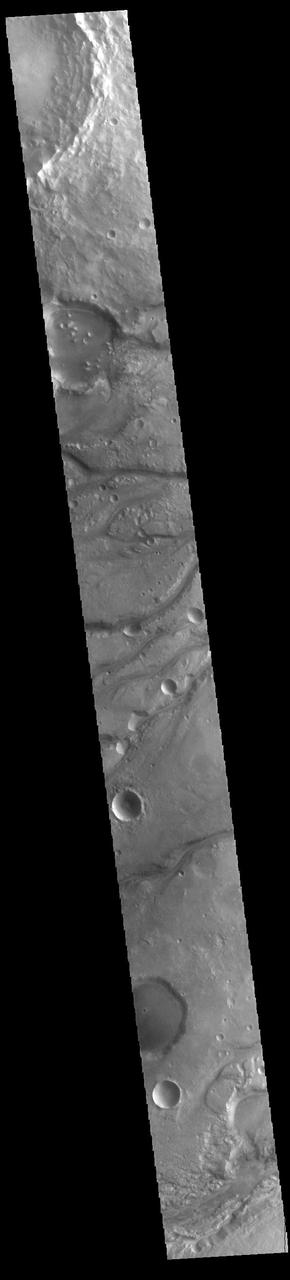
Today's VIS image shows part of Maja Valles, a large channel system in Lunae Planum. The main part of the channel is visible at the upper left in this image. The lower part of the image is located within an old crater called Stege Crater. The channel in the central part of the image is flowing along the inner rim of the crater and into the main Maja Valles channel just off the image to the left. Maja Valles in 1600 km (1000 miles) long. Like most outflow channels in the region, Maja Valles arises from Valles Marineris and drains into Chryse Planitia. Maja Valles starts in Juventae Chasma. Orbit Number: 89111 Latitude: 4.27445 Longitude: 300.886 Instrument: VIS Captured: 2022-01-15 16:56 https://photojournal.jpl.nasa.gov/catalog/PIA25347
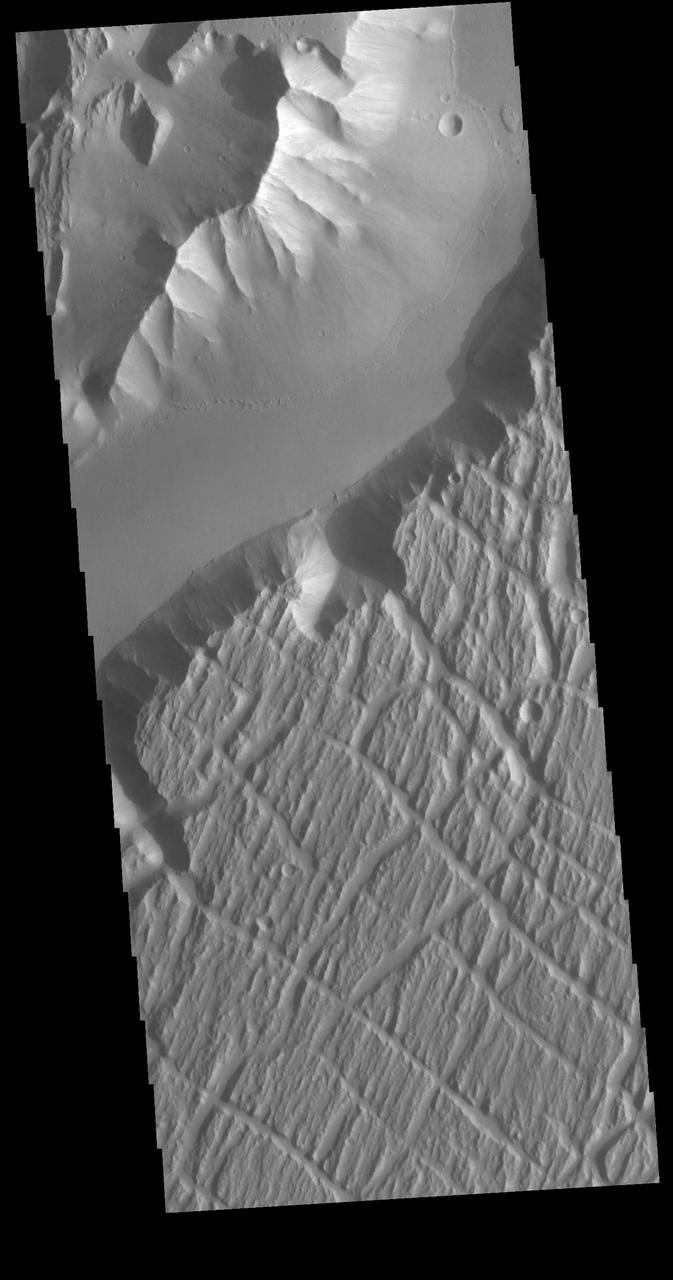
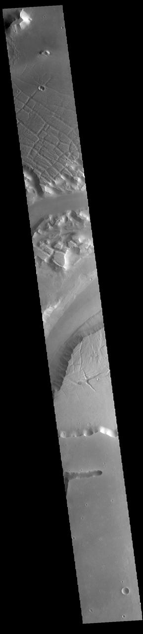
Today's VIS image is located near the beginning of Kasei Valles. At the top of the image is the relative high land of Lunae Planum. The Kasei Valles channel is just below. The bottom part of the image is an eroded surface that forms an island in the channel. The surface of the island has been modified by the flow of water. The linear features forming right angle intersections were caused by tectonic forces in the region. Orbit Number: 72404 Latitude: 18.9511 Longitude: 286.59 Instrument: VIS Captured: 2018-04-10 22:34 https://photojournal.jpl.nasa.gov/catalog/PIA22584
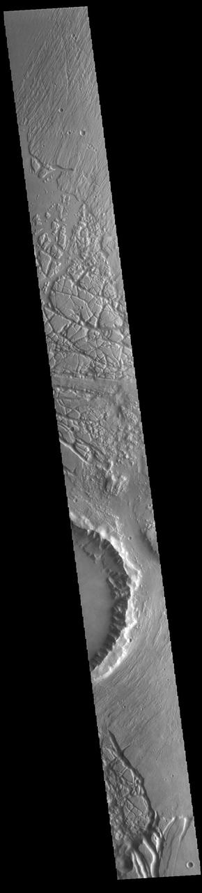
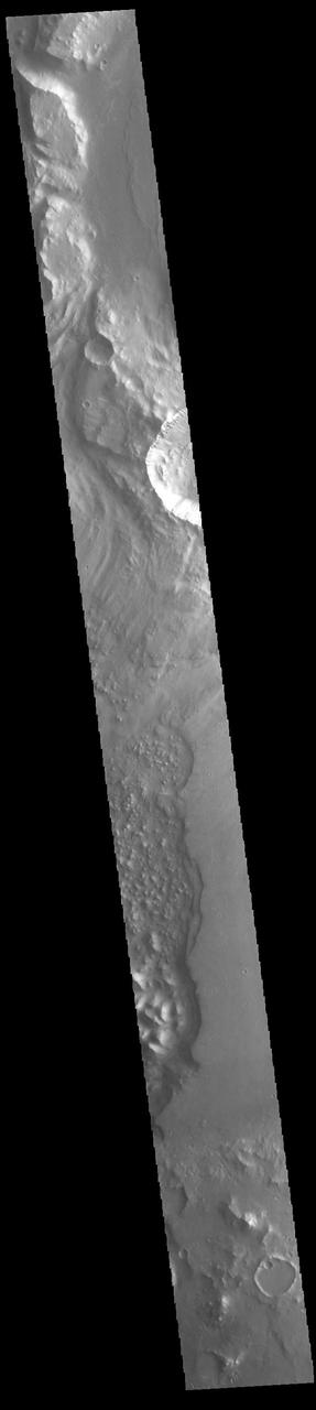
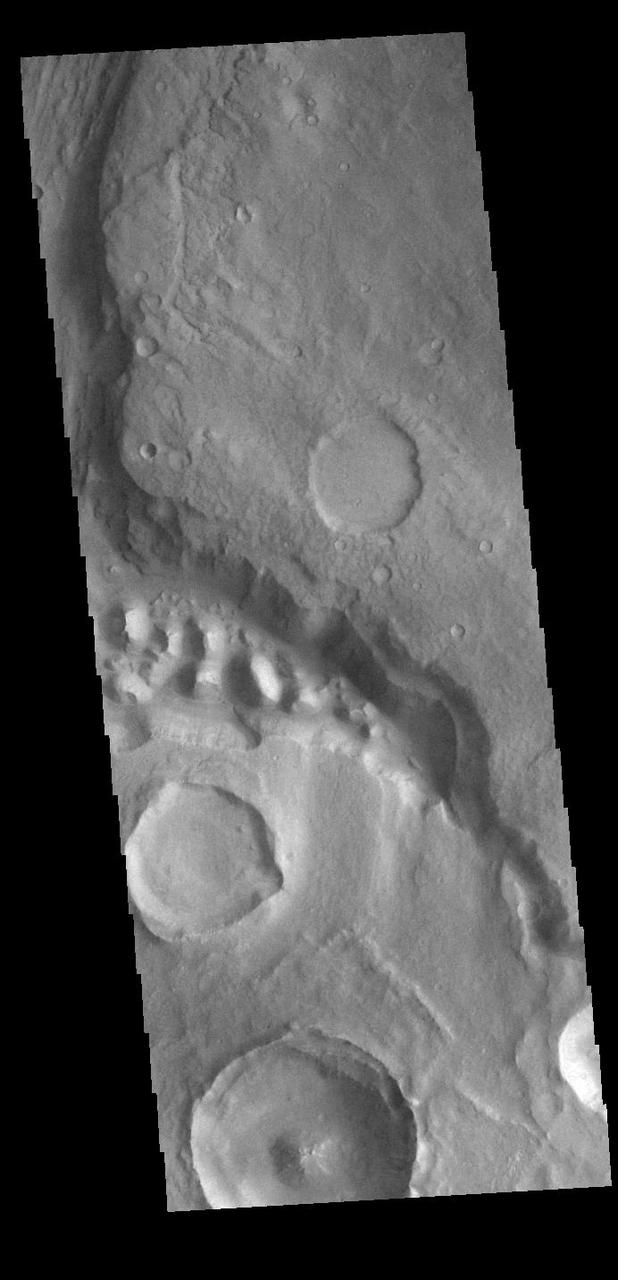
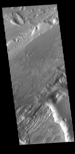
The mesas and valleys in the center of this VIS image are part of Echus Chaos. Located on the margin of Lunae Planum and south of Kasei Valles, Echus Chaos is 480 km (298 miles) long. Orbit Number: 85293 Latitude: 13.7712 Longitude: 285.65 Instrument: VIS Captured: 2021-03-07 08:06 https://photojournal.jpl.nasa.gov/catalog/PIA24825
The steep sided depressions in this image captured by NASA 2001 Mars Odyssey spacecraft are fault bounded tectonic features called graben. These depressions are part of a large region of graben called Sacra Fossae. Sacra Fossae is located on the western margin of Lunae Planum. Orbit Number: 60829 Latitude: 18.2961 Longitude: 287.711 Instrument: VIS Captured: 2015-08-31 10:01 http://photojournal.jpl.nasa.gov/catalog/PIA20094
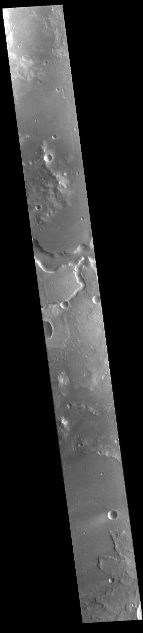
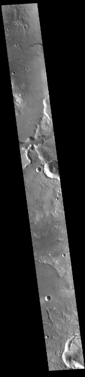
The channels that dissect the center of the VIS image are called Maumee Valles. The much larger Maja Valles is located at the very bottom of the image. The channels in this region are flowing from the highlands of Lunae Planum into the lowlands of Chryse Planitia. Maumee Valles is 390km (242 miles) long. Orbit Number: 94227 Latitude: 18.6849 Longitude: 304.703 Instrument: VIS Captured: 2023-03-12 23:02 https://photojournal.jpl.nasa.gov/catalog/PIA25995
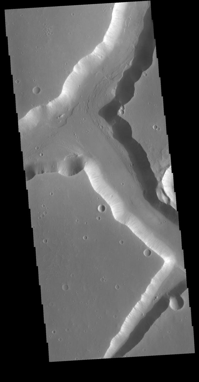
Today's VIS image shows a portion of Kasei Valles. Kasei Valles is one of the largest outflow channel systems on Mars, in places up to 482 km (300 miles) wide and 1580 km (982 miles) long. For comparison, the Grand Canyon in Arizona is is only 29 km (18 miles) at its widest and only 446 km (277 miles) long. Kasei Valles flows eastward through Lunae Planum and empties into Chryse Planitia. Orbit Number: 85280 Latitude: 25.2042 Longitude: 299.095 Instrument: VIS Captured: 2021-03-06 06:28 https://photojournal.jpl.nasa.gov/catalog/PIA24822
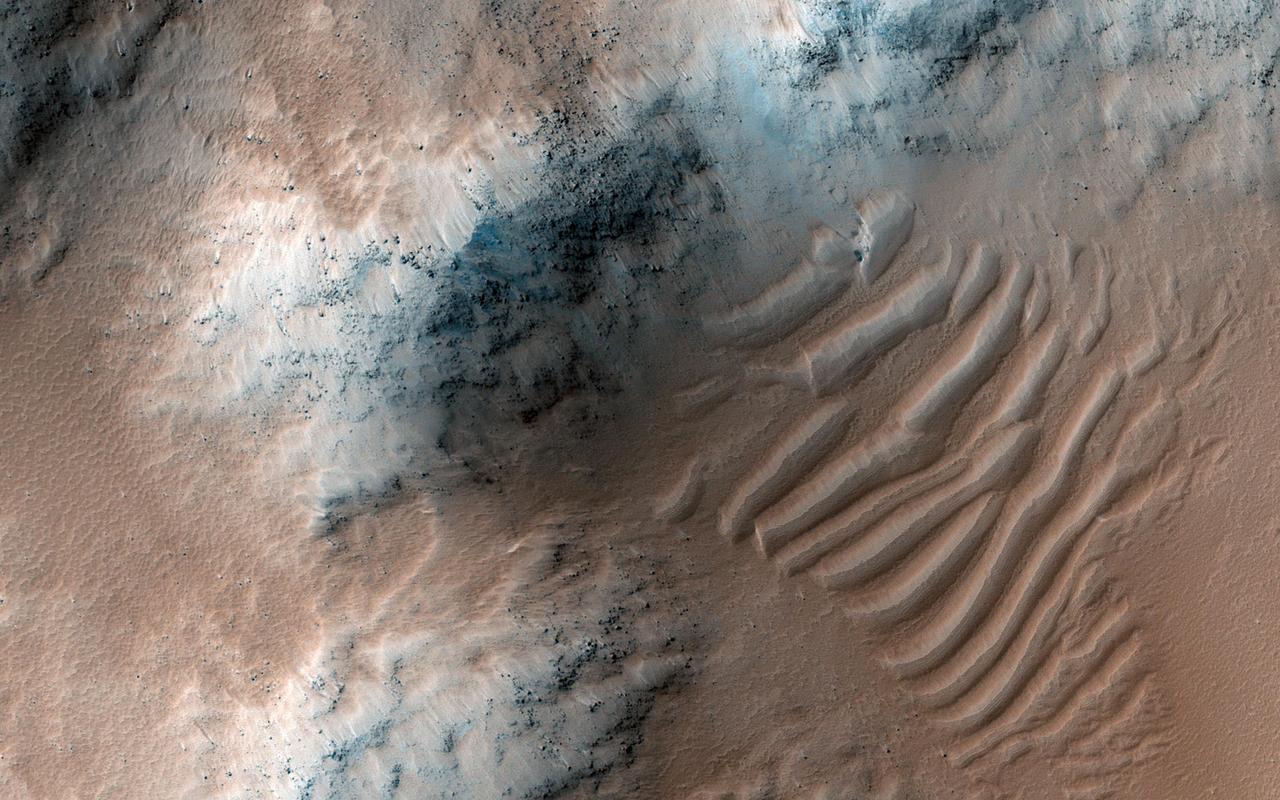
On the north side of Mars' great equatorial rift Valles Marineris lies a large depression called Juventae Chasma. The chasma stretches for 180 kilometers (110 miles) east-west and 250 km (155 miles) north-south. Most of its floor lies 5km (3 miles) or more below the surrounding surface of Lunae Planum. The large outflow channel Maja Valles originates at the northern end of Juventae Chasma. Sand dunes cover a large portion of the floor of Juventae Chasma, visible in the central part of this VIS image. Orbit Number: 85954 Latitude: -3.98251 Longitude: 298.967 Instrument: VIS Captured: 2021-04-30 18:13 https://photojournal.jpl.nasa.gov/catalog/PIA24889

Today's VIS image shows a portion of Kasei Valles. Kasei Valles is one of the largest outflow channel systems on Mars, in places up to 482 km (300 miles) wide and 1580 km (982 miles) long. For comparison, the Grand Canyon in Arizona is is only 29 km (18 miles) at its widest and only 446 km (277 miles) long. Kasei Valles flows eastward through Lunae Planum and empties into Chryse Planitia. Orbit Number: 88163 Latitude: 22.243 Longitude: 288.106 Instrument: VIS Captured: 2021-10-29 15:37 https://photojournal.jpl.nasa.gov/catalog/PIA25153
Today's VIS image shows a portion of Kasei Valles. Kasei Valles is one of the largest outflow channel systems on Mars, in places up to 482 km (300 miles) wide and 1580 km (982 miles) long. For comparison, the Grand Canyon in Arizona is is only 29 km (18 miles) at its widest and only 446 km (277 miles) long. Kasei Valles flows eastward through Lunae Planum and empties into Chryse Planitia. Orbit Number: 80538 Latitude: 24.6507 Longitude: 300.343 Instrument: VIS Captured: 2020-02-09 19:44 https://photojournal.jpl.nasa.gov/catalog/PIA23845
Today's VIS image shows a portion of Kasei Valles. Kasei Valles is one of the largest outflow channel systems on Mars, in places up to 482 km (300 miles) wide and 1580 km (982 miles) long. For comparison, the Grand Canyon in Arizona is is only 29 km (18 miles) at its widest and only 446 km (277 miles) long. Kasei Valles flows eastward through Lunae Planum and empties into Chryse Planitia. Orbit Number: 93978 Latitude: 24.9563 Longitude: 287.171 Instrument: VIS Captured: 2023-02-20 11:01 https://photojournal.jpl.nasa.gov/catalog/PIA25939
Today's VIS image shows a portion of Kasei Valles. Kasei Valles is one of the largest outflow channel systems on Mars, in places up to 482 km (300 miles) wide and 1580 km (982 miles) long. For comparison, the Grand Canyon in Arizona is is only 29 km (18 miles) at its widest and only 446 km (277 miles) long. Kasei Valles flows eastward through Lunae Planum and empties into Chryse Planitia. Orbit Number: 85218 Latitude: 21.7275 Longitude: 288.166 Instrument: VIS Captured: 2021-03-01 03:56 https://photojournal.jpl.nasa.gov/catalog/PIA24821
Today's VIS image shows a portion of Kasei Valles. Kasei Valles is one of the largest outflow channel systems on Mars, in places up to 482 km (300 miles) wide and 1580 km (982 miles) long. For comparison, the Grand Canyon in Arizona is is only 29 km (18 miles) at its widest and only 446 km (277 miles) long. Kasei Valles flows eastward through Lunae Planum and empties into Chryse Planitia. Orbit Number: 93928 Latitude: 25.9137 Longitude: 289.462 Instrument: VIS Captured: 2023-02-16 08:13 https://photojournal.jpl.nasa.gov/catalog/PIA25927
The THEMIS VIS camera contains 5 filters. The data from different filters can be combined in multiple ways to create a false color image. These false color images may reveal subtle variations of the surface not easily identified in a single band image. Today's false color image shows a section of Bahram Vallis. This channel is located in northern Lunae Planum, south of Kasei Valles. Bharam Vallis drains from the higher elevations of Lunae Planum towards the Chryse Planitia basin. This channel is over 300km long (186miles). The THEMIS VIS camera is capable of capturing color images of the Martian surface using five different color filters. In this mode of operation, the spatial resolution and coverage of the image must be reduced to accommodate the additional data volume produced from using multiple filters. To make a color image, three of the five filter images (each in grayscale) are selected. Each is contrast enhanced and then converted to a red, green, or blue intensity image. These three images are then combined to produce a full color, single image. Because the THEMIS color filters don't span the full range of colors seen by the human eye, a color THEMIS image does not represent true color. Also, because each single-filter image is contrast enhanced before inclusion in the three-color image, the apparent color variation of the scene is exaggerated. Nevertheless, the color variation that does appear is representative of some change in color, however subtle, in the actual scene. Note that the long edges of THEMIS color images typically contain color artifacts that do not represent surface variation. Orbit Number: 94826 Latitude: 21.4639 Longitude: 303.82 Instrument: VIS Captured: 2023-05-01 06:44 https://photojournal.jpl.nasa.gov/catalog/PIA26135