
art002e016186 (April 6, 2026) – CSA (Canadian Space Agency) astronaut and Artemis II Mission Specialist Jeremy Hansen is seen working on his personal computing device during the Artemis II lunar flyby. The application seen on the screen is the Lunar Targeting Plan that guides them in the execution of the lunar science observation plan. This custom software was built by the crew lunar observations team, a subset of the Artemis II lunar science team. Hansen and his fellow crewmates spent approximately seven hours taking turns at the Orion windows capturing science data to share with their team back on Earth. At closest approach, they came within 4,067 miles of the Moon’s surface.
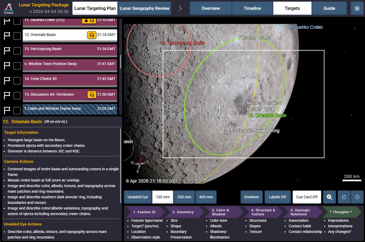
Caption: This is a screen shot of the application the crew sees on their personal computing devices that guides them in the execution of the lunar science observation plan. This custom software was built by the crew lunar observations team, a subset of the Artemis II lunar science team. In this screenshot you can see Orientale basin, target number 12 circled on the bottom right of the Moon, and to its left, target number 13, Hertzsprung basin.
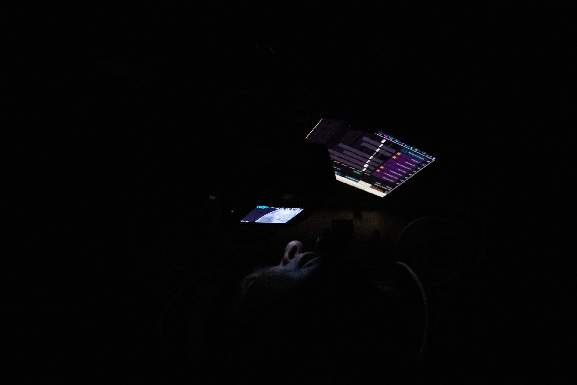
art002e014251 (April 6, 2026) – CSA (Canadian Space Agency) astronaut and Artemis II Mission Specialist Jeremy Hansen is seen taking images through the Orion spacecraft window during the Artemis II lunar flyby. Hansen and his fellow crewmates spent approximately seven hours taking turns at the Orion windows capturing science data to share with their team back on Earth. At closest approach, they came within 4,067 miles of the Moon’s surface. The application seen on the crew personal computing devices is the Lunar Targeting Plan that guides them in the execution of the lunar science observation plan. This custom software was built by the crew lunar observations team, a subset of the Artemis II lunar science team.
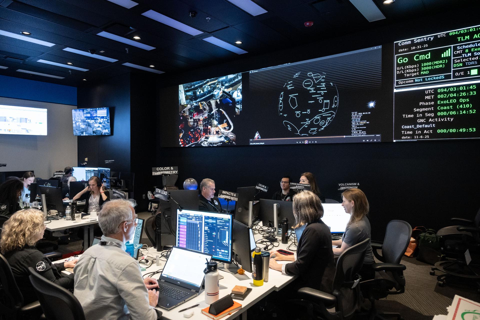
The Artemis II lunar science team works on the lunar targeting plan for the astronauts' several-hour flyby of the Moon, scheduled for April 6. As they pass the Moon, the crew will apply geology skills learned in the classroom and in Moon-like environments on Earth to photograph and describe features including impact craters, ancient lava flows, and surface cracks and ridges formed as the Moon slowly changed over time. They will note differences in color, brightness, and texture, which provide clues that help scientists understand what the surface is made of and how it formed. Credits: NASA/Bill Stafford
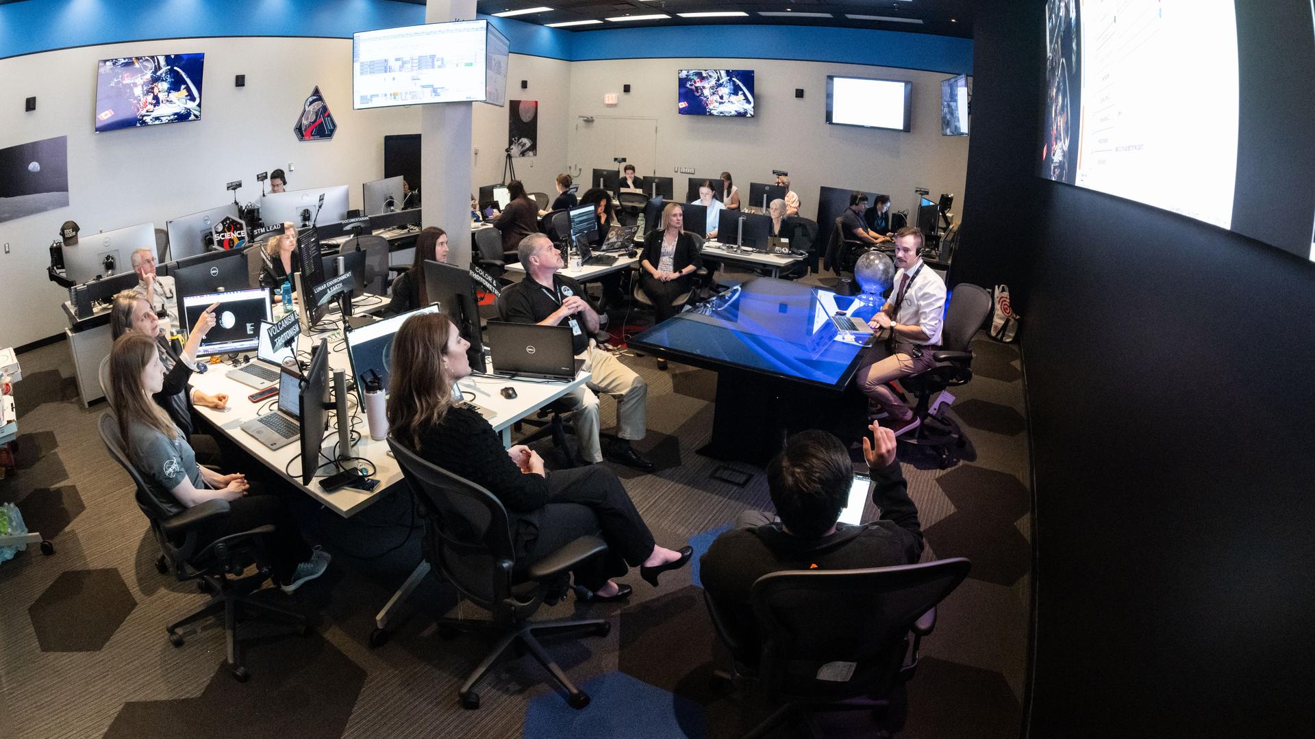
The Artemis II lunar science team works on the lunar targeting plan for the astronauts' several-hour flyby of the Moon, scheduled for April 6. As they pass the Moon, the crew will apply geology skills learned in the classroom and in Moon-like environments on Earth to photograph and describe features including impact craters, ancient lava flows, and surface cracks and ridges formed as the Moon slowly changed over time. They will note differences in color, brightness, and texture, which provide clues that help scientists understand what the surface is made of and how it formed. Credits: NASA/Bill Stafford
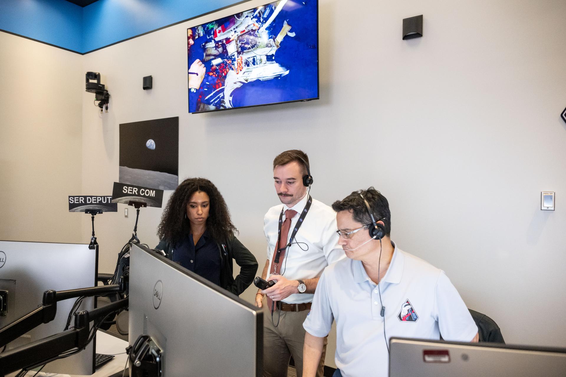
Artemis II lunar science team members, from left, Amber Turner, Jacob Richardson, Jose Hurtado, discuss the team's progress on the lunar targeting plan for the astronauts' six-hour flyby of the Moon, scheduled for April 6. As they pass the Moon, the crew will apply geology skills learned in the classroom and in Moon-like environments on Earth to photograph and describe features including impact craters, ancient lava flows, and surface cracks and ridges formed as the Moon slowly changed over time. They will note differences in color, brightness, and texture, which provide clues that help scientists understand what the surface is made of and how it formed. Credits: NASA/Bill Stafford
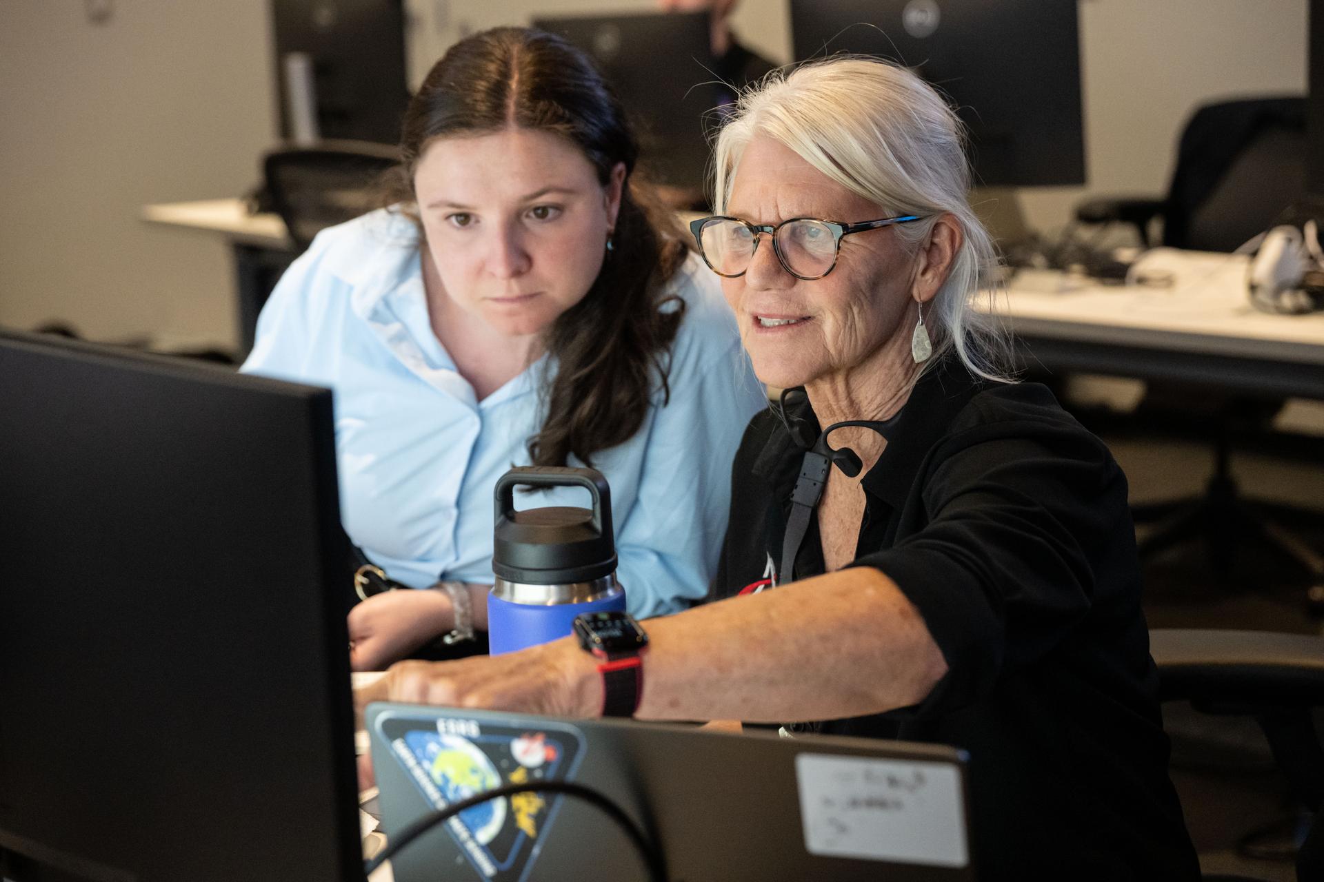
Artemis II lunar science team members, from left, Megan Borel, and Cindy Evans, discuss the lunar targeting plan for the astronauts' several-hour flyby of the Moon, scheduled for April 6. As they pass the Moon, the crew will apply geology skills learned in the classroom and in Moon-like environments on Earth to photograph and describe features including impact craters, ancient lava flows, and surface cracks and ridges formed as the Moon slowly changed over time. They will note differences in color, brightness, and texture, which provide clues that help scientists understand what the surface is made of and how it formed. Credits: NASA/Bill Stafford
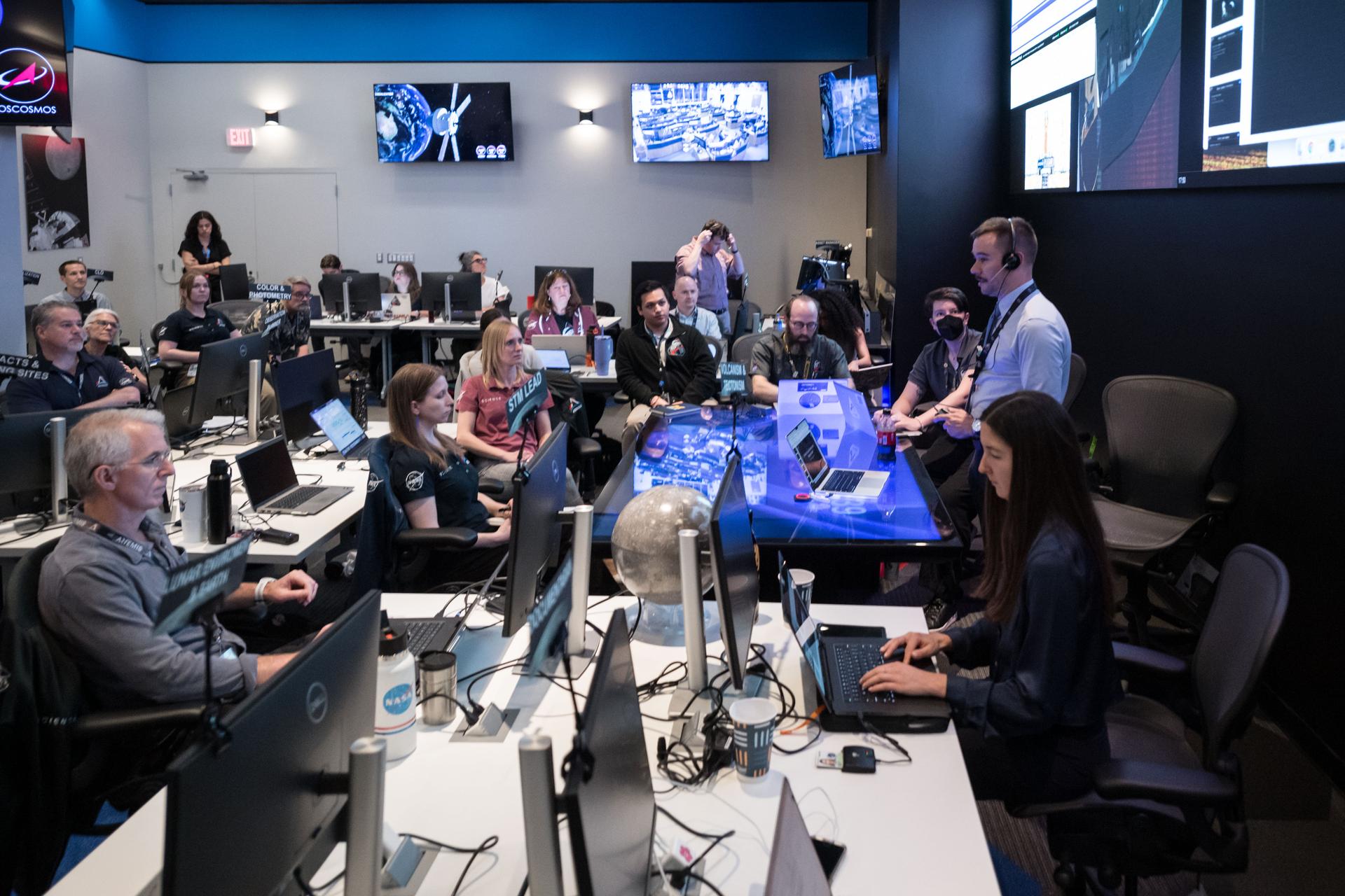
The Artemis II lunar science team gathers for a kickoff meeting before working on the lunar targeting plan for the crew's lunar flyby. The Lunar Targeting Plan is the Artemis II crew's Moon observing assignment, and is fine-tuned to the exact lighting conditions on the Moon’s surface when the Artemis II crew flies by. Like a spacewalk plan, it provides strong, detailed guidance, plus flexibility for the crew to make decisions based on what they’re seeing and experiencing in real time. Targets are prioritized based on both their science value and their visibility at the time of observation. Credits: NASA/Luna Posadas Nava

Artemis II deputy lunar science lead, Jacob Richardson, left, and Artemis II lunar science team members, Kiarre Dumes, react to the astronauts' verbal observations of the Moon during their flyby on April 6, 2026. Along with other lunar science team members, Richardson and Dumes helped train the crew in geology both in the classroom and in the field. The science team also built the lunar targeting plan that, like an International Space Station spacewalk plan, provides strong, detailed observation guidance, plus flexibility for the crew to make decisions based on what they’re seeing and experiencing in real time. The science team had many moments of celebration during the lunar flyby as the astronauts took images of the Moon and provided verbal descriptions of what they were seeing. This type of information reveals the geologic history of an area and will be critical to collect when future Artemis astronauts explore the Moon's surface. Credits: NASA/Luna Posadas Nava
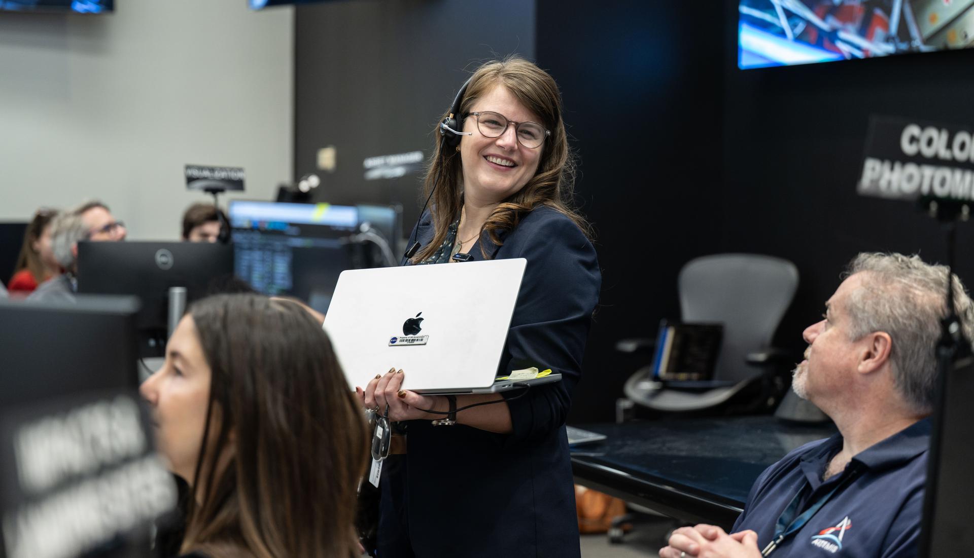
Artemis II deputy lunar science lead, Marie Henderson, reacts to the astronauts' verbal observations of the Moon during their flyby on April 6, 2026. Along with other lunar science team members, Henderson helped train the astronauts in geology both in the classroom and in the field. The team also built the lunar targeting plan that, like an International Space Station spacewalk plan, provides strong, detailed observation guidance, plus flexibility for the crew to make decisions based on what they’re seeing and experiencing in real time. The science team had many moments of celebration during the lunar flyby as the astronauts took images of the Moon and provided verbal descriptions of what they were seeing. This type of information reveals the geologic history of an area and will be critical to collect when future Artemis astronauts explore the Moon's surface. Credits: NASA/Luna Posadas Nava
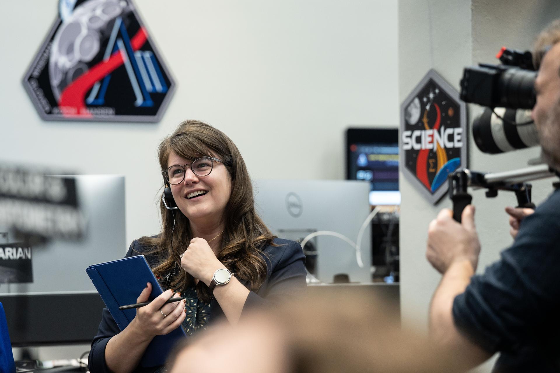
Artemis II deputy lunar science lead, Marie Henderson, reacts to the astronauts' verbal observations of the Moon during their flyby on April 6, 2026. Along with other lunar science team members, Ewing helped train the crew in geology both in the classroom and in the field. The science team also built the lunar targeting plan that, like an International Space Station spacewalk plan, provides strong, detailed observation guidance, plus flexibility for the crew to make decisions based on what they’re seeing and experiencing in real time. The science team had many moments of celebration during the lunar flyby as the astronauts took images of the Moon and provided verbal descriptions of what they were seeing. This type of information reveals the geologic history of an area and will be critical to collect when future Artemis astronauts explore the Moon's surface. Credits: NASA/Luna Posadas Nava

Artemis II lunar science team member, Ryan Ewing, reacts to the astronauts' verbal observations of the Moon during their flyby on April 6, 2026. Along with other lunar science team members, Ewing helped train the crew in geology both in the classroom and in the field. The science team also built the lunar targeting plan that, like an International Space Station spacewalk plan, provides strong, detailed observation guidance, plus flexibility for the crew to make decisions based on what they’re seeing and experiencing in real time. The science team had many moments of celebration during the lunar flyby as the astronauts took images of the Moon and provided verbal descriptions of what they were seeing. This type of information reveals the geologic history of an area and will be critical to collect when future Artemis astronauts explore the Moon's surface. Credits: NASA/Luna Posadas Nava
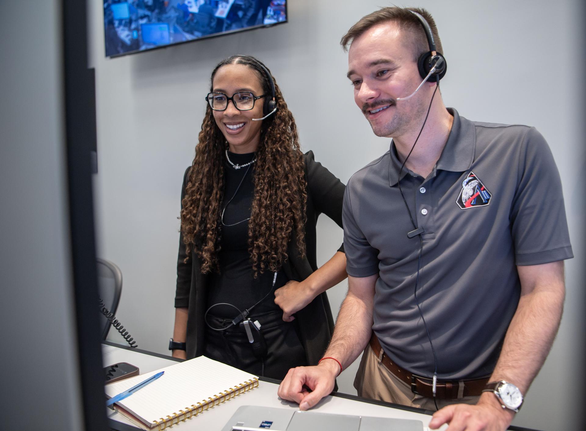
Artemis II Lunar Science Deputy Jacob Richardson and Artemis II Lunar Science Team Member Kiarre Dumes react to the astronauts' verbal observations of the Moon during their flyby on April 6. The science team trained the astronauts in geology both in the classroom and in the field. They also built the lunar targeting plan that, like a spacewalk plan, provides strong, detailed observation guidance, plus flexibility for the crew to make decisions based on what they’re seeing and experiencing in real time. The science team had many moments of celebration during the lunar flyby as the astronauts took pictures of the Moon and provided verbal descriptions of what they were seeing. This type of information reveals the geologic history of an area and will be critical to collect when future Artemis astronauts explore the Moon's surface. Credits: NASA/Luna Posadas Nava
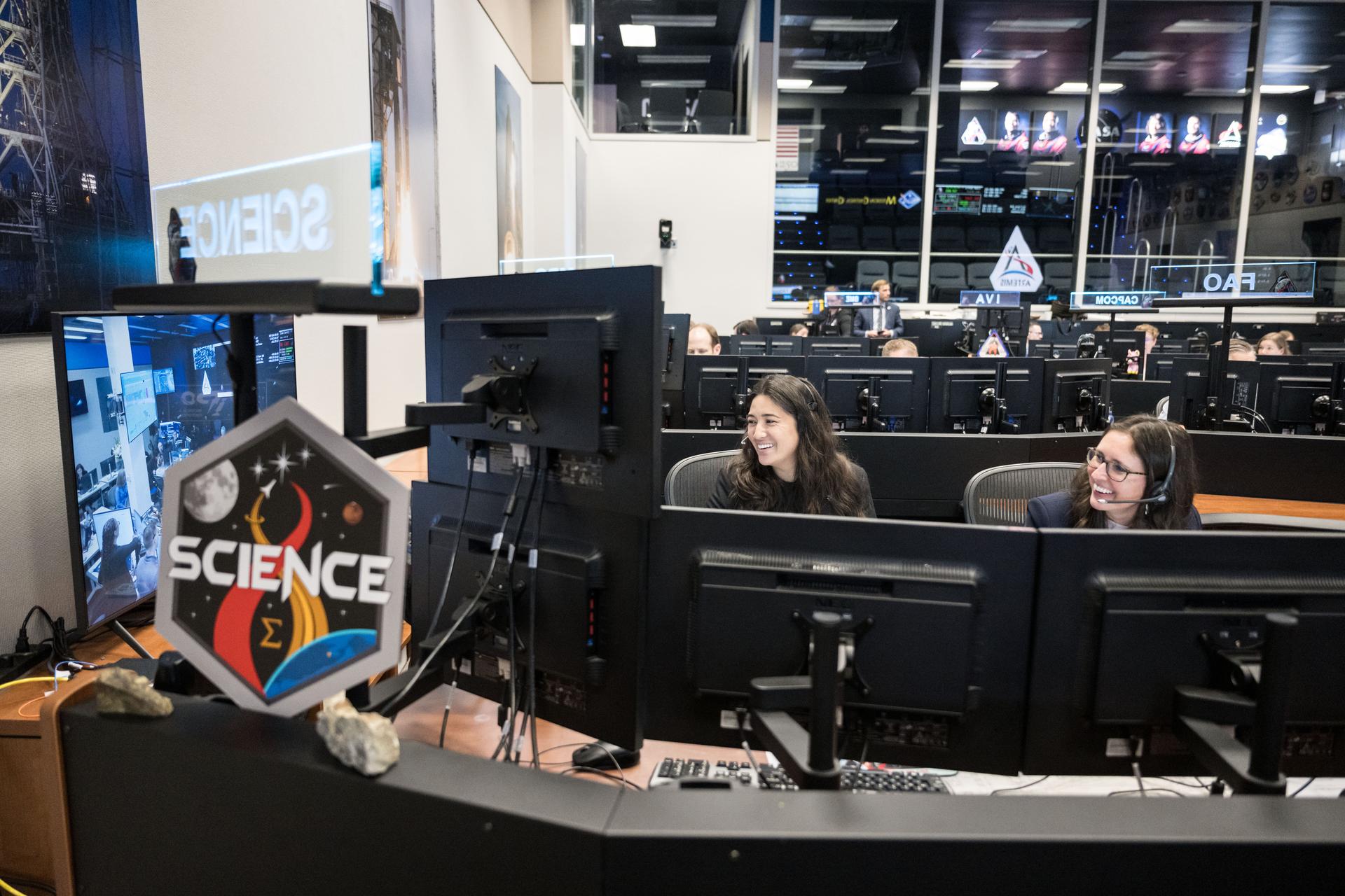
Artemis science officers, from left, Angela Garcia and Kelsey Young, watch the lunar science team celebrating in the Science Evaluation Room (SER) as they hear lunar observations from the Artemis II crew. The science team has spent years training the astronauts in geology and observation, both in the classroom and in the field. They also built the lunar targeting plan that, like a spacewalk plan, provides strong, detailed observation guidance, plus flexibility for the crew to make decisions based on what they’re seeing and experiencing in real time. The science team had many moments of celebration during the lunar flyby as the astronauts took pictures of the Moon and provided verbal descriptions of what they were seeing. This type of information reveals the geologic history of an area and will be critical to collect when future Artemis astronauts explore the Moon's surface. Credits: NASA/Robert Markowitz

Ernie Wright, Artemis II lunar science visualization lead, reacts to hearing the astronauts describe features of the Moon as they few by on April 6, 2026. To prepare the crew for this mission, the Artemis II lunar science team trained the astronauts in geology, both in the classroom and in the field. They also built the lunar targeting plan that, which, like an International Space Station spacewalk plan, provides strong, detailed observation guidance, plus flexibility for the crew to make decisions based on what they’re seeing and experiencing in real time. The science team had many moments of celebration during the lunar flyby as the astronauts took images of the Moon and provided verbal descriptions of what they were seeing. This type of information reveals the geologic history of an area and will be critical to collect when future Artemis astronauts explore the Moon's surface. Credits: NASA/Luna Posadas Nava
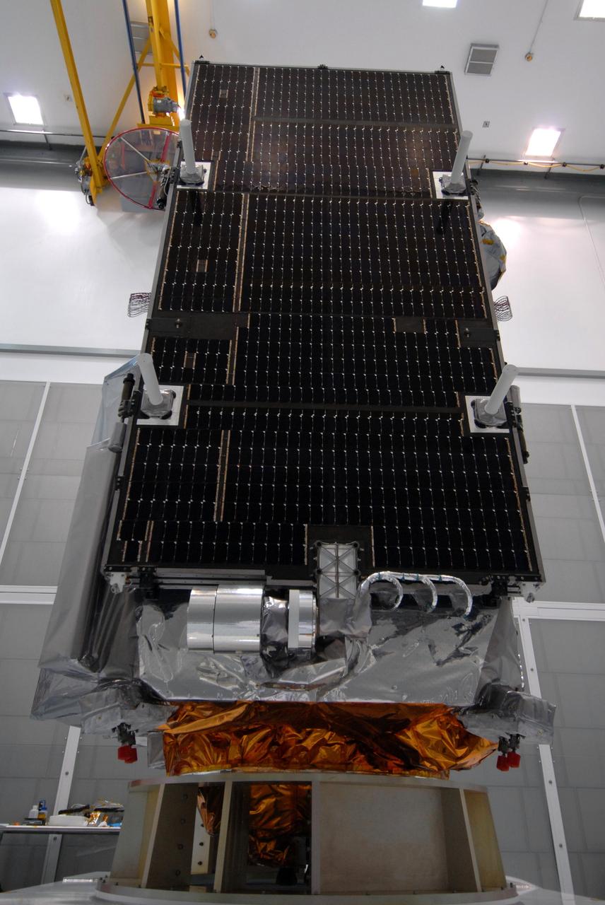
CAPE CANAVERAL, Fla. – One of three solar panels is seen during closeout of the Lunar Reconnaissance Orbiter, or LRO, at Astrotech Space Operations in Titusville, Fla. The satellite's primary mission is to search for water ice on the moon in a permanently shadowed crater near one of the lunar poles. LCROSS is a low-cost, accelerated-development, companion mission to NASA's Lunar Reconnaissance Orbiter, or LRO. LCROSS and LRO are the first missions in NASA's plan to return humans to the moon and begin establishing a lunar outpost by 2020. Launch is targeted for no earlier than June 2 from Cape Canaveral Air Force Station in Florida. Photo credit: NASA/Jack Pfaller
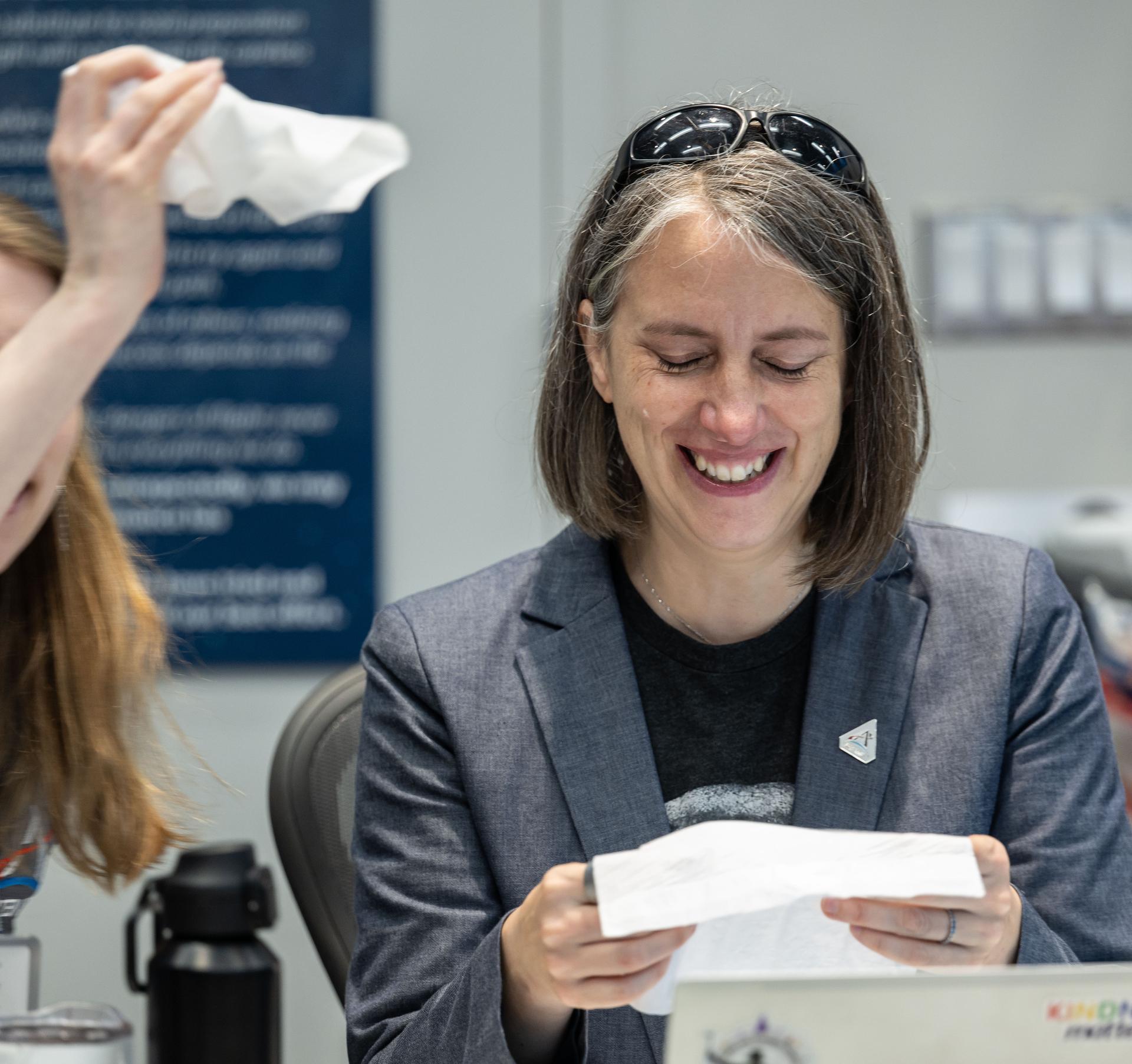
Artemis curation lead, Juliane Gross, reacts to the astronauts' verbal observations of the Moon during their flyby on April 6, 2026. Along with other members of the Artemis II lunar science team, Gross helped train the Artemis II crew in geology both in the classroom and in the field. The team also built the lunar targeting plan that, like an International Space Station spacewalk plan, provides strong, detailed observation guidance, plus flexibility for the crew to make decisions based on what they’re seeing and experiencing in real time. The science team had many moments of celebration during the lunar flyby as the astronauts took images of the Moon and provided verbal descriptions of what they were seeing. This type of information reveals the geologic history of an area and will be critical to collect when future Artemis astronauts explore the Moon's surface. Credits: NASA/Luna Posadas Nava
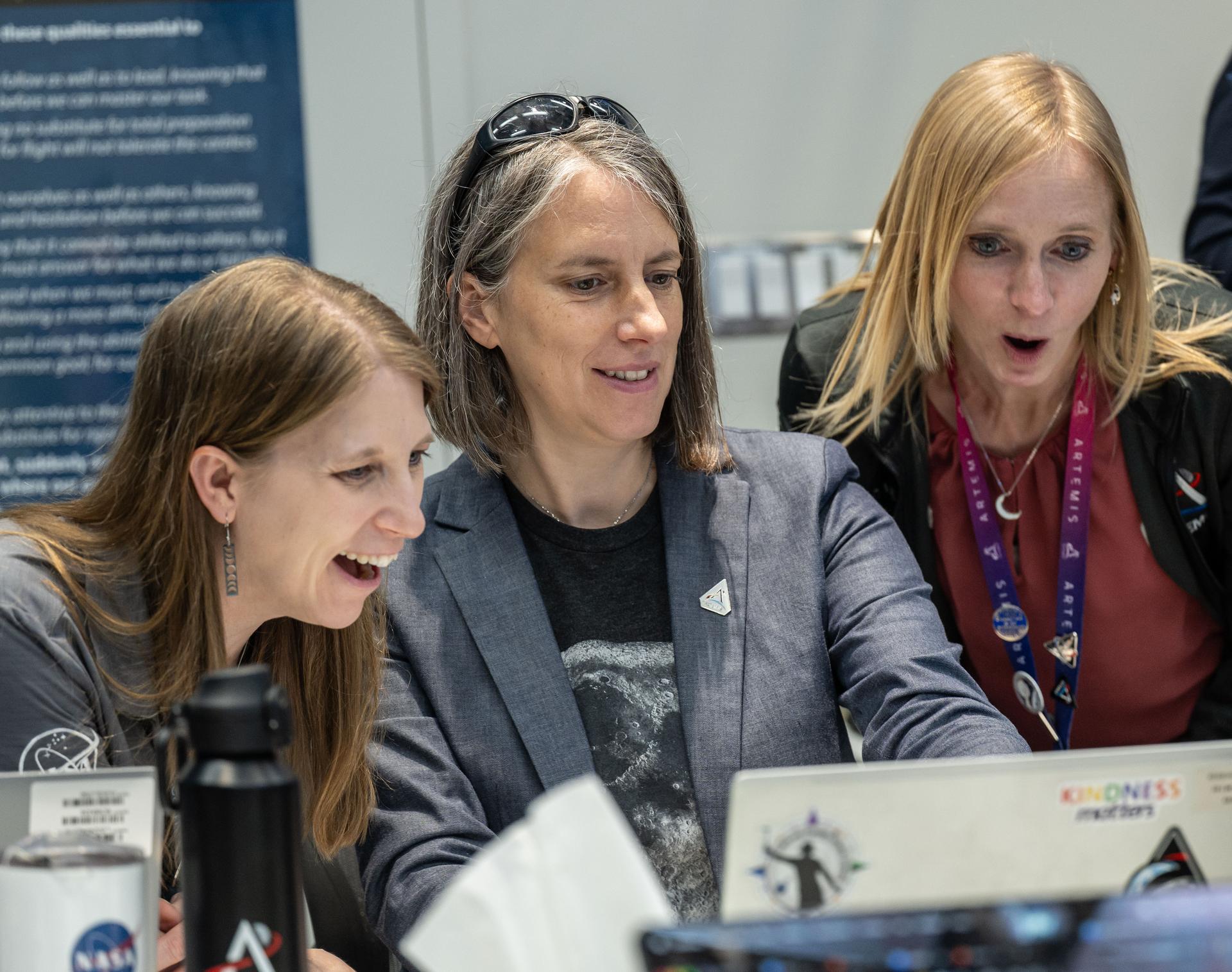
Artemis II lunar science team members, from left, Debra Needham, Juliane Gross, and Ryan Watkins, react to the astronauts' verbal observations of the Moon during their flyby on April 6, 2026. The science team trained the astronauts in geology and observation, both in the classroom and in the field. The team also built the lunar targeting plan that, like an International Space Station spacewalk plan, provides strong, detailed observation guidance, plus flexibility for the crew to make decisions based on what they’re seeing and experiencing in real time. The science team had many moments of celebration during the lunar flyby as the astronauts took images of the Moon and provided verbal descriptions of what they were seeing. This type of information reveals the geologic history of an area and will be critical to collect when future Artemis astronauts explore the Moon's surface. Credits: NASA/Luna Posadas Nava

Artemis II lunar science team member, Ariel Deutsch, reacts to the astronauts' verbal observations of the Moon during their flyby on April 6. The science team has spent years training the astronauts in geology and observation, both in the classroom and in the field. They also built the lunar targeting plan that, like a spacewalk plan, provides strong, detailed observation guidance, plus flexibility for the crew to make decisions based on what they’re seeing and experiencing in real time. The science team had many moments of celebration during the lunar flyby as the astronauts took pictures of the Moon and provided verbal descriptions of what they were seeing. This type of information reveals the geologic history of an area and will be critical to collect when future Artemis astronauts explore the Moon's surface. Credits: NASA/Luna Posadas Nava
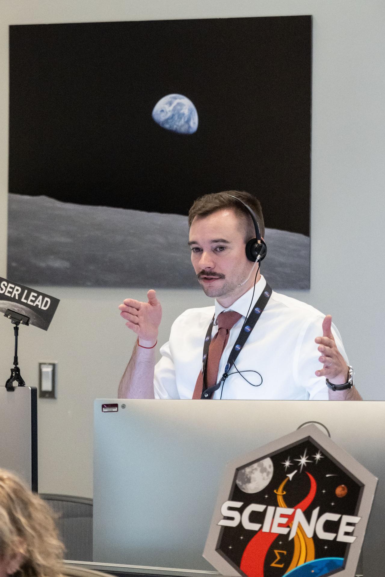
Artemis II lunar science team deputy lead, Jacob Richardson, discusses the lunar science team's progress on the lunar targeting plan for the astronauts' several-hour flyby of the Moon, scheduled for April 6. As they pass the Moon, the crew will apply geology skills learned in the classroom and in Moon-like environments on Earth to photograph and describe features including impact craters, ancient lava flows, and surface cracks and ridges formed as the Moon slowly changed over time. They will note differences in color, brightness, and texture, which provide clues that help scientists understand what the surface is made of and how it formed. Credits: NASA/Bill Stafford
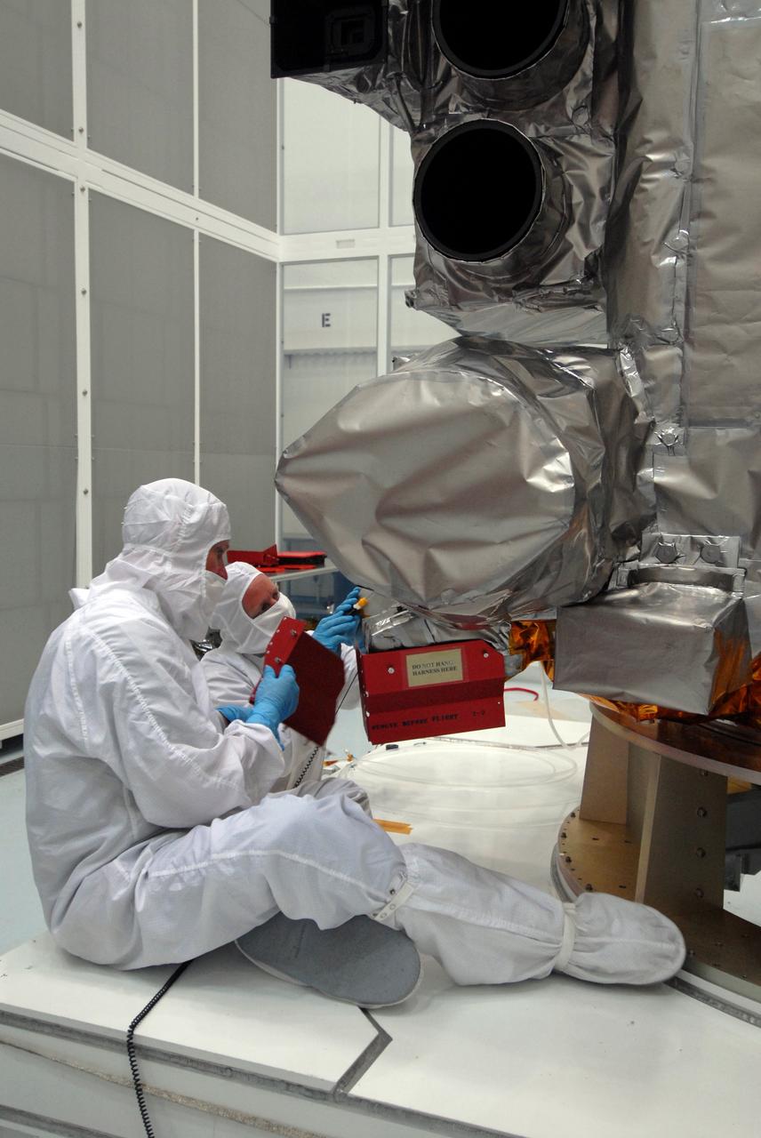
CAPE CANAVERAL, Fla. – At Astrotech Space Operations in Titusville, Fla., technicians remove red-tag items from the Lunar Reconnaissance Orbiter, or LRO, before flight. The LRO will be mated with NASA's Lunar CRater Observation and Sensing Satellite, known as LCROSS, spacecraft. Instruments on the LRO seen here are the LEND (bottom) that will measure the flux of neutrons from the moon and the LROC (above it), a narrow angle camera that will provide panchromatic images. The satellite's primary mission is to search for water ice on the moon in a permanently shadowed crater near one of the lunar poles. LCROSS is a low-cost, accelerated-development, companion mission to NASA's Lunar Reconnaissance Orbiter, or LRO. LCROSS and LRO are the first missions in NASA's plan to return humans to the moon and begin establishing a lunar outpost by 2020. Launch is targeted for no earlier than June 2 from Cape Canaveral Air Force Station in Florida. Photo credit: NASA/Jack Pfaller
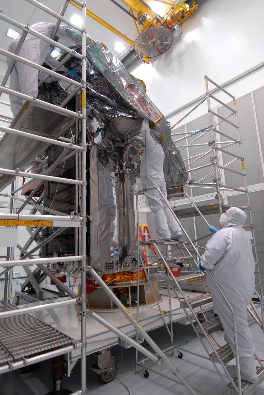
CAPE CANAVERAL, Fla. – At Astrotech Space Operations in Titusville, Fla., technicians begin placing the protective bag around the Lunar Reconnaissance Orbiter, or LRO, before it is mated with NASA's Lunar CRater Observation and Sensing Satellite, known as LCROSS, spacecraft. The satellite's primary mission is to search for water ice on the moon in a permanently shadowed crater near one of the lunar poles. LCROSS is a low-cost, accelerated-development, companion mission to NASA's Lunar Reconnaissance Orbiter, or LRO. LCROSS and LRO are the first missions in NASA's plan to return humans to the moon and begin establishing a lunar outpost by 2020. Launch is targeted for no earlier than June 2 from Cape Canaveral Air Force Station in Florida. Photo credit: NASA/Jack Pfaller
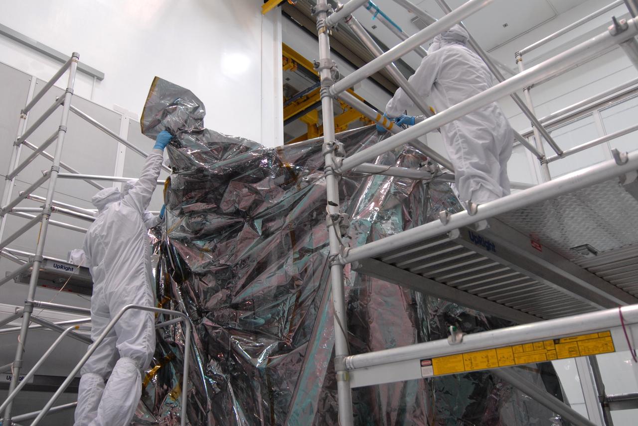
CAPE CANAVERAL, Fla. – At Astrotech Space Operations in Titusville, Fla., technicians place the protective bag around the Lunar Reconnaissance Orbiter, or LRO, before it is mated with NASA's Lunar CRater Observation and Sensing Satellite, known as LCROSS, spacecraft. The satellite's primary mission is to search for water ice on the moon in a permanently shadowed crater near one of the lunar poles. LCROSS is a low-cost, accelerated-development, companion mission to NASA's Lunar Reconnaissance Orbiter, or LRO. LCROSS and LRO are the first missions in NASA's plan to return humans to the moon and begin establishing a lunar outpost by 2020. Launch is targeted for no earlier than June 2 from Cape Canaveral Air Force Station in Florida. Photo credit: NASA/Jack Pfaller
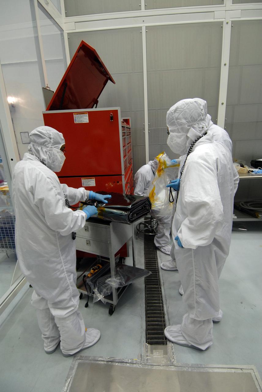
CAPE CANAVERAL, Fla. – At Astrotech Space Operations in Titusville, Fla., technicians remove the bag that will be placed over the Lunar Reconnaissance Orbiter, or LRO, before it is mated with NASA's Lunar CRater Observation and Sensing Satellite, known as LCROSS, spacecraft. The satellite's primary mission is to search for water ice on the moon in a permanently shadowed crater near one of the lunar poles. LCROSS is a low-cost, accelerated-development, companion mission to NASA's Lunar Reconnaissance Orbiter, or LRO. LCROSS and LRO are the first missions in NASA's plan to return humans to the moon and begin establishing a lunar outpost by 2020. Launch is targeted for no earlier than June 2 from Cape Canaveral Air Force Station in Florida. Photo credit: NASA/Jack Pfaller
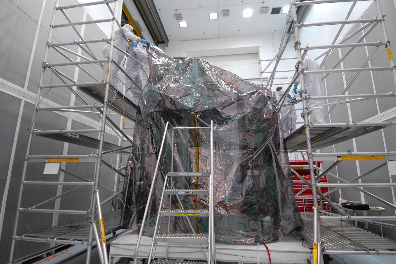
CAPE CANAVERAL, Fla. – At Astrotech Space Operations in Titusville, Fla., technicians complete placing the protective bag around the Lunar Reconnaissance Orbiter, or LRO, before it is mated with NASA's Lunar CRater Observation and Sensing Satellite, known as LCROSS, spacecraft. The satellite's primary mission is to search for water ice on the moon in a permanently shadowed crater near one of the lunar poles. LCROSS is a low-cost, accelerated-development, companion mission to NASA's Lunar Reconnaissance Orbiter, or LRO. LCROSS and LRO are the first missions in NASA's plan to return humans to the moon and begin establishing a lunar outpost by 2020. Launch is targeted for no earlier than June 2 from Cape Canaveral Air Force Station in Florida. Photo credit: NASA/Jack Pfaller

Artemis II deputy lunar science lead Marie Henderson, shown standing on the left, and lunar science team members, from the right foreground, Ariel Deutsch, Maria Banks behind her, Ryan Watkins to her right, and Sara Schmidt in the checkered jacket. In this image they are reacting to astronauts' observations of Moon features during their flyby on April 6, 2026. Leading up to the flight, the science team has been training the astronauts in in the classroom and in the field. They also built the lunar targeting plan that, like a spacewalk plan on the International Space Station, provides strong, detailed observation guidance, plus flexibility for the crew to make decisions based on what they’re seeing and experiencing in real time. The science team had many moments of celebration during the lunar flyby as the astronauts took images of the Moon and provided verbal descriptions of what they were seeing. This type of information reveals the geologic history of various lunar areas and will be critical to collect when future Artemis astronauts explore the Moon's surface. Credits: NASA/Luna Posadas Nava

Artemis II lunar science team member, Amber Turner, works on the lunar targeting plan for the astronauts' several-hour flyby of the Moon, scheduled for April 6. As they pass the Moon, the crew will apply geology skills learned in the classroom and in Moon-like environments on Earth to photograph and describe features including impact craters, ancient lava flows, and surface cracks and ridges formed as the Moon slowly changed over time. They will note differences in color, brightness, and texture, which provide clues that help scientists understand what the surface is made of and how it formed. Credits: NASA/Bill Stafford
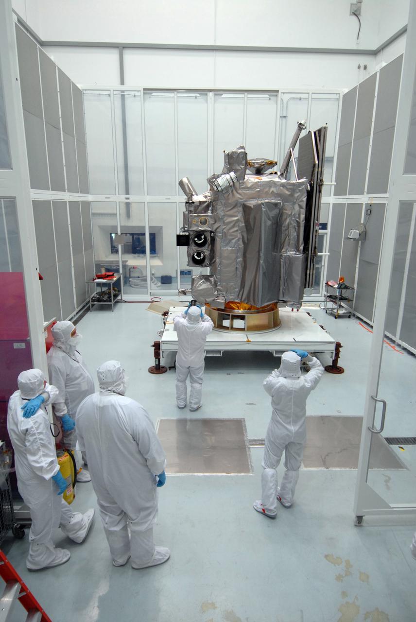
CAPE CANAVERAL, Fla. – At Astrotech Space Operations in Titusville, Fla., technicians photograph the Lunar Reconnaissance Orbiter, or LRO, during closeout before its mating with NASA's Lunar CRater Observation and Sensing Satellite, known as LCROSS, spacecraft. Instruments on the LRO include the LEND that will measure the flux of neutrons from the moon; the LROC, a narrow angle camera that will provide panchromatic images; the LOLA, which will provide a precise global lunar topographic model and geodetic grid; and top right, the DIVINER, which will measure lunar surface temperatures at scales that provide essential information for future surface operations and exploration; and at top, the CRaTER, which will characterize the global lunar radiation environment and its biological impacts. At right is the solar panel. The satellite's primary mission is to search for water ice on the moon in a permanently shadowed crater near one of the lunar poles. LCROSS is a low-cost, accelerated-development, companion mission to NASA's Lunar Reconnaissance Orbiter, or LRO. LCROSS and LRO are the first missions in NASA's plan to return humans to the moon and begin establishing a lunar outpost by 2020. Launch is targeted for no earlier than June 2 from Cape Canaveral Air Force Station in Florida. Photo credit: NASA/Jack Pfaller
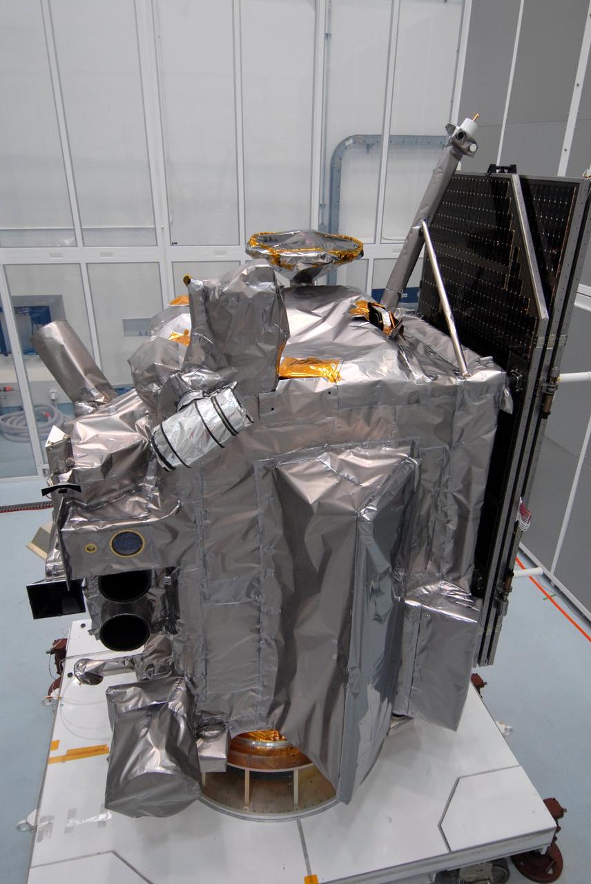
CAPE CANAVERAL, Fla. – Another view of the Lunar Reconnaissance Orbiter, or LRO, at Astrotech Space Operations in Titusville, Fla., during closeout before its mating with NASA's Lunar CRater Observation and Sensing Satellite, known as LCROSS, spacecraft. Instruments seen, at left, are (from bottom) the LEND that will measure the flux of neutrons from the moon; the LROC, a narrow angle camera that will provide panchromatic images; the LOLA, which will provide a precise global lunar topographic model and geodetic grid; and top right, the DIVINER, which will measure lunar surface temperatures at scales that provide essential information for future surface operations and exploration; and at top, the CRaTER, which will characterize the global lunar radiation environment and its biological impacts. At right is the solar panel. The satellite's primary mission is to search for water ice on the moon in a permanently shadowed crater near one of the lunar poles. LCROSS is a low-cost, accelerated-development, companion mission to NASA's Lunar Reconnaissance Orbiter, or LRO. LCROSS and LRO are the first missions in NASA's plan to return humans to the moon and begin establishing a lunar outpost by 2020. Launch is targeted for no earlier than June 2 from Cape Canaveral Air Force Station in Florida. Photo credit: NASA/Jack Pfaller
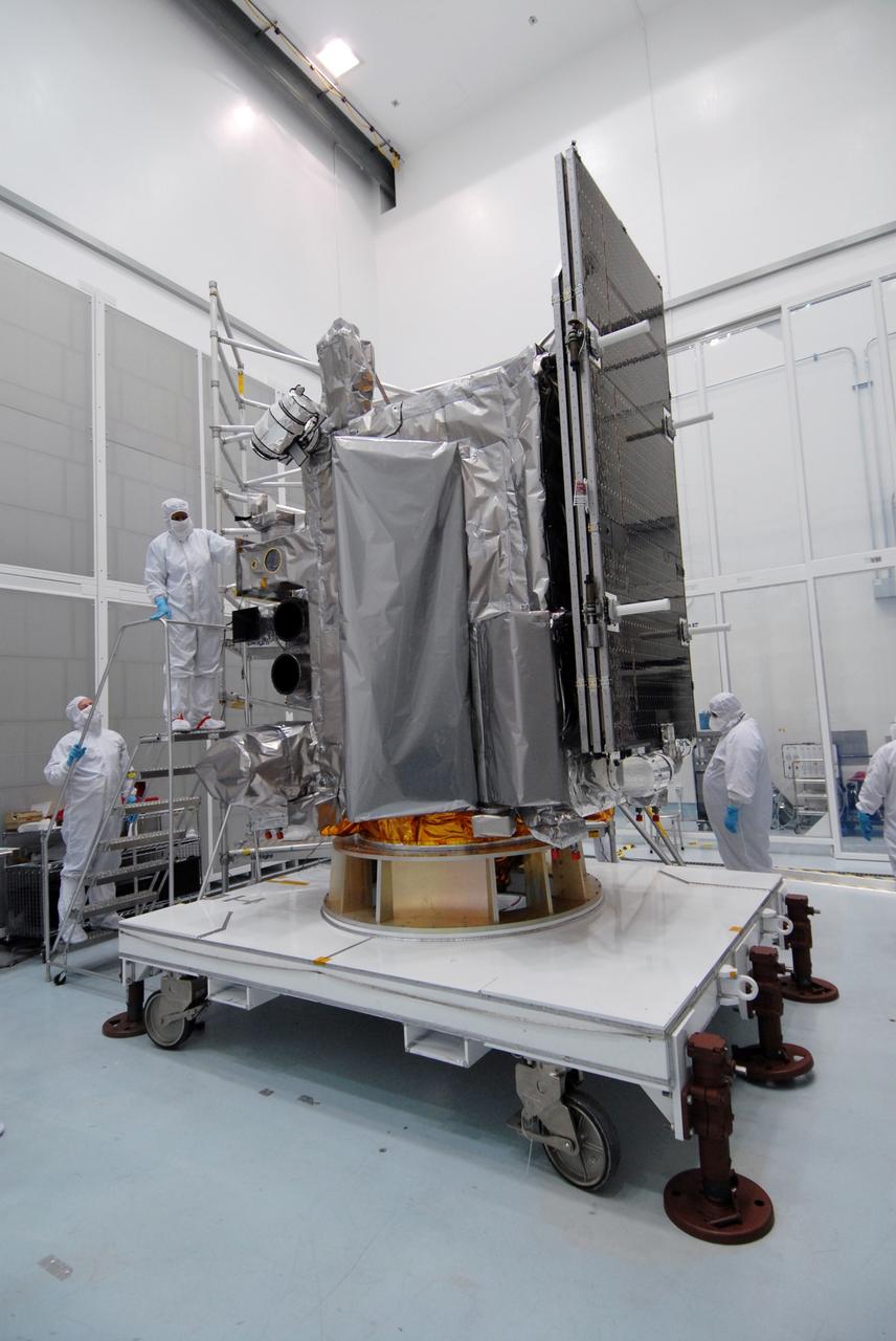
CAPE CANAVERAL, Fla. – At Astrotech Space Operations in Titusville, Fla., technicians are closing out the Lunar Reconnaissance Orbiter, or LRO, before its mating with NASA's Lunar CRater Observation and Sensing Satellite, known as LCROSS, spacecraft. Instruments seen at far left are (from bottom), the LEND that will measure the flux of neutrons from the moon; the LROC, a narrow angle camera that will provide panchromatic images; the LOLA, which will provide a precise global lunar topographic model and geodetic grid; and top right, the DIVINER, which will measure lunar surface temperatures at scales that provide essential information for future surface operations and exploration; and at top, the CRaTER, which will characterize the global lunar radiation environment and its biological impacts. The satellite's primary mission is to search for water ice on the moon in a permanently shadowed crater near one of the lunar poles. LCROSS is a low-cost, accelerated-development, companion mission to NASA's Lunar Reconnaissance Orbiter, or LRO. LCROSS and LRO are the first missions in NASA's plan to return humans to the moon and begin establishing a lunar outpost by 2020. Launch is targeted for no earlier than June 2 from Cape Canaveral Air Force Station in Florida. Photo credit: NASA/Jack Pfaller
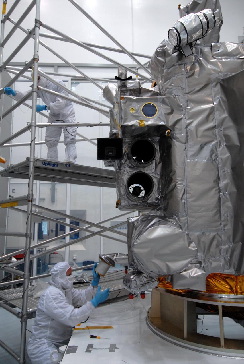
CAPE CANAVERAL, Fla. – At Astrotech Space Operations in Titusville, Fla., technicians begin closeout on the Lunar Reconnaissance Orbiter, or LRO, before its mating with NASA's Lunar CRater Observation and Sensing Satellite, known as LCROSS, spacecraft. Instruments seen are (from bottom), the LEND that will measure the flux of neutrons from the moon; the LROC, a narrow angle camera that will provide panchromatic images; the LOLA, which will provide a precise global lunar topographic model and geodetic grid; and top right, the DIVINER, which will measure lunar surface temperatures at scales that provide essential information for future surface operations and exploration; and at top, the CRaTER, which will characterize the global lunar radiation environment and its biological impacts. The satellite's primary mission is to search for water ice on the moon in a permanently shadowed crater near one of the lunar poles. LCROSS is a low-cost, accelerated-development, companion mission to NASA's Lunar Reconnaissance Orbiter, or LRO. LCROSS and LRO are the first missions in NASA's plan to return humans to the moon and begin establishing a lunar outpost by 2020. Launch is targeted for no earlier than June 2 from Cape Canaveral Air Force Station in Florida. Photo credit: NASA/Jack Pfaller

CAPE CANAVERAL, Fla. – At Astrotech Space Operations in Titusville, Fla., technicians perform black light inspection on the Lunar Reconnaissance Orbiter, or LRO, looking for possible contamination. Instruments on the LRO include the LEND that will measure the flux of neutrons from the moon; the LROC, a narrow angle camera that will provide panchromatic images; the LOLA, which will provide a precise global lunar topographic model and geodetic grid; and top right, the DIVINER, which will measure lunar surface temperatures at scales that provide essential information for future surface operations and exploration; and at top, the CRaTER, which will characterize the global lunar radiation environment and its biological impacts. The satellite's primary mission is to search for water ice on the moon in a permanently shadowed crater near one of the lunar poles. LCROSS is a low-cost, accelerated-development, companion mission to NASA's Lunar Reconnaissance Orbiter, or LRO. LCROSS and LRO are the first missions in NASA's plan to return humans to the moon and begin establishing a lunar outpost by 2020. Launch is targeted for no earlier than June 2 from Cape Canaveral Air Force Station in Florida. Photo credit: NASA/Jack Pfaller

CAPE CANAVERAL, Fla. – At Astrotech Space Operations in Titusville, Fla., technicians perform black light inspection on the Lunar Reconnaissance Orbiter, or LRO, looking for possible contamination. Instruments on the LRO include the LEND that will measure the flux of neutrons from the moon; the LROC, a narrow angle camera that will provide panchromatic images; the LOLA, which will provide a precise global lunar topographic model and geodetic grid; and top right, the DIVINER, which will measure lunar surface temperatures at scales that provide essential information for future surface operations and exploration; and at top, the CRaTER, which will characterize the global lunar radiation environment and its biological impacts. The satellite's primary mission is to search for water ice on the moon in a permanently shadowed crater near one of the lunar poles. LCROSS is a low-cost, accelerated-development, companion mission to NASA's Lunar Reconnaissance Orbiter, or LRO. LCROSS and LRO are the first missions in NASA's plan to return humans to the moon and begin establishing a lunar outpost by 2020. Launch is targeted for no earlier than June 2 from Cape Canaveral Air Force Station in Florida. Photo credit: NASA/Jack Pfaller
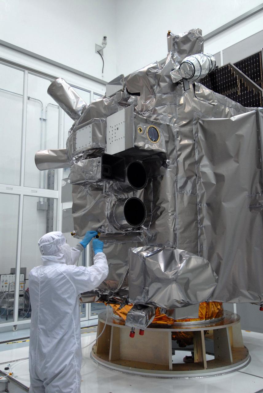
CAPE CANAVERAL, Fla. – At Astrotech Space Operations in Titusville, Fla., a technician checks the thermal blanket around the LROC narrow angle camera during closeout on the Lunar Reconnaissance Orbiter, or LRO, before its mating with NASA's Lunar CRater Observation and Sensing Satellite, known as LCROSS, spacecraft. Above the LROC is the LOLA, which will provide a precise global lunar topographic model and geodetic grid; and top right, the DIVINER, which will measure lunar surface temperatures at scales that provide essential information for future surface operations and exploration. The satellite's primary mission is to search for water ice on the moon in a permanently shadowed crater near one of the lunar poles. LCROSS is a low-cost, accelerated-development, companion mission to NASA's Lunar Reconnaissance Orbiter, or LRO. LCROSS and LRO are the first missions in NASA's plan to return humans to the moon and begin establishing a lunar outpost by 2020. Launch is targeted for no earlier than June 2 from Cape Canaveral Air Force Station in Florida. Photo credit: NASA/Jack Pfaller
![Multiple exposure of Gemini rendezvous docking simulator. Francis B. Smith wrote in his paper "Simulators for Manned Space Research," "The rendezvous and docking operation of the Gemini spacecraft with the Agena and of the Apollo Command Module with the Lunar Excursion Module have been the subject of simulator studies for several years. [This figure] illustrates the Gemini-Agena rendezvous docking simulator at Langley. The Gemini spacecraft was supported in a gimbal system by an overhead crane and gantry arrangement which provided 6 degrees of freedom - roll, pitch, yaw, and translation in any direction - all controllable by the astronaut in the spacecraft. Here again the controls fed into a computer which in turn provided an input to the servos driving the spacecraft so that it responded to control motions in a manner which accurately simulated the Gemini spacecraft." A.W. Vogeley further described the simulator in his paper "Discussion of Existing and Planned Simulators For Space Research," "Docking operations are considered to start when the pilot first can discern vehicle target size and aspect and terminate, of course, when soft contact is made. ... This facility enables simulation of the docking operation from a distance of 200 feet to actual contact with the target. A full-scale mock-up of the target vehicle is suspended near one end of the track. ... On [the Agena target] we have mounted the actual Agena docking mechanism and also various types of visual aids. We have been able to devise visual aids which have made it possible to accomplish nighttime docking with as much success as daytime docking." -- Published in Barton C. Hacker and James M. Grimwood, On the Shoulders of Titans: A History of Project Gemini, NASA SP-4203; Francis B. Smith, "Simulators for Manned Space Research," Paper presented at the 1966 IEEE International convention, March 21-25, 1966; A.W. Vogeley, "Discussion of Existing and Planned Simulators For Space Research," Paper presented at the Conference on the Role of Simulation in Space Technology, August 17-21, 1964.](https://images-assets.nasa.gov/image/LRC-1963-B701_P-08973/LRC-1963-B701_P-08973~medium.jpg)
Multiple exposure of Gemini rendezvous docking simulator. Francis B. Smith wrote in his paper "Simulators for Manned Space Research," "The rendezvous and docking operation of the Gemini spacecraft with the Agena and of the Apollo Command Module with the Lunar Excursion Module have been the subject of simulator studies for several years. [This figure] illustrates the Gemini-Agena rendezvous docking simulator at Langley. The Gemini spacecraft was supported in a gimbal system by an overhead crane and gantry arrangement which provided 6 degrees of freedom - roll, pitch, yaw, and translation in any direction - all controllable by the astronaut in the spacecraft. Here again the controls fed into a computer which in turn provided an input to the servos driving the spacecraft so that it responded to control motions in a manner which accurately simulated the Gemini spacecraft." A.W. Vogeley further described the simulator in his paper "Discussion of Existing and Planned Simulators For Space Research," "Docking operations are considered to start when the pilot first can discern vehicle target size and aspect and terminate, of course, when soft contact is made. ... This facility enables simulation of the docking operation from a distance of 200 feet to actual contact with the target. A full-scale mock-up of the target vehicle is suspended near one end of the track. ... On [the Agena target] we have mounted the actual Agena docking mechanism and also various types of visual aids. We have been able to devise visual aids which have made it possible to accomplish nighttime docking with as much success as daytime docking." -- Published in Barton C. Hacker and James M. Grimwood, On the Shoulders of Titans: A History of Project Gemini, NASA SP-4203; Francis B. Smith, "Simulators for Manned Space Research," Paper presented at the 1966 IEEE International convention, March 21-25, 1966; A.W. Vogeley, "Discussion of Existing and Planned Simulators For Space Research," Paper presented at the Conference on the Role of Simulation in Space Technology, August 17-21, 1964.