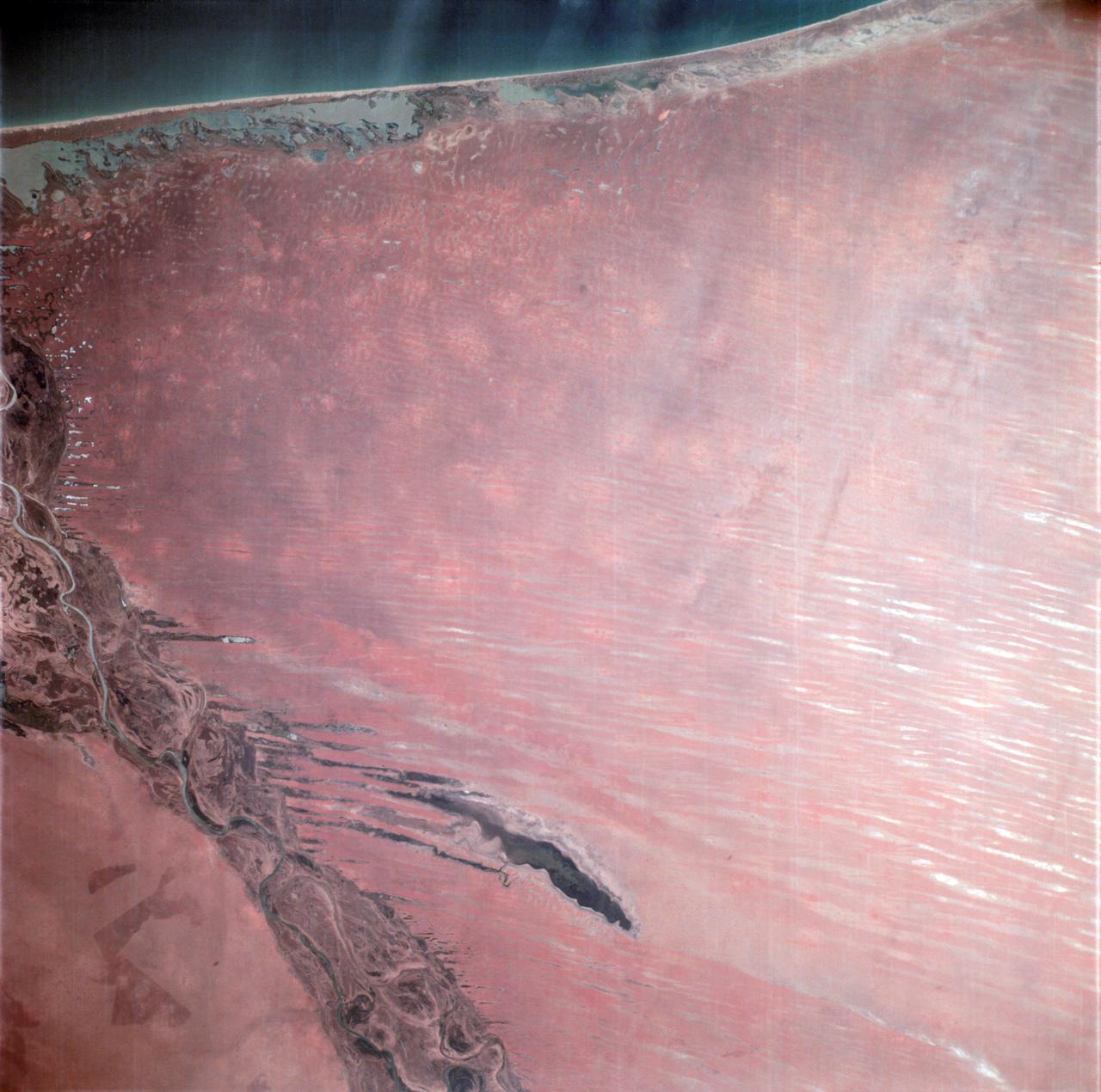
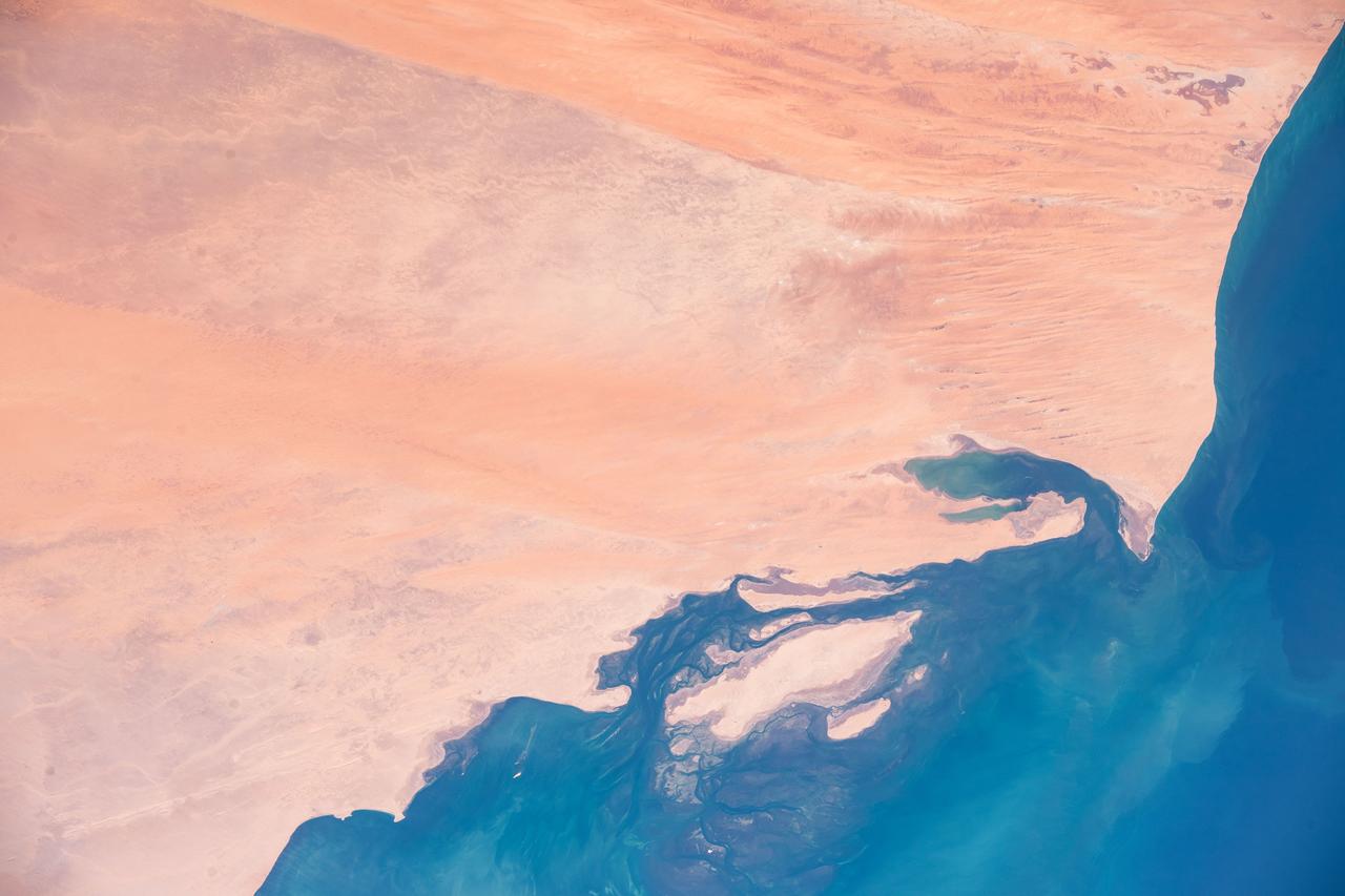
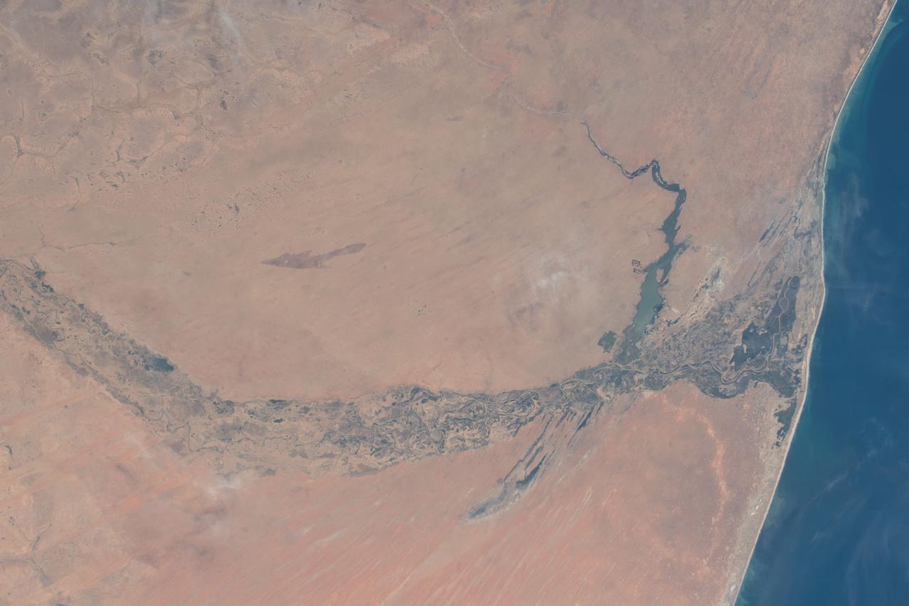
AS06-02-938 (6 April 1968) --- During the second revolution of the National Aeronautics and Space Administration's Apollo 6 spacecraft, this photograph of Senegal and Mauritania was taken at an altitude of 125 nautical miles. The predominant feature is the valley of the Senegal River (flowing to lower right). Lake Rkiz is to the left of the river in Mauritania. The Trarza Scrub Hills, a large area of elongated, fixed dunes, is in the lower left of the print. The land area seen in this photo is approximately 10,000 square miles or about the size of the state of Maryland. The photo was made one hour and fifty minutes after liftoff using a J.A. Maurer model 220G camera with Eastman Kodak SO-121 high resolution aerial Ektachrome film (exposure setting of f: 5.6 at 1/500 sec.).
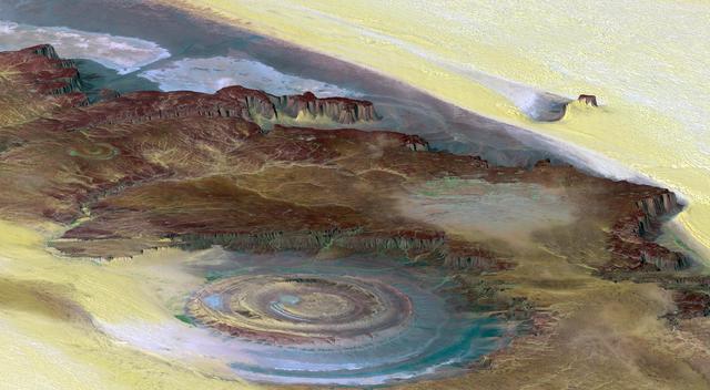
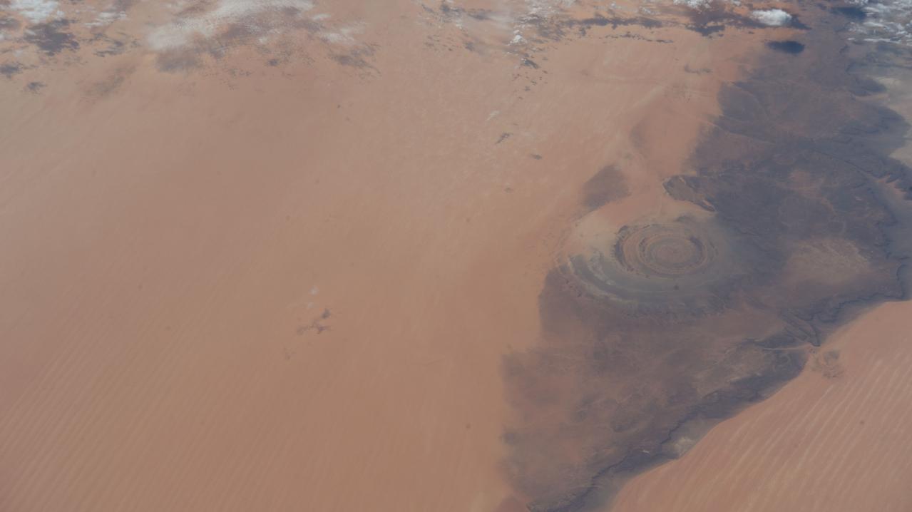
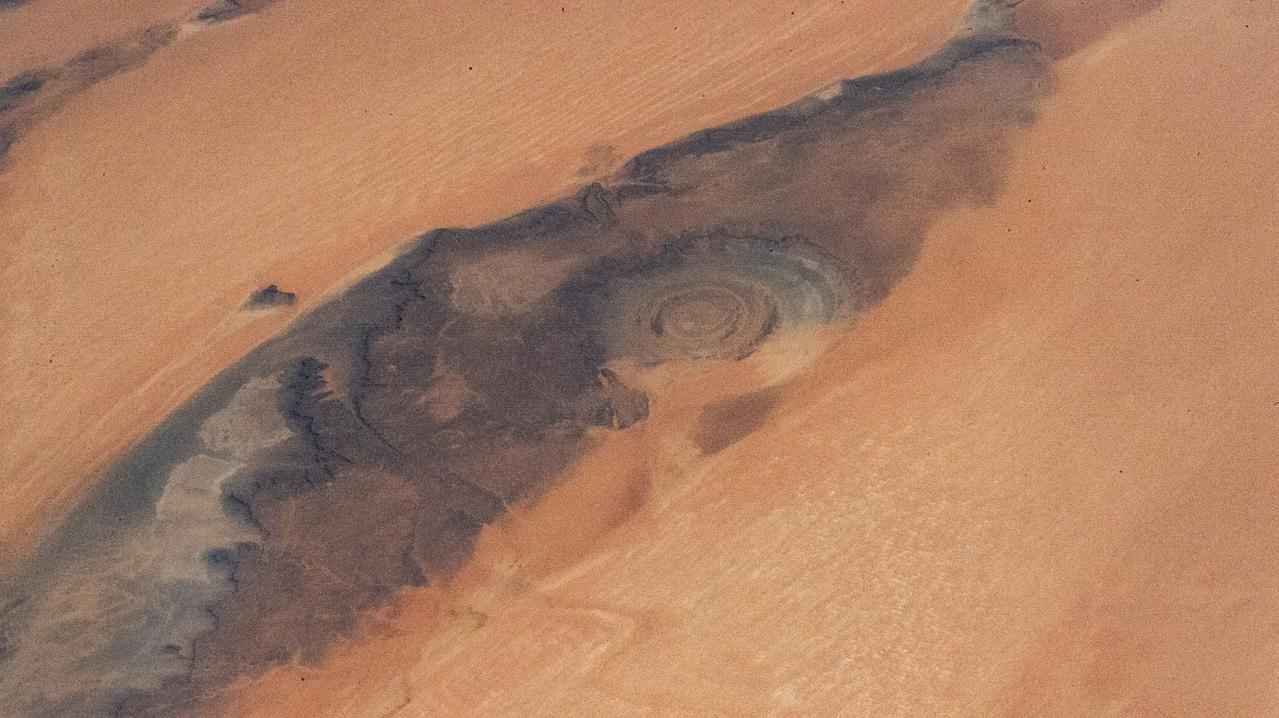
This prominent circular feature, known as the Richat Structure, in the Sahara desert of Mauritania is often noted by astronauts because it forms a conspicuous bull-eye on the otherwise rather featureless expanse of the desert.
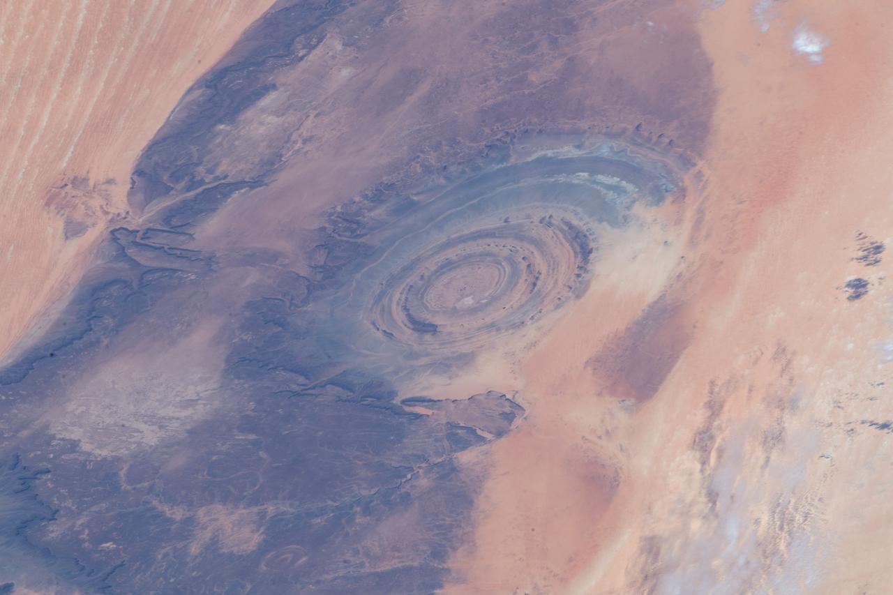
iss069e005471 (April 26, 2023) --- The Richat Structure, also known as the "Eye of the Sahara," an eroded geological dome in the nation of Mauritania, is pictured from the International Space Station as it orbited 259 miles above the African continent.
iss069e005526 (April 26, 2023) --- The Richat Structure, also known as the "Eye of the Sahara," an eroded geological dome in the nation of Mauritania, is pictured from the International Space Station as it orbited 259 miles above the African continent.
SL4-138-3756 (28 Dec. 1973) --- The northern half of Mauritania's Atlantic Coast, as photographed from the Skylab space station in Earth orbit by one of the Skylab 4 crewmen. The camera used was a hand-held 70mm Hasselblad, with SO-368 medium-speed Ektachrome. Spanish Sahara is just out of the picture to the north. The linear chains of sand dunes leading to the sea were the objects of study in an effort to better understand deserts and their formations. Photographs such as this were compared with similar ones taken over the drought-stricken areas including Mali and Niger in an attempt to understand the desertification processes which may be occurring there. Photo credit: NASA
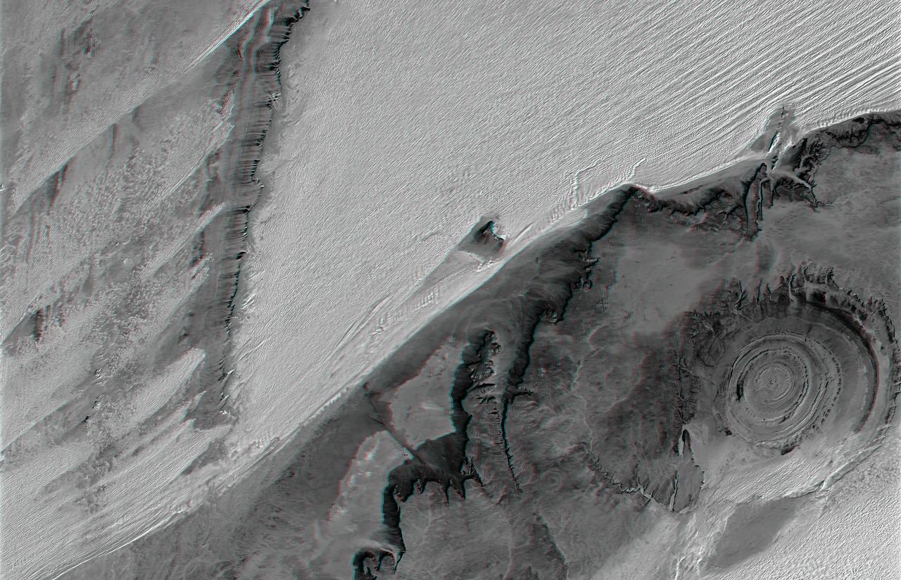
The prominent circular feature seen here is known as the Richat Structure, in the Sahara desert of Mauritania. This anaglyph is from NASA Shuttle Radar Topography Mission. 3D glasses are necessary to view this image.
iss069e005536 (April 26, 2023) --- The Richat Structure, also known as the "Eye of the Sahara," an eroded geological dome in the nation of Mauritania, is pictured from the International Space Station as it orbited 259 miles above the African continent. At left, from top to bottom, are the Nauka multipurpose laboratory module's forward port, the Prichal docking module, and the Soyuz MS-23 crew ship.

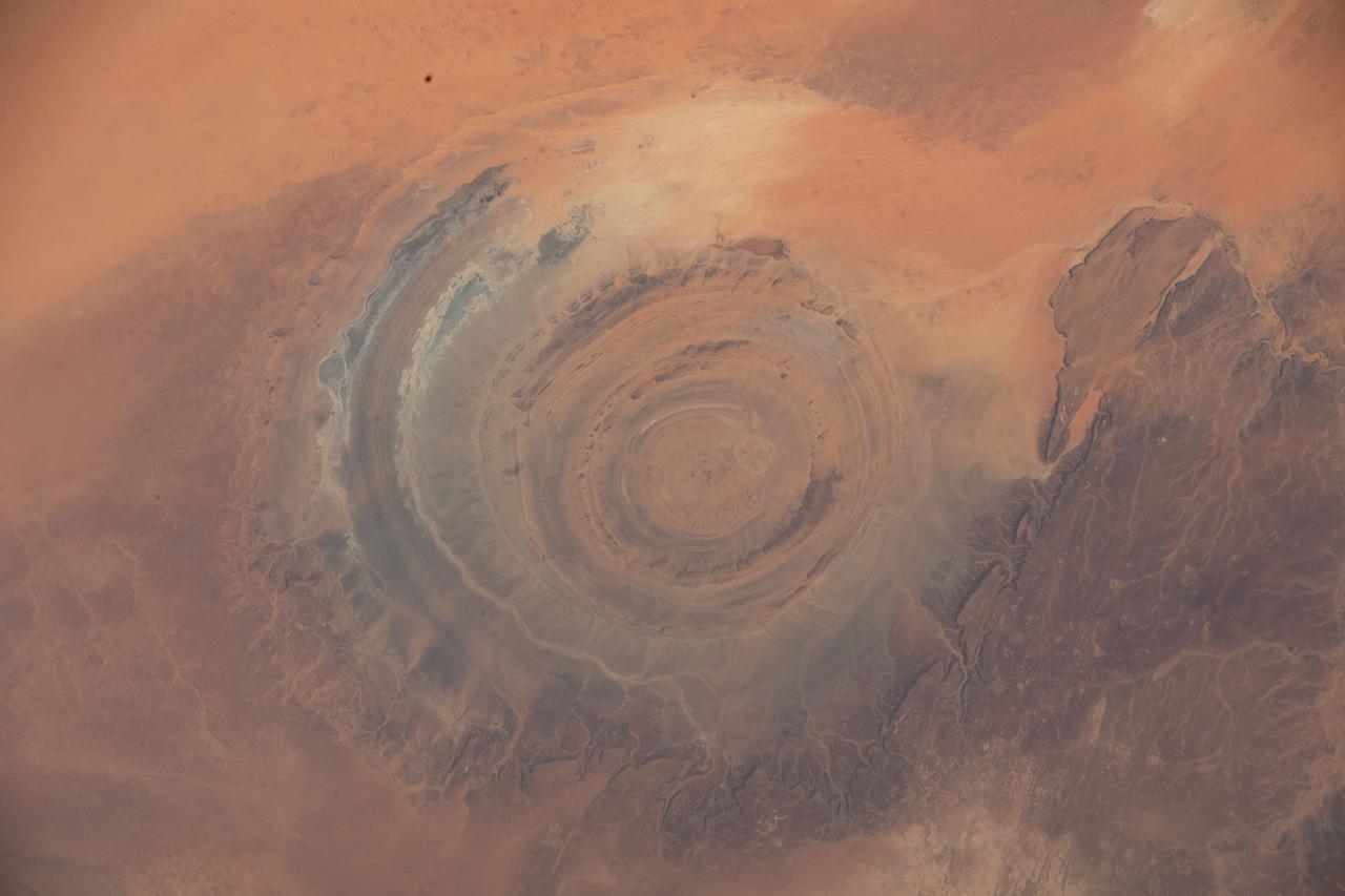
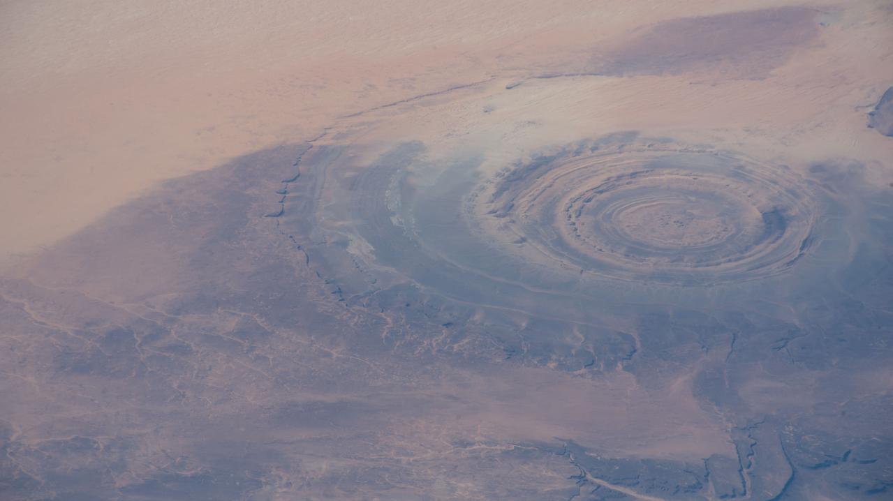
ISS002-E-5457 (13 April 2001) --- The "bull's-eye" of the Richat Structure adds interest to the barren Gres de Chinguetti Plateau in central Mauritania in northwest Africa. It represents domally uplifted, layered (sedimentary) rocks that have been eroded by water and wind into the present shape. The 25-mile-wide structure is a 300-foot-deep landmark that has caught the eye of many an astronaut in Earth orbit. Image number ISS002-E-5693 shows the same feature six days later. The image was recorded with a digital still camera.
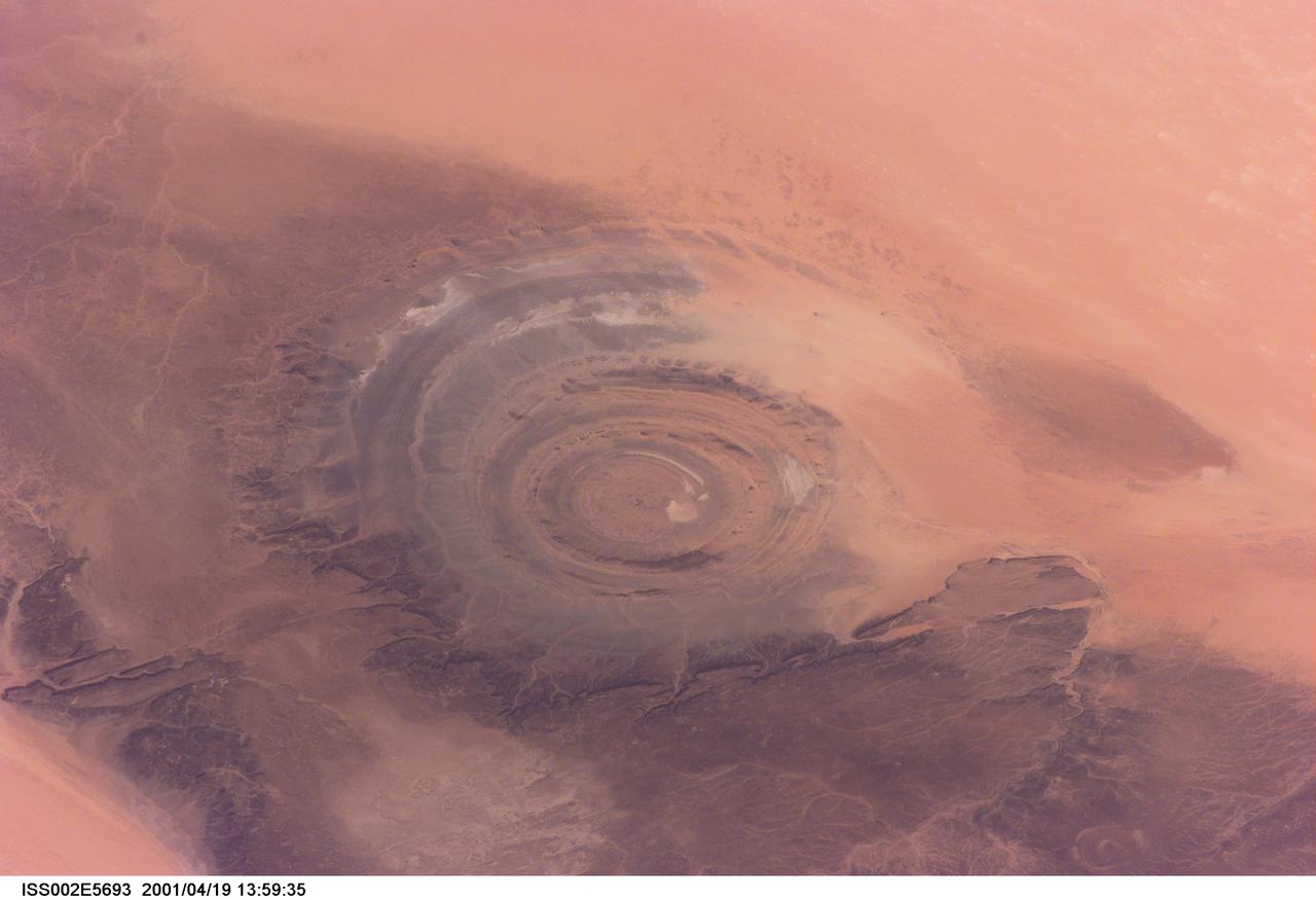
ISS002-E-5693 (19 April 2001) --- The "bull's-eye" of the Richat Structure adds interest to the barren Gres de Chinguetti Plateau in central Mauritania in northwest Africa. It represents domally uplifted, layered (sedimentary) rocks that have been eroded by water and wind into the present shape. The 25-mile-wide structure is a 300-foot-deep landmark that has caught the eye of many an astronaut in Earth orbit. Image number ISS002-E-5457 shows the same feature six days earlier. The image was recorded with a digital still camera.
iss058e007722 (Jan. 29, 2019) --- The Sun's glint radiates off the Atlantic Ocean as the International Space Station orbited 253 miles above the African nation of Mauritania.
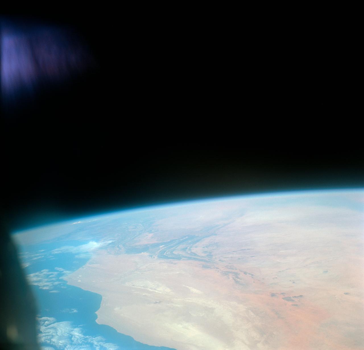
S66-46062 (18-21 July 1966) --- Area of the Spanish Sahara--Mauritania--Algeria--Morocco, looking north into Hamada Du Dra, as seen from the Gemini-10 spacecraft. Taken with a J.A. Maurer 70mm camera, using Eastman Kodak, Ektachrome, MS (S.O. 217) color film. Photo credit: NASA
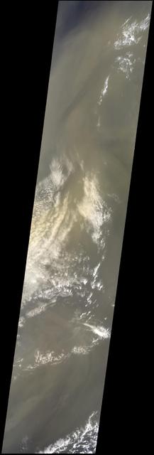
This image, captured by NASA Terra satellite on July 20, 2005, shows the dust cloud just off the west coast of Africa near Mauritania and Senegal.
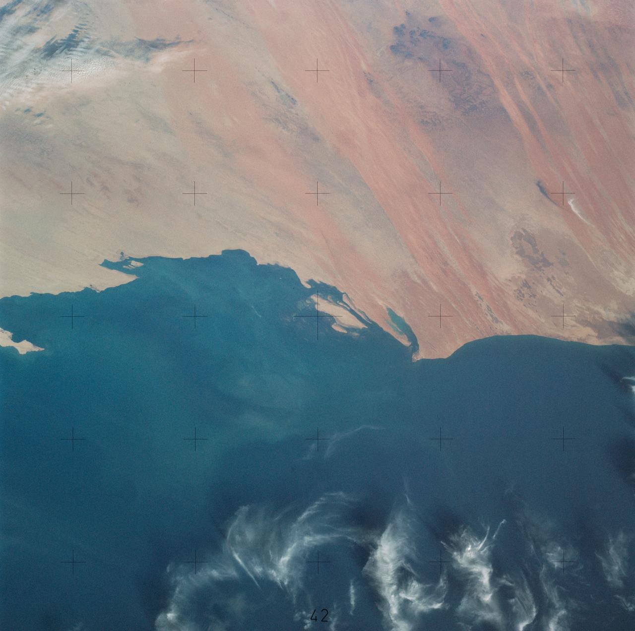
iss062e082367 (March 6, 2020) --- The coast of Mauritania on the Atlantic Ocean is pictured as the International Space Station orbited above the African nation.
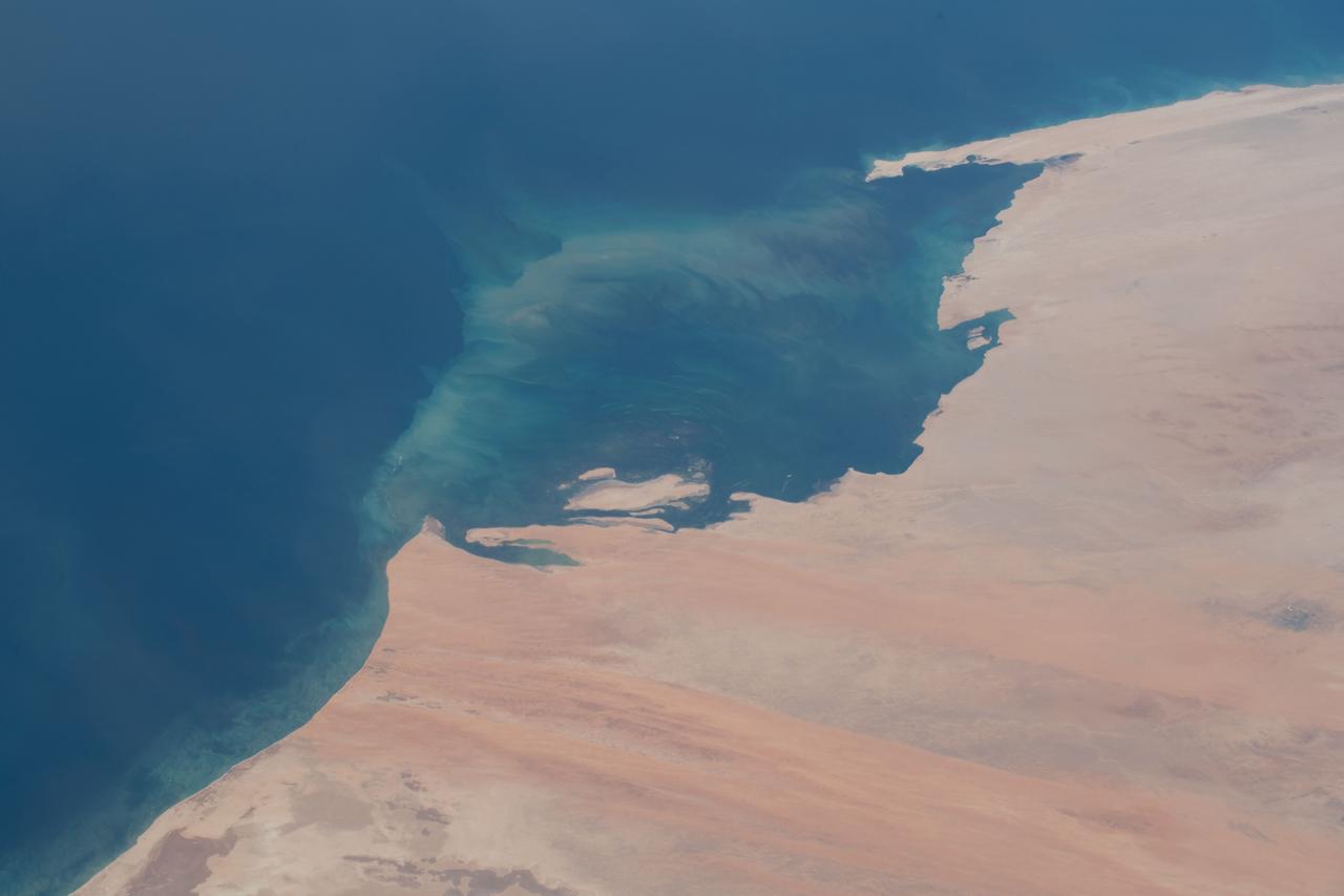
iss057e111398 (Dec. 4, 2018) --- An Expedition 57 crew member photographed the desert coast of Mauritania on the Atlantic Ocean near the border with Western Sahara on the African continent.
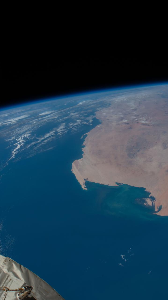
iss059e008252 (April 1, 2019) --- The Atlantic coast of the nations of Mauritania and Western Sahara is pictured as the International Space Station orbited 255 miles off the coast of Africa.
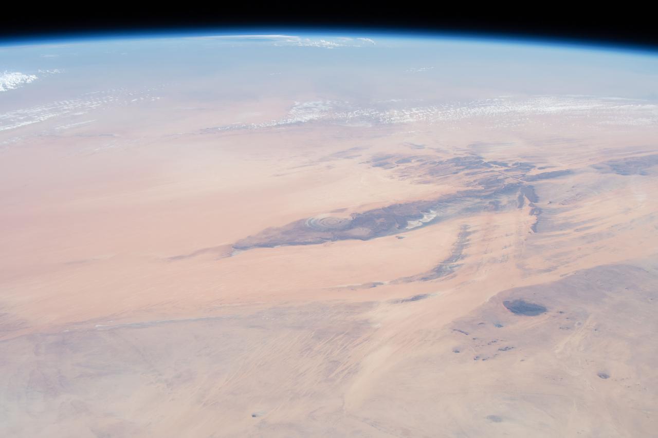
iss068e025663 (Nov. 30, 2022) --- The Richat Structure, or the "Eye of the Sahara," in northwestern Mauritania is pictured from the International Space Station as it orbited 259 miles above the African continent.
iss067e286458 (Aug. 21, 2022) --- The Richat Structure, also known as the "Eye of the Sahara," an eroded geological dome in the nation of Mauritania, is pictured from the International Space Station as it orbited 256 miles above northwestern Africa.
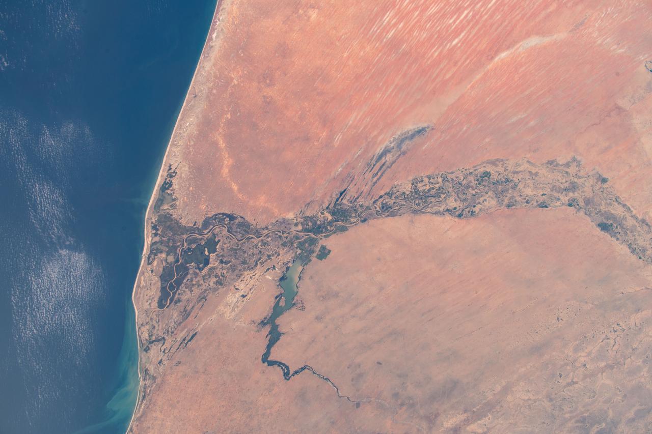
iss061e063348 (Nov. 29, 2019) -- Lake Guiers and the Senegal River separating the African nations of Senegal and Mauritania are pictured as the International Space Station orbited 257 miles in altitude off the Atlantic coast.
iss071e170970 (June 5, 2024) --- The Rihat Structure, also known as the Eye of the Sahara, is a deeply eroded geologic dome in the African nation of Mauritania pictured from the International Space Station as it orbited 258 miles above.
iss057e111395 (Dec. 4, 2018) --- The Senegal River valley that marks the border between the Atlantic coast nations of Senegal and Mauritania is pictured as the International Space Station orbited 252 miles above the African continent.

iss062e085644 (March 9, 2020) --- The SpaceX Dragon resupply ship is pictured approaching the International Space Station as both spacecraft were soaring 264 miles above the African nations of Mauritania and Senegal.
iss066e102086 (Dec. 31, 2021) --- The Richat structure, an eroded geological dome, located in the African nation of Mauritania, is pictured from the International Space Station as it orbited 262 miles above Earth.
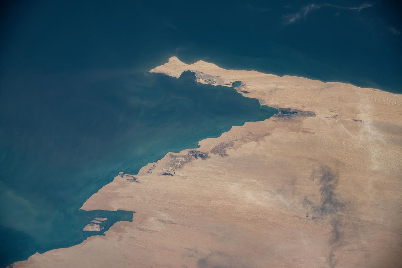
iss071e082698 (May 16, 2024) --- The Atlantic coastal desert region of the Sahara Desert in the African nation of Mauritania is pictured from the International Space Station as it orbited 258 miles above the Atlantic Ocean.
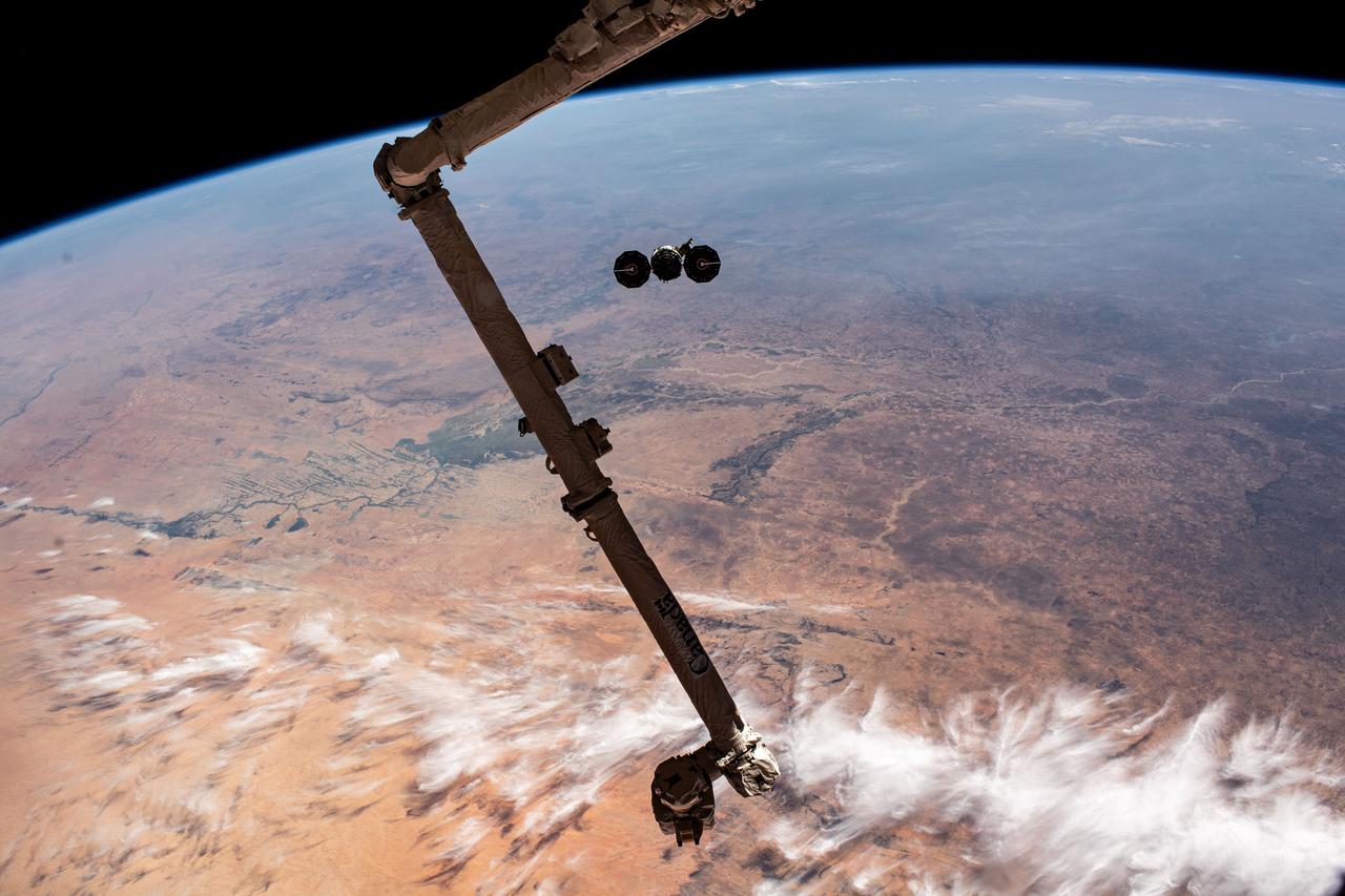
iss070e044315 (Dec. 22, 2023) --- Northrop Grumman's Cygnus space freighter is pictured departing the International Space Station after it was released from the grip of the Canadarm2 robotic arm. The orbital complex was soaring 258 miles above the African nation of Mauritania at the time of this photograph.

S65-63256 (16 Dec. 1965) --- Cap Blanc and Levrier Bay on the coast of Spanish Sahara and Mauritania, as seen from the Gemini-6 spacecraft during its 15th revolution of Earth. Photo credit: NASA or National Aeronautics and Space Administration
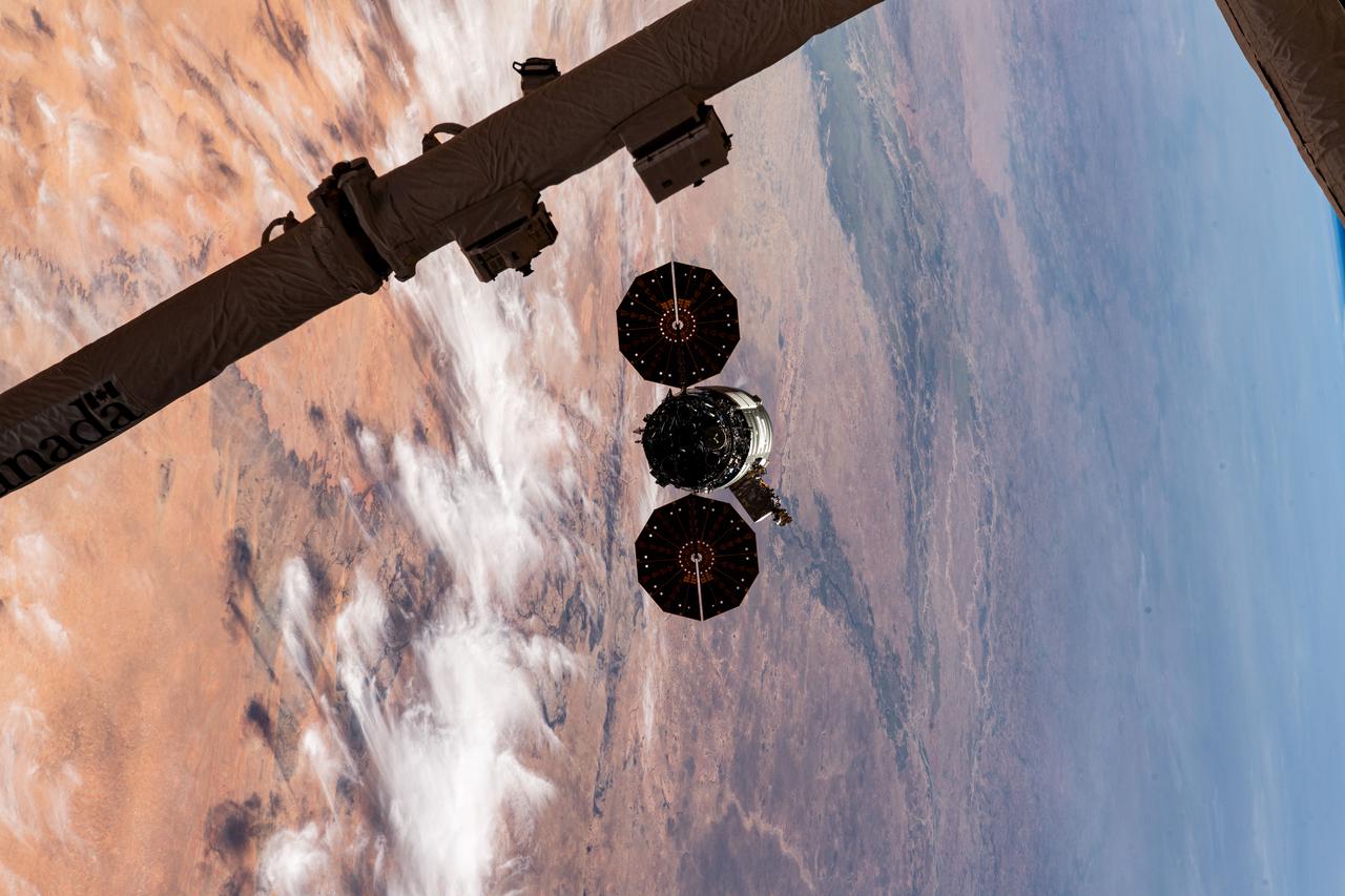
iss070e044312 (Dec. 22, 2023) --- Northrop Grumman's Cygnus space freighter is pictured departing the International Space Station after it was released from the grip of the Canadarm2 robotic arm. The orbital complex was soaring 258 miles above the African nation of Mauritania at the time of this photograph.
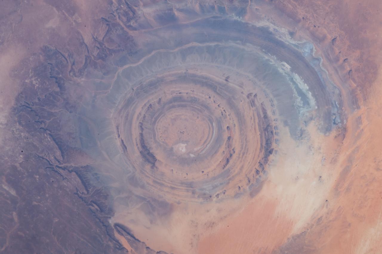
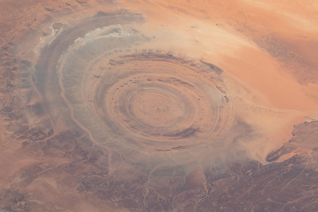
iss059e013137 (March 5, 2019) --- From an altitude of 255 miles, an Expedition 59 crewmember photographed the Richat Structure, or the "Eye of the Sahara," in northwestern Mauritania. The circular geologic feature is thought to be caused by an uplifted dome—geologists would classify it as a domed anticline—that has been eroded to expose the originally flat rock layers.

iss063e110774 (Oct. 18, 2020) --- The Soyuz MS-17 crew ship that carried the Expedition 64 crew to the International Space Station on Oct. 14 is pictured docked to the Rassvet module. The orbital complex was above the Atlantic Ocean in between the island nation of Cape Verde and the African nation of Mauritania.
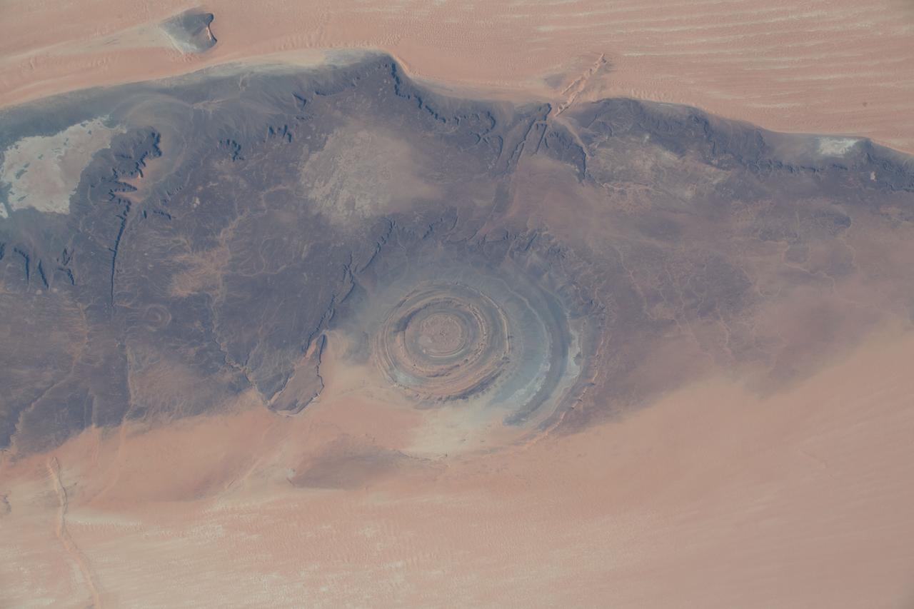
iss061e012458 (Oct. 20, 2019) --- Known as the “Eye of the Sahara," the Richat Structure in northwestern Mauritania is a circular geologic feature thought to be caused by an uplifted dome—geologists would classify it as a domed anticline—that has been eroded to expose the originally flat rock layers.
iss059e013142 (April 5, 2019) --- From an altitude of 255 miles, an Expedition 59 crewmember photographed the Richat Structure, or the "Eye of the Sahara," in northwestern Mauritania. The circular geologic feature is thought to be caused by an uplifted dome—geologists would classify it as a domed anticline—that has been eroded to expose the originally flat rock layers.
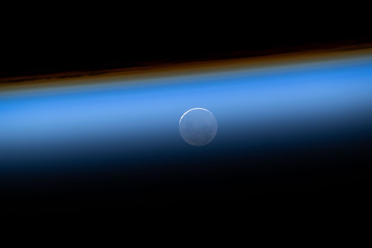
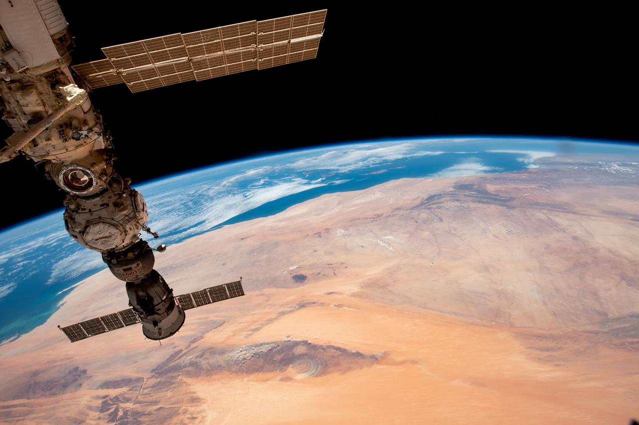
iss073e0175732 (May 27, 2025) --- The New Moon is pictured seemingly beneath Earth's atmosphere during an orbital sunset in this photograph from the International Space Station as it soared 259 miles above Mauritania on the African continent at approximately 9:59 p.m. local time.
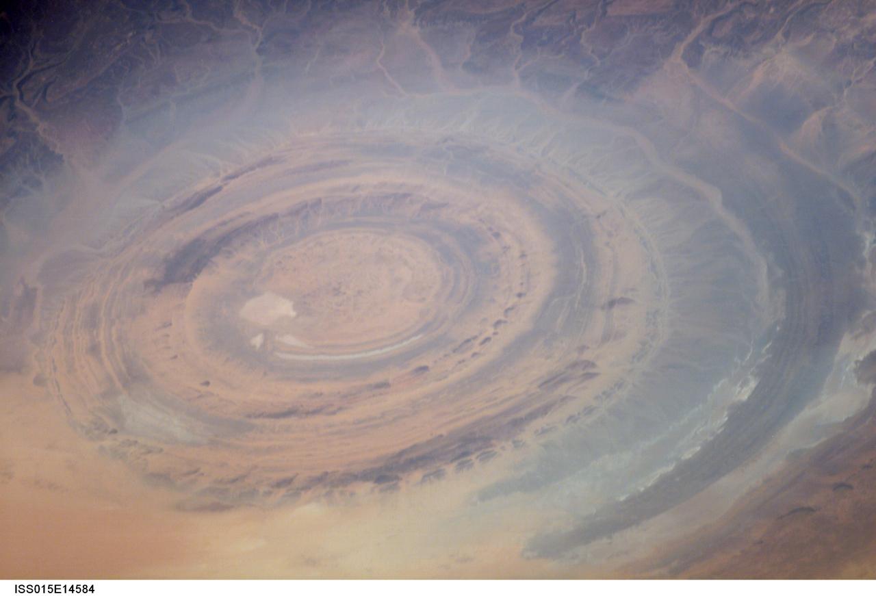
ISS015-E-14584 (26 June 2007) --- The "bull's-eye" of the Richat Structure in the barren Gres de Chinguetti Plateau, central Mauritania in northwest Africa is featured in this image photographed by an Expedition 15 crewmember on the International Space Station. It represents domally uplifted, layered (sedimentary) rocks that have been eroded by water and wind into the present shape. The 25-mile-wide structure is a 300-foot-deep landmark that has caught the eye of many an astronaut in Earth orbit.
iss059e027887 (April 21, 2019) --- This oblique view from 255 miles above northwest Africa, looking from north to south, shows the "Eye of Sahara" in Mauritania. The circular geologic feature, also known as the Richat Structure, is thought to be caused by an uplifted dome—geologists would classify it as a domed anticline—that has been eroded to expose the originally flat rock layers.
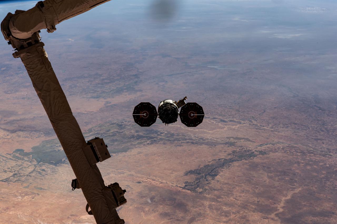
iss070e044314 (Dec. 22, 2023) --- Northrop Grumman's Cygnus space freighter is pictured departing the International Space Station after it was released from the grip of the Canadarm2 robotic arm. The orbital complex was soaring 258 miles above the African nation of Mauritania at the time of this photograph. The major land feature toward the center left, is the Inner Niger Delta, an inland delta created by the Niger River in the central portion of Mali.
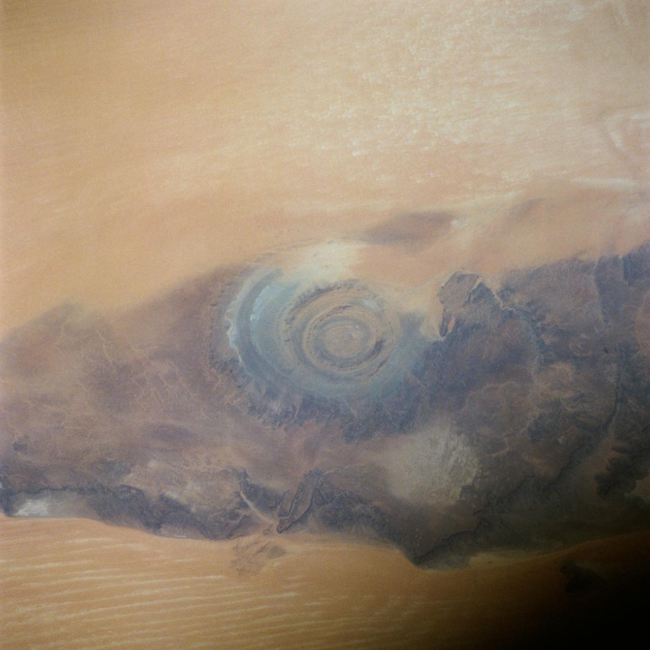
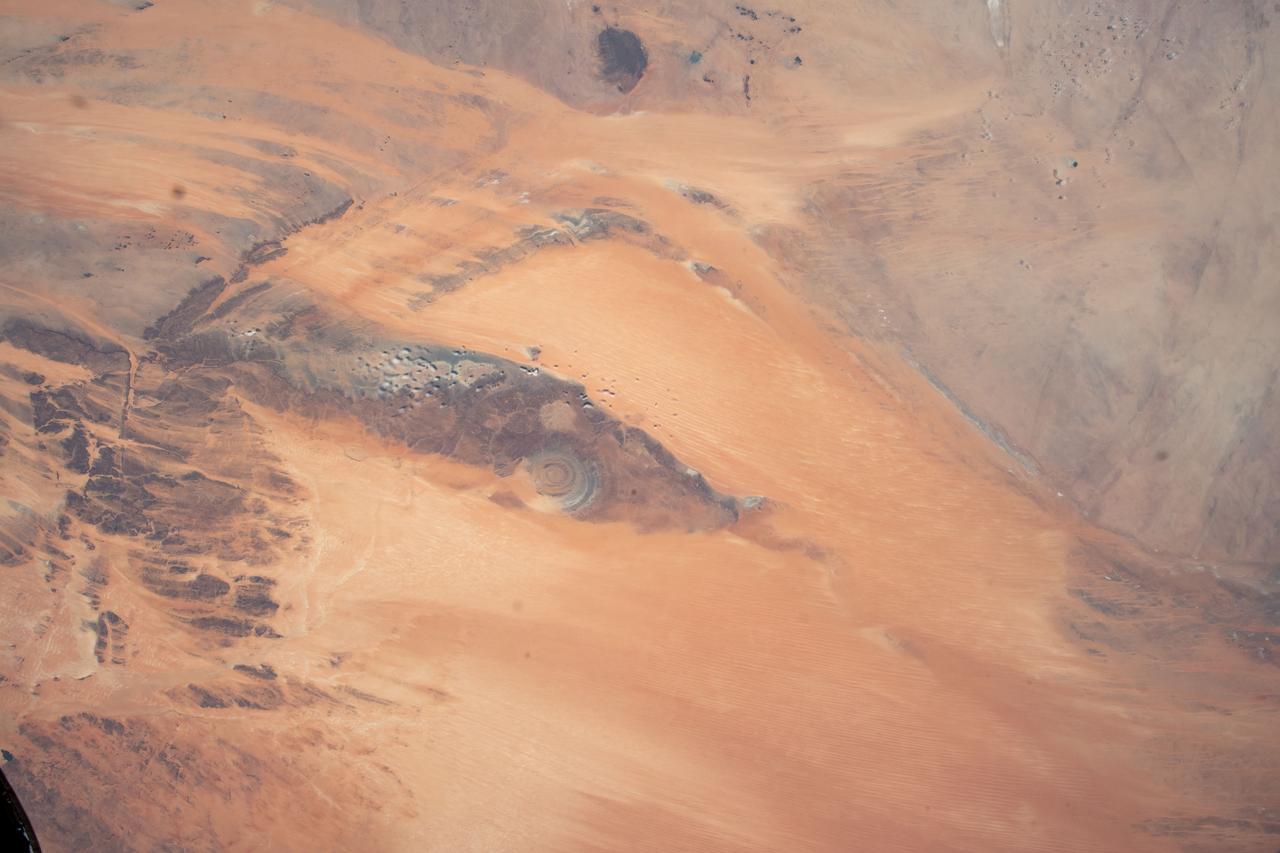
41C-39-1973 (6-13 April 1984) --- Though photographed on previous manned spaceflights, the Richat Structure in Western Mauritania has seldom if ever been able to be seen more clearly and studied more completely than in this 41-C 70mm frame, according to geologists. The structure is actually a 25-mile wide, 1,000-ft. deep hole in the Earth, the result of heavy wind erosion. This frame was one of the visuals used by the 41-C astronauts at their April 24, 1984 post-flight press conference.

iss073e0545547 (Aug. 25, 2025) --- A SpaceX Dragon cargo spacecraft with its nosecone open and carrying over 5,000 pounds of science, supplies, and hardware as NASA's SpaceX CRS-33 mission approaches the International Space Station for an automated docking to the Harmony module's forward port. Both spacecraft were flying 259 miles above western Mauritania near the Atlantic coast at the time of this photograph.
S63-06434 (15-16 May 1963) --- East looking view across Atlantic waters toward Africa, showing Mauritania and Spanish Sahara photographed from the Mercury-Atlas 9 (MA-9) capsule by astronaut L. Gordon Cooper Jr., during his 22-orbit MA-9 spaceflight. Photo credit: NASA

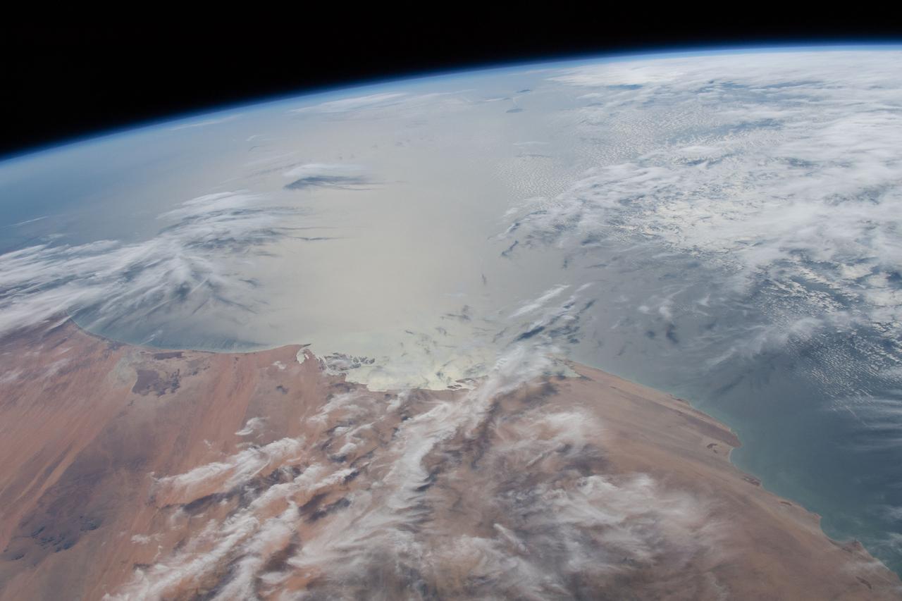
ISS008-E-18202 (8 March 2004) --- This image featuring a Saharan dust outbreak was taken by an Expedition 8 crewmember onboard the International Space Station (ISS) from a position about 1400 kilometers off the coast of Mauritania (about 600 kilometers west of the Cape Verde Islands in the tropical Atlantic Ocean). Looking northwest, this image shows the dusty Saharan air mass in the lower third of the view, with clear air beyond a marked northeast-trending boundary. The dust is blowing west-southwest, parallel to the front, a common trajectory during northern winters. The width of the dust column was about 1800 kilometers, of which 200 kilometers only are seen here (right).

Image taken 1/11/2001: The so-called Richat Structure is a geological formation in the Maur Adrar Desert in the African country of Mauritania. Although it resembles an impact crater, the Richat Structure formed when a volcanic dome hardened and gradually eroded, exposing the onion-like layers of rock. The Richat Structure can be found on Landsat 7 WRS Path 203 Row 45, center: 21.68, -11.94. To learn more about the Landsat satellite go to: <a href="http://landsat.gsfc.nasa.gov/" rel="nofollow">landsat.gsfc.nasa.gov/</a> Credit: NASA/GSFC/Landsat 7/USGS
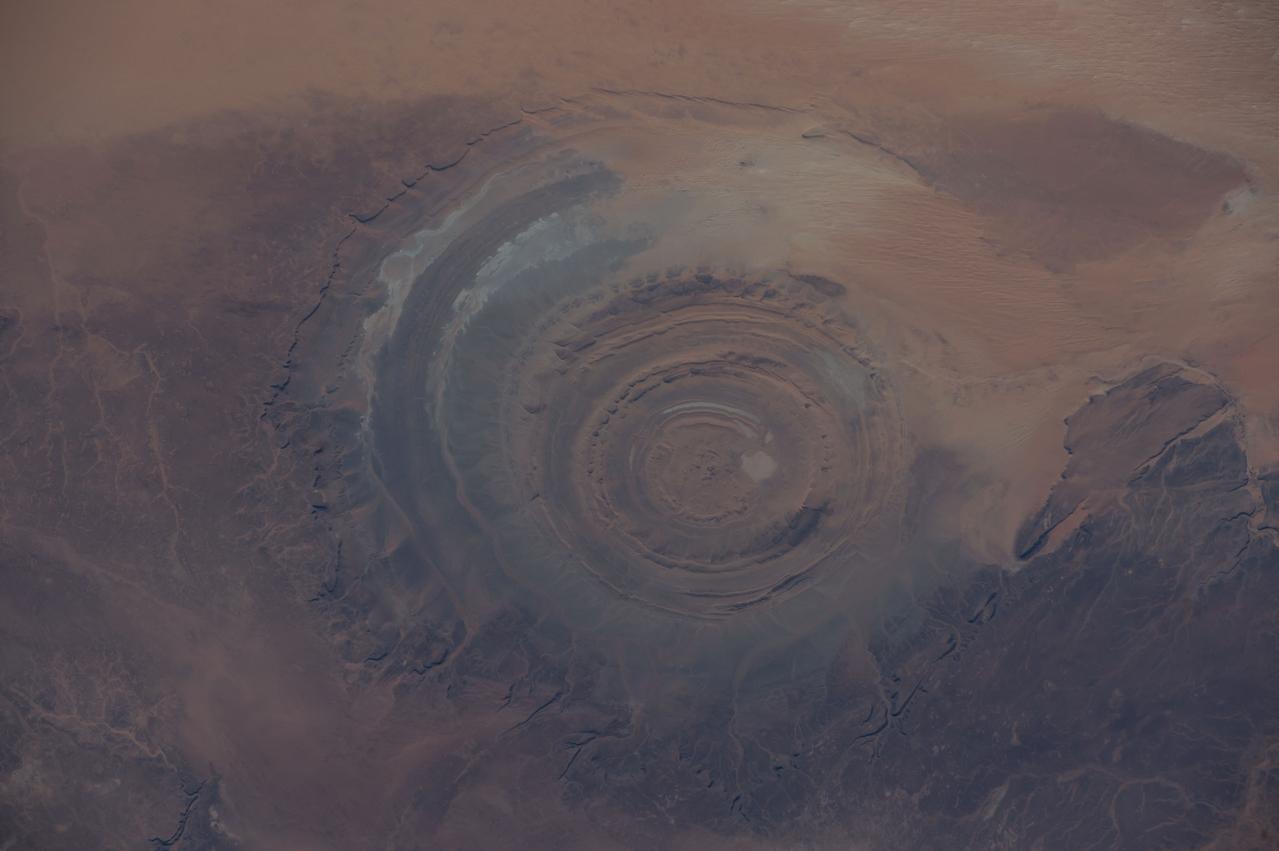
ISS042E007131 (11/22/2014) — Astronauts aboard the International Space Station captured this image of a huge crater in Africa on Nov. 22, 2014. This is the Richat Structure in northwestern Mauritania, otherwise known as the “Eye of the Sahara.” Scientists are still deciding whether this was formed by a subterranean volcano or impact from a large meteor. Deep in the Sahara Desert it is nearly a perfect circle, it is 1.2 miles (1.9 kilometers) wide, and sports a rim 330 feet (100 meters) tall. The crater sits in a vast plain of rocks so ancient they were deposited hundreds of millions of years before the first dinosaurs walked the Earth.
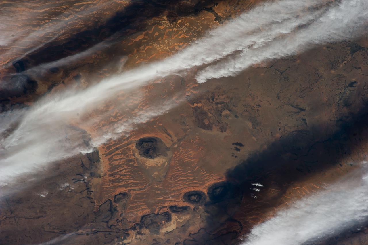
ISS038-E-026862 (8 Jan. 2014) --- The Western Sahara Desert is featured in this image photographed by an Expedition 38 crew member on the International Space Station. The infrequent cloud bands over southern Mauritania were photographed with an oblique look angle so that the dark cloud shadows are also a prominent part of the view. Beneath the cloud the Aouker plateau of dark sedimentary rocks appears as a ragged, near-vertical escarpment at top right. Isolated remnants of the plateau appear as dark mesas (flat-topped hills) across the top and near the center of the image. The escarpment is about 250 meters high, with a field of orange-colored dunes at the base (upper right). Prevailing winds in this part of the Sahara Desert blow from the northeast. The wavy dunes are aligned transverse to these winds. The sand that makes the dunes is blown in from a zone immediately upwind (just out of the bottom of the image) where dry river beds and dry lakes provide large quantities of mobile sand for the wind to transport. This pattern is typical in the western Sahara Desert, where plateau surfaces are mostly dune free and dune fields are located in the surrounding lowlands where the larger rivers deposit quantities of sandy sediment on the few occasions when they flow-sometimes only once in decades.
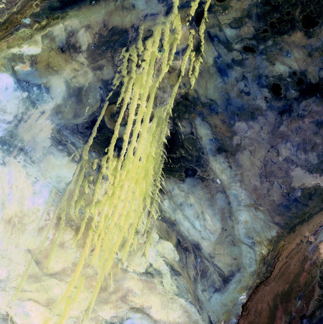
Algerian Abstract - April 8th, 1985 Description: What look like pale yellow paint streaks slashing through a mosaic of mottled colors are ridges of wind-blown sand that make up Erg Iguidi, an area of ever-shifting sand dunes extending from Algeria into Mauritania in northwestern Africa. Erg Iguidi is one of several Saharan ergs, or sand seas, where individual dunes often surpass 500 meters-nearly a third of a mile-in both width and height. Credit: USGS/NASA/Landsat 5 To learn more about the Landsat satellite go to: <a href="http://landsat.gsfc.nasa.gov/" rel="nofollow">landsat.gsfc.nasa.gov/</a> <b><a href="http://www.nasa.gov/centers/goddard/home/index.html" rel="nofollow">NASA Goddard Space Flight Center</a></b> enables NASA’s mission through four scientific endeavors: Earth Science, Heliophysics, Solar System Exploration, and Astrophysics. Goddard plays a leading role in NASA’s accomplishments by contributing compelling scientific knowledge to advance the Agency’s mission. <b>Follow us on <a href="http://twitter.com/NASA_GoddardPix" rel="nofollow">Twitter</a></b> <b>Join us on <a href="http://www.facebook.com/pages/Greenbelt-MD/NASA-Goddard/395013845897?ref=tsd" rel="nofollow">Facebook</a></b>
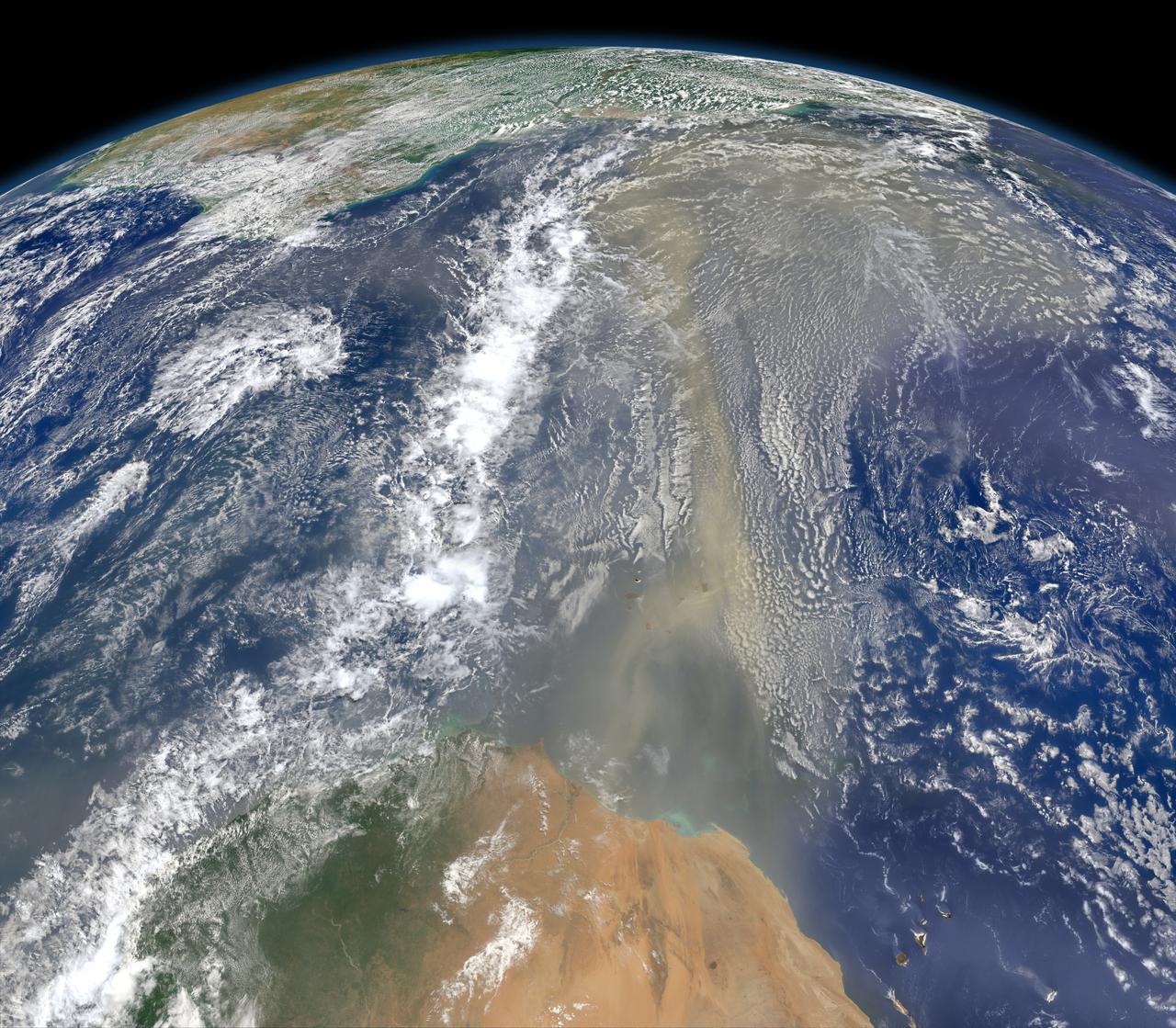
A piece of Africa—actually lots of them—began to arrive in the Americas in June 2014. On June 23, a lengthy river of dust from western Africa began to push across the Atlantic Ocean on easterly winds. A week later, the influx of dust was affecting air quality as far away as the southeastern United States. This composite image, made with data from the Visible Infrared Imaging Radiometer Suite (VIIRS) on Suomi NPP, shows dust heading west toward South America and the Gulf of Mexico on June 25, 2014. The dust flowed roughly parallel to a line of clouds in the intertropical convergence zone, an area near the equator where the trade winds come together and rain and clouds are common. In imagery captured by the Moderate Resolution Imaging Spectroradiometer (MODIS), the dust appeared to be streaming from Mauritania, Senegal, and Western Sahara, though some of it may have originated in countries farther to the east. Saharan dust has a range of impacts on ecosystems downwind. Each year, dust events like the one pictured here deliver about 40 million tons of dust from the Sahara to the Amazon River Basin. The minerals in the dust replenish nutrients in rainforest soils, which are continually depleted by drenching, tropical rains. Research focused on peat soils in the Everglades show that African dust has been arriving regularly in South Florida for thousands of years as well. In some instances, the impacts are harmful. Infusion of Saharan dust, for instance, can have a negative impact on air quality in the Americas. And scientists have linked African dust to outbreaks of certain types of toxic algal blooms in the Gulf of Mexico and southern Florida. Read more: <a href="http://1.usa.gov/1snkzmS" rel="nofollow">1.usa.gov/1snkzmS</a> NASA images by Norman Kuring, NASA’s Ocean Color web. Caption by Adam Voiland. Credit: <b><a href="http://www.earthobservatory.nasa.gov/" rel="nofollow"> NASA Earth Observatory</a></b> <b><a href="http://www.nasa.gov/audience/formedia/features/MP_Photo_Guidelines.html" rel="nofollow">NASA image use policy.</a></b> <b><a href="http://www.nasa.gov/centers/goddard/home/index.html" rel="nofollow">NASA Goddard Space Flight Center</a></b> enables NASA’s mission through four scientific endeavors: Earth Science, Heliophysics, Solar System Exploration, and Astrophysics. Goddard plays a leading role in NASA’s accomplishments by contributing compelling scientific knowledge to advance the Agency’s mission. <b>Follow us on <a href="http://twitter.com/NASAGoddardPix" rel="nofollow">Twitter</a></b> <b>Like us on <a href="http://www.facebook.com/pages/Greenbelt-MD/NASA-Goddard/395013845897?ref=tsd" rel="nofollow">Facebook</a></b> <b>Find us on <a href="http://instagram.com/nasagoddard?vm=grid" rel="nofollow">Instagram</a></b>