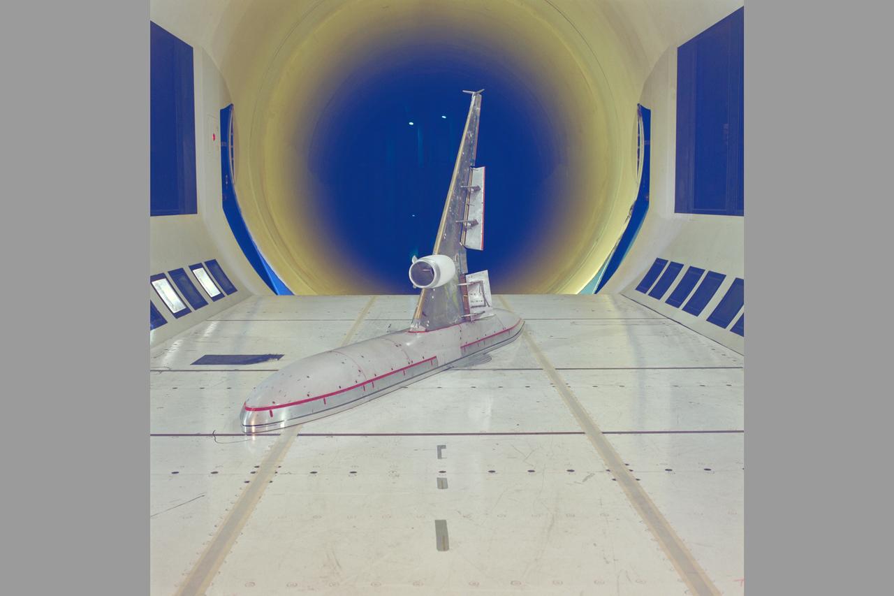
McDonnell-Douglas MD-11 Semi-span model test-12-0016 in 12ft WT
McDonnell-Douglas MD-11 Semi-span model test-12-0016 in 12ft WT

NASA research pilot Gordon Fullerton checked out how the PCA software worked in the multi-engine simulator at NASA Ames before fight-testing PCA in an MD-11.
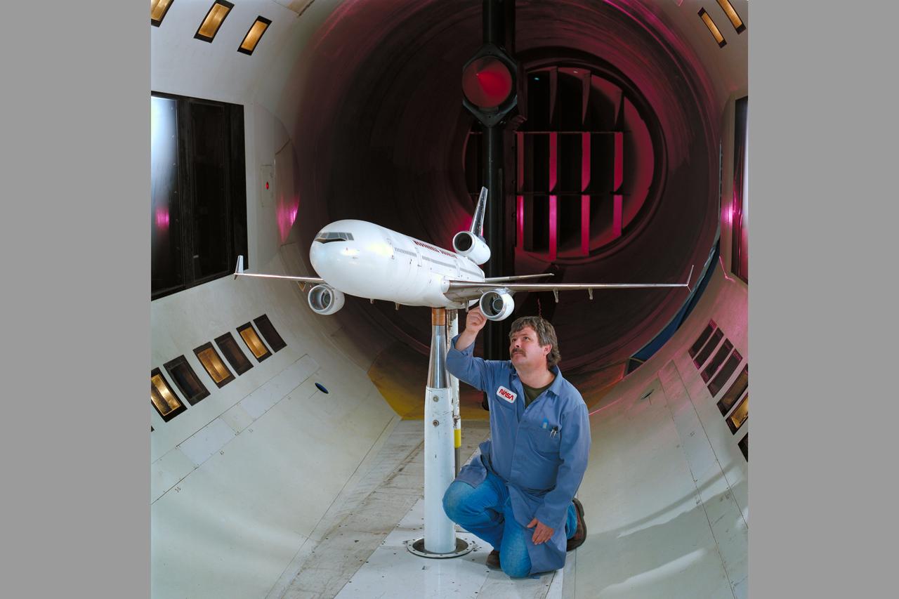
Mc Donnell Douglas MD-11 Model in Ames 12ft. W.T. (1st Non-NASA customer of the refurbished W.T.)
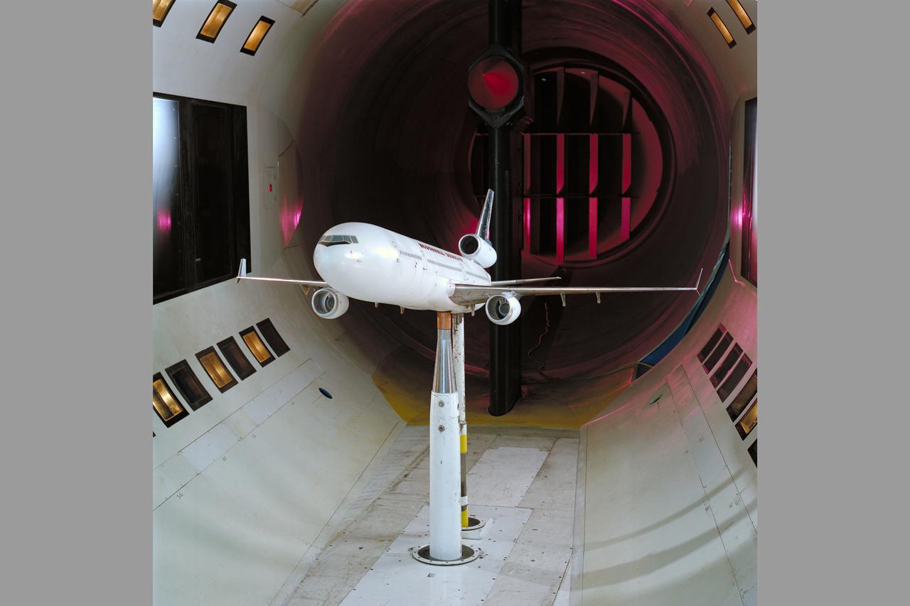
Mc Donnell Douglas MD-11 Model in Ames 12ft. W.T. (1st Non-NASA customer of the refurbished W.T.)

Mc Donnell Douglas MD-11 Model in Ames 12ft. W.T. (1st Non-NASA customer of the refurbished W.T.)
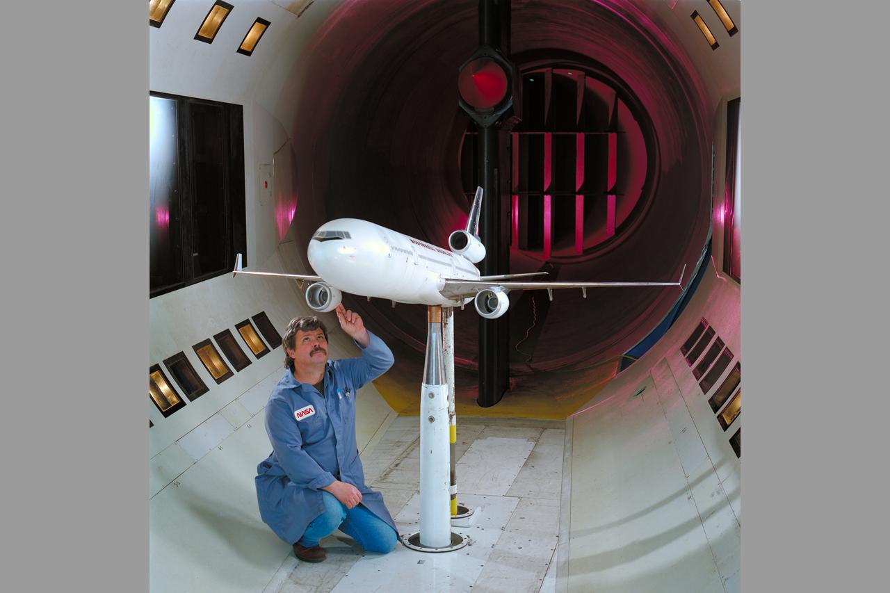
Mc Donnell Douglas MD-11 Model in Ames 12ft. W.T. (1st Non-NASA customer of the refurbished W.T.)

U.S. Rep. Donna Edwards, D-Md., addresses the audience at the 2011 NASA Future Forum, Thursday, Aug. 11, 2011, at the Riggs Alumni Center on the campus of the University of Maryland in College Park, Md. Photo Credit: (NASA/Paul E. Alers)

U.S. Rep. Donna Edwards, D-Md., addresses the audience at the 2011 NASA Future Forum, Thursday, Aug. 11, 2011, at the Riggs Alumni Center on the campus of the University of Maryland in College Park, Md. Photo Credit: (NASA/Paul E. Alers)
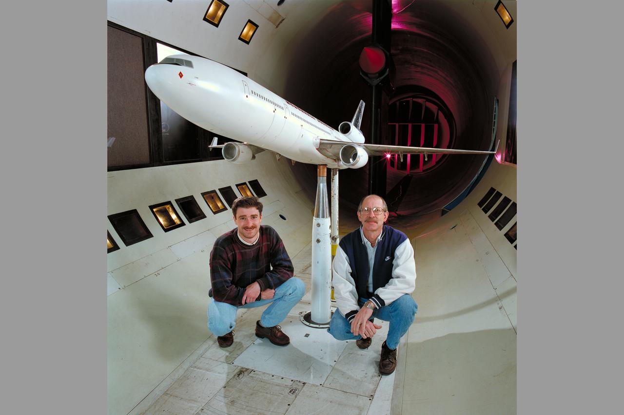
Mc Donnell Douglas MD-11 Model in Ames 12ft. W.T. with members of the MC Donnell Douglas crew (1st Non-NASA customer of the refurbished W.T.)

Mc Donnell Douglas MD-11 Model in Ames 12ft. W.T. with Ron Strong (1st Non-NASA customer of the refurbished W.T.)
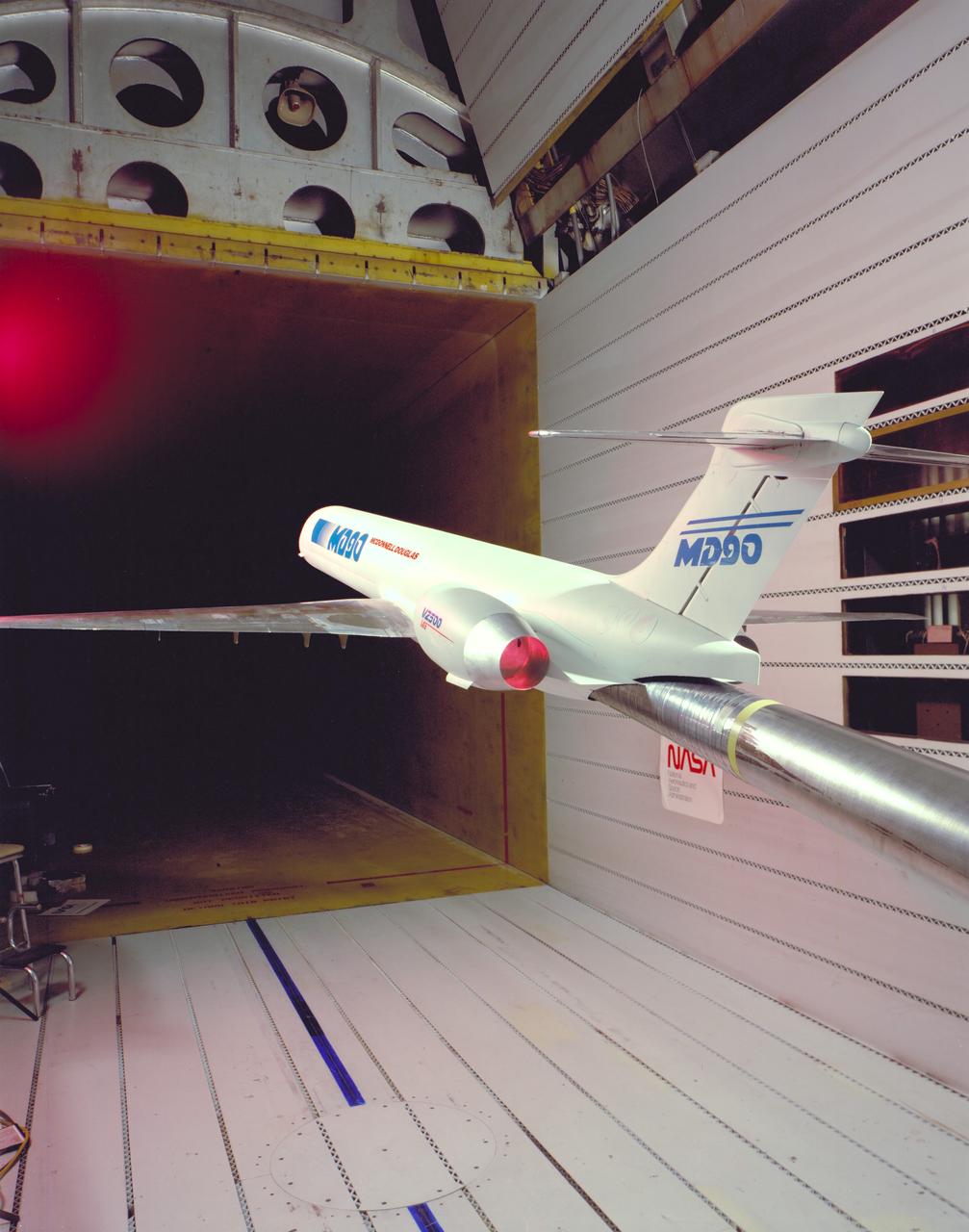
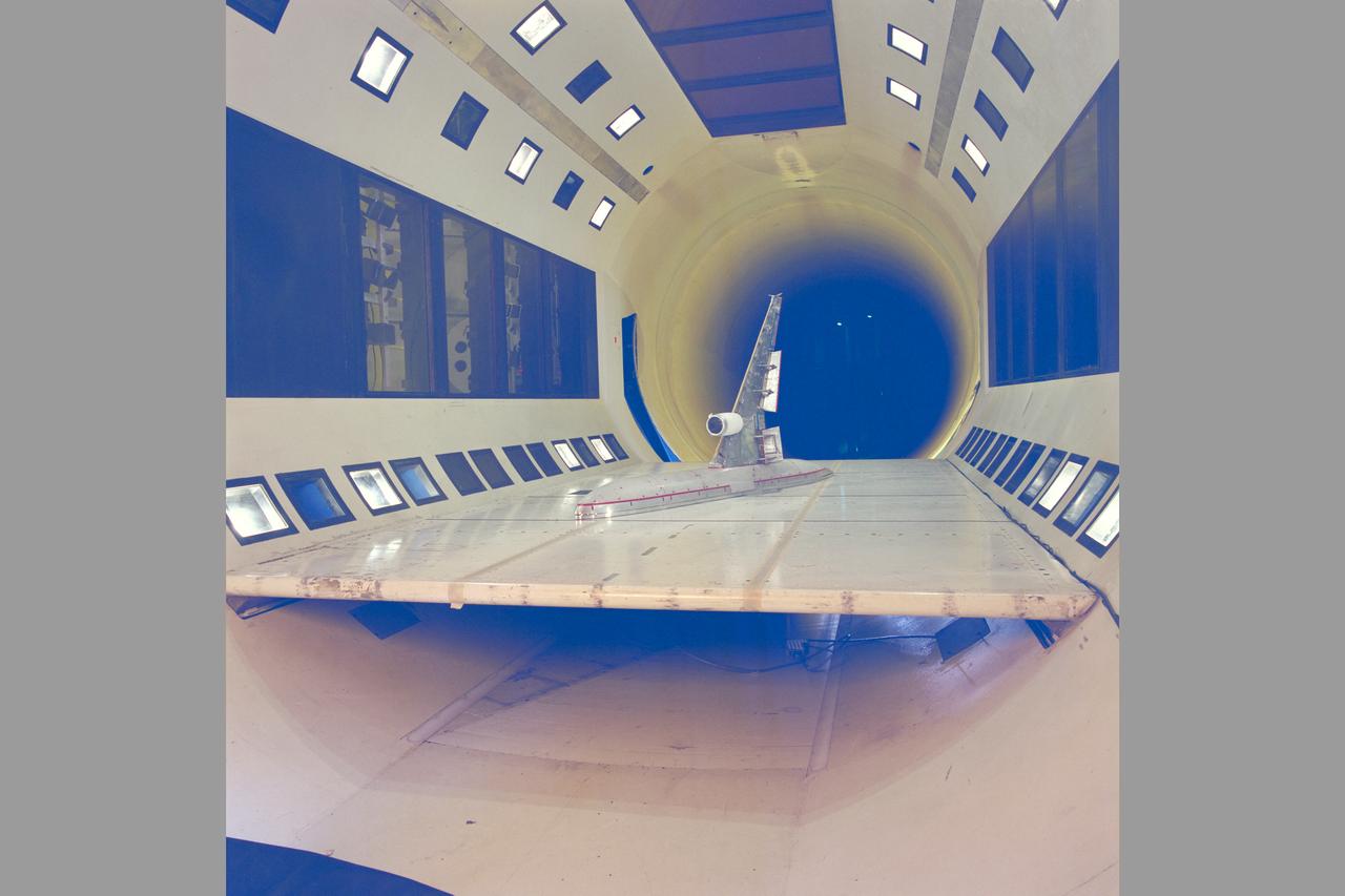
MD-90 Model in NASA Ames Research Center 11ft. Transonic Wind Tunnel part of the Unitary Plan Wind Tunnel Complex Test-091-1-11

A member of the audience asks a question to the technology and innovation panel at the 2011 NASA Future Forum, Thursday, Aug. 11, 2011, at the Riggs Alumni Center on the campus of the University of Maryland in College Park, Md. Photo Credit: (NASA/Paul E. Alers)
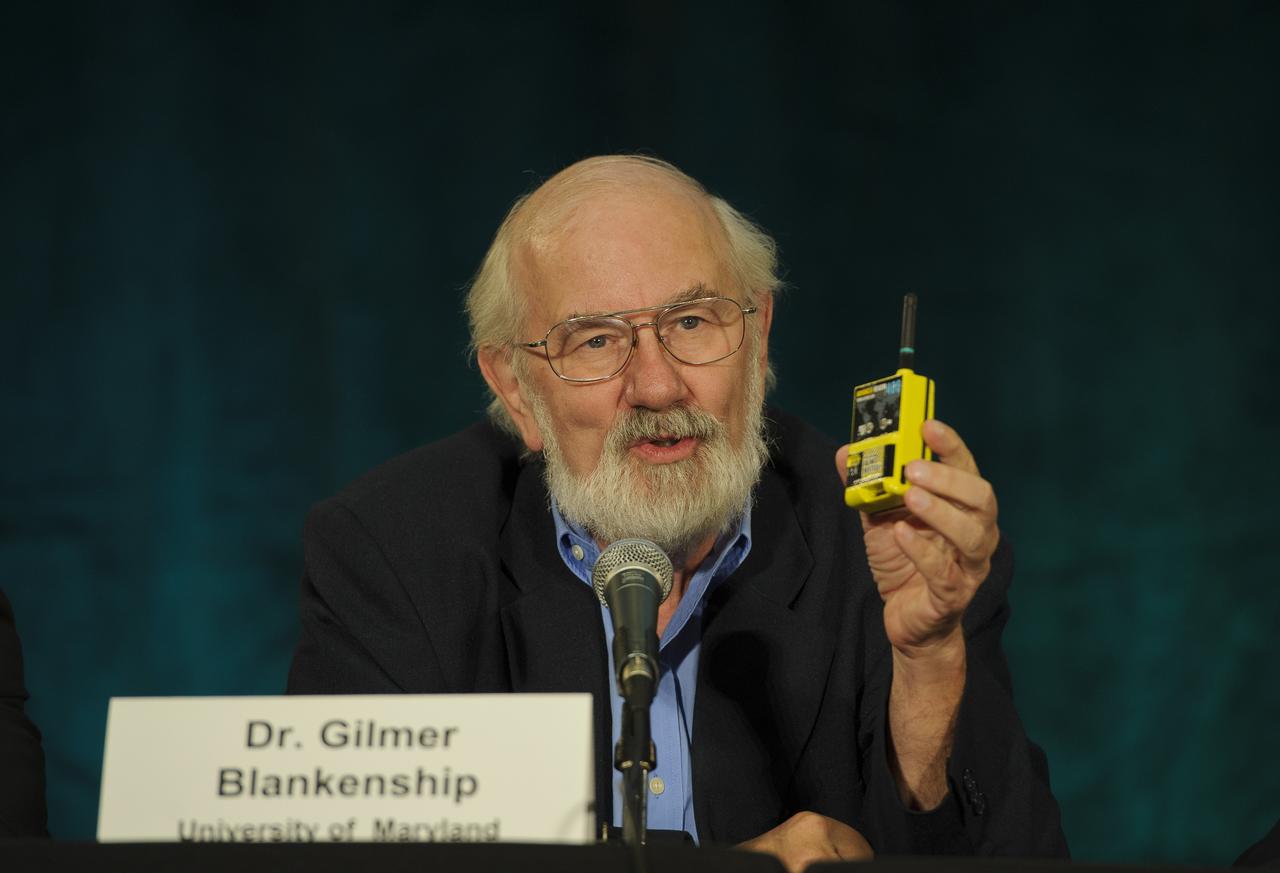
Dr. Gilmer Blankenship, of the University of Maryland, speaks about technology investments and their benefits during a panel discussion at the 2011 NASA Future Forum held at the Riggs Alumni Center on the campus of the University of Maryland, Thursday, Aug. 11, 2011, in College Park, Md. Photo Credit: (NASA/Paul E. Alers)

Leland Melvin, NASA Associate Administrator for Education, speaks during a panel discussion on inspiration in education at the 2011 NASA Future Forum held at the Riggs Alumni Center on the campus of the University of Maryland, Thursday, Aug. 11, 2011, in College Park, Md. Photo Credit: (NASA/Paul E. Alers)

Susan Bardenhagen, an educator from the Fairfax County Public Schools, speaks during a panel discussion on inspiration in education at the 2011 NASA Future Forum held at the Riggs Alumni Center on the campus of the University of Maryland, Thursday, Aug. 11, 2011, in College Park, Md. Photo Credit: (NASA/Paul E. Alers)

NASA Administrator Charles Bolden delivers opening remarks at the NASA Future Forum held at the Riggs Alumni Center on the campus of the University of Maryland, Thursday, Aug. 11, 2011 in College Park, Md. Photo Credit: (NASA/Paul E. Alers)

Dr. Henry Hertzfeld, from George Washington University, speaks about technology investments and their benefits during a panel discussion at the 2011 NASA Future Forum held at the Riggs Alumni Center on the campus of the University of Maryland, Thursday, Aug. 11, 2011, in College Park, Md. Photo Credit: (NASA/Paul E. Alers)
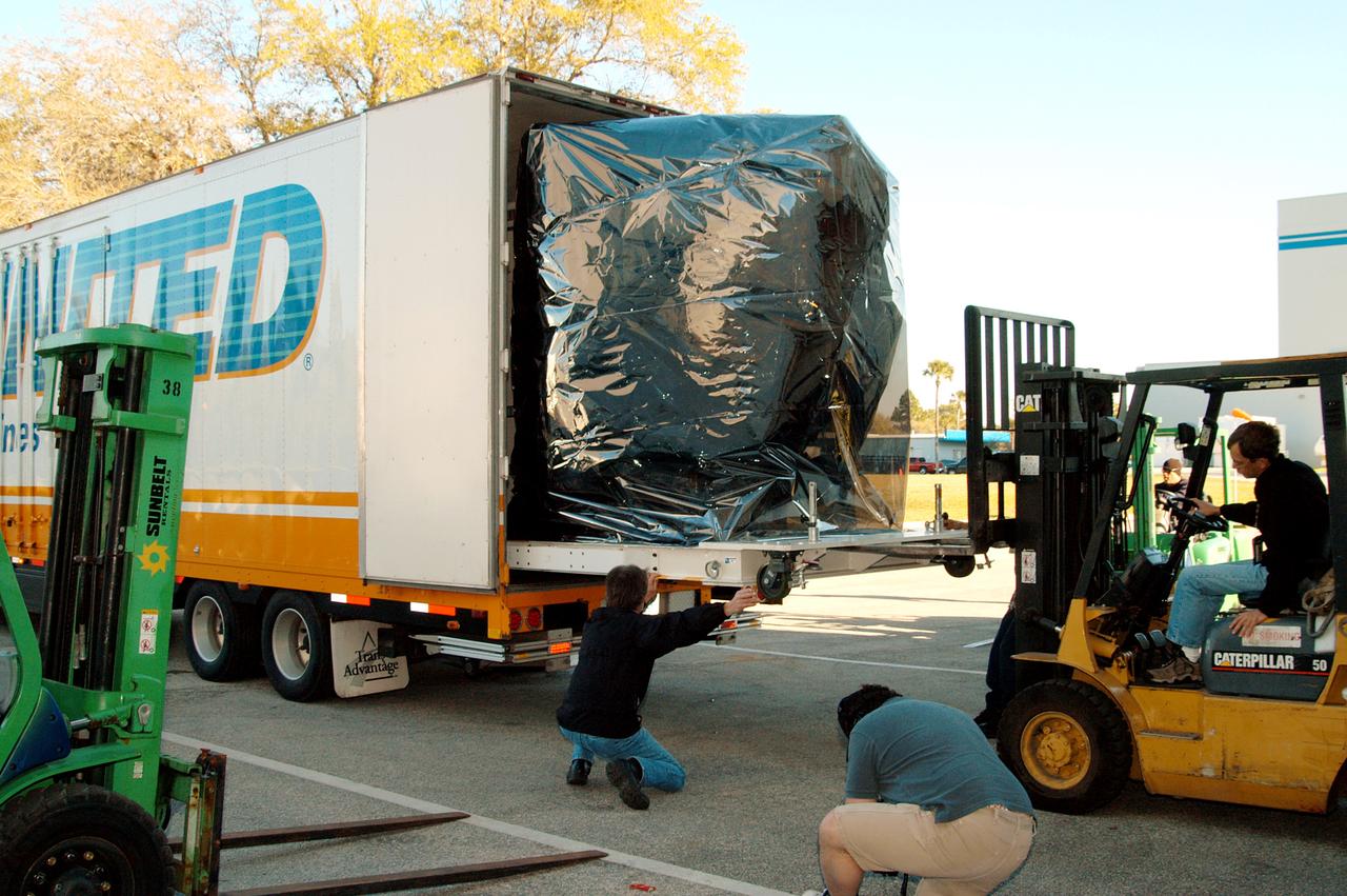
KENNEDY SPACE CENTER, FLA. - At the Astrotech Space Operations processing facilities near KSC, NASA’s MESSENGER spacecraft from NASA’s Goddard Space Flight Center in Greenbelt, Md., is offloaded. MESSENGER - short for MErcury Surface, Space ENvironment, GEochemistry and Ranging - will be taken into a high bay clean room and employees of the Johns Hopkins University Applied Physics Laboratory, builders of the spacecraft, will perform an initial state-of-health check. Then processing for launch can begin, including checkout of the power systems, communications systems and control systems. The thermal blankets will also be attached for flight. MESSENGER will be launched May 11 on a six-year mission aboard a Boeing Delta II rocket. Liftoff is targeted for 2:26 a.m. EDT on Tuesday, May 11.
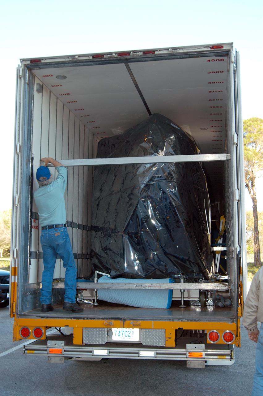
KENNEDY SPACE CENTER, FLA. - Doors are open on the air-conditioned transportation van that carried NASA’s MESSENGER spacecraft from NASA’s Goddard Space Flight Center in Greenbelt, Md., to the Astrotech Space Operations processing facilities near KSC. After offloading, MESSENGER - short for MErcury Surface, Space ENvironment, GEochemistry and Ranging - will be taken into a high bay clean room and employees of the Johns Hopkins University Applied Physics Laboratory, builders of the spacecraft, will perform an initial state-of-health check. Then processing for launch can begin, including checkout of the power systems, communications systems and control systems. The thermal blankets will also be attached for flight. MESSENGER will be launched May 11 on a six-year mission aboard a Boeing Delta II rocket. Liftoff is targeted for 2:26 a.m. EDT on Tuesday, May 11.
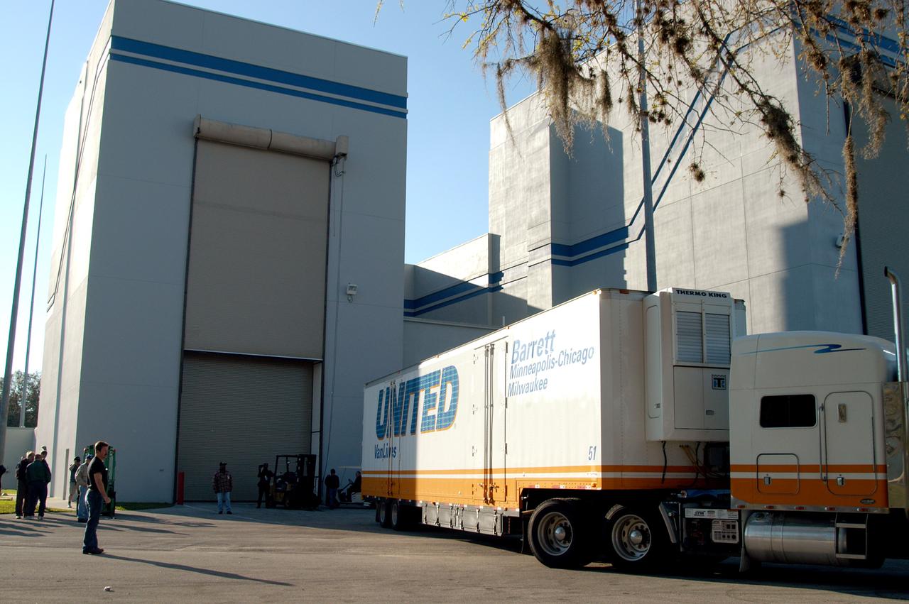
KENNEDY SPACE CENTER, FLA. - Shipped in an air-conditioned transportation van from NASA’s Goddard Space Flight Center in Greenbelt, Md., NASA’s MESSENGER spacecraft, the first Mercury orbiter, arrives at the Astrotech Space Operations processing facilities near KSC. MESSENGER - short for MErcury Surface, Space ENvironment, GEochemistry and Ranging - will be offloaded and taken into a high bay clean room. After the spacecraft is removed from its shipping container, employees of the Johns Hopkins University Applied Physics Laboratory, builders of the spacecraft, will perform an initial state-of-health check. Then processing for launch can begin, including checkout of the power systems, communications systems and control systems. The thermal blankets will also be attached for flight. MESSENGER will be launched May 11 on a six-year mission aboard a Boeing Delta II rocket. Liftoff is targeted for 2:26 a.m. EDT on Tuesday, May 11.
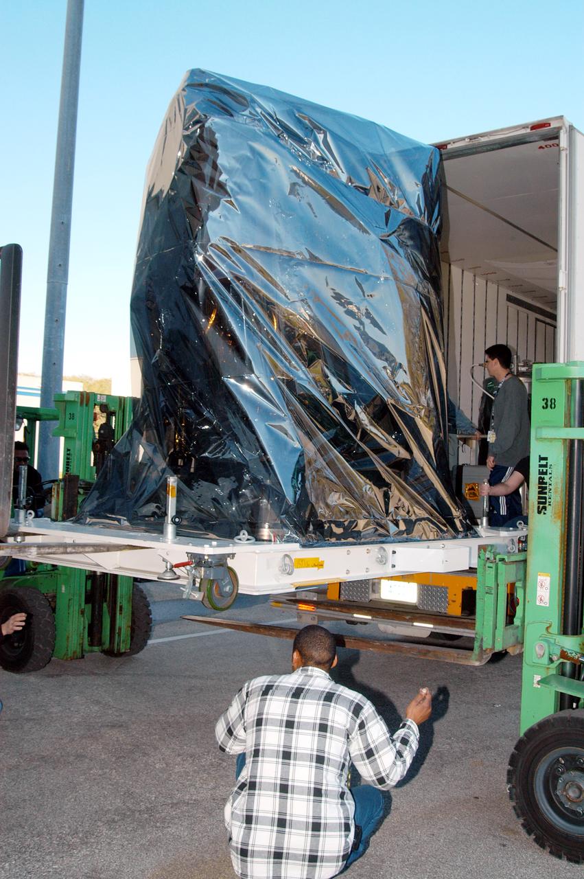
KENNEDY SPACE CENTER, FLA. - At the Astrotech Space Operations processing facilities near KSC, a lift helps offload NASA’s MESSENGER spacecraft shipped from NASA’s Goddard Space Flight Center in Greenbelt, Md. MESSENGER - short for MErcury Surface, Space ENvironment, GEochemistry and Ranging - will be taken into a high bay clean room and employees of the Johns Hopkins University Applied Physics Laboratory, builders of the spacecraft, will perform an initial state-of-health check. Then processing for launch can begin, including checkout of the power systems, communications systems and control systems. The thermal blankets will also be attached for flight. MESSENGER will be launched May 11 on a six-year mission aboard a Boeing Delta II rocket. Liftoff is targeted for 2:26 a.m. EDT on Tuesday, May 11.

A simple sketch on a TWA napkin by NASA Dryden engineer Frank W. "Bill" Burcham led to development and validation of the Propulsion-Controlled Aircraft concept.

Asher Gendelman, a director of technology at Zephyr Technology, holds up chest belt as he speaks about technology investments and their benefits during a panel discussion at the 2011 NASA Future Forum held at the Riggs Alumni Center on the campus of the University of Maryland, Thursday, Aug. 11, 2011, in College Park, Md. Photo Credit: (NASA/Paul E. Alers)

NASA Administrator Charles Bolden, left, speaks with U.S. Sens. Barbara Mikulski, D-Md., center, and Kay Bailey Hutchison, R-Texas, right, prior to his testimony in front of the Senate Appropriations Committee, Monday, April 11, 2011, at the Dirksen Senate Office Building on Capitol Hill in Washington. Photo Credit: (NASA/Paul E. Alers)

Dr. Robert Braun, NASA Chief Technologist, second from left, makes a point, as panelists Leland Melvin, Assoicate Administrator for NASA Education, left, Dr. Laurie Leshin, NASA Deputy Associate Administrator Exploration Systems Mission Directortorate, and Dr. Waleed Abdalati, NASA Chief Scientist, right, look on during a panel discussion at the NASA Future Forum held at the Riggs Alumni Center on the campus of the University of Maryland, Thursday, Aug. 11, 2011 in College Park, Md. Photo Credit: (NASA/Paul E. Alers)

Dr. Laurie Leshin, NASA Deputy Associate Administrator Exploration Systems Mission Directortorate, second from right, speaks as Dr. Waleed Abdalati, NASA Chief Scientist, right, Dr. Robert Braun, NASA Chief Technologist, and Leland Melvin, Assoicate Administrator for NASA Education, far left, at the NASA Future Forum held at the Riggs Alumni Center on the campus of the University of Maryland, Thursday, Aug. 11, 2011 in College Park, Md. Photo Credit: (NASA/Paul E. Alers)
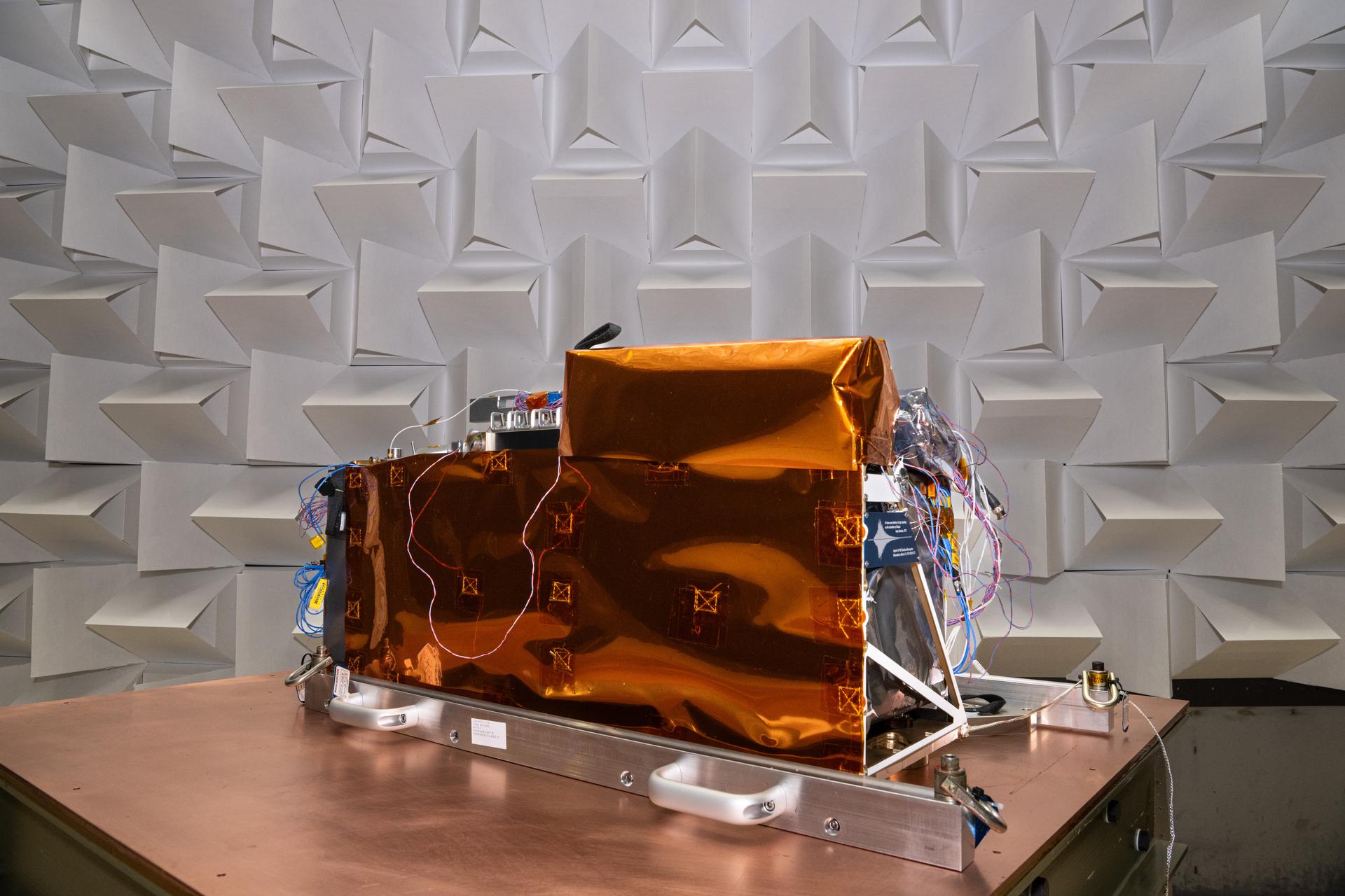
The Lunar Environment Monitoring Station (LEMS) in Electromagnetic Interference/Electromagnetic Compatibility (EMI/EMC) Chamber at Goddard Space Flight Center, Greenbelt Md., Feb 11, 2026. LEMS is a compact, autonomous, and self-sustaining seismometer suite designed to carry out continuous, long-term, monitoring of the lunar seismic environment at the South Polar region. Photo Credit: NASA/Denny Henry

U.S. Navy divers from EOD Mobile Unit 11, MDS Company 11-7 prepare their small boat for launch in the well deck of the USS John P. Murtha, during Underway Recovery Test-7 (URT-7) on Oct. 31, 2018. The Exploration Ground Systems recovery team and the U.S. Navy are using a test version of the Orion crew module, several rigid hull inflatable boats and support equipment to verify and validate processes, procedures, hardware and personnel during recovery of Orion in open waters. The test is one in a series of tests to verify and validate procedures and hardware that will be used to recover the Orion spacecraft after it splashes down in the Pacific Ocean following deep space exploration missions. Orion will have emergency abort capability, sustain the crew during space travel and provide safe re-entry from deep space return velocities.
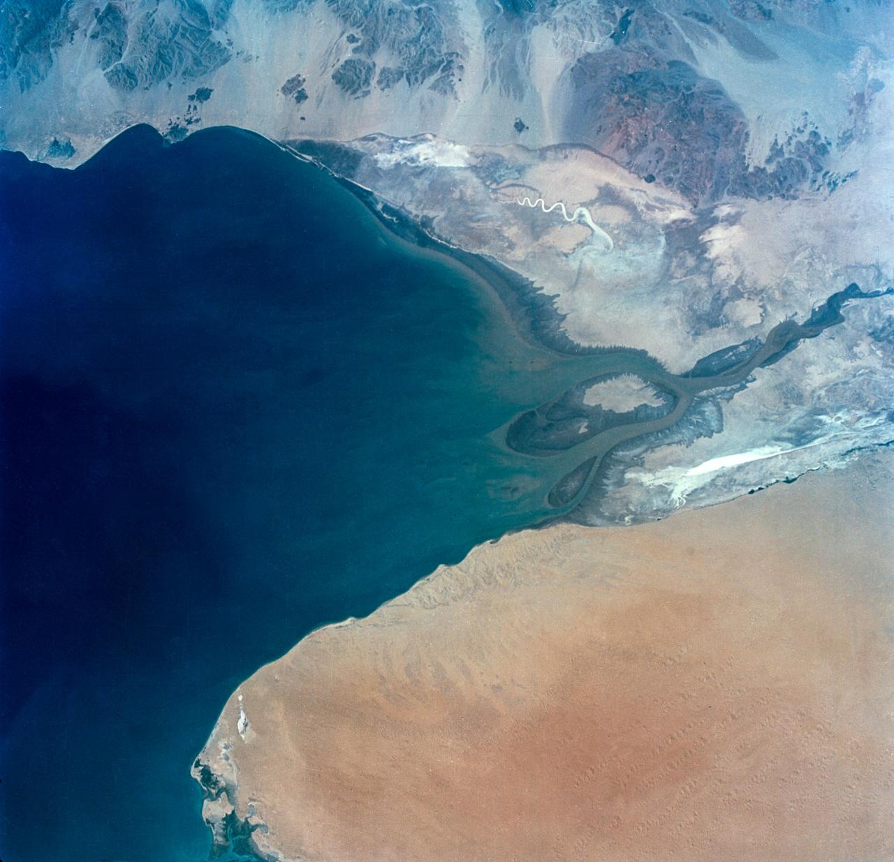
S65-34673 (3-7 June 1965) --- This photograph shows the north end of the Gulf of California at the mouth of the Colorado River as it was seen from the Gemini-4 spacecraft during orbital flight June 3-7, 1965. This picture was part of the Synoptic Terrain Photography experiments conducted during the flight to obtain high quality photographs of large land areas already mapped by aerial photography. In charge of these experiments was Dr. Paul D. Lowman Jr., NASA geologist from Goddard Space Flight Center, Greenbelt, Md. This picture was taken with a modified 70mm Hasselblad camera using Eastman color film, ASA 64 at a lens setting of 250th of a second at f/11.
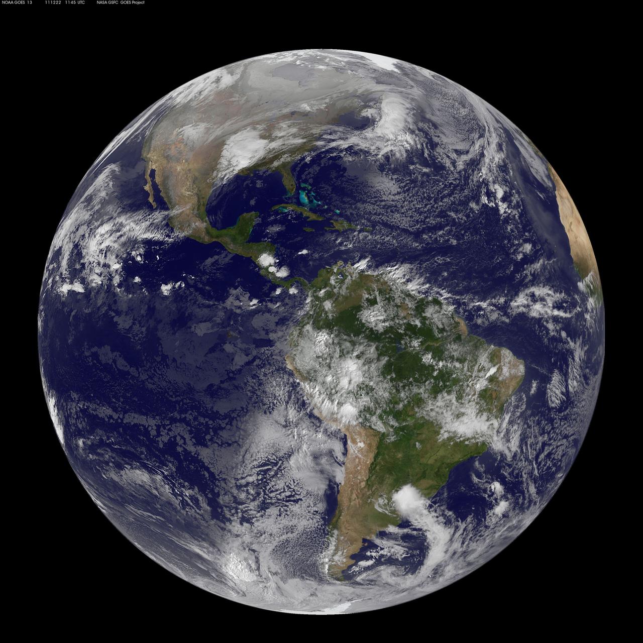
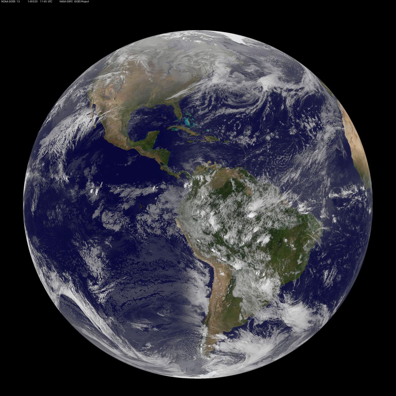
Image acquired December 22, 2011 NOAA's GOES-13 satellite captured this image of Earth on the first day of the winter solstice, December 22, 2011 at 11:45 UTC. The GOES-13 cloud images are overlaid on a true-color NASA/MODIS map by the NASA/NOAA GOES Project at NASA's Goddard Space Flight Center in Greenbelt, Md. <b><a href="http://goes.gsfc.nasa.gov/" rel="nofollow">Credit: NOAA/NASA GOES Project</a></b> <b><a href="http://www.nasa.gov/audience/formedia/features/MP_Photo_Guidelines.html" rel="nofollow">NASA image use policy.</a></b> <b><a href="http://www.nasa.gov/centers/goddard/home/index.html" rel="nofollow">NASA Goddard Space Flight Center</a></b> enables NASA’s mission through four scientific endeavors: Earth Science, Heliophysics, Solar System Exploration, and Astrophysics. Goddard plays a leading role in NASA’s accomplishments by contributing compelling scientific knowledge to advance the Agency’s mission. <b>Follow us on <a href="http://twitter.com/NASA_GoddardPix" rel="nofollow">Twitter</a></b> <b>Like us on <a href="http://www.facebook.com/pages/Greenbelt-MD/NASA-Goddard/395013845897?ref=tsd" rel="nofollow">Facebook</a></b> <b>Find us on <a href="http://instagrid.me/nasagoddard/?vm=grid" rel="nofollow">Instagram</a></b>
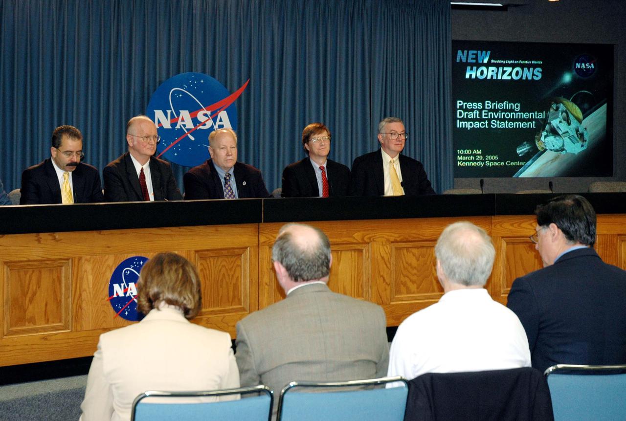
KENNEDY SPACE CENTER, FLA. - Representatives of NASA’s New Horizons Mission to Pluto discuss the mission during a press briefing on the Draft environmental Impact Statement at NASA’s Kennedy Space Center. From left are Orlando Figueroa, deputy association administrator for Programs, Science Mission Directorate; Earl Wahlquist, associate director for Space and Defense Power Systems, Department of Energy, in Germantown, Md.; Kurt Lindstrom, New Horizons Program executive, with NASA; Hal Weaver, New Horizons Project scientist, Johns Hopkins University Applied Physics Laboratory in Laurel, Md.; and Glen Fountain, New Horizons Project manager, also with Johns Hopkins University Applied Physics Laboratory. The spacecraft will explore Pluto, its moon Charon, and possibly one or more objects within the Kuiper Belt. New Horizons is planned for launch during a window from Jan. 11 to Feb. 14, 2006, on an Atlas V 551 booster with a Star 48B third stage. It will proceed to a Jupiter gravity assist between Feb. 25 and March 2, 2007, if launched during the first 23 days of the launch window. (If it is launched during the last 12 days of the launch window it will have a direct-to-Pluto trajectory. There is a backup launch opportunity in February 2007.)
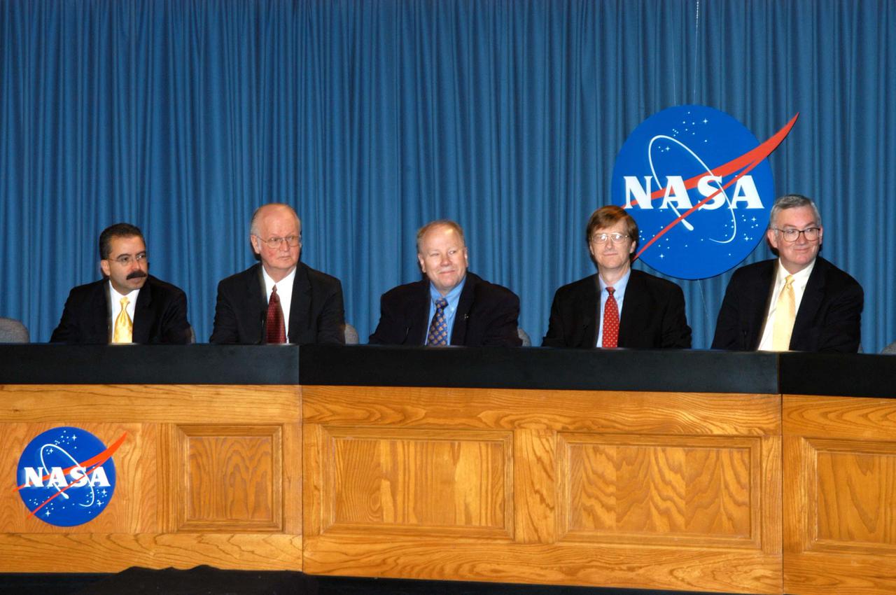
KENNEDY SPACE CENTER, FLA. - Representatives of NASA’s New Horizons Mission to Pluto are ready to answer questions during a press briefing on the Draft environmental Impact Statement at NASA’s Kennedy Space Center. From left are Orlando Figueroa, deputy association administrator for Programs, Science Mission Directorate; Earl Wahlquist, associate director for Space and Defense Power Systems, Department of Energy, in Germantown, Md.; Kurt Lindstrom, New Horizons Program executive, with NASA; Hal Weaver, New Horizons Project scientist, Johns Hopkins University Applied Physics Laboratory in Laurel, Md.; and Glen Fountain, New Horizons Project manager, also with Johns Hopkins University Applied Physics Laboratory. The spacecraft will explore Pluto, its moon Charon, and possibly one or more objects within the Kuiper Belt. New Horizons is planned for launch during a window from Jan. 11 to Feb. 14, 2006, on an Atlas V 551 booster with a Star 48B third stage. It will proceed to a Jupiter gravity assist between Feb. 25 and March 2, 2007, if launched during the first 23 days of the launch window. (If it is launched during the last 12 days of the launch window it will have a direct-to-Pluto trajectory. There is a backup launch opportunity in February 2007.)
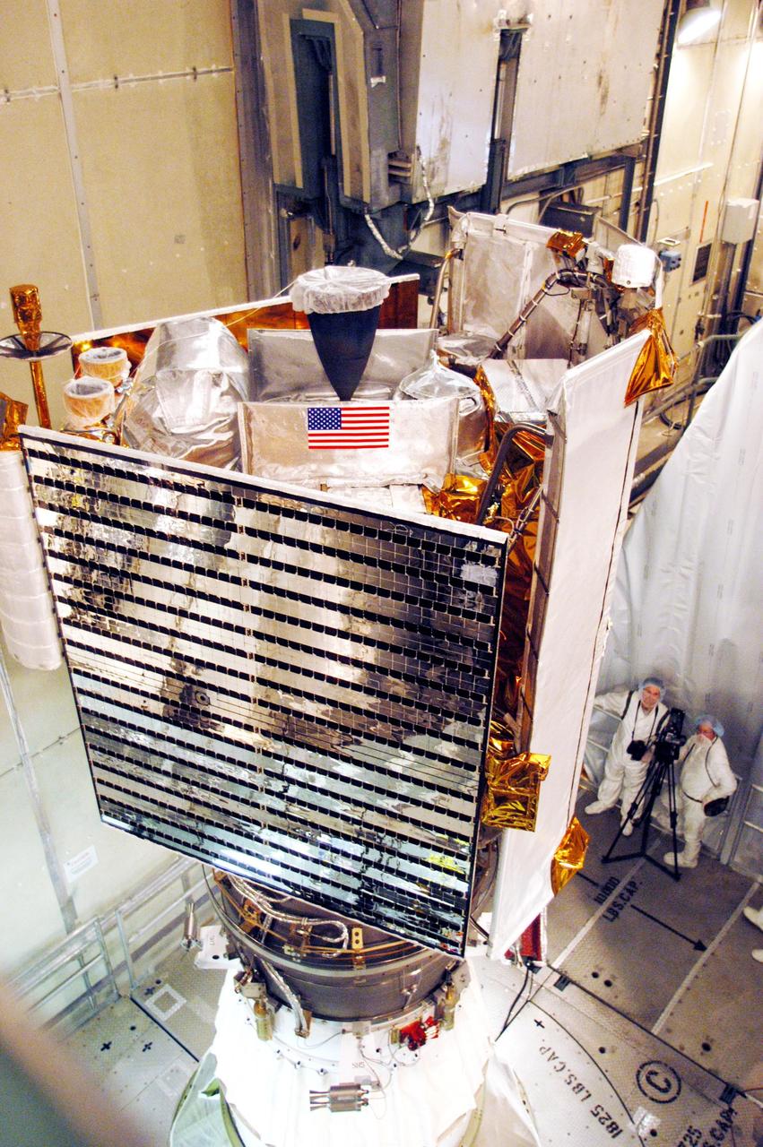
KENNEDY SPACE CENTER, FLA. - On Launch Pad 17-B at Cape Canaveral Air Force Station, the MESSENGER (Mercury Surface, Space Environment, Geochemistry and Ranging) spacecraft is ready for installation of the fairing, a molded structure that fits flush with the outside surface of the Delta II upper stage booster and forms an aerodynamically smooth joint, protecting the spacecraft during launch. Seen on the left is one of the solar panels on the spacecraft. On the right is part of the heat-resistant, ceramic-cloth sunshade that will protect the spacecraft’s instruments as MESSENGER orbits the Mercury where the surface reaches a high temperature near 840 degrees Fahrenheit and the solar intensity can be 11 times greater than on Earth. MESSENGER is scheduled to launch Aug. 2 aboard a Boeing Delta II rocket and is expected to enter Mercury orbit in March 2011. MESSENGER was built for NASA by the Johns Hopkins University Applied Physics Laboratory in Laurel, Md.

GOES 11 satellite image showing earth on March 26, 2010 8:00 AM EDT. <b><a href="http://goes.gsfc.nasa.gov/" rel="nofollow">Credit: NOAA/NASA GOES Project</a><b> <b><a href="http://www.nasa.gov/centers/goddard/home/index.html" rel="nofollow">NASA Goddard Space Flight Center</a></b> is home to the nation's largest organization of combined scientists, engineers and technologists that build spacecraft, instruments and new technology to study the Earth, the sun, our solar system, and the universe. <b>Follow us on <a href="http://twitter.com/NASA_GoddardPix" rel="nofollow">Twitter</a></b> <b>Join us on <a href="http://www.facebook.com/pages/Greenbelt-MD/NASA-Goddard/395013845897?ref=tsd" rel="nofollow">Facebook</a></b></b></b>
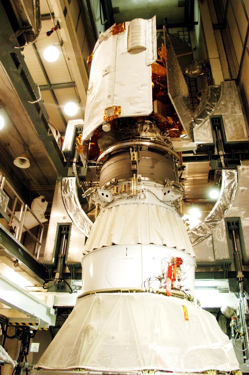
KENNEDY SPACE CENTER, FLA. - On Launch Pad 17-B at Cape Canaveral Air Force Station, the MESSENGER (Mercury Surface, Space Environment, Geochemistry and Ranging) spacecraft is seen atop the Delta II upper stage booster (middle) and the Delta II launch vehicle below. The spacecraft is ready for installation of the fairing, a molded structure that fits flush with the outside surface of the upper stage booster and forms an aerodynamically smooth joint, protecting the spacecraft during launch. Seen on the right is one of the solar panels on the spacecraft. On the left is the heat-resistant, ceramic-cloth sunshade that will protect the spacecraft’s instruments as MESSENGER orbits the Mercury where the surface reaches a high temperature near 840 degrees Fahrenheit and the solar intensity can be 11 times greater than on Earth. MESSENGER is scheduled to launch Aug. 2 and is expected to enter Mercury orbit in March 2011. MESSENGER was built for NASA by the Johns Hopkins University Applied Physics Laboratory in Laurel, Md.

VANDENBERG AIR FORCE BASE, Calif. -- Media attending a post-launch news conference at Vandenberg Air Force Base, Calif. heard from Ken Schwer, LDCM project manager Goddard Space Flight Center, Greenbelt, Md. The Landsat Data Continuity Mission LDCM is the future of Landsat satellites. It will continue to obtain valuable data and imagery to be used in agriculture, education, business, science, and government. The Landsat Program provides repetitive acquisition of high resolution multispectral data of the Earth's surface on a global basis. The data from the Landsat spacecraft constitute the longest record of the Earth's continental surfaces as seen from space. It is a record unmatched in quality, detail, coverage, and value. Liftoff took place at 10:02 a.m. PST 1:02 P.M. EST) on Feb. 11, 2013 aboard a United Launch Alliance Atlas V rocket. For more information, visit: http:__www.nasa.gov_mission_pages_landsat_main_index.html Photo credit: NASA_Kim Shiflett
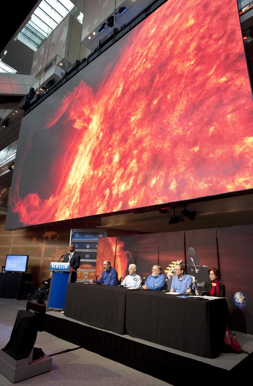
Scientists involved in NASA's Solar Dynamics Observatory (SDO) mission attend a press conference to discuss recent images captured by the SDO spacecraft Wednesday, April 21, 2010, at the Newseum in Washington. On Feb. 11, 2010, NASA launched the SDO spacecraft, which is the most advanced spacecraft ever designed to study the sun. Seated left to right are: Dean Pesnell, SDO project scientist, Goddard Space Flight Center in Greenbelt, Md.; Alan Title, principal investigator, Atmospheric Imaging Assembly instrument, Lockheed Martin Solar and Astrophysics Laboratory in Palo Alto; Philip H. Scherrer, principal investigator, Helioseismic and Magnetic Imager instrument, Stanford University in Palo Alto; Tom Woods, principal investigator, Extreme Ultraviolet Variability Experiment Instrument, Laboratory for Atmospheric and Space Physics, University of Colorado in Boulder and Madhulika Guhathakurta, SDO program scientist, NASA Headquarters in Washington. Photo Credit: (NASA/Carla Cioffi)
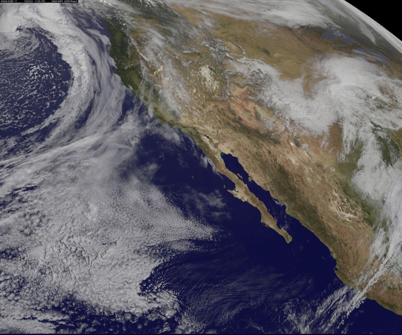
NASA GOES-11 satellite image showing the US west coast on March 24, 2010 1:45 PM EDT. <b><a href="http://goes.gsfc.nasa.gov/" rel="nofollow">Credit: NOAA/NASA GOES Project</a><b> <b><a href="http://www.nasa.gov/centers/goddard/home/index.html" rel="nofollow">NASA Goddard Space Flight Center</a></b> is home to the nation's largest organization of combined scientists, engineers and technologists that build spacecraft, instruments and new technology to study the Earth, the sun, our solar system, and the universe. <b>Follow us on <a href="http://twitter.com/NASA_GoddardPix" rel="nofollow">Twitter</a></b> <b>Join us on <a href="http://www.facebook.com/pages/Greenbelt-MD/NASA-Goddard/395013845897?ref=tsd" rel="nofollow">Facebook</a></b></b></b>
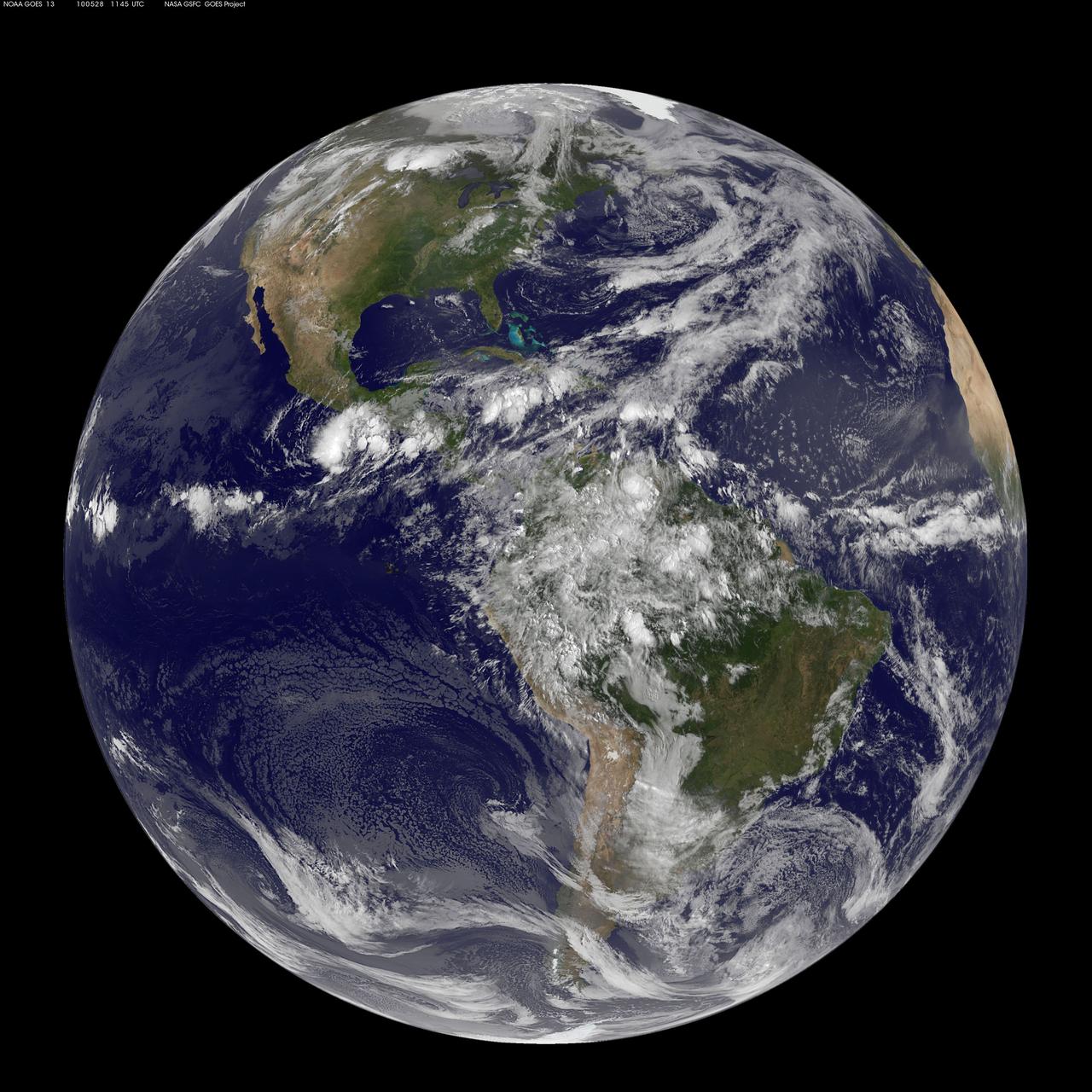
NASA GOES 13 satellite image showing earth on May 28, 2010 11:45 UTC. <b><a href="http://goes.gsfc.nasa.gov/" rel="nofollow">Credit: NOAA/NASA GOES Project</a><b> <b><a href="http://www.nasa.gov/centers/goddard/home/index.html" rel="nofollow">NASA Goddard Space Flight Center</a></b> is home to the nation's largest organization of combined scientists, engineers and technologists that build spacecraft, instruments and new technology to study the Earth, the sun, our solar system, and the universe. <b>Follow us on <a href="http://twitter.com/NASA_GoddardPix" rel="nofollow">Twitter</a></b> <b>Join us on <a href="http://www.facebook.com/pages/Greenbelt-MD/NASA-Goddard/395013845897?ref=tsd" rel="nofollow">Facebook</a></b></b></b>
The Fall 2011 eclipse season started on September 11, 2011. Here is an AIA 304 image from 0658 UT. SDO has eclipse seasons twice a year near each equinox. For three weeks near midnight Las Cruces time (about 0700 UT) our orbit has the Earth pass between SDO and the Sun. These eclipses can last up to 72 minutes in the middle of an eclipse season. The current eclipse season started on September 11 and lasts until October 4. To read more about SDO go to: <a href="http://sdo.gsfc.nasa.gov/" rel="nofollow">sdo.gsfc.nasa.gov/</a> Credit: NASA/GSFC/SDO <b><a href="http://www.nasa.gov/centers/goddard/home/index.html" rel="nofollow">NASA Goddard Space Flight Center</a></b> enables NASA’s mission through four scientific endeavors: Earth Science, Heliophysics, Solar System Exploration, and Astrophysics. Goddard plays a leading role in NASA’s accomplishments by contributing compelling scientific knowledge to advance the Agency’s mission. <b>Follow us on <a href="http://twitter.com/NASA_GoddardPix" rel="nofollow">Twitter</a></b> <b>Like us on <a href="http://www.facebook.com/pages/Greenbelt-MD/NASA-Goddard/395013845897?ref=tsd" rel="nofollow">Facebook</a></b> <b>Find us on <a href="http://instagrid.me/nasagoddard/?vm=grid" rel="nofollow">Instagram</a></b>

NASA image release April 14, 2011 NASA engineer Ernie Wright looks on as the first six flight ready James Webb Space Telescope's primary mirror segments are prepped to begin final cryogenic testing at NASA's Marshall Space Flight Center in Huntsville, Ala. Credit: NASA/MSFC/David Higginbotham To read more go to: <a href="http://www.nasa.gov/centers/marshall/news/jwst/11-111.html" rel="nofollow">www.nasa.gov/centers/marshall/news/jwst/11-111.html</a> <b><a href="http://www.nasa.gov/centers/goddard/home/index.html" rel="nofollow">NASA Goddard Space Flight Center</a></b> enables NASA’s mission through four scientific endeavors: Earth Science, Heliophysics, Solar System Exploration, and Astrophysics. Goddard plays a leading role in NASA’s accomplishments by contributing compelling scientific knowledge to advance the Agency’s mission. <b>Follow us on <a href="http://twitter.com/NASA_GoddardPix" rel="nofollow">Twitter</a></b> <b>Join us on <a href="http://www.facebook.com/pages/Greenbelt-MD/NASA-Goddard/395013845897?ref=tsd" rel="nofollow">Facebook</a></b>

The Fall 2011 eclipse season started on September 11. Here is an AIA 171 image from 0657 UT with the first eclipse! SDO has eclipse seasons twice a year near each equinox. For three weeks near midnight Las Cruces time (about 0700 UT) our orbit has the Earth pass between SDO and the Sun. These eclipses can last up to 72 minutes in the middle of an eclipse season. The current eclipse season started on September 11 and lasts until October 4. To read more about SDO go to: <a href="http://sdo.gsfc.nasa.gov/" rel="nofollow">sdo.gsfc.nasa.gov/</a> Credit: NASA/GSFC/SDO <b><a href="http://www.nasa.gov/centers/goddard/home/index.html" rel="nofollow">NASA Goddard Space Flight Center</a></b> enables NASA’s mission through four scientific endeavors: Earth Science, Heliophysics, Solar System Exploration, and Astrophysics. Goddard plays a leading role in NASA’s accomplishments by contributing compelling scientific knowledge to advance the Agency’s mission. <b>Follow us on <a href="http://twitter.com/NASA_GoddardPix" rel="nofollow">Twitter</a></b> <b>Like us on <a href="http://www.facebook.com/pages/Greenbelt-MD/NASA-Goddard/395013845897?ref=tsd" rel="nofollow">Facebook</a></b> <b>Find us on <a href="http://instagrid.me/nasagoddard/?vm=grid" rel="nofollow">Instagram</a></b>
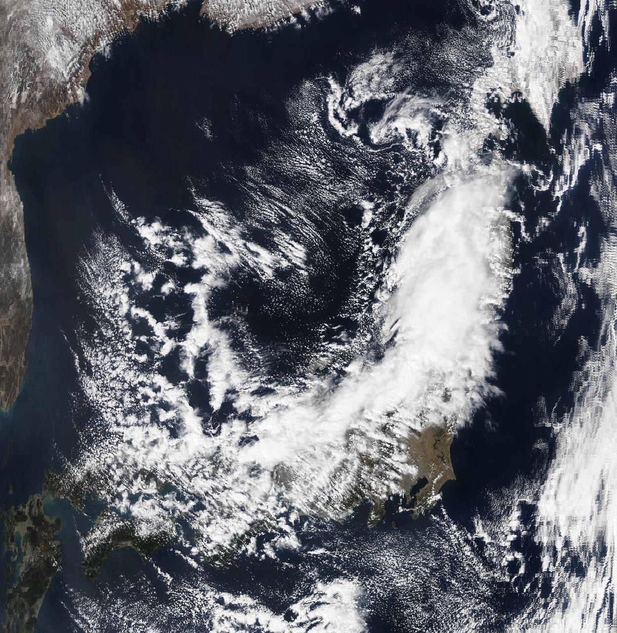
NASA's Aqua satellite passed over Japan one hour and 41 minutes before the quake hit. At the time Aqua passed overhead, the Moderate Resolution Imaging Spectroradiometer (MODIS) instrument captured a visible of Japan covered by clouds. The image was taken at 0405 UTC on March 11 (1:05 p.m. local time Japan /11:05 p.m. EST March 10). The quake hit at 2:46 p.m. local time/Japan. Satellite: Aqua Credit: NASA/GSFC/Aqua <b><a href="http://www.nasa.gov/centers/goddard/home/index.html" rel="nofollow">NASA Goddard Space Flight Center</a></b> enables NASA’s mission through four scientific endeavors: Earth Science, Heliophysics, Solar System Exploration, and Astrophysics. Goddard plays a leading role in NASA’s accomplishments by contributing compelling scientific knowledge to advance the Agency’s mission. <b>Follow us on <a href="http://twitter.com/NASA_GoddardPix" rel="nofollow">Twitter</a></b> <b>Join us on <a href="http://www.facebook.com/pages/Greenbelt-MD/NASA-Goddard/395013845897?ref=tsd" rel="nofollow">Facebook</a></b>
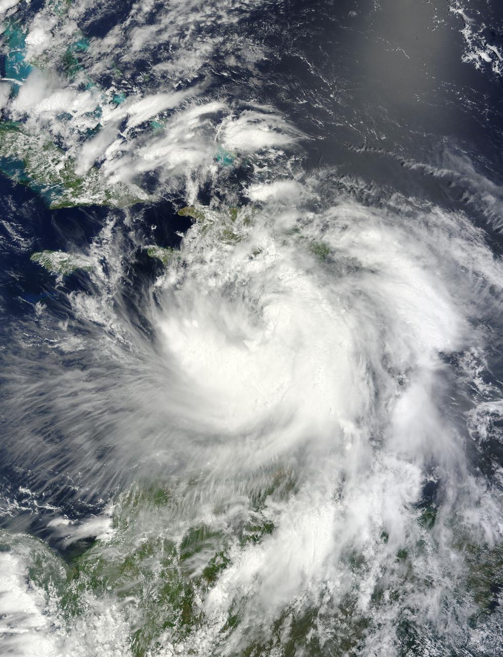
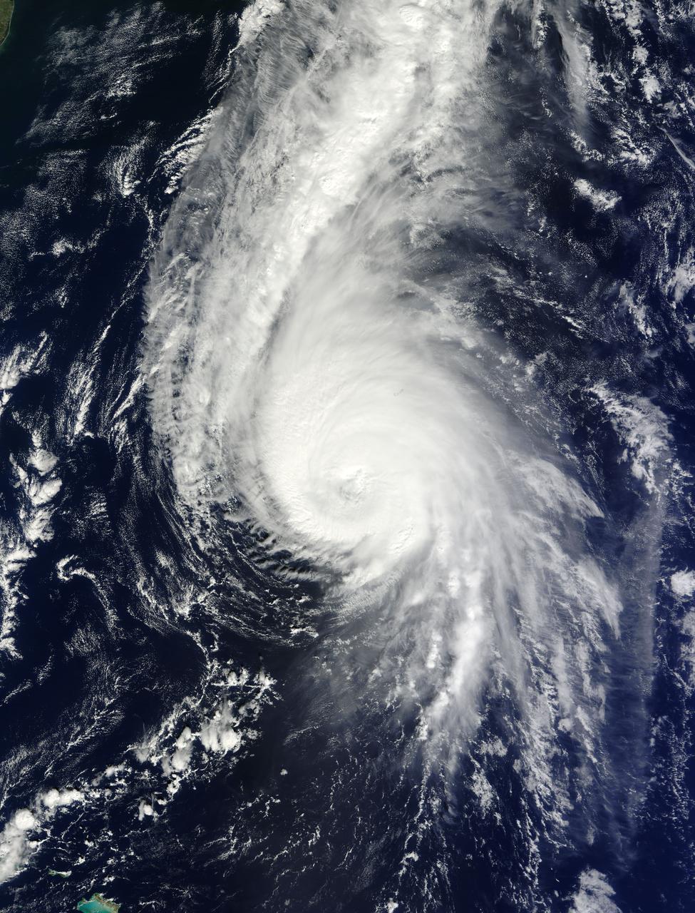
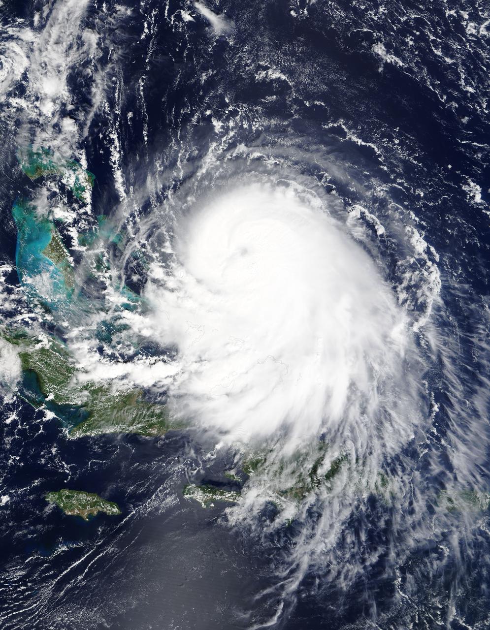
NASA's Terra satellite passed over Tropical Storm Isaac on Aug. 24 at 15:20 UTC (11:20 a.m. EDT) as it continued moving through the eastern Caribbean Sea. The MODIS instrument onboard Aqua captured this visible image. At 2 p.m. EDT on Aug. 24, Isaac's maximum sustained winds were near 60 mph (95 kmh). The National Hurricane Center noted that Isaac could strengthen later before reaching the coast of Hispaniola tonight, Aug. 24. Hispaniola is an island that contains the Dominican Republic and Haiti. Isaac is located about 135 miles (215 km) south-southeast of Port au Prince, Haiti, near latitude 16.8 north and longitude 71.4 west. Isaac is now moving toward the northwest near 14 mph (22 kmh). Isaac is expected to reach hurricane status over the weekend of Aug. 25-26 and NASA satellites will continue providing valuable temperature, rainfall, visible and infrared data. Text Credit: Rob Gutro NASA's Goddard Space Flight Center, Greenbelt, Md. <b>To read more go to: <a href="http://www.nasa.gov/mission_pages/hurricanes/archives/2012/h2012_Isaac.html" rel="nofollow">www.nasa.gov/mission_pages/hurricanes/archives/2012/h2012...</a></b> Credit: NASA Goddard MODIS Rapid Response Team <b><a href="http://www.nasa.gov/audience/formedia/features/MP_Photo_Guidelines.html" rel="nofollow">NASA image use policy.</a></b> <b><a href="http://www.nasa.gov/centers/goddard/home/index.html" rel="nofollow">NASA Goddard Space Flight Center</a></b> enables NASA’s mission through four scientific endeavors: Earth Science, Heliophysics, Solar System Exploration, and Astrophysics. Goddard plays a leading role in NASA’s accomplishments by contributing compelling scientific knowledge to advance the Agency’s mission. <b>Follow us on <a href="http://twitter.com/NASA_GoddardPix" rel="nofollow">Twitter</a></b> <b>Like us on <a href="http://www.facebook.com/pages/Greenbelt-MD/NASA-Goddard/395013845897?ref=tsd" rel="nofollow">Facebook</a></b> <b>Find us on <a href="http://instagrid.me/nasagoddard/?vm=grid" rel="nofollow">Instagram</a></b>
This NOAA GOES-west satellite image shows high pressure over the 4 corners region (Utah, Colorado, northern Arizona and northwestern New Mexico), and the National Weather Service has forecast snow north of the high in the Wasatch range and adjacent valleys. Toward the top of the GOES image, there's a strong Pacific storm moving onshore that NWS expects will bring high winds, heavy rains, and feet of snow to the northwestern U.S. There's a flood watch in effect for portions of western Washington State through Saturday night (January 11), that includes the counties of King, Mason, Pierce, and Snohomish. That storm will bring more snow to the Wasatch range that's getting snow today. Meanwhile, on the far right side of the image, there's a surface low pressure area moving through the Central Plains and middle Mississippi Valley today, Jan. 10, 2014. The image was created by the NASA-NOAA GOES Project at NASA's Goddard Space Flight Center, Greenbelt, Md. <b><a href="http://goes.gsfc.nasa.gov/" rel="nofollow">Credit: NOAA/NASA GOES Project</a></b> <b><a href="http://www.nasa.gov/audience/formedia/features/MP_Photo_Guidelines.html" rel="nofollow">NASA image use policy.</a></b> <b><a href="http://www.nasa.gov/centers/goddard/home/index.html" rel="nofollow">NASA Goddard Space Flight Center</a></b> enables NASA’s mission through four scientific endeavors: Earth Science, Heliophysics, Solar System Exploration, and Astrophysics. Goddard plays a leading role in NASA’s accomplishments by contributing compelling scientific knowledge to advance the Agency’s mission. <b>Follow us on <a href="http://twitter.com/NASA_GoddardPix" rel="nofollow">Twitter</a></b> <b>Like us on <a href="http://www.facebook.com/pages/Greenbelt-MD/NASA-Goddard/395013845897?ref=tsd" rel="nofollow">Facebook</a></b> <b>Find us on <a href="http://instagram.com/nasagoddard?vm=grid" rel="nofollow">Instagram</a></b>
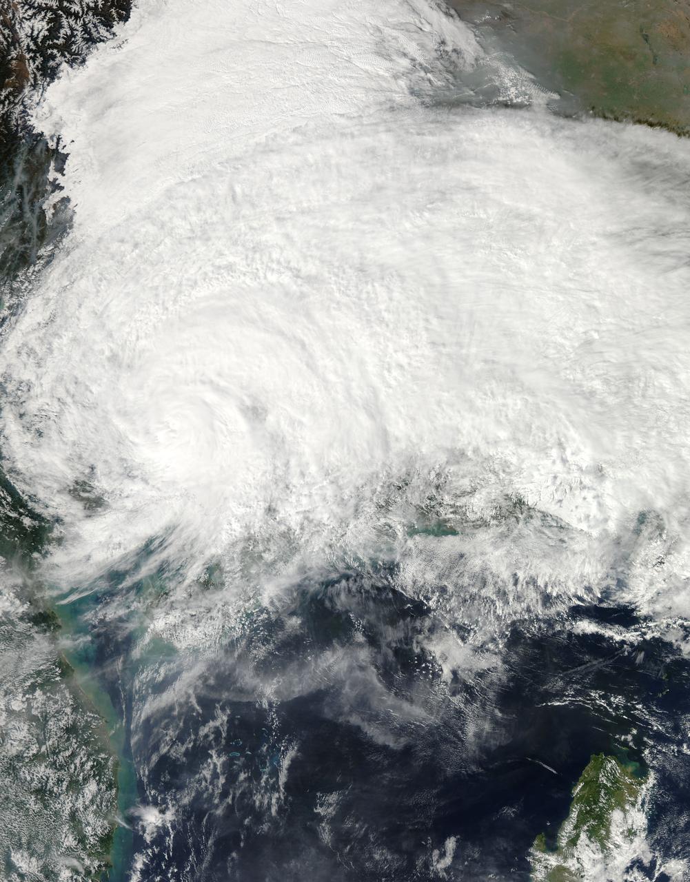
On Nov. 11 at 05:45 UTC, the MODIS instrument aboard NASA's Aqua satellite captured this image of Tropical Storm Haiyan over mainland China. Credit: NASA Goddard MODIS Rapid Response Team <b><a href="http://www.nasa.gov/audience/formedia/features/MP_Photo_Guidelines.html" rel="nofollow">NASA image use policy.</a></b> <b><a href="http://www.nasa.gov/centers/goddard/home/index.html" rel="nofollow">NASA Goddard Space Flight Center</a></b> enables NASA’s mission through four scientific endeavors: Earth Science, Heliophysics, Solar System Exploration, and Astrophysics. Goddard plays a leading role in NASA’s accomplishments by contributing compelling scientific knowledge to advance the Agency’s mission. <b>Follow us on <a href="http://twitter.com/NASA_GoddardPix" rel="nofollow">Twitter</a></b> <b>Like us on <a href="http://www.facebook.com/pages/Greenbelt-MD/NASA-Goddard/395013845897?ref=tsd" rel="nofollow">Facebook</a></b> <b>Find us on <a href="http://instagrid.me/nasagoddard/?vm=grid" rel="nofollow">Instagram</a></b>

With maximum sustained wind speeds of 140 mph, Super Typhoon Utor made landfall in the Philippines on August 11, 2013 around 18:00z. The storm crossed over the island of Luzon and into the South China Sea. The Joint Typhoon Warning Center predicts Utor will head for the Chinese mainland and make landfall again around 12:00z on the 14th about 200 miles southwest of Hong Kong. This colorized infrared image from the Suomi NPP satellite shows the storm on August 11th at 4:30z. NASA/NOAA <b><a href="http://www.nasa.gov/audience/formedia/features/MP_Photo_Guidelines.html" rel="nofollow">NASA image use policy.</a></b> <b><a href="http://www.nasa.gov/centers/goddard/home/index.html" rel="nofollow">NASA Goddard Space Flight Center</a></b> enables NASA’s mission through four scientific endeavors: Earth Science, Heliophysics, Solar System Exploration, and Astrophysics. Goddard plays a leading role in NASA’s accomplishments by contributing compelling scientific knowledge to advance the Agency’s mission. <b>Follow us on <a href="http://twitter.com/NASA_GoddardPix" rel="nofollow">Twitter</a></b> <b>Like us on <a href="http://www.facebook.com/pages/Greenbelt-MD/NASA-Goddard/395013845897?ref=tsd" rel="nofollow">Facebook</a></b> <b>Find us on <a href="http://instagram.com/nasagoddard?vm=grid" rel="nofollow">Instagram</a></b>

VANDENBERG AIR FORCE BASE, Calif. -- Media attending a post-launch news conference at Vandenberg Air Force Base, Calif. heard from officials who described the successful launch of the Landsat Data Continuity Mission, or LDCM. From the left are: George Diller of NASA Public Affairs, Ken Schwer, LDCM project manager Goddard Space Flight Center, Greenbelt, Md., Michael Luther, deputy associate administrator for programs, Science Mission Directorate at NASA Headquarters, Michael Freilich, director of the Earth Science Division, Science Mission Directorate, at Headquarters, Anne Castle, assistant secretary for Water and Science, U.S. Department of the Interior, and Marsha McNutt, director of the U.S. Geological Survey. The Landsat Data Continuity Mission LDCM is the future of Landsat satellites. It will continue to obtain valuable data and imagery to be used in agriculture, education, business, science, and government. The Landsat Program provides repetitive acquisition of high resolution multispectral data of the Earth's surface on a global basis. The data from the Landsat spacecraft constitute the longest record of the Earth's continental surfaces as seen from space. It is a record unmatched in quality, detail, coverage, and value. Liftoff took place at 10:02 a.m. PST 1:02 P.M. EST) on Feb. 11, 2013 aboard a United Launch Alliance Atlas V rocket. For more information, visit: http:__www.nasa.gov_mission_pages_landsat_main_index.html Photo credit: NASA_Kim Shiflett
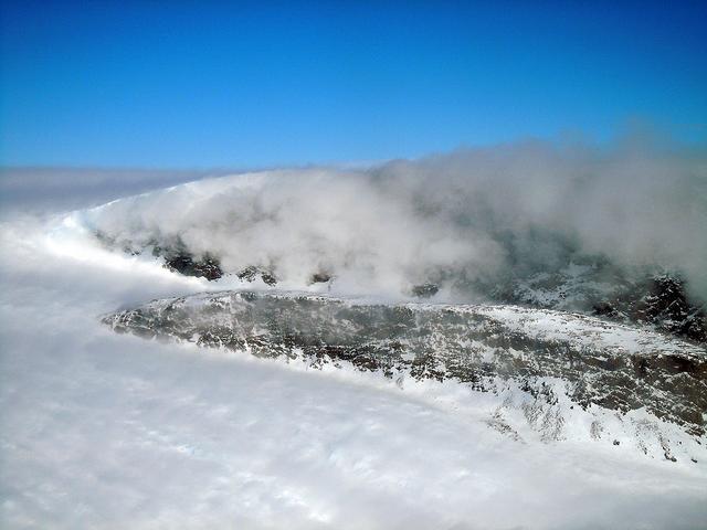
On April 11, 2011, IceBridge finally got the clear weather necessary to fly over glaciers in southeast Greenland, but with clear skies came winds of up to 70 knots. What looks like clouds is actually wind-blown snow. The data could help scientists to evaluate the impact of wind-blown snow on satellite-based laser altimetry measurements. Operation IceBridge, now in its third year, makes annual campaigns in the Arctic and Antarctic where science flights monitor glaciers, ice sheets and sea ice. Credit: NASA/GSFC/Michael Studinger To learn more about Ice Bridge go to: <a href="http://www.nasa.gov/mission_pages/icebridge/news/spr11/index.html" rel="nofollow">www.nasa.gov/mission_pages/icebridge/news/spr11/index.html</a> <b><a href="http://www.nasa.gov/centers/goddard/home/index.html" rel="nofollow">NASA Goddard Space Flight Center</a></b> enables NASA’s mission through four scientific endeavors: Earth Science, Heliophysics, Solar System Exploration, and Astrophysics. Goddard plays a leading role in NASA’s accomplishments by contributing compelling scientific knowledge to advance the Agency’s mission. <b>Follow us on <a href="http://twitter.com/NASA_GoddardPix" rel="nofollow">Twitter</a></b> <b>Join us on <a href="http://www.facebook.com/pages/Greenbelt-MD/NASA-Goddard/395013845897?ref=tsd" rel="nofollow">Facebook</a></b>
The remnants of sea ice along the Northwestern Passage in northern Canada are seen swirling with the blue green of phytoplankton in this image from the Suomi NPP VIIRS sensor, acquired on August 11, 2013. NASA/NOAA <b><a href="http://www.nasa.gov/audience/formedia/features/MP_Photo_Guidelines.html" rel="nofollow">NASA image use policy.</a></b> <b><a href="http://www.nasa.gov/centers/goddard/home/index.html" rel="nofollow">NASA Goddard Space Flight Center</a></b> enables NASA’s mission through four scientific endeavors: Earth Science, Heliophysics, Solar System Exploration, and Astrophysics. Goddard plays a leading role in NASA’s accomplishments by contributing compelling scientific knowledge to advance the Agency’s mission. <b>Follow us on <a href="http://twitter.com/NASA_GoddardPix" rel="nofollow">Twitter</a></b> <b>Like us on <a href="http://www.facebook.com/pages/Greenbelt-MD/NASA-Goddard/395013845897?ref=tsd" rel="nofollow">Facebook</a></b> <b>Find us on <a href="http://instagram.com/nasagoddard?vm=grid" rel="nofollow">Instagram</a></b>
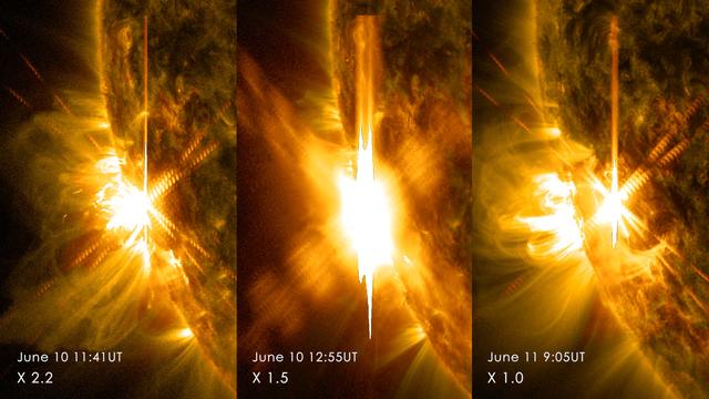
Three X-class flares erupted from the left side of the sun June 10-11, 2014. These images are from NASA's Solar Dynamics Observatory and show light in a blend of two ultraviolet wavelengths: 171 and 131 angstroms. The former is colorized in yellow; the latter, in red. Read more: <a href="http://1.usa.gov/1lneJ3p" rel="nofollow">1.usa.gov/1lneJ3p</a> Credit: NASA/SDO <b><a href="http://www.nasa.gov/audience/formedia/features/MP_Photo_Guidelines.html" rel="nofollow">NASA image use policy.</a></b> <b><a href="http://www.nasa.gov/centers/goddard/home/index.html" rel="nofollow">NASA Goddard Space Flight Center</a></b> enables NASA’s mission through four scientific endeavors: Earth Science, Heliophysics, Solar System Exploration, and Astrophysics. Goddard plays a leading role in NASA’s accomplishments by contributing compelling scientific knowledge to advance the Agency’s mission. <b>Follow us on <a href="http://twitter.com/NASAGoddardPix" rel="nofollow">Twitter</a></b> <b>Like us on <a href="http://www.facebook.com/pages/Greenbelt-MD/NASA-Goddard/395013845897?ref=tsd" rel="nofollow">Facebook</a></b> <b>Find us on <a href="http://instagram.com/nasagoddard?vm=grid" rel="nofollow">Instagram</a></b>
On Oct. 19 at 1500 UTC (11 a.m. EDT), the MODIS instrument aboard NASA's Terra satellite captured this visible image of Hurricane Gonzalo east of Newfoundland, Canada. ..Credit: NASA Goddard MODIS Rapid Response Team ..<b><a href="http://www.nasa.gov/audience/formedia/features/MP_Photo_Guidelines.html" rel="nofollow">NASA image use policy.</a></b> <b><a href="http://www.nasa.gov/centers/goddard/home/index.html" rel="nofollow">NASA Goddard Space Flight Center</a></b> enables NASA’s mission through four scientific endeavors: Earth Science, Heliophysics, Solar System Exploration, and Astrophysics. Goddard plays a leading role in NASA’s accomplishments by contributing compelling scientific knowledge to advance the Agency’s mission. <b>Follow us on <a href="http://twitter.com/NASAGoddardPix" rel="nofollow">Twitter</a></b> <b>Like us on <a href="http://www.facebook.com/pages/Greenbelt-MD/NASA-Goddard/395013845897?ref=tsd" rel="nofollow">Facebook</a></b> <b>Find us on <a href="http://instagram.com/nasagoddard?vm=grid" rel="nofollow">Instagram</a></b>
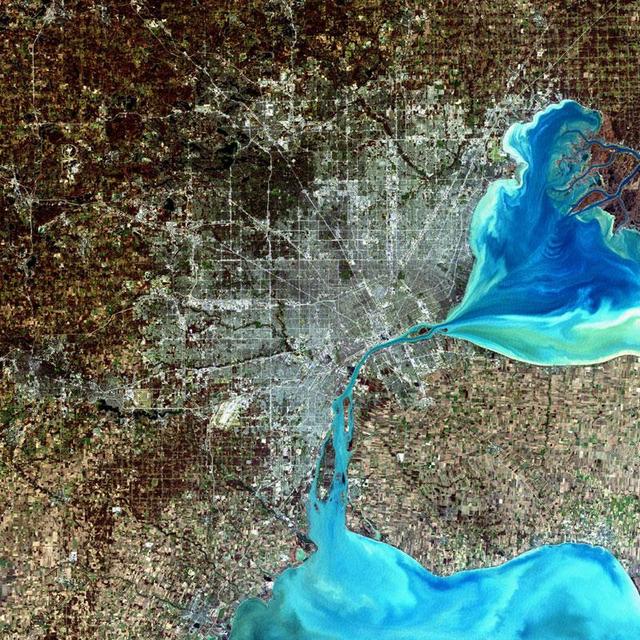
Detroit, Michigan, USA Sensor: L7 ETM+ Acquisition Date: December 11, 2001 Path/Row: 20/30 Lat/Long: 42.330/-83.046 Detroit, Michigan, is commonly referred to as Motor City because of the many automobile manufacturing plants located in the city. It is the largest city in Michigan, with a population approaching one million. Credit: NASA/Goddard/Landsat <b><a href="http://www.nasa.gov/audience/formedia/features/MP_Photo_Guidelines.html" rel="nofollow">NASA image use policy.</a></b> <b><a href="http://www.nasa.gov/centers/goddard/home/index.html" rel="nofollow">NASA Goddard Space Flight Center</a></b> enables NASA’s mission through four scientific endeavors: Earth Science, Heliophysics, Solar System Exploration, and Astrophysics. Goddard plays a leading role in NASA’s accomplishments by contributing compelling scientific knowledge to advance the Agency’s mission. <b>Follow us on <a href="http://twitter.com/NASA_GoddardPix" rel="nofollow">Twitter</a></b> <b>Like us on <a href="http://www.facebook.com/pages/Greenbelt-MD/NASA-Goddard/395013845897?ref=tsd" rel="nofollow">Facebook</a></b> <b>Find us on <a href="http://instagram.com/nasagoddard?vm=grid" rel="nofollow">Instagram</a></b>
On Oct. 17 at 15:15 UTC (11:15 a.m EDT) the MODIS instrument aboard NASA's Aqua satellite saw Hurricane Gonzalo's northern quadrant over Bermuda as it moved to landfall. ..Credit: NASA Goddard MODIS Rapid Response Team ..<b><a href="http://www.nasa.gov/audience/formedia/features/MP_Photo_Guidelines.html" rel="nofollow">NASA image use policy.</a></b> <b><a href="http://www.nasa.gov/centers/goddard/home/index.html" rel="nofollow">NASA Goddard Space Flight Center</a></b> enables NASA’s mission through four scientific endeavors: Earth Science, Heliophysics, Solar System Exploration, and Astrophysics. Goddard plays a leading role in NASA’s accomplishments by contributing compelling scientific knowledge to advance the Agency’s mission. <b>Follow us on <a href="http://twitter.com/NASAGoddardPix" rel="nofollow">Twitter</a></b> <b>Like us on <a href="http://www.facebook.com/pages/Greenbelt-MD/NASA-Goddard/395013845897?ref=tsd" rel="nofollow">Facebook</a></b> <b>Find us on <a href="http://instagram.com/nasagoddard?vm=grid" rel="nofollow">Instagram</a></b>
This full-disk image from NOAA’s GOES-13 satellite was captured at 11:45 UTC (7:45 a.m. EDT) and shows the Americas on March 20, 2014. This date marks the start of astronomical spring in the northern hemisphere. <b><a href="http://goes.gsfc.nasa.gov/" rel="nofollow">Credit: NOAA/NASA GOES Project</a></b> <b><a href="http://www.nasa.gov/audience/formedia/features/MP_Photo_Guidelines.html" rel="nofollow">NASA image use policy.</a></b> <b><a href="http://www.nasa.gov/centers/goddard/home/index.html" rel="nofollow">NASA Goddard Space Flight Center</a></b> enables NASA’s mission through four scientific endeavors: Earth Science, Heliophysics, Solar System Exploration, and Astrophysics. Goddard plays a leading role in NASA’s accomplishments by contributing compelling scientific knowledge to advance the Agency’s mission. <b>Follow us on <a href="http://twitter.com/NASAGoddardPix" rel="nofollow">Twitter</a></b> <b>Like us on <a href="http://www.facebook.com/pages/Greenbelt-MD/NASA-Goddard/395013845897?ref=tsd" rel="nofollow">Facebook</a></b> <b>Find us on <a href="http://instagram.com/nasagoddard?vm=grid" rel="nofollow">Instagram</a></b>
Alan Title, second from left, principal investigator, Atmospheric Imaging Assembly instrument, Lockheed Martin Solar and Astrophysics Laboratory in Palo Alto, speaks during a briefing to discuss recent images from NASA's Solar Dynamics Observatory, or SDO, Wednesday, April 21, 2010, at the Newseum in Washington. Launched on Feb. 11, 2010, SDO is the most advanced spacecraft ever designed to study the sun. During its five-year mission, it will examine the sun's magnetic field and also provide a better understanding of the role the sun plays in Earth's atmospheric chemistry and climate. Pictured from left to right: Dean Pesnell, SDO project scientist, Goddard Space Flight Center in Greenbelt, Md., Alan Title, Philip H. Scherrer, principal investigator, Helioseismic and Magnetic Imager instrument, Stanford University in Palo Alto, Tom Woods, principal investigator, Extreme Ultraviolet Variability Experiment instrument, Laboratory for Atmospheric and Space Physics, University of Colorado in Boulder and Madhulika Guhathakurta, SDO program scientist, NASA Headquarters in Washington. Photo Credit: (NASA/Carla Cioffi)

VANDENBERG AIR FORCE BASE, Calif. -- Media attending a post-launch news conference at Vandenberg Air Force Base, Calif. heard from officials who described the successful launch of the Landsat Data Continuity Mission, or LDCM. From the left are: Ken Schwer, LDCM project manager Goddard Space Flight Center, Greenbelt, Md., Michael Luther, deputy associate administrator for programs, Science Mission Directorate, at NASA Headquarters, Michael Freilich, director of the Earth Science Division, Science Mission Directorate, at Headquarters, Anne Castle, assistant secretary for Water and Science, U.S. Department of the Interior, and Marsha McNutt, director of the U.S. Geological Survey. The Landsat Data Continuity Mission LDCM is the future of Landsat satellites. It will continue to obtain valuable data and imagery to be used in agriculture, education, business, science, and government. The Landsat Program provides repetitive acquisition of high resolution multispectral data of the Earth's surface on a global basis. The data from the Landsat spacecraft constitute the longest record of the Earth's continental surfaces as seen from space. It is a record unmatched in quality, detail, coverage, and value. Liftoff took place at 10:02 a.m. PST 1:02 P.M. EST) on Feb. 11, 2013 aboard a United Launch Alliance Atlas V rocket. For more information, visit: http:__www.nasa.gov_mission_pages_landsat_main_index.html Photo credit: NASA_Kim Shiflett
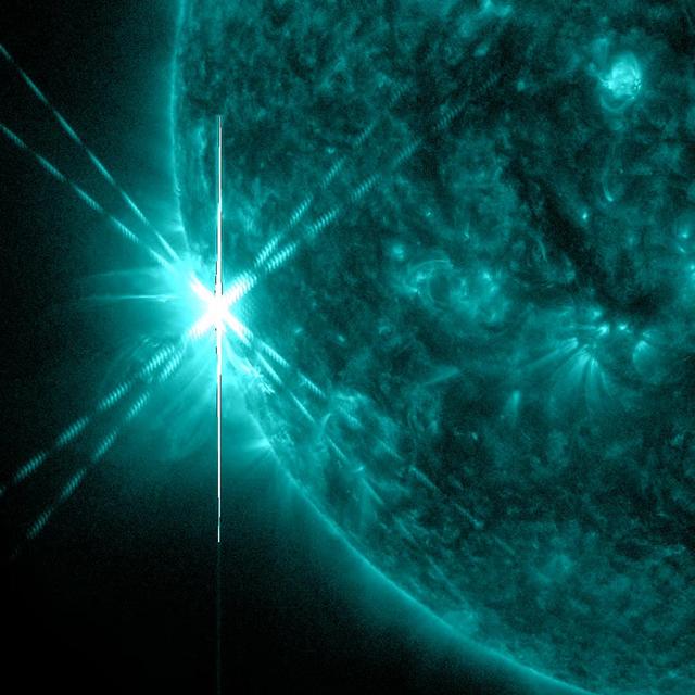
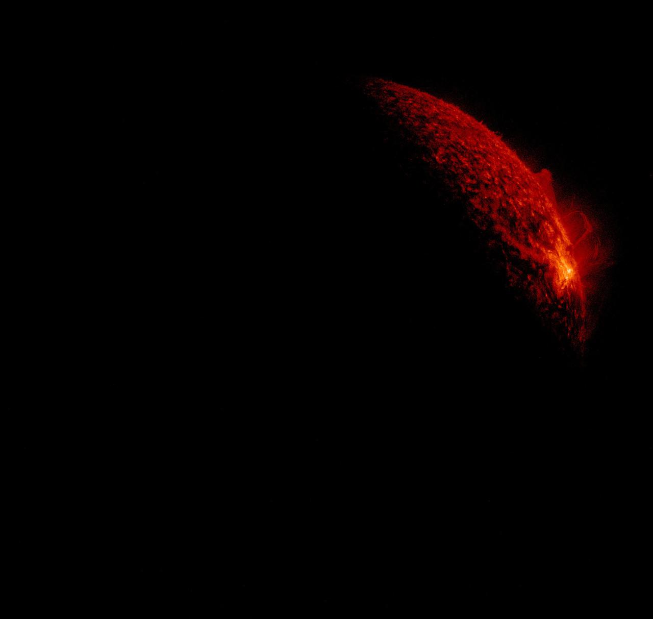
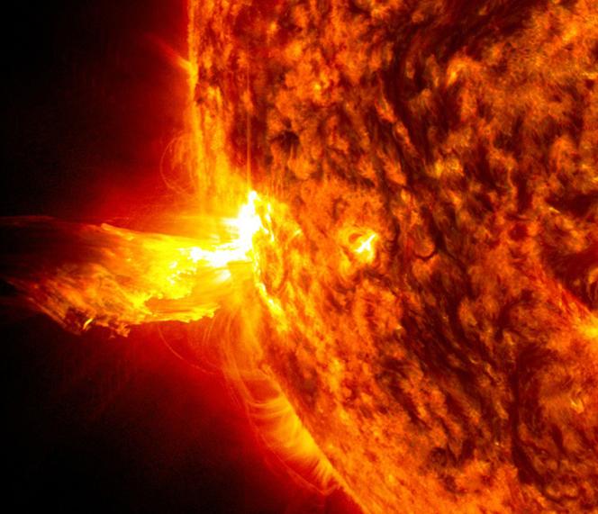
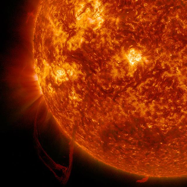
A powerful active region just rotating into view produced two X-class flares (the strongest category) about an hour apart on June 9, 2014. An X-2.3 flare peaked at 11:52 UT followed by an X-1.5 flare at 12:52 UT. This image shows the first of the two flares. The same active region produced another X class flare and a medium (M-class) flare the following day. Credit: NASA/Goddard/Solar Dynamics Observatory <b><a href="http://www.nasa.gov/audience/formedia/features/MP_Photo_Guidelines.html" rel="nofollow">NASA image use policy.</a></b> <b><a href="http://www.nasa.gov/centers/goddard/home/index.html" rel="nofollow">NASA Goddard Space Flight Center</a></b> enables NASA’s mission through four scientific endeavors: Earth Science, Heliophysics, Solar System Exploration, and Astrophysics. Goddard plays a leading role in NASA’s accomplishments by contributing compelling scientific knowledge to advance the Agency’s mission. <b>Follow us on <a href="http://twitter.com/NASAGoddardPix" rel="nofollow">Twitter</a></b> <b>Like us on <a href="http://www.facebook.com/pages/Greenbelt-MD/NASA-Goddard/395013845897?ref=tsd" rel="nofollow">Facebook</a></b> <b>Find us on <a href="http://instagram.com/nasagoddard?vm=grid" rel="nofollow">Instagram</a></b>
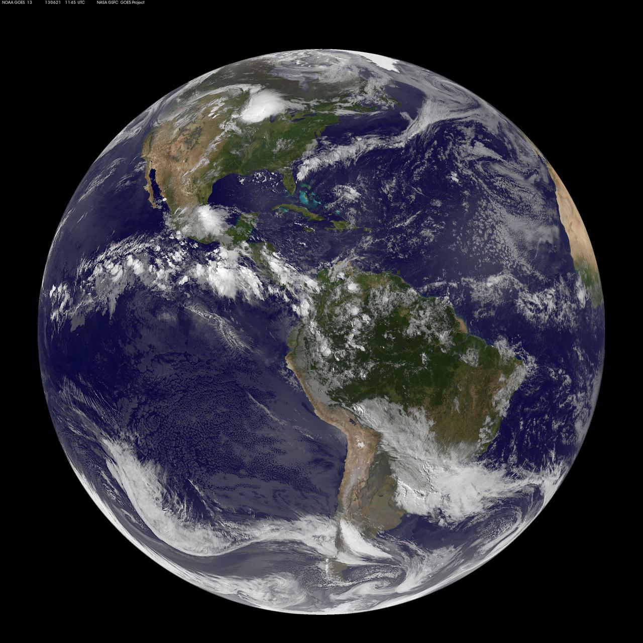
This full-disk image from NOAA’s GOES-13 satellite was captured at 11:45 UTC (7:45 a.m. EDT) and shows the Americas on June 21, 2012. This date marks the start of astronomical summer in the northern hemisphere, making it the longest day of the year! <b><a href="http://www.nasa.gov/audience/formedia/features/MP_Photo_Guidelines.html" rel="nofollow">NASA image use policy.</a></b> <b><a href="http://www.nasa.gov/centers/goddard/home/index.html" rel="nofollow">NASA Goddard Space Flight Center</a></b> enables NASA’s mission through four scientific endeavors: Earth Science, Heliophysics, Solar System Exploration, and Astrophysics. Goddard plays a leading role in NASA’s accomplishments by contributing compelling scientific knowledge to advance the Agency’s mission. <b>Follow us on <a href="http://twitter.com/NASA_GoddardPix" rel="nofollow">Twitter</a></b> <b>Like us on <a href="http://www.facebook.com/pages/Greenbelt-MD/NASA-Goddard/395013845897?ref=tsd" rel="nofollow">Facebook</a></b> <b>Find us on <a href="http://instagram.com/nasagoddard?vm=grid" rel="nofollow">Instagram</a></b>
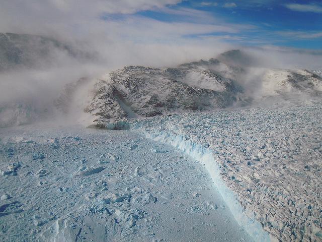
On April 11, 2011, IceBridge finally got the clear weather necessary to fly over glaciers in southeast Greenland. But with clear skies came winds of up to 70 knots, which made for a bumpy ride over the calving front of glaciers like Gyldenlove. Operation IceBridge, now in its third year, makes annual campaigns in the Arctic and Antarctic where science flights monitor glaciers, ice sheets and sea ice. Credit: NASA/GSFC/Michael Studinger To learn more about Ice Bridge go to: <a href="http://www.nasa.gov/mission_pages/icebridge/news/spr11/index.html" rel="nofollow">www.nasa.gov/mission_pages/icebridge/news/spr11/index.html</a> <b><a href="http://www.nasa.gov/centers/goddard/home/index.html" rel="nofollow">NASA Goddard Space Flight Center</a></b> enables NASA’s mission through four scientific endeavors: Earth Science, Heliophysics, Solar System Exploration, and Astrophysics. Goddard plays a leading role in NASA’s accomplishments by contributing compelling scientific knowledge to advance the Agency’s mission. <b>Follow us on <a href="http://twitter.com/NASA_GoddardPix" rel="nofollow">Twitter</a></b> <b>Join us on <a href="http://www.facebook.com/pages/Greenbelt-MD/NASA-Goddard/395013845897?ref=tsd" rel="nofollow">Facebook</a></b>

VANDENBERG AIR FORCE BASE, Calif. -- Media attending a post-launch news conference at Vandenberg Air Force Base, Calif. heard from officials who described the successful launch of the Landsat Data Continuity Mission, or LDCM. From the left are: Ken Schwer, LDCM project manager Goddard Space Flight Center, Greenbelt, Md., Michael Luther, deputy associate administrator for programs, Science Mission Directorate, at NASA Headquarters, Michael Freilich, director of the Earth Science Division, Science Mission Directorate at Headquarters, Anne Castle, assistant secretary for Water and Science, U.S. Department of the Interior, and Marsha McNutt, director of the U.S. Geological Survey. The Landsat Data Continuity Mission LDCM is the future of Landsat satellites. It will continue to obtain valuable data and imagery to be used in agriculture, education, business, science, and government. The Landsat Program provides repetitive acquisition of high resolution multispectral data of the Earth's surface on a global basis. The data from the Landsat spacecraft constitute the longest record of the Earth's continental surfaces as seen from space. It is a record unmatched in quality, detail, coverage, and value. Liftoff took place at 10:02 a.m. PST 1:02 P.M. EST) on Feb. 11, 2013 aboard a United Launch Alliance Atlas V rocket. For more information, visit: http:__www.nasa.gov_mission_pages_landsat_main_index.html Photo credit: NASA_Kim Shiflett
NASA's Aqua satellite passed over Tropical Cyclone Ita as it began making landfall on the Eastern Cape York Peninsula of Queensland, Australia, today, April 11, 2014. Ita officially made landfall at Cape Flattery about 9:00 p.m. local AEST time as a Category 4 storm according to reports from the Australian Broadcasting Corporation (ABC). The Moderate Resolution Imaging Spectroradiometer that flies aboard Aqua captured an image of the Category 4 storm on April 11 at 12:00 a.m. EDT (4 a.m. UTC). Satellite imagery indicates the eye is 9.2 miles wide (8 nautical miles, or 14.8 km). Warnings and watches remain in effect as the center of Ita is expected to remain at hurricane strength as it moves in a southerly direction, staying just west of Cairns over the next day. A tropical cyclone warning is in effect between Coen and Innisfail, including Cooktown, Port Douglas, Cairns, extending inland to Kalinga, Palmerville, Mareeba and Chillagoe. A tropical cyclone watch is in effect between Innisfail to Cardwell, extending inland. ABC reported that the strongest maximum sustained winds around the center of circulation were near 142.9 mph (124.2 knots, or 230 kph) and many trees have been downed and homes damaged. According to ABC, preliminary reports suggest that power may be out for a month in some areas. On April 11 at 5 a.m. EDT (9 a.m. UTC), Tropical Cyclone Ita had maximum sustained winds near 143.8 mph (125 knots, or 231.5 kph). It was centered near 14.8 degrees south latitude and 145.3 degrees east longitude, about 168 miles (146 nautical miles, or 288 km) north of Cairns, Australia, and has tracked south-southwestward at 10.3 mph (9 knots, or 16.6 kph). Ita is moving around a subtropical ridge (elongated area) of high pressure and the Joint Typhoon Warning Center expects Ita to start curving to the southeast around that ridge in the next day before heading back out into the Coral Sea. Credit: NASA/GSFC/Jeff Schmaltz/MODIS Land Rapid Response Team Rob Gutro, NASA's Goddard Space Flight Center, Greenbelt, Md. <b><a href="http://www.nasa.gov/audience/formedia/features/MP_Photo_Guidelines.html" rel="nofollow">NASA image use policy.</a></b> <b><a href="http://www.nasa.gov/centers/goddard/home/index.html" rel="nofollow">NASA Goddard Space Flight Center</a></b> enables NASA’s mission through four scientific endeavors: Earth Science, Heliophysics, Solar System Exploration, and Astrophysics. Goddard plays a leading role in NASA’s accomplishments by contributing compelling scientific knowledge to advance the Agency’s mission. <b>Follow us on <a href="http://twitter.com/NASAGoddardPix" rel="nofollow">Twitter</a></b> <b>Like us on <a href="http://www.facebook.com/pages/Greenbelt-MD/NASA-Goddard/395013845897?ref=tsd" rel="nofollow">Facebook</a></b> <b>Find us on <a href="http://instagram.com/nasagoddard?vm=grid" rel="nofollow">Instagram</a></b>
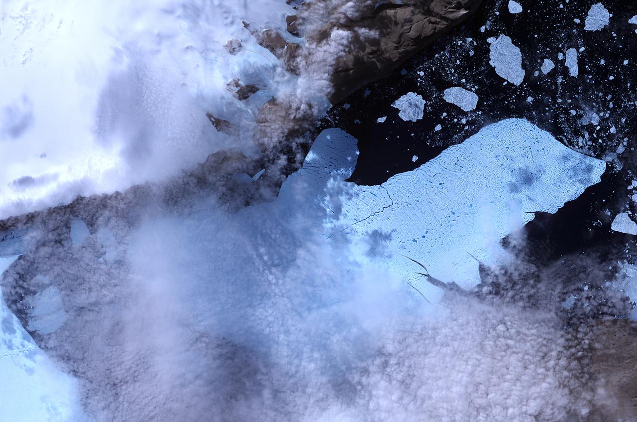
NASA image acquired August 11, 2010. After breaking off the Petermann Glacier on August 5, 2010, a massive ice island floated slowly down the fjord toward the Nares Strait. The Advanced Spaceborne Thermal Emission and Reflection Radiometer (ASTER) on NASA’s Terra satellite captured this false-color image of the ice island on August 11, 2010. In this image, ice is light blue, water is nearly black, and clouds are nearly white. Although a bank of thin clouds hovers over the fjord, the southernmost margin of the ice island is still visible. Toward the north, the leading edge of the ice island retains the same shape it had days earlier, at the time of the initial calving. NASA Earth Observatory image created by Jesse Allen, using data provided courtesy of NASA/GSFC/METI/ERSDAC/JAROS, and U.S./Japan ASTER Science Team. Caption by Michon Scott. Instrument: Terra - ASTER To see more images from of the glacier go to: <a href="http://earthobservatory.nasa.gov/NaturalHazards/event.php?id=45116" rel="nofollow">earthobservatory.nasa.gov/NaturalHazards/event.php?id=45116</a> <b><a href="http://www.nasa.gov/centers/goddard/home/index.html" rel="nofollow">NASA Goddard Space Flight Center</a></b> is home to the nation's largest organization of combined scientists, engineers and technologists that build spacecraft, instruments and new technology to study the Earth, the sun, our solar system, and the universe. <b>Follow us on <a href="http://twitter.com/NASA_GoddardPix" rel="nofollow">Twitter</a></b> <b>Join us on <a href="http://www.facebook.com/pages/Greenbelt-MD/NASA-Goddard/395013845897?ref=tsd" rel="nofollow">Facebook</a><b></b></b>
The MODIS instrument on NASA's Terra satellite captured Hurricane Joaquin off the Bahamas at 15:45 UTC (11:45 a.m. EDT) on September 30, 2015. Credit: NASA/GSFC/Jeff Schmaltz/MODIS Land Rapid Response Team At 11 a.m. EDT (1500 UTC) on Wednesday, September 30, 2015 the center of Hurricane Joaquin was located near latitude 24.7 North, longitude 72.6 West. That puts the center of Joaquin about 215 miles (345 km) east-northeast of the Central Bahamas. Joaquin became a tropical storm Monday evening (EDT), September 29 when it was midway between the Bahamas and Bermuda. By 8 a.m. EDT on September 30, it strengthened into a hurricane and has become the third hurricane of the Atlantic Hurricane season. On September 30, the National Hurricane Center issued a Hurricane Warning for the central Bahamas including Cat Island, the Exumas, Long Island, Rum Cay, and San Salvador. A Hurricane Watch is in effect for the northwestern Bahamas including the Abacos, Berry Islands, Bimini, Eleuthera, Grand Bahama Island, and New Providence, but excluding Andros Island. <b><a href="http://www.nasa.gov/audience/formedia/features/MP_Photo_Guidelines.html" rel="nofollow">NASA image use policy.</a></b> <b><a href="http://www.nasa.gov/centers/goddard/home/index.html" rel="nofollow">NASA Goddard Space Flight Center</a></b> enables NASA’s mission through four scientific endeavors: Earth Science, Heliophysics, Solar System Exploration, and Astrophysics. Goddard plays a leading role in NASA’s accomplishments by contributing compelling scientific knowledge to advance the Agency’s mission. <b>Follow us on <a href="http://twitter.com/NASAGoddardPix" rel="nofollow">Twitter</a></b> <b>Like us on <a href="http://www.facebook.com/pages/Greenbelt-MD/NASA-Goddard/395013845897?ref=tsd" rel="nofollow">Facebook</a></b> <b>Find us on <a href="http://instagrid.me/nasagoddard/?vm=grid" rel="nofollow">Instagram</a></b>

A solar flare erupts on Jan. 30, 2014, as seen by the bright flash on the left side of the sun, captured here by NASA's Solar Dynamics Observatory. In the lower right corner the moon can be seen, having just passed between the observatory and the sun. --- The sun emitted a mid-level solar flare, peaking at 11:11 a.m. EST on Jan. 30, 2014. Images of the flare were captured by NASA's Solar Dynamics Observatory, or SDO, shortly after the observatory witnessed a lunar transit. The black disk of the moon can be seen in the lower right of the images. Solar flares are powerful bursts of radiation. Harmful radiation from a flare cannot pass through Earth's atmosphere to physically affect humans on the ground, however -- when intense enough -- they can disturb the atmosphere in the layer where GPS and communications signals travel. To see how this event may impact Earth, please visit NOAA's Space Weather Prediction Center at <a href="http://spaceweather.gov" rel="nofollow">spaceweather.gov</a>, the U.S. government's official source for space weather forecasts, alerts, watches and warnings. This flare is classified as an M6.6 class flare. Updates will be provided as needed. Credit: NASA/SDO <b><a href="http://www.nasa.gov/audience/formedia/features/MP_Photo_Guidelines.html" rel="nofollow">NASA image use policy.</a></b> <b><a href="http://www.nasa.gov/centers/goddard/home/index.html" rel="nofollow">NASA Goddard Space Flight Center</a></b> enables NASA’s mission through four scientific endeavors: Earth Science, Heliophysics, Solar System Exploration, and Astrophysics. Goddard plays a leading role in NASA’s accomplishments by contributing compelling scientific knowledge to advance the Agency’s mission. <b>Follow us on <a href="http://twitter.com/NASAGoddardPix" rel="nofollow">Twitter</a></b> <b>Like us on <a href="http://www.facebook.com/pages/Greenbelt-MD/NASA-Goddard/395013845897?ref=tsd" rel="nofollow">Facebook</a></b> <b>Find us on <a href="http://instagram.com/nasagoddard?vm=grid" rel="nofollow">Instagram</a></b>
Caption: This image from June 20, 2013, at 11:15 p.m. EDT shows the bright light of a solar flare on the left side of the sun and an eruption of solar material shooting through the sun’s atmosphere, called a prominence eruption. Shortly thereafter, this same region of the sun sent a coronal mass ejection out into space. --- On June 20, 2013, at 11:24 p.m., the sun erupted with an Earth-directed coronal mass ejection or CME, a solar phenomenon that can send billions of tons of particles into space that can reach Earth one to three days later. These particles cannot travel through the atmosphere to harm humans on Earth, but they can affect electronic systems in satellites and on the ground. Experimental NASA research models, based on observations from NASA’s Solar Terrestrial Relations Observatory and ESA/NASA’s Solar and Heliospheric Observatory show that the CME left the sun at speeds of around 1350 miles per second, which is a fast speed for CMEs. Earth-directed CMEs can cause a space weather phenomenon called a geomagnetic storm, which occurs when they funnel energy into Earth's magnetic envelope, the magnetosphere, for an extended period of time. The CME’s magnetic fields peel back the outermost layers of Earth's fields changing their very shape. Magnetic storms can degrade communication signals and cause unexpected electrical surges in power grids. They also can cause aurora. Storms are rare during solar minimum, but as the sun’s activity ramps up every 11 years toward solar maximum – currently expected in late 2013 -- large storms occur several times per year. In the past, geomagnetic storms caused by CMEs of this strength and direction have usually been mild. Credit: NASA/Goddard/SDO <b><a href="http://www.nasa.gov/audience/formedia/features/MP_Photo_Guidelines.html" rel="nofollow">NASA image use policy.</a></b> <b><a href="http://www.nasa.gov/centers/goddard/home/index.html" rel="nofollow">NASA Goddard Space Flight Center</a></b> enables NASA’s mission through four scientific endeavors: Earth Science, Heliophysics, Solar System Exploration, and Astrophysics. Goddard plays a leading role in NASA’s accomplishments by contributing compelling scientific knowledge to advance the Agency’s mission. <b>Follow us on <a href="http://twitter.com/NASA_GoddardPix" rel="nofollow">Twitter</a></b> <b>Like us on <a href="http://www.facebook.com/pages/Greenbelt-MD/NASA-Goddard/395013845897?ref=tsd" rel="nofollow">Facebook</a></b> <b>Find us on <a href="http://instagram.com/nasagoddard?vm=grid" rel="nofollow">Instagram</a></b>
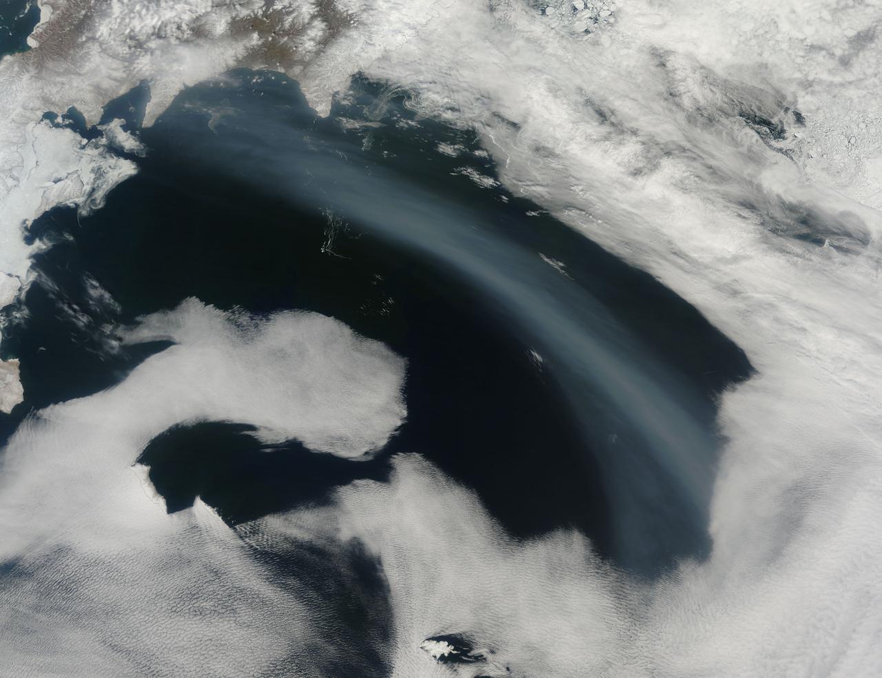
Smoke from Far Eastern Russia’s spring wildfires reached the Bering Sea by May 11, 2012. The Moderate Resolution Imaging Spectroradiometer aboard NASA’s Terra satellite passed over the region at 23:30 UTC on that same day and acquired this true-color image of a broad band of smoke stretching across the blue waters. In this image, the plume of smoke appears light gray while banks of cloud are bright white. Snow covers much of Kamchatka the land mass in the west. Karaginsky Island, just off Kamchatka’s eastern shore, is surrounded by sea ice. Clouds stream off the southwest shores of Beringa and Medny Islands. To the east, Attu Station, Alaska, is surrounded by cloud. In early May, numerous wildfires burned near Lake Baikal, in Siberia. These fires billowed heavy smoke across eastern Mongolia, China and Russia’s Far East. An image of the smoke and fires was captured on May 8 and appeared as the MODIS image of the day on May 11. That image can be viewed here: <a href="http://modis.gsfc.nasa.gov/gallery/individual.php?db_date=2012-05-11" rel="nofollow">modis.gsfc.nasa.gov/gallery/individual.php?db_date=2012-0...</a>. According to a model by the National Oceanic and Atmospheric Administration (NOAA), it is possible that smoke from the Lake Baikal region could take just a few days to reach the Bering Sea. Credit: NASA/GSFC/Jeff Schmaltz/MODIS Land Rapid Response Team <b><a href="http://www.nasa.gov/audience/formedia/features/MP_Photo_Guidelines.html" rel="nofollow">NASA image use policy.</a></b> <b><a href="http://www.nasa.gov/centers/goddard/home/index.html" rel="nofollow">NASA Goddard Space Flight Center</a></b> enables NASA’s mission through four scientific endeavors: Earth Science, Heliophysics, Solar System Exploration, and Astrophysics. Goddard plays a leading role in NASA’s accomplishments by contributing compelling scientific knowledge to advance the Agency’s mission. <b>Follow us on <a href="http://twitter.com/NASA_GoddardPix" rel="nofollow">Twitter</a></b> <b>Like us on <a href="http://www.facebook.com/pages/Greenbelt-MD/NASA-Goddard/395013845897?ref=tsd" rel="nofollow">Facebook</a></b> <b>Find us on <a href="http://instagrid.me/nasagoddard/?vm=grid" rel="nofollow">Instagram</a></b>

Caption: This image from June 20, 2013, at 11:15 p.m. EDT shows the bright light of a solar flare on the left side of the sun and an eruption of solar material shooting through the sun’s atmosphere, called a prominence eruption. Shortly thereafter, this same region of the sun sent a coronal mass ejection out into space. --- On June 20, 2013, at 11:24 p.m., the sun erupted with an Earth-directed coronal mass ejection or CME, a solar phenomenon that can send billions of tons of particles into space that can reach Earth one to three days later. These particles cannot travel through the atmosphere to harm humans on Earth, but they can affect electronic systems in satellites and on the ground. Experimental NASA research models, based on observations from NASA’s Solar Terrestrial Relations Observatory and ESA/NASA’s Solar and Heliospheric Observatory show that the CME left the sun at speeds of around 1350 miles per second, which is a fast speed for CMEs. Earth-directed CMEs can cause a space weather phenomenon called a geomagnetic storm, which occurs when they funnel energy into Earth's magnetic envelope, the magnetosphere, for an extended period of time. The CME’s magnetic fields peel back the outermost layers of Earth's fields changing their very shape. Magnetic storms can degrade communication signals and cause unexpected electrical surges in power grids. They also can cause aurora. Storms are rare during solar minimum, but as the sun’s activity ramps up every 11 years toward solar maximum – currently expected in late 2013 -- large storms occur several times per year. In the past, geomagnetic storms caused by CMEs of this strength and direction have usually been mild. Read more: <a href="http://1.usa.gov/14OxuEe" rel="nofollow">1.usa.gov/14OxuEe</a> Credit: NASA/Goddard/SDO <b><a href="http://www.nasa.gov/audience/formedia/features/MP_Photo_Guidelines.html" rel="nofollow">NASA image use policy.</a></b> <b><a href="http://www.nasa.gov/centers/goddard/home/index.html" rel="nofollow">NASA Goddard Space Flight Center</a></b> enables NASA’s mission through four scientific endeavors: Earth Science, Heliophysics, Solar System Exploration, and Astrophysics. Goddard plays a leading role in NASA’s accomplishments by contributing compelling scientific knowledge to advance the Agency’s mission. <b>Follow us on <a href="http://twitter.com/NASA_GoddardPix" rel="nofollow">Twitter</a></b> <b>Like us on <a href="http://www.facebook.com/pages/Greenbelt-MD/NASA-Goddard/395013845897?ref=tsd" rel="nofollow">Facebook</a></b> <b>Find us on <a href="http://instagram.com/nasagoddard?vm=grid" rel="nofollow">Instagram</a></b>
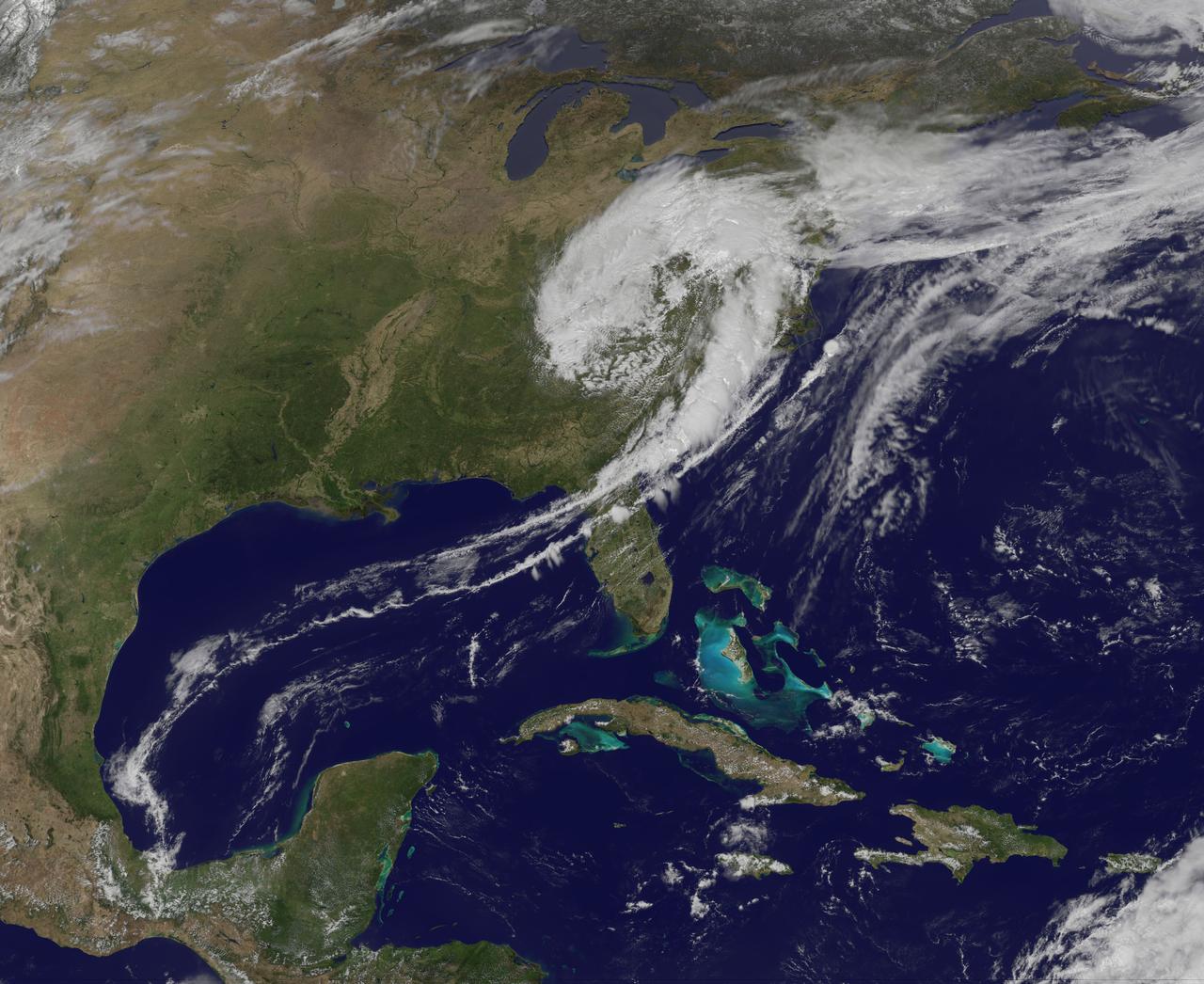
NASA image captured April 12, 2011 at 1731 UTC (1:31 p.m. EDT) A giant swirl of clouds that form an apostrophe-like shape over the eastern U.S. was spotted in visible imagery from the Geostationary Operational Environmental Satellite, GOES-13 on April 12, 2011 at 1731 UTC (1:31 p.m. EDT). The GOES-13 satellite monitors weather over the eastern continental U.S. and Atlantic Ocean, while GOES-11 monitors the western U.S. and the Eastern Pacific Ocean. GOES-13 captured this image of the clouds associated with a strong upper level low pressure area that is moving though the Tennessee River Valley and bringing moderate to heavy rainfall as it moves eastward. The low is forecast by the National Weather Service to bring unsettled conditions to the Mid-Atlantic and then to New England late Tuesday and Wednesday as it tracks northeast. Severe thunderstorms are possible today in extreme eastern Virginia and North Carolina as the cold front associated with the low pushes through that region. Meanwhile, rainfall from the low stretches from Massachusetts south to Florida today. It seems that New Englanders are having a tough time getting warm spring weather and this low won't help as it moves north. The low pressure area may even bring some light to moderate snowfall on the northern fringe of the storm. The GOES series of satellites keep an eye on the weather happening over the continental U.S. and eastern Pacific and Atlantic Oceans. NASA's GOES Project, located at NASA's Goddard Space Flight Center in Greenbelt, Md., procures and manages the development and launch of the GOES series of satellites for NOAA and creates images and animations. The GOES satellites are operated by NOAA. Rob Gutro NASA's Goddard Space Flight Center <b><a href="http://goes.gsfc.nasa.gov/" rel="nofollow">Credit: NOAA/NASA GOES Project</a></b> <b><a href="http://www.nasa.gov/centers/goddard/home/index.html" rel="nofollow">NASA Goddard Space Flight Center</a></b> enables NASA’s mission through four scientific endeavors: Earth Science, Heliophysics, Solar System Exploration, and Astrophysics. Goddard plays a leading role in NASA’s accomplishments by contributing compelling scientific knowledge to advance the Agency’s mission. <b>Follow us on <a href="http://twitter.com/NASA_GoddardPix" rel="nofollow">Twitter</a></b> <b>Join us on <a href="http://www.facebook.com/pages/Greenbelt-MD/NASA-Goddard/395013845897?ref=tsd" rel="nofollow">Facebook</a></b>
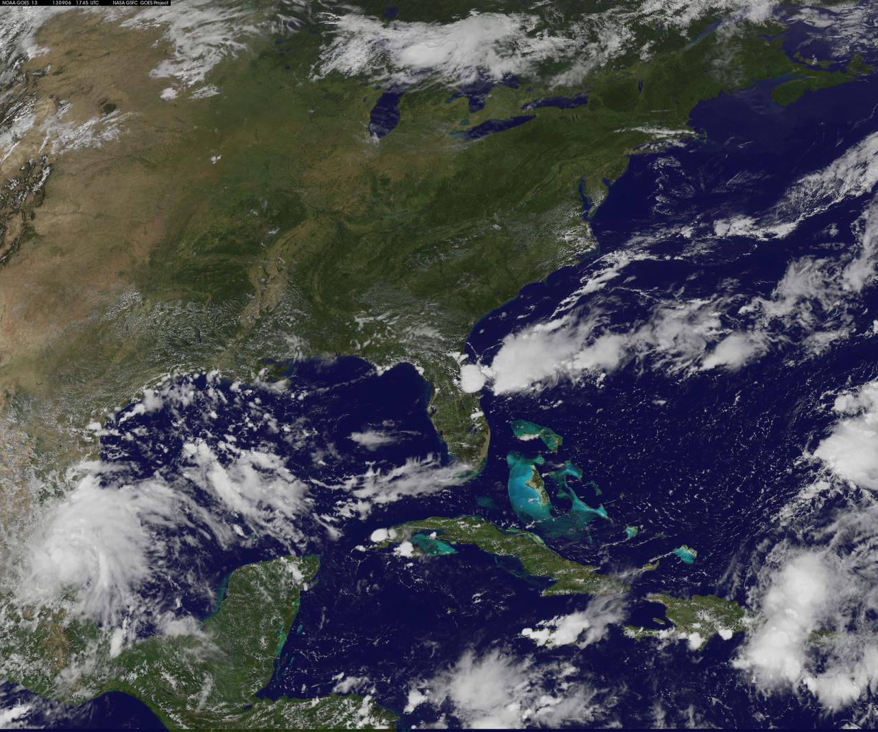
NASA's Wallops Flight Facility is located on Wallops Island, Va. and is the site of tonight's moon mission launch. Satellite imagery from NOAA's GOES-East satellite shows that high pressure remains in control over the Mid-Atlantic region, providing an almost cloud-free sky. This visible image of the Mid-Atlantic was captured by NOAA's GOES-East satellite at 17:31 UTC/1:31 p.m. EDT and shows some fair weather clouds over the Delmarva Peninsula (which consists of the state of Delaware and parts of Maryland and Virginia - which together is "Delmarva") and eastern Virginia and North Carolina. Most of the region is cloud-free, making for a perfect viewing night to see a launch. NOAA operates GOES-East and NASA's GOES Project at the NASA Goddard Space Flight Center in Greenbelt, Md. creates images and animations from the data. NOAA's National Weather Service forecast for tonight, Sept. 6 calls for winds blowing from the east to 11 mph, with clear skies and overnight temperatures dropping to the mid-fifties. The Lunar Atmosphere and Dust Environment Explorer, known as LADEE (pronounced like "laddie"), launches tonight at 11:27 p.m. EDT from Pad 0B at the Mid-Atlantic Regional Spaceport, at NASA Wallops and will be visible along the Mid-Atlantic with tonight's perfect weather conditions. LADEE is managed by NASA's Ames Research Center in Moffett Field, Calif. This will be the first launch to lunar orbit from NASA Wallops and the first launch of a Minotaur V rocket – the biggest ever launched from Wallops. NASA's LADEE is a robotic mission that will orbit the moon to gather detailed information about the lunar atmosphere, conditions near the surface and environmental influences on lunar dust. A thorough understanding of these characteristics will address long-standing unknowns, and help scientists understand other planetary bodies as well. LADEE also carries an important secondary payload, the Lunar Laser Communication Demonstration, or LLCD, which will help us open a new era of space communications by becoming NASA's first high rate, two-way, space laser system. Live coverage of the launch can be seen beginning at 9:30 p.m. EDT on NASA-TV at: <a href="http://www.nasa.gov/ntv" rel="nofollow">www.nasa.gov/ntv</a> For more information about LADEE, visit: <a href="http://www.nasa.gov/ladee" rel="nofollow">www.nasa.gov/ladee</a> <b><a href="http://www.nasa.gov/audience/formedia/features/MP_Photo_Guidelines.html" rel="nofollow">NASA image use policy.</a></b> <b><a href="http://www.nasa.gov/centers/goddard/home/index.html" rel="nofollow">NASA Goddard Space Flight Center</a></b> enables NASA’s mission through four scientific endeavors: Earth Science, Heliophysics, Solar System Exploration, and Astrophysics. Goddard plays a leading role in NASA’s accomplishments by contributing compelling scientific knowledge to advance the Agency’s mission. <b>Follow us on <a href="http://twitter.com/NASA_GoddardPix" rel="nofollow">Twitter</a></b> <b>Like us on <a href="http://www.facebook.com/pages/Greenbelt-MD/NASA-Goddard/395013845897?ref=tsd" rel="nofollow">Facebook</a></b> <b>Find us on <a href="http://instagram.com/nasagoddard?vm=grid" rel="nofollow">Instagram</a></b>
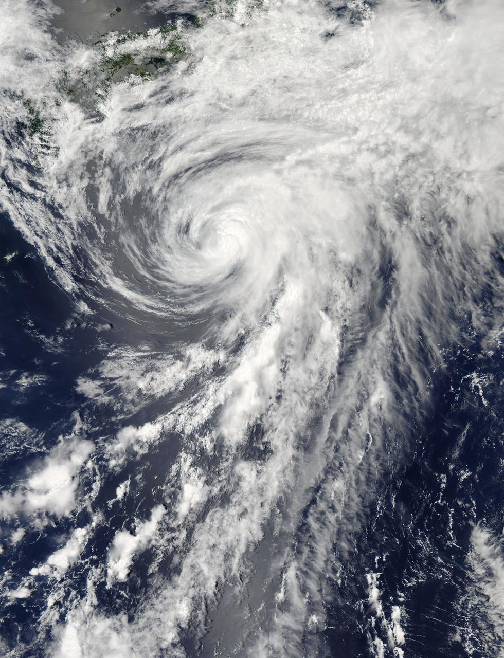
On Tuesday, June 11, 2013 Tropical Storm Yagi spun in the North Pacific Ocean just south of Japan. The Moderate Resolution Imaging Spectroradiometer (MODIS) aboard NASA’s Aqua satellite captured this beautiful true-color image of the storm on that same date at 4:10 UTC (1:10 p.m. Japan local time). The image shows a clear apostrophe-shaped cyclone, with a closed eye and somewhat elliptical shape. The clouds associated with the northern fringes of the storm draped over southeastern coastal Japan, and a long “tail” (or band) of thunderstorms fed into the center from the south. Multispectral imagery also showed tight bands of thunderstorms wrapping into the center of the storm, although the building of thunderstorms was weakening around the center. Near the same time as the image was captured, the Joint Typhoon Warning Center announced that vertical wind shear was starting to take a toll on Yagi. Northwesterly wind shear had caused the system to tilt slightly with the upper-level center displaced about 20 nautical miles east of the low-level center. Tropical Storm Yagi developed from Tropical Depression 03W in the Western North Pacific Ocean on June 6, and intensified the weekend of June 8-9, when it reached Tropical Storm status and was given the name Yagi. Also known as Dante, the storm reached the maximum wind speeds on June 10 and 11, after which it began to weaken as it moved into cooler waters. On June 14, Yagi’s remnants passed about 200 miles south of Tokyo, and brought soaking rains to the coastline of Japan’s Honshu Island. Credit: NASA/GSFC/Jeff Schmaltz/MODIS Land Rapid Response Team <b><a href="http://www.nasa.gov/audience/formedia/features/MP_Photo_Guidelines.html" rel="nofollow">NASA image use policy.</a></b> <b><a href="http://www.nasa.gov/centers/goddard/home/index.html" rel="nofollow">NASA Goddard Space Flight Center</a></b> enables NASA’s mission through four scientific endeavors: Earth Science, Heliophysics, Solar System Exploration, and Astrophysics. Goddard plays a leading role in NASA’s accomplishments by contributing compelling scientific knowledge to advance the Agency’s mission. <b>Follow us on <a href="http://twitter.com/NASA_GoddardPix" rel="nofollow">Twitter</a></b> <b>Like us on <a href="http://www.facebook.com/pages/Greenbelt-MD/NASA-Goddard/395013845897?ref=tsd" rel="nofollow">Facebook</a></b> <b>Find us on <a href="http://instagram.com/nasagoddard?vm=grid" rel="nofollow">Instagram</a></b>
The Sun sported a very long filament that stretched out over 500,000 miles (800,000 km) and was visible for several days (June 3-4, 2014). It broke apart and dissipated soon after the end of the video clip. Filaments are tenuous strands of plasma held above the Sun's surface by magnetic forces. They appear darker because their temperature is somewhat cooler than that of the Sun's surface. The still image, shown in a combination of two wavelengths of extreme ultraviolet light, was taken at 11:33 UT on June 4. Credit: NASA/Goddard/Solar Dynamics Observatory <b><a href="http://www.nasa.gov/audience/formedia/features/MP_Photo_Guidelines.html" rel="nofollow">NASA image use policy.</a></b> <b><a href="http://www.nasa.gov/centers/goddard/home/index.html" rel="nofollow">NASA Goddard Space Flight Center</a></b> enables NASA’s mission through four scientific endeavors: Earth Science, Heliophysics, Solar System Exploration, and Astrophysics. Goddard plays a leading role in NASA’s accomplishments by contributing compelling scientific knowledge to advance the Agency’s mission. <b>Follow us on <a href="http://twitter.com/NASAGoddardPix" rel="nofollow">Twitter</a></b> <b>Like us on <a href="http://www.facebook.com/pages/Greenbelt-MD/NASA-Goddard/395013845897?ref=tsd" rel="nofollow">Facebook</a></b> <b>Find us on <a href="http://instagram.com/nasagoddard?vm=grid" rel="nofollow">Instagram</a></b>

On August 9 at 03:00 UTC (Aug. 8 at 11 p.m. EDT) the MODIS instrument aboard NASA's Terra satellite passed over the remnant clouds of Typhoon Soudelor when it was over eastern China. By 22:35 UTC (6:35 p.m. EDT) on August 8, 2015, Typhoon Soudelor had made landfall in eastern China and was rapidly dissipating. Maximum sustained winds had dropped to 45 knots (51.7 mph/83.3 kph) after landfall, making it a tropical storm. Image credit: NASA Goddard MODIS Rapid Response Team/Jeff Schmaltz..<b><a href="http://www.nasa.gov/audience/formedia/features/MP_Photo_Guidelines.html" rel="nofollow">NASA image use policy.</a></b> <b><a href="http://www.nasa.gov/centers/goddard/home/index.html" rel="nofollow">NASA Goddard Space Flight Center</a></b> enables NASA’s mission through four scientific endeavors: Earth Science, Heliophysics, Solar System Exploration, and Astrophysics. Goddard plays a leading role in NASA’s accomplishments by contributing compelling scientific knowledge to advance the Agency’s mission. <b>Follow us on <a href="http://twitter.com/NASAGoddardPix" rel="nofollow">Twitter</a></b> <b>Like us on <a href="http://www.facebook.com/pages/Greenbelt-MD/NASA-Goddard/395013845897?ref=tsd" rel="nofollow">Facebook</a></b> <b>Find us on <a href="http://instagrid.me/nasagoddard/?vm=grid" rel="nofollow">Instagram</a></b>
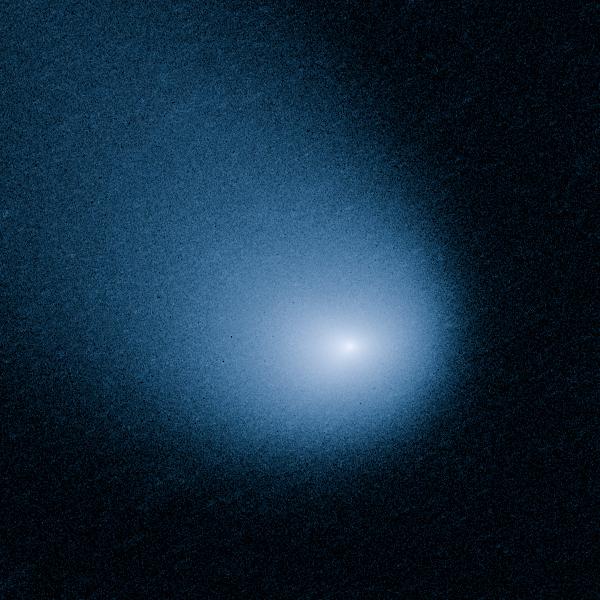
MARCH 27, 2014: Comet Siding Spring is plunging toward the Sun along a roughly 1-million-year orbit. The comet, discovered in 2013, was within the radius of Jupiter's orbit when the Hubble Space Telescope photographed it on March 11, 2014. Hubble resolves two jets of dust coming from the solid icy nucleus. These persistent jets were first seen in Hubble pictures taken on Oct. 29, 2013. The feature should allow astronomers to measure the direction of the nucleus's pole, and hence, rotation axis. The comet will make its closest approach to our Sun on Oct. 25, 2014, at a distance of 130 million miles, well outside Earth's orbit. On its inbound leg, Comet Siding Spring will pass within 84,000 miles of Mars on Oct. 19, 2014, which is less than half the Moon's distance from Earth. The comet is not expected to become bright enough to be seen by the naked eye. Credit: NASA, ESA, and J.-Y. Li (Planetary Science Institute) <b><a href="http://www.nasa.gov/audience/formedia/features/MP_Photo_Guidelines.html" rel="nofollow">NASA image use policy.</a></b> <b><a href="http://www.nasa.gov/centers/goddard/home/index.html" rel="nofollow">NASA Goddard Space Flight Center</a></b> enables NASA’s mission through four scientific endeavors: Earth Science, Heliophysics, Solar System Exploration, and Astrophysics. Goddard plays a leading role in NASA’s accomplishments by contributing compelling scientific knowledge to advance the Agency’s mission. <b>Follow us on <a href="http://twitter.com/NASAGoddardPix" rel="nofollow">Twitter</a></b> <b>Like us on <a href="http://www.facebook.com/pages/Greenbelt-MD/NASA-Goddard/395013845897?ref=tsd" rel="nofollow">Facebook</a></b> <b>Find us on <a href="http://instagram.com/nasagoddard?vm=grid" rel="nofollow">Instagram</a></b>

<b>Share YOUR Supermoon images with NASA in our Flickr Group: <a href="http://www.flickr.com/groups/supermoon2013/">www.flickr.com/groups/supermoon2013/</a></b> Up there in the sky – it's not a bird or a plane; it's a "Supermoon." Bigger and brighter then normal full moons, the supermoon on June 22/23 will be the closest and largest full moon for all of 2013. The moon will be some 29,000 miles closer to Earth than the farthest point in its orbit, but not to worry the moon will still be more than 221,000 miles away from our blue planet. --- This is an animation of the moon that was created using data from NASA's LRO satellite. Details: Time: Sunday, June 23, 2013, 15:00 UT (11:00 AM EDT) Phase: 99.9% Diameter:2007.5 arcseconds Distance:357015 km (28.02 Earth diameters) J2000 Right Ascension, Declination18h 17m 42s, -19° 31' 35" Subsolar Longitude, Latitude-1.905°, -1.129° Sub-Earth Longitude, Latitude0.093°, -5.002° Position Angle:359.213° Credit: NASA/Goddard/LRO More images and animarions of the moon can be found here: <a href="http://1.usa.gov/14bPRjT" rel="nofollow">1.usa.gov/14bPRjT</a> <b><a href="http://www.nasa.gov/audience/formedia/features/MP_Photo_Guidelines.html" rel="nofollow">NASA image use policy.</a></b> <b><a href="http://www.nasa.gov/centers/goddard/home/index.html" rel="nofollow">NASA Goddard Space Flight Center</a></b> enables NASA’s mission through four scientific endeavors: Earth Science, Heliophysics, Solar System Exploration, and Astrophysics. Goddard plays a leading role in NASA’s accomplishments by contributing compelling scientific knowledge to advance the Agency’s mission. <b>Follow us on <a href="http://twitter.com/NASA_GoddardPix" rel="nofollow">Twitter</a></b> <b>Like us on <a href="http://www.facebook.com/pages/Greenbelt-MD/NASA-Goddard/395013845897?ref=tsd" rel="nofollow">Facebook</a></b> <b>Find us on <a href="http://instagram.com/nasagoddard?vm=grid" rel="nofollow">Instagram</a></b>
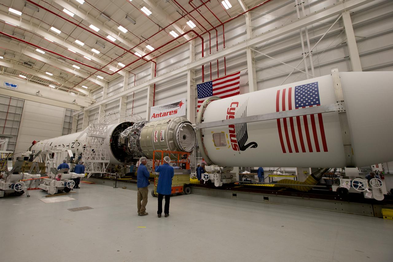
The payload fairing is installed on the Orbital Sciences Antares rocket at the Horizontal Integration Facility at NASA's Wallops Flight Facility on Virginia's Eastern Shore, Tuesday, July 8, 2014. The Antares rocket is scheduled to roll-out to Virginia's Mid-Atlantic Regional Spaceport Pad 0A Wednesday, July 9, ahead of its scheduled launch July 11. The Antares rocket will carry Orbital's unmanned Cygnus spacecraft to the International Space Station. This Orbital-2 mission's cargo is more than 3,000 pounds of supplies for the station, including science experiments to expand the research capability of the Expedition 40 crew members aboard the orbiting laboratory, crew provisions, spare parts and experiment hardware. Credit: NASA's Wallops Flight Facility <b><a href="http://www.nasa.gov/audience/formedia/features/MP_Photo_Guidelines.html" rel="nofollow">NASA image use policy.</a></b> <b><a href="http://www.nasa.gov/centers/goddard/home/index.html" rel="nofollow">NASA Goddard Space Flight Center</a></b> enables NASA’s mission through four scientific endeavors: Earth Science, Heliophysics, Solar System Exploration, and Astrophysics. Goddard plays a leading role in NASA’s accomplishments by contributing compelling scientific knowledge to advance the Agency’s mission. <b>Follow us on <a href="http://twitter.com/NASAGoddardPix" rel="nofollow">Twitter</a></b> <b>Like us on <a href="http://www.facebook.com/pages/Greenbelt-MD/NASA-Goddard/395013845897?ref=tsd" rel="nofollow">Facebook</a></b> <b>Find us on <a href="http://instagram.com/nasagoddard?vm=grid" rel="nofollow">Instagram</a></b>
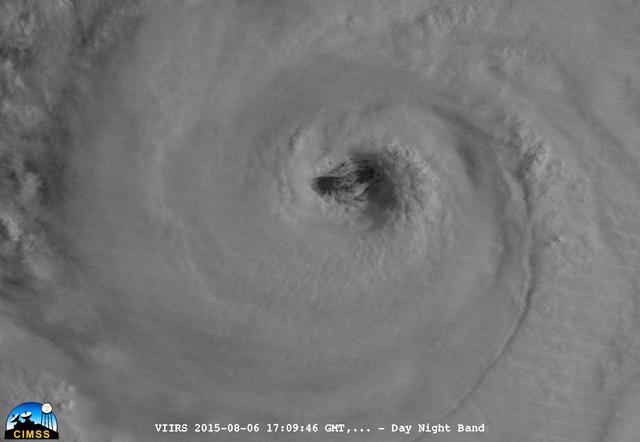
On August 6, 2015, NASA-NOAA's Suomi NPP satellite passed over powerful Typhoon Soudelor when it was headed toward Taiwan. The Visible Infrared Imaging Radiometer Suite (VIIRS) instrument aboard NASA-NOAA's Suomi satellite captured this night-time infrared close-up image of Soudelor's eye. At 1500 UTC (11 a.m. EDT) on August 6, 2015, Typhoon Soudelor had maximum sustained winds near 90 knots (103.6 mph/166.7 kph). It was centered near 21.3 North latitude and 127.5 East longitude, about 324 nautical miles (372.9 miles/600 km) south of Kadena Air Base, Okinawa, Japan. It was moving to the west at 10 knots (11.5 mph/18.5 kph). Credit: UWM/CIMSS/SSEC, William Straka III <b><a href="http://www.nasa.gov/audience/formedia/features/MP_Photo_Guidelines.html" rel="nofollow">NASA image use policy.</a></b> <b><a href="http://www.nasa.gov/centers/goddard/home/index.html" rel="nofollow">NASA Goddard Space Flight Center</a></b> enables NASA’s mission through four scientific endeavors: Earth Science, Heliophysics, Solar System Exploration, and Astrophysics. Goddard plays a leading role in NASA’s accomplishments by contributing compelling scientific knowledge to advance the Agency’s mission. <b>Follow us on <a href="http://twitter.com/NASAGoddardPix" rel="nofollow">Twitter</a></b> <b>Like us on <a href="http://www.facebook.com/pages/Greenbelt-MD/NASA-Goddard/395013845897?ref=tsd" rel="nofollow">Facebook</a></b> <b>Find us on <a href="http://instagrid.me/nasagoddard/?vm=grid" rel="nofollow">Instagram</a></b>
Average cruising speed for the R/V Atlantis is eleven (11) knots. Typical crew size for a research voyage is 22, not counting scientists, guests, and other technicians. --- The <b><a href="http://naames.larc.nasa.gov/" rel="nofollow">North Atlantic Aerosols and Marine Ecosystems Study </a></b> (NAAMES) is a five year investigation to resolve key processes controlling ocean system function, their influences on atmospheric aerosols and clouds and their implications for climate. Michael Starobin joined the NAAMES field campaign on behalf of Earth Expeditions and NASA Goddard Space Flight Center’s Office of Communications. He presented stories about the important, multi-disciplinary research being conducted by the NAAMES team, with an eye towards future missions on the NASA drawing board. This is a NAAMES photo essay put together by Starobin, a collection of 49 photographs and captions. Photo and Caption Credit: Michael Starobin <b><a href="http://www.nasa.gov/audience/formedia/features/MP_Photo_Guidelines.html" rel="nofollow">NASA image use policy</a></b> <b><a href="http://www.nasa.gov/centers/goddard/home/index.html" rel="nofollow">NASA Goddard Space Flight Center</a></b> enables NASA’s mission through four scientific endeavors: Earth Science, Heliophysics, Solar System Exploration, and Astrophysics. Goddard plays a leading role in NASA’s accomplishments by contributing compelling scientific knowledge to advance the Agency’s mission. <b>Follow us on <a href="http://twitter.com/NASAGoddardPix" rel="nofollow">Twitter</a></b> <b>Like us on <a href="http://www.facebook.com/pages/Greenbelt-MD/NASA-Goddard/395013845897?ref=tsd" rel="nofollow">Facebook</a></b> <b>Find us on <a href="https://www.instagram.com/nasagoddard/?hl=en" rel="nofollow">Instagram</a></b>
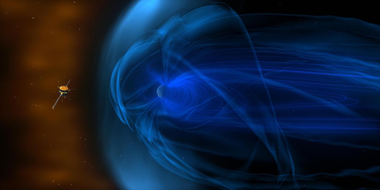
The end of 2014 marks two decades of data from a NASA mission called Wind. Wind -- along with 17 other missions – is part of what's called the Heliophysics Systems Observatory, a fleet of spacecraft dedicated to understanding how the sun and its giant explosions affect Earth, the planets and beyond. Wind launched on Nov. 1, 1994, with the goal of characterizing the constant stream of particles from the sun called the solar wind. With particle observations once every 3 seconds, and 11 magnetic measurements every second, Wind measurements were – and still are – the highest cadence solar wind observations for any near-Earth spacecraft. <b><a href="http://www.nasa.gov/audience/formedia/features/MP_Photo_Guidelines.html" rel="nofollow">NASA image use policy.</a></b> <b><a href="http://www.nasa.gov/centers/goddard/home/index.html" rel="nofollow">NASA Goddard Space Flight Center</a></b> enables NASA’s mission through four scientific endeavors: Earth Science, Heliophysics, Solar System Exploration, and Astrophysics. Goddard plays a leading role in NASA’s accomplishments by contributing compelling scientific knowledge to advance the Agency’s mission. <b>Follow us on <a href="http://twitter.com/NASAGoddardPix" rel="nofollow">Twitter</a></b> <b>Like us on <a href="http://www.facebook.com/pages/Greenbelt-MD/NASA-Goddard/395013845897?ref=tsd" rel="nofollow">Facebook</a></b> <b>Find us on <a href="http://instagrid.me/nasagoddard/?vm=grid" rel="nofollow">Instagram</a></b>
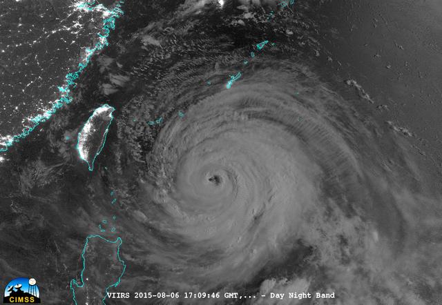
On August 6, 2015, NASA-NOAA's Suomi NPP satellite passed over powerful Typhoon Soudelor at night when it was headed toward Taiwan. The Visible Infrared Imaging Radiometer Suite (VIIRS) instrument aboard NASA-NOAA's Suomi satellite captured this night-time infrared image of the storm. At 1500 UTC (11 a.m. EDT) on August 6, 2015, Typhoon Soudelor had maximum sustained winds near 90 knots (103.6 mph/166.7 kph). It was centered near 21.3 North latitude and 127.5 East longitude, about 324 nautical miles (372.9 miles/600 km) south of Kadena Air Base, Okinawa, Japan. It was moving to the west at 10 knots (11.5 mph/18.5 kph). Taiwan is located west (left) of the powerful typhoon in this image. Credit: UWM/CIMSS/SSEC, William Straka III <b><a href="http://www.nasa.gov/audience/formedia/features/MP_Photo_Guidelines.html" rel="nofollow">NASA image use policy.</a></b> <b><a href="http://www.nasa.gov/centers/goddard/home/index.html" rel="nofollow">NASA Goddard Space Flight Center</a></b> enables NASA’s mission through four scientific endeavors: Earth Science, Heliophysics, Solar System Exploration, and Astrophysics. Goddard plays a leading role in NASA’s accomplishments by contributing compelling scientific knowledge to advance the Agency’s mission. <b>Follow us on <a href="http://twitter.com/NASAGoddardPix" rel="nofollow">Twitter</a></b> <b>Like us on <a href="http://www.facebook.com/pages/Greenbelt-MD/NASA-Goddard/395013845897?ref=tsd" rel="nofollow">Facebook</a></b> <b>Find us on <a href="http://instagrid.me/nasagoddard/?vm=grid" rel="nofollow">Instagram</a></b>
This image from the Aqua satellite's MODIS instrument taken at 11:10 UTC on December 16, 2013 shows areas of snow in Syria, Jordan, Israel and the Palestinian Territory. Snow storms in the Middle East are not frequent but not uncommon either. However, this one was unusually early in the winter and more intense than normal. The storm paralyzed Jerusalem with 30 to 50 centimeters (12 to 20 inches) of snow, knocking out power for roughly 15,000 households. The snow closed mountain roads leading into the city, effectively cutting Jerusalem off. Amman, Jordan, received about 45 cm (18 inches) of snow, and Lebanon and Syria also were unusually cold and snowy. Lower elevations near the coast received torrential rain during the storm, resulting in flooding. Some 40,000 people were forced to evacuate flooded areas in Gaza, according to the Associated Press. The floods are not visible at this scale, but tan and green plumes of sediment are visible along the Mediterranean Sea coast. Such plumes can be caused by floods and run off, though stormy, turbid waters may also bring sediment to the surface. <b><a href="http://www.nasa.gov/audience/formedia/features/MP_Photo_Guidelines.html" rel="nofollow">NASA image use policy.</a></b> <b><a href="http://www.nasa.gov/centers/goddard/home/index.html" rel="nofollow">NASA Goddard Space Flight Center</a></b> enables NASA’s mission through four scientific endeavors: Earth Science, Heliophysics, Solar System Exploration, and Astrophysics. Goddard plays a leading role in NASA’s accomplishments by contributing compelling scientific knowledge to advance the Agency’s mission. <b>Follow us on <a href="http://twitter.com/NASA_GoddardPix" rel="nofollow">Twitter</a></b> <b>Like us on <a href="http://www.facebook.com/pages/Greenbelt-MD/NASA-Goddard/395013845897?ref=tsd" rel="nofollow">Facebook</a></b> <b>Find us on <a href="http://instagram.com/nasagoddard?vm=grid" rel="nofollow">Instagram</a></b>
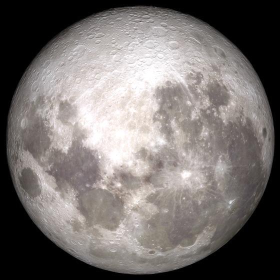
<b>Share YOUR Supermoon images with NASA in our Flickr Group: <a href="http://www.flickr.com/groups/supermoon2013/">www.flickr.com/groups/supermoon2013/</a></b> Up there in the sky – it's not a bird or a plane; it's a "Supermoon." Bigger and brighter then normal full moons, the supermoon on June 22/23 will be the closest and largest full moon for all of 2013. The moon will be some 29,000 miles closer to Earth than the farthest point in its orbit, but not to worry the moon will still be more than 221,000 miles away from our blue planet. --- This is an animation of the moon that was created using data from NASA's LRO satellite. Details: Time: Sunday, June 23, 2013, 15:00 UT (11:00 AM EDT) Phase: 99.9% Diameter:2007.5 arcseconds Distance:357015 km (28.02 Earth diameters) J2000 Right Ascension, Declination18h 17m 42s, -19° 31' 35" Subsolar Longitude, Latitude-1.905°, -1.129° Sub-Earth Longitude, Latitude0.093°, -5.002° Position Angle:359.213° Credit: NASA/Goddard/LRO More images and animarions of the moon can be found here: <a href="http://1.usa.gov/14bPRjT" rel="nofollow">1.usa.gov/14bPRjT</a> <b><a href="http://www.nasa.gov/audience/formedia/features/MP_Photo_Guidelines.html" rel="nofollow">NASA image use policy.</a></b> <b><a href="http://www.nasa.gov/centers/goddard/home/index.html" rel="nofollow">NASA Goddard Space Flight Center</a></b> enables NASA’s mission through four scientific endeavors: Earth Science, Heliophysics, Solar System Exploration, and Astrophysics. Goddard plays a leading role in NASA’s accomplishments by contributing compelling scientific knowledge to advance the Agency’s mission. <b>Follow us on <a href="http://twitter.com/NASAGoddardPix" rel="nofollow">Twitter</a></b> <b>Like us on <a href="http://www.facebook.com/pages/Greenbelt-MD/NASA-Goddard/395013845897?ref=tsd" rel="nofollow">Facebook</a></b> <b>Find us on <a href="http://instagram.com/nasagoddard?vm=grid" rel="nofollow">Instagram</a></b>
Solar eclipse over western Africa (morning overpass) at 11:45 UTC. Satellite: Terra A rare “hybrid” solar eclipse occurred on 03 November 2013, which began over the western Atlantic Ocean as an annular eclipse and transitioned into a full total solar eclipse for observers along the narrow path of totality in the far eastern Atlantic and over parts of Africa. The Lunar Umbra (or solar eclipse shadow) could be seen tracking rapidly southeastward across the Atlantic Ocean. Credit: NASA/GSFC/Jeff Schmaltz/MODIS Land Rapid Response Team <b><a href="http://www.nasa.gov/audience/formedia/features/MP_Photo_Guidelines.html" rel="nofollow">NASA image use policy.</a></b> <b><a href="http://www.nasa.gov/centers/goddard/home/index.html" rel="nofollow">NASA Goddard Space Flight Center</a></b> enables NASA’s mission through four scientific endeavors: Earth Science, Heliophysics, Solar System Exploration, and Astrophysics. Goddard plays a leading role in NASA’s accomplishments by contributing compelling scientific knowledge to advance the Agency’s mission. <b>Follow us on <a href="http://twitter.com/NASA_GoddardPix" rel="nofollow">Twitter</a></b> <b>Like us on <a href="http://www.facebook.com/pages/Greenbelt-MD/NASA-Goddard/395013845897?ref=tsd" rel="nofollow">Facebook</a></b> <b>Find us on <a href="http://instagram.com/nasagoddard?vm=grid" rel="nofollow">Instagram</a></b>
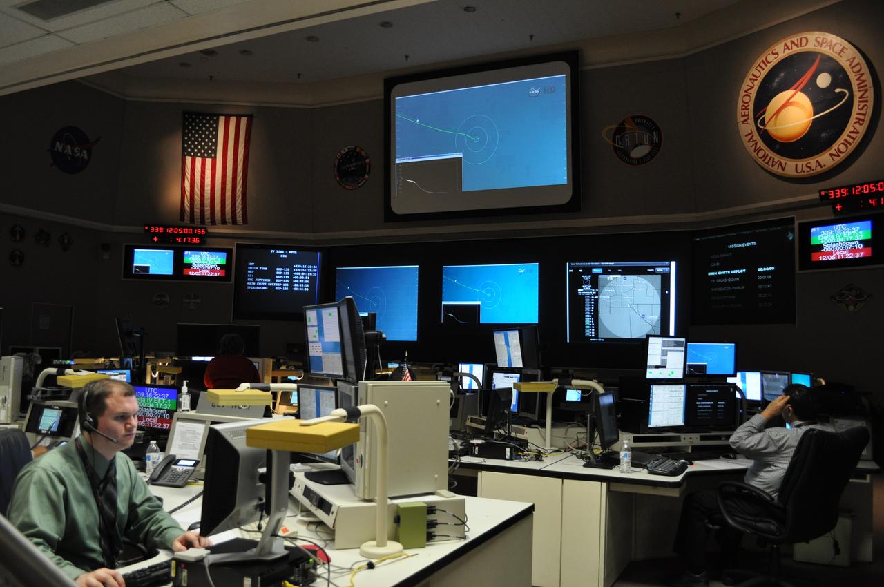
NASA's Goddard Space Flight Center in Greenbelt, Maryland, played a critical role in the test flight of the #Orion spacecraft on Dec. 5, 2014. Goddard's Networks Integration Center, pictured here, coordinated the communications support for both the Orion vehicle and the Delta IV rocket, ensuring complete communications coverage through NASA's Space Network and Tracking and Data Relay Satellite. The Orion spacecraft lifted off from Cape Canaveral Air Force Station's Space Launch Complex 37 in Florida at 7:05 a.m. EST. The Orion capsule splashed down about four and a half hours later, at 11:29 a.m. EST, about 600 miles off the coast of San Diego, California. While no humans were aboard Orion for this test flight, in the future, Orion will allow humans to travel deeper in to space than ever before, including an asteroid and Mars. Credit: NASA/Goddard/Amber Jacobson Credit: NASA/Goddard/Amber Jacobson <b><a href="http://www.nasa.gov/audience/formedia/features/MP_Photo_Guidelines.html" rel="nofollow">NASA image use policy.</a></b> <b><a href="http://www.nasa.gov/centers/goddard/home/index.html" rel="nofollow">NASA Goddard Space Flight Center</a></b> enables NASA’s mission through four scientific endeavors: Earth Science, Heliophysics, Solar System Exploration, and Astrophysics. Goddard plays a leading role in NASA’s accomplishments by contributing compelling scientific knowledge to advance the Agency’s mission. <b>Follow us on <a href="http://twitter.com/NASAGoddardPix" rel="nofollow">Twitter</a></b> <b>Like us on <a href="http://www.facebook.com/pages/Greenbelt-MD/NASA-Goddard/395013845897?ref=tsd" rel="nofollow">Facebook</a></b> <b>Find us on <a href="http://instagram.com/nasagoddard?vm=grid" rel="nofollow">Instagram</a></b>

The sun emitted a mid-level solar flare, peaking at 11:24 p.m. EST on Jan. 12, 2015. NASA’s Solar Dynamics Observatory, which watches the sun constantly, captured an image of the event. Solar flares are powerful bursts of radiation. Harmful radiation from a flare cannot pass through Earth's atmosphere to physically affect humans on the ground, however -- when intense enough -- they can disturb the atmosphere in the layer where GPS and communications signals travel. This flare is classified as an M5.6-class flare. M-class flares are a tenth the size of the most intense flares, the X-class flares. The number provides more information about its strength. An M2 is twice as intense as an M1, an M3 is three times as intense, etc. Credit: NASA/Goddard/SDO <b><a href="http://www.nasa.gov/audience/formedia/features/MP_Photo_Guidelines.html" rel="nofollow">NASA image use policy.</a></b> <b><a href="http://www.nasa.gov/centers/goddard/home/index.html" rel="nofollow">NASA Goddard Space Flight Center</a></b> enables NASA’s mission through four scientific endeavors: Earth Science, Heliophysics, Solar System Exploration, and Astrophysics. Goddard plays a leading role in NASA’s accomplishments by contributing compelling scientific knowledge to advance the Agency’s mission. <b>Follow us on <a href="http://twitter.com/NASAGoddardPix" rel="nofollow">Twitter</a></b> <b>Like us on <a href="http://www.facebook.com/pages/Greenbelt-MD/NASA-Goddard/395013845897?ref=tsd" rel="nofollow">Facebook</a></b> <b>Find us on <a href="http://instagram.com/nasagoddard?vm=grid" rel="nofollow">Instagram</a></b>
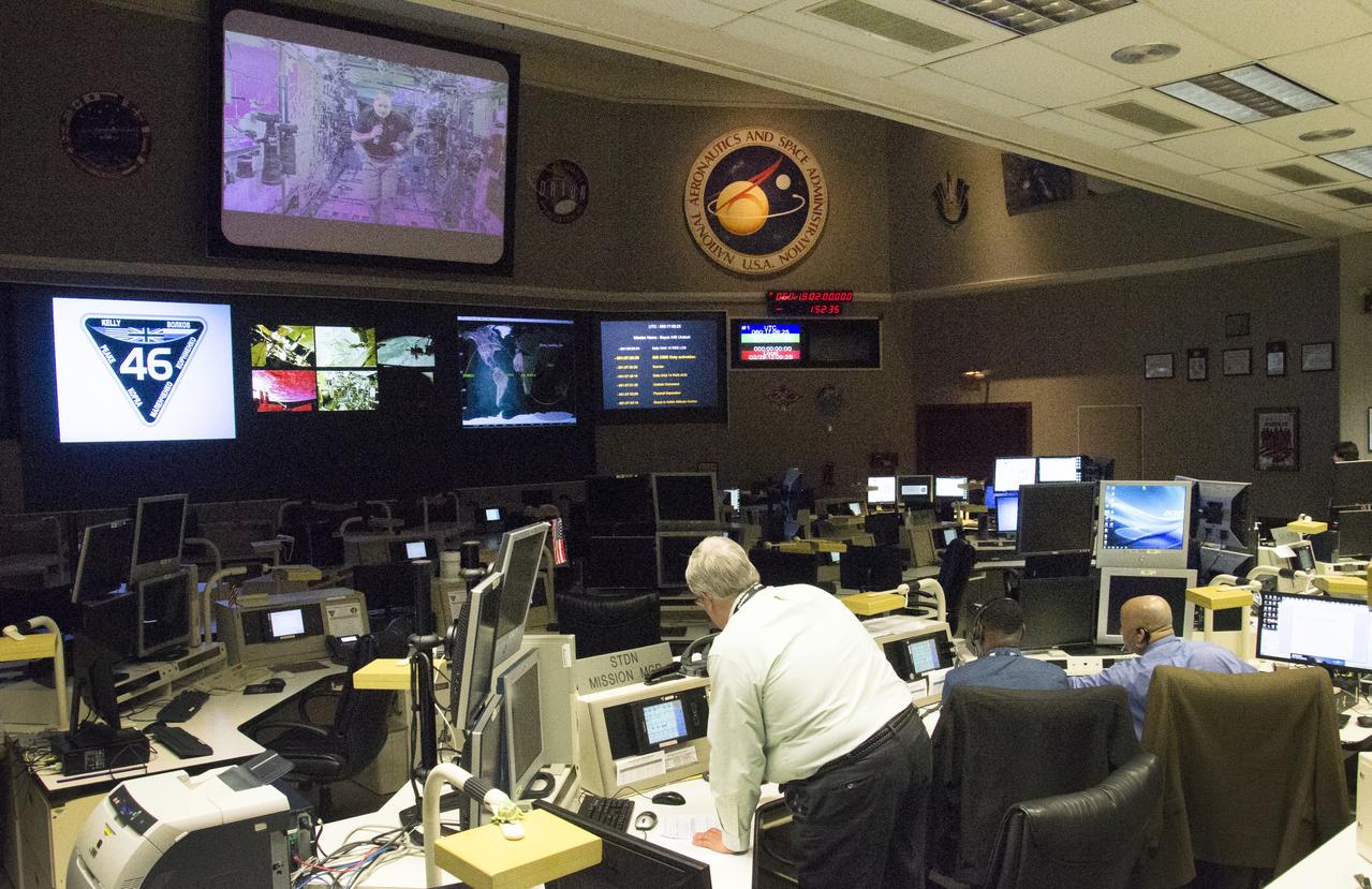
NASA's Goddard Space Flight Center in Greenbelt, Maryland, will monitor the landing of NASA Astronaut Scott Kelly and Russian Cosmonaut Mikhail Kornienko from their #YearInSpace Mission. Goddard's Networks Integration Center, pictured above, leads all coordination for space-to-ground communications support for the International Space Station and provides contingency support for the Soyuz TMA-18M 44S spacecraft, ensuring complete communications coverage through NASA's Space Network. The Soyuz 44S spacecraft will undock at 8:02 p.m. EST this evening from the International Space Station. It will land approximately three and a half hours later, at 11:25 p.m. EST in Kazakhstan. Both Kelly and Kornienko have spent 340 days aboard the International Space Station, preparing humanity for long duration missions and exploration into deep space. Read more: <a href="http://www.nasa.gov/feature/goddard/2016/ending-year-in-space-nasa-goddard-network-maintains-communications-from-space-to-ground" rel="nofollow">www.nasa.gov/feature/goddard/2016/ending-year-in-space-na...</a> Credit: NASA/Goddard/Rebecca Roth <b><a href="http://www.nasa.gov/audience/formedia/features/MP_Photo_Guidelines.html" rel="nofollow">NASA image use policy.</a></b> <b><a href="http://www.nasa.gov/centers/goddard/home/index.html" rel="nofollow">NASA Goddard Space Flight Center</a></b> enables NASA’s mission through four scientific endeavors: Earth Science, Heliophysics, Solar System Exploration, and Astrophysics. Goddard plays a leading role in NASA’s accomplishments by contributing compelling scientific knowledge to advance the Agency’s mission. <b>Follow us on <a href="http://twitter.com/NASAGoddardPix" rel="nofollow">Twitter</a></b> <b>Like us on <a href="http://www.facebook.com/pages/Greenbelt-MD/NASA-Goddard/395013845897?ref=tsd" rel="nofollow">Facebook</a></b> <b>Find us on <a href="http://instagrid.me/nasagoddard/?vm=grid" rel="nofollow">Instagram</a></b>
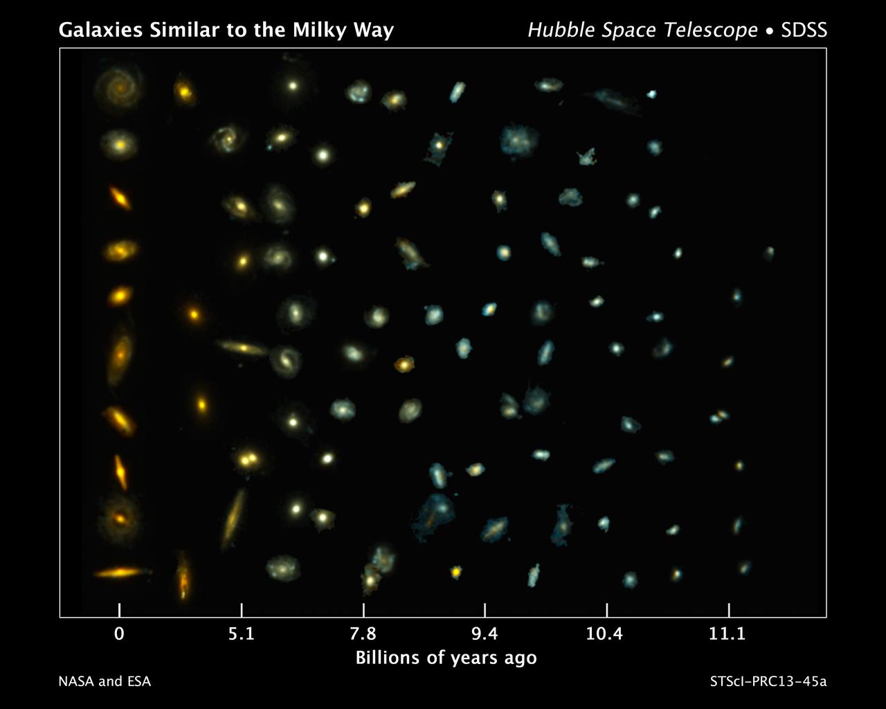
This composite image shows examples of galaxies similar to our Milky Way at various stages of construction over a time span of 11 billion years. The galaxies are arranged according to time. Those on the left reside nearby; those at far right existed when the cosmos was about 2 billion years old. The bluish glow from young stars dominates the color of the galaxies on the right. The galaxies at left are redder from the glow of older stellar populations. Astronomers found the distant galaxies in two Hubble Space Telescope surveys: 3D-HST and the Cosmic Assembly Near-infrared Deep Extragalactic Legacy Survey, or CANDELS. The observations were made in visible and near-infrared light by Hubble's Wide Field Camera 3 and Advanced Camera for Surveys. The nearby galaxies were taken from the Sloan Digital Sky Survey. This image traces Milky Way-like galaxies over most of cosmic history, revealing how they evolve over time. Hubble's sharp vision resolved the galaxies' shapes, showing that their bulges and disks grew simultaneously. Credit: NASA, ESA, P. van Dokkum (Yale University), S. Patel (Leiden University), and the 3D-HST Team <b><a href="http://www.nasa.gov/audience/formedia/features/MP_Photo_Guidelines.html" rel="nofollow">NASA image use policy.</a></b> <b><a href="http://www.nasa.gov/centers/goddard/home/index.html" rel="nofollow">NASA Goddard Space Flight Center</a></b> enables NASA’s mission through four scientific endeavors: Earth Science, Heliophysics, Solar System Exploration, and Astrophysics. Goddard plays a leading role in NASA’s accomplishments by contributing compelling scientific knowledge to advance the Agency’s mission. <b>Follow us on <a href="http://twitter.com/NASA_GoddardPix" rel="nofollow">Twitter</a></b> <b>Like us on <a href="http://www.facebook.com/pages/Greenbelt-MD/NASA-Goddard/395013845897?ref=tsd" rel="nofollow">Facebook</a></b> <b>Find us on <a href="http://instagram.com/nasagoddard?vm=grid" rel="nofollow">Instagram</a></b>
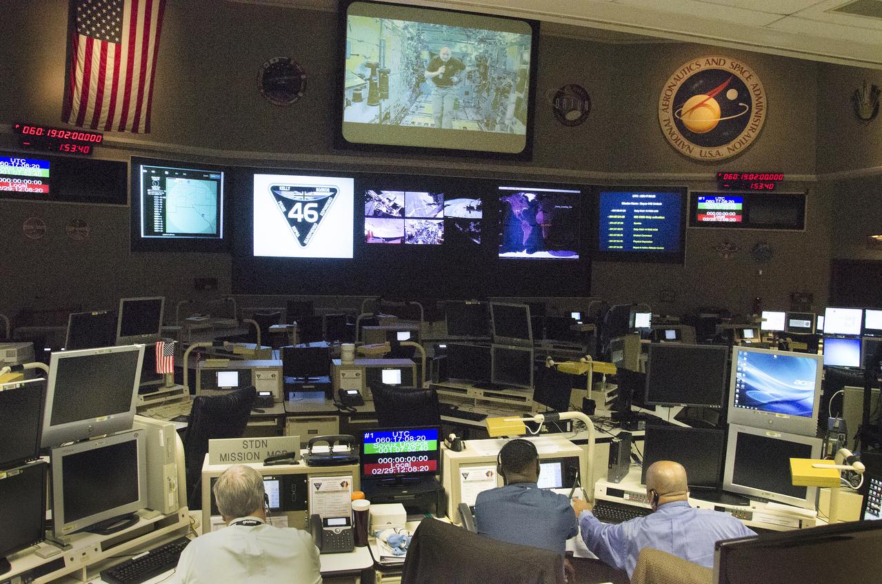
NASA's Goddard Space Flight Center in Greenbelt, Maryland, will monitor the landing of NASA Astronaut Scott Kelly and Russian Cosmonaut Mikhail Kornienko from their #YearInSpace Mission. Goddard's Networks Integration Center, pictured above, leads all coordination for space-to-ground communications support for the International Space Station and provides contingency support for the Soyuz TMA-18M 44S spacecraft, ensuring complete communications coverage through NASA's Space Network. The Soyuz 44S spacecraft will undock at 8:02 p.m. EST this evening from the International Space Station. It will land approximately three and a half hours later, at 11:25 p.m. EST in Kazakhstan. Both Kelly and Kornienko have spent 340 days aboard the International Space Station, preparing humanity for long duration missions and exploration into deep space. Read more: <a href="http://www.nasa.gov/feature/goddard/2016/ending-year-in-space-nasa-goddard-network-maintains-communications-from-space-to-ground" rel="nofollow">www.nasa.gov/feature/goddard/2016/ending-year-in-space-na...</a> Credit: NASA/Goddard/Rebecca Roth <b><a href="http://www.nasa.gov/audience/formedia/features/MP_Photo_Guidelines.html" rel="nofollow">NASA image use policy.</a></b> <b><a href="http://www.nasa.gov/centers/goddard/home/index.html" rel="nofollow">NASA Goddard Space Flight Center</a></b> enables NASA’s mission through four scientific endeavors: Earth Science, Heliophysics, Solar System Exploration, and Astrophysics. Goddard plays a leading role in NASA’s accomplishments by contributing compelling scientific knowledge to advance the Agency’s mission. <b>Follow us on <a href="http://twitter.com/NASAGoddardPix" rel="nofollow">Twitter</a></b> <b>Like us on <a href="http://www.facebook.com/pages/Greenbelt-MD/NASA-Goddard/395013845897?ref=tsd" rel="nofollow">Facebook</a></b> <b>Find us on <a href="http://instagrid.me/nasagoddard/?vm=grid" rel="nofollow">Instagram</a></b>
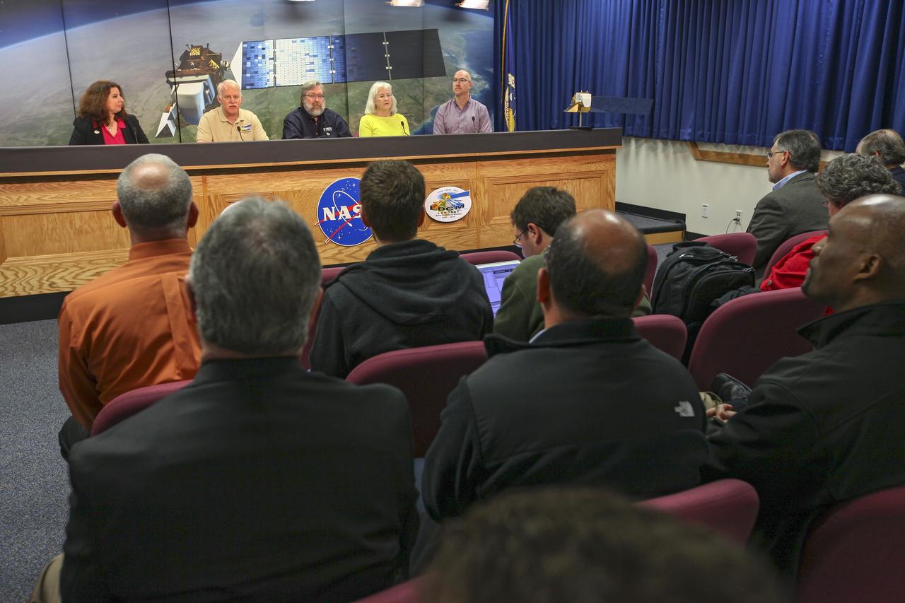
VANDENBERG AIR FORCE BASE, Calif. -- Media attend a mission science briefing at Vandenberg Air Force Base in California in preparation for the launch of the Landsat Data Continuity Mission LDCM. From left are Rani Gran of NASA Public Affairs, LDCM project scientist Dr. Jim Irons from NASA's Goddard Space Flight Center, senior scientist and co-chair of the Landsat Science Team U.S. Geological Survey Earth Resources Observation and Science EROS Center Dr. Thomas Loveland, Landsat scientist and president of Kass Green and Associates Kass Green, and senior research scientist Dr. Mike Wulder of the Landsat Science Team Canadian Forest Service, Natural Resources Canada. Launch of LDCM aboard a United Launch Alliance Atlas V rocket from Vandenberg's Space Launch Complex-3E is planned for Feb. 11 during a 48-minute launch window that opens at 10:02 a.m. PST, or 1:02 p.m. EST. LDCM is the eighth satellite in the Landsat Program series of Earth-observing missions and will continue the program’s critical role in monitoring, understanding and managing the resources needed for human sustainment, such as food, water and forests. NASA's Goddard Space Flight Center in Greenbelt, Md., is responsible for LDCM project management. Orbital Sciences Corp. built the LDCM satellite. NASA's Launch Services Program at the Kennedy Space Center in Florida provides launch management. After launch and the initial checkout phase, the U. S. Geological Survey will take operational control of LDCM, and it will be renamed Landsat 8. Photo credit: NASA/Kim Shiflett
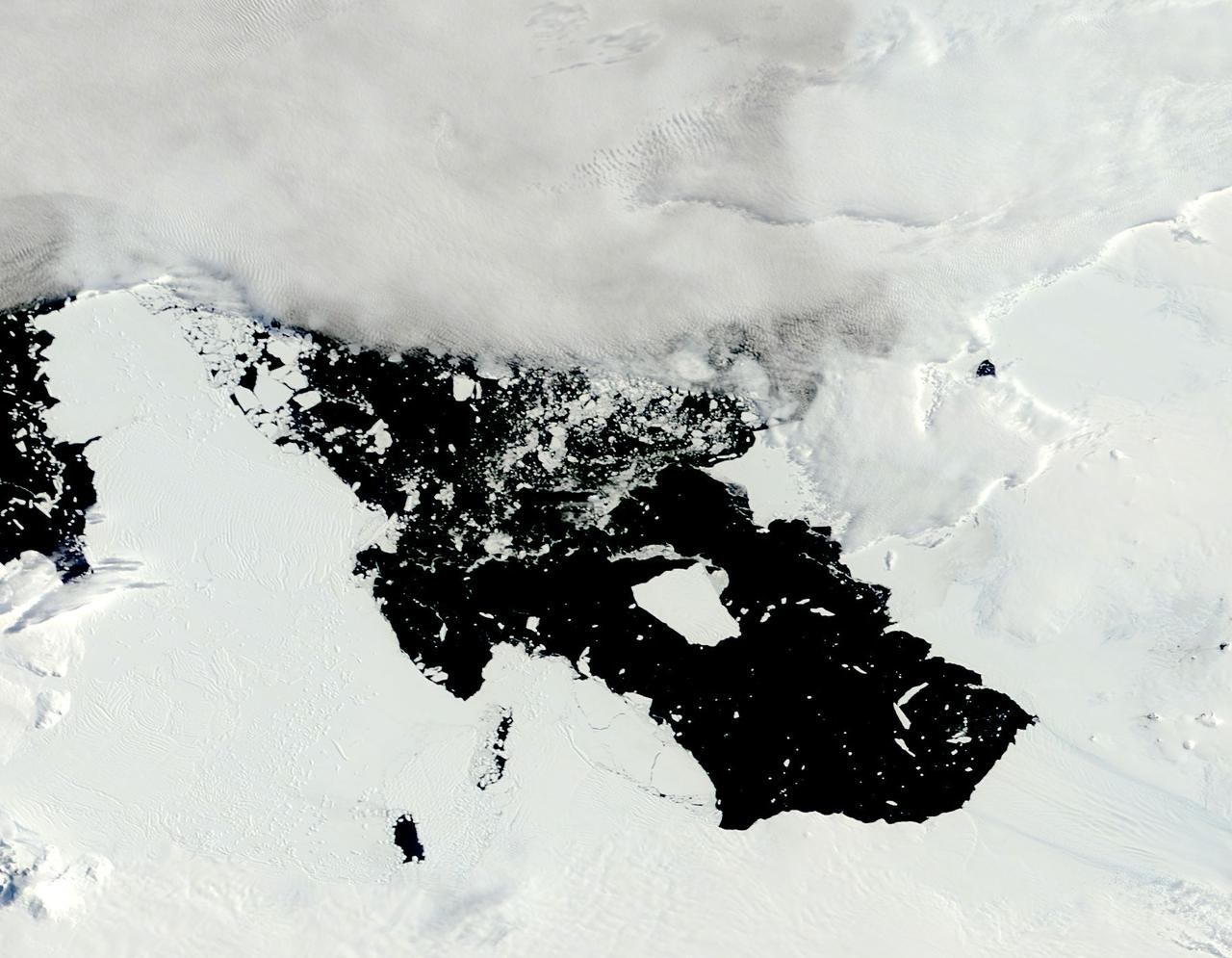
The voyage of Iceberg B-31 continued in January, 2014 as the giant iceberg drifted over the frigid waters of Pine Island Bay and widened the gap between the newly-calved iceberg and the “mother” glacier. Between November 9 and 11, 20143 a giant crack in the Pine Island Glacier gave completely away, liberating Iceberg B-31 from the end of the glacial tongue. The new iceberg was estimated to be 35 km by 20 km (21 mi by 12 mi) in size – or roughly the size of Singapore. On January 5, 2014 the Moderate Resolution Imaging Spectroradiometer (MODIS) aboard NASA’s Terra satellite captured this true-color image of B-31 floating in the center of Pine Island Bay on an approach to the Amundsen Sea. Pine Island Glacier can be seen on the upper right coast of the bay, and is marked by parallel lines in the ice. According to measurements reported by the National U.S. Ice Center, on January 10, B-31 was maintaining its size, and was located at 74°24'S and 104°33'W. Credit: NASA/GSFC/Jeff Schmaltz/MODIS Land Rapid Response Team <b><a href="http://www.nasa.gov/audience/formedia/features/MP_Photo_Guidelines.html" rel="nofollow">NASA image use policy.</a></b> <b><a href="http://www.nasa.gov/centers/goddard/home/index.html" rel="nofollow">NASA Goddard Space Flight Center</a></b> enables NASA’s mission through four scientific endeavors: Earth Science, Heliophysics, Solar System Exploration, and Astrophysics. Goddard plays a leading role in NASA’s accomplishments by contributing compelling scientific knowledge to advance the Agency’s mission. <b>Follow us on <a href="http://twitter.com/NASA_GoddardPix" rel="nofollow">Twitter</a></b> <b>Like us on <a href="http://www.facebook.com/pages/Greenbelt-MD/NASA-Goddard/395013845897?ref=tsd" rel="nofollow">Facebook</a></b> <b>Find us on <a href="http://instagrid.me/nasagoddard/?vm=grid" rel="nofollow">Instagram</a></b>
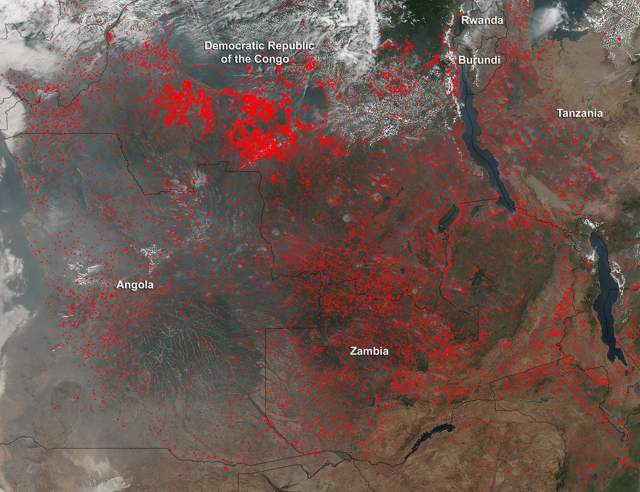
Widespread agricultural burning continues throughout central Africa. Smoke and fires in several countries were seen by the Suomi NPP satellite. Most of the fires were burning in the southern region of the Democratic Republic of the Congo, Tanzania, Zambia and Angola. NASA-NOAA's Suomi NPP satellite's Visible Infrared Imaging Radiometer Suite (VIIRS) instrument captured a look at multiple fires and smoke on August 1 at 7:55 a.m. EDT (11:55 UTC). Actively burning areas, detected by VIIRS are outlined in red. Credit: NASA/Jeff Schmaltz/NASA Goddard Rapid Response Team <b><a href="http://www.nasa.gov/audience/formedia/features/MP_Photo_Guidelines.html" rel="nofollow">NASA image use policy.</a></b> <b><a href="http://www.nasa.gov/centers/goddard/home/index.html" rel="nofollow">NASA Goddard Space Flight Center</a></b> enables NASA’s mission through four scientific endeavors: Earth Science, Heliophysics, Solar System Exploration, and Astrophysics. Goddard plays a leading role in NASA’s accomplishments by contributing compelling scientific knowledge to advance the Agency’s mission. <b>Follow us on <a href="http://twitter.com/NASAGoddardPix" rel="nofollow">Twitter</a></b> <b>Like us on <a href="http://www.facebook.com/pages/Greenbelt-MD/NASA-Goddard/395013845897?ref=tsd" rel="nofollow">Facebook</a></b> <b>Find us on <a href="http://instagrid.me/nasagoddard/?vm=grid" rel="nofollow">Instagram</a></b>
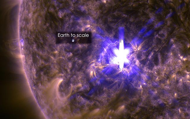
The sun emitted a significant solar flare, peaking at 12:22 p.m. EDT on March 11, 2015. NASA’s Solar Dynamics Observatory, which watches the sun constantly, captured an image of the event. Solar flares are powerful bursts of radiation. Harmful radiation from a flare cannot pass through Earth's atmosphere to physically affect humans on the ground, however -- when intense enough -- they can disturb the atmosphere in the layer where GPS and communications signals travel. This flare is classified as an X2.2-class flare. X-class denotes the most intense flares, while the number provides more information about its strength. An X2 is twice as intense as an X1, an X3 is three times as intense, etc. This image was captured by NASA's Solar Dynamics Observatory and shows a blend of light from the 171 and 131 Ångström wavelengths. The Earth is shown to scale. Credit: NASA/Goddard/SDO <b><a href="http://www.nasa.gov/audience/formedia/features/MP_Photo_Guidelines.html" rel="nofollow">NASA image use policy.</a></b> <b><a href="http://www.nasa.gov/centers/goddard/home/index.html" rel="nofollow">NASA Goddard Space Flight Center</a></b> enables NASA’s mission through four scientific endeavors: Earth Science, Heliophysics, Solar System Exploration, and Astrophysics. Goddard plays a leading role in NASA’s accomplishments by contributing compelling scientific knowledge to advance the Agency’s mission. <b>Follow us on <a href="http://twitter.com/NASAGoddardPix" rel="nofollow">Twitter</a></b> <b>Like us on <a href="http://www.facebook.com/pages/Greenbelt-MD/NASA-Goddard/395013845897?ref=tsd" rel="nofollow">Facebook</a></b> <b>Find us on <a href="http://instagram.com/nasagoddard?vm=grid" rel="nofollow">Instagram</a></b>

Image released 11 Aug 2011. The "Necklace Nebula" is located 15,000 light-years away in the constellation Sagitta (the Arrow). In this composite image, taken on July 2, 2011, Hubble's Wide Field Camera 3 captured the glow of hydrogen (blue), oxygen (green), and nitrogen (red). The object, aptly named the Necklace Nebula, is a recently discovered planetary nebula, the glowing remains of an ordinary, Sun-like star. The nebula consists of a bright ring, measuring 12 trillion miles wide, dotted with dense, bright knots of gas that resemble diamonds in a necklace. <a href="http://www.nasa.gov/mission_pages/hubble/science/necklace-nebula.html" target="_blank" rel="nofollow"></a> <b>Credit:</b> NASA, ESA, and the Hubble Heritage Team (STScI/AURA) <b><a href="http://www.nasa.gov/centers/goddard/home/index.html" rel="nofollow">NASA Goddard Space Flight Center</a></b> enables NASA’s mission through four scientific endeavors: Earth Science, Heliophysics, Solar System Exploration, and Astrophysics. Goddard plays a leading role in NASA’s accomplishments by contributing compelling scientific knowledge to advance the Agency’s mission. <b>Follow us on <a href="http://twitter.com/NASA_GoddardPix" rel="nofollow">Twitter</a></b> <b>Like us on <a href="http://www.facebook.com/pages/Greenbelt-MD/NASA-Goddard/395013845897?ref=tsd" rel="nofollow">Facebook</a></b> <b>Find us on <a href="http://web.stagram.com/n/nasagoddard/?vm=grid" rel="nofollow">Instagram</a></b>
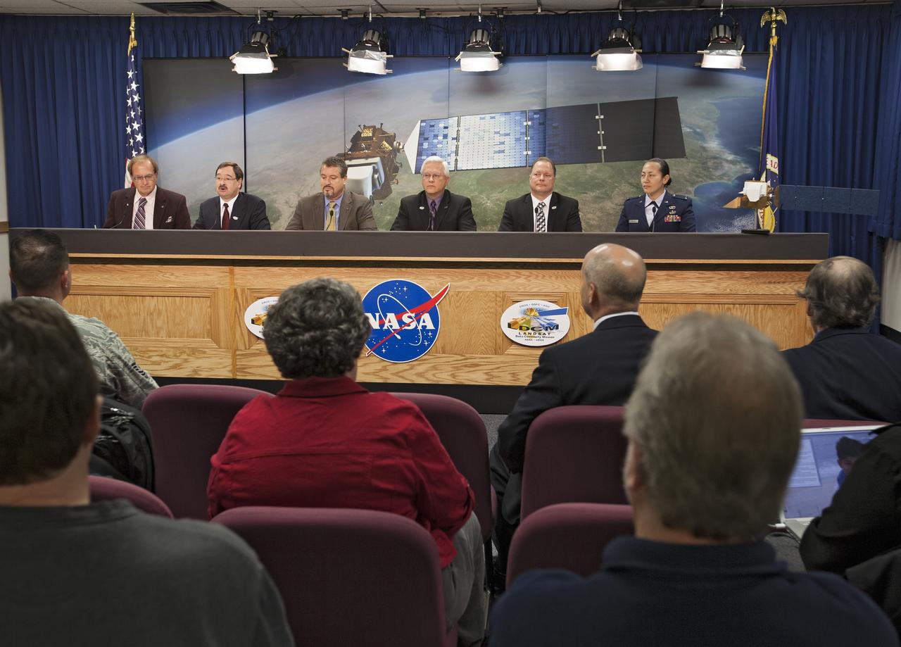
VANDENBERG AIR FORCE BASE, Calif. -- Media attend a prelaunch press conference at Vandenberg Air Force Base in California to discuss NASA's readiness to launch the Landsat Data Continuity Mission LDCM. From left are George Diller of NASA Public Affairs, LDCM program executive David Jarrett from NASA Headquarters, NASA Launch Director Omar Baez from Kennedy Space Center, United Launch Alliance Program Manager for NASA Missions Vernon Thorp, LDCM Project Manager Ken Schwer from Goddard Space Flight Center, and 1st Lt. Jennifer Kelley, launch weather officer for the 30th Operations Support Squadron at Vandenberg. Launch of LDCM aboard a United Launch Alliance Atlas V rocket from Vandenberg's Space Launch Complex-3E is planned for Feb. 11 during a 48-minute launch window that opens at 10:02 a.m. PST, or 1:02 p.m. EST. LDCM is the eighth satellite in the Landsat Program series of Earth-observing missions and will continue the program’s critical role in monitoring, understanding and managing the resources needed for human sustainment, such as food, water and forests. NASA's Goddard Space Flight Center in Greenbelt, Md., is responsible for LDCM project management. Orbital Sciences Corp. built the LDCM satellite. NASA's Launch Services Program at the Kennedy Space Center in Florida provides launch management. After launch and the initial checkout phase, the U. S. Geological Survey will take operational control of LDCM, and it will be renamed Landsat 8. Photo credit: NASA/Kim Shiflett

CLOUDY with a chance of NOT SEEING the Super Blood Moon Lunar Eclipse? WATCH Live here: <a href="http://bit.ly/1LfspfW" rel="nofollow">bit.ly/1LfspfW</a> No worries, we've got you've covered. Click on over to the live stream starting at 8:00 p.m. until at least 11:30 p.m. EDT broadcast from NASA's Marshall Space Flight Center in Huntsville, Ala., with a live feed from the Griffith Observatory, Los Angeles, Calif. Mitzi Adams, a NASA solar physicist at Marshall will discuss the eclipse and answer questions on Twitter. To ask a question, use #askNASA. <b><a href="http://www.nasa.gov/audience/formedia/features/MP_Photo_Guidelines.html" rel="nofollow">NASA image use policy.</a></b> <b><a href="http://www.nasa.gov/centers/goddard/home/index.html" rel="nofollow">NASA Goddard Space Flight Center</a></b> enables NASA’s mission through four scientific endeavors: Earth Science, Heliophysics, Solar System Exploration, and Astrophysics. Goddard plays a leading role in NASA’s accomplishments by contributing compelling scientific knowledge to advance the Agency’s mission. <b>Follow us on <a href="http://twitter.com/NASAGoddardPix" rel="nofollow">Twitter</a></b> <b>Like us on <a href="http://www.facebook.com/pages/Greenbelt-MD/NASA-Goddard/395013845897?ref=tsd" rel="nofollow">Facebook</a></b> <b>Find us on <a href="http://instagrid.me/nasagoddard/?vm=grid" rel="nofollow">Instagram</a></b>

NASA image release April 12, 2011 Astronomers have uncovered one of the youngest galaxies in the distant universe, with stars that formed 13.5 billion years ago, a mere 200 million years after the Big Bang. The finding addresses questions about when the first galaxies arose, and how the early universe evolved. NASA's Hubble Space Telescope was the first to spot the newfound galaxy. Detailed observations from the W.M. Keck Observatory on Mauna Kea in Hawaii revealed the observed light dates to when the universe was only 950 million years old; the universe formed about 13.7 billion years ago. Infrared data from both Hubble and NASA's Spitzer Space Telescope revealed the galaxy's stars are quite mature, having formed when the universe was just a toddler at 200 million years old. The galaxy's image is being magnified by the gravity of a massive cluster of galaxies (Abell 383) parked in front of it, making it appear 11 times brighter. This phenomenon is called gravitational lensing. Hubble imaged the lensing galaxy Abell 383 with the Wide Field Camera 3 and the Advanced Camera for Surveys in November 2010 through March 2011. Credit: NASA, ESA, J. Richard (Center for Astronomical Research/Observatory of Lyon, France), and J.-P. Kneib (Astrophysical Laboratory of Marseille, France) <b><a href="http://www.nasa.gov/centers/goddard/home/index.html" rel="nofollow">NASA Goddard Space Flight Center</a></b> enables NASA’s mission through four scientific endeavors: Earth Science, Heliophysics, Solar System Exploration, and Astrophysics. Goddard plays a leading role in NASA’s accomplishments by contributing compelling scientific knowledge to advance the Agency’s mission. <b>Follow us on <a href="http://twitter.com/NASA_GoddardPix" rel="nofollow">Twitter</a></b> <b>Join us on <a href="http://www.facebook.com/pages/Greenbelt-MD/NASA-Goddard/395013845897?ref=tsd" rel="nofollow">Facebook</a></b>
Former NASA astronaut C. Gordon Fullerton, seated in the cockpit of an F/A-18, is a research pilot at NASA's Dryden Flight Research Center, Edwards, Calif. Since transferring to Dryden in 1986, his assignments have included a variety of flight research and support activities piloting NASA's B-52 launch aircraft, the 747 Shuttle Carrier Aircraft (SCA), and other multi-engine and high performance aircraft. He flew a series of development air launches of the X-38 prototype Crew Return Vehicle and in the launches for the X-43A Hyper-X project. Fullerton also flies Dryden's DC-8 Airborne Science aircraft in support a variety of atmospheric physics, ground mapping and meteorology studies. Fullerton also was project pilot on the Propulsion Controlled Aircraft program, during which he successfully landed both a modified F-15 and an MD-11 transport with all control surfaces neutralized, using only engine thrust modulation for control. Fullerton also evaluated the flying qualities of the Russian Tu-144 supersonic transport during two flights in 1998, one of only two non-Russian pilots to fly that aircraft. With more than 15,000 hours of flying time, Fullerton has piloted 135 different types of aircraft in his career. As an astronaut, Fullerton served on the support crews for the Apollo 14, 15, 16, and 17 lunar missions. In 1977, Fullerton was on one of the two flight crews that piloted the Space Shuttle prototype Enterprise during the Approach and Landing Test Program at Dryden. Fullerton was the pilot on the STS-3 Space Shuttle orbital flight test mission in 1982, and commanded the STS-51F Spacelab 2 mission in 1985. He has logged 382 hours in space flight. In July 1988, he completed a 30-year career with the U.S. Air Force and retired as a colonel.

NASA's IceBridge, an airborne survey of polar ice, flew over the Helheim/Kangerdlugssuaq region of Greenland on Sept. 11, 2016. This photograph from the flight captures Greenland's Steenstrup Glacier, with the midmorning sun glinting off of the Denmark Strait in the background. IceBridge completed the final flight of the summer campaign to observe the impact of the summer melt season on the ice sheet on Sept. 16. The IceBridge flights, which began on Aug. 27, are mostly repeats of lines that the team flew in early May, so that scientists can observe changes in ice elevation between the spring and late summer. For this short, end-of-summer campaign, the IceBridge scientists flew aboard an HU-25A Guardian aircraft from NASA's Langley Research Center in Hampton, Virginia. Credit: NASA/John Sonntag <b><a href="http://www.nasa.gov/audience/formedia/features/MP_Photo_Guidelines.html" rel="nofollow">NASA image use policy.</a></b> <b><a href="http://www.nasa.gov/centers/goddard/home/index.html" rel="nofollow">NASA Goddard Space Flight Center</a></b> enables NASA’s mission through four scientific endeavors: Earth Science, Heliophysics, Solar System Exploration, and Astrophysics. Goddard plays a leading role in NASA’s accomplishments by contributing compelling scientific knowledge to advance the Agency’s mission. <b>Follow us on <a href="http://twitter.com/NASAGoddardPix" rel="nofollow">Twitter</a></b> <b>Like us on <a href="http://www.facebook.com/pages/Greenbelt-MD/NASA-Goddard/395013845897?ref=tsd" rel="nofollow">Facebook</a></b> <b>Find us on <a href="http://instagrid.me/nasagoddard/?vm=grid" rel="nofollow">Instagram</a></b>
NASA's Goddard Space Flight Center in Greenbelt, Maryland, will monitor the landing of NASA Astronaut Scott Kelly and Russian Cosmonaut Mikhail Kornienko from their #YearInSpace Mission. Goddard's Networks Integration Center, pictured above, leads all coordination for space-to-ground communications support for the International Space Station and provides contingency support for the Soyuz TMA-18M 44S spacecraft, ensuring complete communications coverage through NASA's Space Network. The Soyuz 44S spacecraft will undock at 8:02 p.m. EST this evening from the International Space Station. It will land approximately three and a half hours later, at 11:25 p.m. EST in Kazakhstan. Both Kelly and Kornienko have spent 340 days aboard the International Space Station, preparing humanity for long duration missions and exploration into deep space. Read more: <a href="http://www.nasa.gov/feature/goddard/2016/ending-year-in-space-nasa-goddard-network-maintains-communications-from-space-to-ground" rel="nofollow">www.nasa.gov/feature/goddard/2016/ending-year-in-space-na...</a> Credit: NASA/Goddard/Rebecca Roth <b><a href="http://www.nasa.gov/audience/formedia/features/MP_Photo_Guidelines.html" rel="nofollow">NASA image use policy.</a></b> <b><a href="http://www.nasa.gov/centers/goddard/home/index.html" rel="nofollow">NASA Goddard Space Flight Center</a></b> enables NASA’s mission through four scientific endeavors: Earth Science, Heliophysics, Solar System Exploration, and Astrophysics. Goddard plays a leading role in NASA’s accomplishments by contributing compelling scientific knowledge to advance the Agency’s mission. <b>Follow us on <a href="http://twitter.com/NASAGoddardPix" rel="nofollow">Twitter</a></b> <b>Like us on <a href="http://www.facebook.com/pages/Greenbelt-MD/NASA-Goddard/395013845897?ref=tsd" rel="nofollow">Facebook</a></b> <b>Find us on <a href="http://instagrid.me/nasagoddard/?vm=grid" rel="nofollow">Instagram</a></b>