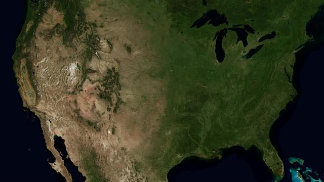
The Mississippi Watershed is the largest drainage basin in North America at 3.2 million square kilometers in area. The USGS has created a database of this area which indicates the direction of waterflow at each point. By assembling these directions into streamflows, it is possible to trace the path of water from every point of the area to the mouth of the Mississippi in the Gulf of Mexico. This animation starts with the points furthest from the Gulf and reveals the streams and rivers as a steady progression towards the mouth of the Mississippi until all the major rivers are revealed. The speed of the reveal of the rivers is not dependent on the actual speed of the water flow. The reveal proceeds at a constant velocity along each river path, timed so that all reveals reach the mouth of the Mississippi at the same time. This animation does not show actual flow rates of the rivers. All rivers are shown with identical rates. The river colors and widths correspond to the relative lengths of river segments. Credit: NASA's Scientific Visualization Studio/Horace Mitchell Go here to download this video: <a href="http://svs.gsfc.nasa.gov/4493" rel="nofollow">svs.gsfc.nasa.gov/4493</a>
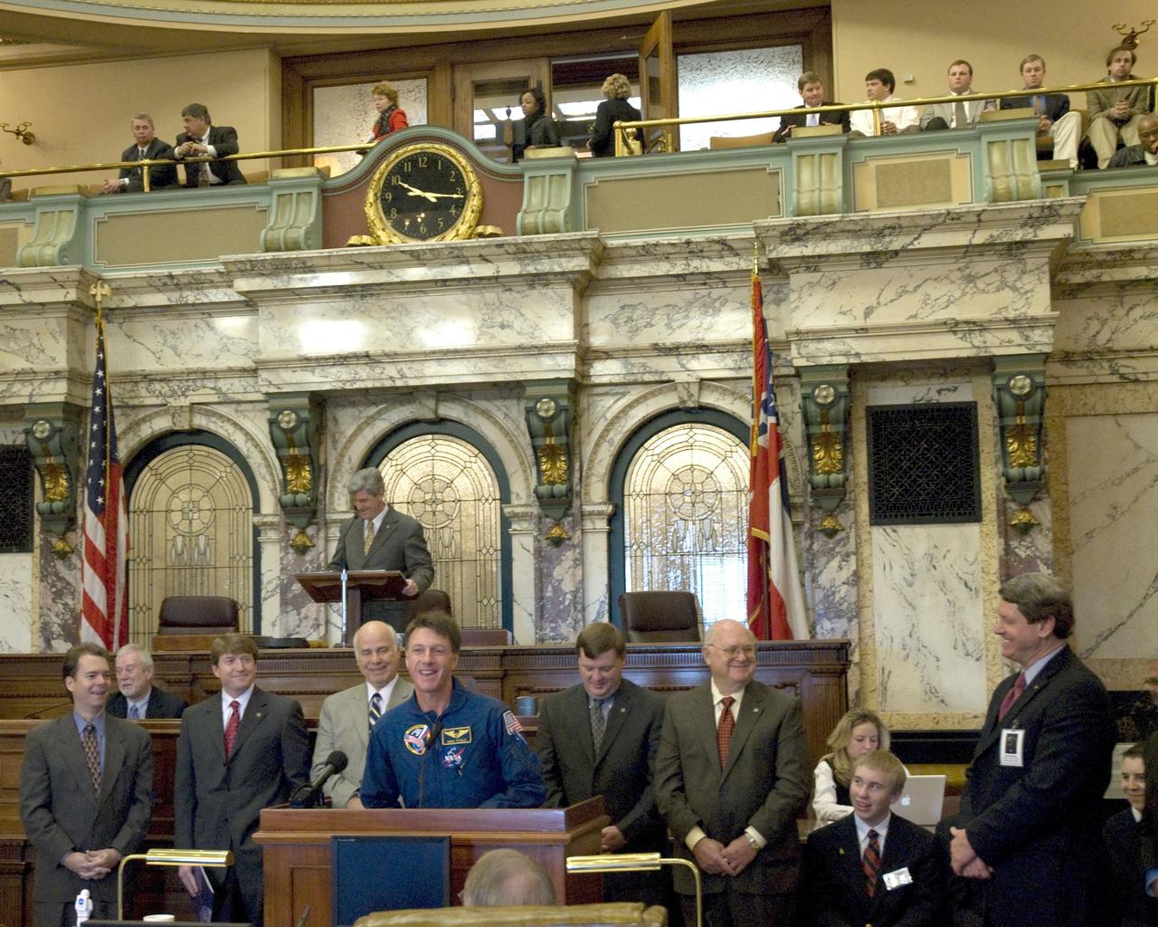
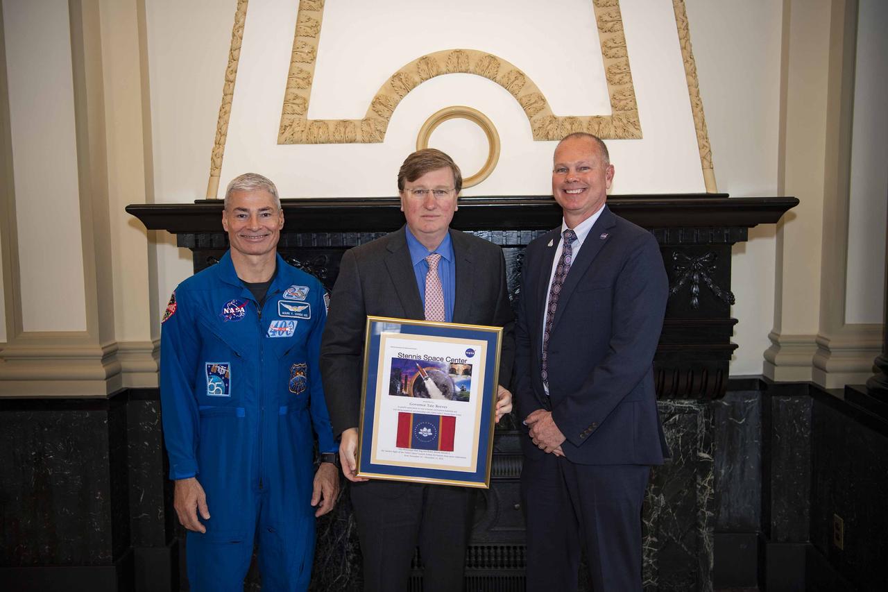
Astronaut Michael Foale (center) and Stennis Space Center officials met with Mississippi Lt. Gov. Phil Bryant (at rear podium) and Gulf Coast delegation members in Mississippi Senate chambers during NASA Space Day in Mississippi activities at the Capitol on January 30.

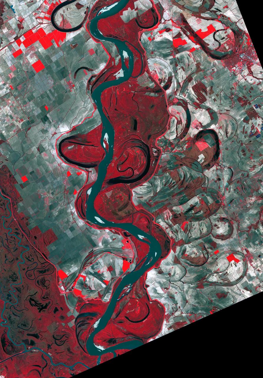
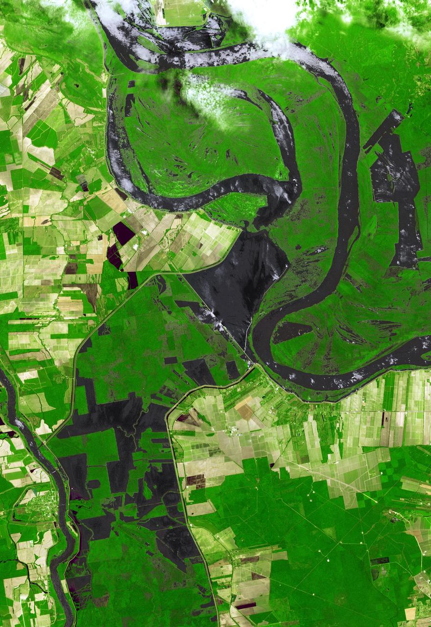
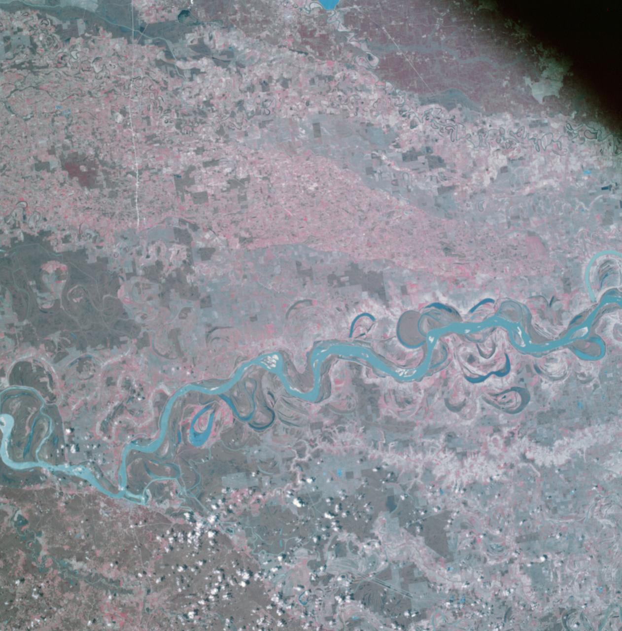
Meandering Mississippi - May 28th, 2003 Description: Small, blocky shapes of towns, fields, and pastures surround the graceful swirls and whorls of the Mississippi River. Countless oxbow lakes and cutoffs accompany the meandering river south of Memphis, Tennessee, on the border between Arkansas and Mississippi, USA. The "mighty Mississippi" is the largest river system in North America. Credit: USGS/NASA/Landsat 7 To learn more about the Landsat satellite go to: <a href="http://landsat.gsfc.nasa.gov/" rel="nofollow">landsat.gsfc.nasa.gov/</a> <b><a href="http://www.nasa.gov/centers/goddard/home/index.html" rel="nofollow">NASA Goddard Space Flight Center</a></b> enables NASA’s mission through four scientific endeavors: Earth Science, Heliophysics, Solar System Exploration, and Astrophysics. Goddard plays a leading role in NASA’s accomplishments by contributing compelling scientific knowledge to advance the Agency’s mission. <b>Follow us on <a href="http://twitter.com/NASA_GoddardPix" rel="nofollow">Twitter</a></b> <b>Join us on <a href="http://www.facebook.com/pages/Greenbelt-MD/NASA-Goddard/395013845897?ref=tsd" rel="nofollow">Facebook</a></b>
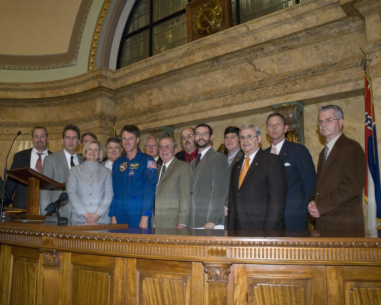
Astronaut Michael Foale (center) and Stennis Space Center officials met with Mississippi House of Representatives Gulf Coast delegation, including Speaker William 'Billy' McCoy (far right), during NASA Space Day in Mississippi on January 30.
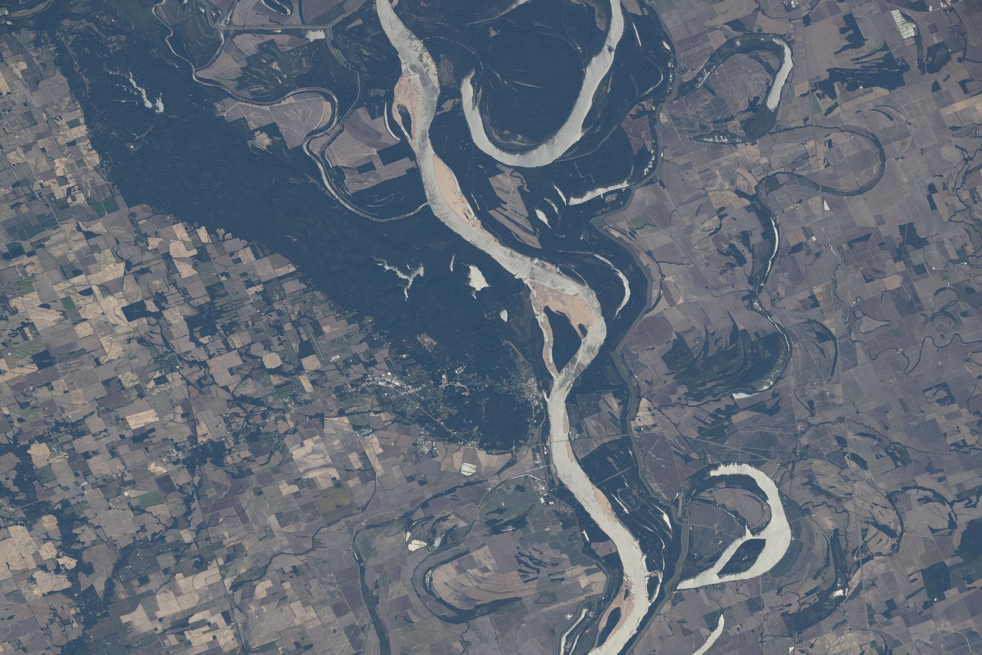
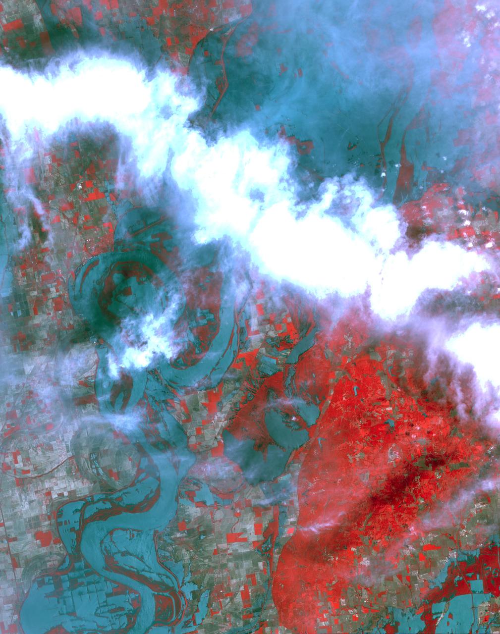
This image of the Mississippi River in Mississippi, Arkansas, and Louisiana shows regions of the southern United States that are prone to flooding.
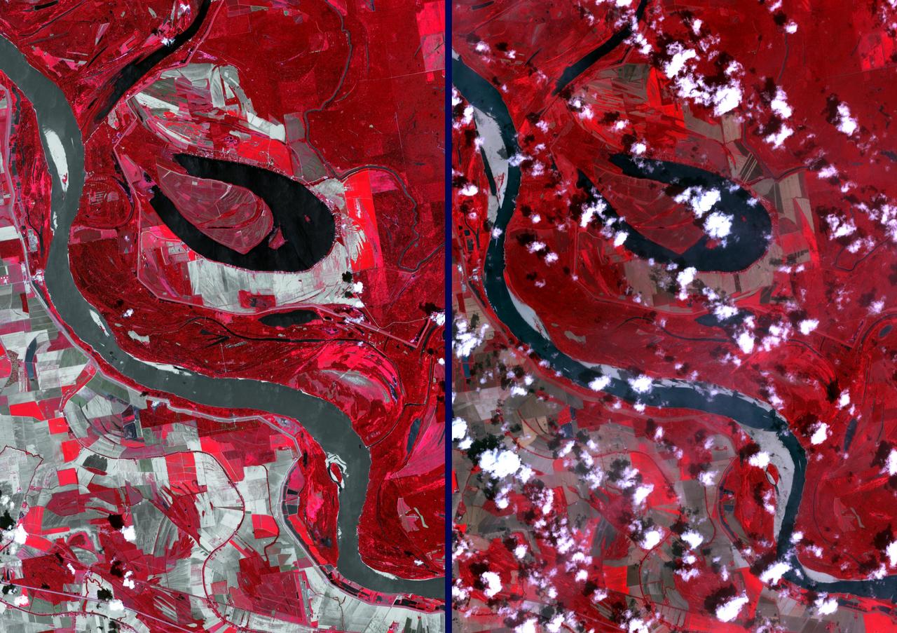
The Mississippi River continually evolves and changes course, as these two images testify. Harold Fisk's 1944 map (Figure 1) covers a stretch of the river between Friars Point and Gunnison, Mississippi. The March 31, 2017 image clearly shows the changing course of the main channel that has taken place in the intervening 73 years. The image covers an area of 39.2 by 56.3 km, and is located at 34.1 degrees north, 90.4 degrees west. https://photojournal.jpl.nasa.gov/catalog/PIA23534
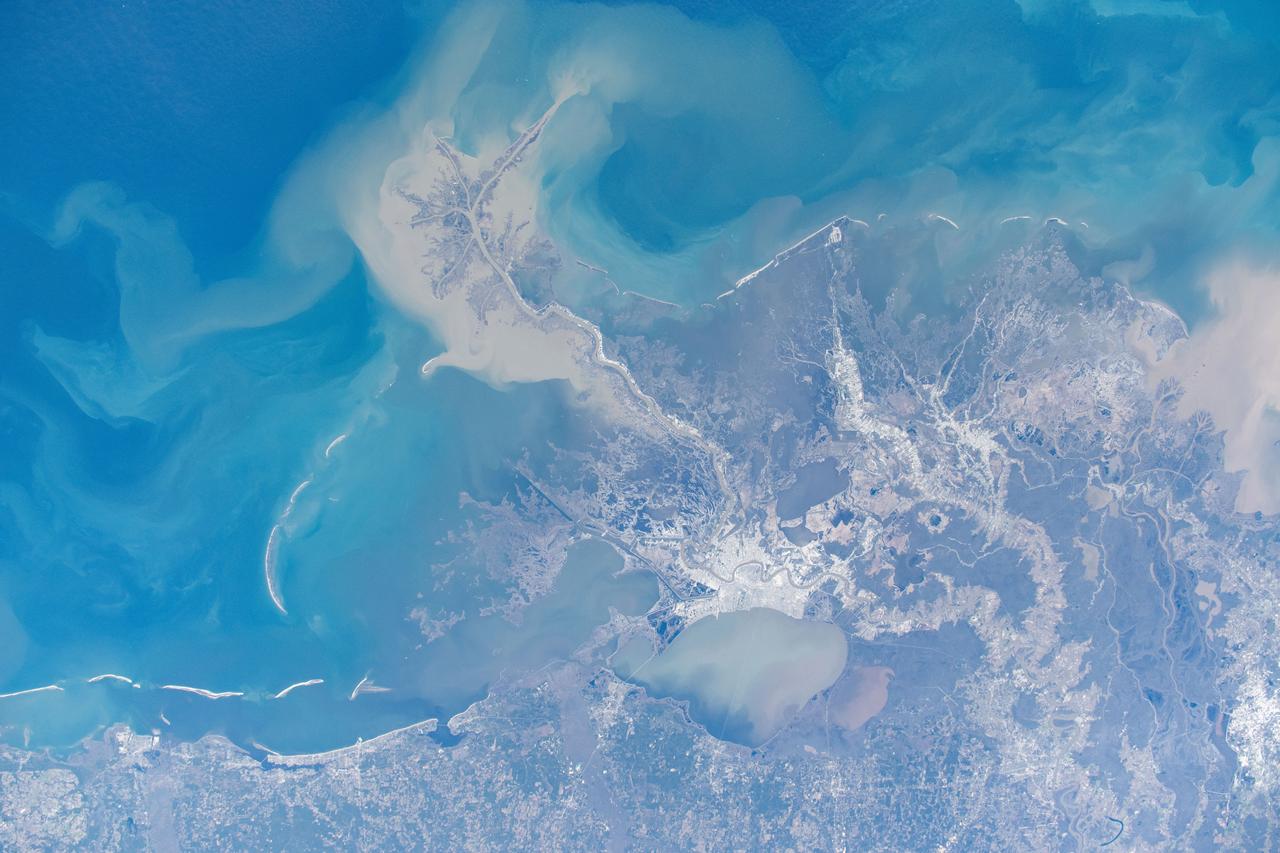
iss073e0880658 (Oct. 15, 2025) --- The Mississippi River separates Arkansas (left) from Mississippi in this view, with the St. Francis National Forest visible on the Arkansas side. Although not a true delta, the Mississippi Delta is a broad floodplain stretching from southern Illinois to Louisiana, with deep cultural roots in northern Mississippi. The International Space Station was orbiting 261 miles above Earth when this photograph was taken.
At the time NASA Terra spacecraft acquired this image, the Mississippi River had reached a level of 53 feet 16.2 meters, 3 feet 1 meter above the major flood stage. Flood water had already inundated parts of Vicksburg, Mississippi.
Pat Gaspard, a visitor relations specialist with NASA's StenniSphere visitor center, speaks to Mississippi Valley State University students. Gaspard spoke July 15 during Stennis Space Center's three-day educational outreach program at the college.
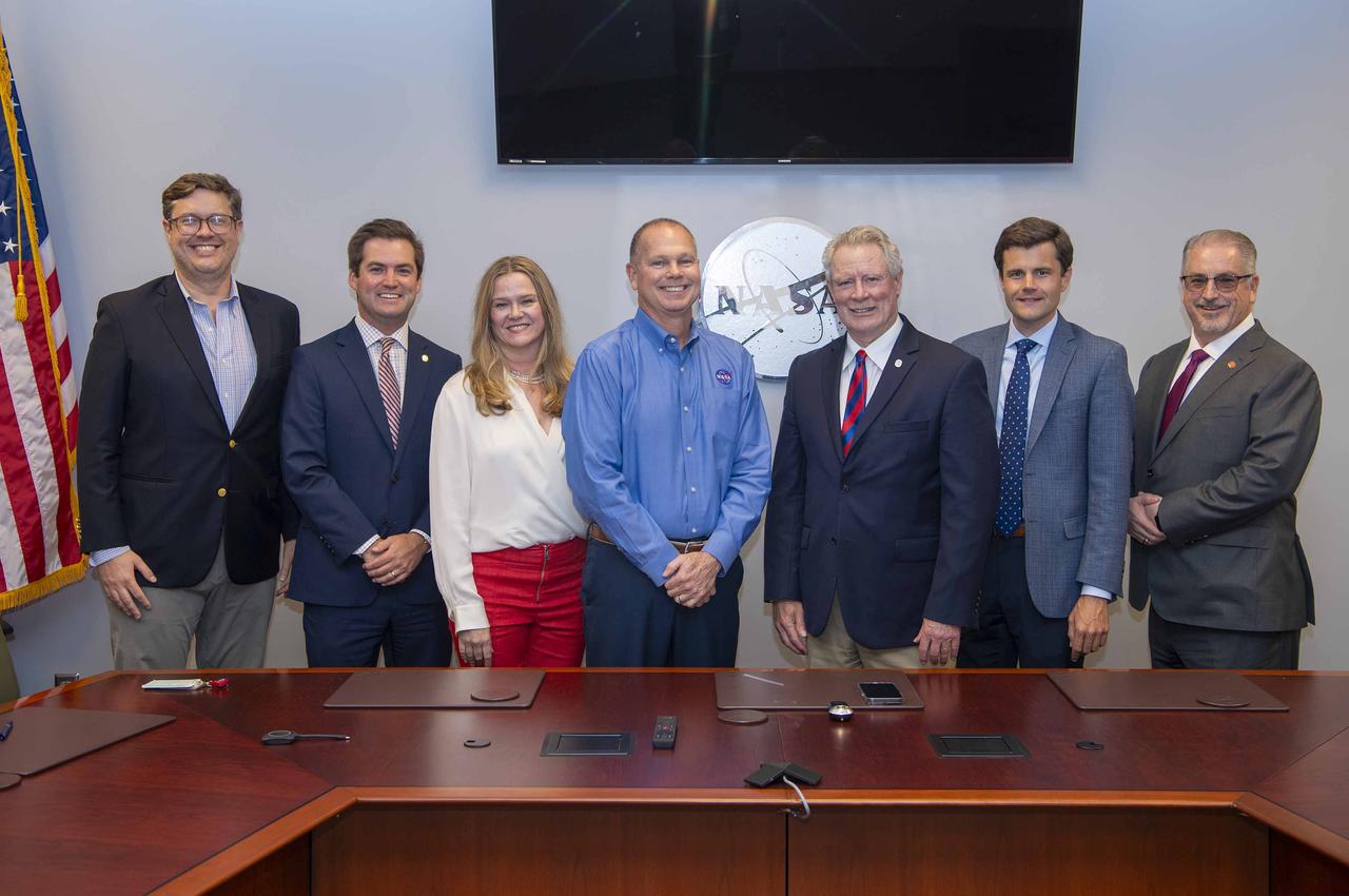
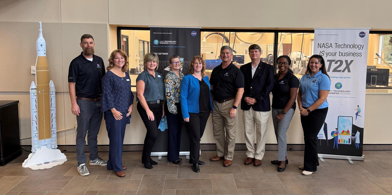
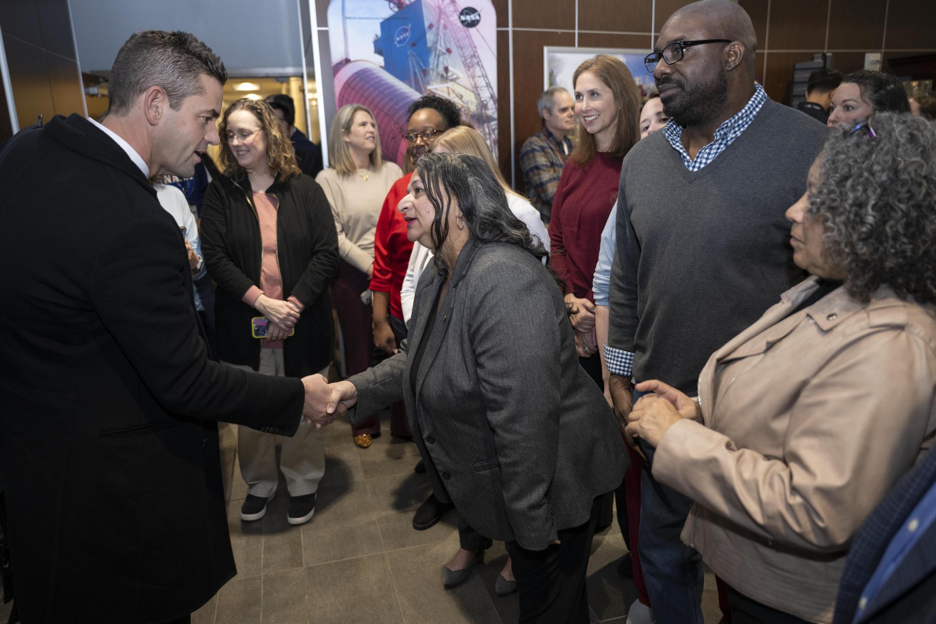
Mississippi Enterprise for Technology (MSET), a public-private partnership between Mississippi Development Authority, NASA, and Mississippi’s research institutions, hosted a visit for University of Mississippi leadership on Sept. 4 to NASA’s Stennis Space Center near Bay St. Louis, Mississippi. The visit showcased the center’s federal assets and the role Mississippi Enterprise for Technology plays in supporting industry and driving sustained economic development of the region and state. Pictured, from left to right, are: Davis Pace, president and CEO of MSET; William Kneip, director of External Relations and assistant to the Chancellor for Executive Affairs, University of Mississippi; Amy Lewis, executive director of Federal Relations, University of Mississippi; John Bailey, director of NASA Stennis; Dr. Glenn Boyce, chancellor of the University of Mississippi; Hughes Miller, senior director of Industry Engagement, University of Mississippi; and Dr. John Higginbotham, vice chancellor of Research and Economic Development, University of Mississippi.
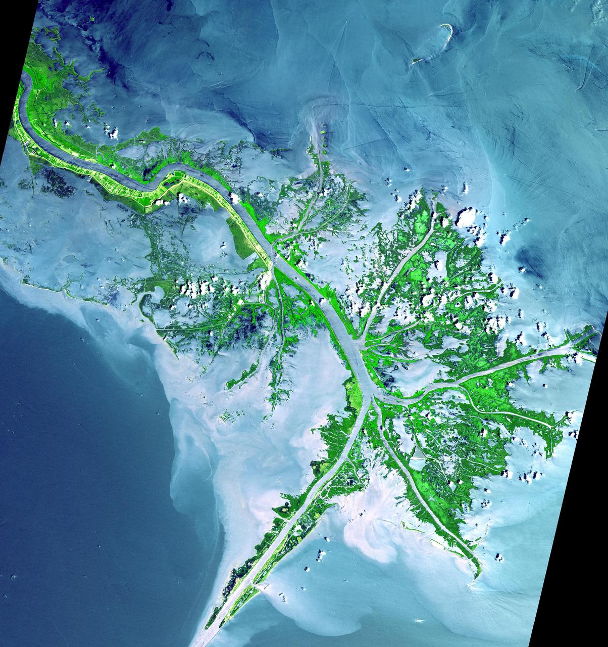
As the Mississippi River enters the Gulf of Mexico, it loses energy and dumps its load of sediment that it has carried on its journey through the mid continent. This pile of sediment, or mud, accumulates over the years building up the delta front. As one part of the delta becomes clogged with sediment, the delta front will migrate in search of new areas to grow. The area shown on this image is the currently active delta front of the Mississippi. The migratory nature of the delta forms natural traps for oil. Most of the land in the image consists of mud flats and marsh lands. There is little human settlement in this area due to the instability of the sediments. The main shipping channel of the Mississippi River is the broad stripe running northwest to southeast. This image was acquired on May 24, 2001 by the Advanced Spaceborne Thermal Emission and Reflection Radiometer (ASTER) on NASA's Terra satellite. With its 14 spectral bands from the visible to the thermal infrared wavelength region, and its high spatial resolution of 15 to 90 meters (about 50 to 300 feet), ASTER will image Earth for the next 6 years to map and monitor the changing surface of our planet. http://photojournal.jpl.nasa.gov/catalog/PIA03497
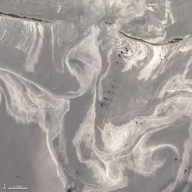
NASA image acquired June 26, 2010 As of June 27, 2010, the entire gulf-facing beachfront of several barrier islands in eastern Mississippi (offshore of Pascagoula) had received a designation of at least “lightly oiled” by the interagency Shoreline Cleanup Assessment Team that is responding to the disaster in the Gulf of Mexico. A few small stretches of Petit Bois Island had been labeled heavily or moderately oiled. (To view this image without a description go to: This high-resolution image shows Petit Bois Island (top right) and the eastern end of Horn Island (top left) on June 26. In general, oil-covered waters are silvery and cleaner waters are blue-gray. This pattern is especially consistent farther from the islands. The intensely bright patches of water directly offshore of the barrier islands, however, may be from a combination of factors, including sediment and organic material, coastal currents and surf, and oil. The islands provide a sense of scale for the ribbons of oil swirling into the area from the south. Petit Bois Island is about 10 kilometers (6 miles) long. It is one of seven barrier islands that, along with some mainland areas of Mississippi and Florida, make up the Gulf Islands National Seashore. According to the National Park Service Gulf Islands National Seashore Website, all the islands remained open to the public as of June 28, 2010, and clean-up crews were on hand to respond to any oil coming ashore. The large version of this image, which was captured by the Advanced Land Imager on NASA’s Earth Observing-1 (EO-1) satellite, shows a larger area, including the Mississippi Sound and parts of mainland Mississippi. Although oil has been observed in the Sound, it is unlikely that all the bright patches of water in that area are thickly oil-covered. Differences in brightness in coastal area waters may be due to other factors, including freshwater runoff, strong currents, and water depth and clarity. NASA Earth Observatory image created by Jesse Allen and Robert Simmon, using EO-1 ALI data provided courtesy of the NASA EO-1 team. Caption by Rebecca Lindsey. Instrument: EO-1 - ALI To see more images go to: <a href="http://earthobservatory.nasa.gov/" rel="nofollow">earthobservatory.nasa.gov/</a> <b><a href="http://www.nasa.gov/centers/goddard/home/index.html" rel="nofollow">NASA Goddard Space Flight Center</a></b> is home to the nation's largest organization of combined scientists, engineers and technologists that build spacecraft, instruments and new technology to study the Earth, the sun, our solar system, and the universe.
The mighty Mississippi River, from its source at Lake Itasca, Minnesota to the Gulf of Mexico, is approximately 3780 kilometers long and has flooded many times during its history. NASA Terra satellite acquired these images one month apart in 2001.
NASA Terra spacecraft shows the resultant flooding of farmland west of the Mississippi 20 miles south of the Mississippi River levee breach. U.S. Army Corps of Engineers detonated explosives at the Birds Point levee near Wyatt, Missouri, on May 2, 2011.
Participants in A Day with NASA at The Accelerator in Hattiesburg, Mississippi, included: (left to right) Marc Shoemaker with the NASA Stennis Small Business Innovation Research/Small Business Technology Transfer Office; Kay Doane with the NASA Stennis Office of Small Business Programs; Sandy Crist with the Mississippi Manufacturers Association Manufacturing Extension Program; Dr. Monica Tisack with the Mississippi Polymer Institute; Caitlyne Shirley with the Mississippi Polymer Institute; Top Lipski with the NASA Stennis Technology Transfer Expansion Team; Thom Jacks with the NASA Stennis Engineering and Test Directorate; Dawn Davis with the NASA Stennis Engineering and Test Directorate; Kelly McCarthy with the NASA Stennis Office of STEM Engagement; and Janet Parker with Innovate Mississippi.

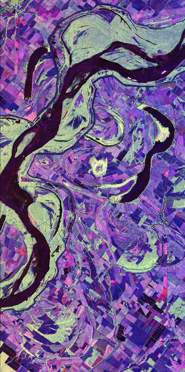
This is a radar image of the Mississippi River Delta where the river enters into the Gulf of Mexico along the coast of Louisiana. This multi-frequency image demonstrates the capability of the radar to distinguish different types of wetlands surfaces in river deltas. This image was acquired by the Spaceborne Imaging Radar-C/X-Band Synthetic Aperture Radar (SIR-C/X-SAR) aboard the space shuttle Endeavour on October 2, 1995. The image is centered on latitude 29.3 degrees North latitude and 89.28 degrees West longitude. The area shown is approximately 63 kilometers by 43 kilometers (39 miles by 26 miles). North is towards the upper right of the image. As the river enters the Gulf of Mexico, it loses energy and dumps its load of sediment that it has carried on its journey through the mid-continent. This pile of sediment, or mud, accumulates over the years building up the delta front. As one part of the delta becomes clogged with sediment, the delta front will migrate in search of new areas to grow. The area shown on this image is the currently active delta front of the Mississippi. The migratory nature of the delta forms natural traps for oil and the numerous bright spots along the outside of the delta are drilling platforms. Most of the land in the image consists of mud flats and marsh lands. There is little human settlement in this area due to the instability of the sediments. The main shipping channel of the Mississippi River is the broad red stripe running northwest to southeast down the left side of the image. The bright spots within the channel are ships. The colors in the image are assigned to different frequencies and polarizations of the radar as follows: red is L-band vertically transmitted, vertically received; green is C-band vertically transmitted, vertically received; blue is X-band vertically transmitted, vertically received. http://photojournal.jpl.nasa.gov/catalog/PIA01784

Oil from the Deepwater Horizon spill laps around the mouth of the Mississippi River Delta in this May 24, 2010, image from NASA Terra spacecraft. The oil appears silver, while vegetation is red.
NASA Terra spacecraft acquired this image on Aug. 24, 2012, 13 miles 20 kilometers north of Vicksburg, Miss., as drought continued to afflict the U.S. Midwest, water levels of the Mississippi River approached historic lows.
Tom Lipski, NASA Stennis Technology Transfer Expansion team lead, speaks at the “A Day with NASA” event at The Accelerator in Hattiesburg, Mississippi, on Nov. 7. NASA speakers focused on providing updates on agency resources available to help companies grow and on different ways to do business with the agency. They also offered information about how businesses could build partnerships with the agency to commercialize NASA-developed technologies. Participants had the opportunity to meet one-on-one with members of the NASA Stennis business and technology team as well. The Mississippi Polymer Institute, with funding from the Mississippi Manufacturer’s Association Manufacturing Extension Partnership, hosted the event.
NASA Terra spacecraft shows the water flow after the U.S. Army Corps of Engineers opened the Morganza Spillway, a flood control structure along the western bank of the Mississippi River in Louisiana, to ease flooding along levee systems on May 14, 2011.
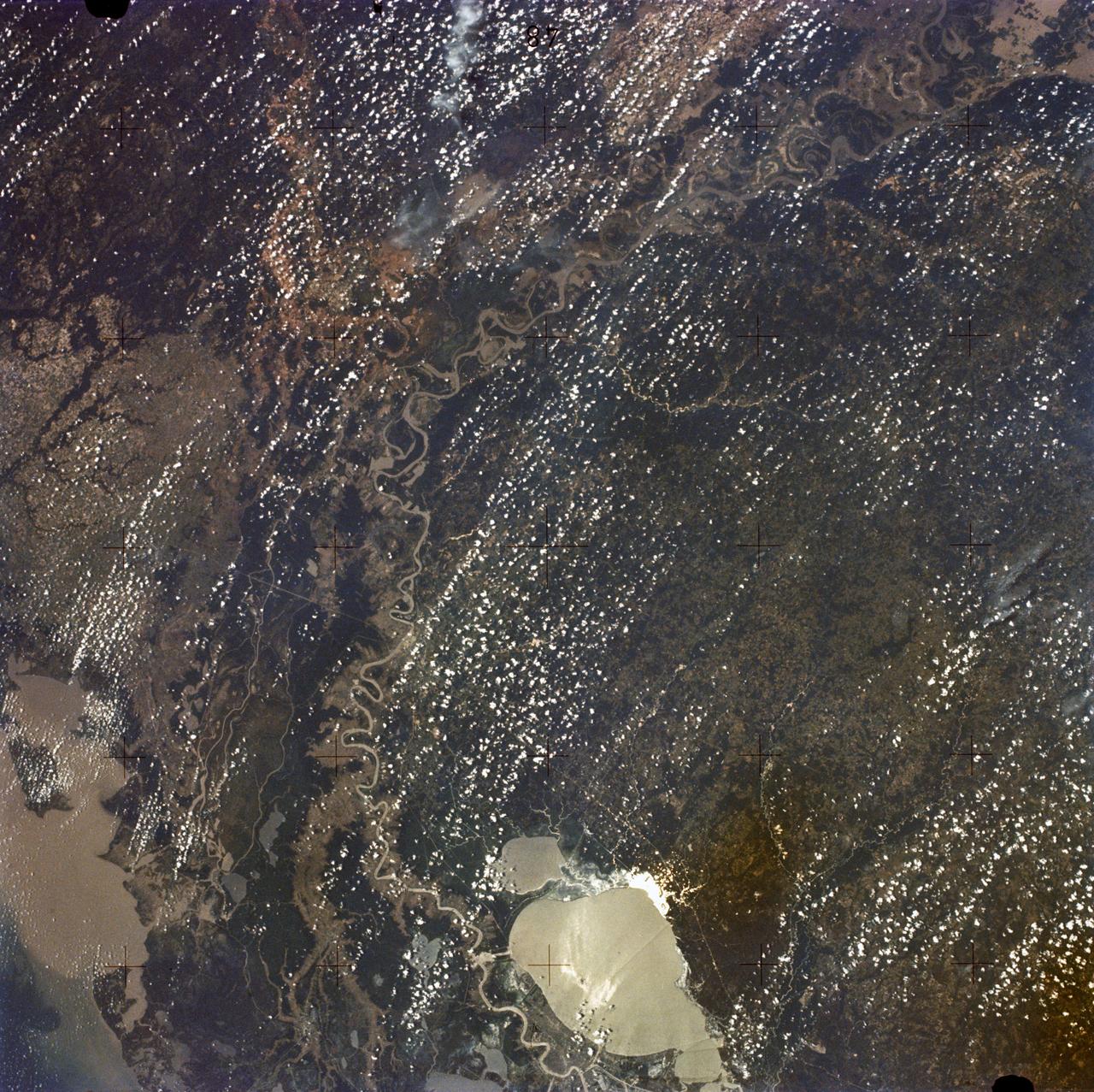
SL2-05-397 (22 June 1973) --- New Orleans, Louisiana, Mississippi River, and Lake Pontchartrain (31.0N, 91.0W) can all be seen in this single detailed view. The marshlands of the Atchafalaya Basin, previously the main drainage way for the Mississippi River, can be seen to be partially silted as a result of sediments. The long narrow field patterns fronting on the river is called the "Long Lot" system of equal land distribution based on the French Napoleonic Civil Code. Photo credit: NASA
Cookbook author and culinary content creator Caroline Davis, popularly known as Mississippi Kween, and her family enjoy touring facilities and learning about NASA Stennis and its frontline work during a site visit Dec. 18. Davis, husband Joe, and children Zeke and Zoey, met with NASA Stennis leadership before touring the L3Harris (formerly Aerojet Rocketdyne) Engine Assembly Facility, Thad Cochran Test Stand, Autonomous Systems Laboratory, and the NASA Stennis rocket engine garden. The tour highlighted the NASA Stennis story and how the south Mississippi NASA center has the ingredients for a recipe that accelerates the exploration and commercialization of space, innovates to benefit NASA and industry, and leverages assets to stimulate the economy.
Cookbook author and culinary content creator Caroline Davis, popularly known as Mississippi Kween, and her family enjoy touring facilities and learning about NASA Stennis and its frontline work during a site visit Dec. 18. Davis, husband Joe, and children Zeke and Zoey, met with NASA Stennis leadership before touring the L3Harris (formerly Aerojet Rocketdyne) Engine Assembly Facility, Thad Cochran Test Stand, Autonomous Systems Laboratory, and the NASA Stennis rocket engine garden. The tour highlighted the NASA Stennis story and how the south Mississippi NASA center has the ingredients for a recipe that accelerates the exploration and commercialization of space, innovates to benefit NASA and industry, and leverages assets to stimulate the economy.
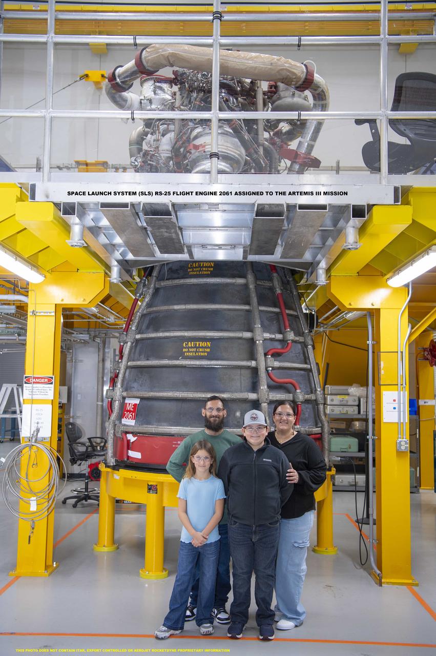
Cookbook author and culinary content creator Caroline Davis, popularly known as Mississippi Kween, and her family enjoy touring facilities and learning about NASA Stennis and its frontline work during a site visit Dec. 18. Davis, husband Joe, and children Zeke and Zoey, met with NASA Stennis leadership before touring the L3Harris (formerly Aerojet Rocketdyne) Engine Assembly Facility, Thad Cochran Test Stand, Autonomous Systems Laboratory, and the NASA Stennis rocket engine garden. The tour highlighted the NASA Stennis story and how the south Mississippi NASA center has the ingredients for a recipe that accelerates the exploration and commercialization of space, innovates to benefit NASA and industry, and leverages assets to stimulate the economy.
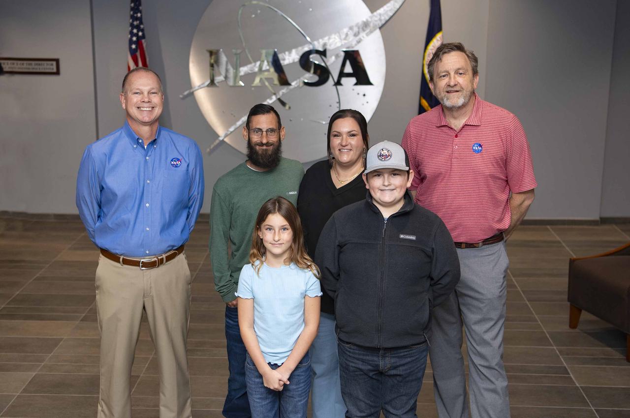
Cookbook author and culinary content creator Caroline Davis, popularly known as Mississippi Kween, and her family enjoy touring facilities and learning about NASA Stennis and its frontline work during a site visit Dec. 18. Davis, husband Joe, and children Zeke and Zoey, met with NASA Stennis leadership before touring the L3Harris (formerly Aerojet Rocketdyne) Engine Assembly Facility, Thad Cochran Test Stand, Autonomous Systems Laboratory, and the NASA Stennis rocket engine garden. The tour highlighted the NASA Stennis story and how the south Mississippi NASA center has the ingredients for a recipe that accelerates the exploration and commercialization of space, innovates to benefit NASA and industry, and leverages assets to stimulate the economy.
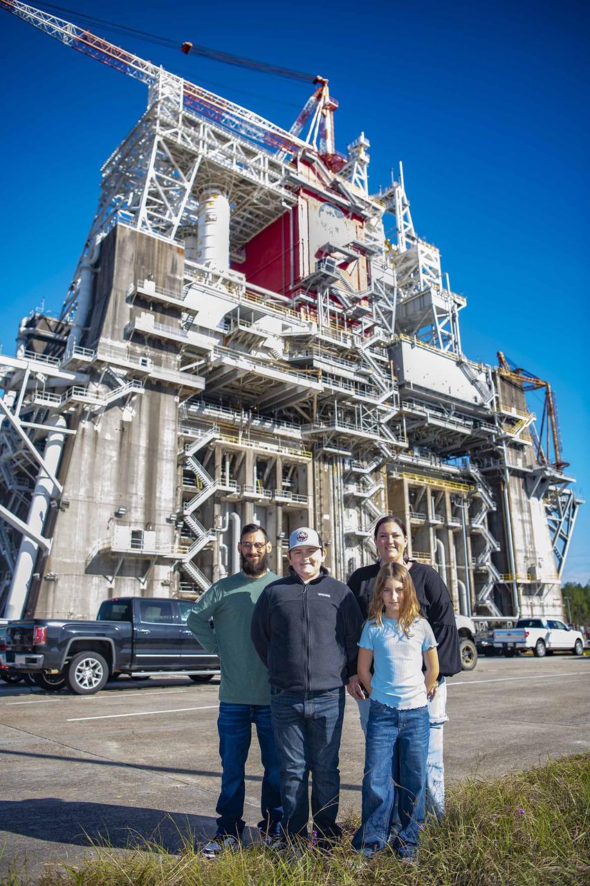
Cookbook author and culinary content creator Caroline Davis, popularly known as Mississippi Kween, and her family enjoy touring facilities and learning about NASA Stennis and its frontline work during a site visit Dec. 18. Davis, husband Joe, and children Zeke and Zoey, met with NASA Stennis leadership before touring the L3Harris (formerly Aerojet Rocketdyne) Engine Assembly Facility, Thad Cochran Test Stand, Autonomous Systems Laboratory, and the NASA Stennis rocket engine garden. The tour highlighted the NASA Stennis story and how the south Mississippi NASA center has the ingredients for a recipe that accelerates the exploration and commercialization of space, innovates to benefit NASA and industry, and leverages assets to stimulate the economy.
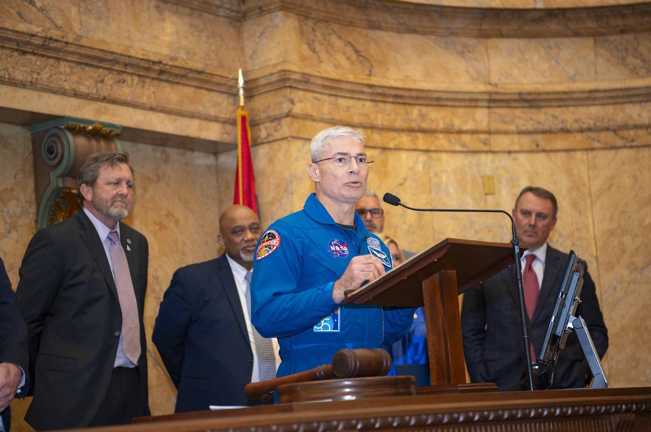
Former astronaut Scott Altman addresses legislators in the Mississippi House of Representatives during NASA Day at the Capitol activities in Jackson on Jan. 12, 2012. During his remarks, Altman was flanked by members of the Mississippi Gulf Coast delegation, as well as Stennis Director Patrick Scheuermann (third from right).
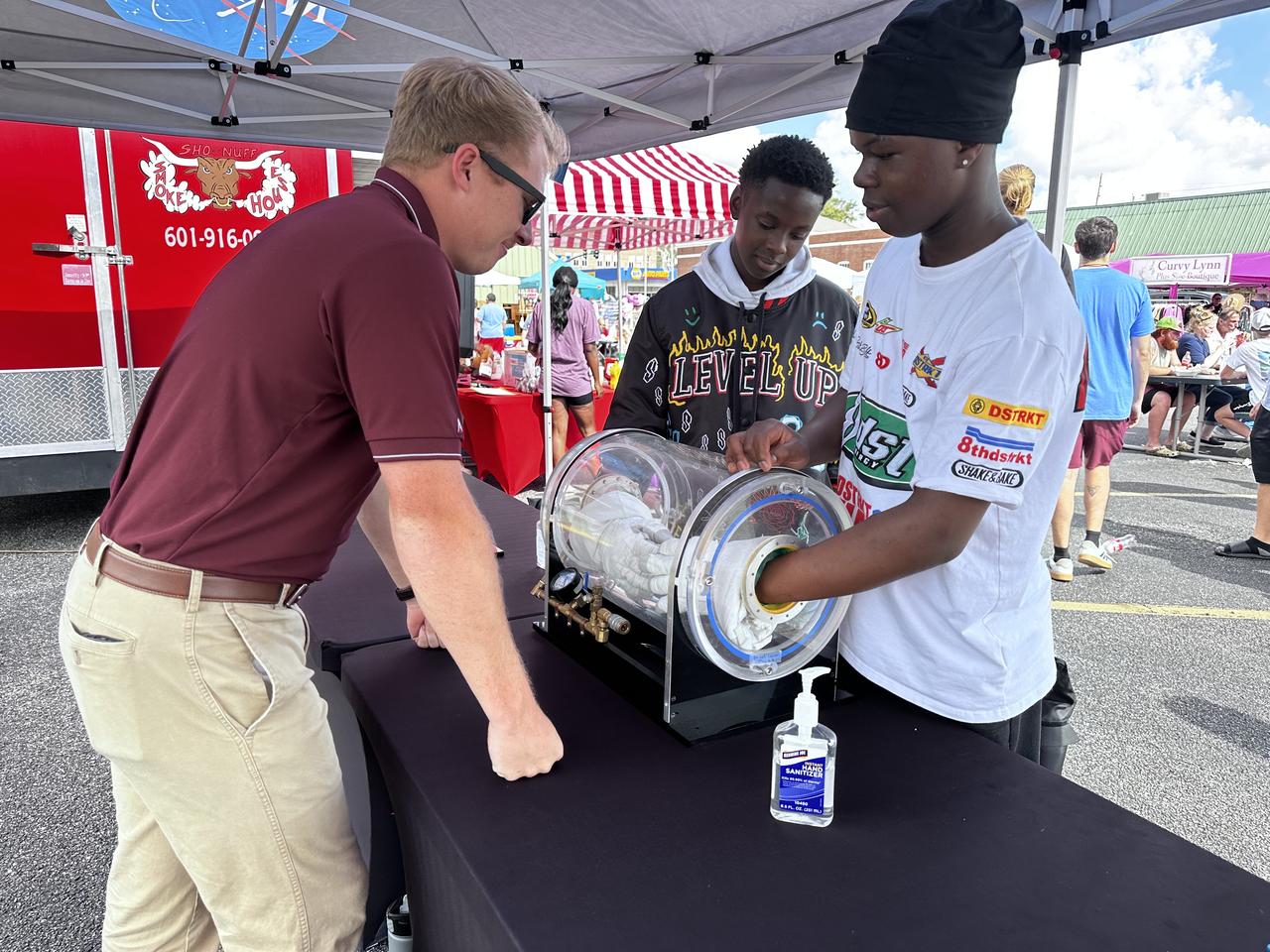
NASA Stennis representatives engage with the Artemis Generation at the Picayune Street Fair in Picayune, Mississippi on Nov. 2-3. The south Mississippi NASA center is located less than 15 miles from Picayune with many employees living in the community. NASA Stennis tests all RS-25 engines to help power NASA’s SLS (Space Launch System) rocket on Artemis missions. The NASA center is also preparing to conduct a full series of tests on the agency’s exploration upper stage to demonstrate it is ready to fly on future Artemis missions. With the Artemis campaign, NASA will land the first woman and the first person of color on the Moon, using innovative technologies to explore more of the lunar surface than ever.
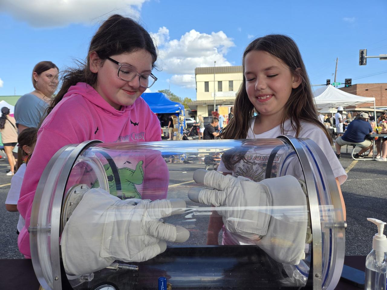
NASA Stennis representatives engage with the Artemis Generation at the Picayune Street Fair in Picayune, Mississippi on Nov. 2-3. The south Mississippi NASA center is located less than 15 miles from Picayune with many employees living in the community. NASA Stennis tests all RS-25 engines to help power NASA’s SLS (Space Launch System) rocket on Artemis missions. The NASA center is also preparing to conduct a full series of tests on the agency’s exploration upper stage to demonstrate it is ready to fly on future Artemis missions. With the Artemis campaign, NASA will land the first woman and the first person of color on the Moon, using innovative technologies to explore more of the lunar surface than ever.
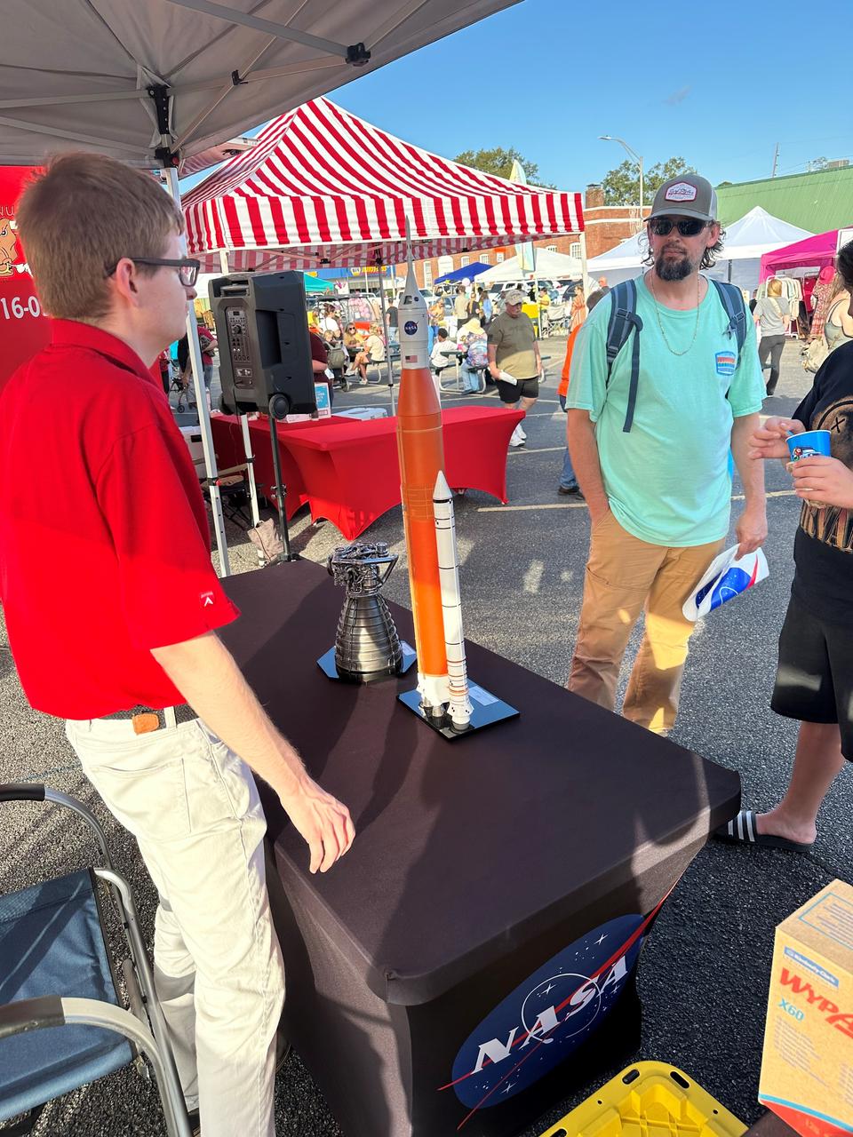
NASA Stennis representatives engage with the Artemis Generation at the Picayune Street Fair in Picayune, Mississippi on Nov. 2-3. The south Mississippi NASA center is located less than 15 miles from Picayune with many employees living in the community. NASA Stennis tests all RS-25 engines to help power NASA’s SLS (Space Launch System) rocket on Artemis missions. The NASA center is also preparing to conduct a full series of tests on the agency’s exploration upper stage to demonstrate it is ready to fly on future Artemis missions. With the Artemis campaign, NASA will land the first woman and the first person of color on the Moon, using innovative technologies to explore more of the lunar surface than ever.
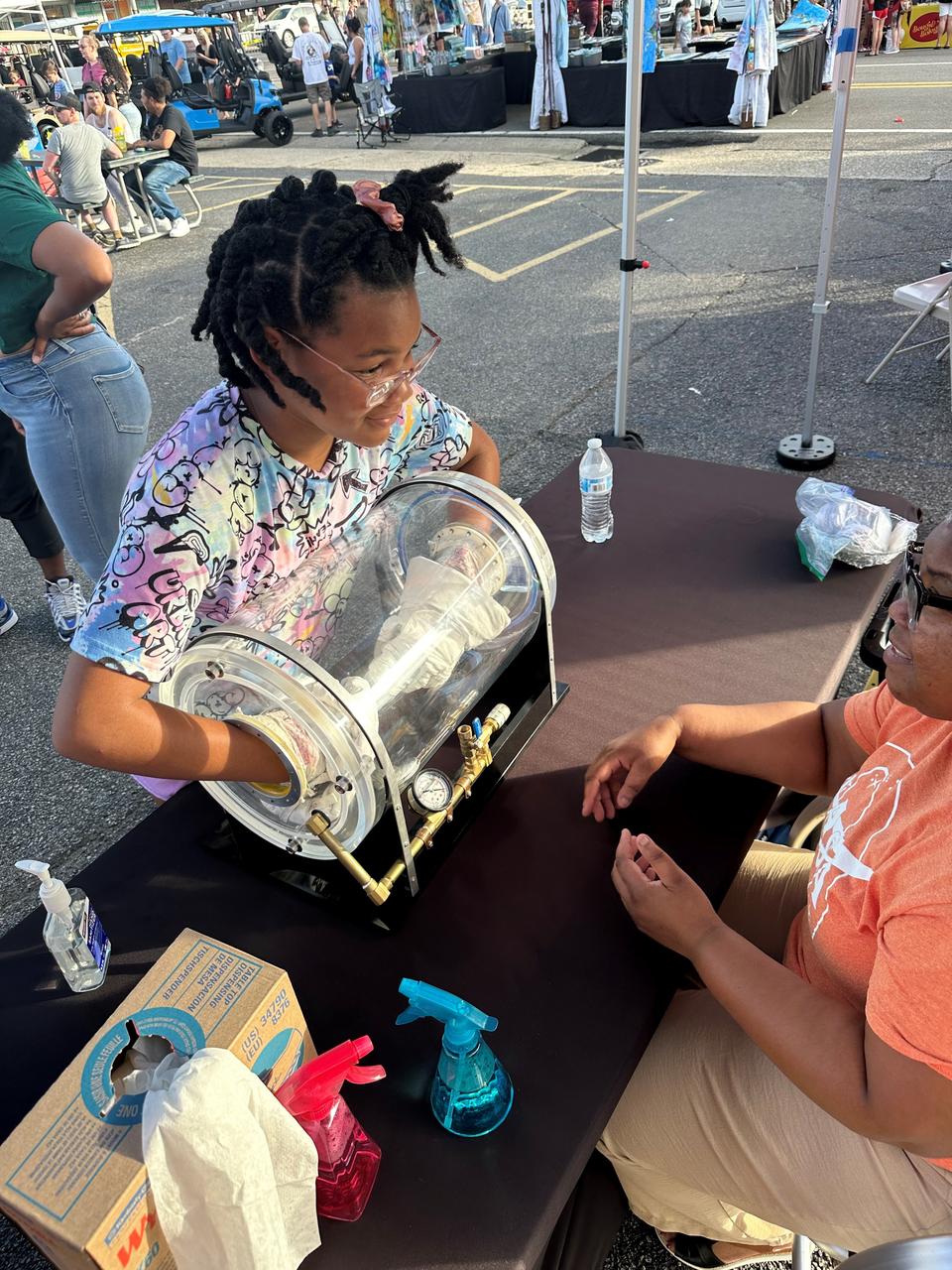
NASA Stennis representatives engage with the Artemis Generation at the Picayune Street Fair in Picayune, Mississippi on Nov. 2-3. The south Mississippi NASA center is located less than 15 miles from Picayune with many employees living in the community. NASA Stennis tests all RS-25 engines to help power NASA’s SLS (Space Launch System) rocket on Artemis missions. The NASA center is also preparing to conduct a full series of tests on the agency’s exploration upper stage to demonstrate it is ready to fly on future Artemis missions. With the Artemis campaign, NASA will land the first woman and the first person of color on the Moon, using innovative technologies to explore more of the lunar surface than ever.
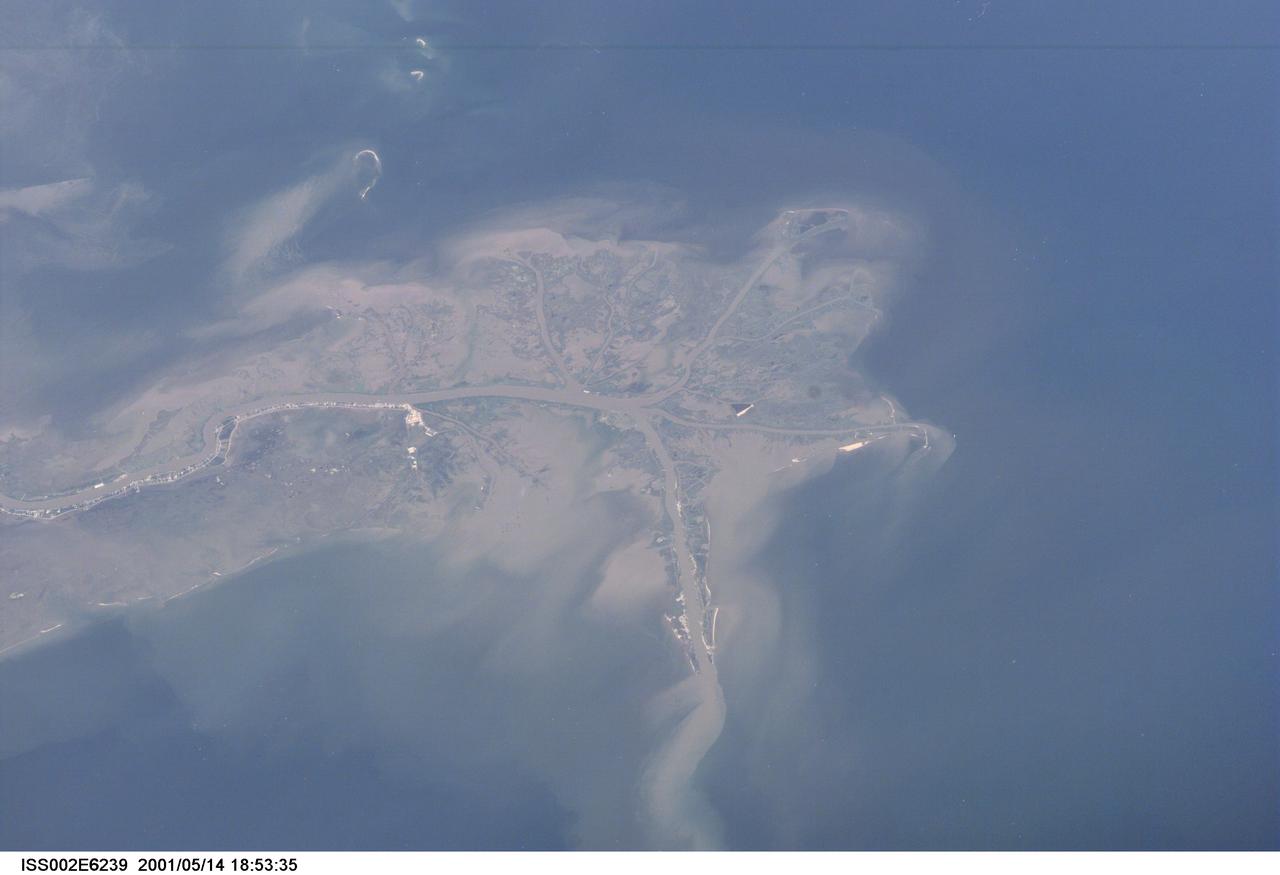
ISS002-E-6239 (14 May 2001) --- This digital still camera's image, recorded by one of the Expedition Two crew members aboard the International Space Station, features the mouth of the Mississippi River. The distribution of riverborne sediments is clearly evident in the Gulf of Mexico. This delta area is often referred to as the "crow's foot."
AS09-26A-3741A (9 March 1969) --- Color infrared photograph of the Mississippi River between Vicksburg and Greenville as photographed from the Apollo 9 spacecraft during its 92nd revolution of Earth. This picture was a part of the SO65 Multispectral Terrain Photography Experiment. The City of Vicksburg is located in the southeast corner of the picture. Note Interstate 20 under construction running east and west. Greenville is just out of picture at top center. All east of river is Mississippi; Louisiana is at lower left; and Arkansas is at upper left.
Leaders from NASA’s Stennis Space Center and NASA Shared Services Center visit Jackson, Mississippi, on Feb. 28-29 to share site updates with state leaders during the annual Stennis Day at the Capitol. NASA Stennis is on the front line of the next great era of human space exploration as NASA explores the secrets of the universe for the benefit of all. The south Mississippi center tests propulsion systems and engines helping power Artemis missions on the SLS (Space Launch System) rocket to deep space. Through Artemis, NASA will establish the foundation for long-term scientific exploration at the Moon, land the first woman, first person of color, and first international partner astronaut on the lunar surface, and prepare for human expeditions to Mars. Moving forward, NASA Stennis is working to accelerate the exploration and commercialization of space, innovate to benefit NASA and industry, and leverage assets to stimulate the economy and enhance national security.
Leaders from NASA’s Stennis Space Center and NASA Shared Services Center visit Jackson, Mississippi, on Feb. 28-29 to share site updates with state leaders during the annual Stennis Day at the Capitol. NASA Stennis is on the front line of the next great era of human space exploration as NASA explores the secrets of the universe for the benefit of all. The south Mississippi center tests propulsion systems and engines helping power Artemis missions on the SLS (Space Launch System) rocket to deep space. Through Artemis, NASA will establish the foundation for long-term scientific exploration at the Moon, land the first woman, first person of color, and first international partner astronaut on the lunar surface, and prepare for human expeditions to Mars. Moving forward, NASA Stennis is working to accelerate the exploration and commercialization of space, innovate to benefit NASA and industry, and leverage assets to stimulate the economy and enhance national security.
Leaders from NASA’s Stennis Space Center and NASA Shared Services Center visit Jackson, Mississippi, on Feb. 28-29 to share site updates with state leaders during the annual Stennis Day at the Capitol. NASA Stennis is on the front line of the next great era of human space exploration as NASA explores the secrets of the universe for the benefit of all. The south Mississippi center tests propulsion systems and engines helping power Artemis missions on the SLS (Space Launch System) rocket to deep space. Through Artemis, NASA will establish the foundation for long-term scientific exploration at the Moon, land the first woman, first person of color, and first international partner astronaut on the lunar surface, and prepare for human expeditions to Mars. Moving forward, NASA Stennis is working to accelerate the exploration and commercialization of space, innovate to benefit NASA and industry, and leverage assets to stimulate the economy and enhance national security.
Leaders from NASA’s Stennis Space Center and NASA Shared Services Center visit Jackson, Mississippi, on Feb. 28-29 to share site updates with state leaders during the annual Stennis Day at the Capitol. NASA Stennis is on the front line of the next great era of human space exploration as NASA explores the secrets of the universe for the benefit of all. The south Mississippi center tests propulsion systems and engines helping power Artemis missions on the SLS (Space Launch System) rocket to deep space. Through Artemis, NASA will establish the foundation for long-term scientific exploration at the Moon, land the first woman, first person of color, and first international partner astronaut on the lunar surface, and prepare for human expeditions to Mars. Moving forward, NASA Stennis is working to accelerate the exploration and commercialization of space, innovate to benefit NASA and industry, and leverage assets to stimulate the economy and enhance national security.
Leaders from NASA’s Stennis Space Center and NASA Shared Services Center visit Jackson, Mississippi, on Feb. 28-29 to share site updates with state leaders during the annual Stennis Day at the Capitol. NASA Stennis is on the front line of the next great era of human space exploration as NASA explores the secrets of the universe for the benefit of all. The south Mississippi center tests propulsion systems and engines helping power Artemis missions on the SLS (Space Launch System) rocket to deep space. Through Artemis, NASA will establish the foundation for long-term scientific exploration at the Moon, land the first woman, first person of color, and first international partner astronaut on the lunar surface, and prepare for human expeditions to Mars. Moving forward, NASA Stennis is working to accelerate the exploration and commercialization of space, innovate to benefit NASA and industry, and leverage assets to stimulate the economy and enhance national security.
Leaders from NASA’s Stennis Space Center and NASA Shared Services Center visit Jackson, Mississippi, on Feb. 28-29 to share site updates with state leaders during the annual Stennis Day at the Capitol. NASA Stennis is on the front line of the next great era of human space exploration as NASA explores the secrets of the universe for the benefit of all. The south Mississippi center tests propulsion systems and engines helping power Artemis missions on the SLS (Space Launch System) rocket to deep space. Through Artemis, NASA will establish the foundation for long-term scientific exploration at the Moon, land the first woman, first person of color, and first international partner astronaut on the lunar surface, and prepare for human expeditions to Mars. Moving forward, NASA Stennis is working to accelerate the exploration and commercialization of space, innovate to benefit NASA and industry, and leverage assets to stimulate the economy and enhance national security.
Leaders from NASA’s Stennis Space Center and NASA Shared Services Center visit Jackson, Mississippi, on Feb. 28-29 to share site updates with state leaders during the annual Stennis Day at the Capitol. NASA Stennis is on the front line of the next great era of human space exploration as NASA explores the secrets of the universe for the benefit of all. The south Mississippi center tests propulsion systems and engines helping power Artemis missions on the SLS (Space Launch System) rocket to deep space. Through Artemis, NASA will establish the foundation for long-term scientific exploration at the Moon, land the first woman, first person of color, and first international partner astronaut on the lunar surface, and prepare for human expeditions to Mars. Moving forward, NASA Stennis is working to accelerate the exploration and commercialization of space, innovate to benefit NASA and industry, and leverage assets to stimulate the economy and enhance national security.
Leaders from NASA’s Stennis Space Center and NASA Shared Services Center visit Jackson, Mississippi, on Feb. 28-29 to share site updates with state leaders during the annual Stennis Day at the Capitol. NASA Stennis is on the front line of the next great era of human space exploration as NASA explores the secrets of the universe for the benefit of all. The south Mississippi center tests propulsion systems and engines helping power Artemis missions on the SLS (Space Launch System) rocket to deep space. Through Artemis, NASA will establish the foundation for long-term scientific exploration at the Moon, land the first woman, first person of color, and first international partner astronaut on the lunar surface, and prepare for human expeditions to Mars. Moving forward, NASA Stennis is working to accelerate the exploration and commercialization of space, innovate to benefit NASA and industry, and leverage assets to stimulate the economy and enhance national security.
Richard Gilbrech, Director of NASA's Stennis Space Center, speaks at an all-hands for employees following the State of NASA address, Monday, Feb. 10, 2020, at NASA’s Stennis Space Center near Bay St. Louis, Mississippi. Photo Credit: (NASA/Joel Kowsky)

NASA astronaut Raja Chari speaks at an all-hands for employees following the State of NASA address, Monday, Feb. 10, 2020, at NASA’s Stennis Space Center near Bay St. Louis, Mississippi. Photo Credit: (NASA/Joel Kowsky)

The geography of the New Orleans and Mississippi delta region is well shown in this radar image from the Shuttle Radar Topography Mission. In this image, bright areas show regions of high radar reflectivity, such as from urban areas, and elevations have been coded in color using height data also from the mission. Dark green colors indicate low elevations, rising through yellow and tan, to white at the highest elevations. New Orleans is situated along the southern shore of Lake Pontchartrain, the large, roughly circular lake near the center of the image. The line spanning the lake is the Lake Pontchartrain Causeway, the world's longest over water highway bridge. Major portions of the city of New Orleans are below sea level, and although it is protected by levees and sea walls, flooding during storm surges associated with major hurricanes is a significant concern. http://photojournal.jpl.nasa.gov/catalog/PIA04175

This image acquired on Jan. 17, 2016 by NASA Terra spacecraft shows major flooding along the Mississippi River, affecting Missouri, Illinois, Arkansas and Tennessee. As of January 17, flood warnings were issued for the area around Baton Rouge, Louisiana, as the river crested at 43.3 feet (13.1 meters), 8 feet (2.4 meters) above flood stage. Shipping and industrial activities were significantly affected; low-lying areas were flooded, and agricultural operations were impacted on the west side of the river. This image from the Advanced Spaceborne Thermal Emission and Reflection Radiometer (ASTER) on NASA's Terra spacecraft was acquired Jan. 17, 2016, covers an area of 23.6 by 23.6 miles (38 by 38 kilometers), and is located at 30.6 degrees north, 91.3 degrees west. http://photojournal.jpl.nasa.gov/catalog/PIA20364
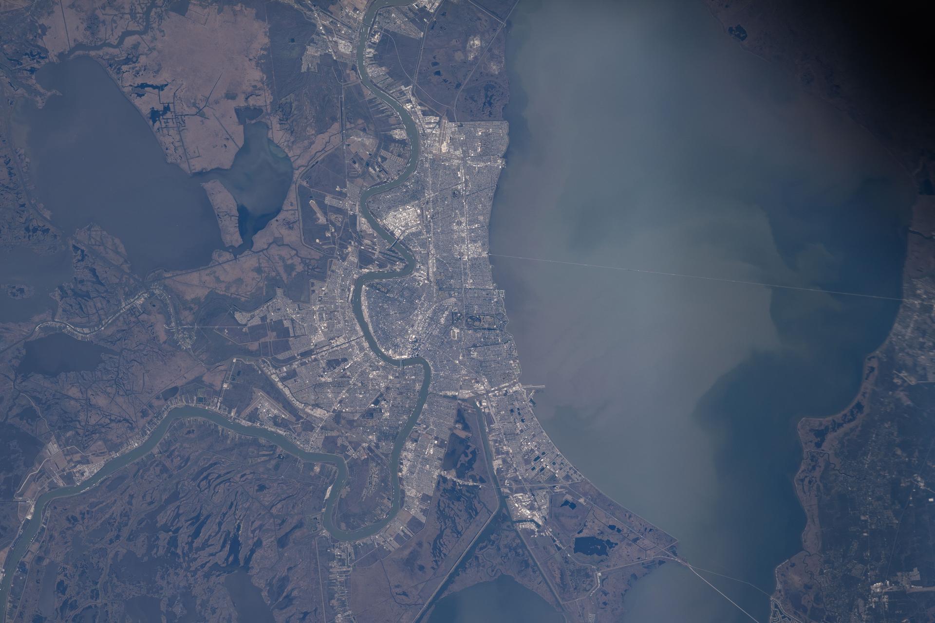
iss074e0150293 (Jan. 19, 2026) --- The Mississippi River winds through New Orleans, Louisiana, and its suburbs on the south shore of Lake Pontchartrain in this photograph taken from the International Space Station as it orbited 258 miles above Earth.
iss072e575684 (Jan. 24, 2025) --- New Orleans, Louisiana, and its suburbs along the Mississippi River and on the shoreline of Lake Pontchartrain are pictured from the International Space Station as it orbited above.
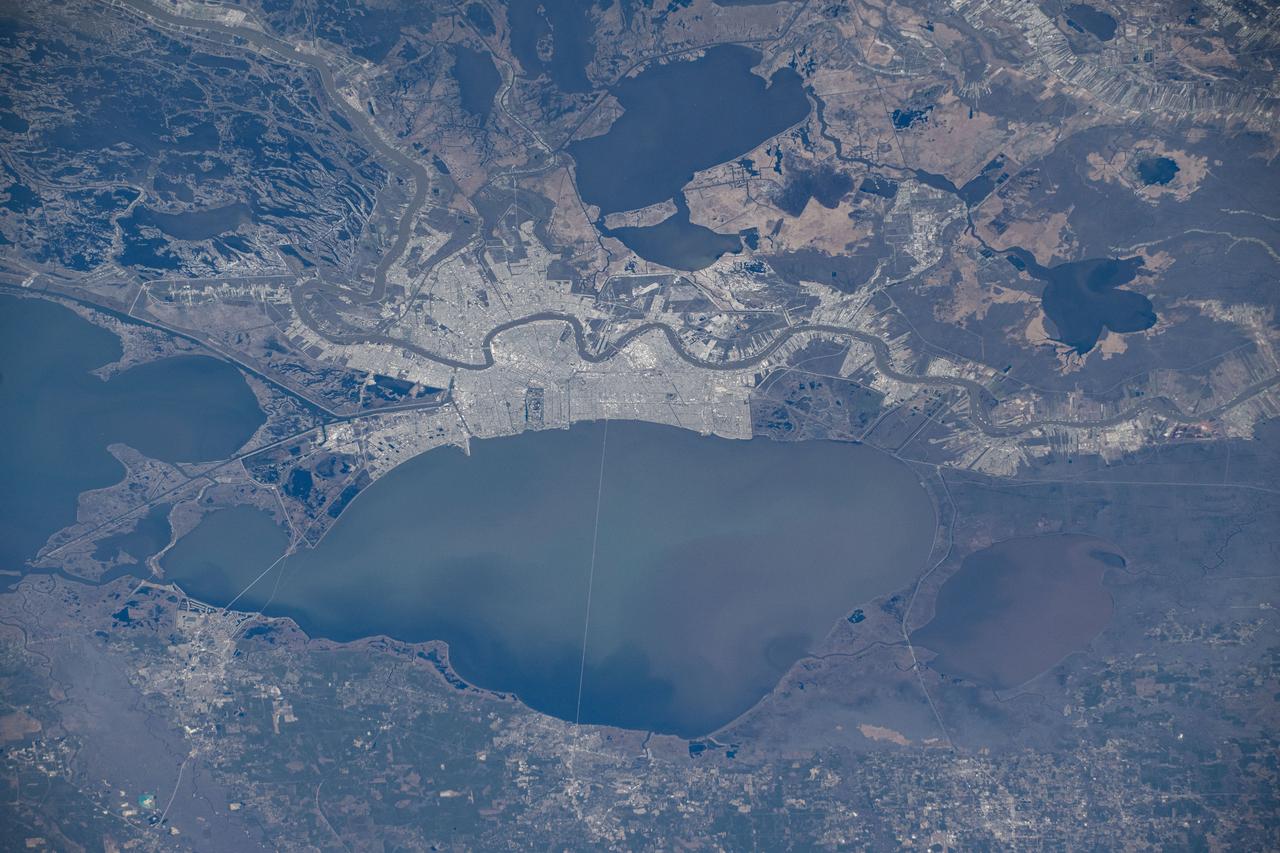
iss072e575658 (Jan. 24, 2025) --- New Orleans, Louisiana, and its suburbs along the Mississippi River and on the shoreline of Lake Pontchartrain are pictured from the International Space Station as it orbited above.
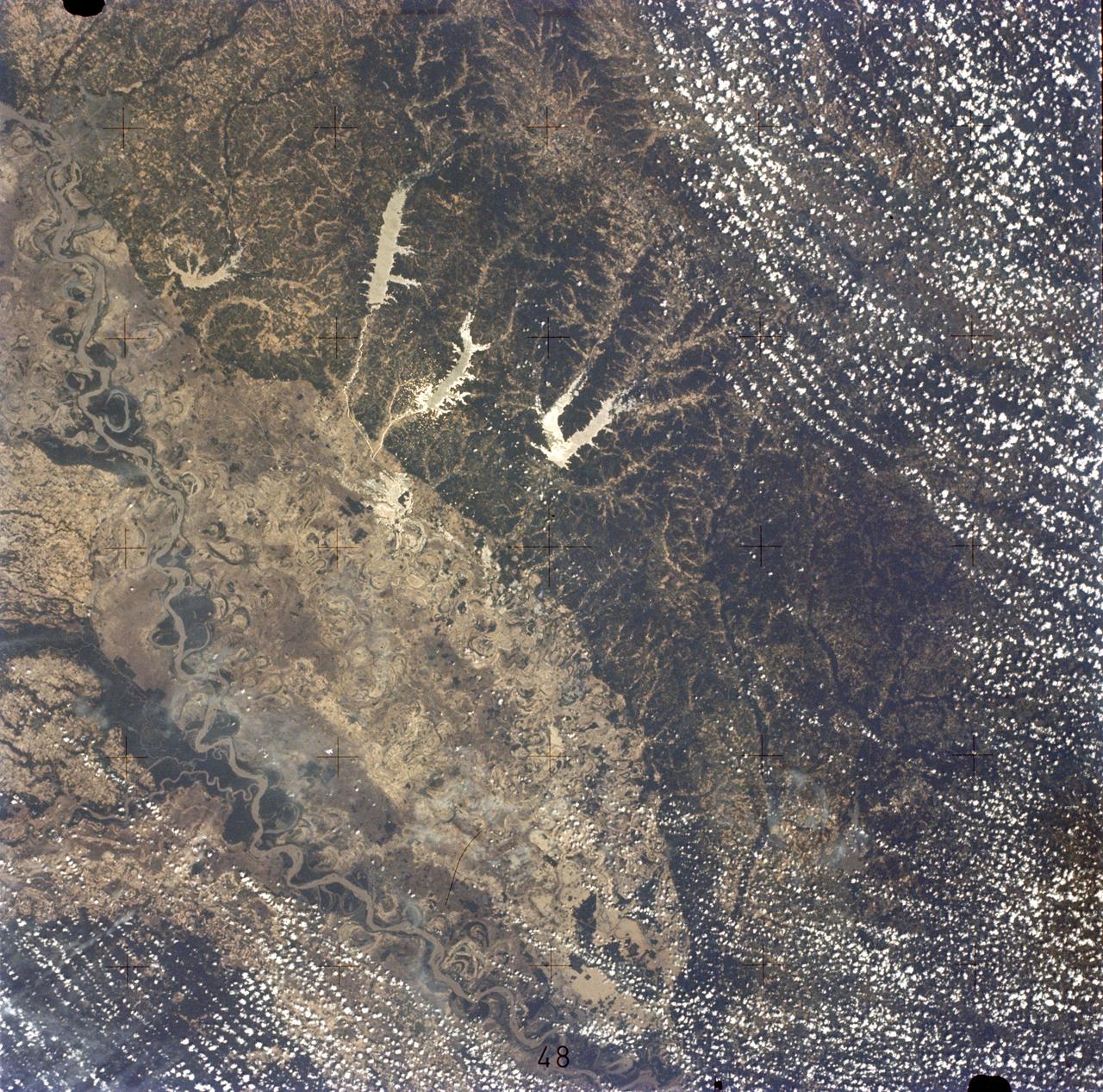
SL2-05-422 (22 June 1973) --- This section of the lower Mississippi River (34.0N, 90.0W) known as the Yazoo Basin, is characterized by a wide expanse of rich river bottomland with many oxbow lakes, the remains of the many changes in the riverbed over the course of many thousands of years. This soil is very fertile and productive but the region is prone to flooding. In this view, some of the back areas around the Delta National Forest show the effects of heavy spring rains. Photo credit: NASA
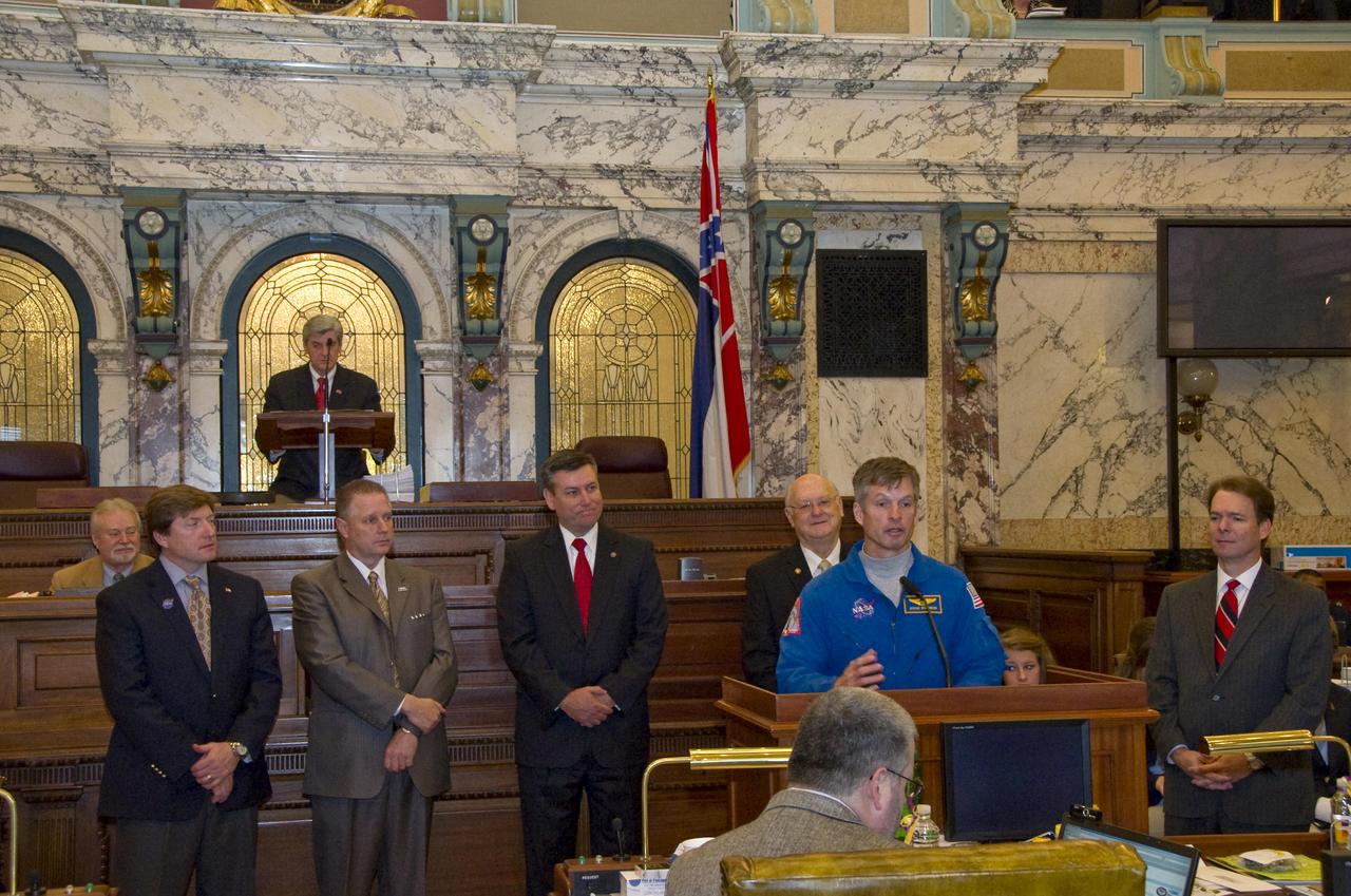
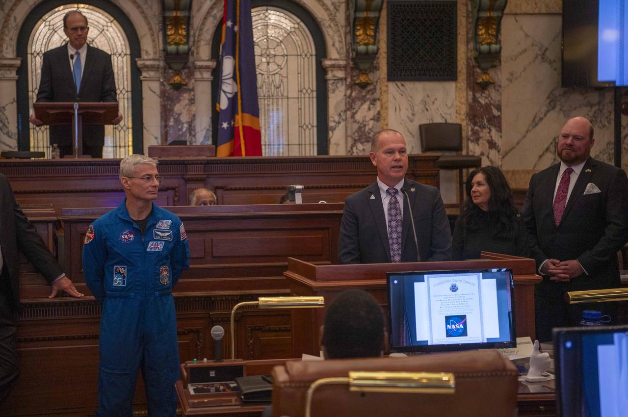
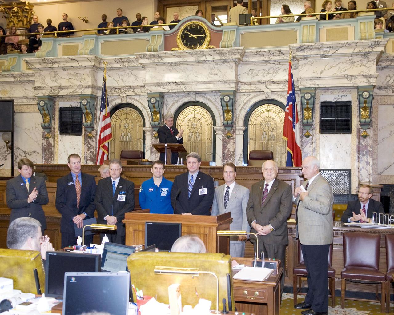
Astronaut Steven Swanson (front) speaks to members of the Mississippi Senate in chambers, with Lt. Gov. Phil Bryant presiding (rear), during NASA Day at the Capitol in Jackson on Feb. 10. Swanson was joined at the podium by Sen. David Baria, D-Bay St. Louis (l to r), NASA Shared Services Center Executive Director Rick Arbuthnot, Stennis Director Patrick Scheuermann, Sen. Ezell Lee, D-Picayune, and Sen. Billy Hewes, R-Gulfport. Baria, Lee and Hewes all are members of the Mississippi Senate Gulf Coast delegation.
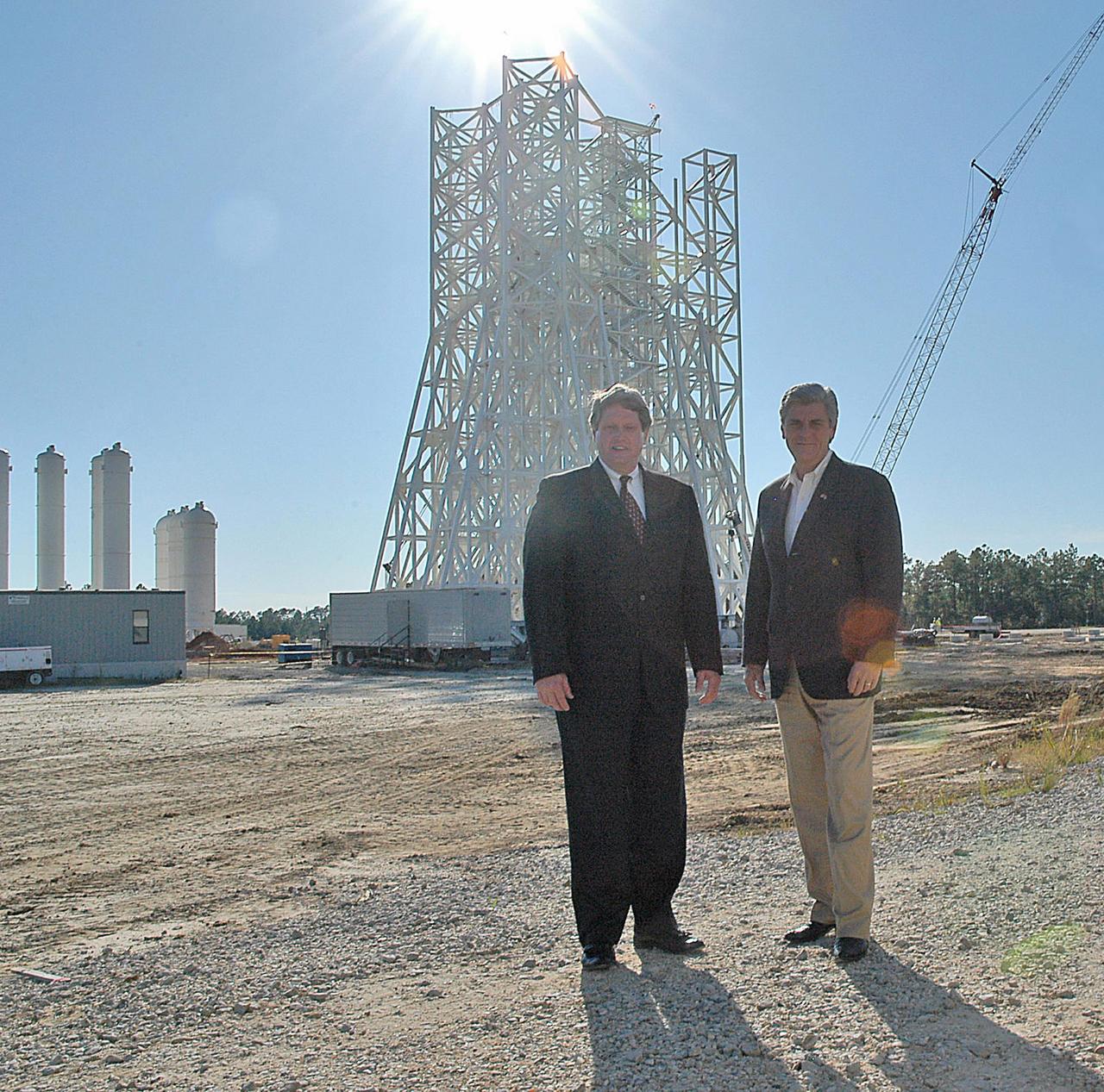
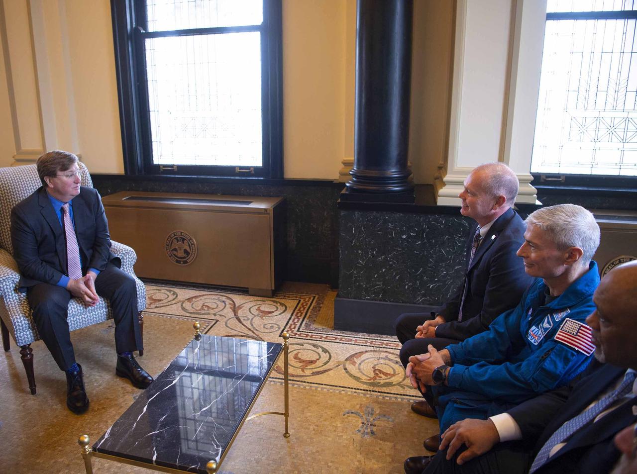
Stennis Space Center Director Gene Goldman (left) stands with Mississippi Lt. Gov. Phil Bryant at the A-3 Test Stand construction site during an Oct. 1 visit by the state official. During his tour, Bryant was updated on construction of the first large test stand at Stennis since the 1960s. The A-3 stand will be used to conduct simulated high-altitude testing on the next generation of rocket engines that will take humans back to the moon and possibly beyond. In addition to touring Stennis facilities, Bryant visited the INFINITY Science Center construction site, where he was updated on work under way to construct a 72,000-square-foot facility that will showcase the science underpinning the missions of NASA and resident agencies at Stennis.
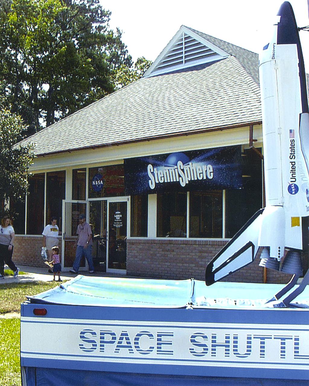
The Launch Pad tour stop at the Mississippi I-10 Welcome Center in Hancock County, Miss., is the point of origin for all tours of Stennis Space Center and StenniSphere. At the Launch Pad, visitors waiting to catch the shuttle buses are provided information and can see videos on StenniSphere exhibits and on the missions and programs of Stennis Space Center. StenniSphere is open free of charge from 9 a.m. to 5 p.m. daily, and buses depart from the Launch Pad to StenniSphere every 15 to 20 minutes.
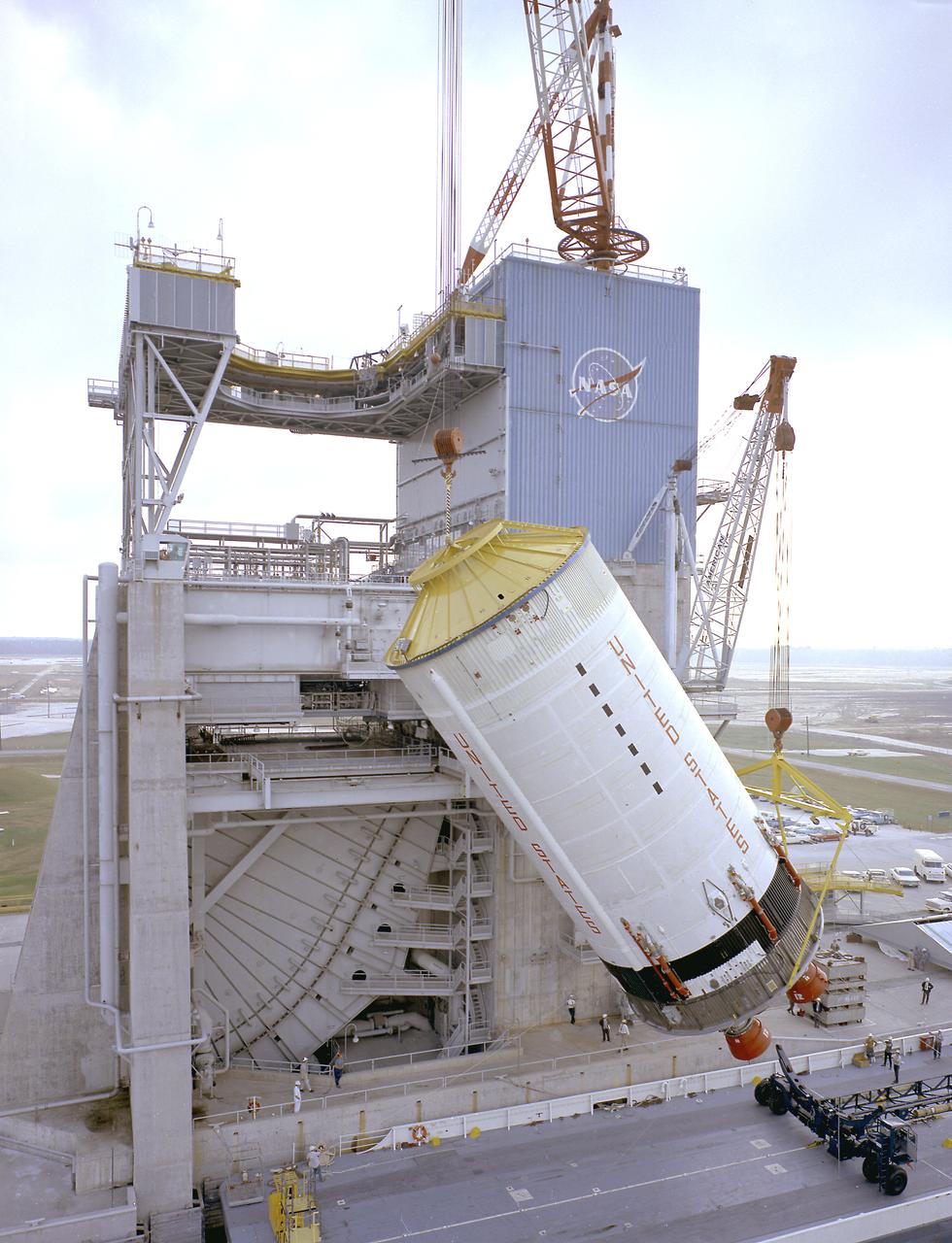
This photograph shows the Saturn V S-II (second) stage being hoisted at the S-II-A2 test stand at the Mississippi Test Facility (MTF). When the Saturn V booster stage (S-IC) burns out and drops away, power for the Saturn will be provided by the 82-foot-long and 33-foot-diameter S-II stage. Developed by the Space Division of North American Aviation under the direction of the Marshall Space Flight Center, the stage utilized five J-2 engines, each producing 200,000 pounds of thrust. The engines used liquid oxygen and liquid hydrogen as propellants. Static test of ground test versions of the S-II stage were conducted at North American Aviation's Santa Susana, California test site. All flight stages were tested at the Mississippi Test Facility, Bay St. Louis, Mississippi. MTF was renamed to the National Space Technology Laboratory (NSTL) in 1974 and later to the Sternis Space Center in May 1988.
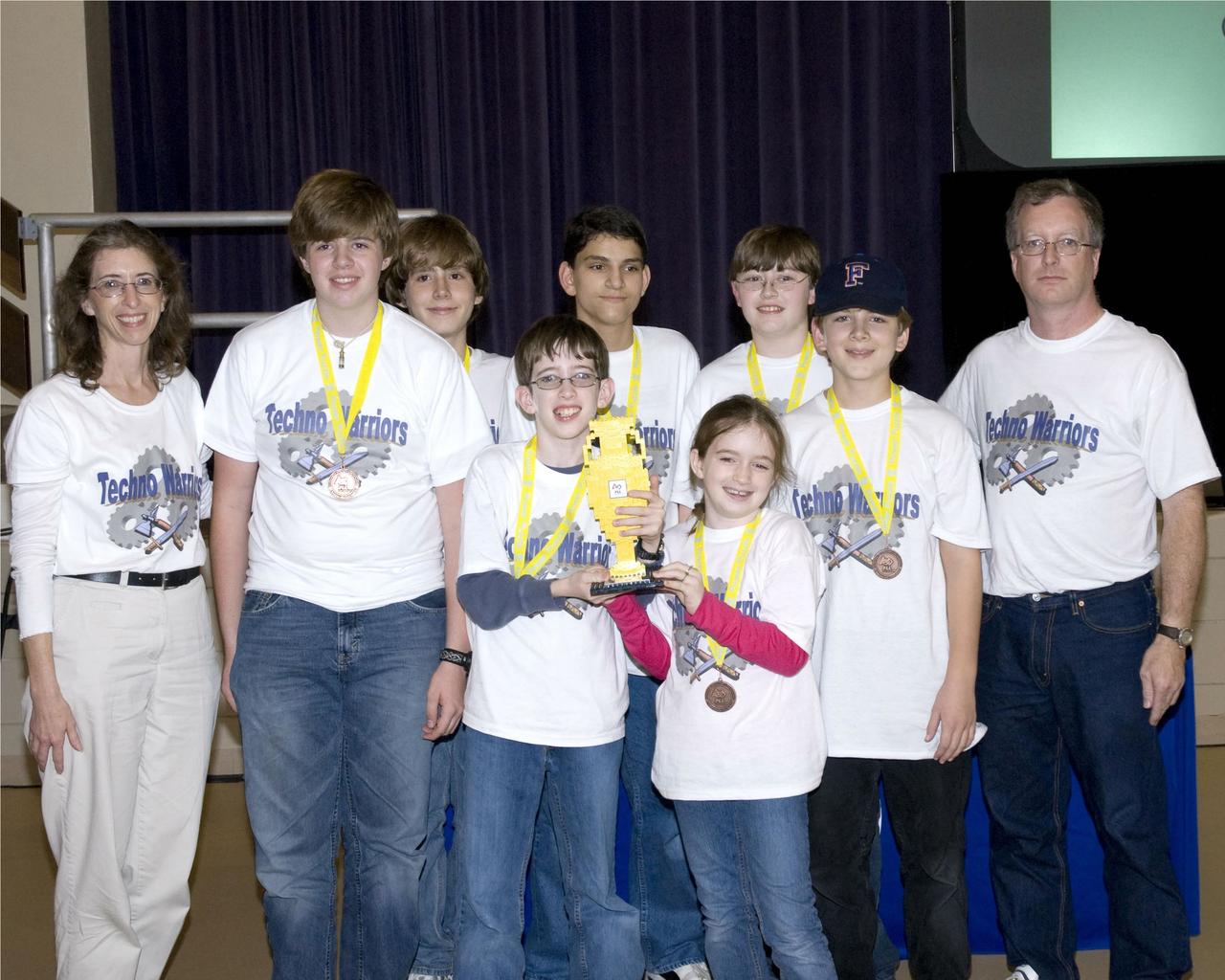
PEAK Home School Network Team 1832 'Techno Warriors' of Brandon sport the Champions Award they won during the Dec. 8 FIRST (For Inspiration and Recognition of Science and Technology) LEGO League 2007 Mississippi Championship Tournament.

Stennis Space Center Director Patrick Scheuermann (l) addresses visitors gathered for the official transfer of the former Mississippi Army Ammunition Plant facilities to NASA. The action transferred 1.6 million square feet of facility space, increasing Stennis work facilities by about one-third and setting the stage for years of expansion.
NASA Administrator Jared Isaacman speaks with NASA employees during his visit to NASA’s Stennis Space Center near Bay St. Louis, Mississippi, on Jan. 15, 2026. Isaacman, NASA’s 15th administrator, began visiting the agency’s centers after his appointment on Dec. 17, 2025.
NASA Administrator Jared Isaacman, right, greets members of the workforce, Thursday, Jan. 15, 2026, at NASA’s Stennis Space Center in Mississippi. Stennis marks the sixth stop in Isaacman’s roadshow to visit NASA facilities and engage directly with the agency’s workforce. Photo Credit: (NASA/John Kraus)
NASA Administrator Jared Isaacman, center, meets with NASA employees during his visit to NASA’s Stennis Space Center near Bay St. Louis, Mississippi, on Jan. 15, 2026. Isaacman, NASA’s 15th administrator, began visiting the agency’s centers after his appointment on Dec. 17, 2025.
NASA Administrator Jared Isaacman, left, speaks with NASA employees during his visit to NASA’s Stennis Space Center near Bay St. Louis, Mississippi, on Jan. 15, 2026. Isaacman, NASA’s 15th administrator, began visiting the agency’s centers after his appointment on Dec. 17, 2025.
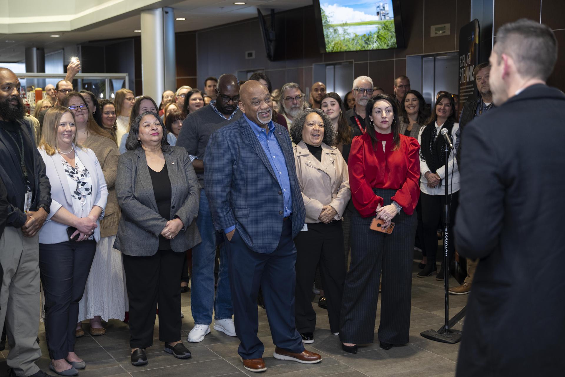
NASA Administrator Jared Isaacman, right, speaks with NASA employees during his visit to NASA’s Stennis Space Center near Bay St. Louis, Mississippi, on Jan. 15, 2026. Isaacman, NASA’s 15th administrator, began visiting the agency’s centers after his appointment on Dec. 17, 2025.
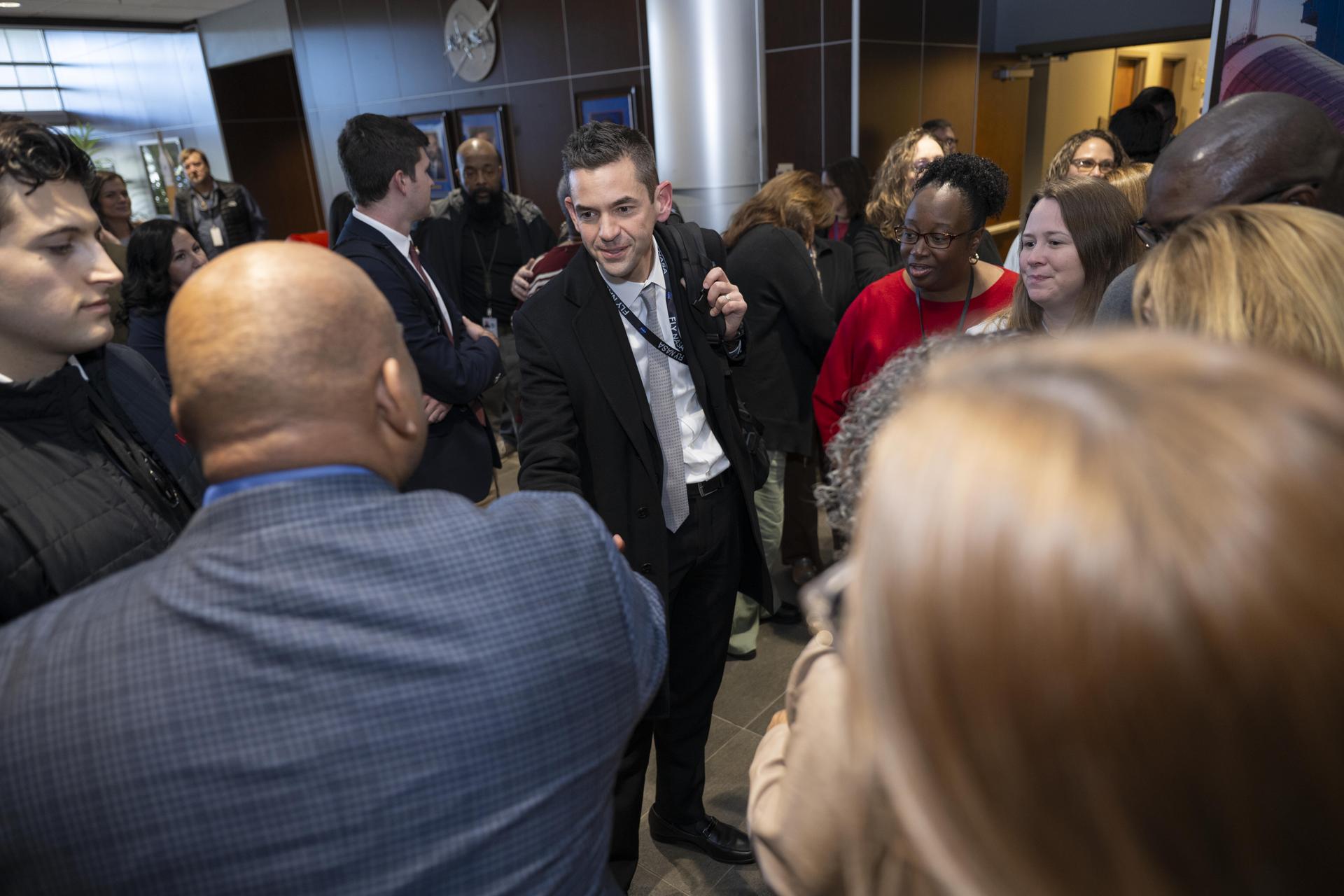
NASA Administrator Jared Isaacman, center, meets with NASA employees during his visit to NASA’s Stennis Space Center near Bay St. Louis, Mississippi, on Jan. 15, 2026. Isaacman, NASA’s 15th administrator, began visiting the agency’s centers after his appointment on Dec. 17, 2025.
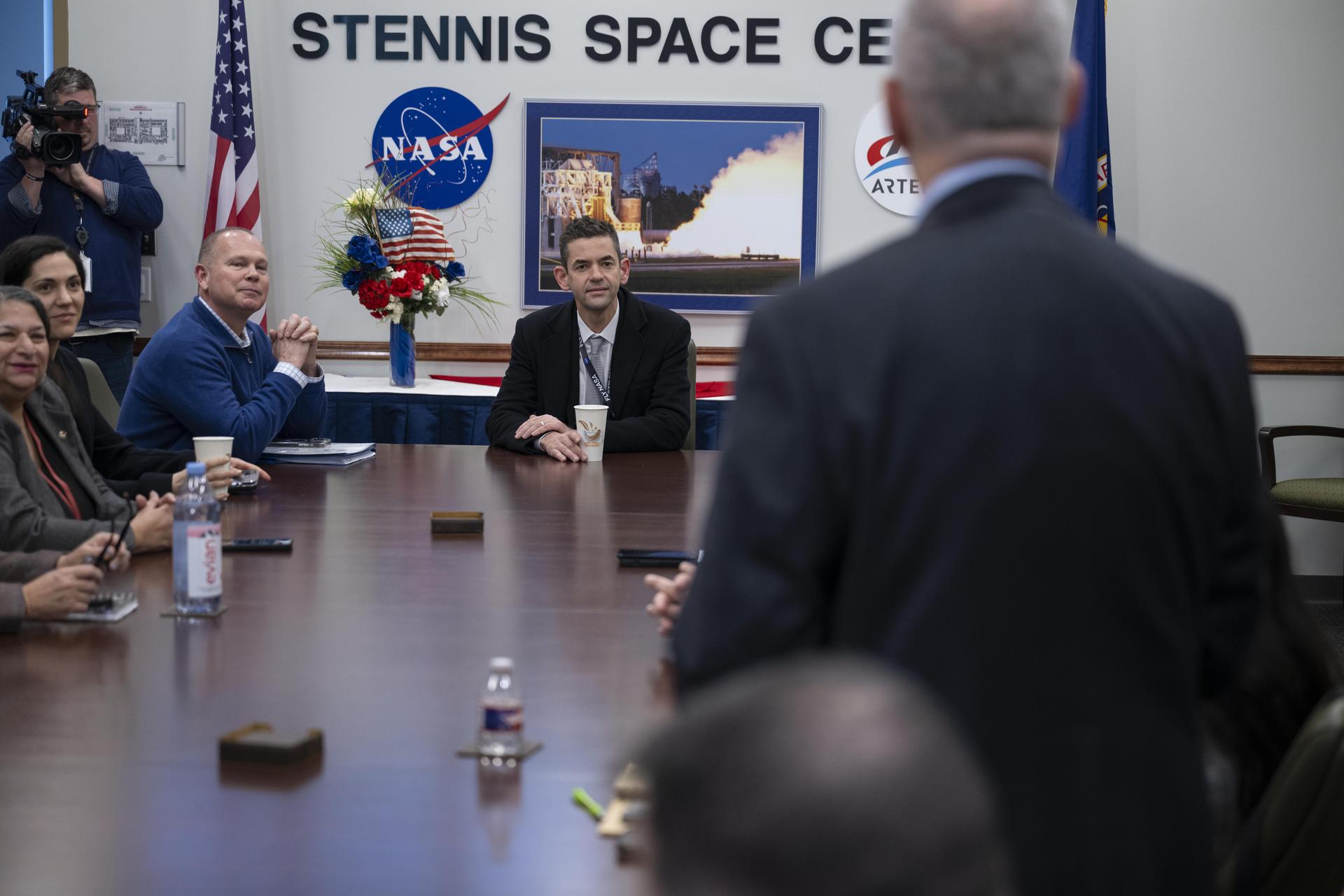
NASA Administrator Jared Isaacman, center, meets with the center’s senior leadership during his visit to NASA’s Stennis Space Center near Bay St. Louis, Mississippi, on Jan. 15, 2026. Isaacman, NASA’s 15th administrator, began visiting the agency’s centers after his appointment on Dec. 17, 2025.
NASA Administrator Jared Isaacman, center, meets with the center’s senior leadership during his visit to NASA’s Stennis Space Center near Bay St. Louis, Mississippi, on Jan. 15, 2026. Isaacman, NASA’s 15th administrator, began visiting the agency’s centers after his appointment on Dec. 17, 2025.
NASA Administrator Jared Isaacman, left, speaks with NASA employees during his visit to NASA’s Stennis Space Center near Bay St. Louis, Mississippi, on Jan. 15, 2026. Isaacman, NASA’s 15th administrator, began visiting the agency’s centers after his appointment on Dec. 17, 2025.
NASA Administrator Jared Isaacman, center, speaks with NASA employees during his visit to NASA’s Stennis Space Center near Bay St. Louis, Mississippi, on Jan. 15, 2026. Isaacman, NASA’s 15th administrator, began visiting the agency’s centers after his appointment on Dec. 17, 2025.
NASA Administrator Jim Bridenstine speaks at an all-hands for employees following the State of NASA address, Monday, Feb. 10, 2020, at NASA’s Stennis Space Center near Bay St. Louis, Mississippi. Photo Credit: (NASA/Joel Kowsky)
Stennis Space Center Director Patrick Scheuermann (l) addresses visitors gathered for the official transfer of the former Mississippi Army Ammunition Plant facilities to NASA. The action transferred 1.6 million square feet of facility space, increasing Stennis work facilities by about one-third and setting the stage for years of expansion.
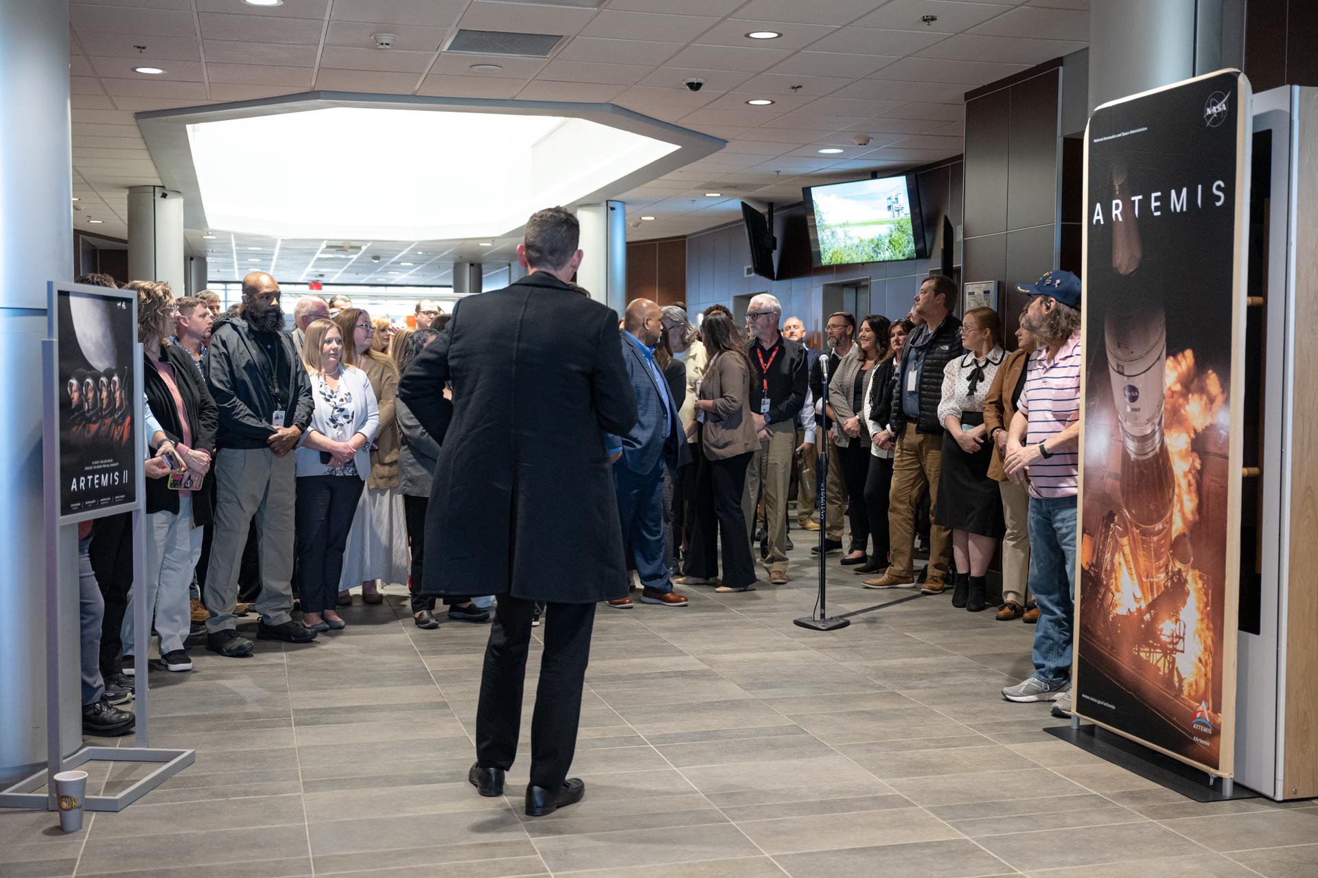
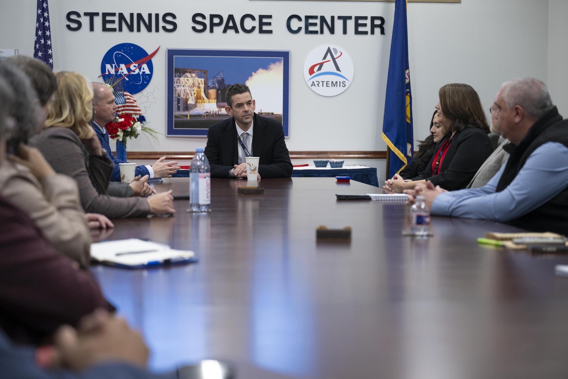
NASA Administrator Jared Isaacman speaks during a workforce Q&A session, Thursday, Jan. 15, 2026, at NASA’s Stennis Space Center in Mississippi. Stennis marks the sixth stop in Isaacman’s roadshow to visit NASA facilities and engage directly with the agency’s workforce. Photo Credit: (NASA/John Kraus)
NASA Administrator Jared Isaacman, left, meets with NASA employees during his visit to NASA’s Stennis Space Center near Bay St. Louis, Mississippi, on Jan. 15, 2026. Isaacman, NASA’s 15th administrator, began visiting the agency’s centers after his appointment on Dec. 17, 2025.
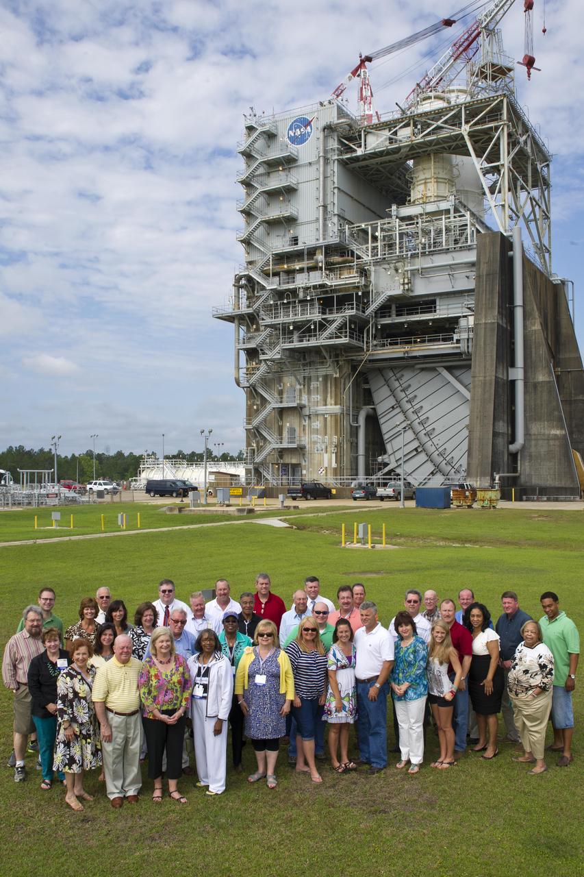
Legislators from across Mississippi visited Stennis Space Center on May 7, 2012, touring various facilities, including the A-1 Test Stand, and learning about work under way at the facility. The legislators also toured the INFINITY at NASA Stennis Space Center facility and met with Apollo 13 astronaut Fred Haise.
NASA Administrator Jared Isaacman, right, speaks with Tyler Bell, multimedia journalist at WLOX-TV, during an interview at NASA’s Stennis Space Center near Bay St. Louis, Mississippi, on Jan. 15, 2026. Isaacman, NASA’s 15th administrator, began visiting the agency’s centers after his appointment on Dec. 17, 2025.
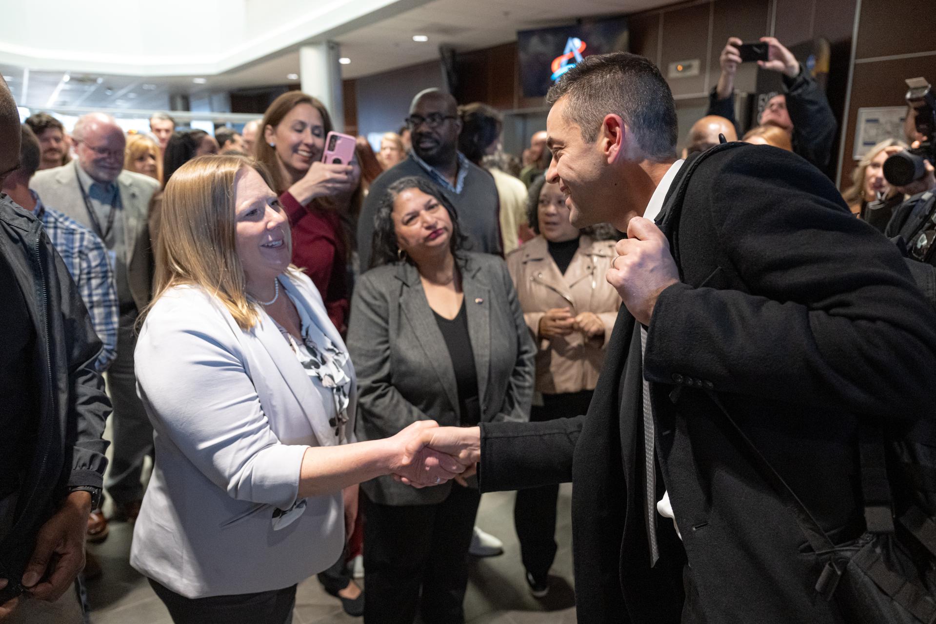
NASA Administrator Jared Isaacman, right, greets members of the workforce, Thursday, Jan. 15, 2026, at NASA’s Stennis Space Center in Mississippi. Stennis marks the sixth stop in Isaacman’s roadshow to visit NASA facilities and engage directly with the agency’s workforce. Photo Credit: (NASA/John Kraus)
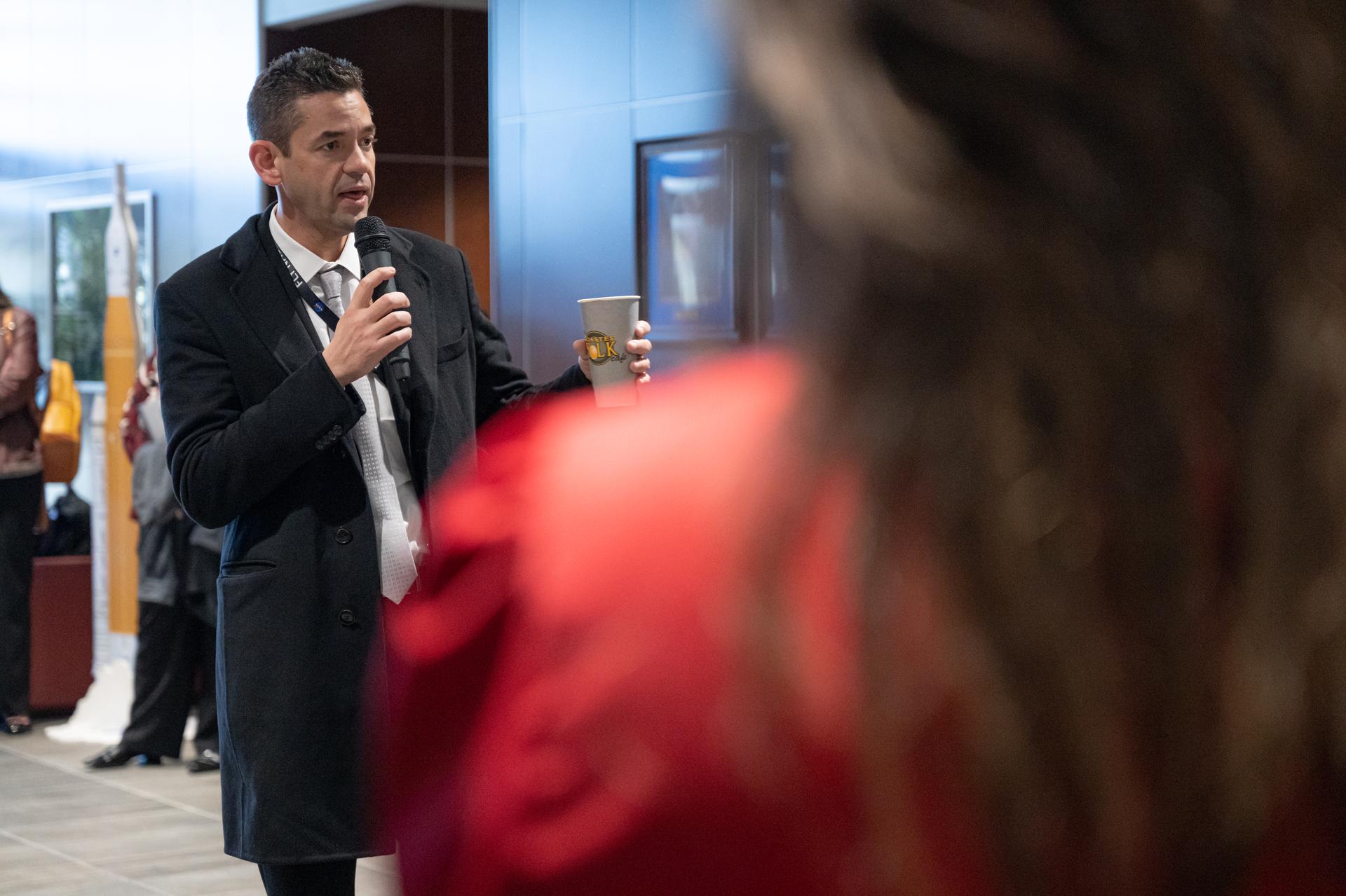
NASA Administrator Jared Isaacman speaks during a workforce Q&A session, Thursday, Jan. 15, 2026, at NASA’s Stennis Space Center in Mississippi. Stennis marks the sixth stop in Isaacman’s roadshow to visit NASA facilities and engage directly with the agency’s workforce. Photo Credit: (NASA/John Kraus)
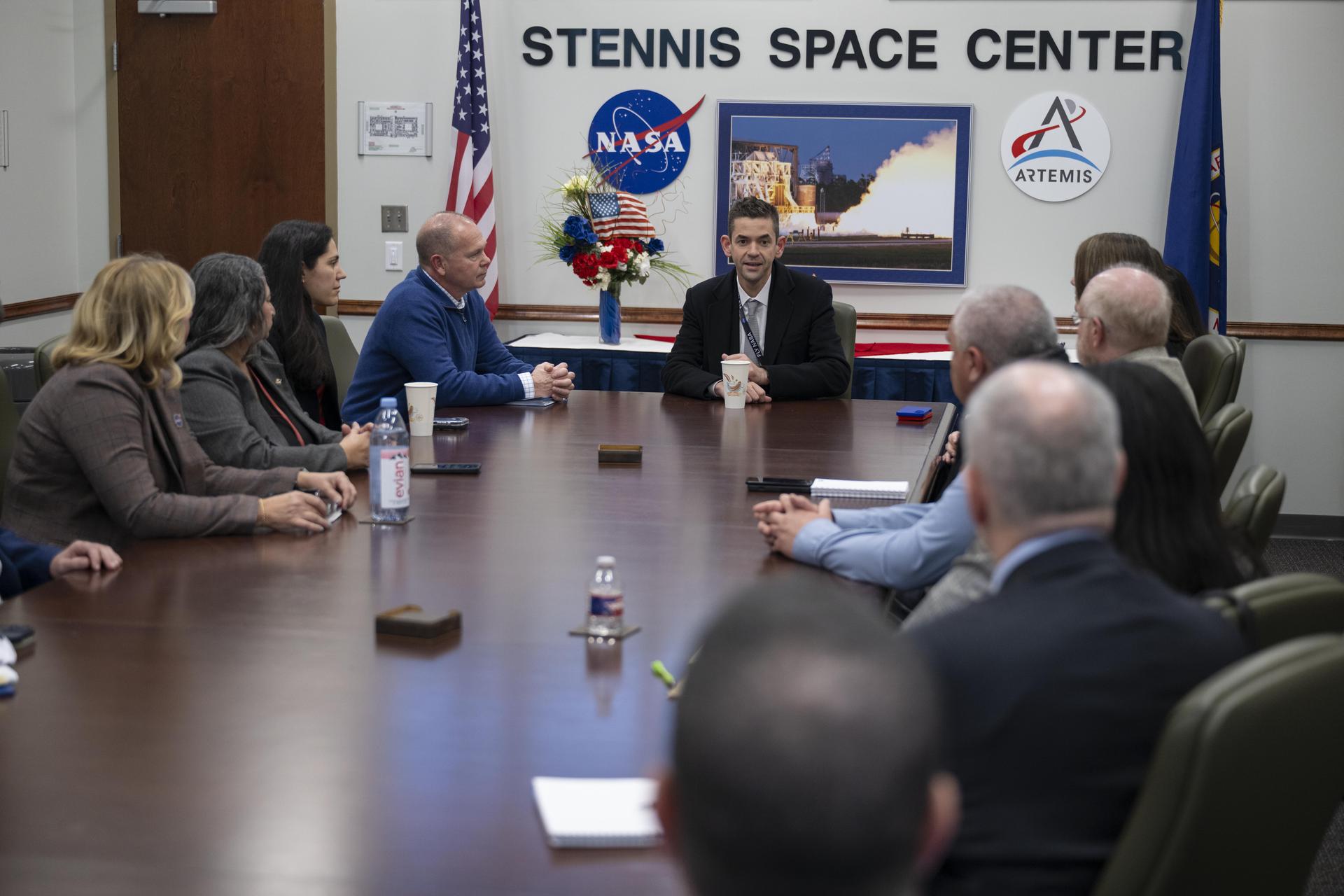
NASA Administrator Jared Isaacman, center, meets with the center’s senior leadership during his visit to NASA’s Stennis Space Center near Bay St. Louis, Mississippi, on Jan. 15, 2026. Isaacman, NASA’s 15th administrator, began visiting the agency’s centers after his appointment on Dec. 17, 2025.
Astronaut Rex Walheim (center) speaks to members of the Mississippi House of Representatives in chambers during NASA Day at the Capitol in Jackson on Feb. 19. Walheim was joined at the podium by members of the Mississippi House of Representatives Gulf Coast delegation, as well as Stennis Space Center Director Gene Goldman (astronaut's immediate right) and NASA's Shared Services Center Director Rick Arbuthnot and Partners for Stennis Executive Director Tish Williams (astronaut's immediate left).

The greater New Orleans area, including portions of Louisiana and Mississippi, as seen from the Apollo 7 spacecraft during its 120th revolution of the earth. Photographed from an altitude of 95 nautical miles, at ground elapsed time of 190 hours and 45 minutes. The largest body of water in the picture is Lake Pontchartrain. The Mississippi River is clearly visible as it meanders past New Orleans. Note highway network, and 25-mile causeway across lake.
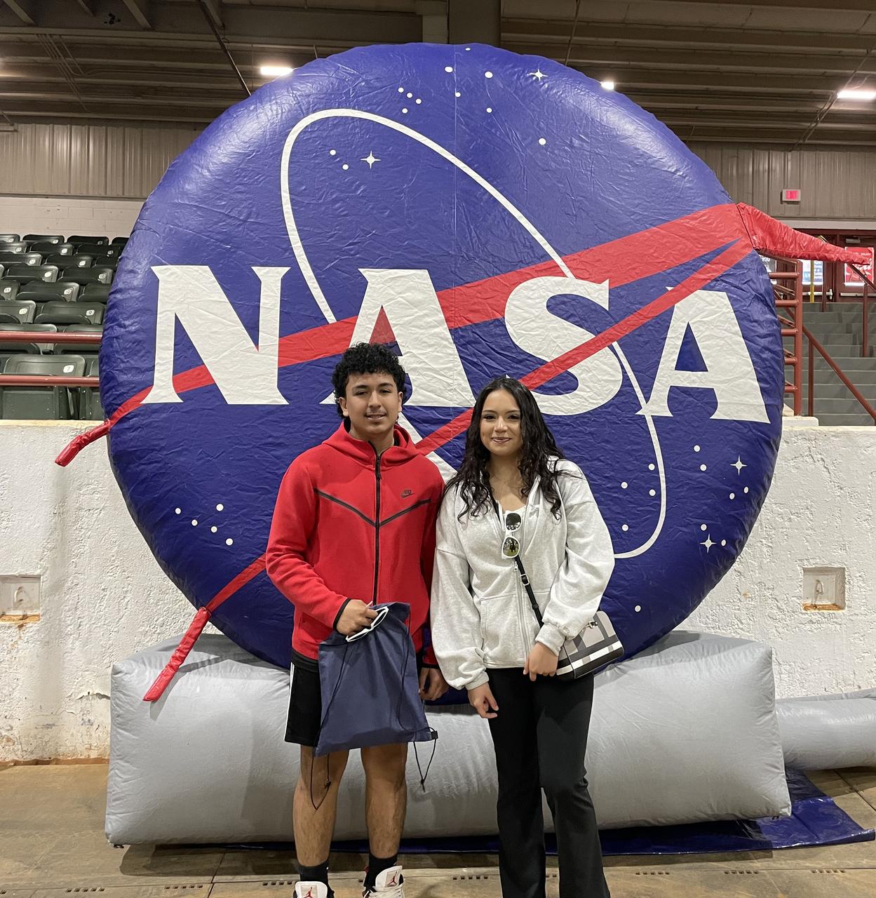
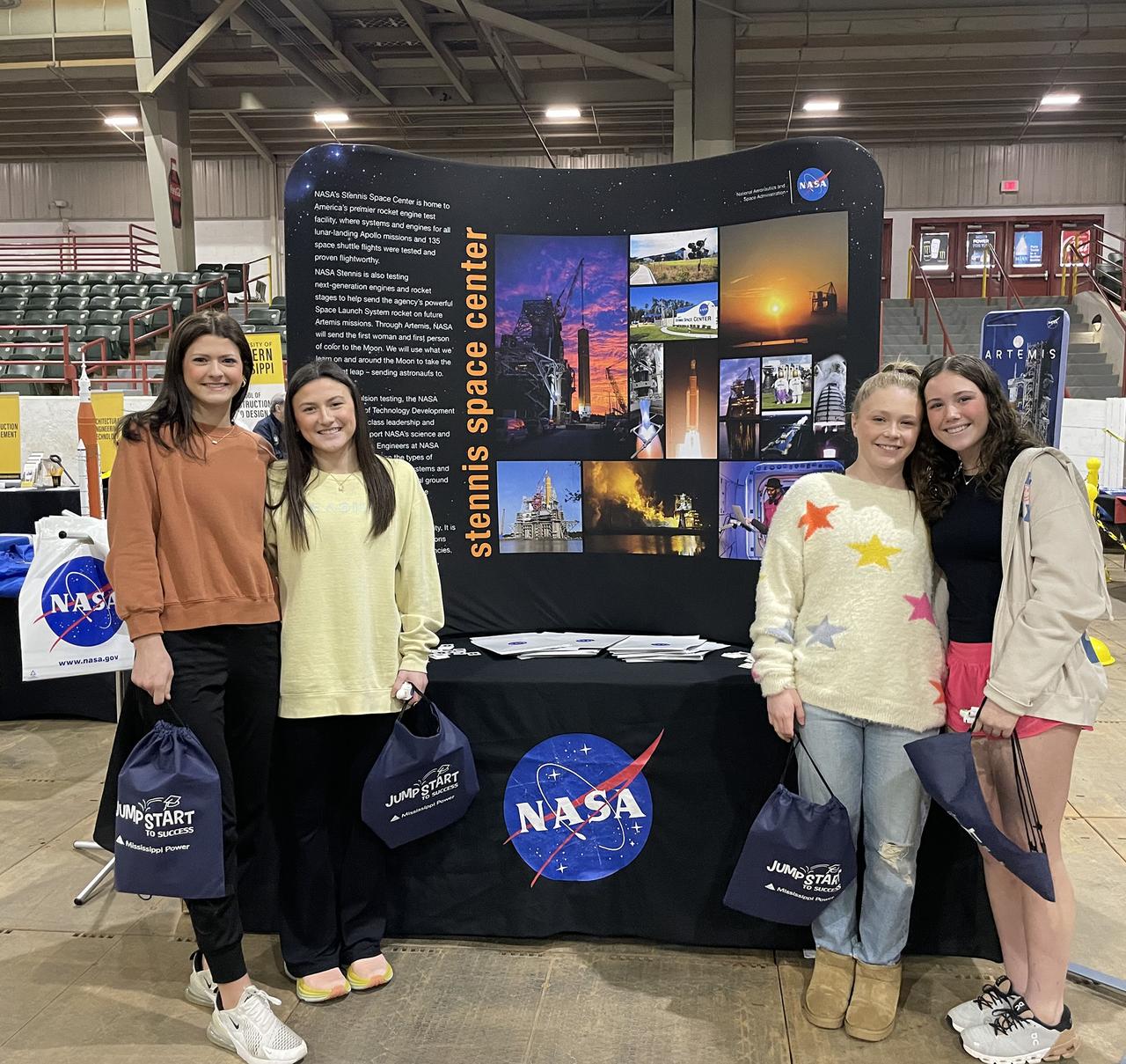
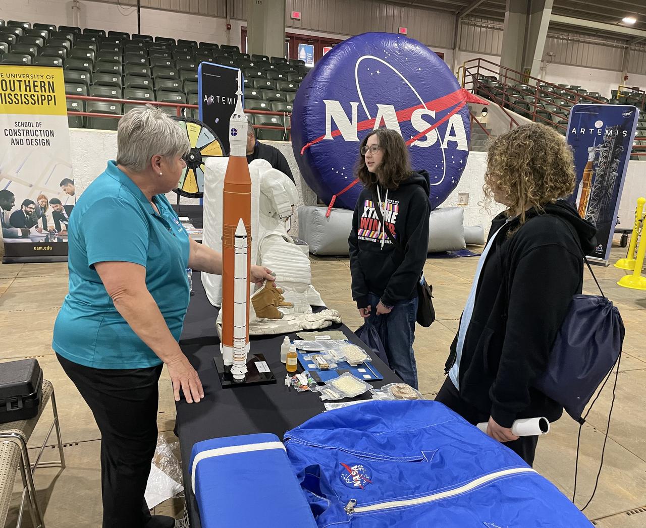
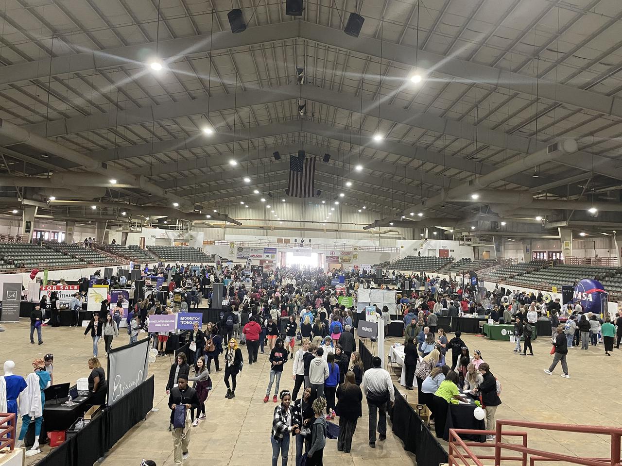
Students in today’s classrooms make up the Artemis Generation and everyone can find their place in space as NASA explores the secrets of the universe for the benefit of all. Representatives from NASA’s Stennis Space Center participated in the Hattiesburg Area Development Partnership’s Jumpstart to Success interactive career expo on Feb. 1, reaching more than 1,700 eighth and ninth grade students from Forrest, Lamar, and Perry counties in Mississippi. Through Artemis, NASA will establish the foundation for long-term scientific exploration at the Moon, land the first woman, first person of color, and first international partner astronaut on the lunar surface, and prepare for human expeditions to Mars. Photo Credit: NASA/Samone Wilson

Students in today’s classrooms make up the Artemis Generation and everyone can find their place in space as NASA explores the secrets of the universe for the benefit of all. Representatives from NASA’s Stennis Space Center participated in the Hattiesburg Area Development Partnership’s Jumpstart to Success interactive career expo on Feb. 1, reaching more than 1,700 eighth and ninth grade students from Forrest, Lamar, and Perry counties in Mississippi. Through Artemis, NASA will establish the foundation for long-term scientific exploration at the Moon, land the first woman, first person of color, and first international partner astronaut on the lunar surface, and prepare for human expeditions to Mars. Photo Credit: NASA/Samone Wilson
Students in today’s classrooms make up the Artemis Generation and everyone can find their place in space as NASA explores the secrets of the universe for the benefit of all. Representatives from NASA’s Stennis Space Center participated in the Hattiesburg Area Development Partnership’s Jumpstart to Success interactive career expo on Feb. 1, reaching more than 1,700 eighth and ninth grade students from Forrest, Lamar, and Perry counties in Mississippi. Through Artemis, NASA will establish the foundation for long-term scientific exploration at the Moon, land the first woman, first person of color, and first international partner astronaut on the lunar surface, and prepare for human expeditions to Mars. Photo Credit: NASA/Samone Wilson
Students in today’s classrooms make up the Artemis Generation and everyone can find their place in space as NASA explores the secrets of the universe for the benefit of all. Representatives from NASA’s Stennis Space Center participated in the Hattiesburg Area Development Partnership’s Jumpstart to Success interactive career expo on Feb. 1, reaching more than 1,700 eighth and ninth grade students from Forrest, Lamar, and Perry counties in Mississippi. Through Artemis, NASA will establish the foundation for long-term scientific exploration at the Moon, land the first woman, first person of color, and first international partner astronaut on the lunar surface, and prepare for human expeditions to Mars. Photo Credit: NASA/Samone Wilson
Students in today’s classrooms make up the Artemis Generation and everyone can find their place in space as NASA explores the secrets of the universe for the benefit of all. Representatives from NASA’s Stennis Space Center participated in the Hattiesburg Area Development Partnership’s Jumpstart to Success interactive career expo on Feb. 1, reaching more than 1,700 eighth and ninth grade students from Forrest, Lamar, and Perry counties in Mississippi. Through Artemis, NASA will establish the foundation for long-term scientific exploration at the Moon, land the first woman, first person of color, and first international partner astronaut on the lunar surface, and prepare for human expeditions to Mars. Photo Credit: NASA/Samone Wilson

Students in today’s classrooms make up the Artemis Generation and everyone can find their place in space as NASA explores the secrets of the universe for the benefit of all. Representatives from NASA’s Stennis Space Center participated in the Hattiesburg Area Development Partnership’s Jumpstart to Success interactive career expo on Feb. 1, reaching more than 1,700 eighth and ninth grade students from Forrest, Lamar, and Perry counties in Mississippi. Through Artemis, NASA will establish the foundation for long-term scientific exploration at the Moon, land the first woman, first person of color, and first international partner astronaut on the lunar surface, and prepare for human expeditions to Mars. Photo Credit: NASA/Samone Wilson

Students in today’s classrooms make up the Artemis Generation and everyone can find their place in space as NASA explores the secrets of the universe for the benefit of all. Representatives from NASA’s Stennis Space Center participated in the Hattiesburg Area Development Partnership’s Jumpstart to Success interactive career expo on Feb. 1, reaching more than 1,700 eighth and ninth grade students from Forrest, Lamar, and Perry counties in Mississippi. Through Artemis, NASA will establish the foundation for long-term scientific exploration at the Moon, land the first woman, first person of color, and first international partner astronaut on the lunar surface, and prepare for human expeditions to Mars. Photo Credit: NASA/Samone Wilson
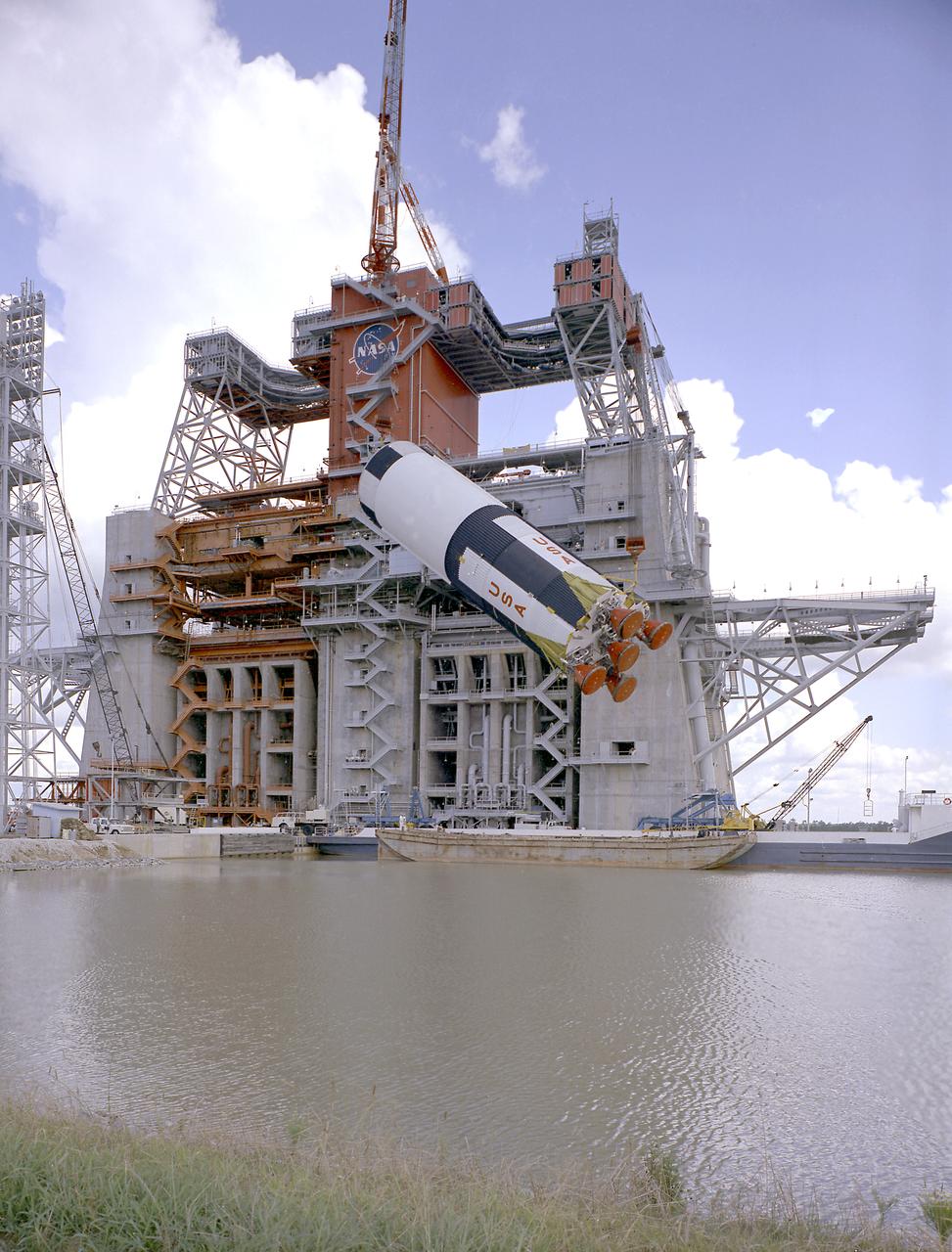
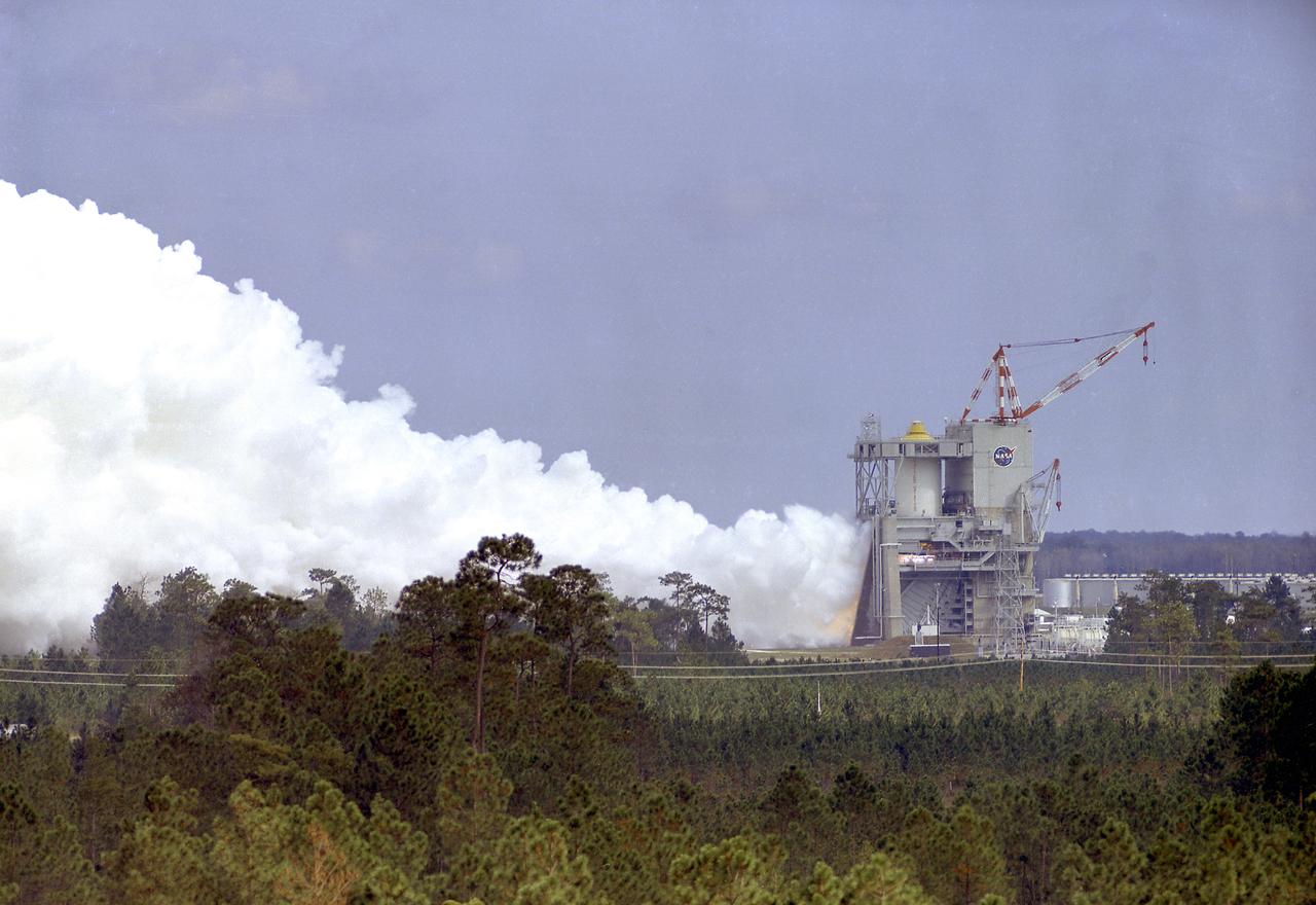
This photograph is a view of the Saturn V S-IC-5 (first) flight stage being hoisted into the S-IC-B1 test stand at the Mississippi Test Facility (MTF), Bay St. Louis, Mississippi. Begirning operations in 1966, the MTF has two test stands, a dual-position structure for running the S-IC stage at full throttle, and two separate stands for the S-II (Saturn V third) stage. It became the focus of the static test firing program. The completed S-IC stage was shipped from Michoud Assembly Facility (MAF) to the MTF. The stage was then installed into the 124-meter-high test stand for static firing tests before shipment to the Kennedy Space Center for final assembly of the Saturn V vehicle. The MTF was renamed to the National Space Technology Laboratory (NSTL) in 1974 and later to the Stennis Space Center (SSC) in May 1988.
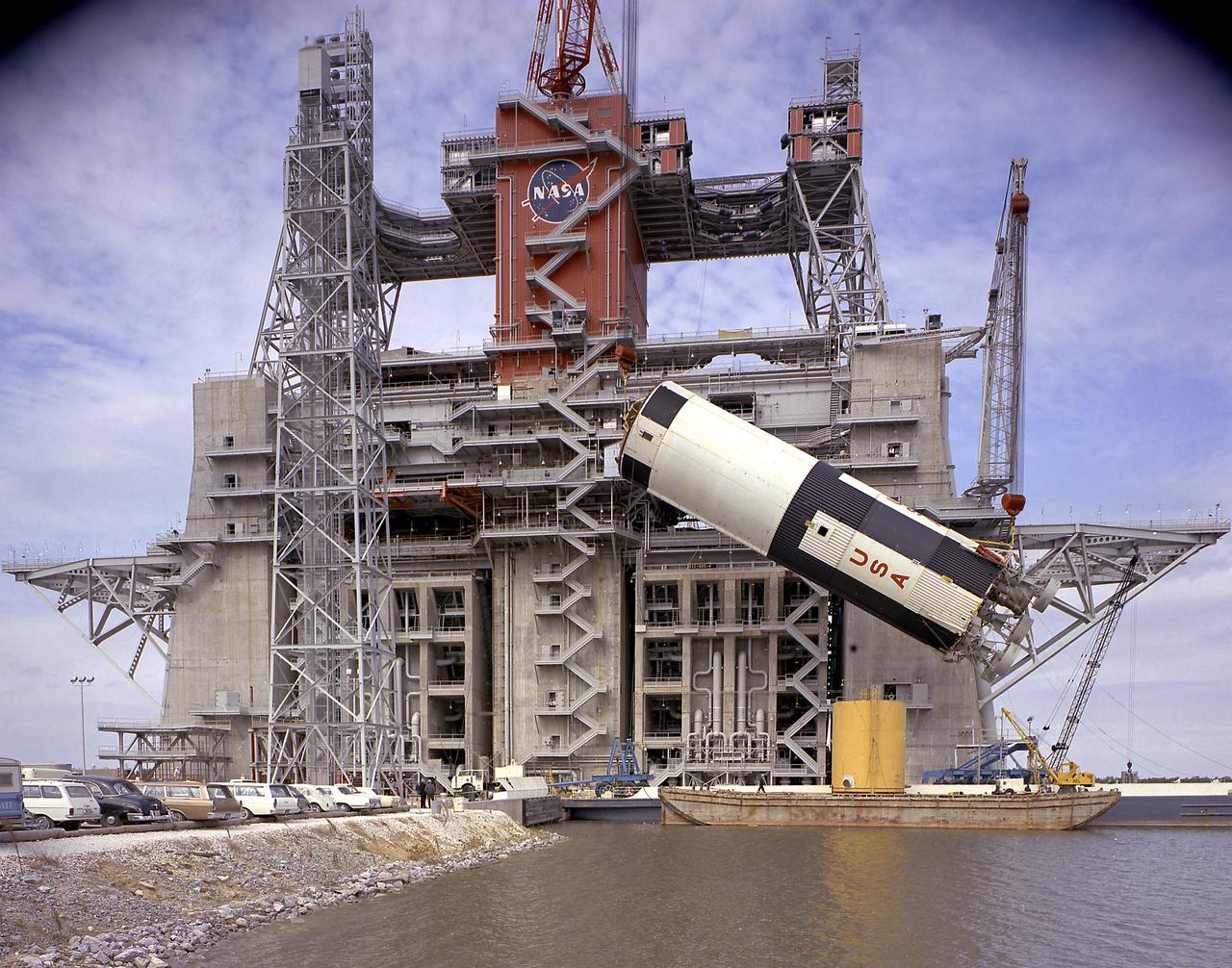
This photograph is a view of the Saturn V S-IC (first) test stage being hoisted into the S-IC-B1 test stand at the Mississippi Test Facility (MTF), Bay St. Louis, Mississippi. This stage was used to prove the operational readiness of the stand. Begirning operations in 1966, the MTF has two test stands; a dual-position structure for running the S-IC stage at full throttle, and two separate stands for the S-II (Saturn V third) stage. It became the focus of the static test firing program. The completed S-IC stage was shipped from the Michoud Assembly Facility (MAF) to the MTF. The stage was then installed into the 124-meter-high test stand for static firing tests before shipment to the Kennedy Space Center for final assembly of the Saturn V vehicle. The MTF was renamed to the National Space Technology Laboratory (NSTL) in 1974 and later to the Stennis Space Center (SSC) in May 1988.
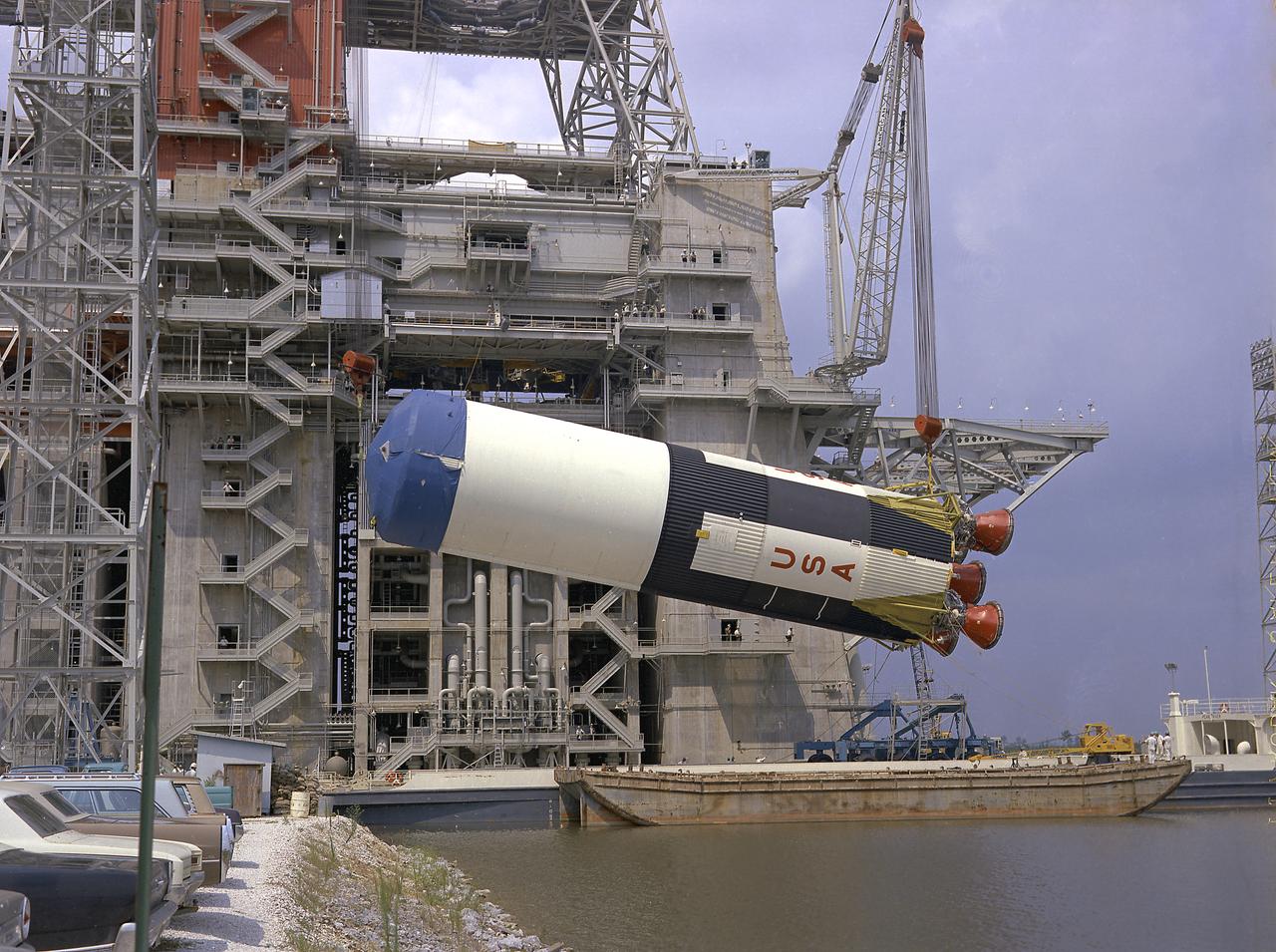
This photograph is a view of the Saturn V S-IC-5 (first) flight stage being hoisted into the S-IC-B1 test stand at the Mississippi Test Facility (MTF), Bay St. Louis, Mississippi. Begirning operations in 1966, the MTF has two test stands, a dual-position structure for running the S-IC stage at full throttle, and two separate stands for the S-II (Saturn V third) stage. It became the focus of the static test firing program. The completed S-IC stage was shipped from Michoud Assembly Facility (MAF) to the MTF. The stage was then installed into the 124-meter-high test stand for static firing tests before shipment to the Kennedy Space Center for final assembly of the Saturn V vehicle. The MTF was renamed to the National Space Technology Laboratory (NSTL) in 1974 and later to the Stennis Space Center (SSC) in May 1988.
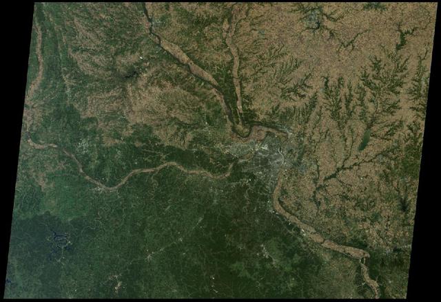
St. Louis, Missouri is tucked in a bend of the Mississippi River, just south of the point at which the Illinois River joins the larger Mississippi as seen by NASA Terra spacecraft on October 15, 2005.

This is a spaceborne radar image of the area surrounding St. Louis, Missouri, where the Mississippi and Missouri Rivers come together. The city of St. Louis is the bright gold area within a bend in the Mississippi River at the lower center of the image.
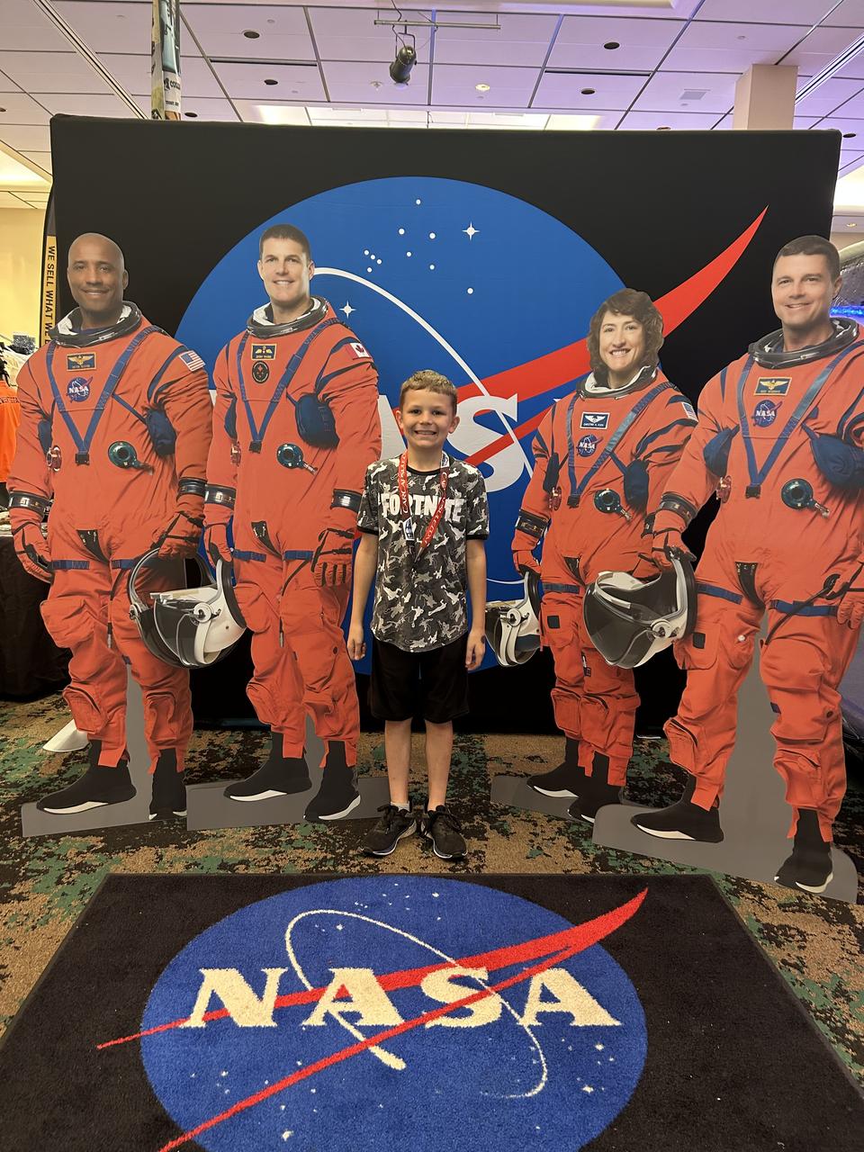
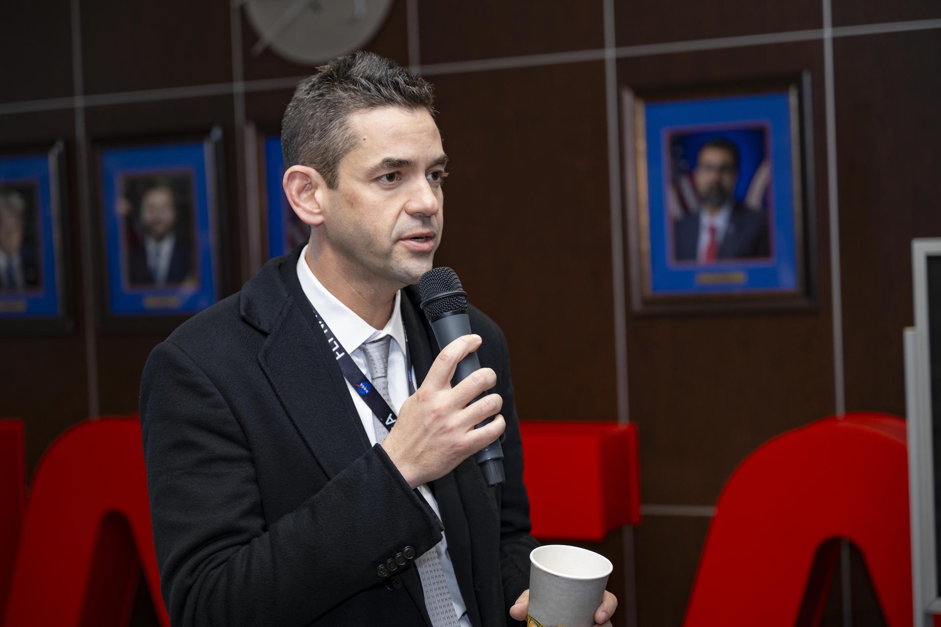
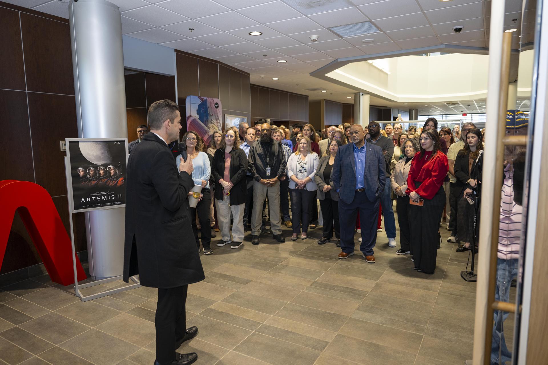
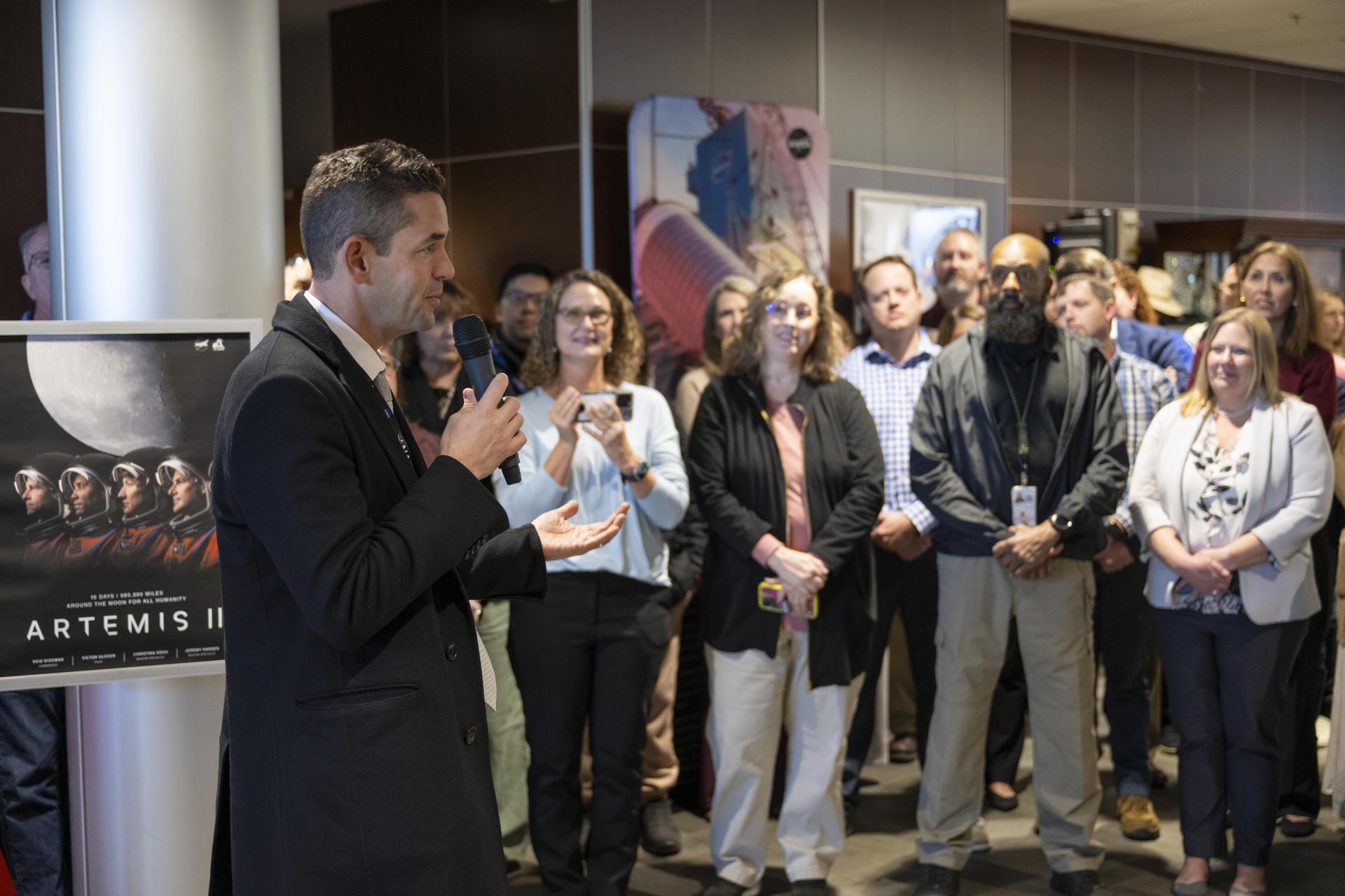
NASA Stennis representatives inspire the Artemis Generation and share NASA Stennis’ rich history of propulsion testing with attendees from over 37 U.S. states and Canada during the 28th Annual Cruisin’ the Coast car show along the Mississippi Gulf Coast Oct. 10-12. NASA provided a virtual reality space experience, and participants were welcomed to the exhibit by life size cardboard cutouts of the Artemis II crew. Artemis II, targeted for 2025, is the first crewed test of the SLS (Space Launch System) rocket and Orion spacecraft, which will carry NASA astronauts Reid Wiseman (commander), Victor Glover (pilot), and Christina Koch (mission specialist), and Canadian Space Agency astronaut Jeremy Hansen (mission specialist) around the Moon. All RS-25 engines that help power NASA’s SLS rocket are tested and proven flightworthy at NASA Stennis prior to use on Artemis missions.
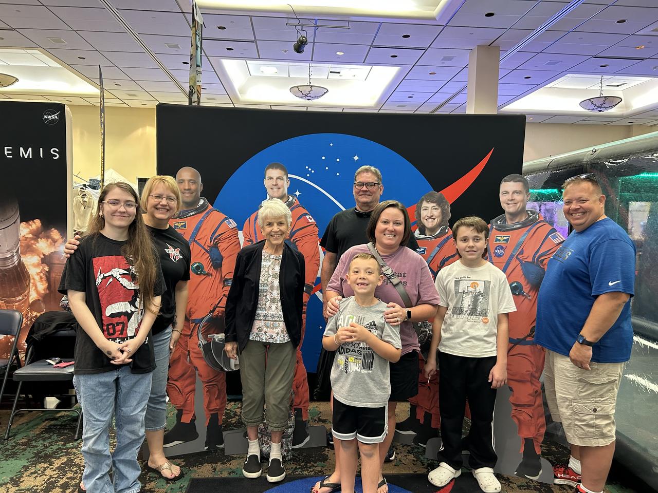
NASA Stennis representatives inspire the Artemis Generation and share NASA Stennis’ rich history of propulsion testing with attendees from over 37 U.S. states and Canada during the 28th Annual Cruisin’ the Coast car show along the Mississippi Gulf Coast Oct. 10-12. NASA provided a virtual reality space experience, and participants were welcomed to the exhibit by life size cardboard cutouts of the Artemis II crew. Artemis II, targeted for 2025, is the first crewed test of the SLS (Space Launch System) rocket and Orion spacecraft, which will carry NASA astronauts Reid Wiseman (commander), Victor Glover (pilot), and Christina Koch (mission specialist), and Canadian Space Agency astronaut Jeremy Hansen (mission specialist) around the Moon. All RS-25 engines that help power NASA’s SLS rocket are tested and proven flightworthy at NASA Stennis prior to use on Artemis missions.
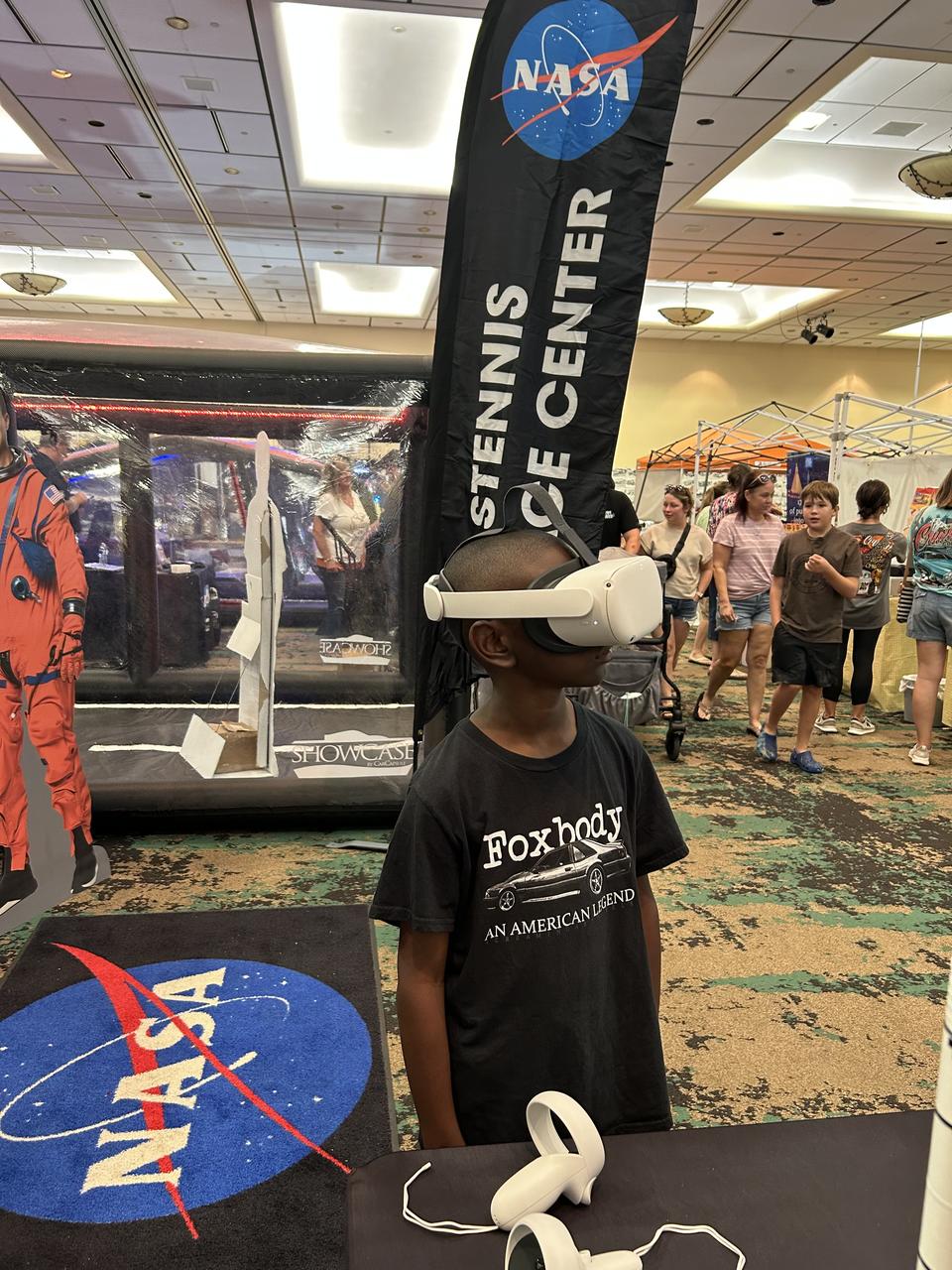
NASA Stennis representatives inspire the Artemis Generation and share NASA Stennis’ rich history of propulsion testing with attendees from over 37 U.S. states and Canada during the 28th Annual Cruisin’ the Coast car show along the Mississippi Gulf Coast Oct. 10-12. NASA provided a virtual reality space experience, and participants were welcomed to the exhibit by life size cardboard cutouts of the Artemis II crew. Artemis II, targeted for 2025, is the first crewed test of the SLS (Space Launch System) rocket and Orion spacecraft, which will carry NASA astronauts Reid Wiseman (commander), Victor Glover (pilot), and Christina Koch (mission specialist), and Canadian Space Agency astronaut Jeremy Hansen (mission specialist) around the Moon. All RS-25 engines that help power NASA’s SLS rocket are tested and proven flightworthy at NASA Stennis prior to use on Artemis missions.
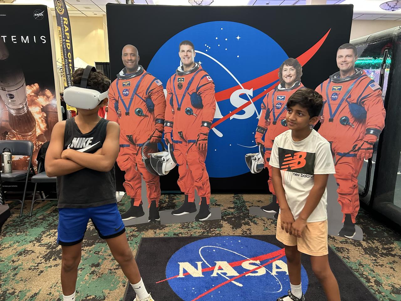
NASA Stennis representatives inspire the Artemis Generation and share NASA Stennis’ rich history of propulsion testing with attendees from over 37 U.S. states and Canada during the 28th Annual Cruisin’ the Coast car show along the Mississippi Gulf Coast Oct. 10-12. NASA provided a virtual reality space experience, and participants were welcomed to the exhibit by life size cardboard cutouts of the Artemis II crew. Artemis II, targeted for 2025, is the first crewed test of the SLS (Space Launch System) rocket and Orion spacecraft, which will carry NASA astronauts Reid Wiseman (commander), Victor Glover (pilot), and Christina Koch (mission specialist), and Canadian Space Agency astronaut Jeremy Hansen (mission specialist) around the Moon. All RS-25 engines that help power NASA’s SLS rocket are tested and proven flightworthy at NASA Stennis prior to use on Artemis missions.
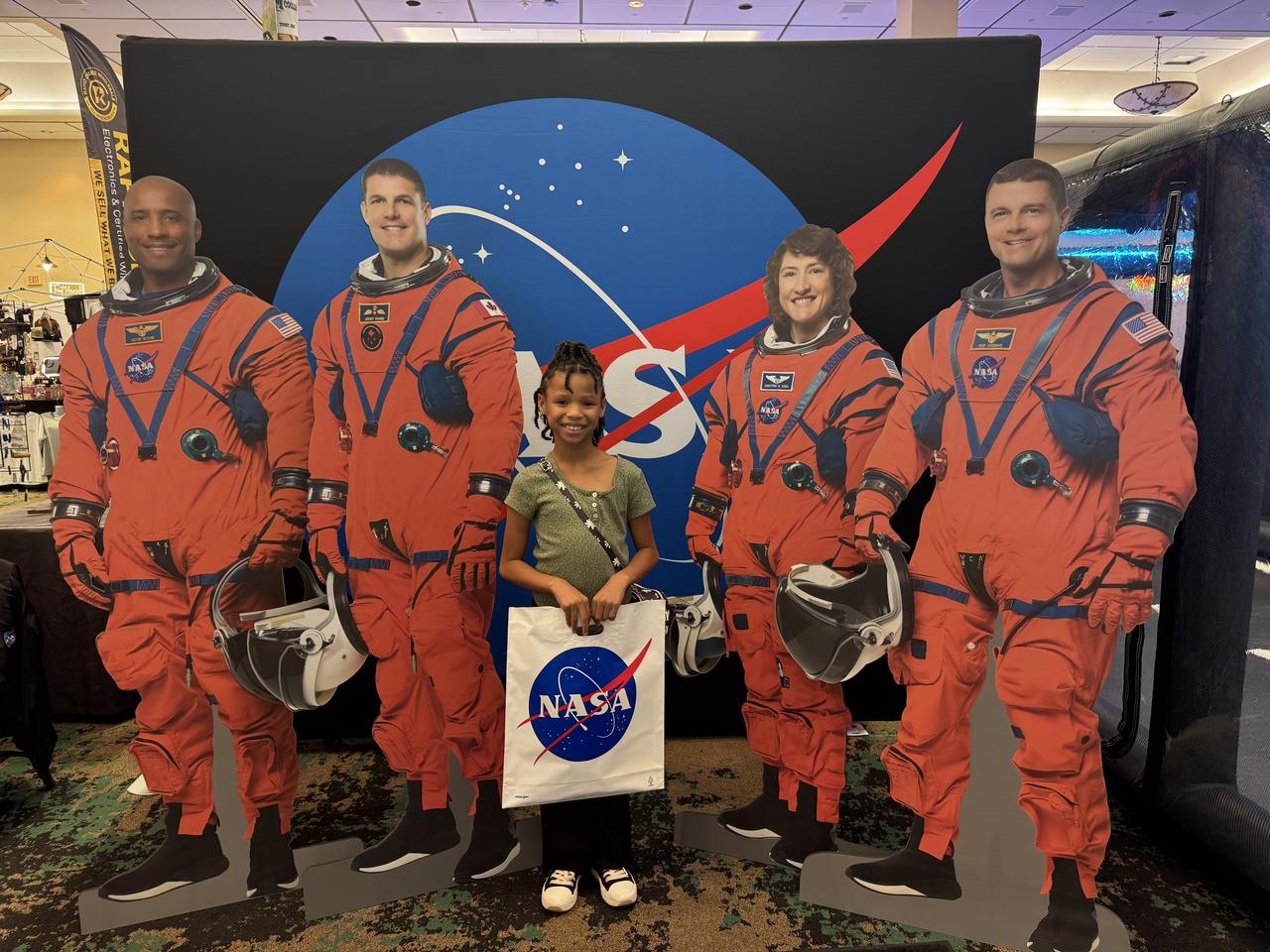
NASA Stennis representatives inspire the Artemis Generation and share NASA Stennis’ rich history of propulsion testing with attendees from over 37 U.S. states and Canada during the 28th Annual Cruisin’ the Coast car show along the Mississippi Gulf Coast Oct. 10-12. NASA provided a virtual reality space experience, and participants were welcomed to the exhibit by life size cardboard cutouts of the Artemis II crew. Artemis II, targeted for 2025, is the first crewed test of the SLS (Space Launch System) rocket and Orion spacecraft, which will carry NASA astronauts Reid Wiseman (commander), Victor Glover (pilot), and Christina Koch (mission specialist), and Canadian Space Agency astronaut Jeremy Hansen (mission specialist) around the Moon. All RS-25 engines that help power NASA’s SLS rocket are tested and proven flightworthy at NASA Stennis prior to use on Artemis missions.
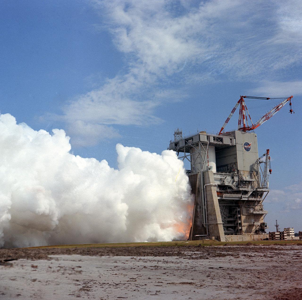
This photograph shows a test firing of the the Saturn V S-II (second) stage at the Mississippi Test Facility's (MTF) S-II test stand. When the Saturn V booster stage (S-IC) burns out and drops away, power for the Saturn will be provided by the 82-foot-long and 33-foot-diameter S-II stage. Developed by the Space Division of North American Aviation under the direction of the Marshall Space Flight Center, the stage utilized five J-2 engines, each producing 200,000 pounds of thrust. The engines used liquid oxygen and liquid hydrogen as propellants. Static test of ground test versions of the S-II stage were conducted at North American Aviation's Santa Susana, California test site. All flight stages were tested at the Mississippi Test Facility, Bay St. Louis, Mississippi. MTF was renamed to the National Space Technology Laboratory (NSTL) in 1974 and later to the Sternis Space Center in May 1988.
This photograph shows a test firing of the the Saturn V S-II (second) stage at the Mississippi Test Facility's (MTF) S-II test stand. When the Saturn V booster stage (S-IC) burns out and drops away, power for the Saturn will be provided by the 82-foot-long and 33-foot-diameter S-II stage. Developed by the Space Division of North American Aviation under the direction of the Marshall Space Flight Center, the stage utilized five J-2 engines, each producing 200,000 pounds of thrust. The engine used liquid oxygen and liquid hydrogen as its propellants. Static test of ground test versions of the S-II stage were conducted at North American Aviation's Santa Susana, California test site. All flight stages were tested at the Mississippi Test Facility, Bay St. Louis, Mississippi. The MTF was renamed to the National Space Technology Laboratory (NSTL) in 1974 and later to the Sternis Space Center (SSC) in May 1988.
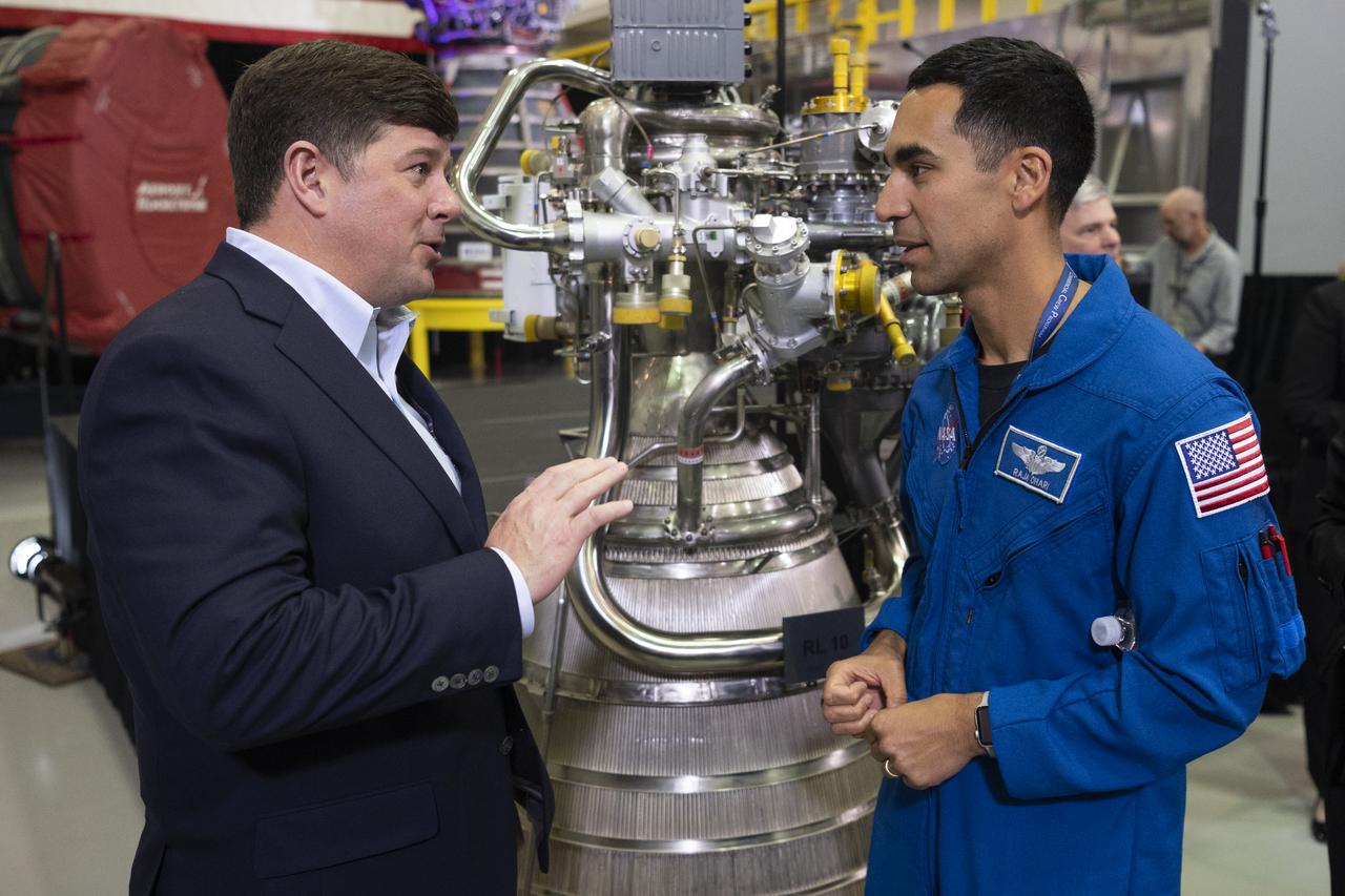
U.S. Representative Steven Palazzo (R-Miss.), left, speaks with NASA astronaut Raja Chari following the State of NASA address, Monday, Feb. 10, 2020, at Aerojet Rocketdyne’s facility at NASA’s Stennis Space Center near Bay St. Louis, Mississippi. Photo Credit: (NASA/Joel Kowsky)
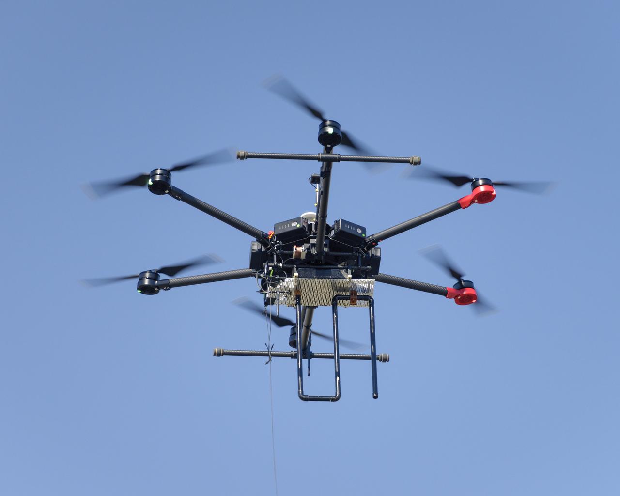
Flight Test in the Roverscape (N-269) at NASA's Ames Research Center, the project team tests the DJI Matrice 600 Unmanned Aerial Vehicle (UAV) equipped with a radio tracking receiver to study the invasive asian carp in the Mississippi River.
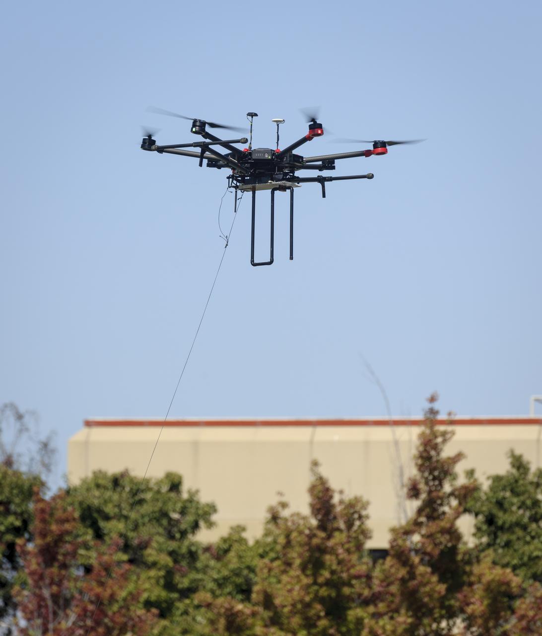
Flight Test in the Roverscape (N-269) at NASA's Ames Research Center, the project team tests the DJI Matrice 600 Unmanned Aerial Vehicle (UAV) equipped with a radio tracking receiver to study the invasive asian carp in the Mississippi River.
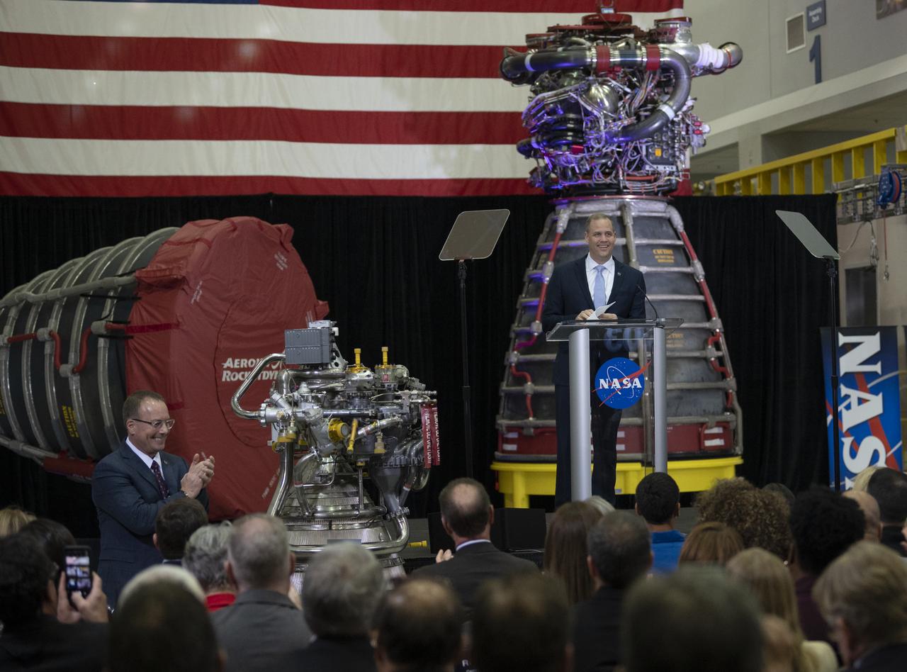
NASA Administrator Jim Bridenstine discusses the fiscal year 2021 budget proposal during a State of NASA address, Monday, Feb. 10, 2020, at Aerojet Rocketdyne’s facility at NASA’s Stennis Space Center near Bay St. Louis, Mississippi. Photo Credit: (NASA/Joel Kowsky)
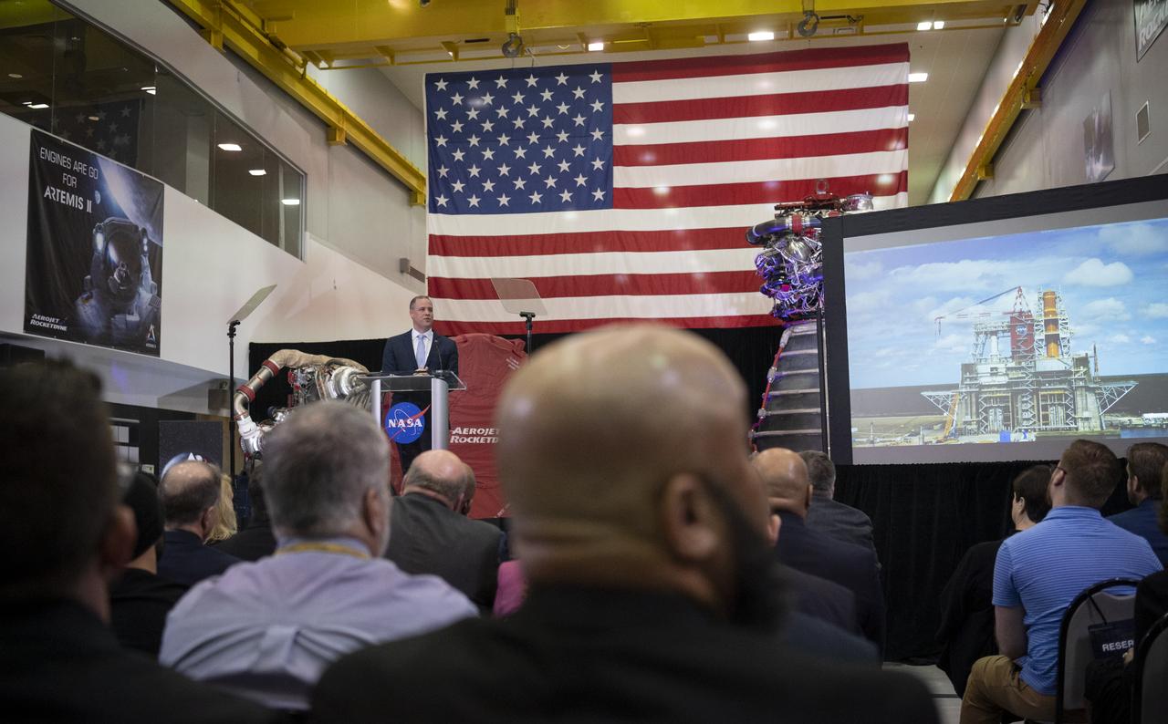
NASA Administrator Jim Bridenstine discusses the fiscal year 2021 budget proposal during a State of NASA address, Monday, Feb. 10, 2020, at Aerojet Rocketdyne’s facility at NASA’s Stennis Space Center near Bay St. Louis, Mississippi. Photo Credit: (NASA/Joel Kowsky)