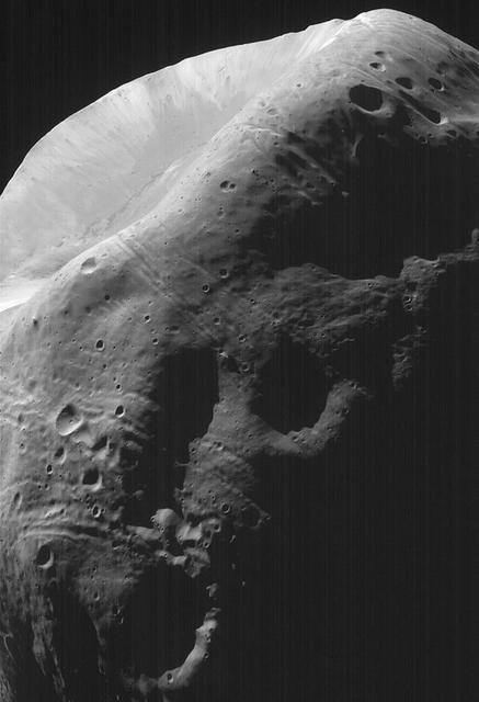
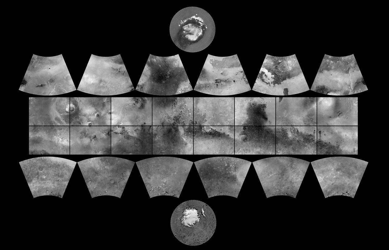
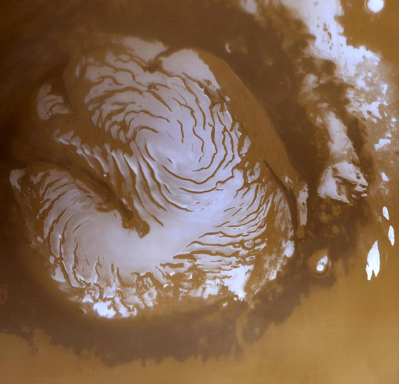
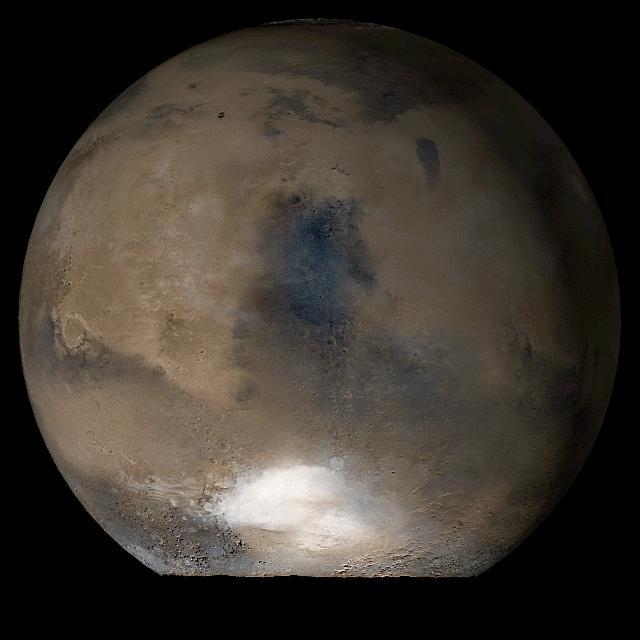
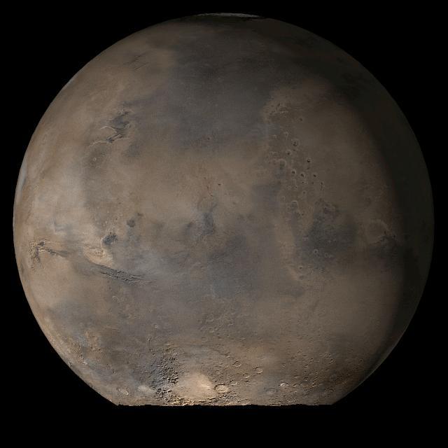
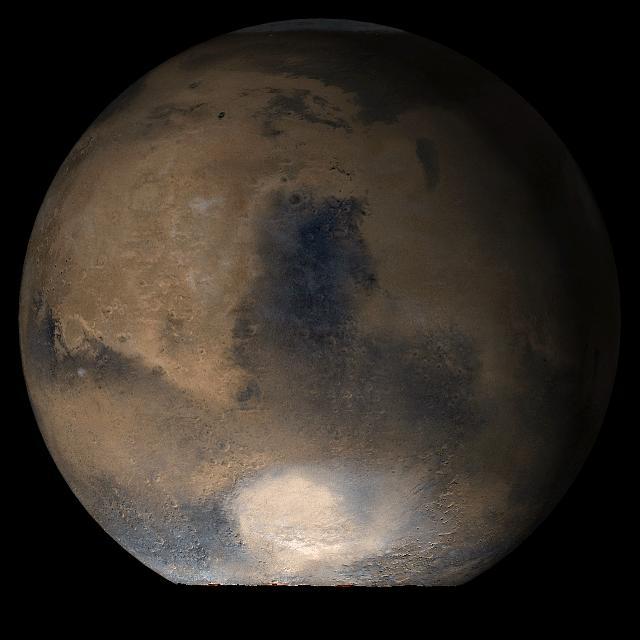
This is a wide angle view of the martian north polar cap as it appeared to the Mars Global Surveyor (MGS) Mars Orbiter Camera (MOC) in early northern summer. The picture was acquired on March 13, 1999, near the start of the Mapping Phase of the MGS mission. The light-toned surfaces are residual water ice that remains through the summer season. The nearly circular band of dark material surrounding the cap consists mainly of sand dunes formed and shaped by wind. The north polar cap is roughly 1100 kilometers (680 miles) across. http://photojournal.jpl.nasa.gov/catalog/PIA02800
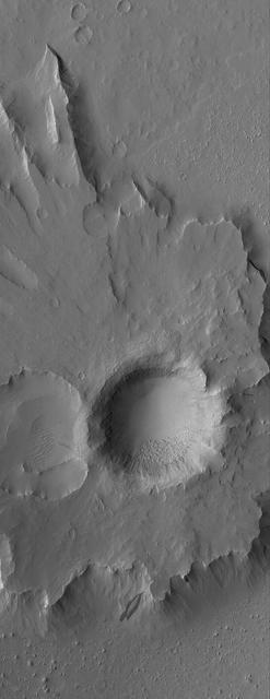
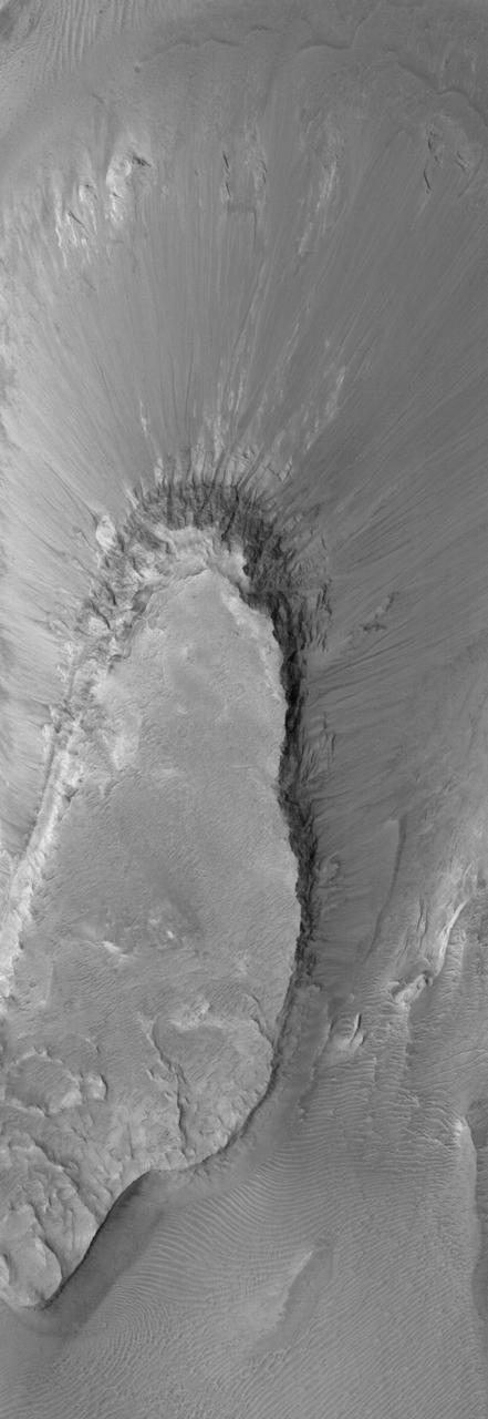
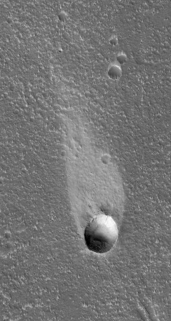
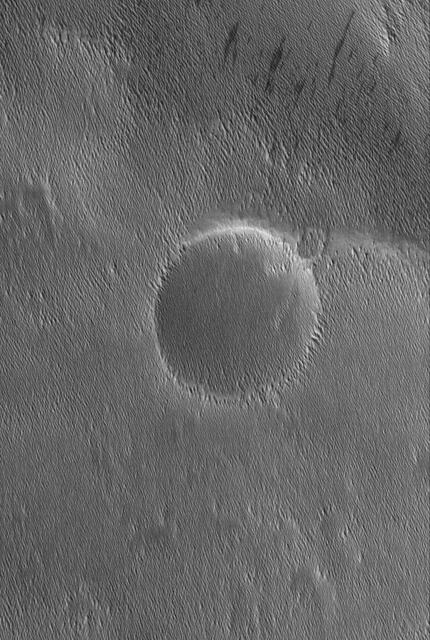
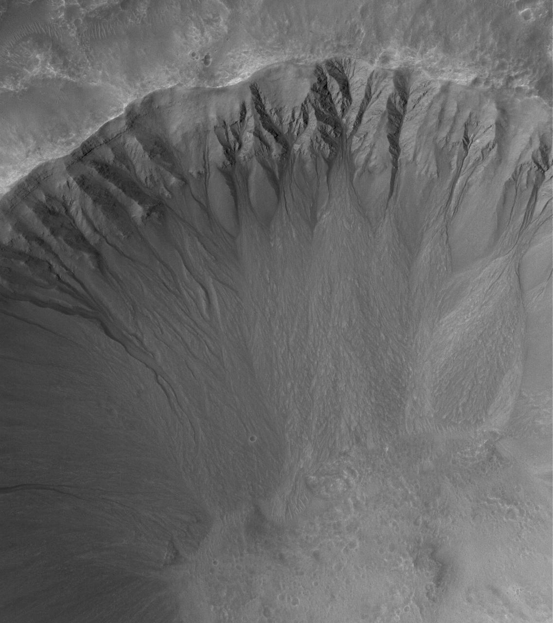
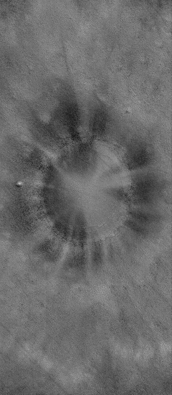
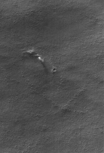
This MOC image shows a bowl-shaped crater on the martian northern plains with a mysterious radiant pattern of zones with and without boulders and rocks
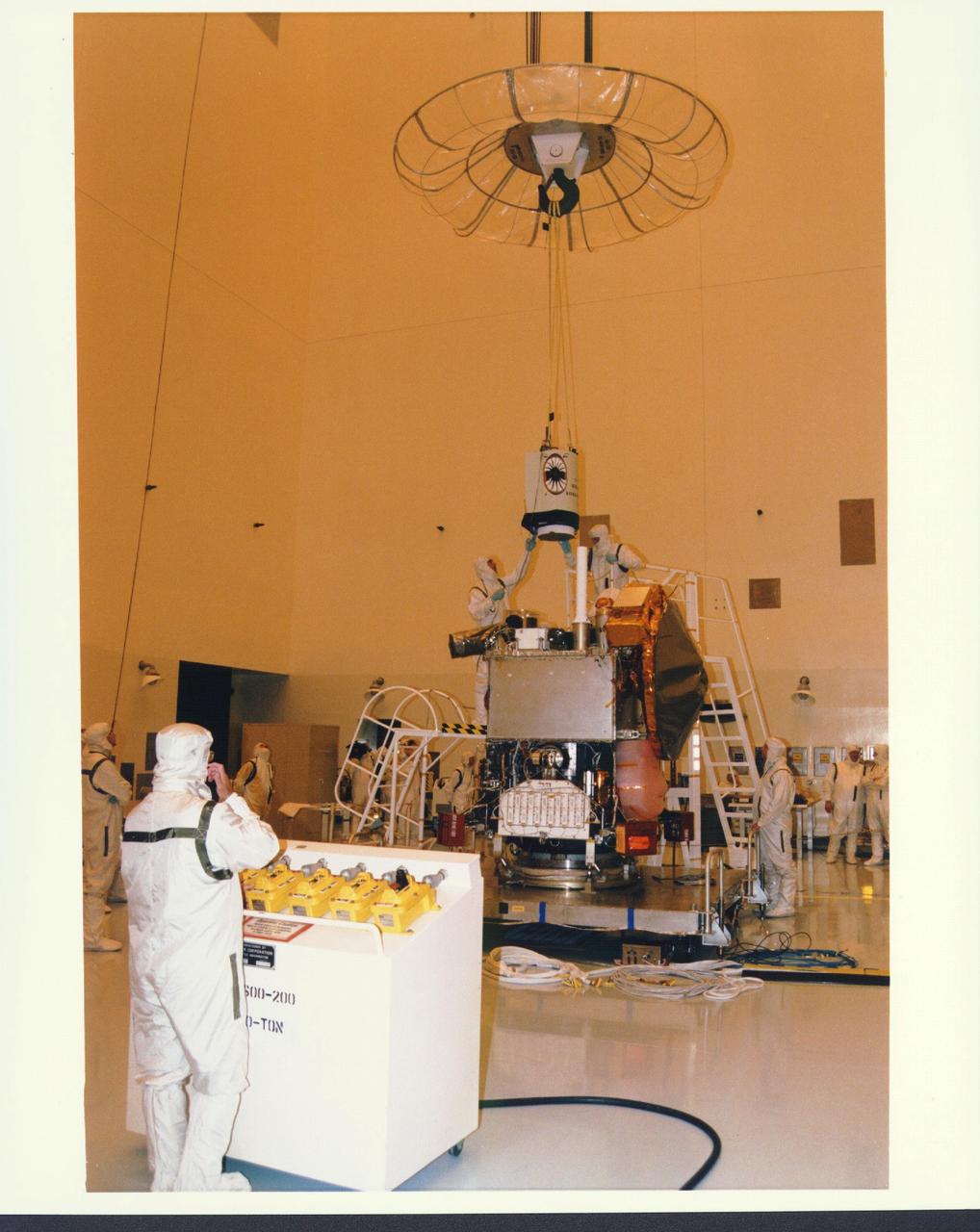
KENNEDY SPACE CENTER, FLA. - In the Payload Hazardous Servicing Facility at KSC, installation is under way of the Mars Orbiter Camera (MOC) on the Mars Global Surveyor spacecraft. The MOC is one of a suite of six scientific instruments that will gather data about Martian topography, mineral distribution and weather during a two-year period. The Mars Global Surveyor is slated for launch aboard a Delta II expendable launch vehicle on Nov. 6, the beginning of a 20-day launch period.
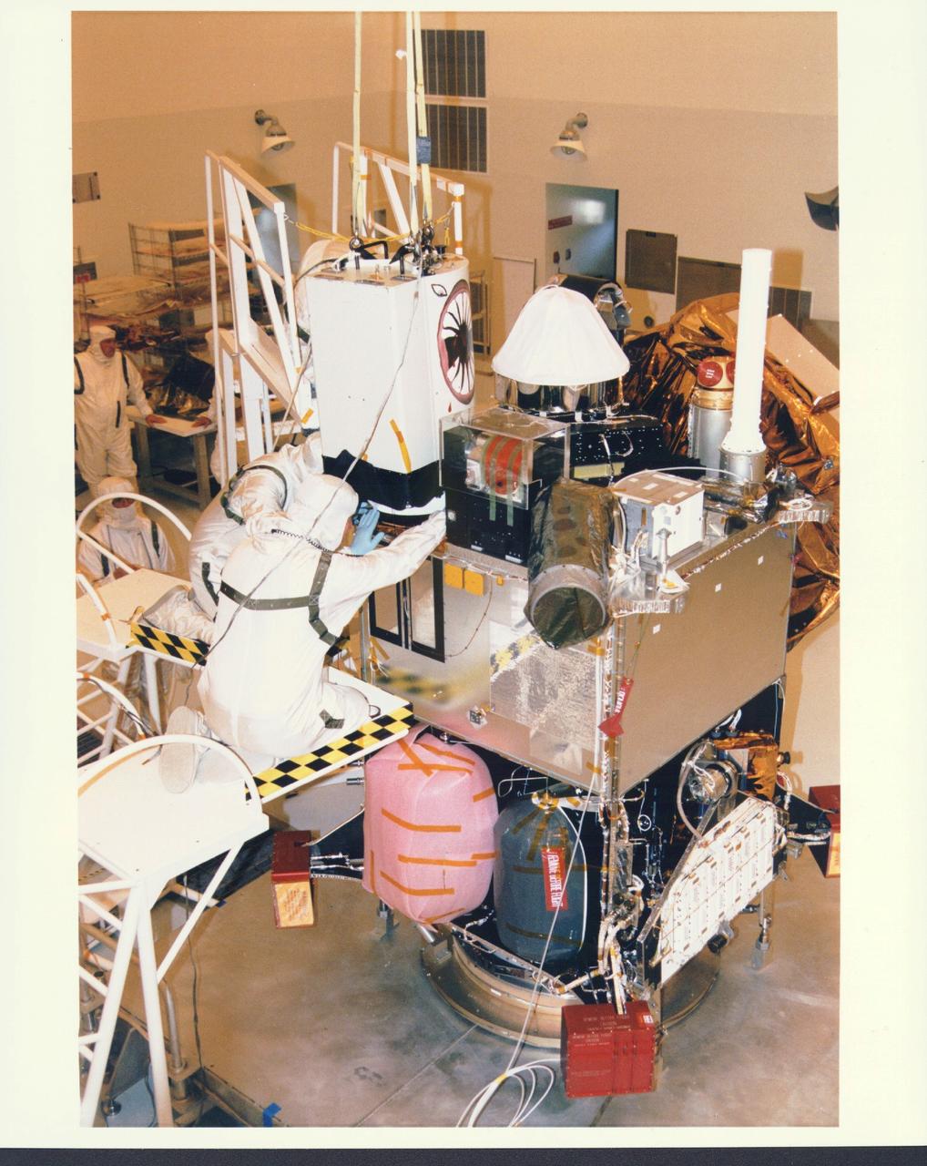
KENNEDY SPACE CENTER, FLA. - In the Payload Hazardous Servicing Facility at KSC, installation is under way of the Mars Orbiter Camera (MOC) on the Mars Global Surveyor spacecraft. The MOC is one of a suite of six scientific instruments that will gather data about Martian topography, mineral distribution and weather during a two-year period. The Mars Global Surveyor is slated for launch aboard a Delta II expendable launch vehicle on Nov. 6, the beginning of a 20-day launch period.
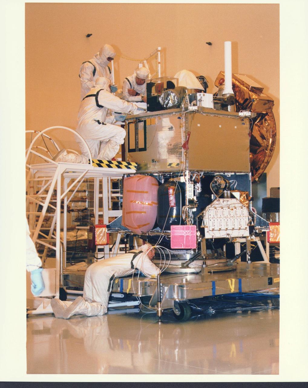
KENNEDY SPACE CENTER, FLA. - In the Payload Hazardous Servicing Facility at KSC, installation is under way of the Mars Orbiter Camera (MOC) on the Mars Global Surveyor spacecraft. The MOC is one of a suite of six scientific instruments that will gather data about Martian topography, mineral distribution and weather during a two-year period. The Mars Global Surveyor is slated for launch aboard a Delta II expendable launch vehicle on Nov. 6, the beginning of a 20-day launch period.
KENNEDY SPACE CENTER, FLA. - In the Payload Hazardous Servicing Facility at KSC, installation is under way of the Mars Orbiter Camera (MOC) on the Mars Global Surveyor spacecraft. The MOC is one of a suite of six scientific instruments that will gather data about Martian topography, mineral distribution and weather during a two-year period. The Mars Global Surveyor is slated for launch aboard a Delta II expendable launch vehicle on Nov. 6, the beginning of a 20-day launch period.
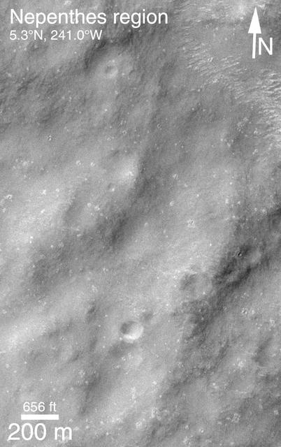
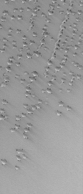
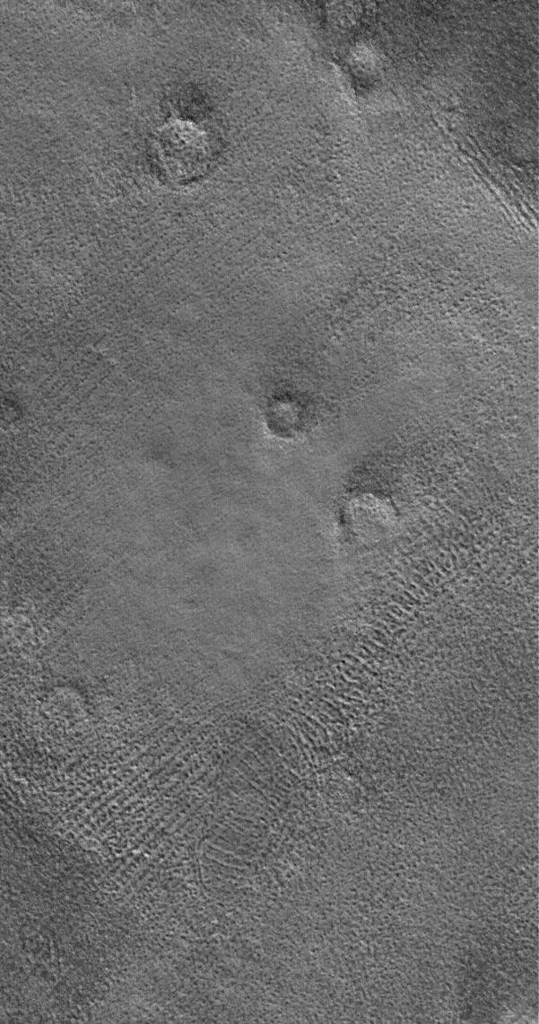
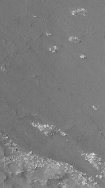
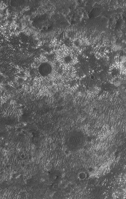
This MOC image shows a cratered plain west of Schiaparelli Crater, Mars. The area captured in this image, and areas adjacent to it, are known for high dust devil traffic
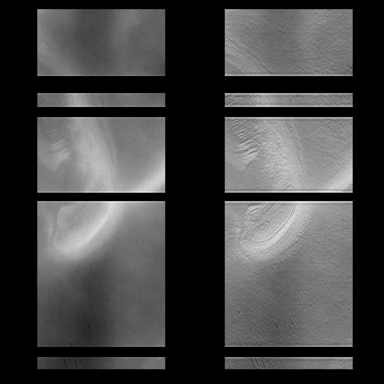
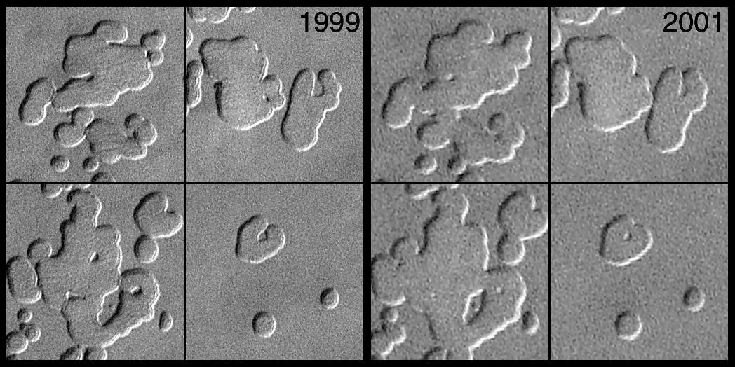
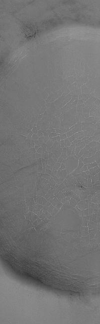
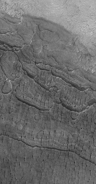
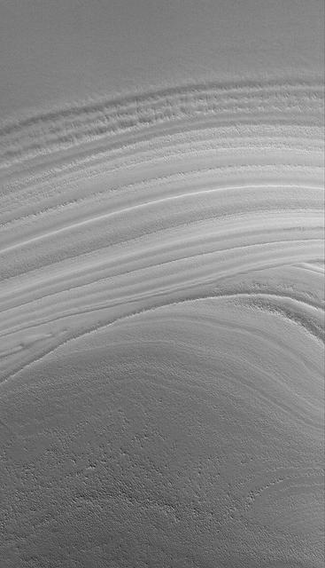
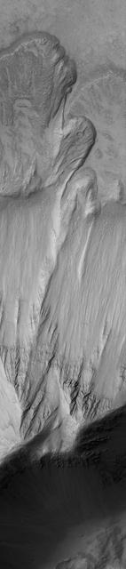
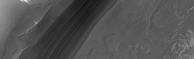
This MOC image shows a nearly ice-free view of layers exposed by erosion in the north polar region. The light-toned patches are remnants of water ice frost
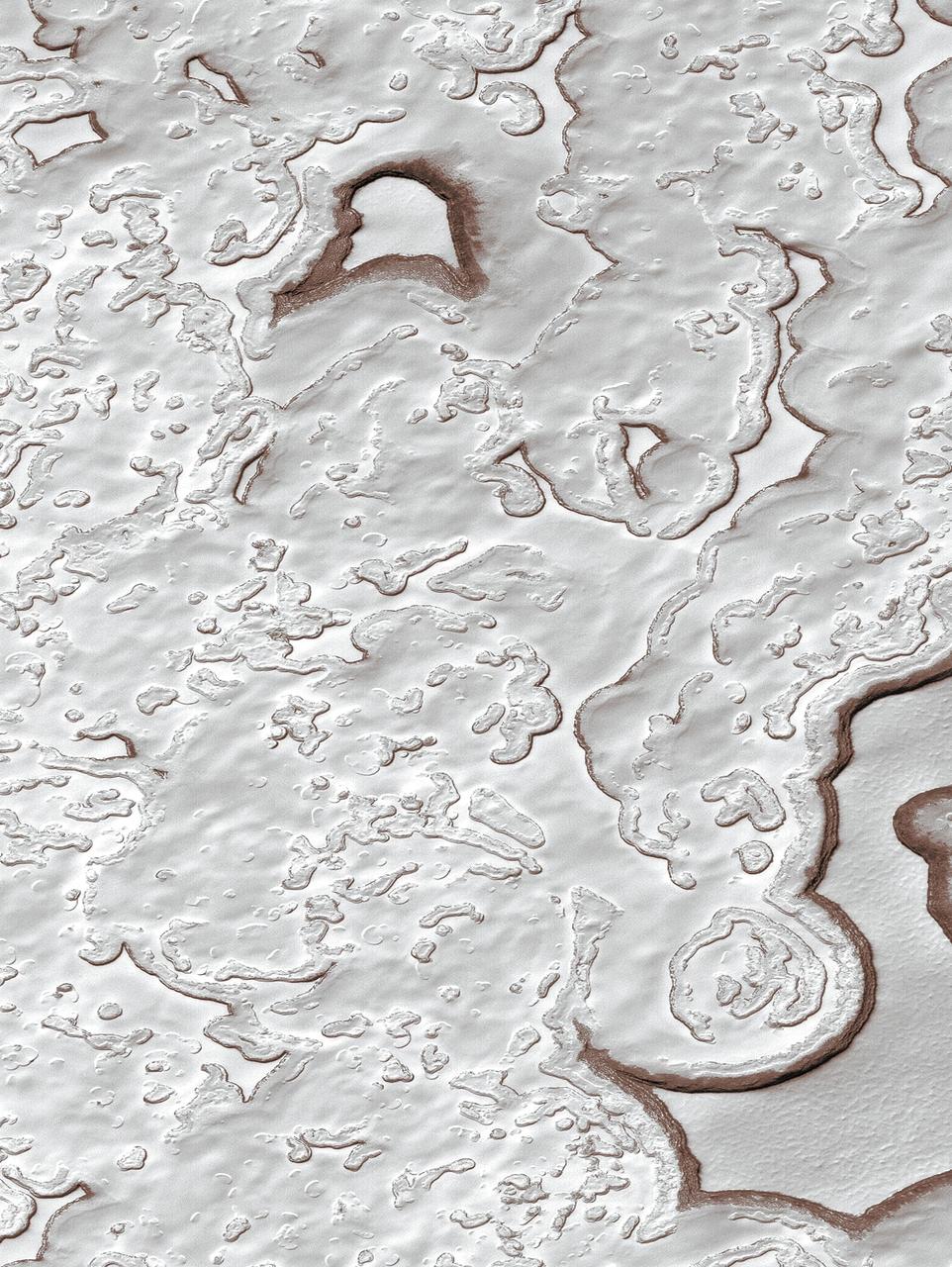
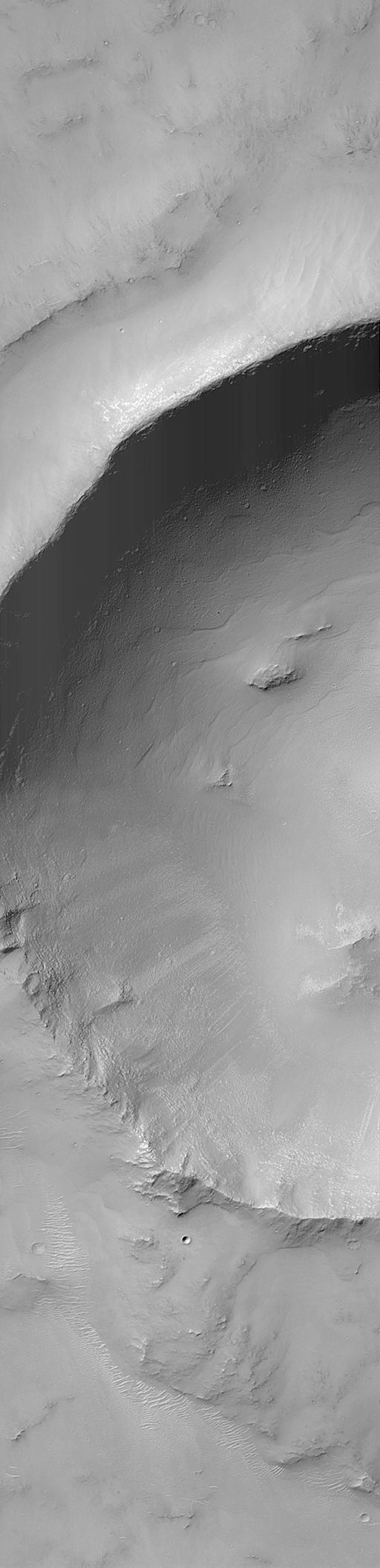
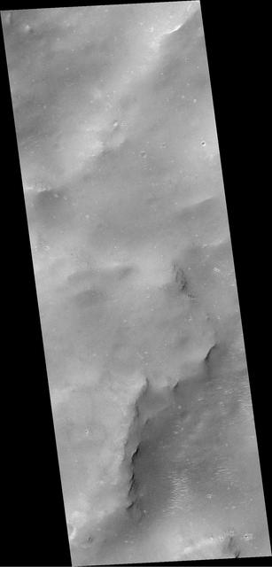
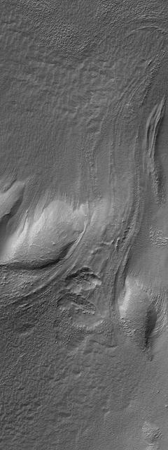
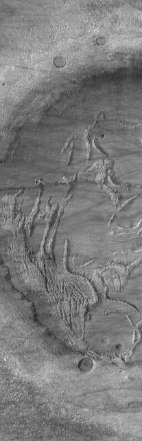
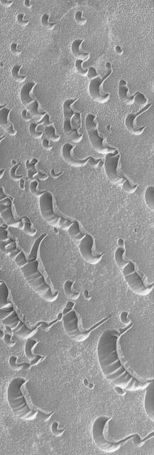
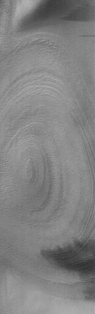
This MOC image shows layers exposed by erosion in a trough within the north polar residual cap of Mars, diving beneath a younger covering of polar materials
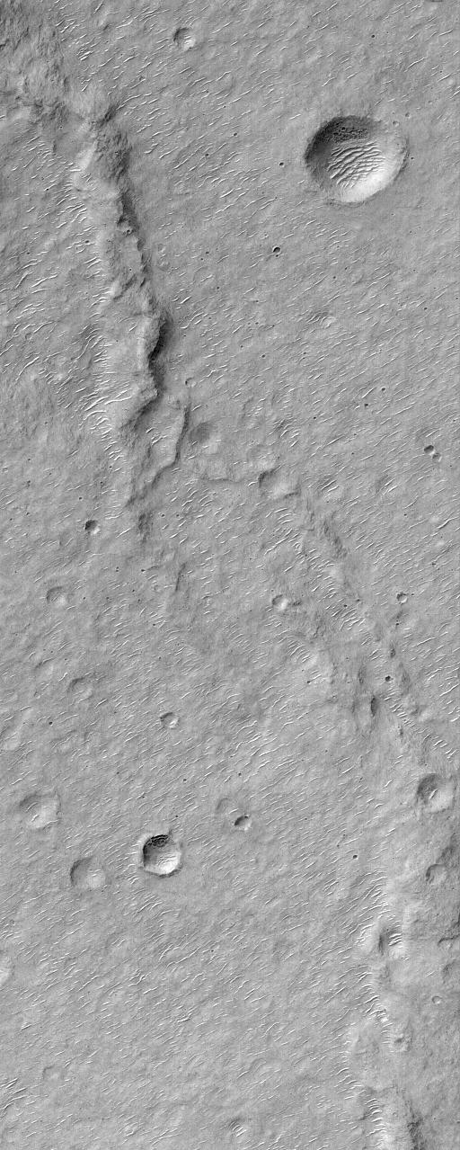
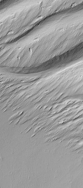
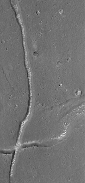
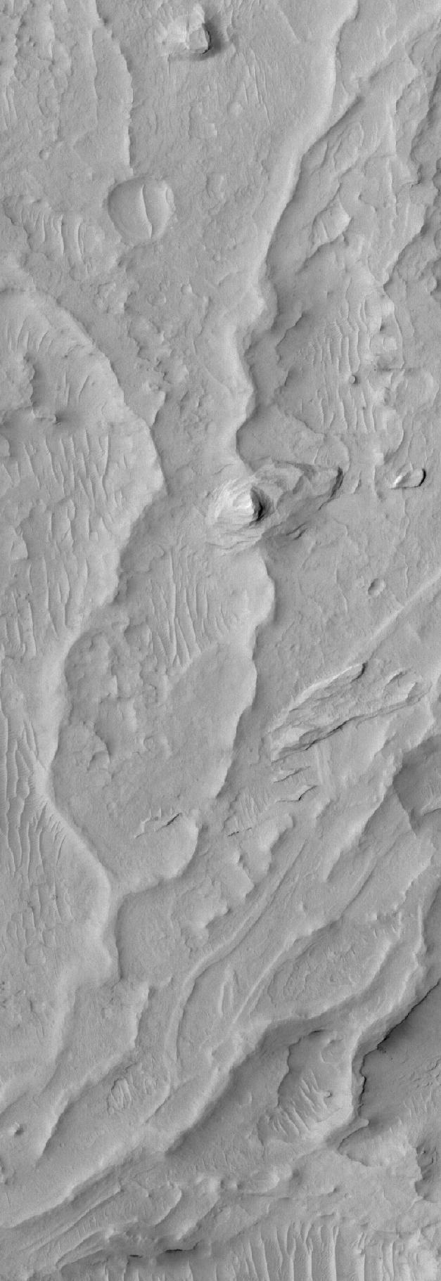
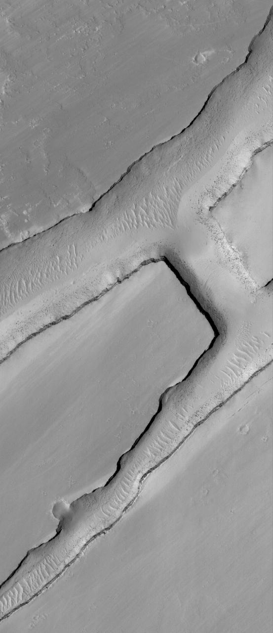
This Mars Global Surveyor MGS Mars Orbiter Camera MOC image shows a complex pattern of intersecting and overlapping troughs in the Olympica Fossae region of northern Tharsis
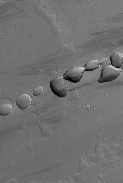
This MOC image shows a portion of a chain of pits on a lava- and dust-covered plain northwest of Tharsis Tholus, one of the many volcanic constructs in the Tharsis region of Mars
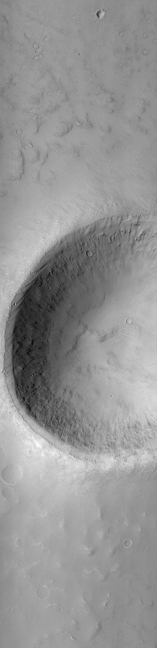
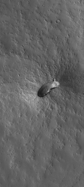
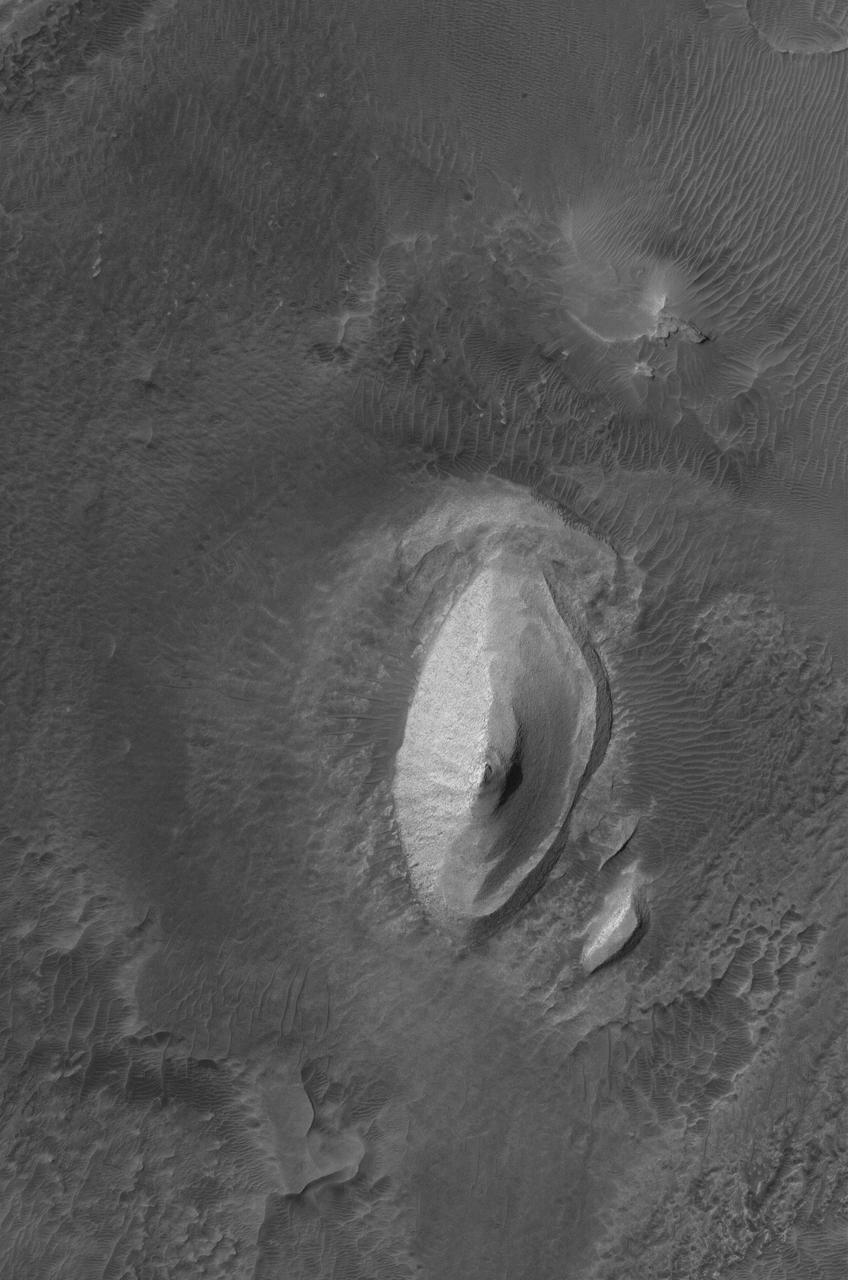
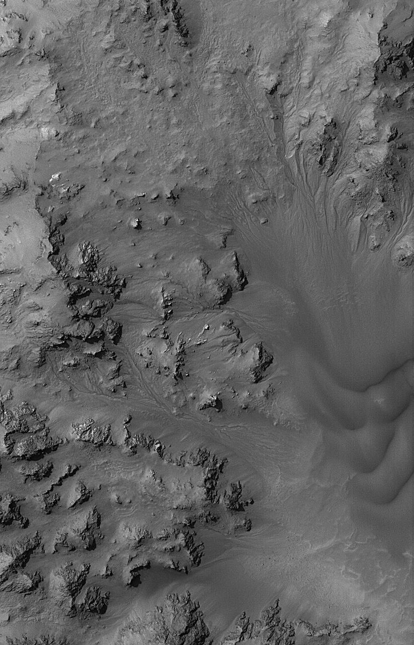
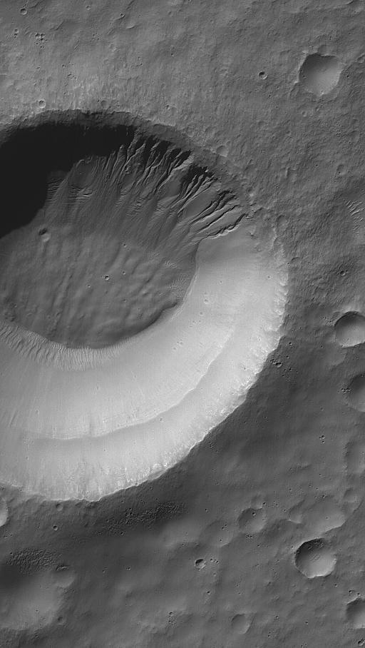
This MOC image shows an impact crater that is approximately 3.5 kilometers 2.2 miles in diameter. Layered rock units are visible on the inside of the raised crater rim
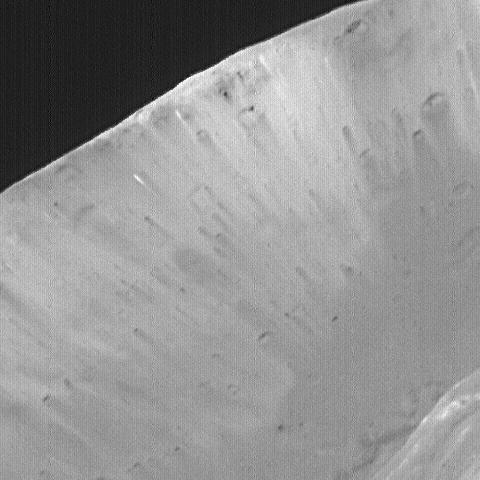
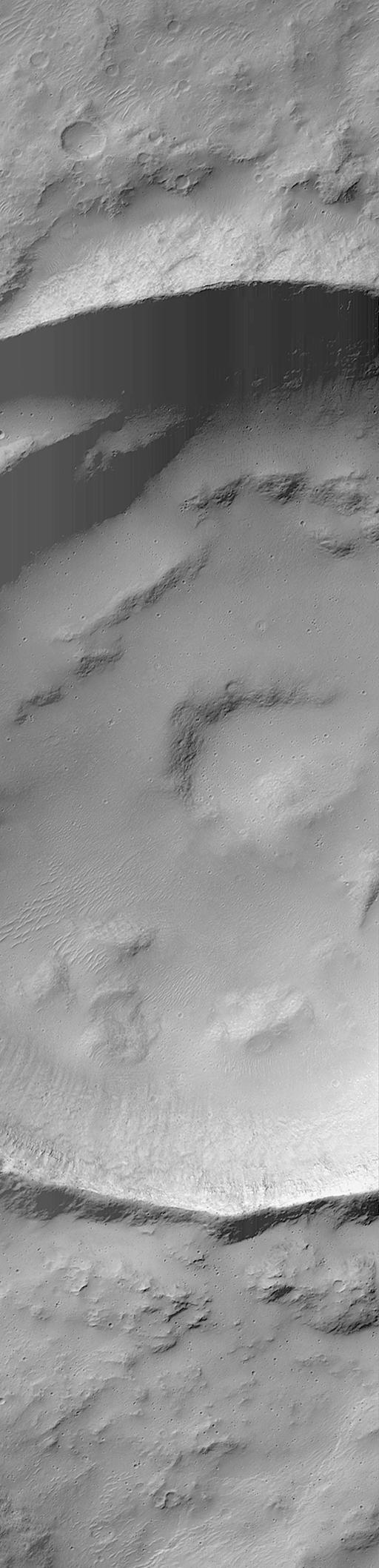
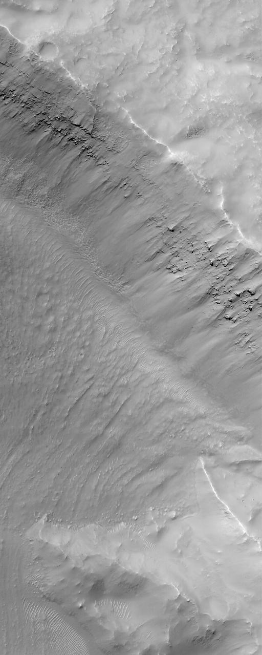
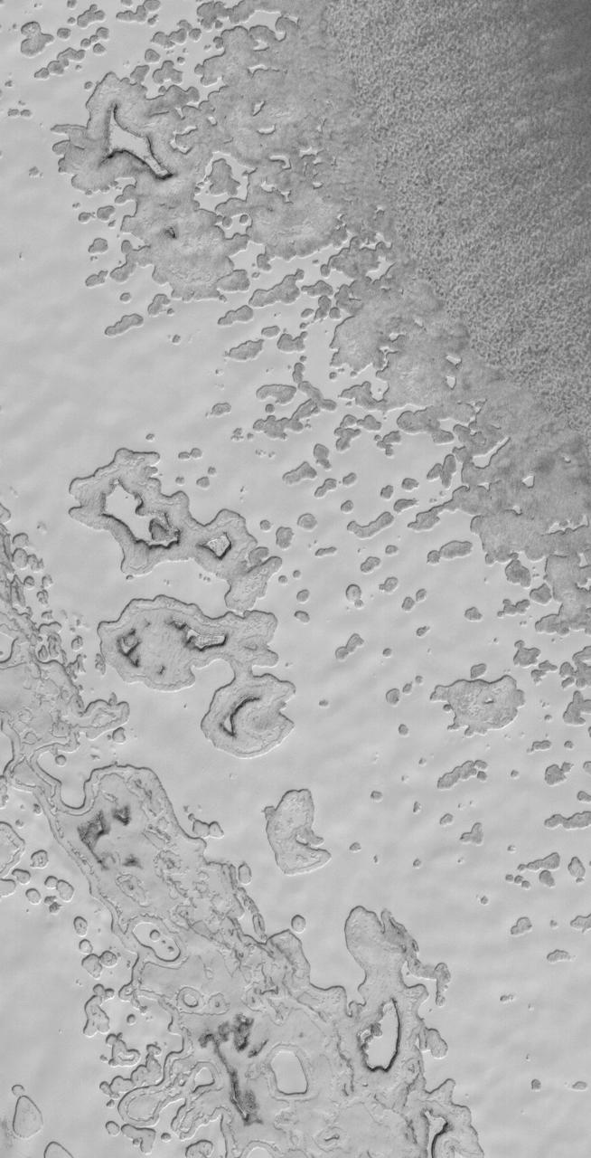
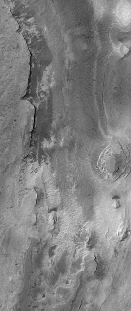
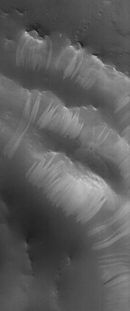
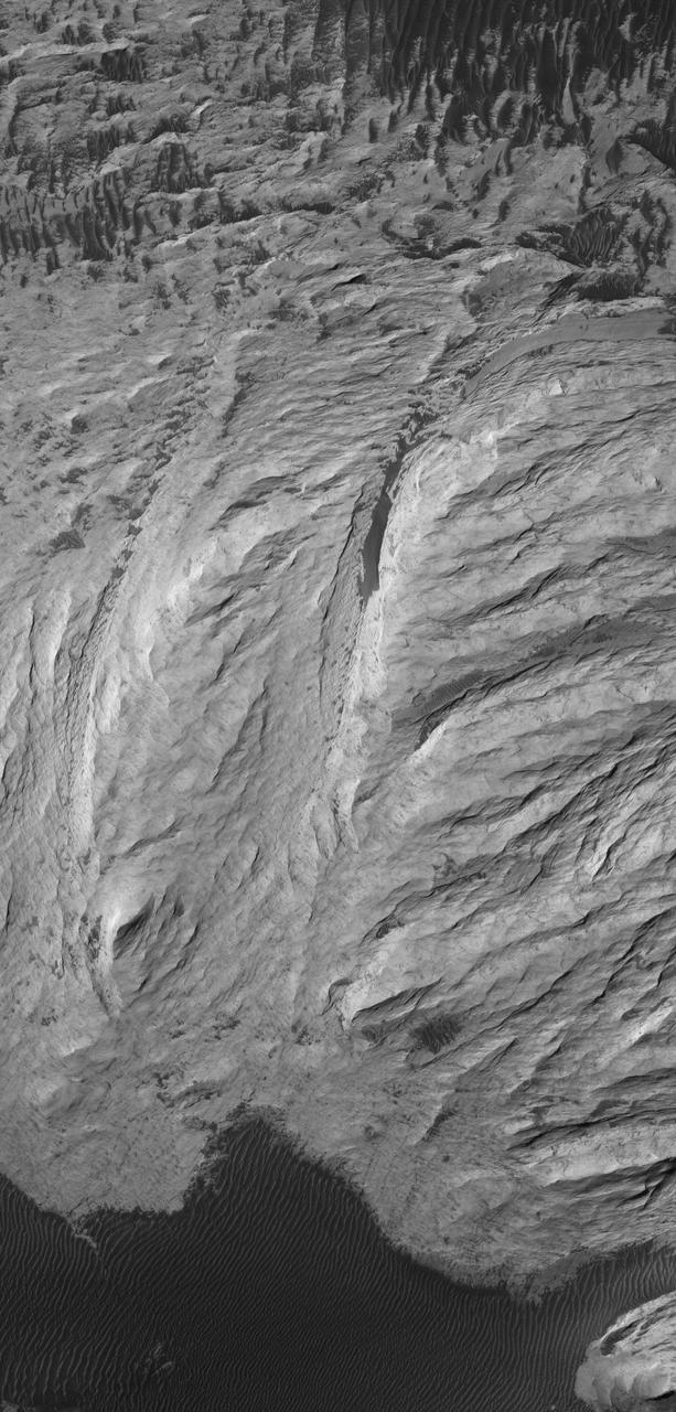
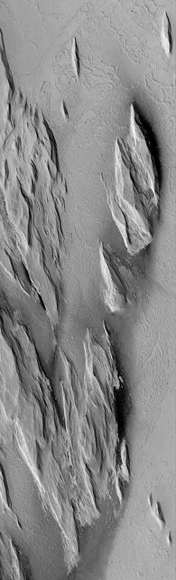
This MOC image shows a layered slope in the martian north polar region, being exposed by the removal of an overlying, smoother material seen in the lower third of the image
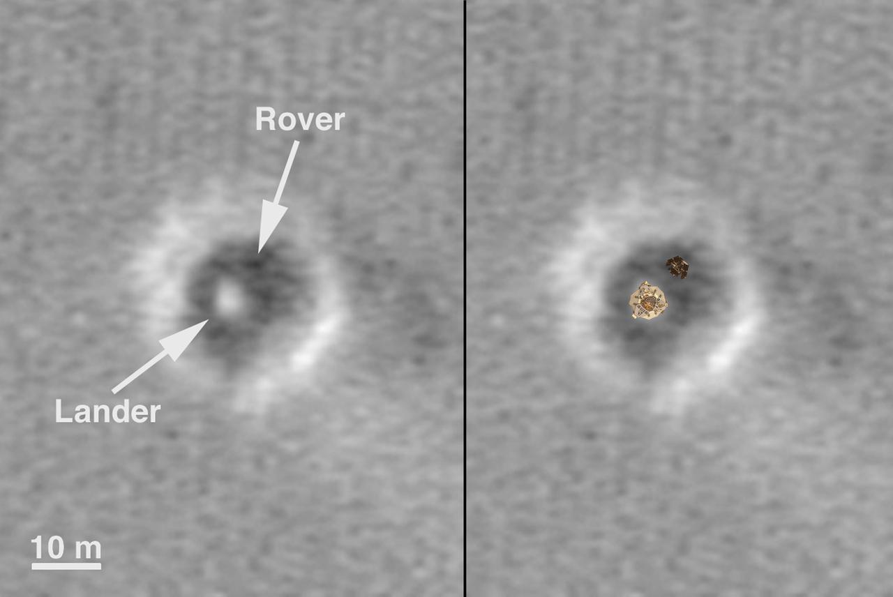
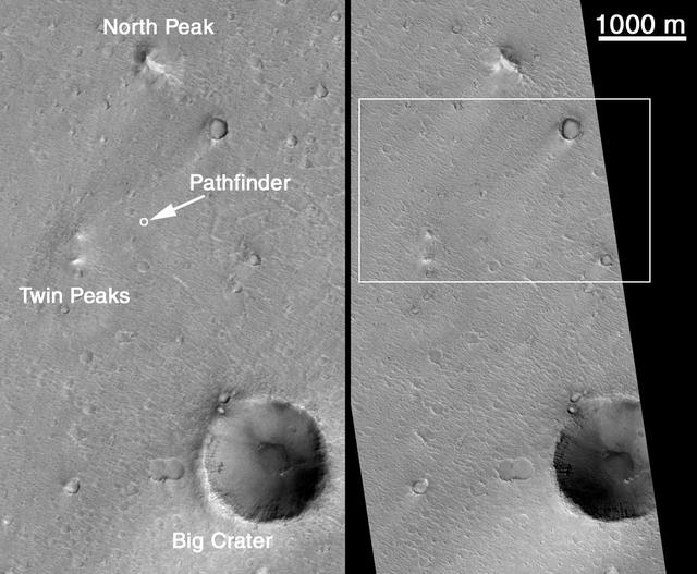
This image of the vicinity of the Viking Lander 1 was captured by NASA Mars Global Surveyor MOC camera. site. 3D glasses are necessary to identify surface detail.
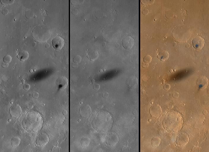
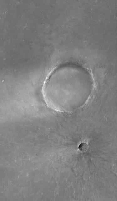
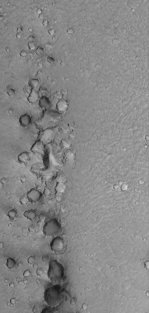
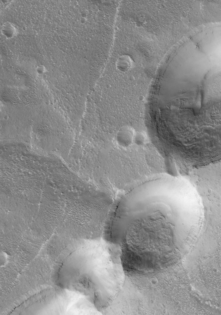
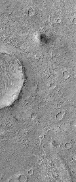
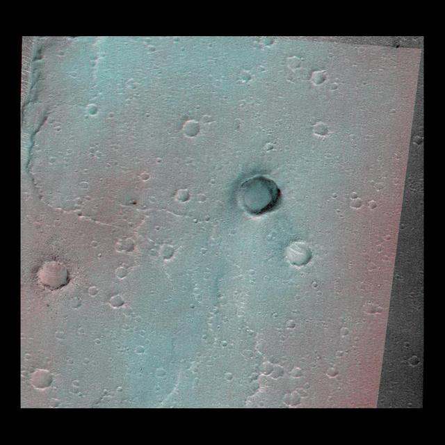
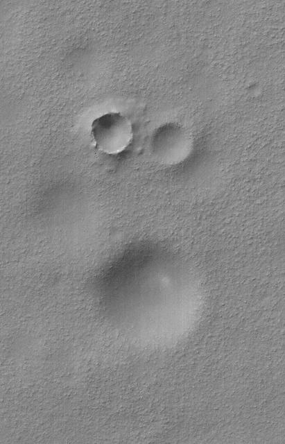
This MOC image shows a group of impact craters in Aonia Planum, Mars. Remarkably, two of the craters are approximately equal in size, however, they clearly differ in age
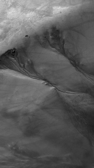
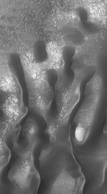
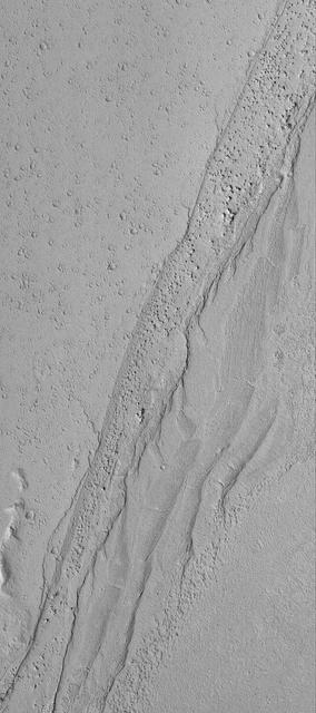
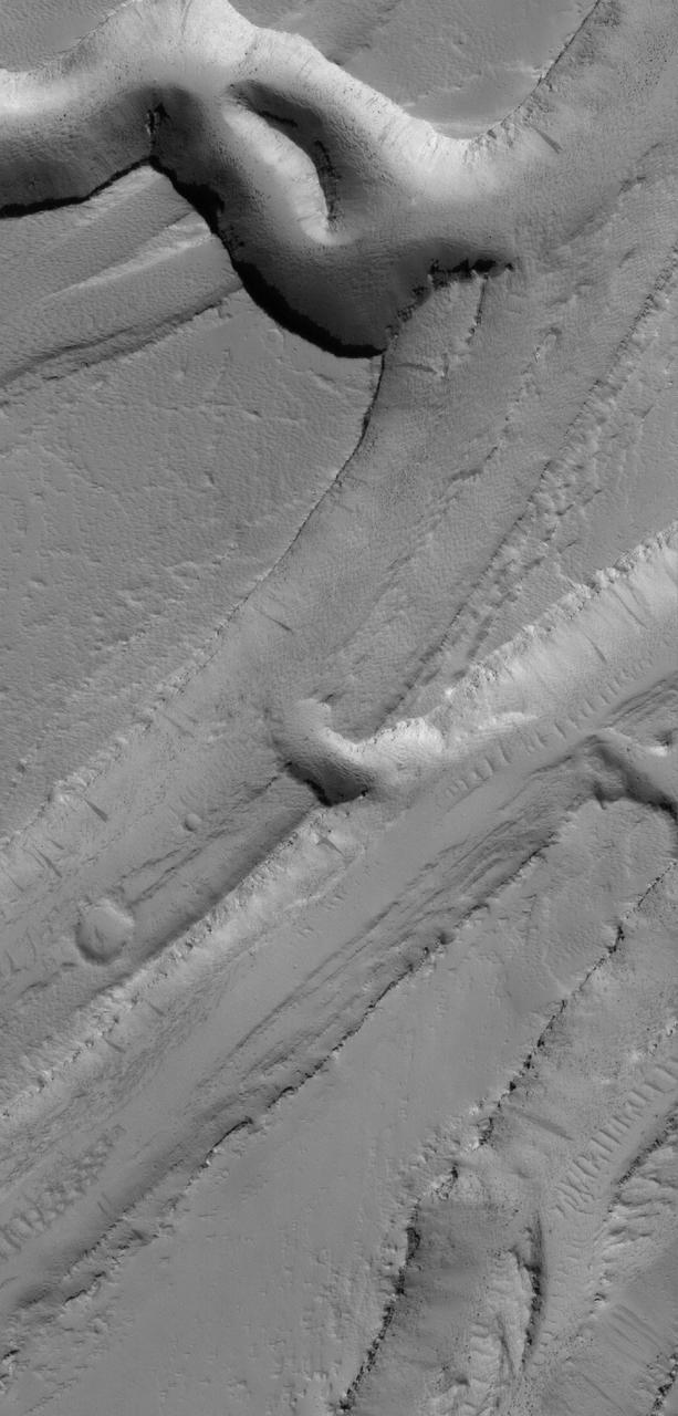
This MOC image shows a plain southeast of Hebrus Valles that is cut by a network of intersecting troughs. Large, windblown -- and perhaps wind-eroded -- ripples occur on the trough floors