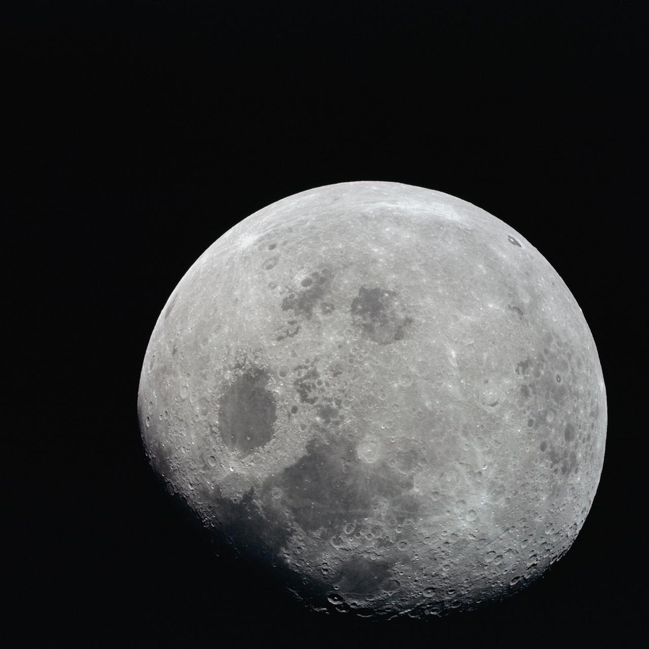
AS08-14-2506 (21-27 Dec. 1968) --- This photograph of a nearly full moon was taken from the Apollo 8 spacecraft at a point above 70 degrees east longitude. (Hold picture with moon's dark portion at left). Mare Crisium, the circular, dark-colored area near the center, is near the eastern edge of the moon as viewed from Earth. Mare Nectaris is the circular mare near the terminator. The large, irregular maira are Tranquillitatis and Fecunditatis. The terminator at left side of picture crosses Mare Tranquillitatis and highlands to the south. Lunar farside features occupy most of the right half of the picture. The large, dark-colored crater Tsiolkovsky is near the limb at the lower right. Conspicuous bright rays radiate from two large craters, one to the north of Tsiolkovsky, the other near the limb in the upper half of the picture. These rayed craters were not conspicuous in Lunar Orbiter photography due to the low sun elevations when the Lunar Orbiter photography was made. The crater Langrenus is near the center of the picture at the eastern edge of Mare Fecunditatis. The lunar surface probably has less pronounced color that indicated by this print.
This photo was taken by Lunar Orbiter IV. In it's mission to photograph areas on the new and far side of the Moon and supplemental photography of suggested Apollo landing sites.

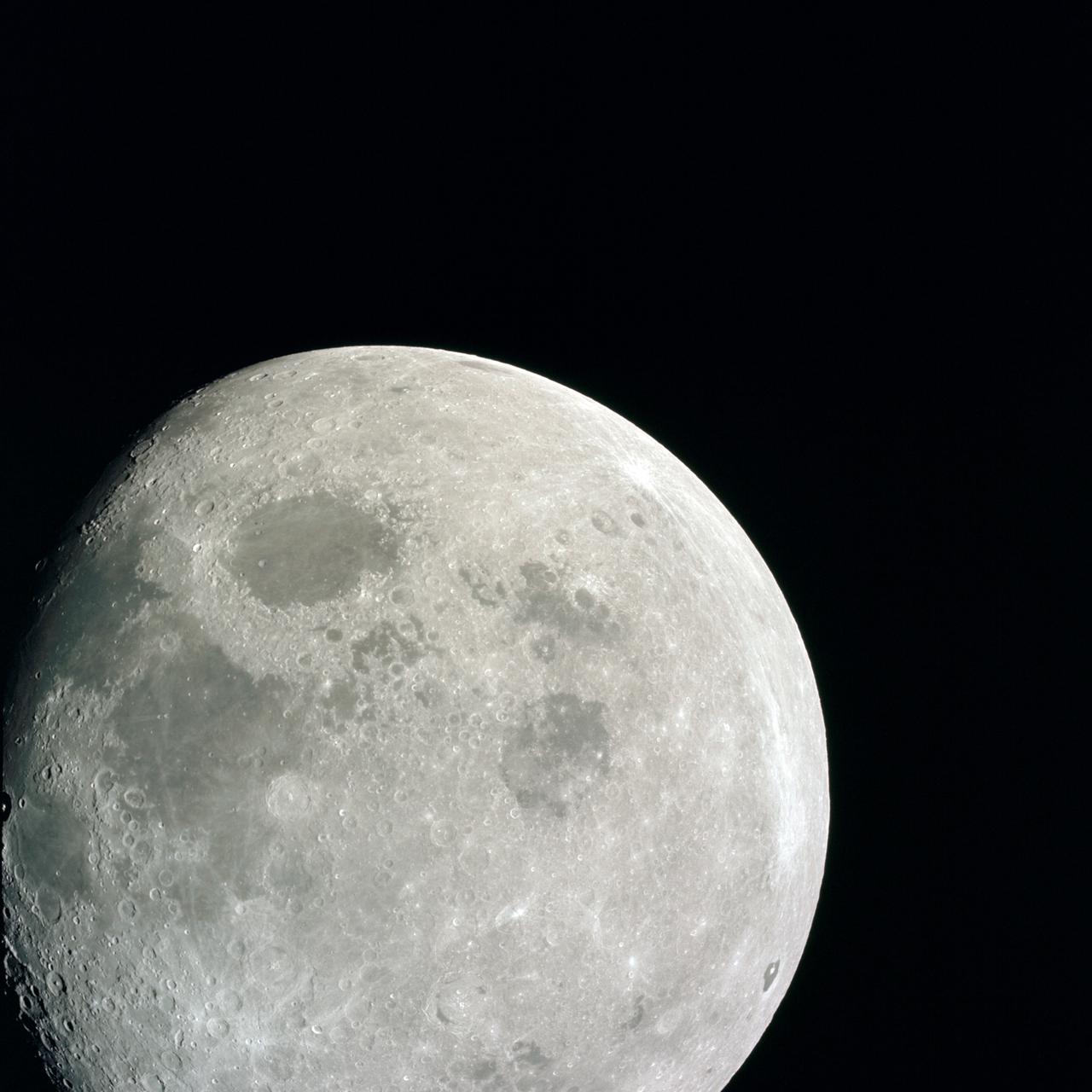
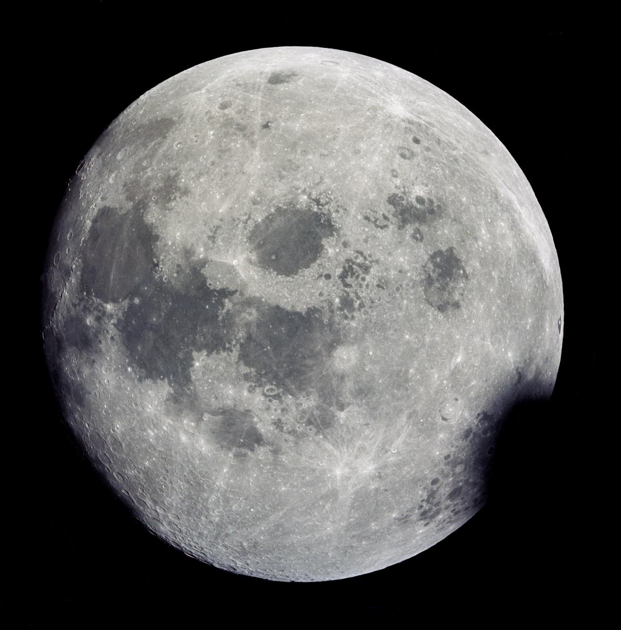
AS11-44-6667 (21 July 1969) --- This outstanding view of the whole full moon was photographed from the Apollo 11 spacecraft during its trans-Earth journey homeward. When this picture was taken, the spacecraft was already 10,000 nautical miles away. Onboard Apollo 11 were astronauts Neil A. Armstrong, commander; Michael Collins, command module pilot; and Edwin E. Aldrin Jr., lunar module pilot. While astronauts Armstrong and Aldrin descended in the Lunar Module (LM) "Eagle" to explore the moon, astronaut Collins remained with the Command and Service Modules (CSM) "Columbia" in lunar orbit.
AS08-14-2505 (21-27 Dec. 1968) --- This photograph of a nearly full moon was taken from the Apollo 8 spacecraft at a point above 70 degrees east longitude. (Hold picture with moon's dark portion at left). Mare Crisium, the circular, dark-colored area near the center, is near the eastern edge of the moon as viewed from Earth. Mare Nectaris is the circular mare near the terminator. The large, irregular maira are Tranquillitatis and Fecunditatis. The terminator at left side of picture crosses Mare Tranquillitatis and highlands to the south. Lunar farside features occupy most of the right half of the picture. The large, dark-colored crater Tsiolkovsky is near the limb at the lower right. Conspicuous bright rays radiate from two large craters, one to the north of Tsiolkovsky, the other near the limb in the upper half of the picture. These rayed craters were not conspicuous in Lunar Orbiter photography due to the low sun elevations when the Lunar Orbiter photography was made. The crater Langrenus is near the center of the picture at the eastern edge of Mare Fecunditatis. The lunar surface probably has less pronounced color that indicated by this print.
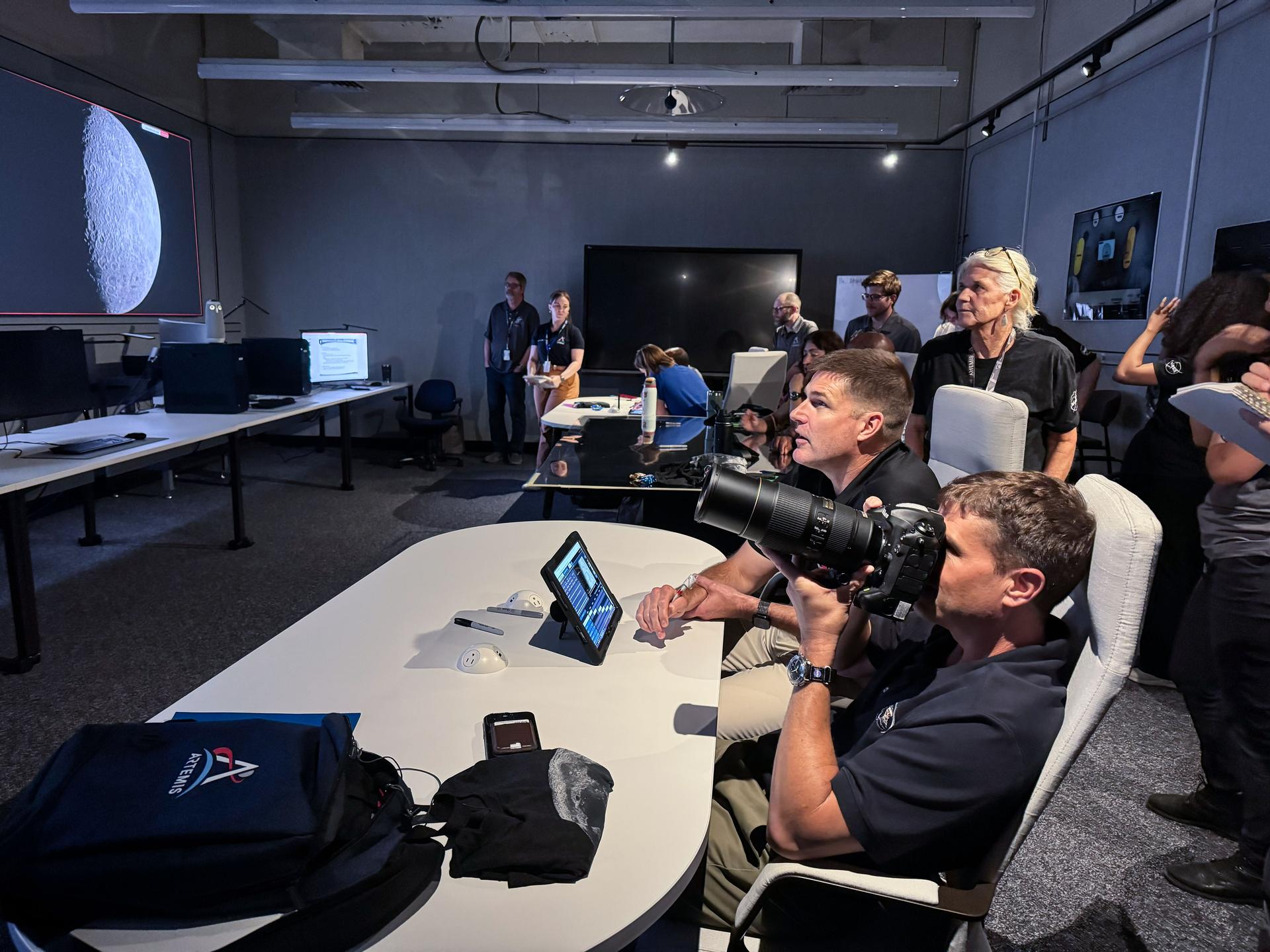
jsc2025e086642 --- NASA astronaut and Artemis II commander, Reid Wiseman (foreground), and CSA (Canadian Space Agency) astronaut and Artemis II mission specialist, practice lunar photography at NASA's Johnson Space Center in Houston. The Artemis II crew will be the first people in more than 50 years to set eyes on the far side of the Moon, depending on illumination conditions. They will document their observations through photographs, audio recordings, and more to inform our understanding of the Moon, and share their experience of being far from Earth. Credit: Kelsey Young
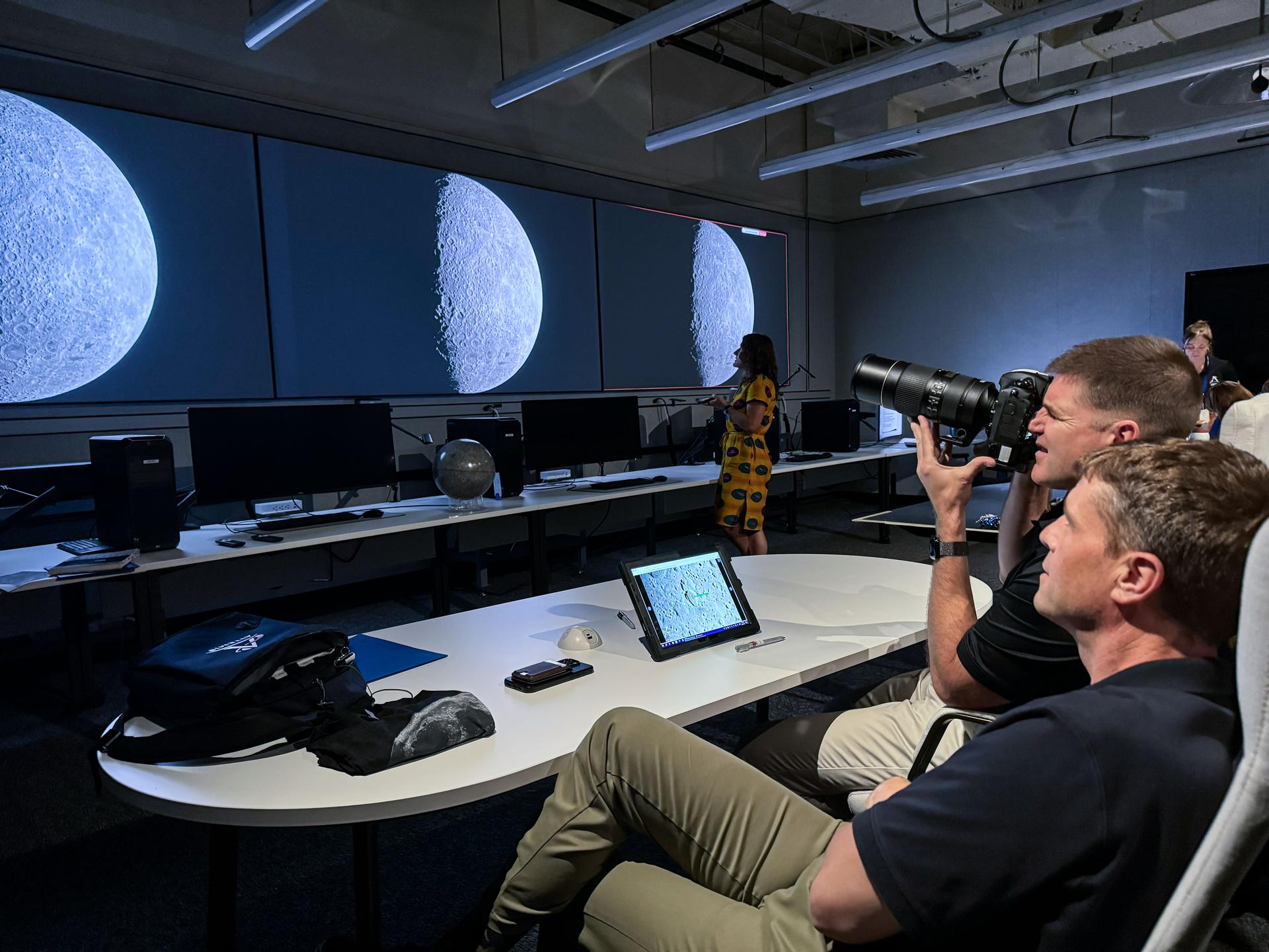
jsc2025e087135 --- NASA astronaut and Artemis II commander, Reid Wiseman (foreground), and CSA (Canadian Space Agency) astronaut and Artemis II mission specialist, practice lunar photography at NASA's Johnson Space Center in Houston. The Artemis II crew will be the first people in more than 50 years to set eyes on the far side of the Moon, depending on illumination conditions. They will document their observations through photographs, audio recordings, and more to inform our understanding of the Moon, and share their experience of being far from Earth. Credit: Kelsey Young
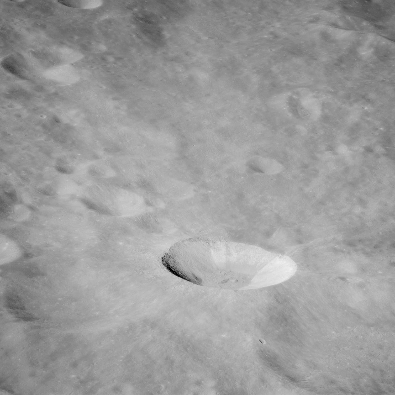
AS11-43-6412 (July 1969) --- This is a northeasterly, low-oblique view of an unmanned crater and highland area on the lunar farside, as photographed from Apollo 11. The center of the picture is located at the 167 degrees east longitude and 6 degrees north latitude. This area of the moon lies just east of International Astronomical Union crater No. 220.
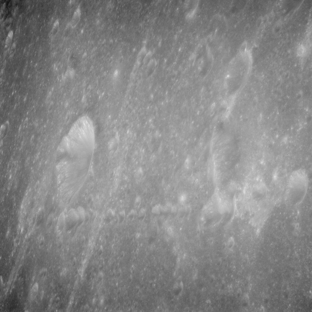
AS11-43-6439 (July 1969) --- An Apollo 11 oblique view of the lunar farside. The linear group of small craters is located within the large International Astronomical Union crater No. IX, and is centered at 139.5 degrees east longitude and 7 degrees north latitude. The absence of shadows is due to the high sun angle. The crater chain is approximately 34 statute miles in length, and the large crater adjacent to the crater is 10.5 statute miles in diameter.
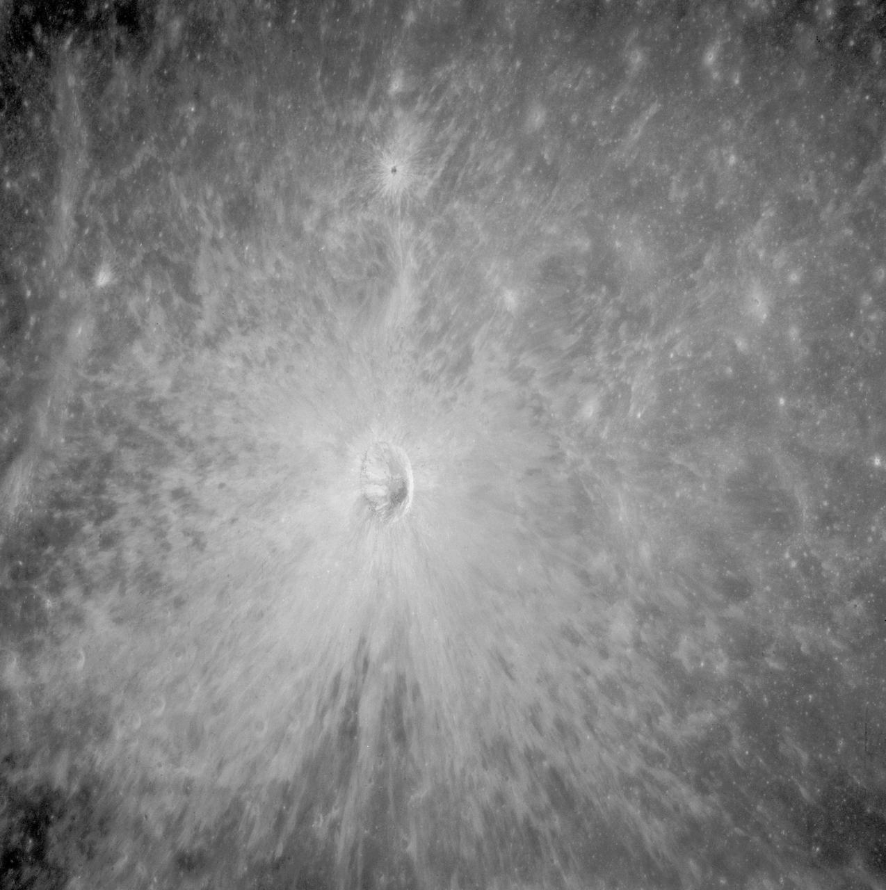
AS11-42-6285 (July 1969) --- An Apollo 11 view of a bright rayed crater on the lunar farside. The crater is unnamed. The center of this photograph is located at 100 degrees southeast longitude and 4 degrees 30 minutes north latitude. This area is just east of Smyth's Sea.
AS11-42-6248 (July 1969) --- An Apollo 11 oblique view of the lunar farside in the area of International Astronomical Union crater No. 312, which is about 30 statute miles in diameter. The center of the photograph is located at 164 degrees west longitude and 8 degrees south latitude. The sharp shadows indicate that the picture was taken at a low sun angle.
AS11-42-6237 (20 July 1969) --- An Apollo 11 oblique view of the large crater Theophilus located at the northwest edge of the Sea of Nectar on the lunar nearside. Theophilus is about 60 statute miles in diameter. The smooth area is Mare Nectaris. The smaller crater Madler, about 14 statute miles in diameter, is located to the east of Theophilus. Visible in the background are the large crater Fracastorius and the smaller crater Beaumont. The coordinates of the center of this photograph are 29 degrees east longitude and 11 degrees south latitude.
AS11-43-6422 (July 1969) --- An Apollo 11 oblique view of the lunar farside. These two odd-shaped craters are located midway between International Astronomical Union craters 218 and 220, and are centered at 155 degrees east longitude and 3 degrees north latitude. The craters total approximately 13.5 statute miles in length and 7.5 statute miles in width at their widest point.
AS11-44-6609 (16-24 July 1969) --- An oblique of the Crater Daedalus on the lunar farside as seen from the Apollo 11 spacecraft in lunar orbit. The view looks southwest. Daedalus (formerly referred to as I.A.U. Crater No. 308) is located at 179 degrees east longitude and 5.5 degrees south latitude. Daedalus has a diameter of about 50 statute miles. This is a typical scene showing the rugged terrain on the farside of the moon. While astronauts Neil A. Armstrong, commander, and Edwin E. Aldrin Jr., lunar module pilot, descended in the Lunar Module (LM) "Eagle" to explore the Sea of Tranquility region of the moon, astronaut Michael Collins, command module pilot, remained with the Command and Service Modules (CSM) "Columbia" in lunar orbit.

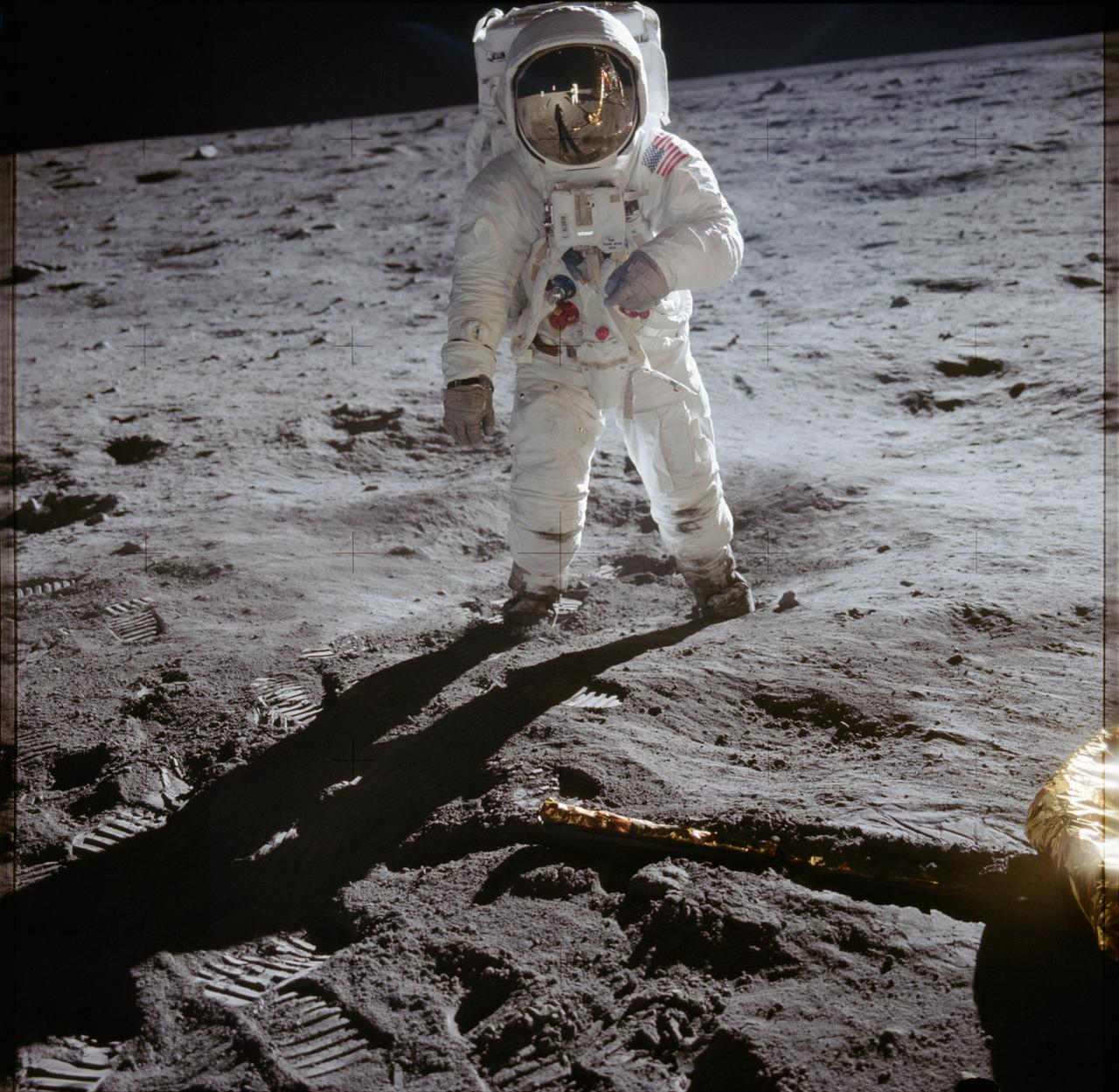
AS11-40-5875 (20 July 1969) --- Astronaut Edwin E. Aldrin Jr., lunar module pilot of the first lunar landing mission, poses for a photograph beside the deployed United States flag during an Apollo 11 extravehicular activity (EVA) on the lunar surface. The Lunar Module (LM) is on the left, and the footprints of the astronauts are clearly visible in the soil of the moon. Astronaut Neil A. Armstrong, commander, took this picture with a 70mm Hasselblad lunar surface camera. While astronauts Armstrong and Aldrin descended in the LM, the "Eagle", to explore the Sea of Tranquility region of the moon, astronaut Michael Collins, command module pilot, remained with the Command and Service Modules (CSM) "Columbia" in lunar orbit. Photo credit: NASA
View of moon taken by Expedition 34 crewmember.
AS13-60-8703 (11-17 April 1970) --- This outstanding view of a near full moon was photographed from the Apollo 13 spacecraft during its trans-Earth journey homeward. Though the explosion of the oxygen tank in the Service Module (SM) forced the cancellation of the scheduled lunar landing, Apollo 13 made a pass around the moon prior to returning to Earth. Some of the conspicuous lunar features include the Sea of Crisis, the Sea of Fertility, the Sea of Tranquility, the Sea of Serenity, the Sea of Nectar, the Sea of Vapors, the Border Sea, Smyth's Sea, the crater Langrenus, and the crater Tsiolkovsky.
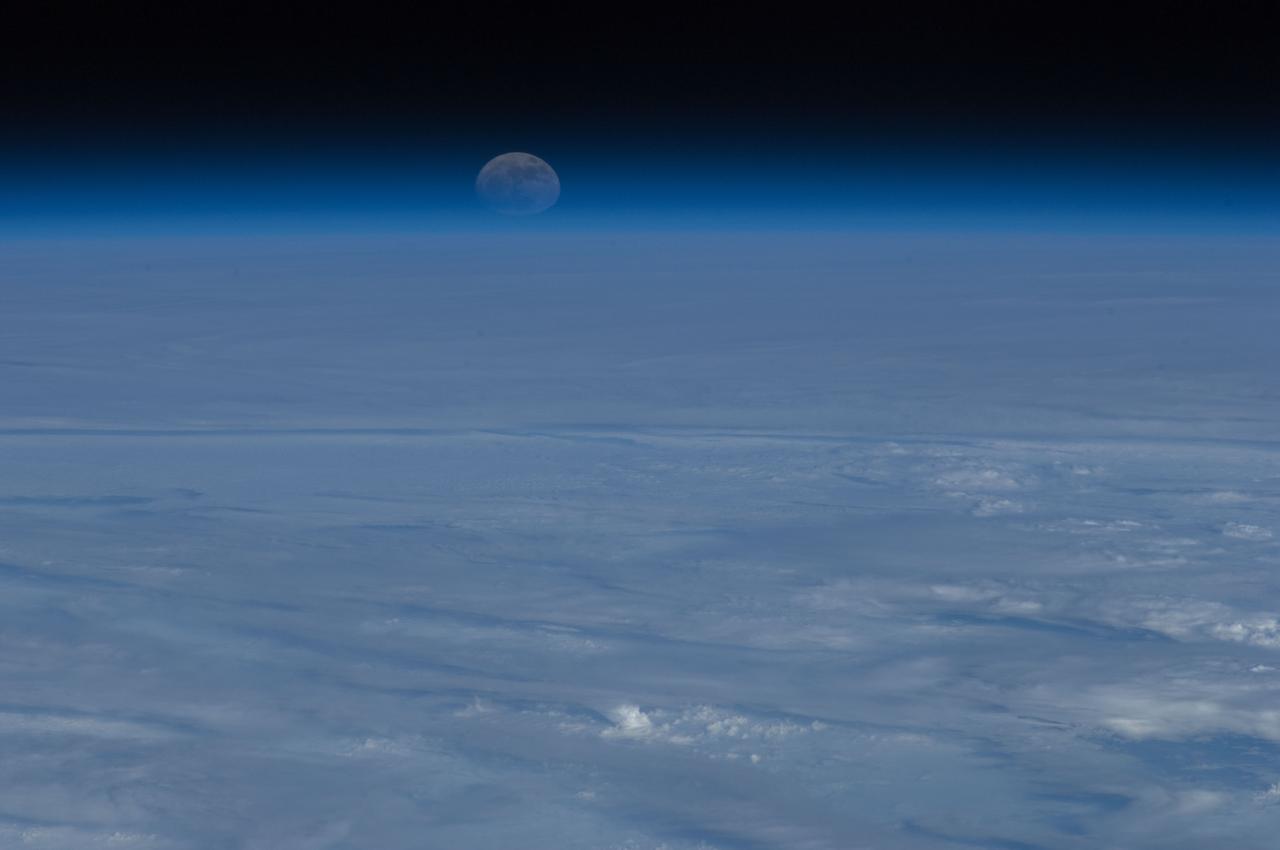
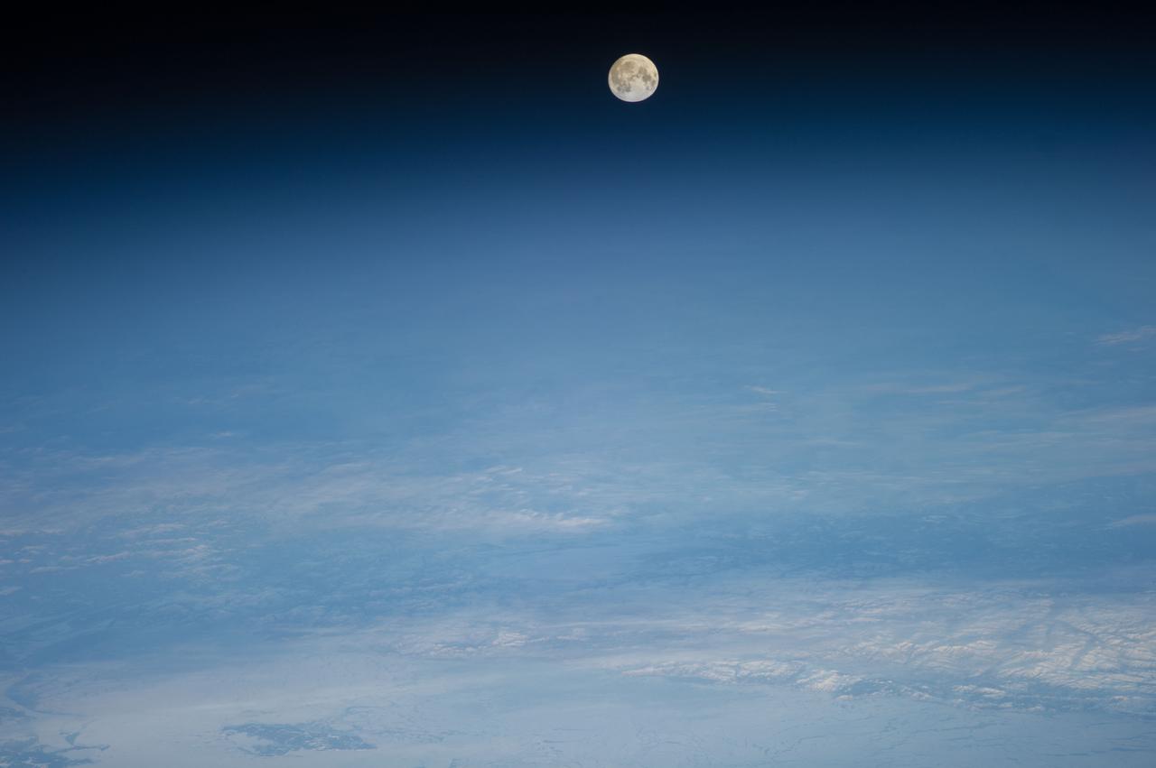
Lunar observation taken during moonrise by Expedition 34 crewmember.
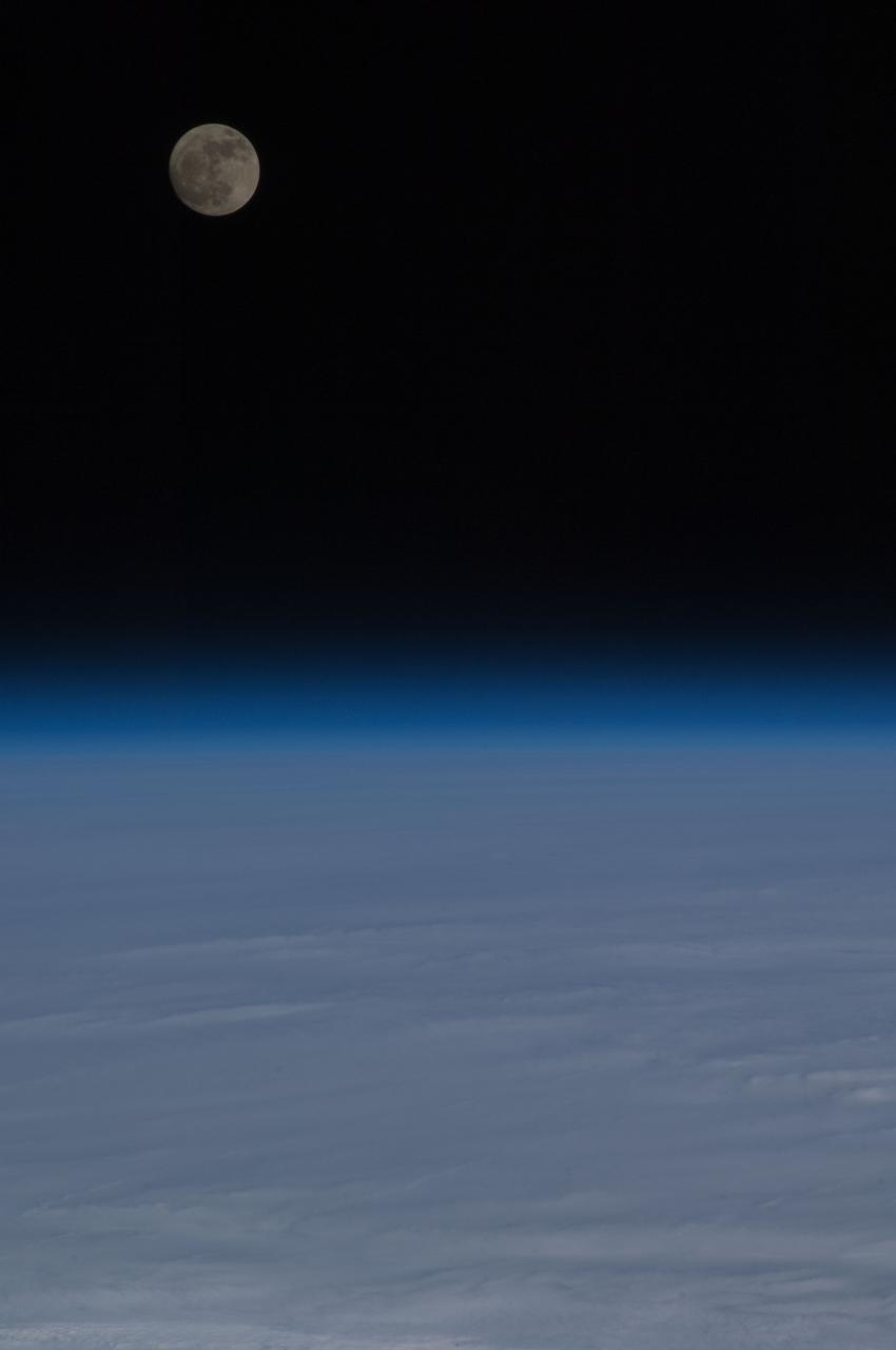
Lunar observation taken during moonrise by Expedition 34 crewmember.
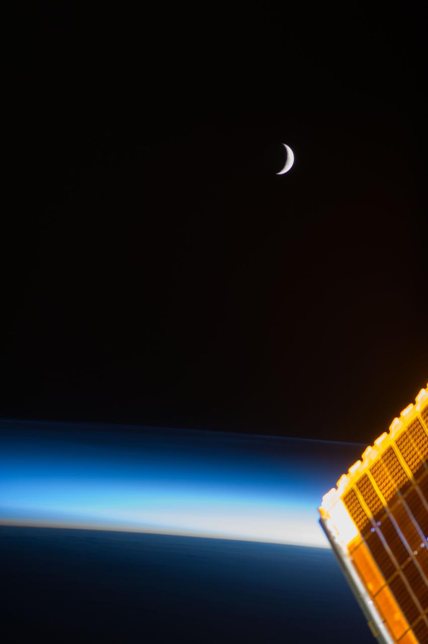
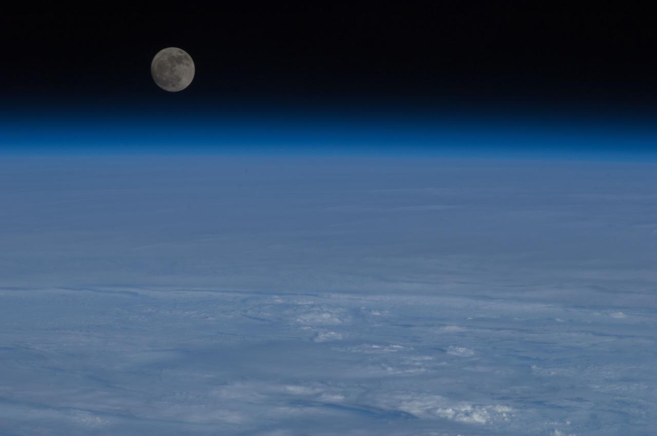
Lunar observation taken during moonset by the Expedition 39 crew aboard the ISS. Earth airglow is in view. Image was released by astronaut on Twitter.
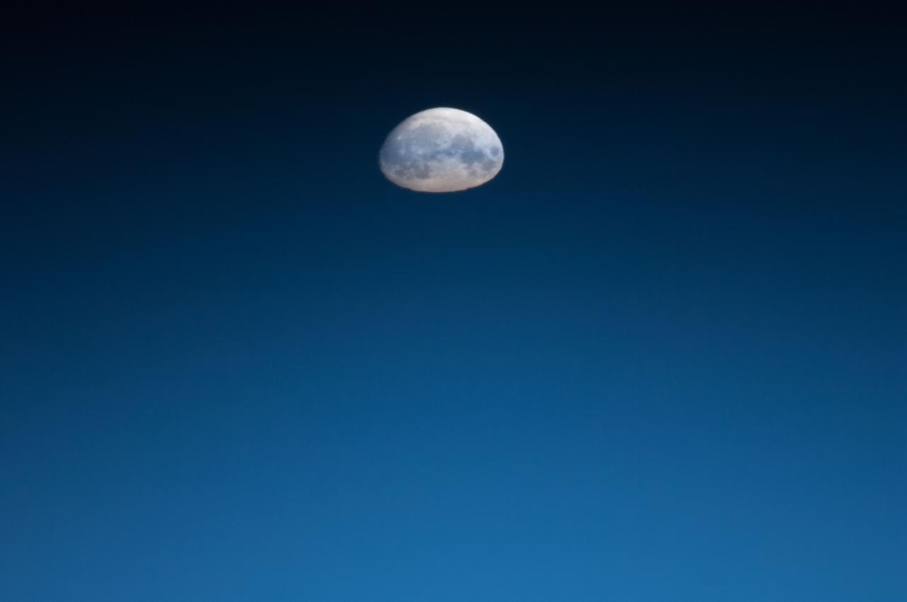
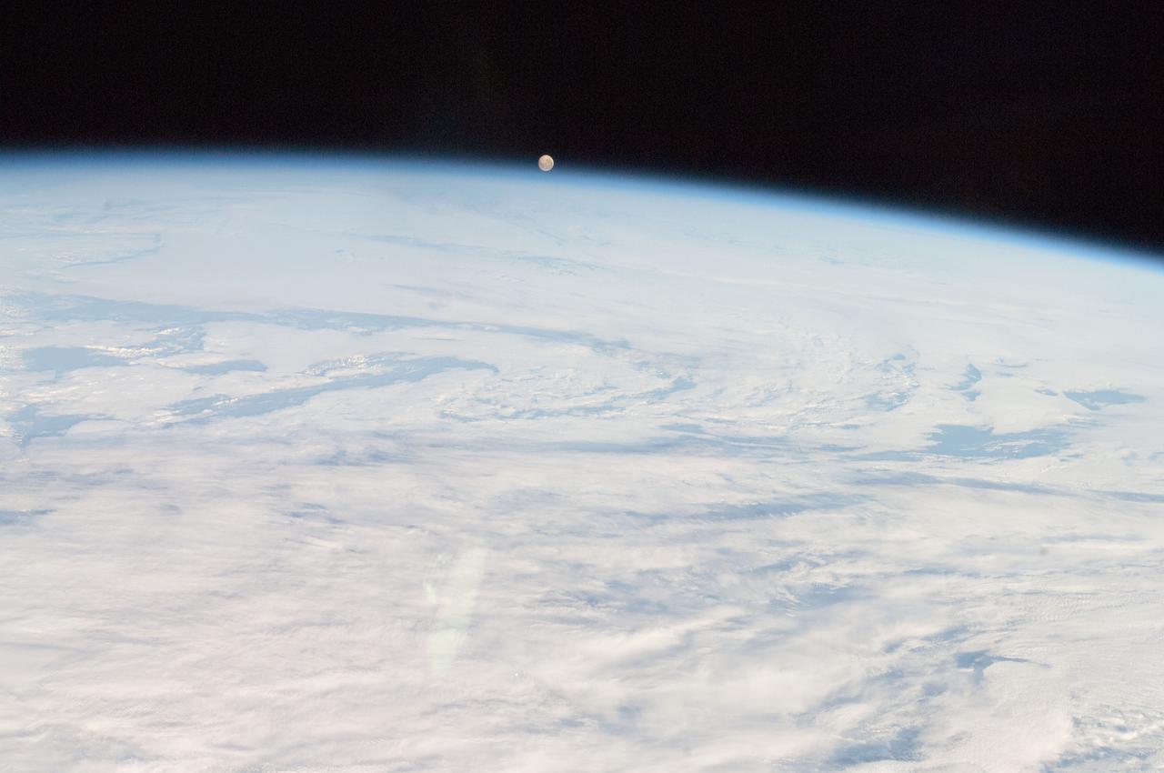
Lunar observation taken during moonrise by Expedition 34 crewmember.
Lunar observation taken during moonrise by Expedition 34 crewmember.
Lunar observation taken during moonrise by Expedition 34 crewmember.
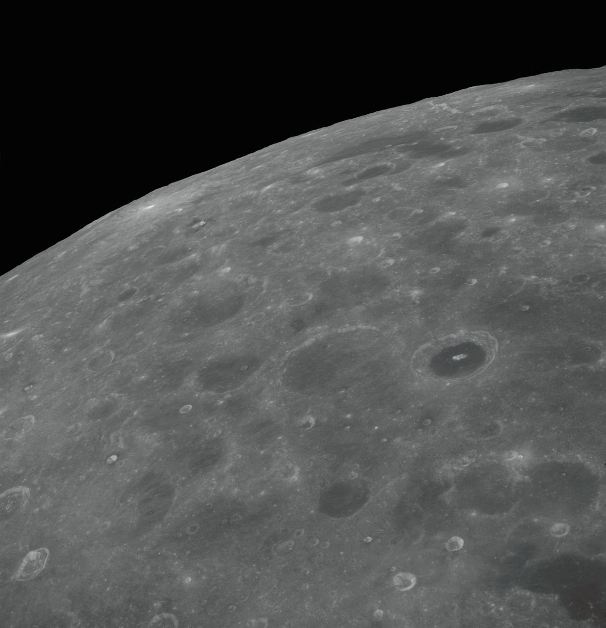
AS08-12-2192 (21-27 Dec. 1968) --- View of the lunar surface taken from the Apollo 8 spacecraft looking southward from high altitude across the Southern Sea. (Hold picture with AS8 number in upper right corner). The bright-rayed crater near the horizon is located near 130 degrees east longitude and 70 degrees south latitude. The dark-floored crater near the middle of the right side of the photograph is about 70 kilometers (45 statute miles) in diameter. Both features are beyond the eastern limb of the moon as viewed from Earth; neither has a name.
AS08-12-2193 (21-27 Dec. 1968) --- View of the lunar surface taken from the Apollo 8 spacecraft looking southward from high altitude across the Southern Sea. (Hold picture with AS8 number in upper right corner). The bright-rayed crater near the horizon is located near 130 degrees east longitude and 70 degrees south latitude. The dark-floored crater near the middle of the right side of the photograph is about 70 kilometers (45 statute miles) in diameter. Both features are beyond the eastern limb of the moon as viewed from Earth; neither has a name.
AS08-12-2209 (21-27 Dec. 1968) --- High altitude oblique view of the lunar surface, looking northeastward, as seen from the Apollo 8 spacecraft. The crater Joliot-Curie, about 175 kilometers in diameter and centered near 94 degrees east longitude and 27 degrees north latitude, is near the center of the left side of this photograph. The bright rayed crater near the horizon is probably located near 105 degrees east longitude and 45 degrees north latitude. Long, narrow rays that have been reported in the polar region of Earth facing hemisphere may radiate from this crater.
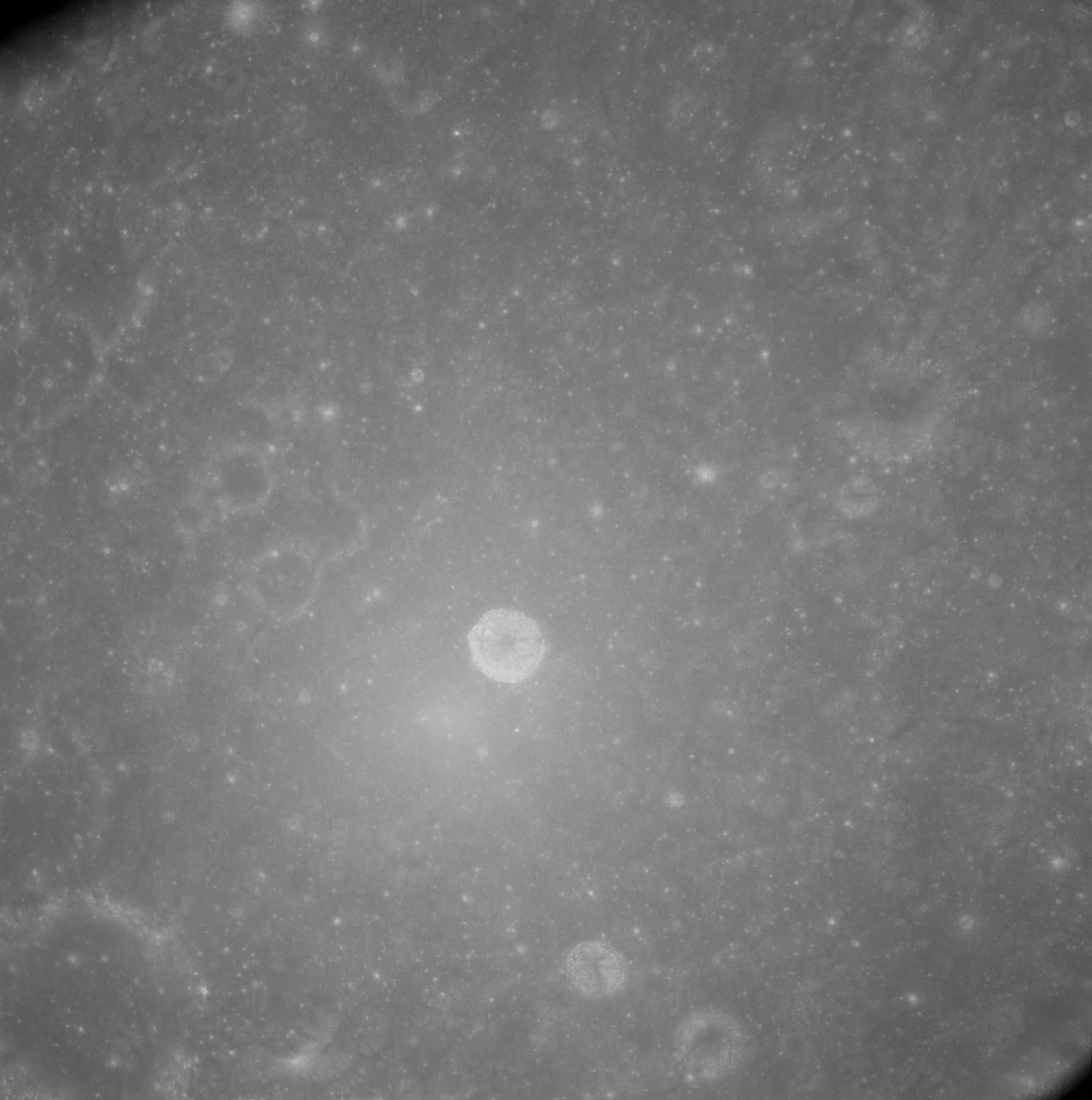
AS08-12-2148 (21-27 Dec. 1968) --- View of the lunar surface as photographed from the Apollo 8 spacecraft. Zero-phase bright spot. With near-vertical sun illumination, topographical detail is washed out and differences in surface brightness are accentuated. The numerous small bright-halo craters become conspicuous. A few larger craters have extremely bright inner walls that are commonly streaked by darker material. The bright glow near the conspicuous bright-walled crater is a halo that surrounds the position of the spacecraft shadow.
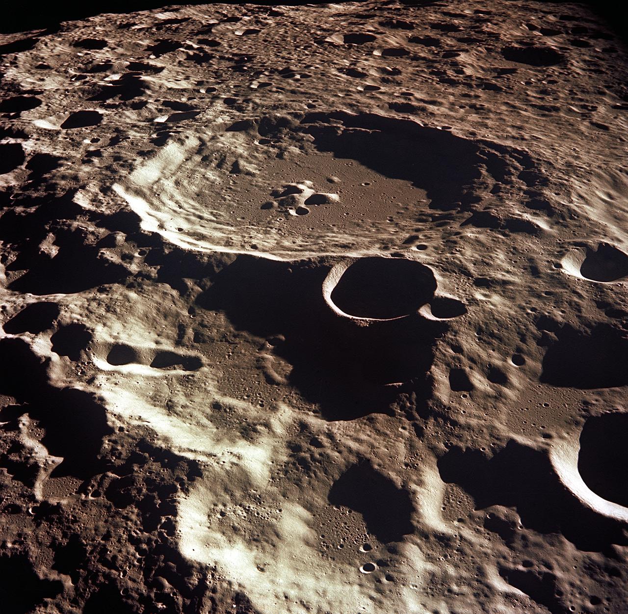
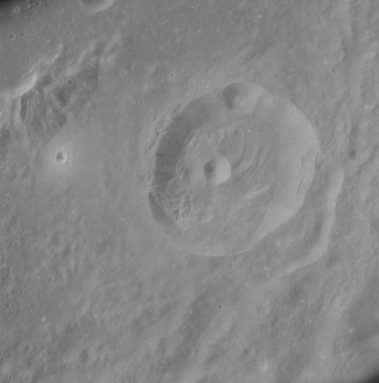
AS08-12-2052 (21-27 Dec. 1968) --- This near-vertical photograph from the Apollo 8 spacecraft covers an area of approximately 50 x 50 statute miles within a 250-statute-miles-in-diameter crater on the lunar farside. The center of this large crater is located at about 157 degrees west longitude and 4 degrees south latitude. The large crater in the center of the picture is about 20 statute miles in diameter.
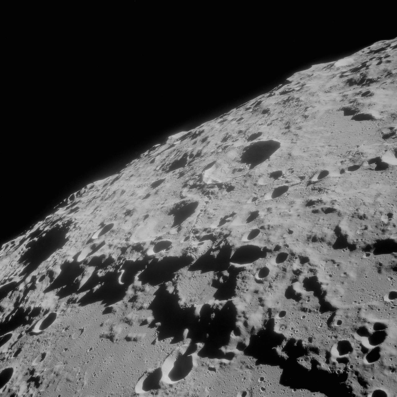
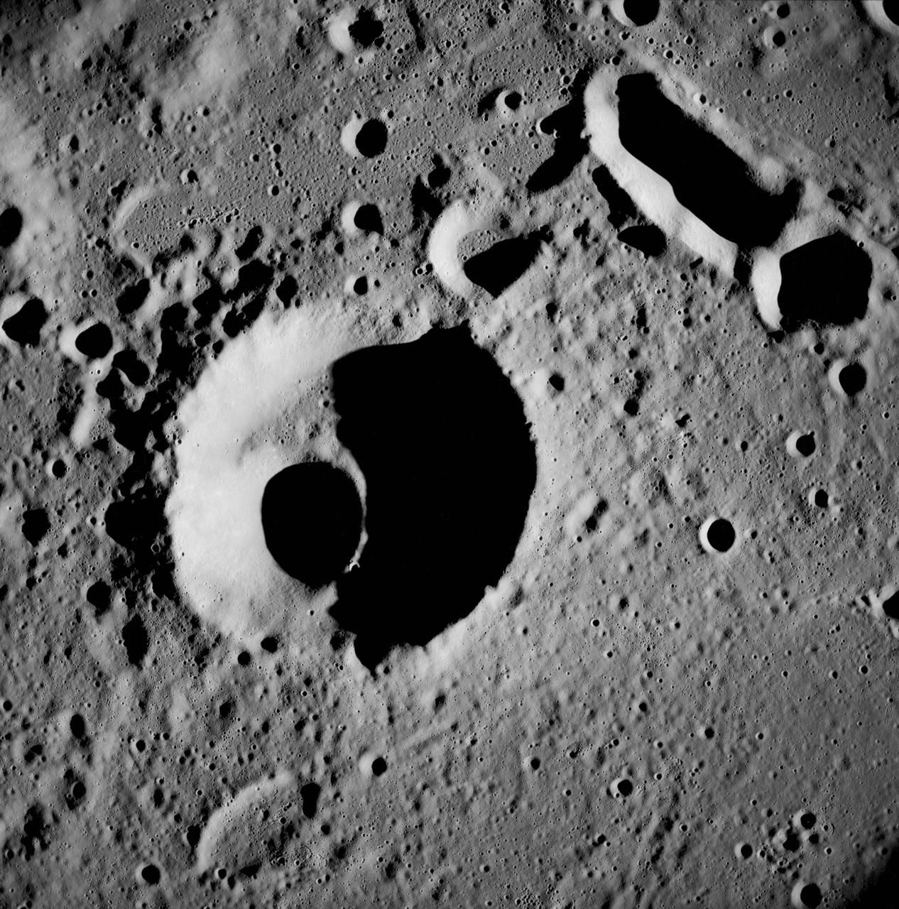
AS8-17-2704 (21-27 Dec. 1968) --- Near vertical view of the lunar farside as photographed from the Apollo 8 spacecraft. This crater, which is about 22 statute miles in diameter, is located at 167 degrees east longitude and 11 degrees south latitude. This crater is located on the eastern edge of a much larger unnamed crater which is about 90 statute miles in diameter.

AS08-14-2383 (24 Dec. 1968) --- The rising Earth is about five degrees above the lunar horizon in this telephoto view taken from the Apollo 8 spacecraft near 110 degrees east longitude. The horizon, about 570 kilometers (350 statute miles) from the spacecraft, is near the eastern limb of the moon as viewed from Earth. Width of the view at the horizon is about 150 kilometers (95 statute miles). On Earth 240,000 statute miles away the sunset terminator crosses Africa. The crew took the photo around 10:40 a.m. Houston time on the morning of Dec. 24, and that would make it 15:40 GMT on the same day. The South Pole is in the white area near the left end of the terminator. North and South America are under the clouds.
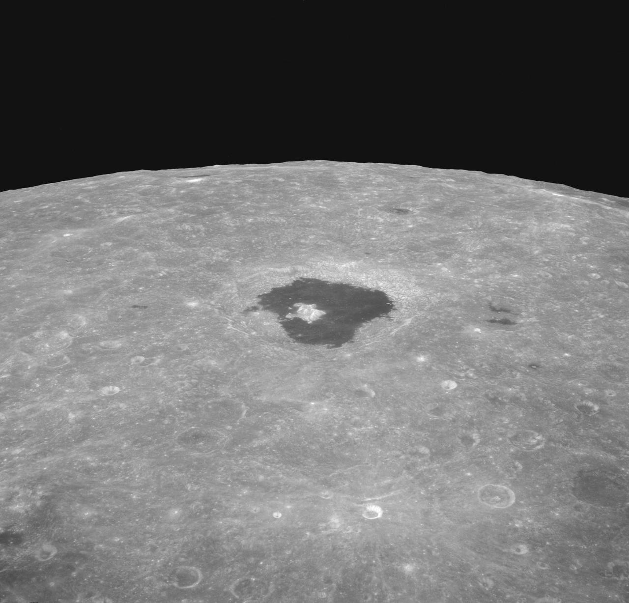
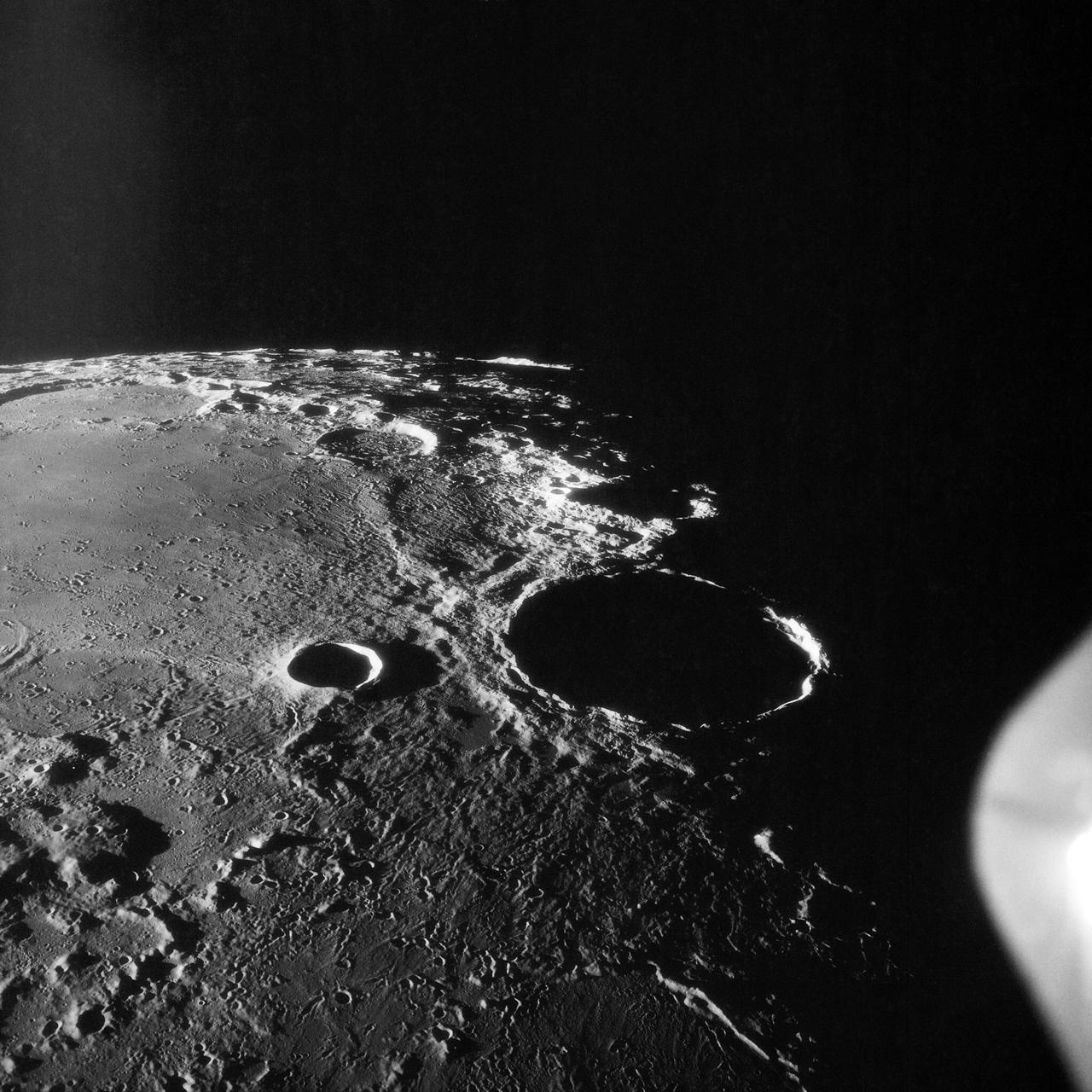
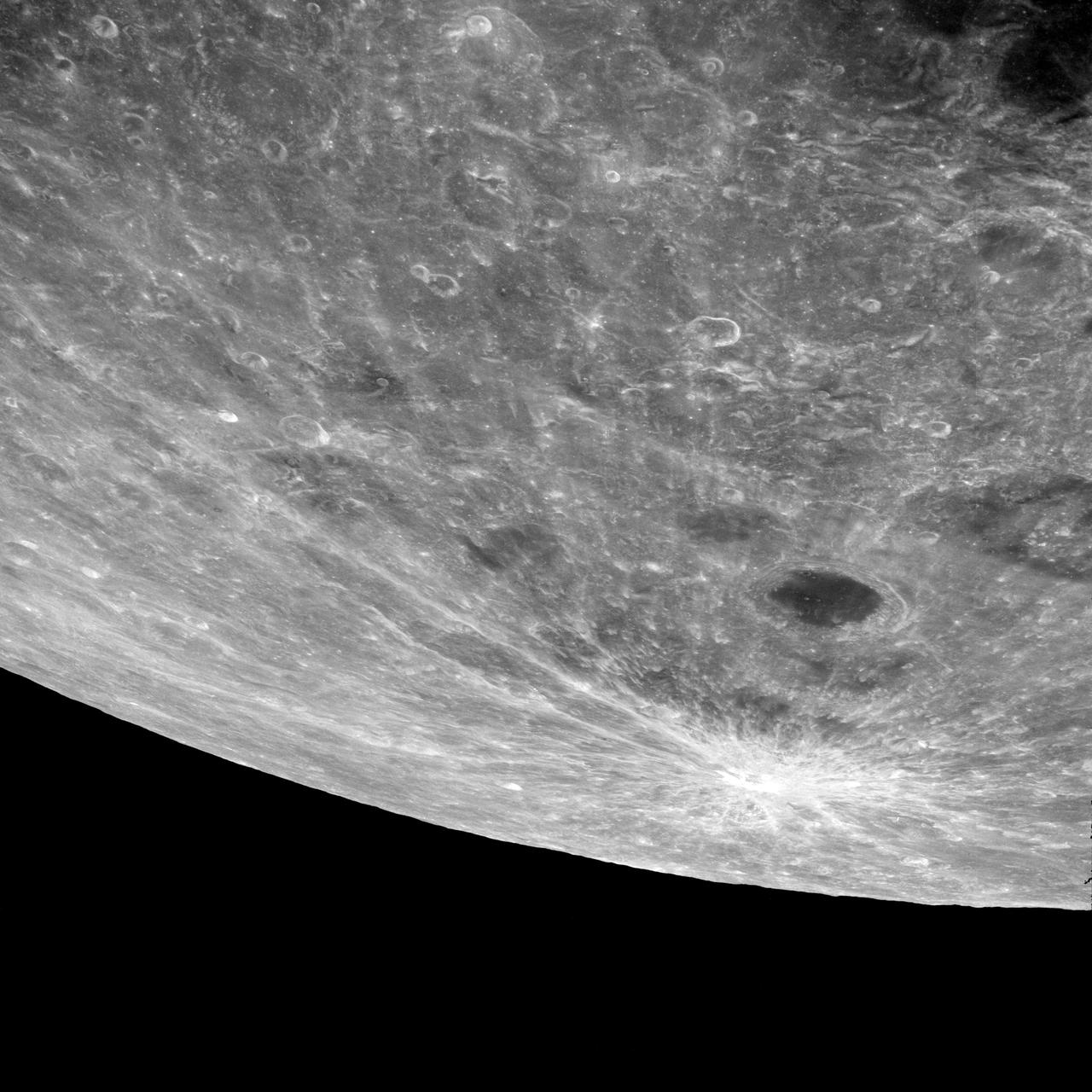
AS08-12-2196 (21-27 Dec. 1968) --- An oblique view from the Apollo 8 spacecraft looking eastward across the lunar surface from about 115 degrees east longitude to the horizon near 180 degrees east longitude. The crater Tsiolkovsky in the center of the picture is 150 kilometers wide and is located at 129 degrees east longitude and 21 degrees south latitude. While in lunar orbit, Apollo 8 moved toward the camera position over the terrain along the left (north) side of this photograph.
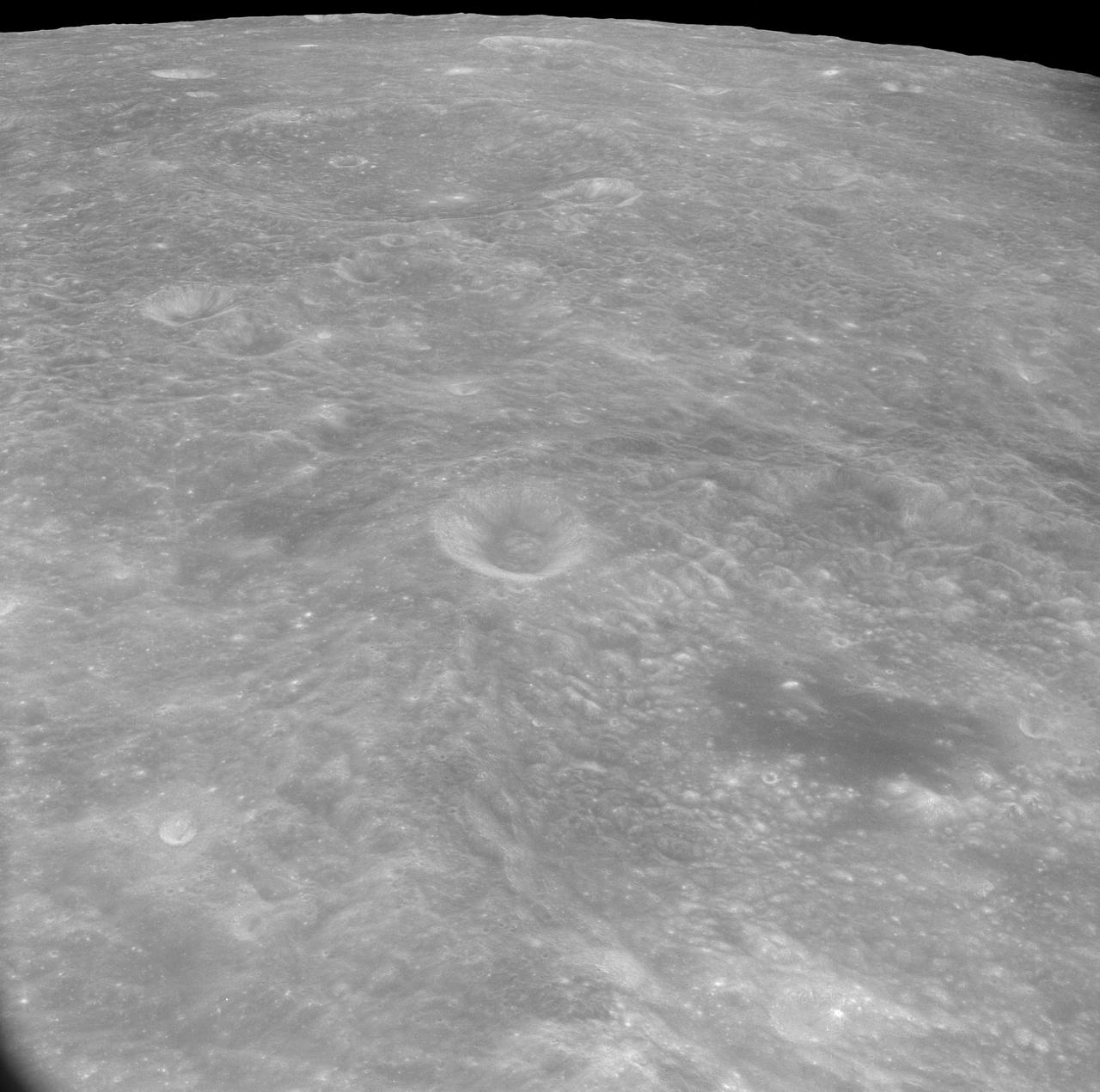
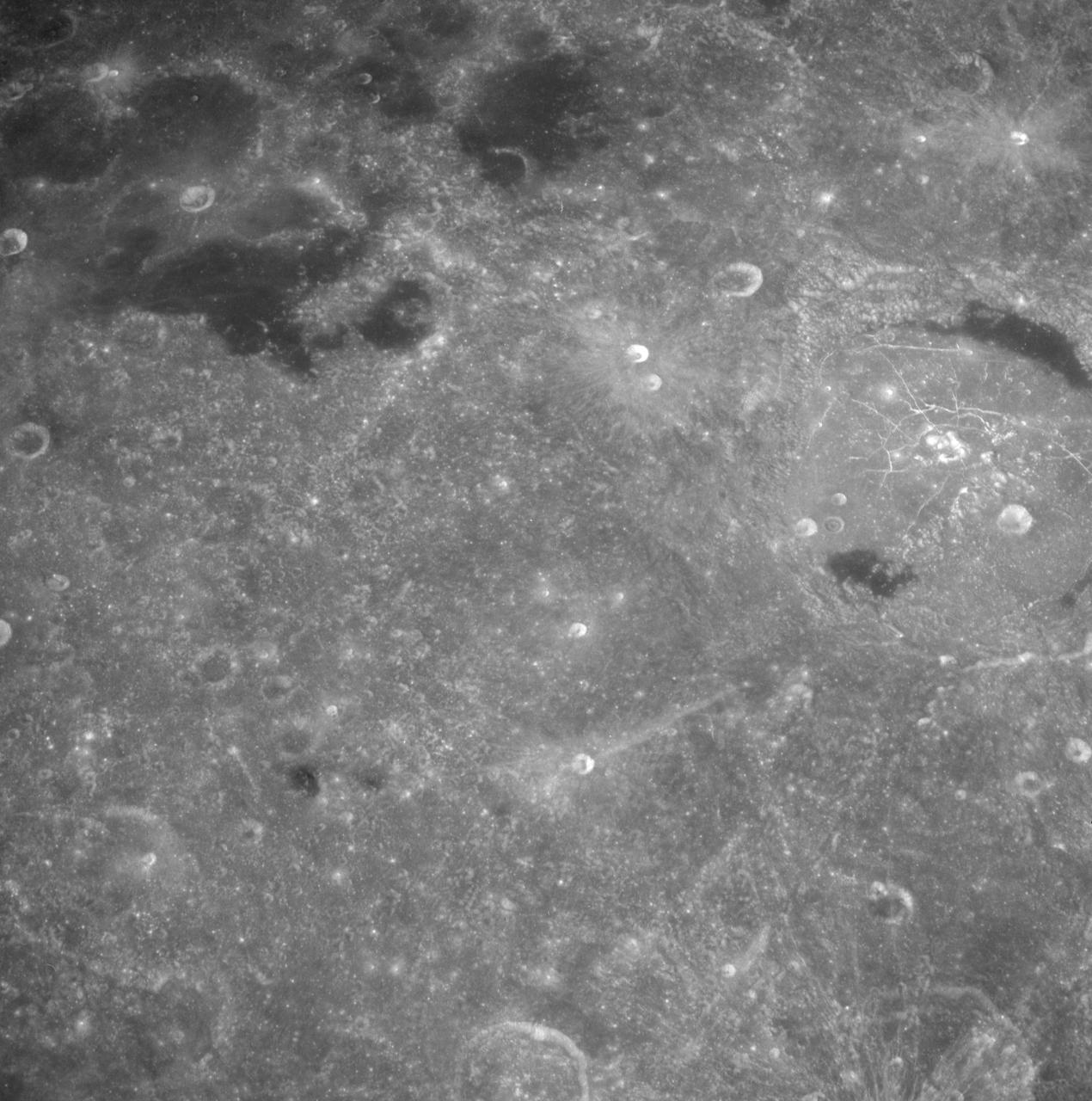
AS8-17-2744 (21-27 Dec. 1968) --- Oblique view of the lunar surface taken from the Apollo 8 spacecraft looking westward showing typical lunar farside terrain. (HOLD PICTURE SO THAT DARK IRREGULAR AREA SURROUNDED BY LIGHT SPOTS IS IN THE LOWER RIGHT QUARTER). The sharp crater near the center of then scene is near 117 degrees east longitude and 5 degrees south latitude; and it is 25 kilometers (15 statute miles) in diameter. That crater is on the rim of a large crater that occupies the lower right quarter of the photograph.
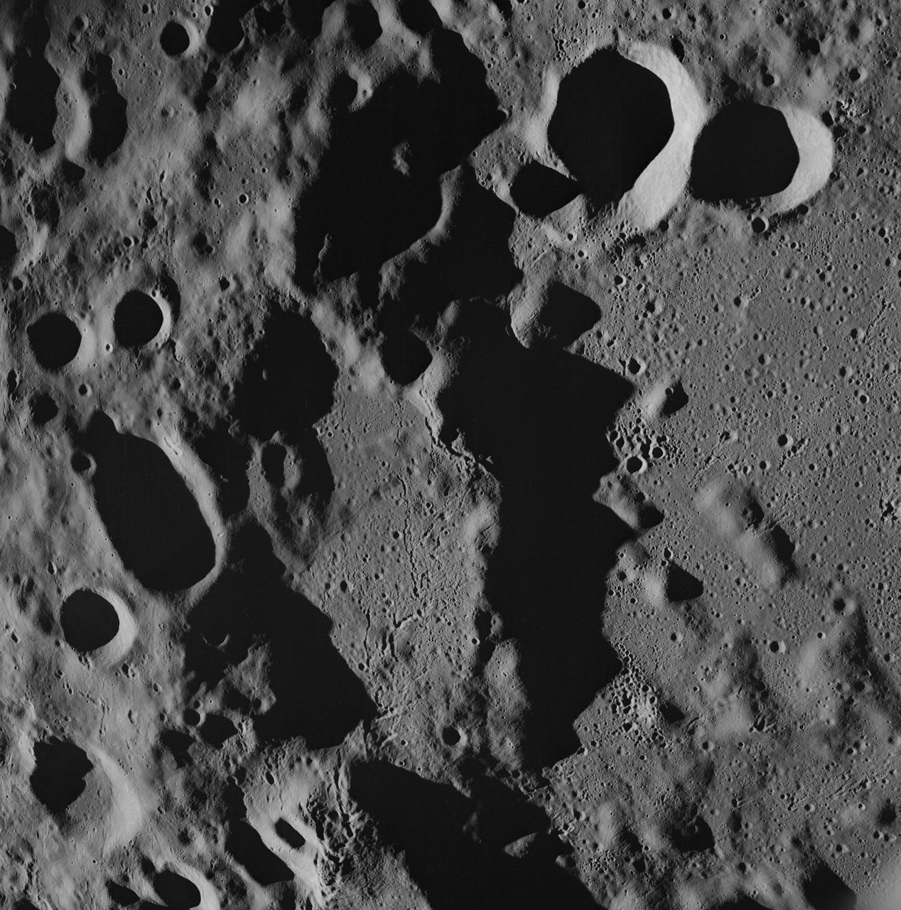
AS08-17-2670 (21-27 Dec. 1968) --- Near vertical view of the lunar farside as photographed from the Apollo 8 spacecraft. The center of the picture is located approximately at 162 degrees west longitude and 6 degrees south latitude.
AS8-14-2392 (21-27 Dec. 1968) --- High-oblique view of the moon's surface showing Earth rising above the lunar horizon, looking west-southwest, as photographed from the Apollo 8 spacecraft as it orbited the moon. The center of the picture is located at about 105 degrees east longitude and 13 degrees south latitude. The lunar surface probably has less pronounced color than indicated by this print.
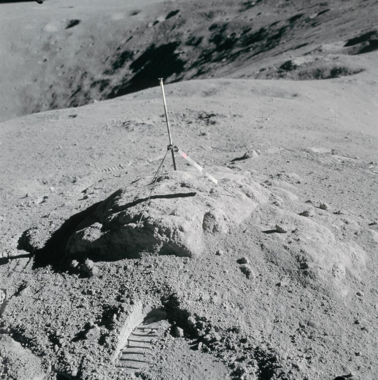
AS16-114-18412 (16-27 April 1972) --- The gnomon and color patch, one of the Apollo Lunar Hand Tools (ALHT), is deployed atop a lunar rock, in this photograph taken by one of the Apollo 16 astronauts during their lunar surface extravehicular activity (EVA) at the Descartes landing site. The gnomon is used as a photographic reference to establish local vertical sun angle, scale, and lunar color. The color patch, mounted on one of the legs of the tripod, provides a larger target for accurately determining colors in color photography. A portion of Flag Crater can be seen in the background. While astronauts John W. Young, commander; and Charles M. Duke Jr., lunar module pilot; descended in the Apollo 16 Lunar Module (LM) "Orion" to explore the Descartes highlands landing site on the moon, astronaut Thomas K. Mattingly II, command module pilot, remained with the Command and Service Modules (CSM) "Casper" in lunar orbit.

AS11-40-5868 (20 July 1969) --- Astronaut Edwin E. Aldrin Jr., lunar module pilot, descends the steps of the Lunar Module (LM) ladder as he prepares to walk on the moon. He had just egressed the LM. This photograph was taken by astronaut Neil A. Armstrong, commander, with a 70mm lunar surface camera during the Apollo 11 extravehicular activity (EVA). While Armstrong and Aldrin descended in the LM "Eagle" to explore the moon, astronaut Michael Collins, command module pilot, remained with the Command and Service Modules (CSM) in lunar orbit.
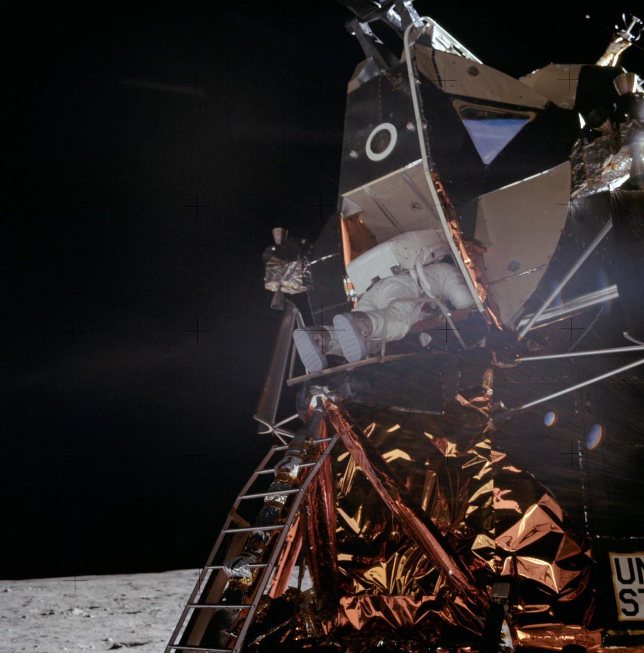
AS11-40-5863 (20 July 1969) --- Astronaut Edwin E. Aldrin Jr., lunar module pilot, is photographed egressing the Lunar Module (LM) during the Apollo 11 extravehicular activity (EVA) on the moon. This photograph was taken by astronaut Neil A. Armstrong, commander, with a 70mm lunar surface camera. While astronauts Armstrong and Aldrin descended in the Lunar Module (LM) "Eagle" to explore the Sea of Tranquility region of the moon, astronaut Michael Collins, command module pilot, remained with the Command and Service Modules (CSM) "Columbia" in lunar orbit.
AS11-40-5903 (20 July 1969) --- Astronaut Edwin E. Aldrin Jr., lunar module pilot, walks on the surface of the moon near the leg of the Lunar Module (LM) "Eagle" during the Apollo 11 extravehicular activity (EVA). Astronaut Neil A. Armstrong, commander, took this photograph with a 70mm lunar surface camera. While astronauts Armstrong and Aldrin descended in the Lunar Module (LM) "Eagle" to explore the Sea of Tranquility region of the moon, astronaut Michael Collins, command module pilot, remained with the Command and Service Modules (CSM) "Columbia" in lunar orbit.

AS11-40-5902 (20 July 1969) --- Astronaut Edwin E. Aldrin Jr., lunar module pilot, walks on the surface of the moon near a leg of the Lunar Module during the Apollo 11 extravehicular activity (EVA). Astronaut Neil A. Armstrong, Apollo 11 commander, took this photograph with a 70mm lunar surface camera. The astronauts' bootprints are clearly visible in the foreground. While astronauts Armstrong and Aldrin descended in the Lunar Module (LM) "Eagle" to explore the Sea of Tranquility region of the moon, astronaut Michael Collins, command module pilot, remained with the Command and Service Modules (CSM) "Columbia" in lunar orbit.
AS08-17-2814 (21-27 Dec. 1968) --- This oblique view of the lunar surface taken from the Apollo 8 spacecraft looking westward across the Sea of Fertility into the Sea of Tranquility shows the terrain the astronauts will see as the approach Apollo Landing Site East 2. The landing site is at the horizon about one-third of the distance from the left to the right photograph margin. The prominent crater in the highlands near the center of the picture is Secchi, about 25 kilometers (15 statute miles) in diameter.
AS08-17-2821 (21-27 Dec. 1968) --- This oblique view of the lunar surface taken from the Apollo 8 spacecraft looking westward across the Sea of Tranquility shows Apollo Landing Site East 2 illuminated by a sun that is six to eight degrees above the eastern horizon. The landing site is on the dark gray, smooth surface of the Sea of Tranquility and north (to the right) of the bright highland terrain at the lower left corner of the photograph. The landing site is about four tenths of the distance from the left to right margin of the photograph.
AS08-13-2344 (21-27 Dec. 1968) --- This oblique photograph looks generally northwest from the Apollo 8 spacecraft into the Sea of Tranquility. (HOLD PICTURE WITH LARGE TRIANGLE FORMED BY DARK SKY AT UPPER LEFT). The three prominent craters are Taruntius F in the lower right corner; Taruntius E in the center; and Cauchy between the two linear features. The Cauchy scarp, this side of the Cauchy crater, is formed by one to three faults stepped down toward the spacecraft. Cauchy Rille, on the other side of Cauchy crater, consists of several arcuate segments of a graben. Each of the three prominent craters is 10 to 15 kilometers (6 to 9 statute miles) across.
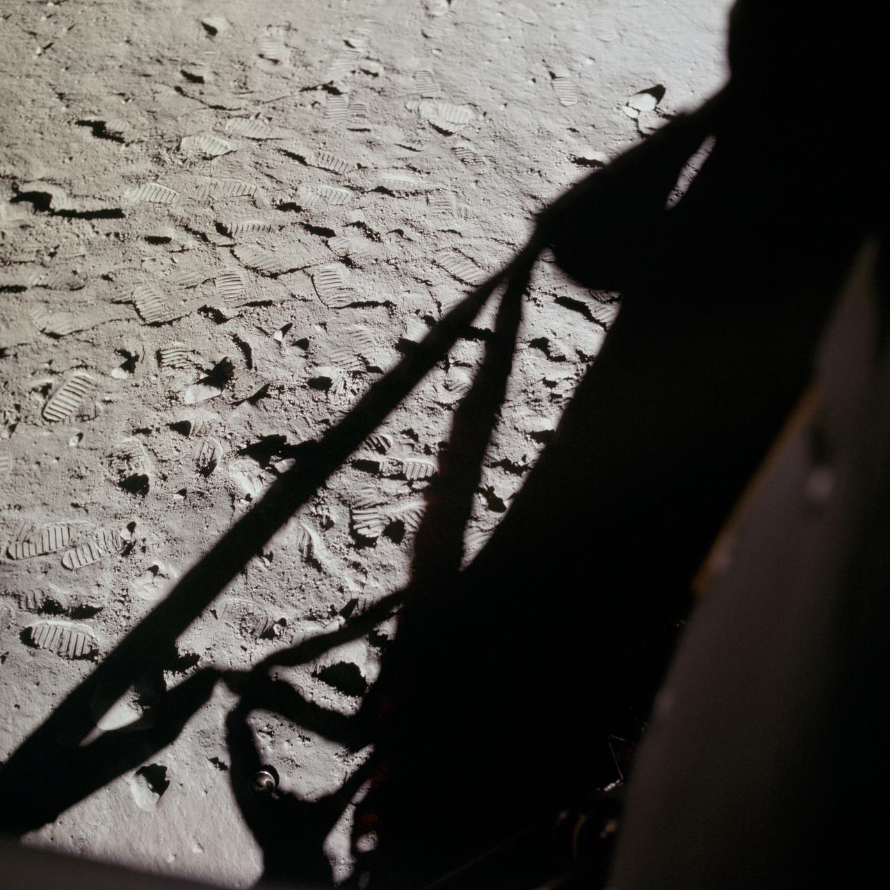
AS11-37-5505 (20 July 1969) --- This photograph shows in fine detail the impressions in the lunar soil made by astronauts Neil A. Armstrong and Edwin E. Aldrin Jr. during their lunar surface extravehicular activity (EVA). While astronauts Armstrong, commander, and Aldrin, lunar module pilot, descended in the Lunar Module (LM) "Eagle" to explore the Sea of Tranquility region of the moon, astronaut Michael Collins, command module pilot, remained with the Command and Service Modules (CSM) "Columbia" in lunar orbit.
AS08-13-2225 (21-27 Dec. 1968) --- This photograph was taken from the Apollo 8 spacecraft with long-focal length lens, looking south at the large crater Goclenius, which is in foreground. Hold picture with Goclenius at bottom center. The three clustered craters are Magelhaens, Magelhaens A, and Colombo A. The crater at upper right is Gutenberg D. The crater Goclenius is located at 10 degrees south latitude, 45 degrees east longitude, and it is approximately 40 statute miles in diameter.
AS08-13-2327 (21-27 Dec. 1968) --- A brightly-rayed crater on the farside of the moon near the sub solar point, where the sun was directly overhead, as seen from the Apollo 8 spacecraft. (HOLD PICTURE WITH THE CRATER SLIGHTLY TO THE UPPER RIGHT). Brightly-rayed craters are numerous on the lunar front side; however, they have not been previously observed in such detail on the farside.
AS10-27-3956 (24 May 1969) --- This photograph of the moon was taken after trans-Earth insertion when the Apollo 10 spacecraft was high above the lunar equator near 27 degrees east longitude. North is about 20 degrees left of the top of the photograph. Apollo Landing Site 3 is on the lighted side of the terminator in a dark area just north of the equator. Apollo Landing Site 2 is near the lower left margin of the Sea of Tranquility (Mare Tranquillitatis), which is the large, dark area near the center of the photograph.
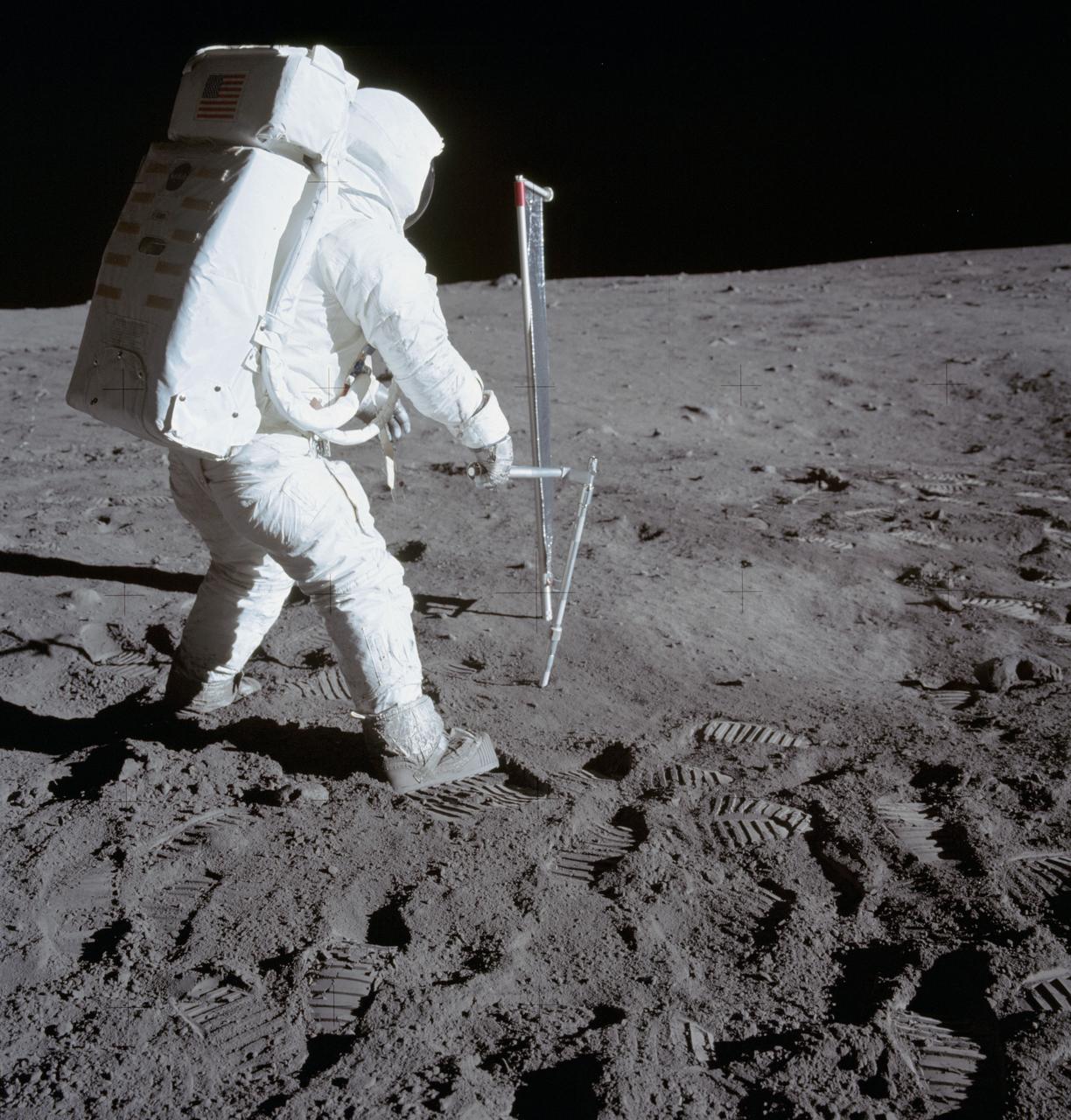
AS11-40-5964 (20 July 1969) --- Astronaut Edwin E. Aldrin Jr., lunar module pilot, is photographed during the Apollo 11 extravehicular activity (EVA) on the moon. He is driving one of two core tubes into the lunar soil. Astronaut Neil A. Armstrong, commander, took this picture with a 70mm lunar surface camera. Aldrin stands near the Solar Wind Composition (SWC) experiment, a component of the Early Apollo Scientific Experiments Package (EASEP, deployed earlier). The SWC is in the center background.
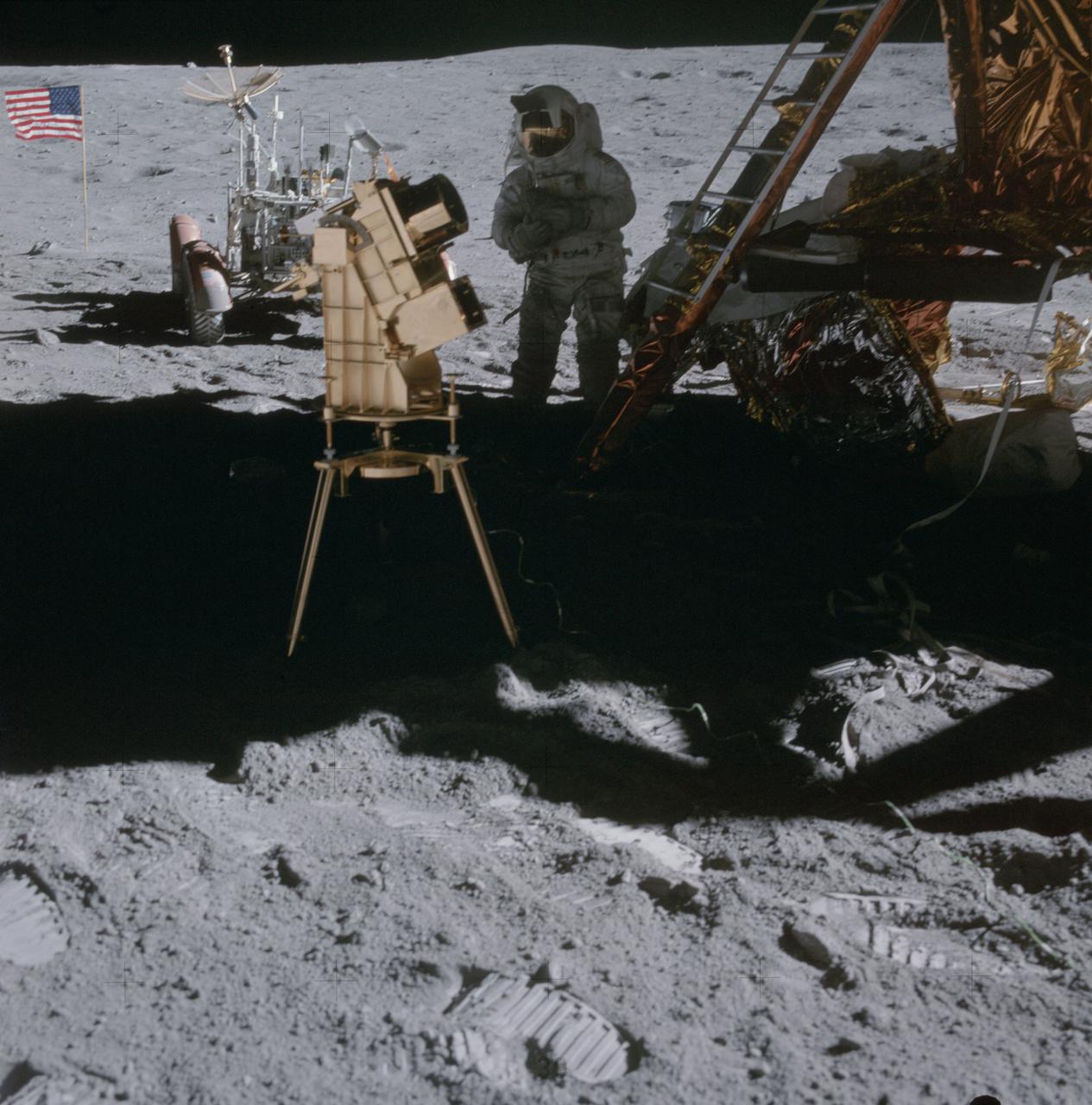
AS16-114-18439 (22 April 1972) --- Astronaut Charles M. Duke Jr., lunar module pilot, stands in the shadow of the Lunar Module (LM) behind the ultraviolet (UV) camera which is in operation. This photograph was taken by astronaut John W. Young, commander, during the mission's second extravehicular activity (EVA). The UV camera's gold surface is designed to maintain the correct temperature. The astronauts set the prescribed angles of azimuth and elevation (here 14 degrees for photography of the large Magellanic Cloud) and pointed the camera. Over 180 photographs and spectra in far-ultraviolet light were obtained showing clouds of hydrogen and other gases and several thousand stars. The United States flag and Lunar Roving Vehicle (LRV) are in the left background. While astronauts Young and Duke descended in the Apollo 16 Lunar Module (LM) "Orion" to explore the Descartes highlands landing site on the moon, astronaut Thomas K. Mattingly II, command module pilot, remained with the Command and Service Modules (CSM) "Casper" in lunar orbit.

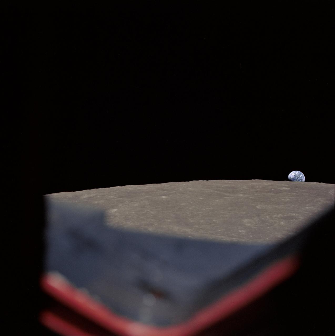
AS11-44-6549 (16-24 July 1969) --- This view from the Apollo 11 spacecraft shows Earth rising above the moon's horizon. The lunar terrain pictured is in the area of Smyth's Sea on the nearside. Coordinates of the center of the terrain are 86 degrees east longitude and 3 degrees north latitude. While astronauts Neil A. Armstrong, commander, and Edwin E. Aldrin Jr., lunar module pilot, descended in the Lunar Module (LM) "Eagle" to explore the Sea of Tranquility region of the moon, astronaut Michael Collins, command module pilot, remained with the Command and Service Modules (CSM) "Columbia" in lunar orbit.

AS11-44-6552 (16-24 July 1969) --- This view of Earth rising over the moon's horizon was taken from the Apollo spacecraft. The lunar terrain pictured is in the area of Smyth's Sea on the nearside. Coordinates of the center of the terrain are 85 degrees east longitude and 3 degrees north latitude. While astronaut Neil A. Armstrong, commander; and Edwin E. Aldrin Jr., lunar module pilot, descended in the Lunar Module (LM) "Eagle" to explore the Sea of Tranquility region of the moon, astronaut Michael Collins remained with the Command and Service Modules (CSM) "Columbia" in lunar orbit.

jsc2025e064747 --- Artemis II mission specialist Christina Koch, left, Artemis II lunar science team member Marie Henderson, Artemis II pilot Victor Glover, and Artemis II backup crew member Andre Douglas practice camera setup during crew lunar observations training at NASA's Johnson Space Center in Houston.
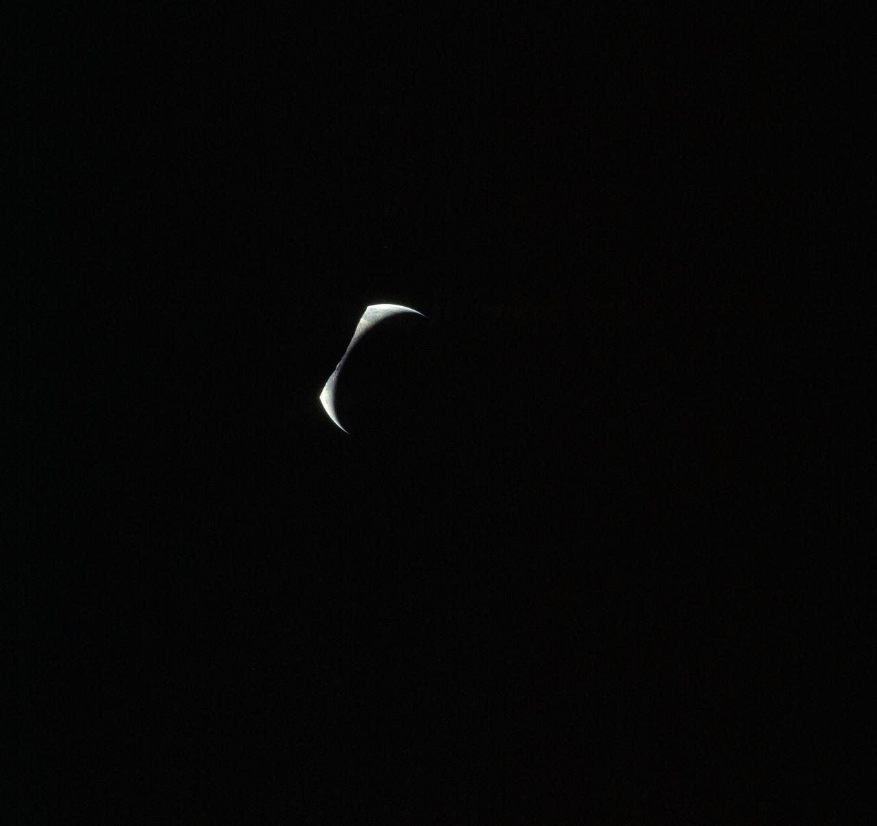
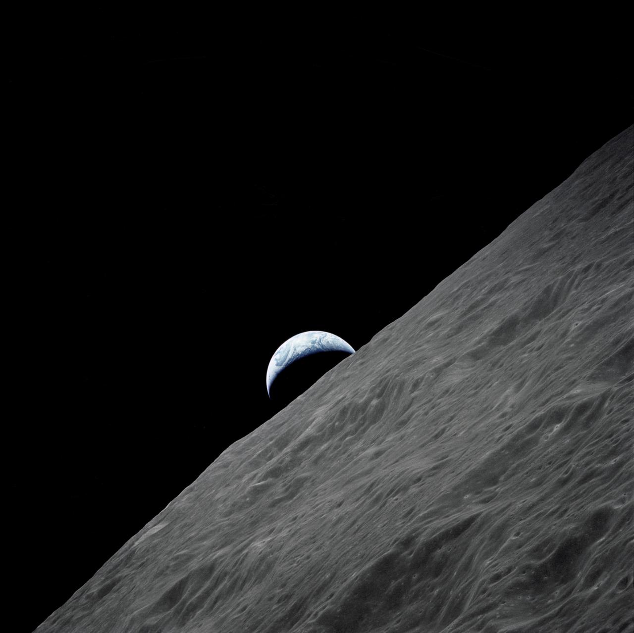
AS17-152-23279 (7-19 Dec. 1972) --- Eclipsed by the silhouetted horizon of the moon, the crescent Earth appears in the shape of a Viking's headwear in this unusual Apollo 17 photograph. The three astronauts--Eugene A. Cernan, Ronald E. Evans and Harrison H. Schmitt--were just about to begin their journey homeward following the successful lunar landing phase of their mission.
Lunar observation taken by the Expedition 39 crew aboard the ISS. An Earth limb and airglow are in view. Image was released by astronaut on Twitter.
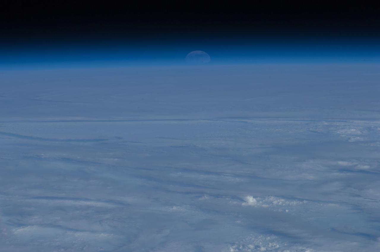
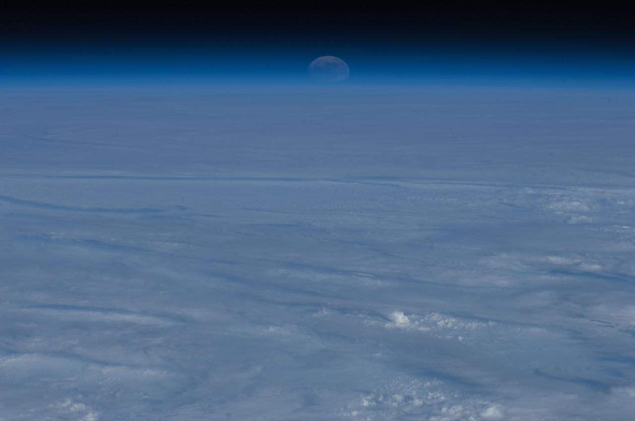
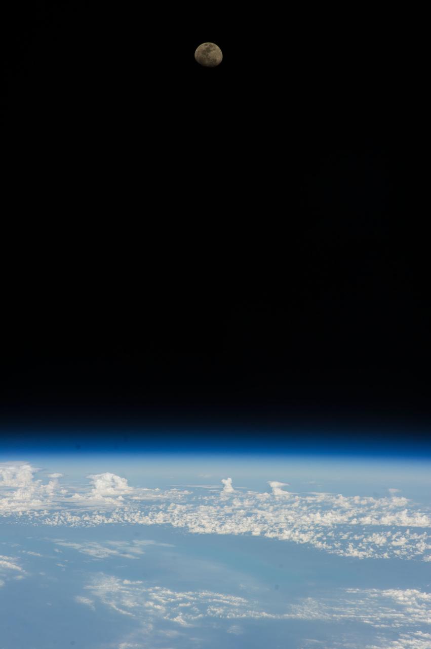
Lunar observation taken by the Expedition 35 crew aboard the ISS. An Earth limb is in view.
Lunar observation taken during moonset by the Expedition 39 crew aboard the ISS. Earth and airglow are in view. Image was released by astronaut on Twitter.
AS17-152-23274 (7-19 Dec. 1972) --- The crescent Earth rises above the lunar horizon in this spectacular photograph taken from the Apollo 17 spacecraft in lunar orbit during National Aeronautics and Space Administration's (NASA) final lunar landing mission in the Apollo program. While astronauts Eugene A. Cernan, commander, and Harrison H. Schmitt, lunar module pilot, descended in the Lunar Module (LM) "Challenger" to explore the Taurus-Littrow region of the moon, astronaut Ronald E. Evans, command module pilot, remained with the Command and Service Modules (CSM) "America" in lunar orbit.
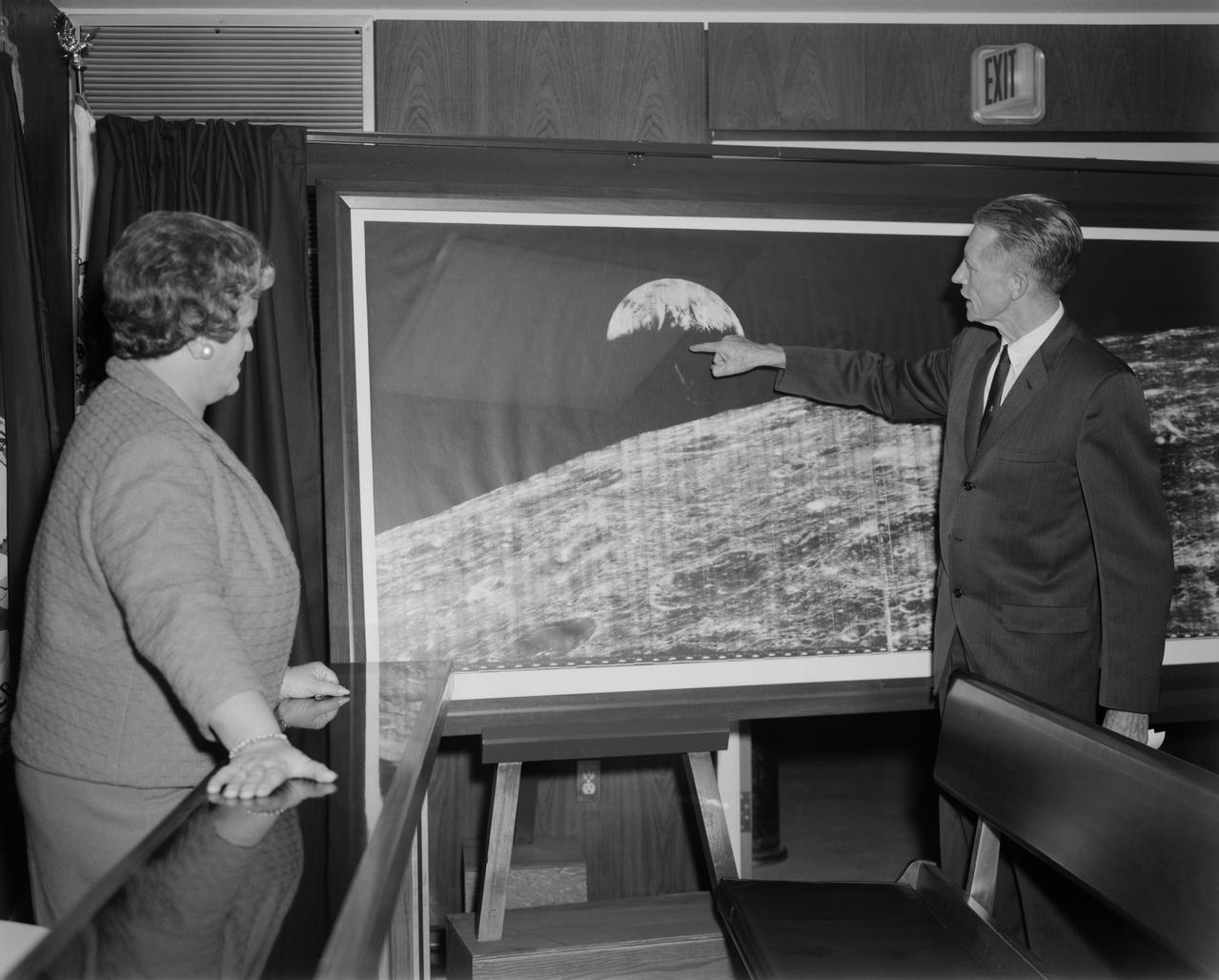
Langley Center Director Floyd Thompson shows Ann Kilgore the "picture of the century." This was the first picture of the earth taken from space. From Spaceflight Revolution: "On 23 August 1966 just as Lunar Orbiter I was about to pass behind the moon, mission controllers executed the necessary maneuvers to point the camera away from the lunar surface and toward the earth. The result was the world's first view of the earth from space. It was called "the picture of the century' and "the greatest shot taken since the invention of photography." Not even the color photos of the earth taken during the Apollo missions superseded the impact of this first image of our planet as a little island of life floating in the black and infinite sea of space." -- Published in James R. Hansen, Spaceflight Revolution: NASA Langley Research Center From Sputnik to Apollo, (Washington: NASA, 1995), pp. 345-346. Mayor Ann Kilgore was married to NASA researcher Edwin Carroll Kilgore. Mrs. Kilgore was Mayor from 1963-1971 and again from 1974-1978.