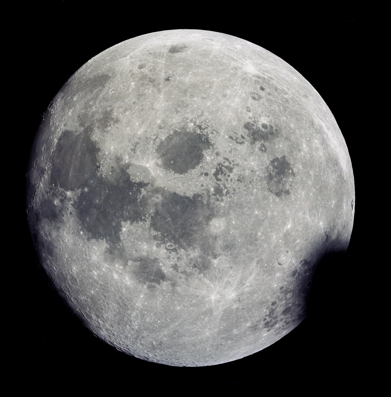
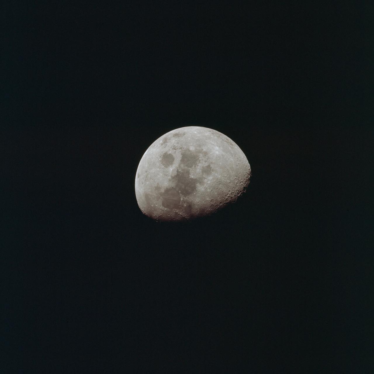
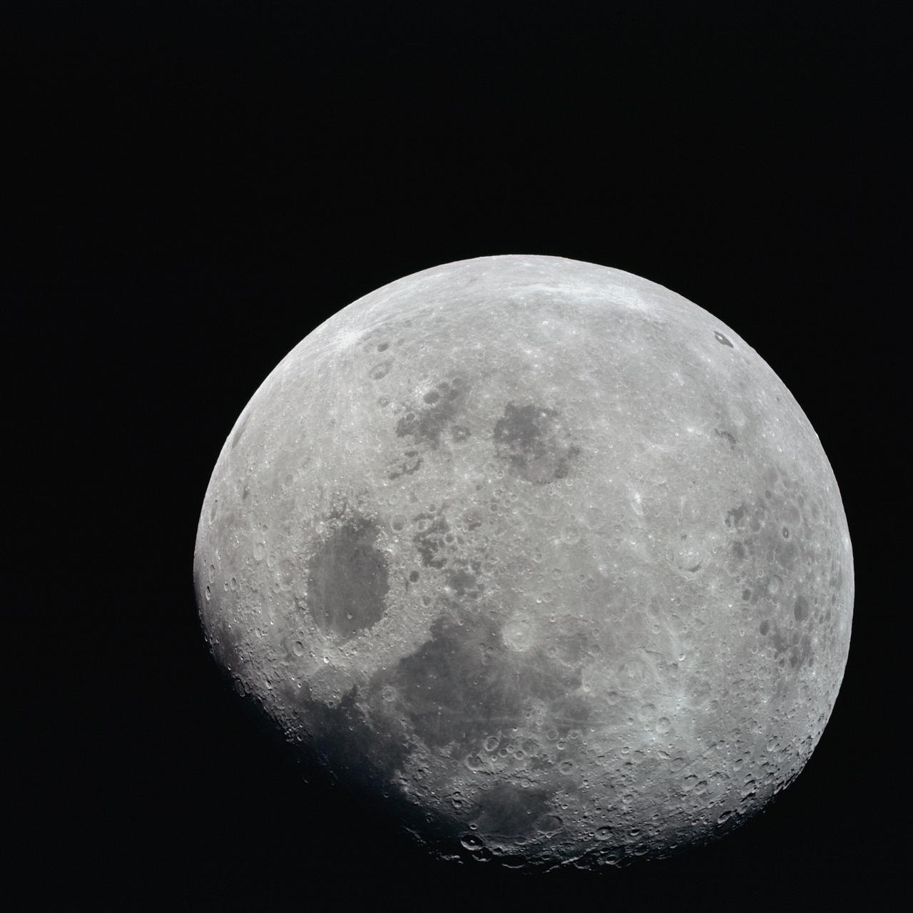
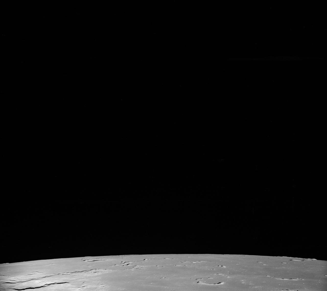
AS13-60-8703 (11-17 April 1970) --- This outstanding view of a near full moon was photographed from the Apollo 13 spacecraft during its trans-Earth journey homeward. Though the explosion of the oxygen tank in the Service Module (SM) forced the cancellation of the scheduled lunar landing, Apollo 13 made a pass around the moon prior to returning to Earth. Some of the conspicuous lunar features include the Sea of Crisis, the Sea of Fertility, the Sea of Tranquility, the Sea of Serenity, the Sea of Nectar, the Sea of Vapors, the Border Sea, Smyth's Sea, the crater Langrenus, and the crater Tsiolkovsky.
AS08-12-2192 (21-27 Dec. 1968) --- View of the lunar surface taken from the Apollo 8 spacecraft looking southward from high altitude across the Southern Sea. (Hold picture with AS8 number in upper right corner). The bright-rayed crater near the horizon is located near 130 degrees east longitude and 70 degrees south latitude. The dark-floored crater near the middle of the right side of the photograph is about 70 kilometers (45 statute miles) in diameter. Both features are beyond the eastern limb of the moon as viewed from Earth; neither has a name.
AS08-12-2193 (21-27 Dec. 1968) --- View of the lunar surface taken from the Apollo 8 spacecraft looking southward from high altitude across the Southern Sea. (Hold picture with AS8 number in upper right corner). The bright-rayed crater near the horizon is located near 130 degrees east longitude and 70 degrees south latitude. The dark-floored crater near the middle of the right side of the photograph is about 70 kilometers (45 statute miles) in diameter. Both features are beyond the eastern limb of the moon as viewed from Earth; neither has a name.
AS08-12-2209 (21-27 Dec. 1968) --- High altitude oblique view of the lunar surface, looking northeastward, as seen from the Apollo 8 spacecraft. The crater Joliot-Curie, about 175 kilometers in diameter and centered near 94 degrees east longitude and 27 degrees north latitude, is near the center of the left side of this photograph. The bright rayed crater near the horizon is probably located near 105 degrees east longitude and 45 degrees north latitude. Long, narrow rays that have been reported in the polar region of Earth facing hemisphere may radiate from this crater.
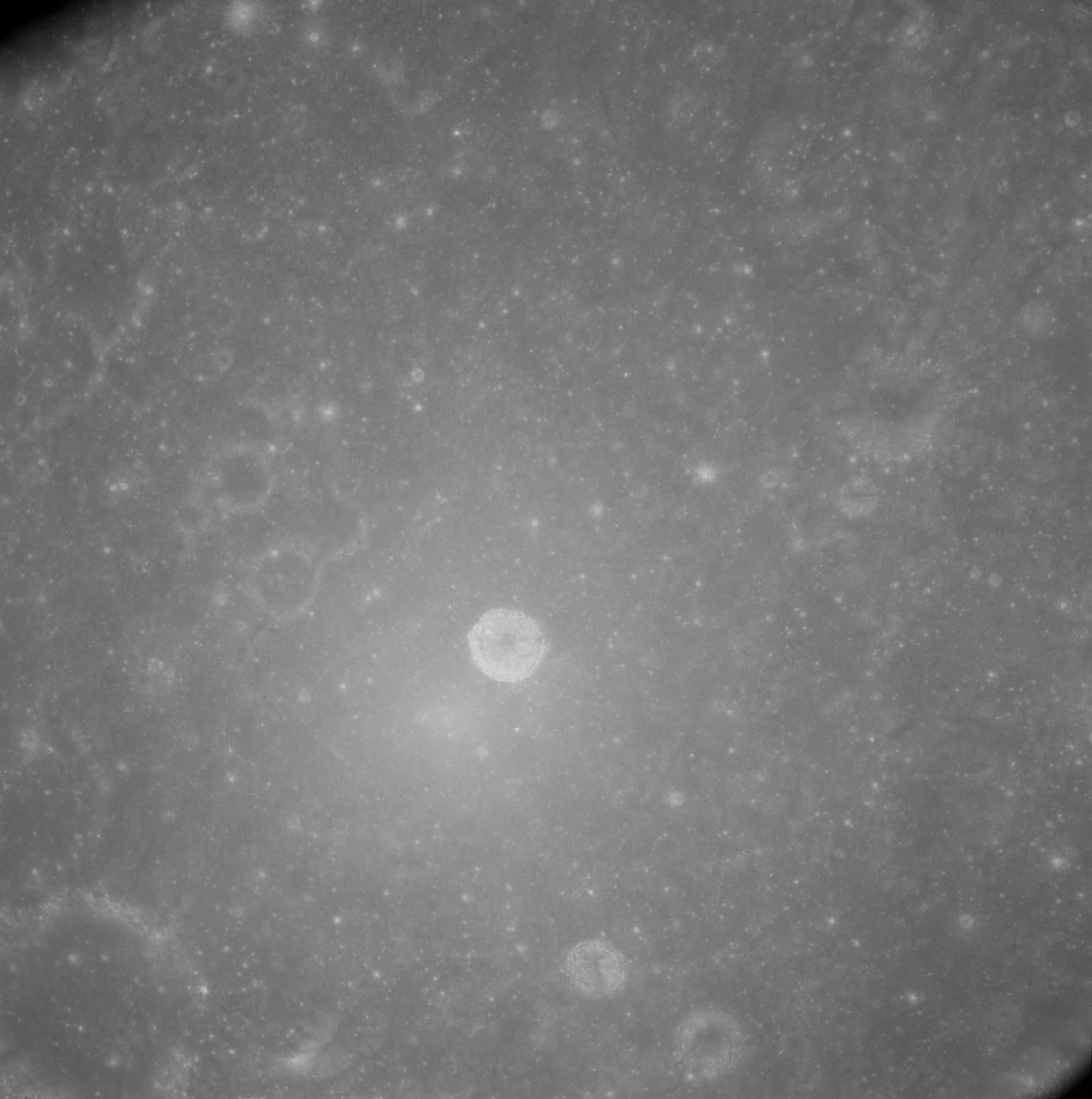
AS08-12-2148 (21-27 Dec. 1968) --- View of the lunar surface as photographed from the Apollo 8 spacecraft. Zero-phase bright spot. With near-vertical sun illumination, topographical detail is washed out and differences in surface brightness are accentuated. The numerous small bright-halo craters become conspicuous. A few larger craters have extremely bright inner walls that are commonly streaked by darker material. The bright glow near the conspicuous bright-walled crater is a halo that surrounds the position of the spacecraft shadow.
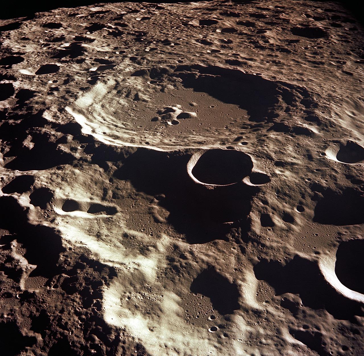
AS08-12-2052 (21-27 Dec. 1968) --- This near-vertical photograph from the Apollo 8 spacecraft covers an area of approximately 50 x 50 statute miles within a 250-statute-miles-in-diameter crater on the lunar farside. The center of this large crater is located at about 157 degrees west longitude and 4 degrees south latitude. The large crater in the center of the picture is about 20 statute miles in diameter.
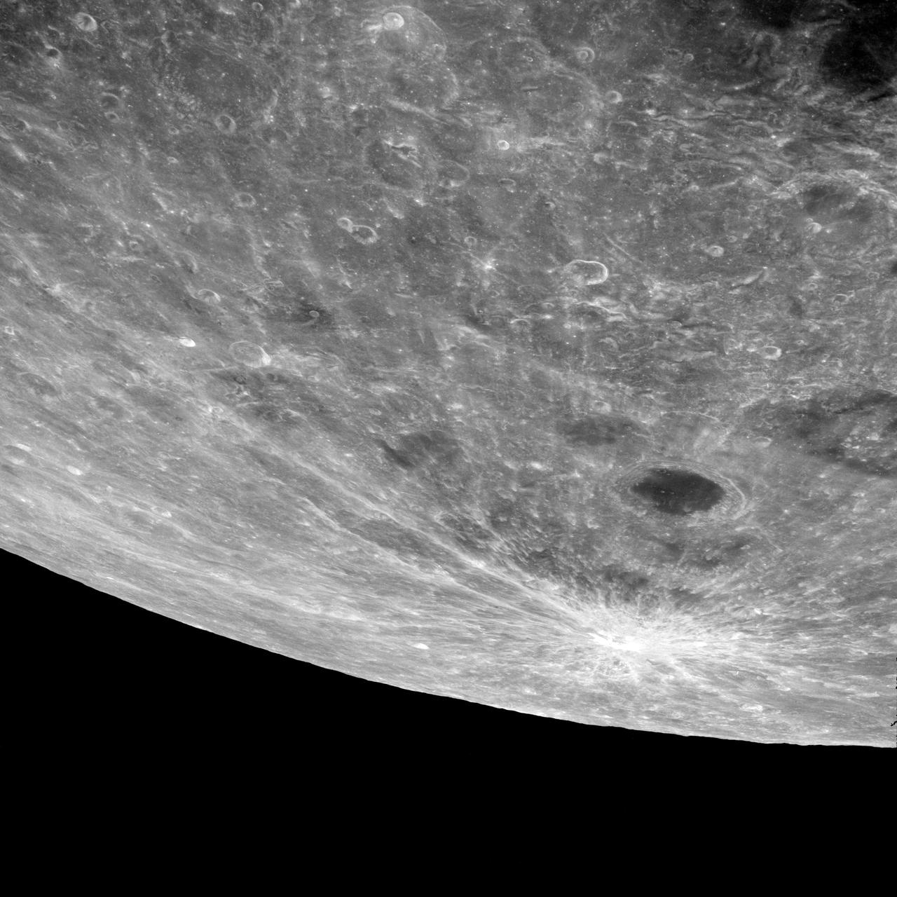
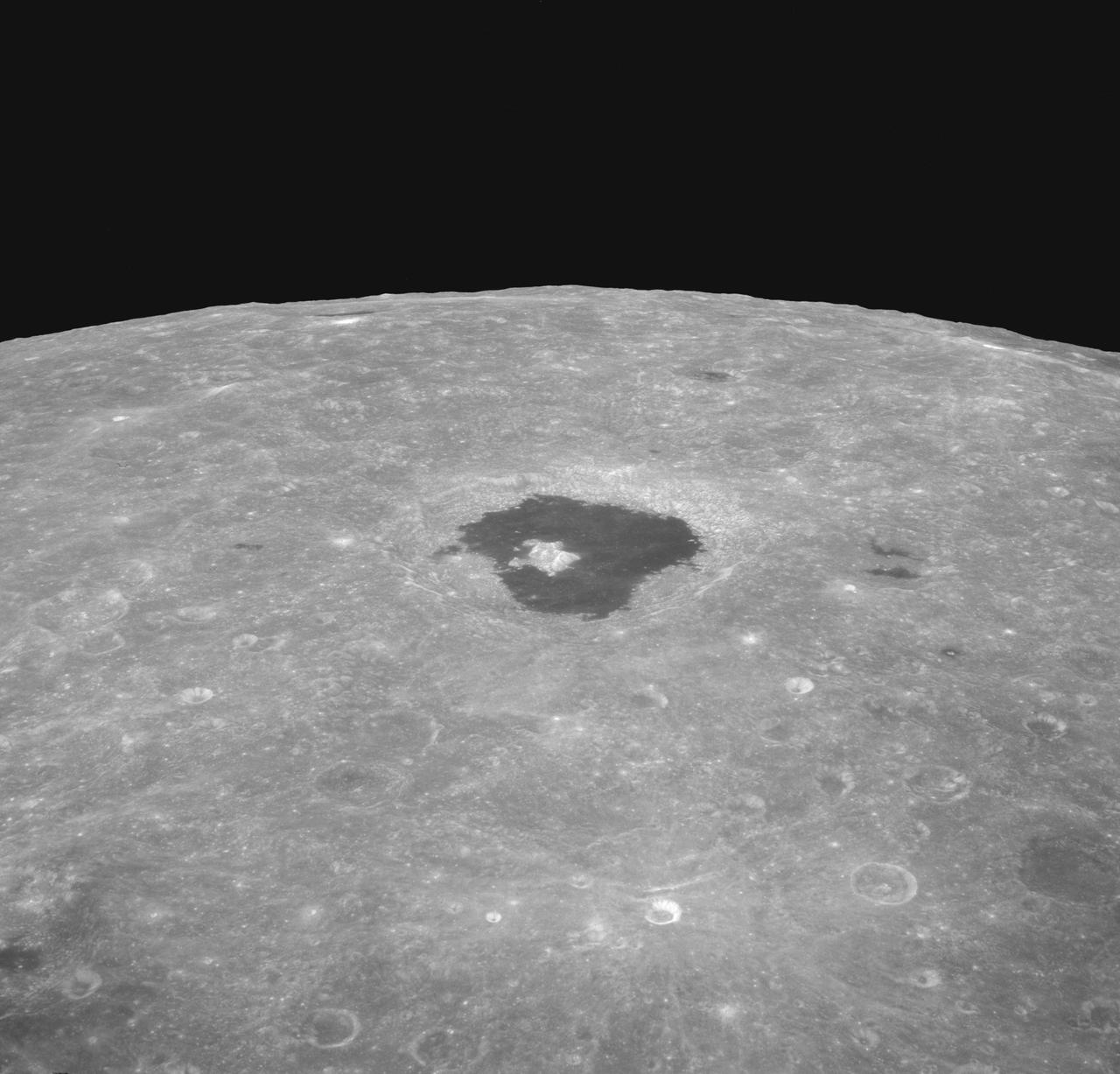
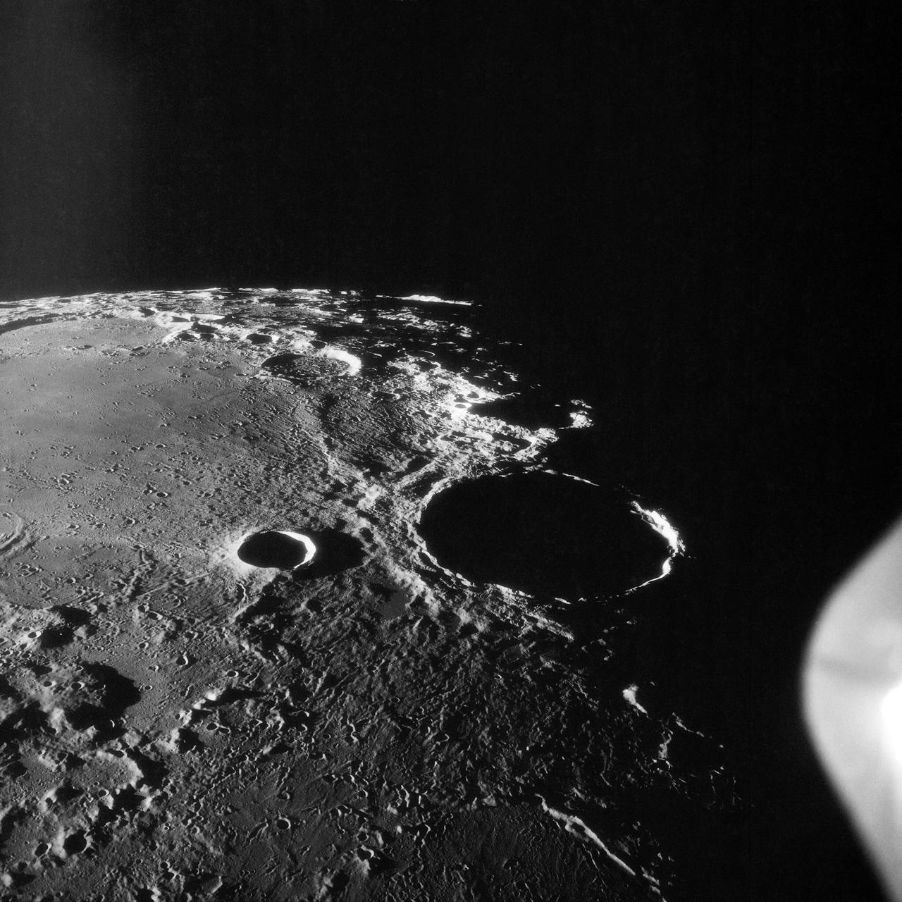
AS8-17-2704 (21-27 Dec. 1968) --- Near vertical view of the lunar farside as photographed from the Apollo 8 spacecraft. This crater, which is about 22 statute miles in diameter, is located at 167 degrees east longitude and 11 degrees south latitude. This crater is located on the eastern edge of a much larger unnamed crater which is about 90 statute miles in diameter.
AS08-13-2344 (21-27 Dec. 1968) --- This oblique photograph looks generally northwest from the Apollo 8 spacecraft into the Sea of Tranquility. (HOLD PICTURE WITH LARGE TRIANGLE FORMED BY DARK SKY AT UPPER LEFT). The three prominent craters are Taruntius F in the lower right corner; Taruntius E in the center; and Cauchy between the two linear features. The Cauchy scarp, this side of the Cauchy crater, is formed by one to three faults stepped down toward the spacecraft. Cauchy Rille, on the other side of Cauchy crater, consists of several arcuate segments of a graben. Each of the three prominent craters is 10 to 15 kilometers (6 to 9 statute miles) across.

AS08-14-2383 (24 Dec. 1968) --- The rising Earth is about five degrees above the lunar horizon in this telephoto view taken from the Apollo 8 spacecraft near 110 degrees east longitude. The horizon, about 570 kilometers (350 statute miles) from the spacecraft, is near the eastern limb of the moon as viewed from Earth. Width of the view at the horizon is about 150 kilometers (95 statute miles). On Earth 240,000 statute miles away the sunset terminator crosses Africa. The crew took the photo around 10:40 a.m. Houston time on the morning of Dec. 24, and that would make it 15:40 GMT on the same day. The South Pole is in the white area near the left end of the terminator. North and South America are under the clouds.
AS08-12-2196 (21-27 Dec. 1968) --- An oblique view from the Apollo 8 spacecraft looking eastward across the lunar surface from about 115 degrees east longitude to the horizon near 180 degrees east longitude. The crater Tsiolkovsky in the center of the picture is 150 kilometers wide and is located at 129 degrees east longitude and 21 degrees south latitude. While in lunar orbit, Apollo 8 moved toward the camera position over the terrain along the left (north) side of this photograph.
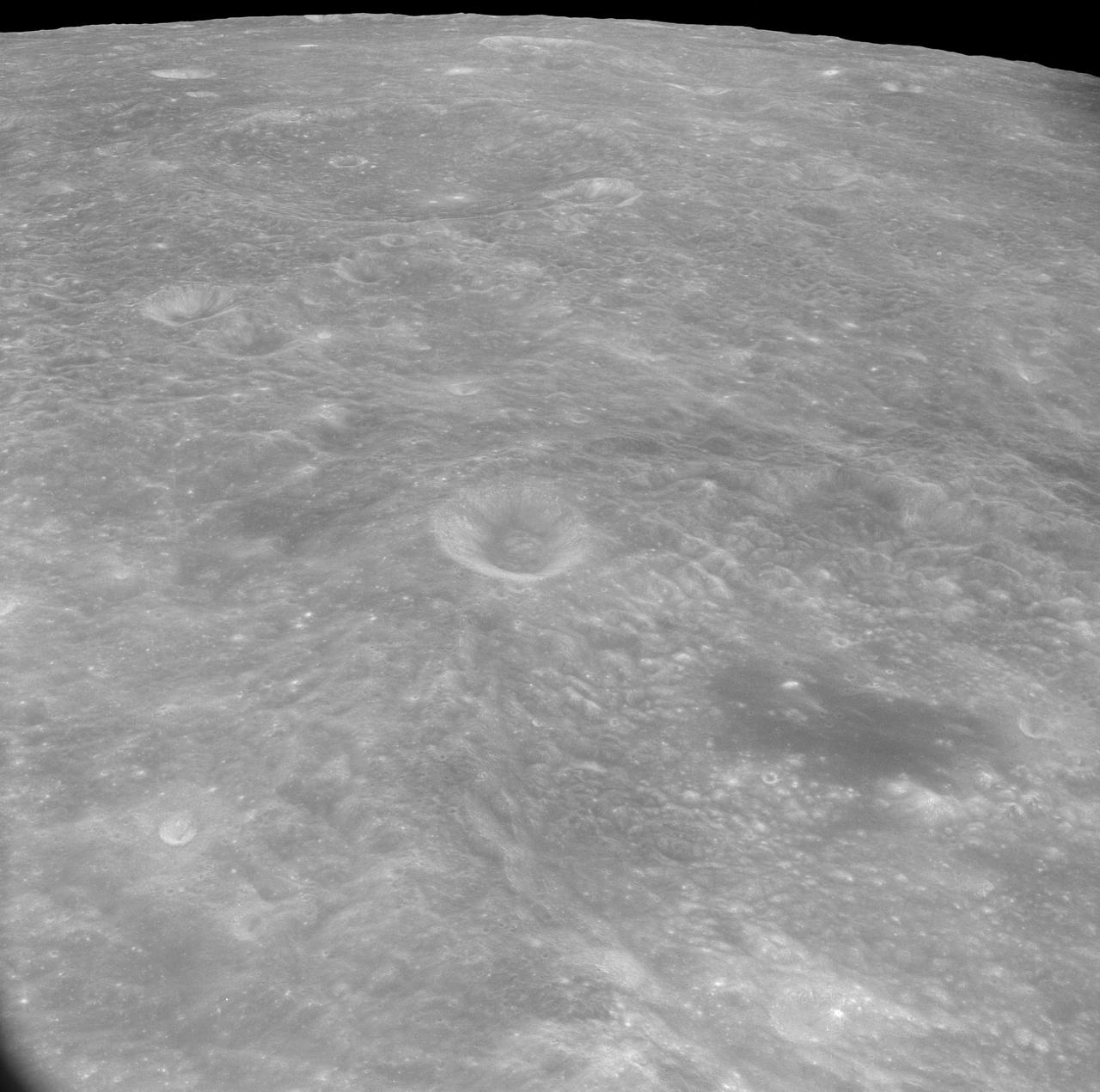
AS8-17-2744 (21-27 Dec. 1968) --- Oblique view of the lunar surface taken from the Apollo 8 spacecraft looking westward showing typical lunar farside terrain. (HOLD PICTURE SO THAT DARK IRREGULAR AREA SURROUNDED BY LIGHT SPOTS IS IN THE LOWER RIGHT QUARTER). The sharp crater near the center of then scene is near 117 degrees east longitude and 5 degrees south latitude; and it is 25 kilometers (15 statute miles) in diameter. That crater is on the rim of a large crater that occupies the lower right quarter of the photograph.
AS08-13-2225 (21-27 Dec. 1968) --- This photograph was taken from the Apollo 8 spacecraft with long-focal length lens, looking south at the large crater Goclenius, which is in foreground. Hold picture with Goclenius at bottom center. The three clustered craters are Magelhaens, Magelhaens A, and Colombo A. The crater at upper right is Gutenberg D. The crater Goclenius is located at 10 degrees south latitude, 45 degrees east longitude, and it is approximately 40 statute miles in diameter.
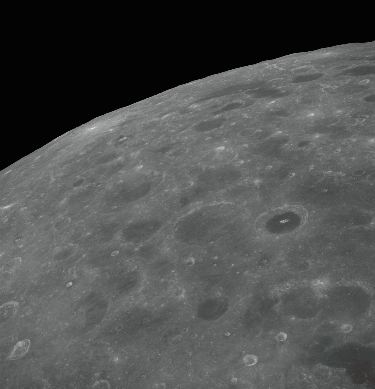
AS08-17-2670 (21-27 Dec. 1968) --- Near vertical view of the lunar farside as photographed from the Apollo 8 spacecraft. The center of the picture is located approximately at 162 degrees west longitude and 6 degrees south latitude.
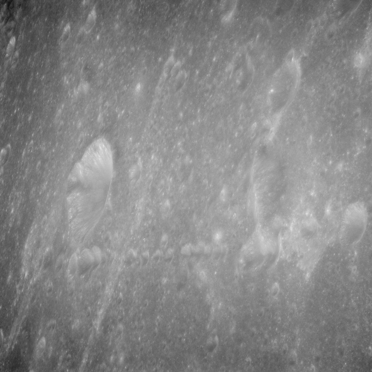
AS08-13-2327 (21-27 Dec. 1968) --- A brightly-rayed crater on the farside of the moon near the sub solar point, where the sun was directly overhead, as seen from the Apollo 8 spacecraft. (HOLD PICTURE WITH THE CRATER SLIGHTLY TO THE UPPER RIGHT). Brightly-rayed craters are numerous on the lunar front side; however, they have not been previously observed in such detail on the farside.
AS10-27-3956 (24 May 1969) --- This photograph of the moon was taken after trans-Earth insertion when the Apollo 10 spacecraft was high above the lunar equator near 27 degrees east longitude. North is about 20 degrees left of the top of the photograph. Apollo Landing Site 3 is on the lighted side of the terminator in a dark area just north of the equator. Apollo Landing Site 2 is near the lower left margin of the Sea of Tranquility (Mare Tranquillitatis), which is the large, dark area near the center of the photograph.
AS8-14-2392 (21-27 Dec. 1968) --- High-oblique view of the moon's surface showing Earth rising above the lunar horizon, looking west-southwest, as photographed from the Apollo 8 spacecraft as it orbited the moon. The center of the picture is located at about 105 degrees east longitude and 13 degrees south latitude. The lunar surface probably has less pronounced color than indicated by this print.
S68-55816 (24 Dec. 1968) --- This is how the surface of the moon looked from an altitude of approximately 60 miles as photographed by a television camera aboard the Apollo 8 spacecraft. This is Apollo 8's third live television transmission back to Earth. At the time this picture was made, the Apollo 8 spacecraft, with astronauts Frank Borman, James A. Lovell Jr., and William A. Anders aboard, was making its second revolution of the moon.
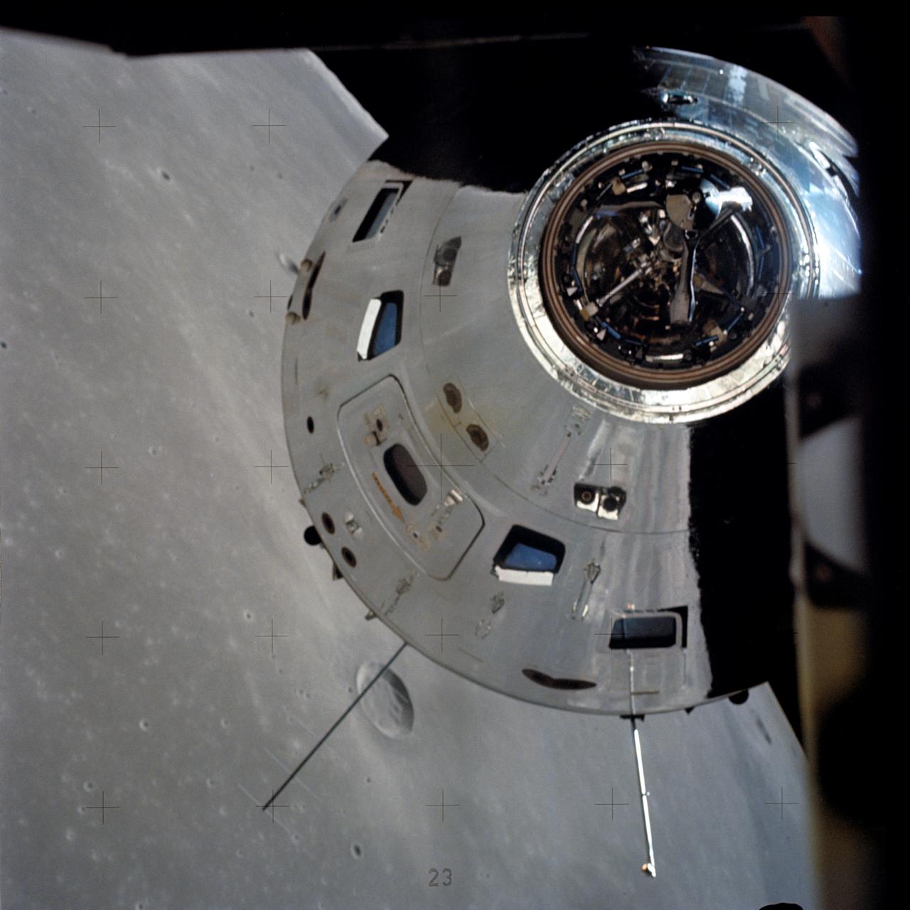
AS17-145-22273 (7-19 Dec. 1972) --- In this view, taken from the Lunar Module (LM), the Command and Service Module (CSM) are seen preparing to rendezvous with the LM. Note the reflection of the lunar surface on the CSM. The CSM, is piloted by Ronald E. Evans; while astronauts Eugene A. Cernan, commander; and Harrison W. Schmitt, lunar module pilot, are onboard the LM, following their extravehicular activities (EVA) on the moon's surface. While astronauts Cernan and Schmitt descended in the LM "Challenger" to explore the Taurus-Littrow region of the moon, astronaut Evans remained with the CSM "America" in lunar orbit.
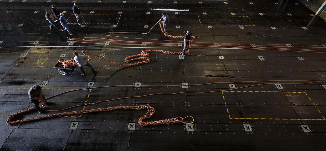
Members of NASA’s Landing and Recovery team clean up after completing the days activities during Underway Recovery Test-12 onboard USS Somerset off the coast of California, Saturday, March 29, 2025. During the test, NASA and Department of Defense teams are practicing to ensure recovery procedures are validated as NASA plans to send the Artemis II astronauts around the Moon and splashdown in the Pacific Ocean. Photo Credit: (NASA/Joel Kowsky)
Members of NASA’s Landing and Recovery team clean up after completing the days activities during Underway Recovery Test-12 onboard USS Somerset off the coast of California, Saturday, March 29, 2025. During the test, NASA and Department of Defense teams are practicing to ensure recovery procedures are validated as NASA plans to send the Artemis II astronauts around the Moon and splashdown in the Pacific Ocean. Photo Credit: (NASA/Joel Kowsky)
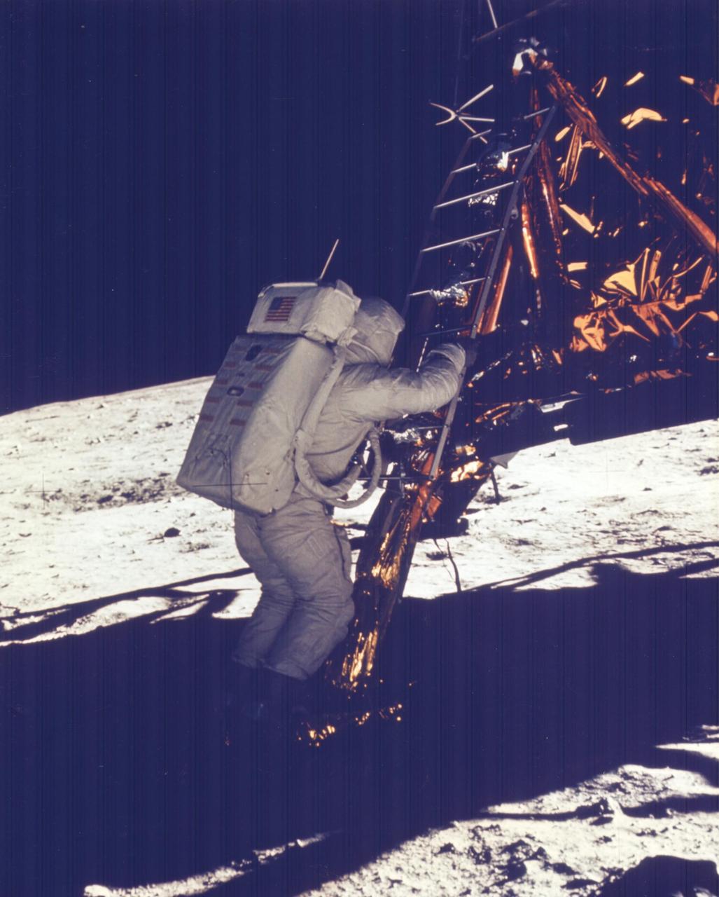
JOHNSON SPACE CENTER, HOUSTON, TEXAS - Apollo 11 Onboard Film -- Astronaut Edwin E. Aldrin Jr., Lunar Module (LM) pilot, descends the steps of the Lunar module ladder as he prepares to walk on the Moon. He had just egressed the LM. This picture was taken by astronaut Neil A. Armstrong, commander, with a 70-mm lunar surface camera during the Apollo 11 extravehicular activity.
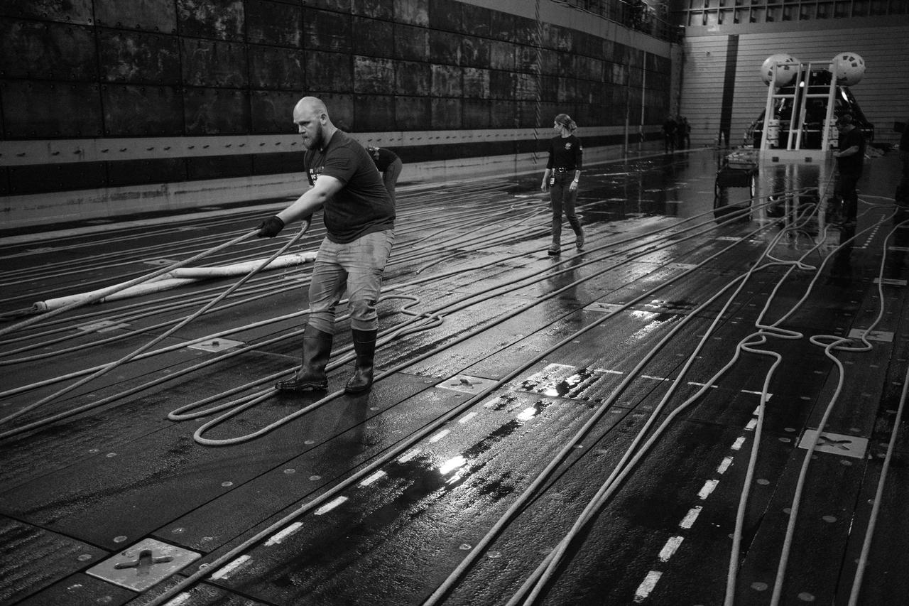
Teams clean up after completing the days activities during Underway Recovery Test-12 onboard USS Somerset, Wednesday, March 26, 2025. During the test, NASA and Department of Defense teams are practicing to ensure recovery procedures are validated as NASA plans to send the Artemis II astronauts around the Moon and splashdown in the Pacific Ocean. Photo Credit: (NASA/Joel Kowsky)
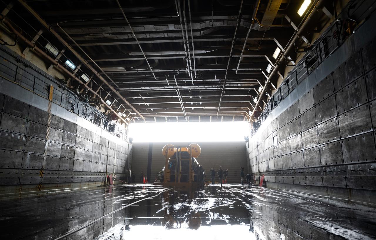
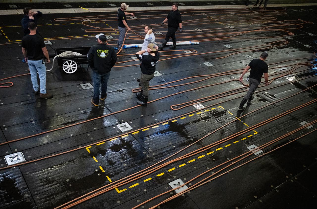
Teams work around the Crew Module Test Article (CMTA), a full scale mockup of the Orion spacecraft, as it sits nestled in its cradle following the completion of the days activities as part of Underway Recovery Test-12 onboard USS Somerset, Wednesday, March 26, 2025. During the test, NASA and Department of Defense teams are practicing to ensure recovery procedures are validated as NASA plans to send the Artemis II astronauts around the Moon and splashdown in the Pacific Ocean. Photo Credit: (NASA/Joel Kowsky)
AS08-17-2814 (21-27 Dec. 1968) --- This oblique view of the lunar surface taken from the Apollo 8 spacecraft looking westward across the Sea of Fertility into the Sea of Tranquility shows the terrain the astronauts will see as the approach Apollo Landing Site East 2. The landing site is at the horizon about one-third of the distance from the left to the right photograph margin. The prominent crater in the highlands near the center of the picture is Secchi, about 25 kilometers (15 statute miles) in diameter.
AS11-43-6412 (July 1969) --- This is a northeasterly, low-oblique view of an unmanned crater and highland area on the lunar farside, as photographed from Apollo 11. The center of the picture is located at the 167 degrees east longitude and 6 degrees north latitude. This area of the moon lies just east of International Astronomical Union crater No. 220.
AS11-43-6439 (July 1969) --- An Apollo 11 oblique view of the lunar farside. The linear group of small craters is located within the large International Astronomical Union crater No. IX, and is centered at 139.5 degrees east longitude and 7 degrees north latitude. The absence of shadows is due to the high sun angle. The crater chain is approximately 34 statute miles in length, and the large crater adjacent to the crater is 10.5 statute miles in diameter.

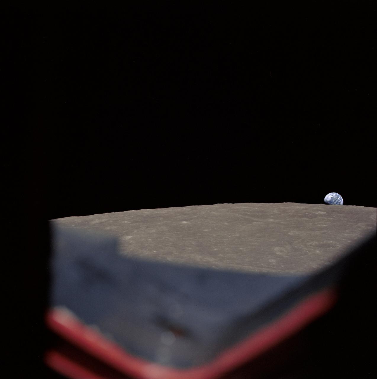
AS11-44-6549 (16-24 July 1969) --- This view from the Apollo 11 spacecraft shows Earth rising above the moon's horizon. The lunar terrain pictured is in the area of Smyth's Sea on the nearside. Coordinates of the center of the terrain are 86 degrees east longitude and 3 degrees north latitude. While astronauts Neil A. Armstrong, commander, and Edwin E. Aldrin Jr., lunar module pilot, descended in the Lunar Module (LM) "Eagle" to explore the Sea of Tranquility region of the moon, astronaut Michael Collins, command module pilot, remained with the Command and Service Modules (CSM) "Columbia" in lunar orbit.
AS11-42-6285 (July 1969) --- An Apollo 11 view of a bright rayed crater on the lunar farside. The crater is unnamed. The center of this photograph is located at 100 degrees southeast longitude and 4 degrees 30 minutes north latitude. This area is just east of Smyth's Sea.

AS11-44-6552 (16-24 July 1969) --- This view of Earth rising over the moon's horizon was taken from the Apollo spacecraft. The lunar terrain pictured is in the area of Smyth's Sea on the nearside. Coordinates of the center of the terrain are 85 degrees east longitude and 3 degrees north latitude. While astronaut Neil A. Armstrong, commander; and Edwin E. Aldrin Jr., lunar module pilot, descended in the Lunar Module (LM) "Eagle" to explore the Sea of Tranquility region of the moon, astronaut Michael Collins remained with the Command and Service Modules (CSM) "Columbia" in lunar orbit.
AS08-14-2506 (21-27 Dec. 1968) --- This photograph of a nearly full moon was taken from the Apollo 8 spacecraft at a point above 70 degrees east longitude. (Hold picture with moon's dark portion at left). Mare Crisium, the circular, dark-colored area near the center, is near the eastern edge of the moon as viewed from Earth. Mare Nectaris is the circular mare near the terminator. The large, irregular maira are Tranquillitatis and Fecunditatis. The terminator at left side of picture crosses Mare Tranquillitatis and highlands to the south. Lunar farside features occupy most of the right half of the picture. The large, dark-colored crater Tsiolkovsky is near the limb at the lower right. Conspicuous bright rays radiate from two large craters, one to the north of Tsiolkovsky, the other near the limb in the upper half of the picture. These rayed craters were not conspicuous in Lunar Orbiter photography due to the low sun elevations when the Lunar Orbiter photography was made. The crater Langrenus is near the center of the picture at the eastern edge of Mare Fecunditatis. The lunar surface probably has less pronounced color that indicated by this print.
AS11-42-6248 (July 1969) --- An Apollo 11 oblique view of the lunar farside in the area of International Astronomical Union crater No. 312, which is about 30 statute miles in diameter. The center of the photograph is located at 164 degrees west longitude and 8 degrees south latitude. The sharp shadows indicate that the picture was taken at a low sun angle.
AS08-17-2821 (21-27 Dec. 1968) --- This oblique view of the lunar surface taken from the Apollo 8 spacecraft looking westward across the Sea of Tranquility shows Apollo Landing Site East 2 illuminated by a sun that is six to eight degrees above the eastern horizon. The landing site is on the dark gray, smooth surface of the Sea of Tranquility and north (to the right) of the bright highland terrain at the lower left corner of the photograph. The landing site is about four tenths of the distance from the left to right margin of the photograph.
AS11-42-6237 (20 July 1969) --- An Apollo 11 oblique view of the large crater Theophilus located at the northwest edge of the Sea of Nectar on the lunar nearside. Theophilus is about 60 statute miles in diameter. The smooth area is Mare Nectaris. The smaller crater Madler, about 14 statute miles in diameter, is located to the east of Theophilus. Visible in the background are the large crater Fracastorius and the smaller crater Beaumont. The coordinates of the center of this photograph are 29 degrees east longitude and 11 degrees south latitude.
AS11-43-6422 (July 1969) --- An Apollo 11 oblique view of the lunar farside. These two odd-shaped craters are located midway between International Astronomical Union craters 218 and 220, and are centered at 155 degrees east longitude and 3 degrees north latitude. The craters total approximately 13.5 statute miles in length and 7.5 statute miles in width at their widest point.
AS11-44-6609 (16-24 July 1969) --- An oblique of the Crater Daedalus on the lunar farside as seen from the Apollo 11 spacecraft in lunar orbit. The view looks southwest. Daedalus (formerly referred to as I.A.U. Crater No. 308) is located at 179 degrees east longitude and 5.5 degrees south latitude. Daedalus has a diameter of about 50 statute miles. This is a typical scene showing the rugged terrain on the farside of the moon. While astronauts Neil A. Armstrong, commander, and Edwin E. Aldrin Jr., lunar module pilot, descended in the Lunar Module (LM) "Eagle" to explore the Sea of Tranquility region of the moon, astronaut Michael Collins, command module pilot, remained with the Command and Service Modules (CSM) "Columbia" in lunar orbit.
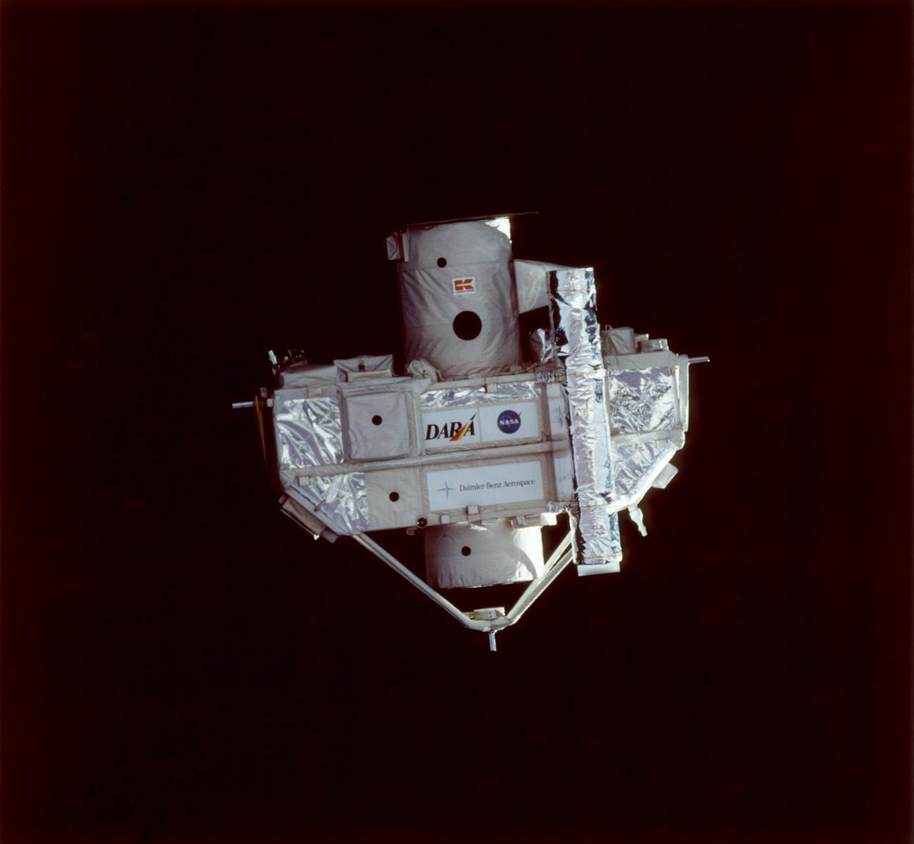
This STS-80 onboard photograph shows the Orbiting Retrievable Far and Extreme Ultraviolet Spectrometer-Shuttle Pallet Satellite II (ORFEUS-SPAS II), photographed during approach by the Space Shuttle Orbiter Columbia for retrieval. Built by the German Space Agency, DARA, the ORFEUS-SPAS II, a free-flying satellite, was dedicated to astronomical observations at very short wavelengths to: investigate the nature of hot stellar atmospheres, investigate the cooling mechanisms of white dwarf stars, determine the nature of accretion disks around collapsed stars, investigate supernova remnants, and investigate the interstellar medium and potential star-forming regions. Some 422 observations of almost 150 astronomical objects were completed, including the Moon, nearby stars, distant Milky Way stars, stars in other galaxies, active galaxies, and quasar 3C273. The STS-80 mission was launched November 19, 1996.
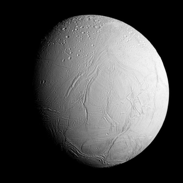
NASA's Cassini spacecraft captured this view as it neared icy Enceladus for its closest-ever dive past the moon's active south polar region. The view shows heavily cratered northern latitudes at top, transitioning to fractured, wrinkled terrain in the middle and southern latitudes. The wavy boundary of the moon's active south polar region -- Cassini's destination for this flyby -- is visible at bottom, where it disappears into wintry darkness. This view looks towards the Saturn-facing side of Enceladus. North on Enceladus is up and rotated 23 degrees to the right. The image was taken in visible light with the Cassini spacecraft narrow-angle camera on Oct. 28, 2015. The view was acquired at a distance of approximately 60,000 miles (96,000 kilometers) from Enceladus and at a Sun-Enceladus-spacecraft, or phase, angle of 45 degrees. Image scale is 1,896 feet (578 meters) per pixel. The Cassini mission is a cooperative project of NASA, ESA (the European Space Agency) and the Italian Space Agency. The Jet Propulsion Laboratory, a division of the California Institute of Technology in Pasadena, manages the mission for NASA's Science Mission Directorate, Washington. The Cassini orbiter and its two onboard cameras were designed, developed and assembled at JPL. The imaging operations center is based at the Space Science Institute in Boulder, Colorado. For more information about the Cassini-Huygens mission visit http://saturn.jpl.nasa.gov and http://www.nasa.gov/cassini. The Cassini imaging team homepage is at http://ciclops.org.
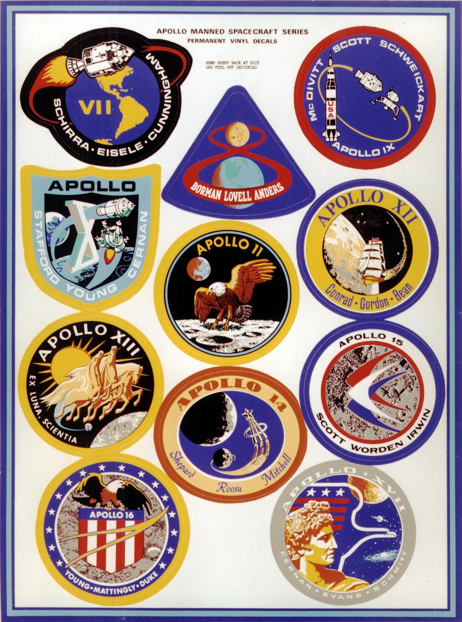
This montage depicts the flight crew patches for the manned Apollo 7 thru Apollo 17 missions. The Apollo 7 through 10 missions were basically manned test flights that paved the way for lunar landing missions. Primary objectives met included the demonstration of the Command Service Module (CSM) crew performance; crew/space vehicle/mission support facilities performance and testing during a manned CSM mission; CSM rendezvous capability; translunar injection demonstration; the first manned Apollo docking, the first Apollo Extra Vehicular Activity (EVA), performance of the first manned flight of the lunar module (LM); the CSM-LM docking in translunar trajectory, LM undocking in lunar orbit, LM staging in lunar orbit, and manned LM-CSM docking in lunar orbit. Apollo 11 through 17 were lunar landing missions with the exception of Apollo 13 which was forced to circle the moon without landing due to an onboard explosion. The craft was,however, able to return to Earth safely. Apollo 11 was the first manned lunar landing mission and performed the first lunar surface EVA. Landing site was the Sea of Tranquility. A message for mankind was delivered, the U.S. flag was planted, experiments were set up and 47 pounds of lunar surface material was collected for analysis back on Earth. Apollo 12, the 2nd manned lunar landing mission landed in the Ocean of Storms and retrieved parts of the unmanned Surveyor 3, which had landed on the Moon in April 1967. The Apollo Lunar Surface Experiments Package (ALSEP) was deployed, and 75 pounds of lunar material was gathered. Apollo 14, the 3rd lunar landing mission landed in Fra Mauro. ALSEP and other instruments were deployed, and 94 pounds of lunar materials were gathered, using a hand cart for first time to transport rocks. Apollo 15, the 4th lunar landing mission landed in the Hadley-Apennine region. With the first use of the Lunar Roving Vehicle (LRV), the crew was bale to gather 169 pounds of lunar material. Apollo 16, the 5th lunar landing mission, landed in the Descartes Highlands for the first study of highlands area. Selected surface experiments were deployed, the ultraviolet camera/spectrograph was used for first time on the Moon, and the LRV was used for second time for a collection of 213 pounds of lunar material. The Apollo program came to a close with Apollo 17, the 6th and final manned lunar landing mission that landed in the Taurus-Littrow highlands and valley area. This mission hosted the first scientist-astronaut, Schmitt, to land on the Moon. The 6th automated research station was set up, and 243 ponds of lunar material was gathered using the LRV.
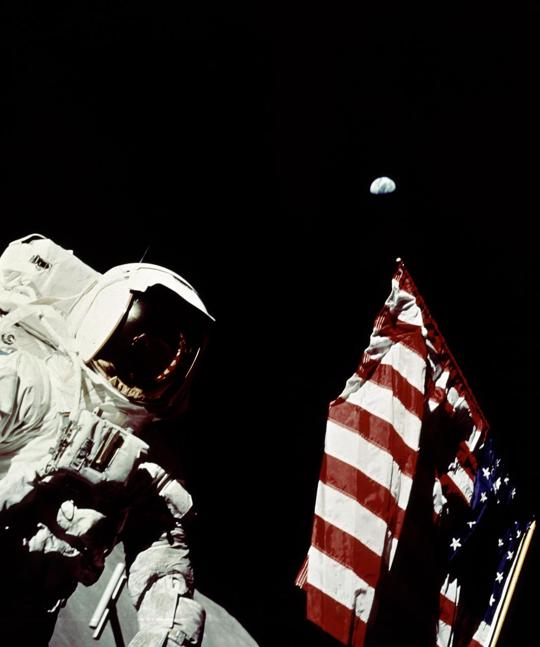
In this Apollo 17 onboard photo, Mission Commander Eugene A. Cernan adjusts the U.S. flag deployed upon the Moon. The seventh and last manned lunar landing and return to Earth mission, the Apollo 17, carrying a crew of three astronauts: Cernan; Lunar Module pilot Harrison H. Schmitt; and Command Module pilot Ronald E. Evans, lifted off on December 7, 1972 from the Kennedy Space Flight Center (KSC). Scientific objectives of the Apollo 17 mission included geological surveying and sampling of materials and surface features in a preselected area of the Taurus-Littrow region, deploying and activating surface experiments, and conducting in-flight experiments and photographic tasks during lunar orbit and transearth coast (TEC). These objectives included: Deployed experiments such as the Apollo lunar surface experiment package (ALSEP) with a Heat Flow experiment, Lunar seismic profiling (LSP), Lunar surface gravimeter (LSG), Lunar atmospheric composition experiment (LACE) and Lunar ejecta and meteorites (LEAM). The mission also included Lunar Sampling and Lunar orbital experiments. Biomedical experiments included the Biostack II Experiment and the BIOCORE experiment. The mission marked the longest Apollo mission, 504 hours, and the longest lunar surface stay time, 75 hours, which allowed the astronauts to conduct an extensive geological investigation. They collected 257 pounds (117 kilograms) of lunar samples with the use of the Marshall Space Flight Center developed LRV. The mission ended on December 19, 1972