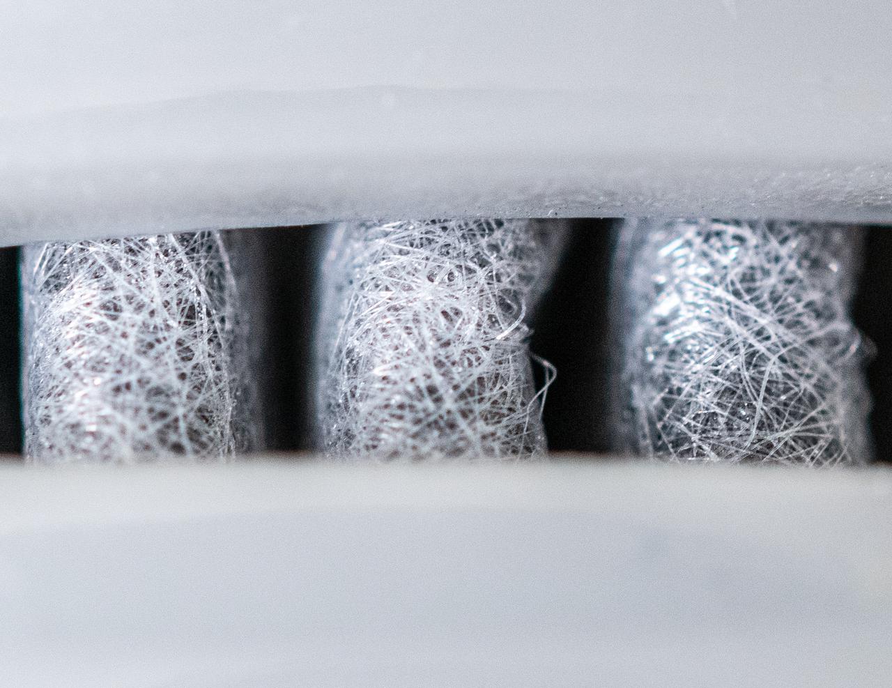
Spin Offs Macro Series - Water Filter
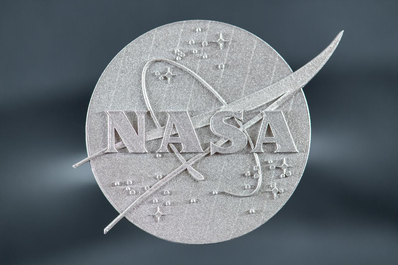
Macro Photographs of 3D Print of NASA Meatball - Made out of GRX-810, an Oxide Dispersion Strengthened (ODS) High Temperature Alloy
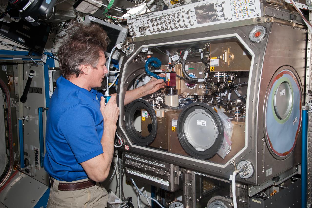
iss044e005118 (6/26/2015) --- Cosmonaut Gennady Padalka in the U.S. Laboratory in the process of aligning the Observation Analysis of Smectic Islands in Space (OASIS) Macro Camera. The Observation and Analysis of Smectic Islands In Space (OASIS) studies the unique behavior of liquid crystals in microgravity, including their overall motion and the merging of crystal layers known as smectic islands. Liquid crystals are used for display screens in televisions and clocks, and they also occur in soaps and in cell membranes. The experiment allows detailed studies of the behavior of these structures, and how microgravity affects their unique ability to act like both a liquid and a solid crystal.
06 066 ACE macro photos_2101_254
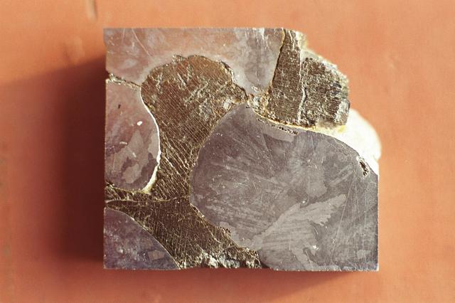
This is a macro photograph of an etched surface of the Mundrabilla meteorite, a small piece of the approximately 3.9 billion-year-old meteorite that was first discovered in Western Australia in 1911. Two more giant chunks, together weighing about 17 tons, were found in 1966. Researchers can learn much from this natural crystal growth experiment since it has spent several hundred million years cooling, and would be impossible to emulate in a lab. This single slice, taken from a 6 ton piece recovered in 1966, measures only 2 square inches. The macro photograph shows a metallic iron-nickel alloy phase of kamcite (38% Ni) and taenite (6% Ni) at bottom right, bottom left, and top left. The darker material is an iron sulfide (FeS or troilite) with a parallel precipitates of duabreelite (iron chromium sulfide (FeCr2S4).

SL4-140-4111 (14 Jan. 1974) --- The Aleutian Islands area of Alaska, as photographed from the Skylab space station in Earth orbit by one of the Skylab 4 crewmen. The camera used was a hand-held Hasselblad, with SO-368 medium-speed Ektachrome. Here is another macro scale phenomenon which is difficult to observe except from a space platform. The Aleutian Islands and clouds with very elaborate van Karman vortices was photographed on Jan. 14, 1974. In addition to the vortices the waves in the clouds due to the mountains on the islands are very evident. In fact, the easiest way to find the mountains is to start with their atmospheric disturbance and work back to the mountain. Photo credit: NASA

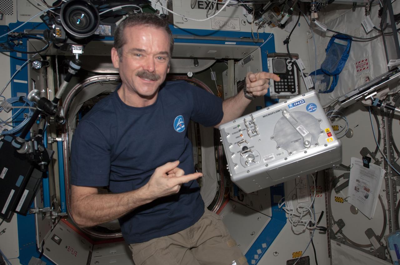
jsc2021e019401 (1/19/2021) --- A preflight macro shot of SIGMA-7 interface for Pilote experiment, In order to test the ergonomics of a multisensory interface for controlling robotic arms and spacecraft, it is necessary to perform the trials in microgravity. Performing the test on Earth would lead to a design of a work station using terrestrial ergonomic principles that do not correspond to conditions experienced on a spacecraft in orbit. The Pilote investigation tests the effectiveness of novel control schemes for the remote operation of robotic arms and space vehicles, using virtual reality and a new class of user-machine interfaces based on haptics. Image courtesy of CNES/DE PRADA Thierry.
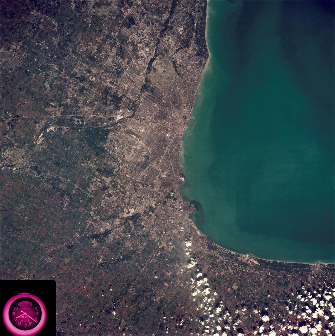
SL3-88-222 (18 Sept. 1973) --- The metropolitan area of Chicago is encompassed in this Skylab 3 Earth Resources Experiments Package (EREP) S190-B photograph taken on Sept. 18, 1973 from the Skylab space station cluster in Earth orbit. The surrounding major cities of Aurora and Joliet, Illinois; Hammond, Gary and East Chicago, Indiana, are easily delineated. The photograph reveals the following: (1) Cultural differentiation of commercial, industrial and residential areas for use in population and social studies in micro-macro community planning and in cultural pattern studies in the improvement of urban areas. (Aurora is one of 27 census cities of interest to Robert Alexander, a principal investigator. Alexander is with the U.S. Geological Survey). (2) The transportation network with major corridors and their interchanges, primary and feeder streets for use in network analysis and in the development of models for population movement and land use projection. (3) The agricultural lands for land use identification on crop inventory analysis; airports for use in delineation of service and infringement of major man-made features that affect ecosystem balance (support to environmental impact studies). (4) Air and water plumes for use in case studies, natural and man-made differentiation of pollution sources, in support of model development and in ecosystem research studies on the effects of pollution. (5) Recreational centers for use in relating recreational centers to population centers, establishing possible demands and in development of possible future recreational centers to support the demand. All EREP photography is available to the public through the Department of Interior?s Earth Resources Observations Systems Data Center, Sioux Falls, South Dakota, 57198. Photo credit: NASA