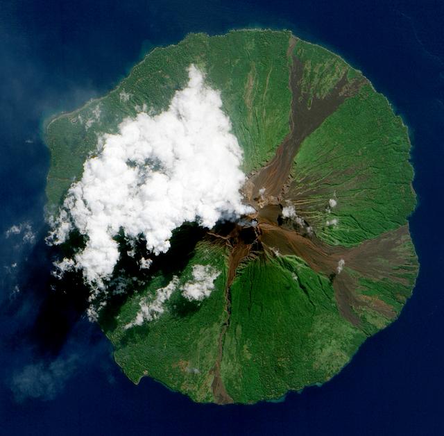
NASA image acquired June 16, 2010. Papua New Guinea’s Manam Volcano released a thin, faint plume on June 16, 2010, as clouds clustered at the volcano’s summit. The Advanced Land Imager (ALI) on NASA’s Earth Observing-1 (EO-1) satellite took this picture the same day. Rivulets of brown rock interrupt the carpet of green vegetation on the volcano’s slopes. Opaque white clouds partially obscure the satellite’s view of Manam. The clouds may result from water vapor from the volcano, but may also have formed independent of volcanic activity. The volcanic plume appears as a thin, blue-gray veil extending toward the northwest over the Bismarck Sea. Located 13 kilometers (8 miles) off the coast of mainland Papua New Guinea, Manam forms an island 10 kilometers (6 miles) wide. It is a stratovolcano. The volcano has two summit craters, and although both are active, most historical eruptions have arisen from the southern crater. NASA Earth Observatory image created by Jesse Allen, using EO-1 ALI data provided courtesy of the NASA EO-1 team. Caption by Michon Scott. Instrument: EO-1 - ALI To view the full image go to: <a href="http://earthobservatory.nasa.gov/NaturalHazards/view.php?id=44307&src=nhrss" rel="nofollow">earthobservatory.nasa.gov/NaturalHazards/view.php?id=4430...</a> <b><a href="http://www.nasa.gov/centers/goddard/home/index.html" rel="nofollow">NASA Goddard Space Flight Center</a></b> is home to the nation's largest organization of combined scientists, engineers and technologists that build spacecraft, instruments and new technology to study the Earth, the sun, our solar system, and the universe.
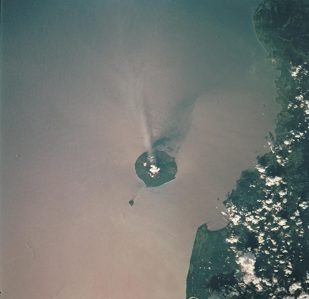
STS093-709-051 (23-27 July 1999) --- The STS-93 astronauts aboard the Space Shuttle Columbia took this picture of the volcanic island of Manam, along the northeast coast of Papua New Guinea. Manam is one in a string of currently active volcanoes called the Bismarck Arc. It is the most active of the group, having begun its present activity in 1994. The plume of steam and ash streaming from its crater extends more than 20 miles into the atmosphere. When the photo was taken, the shuttle was flying over a point located at 12.2 degrees south latitude and 132.0 degrees east longitude. Data back information on the 70mm film lists time and date of the photo as 05:42:31 GMT, July 25, 1999 (orbit 33).