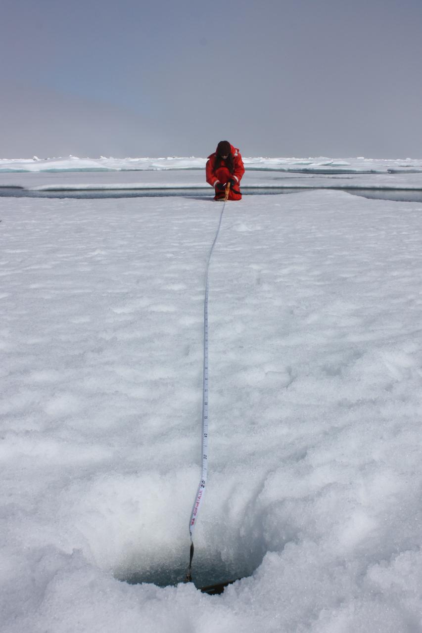
On July 10, 2011, Melinda Webster of University of Washington mapped the locations where measurements were collected during the 2011 ICESCAPE mission's fourth sea ice station in the Chukchi Sea. The ICESCAPE mission, or "Impacts of Climate on Ecosystems and Chemistry of the Arctic Pacific Environment," is a NASA shipborne investigation to study how changing conditions in the Arctic affect the ocean's chemistry and ecosystems. The bulk of the research took place in the Beaufort and Chukchi seas in summer 2010 and 2011. Credit: NASA/Kathryn Hansen <b><a href="http://www.nasa.gov/audience/formedia/features/MP_Photo_Guidelines.html" rel="nofollow">NASA image use policy.</a></b> <b><a href="http://www.nasa.gov/centers/goddard/home/index.html" rel="nofollow">NASA Goddard Space Flight Center</a></b> enables NASA’s mission through four scientific endeavors: Earth Science, Heliophysics, Solar System Exploration, and Astrophysics. Goddard plays a leading role in NASA’s accomplishments by contributing compelling scientific knowledge to advance the Agency’s mission. <b>Follow us on <a href="http://twitter.com/NASA_GoddardPix" rel="nofollow">Twitter</a></b> <b>Like us on <a href="http://www.facebook.com/pages/Greenbelt-MD/NASA-Goddard/395013845897?ref=tsd" rel="nofollow">Facebook</a></b> <b>Find us on <a href="http://instagrid.me/nasagoddard/?vm=grid" rel="nofollow">Instagram</a></b>
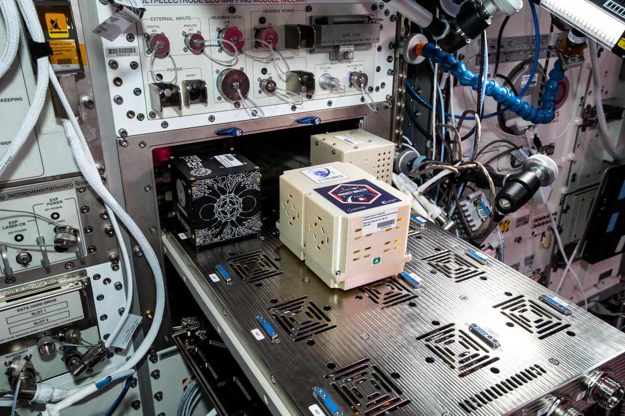
iss065e343736 (9/2/2021) --- A view aboard the International Space Station Columbus module with the Ice Cube #8 and #9 BioCubes. The Ice Cube #8 investigation uses quantum technology to produce high-resolution, high-precision measurements of the local magnetic field to create a high-resolution map of the Earth’s magnetic field. Ice Cube #9 seeks to analize the Skin Microbiome of Diabetic Foot Ulcers . The Ice Cube #8 investigation uses quantum technology to produce high-resolution, high-precision measurements of the local magnetic field to create a high-resolution map of the Earth’s magnetic field.

iss065e343729 (9/2/2021) --- A view aboard the International Space Station Columbus module with the Ice Cube #8 and #9 BioCubes. The Ice Cube #8 investigation uses quantum technology to produce high-resolution, high-precision measurements of the local magnetic field to create a high-resolution map of the Earth’s magnetic field. Ice Cube #9 seeks to analize the Skin Microbiome of Diabetic Foot Ulcers . The Ice Cube #8 investigation uses quantum technology to produce high-resolution, high-precision measurements of the local magnetic field to create a high-resolution map of the Earth’s magnetic field.
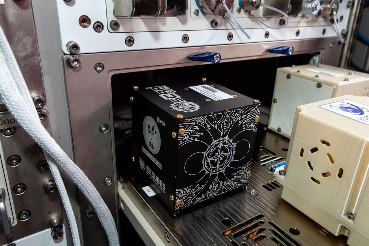
iss065e343732 (9/2/2021) --- A view aboard the International Space Station Columbus module with the Ice Cube #8 BioCube. The Ice Cube #8 investigation uses quantum technology to produce high-resolution, high-precision measurements of the local magnetic field to create a high-resolution map of the Earth’s magnetic field.
iss065e343710 (9/2/2021) --- A view aboard the International Space Station Columbus module with the Ice Cube #8 BioCube. The Ice Cube #8 investigation uses quantum technology to produce high-resolution, high-precision measurements of the local magnetic field to create a high-resolution map of the Earth’s magnetic field.
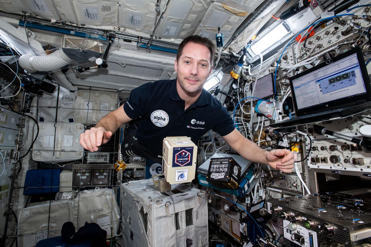
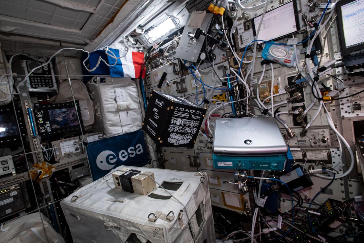
iss065e343728 (9/2/2021) --- European Space Agency (ESA) astronaut Thomas Pesquet is pictured aboard the International Space Station Columbus module with the Ice Cube #8 and #9 BioCubes. The Ice Cube #8 investigation uses quantum technology to produce high-resolution, high-precision measurements of the local magnetic field to create a high-resolution map of the Earth’s magnetic field. Ice Cube #9 seeks to analize the Skin Microbiome of Diabetic Foot Ulcers
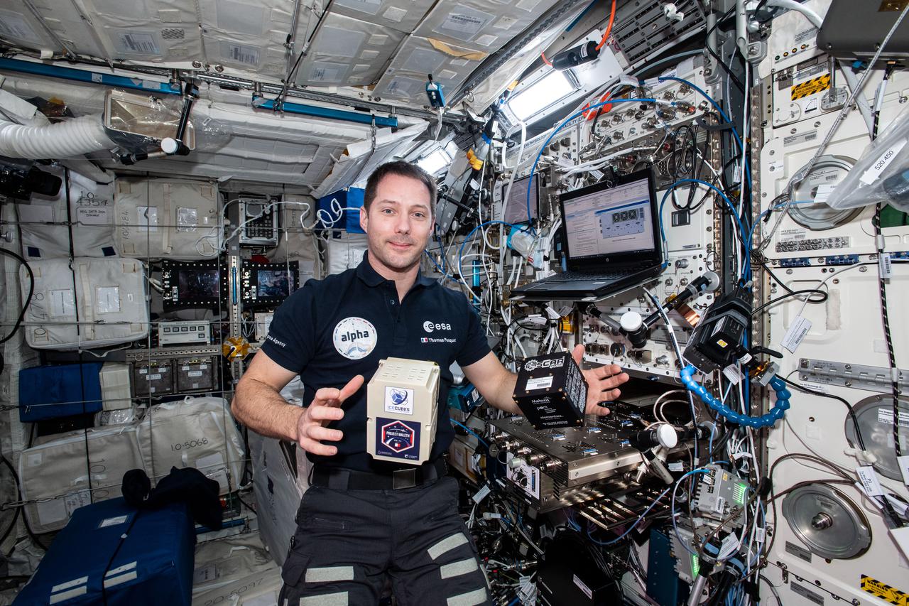
iss065e343725 (9/2/2021) --- European Space Agency (ESA) astronaut Thomas Pesquet is pictured aboard the International Space Station Columbus module with the Ice Cube #8 and #9 BioCubes. The Ice Cube #8 investigation uses quantum technology to produce high-resolution, high-precision measurements of the local magnetic field to create a high-resolution map of the Earth’s magnetic field. Ice Cube #9 seeks to analize the Skin Microbiome of Diabetic Foot Ulcers
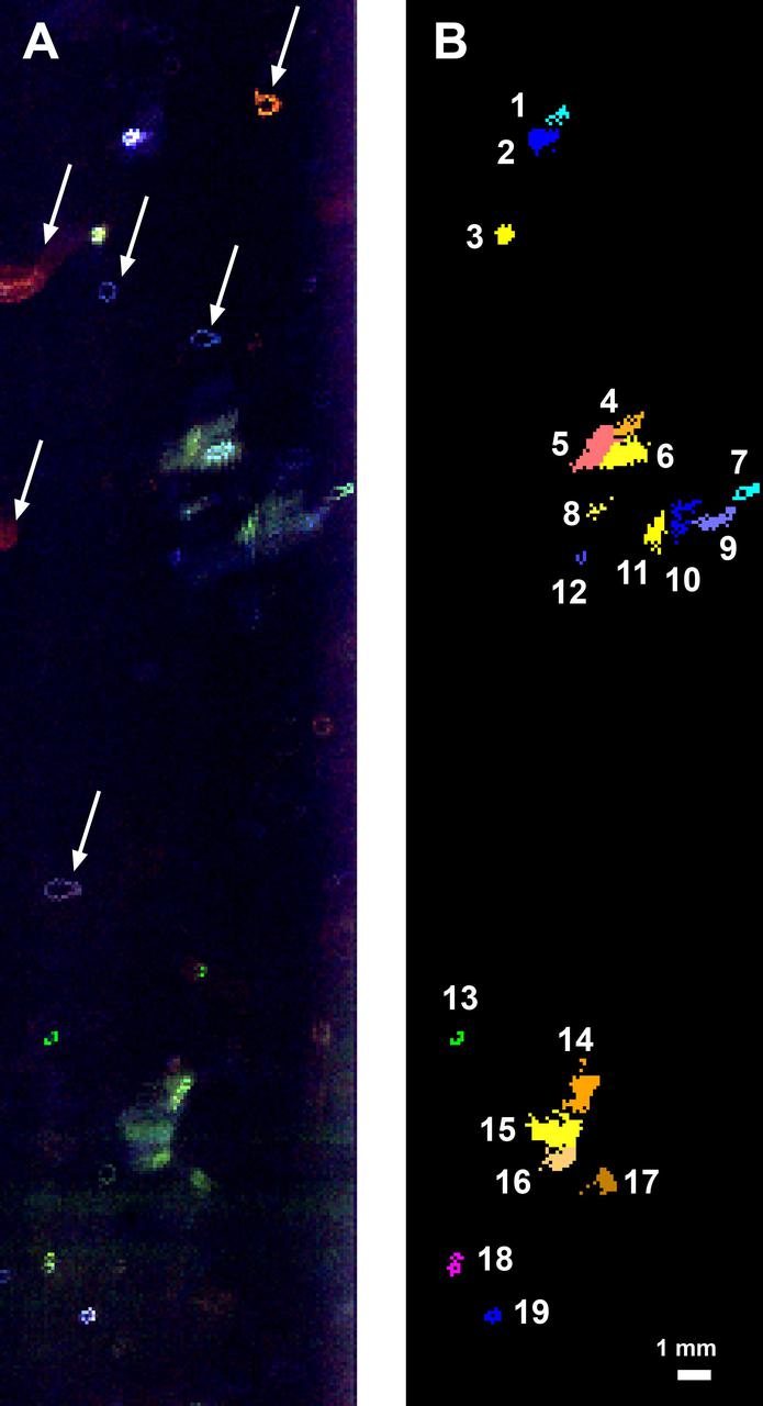
This fluorescence map of the inside wall of an ice borehole near Greenland's Summit Station was produced at a depth of 307.7 feet (93.8 meters) into the ice sheet by the WATSON (Wireline Analysis Tool for the Subsurface Observation of Northern ice sheets) instrument. Recorded during a 2019 field test of the WATSON instrument, the left panel shows the variety of biosignatures that were detected in the ice — different colors represent different organic molecules, some of which are likely microbes. The arrows highlight artifacts on the instrument's optical window, not biosignatures in the ice. In the right panel, the biosignature detections have been colorized to indicate the different features detected. Blotches that are the same color are likely made of the same chemicals. The numbers list the different and distinct features that WATSON detected at that depth in the ice. WATSON could one day be launched aboard a robotic mission to seek out biosignatures on the ocean moons of Enceladus, Europa, or even Titan. The WATSON team hopes to test the instrument in a variety of cold locations on Earth to see how the distribution and variety of biosignatures change depending on where they are. By testing WATSON in different "Earth analogs," scientists would be able to better understand the chemical fingerprints of any biosignatures detected on other worlds. https://photojournal.jpl.nasa.gov/catalog/PIA24140

A group of Coast Guard seamen leave their ship to verify ice formations on the Great Lakes as part of an joint effort with the National Aeronautics and Space Administration (NASA) Lewis Research Center and the National Oceanic and Atmospheric Administration. The regular winter freezing of large portions of the Great Lakes stalled the shipping industry. Lewis began working on two complementary systems to monitor the ice. The Side Looking Airborne Radar (SLAR) system used microwaves to measure the ice distribution and electromagnetic systems used noise modulation to determine the thickness of the ice. The images were then transferred via satellite to the Coast Guard station. The Coast Guard then transmitted the pertinent images by VHF to the ship captains to help them select the best route. The Great Lakes ice mapping devices were first tested on NASA aircraft during the winter of 1972 and 1973. The pulsed radar system was transferred to the Coast Guard’s C-130 aircraft for the 1975 and 1976 winter. The SLAR was installed in the rear cargo door, and the small S-band antenna was mounted to the underside of the aircraft. Coast Guard flights began in January 1975 at an altitude of 11,000 feet. Early in the program, teams of guardsmen and NASA researchers frequently set out in boats to take samples and measurements of the ice in order to verify the radar information.
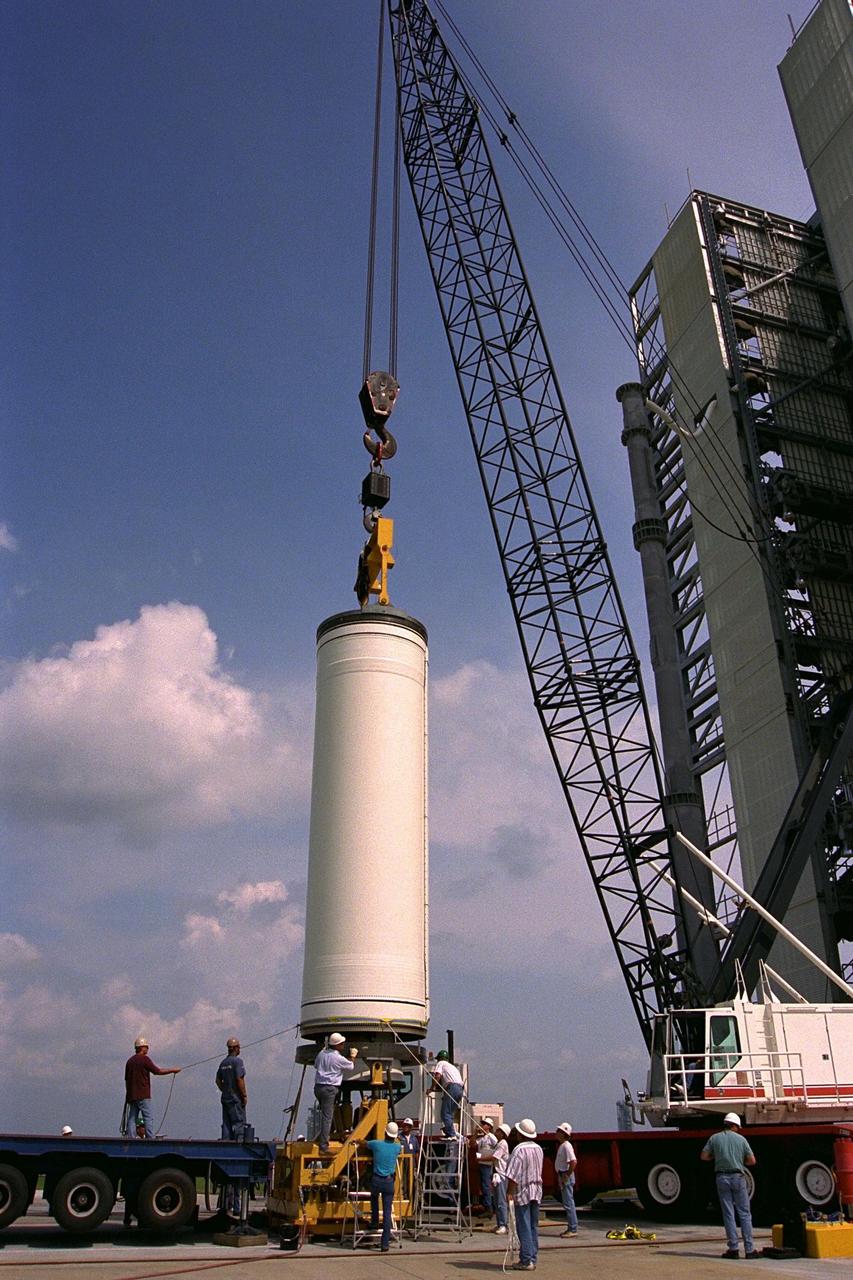
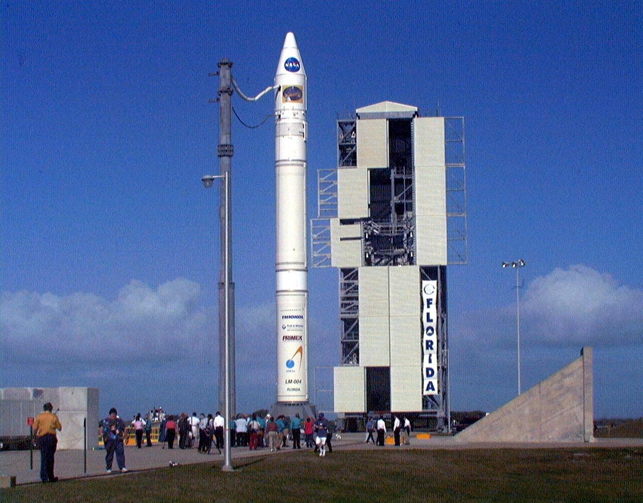
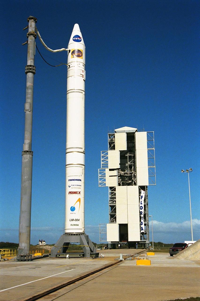
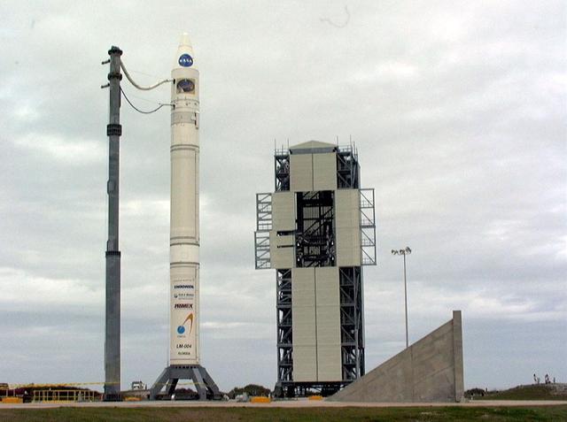
Workers erect the first stage of a Lockheed Martin Launch Vehicle-2 (LMLV-2) at Launch Complex 46 at Cape Canaveral Air Station, Fla. The Lunar Prospector spacecraft is scheduled to launch aboard the LMLV-2 in October for an 18-month mission that will orbit the Earth’s Moon to collect data from the lunar surface. Designed for a low polar orbit investigation of the Moon, the Lunar Prospector will map the Moon’s surface composition and possible polar ice deposits, measure magnetic and gravity fields, and study lunar outgassing events

Workers erect the first stage of a Lockheed Martin Launch Vehicle-2 (LMLV-2) at Launch Complex 46 at Cape Canaveral Air Station, Fla. The Lunar Prospector spacecraft is scheduled to launch aboard the LMLV-2 in October for an 18-month mission that will orbit the Earth’s Moon to collect data from the lunar surface. Designed for a low polar orbit investigation of the Moon, the Lunar Prospector will map the Moon’s surface composition and possible polar ice deposits, measure magnetic and gravity fields, and study lunar outgassing events
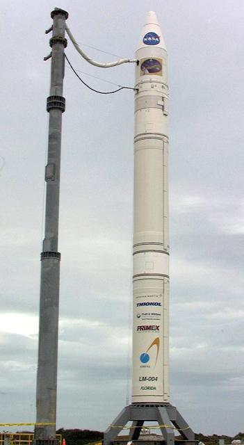
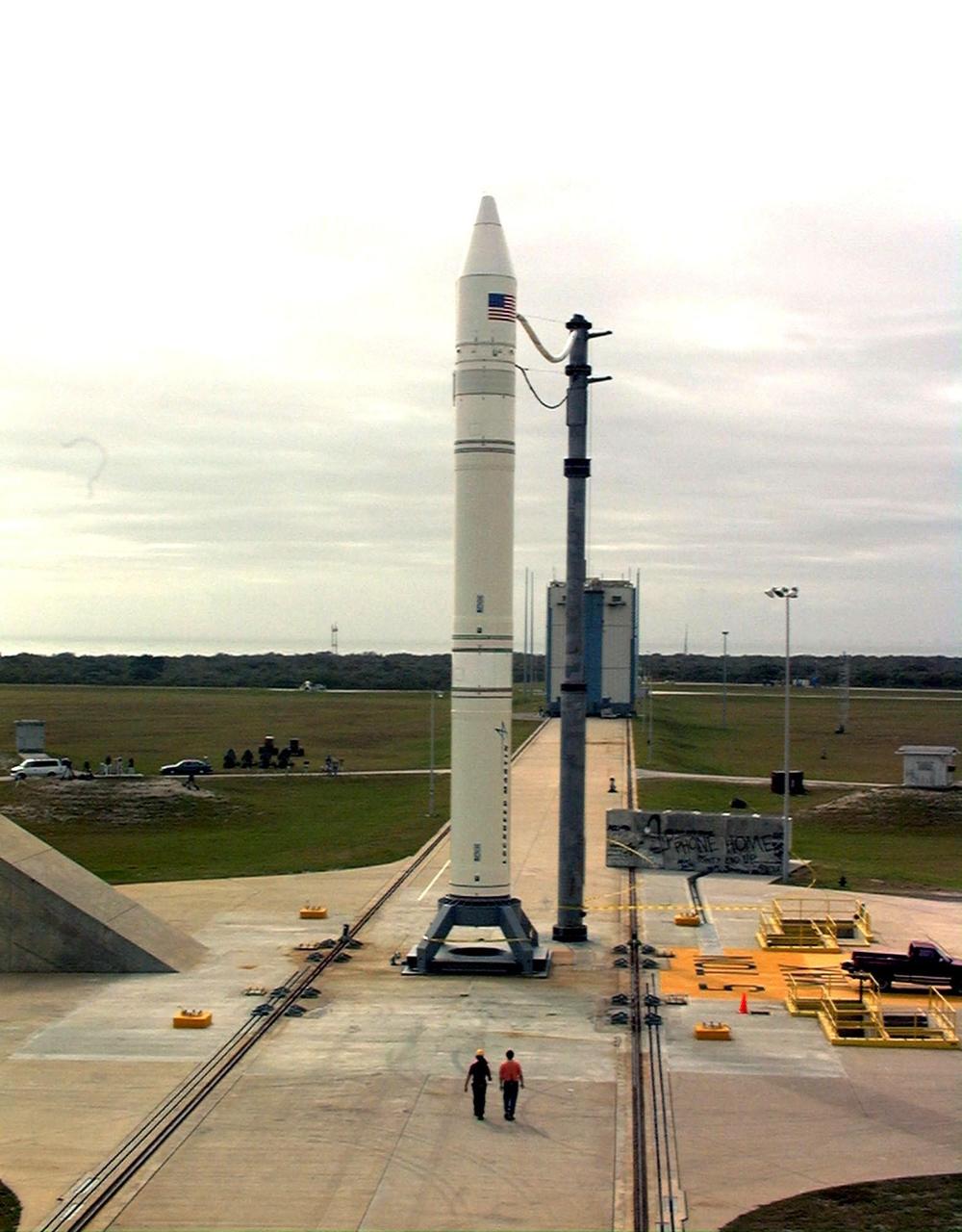
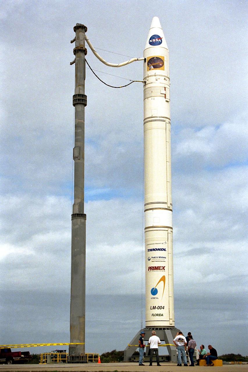
KENNEDY SPACE CENTER, FLA. - NASA's Lunar Prospector spacecraft launched successfully on its way to the Moon from Launch Complex 46 (LC46) at Cape Canaveral Air Station on Jan. 6 at 9:38 p.m. EST. It was the inaugural launch of Lockheed Martin's Athena II launch vehicle and the first launch from LC46, operated by Spaceport Florida Authority. Lunar Prospector, built for the NASA Ames Research Center by Lockheed Martin, is a spin-stabilized spacecraft designed to provide NASA with the first global maps of the Moon's surface and its gravitational magnetic fields, as well as look for the possible presence of ice near the lunar poles. It will orbit the Moon at an altitude of approximately 63 miles during a one-year mission.
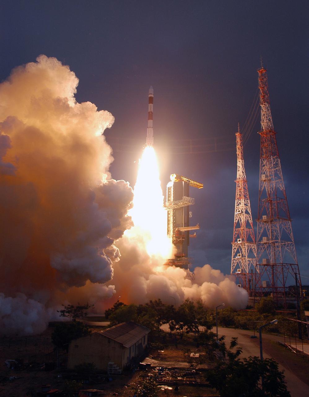
SRIHARIKOTA, India – The Indian Space Research Organization, or ISRO, launches its robotic Chandrayaan-1 rocket with two NASA instruments aboard on India's maiden moon voyage to map the lunar surface. The Moon Mineralogy Mapper will assess mineral resources, and the Miniature Synthetic Aperture Radar, or Mini-SAR, will map the polar regions and look for ice deposits. Data from the two instruments will contribute to NASA's increased understanding of the lunar environment as it implements the nation's space exploration policy, which calls for robotic and human missions to the moon. In addition to the two science instruments, NASA will provide space communications support to Chandrayaan-1. The primary location for the NASA ground tracking station will be at the Johns Hopkins University Applied Physics Laboratory in Laurel, Md. Photo credit: NASA
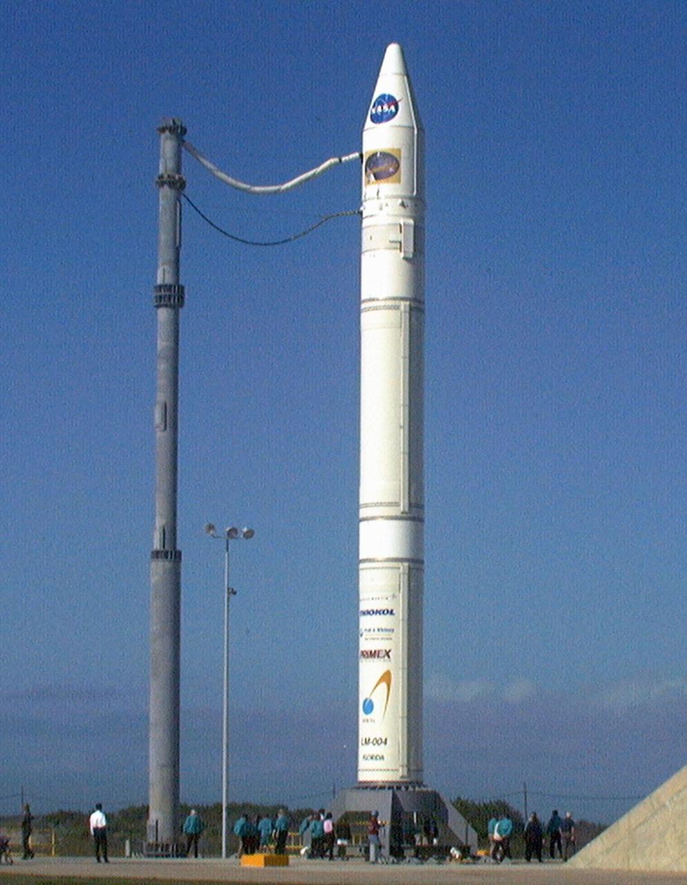
NASA’s Lunar Prospector is readied for launch as its gantry-like service tower is rolled back at Cape Canaveral Air Station’s Launch Complex 46. Lunar Prospector, built for the NASA Ames Research Center by Lockheed Martin, is a spin-stabilized spacecraft designed to provide NASA with the first global maps of the Moon’s surface and its gravitational magnetic fields, as well as look for the possible presence of ice near the lunar poles. It will orbit the Moon at an altitude of approximately 63 miles during a one-year mission. The launch of Lunar Prospector is scheduled for Jan. 5, 1998 at 8:31 p.m. EST
NASA’s Lunar Prospector is readied for launch as its gantry-like service tower is rolled back at Cape Canaveral Air Station’s Launch Complex 46. Lunar Prospector, built for the NASA Ames Research Center by Lockheed Martin, is a spin-stabilized spacecraft designed to provide NASA with the first global maps of the Moon’s surface and its gravitational magnetic fields, as well as look for the possible presence of ice near the lunar poles. It will orbit the Moon at an altitude of approximately 63 miles during a one-year mission. The launch of Lunar Prospector is scheduled for Jan. 5, 1998 at 8:31 p.m. EST
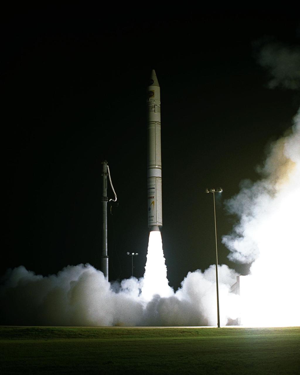
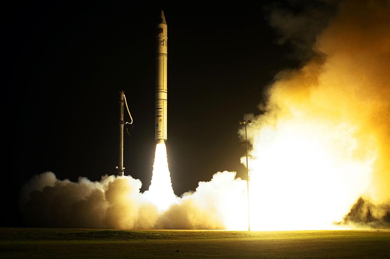
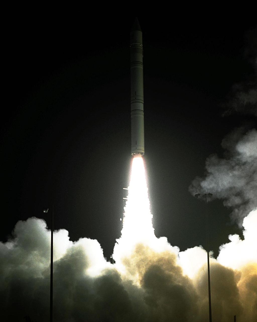
NASA’s Lunar Prospector spacecraft launched successfully on its way to the moon from Launch Complex 46 (LC46) at Cape Canaveral Air Station on Jan. 6 at 9:28 p.m. EST. It was the inaugural launch of Lockheed Martin's Athena II launch vehicle and the first launch from LC46, operated by Spaceport Florida Authority. Lunar Prospector, built for the NASA Ames Research Center by Lockheed Martin, is a spin-stabilized spacecraft designed to provide NASA with the first global maps of the moon’s surface and its gravitational magnetic fields, as well as look for the possible presence of ice near the lunar poles. It will orbit the Moon at an altitude of approximately 63 miles during a one-year mission
NASA’s Lunar Prospector is readied for launch as its gantry-like service tower is rolled back at Cape Canaveral Air Station’s Launch Complex 46. Lunar Prospector, built for the NASA Ames Research Center by Lockheed Martin, is a spin-stabilized spacecraft designed to provide NASA with the first global maps of the Moon’s surface and its gravitational magnetic fields, as well as look for the possible presence of ice near the lunar poles. It will orbit the Moon at an altitude of approximately 63 miles during a one-year mission. The launch of Lunar Prospector is scheduled for Jan. 5, 1998 at 8:31 p.m. EST
NASA’s Lunar Prospector is readied for launch as its gantry-like service tower is rolled back at Cape Canaveral Air Station’s Launch Complex 46. Lunar Prospector, built for the NASA Ames Research Center by Lockheed Martin, is a spin-stabilized spacecraft designed to provide NASA with the first global maps of the Moon’s surface and its gravitational magnetic fields, as well as look for the possible presence of ice near the lunar poles. It will orbit the Moon at an altitude of approximately 63 miles during a one-year mission. The launch of Lunar Prospector is scheduled for Jan. 5, 1998 at 8:31 p.m. EST
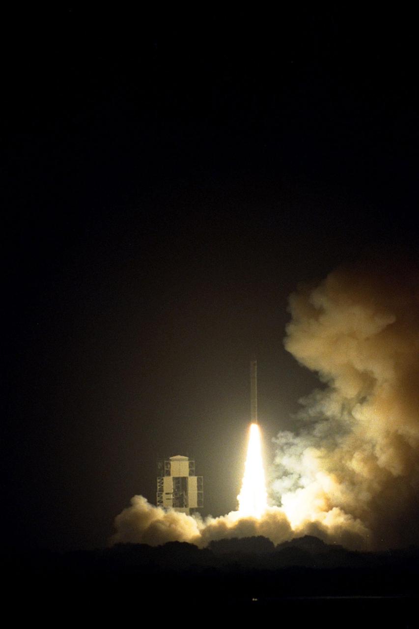
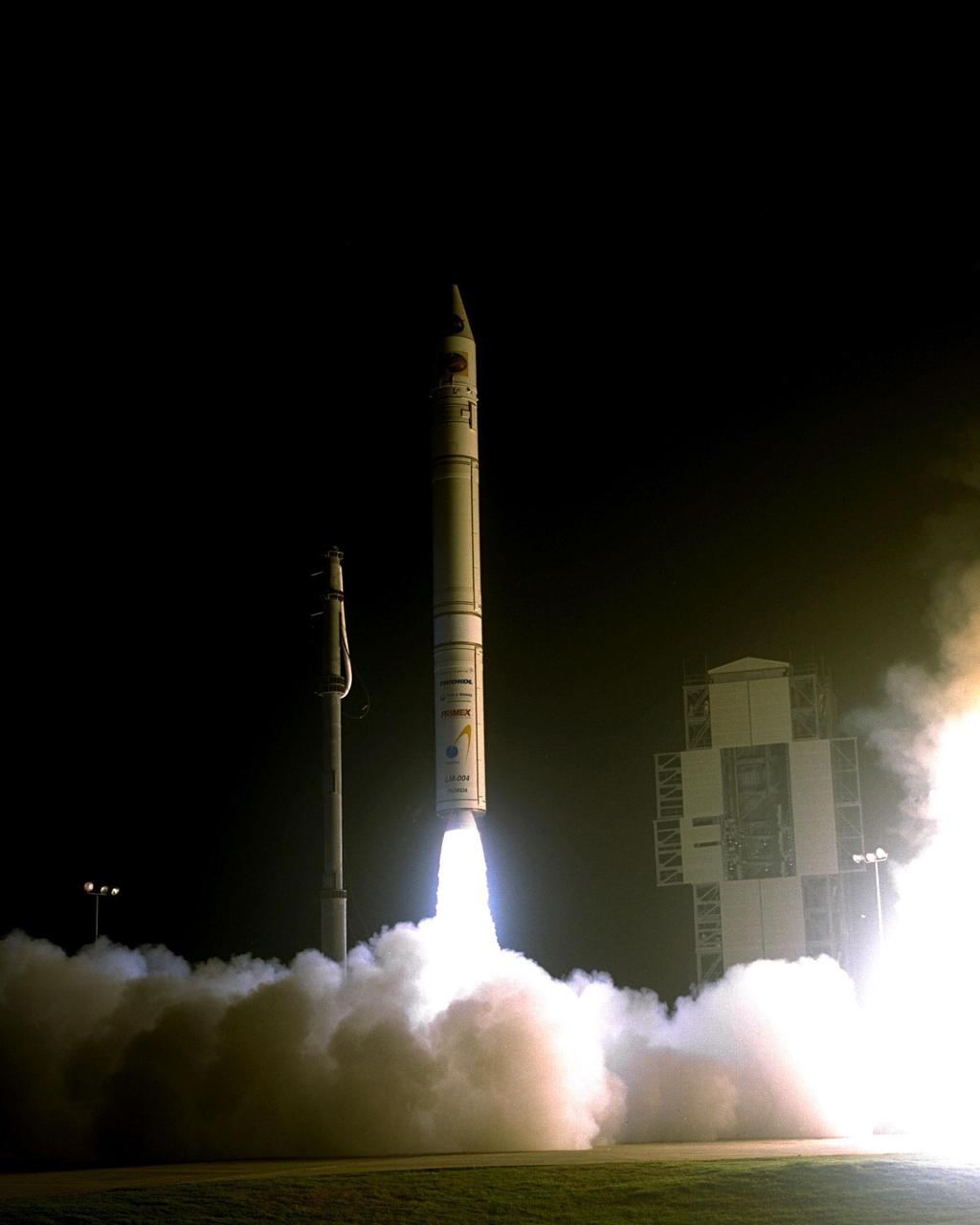
NASA’s Lunar Prospector spacecraft launched successfully on its way to the moon from Launch Complex 46 (LC46) at Cape Canaveral Air Station on Jan. 6 at 9:28 p.m. EST. It was the inaugural launch of Lockheed Martin's Athena II launch vehicle and the first launch from LC46, operated by Spaceport Florida Authority. Lunar Prospector, built for the NASA Ames Research Center by Lockheed Martin, is a spin-stabilized spacecraft designed to provide NASA with the first global maps of the moon’s surface and its gravitational magnetic fields, as well as look for the possible presence of ice near the lunar poles. It will orbit the Moon at an altitude of approximately 63 miles during a one-year mission
NASA’s Lunar Prospector spacecraft launched successfully on its way to the moon from Launch Complex 46 (LC46) at Cape Canaveral Air Station on Jan. 6 at 9:28 p.m. EST. It was the inaugural launch of Lockheed Martin's Athena II launch vehicle and the first launch from LC46, operated by Spaceport Florida Authority. Lunar Prospector, built for the NASA Ames Research Center by Lockheed Martin, is a spin-stabilized spacecraft designed to provide NASA with the first global maps of the moon’s surface and its gravitational magnetic fields, as well as look for the possible presence of ice near the lunar poles. It will orbit the Moon at an altitude of approximately 63 miles during a one-year mission
NASA’s Lunar Prospector spacecraft launched successfully on its way to the moon from Launch Complex 46 (LC46) at Cape Canaveral Air Station on Jan. 6 at 9:28 p.m. EST. It was the inaugural launch of Lockheed Martin's Athena II launch vehicle and the first launch from LC46, operated by Spaceport Florida Authority. Lunar Prospector, built for the NASA Ames Research Center by Lockheed Martin, is a spin-stabilized spacecraft designed to provide NASA with the first global maps of the moon’s surface and its gravitational magnetic fields, as well as look for the possible presence of ice near the lunar poles. It will orbit the Moon at an altitude of approximately 63 miles during a one-year mission
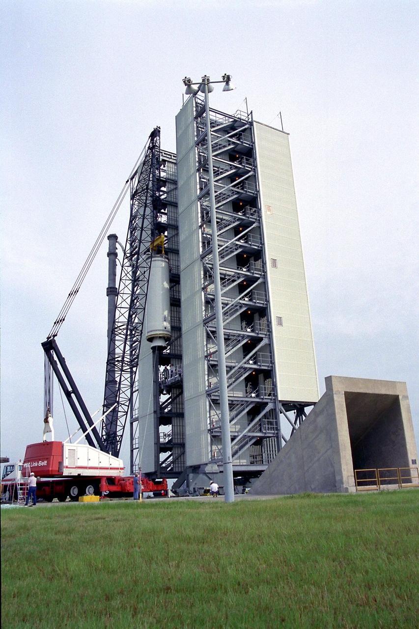
The second stage of the Lockheed Martin Launch Vehicle-2 (LMLV-2) is hoisted into position at Launch Pad 46 at Cape Canaveral Air Station for mating to the rocket’s first stage, which is out of camera view. The LMLV-2 will carry the Lunar Prospector spacecraft, scheduled to launch in October for an 18-month mission that will orbit the Earth’s moon to collect data from the lunar surface. Designed for a low polar orbit investigation of the moon, the Lunar Prospector will map the moon’s surface composition and possible polar ice deposits, measure magnetic and gravity fields, and study lunar outgassing events
NASA’s Lunar Prospector spacecraft launched successfully on its way to the moon from Launch Complex 46 (LC46) at Cape Canaveral Air Station on Jan. 6 at 9:28 p.m. EST. It was the inaugural launch of Lockheed Martin's Athena II launch vehicle and the first launch from LC46, operated by Spaceport Florida Authority. Lunar Prospector, built for the NASA Ames Research Center by Lockheed Martin, is a spin-stabilized spacecraft designed to provide NASA with the first global maps of the moon’s surface and its gravitational magnetic fields, as well as look for the possible presence of ice near the lunar poles. It will orbit the Moon at an altitude of approximately 63 miles during a one-year mission
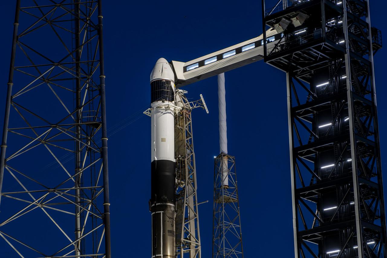
A SpaceX Falcon 9 rocket, with the company’s Dragon spacecraft atop, stands in a vertical position at Space Launch Complex 40 at Cape Canaveral Space Force Station in Florida on Tuesday, March 19, 2024, in preparation for the 30th commercial resupply services launch to the International Space Station. NASA and partner research flying aboard the mission includes a look at plant metabolism in space and a set of new sensors for free-flying Astrobee robots to provide 3D mapping capabilities. Other studies include a fluid physics study that could benefit solar cell technology and a university project from CSA (Canadian Space Agency) that will monitor sea ice and ocean conditions. Liftoff is scheduled for 4:55 p.m. EDT on Thursday, March 21, 2024.
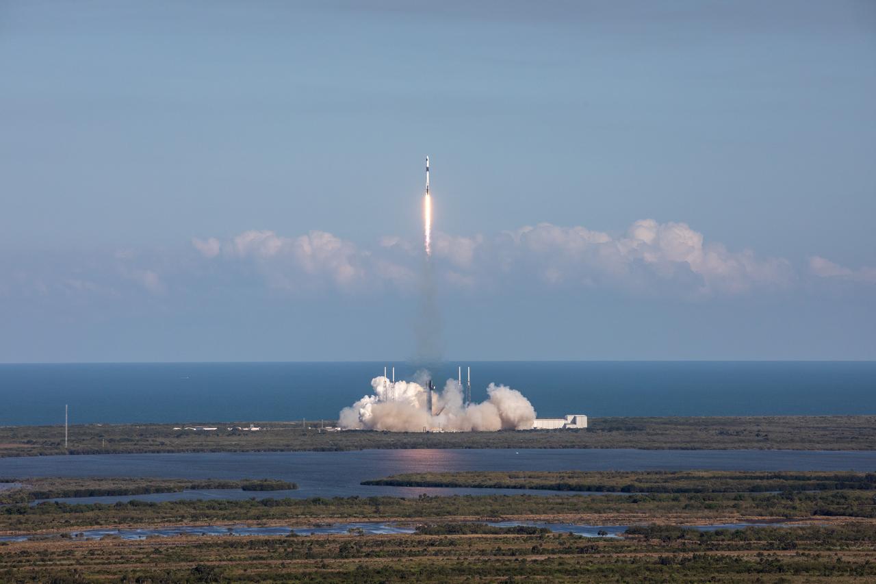
A SpaceX Falcon 9 rocket soars upward after its liftoff from Space Launch Complex 40 at Cape Canaveral Space Force Station in Florida at 4:55 p.m. EDT on Thursday, March 21, on the company’s 30th Commercial Resupply Services mission for the agency to the International Space Station. Dragon will deliver more than 6,200 pounds of cargo, including a variety of NASA and partner research including a look at plant metabolism in space and a set of new sensors for free-flying Astrobee robots to provide 3D mapping capabilities. Other studies include a fluid physics study that could benefit solar cell technology and a university project from CSA (Canadian Space Agency) that will monitor sea ice and ocean conditions. The spacecraft is expected to spend about a month attached to the orbiting outpost before it returns to Earth with research and return cargo, splashing down off the coast of Florida.
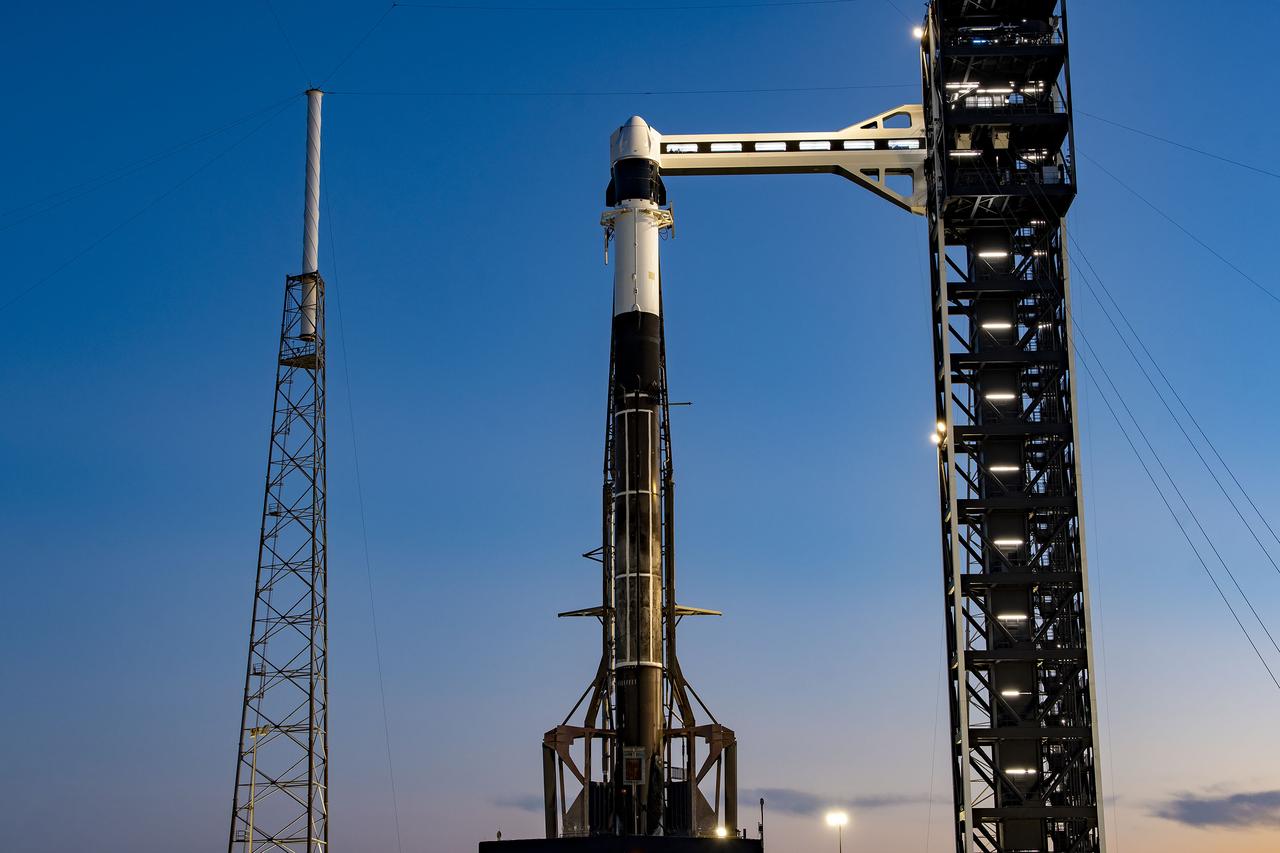
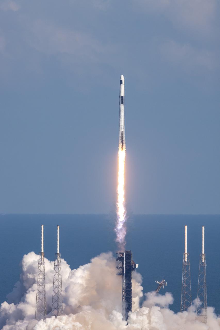
A SpaceX Falcon 9 rocket soars upward after its liftoff from Space Launch Complex 40 at Cape Canaveral Space Force Station in Florida at 4:55 p.m. EDT on Thursday, March 21, on the company’s 30th Commercial Resupply Services mission for the agency to the International Space Station. Dragon will deliver more than 6,200 pounds of cargo, including a variety of NASA and partner research including a look at plant metabolism in space and a set of new sensors for free-flying Astrobee robots to provide 3D mapping capabilities. Other studies include a fluid physics study that could benefit solar cell technology and a university project from CSA (Canadian Space Agency) that will monitor sea ice and ocean conditions. The spacecraft is expected to spend about a month attached to the orbiting outpost before it returns to Earth with research and return cargo, splashing down off the coast of Florida.
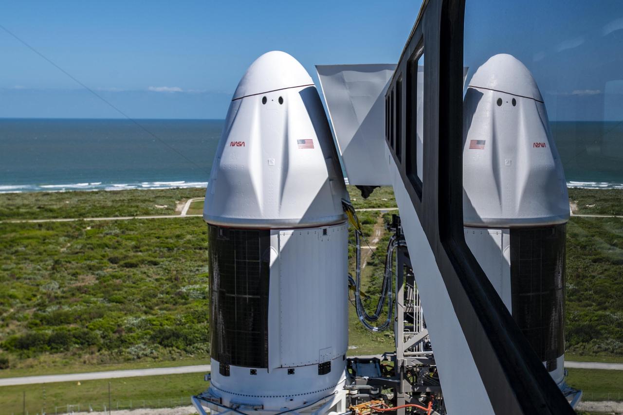
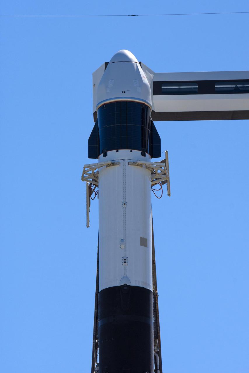
Seen here is an up-close view of the SpaceX Dragon spacecraft atop the company’s Falcon 9 rocket after being raised to a vertical position at Space Launch Complex 40 at Cape Canaveral Space Force Station in Florida on Tuesday, March 19, 2024, in preparation for the 30th commercial resupply services launch to the International Space Station. NASA and partner research flying aboard the mission includes a look at plant metabolism in space and a set of new sensors for free-flying Astrobee robots to provide 3D mapping capabilities. Other studies include a fluid physics study that could benefit solar cell technology and a university project from CSA (Canadian Space Agency) that will monitor sea ice and ocean conditions. Liftoff is scheduled for 4:55 p.m. EDT on Thursday, March 21, 2024.
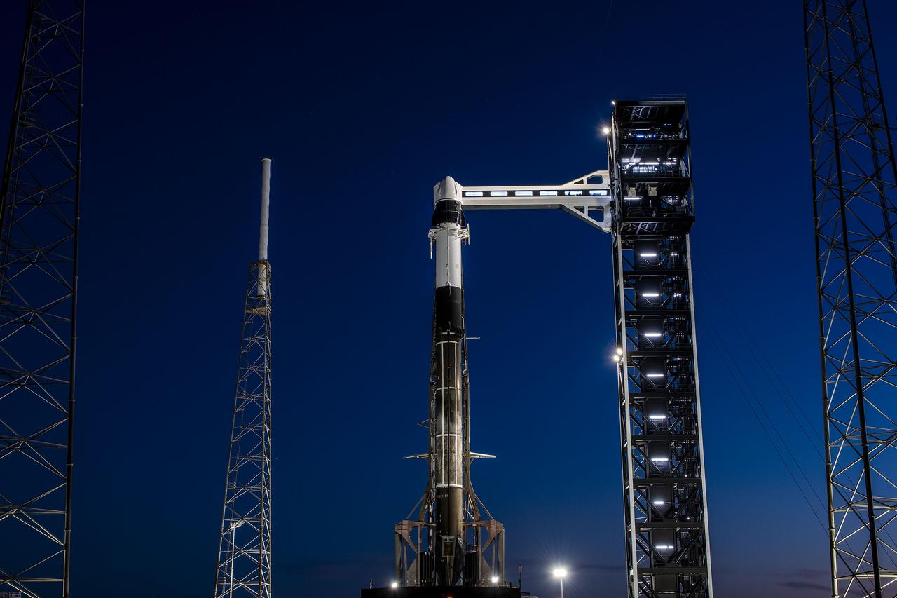
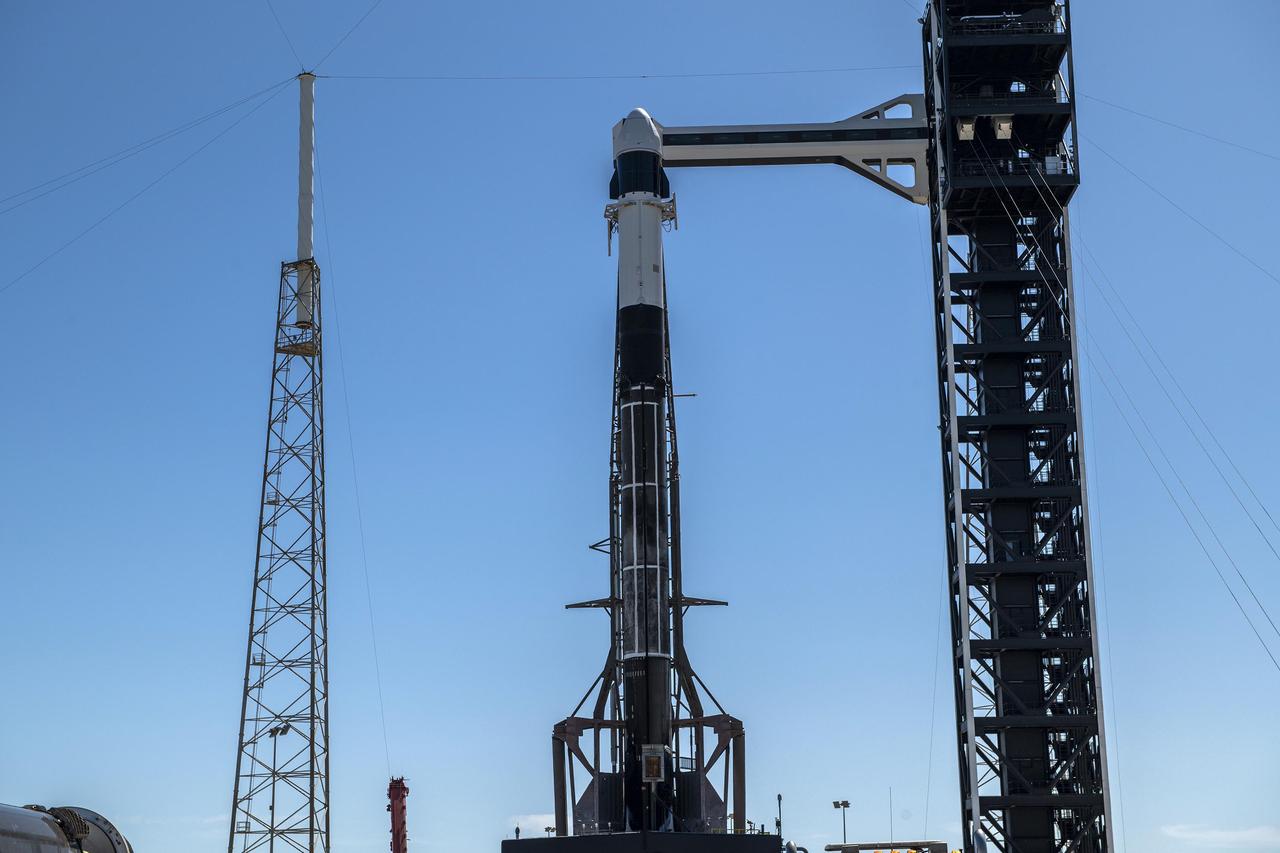
A SpaceX Falcon 9 rocket, with the company’s Dragon spacecraft atop, stands in a vertical position at Space Launch Complex 40 at Cape Canaveral Space Force Station in Florida on Tuesday, March 19, 2024, in preparation for the 30th commercial resupply services launch to the International Space Station. NASA and partner research flying aboard the mission includes a look at plant metabolism in space and a set of new sensors for free-flying Astrobee robots to provide 3D mapping capabilities. Other studies include a fluid physics study that could benefit solar cell technology and a university project from CSA (Canadian Space Agency) that will monitor sea ice and ocean conditions. Liftoff is scheduled for 4:55 p.m. EDT on Thursday, March 21, 2024.
Seen here is an up-close view of the SpaceX Dragon spacecraft atop the company’s Falcon 9 rocket after being raised to a vertical position at Space Launch Complex 40 at Cape Canaveral Space Force Station in Florida on Tuesday, March 19, 2024, in preparation for the 30th commercial resupply services launch to the International Space Station. NASA and partner research flying aboard the mission includes a look at plant metabolism in space and a set of new sensors for free-flying Astrobee robots to provide 3D mapping capabilities. Other studies include a fluid physics study that could benefit solar cell technology and a university project from CSA (Canadian Space Agency) that will monitor sea ice and ocean conditions. Liftoff is scheduled for 4:55 p.m. EDT on Thursday, March 21, 2024.
A SpaceX Falcon 9 rocket, with the company’s Dragon spacecraft atop, stands in a vertical position at Space Launch Complex 40 at Cape Canaveral Space Force Station in Florida on Tuesday, March 19, 2024, in preparation for the 30th commercial resupply services launch to the International Space Station. NASA and partner research flying aboard the mission includes a look at plant metabolism in space and a set of new sensors for free-flying Astrobee robots to provide 3D mapping capabilities. Other studies include a fluid physics study that could benefit solar cell technology and a university project from CSA (Canadian Space Agency) that will monitor sea ice and ocean conditions. Liftoff is scheduled for 4:55 p.m. EDT on Thursday, March 21, 2024.
NASA’s Lunar Prospector is readied for launch as its gantry-like service tower is rolled back again at Cape Canaveral Air Station’s Launch Complex 46. The launch, previously scheduled for Jan. 5, was postponed one day due to a problem with a range safety radar located at Patrick Air Force Base, Fla. Lunar Prospector, built for the NASA Ames Research Center by Lockheed Martin, is a spin-stabilized spacecraft designed to provide NASA with the first global maps of the Moon’s surface and its gravitational magnetic fields, as well as look for the possible presence of ice near the lunar poles. It will orbit the Moon at an altitude of approximately 63 miles during a one-year mission. The launch of Lunar Prospector is now scheduled for Jan. 6, 1998 at 9:28 p.m. EST
This Earth Resource Experiment Package (EREP) photograph of the Uncompahgre area of Colorado was electronically acquired in September of 1973 by the Multi-spectral Scarner, Skylab Experiment S192. EREP images were used to analyze the vegetation conditions and landscape characteristic of this area. Skylab's Earth sensors played the dual roles of gathering information about the planet and perfecting instruments and techniques for future satellites and manned stations. An array of six fixed cameras, another for high resolution, and the astronauts' handheld cameras photographed surface features. Other instruments, recording on magnetic tape, measured the reflectivity of plants, soils, and water. Radar measured the altitude of land and water surfaces. The sensors' objectives were to survey croplands and forests, identify soils and rock types, map natural features and urban developments, detect sediments and the spread of pollutants, study clouds and the sea, and determine the extent of snow and ice cover.
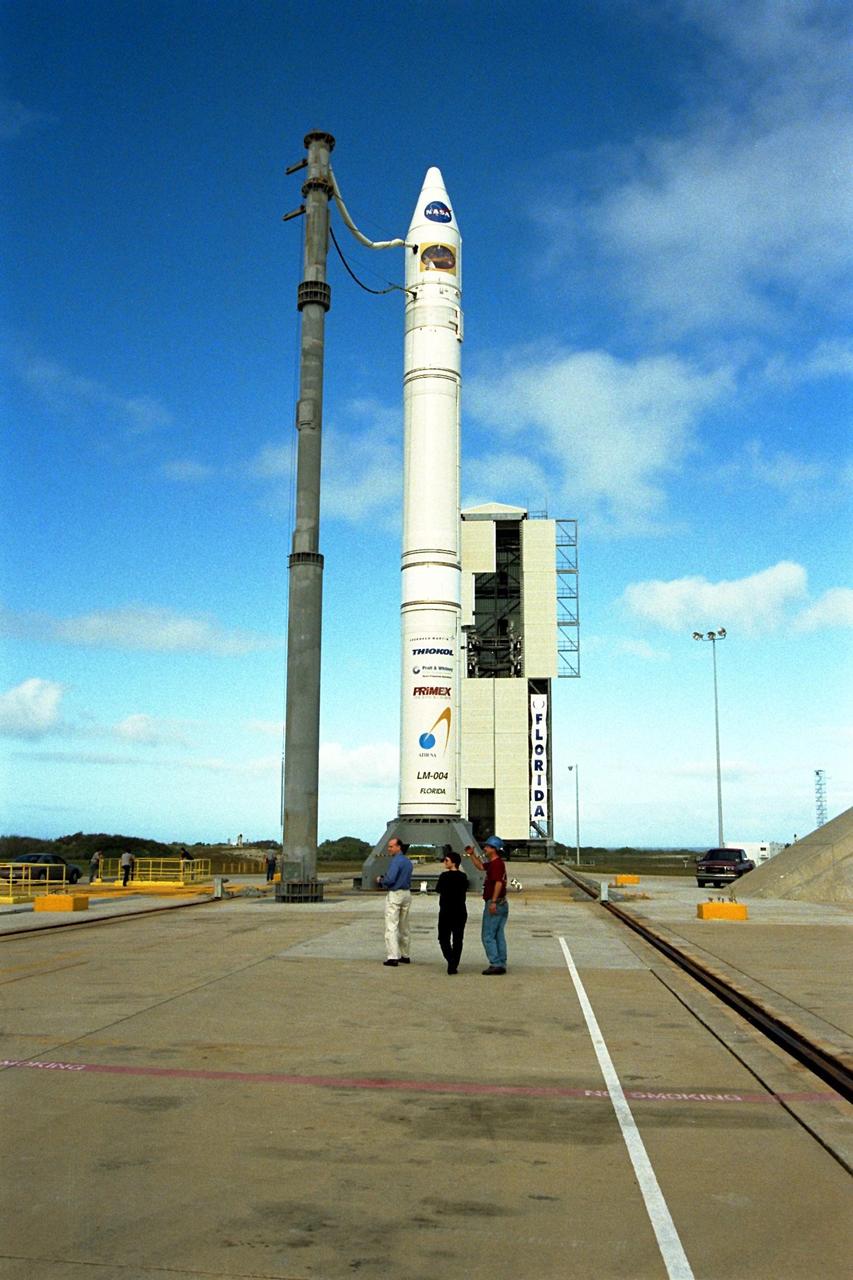
NASA’s Lunar Prospector is readied for launch as its gantry-like service tower is rolled back again at Cape Canaveral Air Station’s Launch Complex 46. The launch, previously scheduled for Jan. 5, was postponed one day due to a problem with a range safety radar located at Patrick Air Force Base, Fla. Lunar Prospector, built for the NASA Ames Research Center by Lockheed Martin, is a spin-stabilized spacecraft designed to provide NASA with the first global maps of the Moon’s surface and its gravitational magnetic fields, as well as look for the possible presence of ice near the lunar poles. It will orbit the Moon at an altitude of approximately 63 miles during a one-year mission. The launch of Lunar Prospector is now scheduled for Jan. 6, 1998 at 9:28 p.m. EST
NASA’s Lunar Prospector is readied for launch as its gantry-like service tower is rolled back again at Cape Canaveral Air Station’s Launch Complex 46. The launch, previously scheduled for Jan. 5, was postponed one day due to a problem with a range safety radar located at Patrick Air Force Base, Fla. Lunar Prospector, built for the NASA Ames Research Center by Lockheed Martin, is a spin-stabilized spacecraft designed to provide NASA with the first global maps of the Moon’s surface and its gravitational magnetic fields, as well as look for the possible presence of ice near the lunar poles. It will orbit the Moon at an altitude of approximately 63 miles during a one-year mission. The launch of Lunar Prospector is now scheduled for Jan. 6, 1998 at 9:28 p.m. EST
NASA’s Lunar Prospector is readied for launch as its gantry-like service tower is rolled back again at Cape Canaveral Air Station’s Launch Complex 46. The launch, previously scheduled for Jan. 5, was postponed one day due to a problem with a range safety radar located at Patrick Air Force Base, Fla. Lunar Prospector, built for the NASA Ames Research Center by Lockheed Martin, is a spin-stabilized spacecraft designed to provide NASA with the first global maps of the Moon’s surface and its gravitational magnetic fields, as well as look for the possible presence of ice near the lunar poles. It will orbit the Moon at an altitude of approximately 63 miles during a one-year mission. The launch of Lunar Prospector is now scheduled for Jan. 6, 1998 at 9:28 p.m. EST
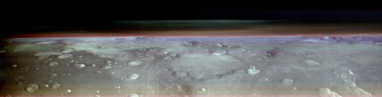
This view of Mars was captured by NASA's Odyssey orbiter using its Thermal Emission Imaging System, or THEMIS, camera. This image is a false color composite, made by combining three channels of infrared data that highlight water-ice clouds and dust in the atmosphere. This panorama was one of 10 captured on May 9, 2023, from an altitude of roughly 250 miles (400 kilometers) above the Martian surface – about the same altitude at which the International Space Station flies over Earth. The 10 panoramas of the Martian horizon were taken to capture a one-of-a-kind view of the Martian atmosphere as Odyssey circled the planet during its two-hour orbit. The reason why the view is so uncommon is because of the challenges involved in creating it. Engineers at NASA's Jet Propulsion Laboratory in Southern California (which leads the Odyssey mission) and Lockheed Martin Space (which built Odyssey and co-leads day-to-day operations) spent three months planning the observations. THEMIS' sensitivity to warmth enables it to map ice, rock, sand, and dust, along with temperature changes, on the planet's surface. It can also measure how much water ice or dust is in the atmosphere, but only in a narrow column directly below the spacecraft. That's because THEMIS is fixed in place on the orbiter; it usually points straight down. Mission scientists wanted a more expansive view of the atmosphere. Seeing where those layers of water-ice clouds and dust are in relation to each other – whether there's one layer or several stacked on top of each other – helps them improve models of Mars' atmosphere. Because THEMIS can't pivot, adjusting the angle of the camera requires adjusting the position of the whole spacecraft. In this case, the team needed to rotate the orbiter almost 90 degrees while making sure the Sun would still shine on the spacecraft's solar panels but not on sensitive equipment that could overheat. The easiest orientation turned out to be one where the orbiter's antenna pointed away from Earth. That meant the team was out of communication with Odyssey for several hours until the operation was completed. https://photojournal.jpl.nasa.gov/catalog/PIA26203
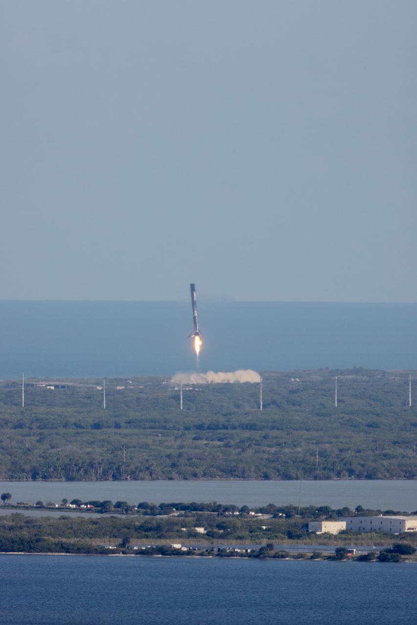
After boosting a SpaceX Dragon spacecraft on its way to the International Space Station for the company’s 30th Commercial Resupply Services mission for NASA, the first stage of the Falcon 9 rocket returns to Landing Zone 1 at Cape Canaveral Space Force Station (CCSFS) in Florida on Thursday, March 21, 2024. Dragon will deliver more than 6,200 pounds of cargo, including a variety of NASA and partner research including a look at plant metabolism in space and a set of new sensors for free-flying Astrobee robots to provide 3D mapping capabilities. Other studies include a fluid physics study that could benefit solar cell technology and a university project from CSA (Canadian Space Agency) that will monitor sea ice and ocean conditions. The spacecraft is expected to spend about a month attached to the orbiting outpost before it returns to Earth with research and return cargo, splashing down off the coast of Florida. Liftoff occurred at 4:55 p.m. EDT from Space Launch Complex 40 at CCSFS.
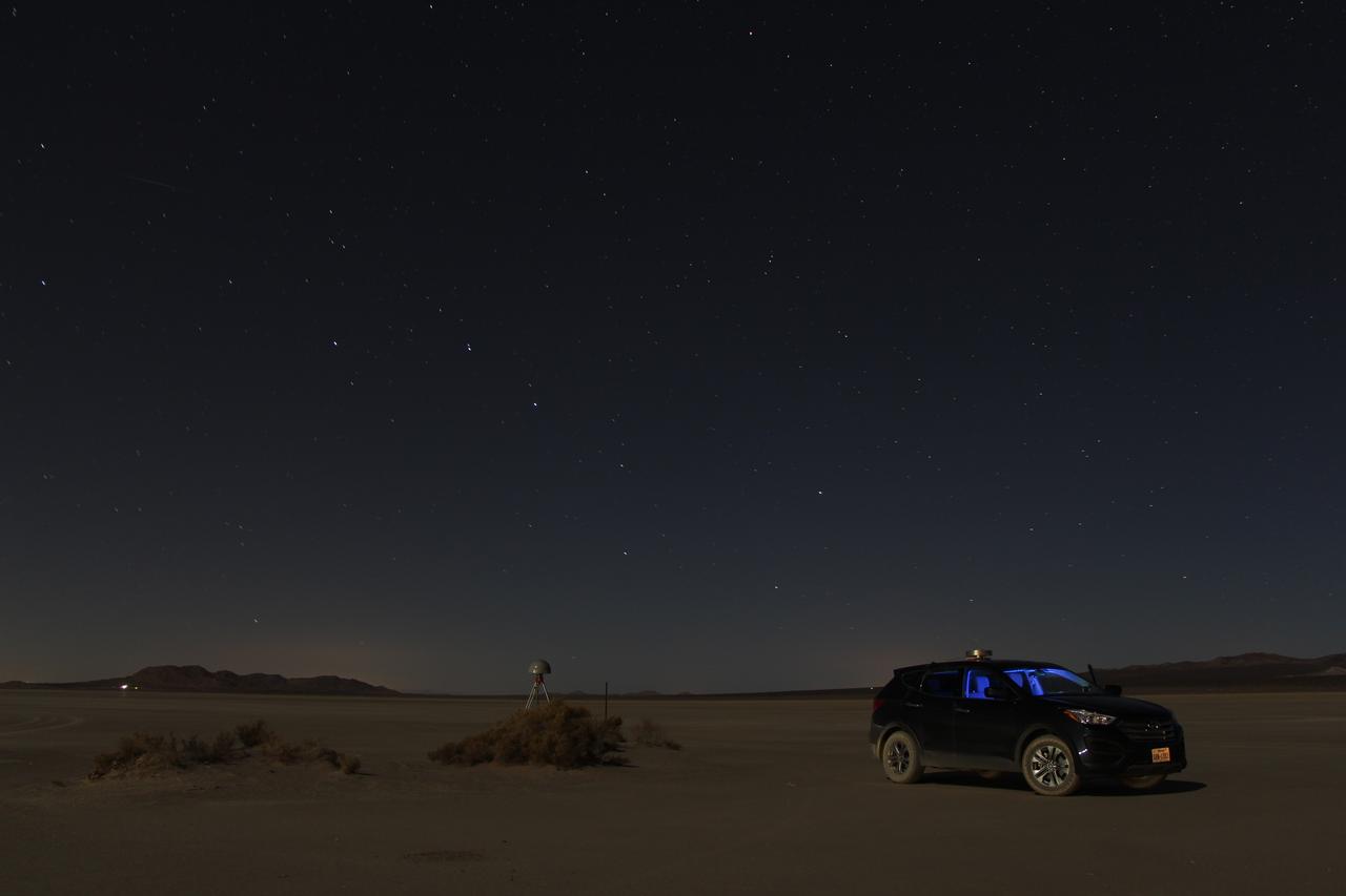
At first glance a dry lake bed in the southern California desert seems like the last place to prepare to study ice. But on Oct. 2, 2014, NASA’s Operation IceBridge carried out a ground-based GPS survey of the El Mirage lake bed in California’s Mojave Desert. Members of the IceBridge team are currently at NASA’s Armstrong Flight Research Center, preparing instruments aboard the DC-8 research aircraft for flights over Antarctica. Part of this preparation involves test flights over the desert, where researchers verify their instruments are working properly. El Mirage serves as a prime location for testing the mission’s laser altimeter, the Airborne Topographic Mapper, because the lake bed has a flat surface and reflects light similarly to snow and ice. This photo, taken shortly after the survey, shows the GPS-equipped survey vehicle and a stationary GPS station (left of the vehicle) on the lake bed with the constellation Ursa Major in the background. By driving the vehicle in parallel back and forth lines over a predefined area and comparing those GPS elevation readings with measurements from the stationary GPS, researchers are able to build an elevation map that will be used to precisely calibrate the laser altimeter for ice measurements. Credit: NASA/John Sonntag Operation IceBridge is scheduled to begin research flights over Antarctica on Oct. 15, 2014. The mission will be based out of Punta Arenas, Chile, until Nov. 23. For more information about IceBridge, visit: <a href="http://www.nasa.gov/icebridge" rel="nofollow">www.nasa.gov/icebridge</a> <b><a href="http://www.nasa.gov/audience/formedia/features/MP_Photo_Guidelines.html" rel="nofollow">NASA image use policy.</a></b> <b><a href="http://www.nasa.gov/centers/goddard/home/index.html" rel="nofollow">NASA Goddard Space Flight Center</a></b> enables NASA’s mission through four scientific endeavors: Earth Science, Heliophysics, Solar System Exploration, and Astrophysics. Goddard plays a leading role in NASA’s accomplishments by contributing compelling scientific knowledge to advance the Agency’s mission. <b>Follow us on <a href="http://twitter.com/NASAGoddardPix" rel="nofollow">Twitter</a></b> <b>Like us on <a href="http://www.facebook.com/pages/Greenbelt-MD/NASA-Goddard/395013845897?ref=tsd" rel="nofollow">Facebook</a></b> <b>Find us on <a href="http://instagram.com/nasagoddard?vm=grid" rel="nofollow">Instagram</a></b>
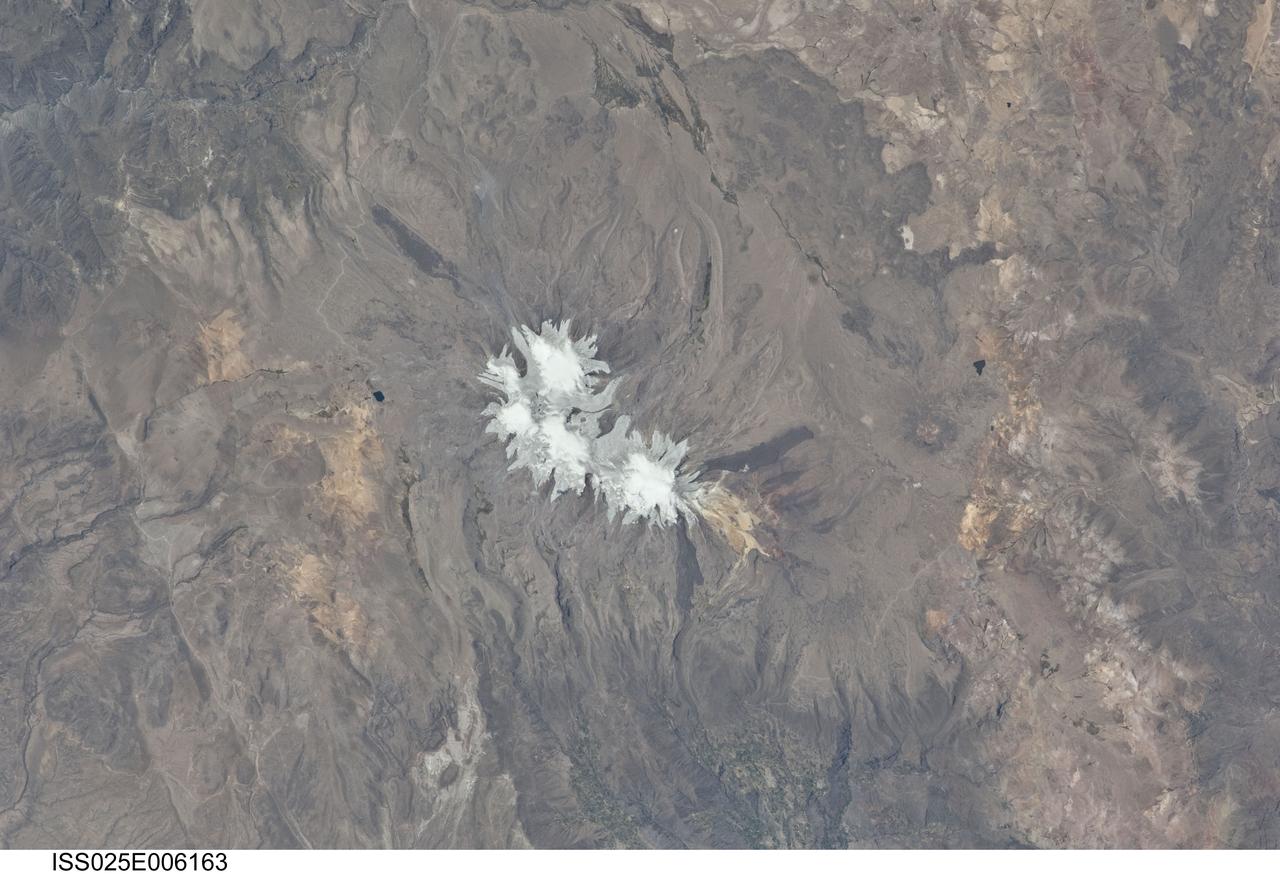
ISS025-E-006163 (6 Oct. 2010) --- Nevado Coropuna, Peru is featured in this image photographed by an Expedition 25 crew member on the International Space Station. Nevado (“snowy” or “snowy peak” in Spanish) Coropuna is the highest volcanic peak in Peru – the summit elevation is 6,377 meters above sea level. Rather than being a single stratovolcano, Coropuna is a volcanic complex of numerous summit cones. The complex covers an area of 240 square kilometers within the Ampato mountain range (Cordillera Ampato) in southeast-central Peru. While the exact date of the volcano’s last eruption is not known, lava flows (black, at center and upper left) along the northern, southern, and western flanks of the complex are thought to have been emplaced during the early Holocene Epoch – the current geologic time period which began approximately 12,000 years ago, according to scientists. Coropuna also hosts several summit glaciers and icefields (white to gray, center) that contrast sharply with the dark rock outcrops and surface deposits at lower elevations. Glacial deposits and lateral moraines on the flanks of Coropuna indicate that glaciers once extended to much lower elevations than are observed today. Scientists believe that careful mapping and surface exposure age-dating of these glacial deposits and landforms provides data on the timing of ice advances and retreats in the tropics near the end of the Pleistocene Epoch (extending from approximately 2.5 million to approximately 12,000 years ago). In turn, this information can be compared with other paleoclimate records to obtain a better understanding of how Earth’s global climate has changed over geologic time.

ISS034-E-057550 (28 Feb. 2013) --- One of the Expedition 34 crew members aboard the Earth-orbiting International Space Station photographed this image featuring the Southern High Plains of northwestern Texas, directly south of the city of Amarillo (off the image to the north). At first glance the picture appears more like a map than an actual photo. The winter of 2012-2013 has been marked by powerful snowstorms with record-setting snowfall throughout much of the Midwestern United States The snowstorm that passed through this area left a record snowfall of approximately 43 centimeters (17 inches). Snow blankets the city of Canyon, Texas. Urban street grids and stream channels appear etched into the landscape by the snow, a result of both melting and street clearing in the urban regions and of the incised nature of stream channels in the surrounding plains. Agricultural fields are easily identified due to the even snow cover broken only by roadways between the fields. Palo Duro Canyon is largely free of snow along the Prairie Dog Town Fork of the Red River channel and at lower elevations, allowing the red sedimentary rocks of the canyon walls to be visible. Lake Tanglewood, a reservoir to the northeast of Canyon, appears dark due to a lack of ice cover. Another dark region to the northwest of Canyon is a feed yard for cattle; any snowfall in this area has been removed by the actions of the livestock. The image was recorded with a digital camera using a 400 millimeter lens,