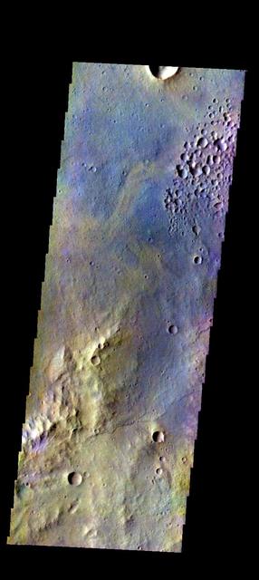
The THEMIS VIS camera contains 5 filters. The data from different filters can be combined in multiple ways to create a false color image. These false color images may reveal subtle variations of the surface not easily identified in a single band image. Today's false color image shows some of the plains of Margaritifer Terra. Orbit Number: 51484 Latitude: -19.1306 Longitude: 331.896 Instrument: VIS Captured: 2013-07-23 03:11 http://photojournal.jpl.nasa.gov/catalog/PIA21309
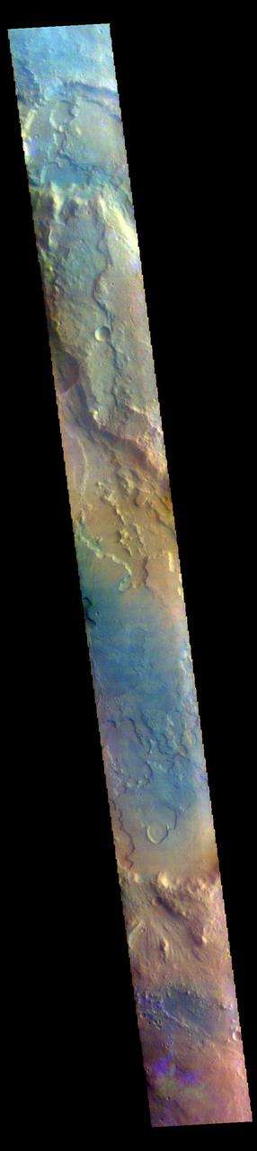
The THEMIS VIS camera contains 5 filters. The data from different filters can be combined in multiple ways to create a false color image. These false color images may reveal subtle variations of the surface not easily identified in a single band image. Today's false color image shows part of the plains of Margaritifer Terra. Orbit Number: 52108 Latitude: -12.6683 Longitude: 344.894 Instrument: VIS Captured: 2013-09-12 11:25 http://photojournal.jpl.nasa.gov/catalog/PIA21508
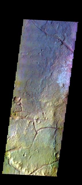
The THEMIS VIS camera contains 5 filters. The data from different filters can be combined in multiple ways to create a false color image. These false color images may reveal subtle variations of the surface not easily identified in a single band image. Today's false color image shows part of the plains of Margaritifer Terra. Orbit Number: 52021 Latitude: -18.9842 Longitude: 332.027 Instrument: VIS Captured: 2013-09-05 07:38 http://photojournal.jpl.nasa.gov/catalog/PIA21506
This image from NASA Mars Odyssey is of an unnamed channel in Margaritifer Terra.
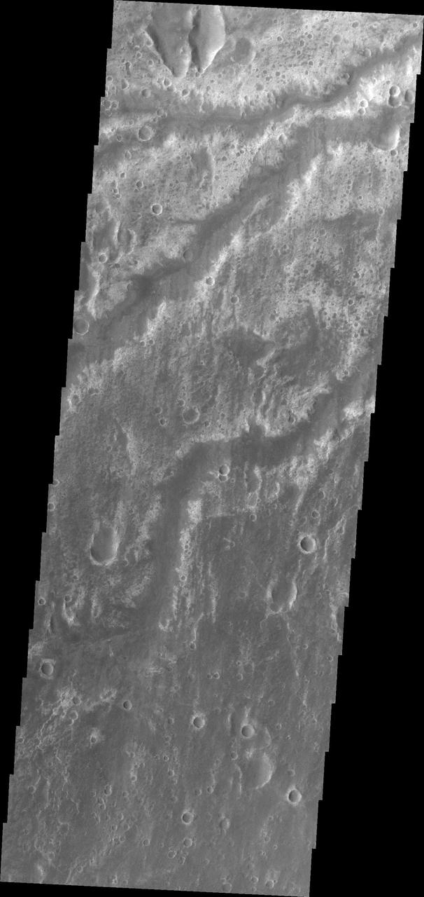
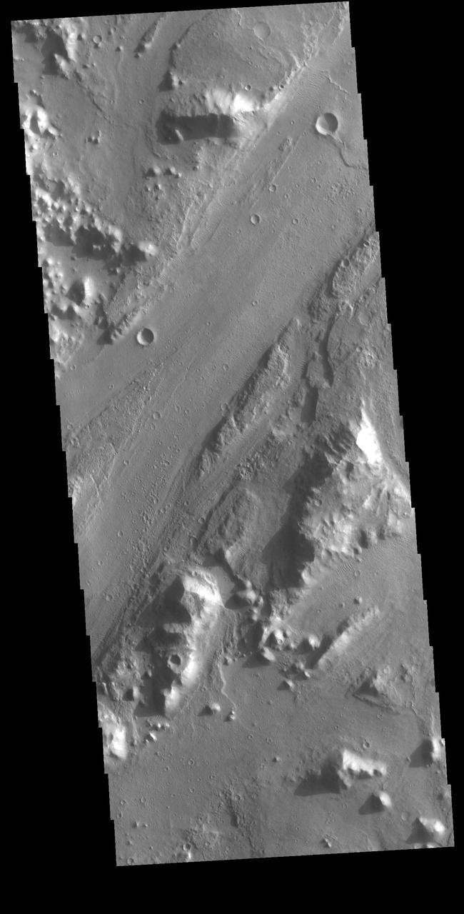
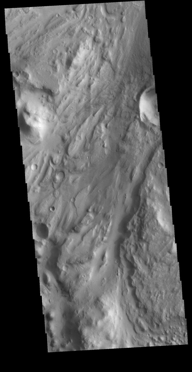
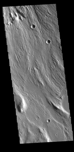
Fractures mark the surface in this region of Margaritifer Terra in this image captured by NASA 2001 Mars Odyssey spacecraft.
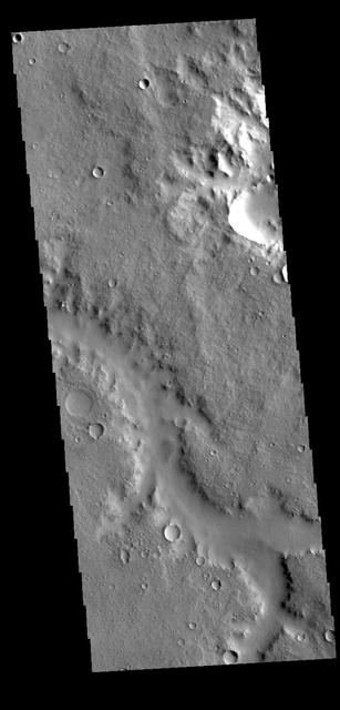
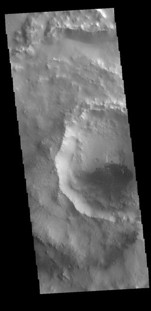
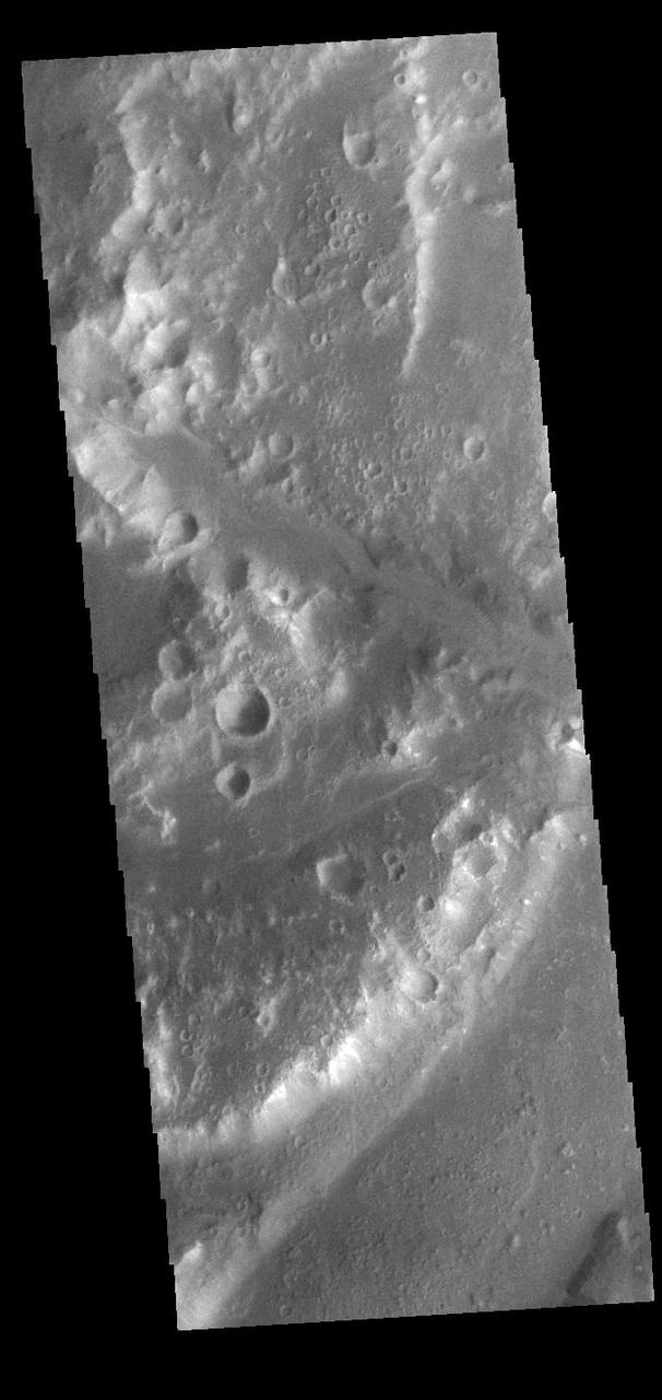
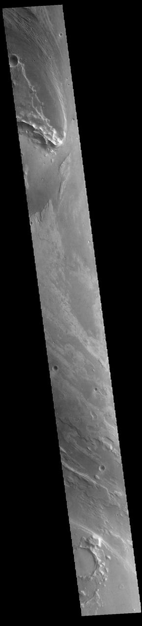
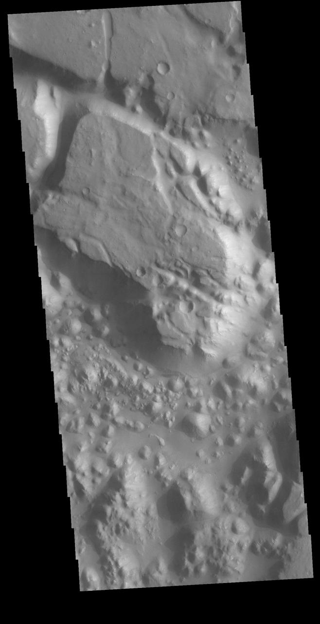
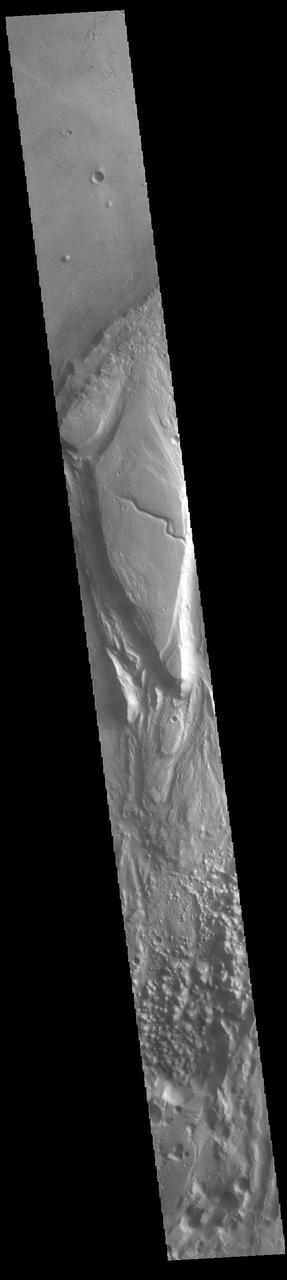
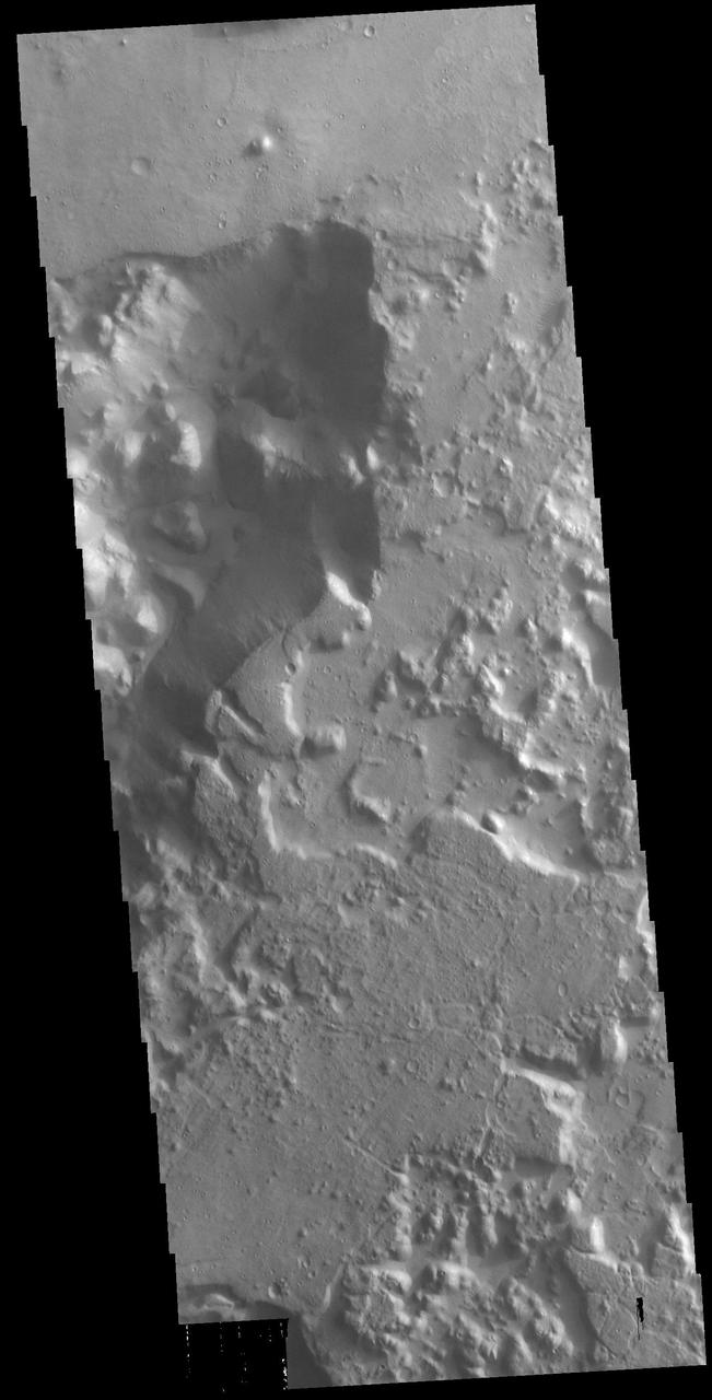
A landslide occurred from the rim of this unnamed crater in Margaritifer Terra as seen by NASA Mars Odyssey.
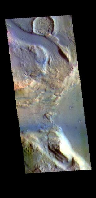
This image captured by NASA 2001 Mars Odyssey shows unnamed channel flows northward in Margaritifer Terra.
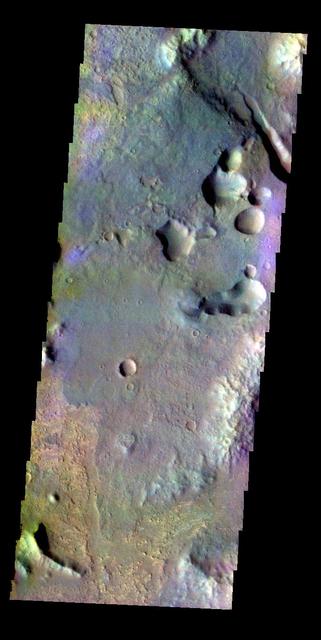
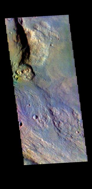
A large enclosed basin is located in Margaritifer Terra. Several small channels flow into the basin and multiple large outflow channels cross it from south to north. This VIS image shows are region of graben within the center of the basin. Orbit Number: 79152 Latitude: -18.905 Longitude: 331.607 Instrument: VIS Captured: 2019-10-18 16:32 https://photojournal.jpl.nasa.gov/catalog/PIA23577
The THEMIS VIS camera contains 5 filters. The data from different filters can be combined in multiple ways to create a false color image. These false color images may reveal subtle variations of the surface not easily identified in a single band image. Today's false color image shows part of Margaritifer Terra. Orbit Number: 77542 Latitude: 18.1396 Longitude: 337.812 Instrument: VIS Captured: 2019-06-08 02:52 https://photojournal.jpl.nasa.gov/catalog/PIA24631
The THEMIS VIS camera contains 5 filters. The data from different filters can be combined in multiple ways to create a false color image. These false color images may reveal subtle variations of the surface not easily identified in a single band image. Today's false color image shows part of Margaritifer Terra near Margaritifer Chaos. Orbit Number: 8178 Latitude: -9.75044 Longitude: 338.017 Instrument: VIS Captured: 2003-10-18 17:39 http://photojournal.jpl.nasa.gov/catalog/PIA19729
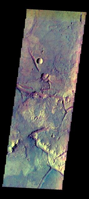
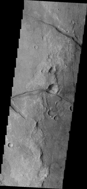
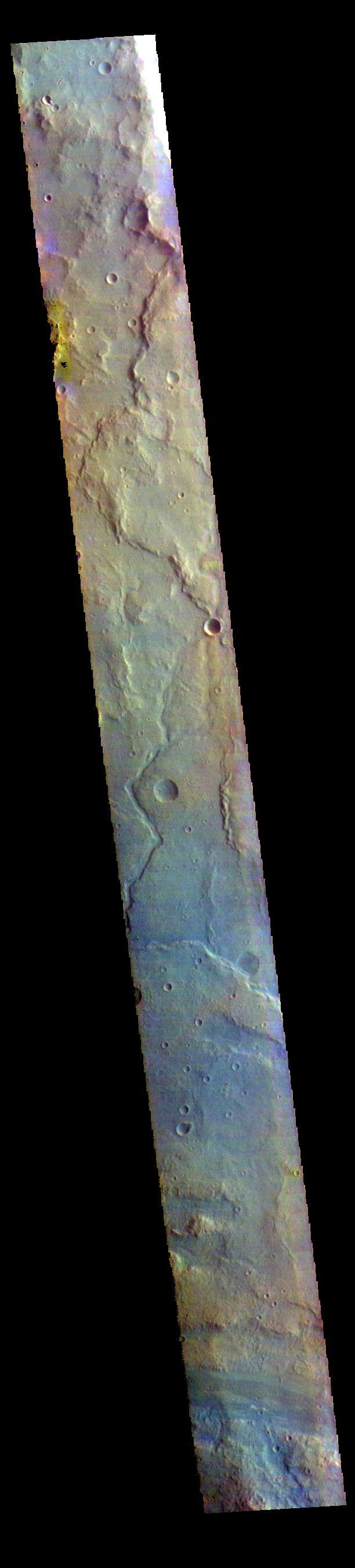
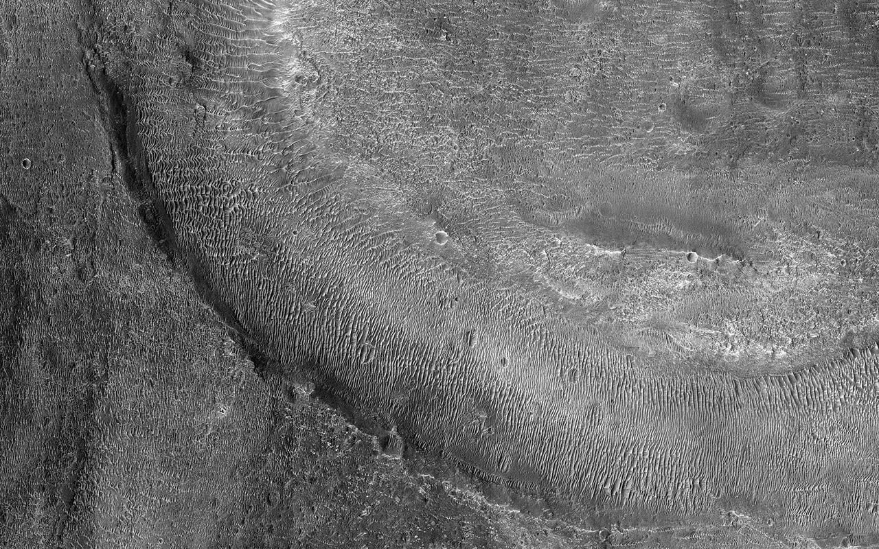
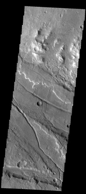
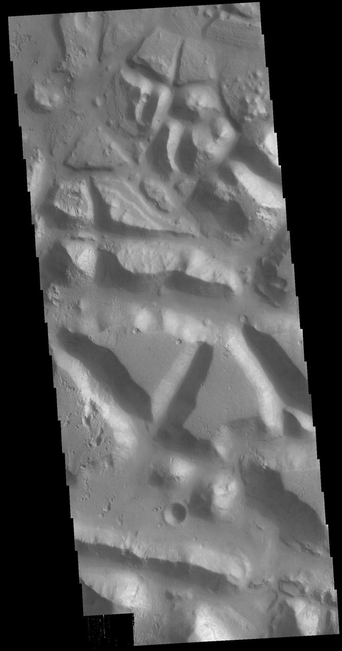
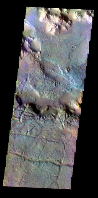
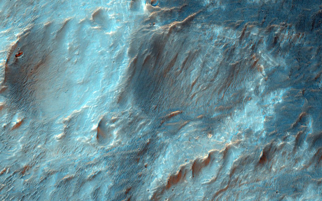
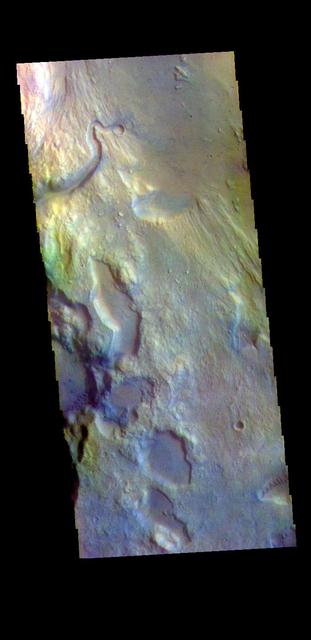
The THEMIS VIS camera contains 5 filters. The data from different filters can be combined in multiple ways to create a false color image. These false color images may reveal subtle variations of the surface not easily identified in a single band image. Today's false color image shows part of Margaritifer Terra. The linear depressions were created by extensional tectonic stresses. The nature of the white toned material is unknown at this time. Orbit Number: 71991 Latitude: -18.9301 Longitude: 332.049 Instrument: VIS Captured: 2018-03-07 21:50 https://photojournal.jpl.nasa.gov/catalog/PIA24515
The THEMIS VIS camera contains 5 filters. The data from different filters can be combined in multiple ways to create a false color image. These false color images may reveal variations of the surface not easily identified in a single band image. Today's false color image shows part of Margaritifer Terra. Dark blue in this band configuration often equates with sand or basaltic materials. Orbit Number: 37552 Latitude: 6.87548 Longitude: 345.994 Instrument: VIS Captured: 2010-06-02 09:07 http://photojournal.jpl.nasa.gov/catalog/PIA20767
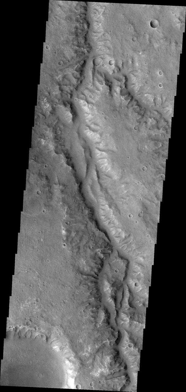
Margaritifer Terra is the most impressive water-modified landscape on Mars that preserves the highest density of valley networks on the planet. Fluvial activity began in the Noachian period, likely peaked in the late Noachian-to-Hesperian, and then persisted, at least locally, into the Late Hesperian or Amazonian epoch. (This time period goes back at least 4 billion years to the present.) Our image shows fluvial channels that cut through the ejecta from Jones Crater, indicating relatively younger water activity in the region. https://photojournal.jpl.nasa.gov/catalog/PIA25360
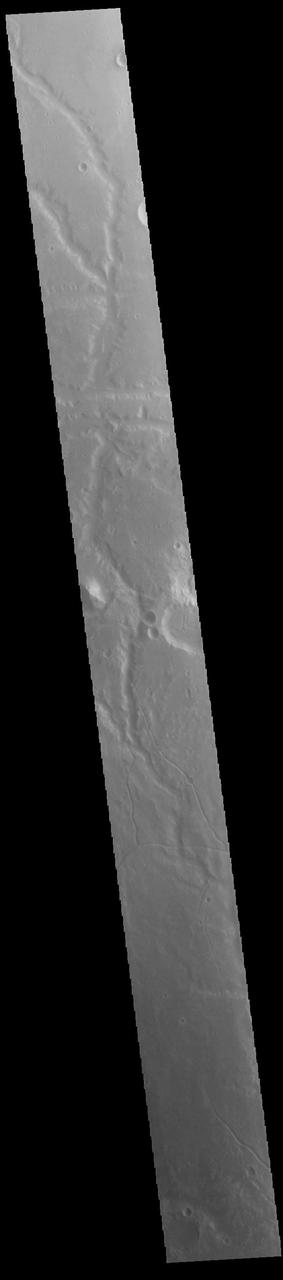
This unnamed as seen by NASA 2001 Mars Odyssey spacecraft channel drains part of Margaritifer Terra.
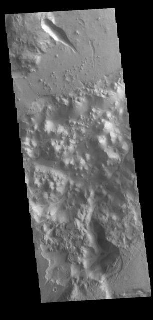
This small landslide deposit is located in an unnamed crater in Margaritifer Terra in this image captured by NASA 2001 Mars Odyssey spacecraft.
This image captured by NASA 2001 Mars Odyssey shows unnamed channel flows northward in Margaritifer Terra.
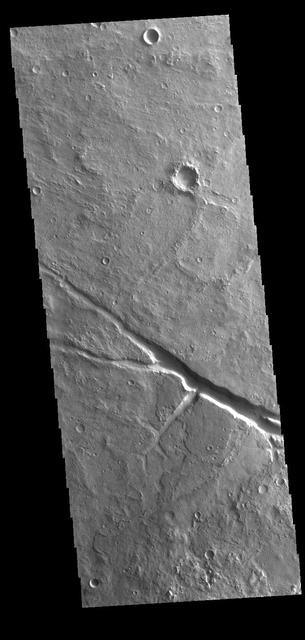
This VIS image shows part of an unnamed channel located on the plains between Margaritifer Terra and Arabia Terra. Orbit Number: 79950 Latitude: -8.16437 Longitude: 347.988 Instrument: VIS Captured: 2019-12-23 09:35 https://photojournal.jpl.nasa.gov/catalog/PIA23745
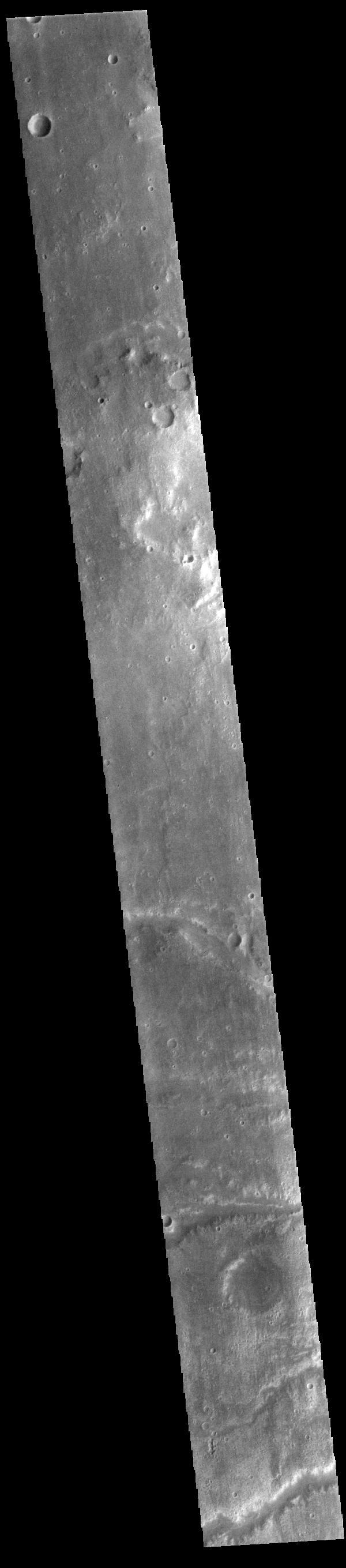
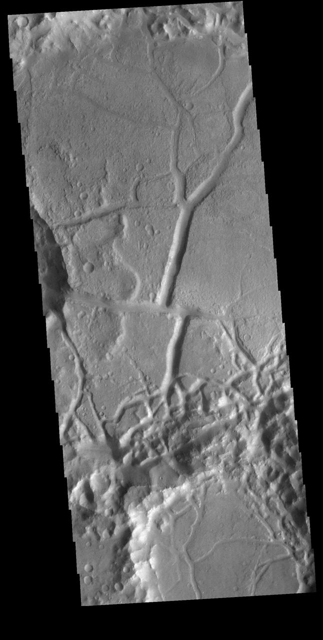
This image from NASA 2001 Mars Odyssey shows a few of the many channels named in this case Arda Valles and unnamed that empty into a large low in Margaritifer Terra.
This image captured by NASA 2001 Mars Odyssey spacecraft shows the complex region where Ladon Valles enters a topographic low in Margaritifer Terra.
This image from NASA Mars Reconnaissance Orbiter shows Vinogradov, an old, 224-kilometer diameter, heavily degraded impact crater in southern Margaritifer Terra.
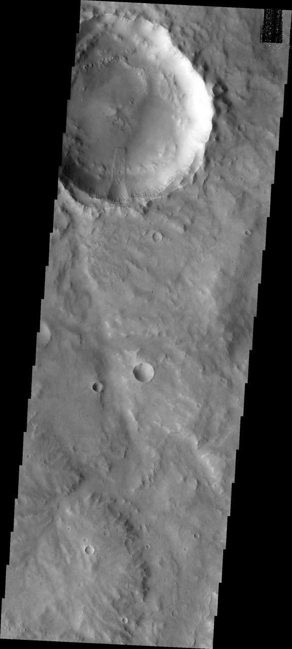
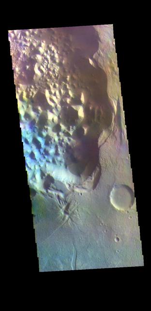
This VIS image shows several unnamed channels. These channels are dissecting the northern rim of a large, unnamed, ancient impact structure. These features are located in Margaritifer Terra. Orbit Number: 85953 Latitude: -14.3851 Longitude: 329.215 Instrument: VIS Captured: 2021-04-30 16:11 https://photojournal.jpl.nasa.gov/catalog/PIA24888
Today's VIS image shows a section of Morava Valles. Morava Valles is located in Margaritifer Terra. Orbit Number: 79601 Latitude: -12.1454 Longitude: 336.946 Instrument: VIS Captured: 2019-11-24 15:53 https://photojournal.jpl.nasa.gov/catalog/PIA23665
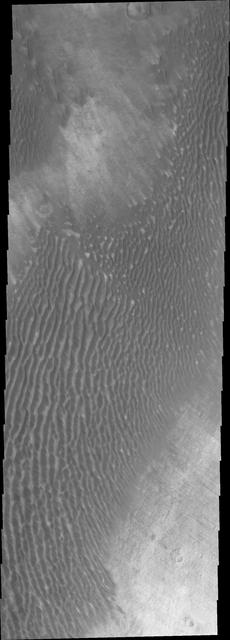
Today's VIS image shows a field of sand dunes in an unnamed crater located in Margaritifer Terra. Most sand dunes on Mars are made of dark basaltic sands. Orbit Number: 78228 Latitude: 6.60598 Longitude: 346.706 Instrument: VIS Captured: 2019-08-03 14:35 https://photojournal.jpl.nasa.gov/catalog/PIA23455
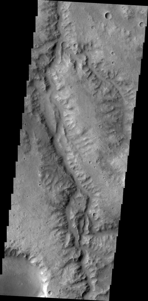
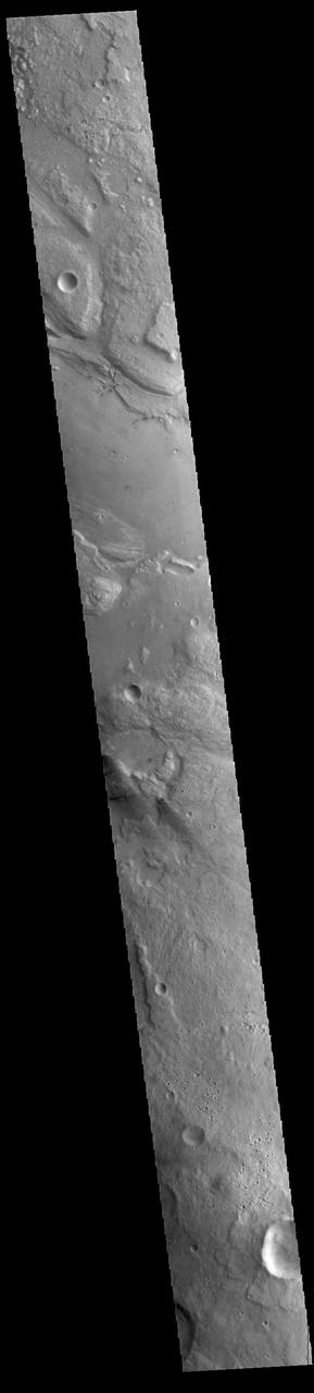
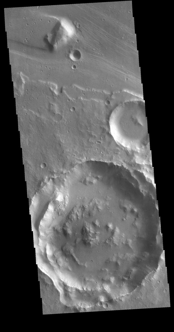
Several channels are visible at the bottom of today's image. These channels, as well as many others, all drain into a large unnamed basin in Margaritifer Terra. Orbit Number: 83058 Latitude: -17.3432 Longitude: 325.925 Instrument: VIS Captured: 2020-09-04 07:23 https://photojournal.jpl.nasa.gov/catalog/PIA24248
Today's VIS image show a section of Ladon Vallis. The channel is 278km long (173 miles). Ladon Vallis is located in Noachis Terrra and flows northward to Margaritifer Terra. Orbit Number: 91481 Latitude: -23.1934 Longitude: 330.565 Instrument: VIS Captured: 2022-07-29 20:19 https://photojournal.jpl.nasa.gov/catalog/PIA25602
Today's VIS image shows a section of Ares Vallis. Ares Vallis is a large channel that arises in Iani Chaos, passes through Margaritifer Terra, and then empties into Chryse Planitia. Orbit Number: 80624 Latitude: 0.445959 Longitude: 342.666 Instrument: VIS Captured: 2020-02-16 21:33 https://photojournal.jpl.nasa.gov/catalog/PIA23843
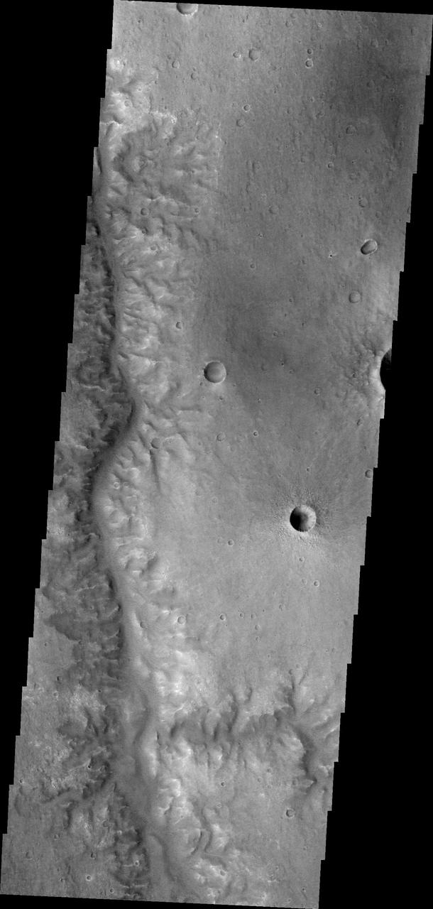
Today's VIS image is located in Margaritifer Terra near Eos Chasma. The ground in this region has been broken up into mesas and valleys, with the initial break up thought to be due to a release of groundwater. With continued erosion, the mesas become smaller and smaller, creating the jumble of hills seen at the bottom of this image. Orbit Number: 82609 Latitude: -16.5146 Longitude: 319.112 Instrument: VIS Captured: 2020-07-29 08:06 https://photojournal.jpl.nasa.gov/catalog/PIA24145
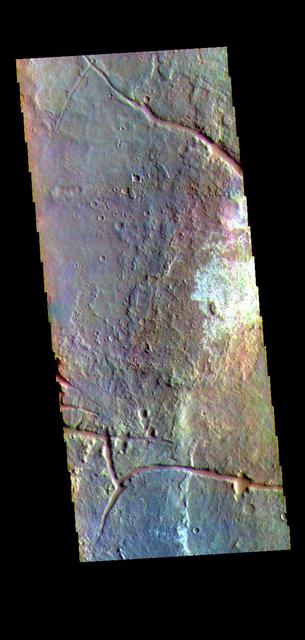
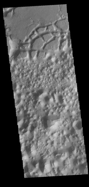
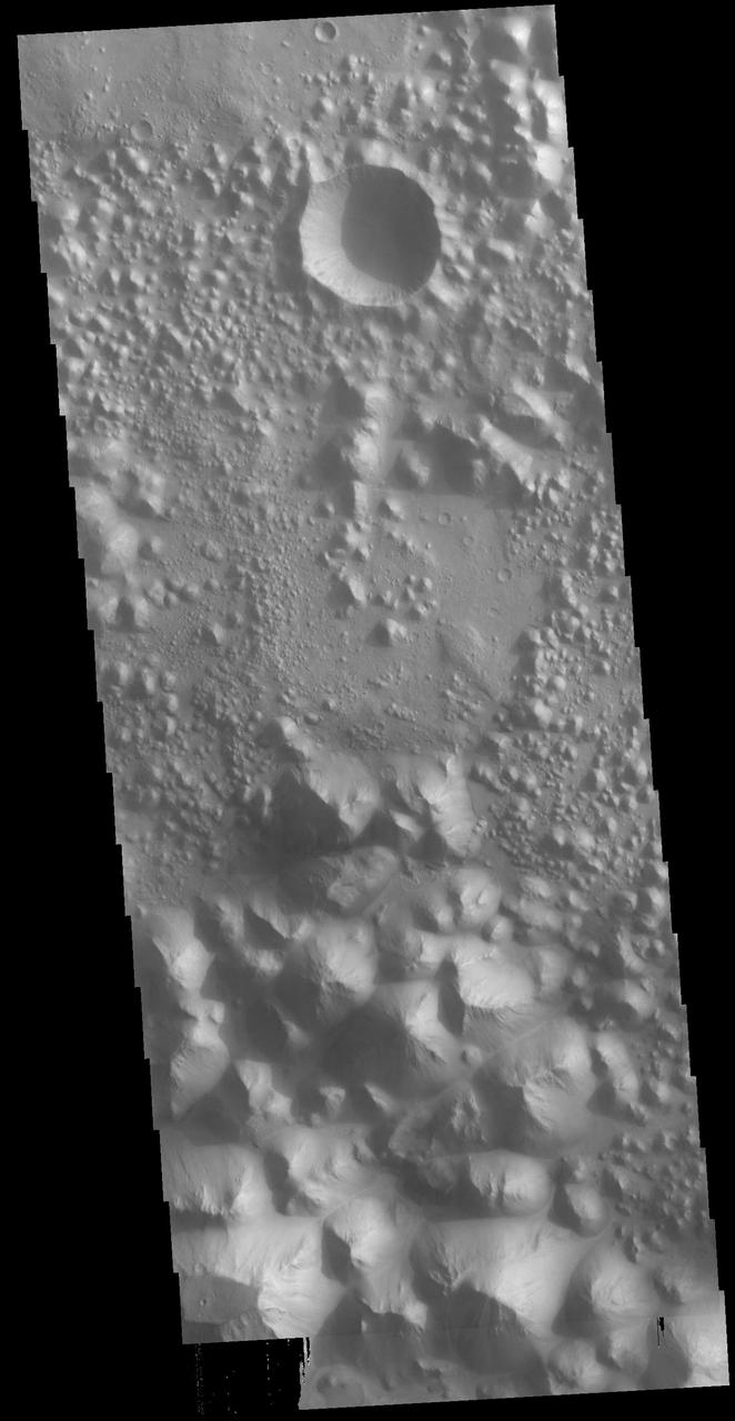
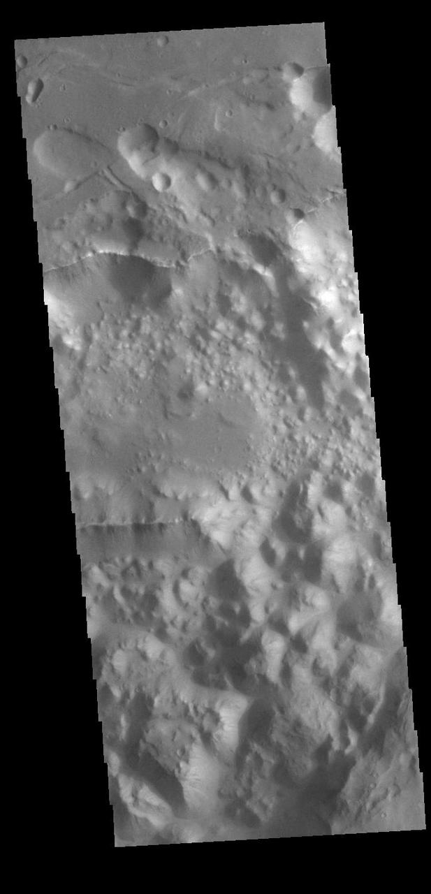
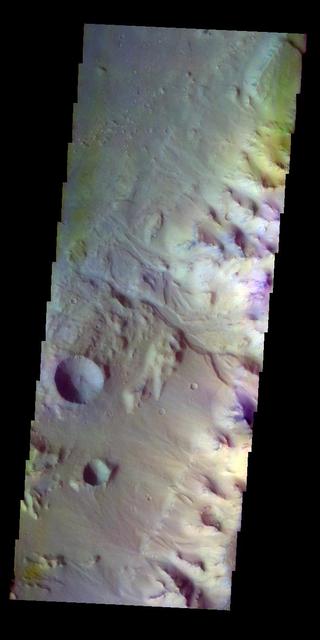
Today's VIS image shows part of the floor of an unnamed crater in Margaritifer Terra. The crater floor is dissected by linear features, most likely faults. There is an offset of the large depression in the center of the image, where the linear feature has been pulled sideways along a perpendicular fault. With time and erosion this region of fault blocks will become chaos terrain. Orbit Number: 81735 Latitude: -18.403 Longitude: 333.725 Instrument: VIS Captured: 2020-05-18 08:56 https://photojournal.jpl.nasa.gov/catalog/PIA24006
The THEMIS VIS camera contains 5 filters. The data from different filters can be combined in multiple ways to create a false color image. These false color images may reveal subtle variations of the surface not easily identified in a single band image. Today's false color image shows part of Margartifier Terra near Ares Vallis. Orbit Number: 80961 Latitude: 7.61436 Longitude: 339.521 Instrument: VIS Captured: 2020-03-15 15:33 https://photojournal.jpl.nasa.gov/catalog/PIA24679
Today's VIS image shows a small section of Hydaspis Chaos, one of many regions of chaos in Margaritifer Terra. The term chaos is applied to regions where the surface is being eroded to form mesas. As the surface processes continue individual mesas become more isolated and take on the appearance of regions of hills. Hydaspis Chaos is is part of the huge outflow system flowing from Valles Marineris to Chryse Planitia. Orbit Number: 79027 Latitude: 2.3043 Longitude: 335.049 Instrument: VIS Captured: 2019-10-08 09:37 https://photojournal.jpl.nasa.gov/catalog/PIA23544
Today's VIS image shows part of Hydaspis Chaos, one of many regions of chaos in Margaritifer Terra. Chaos terrain is typified by mesas and valleys. The initial breakup of the surface can be due to tectonic forces, although on Mars it is thought that the mode of formation involves release of melted subsurface ice. With time and erosion the valleys widen and the mesas grow smaller. Hydaspis Chaos is is part of the huge outflow system flowing from Valles Marineris to Chryse Planitia. The channel in the center of the image becomes part of the larger Tiu Valles channel. Orbit Number: 87600 Latitude: 3.42796 Longitude: 332.822 Instrument: VIS Captured: 2021-09-13 06:56 https://photojournal.jpl.nasa.gov/catalog/PIA25228
Huge regions of complex valleys and chaos are located in Xanthe and Margaritifer Terras. Rising from Valles Marineris, outflow channels like Ares, Tiu and Shalbantana valles empty into Chryse Planitia. This VIS image shows part of Chryse Chaos, located within Masursky Crater, along the Tiu Valles channel. Chaos forms from erosion of the surface into mesa features. With time the valleys expand creating the jumble of hills seen in the image. Orbit Number: 79152 Latitude: 11.5428 Longitude: 327.544 Instrument: VIS Captured: 2019-10-18 16:42 https://photojournal.jpl.nasa.gov/catalog/PIA23578
Today's VIS image shows part of Ares Vallis. Located in Margaritifer Terra, Ares Vallis is part of a large system of channels that arise from Vallis Marineris and empty into Chryse Planitia. Orbit Number: 85304 Latitude: 16.5128 Longitude: 327.987 Instrument: VIS Captured: 2021-03-08 05:51 https://photojournal.jpl.nasa.gov/catalog/PIA24775
The THEMIS VIS camera contains 5 filters. Data from different filters can be combined in multiple ways to create a false color image. This image from NASA 2001 Mars Odyssey spacecraft shows the region at the start of Morava Valles in Margaritifer Terra. Orbit Number: 7916 Latitude: -15.4518 Longitude: 333.474 Instrument: VIS Captured: 2003-09-27 04:05 http://photojournal.jpl.nasa.gov/catalog/PIA19491
The THEMIS VIS camera contains 5 filters. The data from different filters can be combined in multiple ways to create a false color image. These false color images may reveal subtle variations of the surface not easily identified in a single band image. Today's false color image shows a small section of Hydaspis Chaos, one of many regions of chaos in Margaritifer Terra. The term chaos is applied to regions where the surface is being eroded to form mesas. As the surface processes continue individual mesas become more isolated and take on the appearance of regions of hills. Hydaspis Chaos is is part of the huge outflow system flowing from Valles Marineris to Chryse Planitia. Orbit Number: 70332 Latitude: 1.90016 Longitude: 335.673 Instrument: VIS Captured: 2017-10-22 05:45 https://photojournal.jpl.nasa.gov/catalog/PIA24502
Today's VIS image shows a small section on Margaritifer Chaos. The term chaos is applied to regions where the surface is being eroded to form mesas. As the surface processes continue individual mesas become more isolated and take on the appearance of regions of hills. At the top of the image is Margaritifer Terra, which is being dissected into large mesas. Towards the bottom of the image the mesas have been eroded into smaller hills. Orbit Number: 89010 Latitude: -7.22948 Longitude: 336.24 Instrument: VIS Captured: 2022-01-07 09:17 https://photojournal.jpl.nasa.gov/catalog/PIA25345
This VIS image shows a small section on Margaritifer Chaos. The term chaos is applied to regions where the surface is being eroded to form mesas. As the surface processes continue individual mesas become more isolated and take on the appearance of regions of hills. At the top of the image is Margaritifer Terra, which is being dissected into large mesas. Towards the bottom of the image the mesas have been eroded into smaller hills. Orbit Number: 72315 Latitude: -8.86121 Longitude: 339.105 Instrument: VIS Captured: 2018-04-03 14:28 https://photojournal.jpl.nasa.gov/catalog/PIA22538
Bigbee is a 21 kilometer-diameter impact crater located on the northern rim of Holden crater in southern Margaritifer Terra, a region on Mars that is well known for its long record of water-rich activity as seen by NASA Mars Reconnaissance Orbiter. he rim of Bigbee has been heavily modified from its original form, presumably by water and wind. Material eroded and removed from Bigbee's rim was transported and deposited to the crater interior. Some of the darker-toned material near Bigbee's northern rim has been incorporated into fan-shaped deposits with distinct margins at the outer part. The fan surfaces appear to lack obvious layering and channels. The modification of Bigbee and other smaller craters on Holden's rim may have been contemporaneous with a proposed period of relatively late, water-driven activity that formed fans in Holden and other craters in Margaritifer Terra (see Grant and Wilson, 2012). Note: The cutout is 3.5-kilometer across and shows dark fan-like deposits on left side of image at the base of a light-toned scarp. http://photojournal.jpl.nasa.gov/catalog/PIA19296
Located in Margaritifer Terra, Morava Valles is one of several channels that empty northward towards Chryse Planitia. Chaos terrain is typified by regions of blocky, often steep sided, mesas interspersed with deep valleys. With time and erosion the valleys widen and the mesas become smaller. It has been proposed that a catastrophic outflow of subsurface water creates the chaos and provides the surface flow creating the channel. Morava Valles arises from a region of chaos. Chaos terrain is also found along the course of the channel and may occur when the channel flow fluid warms the subsurface ice creating additional release points for melted subsurface ice. This VIS image shows a region of chaos near the terminal end of Morava Valles. Orbit Number: 78166 Latitude: -11.1105 Longitude: 337.845 Instrument: VIS Captured: 2019-07-29 11:58 https://photojournal.jpl.nasa.gov/catalog/PIA23418
The THEMIS VIS camera contains 5 filters. The data from different filters can be combined in multiple ways to create a false color image. These false color images may reveal subtle variations of the surface not easily identified in a single band image. Today's false color image shows the margin between the highlands of Margaritifer Terra and Eos Chasma. An unnamed channel in the center of the image empties into the chasma. Orbit Number: 8191 Latitude: -10.784 Longitude: 322.952 Instrument: VIS Captured: 2003-10-19 19:20 http://photojournal.jpl.nasa.gov/catalog/PIA19730

Today's VIS image shows a landslide deposit in Tiu Valles. The impact that created the crater likely caused the landslide, either during the impact event or shortly after. Located in Margaritifer Terra, Tiu Valles is part of a large system of channels that arise from Vallis Marineris and flow northward to empty into Chryse Planitia. Tiu Valles is 1720km long (1069 miles). Orbit Number: 88299 Latitude: 14.6135 Longitude: 325.705 Instrument: VIS Captured: 2021-11-09 20:20 https://photojournal.jpl.nasa.gov/catalog/PIA25197
Today's VIS image shows a portion of Ares Vallis. Located in Margaritifer Terra, Ares Vallis is an outflow channel carved by massive floods of escaping groundwater whose source lies far to the south of this image. Ares Vallis is over 1757 km long (1091 miles). This channel, and all others in this region, drain into Chryse Planitia. Orbit Number: 93939 Latitude: 9.783 Longitude: 334.4 Instrument: VIS Captured: 2023-02-17 05:51 https://photojournal.jpl.nasa.gov/catalog/PIA25930
Today's VIS image shows a section of Tiu Valles. Located in Margaritifer Terra, Tiu Valles is a complex channel that is part of a large system of outflow channels that arise from Vallis Marineris and flow northward to empty into Chryse Planitia. Tiu Vallis is 1720 km (1069 miles) long. Orbit Number: 87675 Latitude: 4.06653 Longitude: 329.088 Instrument: VIS Captured: 2021-09-19 11:09 https://photojournal.jpl.nasa.gov/catalog/PIA25261
The channel seen in this VIS image is a tributary channel of Ares Vallis. This channel is not as deep as the main channel and parallels Ares Vallis before joining the the deeper channel at one of its bends. This channel is located in Margaritifer Terra. Orbit Number: 79863 Latitude: 8.01076 Longitude: 335.715 Instrument: VIS Captured: 2019-12-16 05:45 https://photojournal.jpl.nasa.gov/catalog/PIA23735
The THEMIS VIS camera contains 5 filters. The data from different filters can be combined in multiple ways to create a false color image. These false color images may reveal subtle variations of the surface not easily identified in a single band image. Today's false color image shows part of the main channel of Ares Vallis, as well as a small side tributary. Located in Margaritifer Terra, Ares Vallis is part of a large system of channels that arise in Valles Marineris and flow northward into Chryse Planitia. Orbit Number: 79239 Latitude: 7.64196 Longitude: 338.056 Instrument: VIS Captured: 2019-10-25 20:37 https://photojournal.jpl.nasa.gov/catalog/PIA24660
This false color image shows a tributary channel that empties into the main Ares Vallis channel. This tributary channel is located east of Ares Vallis. Located in Margaritifer Terra, Ares Vallis is part of a large system of channels that arise from Vallis Marineris and empty into Chryse Planitia. The THEMIS VIS camera contains 5 filters. The data from different filters can be combined in multiple ways to create a false color image. These false color images may reveal subtle variations of the surface not easily identified in a single band image. Orbit Number: 63809 Latitude: 4.17241 Longitude: 343.459 Instrument: VIS Captured: 2016-05-02 20:09
![Holden Crater in southern Margaritifer Terra displays a series of finely layered deposits on its floor. The layered deposits are especially well exposed in the southwestern section of the crater where erosion by water flowing through a breach in the crater rim created spectacular outcrops. In this location, the deposits appear beneath a cap of alluvial fan materials (tan to brown in this image). Within the deposits, individual layers are nearly flat-lying and can be traced for hundreds of meters to kilometers. Information from the CRISM instrument on the Mars Reconnaissance Orbiter suggests that at least some of these beds contain clays. By contrast, the beds in the overlying alluvial fan are less continuous and dip in varying directions, showing less evidence for clays. Collectively, the characteristics of the finely bedded deposits suggest they may have been deposited into a lake on the crater floor, perhaps fed by runoff related to formation of the overlying fans. The map is projected here at a scale of 25 centimeters (9.8 inches) per pixel. [The original image scale is 25.9 centimeters (10.2 inches) per pixel (with 1 x 1 binning); objects on the order of 78 centimeters (30.7 inches) across are resolved.] North is up. http://photojournal.jpl.nasa.gov/catalog/PIA21561](https://images-assets.nasa.gov/image/PIA21561/PIA21561~medium.jpg)
Holden Crater in southern Margaritifer Terra displays a series of finely layered deposits on its floor. The layered deposits are especially well exposed in the southwestern section of the crater where erosion by water flowing through a breach in the crater rim created spectacular outcrops. In this location, the deposits appear beneath a cap of alluvial fan materials (tan to brown in this image). Within the deposits, individual layers are nearly flat-lying and can be traced for hundreds of meters to kilometers. Information from the CRISM instrument on the Mars Reconnaissance Orbiter suggests that at least some of these beds contain clays. By contrast, the beds in the overlying alluvial fan are less continuous and dip in varying directions, showing less evidence for clays. Collectively, the characteristics of the finely bedded deposits suggest they may have been deposited into a lake on the crater floor, perhaps fed by runoff related to formation of the overlying fans. The map is projected here at a scale of 25 centimeters (9.8 inches) per pixel. [The original image scale is 25.9 centimeters (10.2 inches) per pixel (with 1 x 1 binning); objects on the order of 78 centimeters (30.7 inches) across are resolved.] North is up. http://photojournal.jpl.nasa.gov/catalog/PIA21561
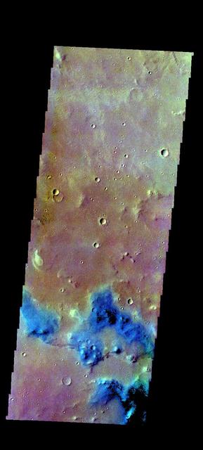
The THEMIS VIS camera contains 5 filters. The data from different filters can be combined in multiple ways to create a false color image. These false color images may reveal subtle variations of the surface not easily identified in a single band image. Today's false color image shows part of Margaritifer Terra just east of Ares Vallis. If you look closely at the bottom of the image, you will see spots of purple and yellow, with similar 'shapes'. These features are not image artifacts. These are clouds. When this image was collected there were high altitude ice clouds being blown across the sky, moving fast enough to reach a different location between the time each filter was collected. Color VIS images are typically the only image type where ice clouds can be identified. The THEMIS VIS camera is capable of capturing color images of the Martian surface using five different color filters. In this mode of operation, the spatial resolution and coverage of the image must be reduced to accommodate the additional data volume produced from using multiple filters. To make a color image, three of the five filter images (each in grayscale) are selected. Each is contrast enhanced and then converted to a red, green, or blue intensity image. These three images are then combined to produce a full color, single image. Because the THEMIS color filters don't span the full range of colors seen by the human eye, a color THEMIS image does not represent true color. Also, because each single-filter image is contrast enhanced before inclusion in the three-color image, the apparent color variation of the scene is exaggerated. Nevertheless, the color variation that does appear is representative of some change in color, however subtle, in the actual scene. Note that the long edges of THEMIS color images typically contain color artifacts that do not represent surface variation. Orbit Number: 85890 Latitude: 2.8487 Longitude: 344.415 Instrument: VIS Captured: 2021-04-25 11:47 https://photojournal.jpl.nasa.gov/catalog/PIA25097
This VIS image shows a region of chaos near the terminal end of Morava Valles. Located in Margaritifer Terra, Morava Valles is one of several channels that empty northward towards Chryse Planitia. Morava Valles arises from a region of chaos. Chaos terrain is also found along the course of the channel and may occur where the channel flow fluid warmed the subsurface ice creating additional release points for melted subsurface ice. Chaos terrain is typified by regions of blocky, often steep sided, mesas interspersed with deep valleys. With time and erosion the valleys widen and the mesas become smaller. It has been proposed that a catastrophic outflow of subsurface water creates the chaos and provides the surface flow creating the channel. Orbit Number: 79002 Latitude: -11.1516 Longitude: 338.097 Instrument: VIS Captured: 2019-10-06 08:08 https://photojournal.jpl.nasa.gov/catalog/PIA23541
The channel form at the top of this VIS image is part of Tiu Valles. The impact crater has affected the course of the channel, as has the small hill at the top of the image. This type of feature, a hill with a teardrop shaped section, is called a streamline island. The hill interrupts the fluid flow, creating eddies on the downstream side where the flow velocity lessens and it is unable to erode as easily as in the main part of the channel. The teardrop points downstream. Located in Margaritifer Terra, Tiu Valles is part of a large system of channels that arise from Vallis Marineris and flow northward to empty into Chryse Planitia. Orbit Number: 86527 Latitude: 16.6616 Longitude: 325.954 Instrument: VIS Captured: 2021-06-16 22:38 https://photojournal.jpl.nasa.gov/catalog/PIA24998
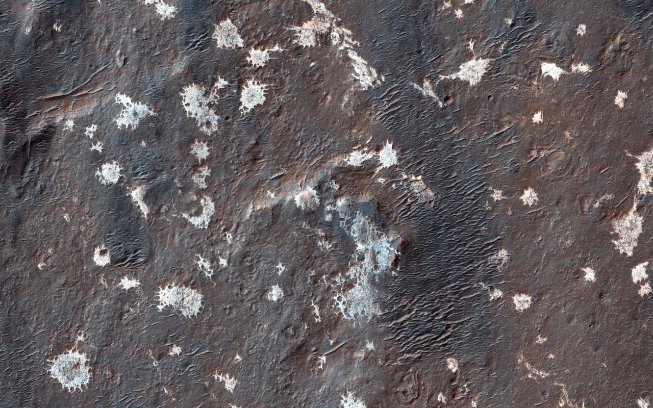
![This white, purple, and pink surface is located on the floor of an impact crater on the southeast rim of the larger Vinogradov Crater in southern Margaritifer Terra. The surface consists of what is left of a series of thin layers that subsequently eroded to create a "bullseye" pattern. The rough, etched appearance of the surface is similar-looking to deposits in other craters in the region and that are often associated with alluvial fans. The apparent ease and manner in which the materials are eroded relative to nearby fans and crater materials suggests they are fine-grained and the dominant agent of erosion is the wind. Although the origin of the deposits remains speculative, their physical character and common association with alluvial fans suggests they may be the result of deposition into a shallow lake or playa enabled by water flowing off the adjacent fan surfaces. The map is projected here at a scale of 25 centimeters (9.8 inches) per pixel. [The original image scale is 26 centimeters (10.2 inches) per pixel (with 1 x 1 binning); objects on the order of 78 centimeters (30.7 inches) across are resolved.] North is up. http://photojournal.jpl.nasa.gov/catalog/PIA21560](https://images-assets.nasa.gov/image/PIA21560/PIA21560~medium.jpg)
This white, purple, and pink surface is located on the floor of an impact crater on the southeast rim of the larger Vinogradov Crater in southern Margaritifer Terra. The surface consists of what is left of a series of thin layers that subsequently eroded to create a "bullseye" pattern. The rough, etched appearance of the surface is similar-looking to deposits in other craters in the region and that are often associated with alluvial fans. The apparent ease and manner in which the materials are eroded relative to nearby fans and crater materials suggests they are fine-grained and the dominant agent of erosion is the wind. Although the origin of the deposits remains speculative, their physical character and common association with alluvial fans suggests they may be the result of deposition into a shallow lake or playa enabled by water flowing off the adjacent fan surfaces. The map is projected here at a scale of 25 centimeters (9.8 inches) per pixel. [The original image scale is 26 centimeters (10.2 inches) per pixel (with 1 x 1 binning); objects on the order of 78 centimeters (30.7 inches) across are resolved.] North is up. http://photojournal.jpl.nasa.gov/catalog/PIA21560