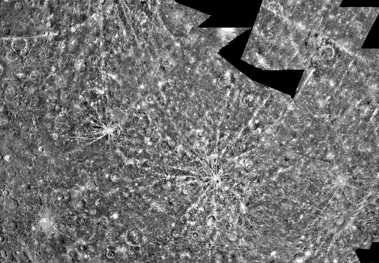
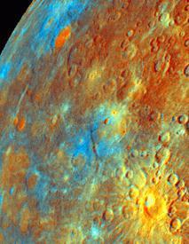
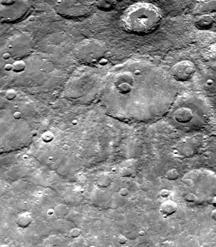
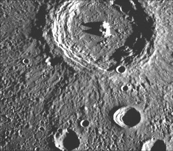
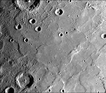
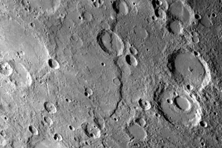
Mariner Crater

Mariner 9 View of Arsia Silva
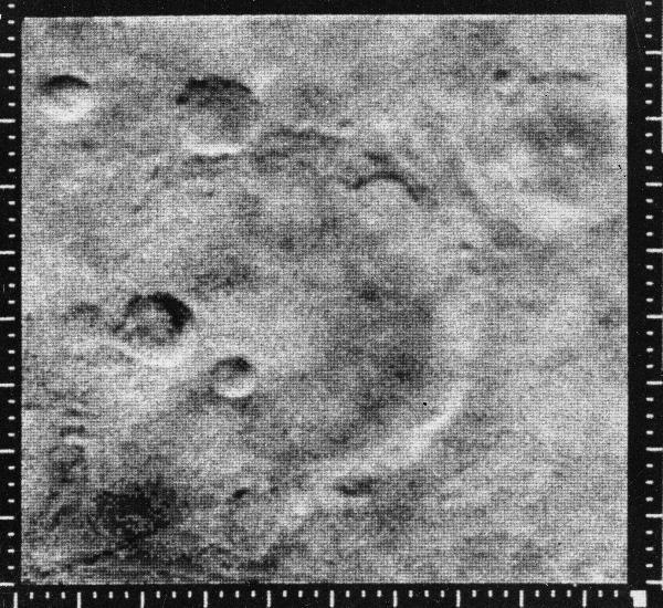
Atlantis Region on Mars - Mariner 4

Mariner 9 views of shield volcano
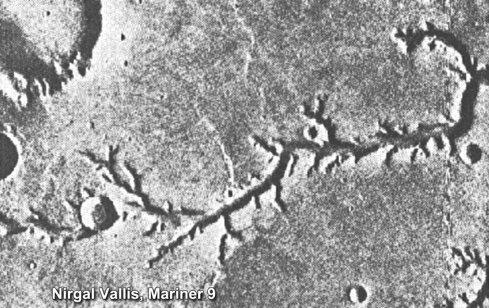
This view of channels on Mars came from NASA Mariner 9 orbiter. In 1971, Mariner 9 became the first spacecraft to enter orbit around Mars.

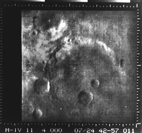
Nix Olympica Identified by Mariner 9 on Mars Approach

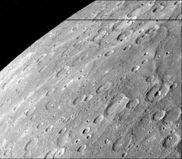
South Pole as viewed by Mariner 9 on Mars Approach
NASA Mariner 2 was the world first successful interplanetary spacecraft. Launched August 27, 1962, on an Atlas-Agena rocket, Mariner 2 passed within about 34,000 kilometers 21,000 miles of Venus.

JPL's Spacecraft Assembly Facility looks more like a hangar in this photo of two engineers standing with Mariner 1 on May 2, 1962. However, the gowning procedures were far less rigorous than they are today. Mariner 1 was destroyed during its attempted launch to Venus. https://photojournal.jpl.nasa.gov/catalog/PIA23310

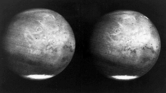
South Polar Cap of Mars as seen by Mariners 9 & 7
Mars full disk approach view from Mariner 7

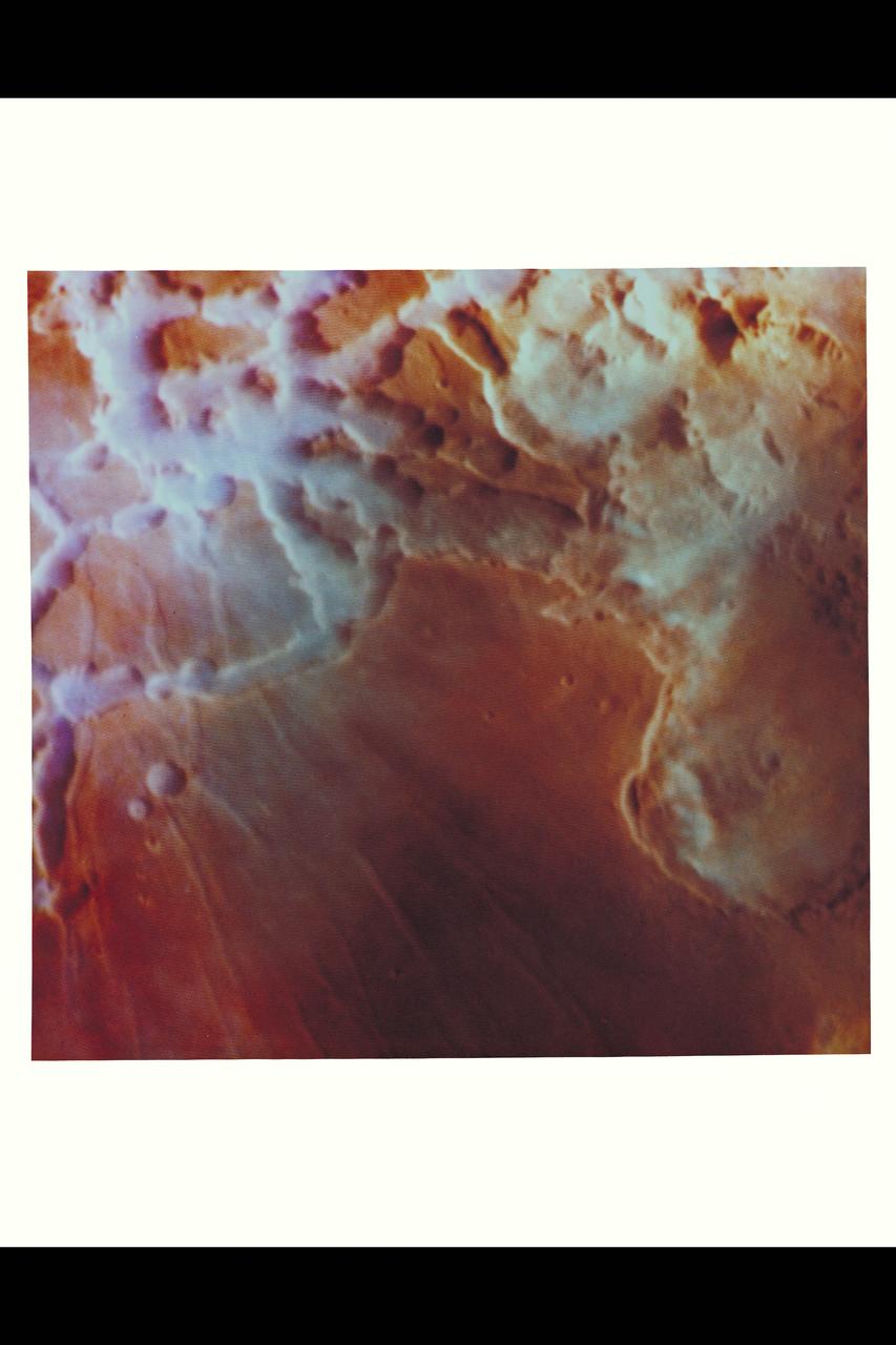
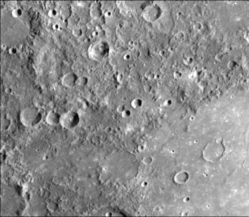
Mariner 9 views Canyon System emerging from Martian Dust Storm

Mariner 9 views Olympus Mons standing above the Martian Dust Storm
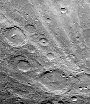
![Oblique view of the crater complex near Ascraeus Lacus in the Tharsis region of Mars was taken by Mariner 9. It is the northernmost of the prominent dark spots observed by Mariner during its approach to the planet. The spot consists of several intersecting shallow crater-like depressions. The main crater is approximately 21 kilometers (13 miles) across, the whole complex about 40 kilometers (25 miles) across. The crater probably is in a relatively high area of the Martian surface, which accounts for its being visible above the dust storm. The faint circular features outside the crater are probably atmospheric. Mariner 9 was the first spacecraft to orbit another planet. The spacecraft was designed to continue the atmospheric studies begun by Mariners 6 and 7, and to map over 70% of the Martian surface from the lowest altitude (1500 kilometers [900 miles]) and at the highest resolutions (1 kilometer per pixel to 100 meters per pixel) of any previous Mars mission. Mariner 9 was launched on May 30, 1971 and arrived on November 14, 1971. http://photojournal.jpl.nasa.gov/catalog/PIA03100](https://images-assets.nasa.gov/image/PIA03100/PIA03100~medium.jpg)
Oblique view of the crater complex near Ascraeus Lacus in the Tharsis region of Mars was taken by Mariner 9. It is the northernmost of the prominent dark spots observed by Mariner during its approach to the planet. The spot consists of several intersecting shallow crater-like depressions. The main crater is approximately 21 kilometers (13 miles) across, the whole complex about 40 kilometers (25 miles) across. The crater probably is in a relatively high area of the Martian surface, which accounts for its being visible above the dust storm. The faint circular features outside the crater are probably atmospheric. Mariner 9 was the first spacecraft to orbit another planet. The spacecraft was designed to continue the atmospheric studies begun by Mariners 6 and 7, and to map over 70% of the Martian surface from the lowest altitude (1500 kilometers [900 miles]) and at the highest resolutions (1 kilometer per pixel to 100 meters per pixel) of any previous Mars mission. Mariner 9 was launched on May 30, 1971 and arrived on November 14, 1971. http://photojournal.jpl.nasa.gov/catalog/PIA03100
NASA Mariner 10 was launched on November 3, 1973, 12:45 am PST, from Cape Canaveral on an Atlas/Centaur rocket a reconditioned Intercontinental Ballistic Missile - ICBM.

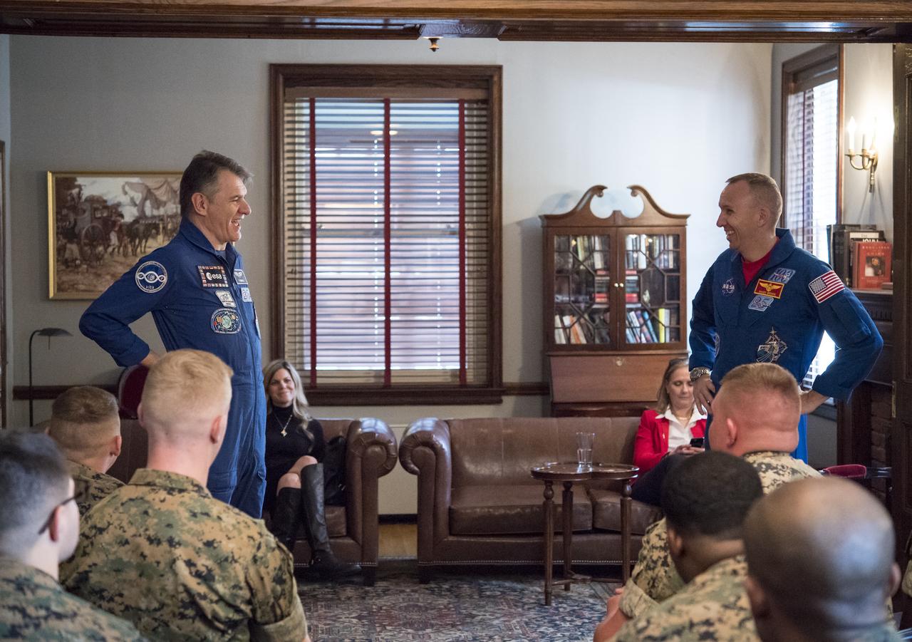
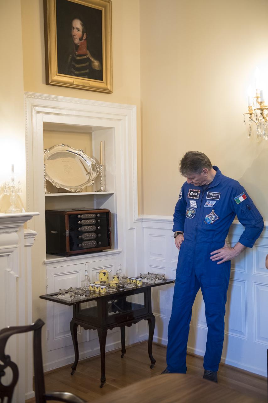
ESA astronaut Paolo Nespoli speaks to Marines about his time onboard the International Space Station after a tour of the Home of the Commandants of the Marine Corps, Monday, May 7, 2018 in Washington. Photo Credit: (NASA/Aubrey Gemignani)
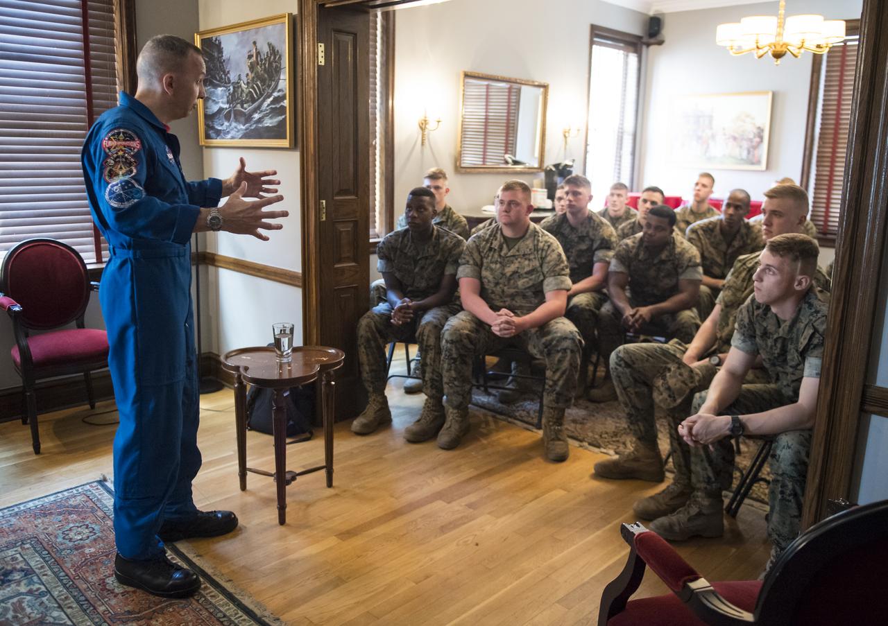
NASA astronaut Randy Bresnik speaks to Marines about his time onboard the International Space Station after a tour of the Home of the Commandants of the Marine Corps, Monday, May 7, 2018 in Washington. Photo Credit: (NASA/Aubrey Gemignani)

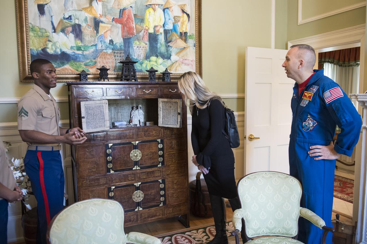
NASA astronaut Randy Bresnik speaks to a Marine about his time onboard the International Space Station after a tour of the Home of the Commandants of the Marine Corps, Monday, May 7, 2018 in Washington. Photo Credit: (NASA/Aubrey Gemignani)
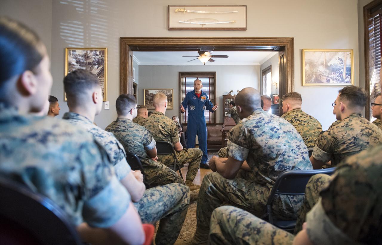
NASA astronaut Randy Bresnik speaks to Marines about his time onboard the International Space Station after a tour of the Home of the Commandants of the Marine Corps, Monday, May 7, 2018 in Washington. Photo Credit: (NASA/Aubrey Gemignani)
NASA astronaut Randy Bresnik thanks Marines for the tour of the Home of the Commandants of the Marine Corps, Monday, May 7, 2018 in Washington. Photo Credit: (NASA/Aubrey Gemignani)

As it sped away from Venus, NASA's Mariner 10 spacecraft captured this seemingly peaceful view of a planet the size of Earth, wrapped in a dense, global cloud layer. But, contrary to its serene appearance, the clouded globe of Venus is a world of intense heat, crushing atmospheric pressure and clouds of corrosive acid. This newly processed image revisits the original data with modern image processing software. A contrast-enhanced version of this view, also provided here, makes features in the planet's thick cloud cover visible in greater detail. The clouds seen here are located about 40 miles (60 kilometers) above the planet's surface, at altitudes where Earth-like atmospheric pressures and temperatures exist. They are comprised of sulfuric acid particles, as opposed to water droplets or ice crystals, as on Earth. These cloud particles are mostly white in appearance; however, patches of red-tinted clouds also can be seen. This is due to the presence of a mysterious material that absorbs light at blue and ultraviolet wavelengths. Many chemicals have been suggested for this mystery component, from sulfur compounds to even biological materials, but a consensus has yet to be reached among researchers. The clouds of Venus whip around the planet at nearly over 200 miles per hour (100 meters per second), circling the globe in about four and a half days. That these hurricane-force winds cover nearly the entire planet is another unexplained mystery, especially given that the solid planet itself rotates at a very slow 4 mph (less than 2 meters per second) — much slower than Earth's rotation rate of about 1,000 mph (450 meters per second). The winds and clouds also blow to the west, not to the east as on the Earth. This is because the planet itself rotates to the west, backward compared to Earth and most of the other planets. As the clouds travel westward, they also typically progress toward the poles; this can be seen in the Mariner 10 view as a curved spiral pattern at mid latitudes. Near the equator, instead of long streaks, areas of more clumpy, discrete clouds can be seen, indicating enhanced upwelling and cloud formation in the equatorial region, spurred on by the enhanced power of sunlight there. This view is a false color composite created by combining images taken using orange and ultraviolet spectral filters on the spacecraft's imaging camera. These were used for the red and blue channels of the color image, respectively, with the green channel synthesized by combining the other two images. Flying past Venus en route to the first-ever flyby of Mercury, Mariner 10 became the first spacecraft to use a gravity assist to change its flight path in order to reach another planet. The images used to create this view were acquired by Mariner 10 on Feb. 7 and 8, 1974, a couple of days after the spacecraft's closest approach to Venus on Feb. 5. Despite their many differences, comparisons between Earth and Venus are valuable for helping to understand their distinct climate histories. Nearly 50 years after this view was obtained, many fundamental questions about Venus remain unanswered. Did Venus have oceans long ago? How has its atmosphere evolved over time, and when did its runaway greenhouse effect begin? How does Venus lose its heat? How volcanically and tectonically active has Venus been over the last billion years? This image was processed from archived Mariner 10 data by JPL engineer Kevin M. Gill. The Mariner 10 mission was managed by NASA's Jet Propulsion Laboratory. https://photojournal.jpl.nasa.gov/catalog/PIA23791
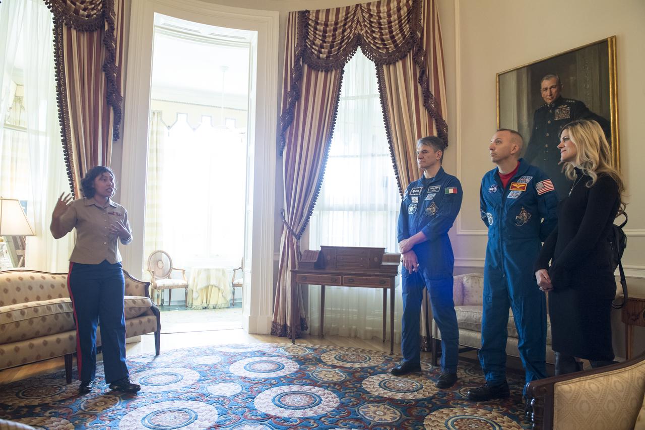
NASA astronaut Randy Bresnik, right, and ESA astronaut Paolo Nespoli, left, speak to Marines about their time onboard the International Space Station after touring the Home of the Commandants of the Marine Corps, Monday, May 7, 2018 in Washington. Photo Credit: (NASA/Aubrey Gemignani)
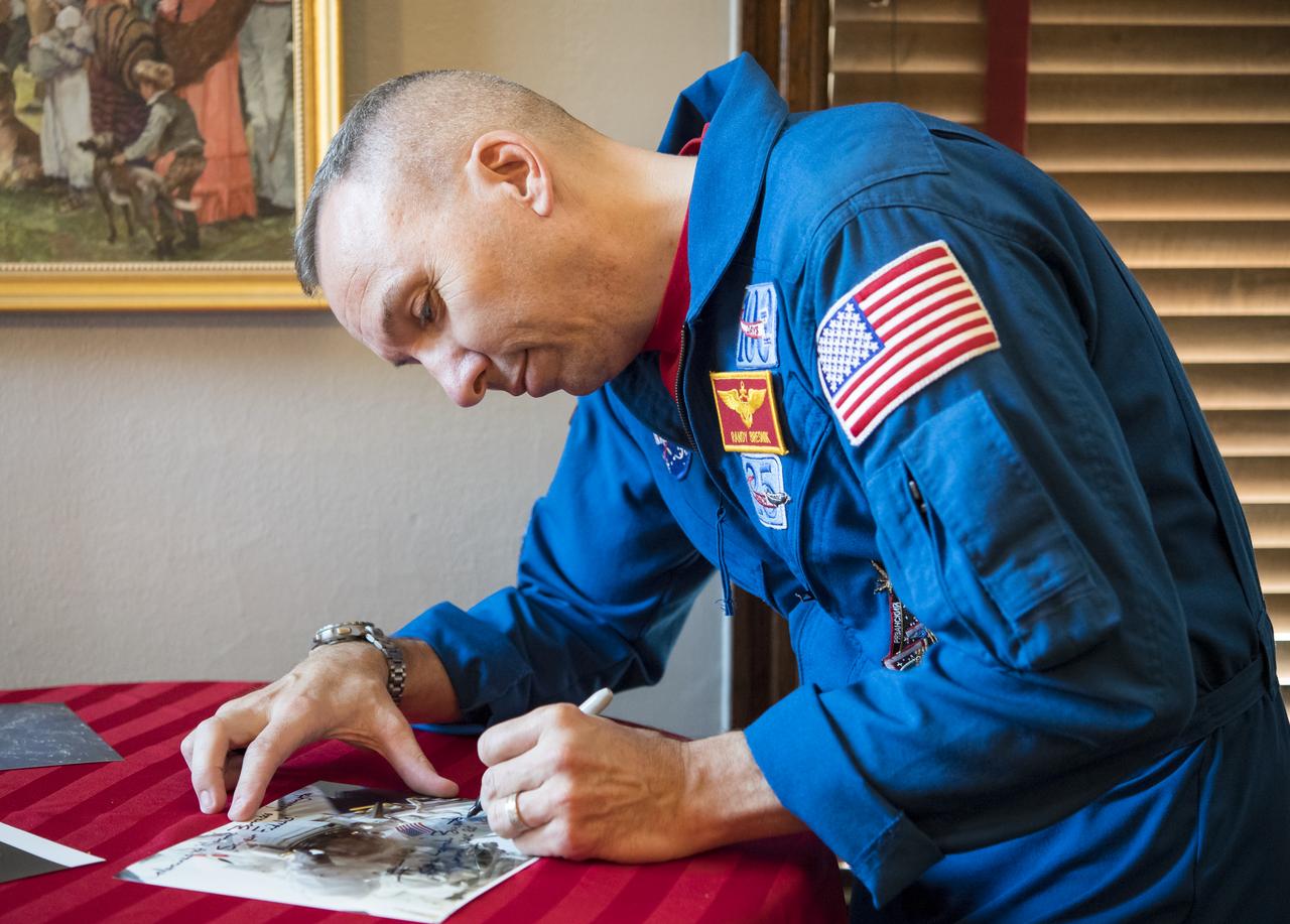
NASA astronaut Randy Bresnik signs photos after speaking to Marines about his time onboard the International Space Station, Monday, May 7, 2018 in Washington. Photo Credit: (NASA/Aubrey Gemignani)
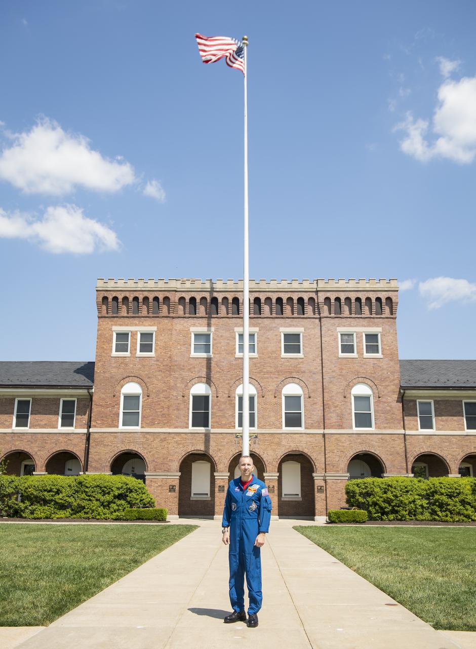
NASA astronaut Randy Bresnik stands on the center point after a tour of the Home of the Commandants of the Marine Corps, Monday, May 7, 2018 in Washington. Photo Credit: (NASA/Aubrey Gemignani)
NASA astronaut Randy Bresnik poses for a photo with a Marine after speaking to them about his time onboard the International Space Station, Monday, May 7, 2018 in Washington. Photo Credit: (NASA/Aubrey Gemignani)
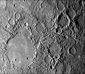
Mariner 4 Meets Mars Global Surveyor -- Mariner Crater 1965 and 1999
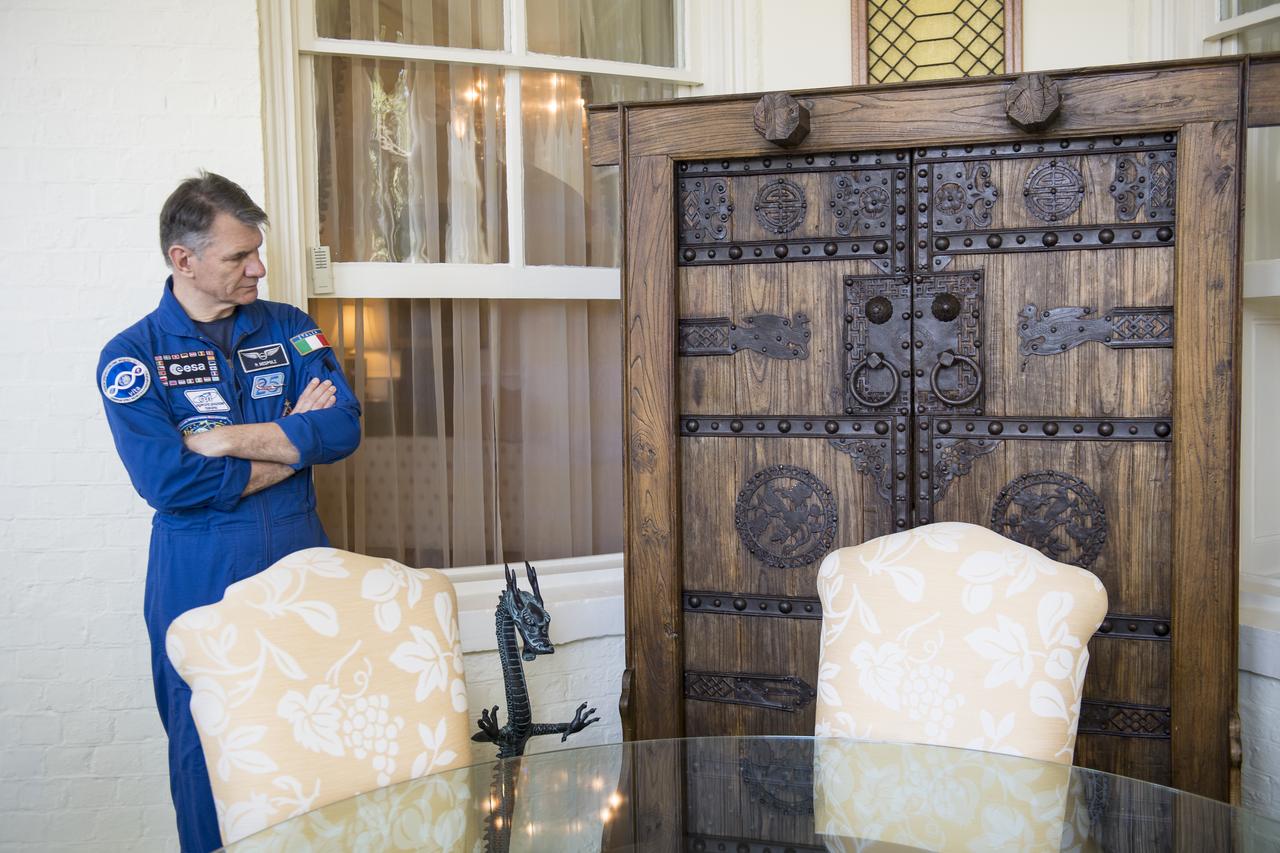
ESA astronaut Paolo Nespoli tours the Home of the Commandants of the Marine Corps, Monday, May 7, 2018 in Washington. Photo Credit: (NASA/Aubrey Gemignani)

ESA astronaut Paolo Nespoli tours the Home of the Commandants of the Marine Corps, Monday, May 7, 2018 in Washington. Photo Credit: (NASA/Aubrey Gemignani)
ESA astronaut Paolo Nespoli tours the Home of the Commandants of the Marine Corps, Monday, May 7, 2018 in Washington. Photo Credit: (NASA/Aubrey Gemignani)

NASA astronaut Randy Bresnik, right, and his wife Rebecca tour the Home of the Commandants of the Marine Corps, Monday, May 7, 2018 in Washington. Photo Credit: (NASA/Aubrey Gemignani)
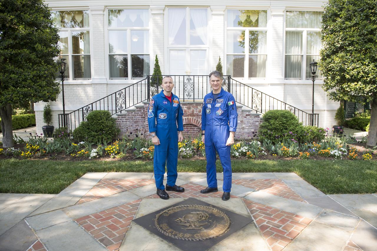
NASA astronaut Randy Bresnik, left, and ESA astronaut Paolo Nespoli, right, pose for a photo outside the Home of the Commandants of the Marine Corps, Monday, May 7, 2018 in Washington. Photo Credit: (NASA/Aubrey Gemignani)

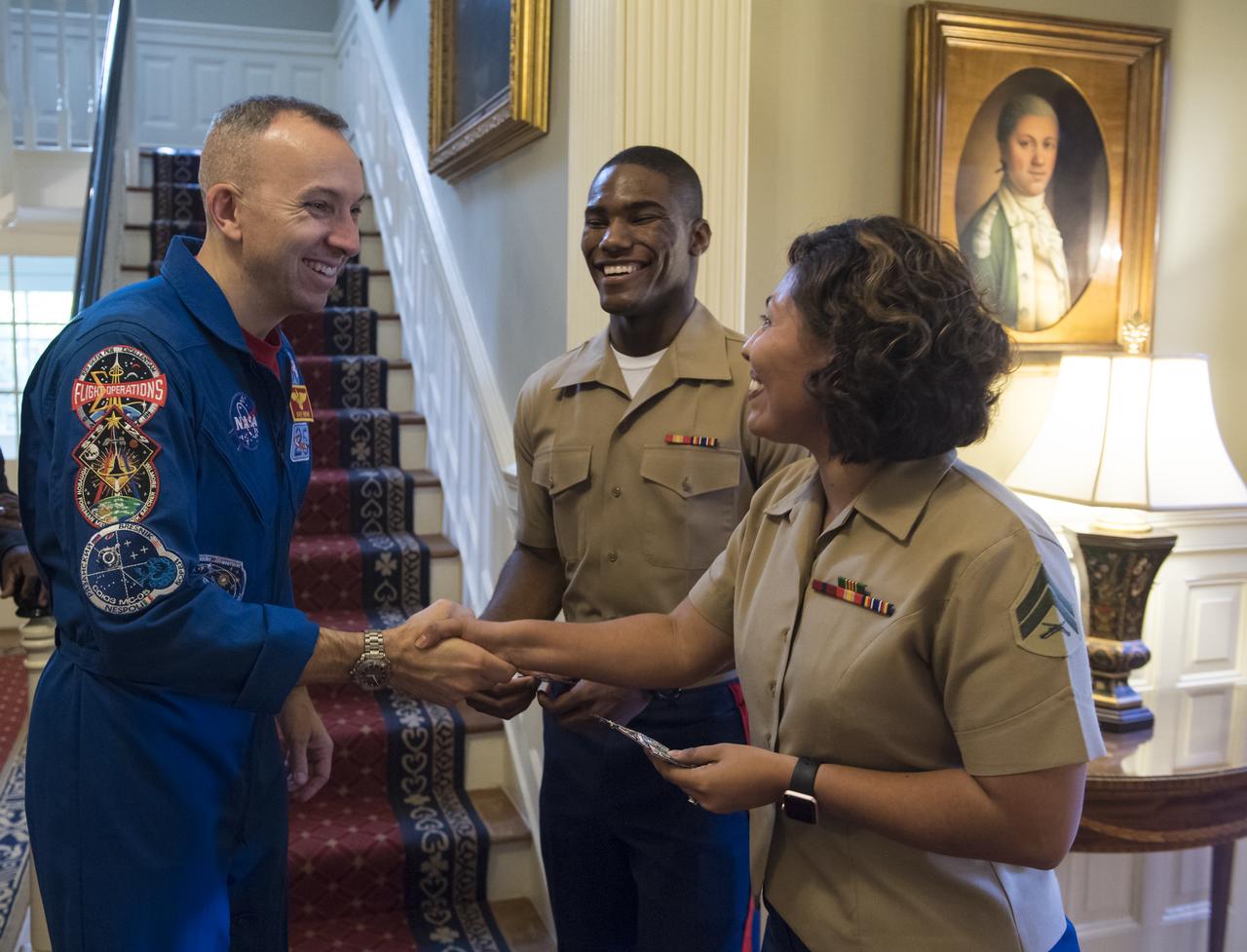
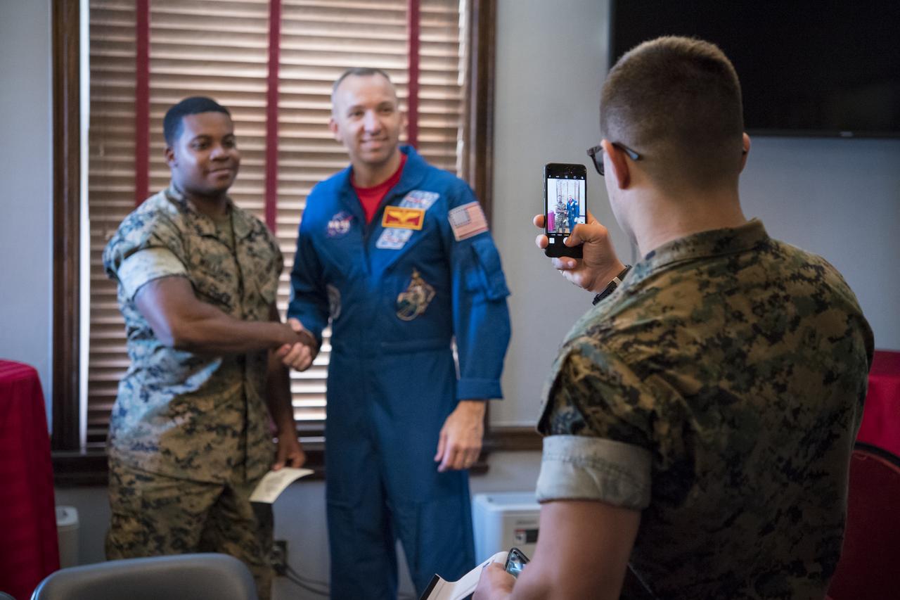
NASA astronaut Randy Bresnik, right, shakes hands with Colonel Tyler Zagurski, Commanding Officer, Marine Corps Barracks, Monday, May 7, 2018 in Washington. Photo Credit: (NASA/Aubrey Gemignani)
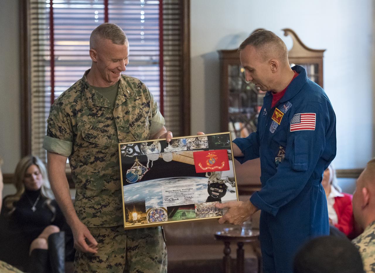
NASA astronaut Randy Bresnik presents Colonel Tyler Zagurski, Commanding Officer, Marine Corps Barracks, with a montage from his Expedition 53, Monday, May 7, 2018 in Washington. Photo Credit: (NASA/Aubrey Gemignani)
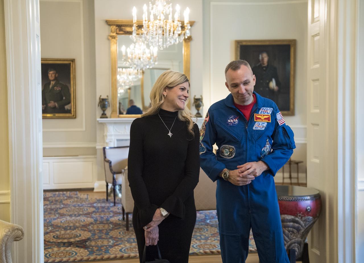
NASA astronaut Randy Bresnik and wife Rebecca tour the Home of the Commandants of the Marine Corps, Monday, May 7, 2018 in Washington. Photo Credit: (NASA/Aubrey Gemignani)
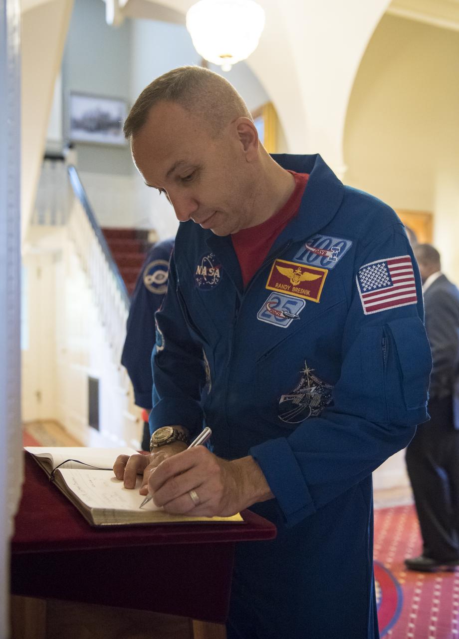
NASA astronaut Randy Bresnik signs the guest book before touring the Home of the Commandants of the Marine Corps, Monday, May 7, 2018 in Washington. Photo Credit: (NASA/Aubrey Gemignani)
NASA astronaut Randy Bresnik, right, and his wife Rebecca tour the Home of the Commandants of the Marine Corps, Monday, May 7, 2018 in Washington. Photo Credit: (NASA/Aubrey Gemignani)
NASA astronaut Randy Bresnik, center, wife Rebecca, right, and ESA astronaut Paolo Nespoli tour the Home of the Commandants of the Marine Corps, Monday, May 7, 2018 in Washington. Photo Credit: (NASA/Aubrey Gemignani)
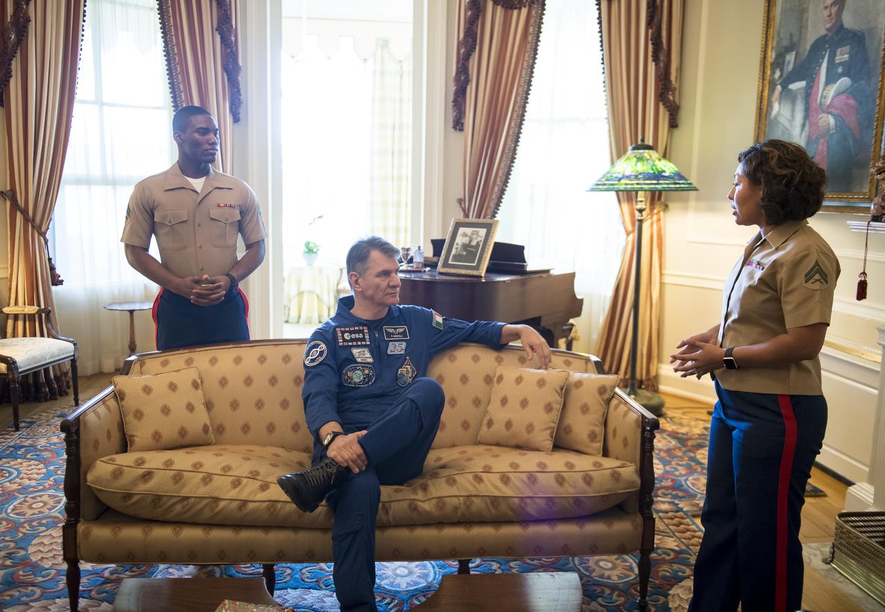
ESA astronaut Paolo Nespoli sits on a couch where Archibald Henderson, the 5th Commandant of the Marine Corps passed away in 1859, during a tour of the Home of the Commandants, Monday, May 7, 2018 in Washington. Photo Credit: (NASA/Aubrey Gemignani)
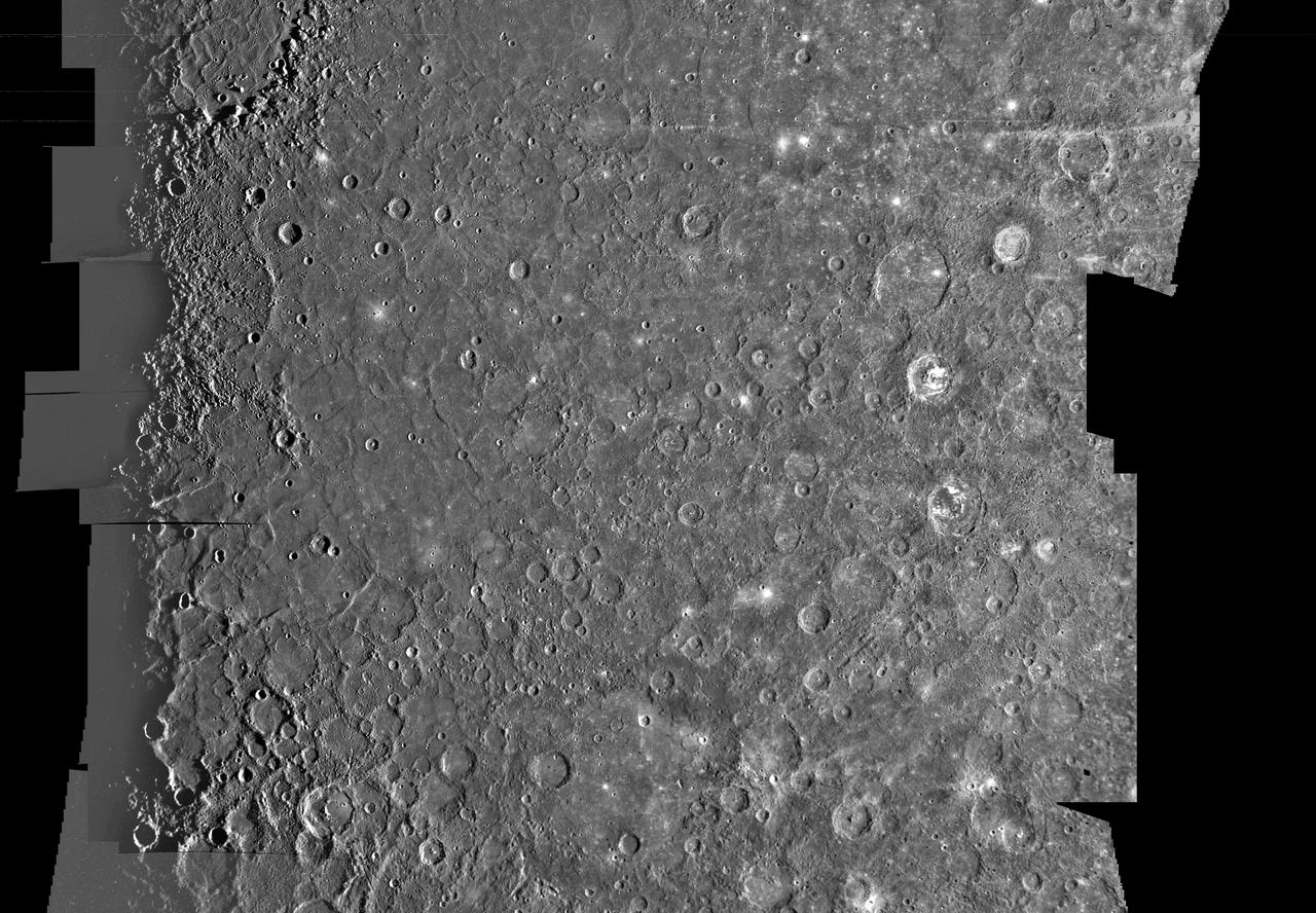
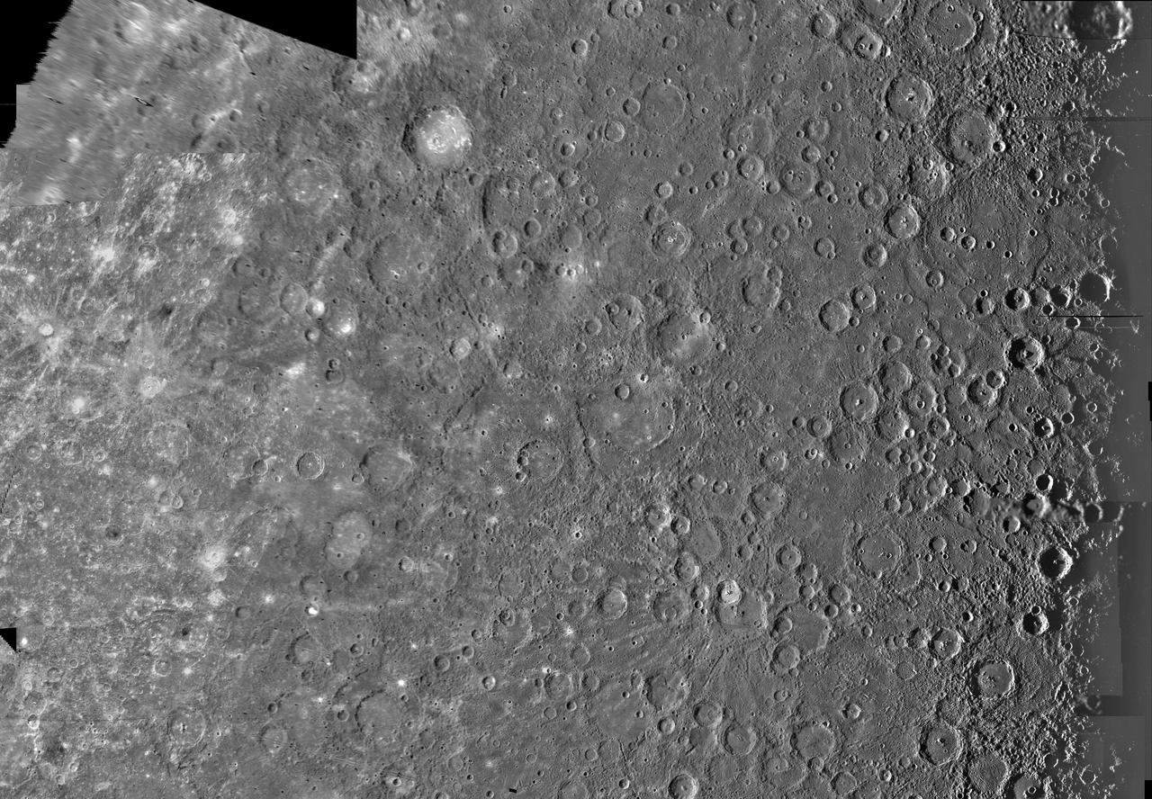
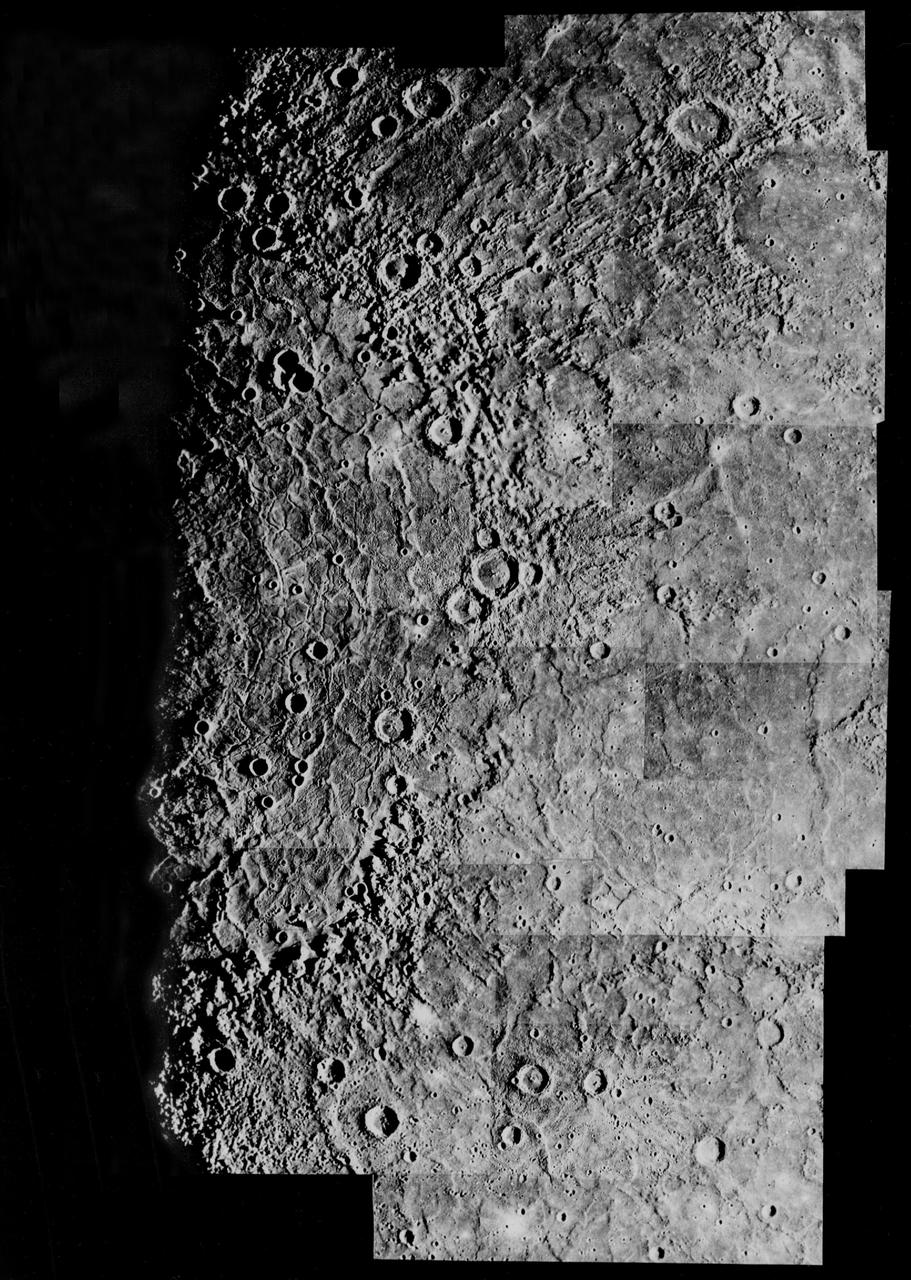
This image, from NASA Mariner 10 spacecraft which launched in 1974, is of the H-7 Beethoven Quadrangle, and lies in Mercury Equatorial Mercator. NASA Mariner 10 spacecraft imaged the region during its initial flyby of the planet.

This image, from NASA Mariner 10 spacecraft which launched in 1974, is of the southern hemisphere of Mercury.
Updated calibration and subsequent mosaicing led to substantial improvements in NASA Mariner 10 color image data; the spacecraft launched in 1974.
NASA Mariner 10 took this picture about an hour after it passed under the South Pole of Mercury in 1974.
A real-time data translator machine converted Mariner 4 digital image data into numbers printed on strips of paper.
This image, from NASA Mariner 10 spacecraft which launched in 1974, is of the northern half of Mercury Shakespeare Quadrangle. http://photojournal.jpl.nasa.gov/catalog/PIA00066

Marine Corps 241st Birthday Celebration, Veterans Advisory Committee
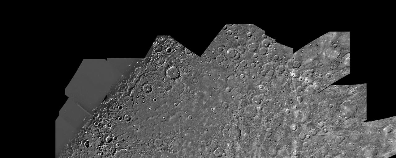
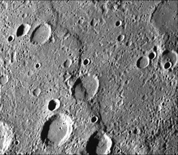
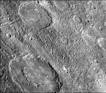
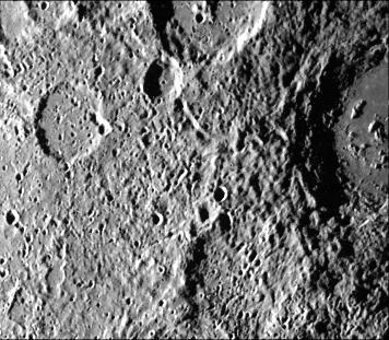
Mariner #9 Mars Craters and Riverbeds
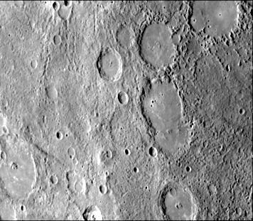
This image, from NASA Mariner 10 spacecraft which launched in 1974, shows hilly and lineated terrain and a patch of smooth plains in a large degraded crater.
This image, from NASA Mariner 10 spacecraft which launched in 1974, features a 140 kilometer diameter crater and its surrounding zone of secondary craters. T
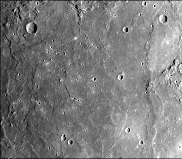
NASA Mariner 10 took this picture of the densely cratered surface of Mercury when the spacecraft was 18,200 kilometers 8085 miles from the planet on March 29, 1974.
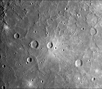
This crater illustrates the narrow hummocky rim facies, radial ridges, and surrounding extensive field of secondary craters. This image of Mercury was taken by NASA Mariner 10.
NASA Mariner 10 spacecraft was coaxed into a third and final encounter with Mercury in March of 1975. This is one of the highest resolution images of Mercury acquired by the spacecraft.
This image, from NASA Mariner 10 spacecraft which launched in 1974, shows an old basin hummocky rim is partly degraded and cratered by later events.

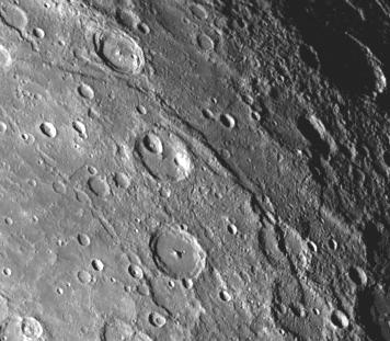
A fresh new crater in the center of an older crater basin is shown in this picture of the surface of Mercury taken March 29, 1974 by NASA Mariner 10.
This image, from NASA Mariner 10 spacecraft which launched in 1974, includes part of the floor of the Caloris basin showing the ridges and fractures.
This image, from NASA Mariner 10 spacecraft which launched in 1974, is a high-resolution picture of a 65-kilometer diameter crater and the scarp transecting its floor.
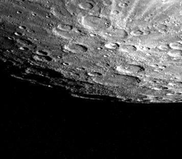
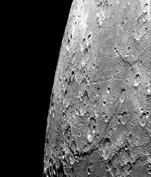
Mercury south pole was photographed by one of NASA Mariner 10 TV cameras; the pole is located inside the large crater on Mercury limb lower center.
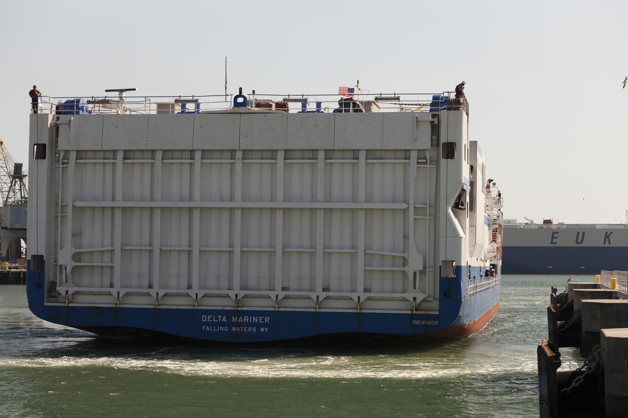
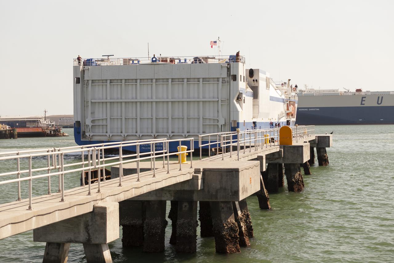
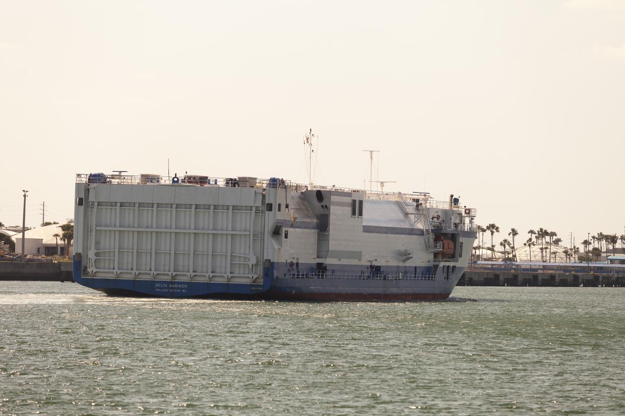
CAPE CANAVERAL, Fla. – The United Launch Alliance barge Delta Mariner enters Port Canaveral in Florida. The barge is carrying two of the booster stages for the Delta IV Heavy rocket slated for Orion's Exploration Flight Test-1, or EFT-1. Orion is the exploration spacecraft designed to carry astronauts to destinations not yet explored by humans. It will have emergency abort capability, sustain the crew during space travel and provide safe re-entry from deep-space return velocities. The first unpiloted test flight of Orion is scheduled to launch in September 2014 atop a Delta IV Heavy rocket and in 2017 on NASA’s Space Launch System
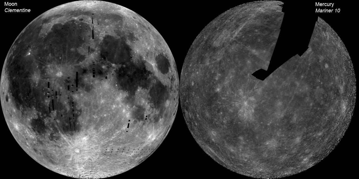
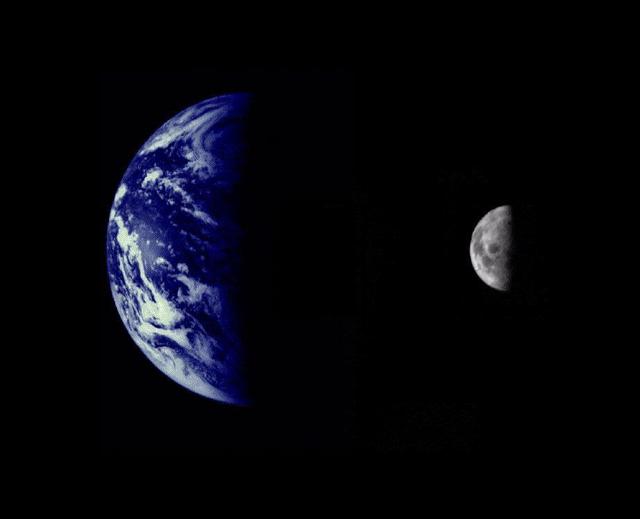
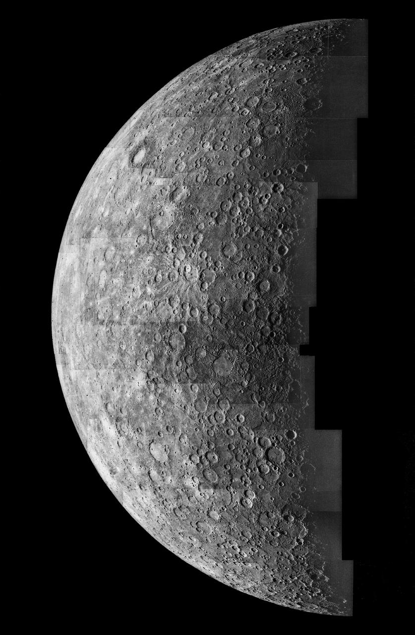
The image of the Moon left is a mosaic of images from NASA Clementine. The Mercury image right is a NASA Mariner 10 mosaic.
This computer generated mosaic from NASA Mariner 10 is of Mercury Tolstoj Quadrangle, named for the ancient Tolstoj crater located in the lower center of the image. http://photojournal.jpl.nasa.gov/catalog/PIA00068
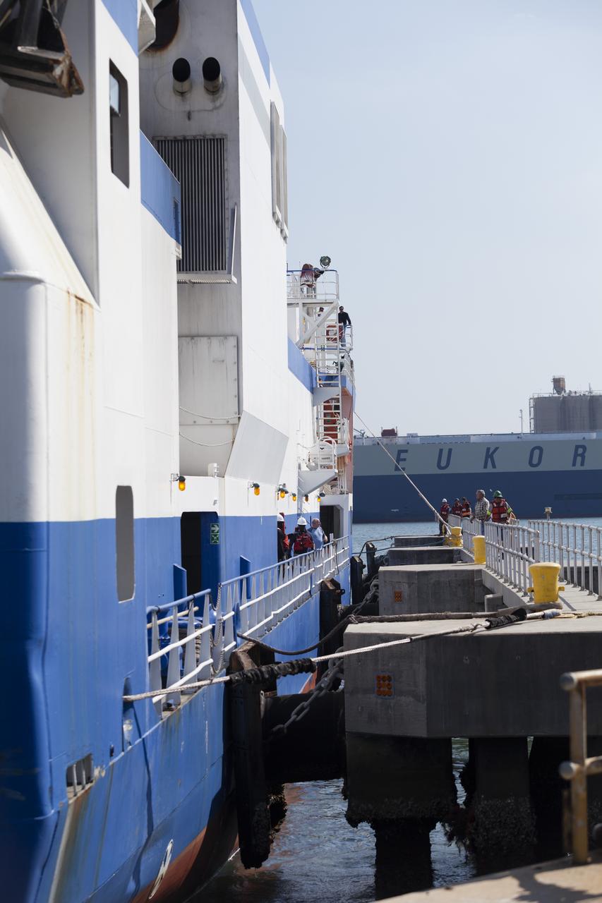
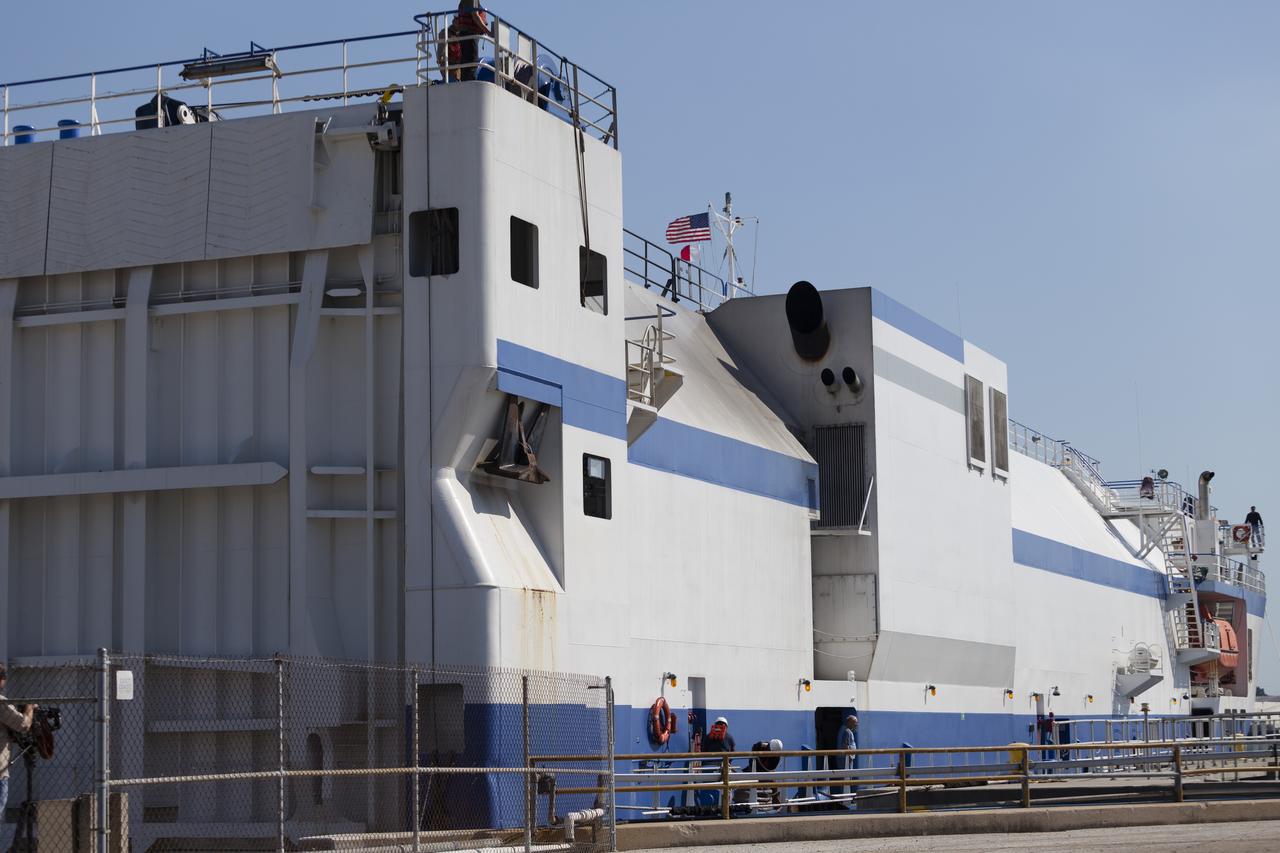
CAPE CANAVERAL, Fla. – The United Launch Alliance barge Delta Mariner is secured to the dock in Port Canaveral in Florida. The barge is carrying two of the booster stages for the Delta IV Heavy rocket slated for Orion's Exploration Flight Test-1, or EFT-1. Orion is the exploration spacecraft designed to carry astronauts to destinations not yet explored by humans. It will have emergency abort capability, sustain the crew during space travel and provide safe re-entry from deep-space return velocities. The first unpiloted test flight of Orion is scheduled to launch in September 2014 atop a Delta IV Heavy rocket and in 2017 on NASA’s Space Launch System rocket. For more information, visit www.nasa.gov/orion. Photo credit: NASA/Frankie Martin
CAPE CANAVERAL, Fla. – The United Launch Alliance barge Delta Mariner is secured to the dock in Port Canaveral in Florida. The barge is carrying two of the booster stages for the Delta IV Heavy rocket slated for Orion's Exploration Flight Test-1, or EFT-1. Orion is the exploration spacecraft designed to carry astronauts to destinations not yet explored by humans. It will have emergency abort capability, sustain the crew during space travel and provide safe re-entry from deep-space return velocities. The first unpiloted test flight of Orion is scheduled to launch in September 2014 atop a Delta IV Heavy rocket and in 2017 on NASA’s Space Launch System rocket. For more information, visit www.nasa.gov/orion. Photo credit: NASA/Frankie Martin
CAPE CANAVERAL, Fla. – The United Launch Alliance barge Delta Mariner prepares to dock in Port Canaveral in Florida. The barge is carrying two of the booster stages for the Delta IV Heavy rocket slated for Orion's Exploration Flight Test-1, or EFT-1. Orion is the exploration spacecraft designed to carry astronauts to destinations not yet explored by humans. It will have emergency abort capability, sustain the crew during space travel and provide safe re-entry from deep-space return velocities. The first unpiloted test flight of Orion is scheduled to launch in September 2014 atop a Delta IV Heavy rocket and in 2017 on NASA’s Space Launch System rocket. For more information, visit www.nasa.gov/orion. Photo credit: NASA/Frankie Martin
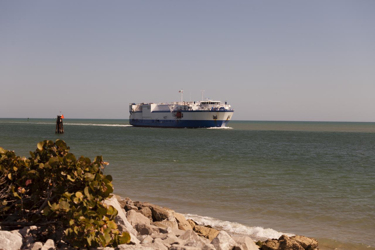
CAPE CANAVERAL, Fla. – The United Launch Alliance barge Delta Mariner enters Port Canaveral in Florida. The barge is carrying two of the booster stages for the Delta IV Heavy rocket slated for Orion's Exploration Flight Test-1, or EFT-1. Orion is the exploration spacecraft designed to carry astronauts to destinations not yet explored by humans. It will have emergency abort capability, sustain the crew during space travel and provide safe re-entry from deep-space return velocities. The first unpiloted test flight of Orion is scheduled to launch in September 2014 atop a Delta IV Heavy rocket and in 2017 on NASA’s Space Launch System rocket. For more information, visit www.nasa.gov/orion. Photo credit: NASA/Frankie Martin
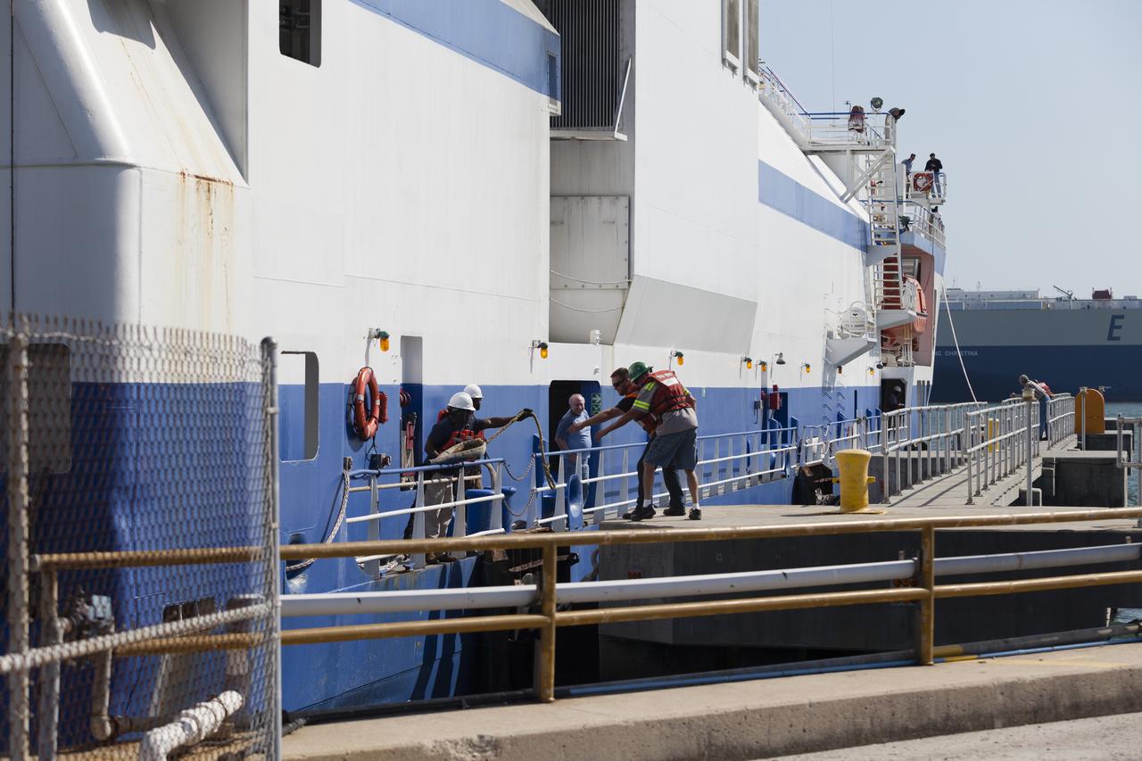
CAPE CANAVERAL, Fla. – The United Launch Alliance barge Delta Mariner docks in Port Canaveral in Florida. The barge is carrying two of the booster stages for the Delta IV Heavy rocket slated for Orion's Exploration Flight Test-1, or EFT-1. Orion is the exploration spacecraft designed to carry astronauts to destinations not yet explored by humans. It will have emergency abort capability, sustain the crew during space travel and provide safe re-entry from deep-space return velocities. The first unpiloted test flight of Orion is scheduled to launch in September 2014 atop a Delta IV Heavy rocket and in 2017 on NASA’s Space Launch System rocket. For more information, visit www.nasa.gov/orion. Photo credit: NASA/Frankie Martin
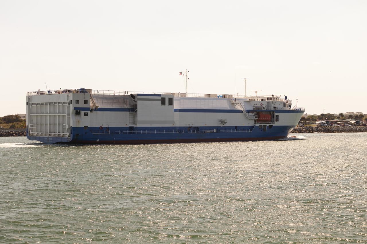
CAPE CANAVERAL, Fla. – The United Launch Alliance barge Delta Mariner glides past the jetties as it enters Port Canaveral in Florida. The barge is carrying two of the booster stages for the Delta IV Heavy rocket slated for Orion's Exploration Flight Test-1, or EFT-1. Orion is the exploration spacecraft designed to carry astronauts to destinations not yet explored by humans. It will have emergency abort capability, sustain the crew during space travel and provide safe re-entry from deep-space return velocities. The first unpiloted test flight of Orion is scheduled to launch in September 2014 atop a Delta IV Heavy rocket and in 2017 on NASA’s Space Launch System rocket. For more information, visit www.nasa.gov/orion. Photo credit: NASA/Frankie Martin
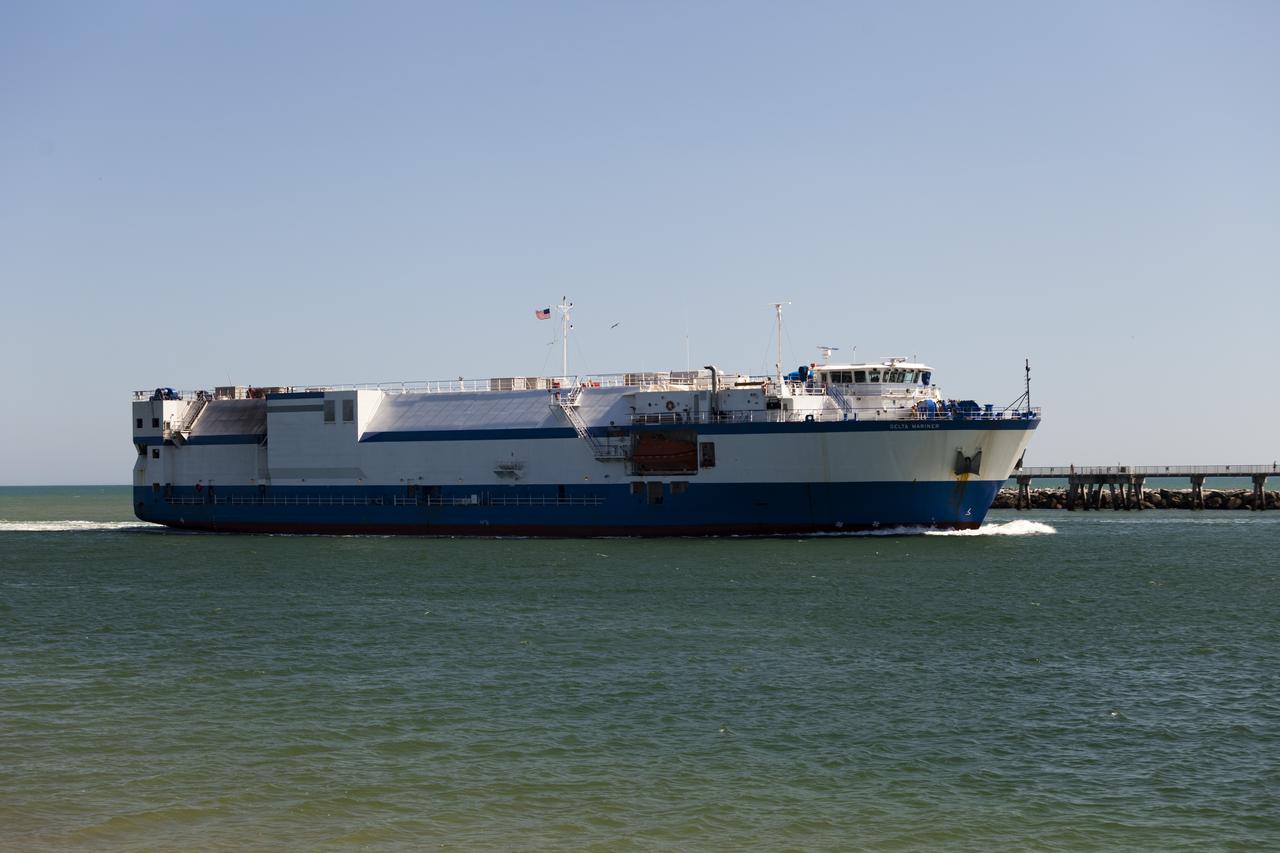
CAPE CANAVERAL, Fla. – The United Launch Alliance barge Delta Mariner glides past the jetties as it enters Port Canaveral in Florida. The barge is carrying two of the booster stages for the Delta IV Heavy rocket slated for Orion's Exploration Flight Test-1, or EFT-1. Orion is the exploration spacecraft designed to carry astronauts to destinations not yet explored by humans. It will have emergency abort capability, sustain the crew during space travel and provide safe re-entry from deep-space return velocities. The first unpiloted test flight of Orion is scheduled to launch in September 2014 atop a Delta IV Heavy rocket and in 2017 on NASA’s Space Launch System rocket. For more information, visit www.nasa.gov/orion. Photo credit: NASA/Frankie Martin
CAPE CANAVERAL, Fla. – The United Launch Alliance barge Delta Mariner nears the dock in Port Canaveral in Florida. The barge is carrying two of the booster stages for the Delta IV Heavy rocket slated for Orion's Exploration Flight Test-1, or EFT-1. Orion is the exploration spacecraft designed to carry astronauts to destinations not yet explored by humans. It will have emergency abort capability, sustain the crew during space travel and provide safe re-entry from deep-space return velocities. The first unpiloted test flight of Orion is scheduled to launch in September 2014 atop a Delta IV Heavy rocket and in 2017 on NASA’s Space Launch System rocket. For more information, visit www.nasa.gov/orion. Photo credit: NASA/Frankie Martin
CAPE CANAVERAL, Fla. – The United Launch Alliance barge Delta Mariner travels through Port Canaveral in Florida. The barge is carrying two of the booster stages for the Delta IV Heavy rocket slated for Orion's Exploration Flight Test-1, or EFT-1. Orion is the exploration spacecraft designed to carry astronauts to destinations not yet explored by humans. It will have emergency abort capability, sustain the crew during space travel and provide safe re-entry from deep-space return velocities. The first unpiloted test flight of Orion is scheduled to launch in September 2014 atop a Delta IV Heavy rocket and in 2017 on NASA’s Space Launch System rocket. For more information, visit www.nasa.gov/orion. Photo credit: NASA/Frankie Martin
CAPE CANAVERAL, Fla. – The United Launch Alliance barge Delta Mariner approaches the mouth of Port Canaveral in Florida. The barge is carrying two of the booster stages for the Delta IV Heavy rocket slated for Orion's Exploration Flight Test-1, or EFT-1. Orion is the exploration spacecraft designed to carry astronauts to destinations not yet explored by humans. It will have emergency abort capability, sustain the crew during space travel and provide safe re-entry from deep-space return velocities. The first unpiloted test flight of Orion is scheduled to launch in September 2014 atop a Delta IV Heavy rocket and in 2017 on NASA’s Space Launch System rocket. For more information, visit www.nasa.gov/orion. Photo credit: NASA/Frankie Martin
A faint double ring crater is seen at upper right in this picture of Mercury taken one hour and 40 minutes before NASA Mariner 10 second rendezvous with the planet Sept. 21, 1975

After passing on the darkside of the planet, NASA Mariner 10 photographed the other, somewhat more illuminated hemisphere of Mercury. The north pole is at the top, two-thirds down from which is the equator.
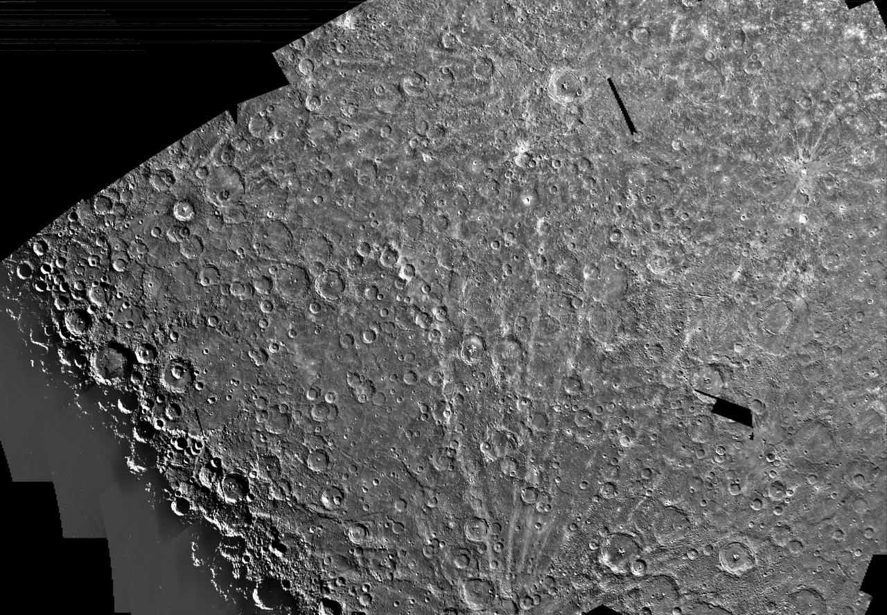
This image, from NASA Mariner 10 spacecraft which launched in 1974, is of the Michelangelo Quadrangle, which lies in Mercury southern polar region. The Mercurian surface is heavily marred by numerous impact craters.
A cratered area near Mercury South Pole was photographed by NASA Mariner 10 during its second flyby of the planet of Sept. 21, 1974 the spacecraft made its first encounter with Mercury on March 19, 1974.
This image, from NASA Mariner 10 spacecraft which launched in 1974, shows several scarps, which appear to be confined to crater floors. The scarp in the crater at the upper left of the image has been diverted by the central peaks.
This picture, taken only minutes after NASA Mariner 10 made its closest approach to Mercury, is one of the highest resolution pictures obtained. Abundant craters in various stages of degradation dot the surface.
A field of bright rays, created by ejecta from a crater, radiating to the north top from off camera lower right is seen in this view of Mercury taken Sept. 21, 1974 by NASA Mariner 10.
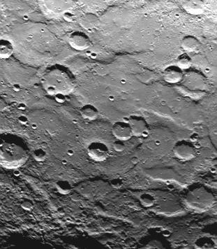
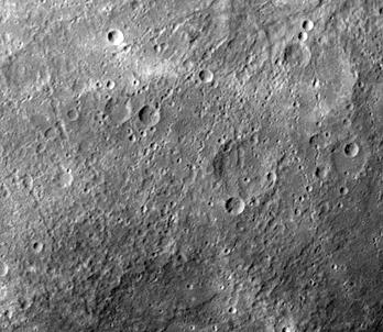
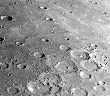
Intercrater plains and heavily cratered terrain typical of much of Mercury outside the area affected by the formation of the Caloris basin are shown in this image taken during the NASA Mariner 10 first encounter with Mercury in 1974.
This image, from NASA Mariner 10 spacecraft which launched in 1974, shows plains filling this basin are uniformly brighter and slightly redder than the surrounding cratered terrain.
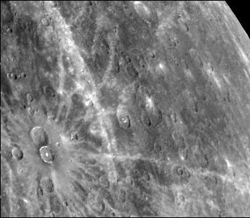
Antoniadi Ridge, over 450 kilometers long, runs along the right side of this acquired image during NASA Mariner 10 first encounter with Mercury after its launch in 1974.
The craters in this image NASA Mariner 10 spacecraft, which launched in 1974, have interior rings of mountains and ejecta deposits which are scarred by deep secondary crater chain groves.
This image, from NASA Mariner 10 spacecraft which launched in 1974, shows young craters superposed on smooth plains. Larger young craters have central peaks, flat floors, terraced walls, and radial ejecta deposits.
After passing Mercury the first time and making a trip around the Sun, NASA Mariner 10 again flew by Mercury on Sept. 21, 1974. This encounter brought the spacecraft in front of Mercury in the southern hemisphere.
This photograph of Mercury, taken by NASA Mariner 10, shows two prominent rayed craters. Bright halos extend as far as 2 crater diameters beyond crater rims. Individual rays extend from halo.
This image, from NASA Mariner 10 spacecraft which launched in 1974, shows intercrater plains and heavily cratered terrain typical of much of Mercury outside the area affected by the formation of the Caloris basin.
After passing Mercury the first time and making a trip around the Sun, NASA Mariner 10 again flew by Mercury on Sept. 21, 1974. This encounter brought the spacecraft in front of Mercury in the southern hemisphere.
This computer generated photomosaic from NASA Mariner 10 is of the southern half of Mercury Shakespeare Quadrangle, named for the ancient Shakespeare crater located on the upper edge to the left of center.
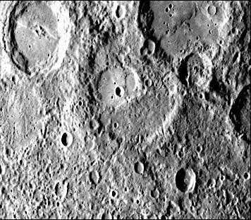
This photograph of Mercury was taken by NASA Mariner 10 spacecraft shows smooth plains areas on Mercury that are thought to be volcanic in origin with lava flows filling in heavily cratered areas.
This image, from NASA Mariner 10 spacecraft which launched in 1974, shows that several west-facing lobate scarps occur in the hummocky plains interpreted as Caloris ejecta.
A scarp, or cliff, extends diagonally from upper left to lower right in this picture of Mercury taken by NASA Mariner 10. The structures are believed to be formed by the compressive forces due to crustal shortening.
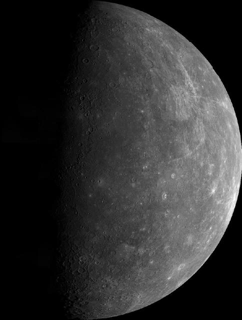
This mosaic, made from over 140 individual TV frames taken about two hours after encounter, shows the planet Mercury as seen by NASA Mariner 10 as it sped away from the planet on March 29, 1974.
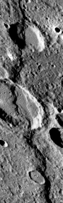
NASA Mariner 10 spacecraft was coaxed into a third and final encounter with Mercury in March of 1975. This is one of the highest resolution images of Mercury acquired by the spacecraft. The prominent scarp snaking up the image was named Discovery Rupes.
A dark, smooth, relatively uncratered area on Mercury was photographed two hours after NASA Mariner 10 flew by the planet. The prominent, sharp crater with a central peak is 30 kilometers 19 miles across.
The Kuiper Quadrangle was named in memory of Dr. Gerard Kuiper, an imaging team member, and well-known astronomer, of NASA Mariner 10 Venus/Mercury. The Kuiper crater is seen left of center in this image.
This image, from NASA Mariner 10 spacecraft which launched in 1974, shows a broadly curved lobate scarp running from left to right in the large crater to the right of center in this image.
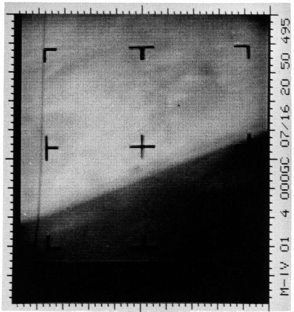
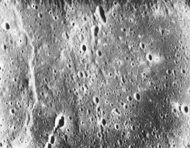
This is an enhanced contrast version of the first Mars photograph released on July 15, 1965. This is man first close-up photograph of another planet, a photographic representation of digital data radioed from Mars by the Mariner 4 spacecraft.
One of the most prominent lobate scarps Discovery Scarp, photographed by NASA Mariner 10 during it first encounter with Mercury, is located at the center of this image extending from the top to near bottom.
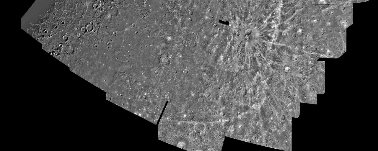
This computer photomosaic is of the Caloris Basin, the largest basin on Mercury. NASA Mariner 10 spacecraft imaged the region during its initial flyby of the planet after its launch in 1974.
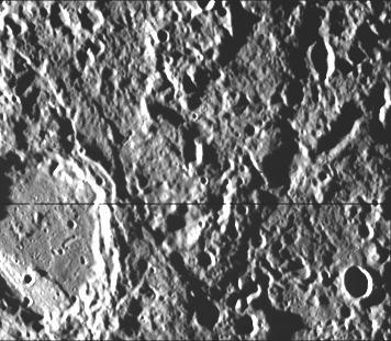
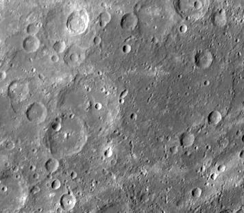
Cratered terrain very similar to that on the Moon is shown in this TV photo of Mercury taken by NASA Mariner 10. Numerous small craters and linear grooves radial to the crater can be seen.
NASA Mariner 10 photo reveals a heavily cratered terrain on Mercury with a prominent scrap extending several hundred kilometers across the upper left. A crater, nested in a larger crater, is at top center.
This computer generated photomosaic from NASA Mariner 10 is of the southern half of Mercury Shakespeare Quadrangle, named for the ancient Shakespeare crater located on the upper edge to the left of center. http://photojournal.jpl.nasa.gov/catalog/PIA00067