
As it sped away from Venus, NASA's Mariner 10 spacecraft captured this seemingly peaceful view of a planet the size of Earth, wrapped in a dense, global cloud layer. But, contrary to its serene appearance, the clouded globe of Venus is a world of intense heat, crushing atmospheric pressure and clouds of corrosive acid. This newly processed image revisits the original data with modern image processing software. A contrast-enhanced version of this view, also provided here, makes features in the planet's thick cloud cover visible in greater detail. The clouds seen here are located about 40 miles (60 kilometers) above the planet's surface, at altitudes where Earth-like atmospheric pressures and temperatures exist. They are comprised of sulfuric acid particles, as opposed to water droplets or ice crystals, as on Earth. These cloud particles are mostly white in appearance; however, patches of red-tinted clouds also can be seen. This is due to the presence of a mysterious material that absorbs light at blue and ultraviolet wavelengths. Many chemicals have been suggested for this mystery component, from sulfur compounds to even biological materials, but a consensus has yet to be reached among researchers. The clouds of Venus whip around the planet at nearly over 200 miles per hour (100 meters per second), circling the globe in about four and a half days. That these hurricane-force winds cover nearly the entire planet is another unexplained mystery, especially given that the solid planet itself rotates at a very slow 4 mph (less than 2 meters per second) — much slower than Earth's rotation rate of about 1,000 mph (450 meters per second). The winds and clouds also blow to the west, not to the east as on the Earth. This is because the planet itself rotates to the west, backward compared to Earth and most of the other planets. As the clouds travel westward, they also typically progress toward the poles; this can be seen in the Mariner 10 view as a curved spiral pattern at mid latitudes. Near the equator, instead of long streaks, areas of more clumpy, discrete clouds can be seen, indicating enhanced upwelling and cloud formation in the equatorial region, spurred on by the enhanced power of sunlight there. This view is a false color composite created by combining images taken using orange and ultraviolet spectral filters on the spacecraft's imaging camera. These were used for the red and blue channels of the color image, respectively, with the green channel synthesized by combining the other two images. Flying past Venus en route to the first-ever flyby of Mercury, Mariner 10 became the first spacecraft to use a gravity assist to change its flight path in order to reach another planet. The images used to create this view were acquired by Mariner 10 on Feb. 7 and 8, 1974, a couple of days after the spacecraft's closest approach to Venus on Feb. 5. Despite their many differences, comparisons between Earth and Venus are valuable for helping to understand their distinct climate histories. Nearly 50 years after this view was obtained, many fundamental questions about Venus remain unanswered. Did Venus have oceans long ago? How has its atmosphere evolved over time, and when did its runaway greenhouse effect begin? How does Venus lose its heat? How volcanically and tectonically active has Venus been over the last billion years? This image was processed from archived Mariner 10 data by JPL engineer Kevin M. Gill. The Mariner 10 mission was managed by NASA's Jet Propulsion Laboratory. https://photojournal.jpl.nasa.gov/catalog/PIA23791
NASA Mariner 10 was launched on November 3, 1973, 12:45 am PST, from Cape Canaveral on an Atlas/Centaur rocket a reconditioned Intercontinental Ballistic Missile - ICBM.
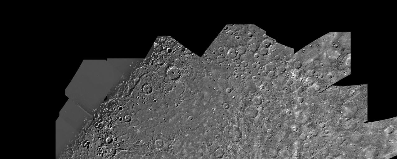
This image, from NASA Mariner 10 spacecraft which launched in 1974, is of the H-7 Beethoven Quadrangle, and lies in Mercury Equatorial Mercator. NASA Mariner 10 spacecraft imaged the region during its initial flyby of the planet.

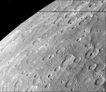
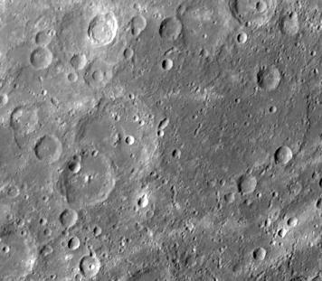
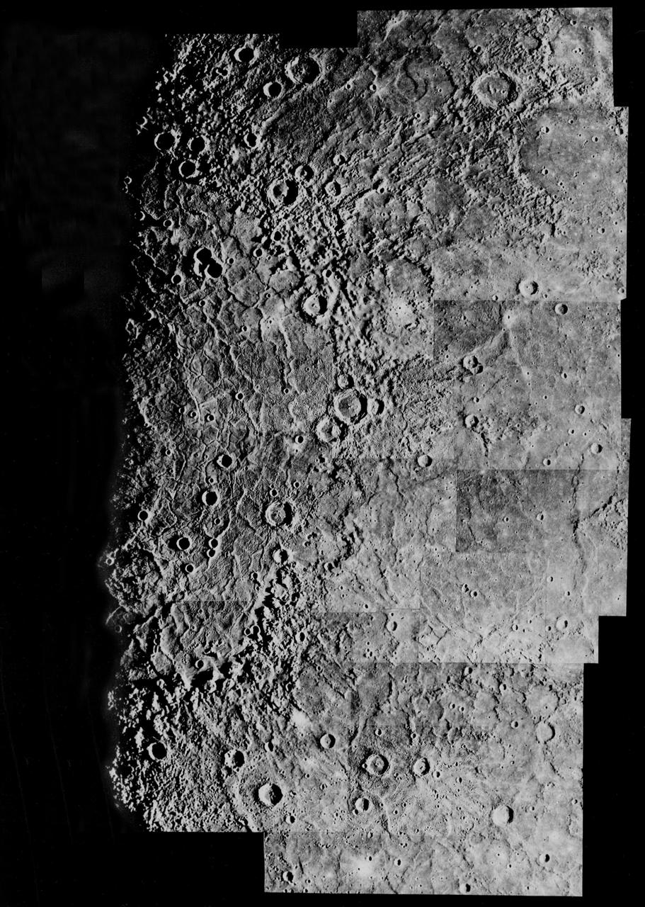
This image, from NASA Mariner 10 spacecraft which launched in 1974, is of the southern hemisphere of Mercury.
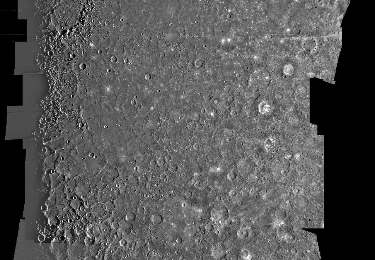
Updated calibration and subsequent mosaicing led to substantial improvements in NASA Mariner 10 color image data; the spacecraft launched in 1974.
NASA Mariner 10 took this picture about an hour after it passed under the South Pole of Mercury in 1974.
This image, from NASA Mariner 10 spacecraft which launched in 1974, is of the northern half of Mercury Shakespeare Quadrangle. http://photojournal.jpl.nasa.gov/catalog/PIA00066
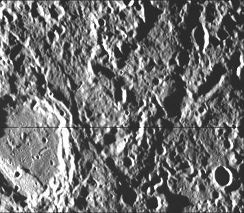
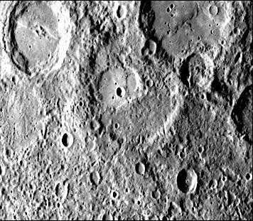
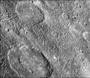
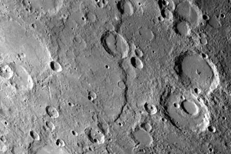
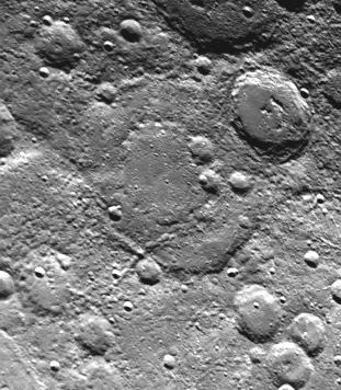
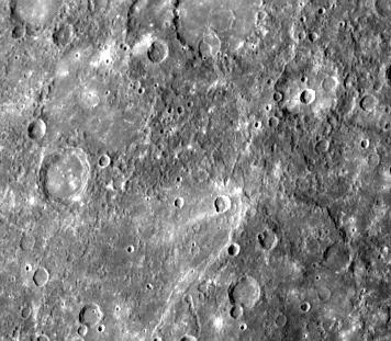
This image, from NASA Mariner 10 spacecraft which launched in 1974, shows hilly and lineated terrain and a patch of smooth plains in a large degraded crater.
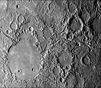
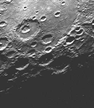
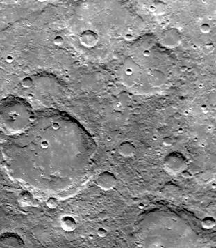
This image, from NASA Mariner 10 spacecraft which launched in 1974, features a 140 kilometer diameter crater and its surrounding zone of secondary craters. T
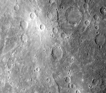
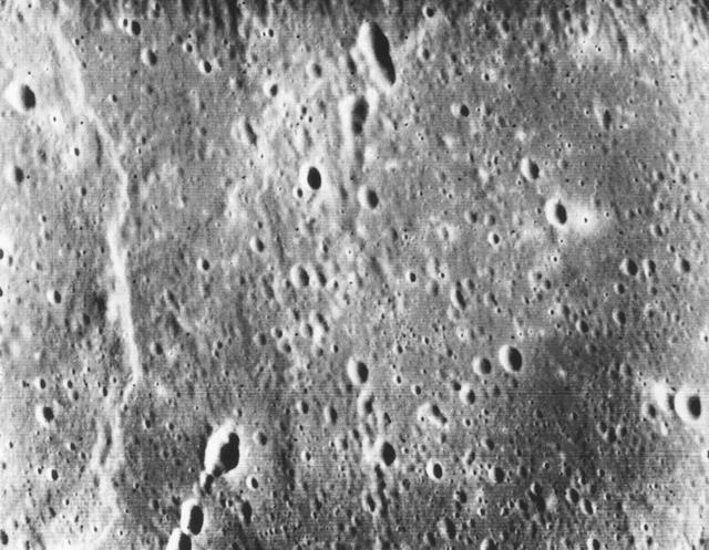
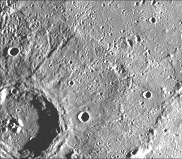
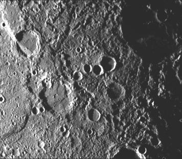
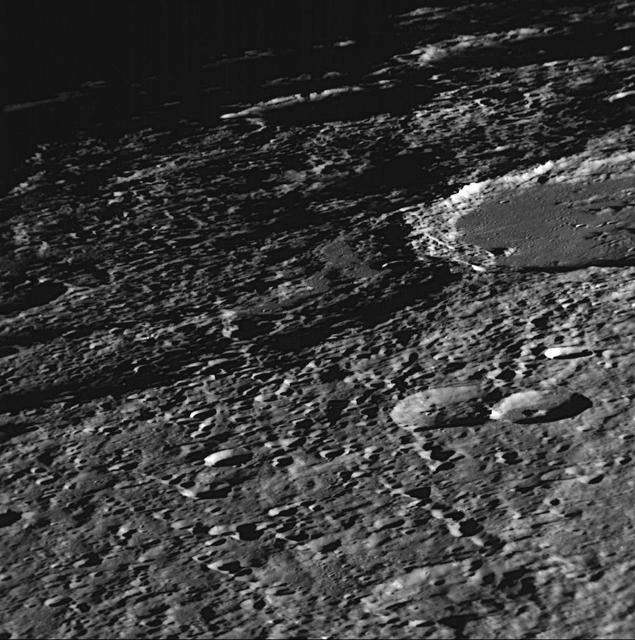
NASA Mariner 10 took this picture of the densely cratered surface of Mercury when the spacecraft was 18,200 kilometers 8085 miles from the planet on March 29, 1974.
This crater illustrates the narrow hummocky rim facies, radial ridges, and surrounding extensive field of secondary craters. This image of Mercury was taken by NASA Mariner 10.
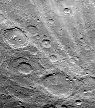
NASA Mariner 10 spacecraft was coaxed into a third and final encounter with Mercury in March of 1975. This is one of the highest resolution images of Mercury acquired by the spacecraft.
This image, from NASA Mariner 10 spacecraft which launched in 1974, shows an old basin hummocky rim is partly degraded and cratered by later events.

A fresh new crater in the center of an older crater basin is shown in this picture of the surface of Mercury taken March 29, 1974 by NASA Mariner 10.
This image, from NASA Mariner 10 spacecraft which launched in 1974, includes part of the floor of the Caloris basin showing the ridges and fractures.
This image, from NASA Mariner 10 spacecraft which launched in 1974, is a high-resolution picture of a 65-kilometer diameter crater and the scarp transecting its floor.
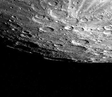
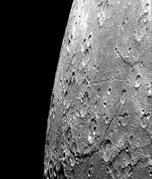
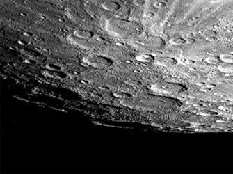
Mercury south pole was photographed by one of NASA Mariner 10 TV cameras; the pole is located inside the large crater on Mercury limb lower center.
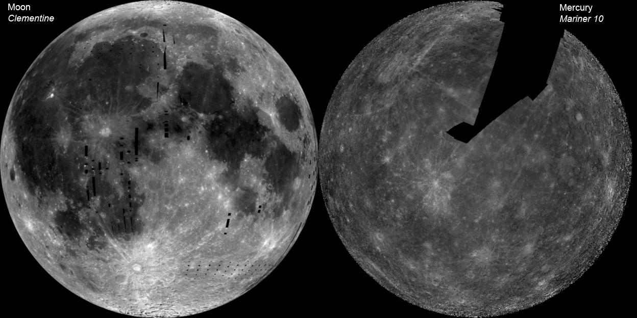
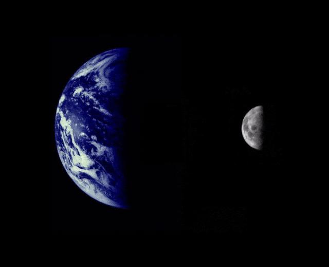
The image of the Moon left is a mosaic of images from NASA Clementine. The Mercury image right is a NASA Mariner 10 mosaic.
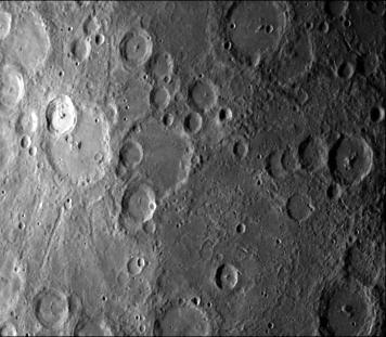
This computer generated mosaic from NASA Mariner 10 is of Mercury Tolstoj Quadrangle, named for the ancient Tolstoj crater located in the lower center of the image. http://photojournal.jpl.nasa.gov/catalog/PIA00068
A faint double ring crater is seen at upper right in this picture of Mercury taken one hour and 40 minutes before NASA Mariner 10 second rendezvous with the planet Sept. 21, 1975

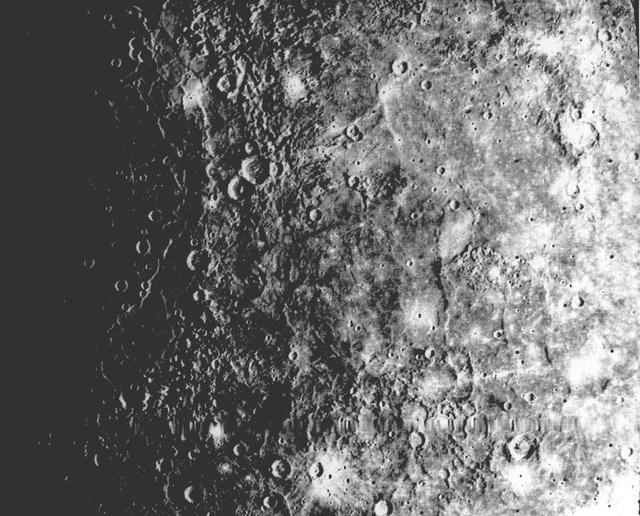
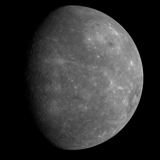
After passing on the darkside of the planet, NASA Mariner 10 photographed the other, somewhat more illuminated hemisphere of Mercury. The north pole is at the top, two-thirds down from which is the equator.
This image, from NASA Mariner 10 spacecraft which launched in 1974, is of the Michelangelo Quadrangle, which lies in Mercury southern polar region. The Mercurian surface is heavily marred by numerous impact craters.
A cratered area near Mercury South Pole was photographed by NASA Mariner 10 during its second flyby of the planet of Sept. 21, 1974 the spacecraft made its first encounter with Mercury on March 19, 1974.
This image, from NASA Mariner 10 spacecraft which launched in 1974, shows several scarps, which appear to be confined to crater floors. The scarp in the crater at the upper left of the image has been diverted by the central peaks.
This picture, taken only minutes after NASA Mariner 10 made its closest approach to Mercury, is one of the highest resolution pictures obtained. Abundant craters in various stages of degradation dot the surface.
A field of bright rays, created by ejecta from a crater, radiating to the north top from off camera lower right is seen in this view of Mercury taken Sept. 21, 1974 by NASA Mariner 10.
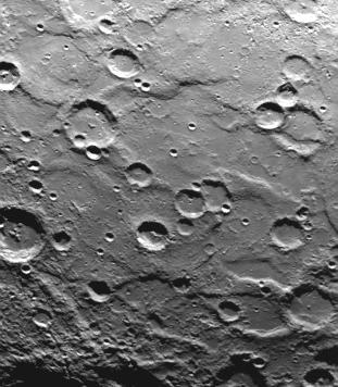
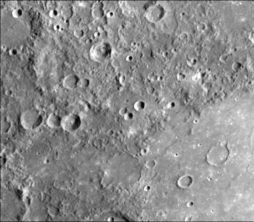
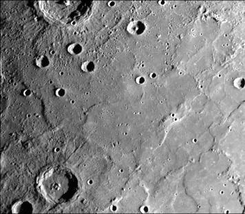
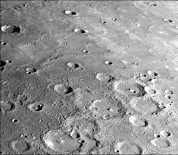
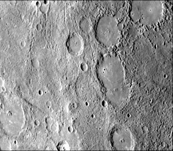
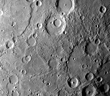
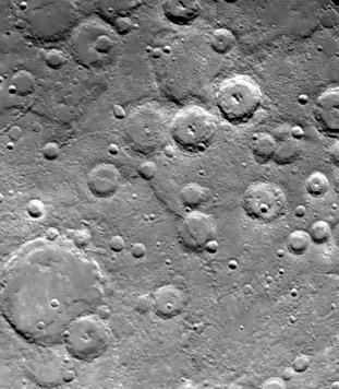
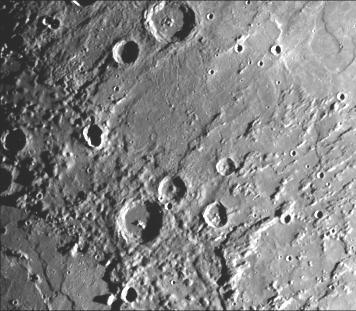
Intercrater plains and heavily cratered terrain typical of much of Mercury outside the area affected by the formation of the Caloris basin are shown in this image taken during the NASA Mariner 10 first encounter with Mercury in 1974.
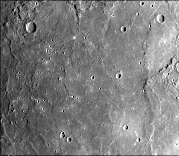
This image, from NASA Mariner 10 spacecraft which launched in 1974, shows plains filling this basin are uniformly brighter and slightly redder than the surrounding cratered terrain.
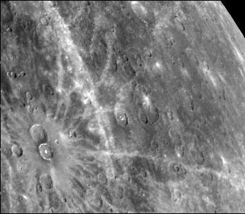
Antoniadi Ridge, over 450 kilometers long, runs along the right side of this acquired image during NASA Mariner 10 first encounter with Mercury after its launch in 1974.
The craters in this image NASA Mariner 10 spacecraft, which launched in 1974, have interior rings of mountains and ejecta deposits which are scarred by deep secondary crater chain groves.
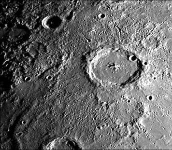
This image, from NASA Mariner 10 spacecraft which launched in 1974, shows young craters superposed on smooth plains. Larger young craters have central peaks, flat floors, terraced walls, and radial ejecta deposits.
After passing Mercury the first time and making a trip around the Sun, NASA Mariner 10 again flew by Mercury on Sept. 21, 1974. This encounter brought the spacecraft in front of Mercury in the southern hemisphere.
This photograph of Mercury, taken by NASA Mariner 10, shows two prominent rayed craters. Bright halos extend as far as 2 crater diameters beyond crater rims. Individual rays extend from halo.
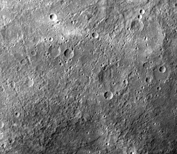
This image, from NASA Mariner 10 spacecraft which launched in 1974, shows intercrater plains and heavily cratered terrain typical of much of Mercury outside the area affected by the formation of the Caloris basin.
After passing Mercury the first time and making a trip around the Sun, NASA Mariner 10 again flew by Mercury on Sept. 21, 1974. This encounter brought the spacecraft in front of Mercury in the southern hemisphere.
This computer generated photomosaic from NASA Mariner 10 is of the southern half of Mercury Shakespeare Quadrangle, named for the ancient Shakespeare crater located on the upper edge to the left of center.
This photograph of Mercury was taken by NASA Mariner 10 spacecraft shows smooth plains areas on Mercury that are thought to be volcanic in origin with lava flows filling in heavily cratered areas.
This image, from NASA Mariner 10 spacecraft which launched in 1974, shows that several west-facing lobate scarps occur in the hummocky plains interpreted as Caloris ejecta.
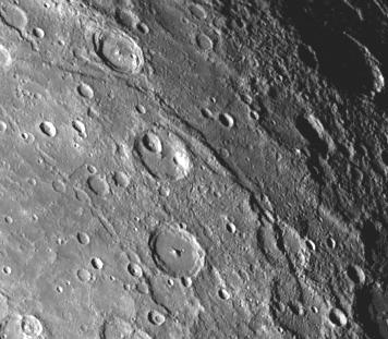
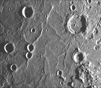
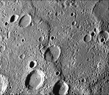
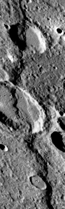
A scarp, or cliff, extends diagonally from upper left to lower right in this picture of Mercury taken by NASA Mariner 10. The structures are believed to be formed by the compressive forces due to crustal shortening.
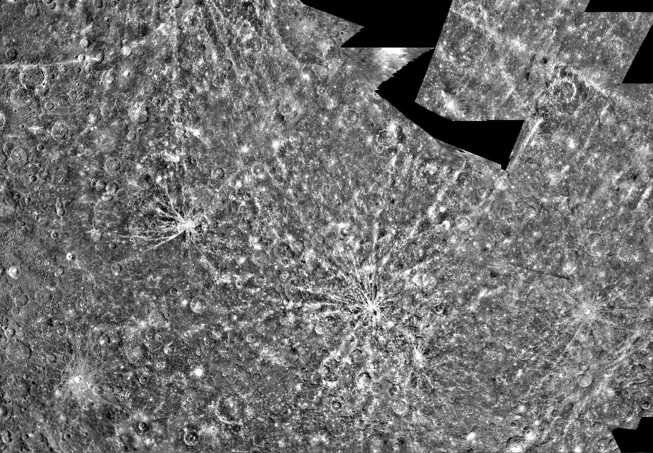
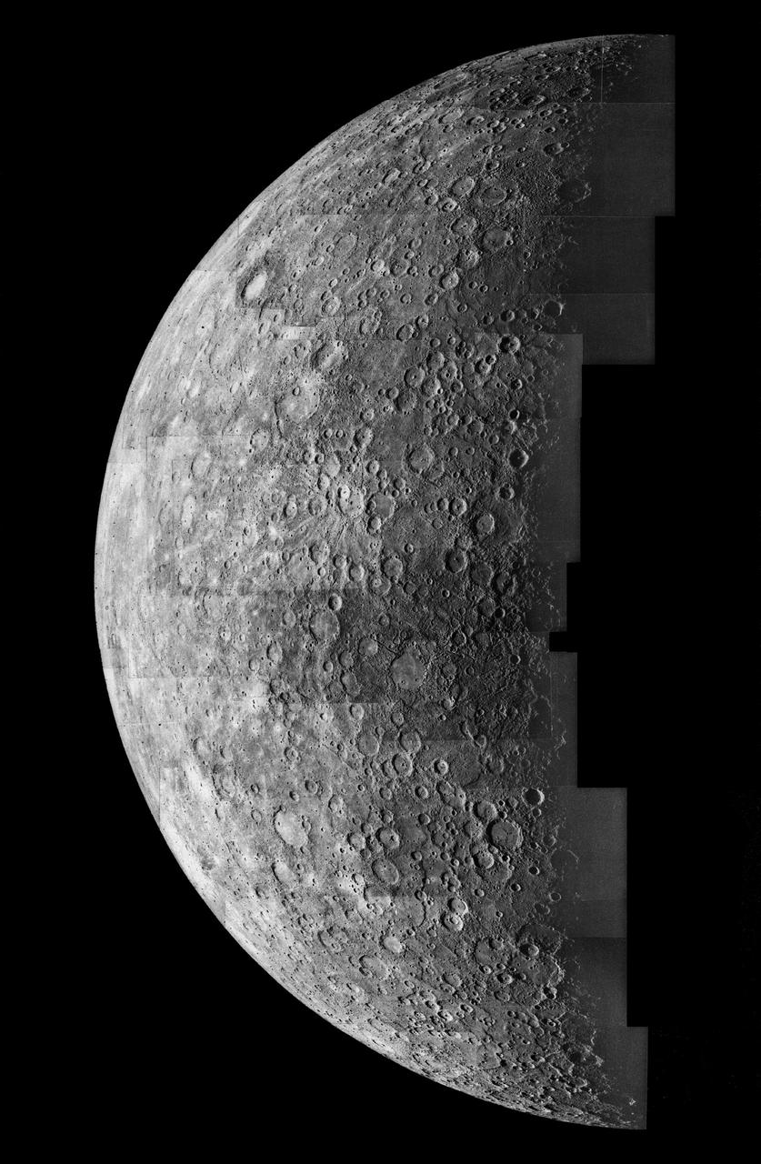
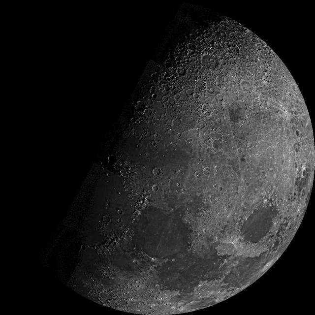
This mosaic, made from over 140 individual TV frames taken about two hours after encounter, shows the planet Mercury as seen by NASA Mariner 10 as it sped away from the planet on March 29, 1974.
NASA Mariner 10 spacecraft was coaxed into a third and final encounter with Mercury in March of 1975. This is one of the highest resolution images of Mercury acquired by the spacecraft. The prominent scarp snaking up the image was named Discovery Rupes.
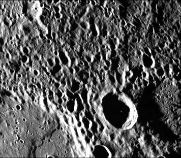
A dark, smooth, relatively uncratered area on Mercury was photographed two hours after NASA Mariner 10 flew by the planet. The prominent, sharp crater with a central peak is 30 kilometers 19 miles across.
The Kuiper Quadrangle was named in memory of Dr. Gerard Kuiper, an imaging team member, and well-known astronomer, of NASA Mariner 10 Venus/Mercury. The Kuiper crater is seen left of center in this image.
This image, from NASA Mariner 10 spacecraft which launched in 1974, shows a broadly curved lobate scarp running from left to right in the large crater to the right of center in this image.
One of the most prominent lobate scarps Discovery Scarp, photographed by NASA Mariner 10 during it first encounter with Mercury, is located at the center of this image extending from the top to near bottom.
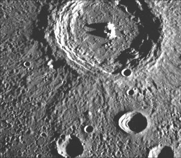
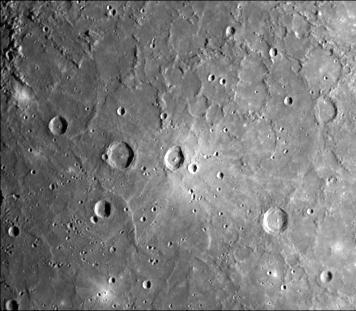
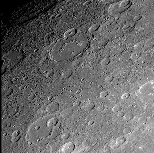
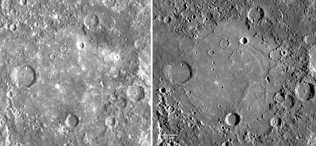
This computer photomosaic is of the Caloris Basin, the largest basin on Mercury. NASA Mariner 10 spacecraft imaged the region during its initial flyby of the planet after its launch in 1974.
Cratered terrain very similar to that on the Moon is shown in this TV photo of Mercury taken by NASA Mariner 10. Numerous small craters and linear grooves radial to the crater can be seen.
NASA Mariner 10 photo reveals a heavily cratered terrain on Mercury with a prominent scrap extending several hundred kilometers across the upper left. A crater, nested in a larger crater, is at top center.
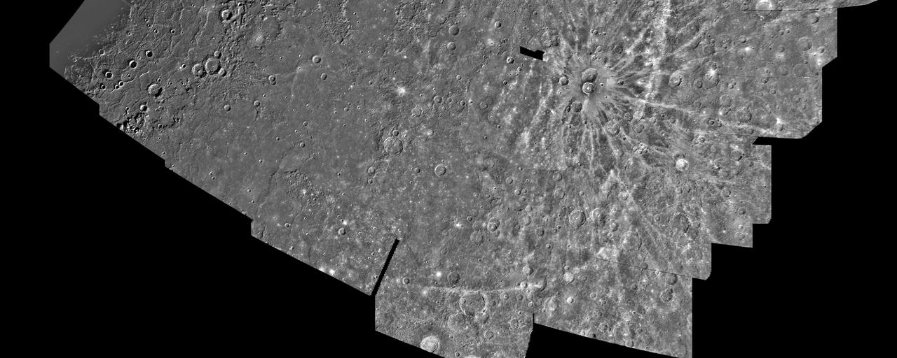
This computer generated photomosaic from NASA Mariner 10 is of the southern half of Mercury Shakespeare Quadrangle, named for the ancient Shakespeare crater located on the upper edge to the left of center. http://photojournal.jpl.nasa.gov/catalog/PIA00067
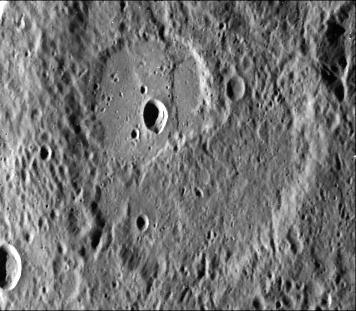
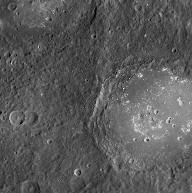
As NASA Mariner 10 passed by Mercury on its second encounter with the planet on Sept. 21, 1974, this picture of a large circular 350 kilometer, 220 mile diameter basin was obtained near the morning terminator.
One of NASA Mariner 10 two TV cameras took this picture of a densely cratered region of Mercury on Sept. 21, 1974, 80 minutes prior to the spacecraft second close encounter with the planet.
NASA Mariner 10 shows a close-up view of one-half of a circular basin the largest observed on Mercury. Hills and valleys extend in a radial fashion outward from the main ring.
This image, from NASA Mariner 10 spacecraft which launched in 1974, shows a crater just north of the Caloris Planitia displays interior and central peaks rising up from a hilly floor.
This image, from NASA Mariner 10 spacecraft which launched in 1974, is of the Borealis area H-1, located in Mercury northern hemisphere. The north pole is visible at the top of the image.
Taken about 40 minutes before NASA Mariner 10 made its close approach to Mercury on Sept. 21,1974, this picture shows a large double-ringed basin center of picture located in the planet south polar region
This image, from NASA Mariner 10 spacecraft which launched in 1974, is of the northeastern quadrant of the Caloris basin and shows the smooth hills and domes between the inner and outer scarps and the well-developed radial system east of the outer scarp
During its second encounter with Mercury on Sept. 21, 1974, NASA Mariner 10 took this picture of the planet South Polar Region. Many of the craters have denuded rims peppered by smaller craters.
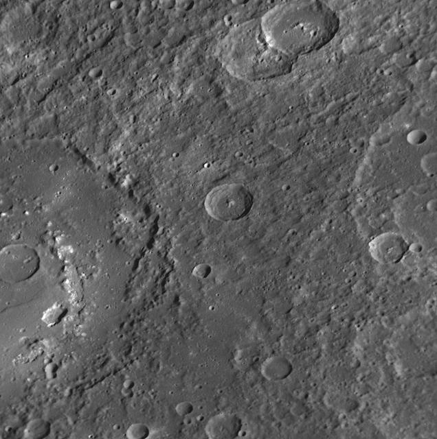
This image was taken by NASA Mariner 10 during it first encounter with Mercury in 1974. The scarp forms a broad lobe whose southern end abuts against and follows closely the irregular contour of the crater wall.
Gazing into the Mariner 10 Gore
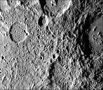
This image, from NASA Mariner 10 spacecraft which launched in 1974, is located about 500 km east of the Caloris basin and shows hummocky plains interpreted as Caloris ejecta in the upper half of the picture and smooth plains in the lower half.
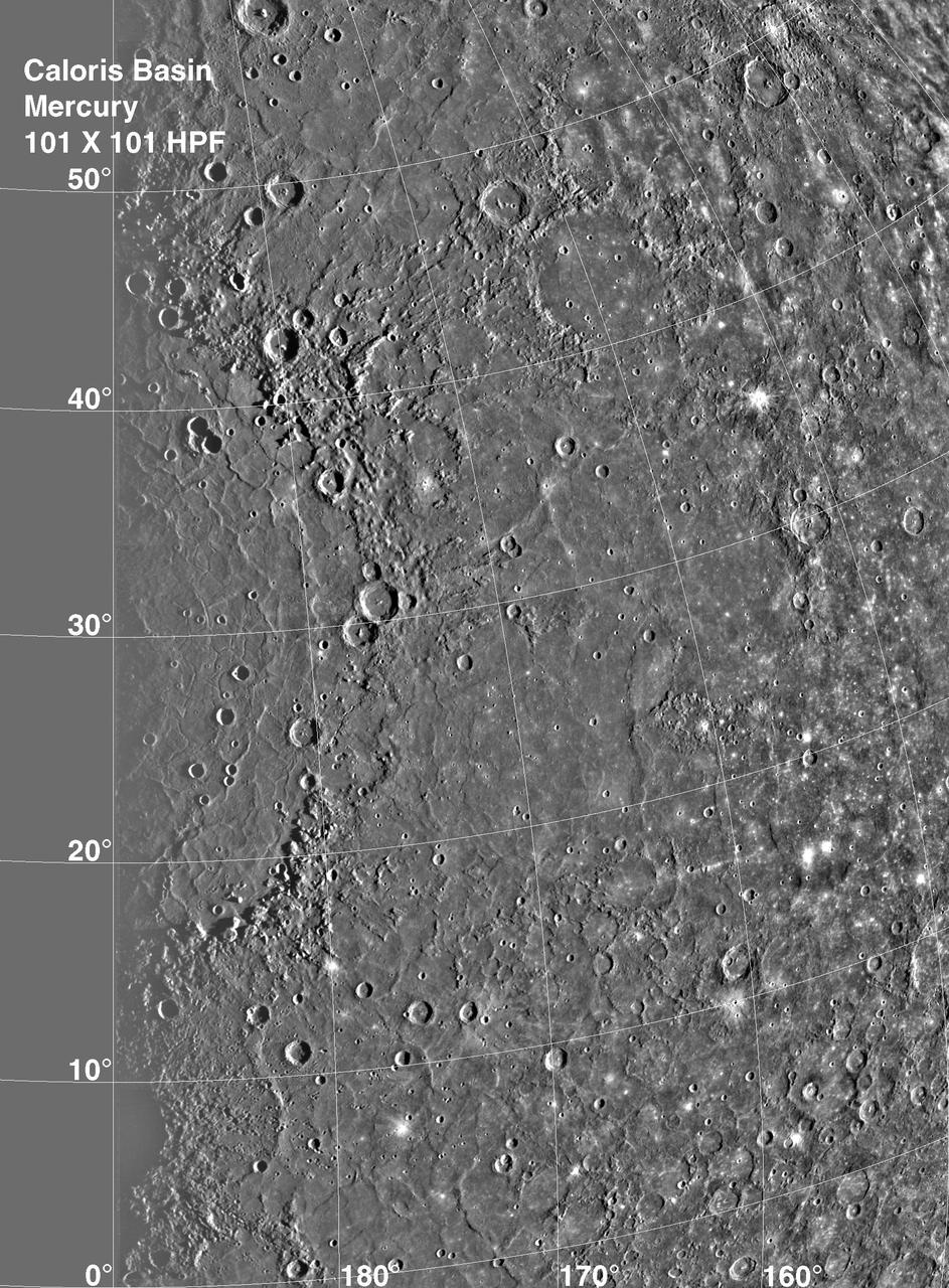
Caloris Basin on Mercury, is one of the largest basins in the solar system, its diameter exceeds 1300 kilometers and is in many ways similar to the great Imbrium basin on the Moon. This image is from NASA Mariner 10 spacecraft which launched in 1974.
After passing Mercury the first time and making a trip around the Sun, NASA Mariner 10 again flew by Mercury on Sept. 21, 1974. The south pole is located on the right hand edge of Chao Meng Fu crater that has only its rim sticking up into the light.
NASA Mariner 10 took this picture some 2 1/2 hours before it passed Mercury on March 29, 1974. The bright-floored crater is the center of a very large bright area which could be seen in pictures from more than two million miles distant

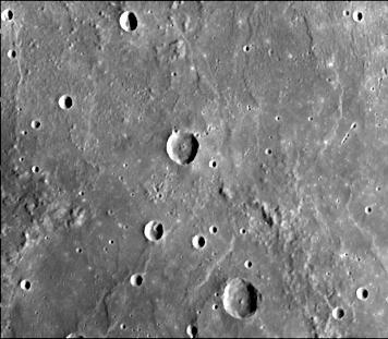
As NASA Mariner 10 approached Mercury at nearly seven miles per second on March 29, 1974, its TV camera took this picture from an altitude of 35,000 kilometers 21,700 miles The picture shows a heavily-cratered surface with many low hills
This double ring basin top center of image was photographed during NASA Mariner 10 second encounter and shows two craters about 30 km in diameter which have been engulfed by smooth plains on the floor of the inner ring.
This image, from NASA Mariner 10 spacecraft which launched in 1974, shows a scarp upper left corner of the image about 130 kilometers long cutting two craters older crater is at extreme left corner, younger is diagonally below.
On January 14, 2008, NASA MESSENGER spacecraft observed about half of the hemisphere missed by Mariner 10.
Goethe - Then and Now
The Tolstoj Impact Basin
Moon North Pole
Lermontov crater was first observed by Mariner 10 and seen here by MESSENGER during its second flyby of Mercury. The crater floor is somewhat brighter than the exterior surface and is smooth with several irregularly shaped depressions.
A Grand Canyon of Mars slices across the Red Planet near its equator. This canyon -- Valles Marineris, or the Mariner Valley -- is 10 times longer and deeper than Arizona Grand Canyon, and 20 times wider
The large crater extending out the left side of this image is Praxiteles. Named for the ancient Greek sculptor of the 4th century BC, Praxiteles crater was first observed by Mariner 10.
NASA Mariner 10 shows a close-up view of craters Vyasa and Stravinsky on Mercury. Stravinsky is a smooth-floored crater partially seen overlying the rim of the larger, rougher crater Vyasa in the center and left.
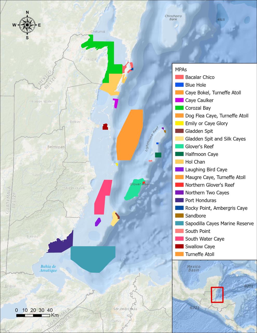
In a paper published in November 2022 in Frontiers in Remote Sensing, researchers at NASA's Jet Propulsion Laboratory, with colleagues in Belize, used data from the Moderate Resolution Imaging Spectroradiometer (MODIS) instrument aboard NASA's Aqua satellite to rank 24 protected marine areas off the Belizean coast based on the risks coral face from murky water and rising temperatures. All the areas are part of the 185-mile-long (298-kilometer-long) Belize Barrier Reef Reserve System, which encompasses a vibrant network of marine environments that supports thousands of animal and plant species and drives the Central American country's largest industry, tourism. The system is one of about 1,200 UNESCO World Heritage sites around the world. Analyzing imagery from 2002 to 2022, researchers developed a coral vulnerability index – a score between 2 and 12 that characterizes the risk to coral, with higher scores signifying greater risk. Their findings could help management authorities protect the reefs from human impacts such as development, overfishing, pollution, and climate change. Port Honduras Marine Reserve, a 156-square-mile (40,000-hectare) protected area in southern Belize, showed the highest coral vulnerability score: 10 out of 12. Based on the index, the study flags Port Honduras, Swallow Caye Wildlife Sanctuary, Sapodilla Cayes Marine Reserve, and Corozal Bay Wildlife Sanctuary as areas for concern. https://photojournal.jpl.nasa.gov/catalog/PIA25862

iss070e064005 (Jan. 10, 2024) --- A portion of Mozambique's Bazaruto Archipelago, a national park ceated to protect marine wildlife, on the southern coast of the African nation is pictured from the International Space Station as it orbited 261 miles above.

Researcher Bobby Sanders examines a 0.10-scale model of the Mariner-C shroud and Agena rocket in the 8- by 6-Foot Supersonic Wind Tunnel at the National Aeronautics and Space Administration (NASA) Lewis Research Center. Mariner-C and Mariner-D were identical spacecraft designed by the Jet Propulsion Laboratory to flyby Mars and photograph the Martian surface. The two Mariner spacecraft were launched by Atlas-Agena-D rockets. Lewis had taken over management of the Agena Program in October 1962. Lewis researchers investigated two different types of shrouds for the Mariner missions—an over-the-nose design and a backup pyrotechnic design. The new shroud was wider in diameter than the Agena rocket, so there was concern that this disparity might create air flow instability that could damage the shroud or destroy the vehicle. The tests in the 8- by 6 tunnel simulated launch speeds from Mach 0.56 to 1.96. Afterwards the Agena-Mariner-C model was studied in the 10- by 10-Foot Supersonic Wind Tunnel at speeds of Mach 2.0 to 3.5. Mariner-C was launched on November 4, 1964, but the payload shroud did not jettison properly and the spacecraft’s battery power did not function. The mission ended unsuccessfully two days later. Mariner-D was launched on November 28, 1964 and became the first successful mission to Mars. It was the first time a planet was photographed from space. Mariner-D’s 21 photographs revealed an inhospitable and barren landscape.
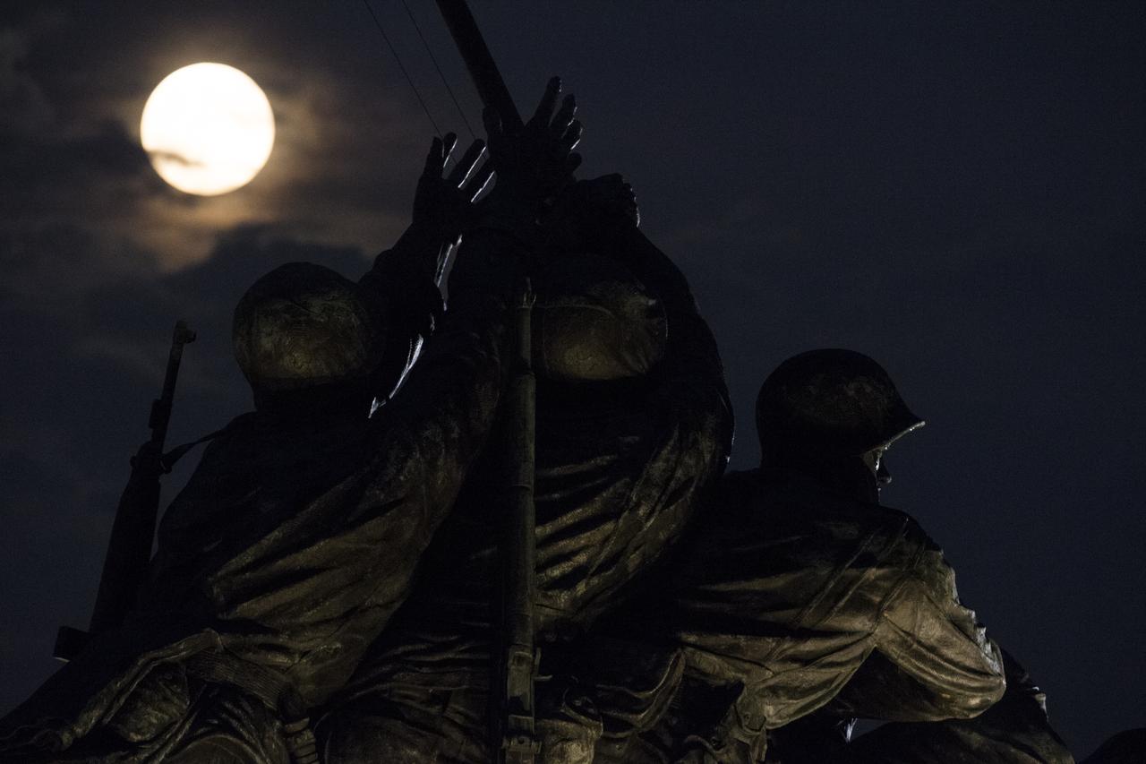
A perigree full moon or supermoon is seen over the US Marine Corps War Memorial, Sunday, August 10, 2014, in Arlington, Virginia. A supermoon occurs when the moon’s orbit is closest (perigee) to Earth at the same time it is full. Photo Credit: (NASA/Joel Kowsky)
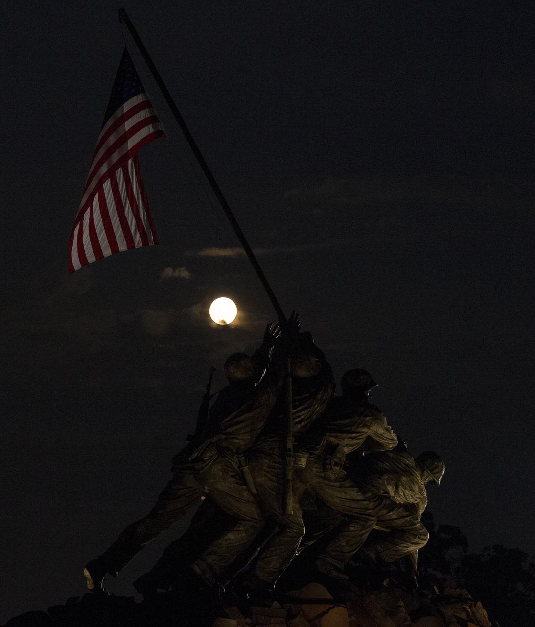
A perigree full moon or supermoon is seen over the US Marine Corps War Memorial, Sunday, August 10, 2014, in Arlington, Virginia. A supermoon occurs when the moon’s orbit is closest (perigee) to Earth at the same time it is full. Photo Credit: (NASA/Joel Kowsky)
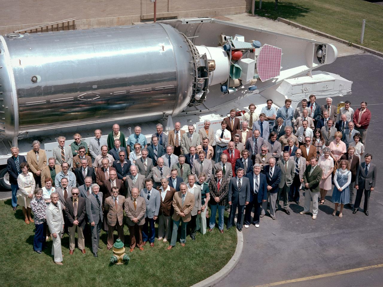
The National Aeronautics and Space Administration (NASA) Lewis Research Center’s Launch Vehicle Directorate in front of a full-scale model of the Centaur second-stage rocket. The photograph was taken to mark Centaur’s fiftieth launch. NASA Lewis managed the Centaur Program since 1962. At that time, the only prior launch attempt ended in failure. Lewis improved the spacecraft and tested it extensively throughout the early 1960s. In May 1966 an Atlas-Centaur sent the Surveyor spacecraft to the moon. It was the first successful soft landing on another planet. The Launch Vehicles Division was formed in 1969 to handle the increasing number of Centaur launches. The Lewis team became experts at integrating the payload with the Centaur and calculating proper trajectories for the missions. Centaur’s first 50 missions included Orbiting Astronomical Observatories, the Mariner 6 and 7 flybys of Mars, Mariner 9 which was the first spacecraft to orbit around another planet, the Pioneer 10 and 11 missions to the outer solar system, the Mariner 10 flyby of Venus and Mercury, the Viking 1 and 2 Mars landers, Voyagers 1 and 2 missions to Jupiter, Saturn, Uranus, and Neptune, and the Pioneer 12 and 13 flights to Venus.
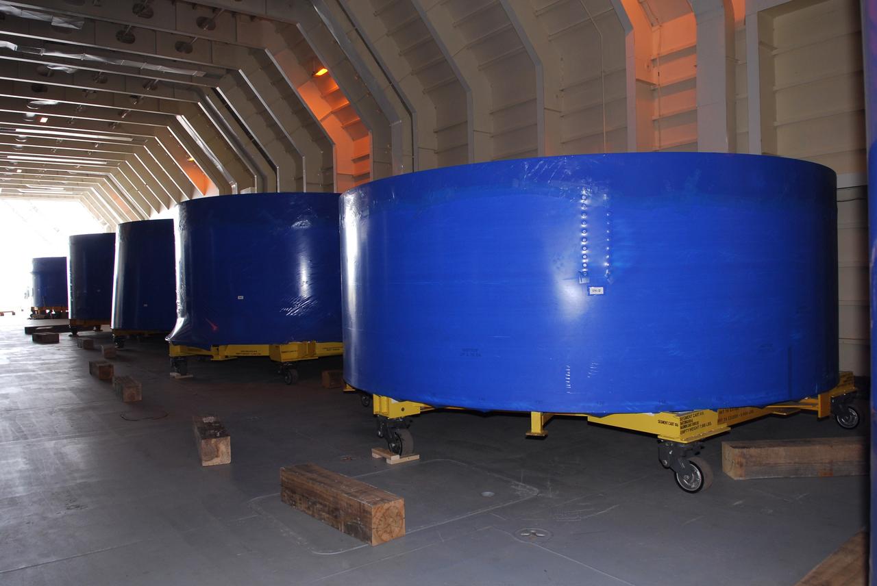
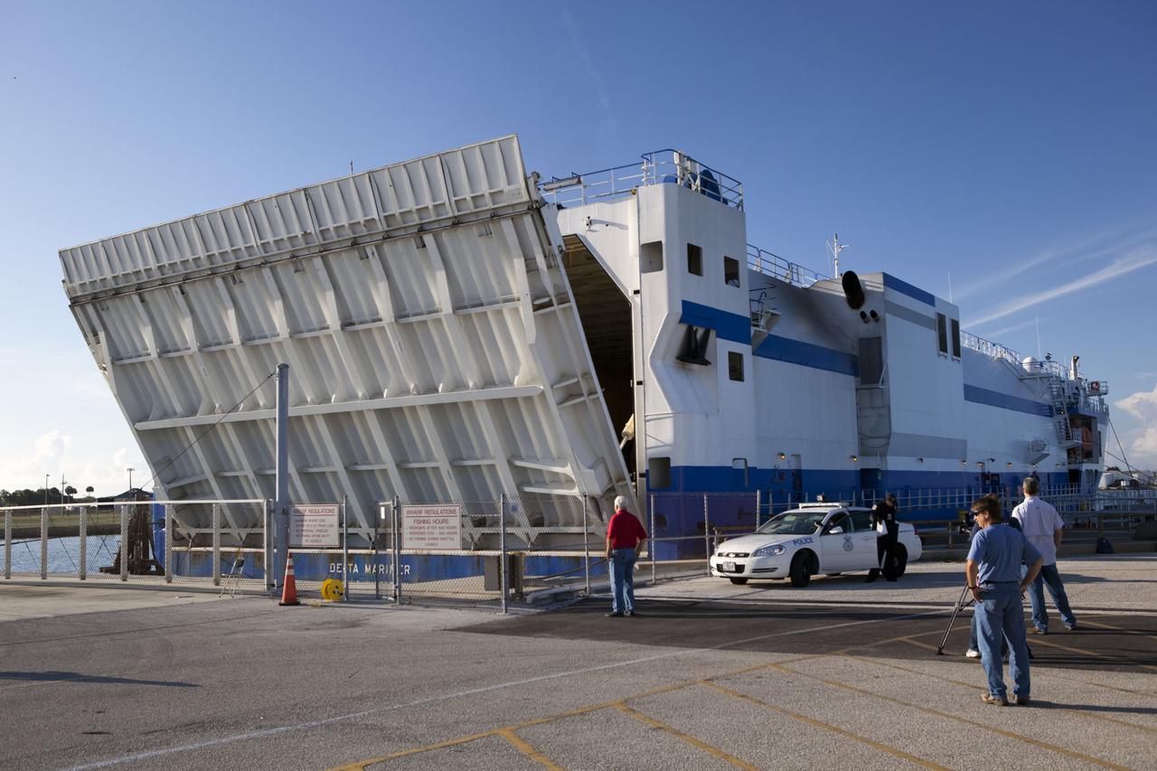
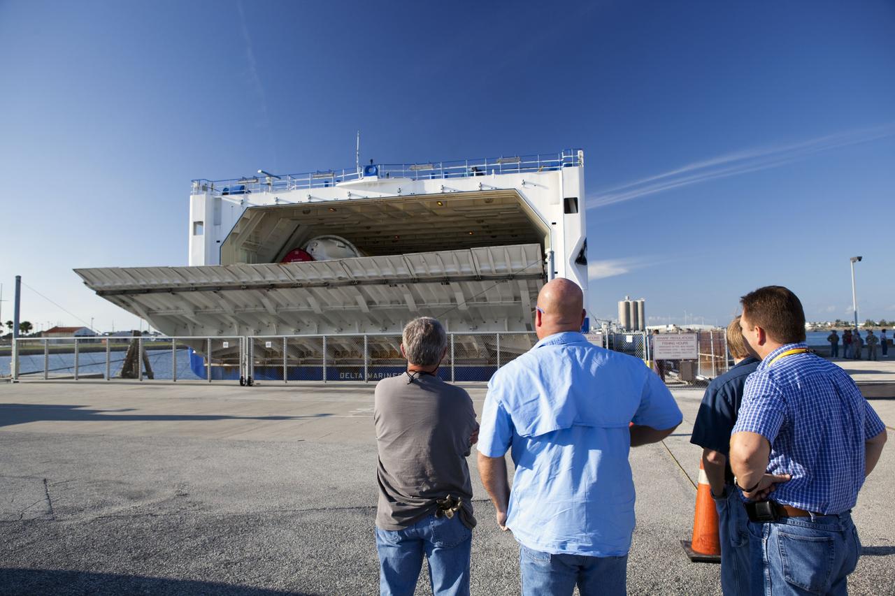
CAPE CANAVERAL, Fla. – Segments of the Ares I-X upper stage simulator are lined up in the cargo hold of the Delta Mariner, docked at Port Canaveral, Fla. The upper stage simulator will be used in the test flight identified as Ares I-X in 2009. The segments will simulate the mass and the outer mold line and will be more than 100 feet of the total vehicle height of 327 feet. The simulator comprises 11 segments that are approximately 18 feet in diameter. Most of the segments will be approximately 10 feet high, ranging in weight from 18,000 to 60,000 pounds, for a total of approximately 450,000 pounds. Photo credit: NASA/Dimitri Gerondidakis

CAPE CANAVERAL, Fla. – On the bridge of the Delta Mariner, whose cargo is the Ares I-X upper stage simulator segments. The upper stage simulator will be used in the test flight identified as Ares I-X in 2009. The segments will simulate the mass and the outer mold line and will be more than 100 feet of the total vehicle height of 327 feet. The simulator comprises 11 segments that are approximately 18 feet in diameter. Most of the segments will be approximately 10 feet high, ranging in weight from 18,000 to 60,000 pounds, for a total of approximately 450,000 pounds. Photo credit: NASA/Dimitri Gerondidakis
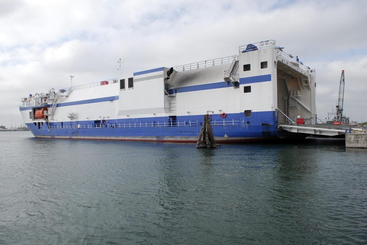
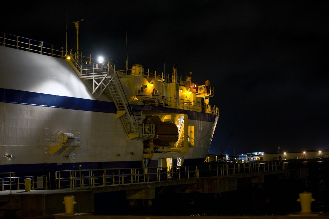
CAPE CANAVERAL, Fla. – The Delta Mariner docks at Port Canaveral, Fla., with its cargo of the Ares I-X upper stage simulator segments. The upper stage simulator will be used in the test flight identified as Ares I-X in 2009. The segments will simulate the mass and the outer mold line and will be more than 100 feet of the total vehicle height of 327 feet. The simulator comprises 11 segments that are approximately 18 feet in diameter. Most of the segments will be approximately 10 feet high, ranging in weight from 18,000 to 60,000 pounds, for a total of approximately 450,000 pounds. Photo credit: NASA/Dimitri Gerondidakis
CAPE CANAVERAL, Fla. – The Delta Mariner arrives at Port Canaveral, Fla., with its cargo of the Ares I-X upper stage simulator segments. The upper stage simulator will be used in the test flight identified as Ares I-X in 2009. The segments will simulate the mass and the outer mold line and will be more than 100 feet of the total vehicle height of 327 feet. The simulator comprises 11 segments that are approximately 18 feet in diameter. Most of the segments will be approximately 10 feet high, ranging in weight from 18,000 to 60,000 pounds, for a total of approximately 450,000 pounds. Photo credit: NASA/Dimitri Gerondidakis
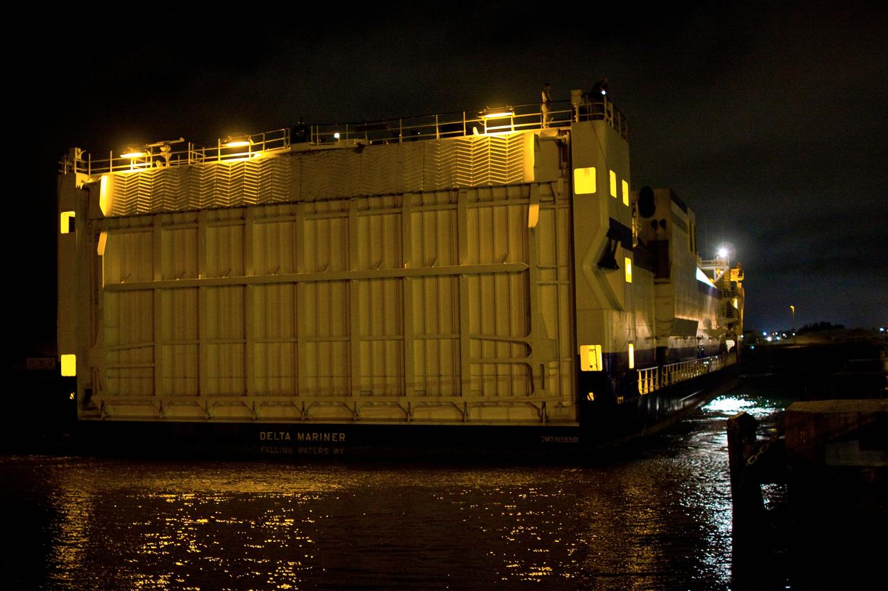
CAPE CANAVERAL, Fla. – The Delta Mariner arrives at Port Canaveral, Fla., with its cargo of the Ares I-X upper stage simulator segments. The upper stage simulator will be used in the test flight identified as Ares I-X in 2009. The segments will simulate the mass and the outer mold line and will be more than 100 feet of the total vehicle height of 327 feet. The simulator comprises 11 segments that are approximately 18 feet in diameter. Most of the segments will be approximately 10 feet high, ranging in weight from 18,000 to 60,000 pounds, for a total of approximately 450,000 pounds. Photo credit: NASA/Dimitri Gerondidakis
CAPE CANAVERAL, Fla. – The Delta Mariner docks at Port Canaveral, Fla., with its cargo of the Ares I-X upper stage simulator segments. The upper stage simulator will be used in the test flight identified as Ares I-X in 2009. The segments will simulate the mass and the outer mold line and will be more than 100 feet of the total vehicle height of 327 feet. The simulator comprises 11 segments that are approximately 18 feet in diameter. Most of the segments will be approximately 10 feet high, ranging in weight from 18,000 to 60,000 pounds, for a total of approximately 450,000 pounds. Photo credit: NASA/Dimitri Gerondidakis
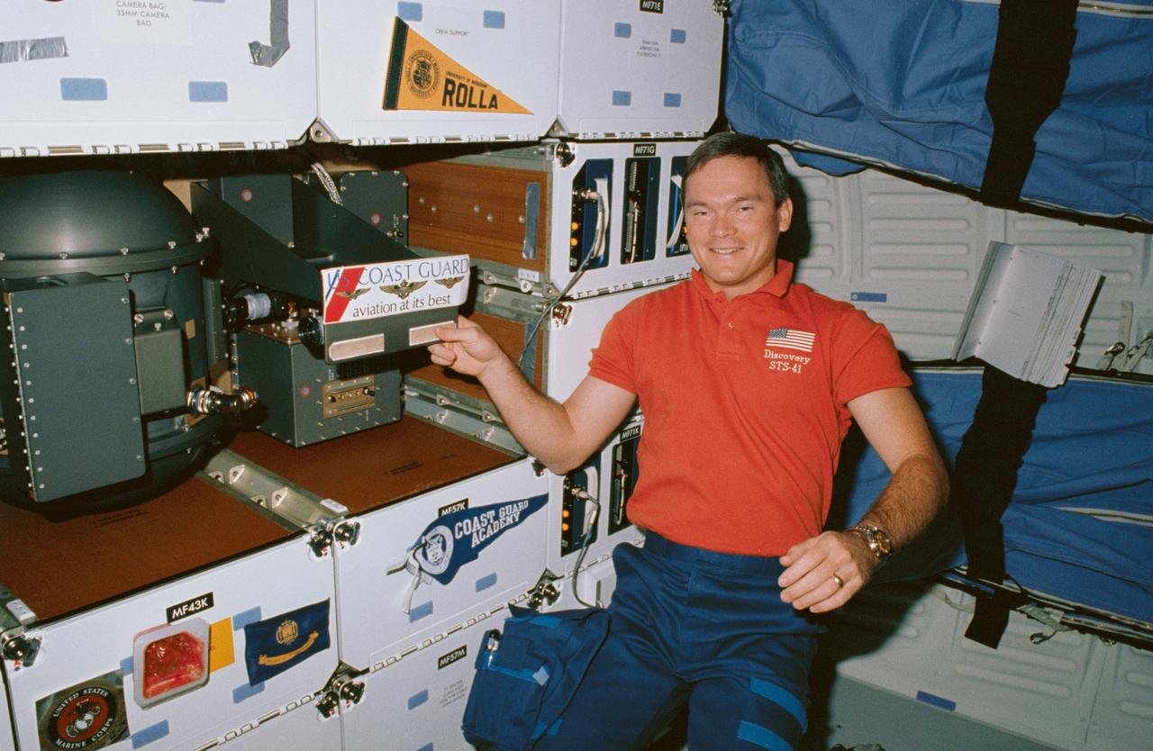
STS041-06-029 (10 Oct 1990) --- STS-41 Mission Specialist (MS) Bruce E. Melnick, who is a graduate of the Coast Guard Academy and the first ever active Coast Guardsman to fly in space, draws attention to his branch of the service, while posing next to a banner from his Alma Mater (on locker MF57K) and a United States (U.S.) Coast Guard decal (on the Solid Surface Combustion Experiment (SSCE)). Behind Melnick are the starboard wall-mounted sleep restraints. Insignias belonging to other crewmembers are displayed on the lockers including University of Missouri Rolla and U.S. Marine Corps.

CAPE CANAVERAL, Fla. – Segments of the Ares I-X upper stage simulator are lined up in the cargo hold of the Delta Mariner, docked at Port Canaveral, Fla. The upper stage simulator will be used in the test flight identified as Ares I-X in 2009. The segments will simulate the mass and the outer mold line and will be more than 100 feet of the total vehicle height of 327 feet. The simulator comprises 11 segments that are approximately 18 feet in diameter. Most of the segments will be approximately 10 feet high, ranging in weight from 18,000 to 60,000 pounds, for a total of approximately 450,000 pounds. Photo credit: NASA/Dimitri Gerondidakis
CAPE CANAVERAL, Fla. – The Delta Mariner is docked at Port Canaveral, Fla., with its cargo of the Ares I-X upper stage simulator segments. The upper stage simulator will be used in the test flight identified as Ares I-X in 2009. The segments will simulate the mass and the outer mold line and will be more than 100 feet of the total vehicle height of 327 feet. The simulator comprises 11 segments that are approximately 18 feet in diameter. Most of the segments will be approximately 10 feet high, ranging in weight from 18,000 to 60,000 pounds, for a total of approximately 450,000 pounds. Photo credit: NASA/Dimitri Gerondidakis
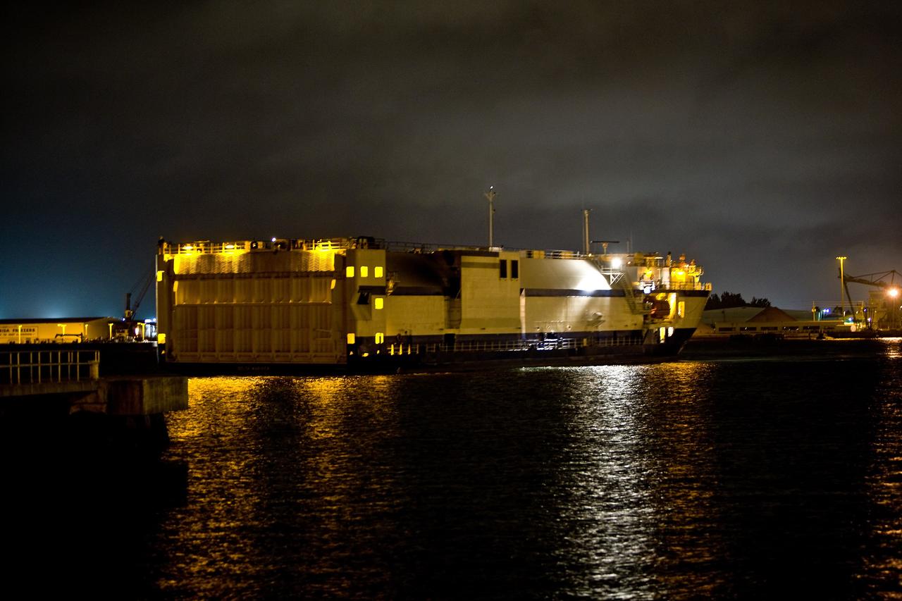
CAPE CANAVERAL, Fla. – The Delta Mariner arrives at Port Canaveral, Fla., with its cargo of the Ares I-X upper stage simulator segments. The upper stage simulator will be used in the test flight identified as Ares I-X in 2009. The segments will simulate the mass and the outer mold line and will be more than 100 feet of the total vehicle height of 327 feet. The simulator comprises 11 segments that are approximately 18 feet in diameter. Most of the segments will be approximately 10 feet high, ranging in weight from 18,000 to 60,000 pounds, for a total of approximately 450,000 pounds. Photo credit: NASA/Dimitri Gerondidakis
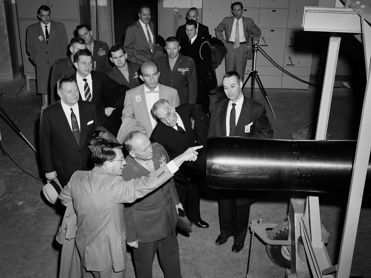
Abe Silverstein, Associate Director of the National Advisory Committee for Aeronautics (NACA) Lewis Flight Propulsion Laboratory, provides a personal tour of the new 10- by 10-Foot Supersonic Wind Tunnel for US Senator George Bender (hat in hand) and General Lemuel Shepherd. Shepherd was Commandant of the Marine Corps and had served in World War I, World War II, and the Korean War. The general was accompanied by Admiral Herbert Leary, in dark uniform. Bender was a Republican Senator from Ohio. Behind Bender is President of the Cleveland Chamber of Commerce Curtis Smith. NACA Lewis managers Eugene Manganiello and Wilson Hunter assist with the tour. Abe Silverstein oversaw all research at the laboratory. Upon taking his post in 1952 he reorganized the research staff and began shifting the focus away from airbreathing aircraft engines to new fields such as high energy fuels, electric propulsion, and nuclear power and propulsion. He was an early advocate of the NACA’s involvement in the space program and crucial to the founding of National Aeronautics and Space Administration in 1958. Silverstein began his career helping design and conduct research in the Full Scale Tunnel in 1929 at the Langley Memorial Aeronautical Laboratory. Silverstein advocated a series of increasingly large supersonic wind tunnels after the war, culminating in the 10- by 10.

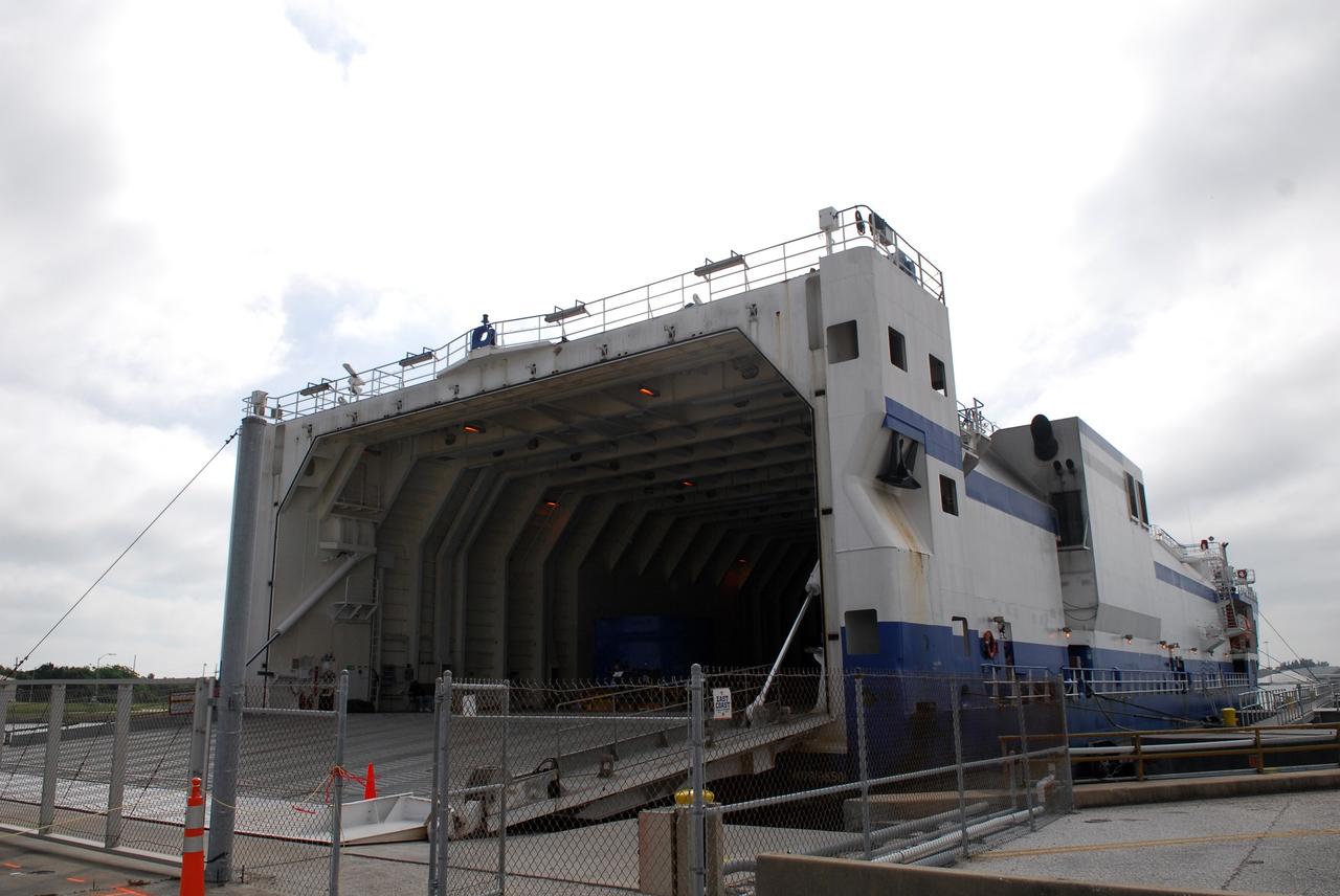
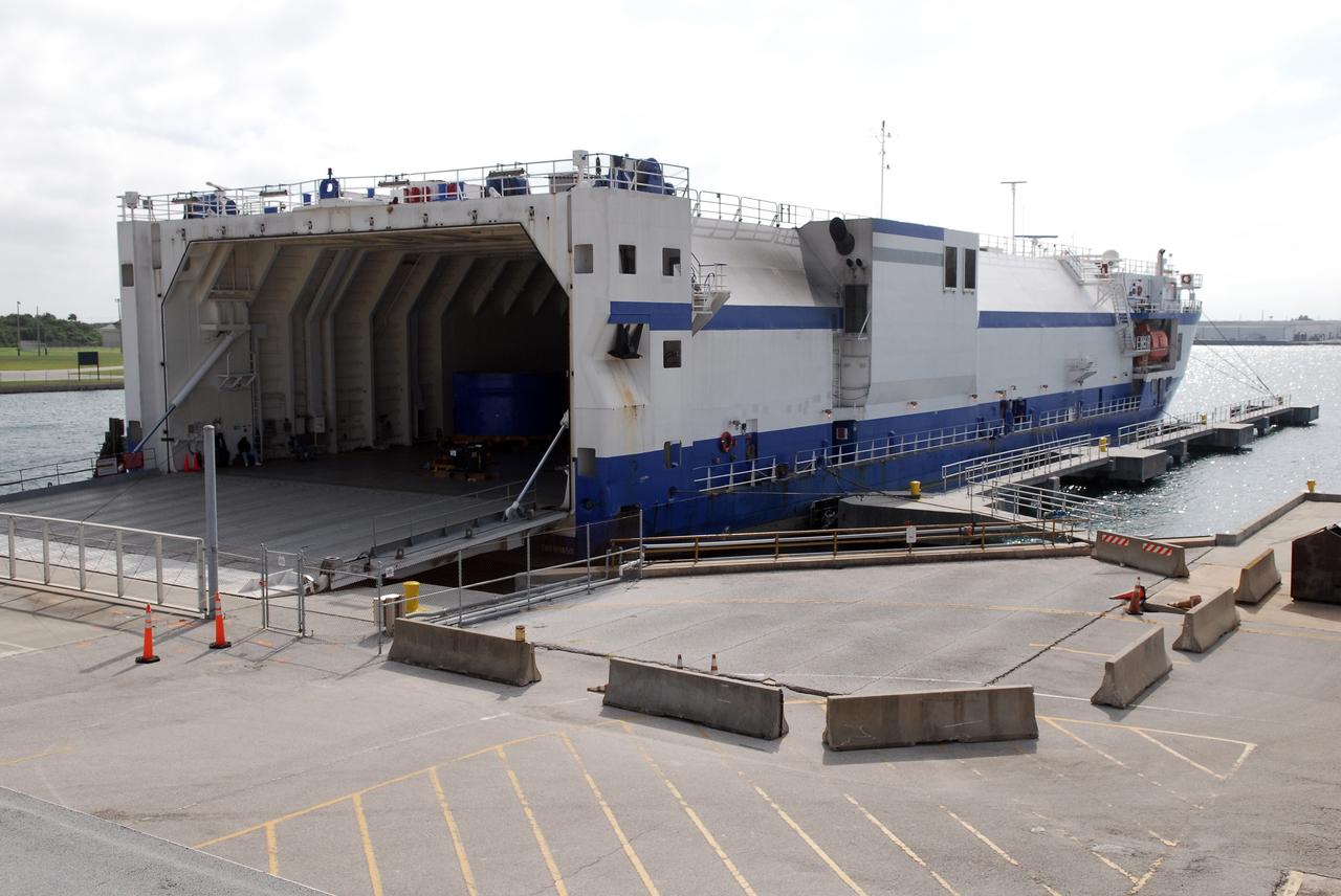
CAPE CANAVERAL, Fla. -- The Atlas V first stage (right) and Centaur upper stage to support the Mars Science Laboratory (MSL) mission are offloaded from the Delta Mariner transport ship at Port Canaveral in Florida. MSL's components include a compact car-sized rover, Curiosity, which has 10 science instruments designed to search for evidence on whether Mars has had environments favorable to microbial life, including chemical ingredients for life. The unique rover will use a laser to look inside rocks and release its gasses so that the rover’s spectrometer can analyze and send the data back to Earth. Launch of MSL aboard a United Launch Alliance Atlas V rocket is scheduled for Nov. 25 from Space Launch Complex 41 on Cape Canaveral Air Force Station. For more information, visit http://www.nasa.gov/msl. Photo credit: NASA/Dimitri Gerondidakis
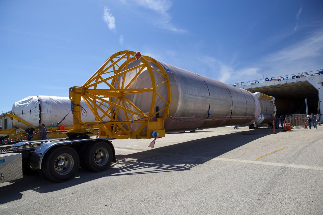
CAPE CANAVERAL, Fla. -- The Atlas V first stage (right) and Centaur upper stage to support the Mars Science Laboratory (MSL) mission are offloaded from the Delta Mariner transport ship at Port Canaveral in Florida. MSL's components include a compact car-sized rover, Curiosity, which has 10 science instruments designed to search for evidence on whether Mars has had environments favorable to microbial life, including chemical ingredients for life. The unique rover will use a laser to look inside rocks and release its gasses so that the rover’s spectrometer can analyze and send the data back to Earth. Launch of MSL aboard a United Launch Alliance Atlas V rocket is scheduled for Nov. 25 from Space Launch Complex 41 on Cape Canaveral Air Force Station. For more information, visit http://www.nasa.gov/msl. Photo credit: NASA/Dimitri Gerondidakis
CAPE CANAVERAL, Fla. -- The Atlas V first stage and Centaur upper stage to support the Mars Science Laboratory (MSL) mission arrive at Port Canaveral in Florida aboard the Delta Mariner transport ship. MSL's components include a compact car-sized rover, Curiosity, which has 10 science instruments designed to search for evidence on whether Mars has had environments favorable to microbial life, including chemical ingredients for life. The unique rover will use a laser to look inside rocks and release its gasses so that the rover’s spectrometer can analyze and send the data back to Earth. Launch of MSL aboard a United Launch Alliance Atlas V rocket is scheduled for Nov. 25 from Space Launch Complex 41 on Cape Canaveral Air Force Station. For more information, visit http://www.nasa.gov/msl. Photo credit: NASA/Dimitri Gerondidakis
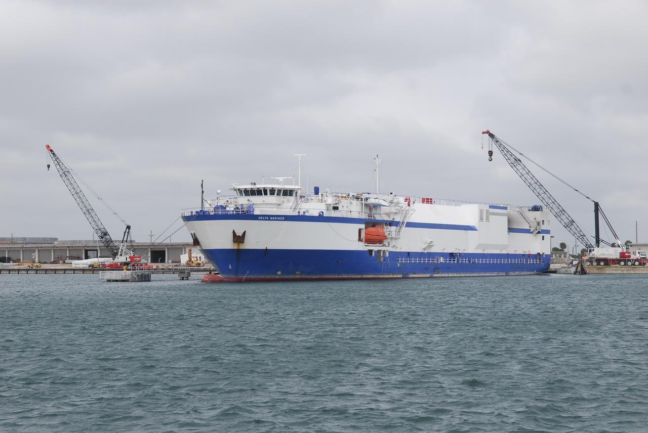
CAPE CANAVERAL, Fla. – The Delta Mariner is docked at Port Canaveral, Fla., with its cargo of the Ares I-X upper stage simulator segments. The cranes near the ship will be used to remove the segments and place them on a flatbed truck for transportation to the Vehicle Assembly Building's high bay 4 at NASA's Kennedy Space Center in Florida. The upper stage simulator will be used in the test flight identified as Ares I-X in 2009. The segments will simulate the mass and the outer mold line and will be more than 100 feet of the total vehicle height of 327 feet. The simulator comprises 11 segments that are approximately 18 feet in diameter. Most of the segments will be approximately 10 feet high, ranging in weight from 18,000 to 60,000 pounds, for a total of approximately 450,000 pounds. Photo credit: NASA/Dimitri Gerondidakis
CAPE CANAVERAL, Fla. -- The Atlas V first stage and Centaur upper stage to support the Mars Science Laboratory (MSL) mission arrive at Port Canaveral in Florida aboard the Delta Mariner transport ship. MSL's components include a compact car-sized rover, Curiosity, which has 10 science instruments designed to search for evidence on whether Mars has had environments favorable to microbial life, including chemical ingredients for life. The unique rover will use a laser to look inside rocks and release its gasses so that the rover’s spectrometer can analyze and send the data back to Earth. Launch of MSL aboard a United Launch Alliance Atlas V rocket is scheduled for Nov. 25 from Space Launch Complex 41 on Cape Canaveral Air Force Station. For more information, visit http://www.nasa.gov/msl. Photo credit: NASA/Dimitri Gerondidakis
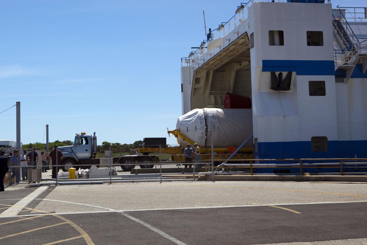
CAPE CANAVERAL, Fla. -- The Centaur upper stage to support the Mars Science Laboratory (MSL) mission is offloaded from the Delta Mariner transport ship at Port Canaveral in Florida. MSL's components include a compact car-sized rover, Curiosity, which has 10 science instruments designed to search for evidence on whether Mars has had environments favorable to microbial life, including chemical ingredients for life. The unique rover will use a laser to look inside rocks and release its gasses so that the rover’s spectrometer can analyze and send the data back to Earth. Launch of MSL aboard a United Launch Alliance Atlas V rocket is scheduled for Nov. 25 from Space Launch Complex 41 on Cape Canaveral Air Force Station. For more information, visit http://www.nasa.gov/msl. Photo credit: NASA/Dimitri Gerondidakis
ISS010-E-09287 (3 December 2004) --- Howland Island, Oceania is featured in this digital image photographed by an Expedition 10 crewmember on the International Space Station (ISS). Howland Island is a United States possession located in the north Pacific between Australia and the Hawaiian Islands. Prior to 1890, organic nitrate (guano) was mined from the island by both the United States and the British. This tiny island is currently part of the US National Wildlife Refuge system, and provides nesting areas and forage for a variety of birds and marine wildlife. The island is composed of coral fragments and is surrounded by an active fringing reef. White breakers encircling the island indicate the position of the reef. Astronauts aboard the Space Station photograph numerous reefs around the world as part of a global mapping and monitoring program. High-resolution images such as this one are used to update geographic maps of reefs and islands, assess the health of reef ecosystems, and calculate bathymetry of the surrounding ocean bottom.

CAPE CANAVERAL, Fla. -- The Atlas V first stage (right) and Centaur upper stage to support the Mars Science Laboratory (MSL) mission are offloaded from the Delta Mariner transport ship at Port Canaveral in Florida. MSL's components include a compact car-sized rover, Curiosity, which has 10 science instruments designed to search for evidence on whether Mars has had environments favorable to microbial life, including chemical ingredients for life. The unique rover will use a laser to look inside rocks and release its gasses so that the rover’s spectrometer can analyze and send the data back to Earth. Launch of MSL aboard a United Launch Alliance Atlas V rocket is scheduled for Nov. 25 from Space Launch Complex 41 on Cape Canaveral Air Force Station. For more information, visit http://www.nasa.gov/msl. Photo credit: NASA/Dimitri Gerondidakis
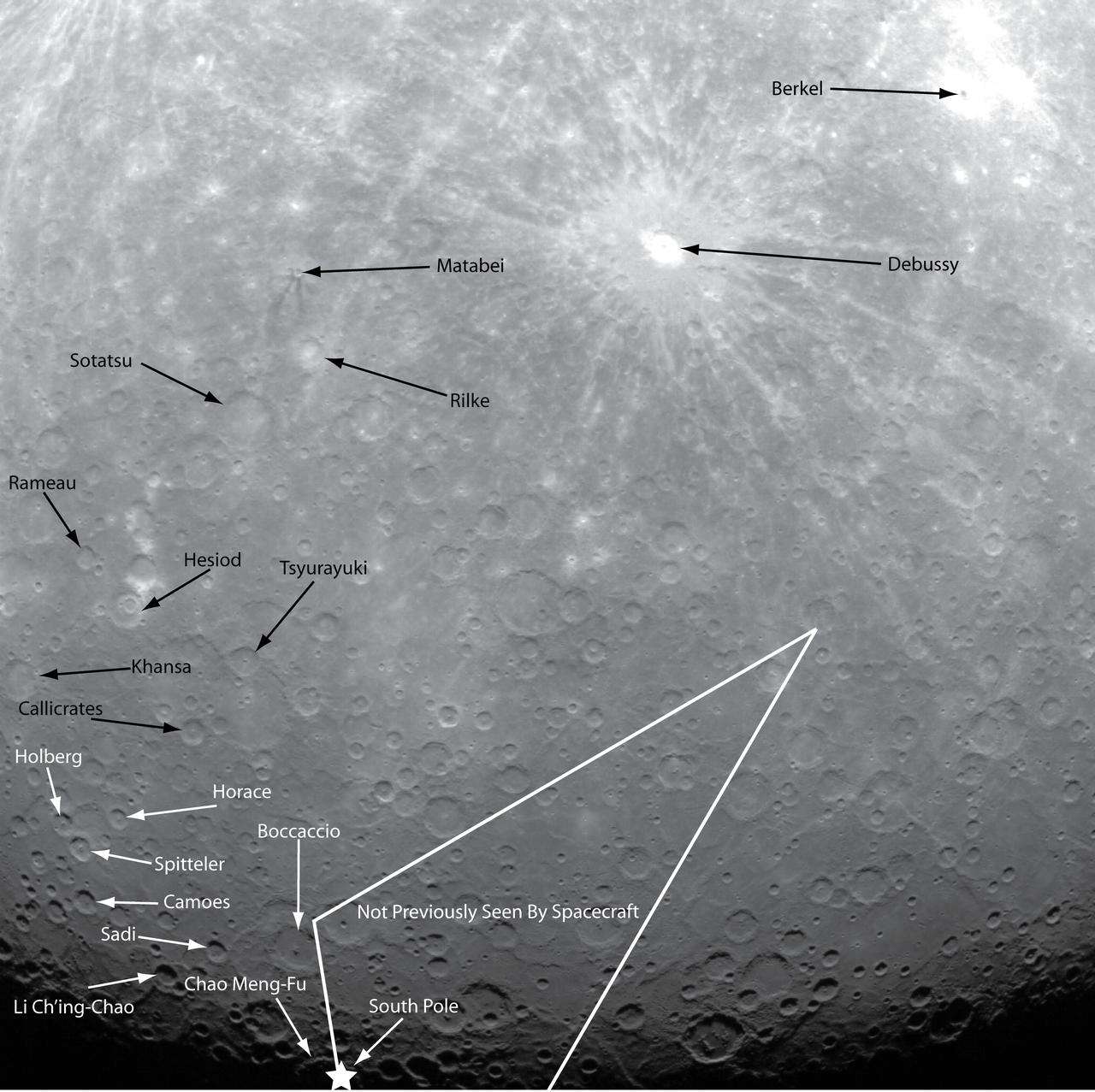
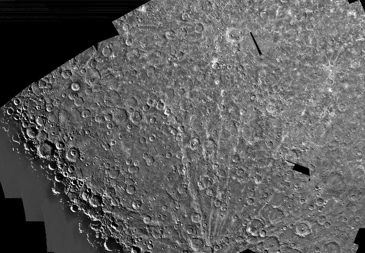
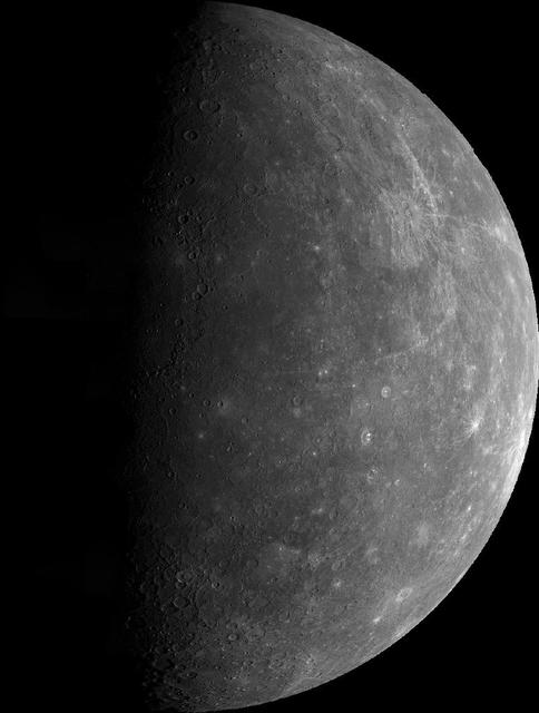
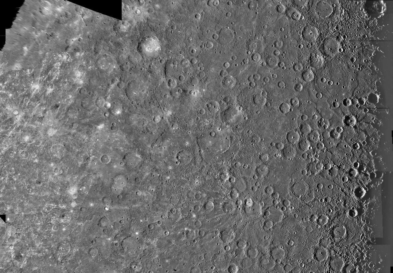
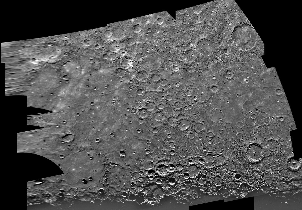
NASA image acquired: March 29, 2011 This historic first orbital image of Mercury was acquired 37 years to the day after Mariner 10’s historic first flyby of the innermost planet. Labels have been added to indicate several craters that were named based on Mariner 10 images, as well as Debussy, Matabei, and Berkel, which were named based on MESSENGER flyby images. The surface contained in the white lines is terrain previously unseen by spacecraft, and the star indicates the location of the south pole. On March 17, 2011 (March 18, 2011, UTC), MESSENGER became the first spacecraft to orbit the planet Mercury. The mission is currently in its commissioning phase, during which spacecraft and instrument performance are verified through a series of specially designed checkout activities. In the course of the one-year primary mission, the spacecraft's seven scientific instruments and radio science investigation will unravel the history and evolution of the Solar System's innermost planet. Visit the Why Mercury? section of this website to learn more about the science questions that the MESSENGER mission has set out to answer. Credit: NASA/Johns Hopkins University Applied Physics Laboratory/Carnegie Institution of Washington <b><a href="http://www.nasa.gov/centers/goddard/home/index.html" rel="nofollow">NASA Goddard Space Flight Center</a></b> enables NASA’s mission through four scientific endeavors: Earth Science, Heliophysics, Solar System Exploration, and Astrophysics. Goddard plays a leading role in NASA’s accomplishments by contributing compelling scientific knowledge to advance the Agency’s mission. <b>Follow us on <a href="http://twitter.com/NASA_GoddardPix" rel="nofollow">Twitter</a></b> <b>Join us on <a href="http://www.facebook.com/pages/Greenbelt-MD/NASA-Goddard/395013845897?ref=tsd" rel="nofollow">Facebook</a></b>