Spirit Nears North-Tilting Site for Winter Haven
The yellow line on this map shows where NASA Mars Rover Opportunity has driven from the place where it landed in January 2004, inside Eagle crater, upper left end of track, to a point about 2.2 miles away from reaching the rim of Endeavour crater.
Eagle to Endeavour: Opportunity Path, Sol 2609
The gold line on this image shows NASA Mars Exploration Rover Opportunity route as it investigating on the western rim of Endeavour Crater.
Opportunity Journey, Approaching 10th Anniversary
NASA Mars Exploration Rover Opportunity will spend its fifth Martian winter working at a location informally named Greeley Haven. This image indicates the location of Greeley Haven on Cape York.
Locator Map for Greeley Haven on Endeavour Rim
Rover Tracks at Crater Edge
Opportunity Gets Ready to Roll
This map shows the path that NASA Mars Exploration Rover Opportunity followed from the 1,813th Martian day, or sol, to Sol 2450 Dec. 15, 2010 when Opportunity approached a crater informally named Santa Maria.
Opportunity Traverse Map, Sol 2450
This animation shows a hypothetical flyover above Victoria Crater, where NASA Mars Exploration Rover Opportunity is perched on a rim. The rover is expected to begin rolling down into the crater in early July 2007.
Surveying the Scene Above Opportunity Simulation
This view of Murray Ridge was generated from data from NASA Mars Reconnaissance Rover and a digital topographic map generated from stereo HiRISE coverage.
A New Perspective on Murray Ridge
This image shows the portion of the rim of Endeavour crater given the informal name Spirit Point. This is the location where the team operating NASA Mars Exploration Rover Opportunity plans to drive the rover to its arrival at the Endeavour rim.
Opportunity First Goal at Endeavour Crater: Spirit Point
The gold line on this image shows NASA Opportunity route from the landing site, in upper left, to the area it is investigating on the western rim of Endeavour Crater as of the rover 10th anniversary on Mars, in Earth years.
Opportunity First Decade of Driving on Mars
This image taken by the HiRISE camera on NASA Mars Reconnaissance Orbiter, captures Opportunity traversing south at the end of the white arrow to new science targets and a winter haven at Solander Point, another portion of the Endeavour rim.
Color View From Orbit Showing Opportunity in Botany Bay
NASA Mars Exploration Rover Opportunity drove onto the Cape York segment of the rim of Endeavour Crater in August 2011 and departed Cape York in May 2013. The location of a rock target called Esperance is indicated in the main map.
Opportunity Exploration of Cape
NASA Mars Reconnaissance Orbiter acquired this color image on March 9, 2011, of Santa Maria crater, showing NASA Mars Exploration Rover Opportunity perched on the southeast rim. The rover is the bluish speck on the crater rim arrow.
Opportunity is Still Smiling
Spirit Winter Work Site
This map shows the route driven by NASA Opportunity rover from the site of its landing, inside Eagle crater, to its location more than 112 months later, in late May 2013, departing the Cape York section of the rim of Endeavour crater.
Opportunity Traverse Through 112 Months
NASA Opportunity rover, working on Mars since January 2004, passed 25 miles of total driving on the July 27, 2014. The gold line on this map shows Opportunity route from the landing site inside Eagle Crater, in upper left.
Opportunity Journey Exceeds 25 Miles
Mars Exploration Rover Landing Site at Gusev Crater
Spirit Traverse, Sols 1 to 1,386
Opportunity at Crater Cape Verde
This map shows route driven by NASA Mars Exploration Rover Opportunity from the site of its landing, inside Eagle crater at the upper left, to its location more than 91 months later, on the Cape York section of the rim of Endeavour crater.
Opportunity Traverses Through 2,700 Martian Days
The Opportunity Rover at Victoria Crater
A region known as Cape York on the western rim of Endeavour Crater, where the Opportunity rover worked for 20 months, is highlighted in these images from NASA Mars Reconnaissance Orbiter.
Cape York Explored
Eleven years and two months after its landing on Mars, the total driving distance of NASA's Mars Exploration Rover Opportunity surpassed the length of a marathon race: 26.219 miles (42.195 kilometers).  This map shows the southward path driven by Opportunity from late December 2014 until it passed marathon distance on March 24, 2015, during the 3,968th Martian day, or sol, of the rover's work on Mars. Recent drives bring the vehicle close to a science destination called "Marathon Valley" on the west rim of Endeavour Crater. The rover team is using instruments on Opportunity to study "Spirit of St. Louis Crater" before entry into Marathon Valley.  Opportunity reached the Sol 3881 location near the top of the map on Dec. 24, 2015. A map showing wider context of Opportunity's route from its January 2004 landing in Eagle Crater to Endeavour Crater is at PIA18404. A view from the Sol 3893 location at the summit of "Cape Tribulation," taken the following sol, is at PIA19109.  The rover's traverse shown here has been mapped onto an image from the High Resolution Imaging Science Experiment (HiRISE) camera on NASA's Mars Reconnaissance Orbiter.   http://photojournal.jpl.nasa.gov/catalog/PIA19157
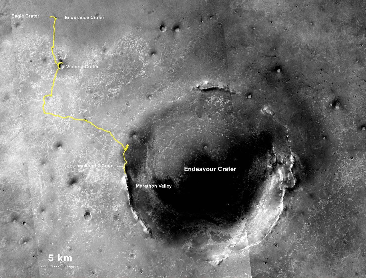
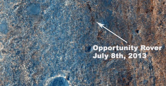
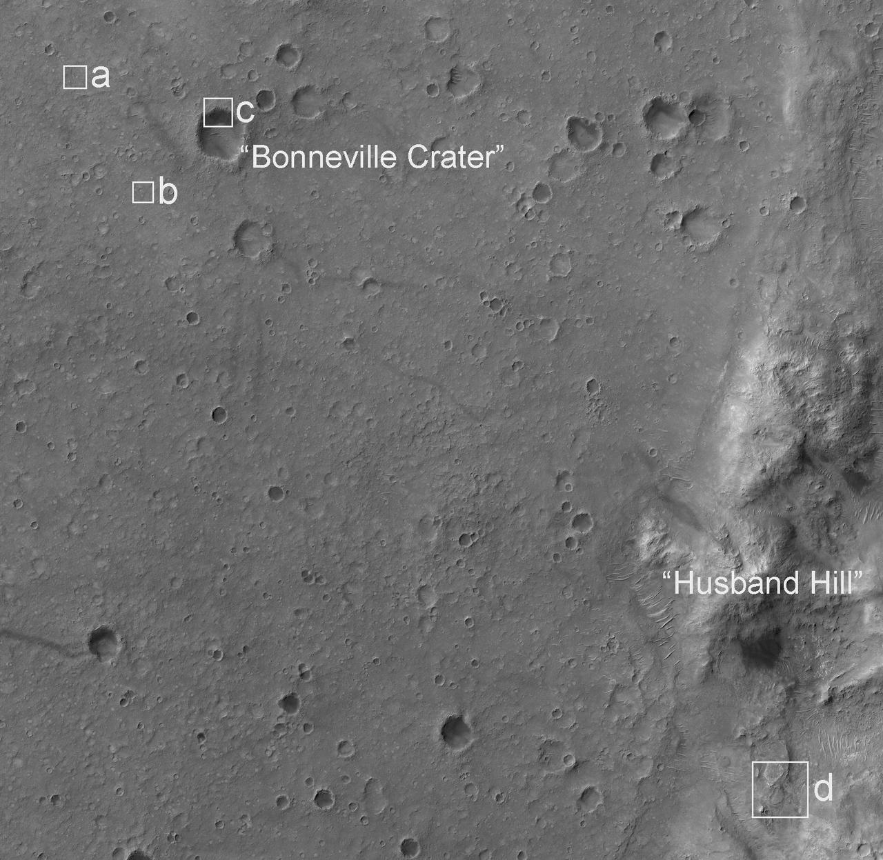
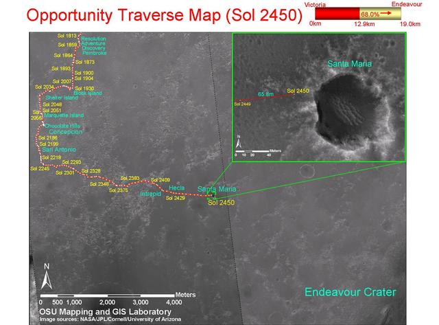
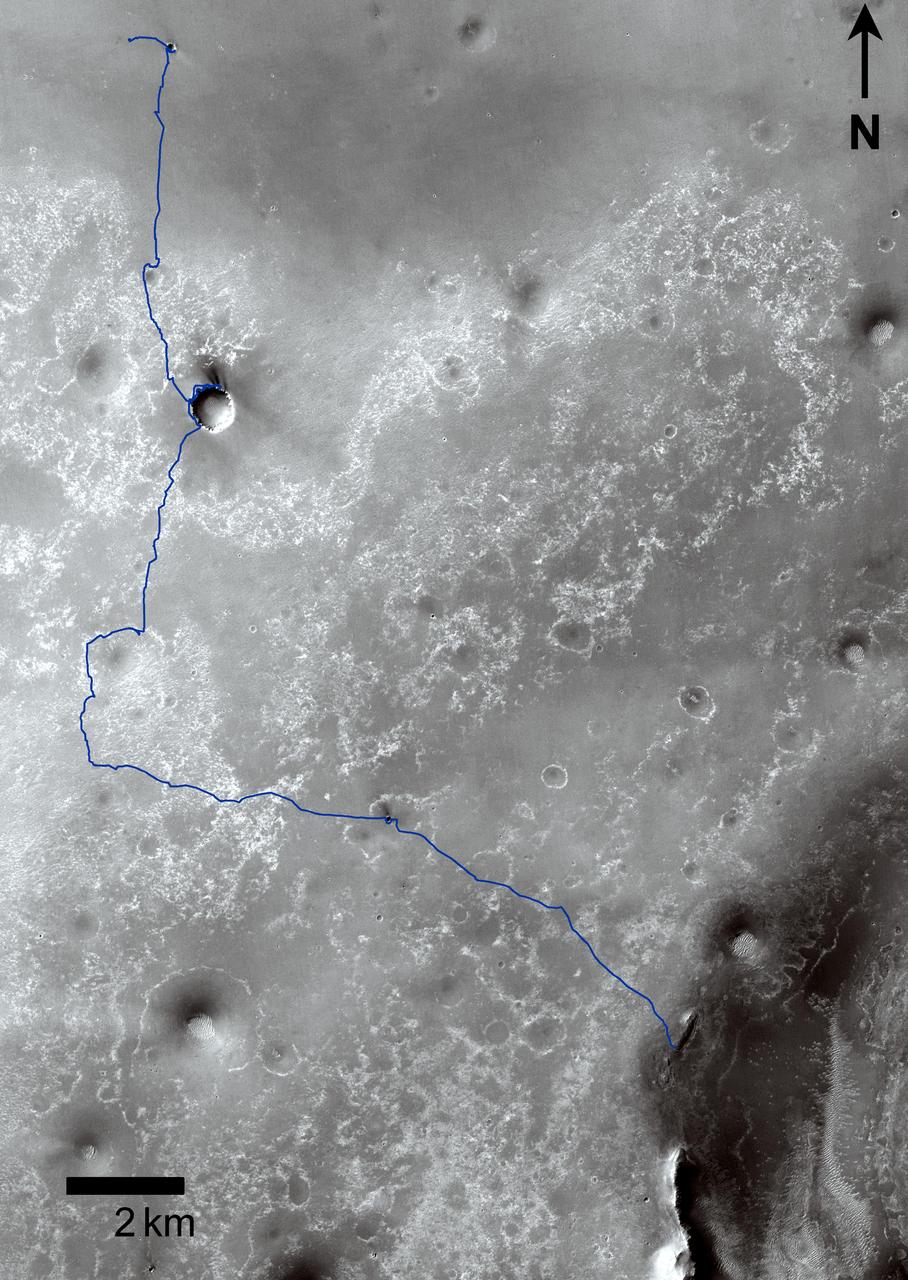
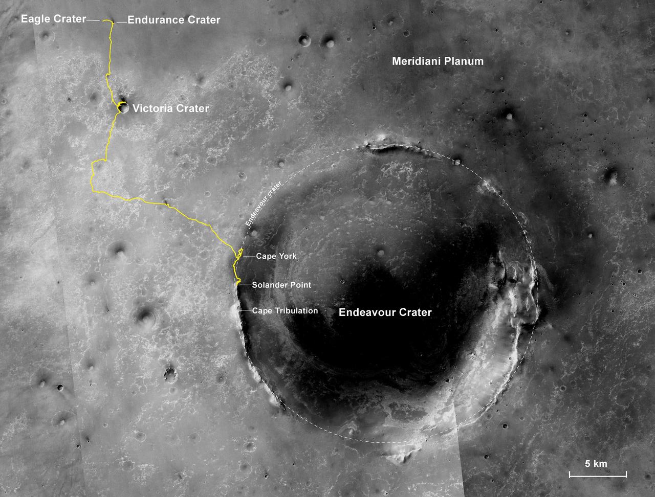
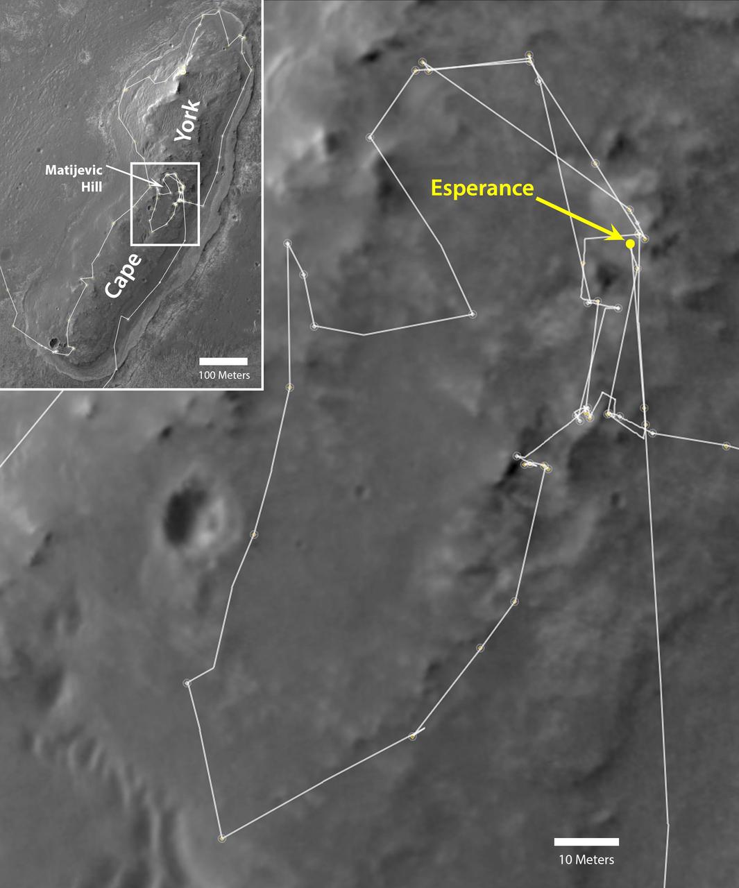
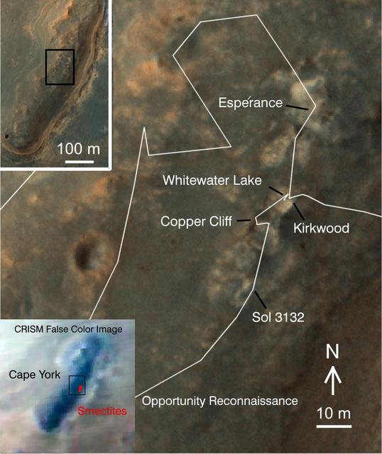
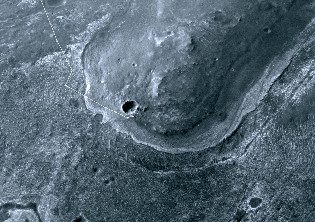
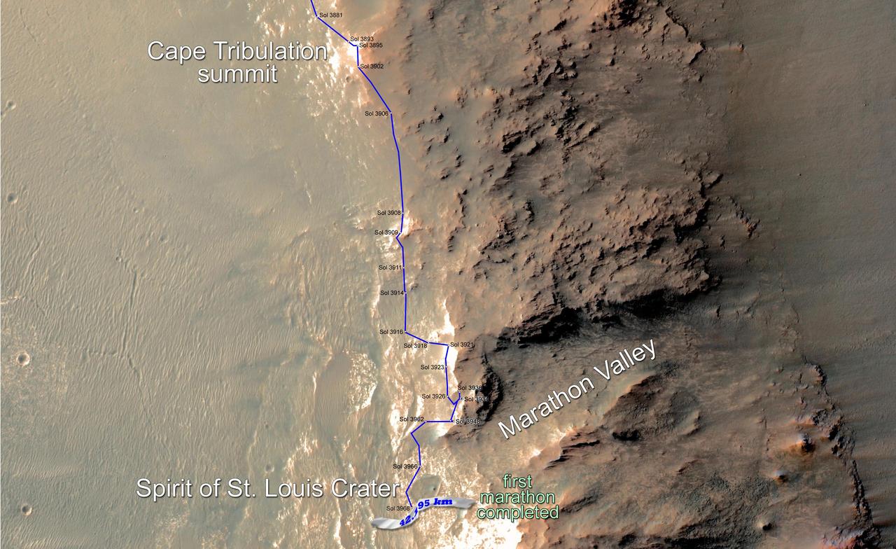
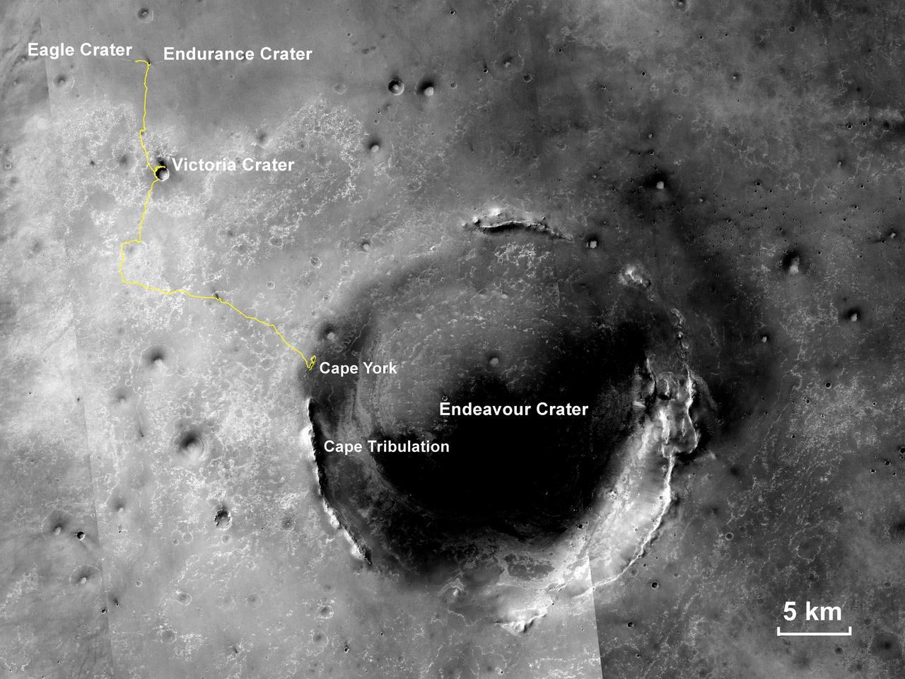
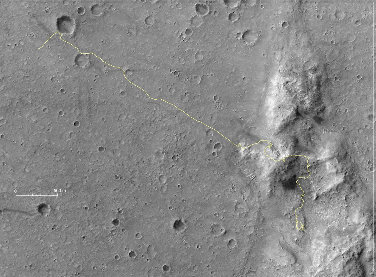
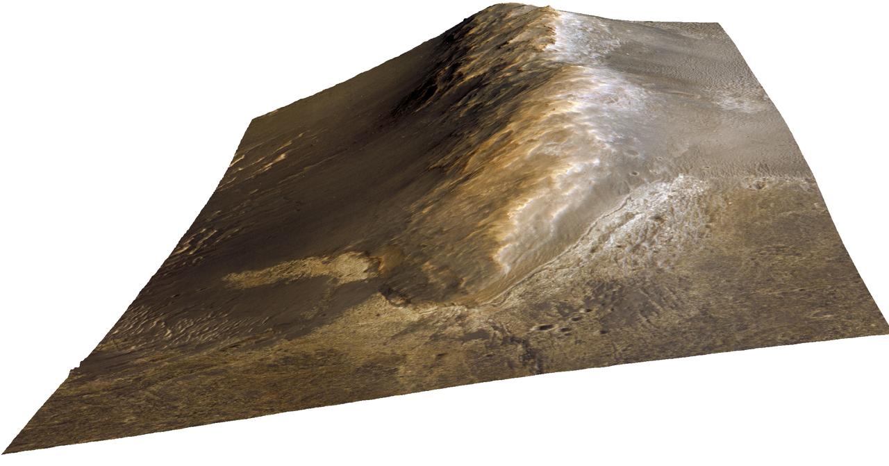
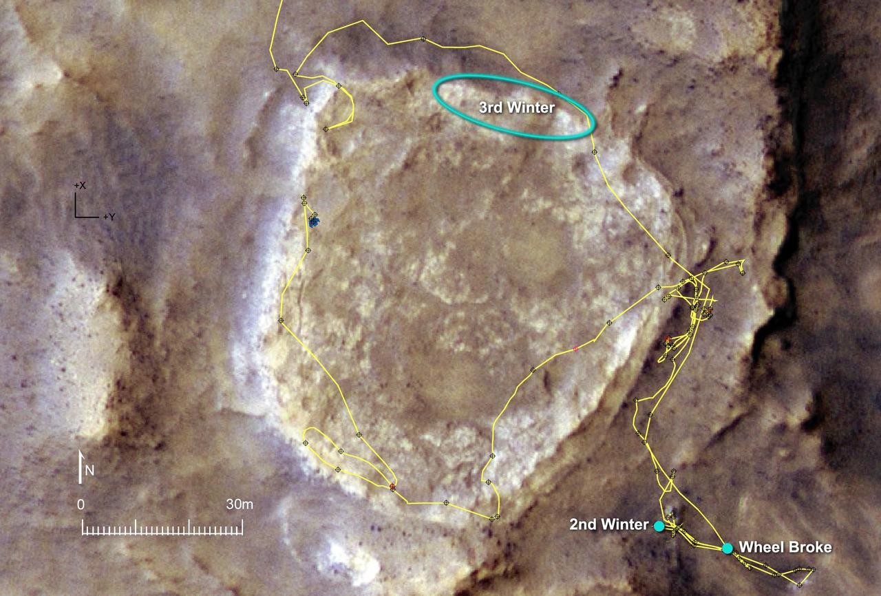
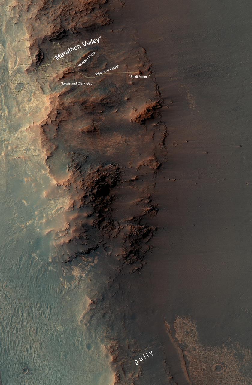
Opportunity Rover Surpasses Marathon Distance
NASA Mars Reconnaissance Orbiter caught this view of NASA Mars Exploration Rover Opportunity on Feb. 14, 2014. The red arrow points to Opportunity at the center of the image. Blue arrows point to tracks left by the rover in October 2013.
Opportunity Rover on Murray Ridge Seen From Orbit
This map shows the path that NASA Mars Exploration Rover Spirit followed from the 743rd Martian day Feb. 4, 2009, or sol, to Sol 2471 Dec. 15, 2010. Spirit has been at a sand-trap location called Troy since April 2009.
Spirit Traverse Map, Sol 2471
Crater Rim Path, Sol 1,215
Near the lower left corner of this view is the three-petal lander platform that NASA Mars Exploration Rover Spirit drove off in January 2004. The lander is still bright, but with a reddish color, probably due to accumulation of Martian dust.
Spirit Lander and Bonneville Crater in Color
This image taken from orbit shows the path driven by NASA Mars Exploration Rover Opportunity in the weeks around the rover arrival at the rim of Endeavour crater.
Opportunity First Neighborhood on Rim of Endeavour
This image from the HiRISE instrument on NASA Mars Reconnaissance Orbiter shows Victoria crater, an impact crater at Meridiani Planum, near the equator of Mars.
Victoria Crater at Meridiani Planum
Three-Frame Movie of Opportunity Rover at Victoria Crater
Heading for Next Winter Haven
Opportunity at Crater Cape Verde Red Filter
Rovers Get New Driving Capability
Three years after embarking on a historic exploration of the red planet and six miles away from its landing site, NASA's Mars Exploration Rover Opportunity is traversing "Victoria Crater" ridge by ridge, peering at layered cliffs in the interior. To identify various alcoves and cliffs along the way, science team members are using names of places visited by the 16th-century Earth explorer Ferdinand Magellan and his crew aboard the ship Victoria, who proved the Earth is round. (All names are unofficial unless approved by the International Astronomical Union.) This orbital view of "Victoria Crater" was taken by NASA's Mars Reconnaissance Orbiter. http://photojournal.jpl.nasa.gov/catalog/PIA09116
Satellite View of Opportunity Journey around Victoria Crater
This map show a portion of Endeavour Crater's western rim that includes the "Marathon Valley" area investigated intensively by NASA's Mars Exploration Rover Opportunity in 2015 and 2016, and a fluid-carved gully that is a destination to the south for the mission.  The width of the area covered in the map is about half a mile (about 800 meters). North is up. Opportunity entered the northern end of the mapped area in January 2015 and entered Marathon Valley in July 2015. A gold line on the map, which may not be visible without zooming into the image, shows the rover's route. Curiosity departed Marathon Valley in September 2016 by driving southward through "Lewis and Clark Gap" into "Bitterroot Valley."  The gully near the south end of the map was incised into Endeavour's rim long ago by a fluid, possibly a water-lubricated debris flow or a flow with mostly water. Driving into this gully to learn more about that flow is one of the goals for a two-year mission extension taking Opportunity through September 2018.  A map showing wider context of Opportunity's route from its January 2004 landing in Eagle Crater to Endeavour Crater and Marathon Valley is at PIA19154.  The rover's traverse shown here has been mapped by Tim Parker of NASA's Jet Propulsion Laboratory, Pasadena, California, onto an image from the High Resolution Imaging Science Experiment (HiRISE) camera on NASA's Mars Reconnaissance Orbiter.   http://photojournal.jpl.nasa.gov/catalog/PIA20854
From Marathon Valley to Gully on Endeavour Rim