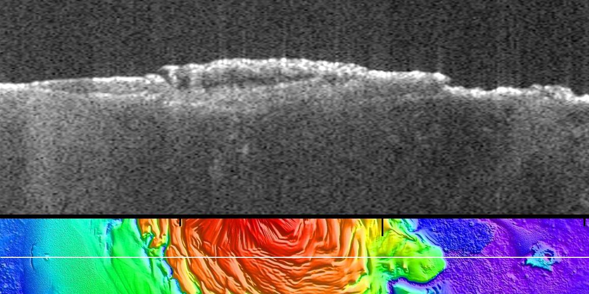
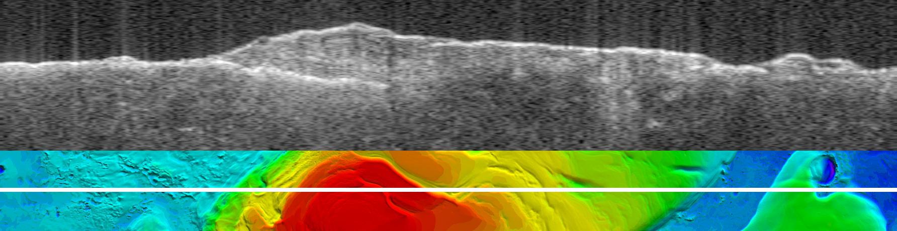
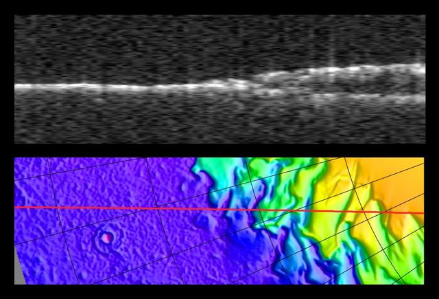
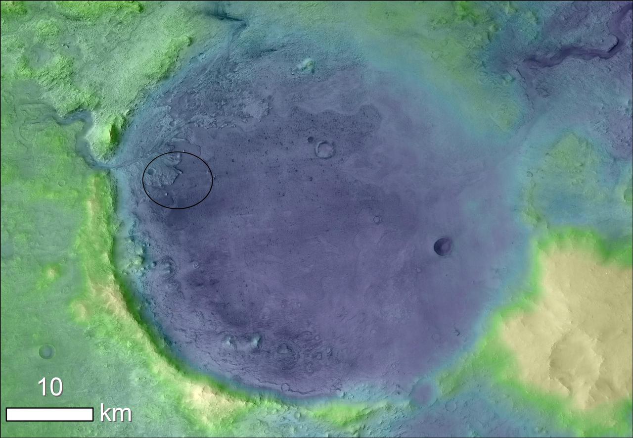
This picture of the European Space Agency Mars Express spacecraft by the Mars Orbiter Camera on NASA Mars Global Surveyor is from the first successful imaging of any spacecraft orbiting Mars taken by another spacecraft orbiting Mars.
Mars Express Seen by Mars Global Surveyor
On this map of Mars, spectrometers on spacecraft orbiting Mars have detected clay minerals green and hydrated minerals-- clays, sulfates and others blue.
Regions of Mars with Clays and Hydrated Minerals Identified from Orbit
Radargram of Mars North Polar Layered Deposits with Topographic Map
This map shows the thickness of the south polar layered deposits of Mars, an ice-rich geologic unit that was probed by the Mars Advanced Radar for Subsurface and Ionospheric Sounding MARSIS
Thickness of Mars South Polar Layered Deposits
Bright Lower Echo in Radargram of South Polar Layered Deposits
This radargram profile from ESA Mars Express and NASA Mars Global Surveyor orbiter shows data from the subsurface of Mars in the ice-rich north polar plateau of Mars.
Radargram of Mars North Polar Plateau from Mars Express
This map shows the topography of the south polar region of Mars. The elevation of the terrain is shown by colors, with purple and blue representing the lowest areas, and orange and red the highest
Upper Surface of Icy Layers Covering Mars South Polar Region
The upper image is a radargram showing data from the subsurface of Mars in the ice-rich layered deposits that surround the south pole. The lower image shows the position of the ground track white line on a topographic map
Virtual Slice Through Icy Layered Deposits Near Mars South Pole
This map shows the topography of the south polar region of Mars, including topography buried by thick deposits of icy material
Lower Boundary of Icy Layers Covering Mars South Polar Region
Topographic Map of Chryse Planitia with Location of Possible Buried Basin
Lighter colors represent higher elevation in this image of Jezero Crater on Mars, the landing site for NASA's Mars 2020 mission. The oval indicates the landing ellipse, where the rover will be touching down on Mars. The color added to this image helps the crater rim stand out clearly, and makes it easier to spot the shoreline of a lake that dried up billions of years ago.  Scientists want to visit this shoreline because it may have preserved fossilized microbial life, if any ever formed on Mars.  The image was created using data from a combination of instruments and spacecraft: NASA's Mars Global Surveyor and its Mars Orbiter Laser Altimeter (MOLA); NASA's Mars Reconnaissance Orbiter and its Compact Reconnaissance Imaging Spectrometer for Mars (CRISM) and Context Camera (CTX); and the European Space Agency's Mars Express and its High Resolution Stereo Camera (HRSC).  https://photojournal.jpl.nasa.gov/catalog/PIA23511
Jezero Crater's Ancient Lakeshore