Spirit Hardware Up Close on Mars

John Grant, geologist and long-term planner, Curiosity Mars Science Laboratory, discusses what we’ve learned from Curiosity and the other Mars rovers during a “Mars Up Close” panel discussion, Tuesday, August 5, 2014, at the National Geographic Society headquarters in Washington. Photo Credit: (NASA/Bill Ingalls)

Ken Edgett, principal investigator, MAHLI Camera, Mars Exploration Program, discusses what we’ve learned from Curiosity and the other Mars rovers during a “Mars Up Close” panel discussion, Tuesday, August 5, 2014, at the National Geographic Society headquarters in Washington. Photo Credit: (NASA/Bill Ingalls)

John Grant, geologist and long-term planner, Curiosity Mars Science Laboratory, discusses what we’ve learned from Curiosity and the other Mars rovers during a “Mars Up Close” panel discussion, Tuesday, August 5, 2014, at the National Geographic Society headquarters in Washington. Photo Credit: (NASA/Bill Ingalls)

Dr. Jim Green, NASA‘s Planetary Science Division Director and Head of Mars Program, discusses what we’ve learned from Curiosity and the other Mars rovers during a “Mars Up Close” panel discussion, Tuesday, August 5, 2014, at the National Geographic Society headquarters in Washington. Photo Credit: (NASA/Bill Ingalls)

Ken Edgett, principal investigator, MAHLI Camera, Mars Exploration Program, discusses what we’ve learned from Curiosity and the other Mars rovers during a “Mars Up Close” panel discussion, Tuesday, August 5, 2014, at the National Geographic Society headquarters in Washington. Photo Credit: (NASA/Bill Ingalls)
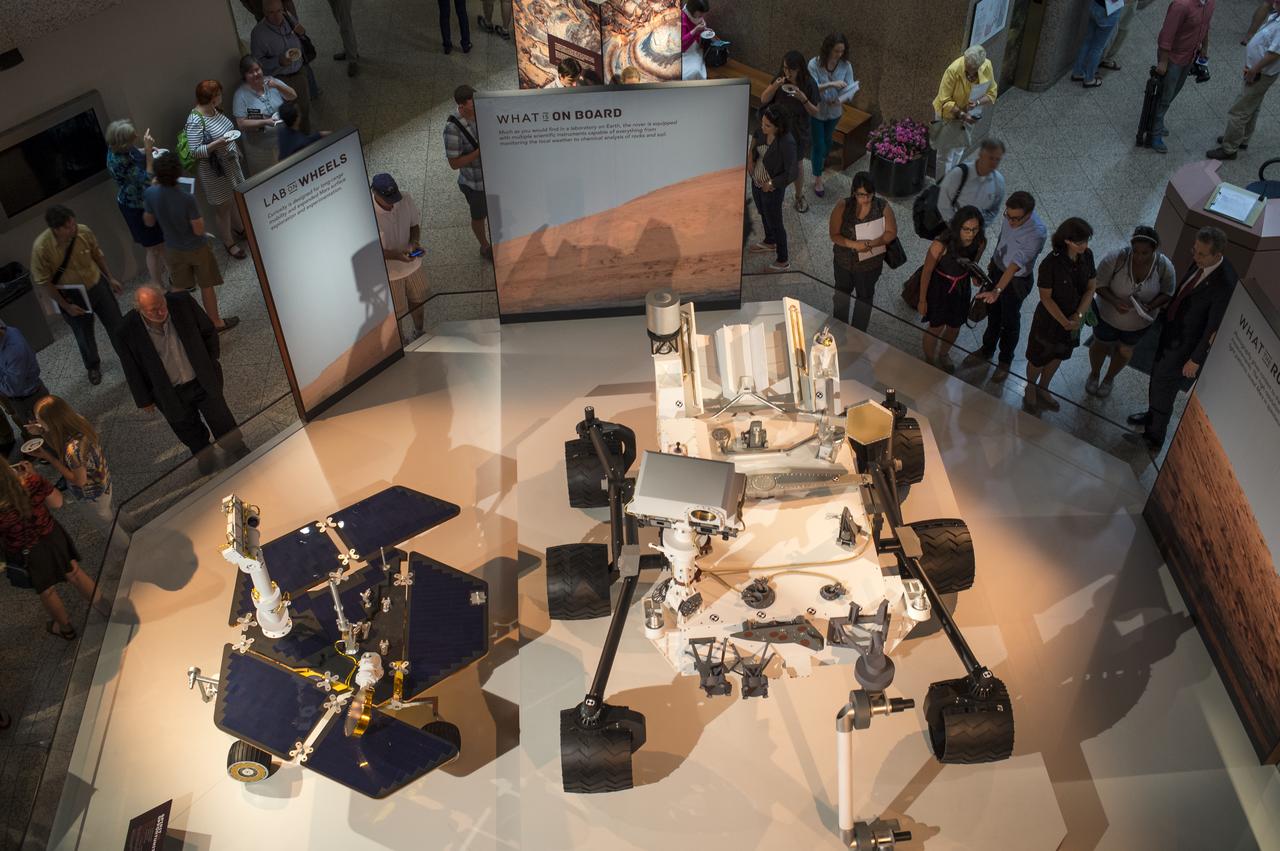
Guest attending the National Geographic “Mars Up Close” panel discussion, look at full scale models of the Spirit/Opportunity, left, and Curiosity, Mars rovers, Tuesday, August 5, 2014, at the National Geographic Society headquarters in Washington. Guest listened to a panel of distinguished space scientists and Mars experts involved in current Mars exploration that shared what we’ve learned from Curiosity and the other Mars rovers. Photo Credit: (NASA/Bill Ingalls)

Marc Kaufman, space news writer, National Geographic and The Washington Post, and author of the new National Geographic book “Mars Up Close”, kicks off a panel discussion of Mars experts involved in current Mars exploration, Tuesday, August 5, 2014, at the National Geographic Society headquarters in Washington. The panelist shared what we’ve learned from Curiosity and the other Mars rovers surveying the red planet. Photo Credit: (NASA/Bill Ingalls)

Marc Kaufman, space news writer, National Geographic and The Washington Post, and author of the new National Geographic book “Mars Up Close”, kicks off a panel discussion of Mars experts involved in current Mars exploration, Tuesday, August 5, 2014, at the National Geographic Society headquarters in Washington. The panelist shared what we’ve learned from Curiosity and the other Mars rovers surveying the red planet. Photo Credit: (NASA/Bill Ingalls)

Marc Kaufman, space news writer, National Geographic and The Washington Post, and author of the new National Geographic book “Mars Up Close”, kicks off a panel discussion of Mars experts involved in current Mars exploration, Tuesday, August 5, 2014, at the National Geographic Society headquarters in Washington. The panelist shared what we’ve learned from Curiosity and the other Mars rovers surveying the red planet. Photo Credit: (NASA/Bill Ingalls)

Marc Kaufman, space news writer, National Geographic and The Washington Post, and author of the new National Geographic book “Mars Up Close”, kicks off a panel discussion of Mars experts involved in current Mars exploration, Tuesday, August 5, 2014, at the National Geographic Society headquarters in Washington. The panelist shared what we’ve learned from Curiosity and the other Mars rovers surveying the red planet. Photo Credit: (NASA/Bill Ingalls)

Pan Conrad, deputy principal investigator, Sample Analysis at Mars team, NASA‘s Goddard Space Flight Center, discusses what we’ve learned from Curiosity and the other Mars rovers during a “Mars Up Close” panel discussion, Tuesday, August 5, 2014, at the National Geographic Society headquarters in Washington. Photo Credit: (NASA/Bill Ingalls)

Pan Conrad, deputy principal investigator, Sample Analysis at Mars team, NASA‘s Goddard Space Flight Center, discusses what we’ve learned from Curiosity and the other Mars rovers during a “Mars Up Close” panel discussion, Tuesday, August 5, 2014, at the National Geographic Society headquarters in Washington. Photo Credit: (NASA/Bill Ingalls)

Pan Conrad, deputy principal investigator, Sample Analysis at Mars team, NASA‘s Goddard Space Flight Center, discusses what we’ve learned from Curiosity and the other Mars rovers during a “Mars Up Close” panel discussion, Tuesday, August 5, 2014, at the National Geographic Society headquarters in Washington. Photo Credit: (NASA/Bill Ingalls)
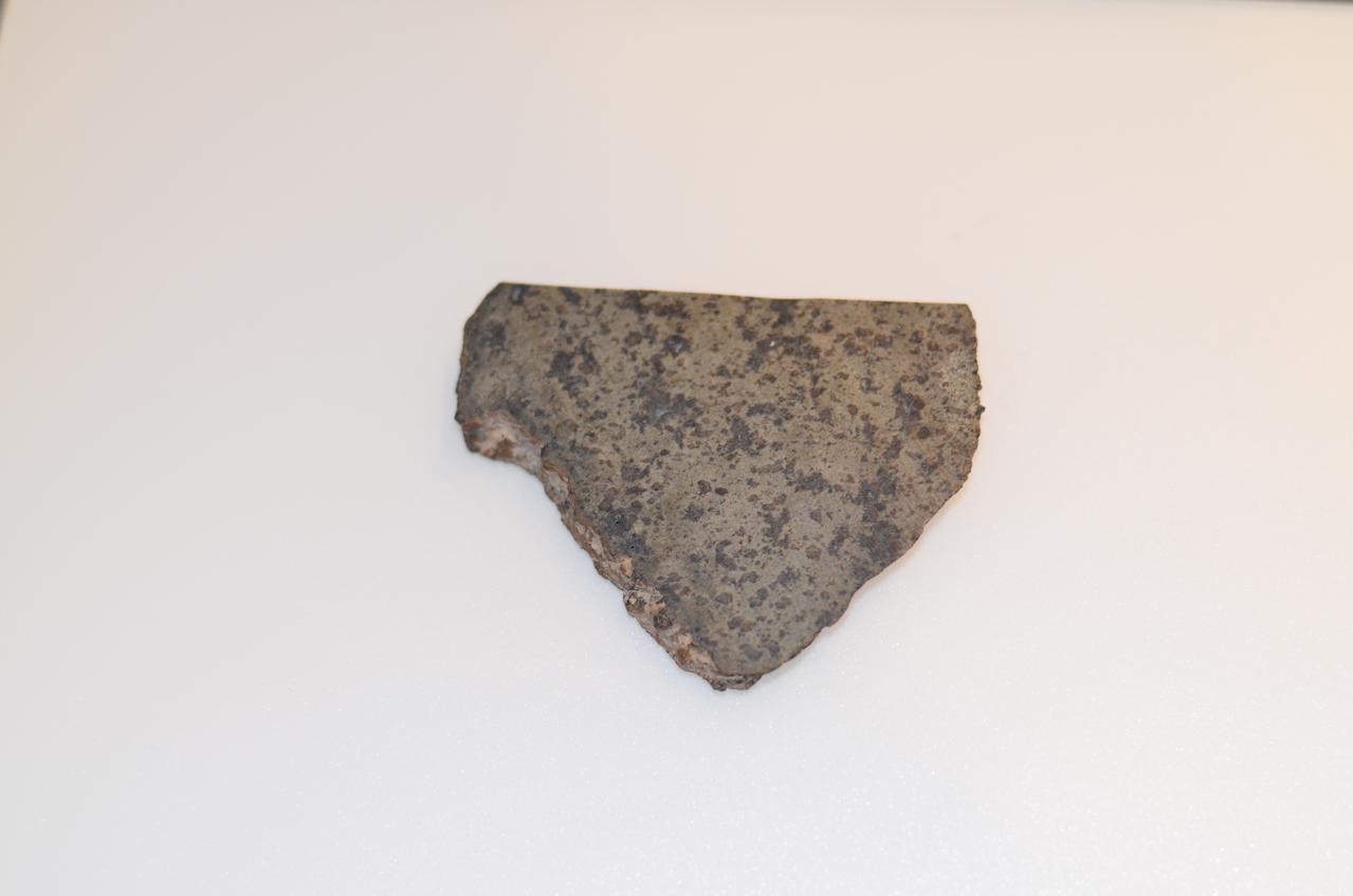
Close-up of a slice of a meteorite scientists have determined came from Mars. This slice will likely be used here on Earth for testing a laser instrument for NASA's Mars 2020 rover; a separate slice will go to Mars on the rover. Martian meteorites are believed to be the result of impacts to the Red Planet's surface, resulting in rock being heaved into the atmosphere. After traveling through space for eons, some of these rocks entered Earth's atmosphere. Scientists determine whether they are true Martian meteorites based on their rock and noble gas chemistry and mineralogy. The gases trapped in these meteorites bear the unique fingerprint of the Martian atmosphere, as recorded by NASA's Viking mission in 1976. The rock types also show clear signs of igneous processing not possible on smaller bodies, such as asteroids. https://photojournal.jpl.nasa.gov/catalog/PIA22246
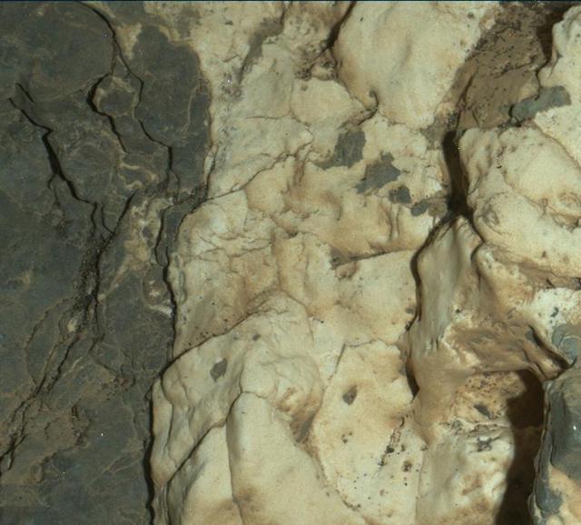
This view from the Mars Hand Lens Imager (MAHLI) on the arm of NASA's Curiosity Mars rover is a close-up of a two-tone mineral vein at a site called "Garden City" on lower Mount Sharp. The area shown is roughly one inch (2.5 centimeters) wide. The image was taken at night, using illumination from MAHLI's light-emitting diodes, during the 935th Martian day, or sol, of Curiosity's work on Mars (March 25, 2015). The vein includes both light-toned and dark-toned materials. The whiter material appears to have ripped up and incorporated portions of both the darker vein material (black arrows in Figure 1) and a third material (white arrow in Figure 1). The Curiosity mission's examination of material in these veins may provide clues about multiple episodes of fluids moving through fractured rock at this site. The fluid movement through fractures occurred later than wet environmental conditions in which the host rock formed, before it hardened and cracked. http://photojournal.jpl.nasa.gov/catalog/PIA19162
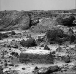
A close-up of the rectangular rock called "Flat Top" from NASA's Mars Pathfinder (MPF) rover Sojourner in July, 1997. http://photojournal.jpl.nasa.gov/catalog/PIA00626
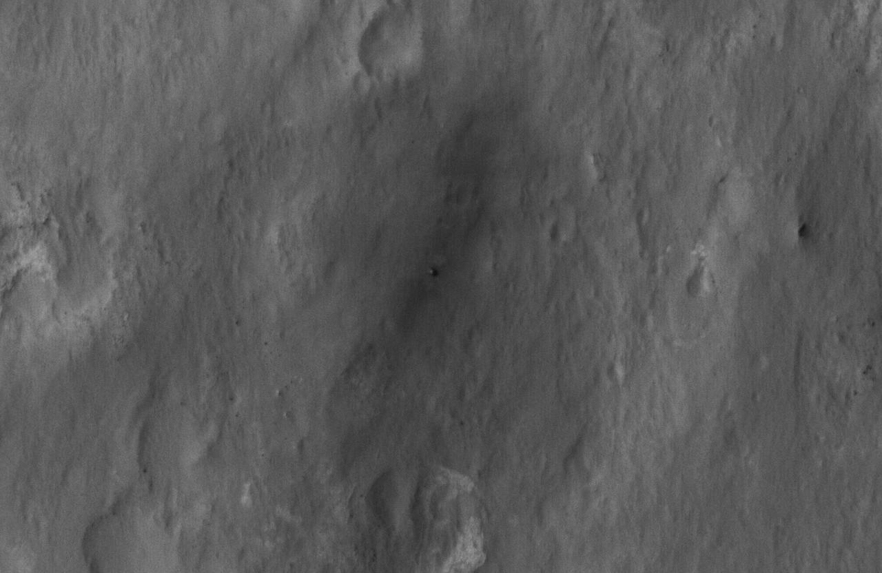
This close-up view shows NASA Curiosity rover on the surface of Mars. The image was captured by the NASA Mars Reconnaissance Orbiter about 24 hours after the rover made its grand appearance on Mars.
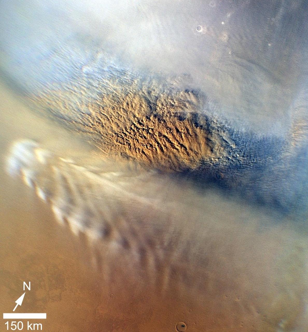
This close-up image of a dust storm on Mars was acquired by the Mars Color Imager instrument on NASA Mars Reconnaissance Orbiter on Nov. 7, 2007. This image is centered on Utopia Planitia.

This close-up image of a penny shows the degree to which the microscopic imager on NASA Mars Exploration Rover Spirit can zoom in on a target.
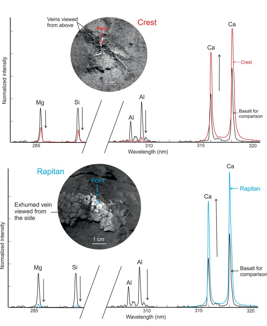
This graphic from NASA Curiosity mission shows close-ups of light-toned veins in rocks in the Yellowknife Bay area of Mars together with analyses of their composition.
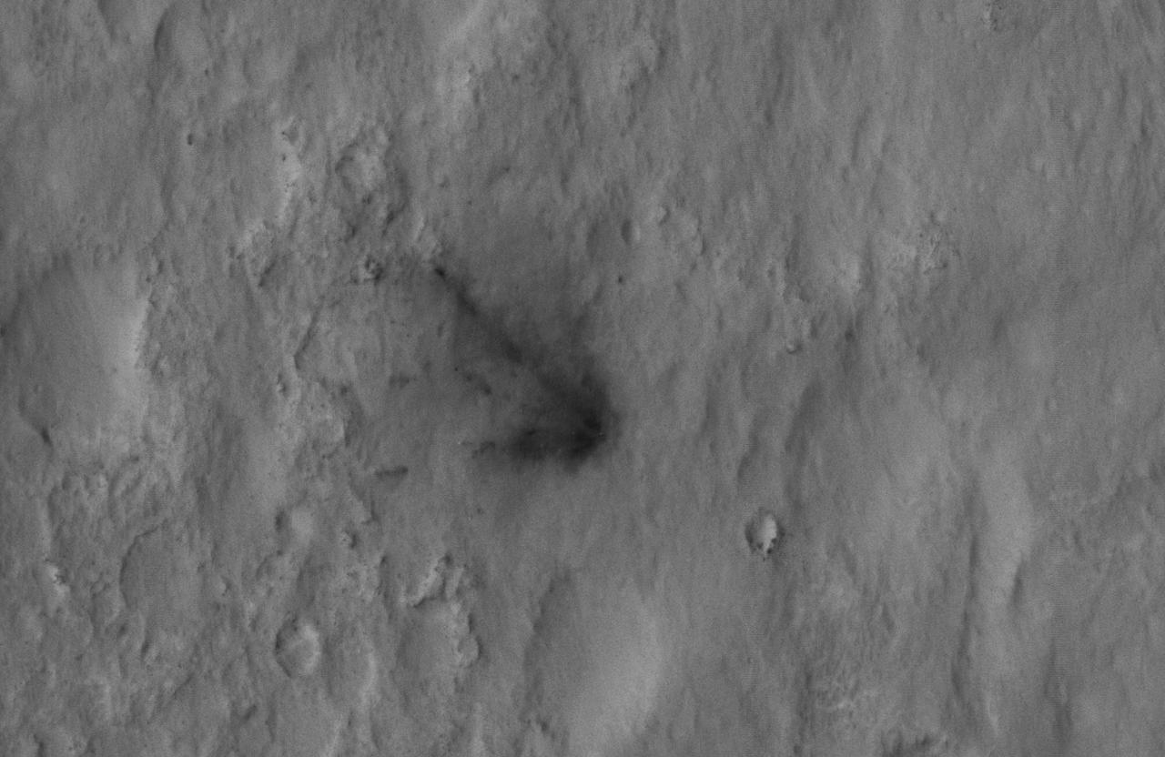
This close-up view captured by NASA Mars Reconnaissance Orbiter shows darkened radial jets caused by the impact of Curiosity sky crane, which helped deliver the rover to the surface of Mars.
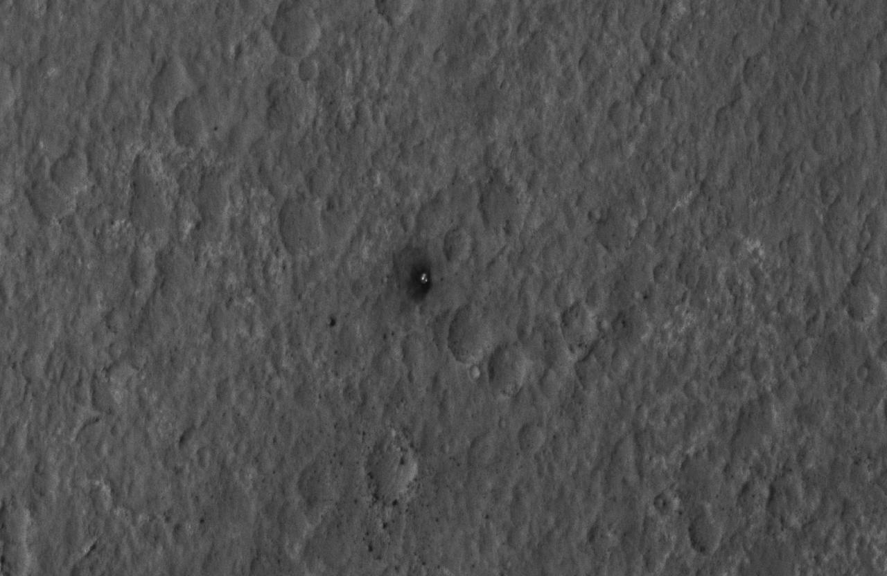
This close-up view shows Curiosity heat shield, which helped the rover survive the harrowing journey through the Martian atmosphere, on the surface of Mars. NASA Mars Reconnaissance Orbiter about 24 hours after landing.
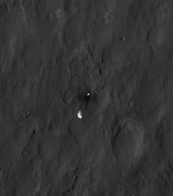
This close-up view shows the rover Curiosity parachute and back shell strewn across the surface of Mars. The image was captured by NASA Mars Reconnaissance Orbiter about 24 hours after the parachute helped guide the rover to the surface.
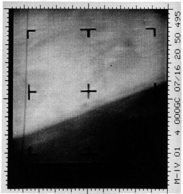
This is an enhanced contrast version of the first Mars photograph released on July 15, 1965. This is man first close-up photograph of another planet, a photographic representation of digital data radioed from Mars by the Mariner 4 spacecraft.
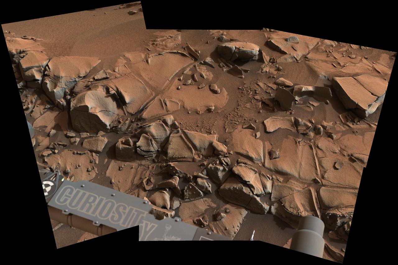
This view from ASA Curiosity Mars rover shows a swath of bedrock called Alexander Hills, which the rover approached for close-up inspection of selected targets. It is a mosaic of six frames taken on Nov. 23, 2014.

This 3-D image taken by the microscopic imager on NASA Mars Exploration Rover Opportunity shows a close-up of the center of the rock abrasion tool hole, ground into Bounce. 3D glasses are necessary to view this image.
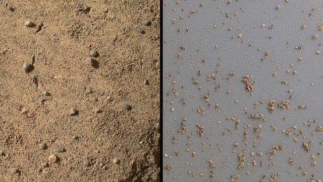
NASA Mars rover Curiosity acquired close-up views of sands in the Rocknest wind drift to document the nature of the material that the rover scooped, sieved and delivered to the CheMin and SAM instruments in October and November 2012.
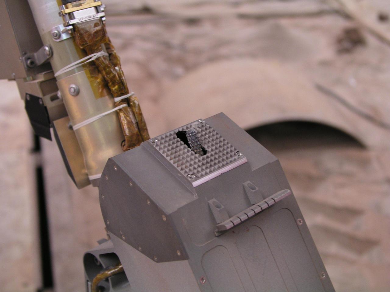
This close-up photograph taken at the Payload Interoperability Testbed at the University of Arizona, Tucson, shows the motorized rasp protruding from the bottom of the scoop on the engineering model of NASA Phoenix Mars Lander Robotic Arm.
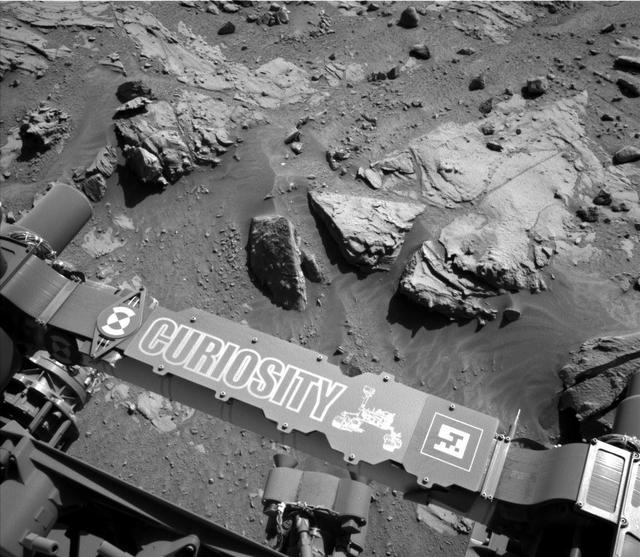
This image from the Navigation Camera on NASA Curiosity Mars rover shows a sandstone slab on which the rover team has selected a target, Windjana, for close-up examination.
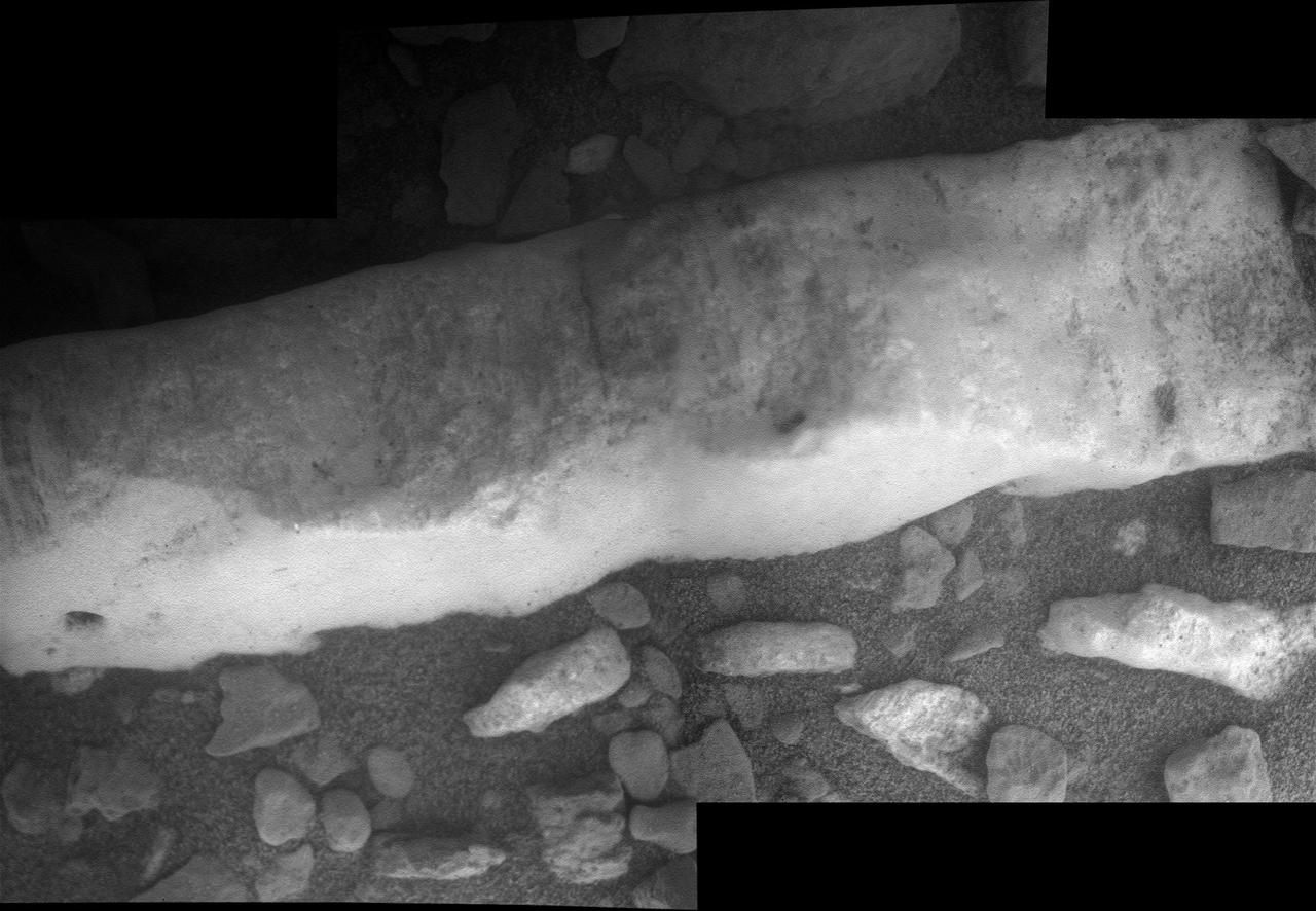
This close-up view of a mineral vein called Homestake comes from the microscopic imager on NASA Mars Exploration Rover Opportunity; the vein is found to be rich in calcium and sulfur, possibly the calcium-sulfate mineral gypsum.
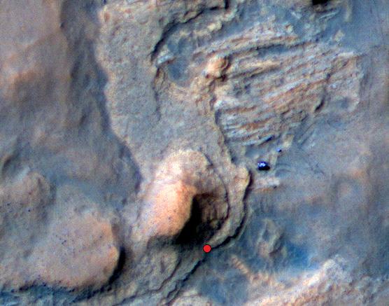
In this Mars Reconnaissance Orbiter view of the Curiosity rover mission waypoint called the Kimberley, the red dot indicates the location of a sandstone target, Windjana, selected for close-up inspection.
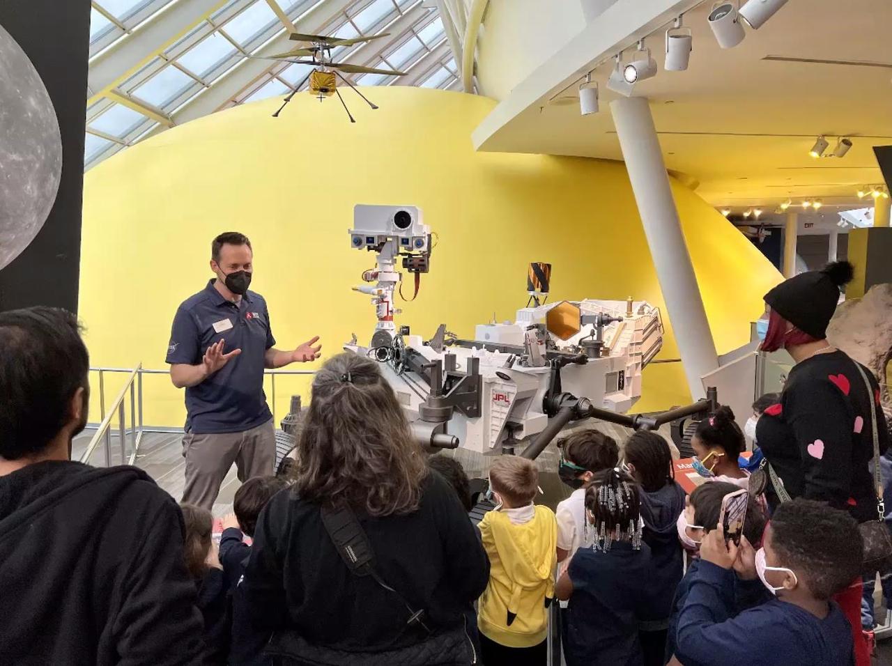
Members of the public met with NASA Mars team members and saw the Perseverance rover and Ingenuity helicopter models up close during a "Roving With Perseverance" tour stop at the Adler Planetarium in Chicago. https://photojournal.jpl.nasa.gov/catalog/PIA25640
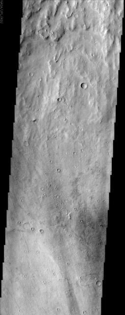
This NASA Mars Odyssey image shows a close-up view of the ridged plains in Hesperia Planum, a classic locality for Martian surfaces that formed in the middle ages of the planet history.
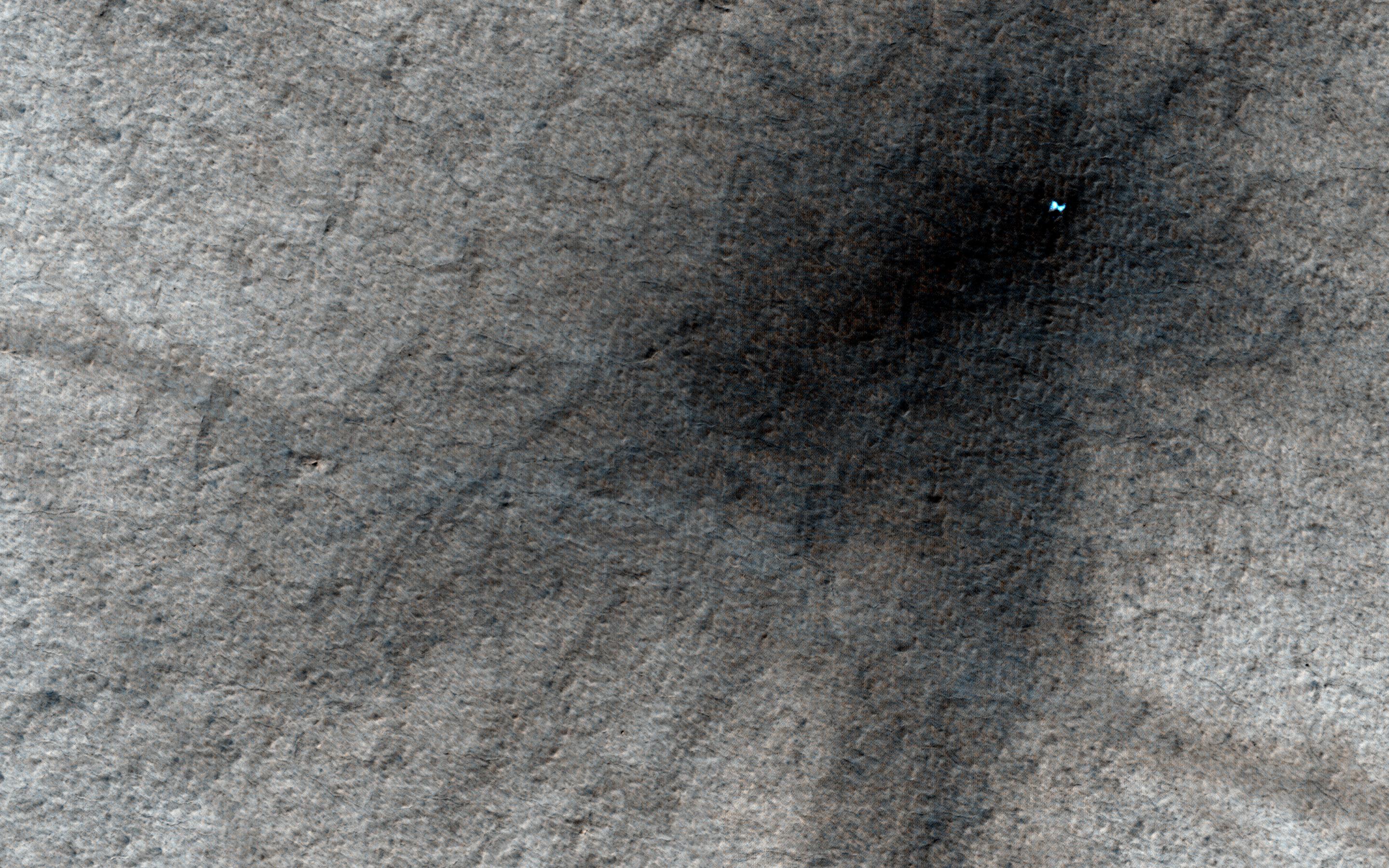
These craters on Tharsis are first visible as new dark spots observed by NASA Mars Reconnaissance Orbiter Context Camera CTX, which can view much larger areas, and then imaged by HiRISE for a close-up look.
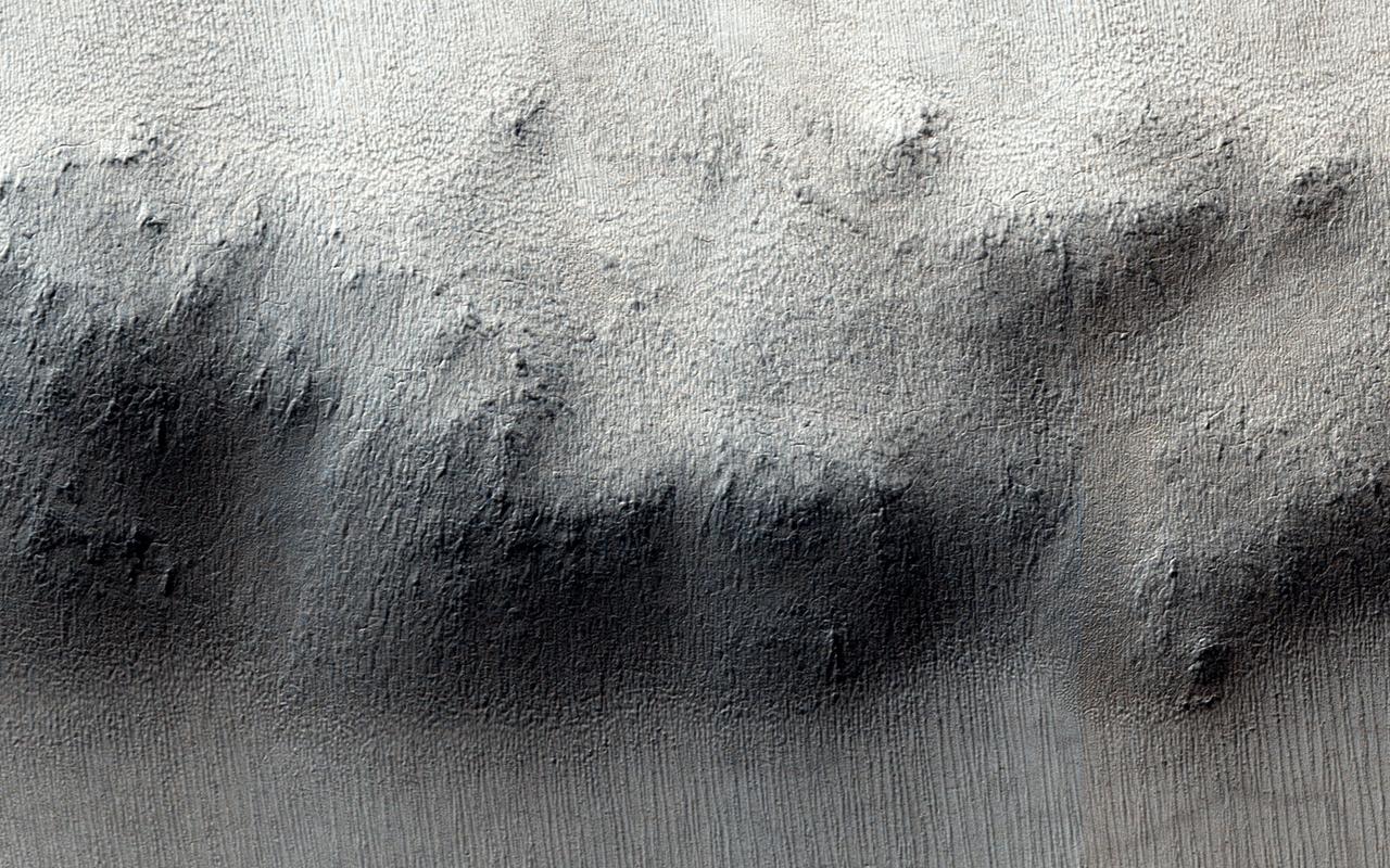
These craters on Tharsis are first visible as new dark spots observed by NASA Mars Reconnaissance Orbiter Context Camera CTX, which can view much larger areas, and then imaged by HiRISE for a close-up look.

This is a close-up view of the northern two-thirds of one of the quadrangles number 50 that were mapped onto the landing region of NASA Curiosity rover; background image obtained by NASA Mars Reconnaissance Orbiter.
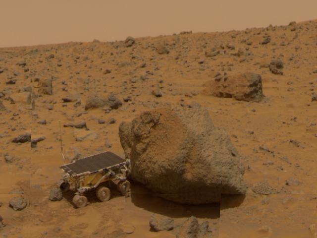
This 1997 image from NASA Mars Pathfinder shows a close up of Sojourner as it placed its Alpha Proton X-Ray Spectrometer APXS upon the surface of the rock Yogi.
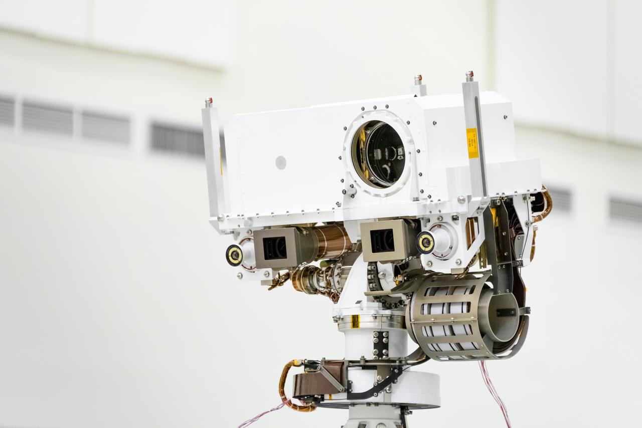
This image, taken in the Spacecraft Assembly Facility's High Bay 1 at the Jet Propulsion Laboratory in Pasadena, California, on July 23, 2019, shows a close-up of the head of Mars 2020's remote sensing mast. The mast head contains the SuperCam instrument (its lens is in the large circular opening). In the gray boxes beneath mast head are the two Mastcam-Z imagers. On the exterior sides of those imagers are the rover's two navigation cameras. https://photojournal.jpl.nasa.gov/catalog/PIA23316
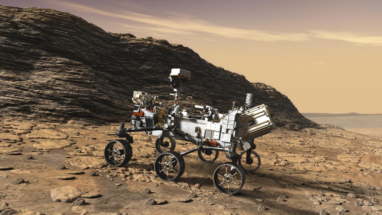
This artist's concept shows a close-up of NASA's Mars 2020 rover studying an outcrop. The mission will not only seek out and study an area likely to have been habitable in the distant past, but it will take the next, bold step in robotic exploration of the Red Planet by seeking signs of past microbial life itself. Mars 2020 will use powerful instruments to investigate rocks on Mars down to the microscopic scale of variations in texture and composition. It will also acquire and store samples of the most promising rocks and soils that it encounters, and set them aside on the surface of Mars. A future mission could potentially return these samples to Earth. Mars 2020 is targeted for launch in July/August 2020 aboard an Atlas V-541 rocket from Space Launch Complex 41 at Cape Canaveral Air Force Station in Florida. https://photojournal.jpl.nasa.gov/catalog/PIA22108
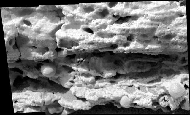
This close-up view of a target rock called "Last Chance" was acquired by the microscopic imager on the arm of NASA's Mars Exploration Rover Opportunity on March 3, 2004, during the 39th Martian day, or sol, of Opportunity's work on Mars. The area covered in the view is about 2 inches (5 centimeters) across. The embedded spherules evident in this image reminded researchers of berries in a muffin, so they were nicknamed "blueberries." These mineral concretions and other textures in this rock provided evidence about wet environmental conditions in the ancient past at Opportunity's landing site in the Meridiani Planum region. http://photojournal.jpl.nasa.gov/catalog/PIA18885
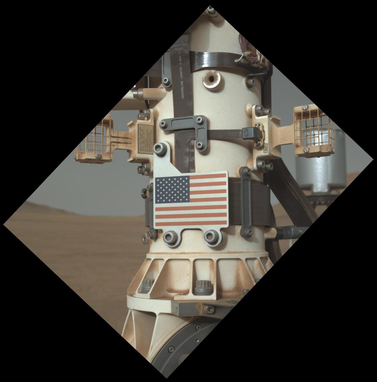
This close-up view of the United States flag plate on NASA's Perseverance was acquired on June 28, 2025 (the 1,548th day, or sol, of its mission to Mars), by the WATSON (Wide Angle Topographic Sensor for Operations and eNgineering) imager on the turret at the end of the rover's Mars robotic arm. This flag artwork is located on an aluminum plate mounted on the base of Perseverance's remote sensing mast. https://photojournal.jpl.nasa.gov/catalog/PIA26579
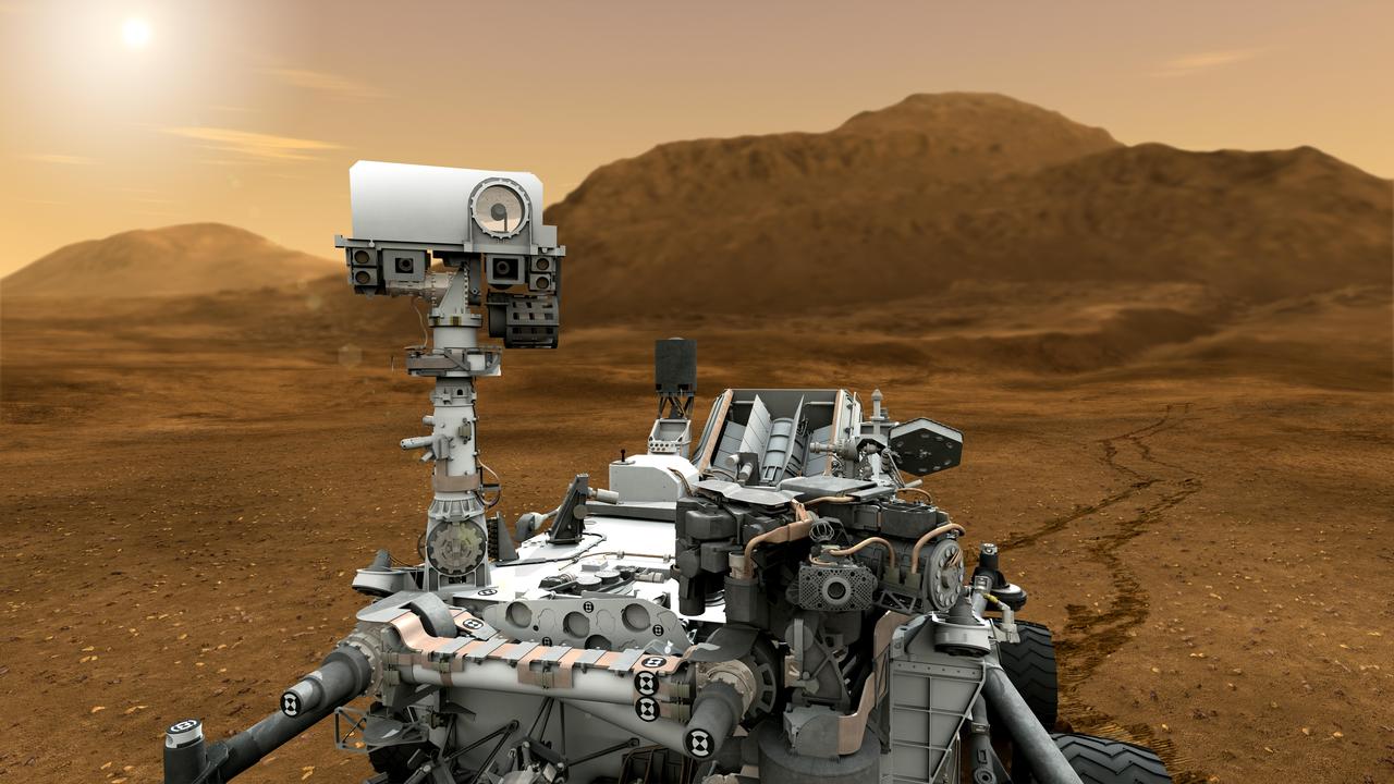
This artist concept features NASA Mars Science Laboratory Curiosity rover. The mast, or rover head, rises to about 2.1 meters 6.9 feet above ground level, about as tall as a basketball player.
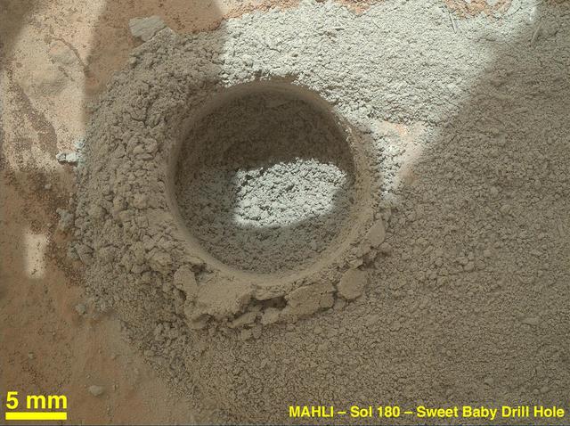
After an activity called the mini drill test by NASA Mars rover Curiosity, the rover MAHLI camera recorded this view of the results. The test generated a ring of powdered rock for inspection in advance of the rover first full drilling.
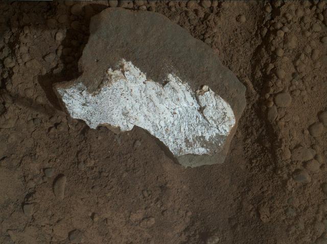
NASA rover Curiosity took this close-up view of Tintina showing interesting linear textures in the bright white material on the rock.
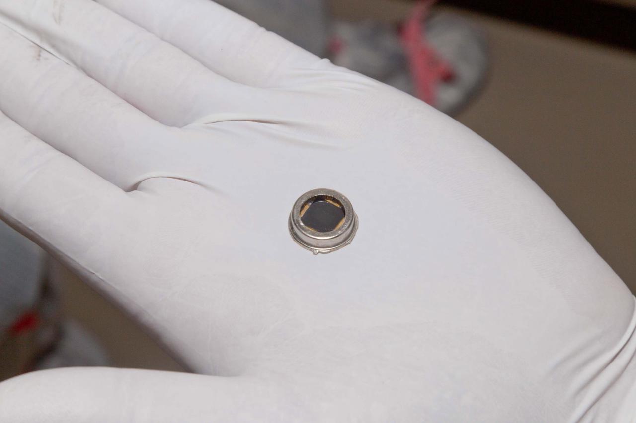
The dime-size microchip in this close-up image carries 826,923 names that will go to Mars on NASA InSight lander. The image was taken in November 2015 inside a clean room at Lockheed Martin Space Systems, Denver, where the lander was built.
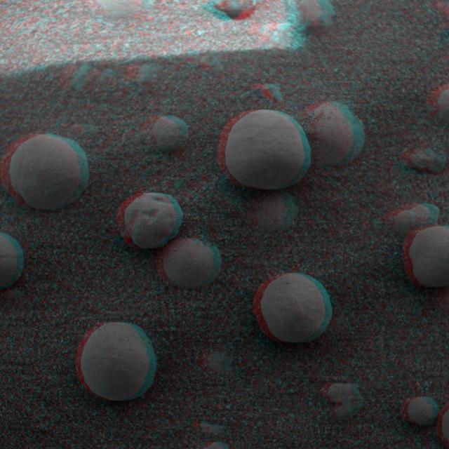
This is 3-D anaglyph, from NASA Mars Exploration Rover Spirit, shows an extreme close-up of round, blueberry-shaped grains on the crater floor near the rock outcrop at Meridiani Planum called Stone Mountain. 3D glasses are necessary.
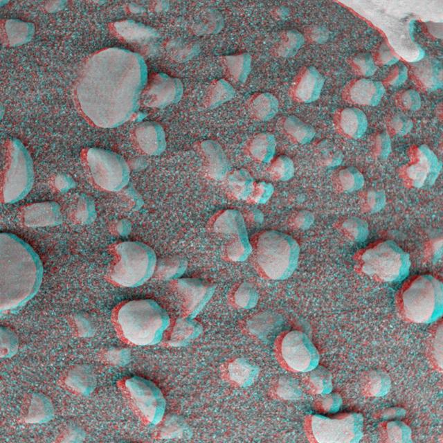
This 3-D anaglyph, from NASA Mars Exploration Rover Spirit, shows an extreme close-up of round, blueberry-shaped grains on the crater floor near the rock outcrop at Meridiani Planum called Stone Mountain. 3D glasses are necessary.
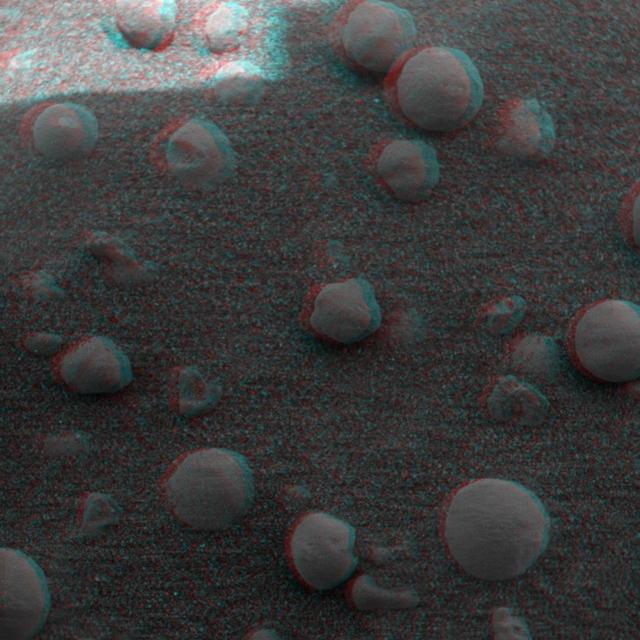
This 3-D anaglyph, from NASA Mars Exploration Rover Spirit, shows an extreme close-up of round, blueberry-shaped grains on the crater floor near the rock outcrop at Meridiani Planum called Stone Mountain. 3D glasses are necessary.
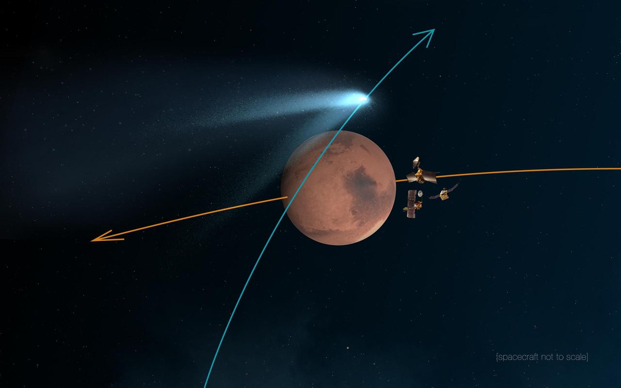
This artist concept shows NASA Mars orbiters lining up behind the Red Planet for their duck and cover maneuver to shield them from comet dust that may result from the close flyby of comet Siding Spring C/2013 A1 on Oct. 19, 2014.
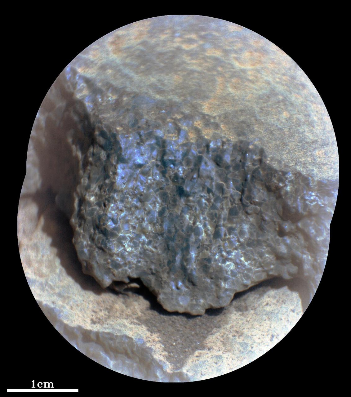
This enhanced-color close-up of a rock target called "Cine" was captured by the SuperCam instrument aboard NASA's Perseverance Mars rover on Sept. 17, 2021, the 206th Martian day, or sol, of rover's mission. SuperCam’s Remote Microscopic Imager took two images that were later combined to form this close-up. The target is 92 inches (2 meters) away, seen from the rover's mast. The image shows a rock layer made up of tightly packed millimeter-size gray, angular grains, or crystals. The image on the right shows a detail of the grain/crystal texture. The composition of this rock target was investigated with SuperCam's laser and spectrometer, along with the Mastcam-Z camera. Using these instruments, scientists can study the chemical composition of rocks from a distance. Analysis of "Cine" showed that it is rich in the mineral olivine. After the image was taken, the mission’s science team debated whether the rock is igneous (volcanic) or consists of fine sedimentary grains of igneous material that were cemented together in a watery environment. SuperCam is led by Los Alamos National Laboratory in New Mexico, where the instrument's body unit was developed. That part of the instrument includes several spectrometers as well as control electronics and software. The mast unit, including the Remote Microscopic Imager used for these images, was developed and built by several laboratories of the CNRS (the French research center) and French universities under the contracting authority of Centre National d'Etudes Spatiales (CNES), the French space agency. A key objective for Perseverance's mission on Mars is astrobiology, including the search for signs of ancient microbial life. The rover will characterize the planet's geology and past climate, pave the way for human exploration of the Red Planet, and be the first mission to collect and cache Martian rock and regolith (broken rock and dust). Subsequent NASA missions, in cooperation with ESA (European Space Agency), would send spacecraft to Mars to collect these sealed samples from the surface and return them to Earth for in-depth analysis. The Mars 2020 Perseverance mission is part of NASA's Moon to Mars exploration approach, which includes Artemis missions to the Moon that will help prepare for human exploration of the Red Planet. https://photojournal.jpl.nasa.gov/catalog/PIA24936

NASA's Curiosity Mars rover took this close-up view of a rock nicknamed "Terra Firme" that looks like the open pages of a book, on April 15, 2023, the 3,800th Martian day, or sol, of the mission, using the Mars Hand Lens Imager (MAHLI) on the end of its robotic arm. The rock is about an inch across (2.5 centimeters). Rocks with unusual shapes are common on Mars, and often were formed by water seeping through cracks in a rock in the ancient past, bringing harder minerals along with them. After eons of being sand-blasted by the wind, softer rock is carved away and the harder materials are all that's left. https://photojournal.jpl.nasa.gov/catalog/PIA25828
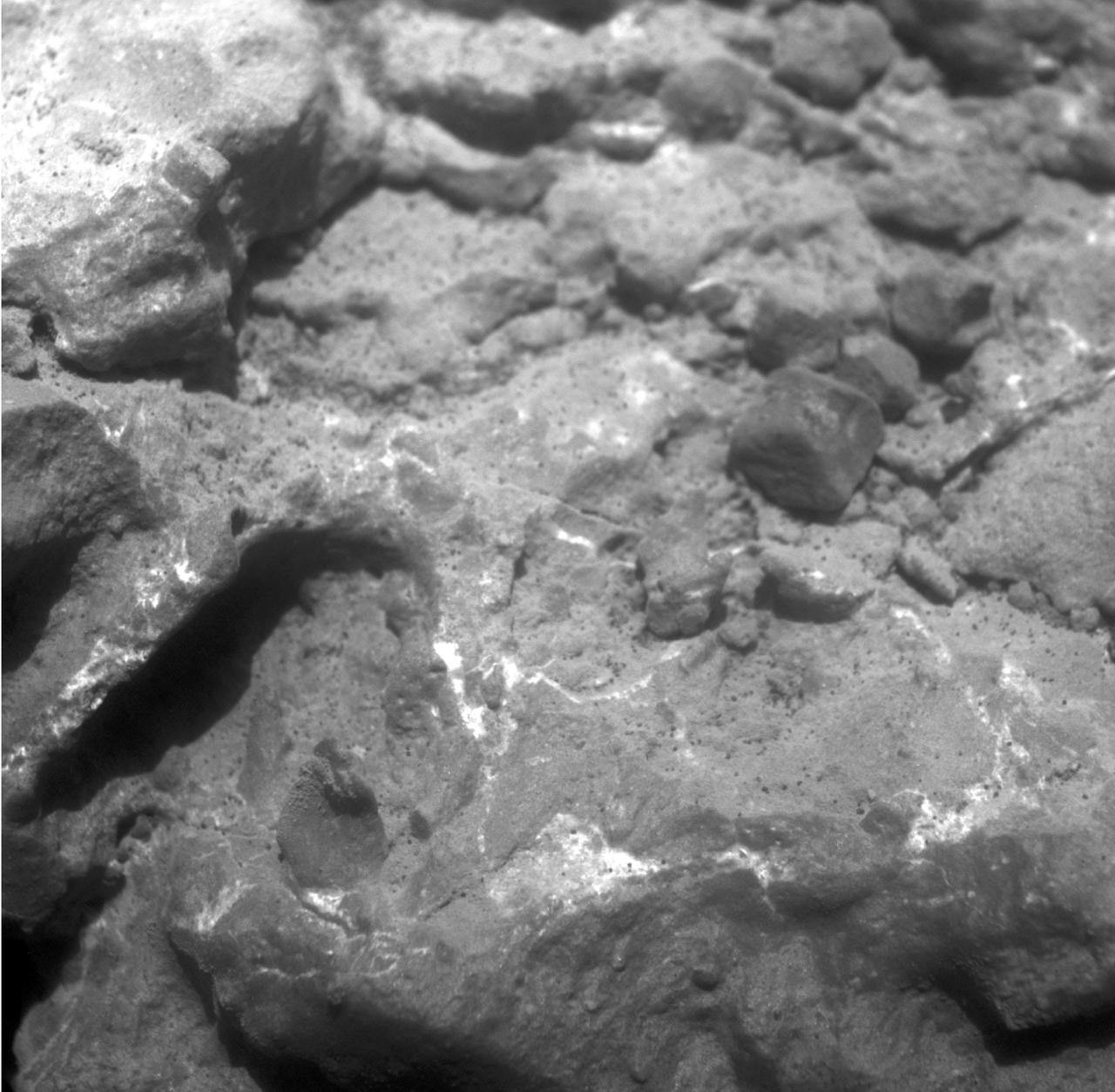
NASA Mars Exploration Rover Opportunity used its microscopic imager to record this close-up view of texture on part of a rock informally named Tisdale
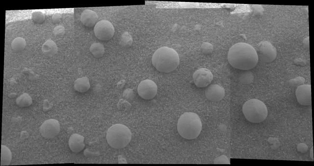
This mosaic image shows an extreme close-up of round, blueberry-shaped formations in the martian soil near a part of the rock outcrop at Meridiani Planum called Stone Mountain. Scientists are studying these curious formations for clues about the area's past environmental conditions. The image, one of the highest resolution images ever taken by the microscopic imager, an instrument located on the Mars Exploration Rover Opportunity's instrument deployment device or "arm." http://photojournal.jpl.nasa.gov/catalog/PIA05273
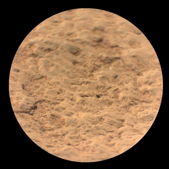
This image shows a close-up view of the rock target named "Máaz" from the SuperCam instrument on NASA's Perseverance Mars rover. It was taken by SuperCam's Remote Micro-Imager (RMI) on March 2, 2021 (the 12th Martian day, or "sol," Perseverance's mission on Mars). "Máaz" means Mars in the Navajo language. Analysis of SuperCam data shows that Máaz has a basaltic composition. It is either an igneous rock or consists of fine grains of igneous material that were cemented together in a watery environment. The target was 10.4 feet (3.17 meters) from the rover. The image field of view is 2.3 inches (6.0 centimeters) in diameter. A key objective for Perseverance's mission on Mars is astrobiology, including the search for signs of ancient microbial life. The rover will characterize the planet's geology and past climate, pave the way for human exploration of the Red Planet, and be the first mission to collect and cache Martian rock and regolith (broken rock and dust). Subsequent NASA missions, in cooperation with ESA (European Space Agency), would send spacecraft to Mars to collect these sealed samples from the surface and return them to Earth for in-depth analysis. The Mars 2020 Perseverance mission is part of NASA's Moon to Mars exploration approach, which includes Artemis missions to the Moon that will help prepare for human exploration of the Red Planet. https://photojournal.jpl.nasa.gov/catalog/PIA24493
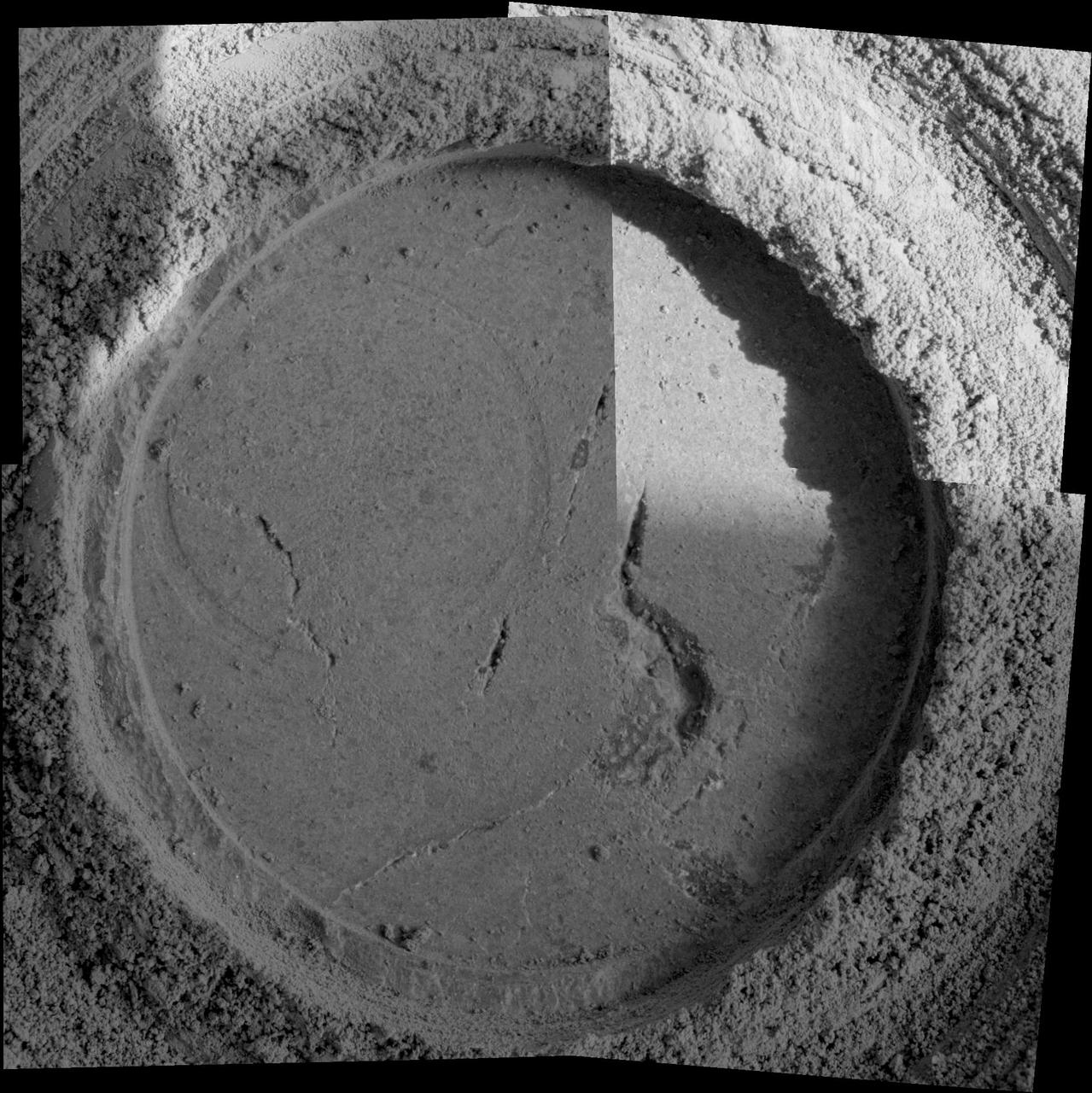
Close-up examination of a freshly exposed area of a rock called "Uchben" in the "Columbia Hills" of Mars reveals an assortment of particle shapes and sizes in the rock's makeup. NASA's Mars Exploration Rover Spirit used its microscopic imager during the rover's 286th martian day (Oct. 22, 2004) to take the frames assembled into this view. The view covers a circular hole ground into a target spot called "Koolik" on Uchben by the rover's rock abrasion tool. The circle is 4.5 centimeters (1.8 inches) in diameter. Particles in the rock vary in shape from angular to round, and range in size from about 0.5 millimeter (0.2 inch) to too small to be seen. This assortment suggests that the rock originated from particles that had not been transported much by wind or water, because such a transport process would likely have resulted in more sorting of the particles by size and shape. http://photojournal.jpl.nasa.gov/catalog/PIA07023

This frame from an animation links two images taken by the front hazard avoidance camera on the Mars Exploration Rover Spirit. The rover is stowing and unstowing its robotic arm, or instrument deployment device. The device is designed to hold and maneuver the various instruments on board that will help scientists get up-close and personal with martian rocks and soil. An animation is available at http://photojournal.jpl.nasa.gov/catalog/PIA05045
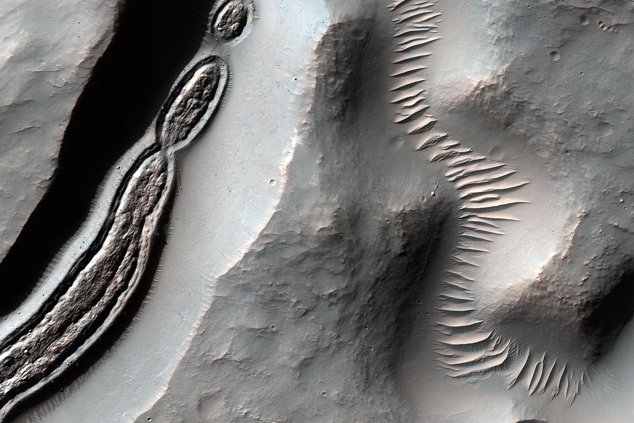
This image from NASA's Mars Reconnaissance Orbiter is a close-up of a trough, along with channels draining into the depression. Some HiRISE images show strange-looking formations. Sometimes it helps to look at Context Camera images to understand the circumstances of a scene -- like this cutout from CTX 033783_1509 -- which here shows an impact crater with a central peak, and a collapse depression with concentric troughs just north of that peak. On the floor of the trough is some grooved material that we typically see in middle latitude regions where there has been glacial flow. These depressions with concentric troughs exist elsewhere on Mars, and their origins remain a matter of debate. NB: The Context Camera is another instrument onboard MRO, and it has a larger viewing angle than HiRISE, but less resolution capability than our camera. https://photojournal.jpl.nasa.gov/catalog/PIA22348
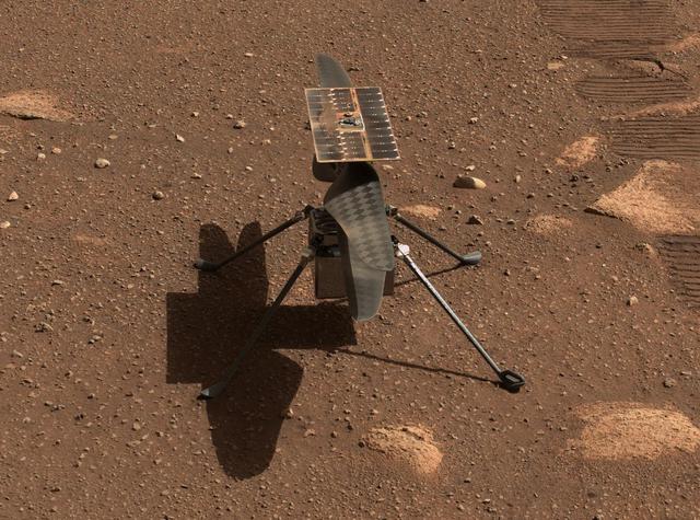
NASA's Ingenuity Mars helicopter is seen here in a close-up taken by Mastcam-Z, a pair of zoomable cameras aboard the Perseverance rover. This image was taken on April 5, the 45th Martian day, or sol, of the mission. The mosaic is not white balanced but is instead displayed in a preliminary calibrated version of a natural color composite, approximately simulating the colors of the scene that we would see if we were there viewing it ourselves. Arizona State University in Tempe leads the operations of the Mastcam-Z instrument, working in collaboration with Malin Space Science Systems in San Diego. A key objective for Perseverance's mission on Mars is astrobiology, including the search for signs of ancient microbial life. The rover will characterize the planet's geology and past climate, pave the way for human exploration of the Red Planet, and be the first mission to collect and cache Martian rock and regolith (broken rock and dust). Subsequent NASA missions, in cooperation with ESA (European Space Agency), would send spacecraft to Mars to collect these sealed samples from the surface and return them to Earth for in-depth analysis. The Mars 2020 Perseverance mission is part of NASA's Moon to Mars exploration approach, which includes Artemis missions to the Moon that will help prepare for human exploration of the Red Planet. https://photojournal.jpl.nasa.gov/catalog/PIA24547
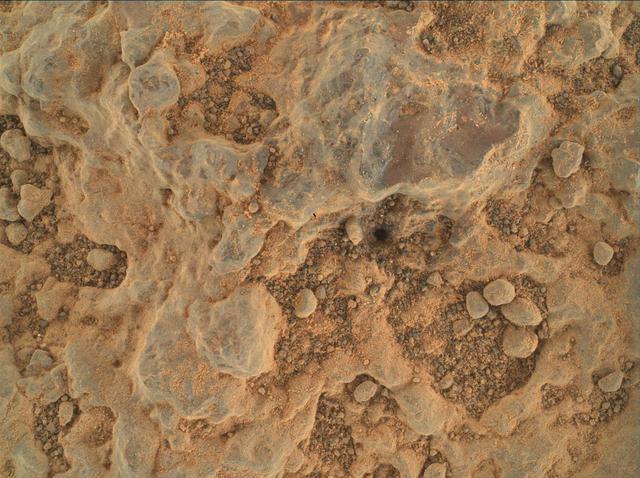
NASA's Perseverance Mars rover took this close-up of a rock target nicknamed "Foux" using its WATSON (Wide Angle Topographic Sensor for Operations and eNgineering) camera, part of the SHERLOC instrument on the end of the rover's robotic arm. The image was taken July 11, 2021, the 139th Martian day, or sol, of the mission. The area within the camera is roughly 1.4 by 1 inches (3.5 centimeters by 2.6 centimeters). NASA's Jet Propulsion Laboratory built and manages operations of Perseverance and Ingenuity for the agency. Caltech in Pasadena, California, manages JPL for NASA. WATSON was built by Malin Space Science Systems (MSSS) in San Diego and is operated jointly by MSSS and JPL. A key objective for Perseverance's mission on Mars is astrobiology, including the search for signs of ancient microbial life. The rover will characterize the planet's geology and past climate, pave the way for human exploration of the Red Planet, and be the first mission to collect and cache Martian rock and regolith (broken rock and dust). Subsequent NASA missions, in cooperation with ESA (European Space Agency), would send spacecraft to Mars to collect these sealed samples from the surface and return them to Earth for in-depth analysis. The Mars 2020 Perseverance mission is part of NASA's Moon to Mars exploration approach, which includes Artemis missions to the Moon that will help prepare for human exploration of the Red Planet. https://photojournal.jpl.nasa.gov/catalog/PIA24728
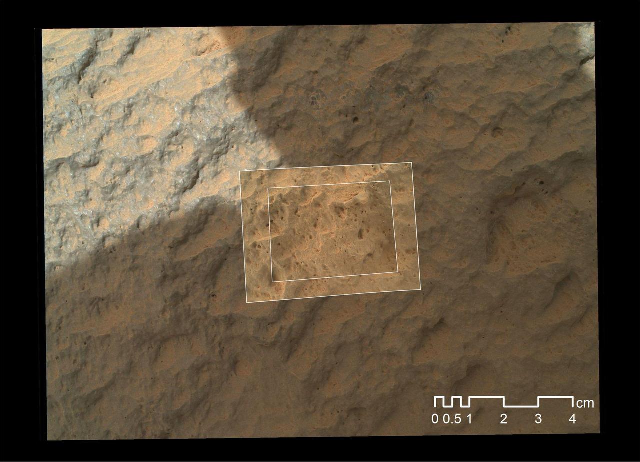
This image combines photographs taken by the Mars Hand Lens Imager MAHLI at three different distances from the first Martian rock that NASA Curiosity rover touched with its arm.
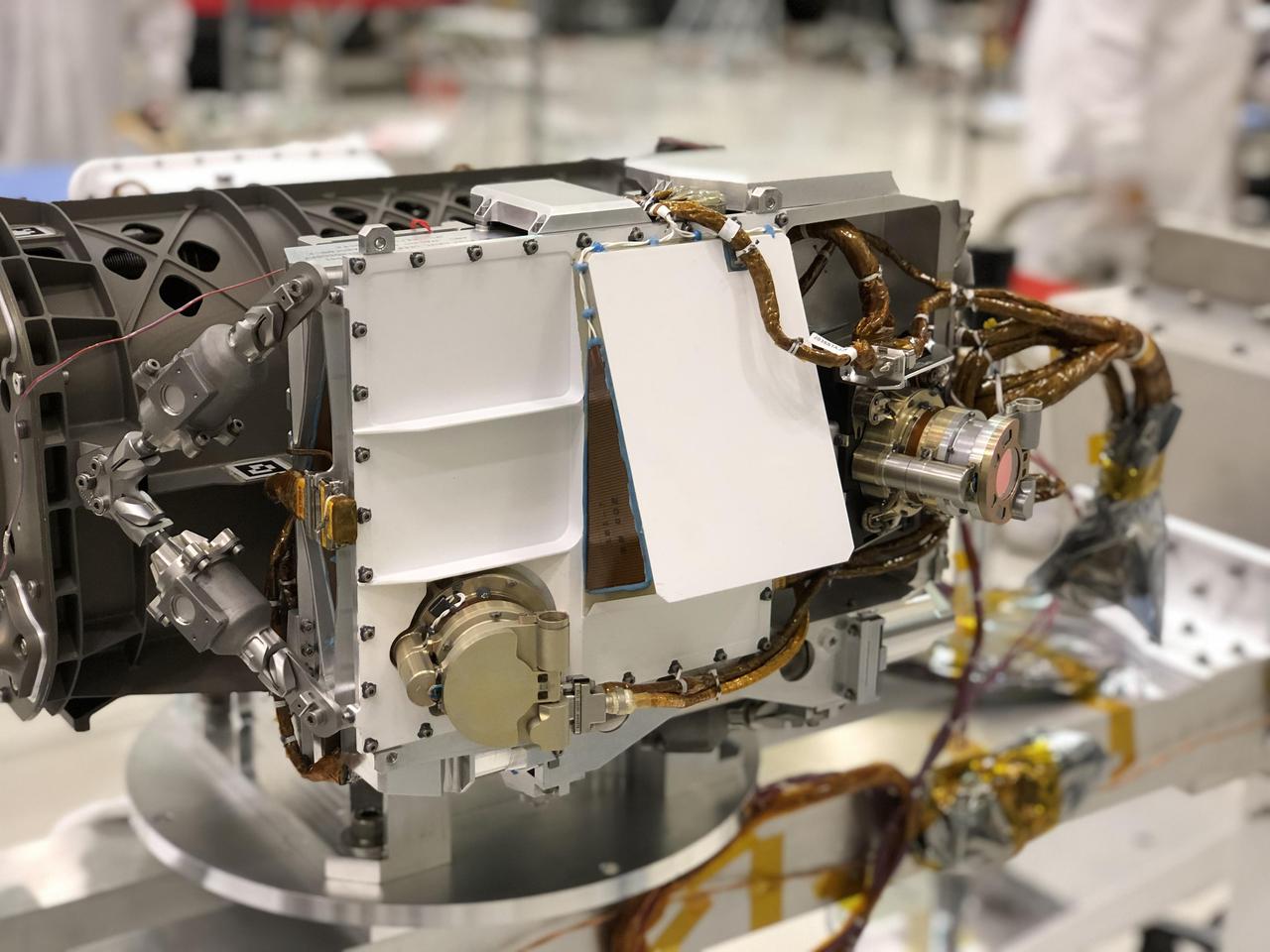
The SHERLOC instrument is located at the end of the robotic arm on NASA's Mars 2020 rover. SHERLOC (short for Scanning Habitable Environments with Raman & Luminescence for Organics and Chemicals) is a spectrometer that will provide fine-scale imaging and use an ultraviolet laser to determine fine-scale mineralogy and detect organic compounds on Mars. https://photojournal.jpl.nasa.gov/catalog/PIA23621
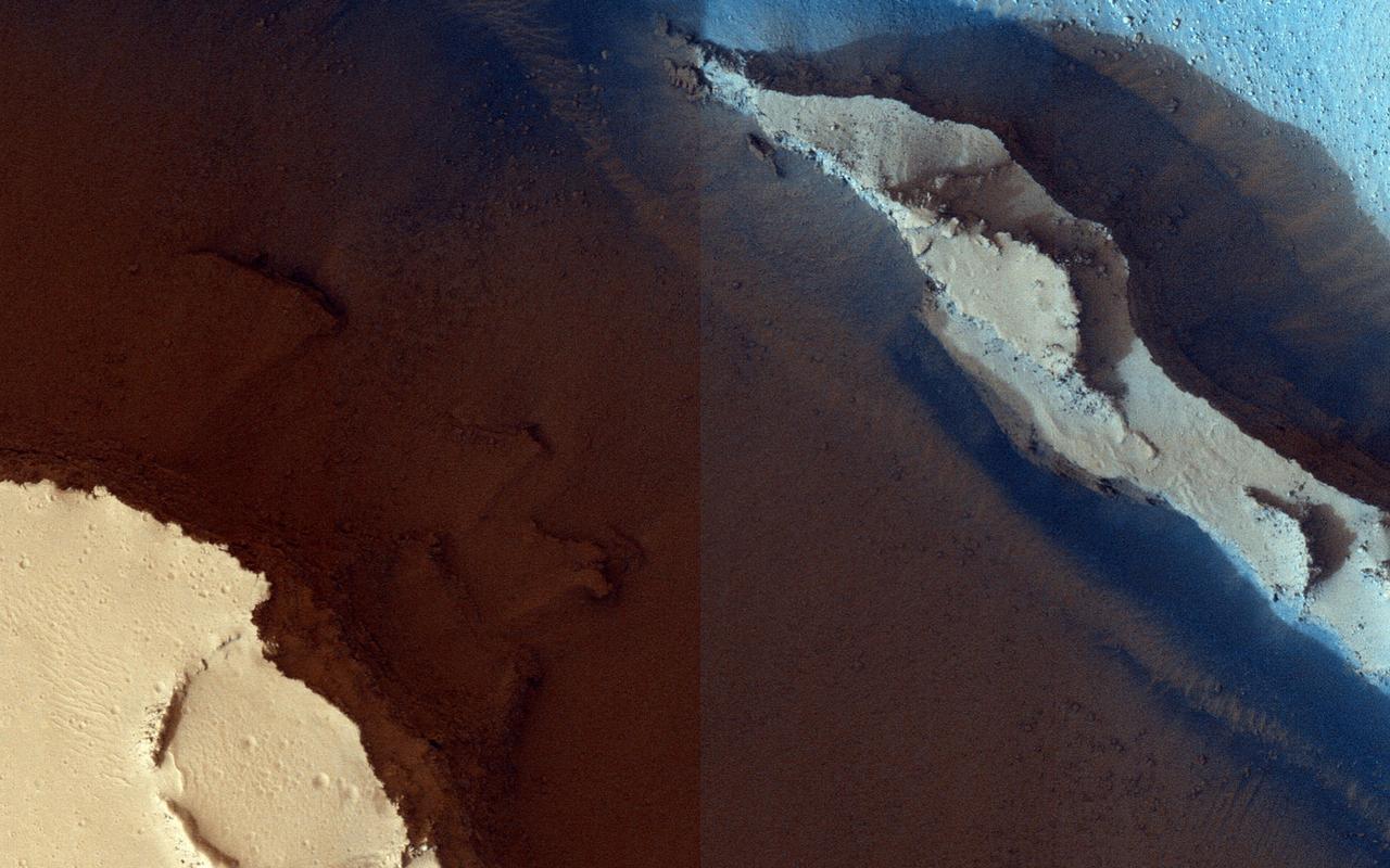
The trenches or fossae are found in Athabasca Valles as seen by NASA Mars Reconnaissance Orbiter. These trenches or "fossae" are about a kilometer (0.62 miles) across. This area shows where two segments have joined up and are close to a third section. The fossae are probably areas where the surface has collapsed down into voids made from faults (huge cracks with movement on either side) that don't extend up to the surface. In structural geology, when multiple faults are closely spaced, we call that a relay zone. These zones have much higher stress built up in the crust and consequently tend to be more fractured. These fractures can serve as "pipes" for fluids (water, lava, gases) to flow through. This area corresponds with the youngest of Mars' giant outflow channels, Athabasca Valles, that is only 2 to 20 million years old and shows geologic evidence of having been formed and modified jointly by water and lava. http://photojournal.jpl.nasa.gov/catalog/PIA19300

Combining two images, this mosaic shows a close-up view of the rock target named "Yeehgo" from the SuperCam instrument on NASA's Perseverance rover on Mars. The component images were taken by SuperCam's Remote Micro-Imager (RMI) on March 7, 2021 (the 16th Martian day, or sol, of Perseverance's mission on Mars). To be compatible with the rover's software, "Yeehgo" is an alternative spelling of "Yéigo," the Navajo word for diligent. The target is 10.9 feet (3.325 meters) from the rover. Each of the two images in the mosaic shows a field of view 2.5 inches (6.2 centimeters) in diameter. Perseverance's Navigation Cameras (Nav Cam) and Mastcam-Z instrument also took images of that area at the same time to provide multiple views of the rock target, as seen in the annotated version of this image. A key objective for Perseverance's mission on Mars is astrobiology, including the search for signs of ancient microbial life. The rover will characterize the planet's geology and past climate, pave the way for human exploration of the Red Planet, and be the first mission to collect and cache Martian rock and regolith (broken rock and dust). Subsequent NASA missions, in cooperation with ESA (European Space Agency), would send spacecraft to Mars to collect these sealed samples from the surface and return them to Earth for in-depth analysis. The Mars 2020 Perseverance mission is part of NASA's Moon to Mars exploration approach, which includes Artemis missions to the Moon that will help prepare for human exploration of the Red Planet. https://photojournal.jpl.nasa.gov/catalog/PIA24492
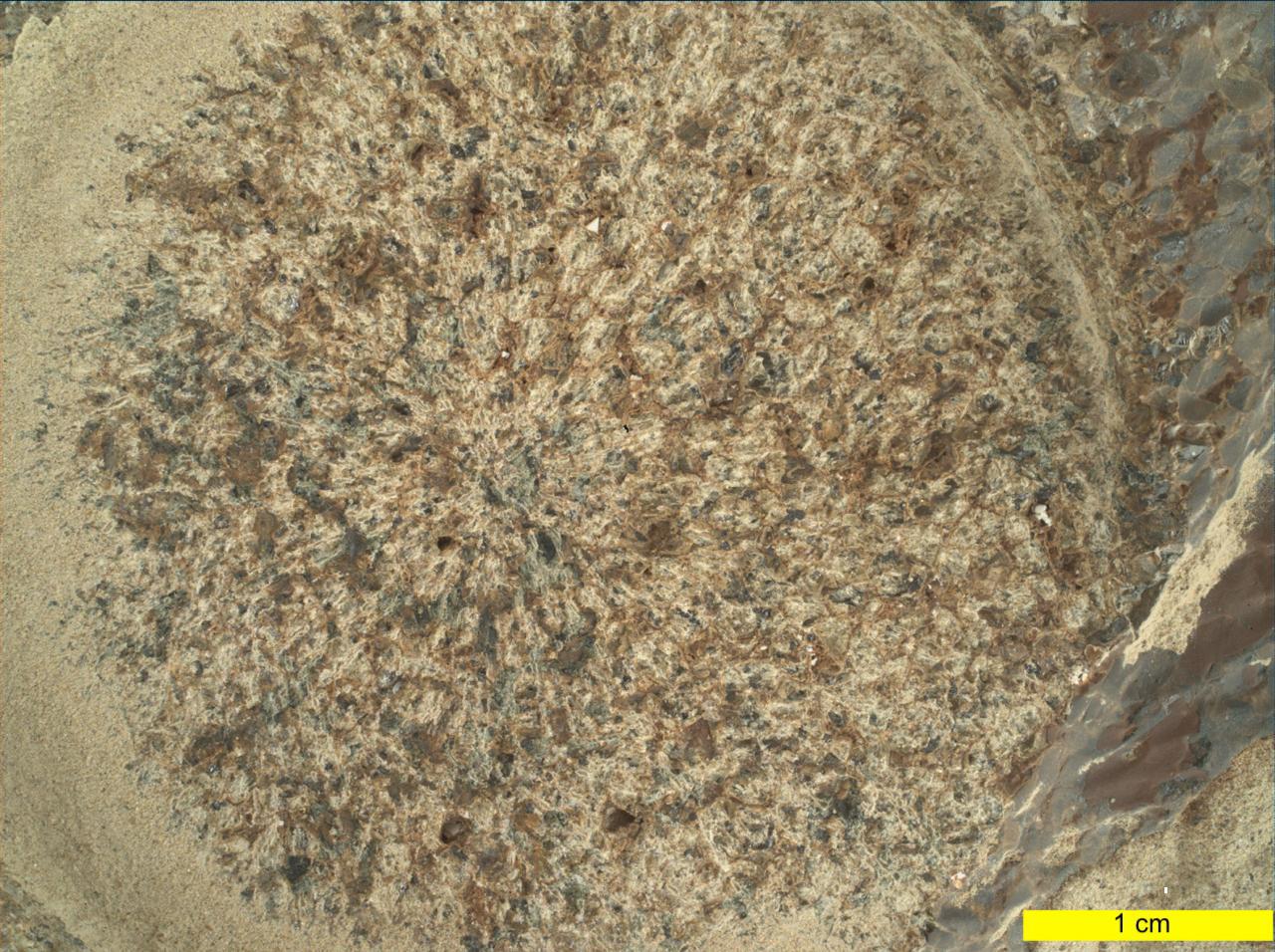
This close-up view of a rock target named "Dourbes" was provided by the WATSON (Wide Angle Topographic Sensor for Operations and eNgineering) camera on the end of the robotic arm aboard NASA's Perseverance Mars rover. WATSON took a series of eight fully-shadowed images on Nov. 5, 2021, the 253rd Martian day, or sol, of the mission, and the images were subsequently merged to create this view. Before drilling rocks, the rover abrades the rock surface using a tool on its robotic arm to clear away dust and weathering rinds, allowing other instruments to study the rocks in detail. The abraded patch is 2 inches (5 centimeters) in diameter. Perseverance subsequently acquired two rock core samples from this outcrop, called "Brac," which forms part of the "South Séítah" geologic unit of Jezero Crater. The WATSON image shows that the abrasion patch is dominated by discrete areas of light-toned material, with subordinate brown, dark-toned interstitial areas. The chemistry and mineralogy of the abrasion patch was analysed by a series of co-registered observations using the SuperCam, Mastcam-Z, PIXL (Planetary Instrument for X-ray Lithochemistry), and SHERLOC (Scanning Habitable Environments with Raman & Luminescence for Organics & Chemicals) instruments. A subsystem of an instrument called SHERLOC (Scanning Habitable Environments with Raman & Luminescence for Organics & Chemicals), WATSON can document the structure and texture within a drilled or abraded target, and its data can be used to derive depth measurements. WATSON was built by Malin Space Science Systems (MSSS) in San Diego and is operated jointly by MSSS and JPL. A key objective for Perseverance's mission on Mars is astrobiology, including the search for signs of ancient microbial life. The rover will characterize the planet's geology and past climate, pave the way for human exploration of the Red Planet, and be the first mission to collect and cache Martian rock and regolith (broken rock and dust). Subsequent NASA missions, in cooperation with ESA (European Space Agency), would send spacecraft to Mars to collect these sealed samples from the surface and return them to Earth for in-depth analysis. The Mars 2020 Perseverance mission is part of NASA's Moon to Mars exploration approach, which includes Artemis missions to the Moon that will help prepare for human exploration of the Red Planet. https://photojournal.jpl.nasa.gov/catalog/PIA24940
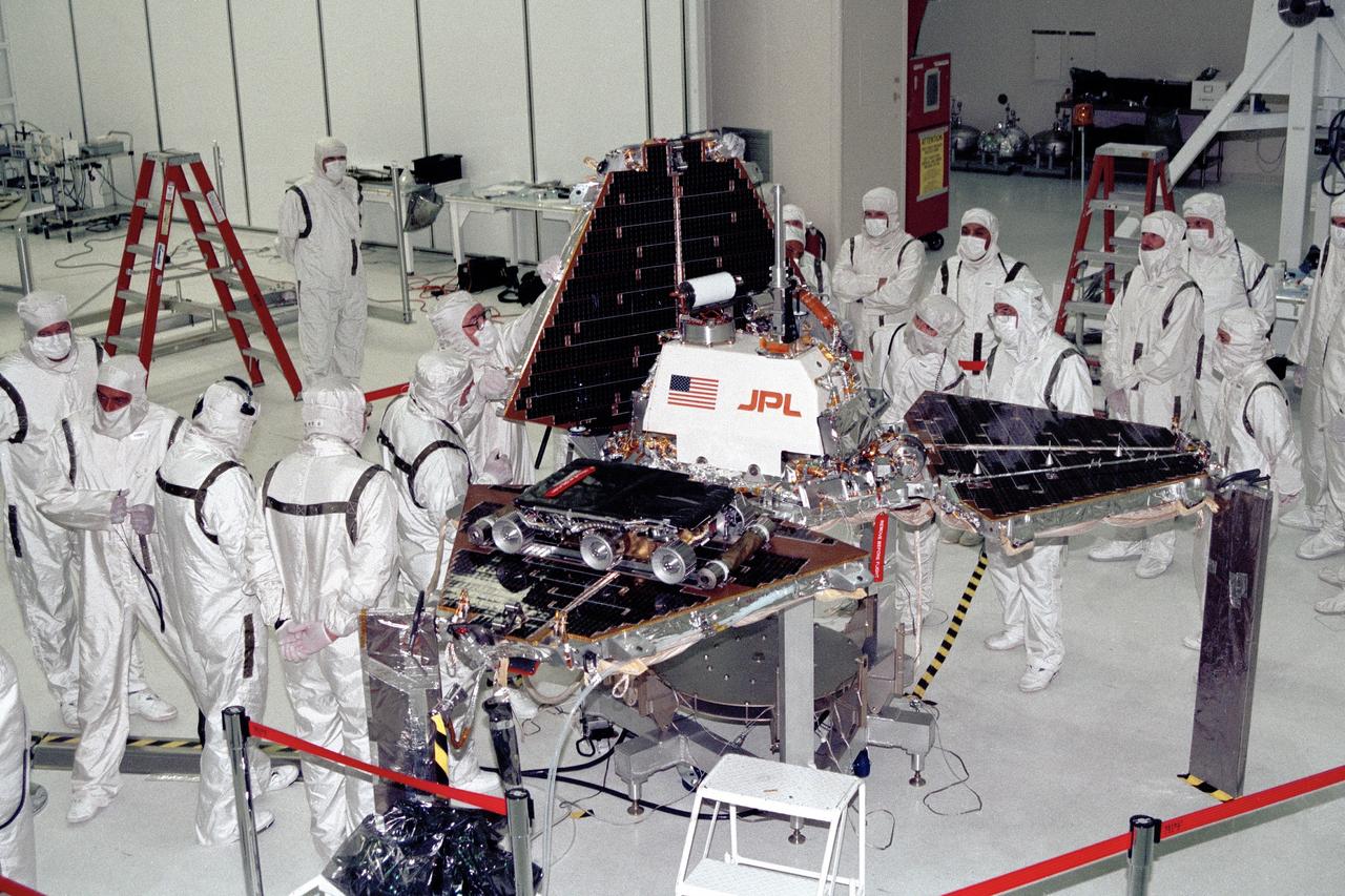
CAPE CANAVERAL, Fla. -- In the Spacecraft Assembly and Encapsulation Facility-2 at NASA's Kennedy Space Center in Florida, Jet Propulsion Laboratory technicians are closing up the metal "petals" of the Mars Pathfinder lander. The Sojourner rover is visible on one of the three petals. Photo Credit: NASA
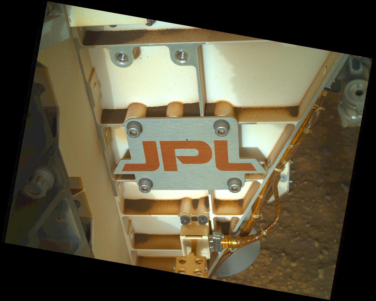
The logo of NASA's Jet Propulsion Laboratory has roamed Mars since the September 1997 landing of very first rover, Sojourner, part of the Mars Pathfinder mission. This close-up view of the JPL logo – bolted to the chassis of NASA's Perseverance – was acquired on June 28, 2025 (the 1,548th day, or sol, of its mission to Mars), by the rover's WATSON (Wide Angle Topographic Sensor for Operations and eNgineering) imager. https://photojournal.jpl.nasa.gov/catalog/PIA26580
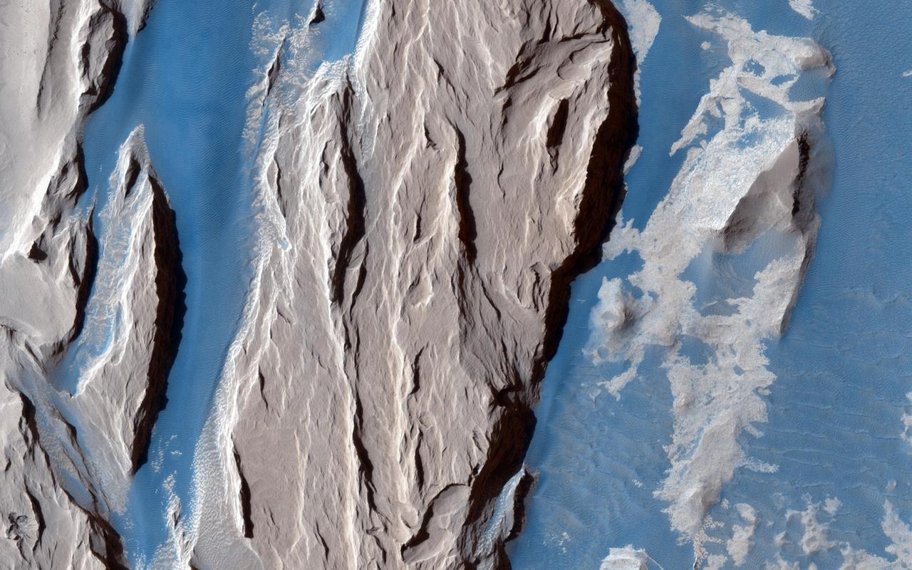
This beautifully contrasted infrared-color image shows an area approximately 600 by 900 meters. This is a close-up from NASA Mars Reconnaissance Orbiter spacecraft of the western Medusa Fossae formation where we can see dust-covered rocky, bedrock surfaces beige and a bluish-tinted sand sheet that transitions into several dunes. The bluish sand is thought to originate from the bedrock that lies beneath the dust. If true, this has implications for the composition of the formation, which has been highly debated over the years. http://photojournal.jpl.nasa.gov/catalog/PIA19939
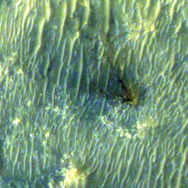
The High Resolution Imaging Experiment (HiRISE) camera aboard NASA's Mars Reconnaissance Orbiter (MRO) was able to capture this image of the final location of the descent stage that helped fly NASA's Perseverance rover down to the surface of Mars. The image was taken on Feb. 19, 2021. It is a close-up version of a larger image showing several parts of the Mars 2020 mission landing system that got the rover safely on the ground. These close-ups of Mars 2020 hardware were processed to make them easier to see. The insets showing the descent stage and parachute have had color added and include data from the infrared band of light. A key objective for Perseverance's mission on Mars is astrobiology, including the search for signs of ancient microbial life. The rover will characterize the planet's geology and past climate, pave the way for human exploration of the Red Planet, and be the first mission to collect and cache Martian rock and regolith (broken rock and dust). Subsequent NASA missions, in cooperation with ESA (European Space Agency), would send spacecraft to Mars to collect these sealed samples from the surface and return them to Earth for in-depth analysis. The Mars 2020 Perseverance mission is part of NASA's Moon to Mars exploration approach, which includes Artemis missions to the Moon that will help prepare for human exploration of the Red Planet. https://photojournal.jpl.nasa.gov/catalog/PIA24335
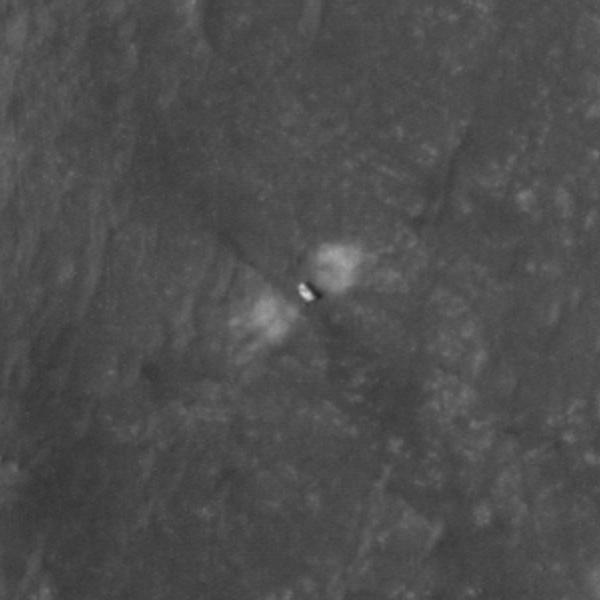
The High Resolution Imaging Experiment (HiRISE) camera aboard NASA's Mars Reconnaissance Orbiter (MRO) was able to capture this image of NASA's Perseverance rover on the surface of Mars. The image was taken on Feb. 19, 2021. It is a close-up version of a larger image showing several parts of the Mars 2020 mission landing system that got the rover safely on the ground. These close-ups of Mars 2020 hardware were processed to make them easier to see. A key objective for Perseverance's mission on Mars is astrobiology, including the search for signs of ancient microbial life. The rover will characterize the planet's geology and past climate, pave the way for human exploration of the Red Planet, and be the first mission to collect and cache Martian rock and regolith (broken rock and dust). Subsequent NASA missions, in cooperation with ESA (European Space Agency), would send spacecraft to Mars to collect these sealed samples from the surface and return them to Earth for in-depth analysis. The Mars 2020 Perseverance mission is part of NASA's Moon to Mars exploration approach, which includes Artemis missions to the Moon that will help prepare for human exploration of the Red Planet. https://photojournal.jpl.nasa.gov/catalog/PIA24334
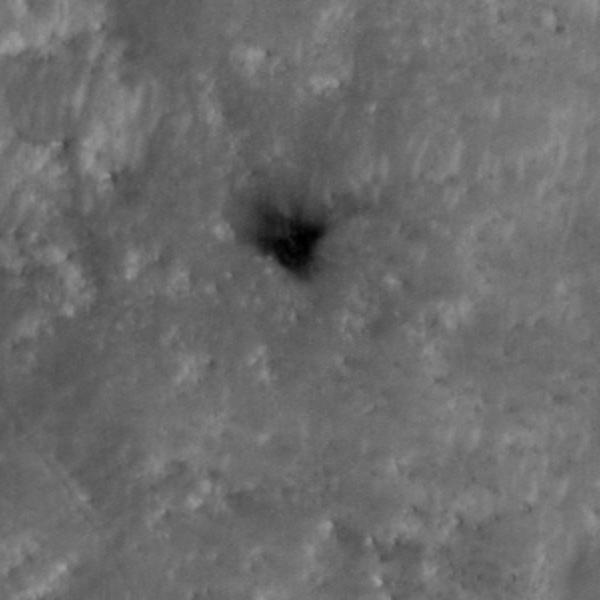
The High Resolution Imaging Experiment (HiRISE) camera aboard NASA's Mars Reconnaissance Orbiter (MRO) was able to capture this image of the final location of the heat shield that helped protect NASA's Perseverance rover during its landing on the surface of Mars. The image was taken on Feb. 19, 2021. It is a close-up version of a larger image showing several parts of the Mars 2020 mission landing system that got the rover safely on the ground. These close-ups of Mars 2020 hardware were processed to make them easier to see. A key objective for Perseverance's mission on Mars is astrobiology, including the search for signs of ancient microbial life. The rover will characterize the planet's geology and past climate, pave the way for human exploration of the Red Planet, and be the first mission to collect and cache Martian rock and regolith (broken rock and dust). Subsequent NASA missions, in cooperation with ESA (European Space Agency), would send spacecraft to Mars to collect these sealed samples from the surface and return them to Earth for in-depth analysis. The Mars 2020 Perseverance mission is part of NASA's Moon to Mars exploration approach, which includes Artemis missions to the Moon that will help prepare for human exploration of the Red Planet. https://photojournal.jpl.nasa.gov/catalog/PIA24337
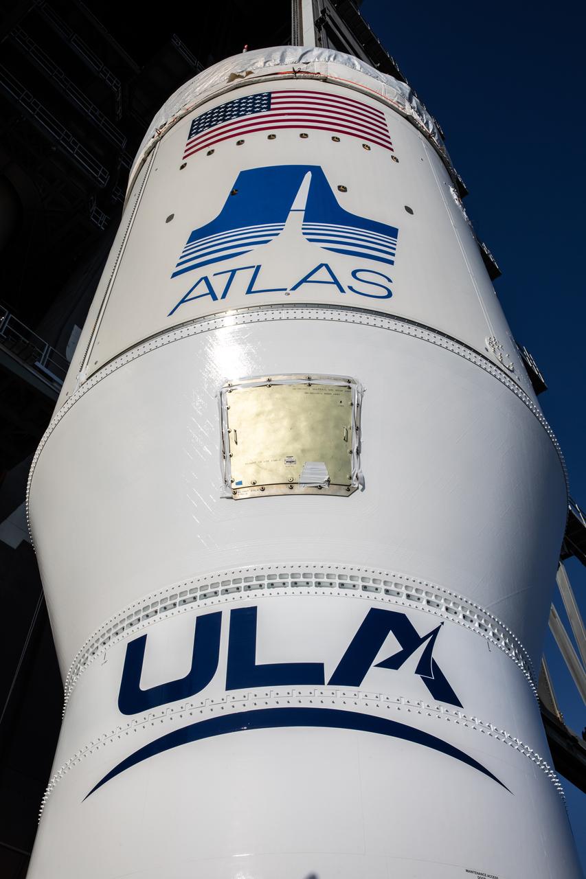
A close-up view of the single-engine Centaur upper stage for the United Launch Alliance Atlas V rocket for NASA’s Mars Perseverance rover as it is being lifted up into the Vertical Integration Facility at Space Launch Complex 41 at Cape Canaveral Air Force Station in Florida on June 10, 2020. The Centaur will be lifted up and attached to the rocket’s first stage. The Mars Perseverance rover is scheduled to launch atop the Atlas V 541 rocket from Pad 41 on July 20, 2020. The rover is part of NASA’s Mars Exploration Program, a long-term effort of robotic exploration of the Red Planet. The rover’s seven instruments will search for habitable conditions in the ancient past and signs of past microbial life on Mars. The Launch Services Program at Kennedy is responsible for launch management.
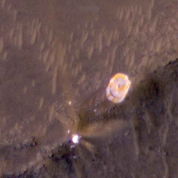
The High Resolution Imaging Experiment (HiRISE) camera aboard NASA's Mars Reconnaissance Orbiter (MRO) was able to capture this image of the final location of the parachute that helped slow down NASA's Perseverance rover during its landing on the surface of Mars. It is a close-up version of a larger image showing several parts of the Mars 2020 mission landing system that got the rover safely on the ground. The image was taken on Feb. 19, 2021. These close-ups were processed to make them easier to see. The insets showing the descent stage and parachute have had color added and include data from the infrared band of light. A key objective for Perseverance's mission on Mars is astrobiology, including the search for signs of ancient microbial life. The rover will characterize the planet's geology and past climate, pave the way for human exploration of the Red Planet, and be the first mission to collect and cache Martian rock and regolith (broken rock and dust). Subsequent NASA missions, in cooperation with ESA (European Space Agency), would send spacecraft to Mars to collect these sealed samples from the surface and return them to Earth for in-depth analysis. The Mars 2020 Perseverance mission is part of NASA's Moon to Mars exploration approach, which includes Artemis missions to the Moon that will help prepare for human exploration of the Red Planet. https://photojournal.jpl.nasa.gov/catalog/PIA24336
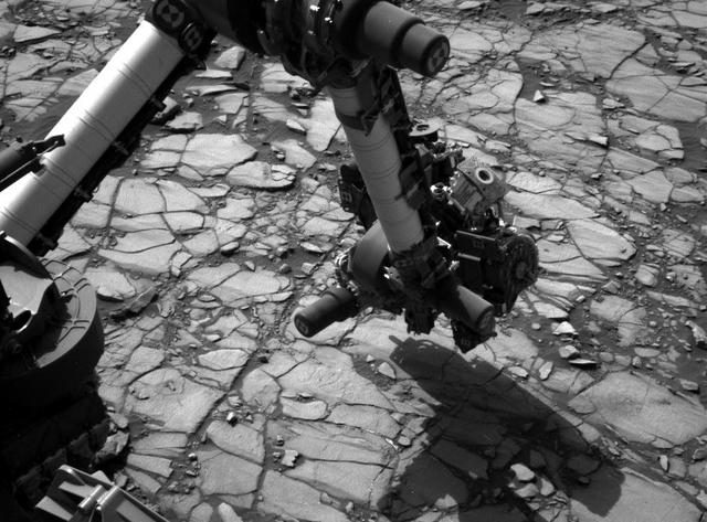
NASA's Curiosity Mars rover began close-up investigation of a target called "Marimba," on lower Mount Sharp, during the week preceding the fourth anniversary of the mission's dramatic sky-crane landing. The Navigation Camera (Navcam) on Curiosity's mast took this image on Aug. 2, 2016, during the 1,418th Martian day, or sol, since Curiosity landed inside Gale Crater on Aug. 6, 2012, Universal Time (Aug. 5, PDT). In this scene, the rover has extended its arm over a patch of bedrock selected as the target for rover's next drilling operation. The drilling collects rock powder for onboard laboratory analysis. The arm is positioned with the rover's wire-bristle Dust Removal Tool above the target. http://photojournal.jpl.nasa.gov/catalog/PIA20764
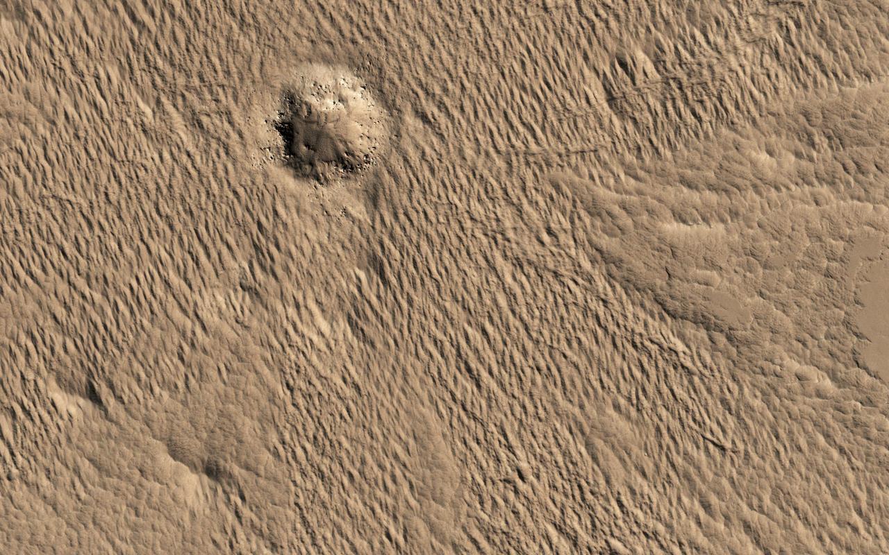
A close-up image from NASA's Mars Reconnaissance Orbiter of a recent 150-meter diameter impact crater near Amazonis Mensa and Medusae Fossae is another great example of geologic complexity of Mars. The spider web-like texture of this crater is intriguing. But what does it mean? On Earth, we have many geologic mechanisms that embrace the surface of the planet in an almost constant state of metamorphosis. Although Mars is not nearly as geologically active as Earth, it is still a host to many processes that shape its surface even today (e.g., aeolian modification, periglacial processes, recent impacts, etc.). The appearance of the ejecta of this crater is likely a combination of both the characteristics of the target material it was deposited on, and processes that modified and degraded it over time. When we look to other images in this region we find a similar texture. This texture is referred to as “yardangs†by scientists who study wind erosion. Yardangs are streamlined ridge-and-trough patterns formed by the erosion of wind dominating from a specific direction; in this particular case, from the southeast to the northwest. The specific direction of the winds is supported by regional context images that show many craters in the region have wind streak "tails" that points to the northwest. Craters of this size have been observed to form recently on Mars, so the fact that this crater is modified speaks volumes, and gives us a chance to decode some geological messages from Mars. https://photojournal.jpl.nasa.gov/catalog/PIA21759
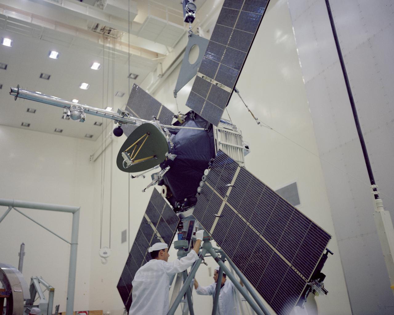
CAPE KENNEDY, Fla. -- In the AO Building at Cape Kennedy Air Force Station in Florida, the Mariner 3 spacecraft is processed prior to mating with its payload faring. Mariner is one of two identical deep-space probes designed and built by the Jet Propulsion Laboratory for NASA's Mariner Mars 1964 project. Mariner 3 is intended to conduct close-up scientific observations of Mars and transmit information back to Earth on interplanetary space and the space surrounding the Red Planet. Photo Credit: NASA
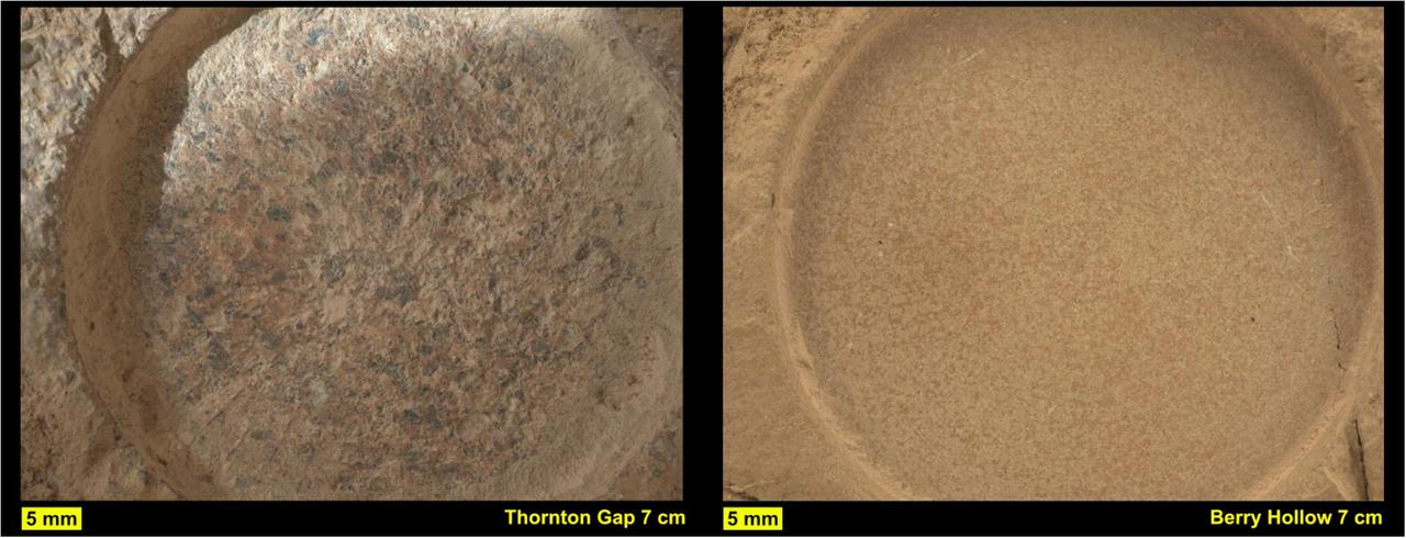
This pair of images from NASA's Perseverance shows close-up views of two rock types the rover investigated in the delta area of Mars' Jezero Crater, which scientists consider one of the best places on the Red Planet to search for potential signs of ancient microbial life. The image on the left shows a circular patch Perseverance abraded on a rocky outcrop called "Skinner Ridge," while the image on the right shows an abrasion patch on a rocky outcrop called "Wildcat Ridge." Under each image is the abrasion patch's name the mission team has provided them for identification purposes. Perseverance grinds circular patches into rocks so its science instruments can analyze the rocks' composition. The images were taken by the WATSON (Wide Angle Topographic Sensor for Operations and eNgineering) camera on the SHERLOC (Scanning Habitable Environments with Raman & Luminescence for Organics & Chemicals) instrument on June 29 and July 21, 2022, the 482nd and 504th Martian days, or sols, of the mission. The camera that took these images, located at the end of Perseverance's robotic arm, was about 3 inches (7 centimeters) away from each rock surface. The Skinner Ridge rock is sandstone and composed of much larger grains than the Wildcat Ridge rock. The rock and mineral fragments at Skinner Ridge – which are the detritus of larger rocks – have a diversity of compositions and were transported by water from possibly hundreds of miles outside of Jezero Crater. The Wildcat Ridge rock is a more finely grained sedimentary rock, a sulfate-bearing mudstone. It has a more homogeneous composition than Skinner Ridge and appears to have formed in saltwater in the distant past, possibly as ancient lake water evaporated. Scientists believe both rocks formed in, and preserve information about, potentially habitable environments in Mars' ancient past. The verification of ancient life on the Red Planet carries an enormous burden of proof. Perseverance collected rock samples beside these abrasion patches (see PIA24927 and PIA24929) and sealed them in ultra-clean sample tubes. A key objective for Perseverance's mission on Mars is astrobiology, including the search for signs of ancient microbial life. The rover will characterize the planet's geology and past climate, pave the way for human exploration of the Red Planet, and be the first mission to collect and cache Martian rock and regolith (broken rock and dust). Subsequent NASA missions, in cooperation with ESA (European Space Agency), would send spacecraft to Mars to collect these sealed samples from the surface and return them to Earth for in-depth analysis. The Mars 2020 Perseverance mission is part of NASA's Moon to Mars exploration approach, which includes Artemis missions to the Moon that will help prepare for human exploration of the Red Planet. https://photojournal.jpl.nasa.gov/catalog/PIA24926
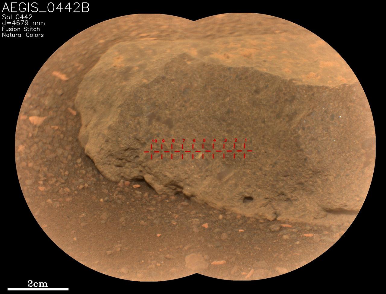
On May 18, 2022, NASA's Perseverance Mars rover used an artificial intelligence software called Autonomous Exploration for Gathering Increased Science (AEGIS) to select and target the rock seen in close-up here. It's one of two rocks that the AI for the first time helped Perseverance study without direction from the mission's team back on Earth. AEGIS was developed by NASA's Jet Propulsion Laboratory in Southern California – which also built Perseverance – to collect data on rocks and other Martian features that the rover discovers while driving. AEGIS is used in conjunction with Perseverance's SuperCam laser instrument, directing the laser to zap certain features that scientists have commanded the rover to look for. SuperCam used its Remote Micro-Imager (RMI) camera to take two images of this target, which were stitched together into the main picture seen here. The rock target, which was about 16 feet (5 meters) away from the rover, is named "AEGIS_0442B," referring to the Martian day, or sol, it was targeted (Sol 442) and that it was the second rock ("B") targeted by AEGIS on that sol. The red crosshairs seen across the rock target indicate each place AEGIS directed the laser to zap. SuperCam is led by Los Alamos National Laboratory in New Mexico, where the instrument's body unit was developed. That part of the instrument includes several spectrometers as well as control electronics and software. The mast unit, including RMI, was developed and built by several laboratories of the CNRS (the French research center) and French universities under the contracting authority of Centre National d'Études Spatiales (CNES), the French space agency. A key objective for Perseverance's mission on Mars is astrobiology, including the search for signs of ancient microbial life. The rover will characterize the planet's geology and past climate, pave the way for human exploration of the Red Planet, and be the first mission to collect and cache Martian rock and regolith (broken rock and dust). Subsequent NASA missions, in cooperation with ESA (European Space Agency), would send spacecraft to Mars to collect these sealed samples from the surface and return them to Earth for in-depth analysis. The Mars 2020 Perseverance mission is part of NASA's Moon to Mars exploration approach, which includes Artemis missions to the Moon that will help prepare for human exploration of the Red Planet. https://photojournal.jpl.nasa.gov/catalog/PIA25289
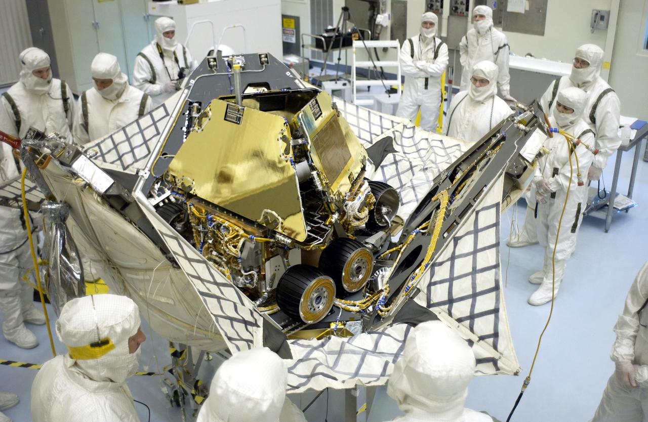
KENNEDY SPACE CENTER, FLA. - While workers watch the process, the petals on the lander close up around the Mars Exploration Rover 2 (MER-A). The lander and rover will be enclosed within an aeroshell for launch. The MER Mission consists of two identical rovers designed to cover roughly 110 yards each Martian day over various terrain. Each rover will carry five scientific instruments that will allow it to search for evidence of liquid water that may have been present in the planet's past. Identical to each other, the rovers will land at different regions of Mars. Launch date for this first of NASA's two Mars Exploration Rover missions is scheduled no earlier than June 6.
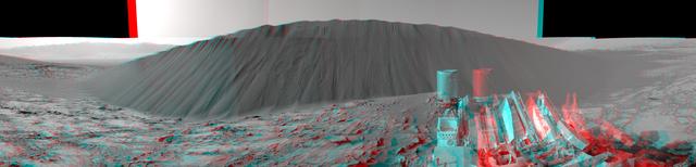
This stereo view from NASA's Curiosity Mars Rover shows the downwind side of "Namib Dune," which stands about 13 feet (4 meters) high. The image appears three-dimensional when viewed through red-blue glasses with the red lens on the left. The site is part of Bagnold Dunes, a band of dark sand dunes along the northwestern flank of Mars' Mount Sharp. The component images stitched together into this scene were taken with Curiosity's Navigation Camera (Navcam) on Dec. 17, 2015, during the 1,196th Martian day, or sol, of the rover's work on Mars. In late 2015 and early 2016, Curiosity is conducting the first up-close studies ever made of active sand dunes anywhere but on Earth. Under the influence of Martian wind, the Bagnold Dunes are migrating up to about one yard or meter per Earth year. http://photojournal.jpl.nasa.gov/catalog/PIA20282
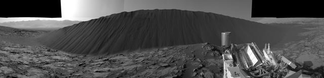
This view from NASA's Curiosity Mars Rover shows the downwind side of "Namib Dune," which stands about 13 feet (4 meters) high. The site is part of Bagnold Dunes, a band of dark sand dunes along the northwestern flank of Mars' Mount Sharp. The component images stitched together into this scene were taken with Curiosity's Navigation Camera (Navcam) on Dec. 17, 2015, during the 1,196th Martian day, or sol, of the rover's work on Mars. In late 2015 and early 2016, Curiosity is conducting the first up-close studies ever made of active sand dunes anywhere but on Earth. Under the influence of Martian wind, the Bagnold Dunes are migrating up to about one yard or meter per Earth year. The view spans from westward on the left to east-southeastward on the right. It is presented as a cylindrical perspective projection. http://photojournal.jpl.nasa.gov/catalog/PIA20281
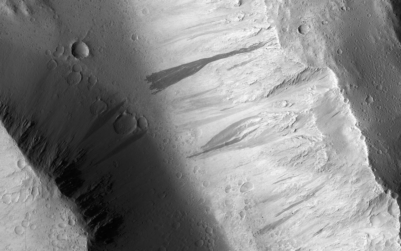
Changes on the Martian surface are detected by imaging the same area more than once. In this image acquired on May 13, 2018, NASA's Mars Reconnaissance Orbiter observes several new dust avalanches on the slopes of ridges within the Olympus Mons Aureole. These changes occurred within six years. (Also see the animated GIF). Dust avalanches create slope streaks that expose darker materials usually hidden below a lighter-toned layer. Cascading fine-grained material easily diverts around boulders or alters direction when encountering a change in slope (see the top right corner of the first close-up). The dark steak in another close-up is approximately 1 kilometer in length that not seen in a previous image. Past avalanche sites are still visible and fading slowly as dust settles out of the atmosphere and is deposited on the dark streaks over time. More information is available at https://photojournal.jpl.nasa.gov/catalog/PIA22595

This image shows a large sand dune with bright patches. Martian dunes near the poles often have bright patches in the spring, when seasonal frost is lingering. However, this image is from late summer, when frost is long gone. What is going on here? A close-up look with HiRISE provides some clues. The bright patches are made up of large ridges that look like wind-blown bedforms. Additionally, the bright patches are yellowish in the infrared-red-blue image. In enhanced color, most sand on Mars is blue but dust is yellow. This suggests that the bright bedforms are either built from, or covered by, dust or material with a different composition. https://photojournal.jpl.nasa.gov/catalog/PIA24461
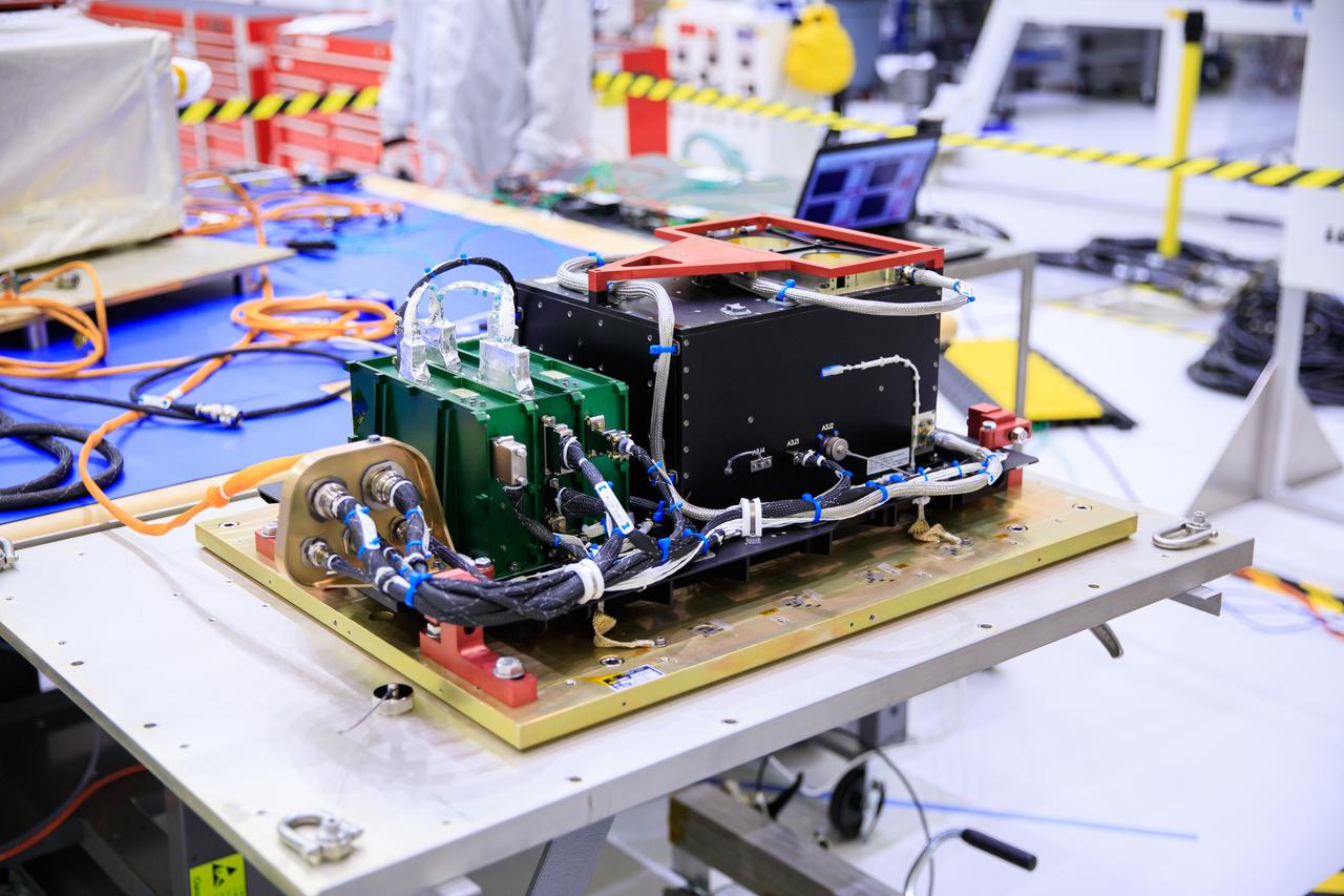
A close-up view of one of the parts of the Optical Communications System for the Artemis II mission inside the Neil Armstrong Operations and Checkout Building high bay on June 2, 2023. Optical communications is the latest space communications technology that is able to provide data rates as much as a hundred times higher than current systems. This will allow astronauts to send and receive ultra-high-definition video from the surface of the Moon or other planets such as Mars. Artemis II will be the first Artemis mission flying crew aboard Orion.

NASA Administrator Jim Bridenstine made his first official visit to the agency's Kennedy Space Center on Monday, Aug. 6, 2018. His up-close look at the premier, multi-user spaceport began with a helicopter tour over the bustling Florida spaceport that included the center's Launch Complex 39B. This will be the site where NASA's Space Launch System rocket and Orion spacecraft will liftoff on trips to the Moon, Mars and beyond.
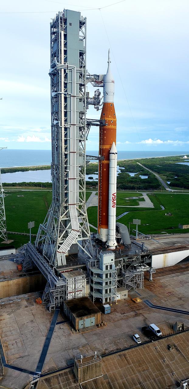
A close-up view of the Artemis I Space Launch System (SLS) and Orion spacecraft atop the mobile launcher on Launch Pad 39B at NASA’s Kennedy Space Center in Florida on Sept. 15, 2022. A portion of the umbilical connections are in view, as well as the crew access arm. Artemis I is the first integrated test of the SLS and Orion spacecraft. In future Artemis missions, NASA will land the first woman and the first person of color on the surface of the Moon, paving the way for a long-term lunar presence and serving as a steppingstone on the way to Mars.
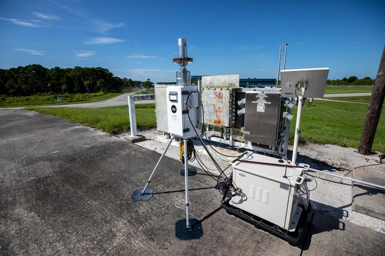
A close-up view of one of several Environmental Continuous Air Monitors, or ECAMS, located in the Space Coast area on July 27, 2020, in preparation for launch of NASA’s Mars 2020 mission on July 30. The ECAMS are updated versions of those that were used for the launch of Curiosity. The Data Collection and Assessment Center uses information from the network of remote monitoring devises, including several that are located in areas for specific weather forecasting reported back to the operations center.
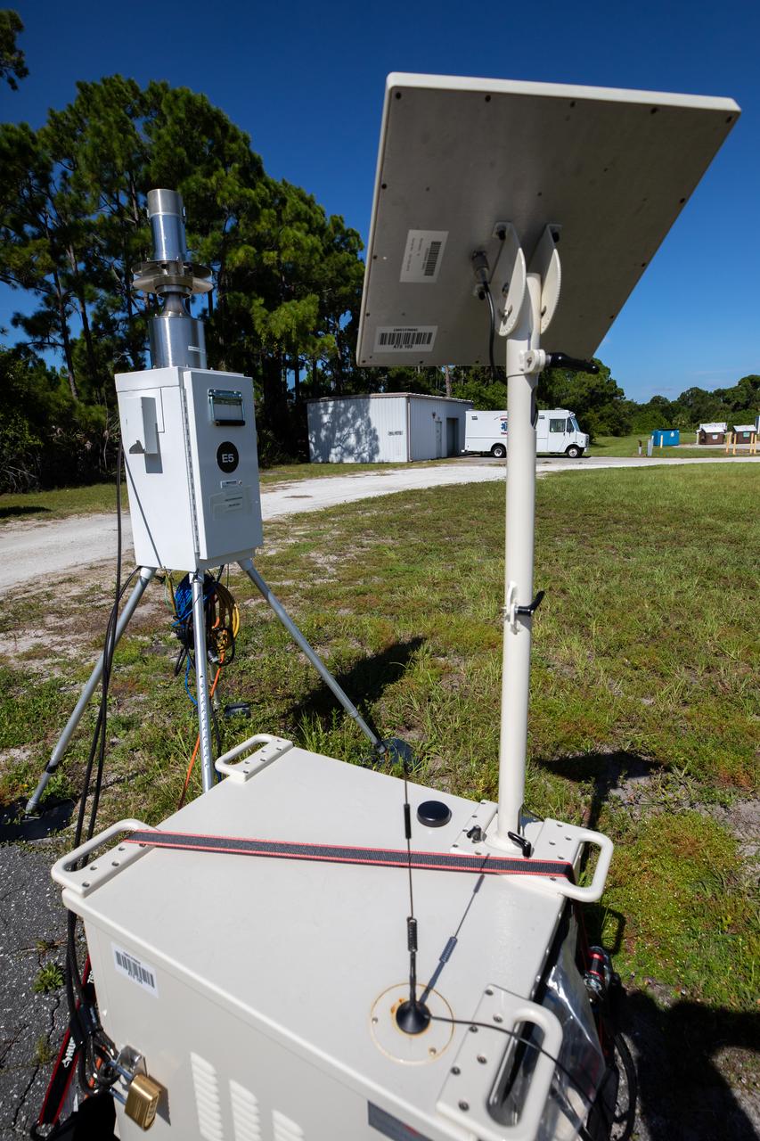
A close-up view of one of several Environmental Continuous Air Monitors, or ECAMS, located in the Space Coast area on July 27, 2020, in preparation for launch of NASA’s Mars 2020 mission on July 30. The ECAMS are updated versions of those that were used for the launch of Curiosity. The Data Collection and Assessment Center uses information from the network of remote monitoring devises, including several that are located in areas for specific weather forecasting reported back to the operations center.
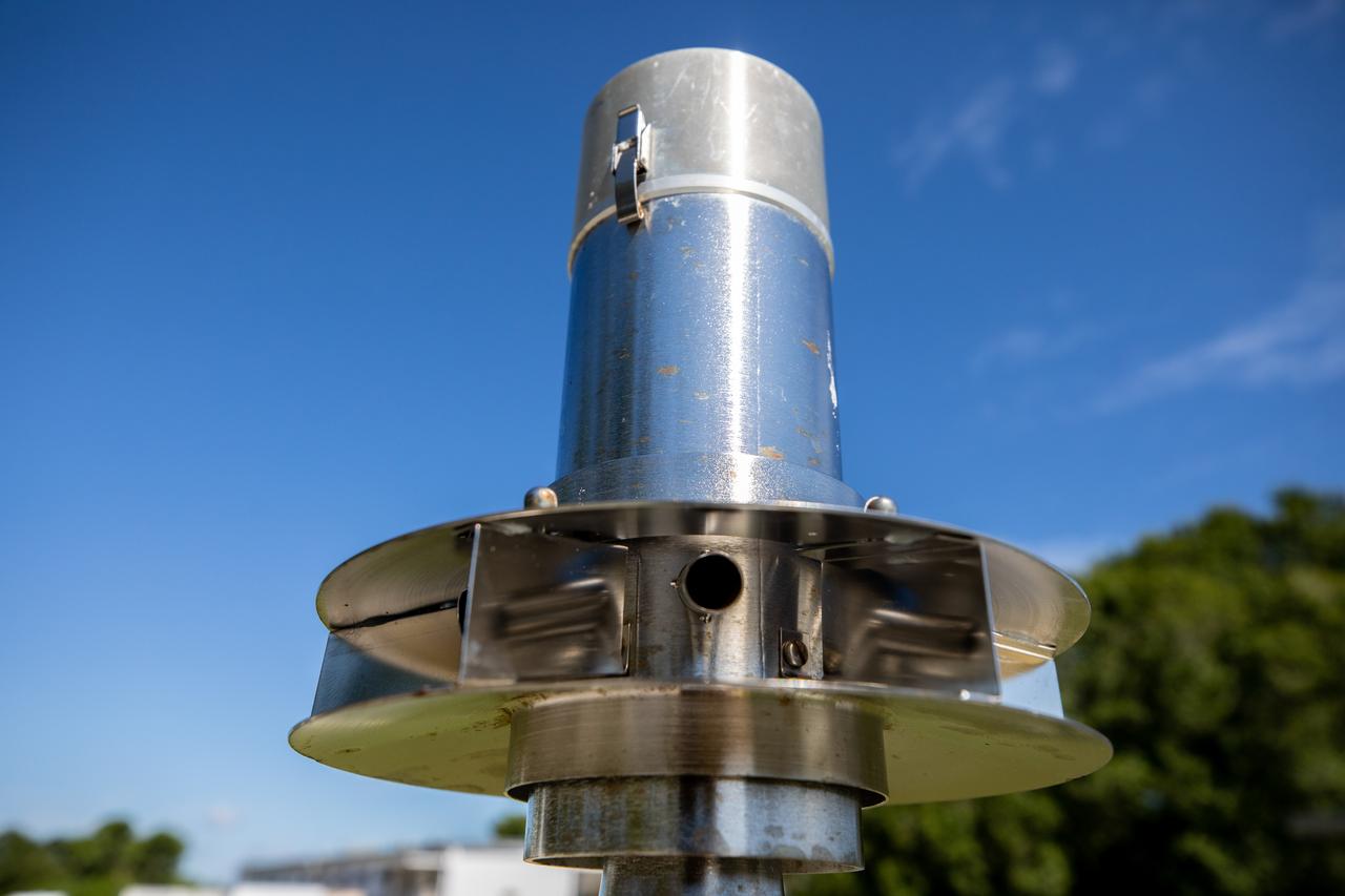
A close-up view of one of several Environmental Continuous Air Monitors, or ECAMS, located in the Space Coast area on July 27, 2020, in preparation for launch of NASA’s Mars 2020 mission on July 30. The ECAMS are updated versions of those that were used for the launch of Curiosity. The Data Collection and Assessment Center uses information from the network of remote monitoring devises, including several that are located in areas for specific weather forecasting reported back to the operations center.

NASA Administrator Jim Bridenstine made his first official visit to the agency's Kennedy Space Center on Monday, Aug. 6, 2018. His up-close look at the premier, multi-user spaceport began with a helicopter tour over the bustling Florida spaceport that included the center's Launch Complex 39B. This will be the site where NASA's Space Launch System rocket and Orion spacecraft will liftoff on trips to the Moon, Mars and beyond.
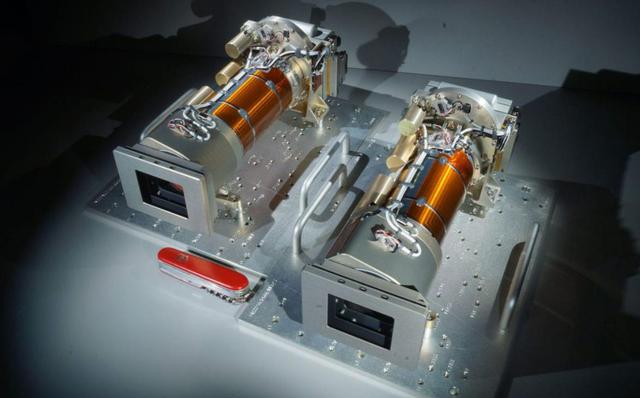
The twin Mastcam-Z cameras, shown with a pocket knife for scale, are assembled and ready for testing in this photo taken at Malin Space Science Systems, in San Diego, California. One of two sets of "eyes" on the "head," or mast, of the rover, these cameras can take high-definition video, panoramic color, and 3D images of the Martian surface. These are the first cameras sent to Mars with built-in zoom capability, able to switch from a wide angle to a close-up view. https://photojournal.jpl.nasa.gov/catalog/PIA24200
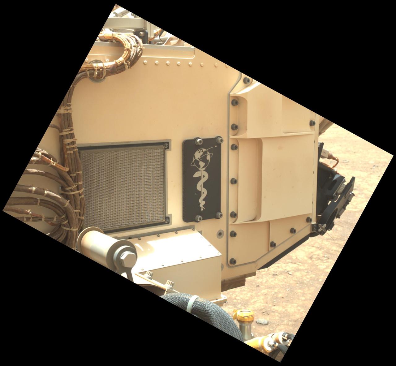
This close-up view of a plate on NASA's Perseverance rover commemorating the impact of the COVID-19 pandemic and paying tribute to the perseverance of health care workers around the world was acquired on June 28, 2025 (the 1,548th day, or sol, of its mission to Mars). Located on the left side of the rover chassis, the 3-by-5-inch (8-by-13-centimeter) aluminum plaque was attached in May 2020 during final assembly at NASA's Kennedy Space Center in Florida. https://photojournal.jpl.nasa.gov/catalog/PIA26641

NASA Administrator Jim Bridenstine made his first official visit to the agency's Kennedy Space Center on Monday, Aug. 6, 2018. His up-close look at the premier, multi-user spaceport began with a helicopter tour over the bustling Florida spaceport that included the mobile launcher, in the foreground, that will support NASA's Space Launch System rocket and Orion spacecraft will liftoff on trips to the Moon, Mars and beyond. In the background is the iconic Vehicle Assembly Building.
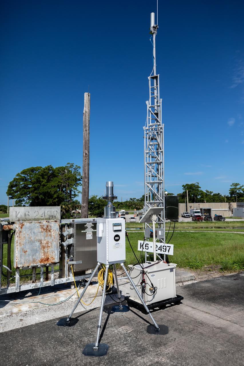
A close-up view of one of several Environmental Continuous Air Monitors, or ECAMS, located in the Space Coast area on July 27, 2020, in preparation for launch of NASA’s Mars 2020 mission on July 30. The ECAMS are updated versions of those that were used for the launch of Curiosity. The Data Collection and Assessment Center uses information from the network of remote monitoring devises, including several that are located in areas for specific weather forecasting reported back to the operations center.
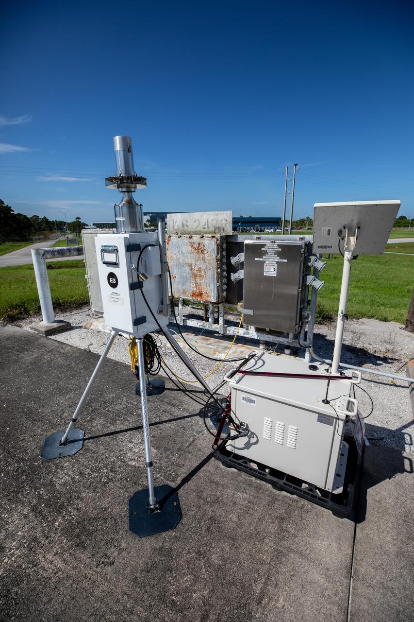
A close-up view of one of several Environmental Continuous Air Monitors, or ECAMS, located in the Space Coast area on July 27, 2020, in preparation for launch of NASA’s Mars 2020 mission on July 30. The ECAMS are updated versions of those that were used for the launch of Curiosity. The Data Collection and Assessment Center uses information from the network of remote monitoring devises, including several that are located in areas for specific weather forecasting reported back to the operations center.
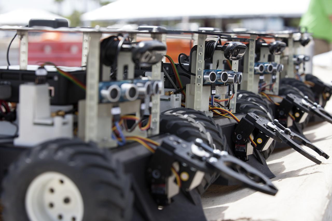
This close-up shows Swarmie robots that were programmed with computer code by college and university students. During the Swarmathon competition at the Kennedy Space Center Visitor Complex, the small robots looked for "resources" in the form of cubes with AprilTags, similar to barcodes. Similar robots could help find resources when astronauts explore distant locations, such as the moon or Mars.

NASA Administrator Jim Bridenstine made his first official visit to the agency's Kennedy Space Center on Monday, Aug. 6, 2018. His up-close look at the premier, multi-user spaceport began with a helicopter tour over the bustling Florida spaceport that included the center's Launch Complex 39B. This will be the site where NASA's Space Launch System rocket and Orion spacecraft will liftoff on trips to the Moon, Mars and beyond.
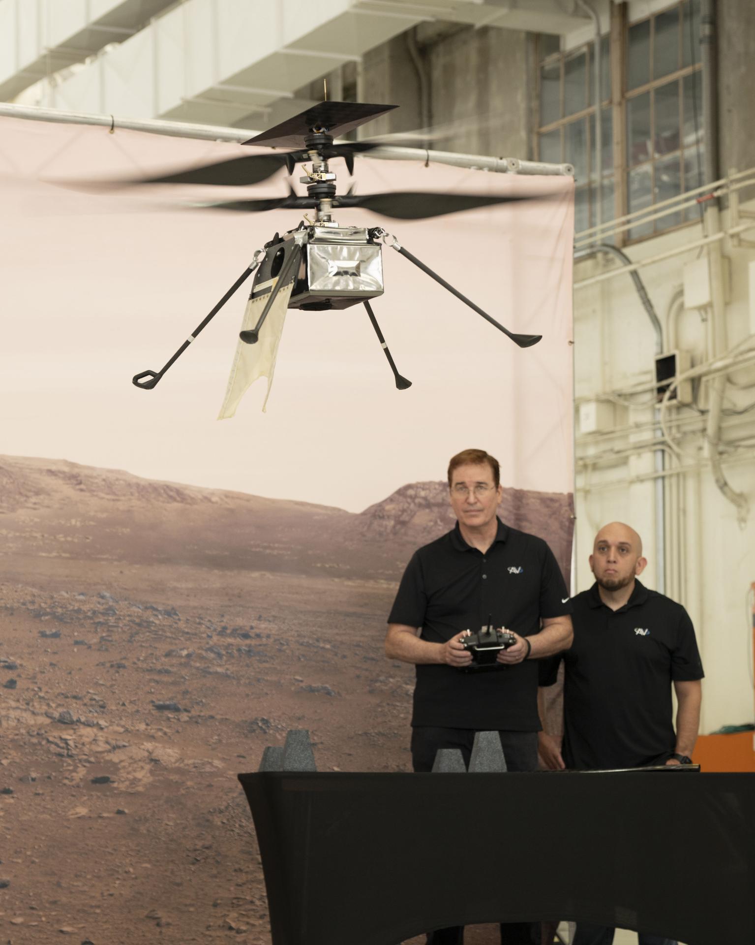
AeroVironment team members Matt Keenon, left, and Steve Quintero fly SkyFall, the next evolution of Mars helicopters, during Jet Propulsion Laboratory’s media demonstration at Los Alamitos Joint Forces Training Base, California, Thursday, Oct. 1, 2026. Visitors to the Pacific Airshow in Huntington Beach, California, Oct. 2-4, can get an up-close look at the rotorcraft at the NASA exhibit, which also highlights Artemis, the X-59, a lunar globe, and an Apollo 15 Moon rock.
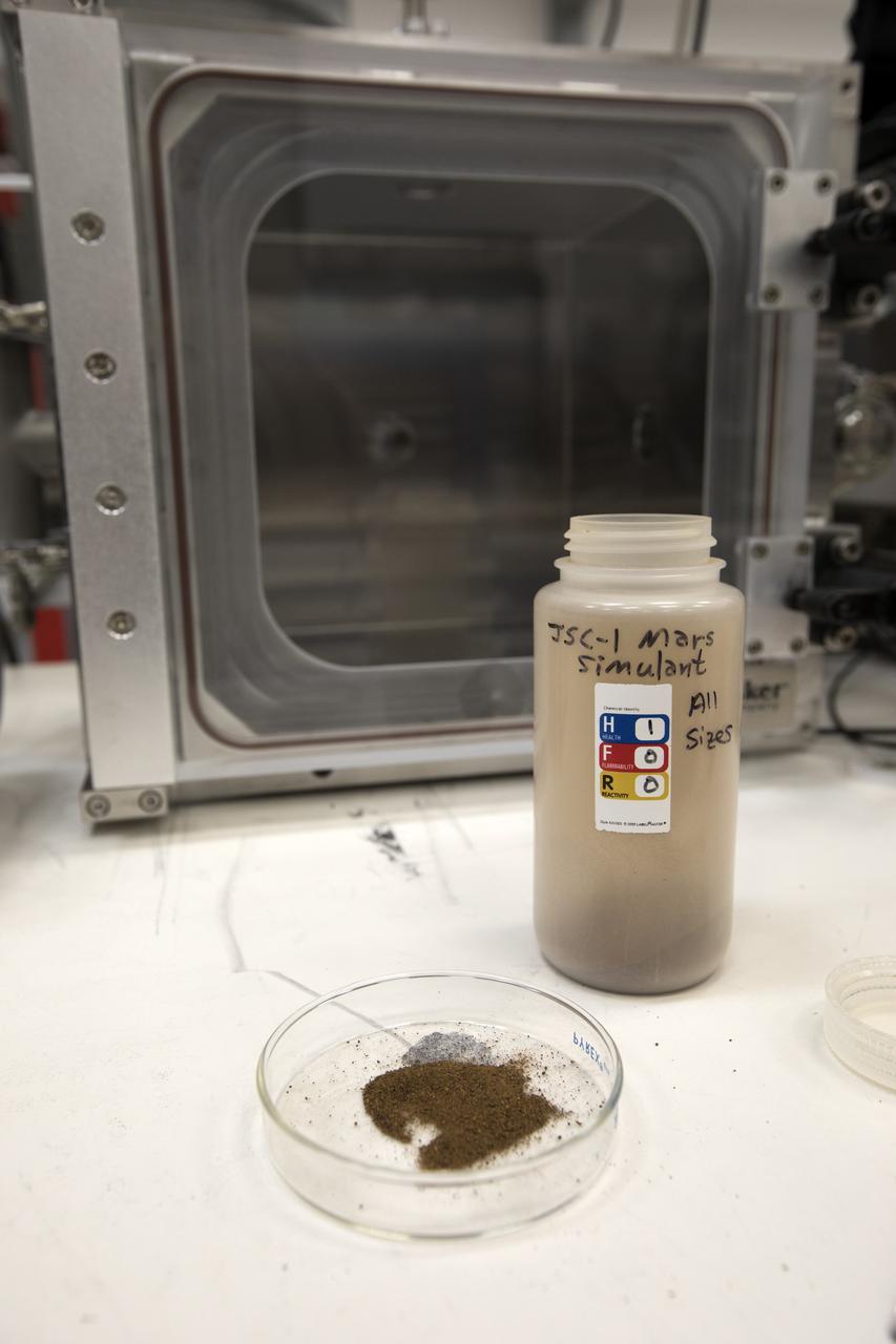
In their Swamp Works laboratory at NASA's Kennedy Space Center, Dr. Carlos Calle and Jay Phillips are testing an electrostatic precipitator using dust that closely approximates the make-up of that on Mars. They upgraded their electrostatic precipitator to fully simulate Martian atmosphere by designing and constructing a dust aerosolization pre-chamber. The agency's Journey to Mars requires cutting-edge technologies to solve the problems explorers will face on the Red Planet. Scientists are developing some of the needed solutions by adapting a device to remove the ever-present dust from valuable elements in the Martian atmosphere. Those commodities include oxygen, water and methane.
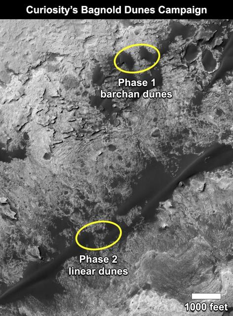
This map shows the two locations of a research campaign by NASA's Curiosity Mars rover mission to investigate active sand dunes inside Gale Crater on Mars. The Bagnold Dunes form a dark band on the northwestern flank of Mount Sharp, inside the crater. In late 2015 and early 2016, Curiosity examined crescent-shaped dunes, called barchans, which are convex on the downwind (leeward) side. This was the first close-up study of active sand dunes anywhere other than Earth. In February 2017, the rover reached a location where the dunes are linear in shape, and the mission began Phase 2 of its dunes campaign. http://photojournal.jpl.nasa.gov/catalog/PIA21269