Artist Concept of Mars Reconnaissance Orbiter
This is an artist concept of NASA Mars Reconnaissance Orbiter during the critical process of Mars orbit insertion.
Orbit Insertion by Mars Reconnaissance Orbiter Artist Concept
This illustration depicts a concept for NASA Mars Telecommunications Orbiter in flight around Mars.
Mars Telecommunications Orbiter, Artist Concept
New Mars Camera First Image of Mars from Mapping Orbit
Mars Climate Orbiter MARCI Approach Image
This graphic depicts the relative shapes and distances from Mars for five active orbiter missions plus the planet's two natural satellites. It illustrates the potential for intersections of the spacecraft orbits.  The number of active orbiter missions at Mars increased from three to five in 2014. With the increased traffic, NASA has augmented a process for anticipating orbit intersections and avoiding collisions.  NASA's Mars Odyssey and MRO (Mars Reconnaissance Orbiter) travel near-circular orbits. The European Space Agency's Mars Express, NASA's MAVEN (Mars Atmosphere and Volatile Evolution) and India's MOM (Mars Orbiter Mission), travel more elliptical orbits. Phobos and Deimos are the two natural moons of Mars.  http://photojournal.jpl.nasa.gov/catalog/PIA19396
Diverse Orbits Around Mars Graphic
Artist concept of NASA Mars Reconnaissance Orbiter.  http://photojournal.jpl.nasa.gov/catalog/PIA04241
Artist concept of Mars Reconnaissance Orbiter
NASA Mars Reconnaissance Orbiter dips into the thin martian atmosphere to adjust its orbit in this artist concept illustration.
Mars Reconnaissance Orbiter Aerobraking Artist Concept
Engineers and technicians at Lockheed Martin Space Systems, Denver, building the Mars Reconnaissance Orbiter for NASA.
Mars Reconnaissance Orbiter in High Bay
The Compact Reconnaissance Imaging Spectrometer for Mars CRISM aboard NASA Mars Reconnaissance Orbiter obtained this spectrum for comet C/2013 A1 Siding Spring during the comet close approach to Mars.
Mars-Orbiting Spectrometer Shows Dusty Comet Spectrum
This frame from an animated artist rendering begins with NASA Mars Reconnaissance Orbiter spacecraft above Mars. The movie then transitions to a sequence of HiRISE images of the comet taken as it flew past Mars.
Mars Orbiter Observes Comet Siding Spring Animation
The Mars Climate Sounder instrument, shown here prior to its installation onto NASA Mars Reconnaissance Orbiter for the mission 2006 launch, will get a similar-looking sibling at Mars in 2016.
Climate Sounder Instrument for Mars Reconnaissance Orbiter
New Mars Camera First Image of Mars from Mapping Orbit Full Frame
Interpreting Radar View near Mars South Pole, Orbit 1334
Interpreting Radar View near Mars South Pole, Orbit 1360
Interpreting Radar View near Mars South Pole, Orbit 1334
Radar View of Layering near Mars South Pole, Orbit 1360
Interpreting Radar View near Mars North Pole, Orbit 1512
Radar View of Layering near Mars South Pole, Orbit 1360
In late October 2004, NASA Mars Reconnaissance Orbiter was moved from the High Bay 100,000-class clean room at Lockheed Martin Space Systems, Denver, to the facility Reverberant Acoustic Lab.
Moving the Mars Reconnaissance Orbiter
Workers at Lockheed Martin Space Systems, Denver, hoist a telescopic camera for installation onto NASA Mars Reconnaissance Orbiter spacecraft on Dec. 11, 2004.
Hoisting a Camera for Mars Reconnaissance Orbiter
Workers at Lockheed Martin Space Systems, Denver, install a telescopic camera on NASA Mars Reconnaissance Orbiter spacecraft on Dec. 11, 2004.
Installing a Camera on Mars Reconnaissance Orbiter
Workers at Lockheed Martin Space Systems, Denver, position a telescopic camera for installation onto NASA Mars Reconnaissance Orbiter spacecraft on Dec. 11, 2004.
Positioning a Camera for Mars Reconnaissance Orbiter
NASA's Mars Reconnaissance Orbiter has been observing Mars in sharp detail for more than a decade, enabling it to document many types of changes, such as the way winds alter the appearance of this recent impact site.  The space-rock impact that created this blast zone occurred sometime between September 2005 and February 2006, as bracketed by observations made with the Mars Orbiter Camera on NASA's Mars Global Surveyor spacecraft. The location is between two large volcanos, named Ascraeus Mons and Pavonis Mons, in a dusty area of the Tharsis region of Mars. During the period from 2007 to 2012, winds blowing through the pass between the volcanoes darkened some regions and brightened others, probably by removing and depositing dust.   The view covers an area about 1.0 mile (1.6 kilometers) across, at 7 degrees north latitude, 248 degrees east longitude. North is toward the top.  An animation is availalble at http://photojournal.jpl.nasa.gov/catalog/PIA21267
Mars Reconnaissance Orbiter Observes Changes
This artist concept of NASA Mars Reconnaissance Orbiter highlights the spacecraft radar capability.
Mars Reconnaissance Orbiter Radar at Work, Top View Artist Concept
This image is an artist concept of a view looking down on NASA Mars Reconnaissance Orbiter.
Mars Reconnaissance Orbiter Radar, Top View Artist Concept
NASA Mars Reconnaissance Orbiter passes over the planet south polar region in this artist concept illustration.
Mars Reconnaissance Orbiter over Pole Artist Concept
This artist concept of NASA Mars Reconnaissance Orbiter features the spacecraft main bus facing down, toward the red planet.
Mars Reconnaissance Orbiter, Front View Artist Concept
NASA Mars Reconnaissance Orbiter passes above a portion of the planet called Nilosyrtis Mensae in this artist concept illustration.
Mars Reconnaissance Orbiter over Nilosyrtis Artist Concept
The high resolution imaging science experiment HiRISE is one of six science instruments for NASA Mars Reconnaissance Orbiter.
Telescopic Camera for Mars Reconnaissance Orbiter, Front End
This frame from an animation shows NASA Mars Reconnaissance Orbiter flying over NASA Curiosity shown in pink as the rover lands on the Red Planet.
Mars Reconnaissance Orbiter Flying Over Mars
Lockheed Martin Space Systems engineer Terry Kampmann left and lead technician Jack Farmerie work on assembly and test of NASA Mars Reconnaissance Orbiter spacecraft bus in a cleanroom at the company Denver facility.
Mars Reconnaissance Orbiter Taking Shape
Five images of comet Siding Spring taken within a 35-minute period as it passed near Mars on Oct. 19, 2014, provide information about the size of the comet nucleus. The images were acquired by the HiRISE camera on NASA Mars Reconnaissance Orbiter.
Mars Orbiter Sizes Up Passing Comet
These two infrared images of comet C/2013 A1 Siding Spring were taken by the Compact Reconnaissance Imaging Spectrometer for Mars CRISM aboard NASA Mars Reconnaissance Orbiter on Oct. 19, 2014.
Images From Mars-Orbiting Spectrometer Show Comet Coma
This image taken by NASA Mars Reconnaissance Orbite on May 19, 2010, shows an impact crater that had not existed when the same location on Mars was previously observed in March 2008.
Mars Orbiter Laser Altimeter, Thermal Emission Imaging System
NASA Mars Reconnaissance Orbiter used its HiRISE camera to obtain this view of an area with unusual texture on the southern floor of Gale Crater. An enigmatic deposit appears to have flowed into the small crater from the south.
For a Decade Orbiting Mars: One Recent View
This image of Santa Maria Crater was taken by HiRISE camera on NASA Mars Reconnaissance Orbiter where NASA rover Opportunity approached Santa Maria Crater in December 2010.
Orbital Observations of Crater on Mars Rover Route
A view from NASA's Mars Reconnaissance Orbiter on April 8, 2015, catches sight of NASA's Curiosity Mars rover passing through a valley called "Artist's Drive" on the lower slope of Mount Sharp.  The image is from the orbiter's High Resolution Imaging Science Experiment (HiRISE) camera. It shows the rover's position after a drive of about 75 feet (23 meters) during the 949th Martian day, or sol, of the rover's work on Mars.  North is toward the top. The rover's location, with its shadow extending toward the right, is indicated with an inscribed rectangle. The view in this image covers an area about 550 yards (500 meters) across.   http://photojournal.jpl.nasa.gov/catalog/PIA19392
Mars Orbiter Sees Curiosity Rover in Artist Drive
NASA Mars Reconnaissance Orbiter MRO launched at 7:43 a.m. EDT atop a Lockheed Martin Atlas V rocket from Launch Complex 41 at Cape Canaveral Air Force Station in Florida on Aug. 12, 2005.
Mars Reconnaissance Orbiter MRO Launches
A telescopic camera called the High Resolution Imaging Science Experiment, or HiRISE, right was installed onto the main structure of NASA Mars Reconnaissance Orbiter left on Dec. 11, 2004 at Lockheed Martin Space Systems, Denver.
Camera Ready to Install on Mars Reconnaissance Orbiter
This annotated image taken on Dec. 15, 2014 by NASA Mars Reconnaissance Orbiter shows a bright feature interpreted as the United Kingdom Beagle 2 Lander, which was never heard from after its expected Dec. 25, 2003, landing.
Beagle 2 Lander Observed by Mars Reconnaissance Orbiter
These two frames were taken of the same place on Mars by the same orbiting camera before (left) and after some images from the camera began showing unexpected blur.  The images are from the High Resolution Imaging Science Experiment (HiRISE) camera on NASA's Mars Reconnaissance Orbiter. They show a patch of ground about 500 feet or 150 meters wide in Gusev Crater. The one on the left, from HiRISE observation ESP_045173_1645, was taken March 16, 2016. The one on the right was taken Jan. 9, 2018. Gusev Crater, at 15 degrees south latitude and 176 degrees east longitude, is the landing site of NASA's Spirit Mars rover in 2004 and a candidate landing site for a rover to be launched in 2020. HiRISE images provide important information for evaluating potential landing sites. The smallest boulders with measurable diameters in the left image are about 3 feet (90 centimeters) wide. In the blurred image, the smallest measurable are about double that width.  As of early 2018, most full-resolution images from HiRISE are not blurred, and the cause of the blur is still under investigation. Even before blurred images were first seen, in 2017, observations with HiRISE commonly used a technique that covers more ground area at half the resolution. This shows features smaller than can be distinguished with any other camera orbiting Mars, and little blurring has appeared in these images.   https://photojournal.jpl.nasa.gov/catalog/PIA22215
Slight Blurring in Newer Image from Mars Orbiter
Atlas V launch vehicle, 19 stories tall, with a two-ton NASA Mars Reconnaissance Orbiter MRO on top, lifts off the pad on Launch Complex 41 at Cape Canaveral Air Force Station in Florida on Aug. 12, 2005.
Mars Reconnaissance Orbiter MRO Lifts Off
With the Atlantic Ocean as a backdrop, an Atlas V launch vehicle, 19 stories tall, with a two-ton NASA Mars Reconnaissance Orbiter MRO on top, roars away from Launch Complex 41 at Cape Canaveral Air Force Station.
Mars Reconnaissance Orbiter MRO Roars Away
A Regional View of Mars on Orbit 63
Mars Orbiter Laser Altimeter Passes
A telescopic camera called the High Resolution Imaging Science Experiment, or HiRISE, was installed onto the main structure of NASA Mars Reconnaissance Orbiter on Dec. 11, 2004 at Lockheed Martin Space Systems, Denver, Colo. HiRISE is at the top of the spacecraft in this image. Some other large components, including solar panels and the high-gain antenna, had not yet been installed. The orbiter is scheduled for launch in August 2005 carrying six science instruments. Ball Aerospace and Technology Corp., Boulder, Colo., built HiRISE for the University of Arizona, Tucson, to supply for the mission.  http://photojournal.jpl.nasa.gov/catalog/PIA07210
Mars Reconnaissance Orbiter After Camera Installation
NASA rover Curiosity appears as a bluish dot near the lower right corner of this enhanced-color view from the HiRISE camera on NASA Mars Reconnaissance Orbiter.
View From Mars Orbiter Showing Curiosity Rover at Shaler
NASA's 2001 Mars Odyssey orbiter arrived at Mars on Oct. 24, 2001.  Over the past two decades, the mission has mapped the composition of the Martian surface, providing a window to the past so scientists could piece together how the planet evolved. It has also served as a vital asset in relaying communications between landers and rovers at the Red Planet and the mission teams back on Earth.  Here are some of the highlights of the last 20 years:      Mars Odyssey has completed 80,000 orbits.     Mars Odyssey has taken more than 1.2 million images.     Mars Odyssey has returned 16 terabits of total science data to Earth, including 1 terabit of data relayed from Mars surface missions.     Mars Odyssey has provided communications relay for six Mars surface missions: the Phoenix and InSight landers, as well as the Spirit, Opportunity, Curiosity, and Perseverance rovers.  https://photojournal.jpl.nasa.gov/catalog/PIA24915
Mars Odyssey Orbiter By the Numbers
NASA Mars Reconnaissance Orbiter MRO launched at 7:43 a.m. EDT atop a Lockheed Martin Atlas V rocket from Launch Complex 41 at Cape Canaveral Air Force Station in Florida on Aug. 12, 2005.
Mars Reconnaissance Orbiter MRO Multipurpose Mission Successfully Launched
NASA Mars Reconnaissance Orbiter will be the largest spacecraft to orbit Mars, weighing 2,180 kilograms 4,796 pounds at liftoff.
Orbiter Near Final Configuration
MGS Mars Orbiter Laser Altimeter MOLA - Mars/Earth Relief Comparison
This artist concept of NASA Mars Reconnaissance Orbiter at Mars features one of its instruments -- the Mars Climate Sounder -- in action.
Mars Climate Sounder Artist Concept
The feature that appears bright blue at the center of this scene is NASA's Curiosity Mars rover on the northwestern flank of Mount Sharp, viewed by NASA's Mars Reconnaissance Orbiter. Curiosity is approximately 10 feet long and 9 feet wide (3.0 meters by 2.8 meters).  The view is a cutout from observation ESP_050897_1750 taken by the High Resolution Imaging Science Experiment (HiRISE) camera on the orbiter on June 5, 2017. HiRISE has been imaging Curiosity about every three months, to monitor the surrounding features for changes such as dune migration or erosion.   When the image was taken, Curiosity was partway between its investigation of active sand dunes lower on Mount Sharp, and "Vera Rubin Ridge," a destination uphill where the rover team intends to examine outcrops where hematite has been identified from Mars orbit. The rover's surroundings include tan rocks and patches of dark sand.   As in previous HiRISE color images of Curiosity since the rover was at its landing site, the rover appears bluer than it really is. HiRISE color observations are recorded in a red band, a blue-green band and an infrared band, and displayed in red, green and blue. This helps make differences in Mars surface materials apparent, but does not show natural color as seen by the human eye.  Lower Mount Sharp was chosen as a destination for the Curiosity mission because the layers of the mountain offer exposures of rocks that record environmental conditions from different times in the early history of the Red Planet. Curiosity has found evidence for ancient wet environments that offered conditions favorable for microbial life, if Mars has ever hosted life.  https://photojournal.jpl.nasa.gov/catalog/PIA21710
Curiosity Rover on Mount Sharp, Seen from Mars Orbit
Among the many discoveries by NASA's Mars Reconnaissance Orbiter since the mission was launched on Aug. 12, 2005, are seasonal flows on some steep slopes. These flows have a set of characteristics consistent with shallow seeps of salty water.  This July 21, 2015, image from the orbiter's High Resolution Imaging Science Experiment (HiRISE) camera shows examples of these flows on a slope within Coprates Chasma, which is part of the grandest canyon system on Mars, Valles Marineris. The image covers an area of ground one-third of a mile (536 meters) wide.  These flows are called recurring slope lineae because they fade and disappear during cold seasons and reappear in warm seasons, repeating this pattern every Martian year. The flows seen in this image are on a north-facing slope, so they are active in northern-hemisphere spring. The flows emanate from the relatively bright bedrock and flow onto sandy fans, where they are remarkably straight, following linear channels. Valles Marineris contains more of these flows than everywhere else on Mars combined. At any season, some are active, though on different slope aspects at different seasons.  Future human explorers (and settlers?) will need water to drink, grow food, produce oxygen to breath, and make rocket fuel. Bringing all of that water from Earth would be extremely expensive, so using water on Mars is essential. Although there is plenty of water ice at high latitudes, surviving the cold winters would be difficult. An equatorial source of water would be preferable, so Valles Marineris may be the best destination. However, the chemistry of this water must be understood before betting any lives on it.   http://photojournal.jpl.nasa.gov/catalog/PIA19805
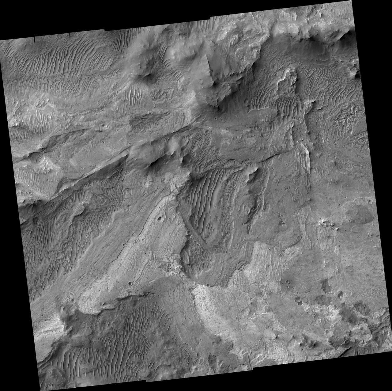
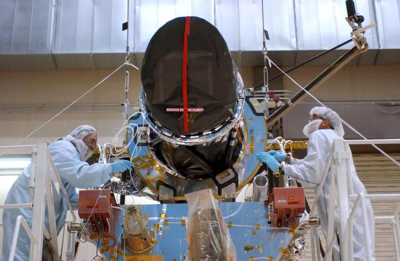
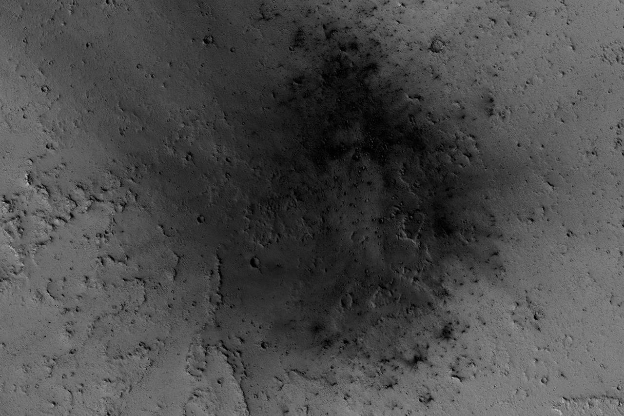
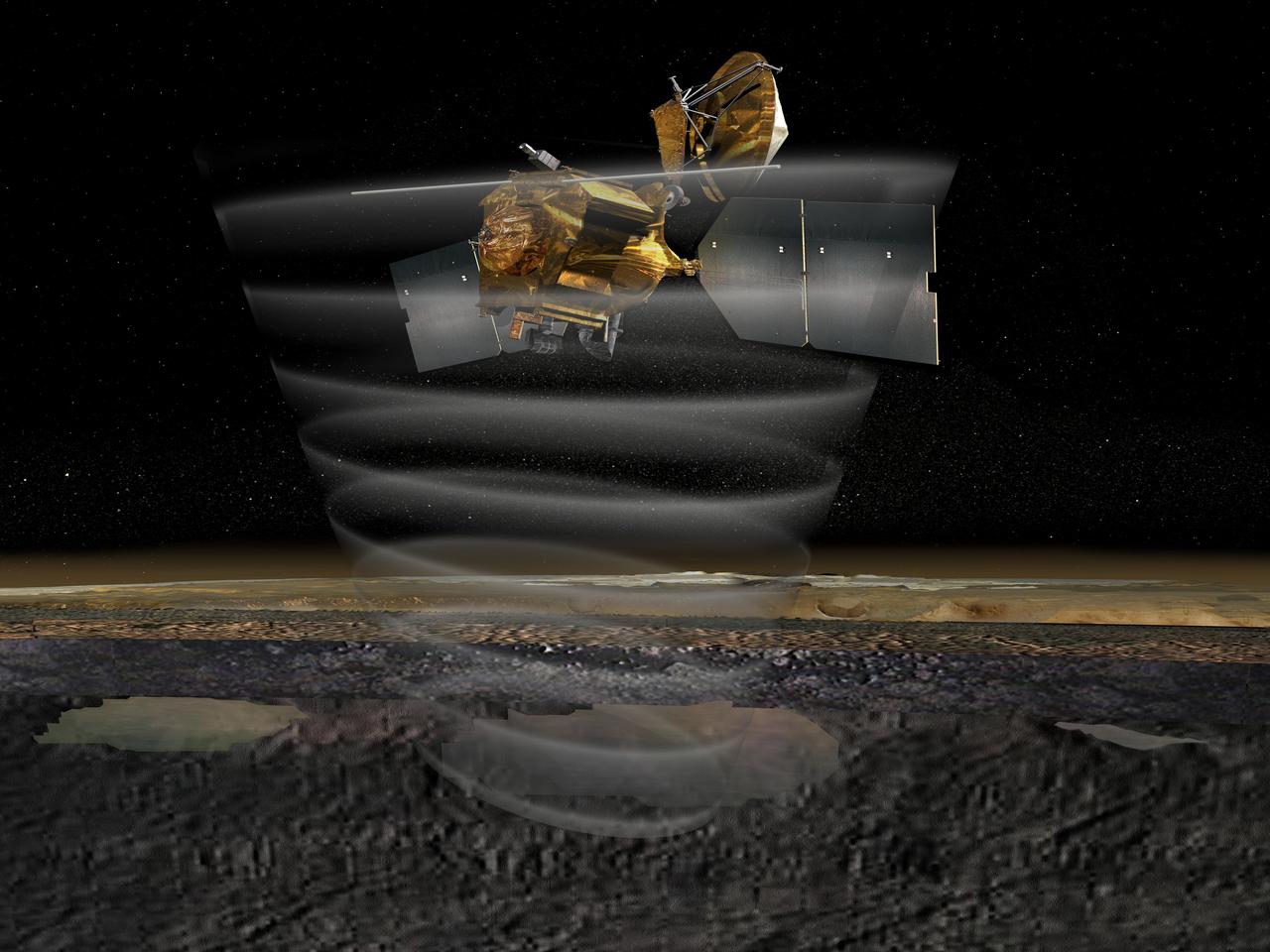
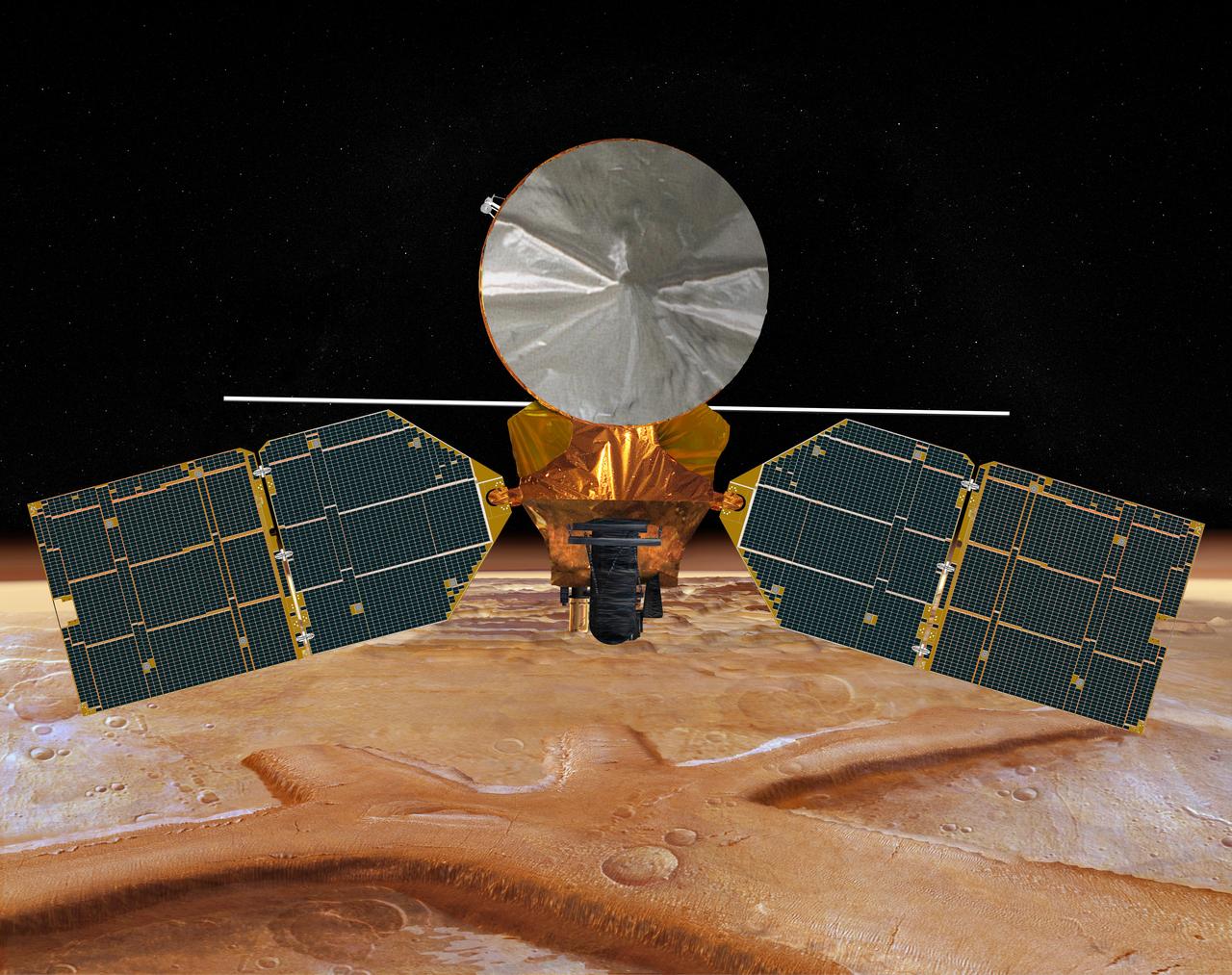
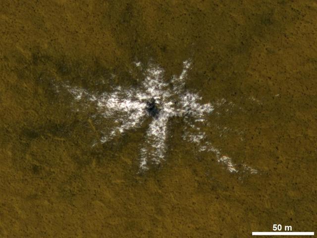
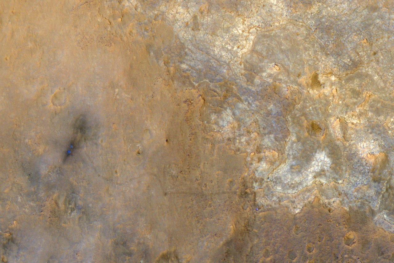
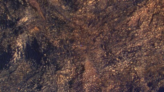
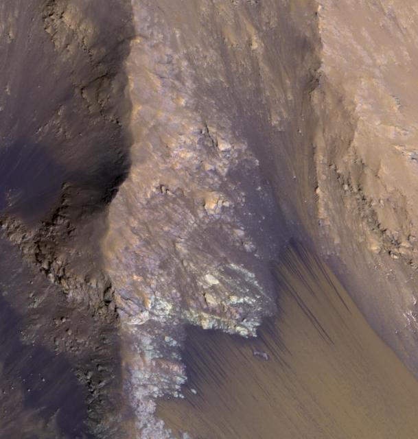
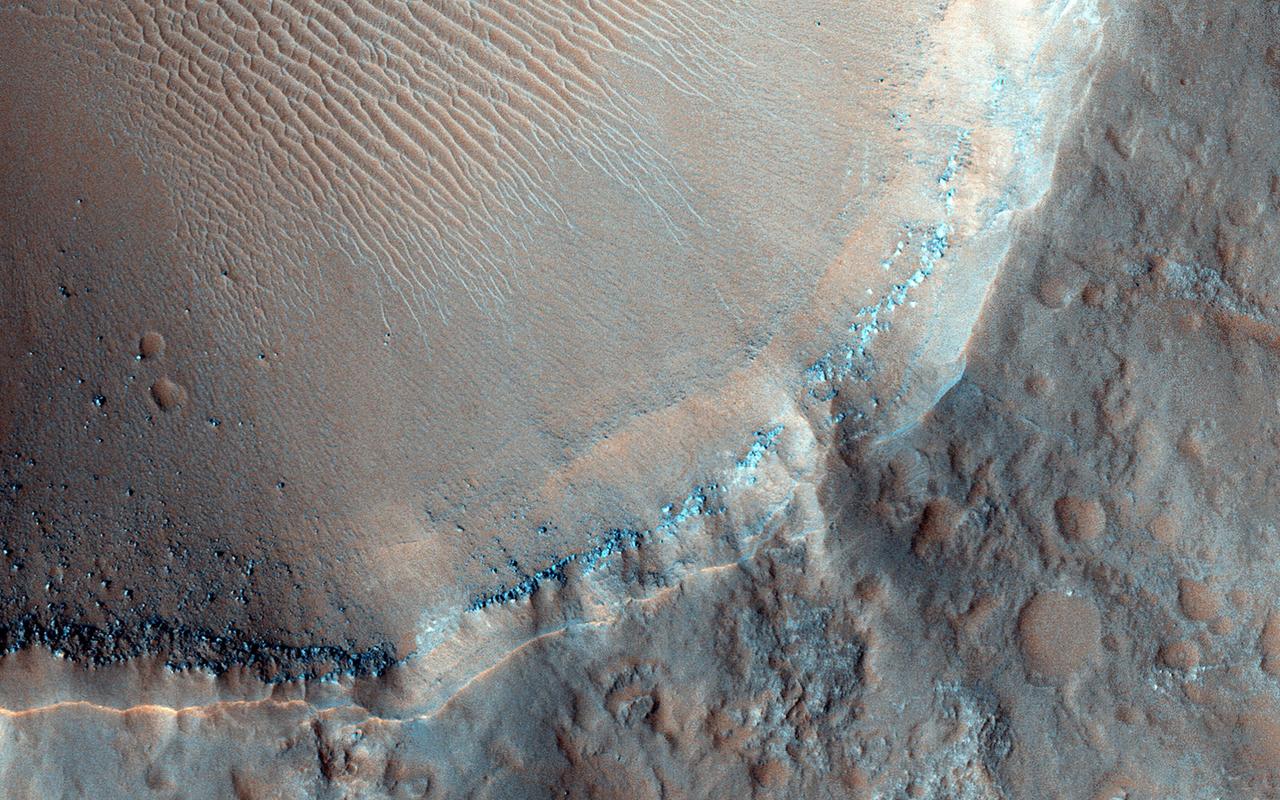
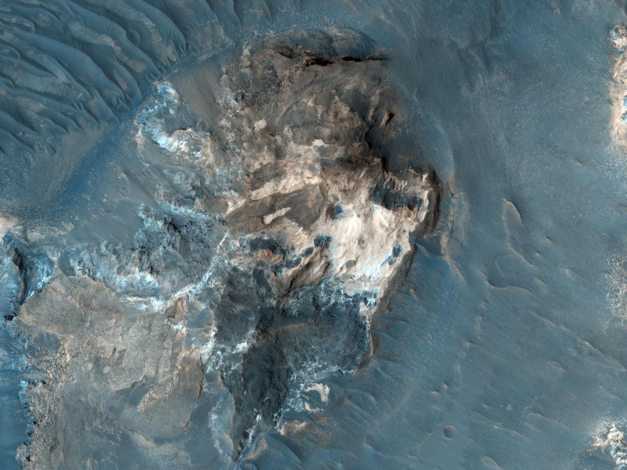
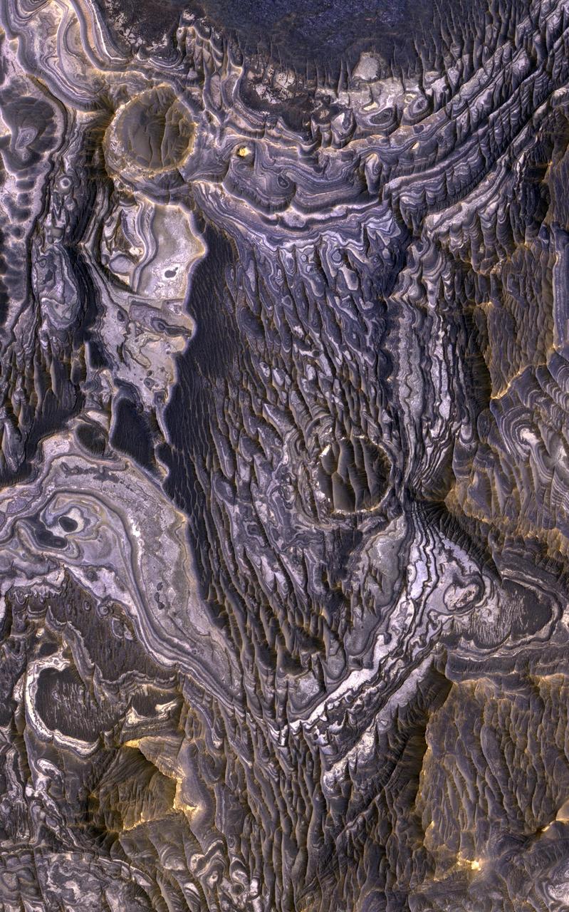
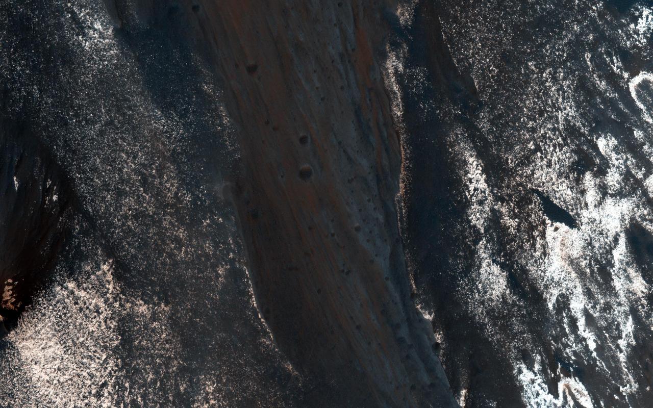
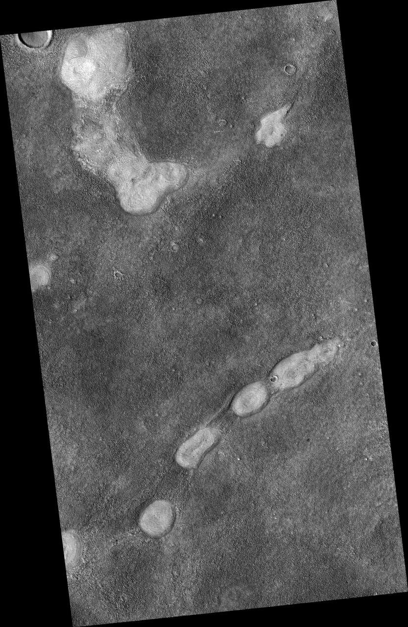
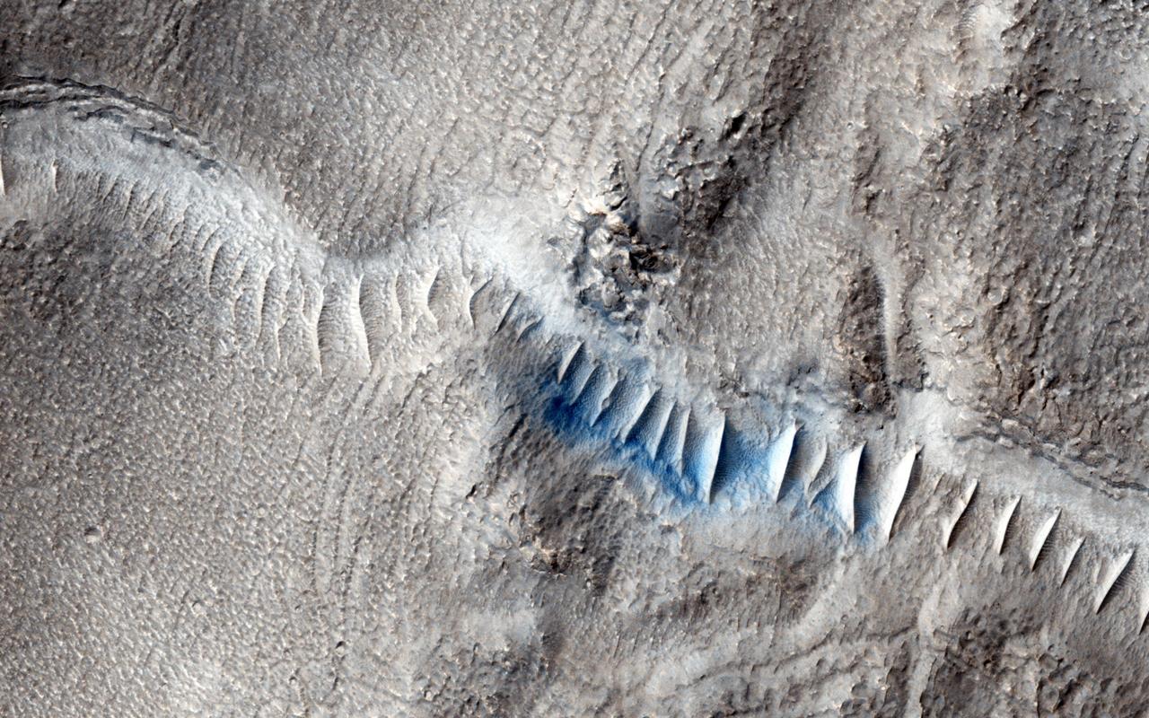
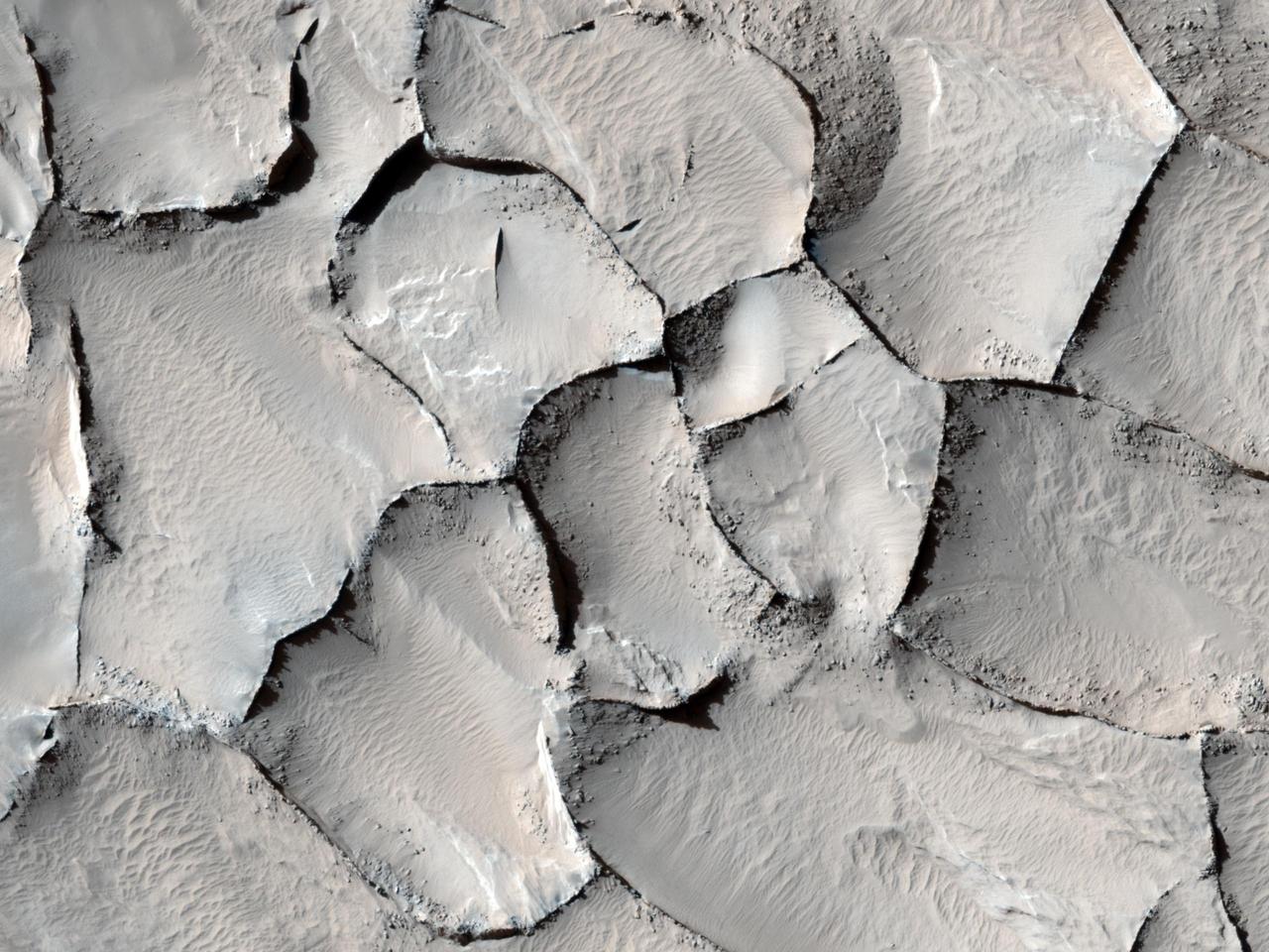
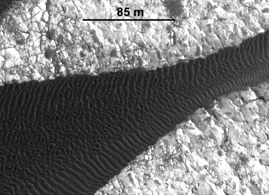
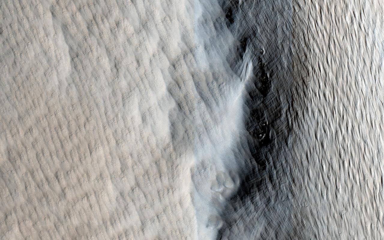
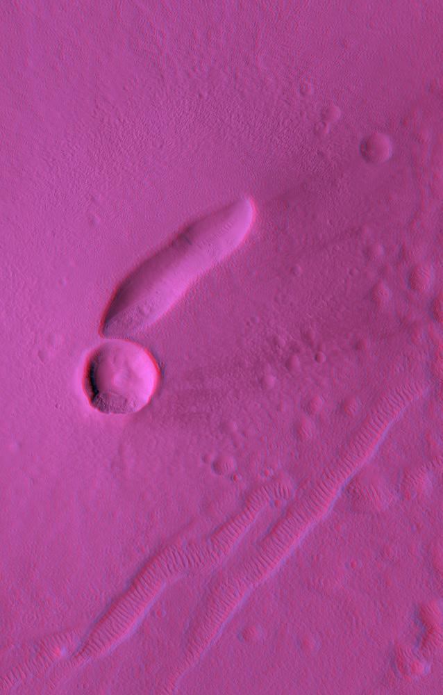
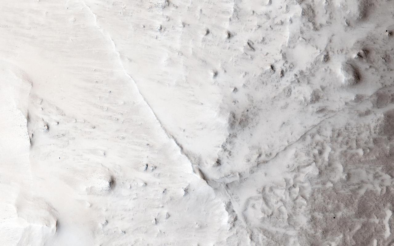
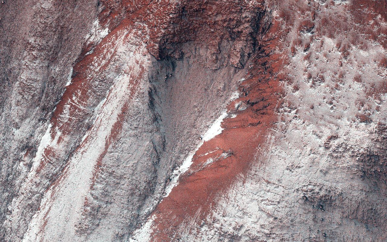
For Anniversary of Orbiter Launch: Seasonal Flows in Mars Valles Marineris
MGS Mars Orbiter Camera: 10 Years In Space
Mars Orbiter Laser Altimiter MOLA Globe
Pathfinder Landing Site Observed by Mars Orbiter Camera
This set of images from cameras on NASA Mars Reconnaissance Orbiter documents the appearance of a new cluster of impact craters on Mars. The orbiter has imaged at least 248 fresh craters, or crater clusters, on Mars.
Fresh Cluster of Impact Craters on Mars
The Mars Climate Sounder instrument on NASA Mars Reconnaissance Orbiter maps the vertical distribution of temperatures, dust, water vapor and ice clouds in the Martian atmosphere as the orbiter flies a near-polar orbit.
Martian Atmosphere Profiles
This illustration shows NASA's Mars Ascent Vehicle (MAV), which will carry tubes containing Martian rock and soil samples into orbit around Mars, where ESA's Earth Return Orbiter spacecraft will enclose them in a highly secure containment capsule and deliver them to Earth.  https://photojournal.jpl.nasa.gov/catalog/PIA25078
Mars Samples in Orbit (Illustration)
This image from NASA Mars Reconnaissance Orbiter covers a region of Mars near Nili Fossae that contains some of the best exposures of ancient bedrock on Mars.
A Wild Assortment of Jumbled Rocks
This image is of Jezero Crater on Mars, the landing site for NASA's Mars 2020 mission. It was taken by instruments on NASA's Mars Reconnaissance Orbiter (MRO), which regularly takes images of potential landing sites for future missions.  On ancient Mars, water carved channels and transported sediments to form fans and deltas within lake basins. Examination of spectral data acquired from orbit show that some of these sediments have minerals that indicate chemical alteration by water. Here in Jezero Crater delta, sediments contain clays and carbonates.  https://photojournal.jpl.nasa.gov/catalog/PIA23239
Jezero Crater, Mars 2020's Landing Site
This image from NASA Mars Reconnaissance Orbiter shows Morava Valles, a small outflow channel in the Margaritifer Sinus region of Mars.
Seeing Beneath the Surface in Morava Valles
This observance from NASA Mars Reconnaissance Orbiter shows a formation of large outflow channels on Mars Aureum Chaos.
Light-Toned Outcrop in Aureum Chaos
NASA Mars Reconnaissance Orbiter reveals that gullies, or ravines, are landforms commonly found in the mid-latitudes on Mars, particularly in the Southern highlands.
A New Gully Channel in Terra Sirenum
Nirgal Vallis is one of the largest and longest valley networks on Mars as seen by NASA Mars Reconnaissance Orbiter.
Nirgal Vallis Tributaries
Procedure for Finding New Impact Sites on Mars Using the Mars Global   Surveyor Mars Orbiter Camera
Procedure for Finding New Impact Sites on Mars Using the Mars Global Surveyor Mars Orbiter Camera
This image from NASA Mars Reconnaissance Orbiter shows impact craters.
New Impact Site
A surprise landslump in Melas Chasma was observed by NASA Mars Reconnaissance Orbiter.
A Surprise Landslump in Melas Chasma
This image of Victoria Crater in the Meridiani Planum region of Mars was taken by the High Resolution Imaging Science Experiment HiRISE camera on NASA Mars Reconnaissance Orbiter at more of a sideways angle than earlier orbital images of this crater.
Oblique View of Victoria Crater
This graphic depicts the Mars Climate Sounder instrument on NASA Mars Reconnaissance Orbiter measuring the temperature of a cross section of the Martian atmosphere as the orbiter passes above the south polar region.
Scanning Martian Atmospheric Temperatures Graphic
This view of Stokes Crater is a mosaic of images taken by NASA Mars Reconnaissance Orbiter and ESA Mars Express showing at least one of the nine craters in the northern lowlands of Mars with exposures of hydrated minerals detected from orbit.
Hydrated Minerals Exposed at Stokes, Northern Mars
This image from NASA Mars Reconnaissance Orbiter is one of the rare examples of a fresh lunar-like crater on Mars. The impact crater formed in the Tharsis region.
A Fresh, Lunar-Like Crater on Mars
The track left by an oblong boulder as it tumbled down a slope on Mars runs from upper left to right center of this image taken by NASA Mars Reconnaissance Orbiter.
An Irregular, Upright Boulder on Mars
This image from NASA Mars Reconnaissance Orbiter is a proposed future Mars landing site in Acidalia Planitia targets densely occurring mounds thought to be mud volcanoes.
Proposed Future Mars Landing Site: Acidalia Planitia Mud Volcanoes
The Compact Reconnaissance Imaging Spectrometer for Mars, an instrument on NASA Mars Reconnaissance Orbiter, obtained information confirming material excavated by a fresh impact and Identified as water ice.
Material Excavated by a Fresh Impact and Identified as Water Ice
This field of dunes lies on the floor of an old crater in Noachis Terra, one of the oldest places on Mars, as seen by NASA Mars Reconnaissance Orbiter.
Colorful Dunes
Straight and meandering thin ridges are periodically found on Mars. Such ridges can form in a variety of ways, as seen in this image from NASA Mars Reconnaissance Orbiter.
Linear Ridges
This image from NASA Mars Reconnaissance Orbiter MRO is part of simulated flyover showing rhythmic layers of sedimentary rock inside Becquerel crater on Mars.
Flyover Animation of Becquerel Crater on Mars
This image from NASA Mars Reconnaissance Orbiter spacecraft shows part of a broad plain covered with cratered cones and domes in the Northern lowlands of Mars.
Cratered Cones in Acidalia Planitia
The High Resolution Imaging Science Experiment camera on NASA Mars Reconnaissance Orbiter captured this image of spider-shaped features on Mars, carved by vaporizing dry ice.
Radial Channels Carved by Dry Ice
This observation from NASA Mars Reconnaissance Orbiter shows enigmatic, shallowly incised valleys, found in some mid- to low-latitude regions on Mars.
Valleys in Tyrrhena Terra
Monitoring by NASA Mars Reconnaissance Orbiter HiRISE has shown that gully formation on Mars occurs in winter and early spring in times and places with frost on the ground.
Frosty Gullies
Three pairs of before and after images from NASA Mars Reconnaissance Orbiter illustrate movement of ripples on dark sand dunes in the Nili Patera region of Mars.
Changes in Ripples on Martian Dunes in Nili Patera
The formation of recurring slope lineae is a fascinating process on Mars. These RSLs show up in the spring and fade in the winter as seen by NASA Mars Reconnaissance Orbiter.
Slope Lineae along Coprates Chasma Ridge
This enhanced-color image from NASA Mars Reconnaissance Orbiter shows sand dunes trapped in an impact crater in Noachis Terra, Mars.
Dunes in Noachis Terra Region of Mars
The terrain in this image from NASA Mars Reconnaissance Orbiter lies in the Deuteronilus Mensae region along the highland-lowland dichotomy boundary in the northern hemisphere of Mars.
Lobate Debris Apron in Deuteronilus Mensae
This view, taken by NASA Mars Reconnaissance Orbiter, shows color variations in bright layered deposits on a plateau near Juventae Chasma in the Valles Marineris region of Mars.
Bright Layered Deposits with Clues of Acidic Water
This image shows numerous dark shapes and bright spots on a sand dune in the Northern polar regions of Mars. This observation is from NASA Mars Reconnaissance Orbiter.
Shapes and Spots on a Polar Sand Dune
This observation from NASA Mars Reconnaissance Orbiter shows sand dunes in late Northern spring on Mars, mixed with rock outcrops on the floor of a large crater.
Squiggly Sand Dunes
Recent small craters discovered by NASA Mars Reconnaissance Orbiter expose buried ice in the middle latitudes of Mars. This ice is a record of past climate change.
Fresh Crater Revealing Buried Ice
This is only one of four impact craters on Mars known that possesses intact layers exposed in the central uplift in this image from NASA Mars Reconnaissance Orbiter.
Beautiful Layers in the Central Uplift of Mazamba Crater
This anaglyph from NASA Mars Reconnaissance Orbiter spacecraft, is of East Mareotis Tholus, a small volcano in Tempe Terra, Mars. 3D glasses are necessary to view this image.
Anaglyph of East Mareotis Tholus
This image, taken by the HiRISE camera onboard NASA Mars Reconnaissance Orbiter is of a gully on a south-facing slope in middle southern latitudes of Mars.
Changes in a Gully in a Mars Crater Two-Image Comparison
This image from NASA Mars Reconnaissance Orbiter shows an impact crater with a diameter of approximately 2 kilometers located in the Coloe Fossae region of Mars.
Breached Rim of a Circular Depression
A Martian dust devil was captured winding its way along the Amazonis Planitia region of Northern Mars on March 14, 2012 NASA Mars Reconnaissance Orbiter.
Mars Whirling Dust Devil
With NASA Mars Reconnaissance Orbiter HiRISE camera and its powerful resolution, other mission teams can request images of potential future landing sites on Mars.
A Possible Landing Site for NASA InSight Mission
The upper portion of this map is from an observation by the Context Camera on NASA Mars Reconnaissance Orbiter of a field of dark sand dunes in the Nili Patera region of Mars.
Location Map for Images of Changing Martian Dunes
This image captured by NASA Mars Reconnaissance Orbiter shows Tharsis Tholus, one of the smaller shield volcanoes on Mars massive Tharsis Rise.
Dust Covered Channels on Tharsis Tholus