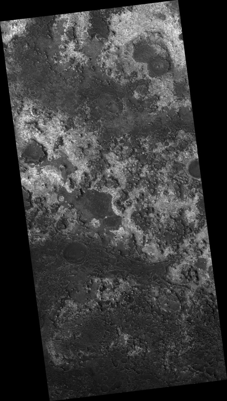
![In Andy Weir's "The Martian," stranded astronaut Mark Watney drives from the Ares 3 landing site in Acidalia Planitia towards the Ares 4 landing site in Schiaparelli Crater via Mawrth Vallis. This image covers the entrance to Mawrth Vallis. As you can tell, driving over this terrain will be much more difficult than it was depicted in the novel or the movie. The map is projected here at a scale of 50 centimeters (19.7 inches) per pixel. [The original image scale is 58.5 centimeters (19.1 inches) per pixel (with 2 x 2 binning); objects on the order of 176 centimeters (69.2 inches) across are resolved.] North is up. http://photojournal.jpl.nasa.gov/catalog/PIA21555](https://images-assets.nasa.gov/image/PIA21555/PIA21555~medium.jpg)
In Andy Weir's "The Martian," stranded astronaut Mark Watney drives from the Ares 3 landing site in Acidalia Planitia towards the Ares 4 landing site in Schiaparelli Crater via Mawrth Vallis. This image covers the entrance to Mawrth Vallis. As you can tell, driving over this terrain will be much more difficult than it was depicted in the novel or the movie. The map is projected here at a scale of 50 centimeters (19.7 inches) per pixel. [The original image scale is 58.5 centimeters (19.1 inches) per pixel (with 2 x 2 binning); objects on the order of 176 centimeters (69.2 inches) across are resolved.] North is up. http://photojournal.jpl.nasa.gov/catalog/PIA21555
There is a candidate landing site in the Mawrth Vallis region for the European Space Agency's ExoMars rover, planned to launch in 2020. This is one of the HiRISE images acquired to evaluate this site. Mawrth Vallis has some of the most spectacular color variations seen anywhere on Mars. This color variability is due to a range of hydrated minerals -- water caused alteration of these ancient deposits -- which is why this site is of interest to study the past habitability of Mars. http://photojournal.jpl.nasa.gov/catalog/PIA21029
The THEMIS VIS camera contains 5 filters. The data from different filters can be combined in multiple ways to create a false color image. These false color images may reveal subtle variations of the surface not easily identified in a single band image. Today's false color image shows part of Mawrth Vallis. Orbit Number: 46064 Latitude: 22.2964 Longitude: 342.796 Instrument: VIS Captured: 2012-05-03 03:31 http://photojournal.jpl.nasa.gov/catalog/PIA21194
Mawrth Vallis Phyllosilicates
Mawrth Vallis Layered Deposits

Part of Mawrth Vallis
Proposed MSL Site in Mawrth Vallis
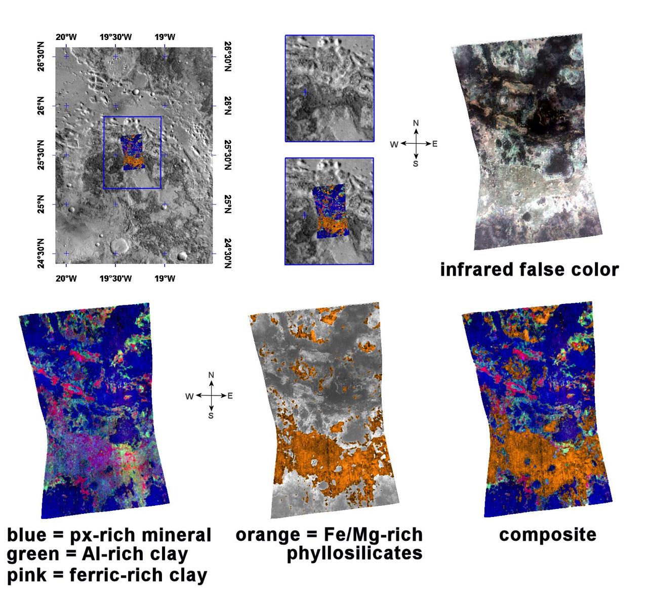
Spectrometer Observations Near Mawrth Vallis
Layered Rocks Near Mawrth Vallis
Clay Minerals in Mawrth Vallis Region of Mars
Mawrth Vallis, a Finalist Not Selected as a Landing Site for Curiosity
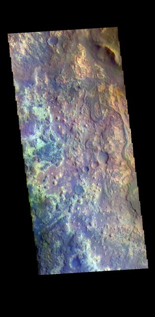
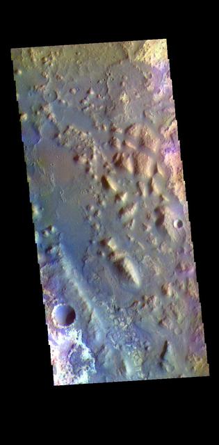
The THEMIS VIS camera contains 5 filters. The data from different filters can be combined in multiple ways to create a false color image. These false color images may reveal subtle variations of the surface not easily identified in a single band image. Today's false color image shows the channel floor of Mawrth Vallis. Of all the channels carved by flowing water on Mars, one of the more unusual is Mawrth Vallis, whose name comes from the Welsh word for Mars. Mawrth Vallis winds through northwest Arabia Terra for some 640 kilometers (400 miles) before emptying into Acidalia Planitia on the edge of the vast northern lowlands. Unlike many outflow channels that start in regions of chaotic terrain, Mawrth Vallis just appears and then grows deeper as it heads downstream, holding a width of approximately 15 km (9 mi) until it widens near its mouth at Chryse Planitia. Orbit Number: 71080 Latitude: 22.9484 Longitude: 341.466 Instrument: VIS Captured: 2017-12-22 20:52 https://photojournal.jpl.nasa.gov/catalog/PIA24507

Today's image shows the channel floor of Mawrth Vallis. Of all the channels carved by flowing water on Mars, one of the more unusual is Mawrth Vallis, whose name comes from the Welsh word for Mars. Mawrth Vallis winds through northwest Arabia Terra for some 640 kilometers (400 miles) before emptying into Acidalia Planitia on the edge of the vast northern lowlands. Unlike many outflow channels that start in regions of chaotic terrain, Mawrth Vallis just appears and then grows deeper as it heads downstream, holding a width of approximately 15 km (9 mi) until it widens near its mouth at Chryse Planitia. And the floor of the channel is a much more complex surface than most channels, with layers of different materials and a decidedly non-waterworn appearance. Today's image is located within an almost 90 degree bend in the channel. Orbit Number: 87662 Latitude: 22.708 Longitude: 341.608 Instrument: VIS Captured: 2021-09-18 09:34 https://photojournal.jpl.nasa.gov/catalog/PIA25229
The THEMIS VIS camera contains 5 filters. The data from different filters can be combined in multiple ways to create a false color image. These false color images may reveal subtle variations of the surface not easily identified in a single band image. Today's false color image shows the region where Mawrth Vallis enters Acidalia Planitia. The name Mawrth Vallis comes from the Welsh word for Mars. Mawrth winds through northwest Arabia Terra for some 640 kilometers (400 miles) before emptying into Acidalia Planitia on the edge of the vast northern lowlands. Unlike many outflow channels that start in regions of chaotic terrain, Mawrth Vallis just appears and then grows deeper as it heads downstream, holding a width of approximately 15 km (9 mi) until it widens near its mouth. Orbit Number: 72901 Latitude: 25.6457 Longitude: 341.295 Instrument: VIS Captured: 2018-05-21 21:12 https://photojournal.jpl.nasa.gov/catalog/PIA24519

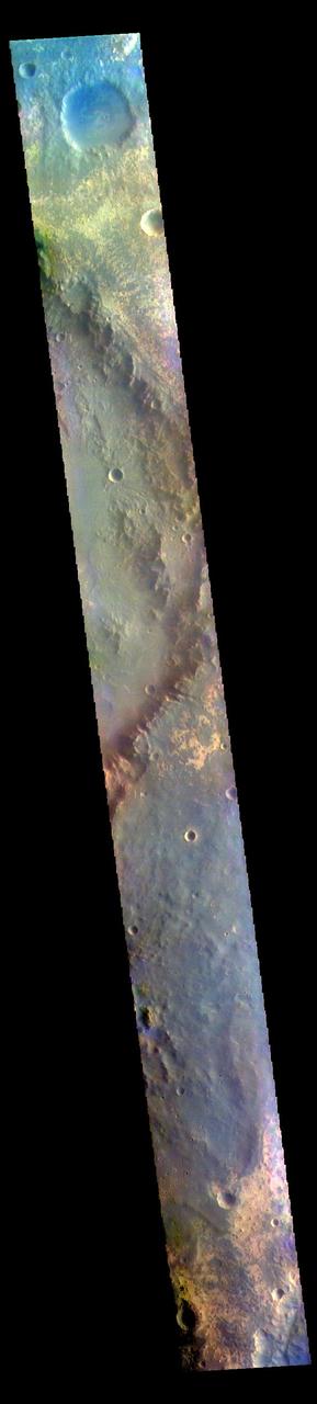
The THEMIS VIS camera contains 5 filters. The data from different filters can be combined in multiple ways to create a false color image. These false color images may reveal subtle variations of the surface not easily identified in a single band image. Today's false color image shows a small section of Mawrth Vallis (near the top of the image). Of all the channels carved by flowing water on Mars, one of the more unusual is Mawrth Vallis, whose name comes from the Welsh word for Mars. Mawrth winds through northwest Arabia Terra for some 640 kilometers (400 miles) before emptying into Acidalia Planitia on the edge of the vast northern lowlands. Unlike many outflow channels that start in regions of chaotic terrain, Mawrth Vallis just appears and then grows deeper as it heads downstream, holding a width of approximately 15 km (9 mi) until it widens near its mouth at Chryse Planitia. Orbit Number: 68698 Latitude: 21.9401 Longitude: 342.256 Instrument: VIS Captured: 2017-06-09 14:48 https://photojournal.jpl.nasa.gov/catalog/PIA24079

This observation from NASA Mars Reconnaissance Orbiter shows a small portion of Mawrth Vallis, one of the many outflow channels feeding north into the Chryse Basin. This ancient valley once hosted flowing water.
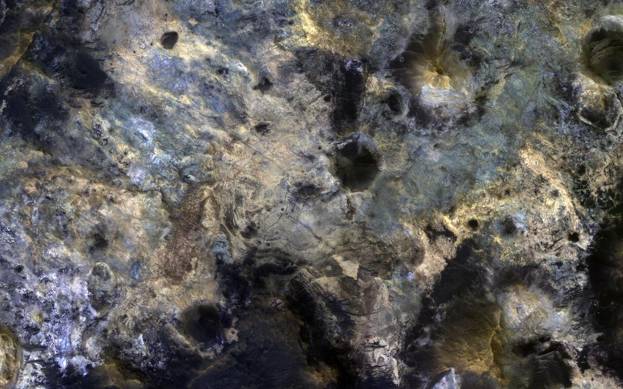
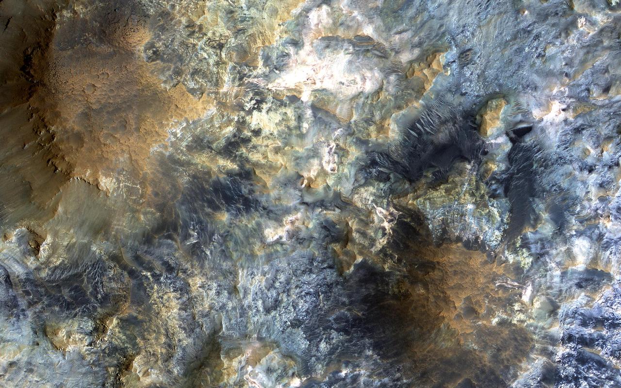
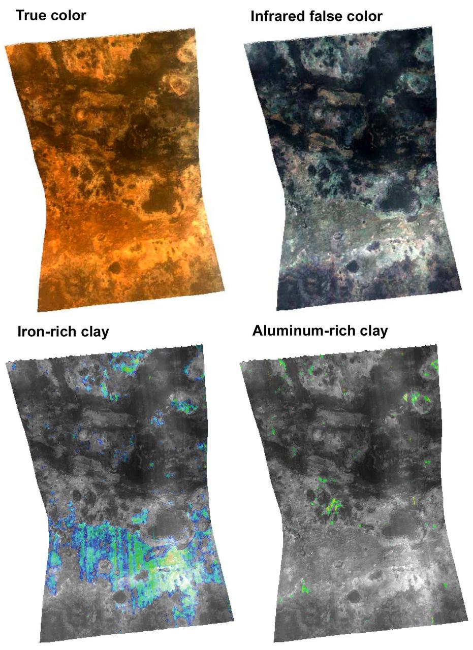
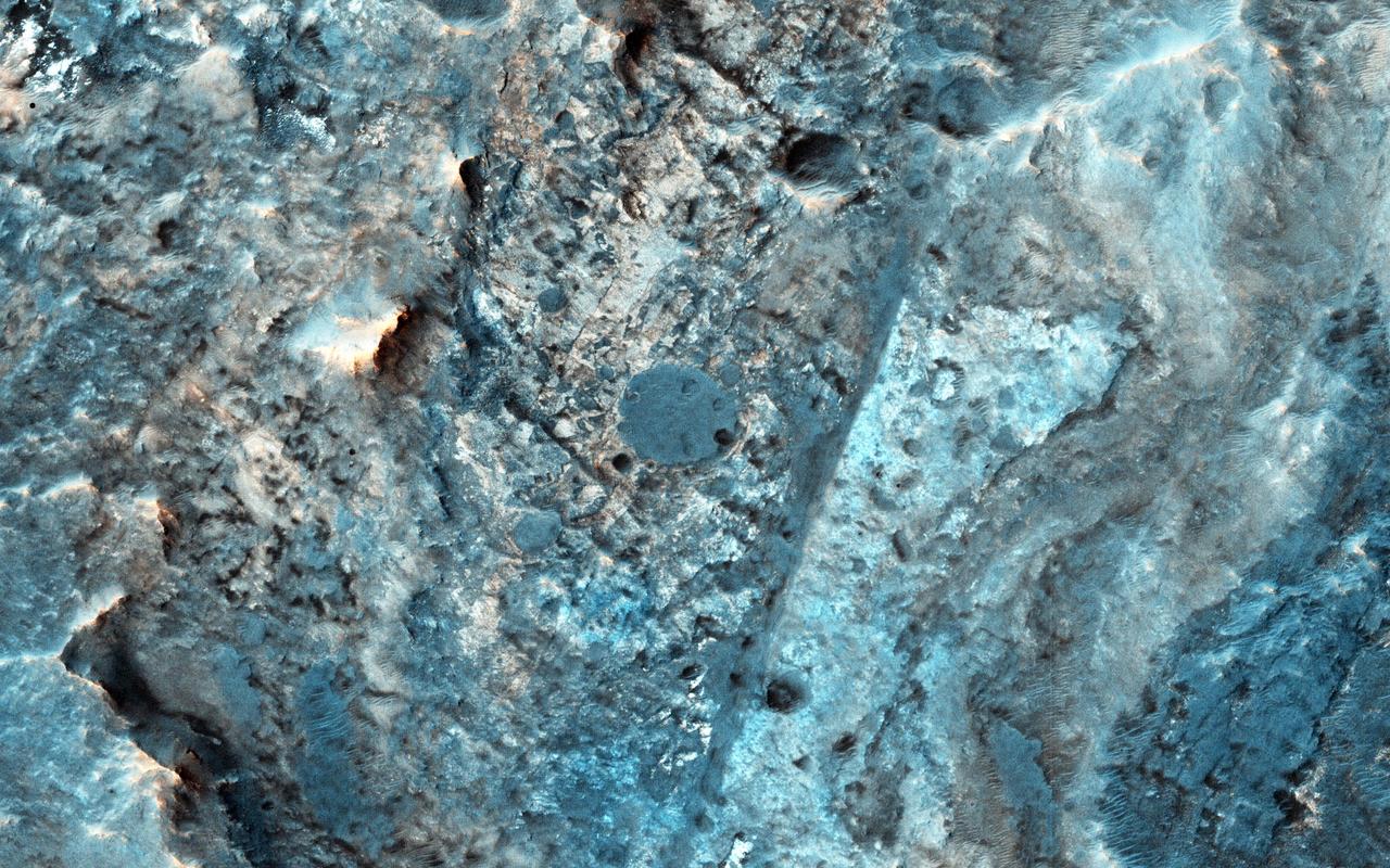
Mawrth Vallis is a place on Mars that has fascinated scientists because of the clays and other hydrated minerals detected from orbit. In this image, the enhanced black colors are most likely basaltic sands and rocks, while the green, yellow, and blue colors correspond to the different hydrated minerals. This particular image was taken of a location in Mawrth Vallis that has a mineral called jarosite. Jarosite on Earth forms under wet, oxidizing, and acidic conditions. Another place on Mars where the Opportunity rover landed and explored also has jarosite. https://photojournal.jpl.nasa.gov/catalog/PIA23080
This VIS image shows a small section of Mawrth Vallis in Arabia Terra. The THEMIS VIS camera contains 5 filters. The data from different filters can be combined in multiple ways to create a false color image. These false color images may reveal subtle variations of the surface not easily identified in a single band image. Orbit Number: 60877 Latitude: 23.0343 Longitude: 342.383 Instrument: VIS Captured: 2015-09-04 08:54 https://photojournal.jpl.nasa.gov/catalog/PIA22730
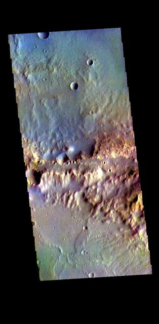
Mawrth Vallis cuts across the center of this VIS image. The THEMIS VIS camera contains 5 filters. The data from different filters can be combined in multiple ways to create a false color image. These false color images may reveal subtle variations of the surface not easily identified in a single band image. Orbit Number: 61451 Latitude: 22.5231 Longitude: 343.092 Instrument: VIS Captured: 2015-10-21 15:20 https://photojournal.jpl.nasa.gov/catalog/PIA23037
The THEMIS VIS camera contains 5 filters. The data from different filters can be combined in multiple ways to create a false color image. This image from NASA 2001 Mars Odyssey spacecraft shows where Mawrth Vallis empties into Chryse Planitia.
![This image from NASA's Mars Reconnaissance Orbiter (MRO) captures details of an approximately 1-kilometer inverted crater west of Mawrth Vallis. A Context Camera image provides context for the erosional features observed at this site. The location of this HiRISE image is north of the proposed landing ellipse for the ExoMars 2020 rover mission that will investigate diverse rocks and minerals related to ancient water-related activity in this region. Prolonged erosion removed less resistant rocks leaving behind other rocks that stand up locally such as the crater seen here and other nearby remnants. These resistant layers may belong to a phase of volcanism and/or water-related activity that carved Mawrth Vallis and filled in existing craters, and other lower-lying depressions, with darker materials. Erosion has also exposed these layers down to older, more resistant lighter rocks that are clay-bearing. The diversity of exposed bedrock made this location an ideal candidate for exploring a potentially water-rich ancient environment that might have once harbored life. The map is projected here at a scale of 25 centimeters (9.8 inches) per pixel. [The original image scale is 28.7 centimeters (11.3 inches) per pixel (with 1 x 1 binning); objects on the order of 86 centimeters (33.9 inches) across are resolved.] North is up. https://photojournal.jpl.nasa.gov/catalog/PIA22117](https://images-assets.nasa.gov/image/PIA22117/PIA22117~medium.jpg)
This image from NASA's Mars Reconnaissance Orbiter (MRO) captures details of an approximately 1-kilometer inverted crater west of Mawrth Vallis. A Context Camera image provides context for the erosional features observed at this site. The location of this HiRISE image is north of the proposed landing ellipse for the ExoMars 2020 rover mission that will investigate diverse rocks and minerals related to ancient water-related activity in this region. Prolonged erosion removed less resistant rocks leaving behind other rocks that stand up locally such as the crater seen here and other nearby remnants. These resistant layers may belong to a phase of volcanism and/or water-related activity that carved Mawrth Vallis and filled in existing craters, and other lower-lying depressions, with darker materials. Erosion has also exposed these layers down to older, more resistant lighter rocks that are clay-bearing. The diversity of exposed bedrock made this location an ideal candidate for exploring a potentially water-rich ancient environment that might have once harbored life. The map is projected here at a scale of 25 centimeters (9.8 inches) per pixel. [The original image scale is 28.7 centimeters (11.3 inches) per pixel (with 1 x 1 binning); objects on the order of 86 centimeters (33.9 inches) across are resolved.] North is up. https://photojournal.jpl.nasa.gov/catalog/PIA22117
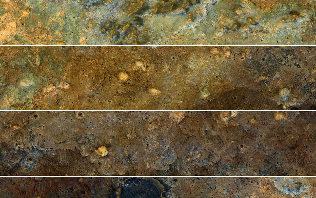
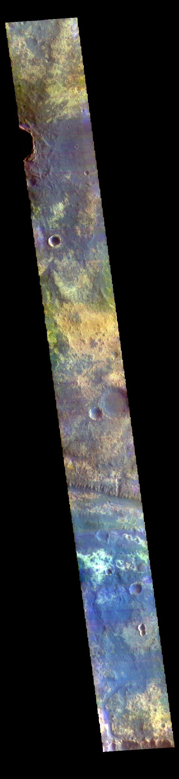
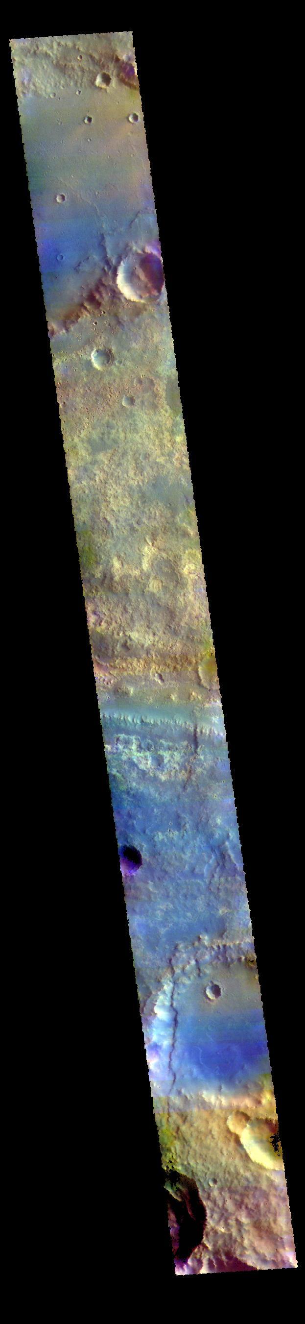
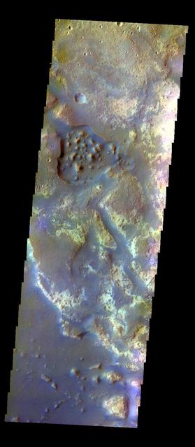
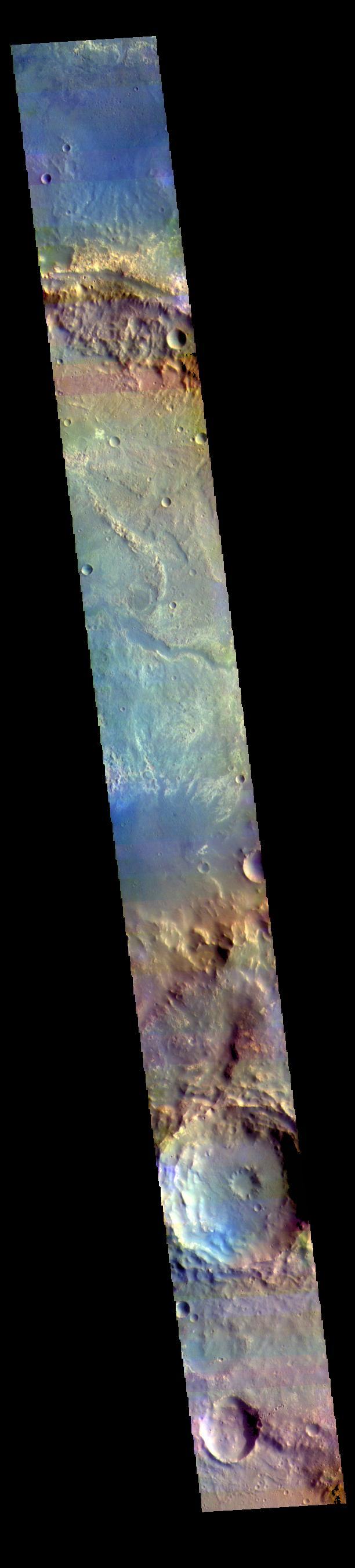
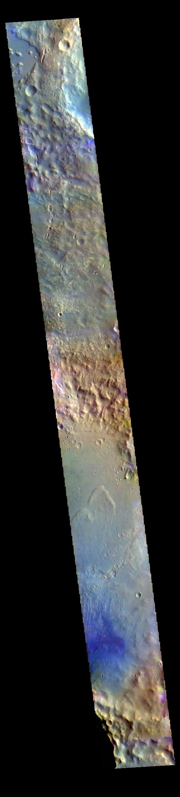
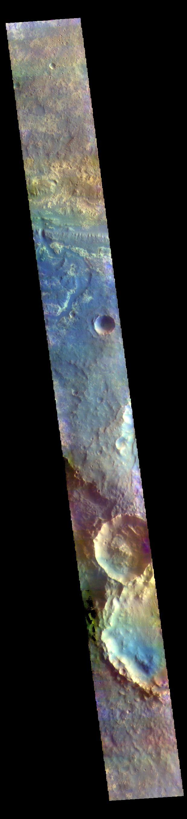
The clay-rich terrain surrounding Mawrth Vallis is one of the most scenic regions of Mars, a future interplanetary park, as seen by NASA's Mars Reconnaissance Orbiter. Here, we cut a long, oblique view into strips to see the full color coverage in more compact form. The origin of these altered layers is the subject of continued debates, perhaps to be resolved by a future rover on the surface. We do know that these layers are very ancient, dating back to a time when the environment of Mars was wetter and more habitable, if there were any inhabitants. https://photojournal.jpl.nasa.gov/catalog/PIA21871
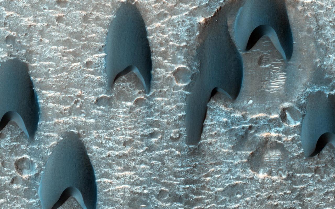
This image from NASA Mars Reconnaissance Orbiter shows a dune field in a large crater near Mawrth Vallis; some of the dunes appear to be in V formation.
Oxia Planum is broad clay-bearing surface between Mawrth and Ares Vallis that has been proposed as a future landing site on Mars. This image is from NASA Mars Reconnaissance Orbiter.
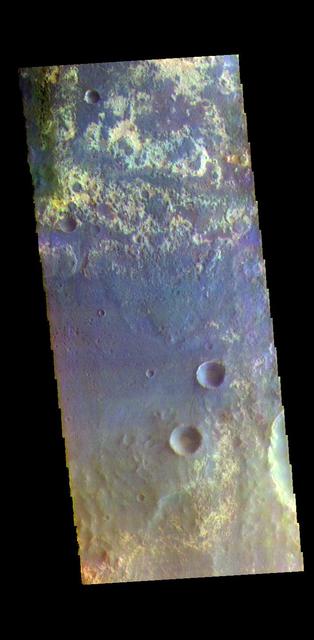
The THEMIS VIS camera contains 5 filters. The data from different filters can be combined in multiple ways to create a false color image. These false color images may reveal subtle variations of the surface not easily identified in a single band image. Today's false color image shows part of Arabia Terra near Mawrth Vallis and Oyama Crater. Orbit Number: 77205 Latitude: 24.7753 Longitude: 340.276 Instrument: VIS Captured: 2019-05-11 08:52 https://photojournal.jpl.nasa.gov/catalog/PIA24606
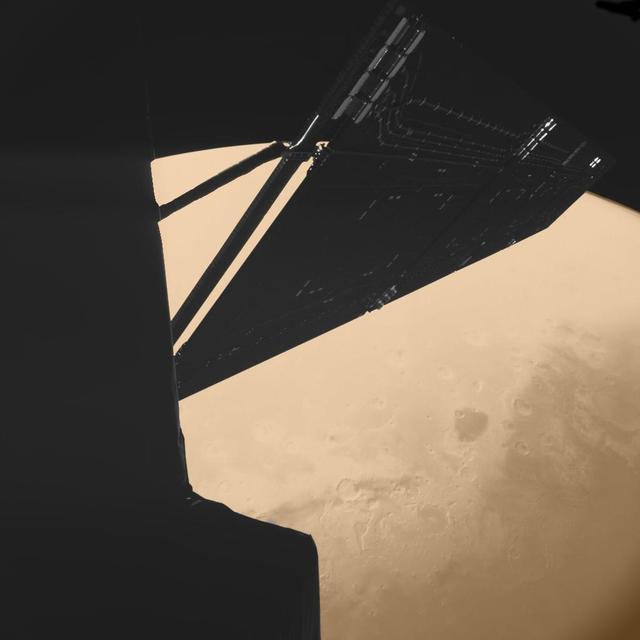
Stunning image taken by the CIVA imaging instrument on Rosetta Philae lander just 4 minutes before closest approach at a distance of some 1000 km from Mars on Feb. 25, 2007. A portion of the spacecraft and one of its solar arrays are visible in nice detail. Beneath, the Mawrth Vallis region is visible on the planet's disk. Mawrth Vallis is particularly relevant as it is one of the areas on the Martian surface where the OMEGA instrument on board ESA's Mars Express detected the presence of hydrated clay minerals -- a sign that water may have flown abundantly on that region in the very early history of Mars. Id 217487 http://photojournal.jpl.nasa.gov/catalog/PIA18154
Oyama Crater dominates the top of this VIS image. Oyama Crater is located in Arabia Terra, just west of Mawrth Vallis. The two craters at the bottom of the image are unnamed. The THEMIS VIS camera contains 5 filters. The data from different filters can be combined in multiple ways to create a false color image. These false color images may reveal subtle variations of the surface not easily identified in a single band image. Orbit Number: 62050 Latitude: 23.3269 Longitude: 340.286 Instrument: VIS Captured: 2015-12-09 23:15 https://photojournal.jpl.nasa.gov/catalog/PIA23094
The large crater at the bottom of today's image is called McLaughlin Crater. It is located west of Mawrth Vallis, on the margin between Arabia Terra and Chryse Planitia. The THEMIS VIS camera contains 5 filters. The data from different filters can be combined in multiple ways to create a false color image. These false color images may reveal subtle variations of the surface not easily identified in a single band image. Orbit Number: 62100 Latitude: 22.4939 Longitude: 337.635 Instrument: VIS Captured: 2015-12-14 02:05 https://photojournal.jpl.nasa.gov/catalog/PIA23108
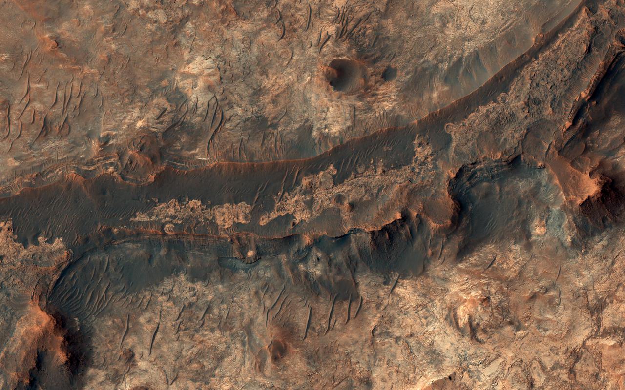
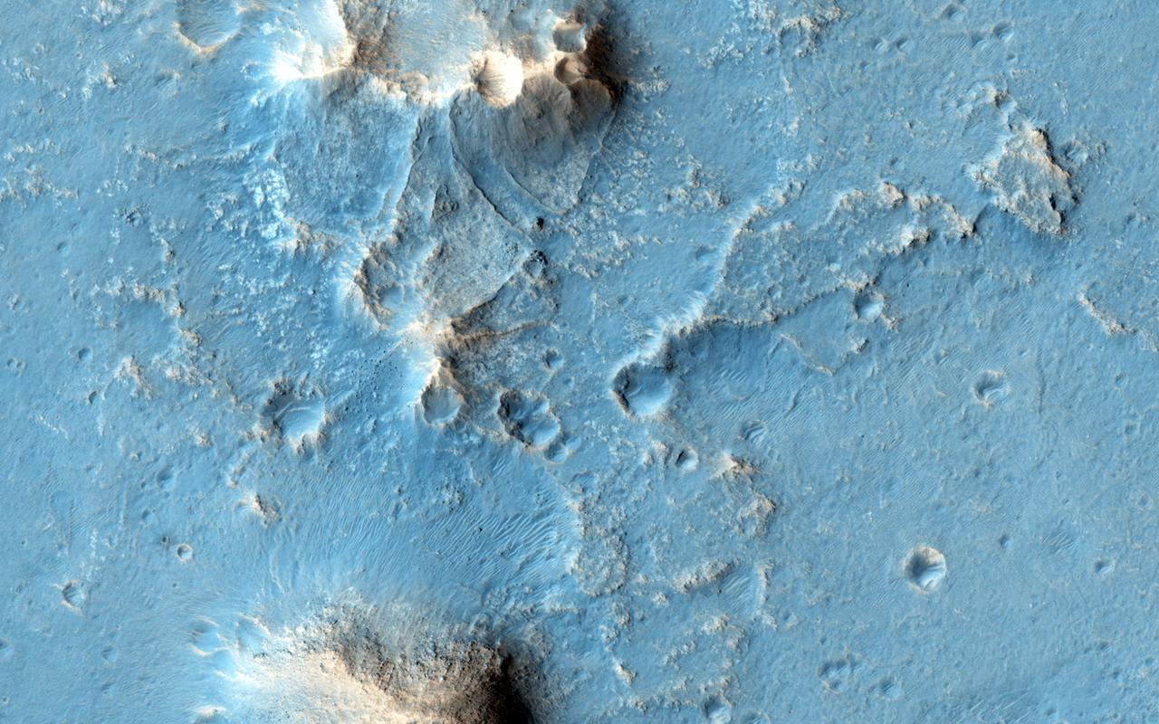
Billions of years ago, a river flowed across this scene in Mawrth Vallis. Like on Earth, these river beds can get filled up with rocks that are cemented together. After Mars became a colder, drier place and the river disappeared, the rocky river bed remained. In this HiRISE image, we see a dark ridge snaking across the surface. The dark ridge is the old river bed. It is raised above its surroundings now because these softer surroundings have been eroded away, whereas the rocky river bed resists that. Scientists call these ridges inverted channels and many of them are visible in this area of Mars. https://photojournal.jpl.nasa.gov/catalog/PIA25081
McLaughlin Crater (21.9 N, 337.6 E) is a large, approximately 95-kilometer diameter impact crater located north of Mawrth Vallis, in Arabia Terra, a region that was made famous by the book and movie "The Martian" by Andy Weir. McLaughlin Crater straddles three major terrain types: the Northern lowlands, the Southern highlands and the Mawrth Vallis region. The crater floor is thought to be covered by clays and carbonates that were deposited in a deep lake at least 3.8 billion years ago perhaps by ground water upwelling from beneath the crater floor (Michalski et al., 2013, Nature Geoscience). McLaughlin Crater is listed as a candidate landing site for the 2020 Mars surface mission. Although it is described as a "flat, low-risk and low-elevation landing zone," the region in this image on the southern floor of the crater shows a complex surface of eroded layers that are rough in places. An unusual feature is a straight fracture cutting diagonally across the layered material at the bottom portion of the image that may be a fault line. http://photojournal.jpl.nasa.gov/catalog/PIA20338
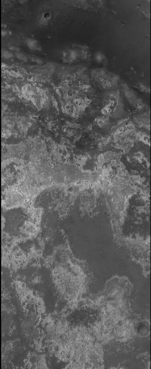
This VIS image shows a small section of Mawrth Valles and several surrounding craters located in Arabia Terra. The THEMIS VIS camera contains 5 filters. The data from different filters can be combined in multiple ways to create a false color image. These false color images may reveal subtle variations of the surface not easily identified in a single band image. Orbit Number: 61164 Latitude: 21.6892 Longitude: 342.969 Instrument: VIS Captured: 2015-09-28 00:06 https://photojournal.jpl.nasa.gov/catalog/PIA22787
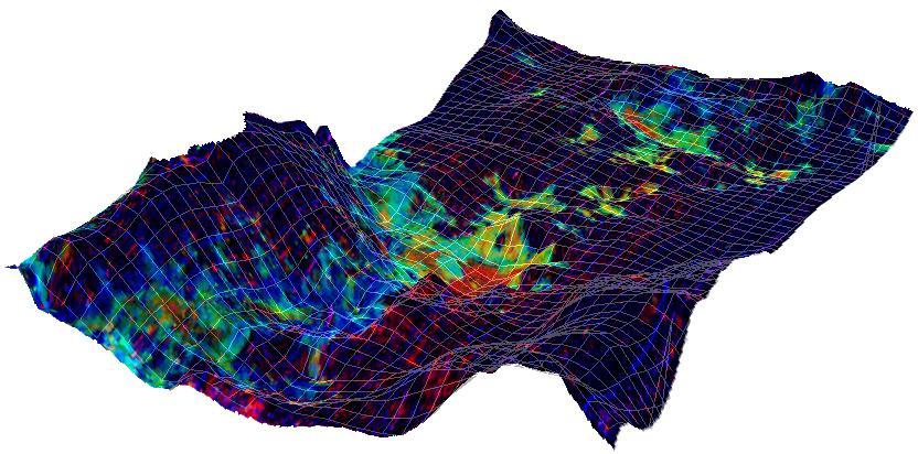
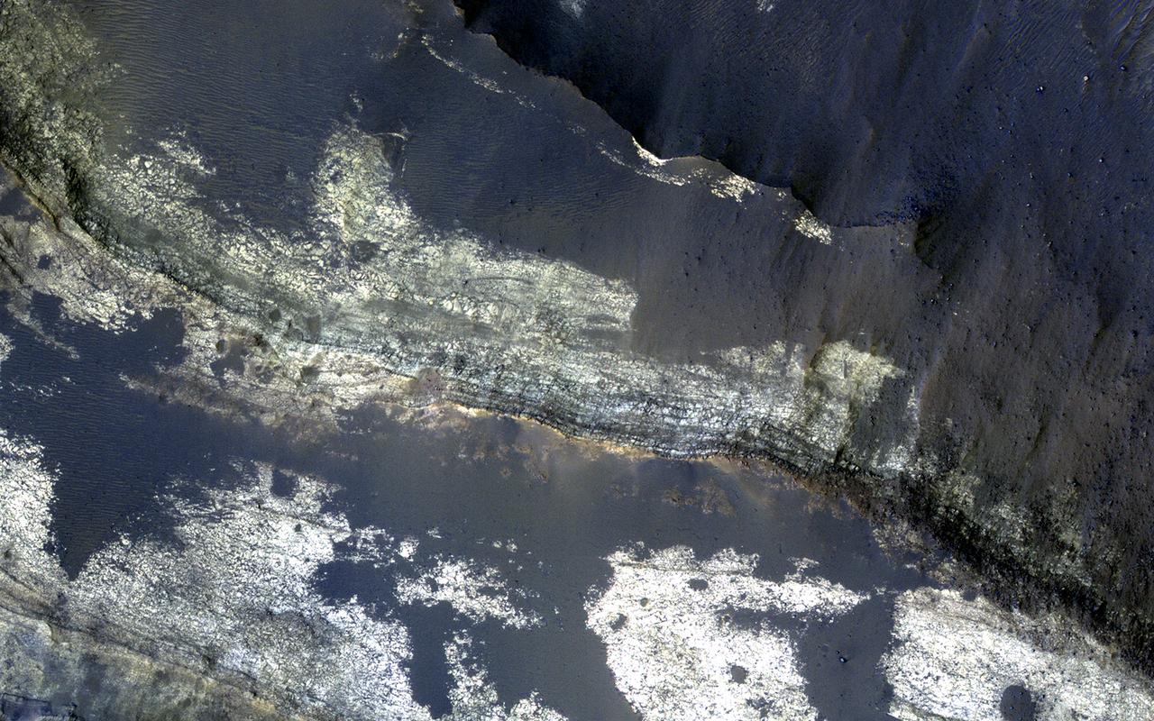
![The combination of morphological and topographic information from stereo images from NASA's Mars Reconnaissance Orbiter, as well as compositional data from near-infrared spectroscopy has been proven to be a powerful tool for understanding the geology of Mars. Beginning with the OMEGA instrument on the European Space Agency's Mars Express orbiter in 2003, the surface of Mars has been examined at near-infrared wavelengths by imaging spectrometers that are capable of detecting specific minerals and mapping their spatial extent. The CRISM (Compact Reconnaissance Imaging Spectrometer for Mars) instrument on our orbiter is a visible/near-infrared imaging spectrometer, and the HiRISE camera works together with it to document the appearance of mineral deposits detected by this orbital prospecting. Mawrth Vallis is one of the regions on Mars that has attracted much attention because of the nature and diversity of the minerals identified by these spectrometers. It is a large, ancient outflow channel on the margin of the Southern highlands and Northern lowlands. Both the OMEGA and CRISM instruments have detected clay minerals here that must have been deposited in a water-rich environment, probably more than 4 billion years ago. For this reason, Mawrth Vallis is one of the two candidate landing sites for the future Mars Express Rover Mission planned by the European Space Agency. This image was targeted on a location where the CRISM instrument detected a specific mineral called alunite, KAl3(SO4)2(OH)6. Alunite is a hydrated aluminum potassium sulfate, a mineral that is notable because it must have been deposited in a wet acidic environment, rich in sulfuric acid. Our image shows that the deposit is bright and colorful, and extensively fractured. The width of the cutout is 1.2 kilometers. The map is projected here at a scale of 50 centimeters (19.7 inches) per pixel. [The original image scale is 60.1 centimeters (23.7 inches) per pixel (with 2 x 2 binning); objects on the order of 180 centimeters (70.9 inches) across are resolved.] North is up. https://photojournal.jpl.nasa.gov/catalog/PIA21936](https://images-assets.nasa.gov/image/PIA21936/PIA21936~medium.jpg)
The combination of morphological and topographic information from stereo images from NASA's Mars Reconnaissance Orbiter, as well as compositional data from near-infrared spectroscopy has been proven to be a powerful tool for understanding the geology of Mars. Beginning with the OMEGA instrument on the European Space Agency's Mars Express orbiter in 2003, the surface of Mars has been examined at near-infrared wavelengths by imaging spectrometers that are capable of detecting specific minerals and mapping their spatial extent. The CRISM (Compact Reconnaissance Imaging Spectrometer for Mars) instrument on our orbiter is a visible/near-infrared imaging spectrometer, and the HiRISE camera works together with it to document the appearance of mineral deposits detected by this orbital prospecting. Mawrth Vallis is one of the regions on Mars that has attracted much attention because of the nature and diversity of the minerals identified by these spectrometers. It is a large, ancient outflow channel on the margin of the Southern highlands and Northern lowlands. Both the OMEGA and CRISM instruments have detected clay minerals here that must have been deposited in a water-rich environment, probably more than 4 billion years ago. For this reason, Mawrth Vallis is one of the two candidate landing sites for the future Mars Express Rover Mission planned by the European Space Agency. This image was targeted on a location where the CRISM instrument detected a specific mineral called alunite, KAl3(SO4)2(OH)6. Alunite is a hydrated aluminum potassium sulfate, a mineral that is notable because it must have been deposited in a wet acidic environment, rich in sulfuric acid. Our image shows that the deposit is bright and colorful, and extensively fractured. The width of the cutout is 1.2 kilometers. The map is projected here at a scale of 50 centimeters (19.7 inches) per pixel. [The original image scale is 60.1 centimeters (23.7 inches) per pixel (with 2 x 2 binning); objects on the order of 180 centimeters (70.9 inches) across are resolved.] North is up. https://photojournal.jpl.nasa.gov/catalog/PIA21936
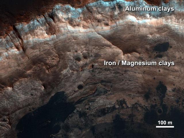
Thick stacks of clay minerals indicate chemical alteration of thick stacks of rock by interaction with liquid water on ancient Mars as seen in this image from NASA Mars Reconnaissance Orbiter.

HiRISE plays an important role in finding suitable landing sites for future rover missions. Scientists have narrowed down the candidate landing sites for the upcoming European ExoMars rover mission to two regions: the plains of Oxia and Mawrth Vallis. Images covering these areas aid scientists in picking a location that will be both scientifically interesting and a safe place to land and operate. HiRISE pictures help to assess the risk for each particular location so that a final landing site can be selected. If you look very closely, the image may appear hazy. This is due to additional dust lingering in the atmosphere from the massive summer global dust storm at the time we acquired this observation. ExoMars is due to launch to Mars in 2020. https://photojournal.jpl.nasa.gov/catalog/PIA22805
The THEMIS VIS camera contains 5 filters. The data from different filters can be combined in multiple ways to create a false color image. These false color images may reveal subtle variations of the surface not easily identified in a single band image. Today's false color image shows part of the northern rim of Oyama Crater. Located in Arabia Terra near Mawrth Vallis, Oyama Crater is 101km (63 miles) in diameter. Orbit Number: 81198 Latitude: 24.3956 Longitude: 340.003 Instrument: VIS Captured: 2020-04-04 03:59 https://photojournal.jpl.nasa.gov/catalog/PIA24701

NASA Mars Reconnaissance Orbiter shows the surface outside this large crater is relatively dark, while the interior wall of the crater exposes lighter, layered bedrock of diverse colors.
The THEMIS VIS camera contains 5 filters. The data from different filters can be combined in multiple ways to create a false color image. These false color images may reveal subtle variations of the surface not easily identified in a single band image. Today's false color image shows part of Oyama Crater. Located in Arabia Terra near Mawrth Vallis, Oyama Crater is 101km (63 miles) in diameter. The THEMIS VIS camera is capable of capturing color images of the Martian surface using five different color filters. In this mode of operation, the spatial resolution and coverage of the image must be reduced to accommodate the additional data volume produced from using multiple filters. To make a color image, three of the five filter images (each in grayscale) are selected. Each is contrast enhanced and then converted to a red, green, or blue intensity image. These three images are then combined to produce a full color, single image. Because the THEMIS color filters don't span the full range of colors seen by the human eye, a color THEMIS image does not represent true color. Also, because each single-filter image is contrast enhanced before inclusion in the three-color image, the apparent color variation of the scene is exaggerated. Nevertheless, the color variation that does appear is representative of some change in color, however subtle, in the actual scene. Note that the long edges of THEMIS color images typically contain color artifacts that do not represent surface variation. Orbit Number: 94363 Latitude: 23.2241 Longitude: 340.695 Instrument: VIS Captured: 2023-03-24 03:48 https://photojournal.jpl.nasa.gov/catalog/PIA26128
This image from NASA's Mars Reconnaissance Orbiter shows the north-facing wall of a moat-like depression in the middle of Terby Crater, exposing a beautiful 400 meter-high sequence of light-toned, repetitive sedimentary layers. These deposits are often obscured by darker-toned patches of material as well as ripples and dunes. The deposits in Terby, located on the northern rim of Hellas Planitia, are consistent with deposition in a standing body of water. The layers have been proposed as science targets for future landed missions. https://photojournal.jpl.nasa.gov/catalog/PIA21952