Medusa Fossae
Medusa Fossae Textures

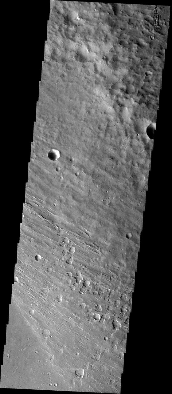
Medusae Fossae #2
Medusa Fossae Textures
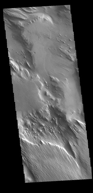
Medusae Fossae Formation
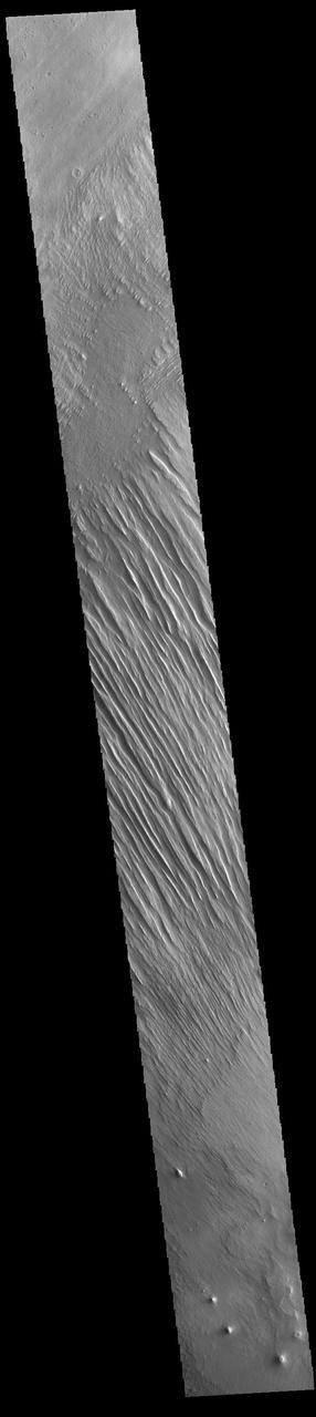
Medusa Fossae Textures
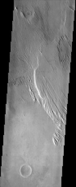
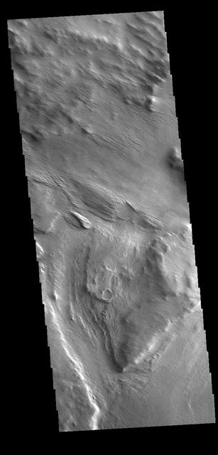
A Different Medusae Fossae Formation
Medusa Fossae Textures
Medusa Fossae Textures
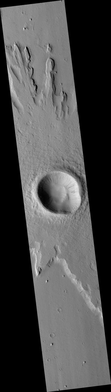
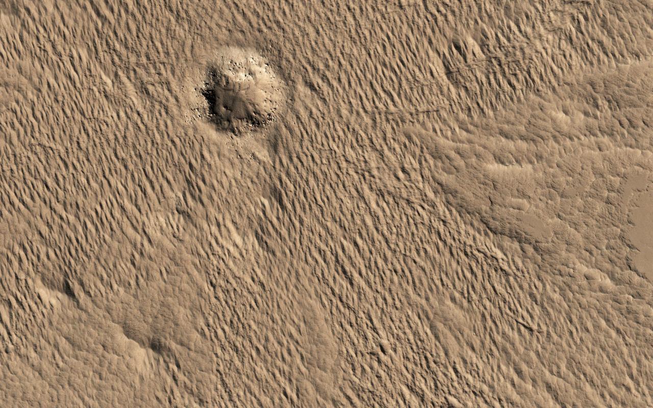
Pedestal Crater in the Medusa Fossae Formation
This image from NASA Mars Odyssey covers a portion of the Medusa Fossae formation, near the equator of Mars. The most characteristic feature of the Medusa Fossae formation is the abundance of yardangs, which are erosional landforms carved by wind.
Pedestal Craters and Wind Streaks, South Medusae Fossae
Medusae Fossae Formation - High Resolution Image
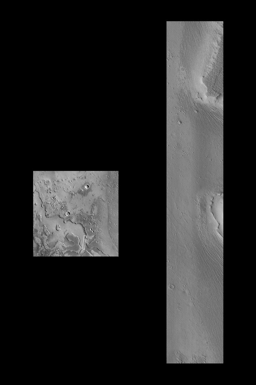
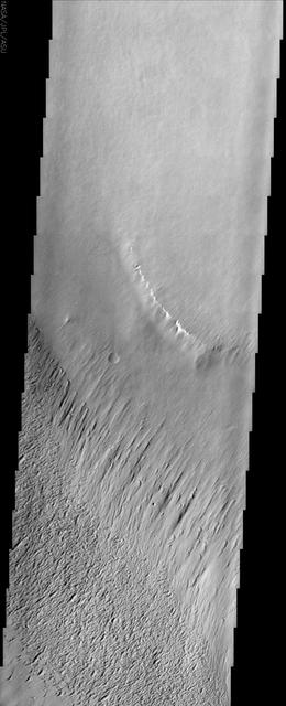
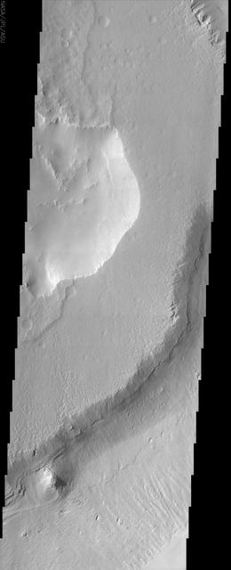
The channel in this VIS image is located on the western margin of Medusae Fossae. Orbit Number: 78907 Latitude: -5.87425 Longitude: 198.259 Instrument: VIS Captured: 2019-09-28 12:25 https://photojournal.jpl.nasa.gov/catalog/PIA23522
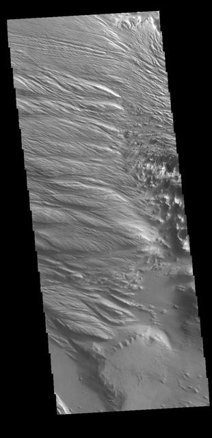
Today's VIS image is located at the intersection of Medusae Fossae and Medusae Sulci. Long term surface winds have eroded materials in this region, creating ridges and valleys aligned with the direction of the wind. To form the surface features seen in this image, the surface must have been soft and easily eroded. It has been suggested that the materials may be volcanic ash from nearby volcanoes (Olympus Mons and Arsia Mons). Orbit Number: 79431 Latitude: -3.99572 Longitude: 200.385 Instrument: VIS Captured: 2019-11-10 15:59 https://photojournal.jpl.nasa.gov/catalog/PIA23701
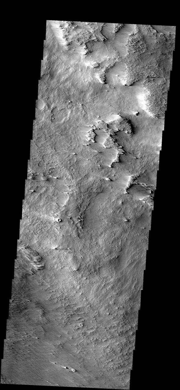
This image from NASA Mars Odyssey shows a sample of the middle member of the Medusae Fossae formation. The layers exposed in the southeast-facing scarp suggest that there is a fairly competent unit underlying the mesa in the center of the image.
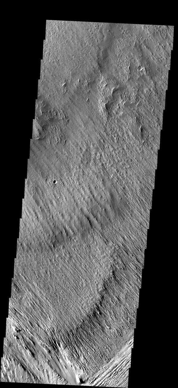
The Medusae Fossae Formation, shown in this image from NASA Mars Odyssey spacecraft, is a large region of material that is easily eroded by the wind. The work of the wind has produced a variety of surface textures.
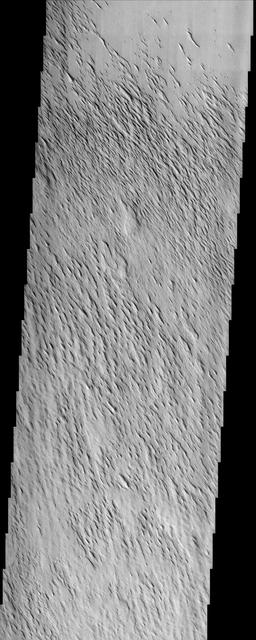
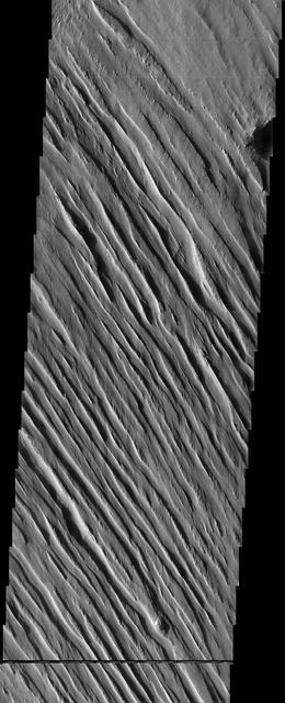
The materials that make up the Medusa Fossae Formation are easily eroded by the wind. Over the millenia the wind has sculpted the surface into new textures
This VIS image shows part of Medusa Fossae. Winds have eroded materials in this region, creating ridges and valleys aligned with the direction of the wind. Orbit Number: 72008 Latitude: -3.47752 Longitude: 199.295 Instrument: VIS Captured: 2018-03-09 07:31 https://photojournal.jpl.nasa.gov/catalog/PIA22510
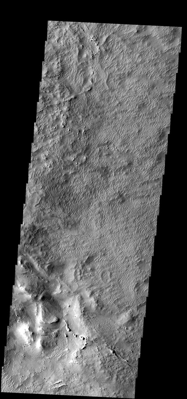
The Medusae Fossae formation, seen in this NASA Mars Odyssey image, is an enigmatic pile of eroding sediments that spans over 5,000 km 3,107 miles in discontinuous masses along the Martian equator.
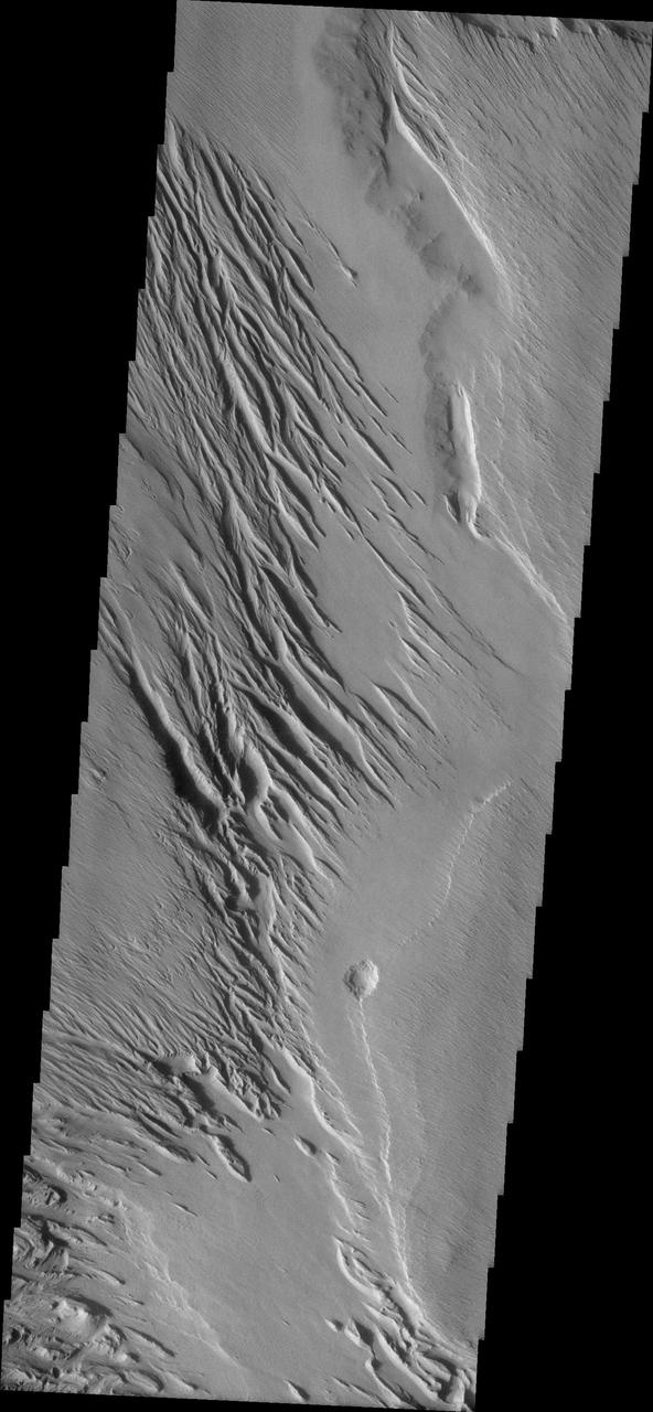
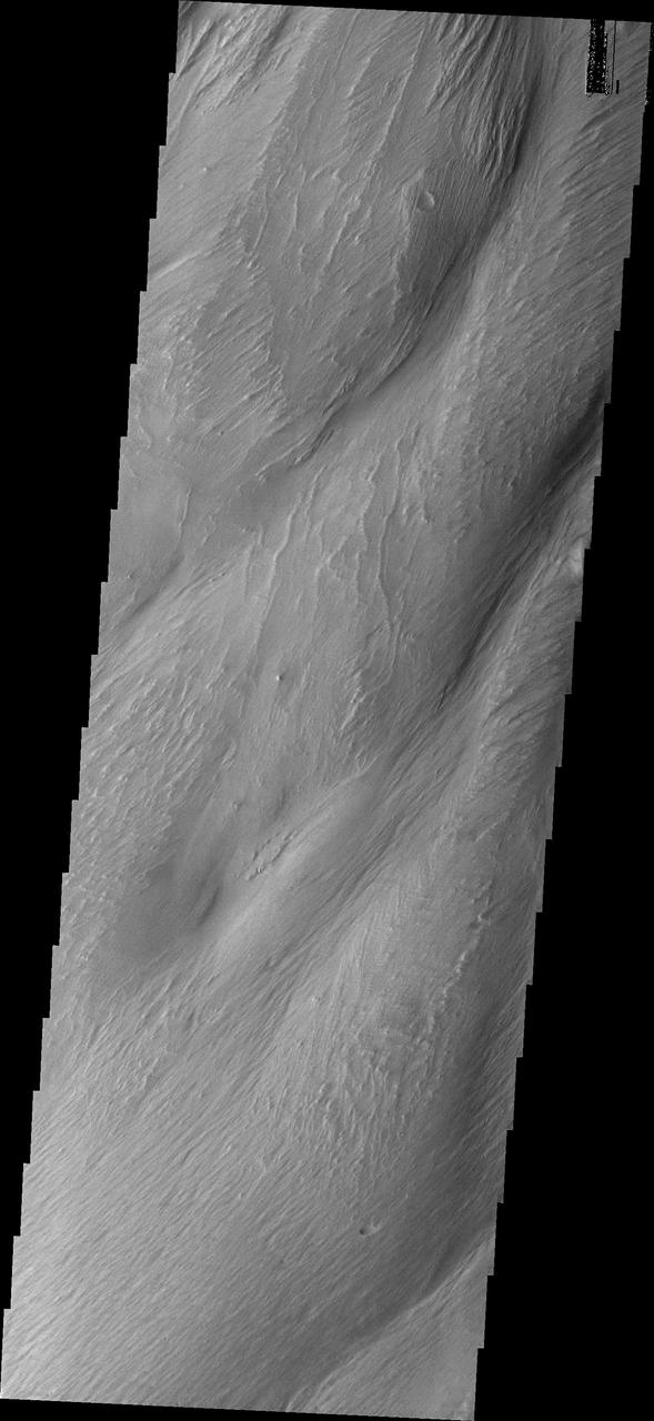
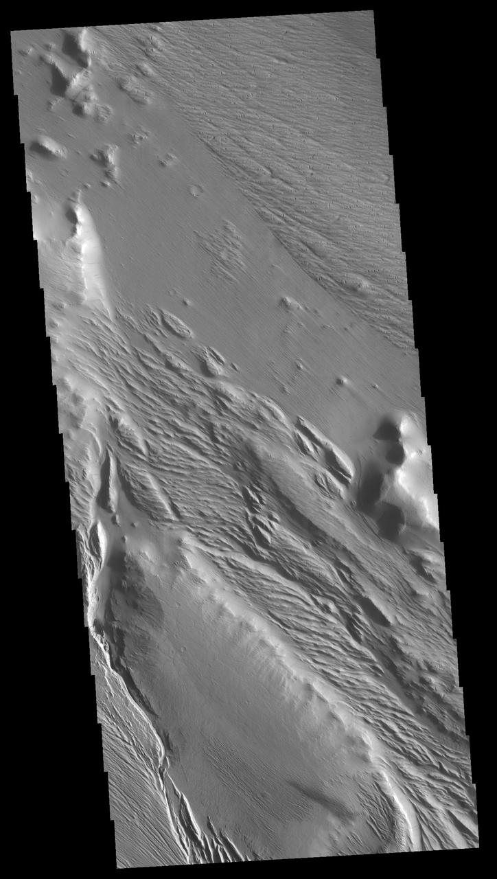
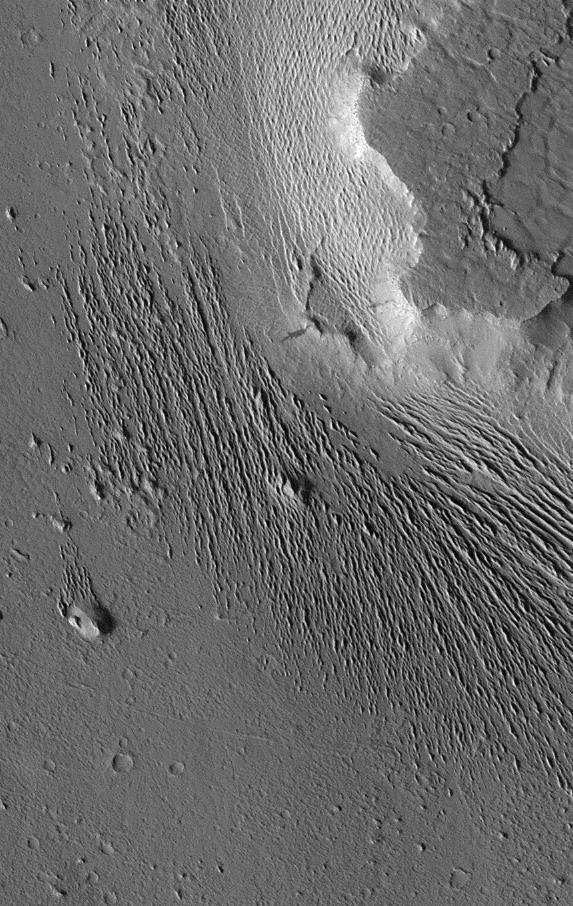
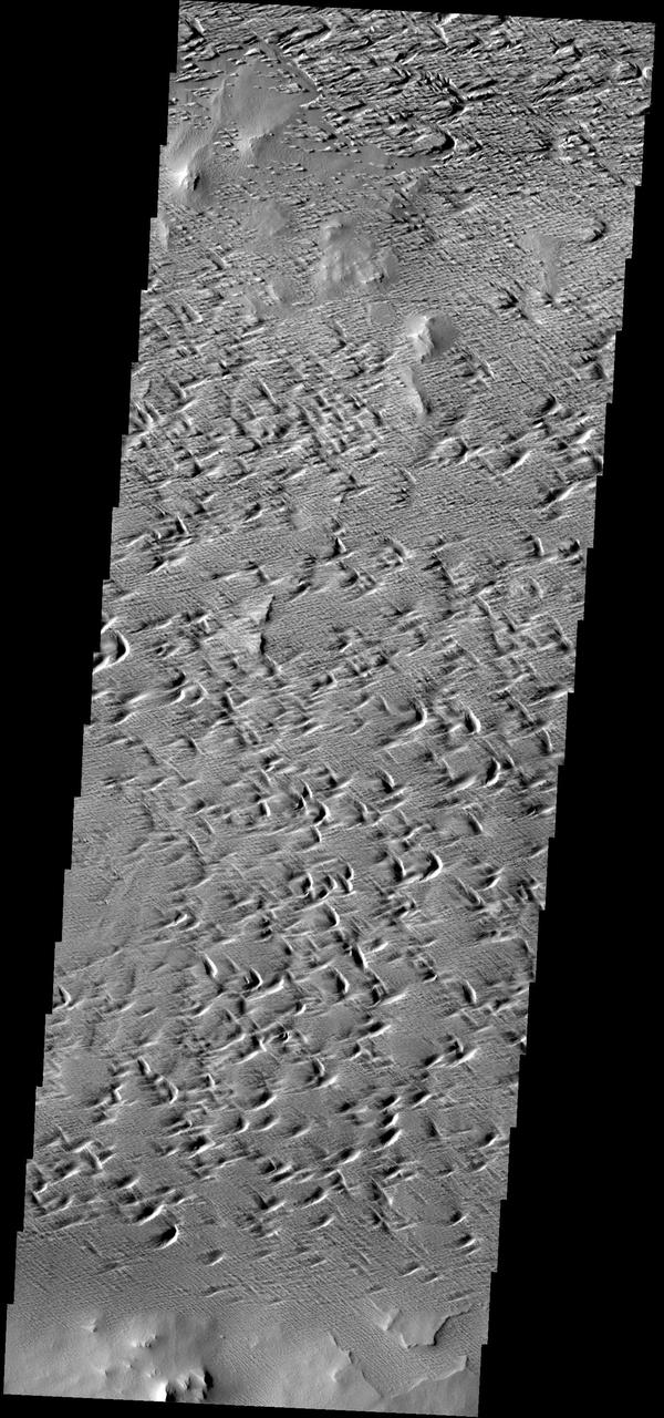
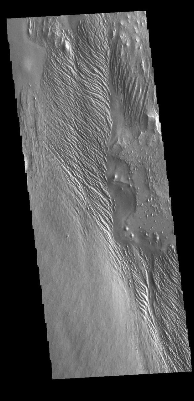
Remarkable variations in the erosion of the Medusae Fossae Formation are shown in this scene from NASA Mars Odyssey spacecraft. In this region, the surface has been eroded by the wind into a series of linear ridges called yardangs.
Extensive wind-swept plains of the Medusae Fossae formation on Mars. This northern subframe image, frame 3104, is of a 3.0 x 4.7 km area centered near 2.4 degrees north, 163.8 degrees west. Science Magazine, Volume 279, Number 5357, 13 March 1998, M. C. Malin, et. al., "Early Views of the Martian Surface from the Mars Orbiter Camera of Mars Global Surveyor", pp. 1681-1685 (Fig. 1A) http://photojournal.jpl.nasa.gov/catalog/PIA00800
This VIS image shows part of Medusa Fossae. Winds have eroded materials in this region, creating ridges and valleys aligned with the direction of the wind. These features are created by long term winds scouring a poorly cemented surface material. It has been suggested that this region of Mars provides a large percentage of the surface dust seen around the planet. Ash falls from nearby volcanoes may have been the source of the surface materials eroded into these and other wind eroded landforms. Orbit Number: 79144 Latitude: -4.5831 Longitude: 200.487 Instrument: VIS Captured: 2019-10-18 00:48 https://photojournal.jpl.nasa.gov/catalog/PIA23576
This image from NASA Mars Odyssey shows a Martian geologic deposit known as the Medusae Fossae Formation the raised plateau in the upper two-thirds of the image, a soft, easily eroded deposit that extends for nearly 1,000 km along the equator of Mars.
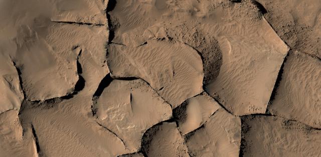
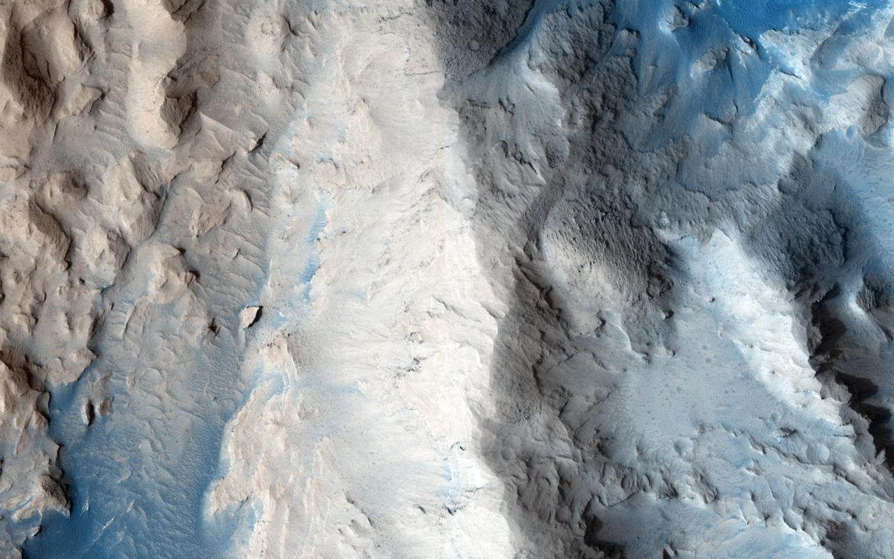
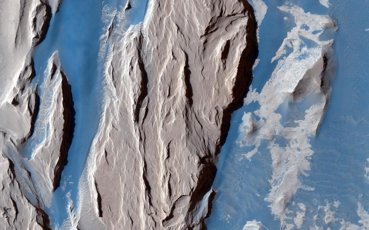
This view shows part of an area on Mars where narrow rock ridges, some as tall as a 16-story building, intersect at angles forming corners of polygons. The area covered in the image spans about two-thirds of a mile (1.1 kilometers) wide, in the Gordii Dorsum portion of the Medusae Fossae region of Mars. The image is from the High Resolution Imaging Science Experiment (HiRISE) camera on the Mars Reconnaissance Orbiter. North is up. Note the shadows cast by some of the walls. These ridges likely formed as lava that hardened underground and later resisted erosion better than the surrounding material. From ground level, they would resemble hardened-lava walls on Earth http://photojournal.jpl.nasa.gov/catalog/PIA21264
The dark dunes in the western Medusae Fossae formation provide some evidence of having a local origin. This image shows no large dunes, but many of the dark sand patches cover slopes up to discrete layers. It is possible that the sand is eroding out from those layers, but slopes can also act as sand traps. http://photojournal.jpl.nasa.gov/catalog/PIA19302
Shown here is an exceptionally long sinuous ridge, possibly an inverted fluvial feature, that cuts across newly mapped geologic units of the Medusae Fossae Formation, from NASA Mars Reconnaissance Orbiter.
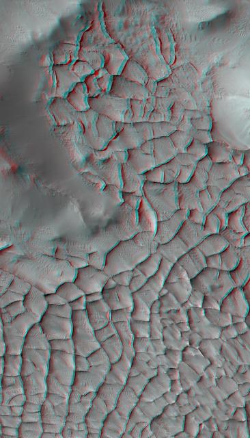
This stereo view shows part of an area on Mars where narrow rock ridges, some as tall as a 16-story building, intersect at angles forming corners of polygons. It appears three-dimensional when viewed through red-blue glasses with the red lens on the left. The area covered in the image is about 1.9 miles (3 kilometers) wide, in the Gordii Dorsum portion of the Medusae Fossae region of Mars. This stereo view combines two observations from the High Resolution Imaging Science Experiment (HiRISE) camera on the Mars Reconnaissance Orbiter.. North is up. Note the afternoon shadows cast by some of the walls. These ridges likely formed as lava that hardened underground and later resisted erosion better than the surrounding material. From ground level, they would resemble hardened-lava walls on Earth. http://photojournal.jpl.nasa.gov/catalog/PIA21265
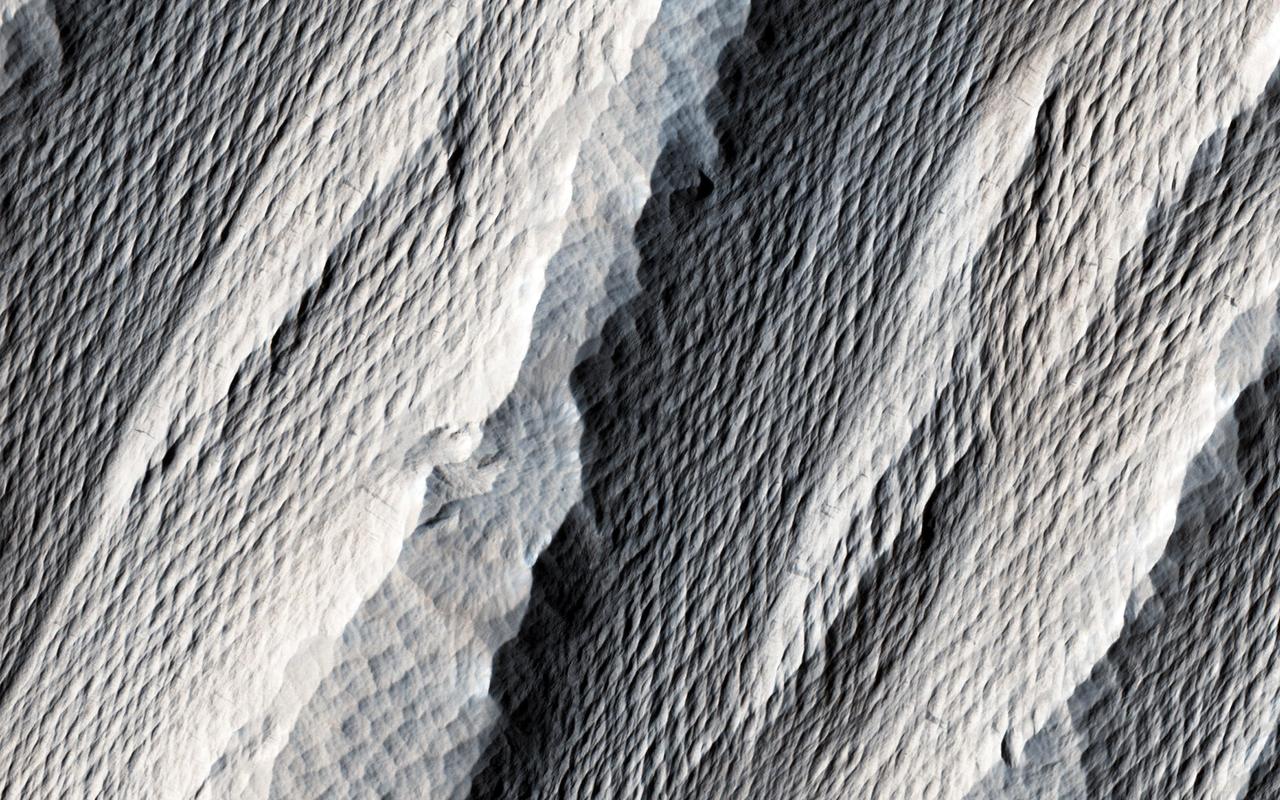
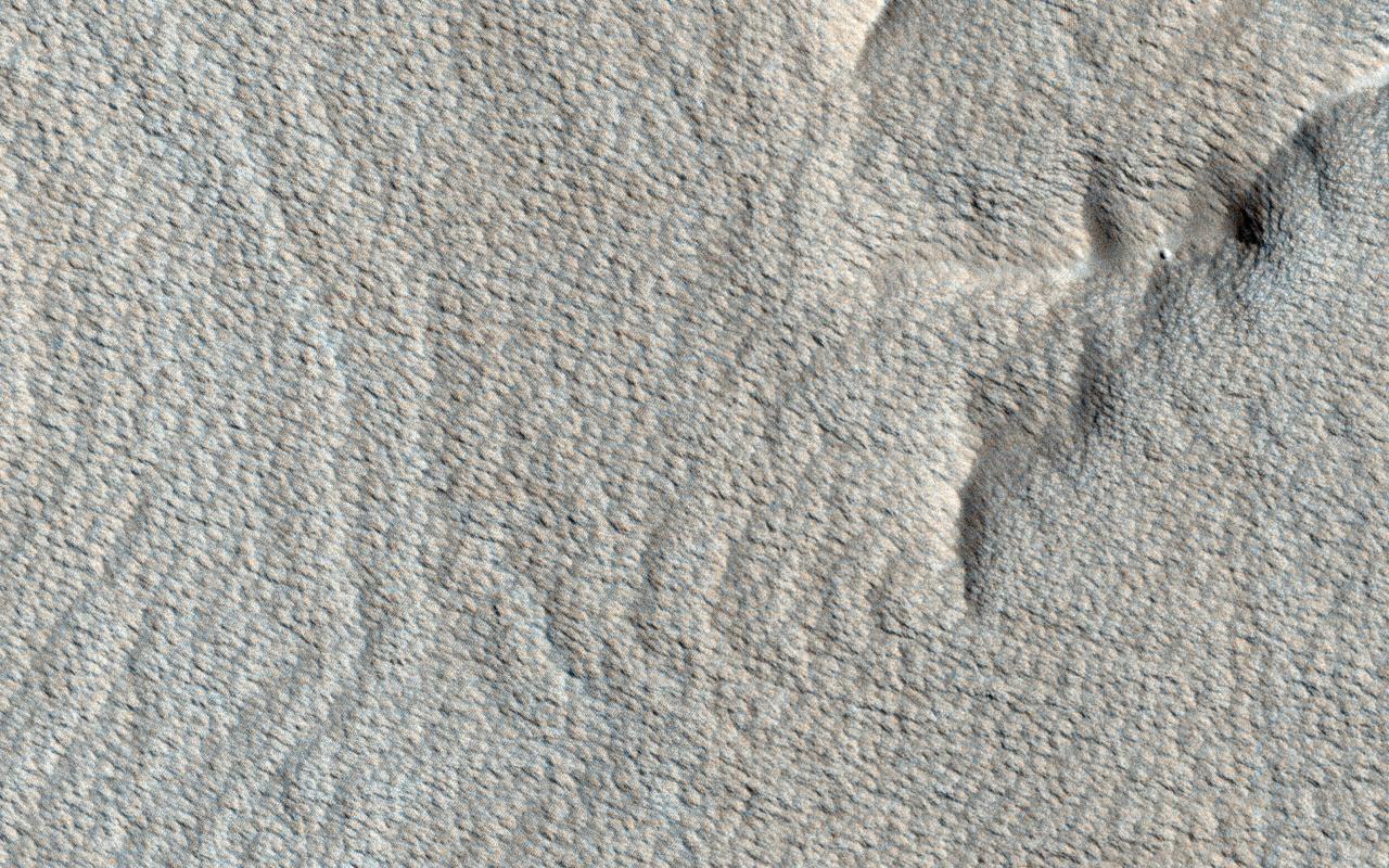
The distinctively fluted surface and elongated hills in this image in Medusae Fossae are caused by wind erosion of a soft fine-grained rock. Called yardangs, these features are aligned with the prevailing wind direction. This wind direction would have dominated for a very long time to carve these large-scale features into the exposed rock we see today. Yardangs not only reveal the strength and direction of historic winds, but also reveal something of the host rock itself. Close inspection by HiRISE shows an absence of boulders or rubble, especially along steep yardang cliffs and buttresses. The absence of rubble and the scale of the yardangs tells us that the host rock consists only of weakly cemented fine granules in tens of meters or more thick deposits. Such deposits could have come from extended settling of volcanic ash, atmospheric dust, or accumulations of wind deposited fine sands. After a time these deposits became cemented and cohesive, illustrated by the high standing relief and exposed cliffs. http://photojournal.jpl.nasa.gov/catalog/PIA21111
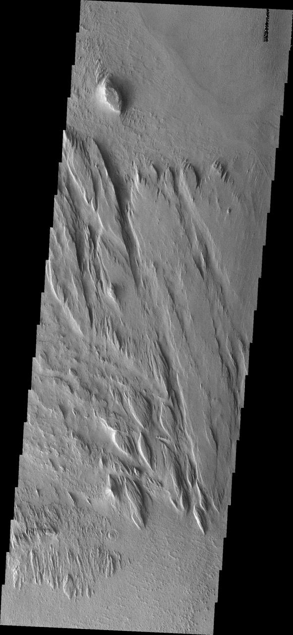
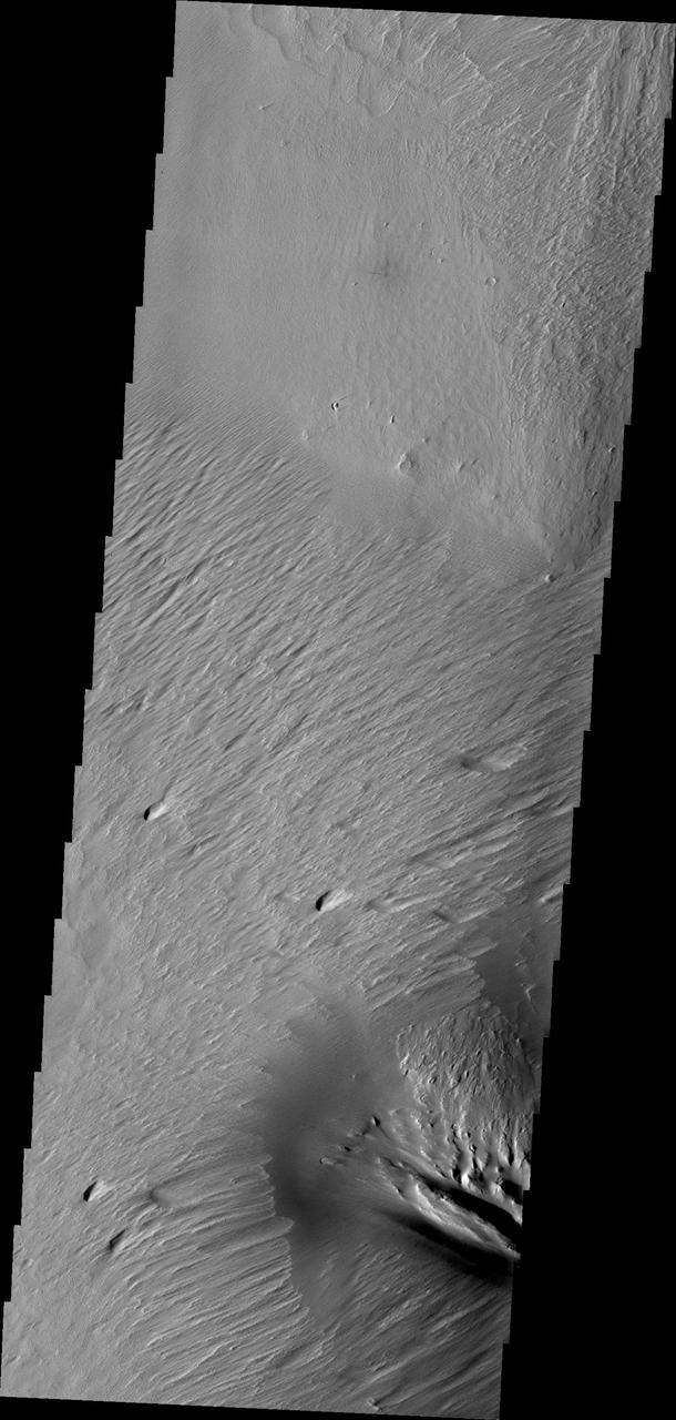
Wind action in the Medusae Fossae region is creating yardangs in the easily eroded material
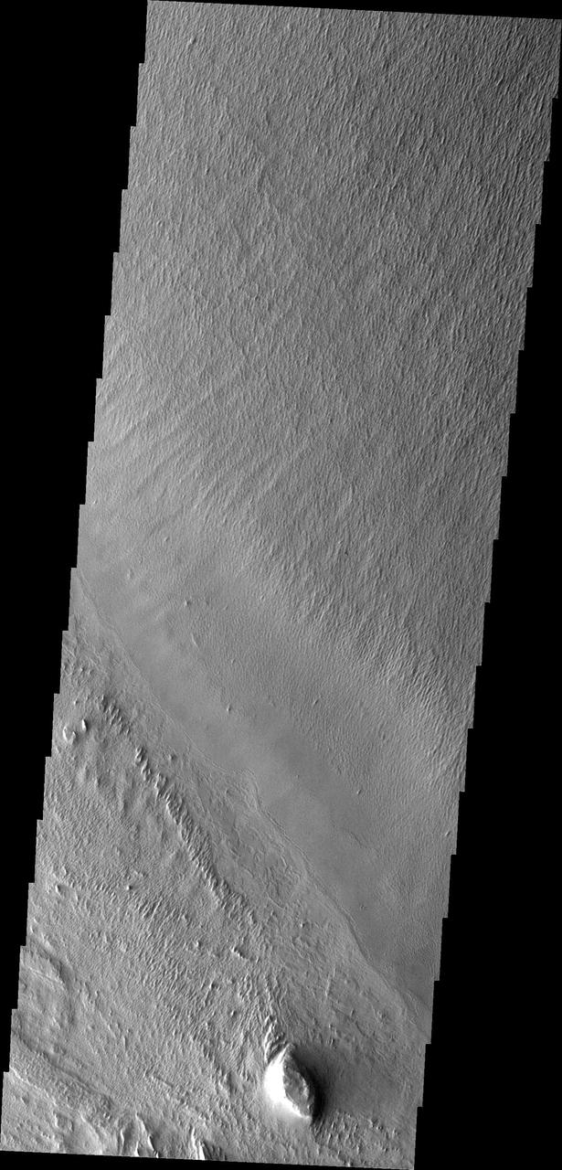
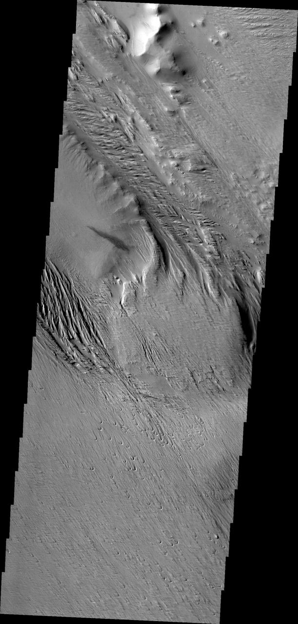
The power of the wind is evident in the erosion of this portion of the Medusae Fossae Formation
These old dunes and the surrouning wind eroded material are part of the Medusa Fossae Formation
This beautifully contrasted infrared-color image shows an area approximately 600 by 900 meters. This is a close-up from NASA Mars Reconnaissance Orbiter spacecraft of the western Medusa Fossae formation where we can see dust-covered rocky, bedrock surfaces beige and a bluish-tinted sand sheet that transitions into several dunes. The bluish sand is thought to originate from the bedrock that lies beneath the dust. If true, this has implications for the composition of the formation, which has been highly debated over the years. http://photojournal.jpl.nasa.gov/catalog/PIA19939
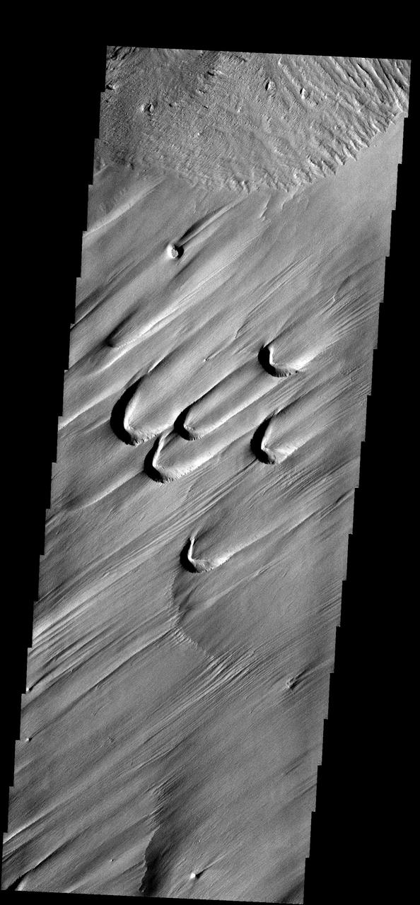
The semi-circular depressions in this image are called blowouts and are formed by wind action. These blowouts are part of the Medusae Fossae Formation
Constant sand-blasting by the winds on Mars have eroded and sculpted the surface in the equatorial region around Medusae Fossae in this image captured by NASA Mars Odyssey.
NASA 2001 Mars Odyssey captured this region of Mars which has been eroded by the wind. Linear hills called yardangs indicate the wind direction, which varies in this area of Medusae Fossae.
The wind-sculpted yardangs in this scene from NASA Mars Odyssey spacecraft are part of the Medusae Fossae Formation, a regionally extensive geologic unit that probably was produced from the accumulation of volcanic ash.
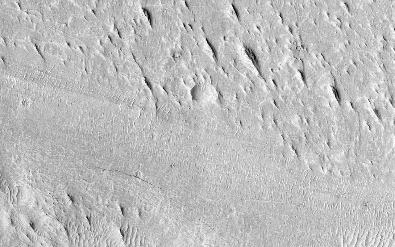
Today's VIS image shows some of the extensive wind etched terrain in Memnonia Sulci, located east of Apollinaris Mons. Memnonia Sulci is part of the Medusae Fossae Formation, a region of soft, easily eroded deposits that extends for nearly 5000km (3106 miles) along the equator of Mars between Olympus Mons and Apollinaris Mons. In this region, like many others throughout the Medusae Fossae Formation, the surface has been eroded by the wind into a series of linear ridges called yardangs. The ridges generally point in direction of the prevailing winds that carved them, so the predominate winds that created the yardangs in this image blew NW/SE. The easily eroded nature of the Medusae Fossae Formation suggests that it is composed of weakly cemented particles, and was most likely formed by the deposition of wind-blown dust or volcanic ash. Orbit Number: 94406 Latitude: -5.66737 Longitude: 184.045 Instrument: VIS Captured: 2023-03-27 16:37 https://photojournal.jpl.nasa.gov/catalog/PIA26027
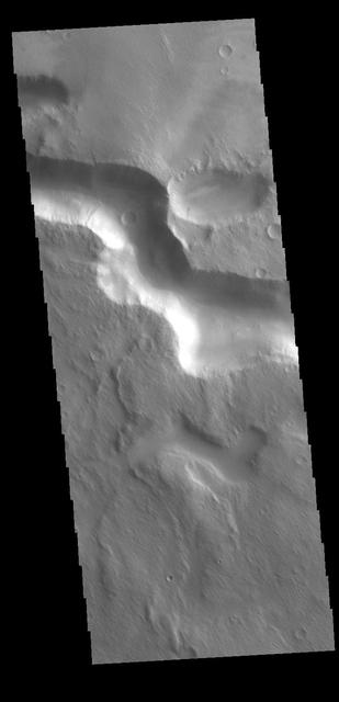
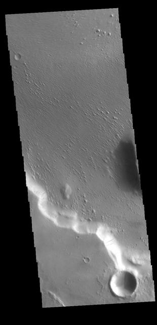
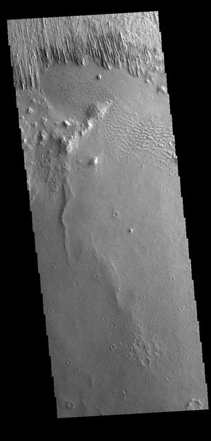
Several named and unnamed channels are located south of the Medusa Fossae Formation on the margin with Terra Sirenum. One of the unnamed channels is visible in the lower half of this VIS image. Wind erosion and deposition have modified the channel, indicating the channel is older than the wind action. Orbit Number: 77996 Latitude: -6.80206 Longitude: 202.156 Instrument: VIS Captured: 2019-07-15 12:00 https://photojournal.jpl.nasa.gov/catalog/PIA23415
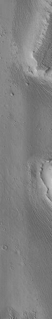
This VIS image is located in Medusae Fossae. Along the cliffside several dark streaks are visible. It is thought that these streaks mark the location where downslope movement of material has removed some of the dust that coats every surface of Mars, and revealed the rocky surface beneath the dust. The surface of the rest of the image appears to have been modified by wind erosion, which has created the aligned small hills and ridges. Orbit Number: 71135 Latitude: -5.43154 Longitude: 197.71 Instrument: VIS Captured: 2017-12-27 09:27 https://photojournal.jpl.nasa.gov/catalog/PIA22365
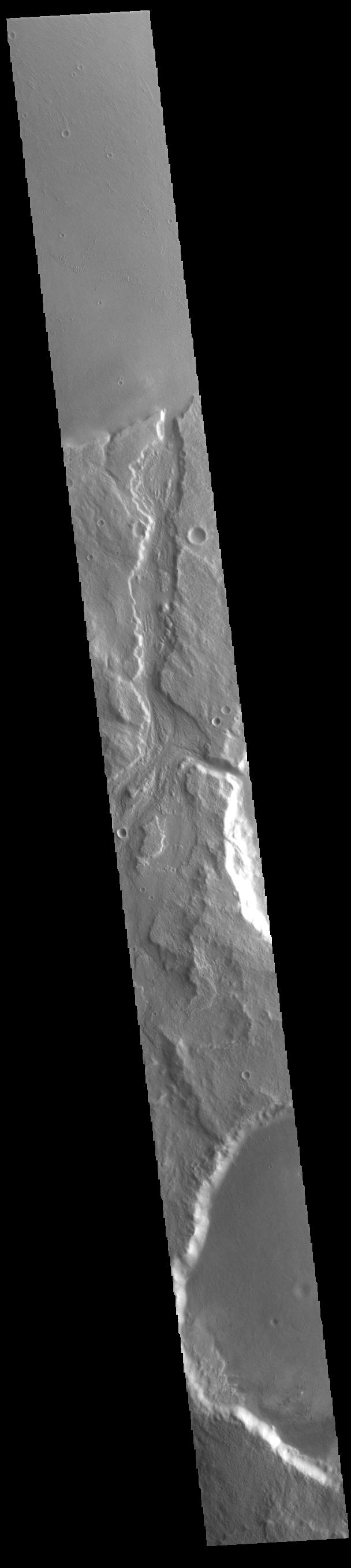
Today's VIS image shows Padus Vallis (middle of image). Located east of Mangala Valles, Padus Vallis is just one of the many small channels that empty into the Medusa Fossae Formation region. Padus Vallis is 57 km (35 miles) long. Orbit Number: 86007 Latitude: -4.81752 Longitude: 210.081 Instrument: VIS Captured: 2021-05-05 02:57 https://photojournal.jpl.nasa.gov/catalog/PIA24220
The surface of this image looks wavy, like that of the sea. These wave shapes are the result of erosion: the removal of material, which has been ongoing for millions, if not billions, of years. This erosion is likely performed by the action of wind and has revealed layered rock that was deposited in this area in the ancient past. The layers were deposited very regularly one on top of another and the erosion has cut across them — sometimes shallowly, sometimes more deeply — to create these giant undulations. More resistant layers protrude further, making them the visible crests of the waves. https://photojournal.jpl.nasa.gov/catalog/PIA23287
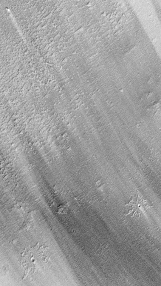
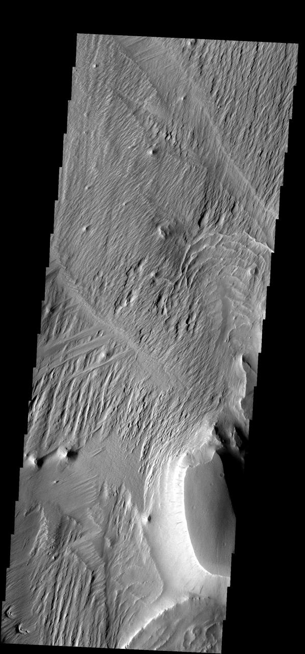
Yardangs are present at the top of this VIS image. These features are created by long term winds scouring a poor cemented surface material into linear ridges and valleys. These yardangs are part of the Medusa Fossae Formation. It has been suggested that this region of Mars provides a large percentage of the surface dust seen around the planet. Ash falls from nearby volcanoes may have been the source of the surface materials eroded into these and other wind eroded landforms. Orbit Number: 77922 Latitude: -12.7644 Longitude: 177.96 Instrument: VIS Captured: 2019-07-09 09:43 https://photojournal.jpl.nasa.gov/catalog/PIA23398
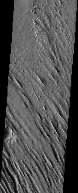
Today's VIS image shows part of the eastern flank of Eumenides Dorsum, a large linear rise located in southern Amazonis Planitia. This area of Mars is dominated by poorly cemented surface material that is easily eroded by the wind. Features align with wind direction, indicating that the winds in this region blew from the northeast. Eumenides Dorsum is part of the larger Medusa Fossae Formation of wind eroded materials south and southwest of Olympus Mons. The nature of the material being eroded is not known, but may be ash fall deposits, sourced from the Tharsis and Apollinaris volcanoes. Orbit Number: 93214 Latitude: -3.19141 Longitude: 205.117 Instrument: VIS Captured: 2022-12-19 12:09 https://photojournal.jpl.nasa.gov/catalog/PIA25849
This VIS image of the northwestern end of Gordii Dorsum shows where the dorsum meets Amazonis Planitia. This area of Mars is dominated by poorly cemented surface material that is easily eroded by the wind. Features align with wind direction, indicating that the winds in this region blew to the northwest. Gordii Dorsum is part of the larger Medusa Fossae Formation of wind eroded materials south and southwest of Olympus Mons. The nature of the material being eroded is not known, but may be ash fall from the large volcanoes in the region. Orbit Number: 86244 Latitude: 10.6389 Longitude: 210.903 Instrument: VIS Captured: 2021-05-24 15:22 https://photojournal.jpl.nasa.gov/catalog/PIA24230
A close-up image from NASA's Mars Reconnaissance Orbiter of a recent 150-meter diameter impact crater near Amazonis Mensa and Medusae Fossae is another great example of geologic complexity of Mars. The spider web-like texture of this crater is intriguing. But what does it mean? On Earth, we have many geologic mechanisms that embrace the surface of the planet in an almost constant state of metamorphosis. Although Mars is not nearly as geologically active as Earth, it is still a host to many processes that shape its surface even today (e.g., aeolian modification, periglacial processes, recent impacts, etc.). The appearance of the ejecta of this crater is likely a combination of both the characteristics of the target material it was deposited on, and processes that modified and degraded it over time. When we look to other images in this region we find a similar texture. This texture is referred to as “yardangs†by scientists who study wind erosion. Yardangs are streamlined ridge-and-trough patterns formed by the erosion of wind dominating from a specific direction; in this particular case, from the southeast to the northwest. The specific direction of the winds is supported by regional context images that show many craters in the region have wind streak "tails" that points to the northwest. Craters of this size have been observed to form recently on Mars, so the fact that this crater is modified speaks volumes, and gives us a chance to decode some geological messages from Mars. https://photojournal.jpl.nasa.gov/catalog/PIA21759
Today's VIS image shows a region of wind etched materials. In regions of poorly cemented surface materials it is possible to create large features due to just the action of the wind. The equatorial region between Olympus Mons and Apollinaris Mons is dominated by wind etched regions. The direction of the wind aligns with the ridges and valleys. The dominant wind direction in this region is southeast to northwest; however, the wind direction for the upper right of the image is to the other direction. The long linear wind etched valleys are called yardangs. These features are created by long term winds scouring a poor cemented surface material into linear ridges and valleys. These yardangs are part of the Medusa Fossae Formation. It has been suggested that this region of Mars provides a large percentage of the surface dust seen around the planet. Ash falls from nearby volcanoes may have been the source of the surface materials eroded into these and other wind eroded landforms. Orbit Number: 94817 Latitude: -0.841679 Longitude: 206.486 Instrument: VIS Captured: 2023-04-30 12:50 https://photojournal.jpl.nasa.gov/catalog/PIA26177
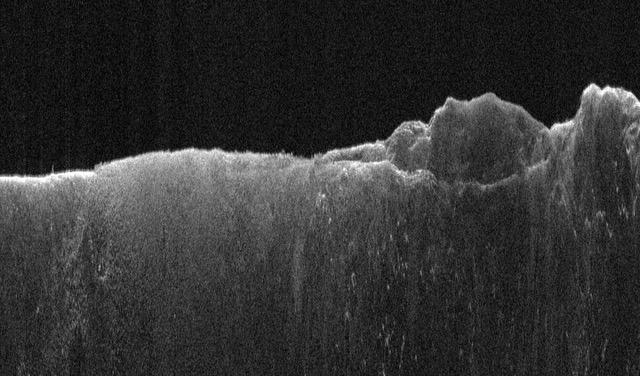
This radargram shows data collected by the Shallow Radar, or SHARAD, on NASA's Mars Reconnaissance Orbiter (MRO) on May 2, 2023, as it performed a 120-degree roll maneuver called a "very large roll" over a formation named Medusae Fossae. Scientists used SHARAD to look for ice beneath the surface of this region. Designed to peer from about a half-mile to a little over a mile (1 to 2 kilometers) below ground, SHARAD emits radio waves that are reflected off materials in the subsurface, measuring how long it takes for those waves to bounce back to the instrument. The longer it takes, the deeper the subsurface layer is. Because different materials reflect radio waves differently, SHARAD allows scientists to distinguish between rock, sand, and ice. While MRO often performs a standard 28-degree roll to give SHARAD's antenna a more direct view of Martian terrain, the 120-degree very large roll rotates the antenna even farther, providing its radio waves an unobstructed path to the surface. This boosts the radar's signals by 10 times or more, giving SHARAD a clearer, deeper view of the Martian underground than ever before. Scientists hope the very large rolls will help them look for frozen and liquid water, among other things. https://photojournal.jpl.nasa.gov/catalog/PIA26555
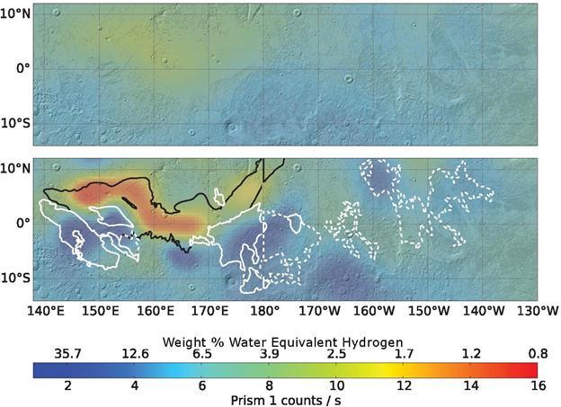
Re-analysis of 2002-2009 data from a hydrogen-finding instrument on NASA's Mars Odyssey orbiter increased the resolution of maps of hydrogen abundance. The reprocessed data (lower map) shows more "water-equivalent hydrogen" (darker blue) in some parts of this equatorial region of Mars. Puzzingly, this suggests the possible presence of water ice just beneath the surface near the equator, though it would not be thermodynamically stable there. The upper map uses raw data from Odyssey's neutron spectrometer instrument, which senses the energy state of neutrons coming from Mars, providing an indication of how much hydrogen is present in the top 3 feet (1 meter) of the surface. Hydrogen detected by Odyssey at high latitudes of Mars in 2002 was confirmed to be in the form of water ice by the follow-up NASA Phoenix Mars Lander mission in 2008. A 2017 reprocessing of the older data applied image-reconstruction techniques often used to reduce blurring from medical imaging data. The results are shown here for an area straddling the equator for about one-fourth the circumference of the planet, centered at 175 degrees west longitude. The white contours outline lobes of a formation called Medusae Fossae, coinciding with some areas of higher hydrogen abundance in the enhanced-resolution analysis. The black line indicates the limit of a relatively young lava plain, coinciding with areas of lower hydrogen abundance in the enhanced-resolution analysis. The color-coding key for hydrogen abundance in both maps is indicated by the horizontal bar, in units expressed as how much water would be present in the ground if the hydrogen is all in the form of water. Units of the equivalent water weight, as a percentage of the material in the ground, are correlated with counts recorded by the spectrometer, ranging from less than 1 weight-percent water equivalent (red) to more than 30 percent (dark blue). https://photojournal.jpl.nasa.gov/catalog/PIA21848