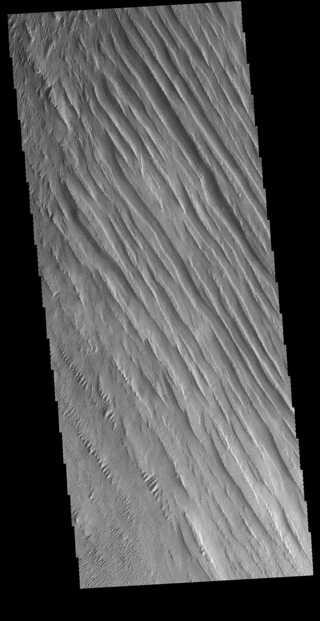
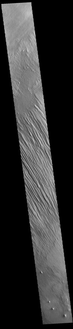
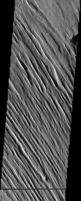
Today's VIS image shows some of the extensive wind etched terrain in Memnonia Sulci, located south west of Olympus Mons. The linear ridges are called yardangs and form by wind removal of semi-cemented material. The ridges are parallel to wind direction, so the predominate winds that created the yardangs in this image blew NW/SE. At the bottom of the image several of the ridges have been eroded into smaller ridges aligned perpendicular to the large yardangs, indicating winds at a different angle. Orbit Number: 66197 Latitude: -5.91796 Longitude: 183.886 Instrument: VIS Captured: 2016-11-15 13:08 http://photojournal.jpl.nasa.gov/catalog/PIA21283
Memnonia Sulci Yardangs
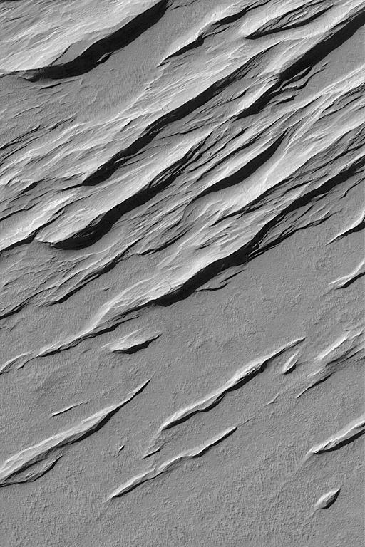
These yardangs are being formed by wind erosion of the Memnonia Sulci deposits
Wind is one of a handful of active processes on Mars today. This image taken by NASA 2001 Mars Odyssey of Memnonia Sulci demonstrates the power of wind in eroding and shaping the surface.
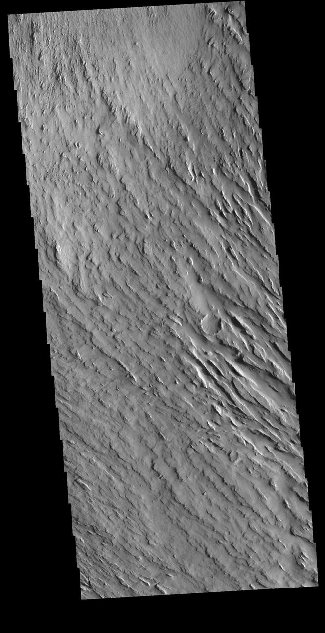
Today's VIS image shows some of the extensive wind etched terrain in Memnonia Sulci, located east of Apollinaris Mons. Memnonia Sulci is part of the Medusae Fossae Formation, a region of soft, easily eroded deposits that extends for nearly 5000km (3106 miles) along the equator of Mars between Olympus Mons and Apollinaris Mons. In this region, like many others throughout the Medusae Fossae Formation, the surface has been eroded by the wind into a series of linear ridges called yardangs. The ridges generally point in direction of the prevailing winds that carved them, so the predominate winds that created the yardangs in this image blew NW/SE. The easily eroded nature of the Medusae Fossae Formation suggests that it is composed of weakly cemented particles, and was most likely formed by the deposition of wind-blown dust or volcanic ash. Orbit Number: 94406 Latitude: -5.66737 Longitude: 184.045 Instrument: VIS Captured: 2023-03-27 16:37 https://photojournal.jpl.nasa.gov/catalog/PIA26027
Today's VIS image shows some of the extensive wind etched terrain in Memnonia Sulci, located southwest of Olympus Mons. The linear ridges are called yardangs and form by wind removal of semi-cemented material. The ridges are parallel to wind direction, so the predominate winds that created the yardangs in this image blew NW/SE. Orbit Number: 81216 Latitude: -7.99809 Longitude: 185.052 Instrument: VIS Captured: 2020-04-05 15:23 https://photojournal.jpl.nasa.gov/catalog/PIA23944
This MOC image shows a contact between a dust-covered plain and a dust-mantled, textured upland in the Memnonia Sulci region of Mars
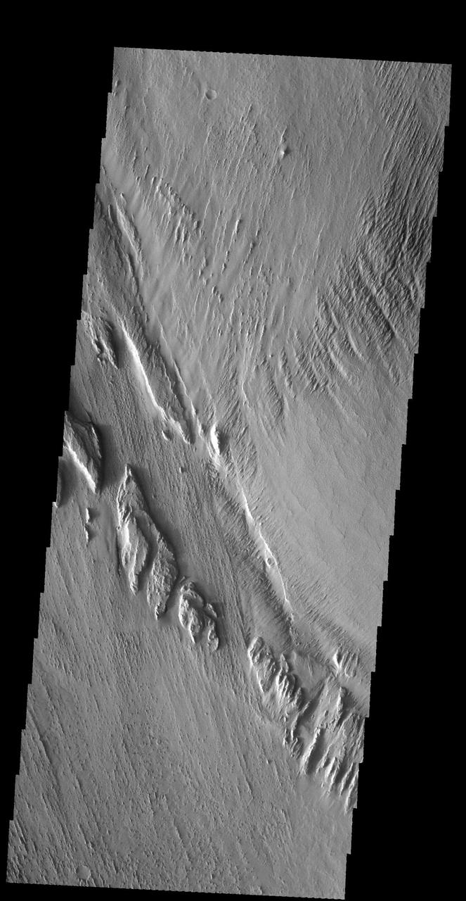
This image captured by NASA 2001 Mars Odyssey spacecraft is located near Memnonia Sulci, on the edge of Lucus Planum.
This image from NASA 2001 Mars Odyssey spacecraft shows a region near Memnonia Sulci, which has been eroded by the wind to form linear ridges called yardangs. The two prominent directions of wind are recorded by the two directions of the ridges.
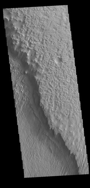
The elongated hills in this VIS image are a feature termed yardangs. Yardangs are formed by wind activity in regions where the surface material is not well cemented. The elongation indicates the direction of the wind. Orbit Number: 65299 Latitude: -10.1078 Longitude: 183.91 Instrument: VIS Captured: 2016-09-02 13:39 http://photojournal.jpl.nasa.gov/catalog/PIA21019
The wind-sculpted yardangs in this scene from NASA Mars Odyssey spacecraft are part of the Medusae Fossae Formation, a regionally extensive geologic unit that probably was produced from the accumulation of volcanic ash.
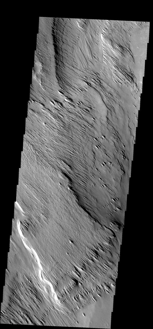
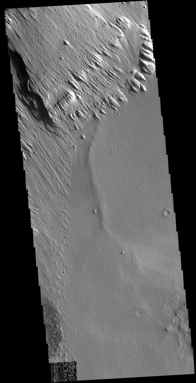
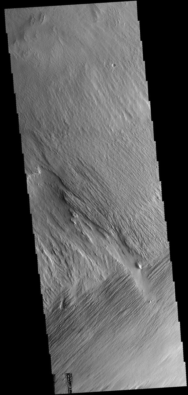
The lower elevation on the left side of this VIS image is part of Memnonia Sucli. The higher elevations to the right are on the upper part of a mesa that bounds the sulci. The image shows some of the extensive wind etched terrain in Memnonia Sulci, located south west of Olympus Mons. The linear ridges are called yardangs and form by wind removal of semi-cemented material. The ridges are parallel to wind direction, so the predominate winds that created the yardangs in this image blew NE/SW. Orbit Number: 78296 Latitude: -7.8302 Longitude: 186.694 Instrument: VIS Captured: 2019-08-09 04:54 https://photojournal.jpl.nasa.gov/catalog/PIA23471
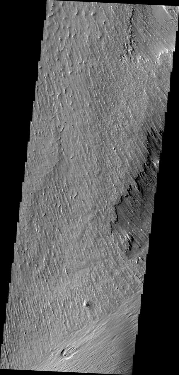
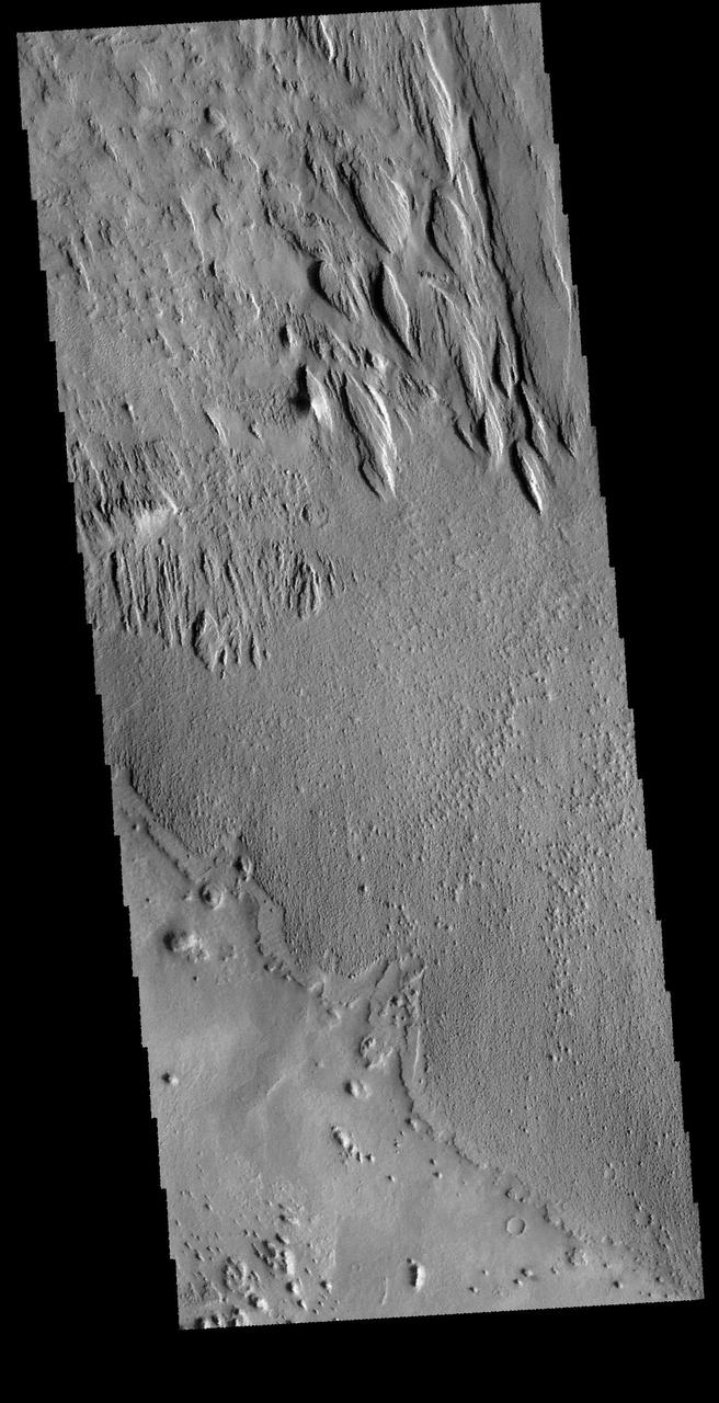
Long term winds have etched the surface in Memnonia Sulci. Partial cemented surface materials are easily eroded by the wind, forming linear ridges called yardangs. The multiple direction of yardangs in this VIS image indicate that there were at least two different wind directions in this area. Orbit Number: 59217 Latitude: -8.33112 Longitude: 186.506 Instrument: VIS Captured: 2015-04-20 15:12 http://photojournal.jpl.nasa.gov/catalog/PIA19502