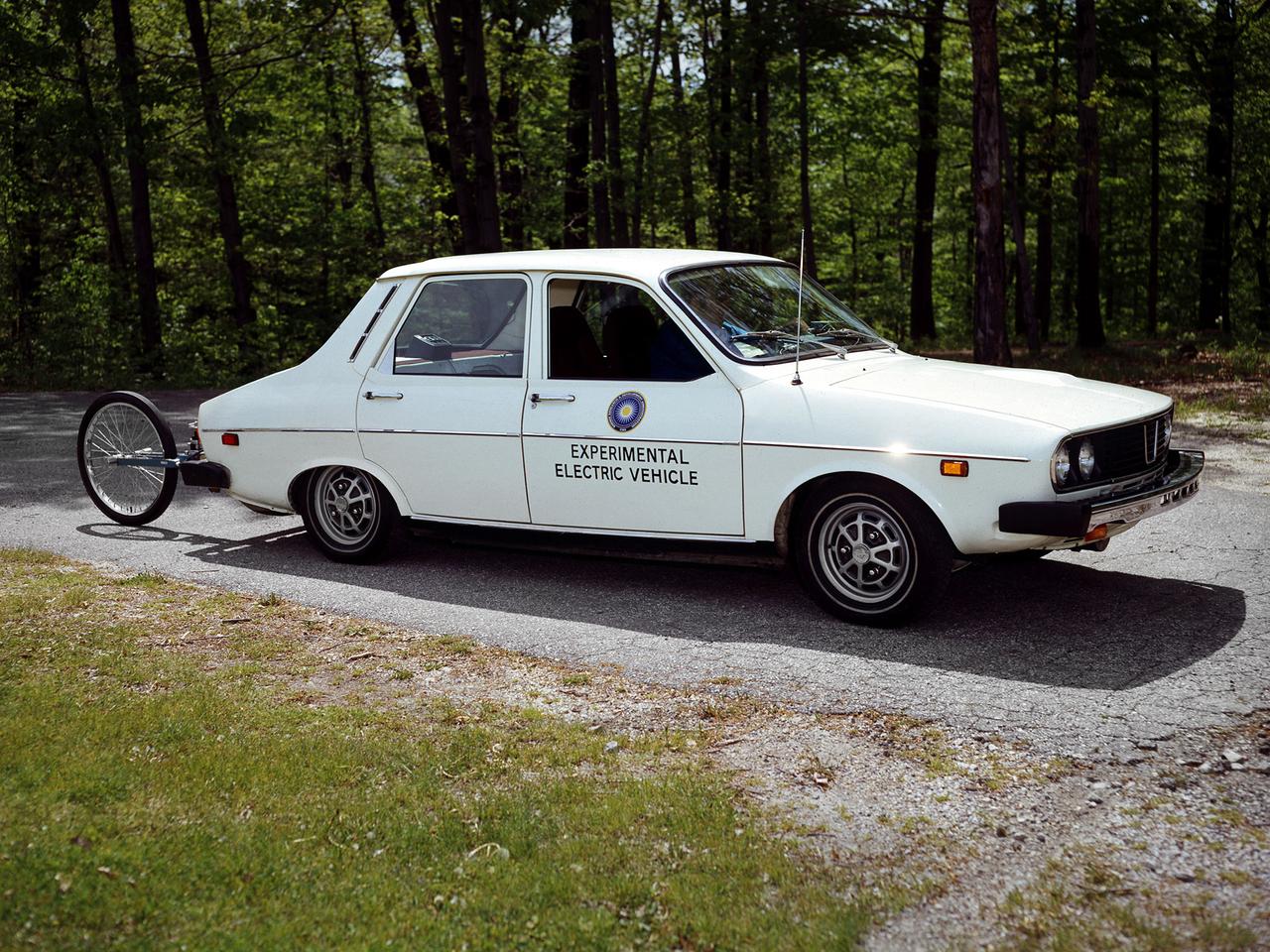
The National Aeronautics and Space Administration (NASA) Lewis Research Center tested 16 commercially-manufactured electric vehicles, including this Metro, during the mid-1970s. Lewis and the Energy Research and Development Administration (ERDA) engaged in several energy-related programs in the mid-1970s, including the Electric Vehicle Project. NASA and ERDA undertook the program in 1976 to determine the state of the current electric vehicle technology. As part of the project, Lewis and ERDA tested every commercially available electric car model. Electric Vehicle Associates, located in a Cleveland suburb, modified a Renault 12 vehicle to create this Metro. Its 1040-pound golfcart-type battery provided approximately 106 minutes of operation. The tests analyzed the vehicle’s range, acceleration, coast-down, braking, and energy consumption. Some of the vehicles had analog data recording systems to measure the battery during operation and sensors to determine speed and distance. The researchers found the performance of the different vehicles varied significantly. In general, the range, acceleration, and speed were lower than that found on conventional vehicles. They also found that traditional gasoline-powered vehicles were as efficient as the electric vehicles. The researchers concluded, however, that advances in battery technology and electric drive systems would significantly improve efficiency and performance.
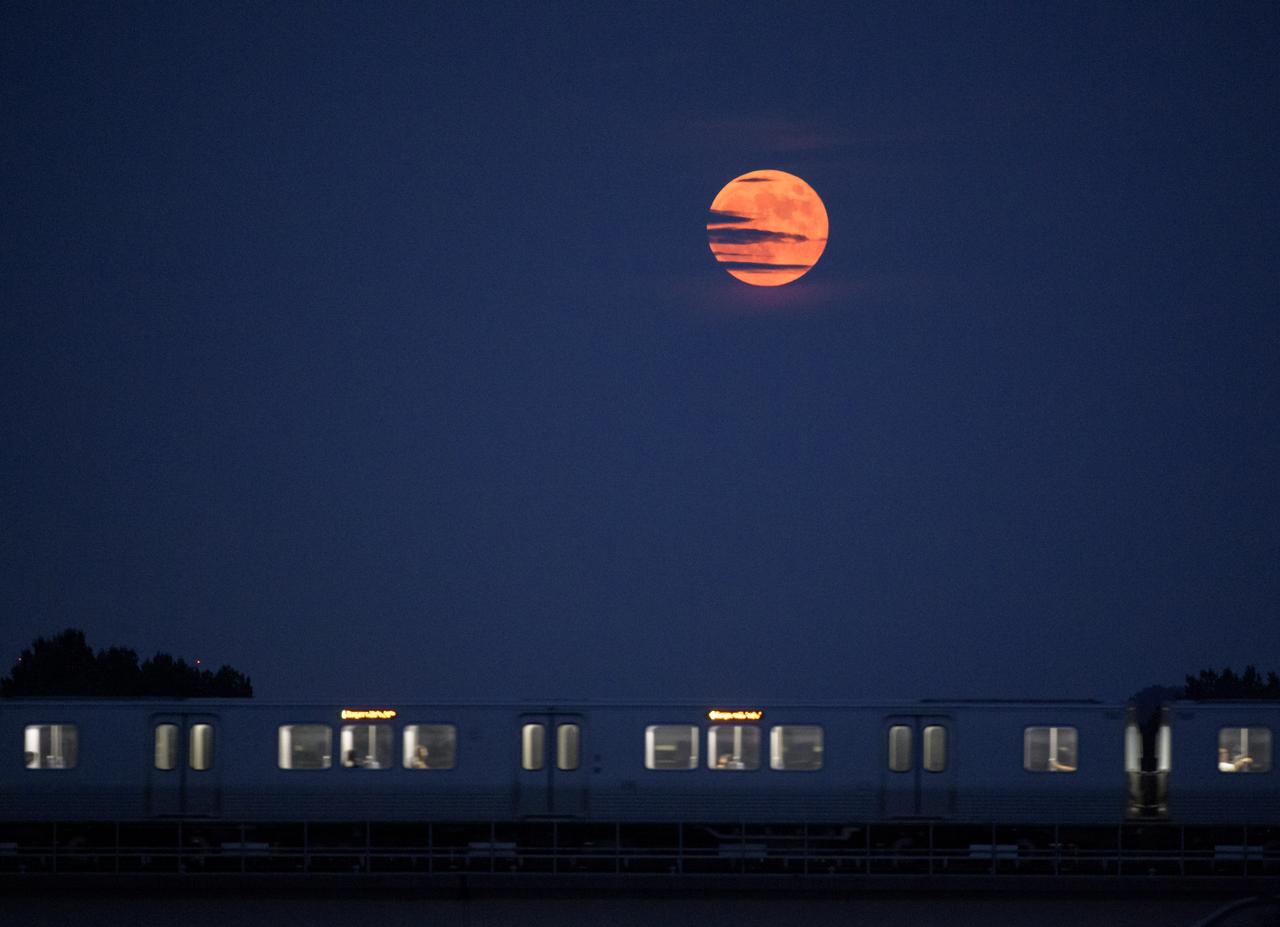
The Moon rises as a Metrorail car crosses the Potomac river in Washington 50 years to the day after astronauts Neil Armstrong, Michael Collins, and Buzz Aldrin launched on Apollo 11, the first mission to land astronauts on the Moon, Tuesday, July 16, 2019. Photo Credit: (NASA/Bill Ingalls)

Silicon Valley FIRST Regional Robotics competition: Evolution Team 1834 - NASA/Google/NASA Robotics Education FIRST Spnsorship program/San Jose Job Corps/MetroED & SIA Tech, San Jose, California (CA)
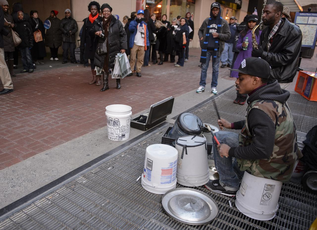
Parade goers enjoy the music of street musicians outside a metro stop after attending the inaugural parade honoring President Barack Obama, Monday, Jan. 21, 2013, in Washington. Photo Credit: (NASA/Paul E. Alers)
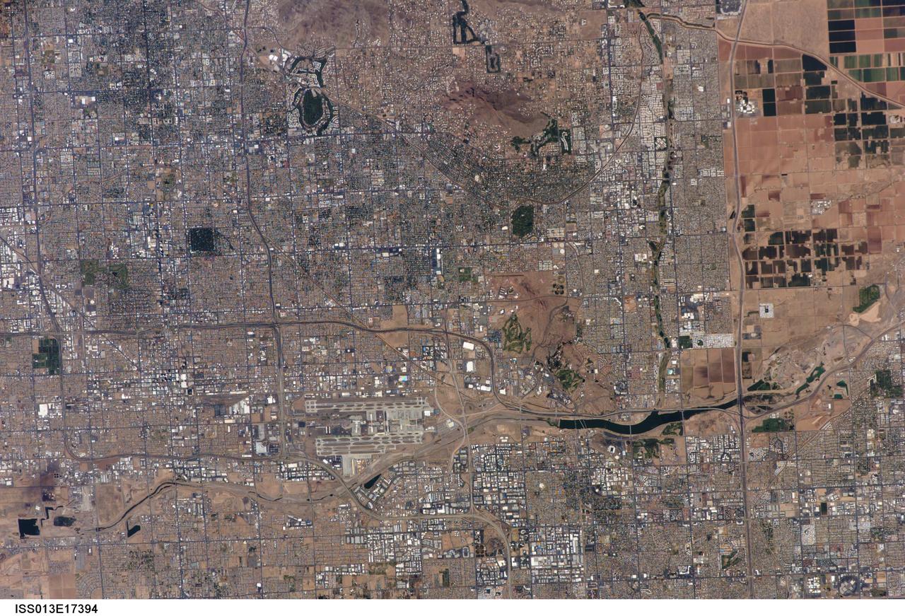
ISS013-E-17394 (10 May 2006) --- The central Phoenix Metro Area, Arizona is featured in this image photographed by an Expedition 13 crewmember on the International Space Station. The Phoenix, Arizona metropolitan area is the largest in the southwestern United States, and is comprised of 21 contiguous incorporated municipalities. Such a collection of discrete political entities forming a larger integrated urban landscape is referred to as a conurbation by urban geographers. This portion of a high resolution (approximately 9 meters/pixel) photograph (upper image) of the central metro region includes the boundary area between three of the municipalities included in the conurbation: the Cities of Phoenix (upper image, left), Tempe (upper image, center and lower right), and Scottsdale (upper image, upper right).
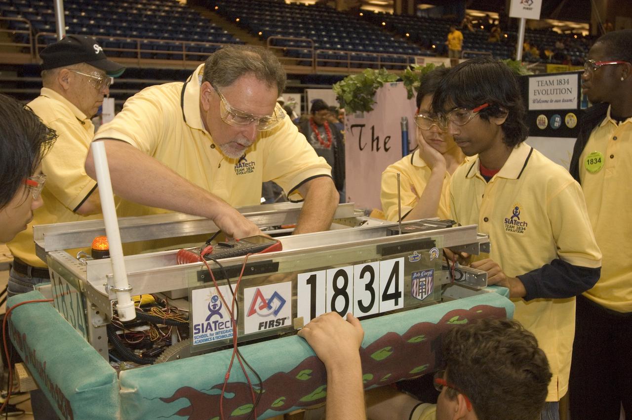
Silicon Valley FIRST Regional Robotics competition: Evolution Team 1834 - NASA/Google/NASA Robotics Education FIRST Spnsorship program/San Jose Job Corps/MetroED & SIA Tech, San Jose, California (CA)s Cheezy Poofs team-1834

ISS033-E-011058 (9 Oct. 2012) --- Photographed by one of the Expedition 33 crew members aboard the International Space Station, this oblique nocturnal view features Phoenix, Arizona. According to the U.S. Census Bureau, the Phoenix-Mesa-Glendale metro area has a population approaching 4.5 million, ranking the area number 13 in the United States.

Silicon Valley FIRST Regional Robotics competition: Evolution Team 1834 - NASA/Google/NASA Robotics Education FIRST Spnsorship program/San Jose Job Corps/MetroED & SIA Tech , San Jose, California (CA) trouble shooting with the help of Royal Robotrons Team 1070 - California State University, Northridge/Dreamworks Animation skg Louisville Hight school, Woodlands Hills, California (CA)

Metro High School Student Anthony Springer talks during the NASA Future Forum Inspiration and Education Panel at The Ohio State University on Monday, Feb. 20, 2012, in Columbus, Ohio. The NASA Future Forum features panel discussions on the importance of education to our nation's future in space, the benefit of commercialized space technology to our economy and lives here on Earth, and the shifting roles for the public, commercial and international communities in space. Photo Credit: (NASA/Bill Ingalls)
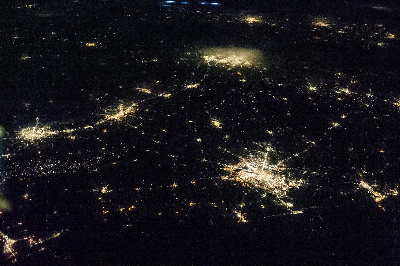
ISS036-E-009405 (17 June 2013) --- One of the Expedition 36 crew members aboard the International Space Station, some 240 miles above Earth, used a 50mm lens to record this oblique nighttime image of a large part of the nation’s second largest state in area, including the four largest metropolitan areas in population. The extent of the metropolitan areas is easily visible at night due to city and highway lights. The largest metro area, Dallas-Fort Worth, often referred to informally as the Metroplex, is the heavily cloud-covered area at the top center of the photo. Neighboring Oklahoma, on the north side of the Red River, less than 100 miles to the north of the Metroplex, appears to be experiencing thunderstorms. The Houston metropolitan area, including the coastal city of Galveston, is at lower right. To the east near the Texas border with Louisiana, the metropolitan area of Beaumont-Port Arthur appears as a smaller blotch of light, also hugging the coast of the Texas Gulf. Moving inland to the left side of the picture one can delineate the San Antonio metro area. The capital city of Austin can be seen to the northeast of San Antonio. This and hundreds of thousands of other Earth photos taken by astronauts and cosmonauts over the past 50 years are available on http://eol.jsc.nasa.gov
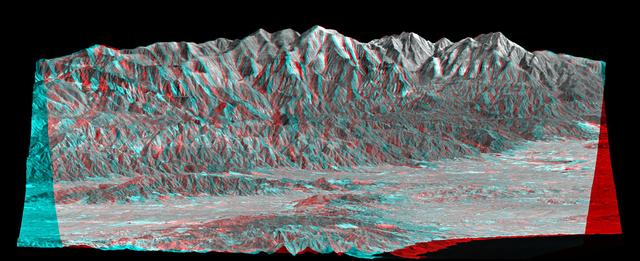
Mount San Antonio more commonly known as Mount Baldy crowns the San Gabriel Mountains northeast of Los Angeles, Calif., in this anaglyph from NASA Shuttle Radar Topography Mission. 3D glasses are necessary to view this image.
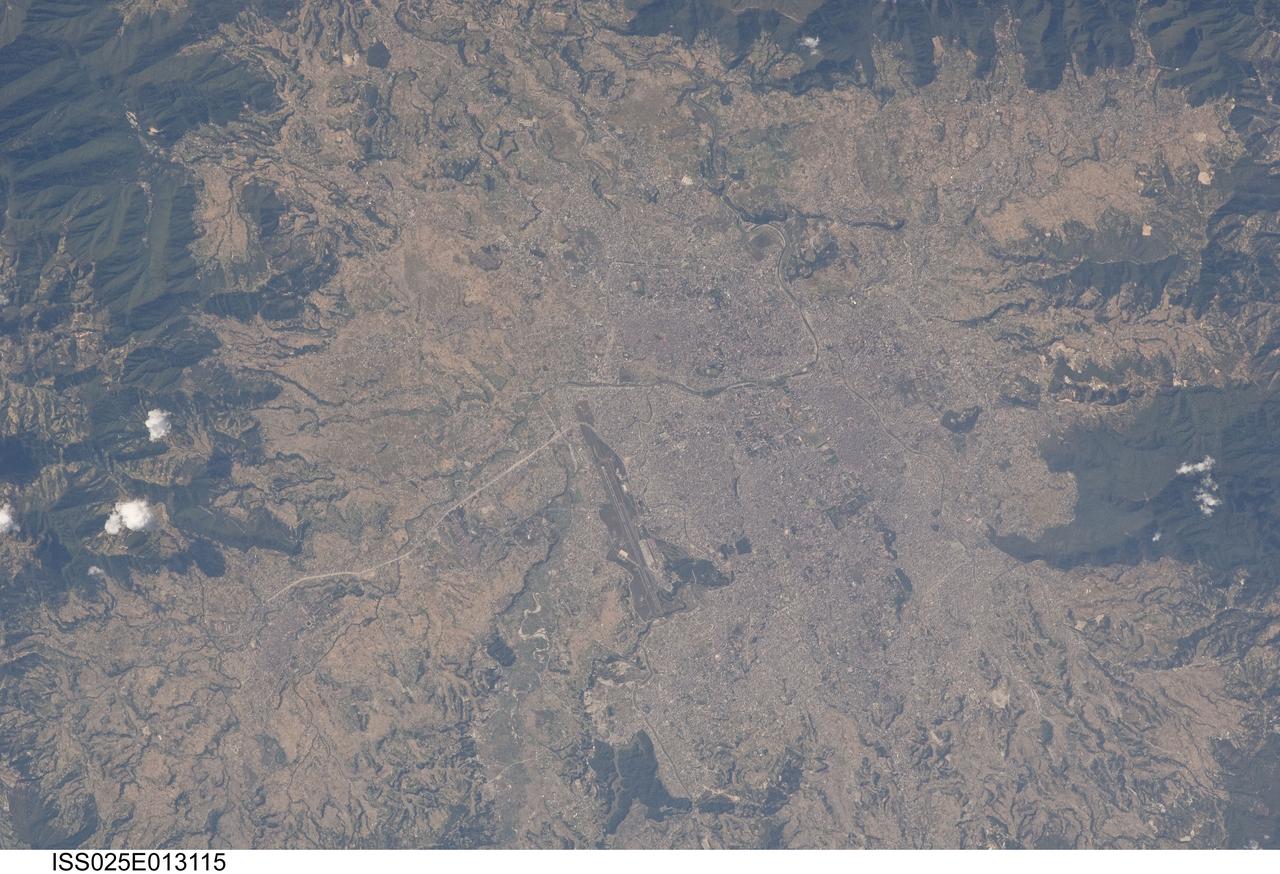
ISS025-E-013115 (9 Nov. 2010) --- Kathmandu, Nepal is featured in this image photographed by an Expedition 25 crew member on the International Space Station. The capital and largest city of Nepal, Kathmandu occupies much of the Kathmandu Valley located near the center of the country. Nepal itself contains much of the Himalaya mountain range between China (Tibet) to the north and India to the south. Geological and fossil evidence indicates that the Kathmandu Valley was filled by a large lake (Paleo-Kathmandu Lake) between approximately 2.8 million and 10,000 years ago, according to scientists. Geologists believe the lake drained in phases over time due both to a drier regional climate, continuing tectonic uplift and faulting in the region, and formation of an integrated valley drainage system as river channels cut through previous natural rock ridge dams. The green vegetated slopes that ring the Kathmandu metro area (light gray, center) include both forest reserves and national parks. The metropolitan area is relatively flat compared to the surrounding high mountains. Tribhuvan International Airport, located near the current eastern margin of the metro area, is the only international airport in Nepal. Archeological evidence suggests that the development of Kathmandu, together with the nearby “sister cities” of Lalitpur and Bhaktapur, began almost 2,000 years ago. Today, Kathmandu and its sister cities form the governmental, cultural, and—as a main access point to the Himalayas for tourism—economic center of the country.
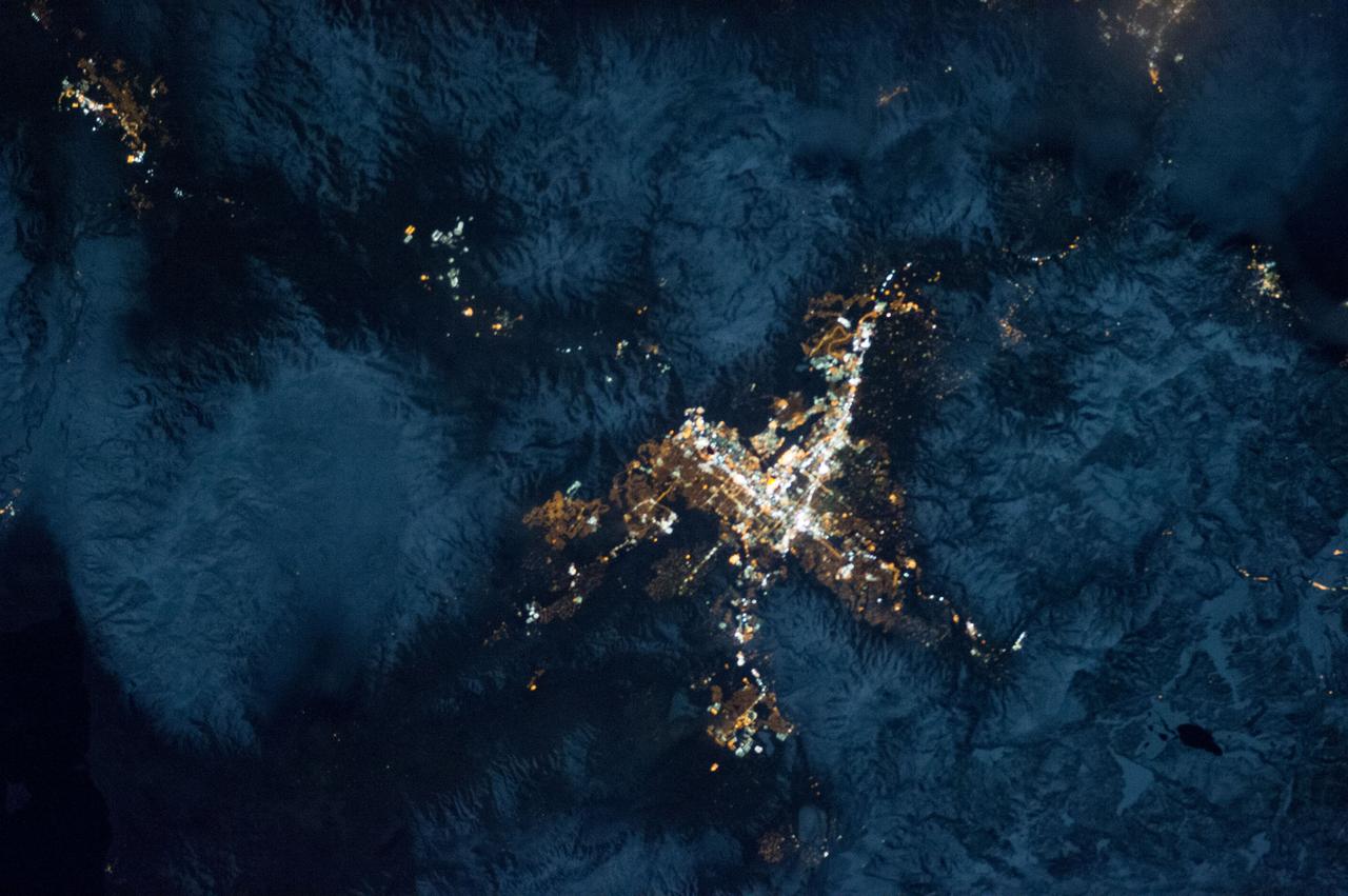
ISS034-E-035548 (28 Jan. 2013) --- A nighttime view of the Reno, Nevada metropolitan area is featured in this image photographed by an Expedition 34 crew member on the International Space Station. Known as ?the biggest little city in the world?, the city of Reno is located in Truckee Meadows along the eastern foothills of the Sierra Nevada near the California border. It forms part of the Reno-Sparks metropolitan area?the largest such area in northern Nevada, and the second largest in the state after Las Vegas. Lake Tahoe, a major destination for skiing and other outdoor recreational activities, is located less than 50 kilometers to the southwest of the Reno-Sparks metro area. The relatively isolated nature of the metropolitan area within the surrounding terrain is highlighted in this nighttime image. The major industrial and commercial areas of both Reno and Sparks are brightly lit at center. The major street grid is visible as orange linear features adjacent to the industrial/commercial areas. Residential areas appear dark in contrast. The Reno-Tahoe International Airport (center) is visible as a dark, dagger-shaped region in the southeast quarter of the metropolitan area. At the time this photograph was taken, the moon was in a waning gibbous phase (98 percent of a full moon). Moonlight provided enough illumination of the ground surface such that the topography, accentuated by snow cover, surrounding the Reno-Sparks area is clearly visible (upper right, lower right) following color enhancement.
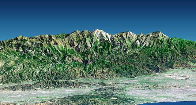
Mount San Antonio more commonly known as Mount Baldy crowns the San Gabriel Mountains northeast of Los Angeles in this computer-generated east-northeast perspective viewed from above the Malibu coastline.

ISS026-E-012474 (24 Dec. 2010) --- A night view of the Montreal metropolitan area is featured in this image photographed by an Expedition 26 crew member on the International Space Station. This photograph of the Montreal, Quebec, Canada metropolitan area (center) illustrates the extent of urbanization made clearly visible by city lights at night. Major roadways and industrial areas are traced by bright white lighting, while the adjacent residential and commercial land uses are characterized by more diffuse yellow-gold lighting. Rivers and other water bodies appear black, while the surrounding rural countryside is faintly illuminated by moonlight. Blurry areas at top and bottom left are caused by cloud cover. Montreal is the largest city in the dominantly French-speaking Province of Quebec. The metropolitan area is the country?s second-largest, having been surpassed by Toronto in 1976. While the city of Montreal proper is located on?and almost completely covers?the Island of Montreal at the confluence of the St. Lawrence (center) and Ottawa Rivers (not visible), the city takes its name from Mont Royal located at the city?s center . Several smaller urban areas form a loose ring around the Montreal metro region: Sorel-Tracy, Saint-Hyacinthe, Saint-Jean-sur-Richelieu, Salaberry-de-Valleyfield, Saint-Jerome, and Joliette are among those that can be readily identified. The International Space Station was located over the Pennsylvania-New York border (near Warren, PA) at the time this image was taken?a ground distance of approximately 600 kilometers southwest of Montreal. This distance from the camera target, coupled with the oblique (inclined) viewing angle from the ISS, results in the foreshortened appearance of urban areas in the image.
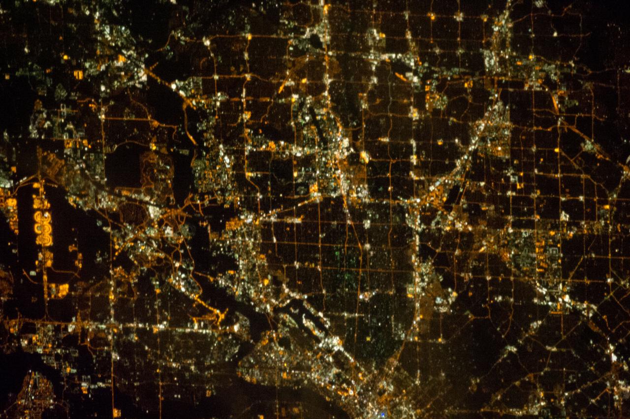
ISS033-E-021663 (15 Nov. 2012) --- A nighttime view of the Dallas, Texas metropolitan area is featured in this image photographed by an Expedition 33 crew member on the International Space Station. Most metropolitan areas of the western United States are configured over large areas with a regular street grid pattern that is highly recognizable from space, particularly at night. The northern Dallas metropolitan area exhibits this pattern. The north-south and east-west grid pattern of major surface streets is highlighted by orange street lighting, lending a fishnet-like appearance to the urban area. Within this framework, smaller residential and commercial buildings and streets give green-gray stipple patterns to some blocks. The airplane terminals of Dallas-Fort Worth International Airport are lit with golden-yellow lights, and surrounded by relatively dark runways and fields at left. Likewise, the runways of Dallas Love Field at lower center are recognizable by their darkness. Other dark areas within the metro region are open space, parks, and water bodies. Dallas is part of the larger Dallas-Fort Worth-Arlington Metropolitan Statistical Area (population 6,526,548 in 2011) as recognized by the U.S. Census Bureau; to most Texans, it is simply ?DFW? or ?the Metroplex.? Several of the larger urban areas within DFW are visible in this image; Dallas, Garland and Richardson all have populations above 100,000 according to the North Central Texas Council of Governments. While historically the economy of Dallas was based in the oil and cotton industries, today commerce, technology, healthcare, and transportation are the major economic drivers.
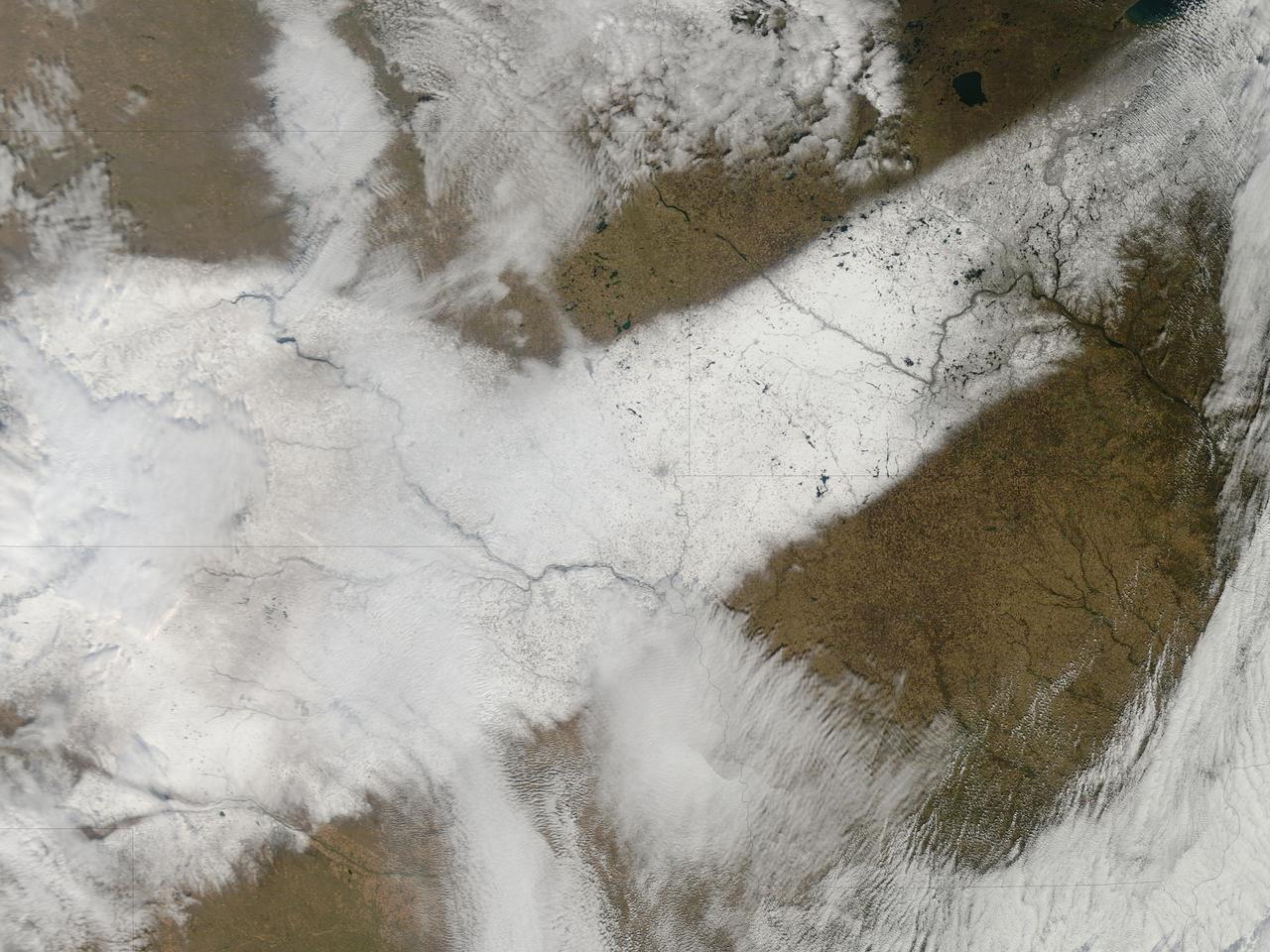
An autumn storm brought the first snow of the season to the Upper Mississippi River Valley and the Midwestern United States in early November, 2013. The Moderate Resolution Imaging Spectroradiometer (MODIS) aboard NASA’s Terra satellite captured this true color image on November 6 just as the storm was clearing. A long band of snow stretching from Colorado in the southwest to Wisconsin in the northeast marked the path of the blowing storm. According to WeatherBug, up to 10 inches blanketed Gordon, Nebraska and Pipestone, Minnesota. Most snow totals in the Central and Northern Plains and Upper Mississippi Valley ranged from 2-5 inches, while Minneapolis-St. Paul metro area picked up 1-2 inches of new snow from the event. Credit: NASA/GSFC/Jeff Schmaltz/MODIS Land Rapid Response Team <b><a href="http://www.nasa.gov/audience/formedia/features/MP_Photo_Guidelines.html" rel="nofollow">NASA image use policy.</a></b> <b><a href="http://www.nasa.gov/centers/goddard/home/index.html" rel="nofollow">NASA Goddard Space Flight Center</a></b> enables NASA’s mission through four scientific endeavors: Earth Science, Heliophysics, Solar System Exploration, and Astrophysics. Goddard plays a leading role in NASA’s accomplishments by contributing compelling scientific knowledge to advance the Agency’s mission. <b>Follow us on <a href="http://twitter.com/NASA_GoddardPix" rel="nofollow">Twitter</a></b> <b>Like us on <a href="http://www.facebook.com/pages/Greenbelt-MD/NASA-Goddard/395013845897?ref=tsd" rel="nofollow">Facebook</a></b> <b>Find us on <a href="http://instagram.com/nasagoddard?vm=grid" rel="nofollow">Instagram</a></b>
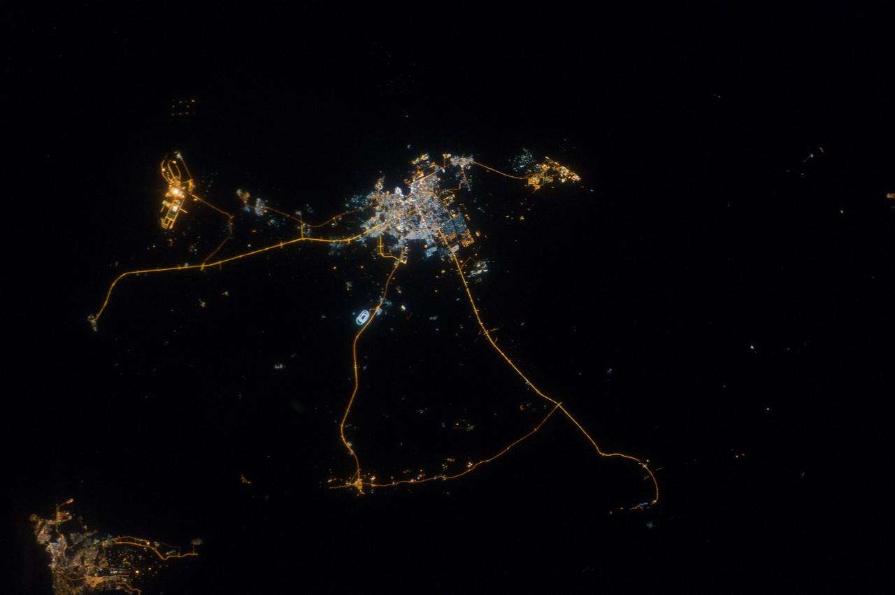
ISS033-E-014856 (13 Oct. 2012) --- A nighttime view of Qatar is featured in this image photographed by an Expedition 33 crew member on the International Space Station. Night lights can be very revealing regarding the distribution of people on the landscape. Here the lights of Qatar show the precise demographic geography of the country. The brightest group at center shows the capital city Doha with the neighboring smaller ports of Ad-Dahira and Umm Sa?id to the north and south, respectively. Even highways and their relative importance can be discerned. Highways are clearly visible leading from the capital west to the Dukhan oil fields, to Saudi Arabia, and to the north of the country--where, judging by the lack of night lights, the population is very low. The relatively low-traffic coast road between the oil fields and the Saudi frontier also stands out. This kind of highly informative human geographic detail is very difficult to discern in daylight images, in which even larger cities, especially in deserts, are hard to see. Almost the entire island nation of Bahrain appears at lower left, with its capital city Manama nearly as bright as the lights of Doha. The difference in light intensity reflects a difference in population?Doha has 1.45 million inhabitants, while the very dense Manama metro area has a population of 1.2 million. While some night views are highly informative about a landscape, they can also be difficult and confusing to identify. Astronauts learn to recognize where they are at night by flying over populated places repeatedly, even though coastlines?one of their best geographic indicators?are generally lost to view because water surfaces and unpopulated land surfaces look the same without illumination (such as from a full moon). Thus the thumb-shaped Qatari peninsula, so well-known in Middle Eastern geography, cannot be discerned at all in this night image. The inset at top right overlays the coastline as seen in daylight onto the night patterns of the image. It shows the Qatari peninsula, with the long arm of the Gulf of Bahrain separating it from Saudi Arabia.
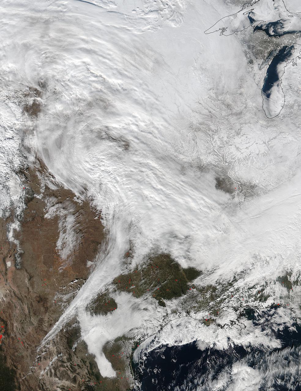
On Jan. 20 at 2:30 p.m. EST the VIIRS instrument aboard NASA-NOAA's Suomi NPP captured this image of the winter storm moving through the central U.S. Credits: NASA Goddard Rapid Response The low pressure area from the Eastern Pacific Ocean moved into the western U.S. and tracked across the four corners region into Texas where NASA-NOAA's Suomi NPP satellite observed the clouds associated with the storm. The Visible Infrared Imaging Radiometer Suite (VIIRS) instrument aboard Suomi NPP satellite captured the visible image on January 20, 2016 at 19:30 UTC (2:30 p.m. EST) when the storm was over the central U.S. In the image, snow cover is visible in the Rockies and southern Great Lakes states. VIIRS collects visible and infrared imagery and global observations of land, atmosphere, cryosphere and oceans. That low pressure system located over the south central United States on Jan. 21 is expected to track east across the Tennessee Valley and will give way to a deepening coastal low pressure area. The National Weather Service said "This latter feature takes over and becomes a dominant force in setting up heavy snow bands over the Mid-Atlantic and very gusty winds." The storm system is expected to bring an increased risk of severe weather from far southeastern Texas across southern Louisiana/Mississippi, and into the far western Florida Panhandle on Thursday, Jan. 21. That threat for severe weather will move east as the low pressure area continues heading in that direction. The National Weather Service Weather Prediction Center in College Park, Maryland said "A potentially crippling winter storm is anticipated for portions of the mid-Atlantic Friday into early Saturday. Snowfall may approach two feet for some locations, including the Baltimore and Washington, D.C. metro areas. Farther north, there is uncertainty in snowfall for the New York City-to-Boston corridor. Farther south, significant icing is likely for portions of Kentucky and North Carolina." <b><a href="http://www.nasa.gov/audience/formedia/features/MP_Photo_Guidelines.html" rel="nofollow">NASA image use policy.</a></b> <b><a href="http://www.nasa.gov/centers/goddard/home/index.html" rel="nofollow">NASA Goddard Space Flight Center</a></b> enables NASA’s mission through four scientific endeavors: Earth Science, Heliophysics, Solar System Exploration, and Astrophysics. Goddard plays a leading role in NASA’s accomplishments by contributing compelling scientific knowledge to advance the Agency’s mission. <b>Follow us on <a href="http://twitter.com/NASAGoddardPix" rel="nofollow">Twitter</a></b> <b>Like us on <a href="http://www.facebook.com/pages/Greenbelt-MD/NASA-Goddard/395013845897?ref=tsd" rel="nofollow">Facebook</a></b> <b>Find us on <a href="http://instagram.com/nasagoddard?vm=grid" rel="nofollow">Instagram</a></b>