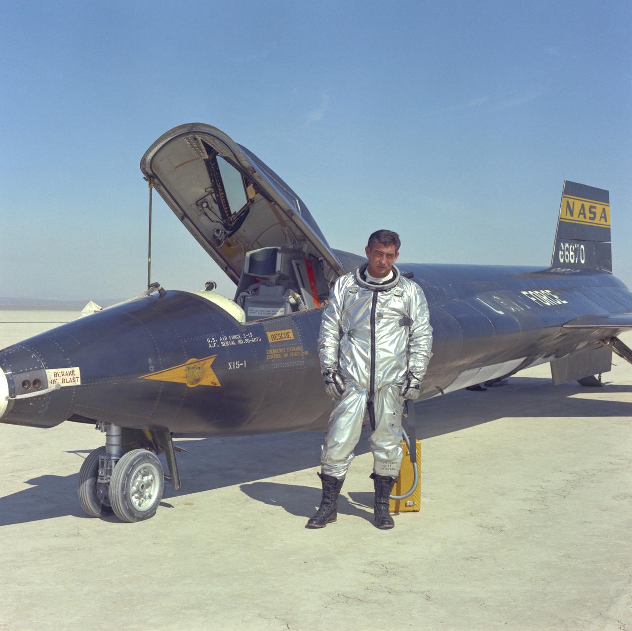
Air Force pilot Mike Adams poses in front of X-15-#1 after flight on Rogers Dry Lake at Edwards Air Force Base in California.
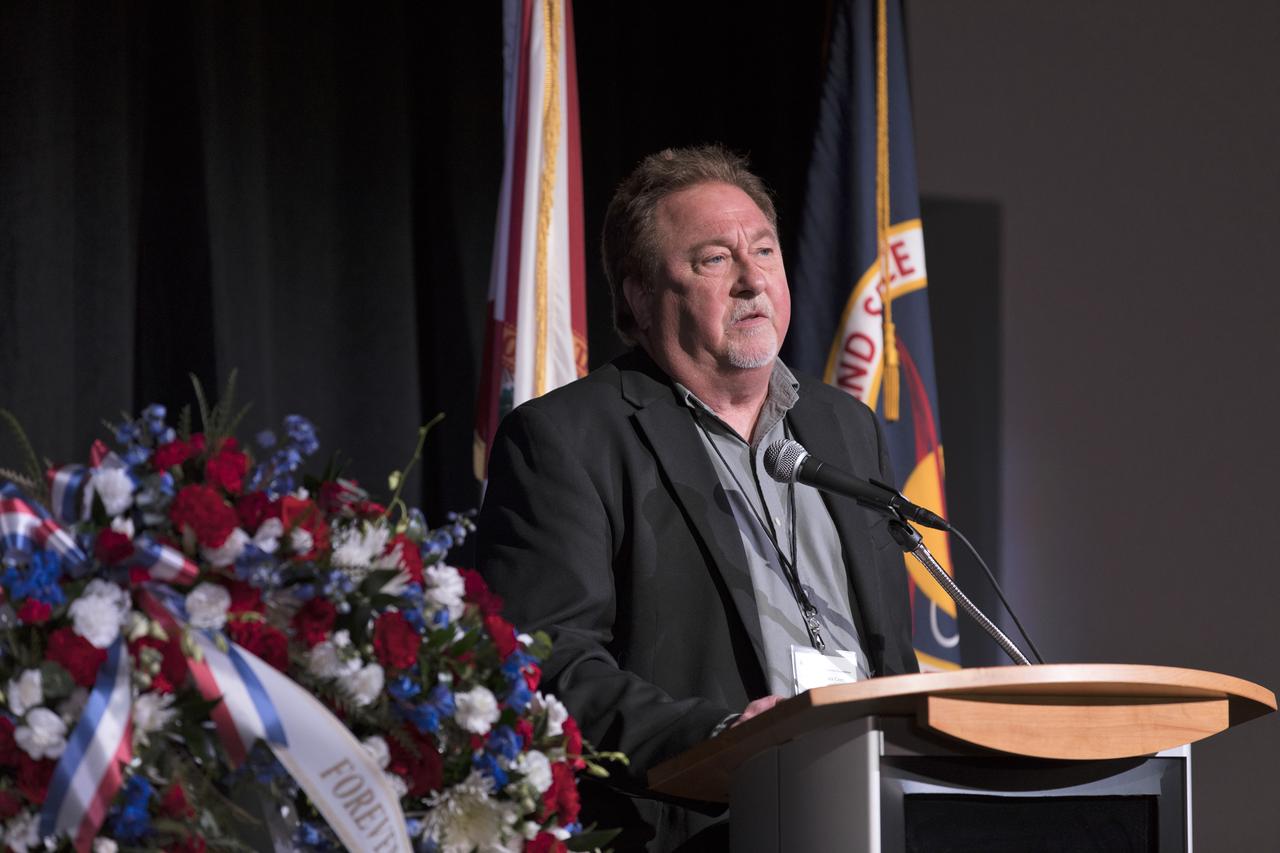
Brent Adams, son of U.S. Air Force astronaut Mike Adams, speaks during this year's Day of Remembrance ceremony at the Kennedy Space Center Visitor Complex. Each year spaceport employees and guests join others throughout NASA honoring the contributions of astronauts who have perished in the conquest of space.
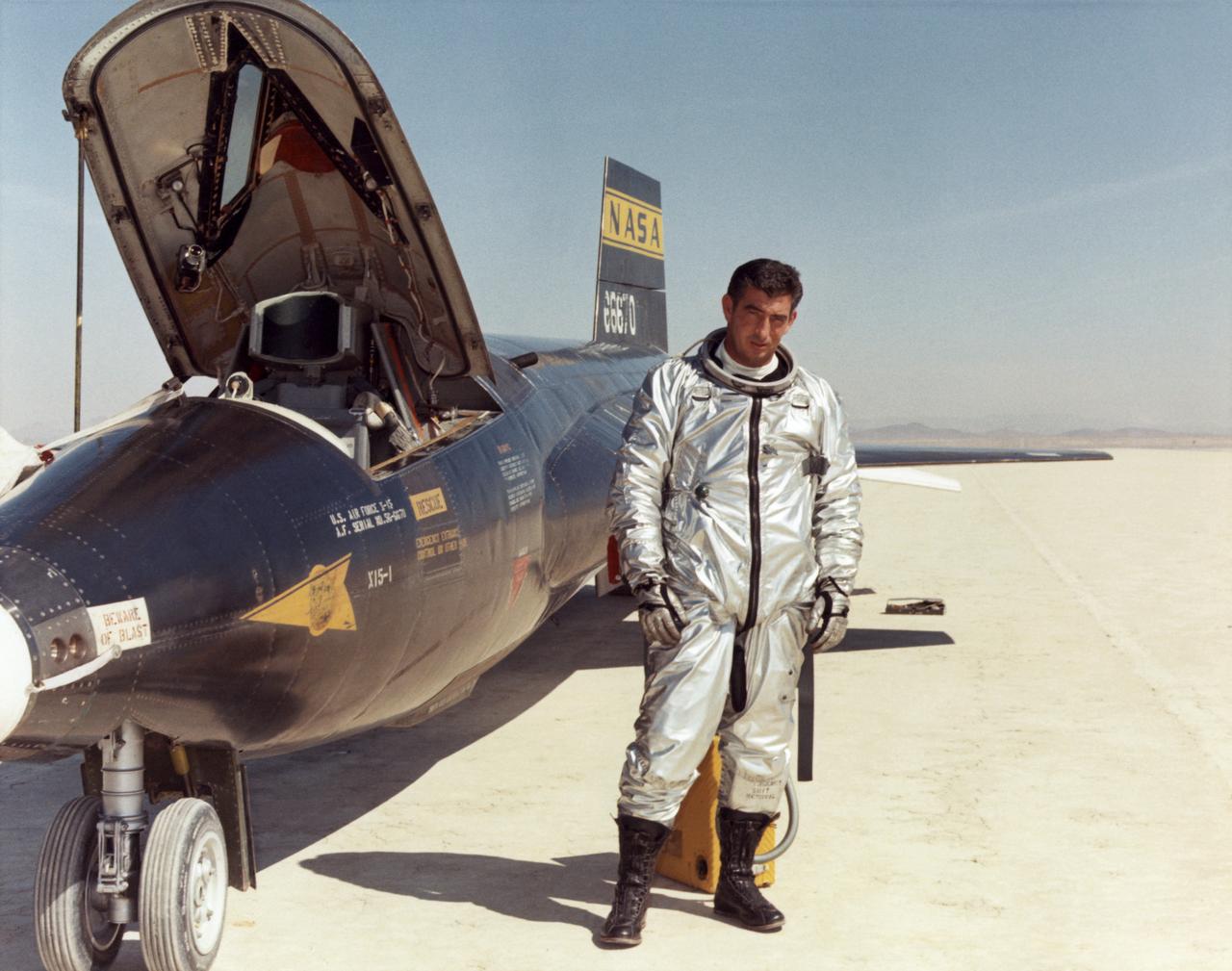
Air Force test pilot Maj. Michael J. Adams stands beside X-15 ship number one. Adams was selected for the X-15 program in 1966 and made his first flight on Oct. 6, 1966. On Nov. 15, 1967, Adams made his seventh and final X-15 flight. The X-15 launched from the B-52, but during the ascent an electrical problem affected the X-15's control system. The aircraft crashed northwest of Cuddeback Lake, California, causing the death of Adams. He was posthumously awarded Air Force astronaut wings because his final flight exceeded 50 miles in altitude. Adams was the only pilot lost in the 199-flight X-15 program.
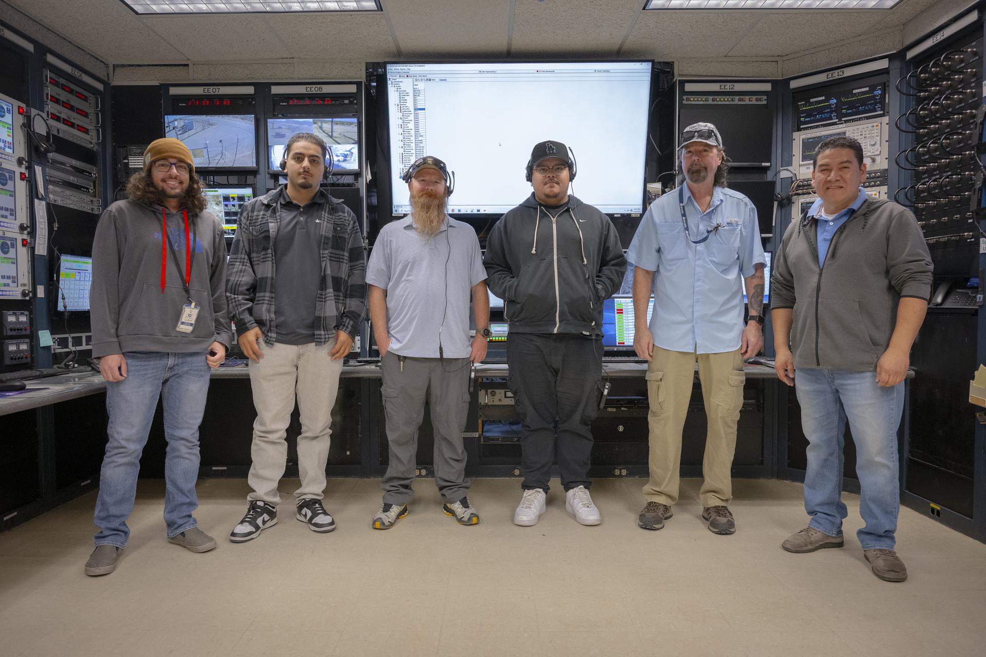
Mission technicians, from left, Adam Cataldo, Alex Oganesyan, Daniel Kelly, Deming Ingles, Mike Gibson, and Kelvin Menendez support communications backup for an International Space Station mission on Tuesday, Sept. 30, 2025, at NASA’s Armstong Flight Research Center in Edwards, California. The team is part of the center’s Dryden Aeronautical Test Range, which provides voice and tracking support to the space station.
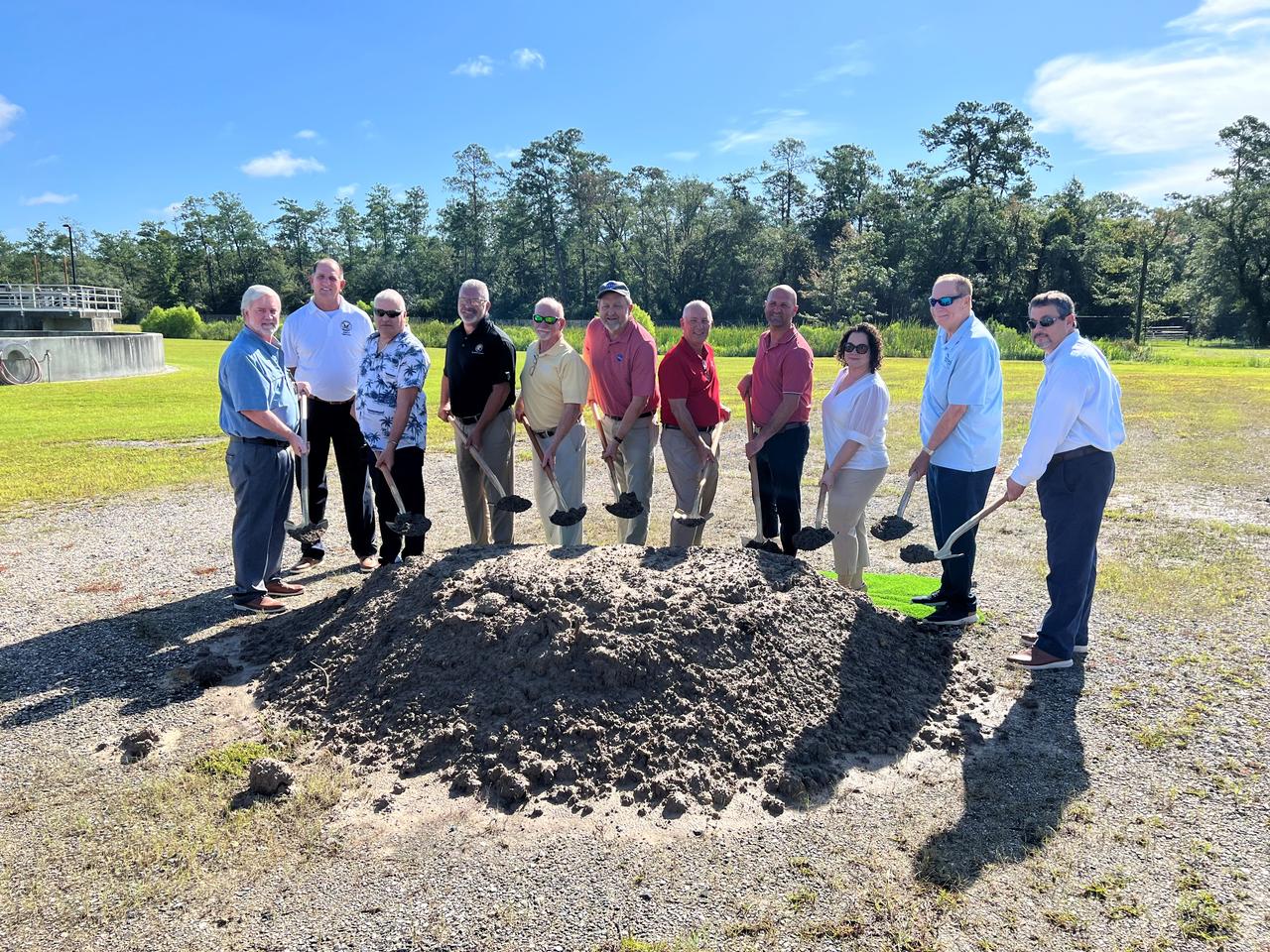
NASA Stennis breaks ground with officials from Hancock County on July 18 for the Stennis Wastewater Conveyance Project at the Northern Wastewater Treatment Plant in Kiln, Mississippi. The groundbreaking represented launch of an agreement described as a win-win situation for Hancock County and NASA Stennis. Upon completion of the project, the county will assume responsibility for servicing wastewater from the NASA center. The new agreement will enable the county to utilize its existing facility more efficiently, while also allowing NASA Stennis to devote more center resources its mission work. Groundbreaking participants include (left to right): Hancock County supervisor Chuck Clark, District 3; Hancock County supervisor Bo Ladner, District 5; Hancock County Water & Sewer District Chair Farron Hoda; state Rep. Brent Anderson, Mississippi District 122; Mayor Mike Favre, Bay St. Louis, Mississippi; NASA Stennis Associate Director Rodney McKellip; Hancock County Board President Scotty Adam (District 4 supervisor); state Sen. Philman Ladner, Mississippi District 46; NASA Stennis project manager Brittany Bouche; Mayor Jay Trapani, Waveland, Mississippi; and Hancock County Utility Authority Executive Director David Pitalo.

Using the “day-night band” (DNB) of the Visible Infrared Imaging Radiometer Suite (VIIRS), the Suomi National Polar-orbiting Partnership (Suomi NPP) satellite acquired this view of the aurora borealis on March 18, 2015. The northern lights stretch across Canada’s Quebec, Ontario, Manitoba, Nunavut, and Newfoundland provinces in the image, and are part of the auroral oval that expanded to middle latitudes because of a geomagnetic storm on March 17, 2015. The DNB sensor detects dim light signals such as auroras, airglow, gas flares, city lights, and reflected moonlight. In the case of the image above, the sensor detected the visible light emissions as energetic particles rained down from Earth’s magnetosphere and into the gases of the upper atmosphere. The images are similar to those collected by the Operational Linescan System flown on U.S. Defense Meteorological Satellite Program (DMSP) satellites for the past three decades. Auroras typically occur when solar flares and coronal mass ejections—or even an active solar wind stream—disturb and distort the magnetosphere, the cocoon of space protected by Earth’s magnetic field. The collision of solar particles and pressure into our planet’s magnetosphere accelerates particles trapped in the space around Earth (such as in the radiation belts). Those particles are sent crashing down into Earth’s upper atmosphere—at altitudes of 100 to 400 kilometers (60 to 250 miles)—where they excite oxygen and nitrogen molecules and release photons of light. The results are rays, sheets, and curtains of dancing light in the sky. Read more: <a href="http://earthobservatory.nasa.gov/NaturalHazards/view.php?id=85556&eocn=home&eoci=nh" rel="nofollow">earthobservatory.nasa.gov/NaturalHazards/view.php?id=8555...</a> NASA Earth Observatory image by Jesse Allen, using VIIRS day-night band data from the Suomi National Polar-orbiting Partnership. Suomi NPP is the result of a partnership between NASA, the National Oceanic and Atmospheric Administration, and the Department of Defense. Caption by Mike Carlowicz and Adam Voiland. Credit: <b><a href="http://www.earthobservatory.nasa.gov/" rel="nofollow"> NASA Earth Observatory</a></b> <b><a href="http://www.nasa.gov/audience/formedia/features/MP_Photo_Guidelines.html" rel="nofollow">NASA image use policy.</a></b> <b><a href="http://www.nasa.gov/centers/goddard/home/index.html" rel="nofollow">NASA Goddard Space Flight Center</a></b> enables NASA’s mission through four scientific endeavors: Earth Science, Heliophysics, Solar System Exploration, and Astrophysics. Goddard plays a leading role in NASA’s accomplishments by contributing compelling scientific knowledge to advance the Agency’s mission. <b>Follow us on <a href="http://twitter.com/NASAGoddardPix" rel="nofollow">Twitter</a></b> <b>Like us on <a href="http://www.facebook.com/pages/Greenbelt-MD/NASA-Goddard/395013845897?ref=tsd" rel="nofollow">Facebook</a></b> <b>Find us on <a href="http://instagrid.me/nasagoddard/?vm=grid" rel="nofollow">Instagram</a></b>