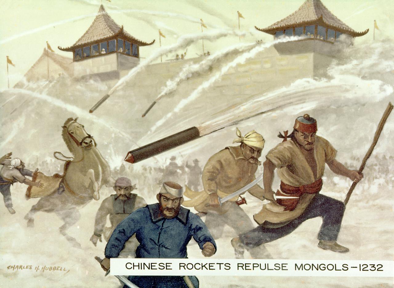
One of the earliest recorded instances of the use of rockets was as military weapons against the Mongols by the Chinese at the siege of Kai Fung Foo in 1232 A.D. An arrow with a tube of gunpowder produced an arrow of flying fire. The Mongol attackers fled in terror, even though the rockets were inaccurate and relatively harmless.
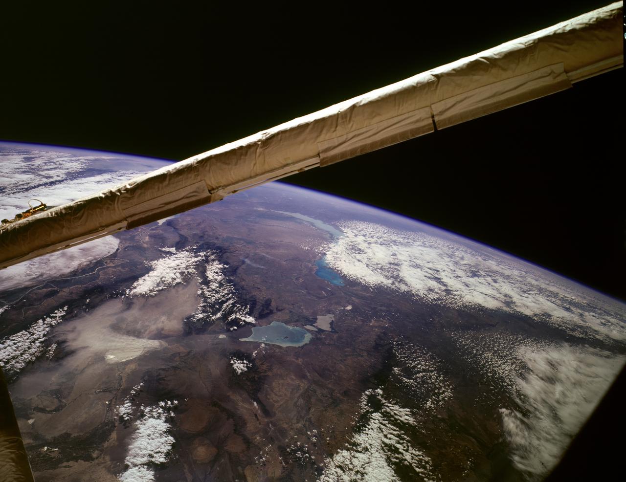
STS085-503-061 (7 - 19 August 1997) --- Lakes Balkhash and Alakol, southern uplands of Kazakhstan, central Asia. The long, 600 kilometers arc of Lake Balkhash occupies the center of this clear west-looking view. The left of the view shows clearly the westernmost Dzungarian Basin in the autonomous region of Xinjiang Uygur (Sinkiang), China. Kazakhstan's capital city Almaty (Alma-Ata) lies out of sight behind the boom. The Dzungarian Gate is the straight, fault-bounded valley cutting through the Dzhungarskiy Alatau Range. The Gate has acted as a major pass for centuries, allowing access between east Asia and central Asia (the valley floor is about 1,500 feet, whereas peaks reach 15,000 feet on the west and about 10,000 feet on the east side) -- it was one of the routes used by the Mongols when they began their invasion of central Asia and Europe in the 13th century. Lake Ebinur is the bright area beneath the dust plume (left center); strong north winds from the steppes of Kazakhstan and Russia are funneled through the Dzungarian Gate where they pick up sediment from dry lakebeds and blow it into China. The Ili River flows westward, parallel to the Dzhungarskiy Alatau Range, through Kapchagay Lake (partially visible beneath boom), then northwest across a large delta plain and into Lake Balkhash.
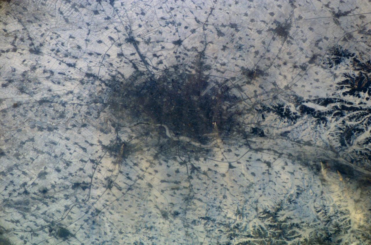
ISS010-E-13807 (18 January 2005) --- Shenyang, China is featured in this image photographed by an Expedition 10 crewmember on the International Space Station (ISS). The city of Shenyang is China’s sixth largest city with a population of over 4 million residents in the urban core. The city is the major industrial, commercial, and cultural center of northeast China (the region historically known as Manchuria). Its geographic location on the floodplains of the Hun and Liao Rivers ensured an early agrarian economy that was later replaced by industrialization and natural resource extraction. Shenyang was first settled as a Mongol trading center in the 10th century, and served as the capitol of the Manchu government from the 17th through 20th centuries. Currently the city serves as the capital of Liaoning Province. Snow cover provides a clear contrast between urbanized (dark grey, center of image) and rural regions (white to light grey). The major portion of the local economy is devoted to industries such as metal smelting, coal mining, and petrochemical processing. Several southeast-trending plumes from industrial facilities are visible in the image. According to NASA scientists studying the Expedition 10 imagery, the high density of industrial land use in the Shenyang metropolitan area has lead to significant air, water, and soil pollution in the region. Recently, several initiatives to reduce pollution levels and establish environmentally-sound development guidelines have begun with support from local government and the United Nations.