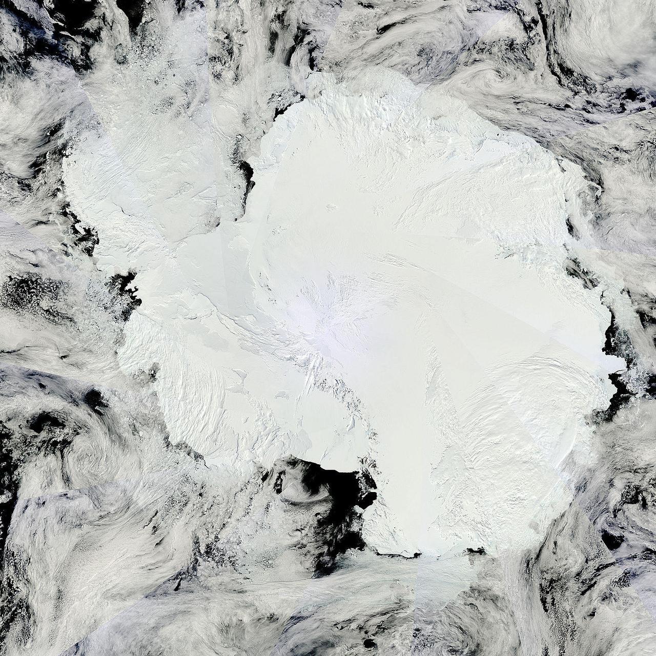
Antarctica is the coldest, driest and windiest place on Earth – and, during the austral summer, it is also the sunniest. Due to the tilt of the Earth’s axis in relation of the sun, the frozen land south of the Antarctic Circle receives six months of daylight in summertime, and six months of darkness in winter. The long hours of sunshine allow for excellent imagery of the region from space. This true-color mosaic of Antarctica was created from images acquired by multiple passes of the Moderate Resolution Imaging Spectroradiometer (MODIS) aboard the Terra satellite on December 16, 2013. Because Terra is in a polar orbit, it passes over each pole approximately 14 times a day, and acquires an image on each pass. To create a mosaic, the data that are closest to the center of each swath – where edge distortion is minimized – are used to create a complete view of the region. The MODIS Rapid Response system generates complete mosaic images of Antarctica every day in austral late spring, summer and early fall. Because the light is poor in austral late fall, winter and early spring, MODIS images are not created during that period. A mosaic of Antarctica can be found for any given day at NASA’s Project Antarctica at <a href="http://rapidfire.sci.gsfc.nasa.gov/subsets/?project=antarctica" rel="nofollow">rapidfire.sci.gsfc.nasa.gov/subsets/?project=antarctica</a> Credit: NASA/GSFC/Jeff Schmaltz/MODIS Land Rapid Response Team <b><a href="http://www.nasa.gov/audience/formedia/features/MP_Photo_Guidelines.html" rel="nofollow">NASA image use policy.</a></b> <b><a href="http://www.nasa.gov/centers/goddard/home/index.html" rel="nofollow">NASA Goddard Space Flight Center</a></b> enables NASA’s mission through four scientific endeavors: Earth Science, Heliophysics, Solar System Exploration, and Astrophysics. Goddard plays a leading role in NASA’s accomplishments by contributing compelling scientific knowledge to advance the Agency’s mission. <b>Follow us on <a href="http://twitter.com/NASA_GoddardPix" rel="nofollow">Twitter</a></b> <b>Like us on <a href="http://www.facebook.com/pages/Greenbelt-MD/NASA-Goddard/395013845897?ref=tsd" rel="nofollow">Facebook</a></b> <b>Find us on <a href="http://instagram.com/nasagoddard?vm=grid" rel="nofollow">Instagram</a></b>

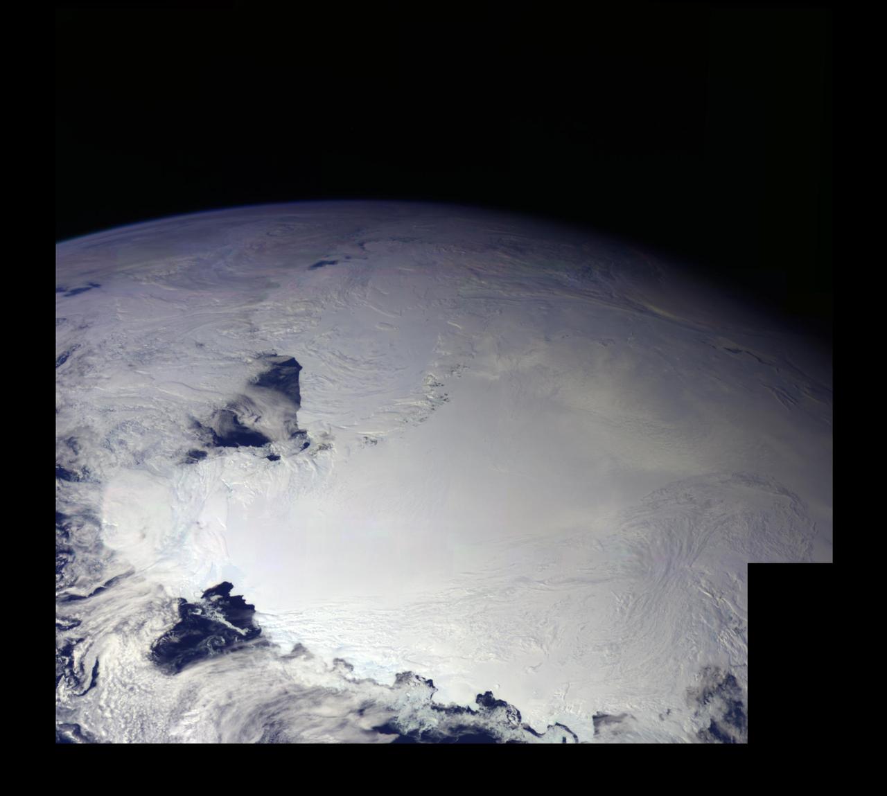
This color picture of the limb of the Earth, looking north past Antarctica, is a mosaic of 11 images taken during a ten-minute period near 5:45 p.m. PST Dec. 8, 1990, by NASA’s Galileo imaging system. http://photojournal.jpl.nasa.gov/catalog/PIA00116
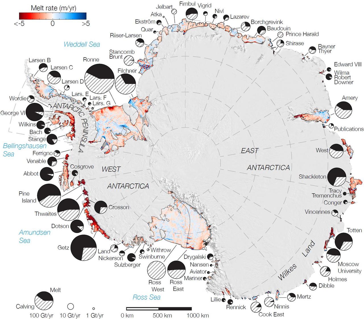
Rates of basal melt of Antarctic ice shelves melting of the shelves from underneath overlaid on a 2009 mosaic of Antarctica created from data from NASA Terra and Aqua spacecraft.
This color picture of Antarctica is one part of a mosaic of pictures covering the entire Antarctic continent taken during the hours following NASA's Galileo historic first encounter with its home planet. http://photojournal.jpl.nasa.gov/catalog/PIA00117
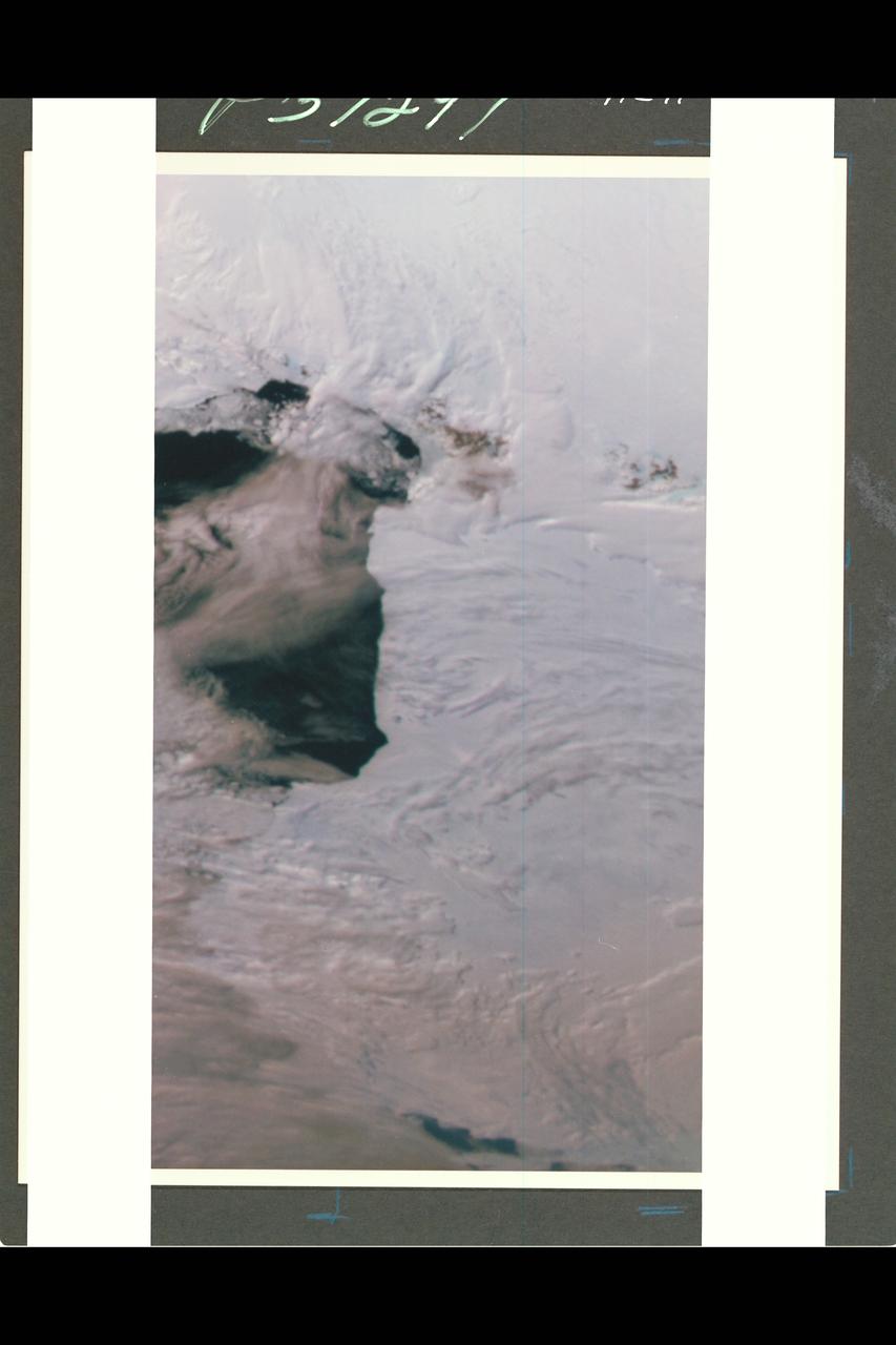
This color picture of Antarctica is one part of a mosaic of pictures covering the entire polar continent taken during the hours following Galileo's historic first encounter with its home planet. The view shows the Ross Ice Shelf to the right and its border with the sea. An occasional mountain can be seen poking through the ice near the McMurdo Station. It is late spring in Antarctica, so the sun never sets on the frigid, icy continent. This picture was taken about 6:20 pm PST. From top to bottom, the frame looks across about half of Antarctica.
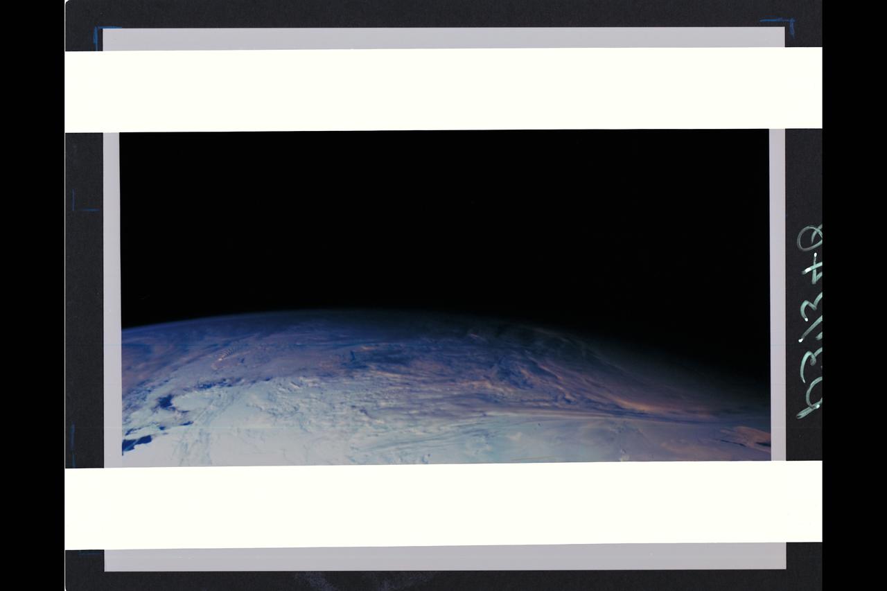
This color picture of the limb of the Earth, looking north past Antarctica, is a mosaic of 11 images taken during a ten-minute period near 5:45 p.m. PST Dec. 8, 1990, by Galileo's imaging system. Red, green and violet filters were used. The picture spans about 1,600 miles across the south polar latitudes of our planet The morning day/night terminator is toward the right. The South Pole is out of sight below the picture; the visible areas of Antarctica are those lying generally south of South America. The violet-blue envelope of Earth's atmosphere is prominent along the limb to the left. At lower left, the dark blue Amundsen Sea lies to the left of the Walgreen and Bakutis Coasts. Beyond it, Peter Island reacts with the winds to produce a striking pattern of atmosperic waves. (JPL ref. No. P-37340)