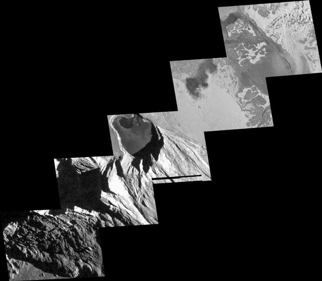
Detailed View of Mountain and Craters at Tohil, Io
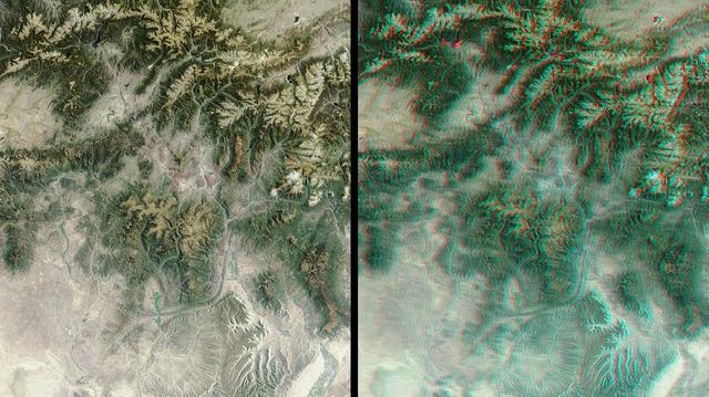
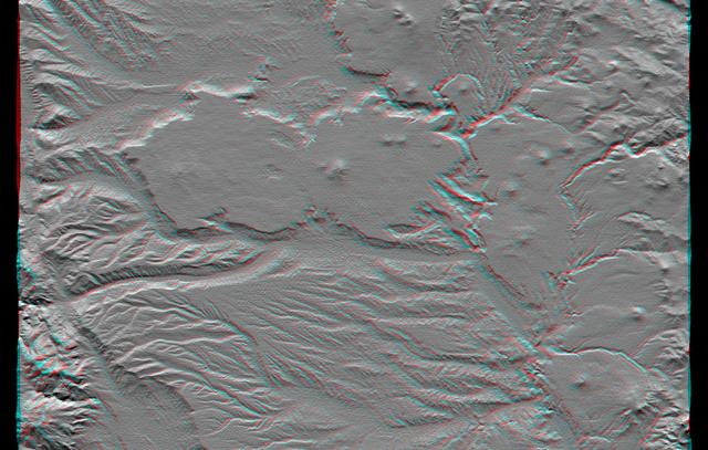
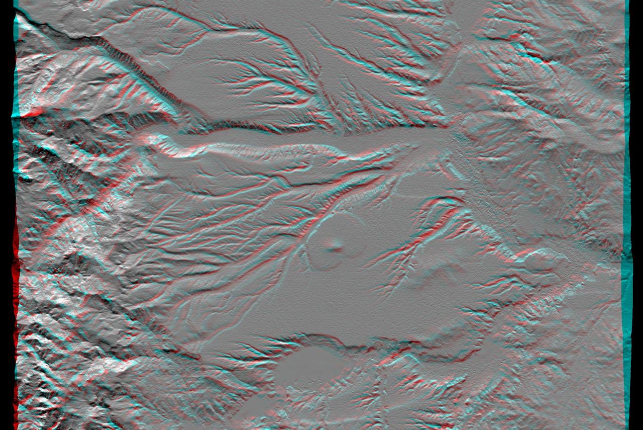
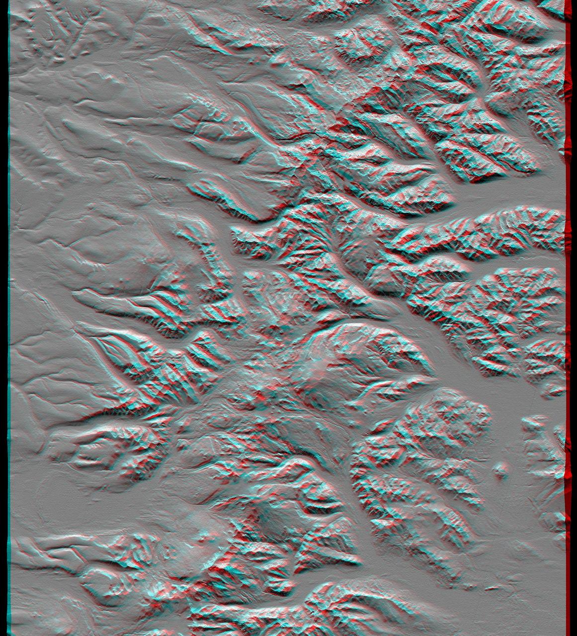
The mountains and desert plateaus of northwest Colorado are shown in this anaglyph from the MISR instrument aboard NASA Terra spacecraft. 3D glasses are necessary to view this image.
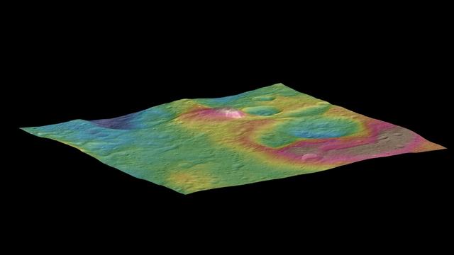
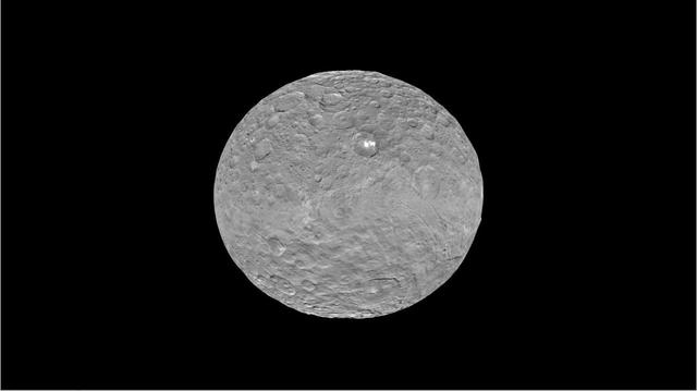
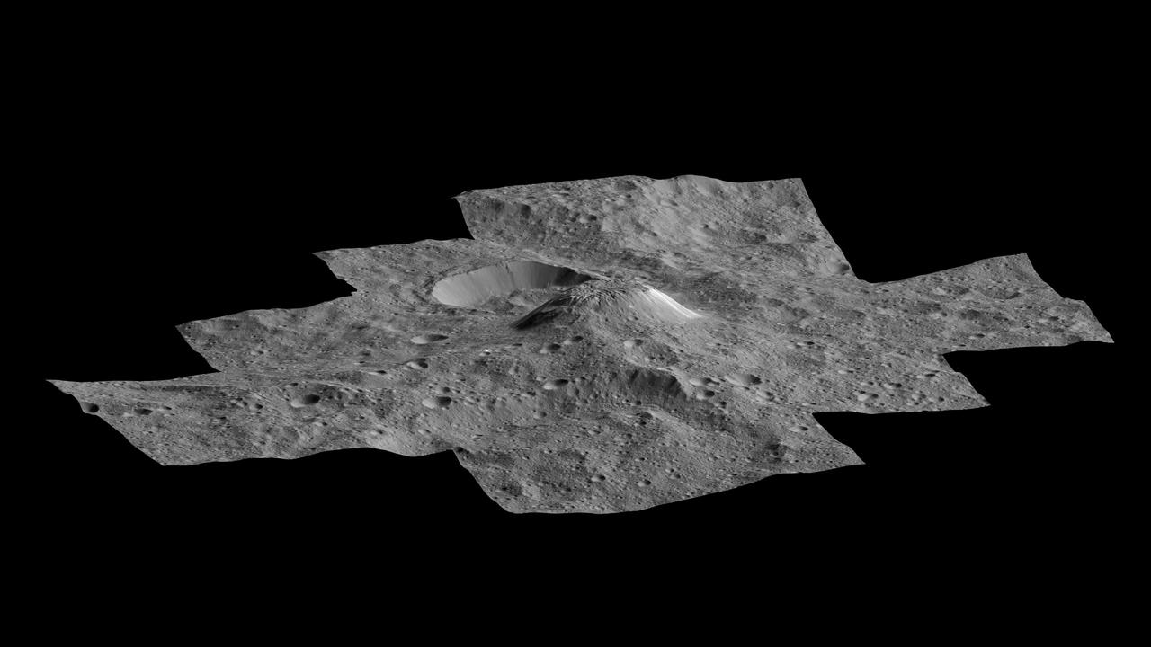
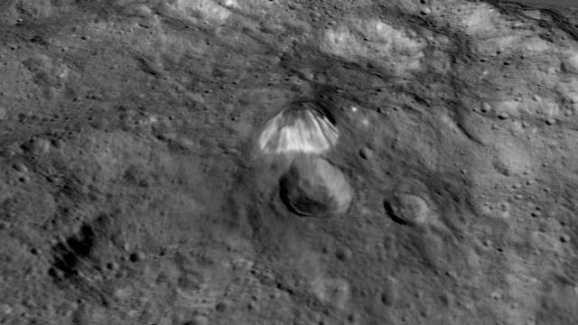
This view, made using images taken by NASA's Dawn spacecraft, features a tall conical mountain on Ceres. Elevations span a range of about 5 miles (8 kilometers) from the lowest places in this region to the highest terrains. Blue represents the lowest elevation, and brown is the highest. The white streaks seen running down the side of the mountain are especially bright parts of the surface. The image was generated using two components: images of the surface taken during Dawn's High Altitude Mapping Orbit (HAMO) phase, where it viewed the surface at a resolution of about 450 feet (140 meters) per pixel, and a shape model generated using images taken at varying sun and viewing angles during Dawn's lower-resolution Survey phase. The image of the region is color-coded according to elevation, and then draped over the shape model to give this view. http://photojournal.jpl.nasa.gov/catalog/PIA19976
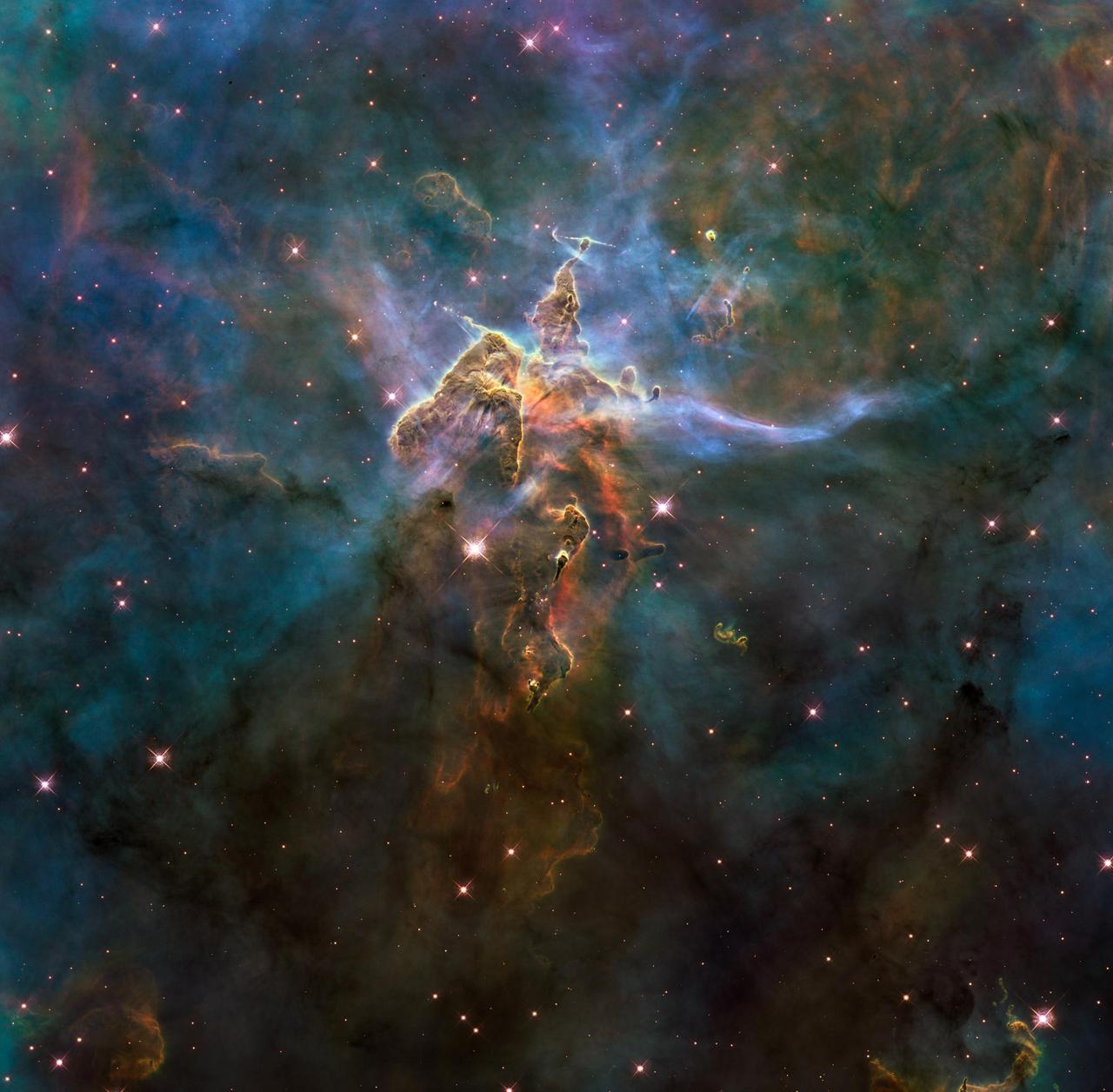
NASA image release April 22, 2010 This craggy fantasy mountaintop enshrouded by wispy clouds looks like a bizarre landscape from Tolkien's "The Lord of the Rings" or a Dr. Seuss book, depending on your imagination. The NASA Hubble Space Telescope photograph, which is stranger than fiction, captures the chaotic activity atop a three-light-year-tall pillar of gas and dust that is being eaten away by the brilliant light from nearby bright stars. The pillar is also being assaulted from within, as infant stars buried inside it fire off jets of gas that can be seen streaming from towering peaks. This turbulent cosmic pinnacle lies within a tempestuous stellar nursery called the Carina Nebula, located 7,500 light-years away in the southern constellation Carina. The image marks the 20th anniversary of Hubble's launch and deployment into Earth orbit. Scorching radiation and fast winds (streams of charged particles) from hot newborn stars in the nebula are shaping and compressing the pillar, causing new stars to form within it. Streamers of hot ionized gas can be seen flowing off the ridges of the structure, and wispy veils of dust, illuminated by starlight, float around its peaks. The pillar is resisting being eroded by radiation much like a towering butte in Utah's Monument Valley withstands erosion by water and wind. Nestled inside this dense mountain are fledgling stars. Long streamers of gas can be seen shooting in opposite directions off the pedestal at the top of the image. Another pair of jets is visible at another peak near the center of the image. These jets are the signpost for new star birth. The jets are launched by swirling disks around the stars, as these disks allow material to slowly accrete onto the stars' surfaces. Hubble's Wide Field Camera 3 observed the pillar on Feb. 1-2, 2010. The colors in this composite image correspond to the glow of oxygen (blue), hydrogen and nitrogen (green), and sulfur (red). Object Names: HH 901, HH 902 Image Type: Astronomical Credit: NASA, ESA, and M. Livio and the Hubble 20th Anniversary Team (STScI) To read learn more about this image go to: <a href="http://www.nasa.gov/mission_pages/hubble/science/hubble20th-img.html" rel="nofollow">www.nasa.gov/mission_pages/hubble/science/hubble20th-img....</a> <b><a href="http://www.nasa.gov/centers/goddard/home/index.html" rel="nofollow">NASA Goddard Space Flight Center</a></b> is home to the nation's largest organization of combined scientists, engineers and technologists that build spacecraft, instruments and new technology to study the Earth, the sun, our solar system, and the universe.
These images from NASA Terra spacecraft show the nadir view of the eastern United States, stretching from Lake Ontario to northern Georgia, and spanning the Appalachian Mountains.

JSC2011-E-040202 (2 March 2011) --- NASA astronaut Chris Ferguson, STS-135 commander, departs from the Moffett Field (Calif.) flight operations center for his trip home to Houston after he and his crew trained in the Vertical Motion Simulator (VMS) at NASA's Ames Research Center in Mountain View, March 2, 2011. Photo credit: NASA Photo/Houston Chronicle, Smiley N. Pool

JSC2011-E-040243 (2 March 2011) --- NASA astronaut Chris Ferguson, STS-135 commander, prepares for departure from Moffett Field as he flies a T-38 trainer home to Houston after the crew of STS-135 trained in the Vertical Motion Simulator (VMS) at NASA's Ames Research Center on March 2, 2011, in Mountain View, Calif. Photo credit: NASA Photo/Houston Chronicle, Smiley N. Pool

JSC2011-E-040200 (2 March 2011) --- The landing approach to the Kennedy Space Center is seen in a heads up display as the STS-135 crew trains in the Vertical Motion Simulator (VMS) at NASA's Ames Research Center in Mountain View, Calif., on March 2, 2011. Photo credit: NASA Photo/Houston Chronicle, Smiley N. Pool
JSC2011-E-040205 (2 March 2011) --- A NASA T-38 jet trainer piloted by astronaut Chris Ferguson, STS-135 commander, takes off from Moffett Field in California for a flight home to Houston after Ferguson and his crew trained in the Vertical Motion Simulator (VMS) at NASA's Ames Research Center in Mountain View, March 2, 2011. Photo credit: NASA Photo/Houston Chronicle, Smiley N. Pool

JSC2011-E-040193 (2 March 2011) --- NASA astronaut Chris Ferguson (left), STS-135 commander, confers with astronaut Rex Walheim, mission specialist, as the Atlantis crew participates in a briefing before a training session in the Vertical Motion Simulator (VMS) at NASA's Ames Research Center in Mountain View, Calif. March 2, 2011. Photo credit: NASA Photo/Houston Chronicle, Smiley N. Pool
JSC2011-E-040195 (2 March 2011) --- NASA astronaut Chris Ferguson, STS-135 commander, takes photos of the massive Vertical Motion Simulator (VMS) at NASA's AMES Research Center before the crew trains in the simulator on Wednesday, March 2, 2011, in Mountain View, Calif. Photo credit: NASA Photo/Houston Chronicle, Smiley N. Pool

JSC2011-E-040201 (2 March 2011) --- NASA astronaut Doug Hurley pilots a simulated landing at the Kennedy Space Center as the STS-135 crew trains in the Vertical Motion Simulator (VMS) at NASA's Ames Research Center in Mountain View, Calif. on March 2, 2011. Photo credit: NASA Photo/Houston Chronicle, Smiley N. Pool

JSC2011-E-040199 (2 March 2011) --- NASA astronaut Rex Walheim, STS-135 mission specialist, exits the Vertical Motion Simulator (VMS) at NASA's Ames Research Center in Mountain View, Calif. after what is scheduled to be the crew's final training session in the simulator March 2, 2011. Photo credit: NASA Photo/Houston Chronicle, Smiley N. Pool

JSC2011-E-040204 (2 March 2011) --- NASA astronaut Chris Ferguson, STS-135 commander, prepares for departure from Moffett Field in a T-38 trainer home to Houston after the crew of STS-135 trained in the Vertical Motion Simulator (VMS) at NASA's Ames Research Center in Mountain View, Calif. on March 2, 2011, Photo credit: NASA Photo/Houston Chronicle, Smiley N. Pool
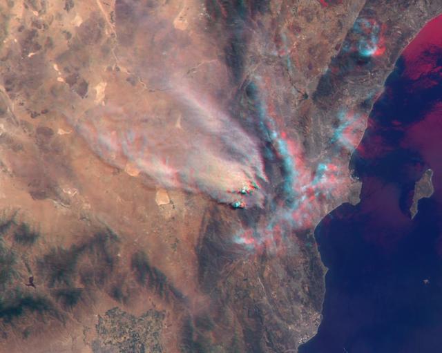
NASA MISR instrument onbard NASA Terra spacecraft captured a stereo view of Mountain Fire near Idyllwild, Calif. in July, 2013.

NASA Administrator Jared Isaacman views an arc jet test, Monday, Jan. 26, 2026, at NASA’s Ames Research Center in Mountain View, Calif. Ames marks the tenth stop in Isaacman’s roadshow to visit NASA facilities and engage directly with the agency’s workforce. Photo Credit: (NASA/John Kraus)
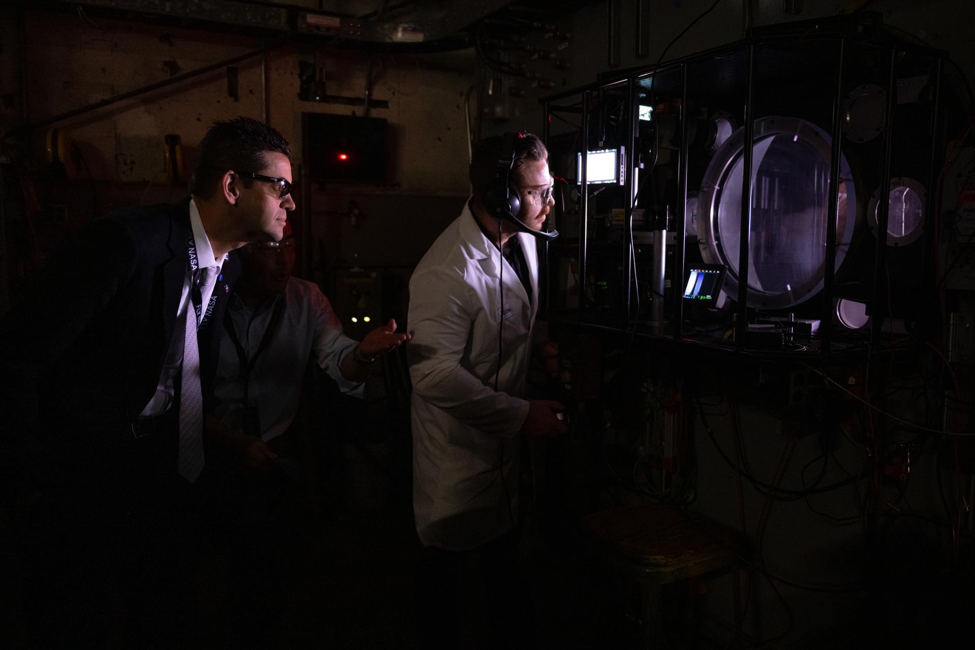
NASA Administrator Jared Isaacman, left, views an arc jet test, Monday, Jan. 26, 2026, at NASA’s Ames Research Center in Mountain View, Calif. Ames marks the tenth stop in Isaacman’s roadshow to visit NASA facilities and engage directly with the agency’s workforce. Photo Credit: (NASA/John Kraus)
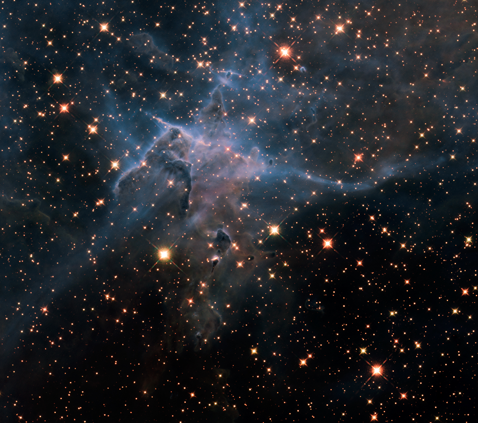
NASA image release April 22, 2010 This is a NASA Hubble Space Telescope near-infrared-light image of a three-light-year-tall pillar of gas and dust that is being eaten away by the brilliant light from nearby stars in the tempestuous stellar nursery called the Carina Nebula, located 7,500 light-years away in the southern constellation Carina. The image marks the 20th anniversary of Hubble's launch and deployment into an orbit around Earth. The image reveals a plethora of stars behind the gaseous veil of the nebula's wall of hydrogen, laced with dust. The foreground pillar becomes semi-transparent because infrared light from background stars penetrates through much of the dust. A few stars inside the pillar also become visible. The false colors are assigned to three different infrared wavelength ranges. Hubble's Wide Field Camera 3 observed the pillar in February and March 2010. Object Names: HH 901, HH 902 Image Type: Astronomical Credit: NASA, ESA, and M. Livio and the Hubble 20th Anniversary Team (STScI) To read learn more about this image go to: <a href="http://www.nasa.gov/mission_pages/hubble/science/hubble20th-img.html" rel="nofollow">www.nasa.gov/mission_pages/hubble/science/hubble20th-img....</a> <b><a href="http://www.nasa.gov/centers/goddard/home/index.html" rel="nofollow">NASA Goddard Space Flight Center</a></b> is home to the nation's largest organization of combined scientists, engineers and technologists that build spacecraft, instruments and new technology to study the Earth, the sun, our solar system, and the universe.

NASA Administrator Jared Isaacman, right, speaks during a workforce Q&A session, Monday, Jan. 26, 2026, at NASA’s Ames Research Center in Mountain View, Calif. Ames marks the tenth stop in Isaacman’s roadshow to visit NASA facilities and engage directly with the agency’s workforce. Photo Credit: (NASA/John Kraus)

NASA Administrator Jared Isaacman, right, greets members of the workforce, Monday, Jan. 26, 2026, at NASA’s Ames Research Center in Mountain View, Calif. Ames marks the tenth stop in Isaacman’s roadshow to visit NASA facilities and engage directly with the agency’s workforce. Photo Credit: (NASA/John Kraus)

NASA Administrator Jared Isaacman poses for a photograph with the workforce, Monday, Jan. 26, 2026, at NASA’s Ames Research Center in Mountain View, Calif. Ames marks the tenth stop in Isaacman’s roadshow to visit NASA facilities and engage directly with the agency’s workforce. Photo Credit: (NASA/John Kraus)
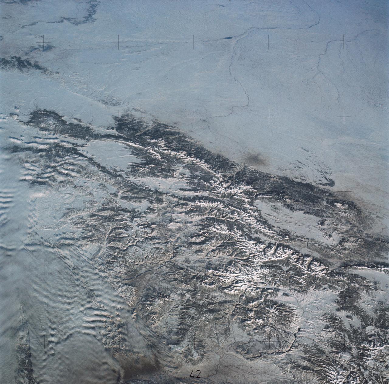
SL4-138-3875 (February 1974) --- A color oblique photograph looking east over the Rocky Mountains and Great Plains. This view covers a portion of the States of Colorado, Wyoming, and Nebraska. A Skylab 4 crewmen took this picture with a hand-held 70mm Hasselblad camera. This entire region, covered with a blanket of snow, depicts much of the structural and topographic features of the Rocky Mountain chain. Man's only apparent change to the snow pattern seen here is the (right center) metropolitan areas of Denver and Colorado Springs, Colorado, which can be observed along the eastern edge of the mountain front. Grand Junction, Colorado on the western slope of the Rocky Mountains is just off the photograph at left center bottom. The major inter-montane valleys of South Park (right center), Middle Park (center), and North Park (left center) are clearly visible and separate the Colorado Rockies Front Range from the high rugged mountains can be discovered such as Pikes Peak near right border (center), Mt. Cunnison region, circular feature accentuated by the Cunnison River (dark) in the right center (bottom) of the photograph. The snow covered peaks of Mts. Harvard, Princeton and Yale form the high region of the Collegiate Range which is the pronounced mountain area in the right center. Snow cover not only enhances mountain features but also the drainage patterns. East of Denver (right corner) the sinuous trace of the South Platte River (center) and its junction with the North Platte River near North Platte, Nebraska. Lake McConaughy in Nebraska is the body of water (black) near the river intersection. The trace of the Republic River in southern Nebraska is visible near the right corner of the photography. Geologic and hydro logic studies using this photograph will be conducted by Dr. Roger Morrison, U.S. Geological Survey. Photo credit: NASA

Team Lead Jack Langelaan poses for a photograph next to the Pipistrel-USA, Taurus G4, aircraft prior to winning the 2011 Green Flight Challenge, sponsored by Google, on Monday, Oct. 3, 2011 at the NASA Ames Research Center, Mountain View, Calif. The all electric Taurus G4 aircraft achieved the equivalency of more than 400 miles per gallon. NASA and CAFE held the challenge to advance technologies in fuel efficiency and reduced emissions with cleaner renewable fuels and electric aircraft. Photo Credit: (NASA/Bill Ingalls)

Pipistrel-USA Team Lead Jack Langelaan talks after his team won the 2011 Green Flight Challenge, sponsored by Google, on Monday, Oct. 3, 2011 at the NASA Ames Research Center, Mountain View, Calif. The all electric Taurus G4 aircraft achieved the equivalency of more than 400 miles per gallon. NASA and CAFE Foundation held the challenge to advance technologies in fuel efficiency and reduced emissions with cleaner renewable fuels and electric aircraft. Photo Credit: (NASA/Bill Ingalls)
This perspective view of upstate New York shows Lake Ontario in the lower left, the Adirondack Mountains in the upper left, and the Catskill Mountains on the right.
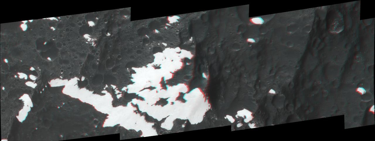
This frame from a video shows the bright spots in Occator crater on dwarf planet Ceres, generated from data from NASA Dawn spacecraft. The global view uses data collected by NASA's Dawn mission in April and May 2015. The highest-resolution parts of the map have a resolution of 1,600 feet (480 meters) per pixel. The second portion of the video shows the bright spots in Occator crater, which is about 60 miles (90 kilometers) across and 2 miles (4 kilometers) deep. Vertical relief has been exaggerated by a factor of five. Exaggerating the relief helps scientists understand and visualize the topography more easily, and highlights features that are sometimes subtle. The third portion of the video shows a mountain about 4 miles (6 kilometers) high, which is roughly the elevation of Mount McKinley in Alaska's Denali National Park. Vertical relief has been exaggerated by a factor of five. Exaggerating the relief helps scientists understand and visualize the topography much more easily, and highlights features that are sometimes subtle. The fourth section of the video shows the global view from the first section in 3-D view. A pair of 3-D glasses reveals striking detail in the topography of the dwarf planet. http://photojournal.jpl.nasa.gov/catalog/PIA19619
Antelope Valley is bounded by two of the most active faults in California: the Garlock fault, which fronts the distant mountains in this view, and the San Andreas fault, part of which is seen bounding the mountains in the left foreground.
This depiction of an area south of San Martin de Los Andes, Argentina, is the first Shuttle Radar Topography Mission SRTM view of the Andes Mountains, the tallest mountain chain in the western hemisphere.

Comparative Aircraft Flight Efficiency (CAFE) Foundation President Brien A. Seeley M.D., left, NASA Acting Chief Technologist Joe Parrish, 2nd from left, and Pipistrel-USA Team Lead Jack Langelaan, center with suit, and the entire Pipistrel-USA, Taurus G4 aircraft team pose for a photograph shortly after winning the 2011 Green Flight Challenge, sponsored by Google, on Monday, Oct. 3, 2011 at the NASA Ames Research Center, Mountain View, Calif. The all electric Taurus G4 aircraft achieved the equivalency of more than 400 miles per gallon. NASA and CAFE held the challenge to advance technologies in fuel efficiency and reduced emissions with cleaner renewable fuels and electric aircraft. Photo Credit: (NASA/Bill Ingalls)
AST-19-1570 (24 July 1975) --- An oblique view of the Rocky Mountains area of British Columbia and Alberta in Canada, as photographed from the Apollo spacecraft in Earth orbit during the joint U.S.-USSR Apollo-Soyuz Test Project mission. This picture was taken at an altitude of 222 kilometers (138 statute miles) with a 70mm Hasselblad camera using medium-speed Ektachrome QX-807 type film.
Volcanism and erosion are prominently seen in this view of the eastern flank of the Andes Mountains taken by NASA Shuttle Radar Topography Mission SRTM.
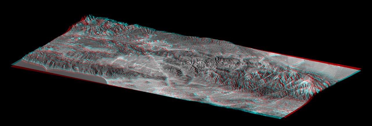
STS059-S-084 (17 April 1994) --- This is a three-dimensional perspective of Mammoth Mountain, California. This view was constructed by overlaying a SIR-C radar image on a U.S. Geological Survey digital elevation map. Vertical exaggeration is 2x. The image is centered at 37.6 degrees north, 119.0 degrees west. It was acquired from the Spaceborne Imaging Radar-C and X-Band Synthetic Aperture Radar (SIR-C/X-SAR) onboard the Space Shuttle Endeavour on its 67th orbit, April 13, 1994. In this color representation, red is C-Band HV-polarization, green is C-Band VV-polarization and blue is the ratio of C-Band VV to C-Band HV. Blue areas are smooth and yellow areas are rock outcrops with varying amounts of snow and vegetation. Crowley Lake is in the foreground and Highway 395 crosses in the middle of the image. Mammoth Mountain is shown in the upper right. SIR-C/X-SAR is part of NASA's Mission to Planet Earth (MTPE). SIR-C/X-SAR radars illuminate Earth with microwaves allowing detailed observations at any time, regardless of weather or sunlight conditions. SIR-C/X-SAR uses three microwave wavelengths: L-Band (24 cm), C-Band (6 cm), and X-Band (3 cm). The multi-frequency data will be used by the international scientific community to better understand the global environment and how it is changing. The SIR-C/X-SAR data, complemented by aircraft and ground studies, will give scientists clearer insights into those environmental changes which are caused by nature and those changes which are induced by human activity. SIR-C was developed by NASA's Jet Propulsion Laboratory (JPL). X-SAR was developed by the Dornire and Alenia Spazio Companies for the German Space Agency, Deutsche Agentur fuer Raumfahrtangelegenheiten (DARA), and the Italian Space Agency, Agenzia Spaziale Italiana (ASI). JPL Photo ID: P-43933
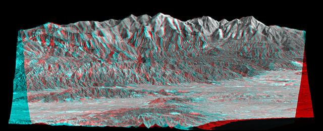
This stereo view of the Sierra Nevada mountains near the California-Nevada border was acquired on August 12, 2000 by NASA Terra satellite. 3D glasses are necessary to view this image.
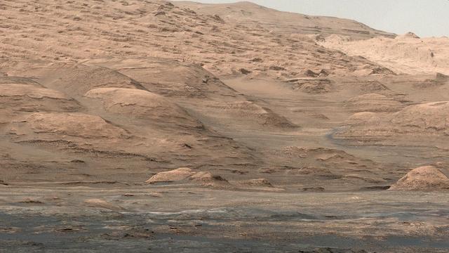
NASA's Curiosity Mars rover captured this view of a mountain nearly 57 miles (91 kilometers) away and outside of Gale Crater, where Curiosity landed in 2012. The rover is currently in the foothills of Mount Sharp, a 3-mile-tall (5-kilometer-tall) mountain within the crater. Estimated to be 8,202 feet (2,500 meters) tall, the mountain's summit just peeks over the crater rim in the panorama. It has never been viewed with this much detail. Toward the lower left, dark rocky outcrops are visible. Curiosity captured the view with its black-and-white Remote Micro Imager, or RMI. Part of the rover's ChemCam instrument, RMI can be used like a small telescope to see distant features, creating a circular "spyglass" view. Ten RMI images taken on Aug. 28, 2025 (the 4,643rd Martian day, or sol of the mission) were stitched together to create the mosaic. https://photojournal.jpl.nasa.gov/catalog/PIA26638
This anaglyph, from NASA Shuttle Radar Topography Mission, is of the Andes Mountains, southeast of San Carlos de Bariloche, Argentina. 3D glasses are necessary to view this image.
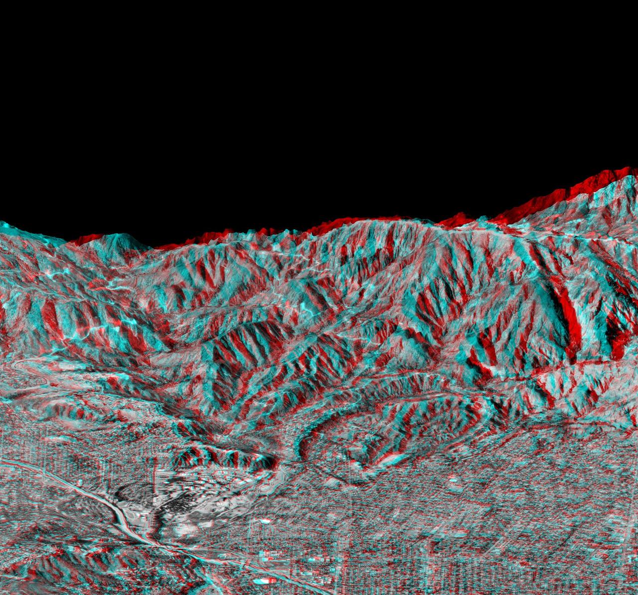
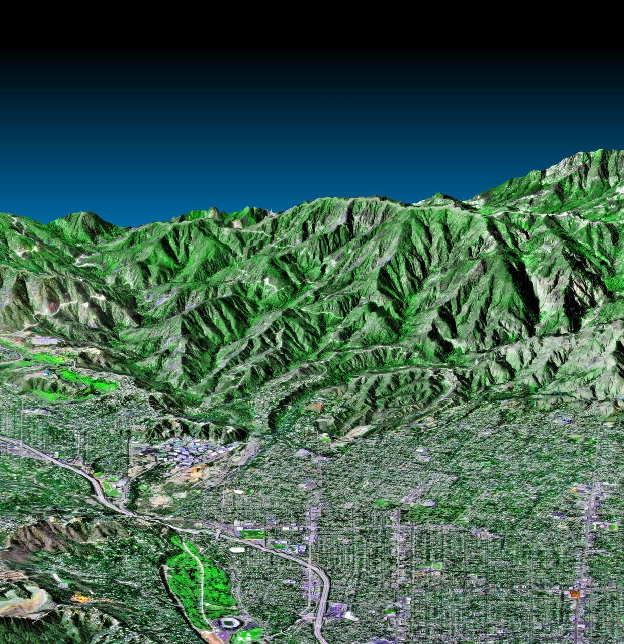
This elevation anaglyph of Los Angeles and adjacent mountainous terrain was created by NASA Shuttle Radar Topography Mission. 3D glasses are necessary to view this image.
This side-perspective view of Ceres mysterious mountain Ahuna Mons was made with images from NASA Dawn spacecraft. Dawn took these images in December 2015.
This anaglyph, from NASA Shuttle Radar Topography Mission, is of Massanutten Mountain in the Shenandoah Valley of northern Virginia. 3D glasses are necessary to view this image.
This anaglyph, from NASA Shuttle Radar Topography Mission, is of Pasadena, California, looking north toward the San Gabriel Mountains. 3D glasses are necessary to view this image.
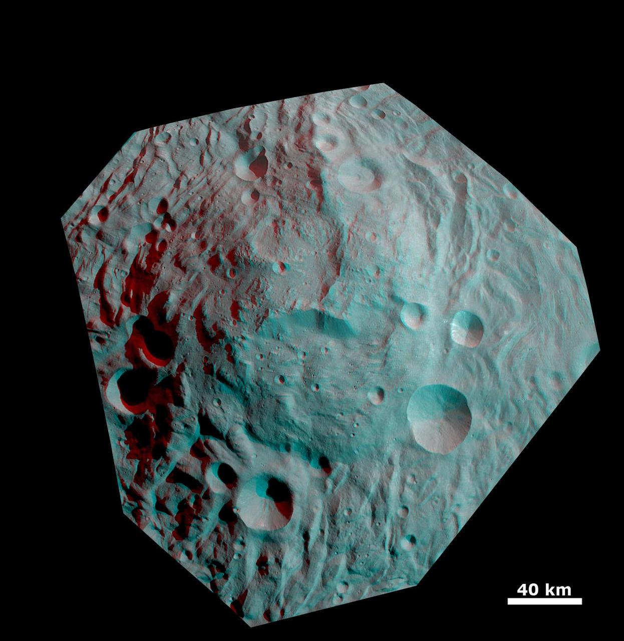
This anaglyph image shows the topography of the mountain-central complex in asteroid Vesta south polar region. You need 3D glasses to view this image.
SL3-27-180 (July-September 1973) --- A vertical view of the Snowy Mountains area of Australian Alps in the States of Victoria and New South Wales, Australia, as photographed from Earth orbit by one of the six lenses of the Itek-furnished S190-A Multispectral Photographic Facility Experiment aboard the Skylab space station. This picture was taken with type 2443 infrared color film. The lake near the center of the picture is the Eucumbene Reservoir. This area is located immediately south-southwest of the capital city of Canberra. Federal agencies participating with NASA on the EREP project are the Departments of Agriculture, Commerce, Interior, the Environmental Protection Agency and the Corps of Engineers. All EREP photography is available to the public through the Department of Interior?s Earth Resources Observations Systems Data Center, Sioux Falls, South Dakota, 57198. Photo credit: NASA
AS16-112-18234 (22 April 1972) --- This view of South Ray Crater was taken during the second Apollo 16 extravehicular activity (EVA) from Station No. 4 -- highest point on the traverse up Stone Mountain -- using a 500mm lens. South Ray Crater is a "fresh" source of angular ejecta in the LM-ALSEP area and samples at Station No. 8.
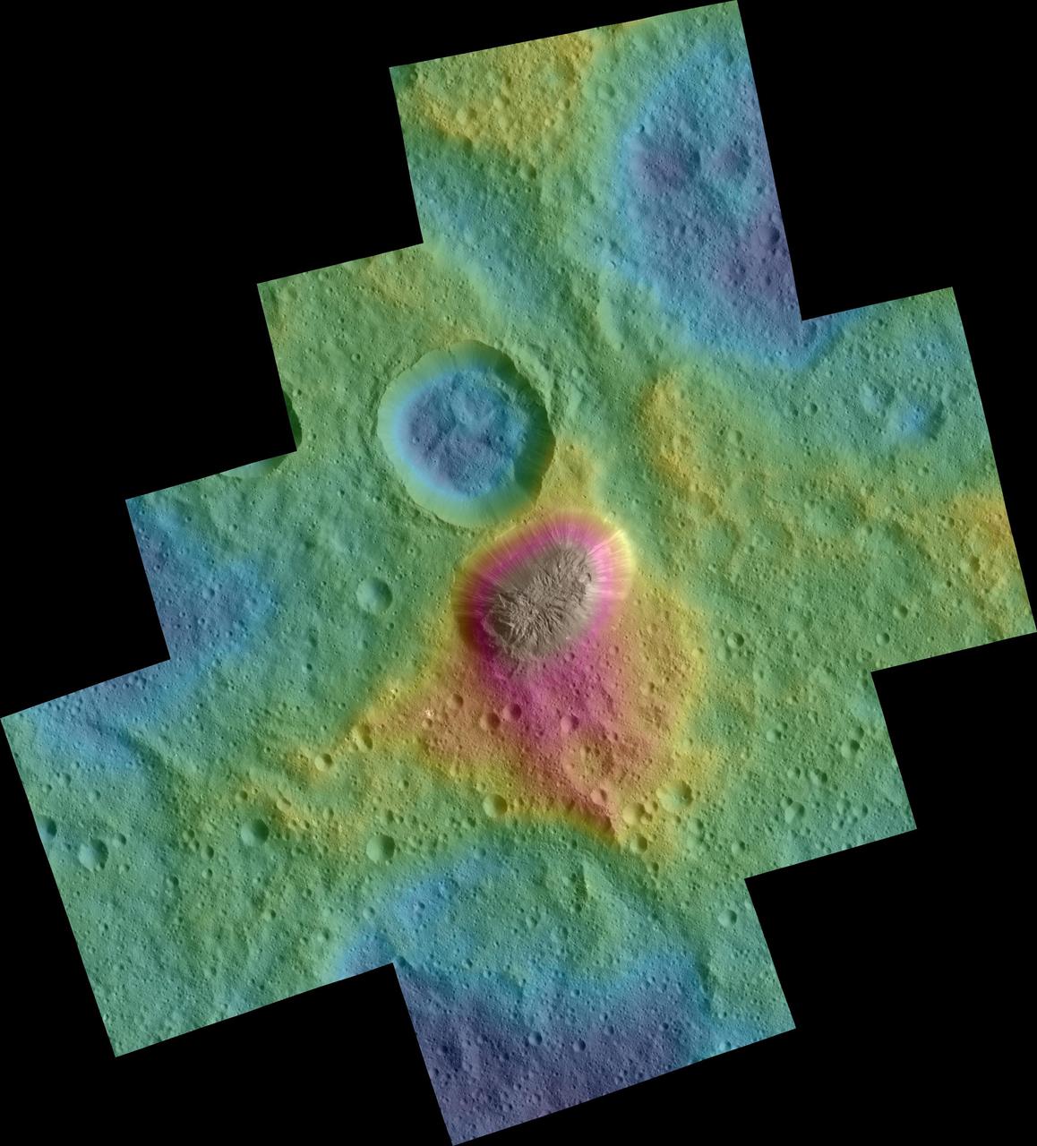
These color topographic views show variations in surface height around Ahuna Mons, a mysterious mountain on Ceres. The views are colorized versions of PIA20348 and PIA20349. They represent an update to the view in PIA19976, which showed the mountain using data from an earlier, higher orbit. Both views were made using images taken by NASA's Dawn spacecraft during its low-altitude mapping orbit, at a distance of about 240 miles (385 kilometers) from the surface. The resolution of the component images is about 120 feet (35 meters) per pixel. Elevations span a range of about 5.5 miles (9 kilometers) from the lowest places in the region to the highest terrains. Blue represents the lowest elevation, and brown is the highest. The streaks running down the side of the mountain, which appear white in the grayscale view, are especially bright parts of the surface (the brightness does not relate to elevation). The elevations are from a shape model generated using images taken at varying sun and viewing angles during Dawn's lower-resolution, high-altitude mapping orbit (HAMO) phase. The side perspective view was generated by draping the image mosaics over the shape model. http://photojournal.jpl.nasa.gov/catalog/PIA20399
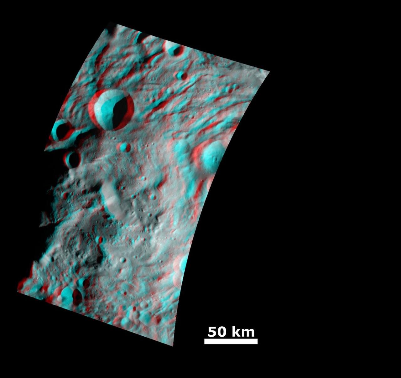
This anaglyph image from NASA Dawn spacecraft shows the topography of the mountain-central complex in asteroid Vesta south polar region. You need 3D glasses to view this image.
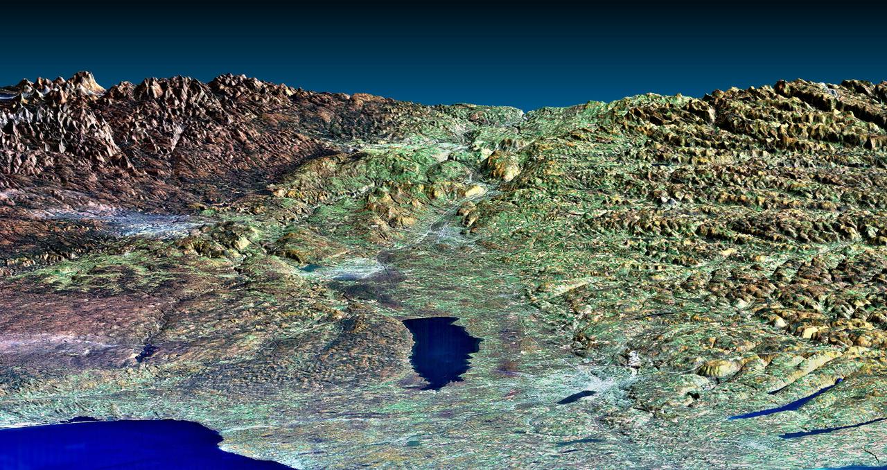
Mount San Antonio more commonly known as Mount Baldy crowns the San Gabriel Mountains northeast of Los Angeles in this computer-generated east-northeast perspective viewed from above the Malibu coastline.
The interplay of volcanism, stream erosion and landslides is evident in this Shuttle Radar Topography Mission view of the eastern flank of the Andes Mountains, southeast of San Carlos de Bariloche, Argentina.
This anaglyph, from NASA Shuttle Radar Topography Mission, shows the eastern flank of the Andes Mountains, southeast of San Martin de Los Andes, Argentina. 3D glasses are necessary to view this image.
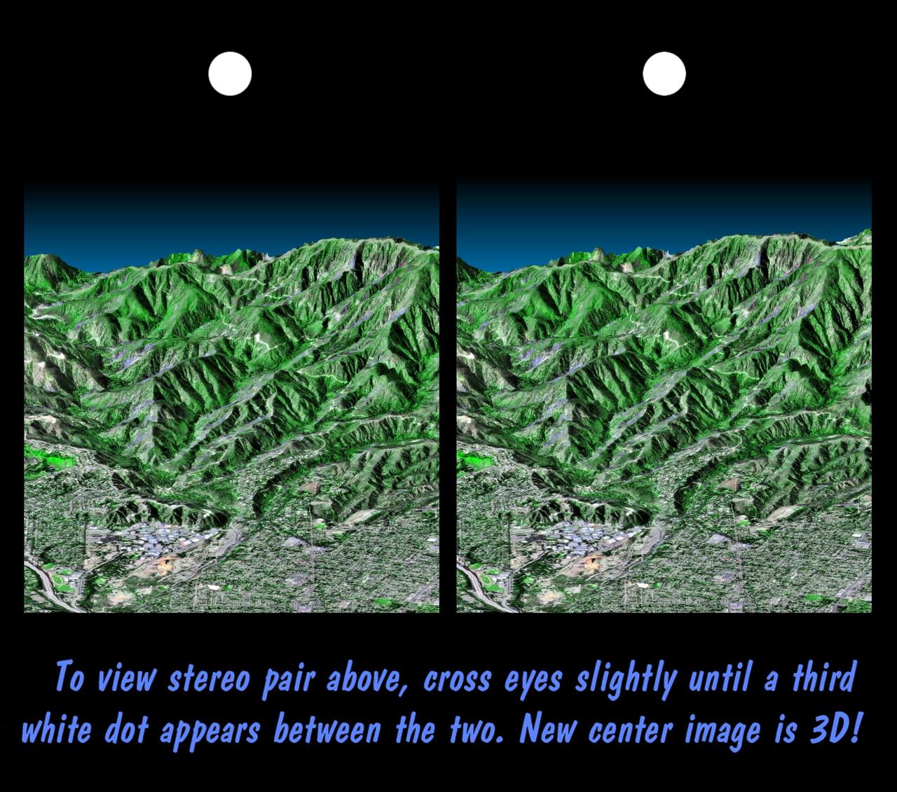
This stereoscopic image pair is a perspective view that shows the western part of the city of Pasadena, California, looking north toward the San Gabriel Mountains. Portions of the cities of Altadena and La Canada Flintridge are also shown.
The Zagros Mountains in Iran offer a visually stunning topographic display of geologic structure in layered sedimentary rocks in this anaglyph from NASA Shuttle Radar Topography Mission. 3D glasses are necessary to view this image.
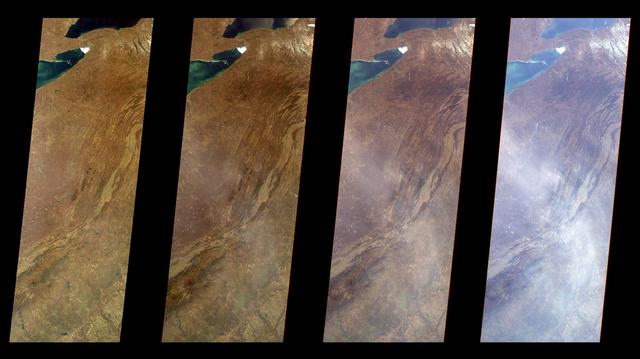
Several mountain ranges and a portion of the Amur River are visible in this set of stereo images of Russia far east Khabarovsk region taken by the MISR instrument aboard NASA Terra spacecraft. 3D glasses are necessary to view this image.
This anaglyph, from NASA Shuttle Radar Topography Mission, shows the Kamchatka Peninsula in eastern Russia. Sredinnyy Khrebet, the mountain range that makes up the spine of the peninsula. 3D glasses are necessary to view this image.
Mount San Antonio more commonly known as Mount Baldy crowns the San Gabriel Mountains northeast of Los Angeles, Calif., in this anaglyph from NASA Shuttle Radar Topography Mission. 3D glasses are necessary to view this image.
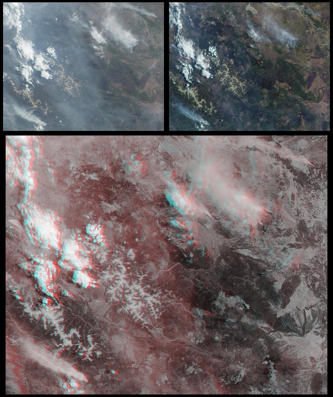
NASA Terra satellite took this anaglyph of several pyrocumulus clouds, created by the Station Fire, visible above the smoke plumes rising from the San Gabriel Mountains north of Los Angeles. 3D glasses are necessary to view this image.
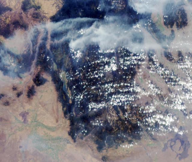
These images from NASA Terra satellite are of smoke plumes from devastating wildfires in the northwestern U.S. This view of the Clearwater and Salmon River Mountains in Idaho was acquired on August 5, 2000 Terra orbit 3370.
This dramatic view looks west along the Cucharas River Canyon in Colorado toward the 4,152 meter 13,623 ft high Spanish Peaks, in the foothills of the Sangre De Cristo Mountains.
This perspective view, acquired by NASA Shuttle Radar Topography Mission SRTM in Feb. 2000, shows the western part of the city of Pasadena, California, looking north towards the San Gabriel Mountains.
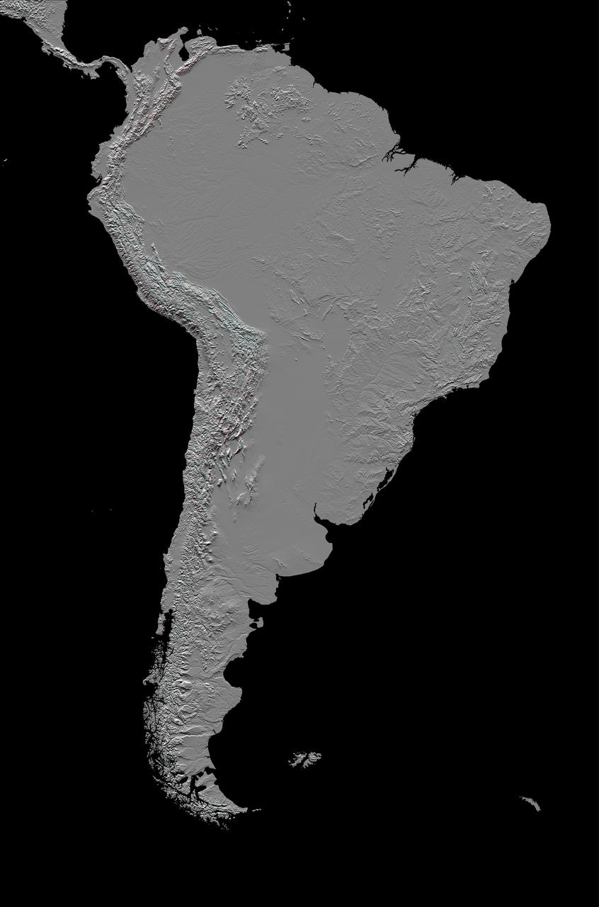
This anaglyph, from NASA Shuttle Radar Topography Mission, in South America is dominated by the Andes Mountains, which extend all along the Pacific Coast. 3D glasses are necessary to view this image.
This is a three-dimensional perspective of Mammoth Mountain, California. This view was constructed by overlaying a NASA Spaceborne Imaging Radar-C SIR-C radar image on a U.S. Geological Survey digital elevation map.
This anaglyph, shows huge mountains on Saturn moon Iapetus, imaged by NASA Cassini spacecraft during its very close flyby in Sept. 2007. 3D glasses are necessary to view this image.

Northrop N9M-2 airplane; 3/4 front view from above.
Among the highest features seen on Ceres so far is a mountain about 4 miles (6 kilometers) high, which is roughly the elevation of Mount McKinley in Alaska's Denali National Park. This image comes from an animation, shown in PIA19619, generated using data from NASA's Dawn spacecraft. Vertical relief has been exaggerated by a factor of five. Exaggerating the relief helps scientists understand and visualize the topography much more easily, and highlights features that are sometimes subtle. http://photojournal.jpl.nasa.gov/catalog/PIA19618
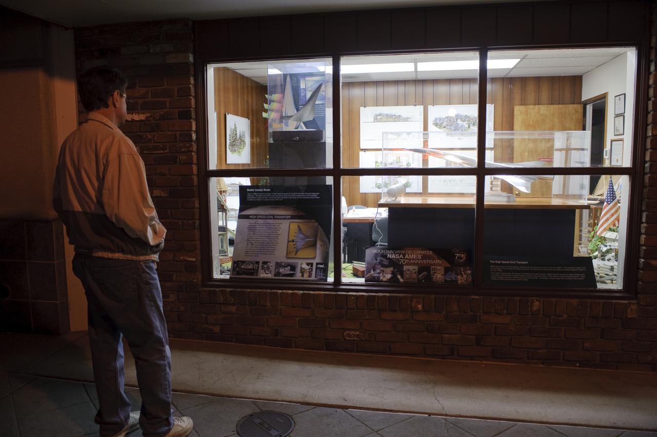
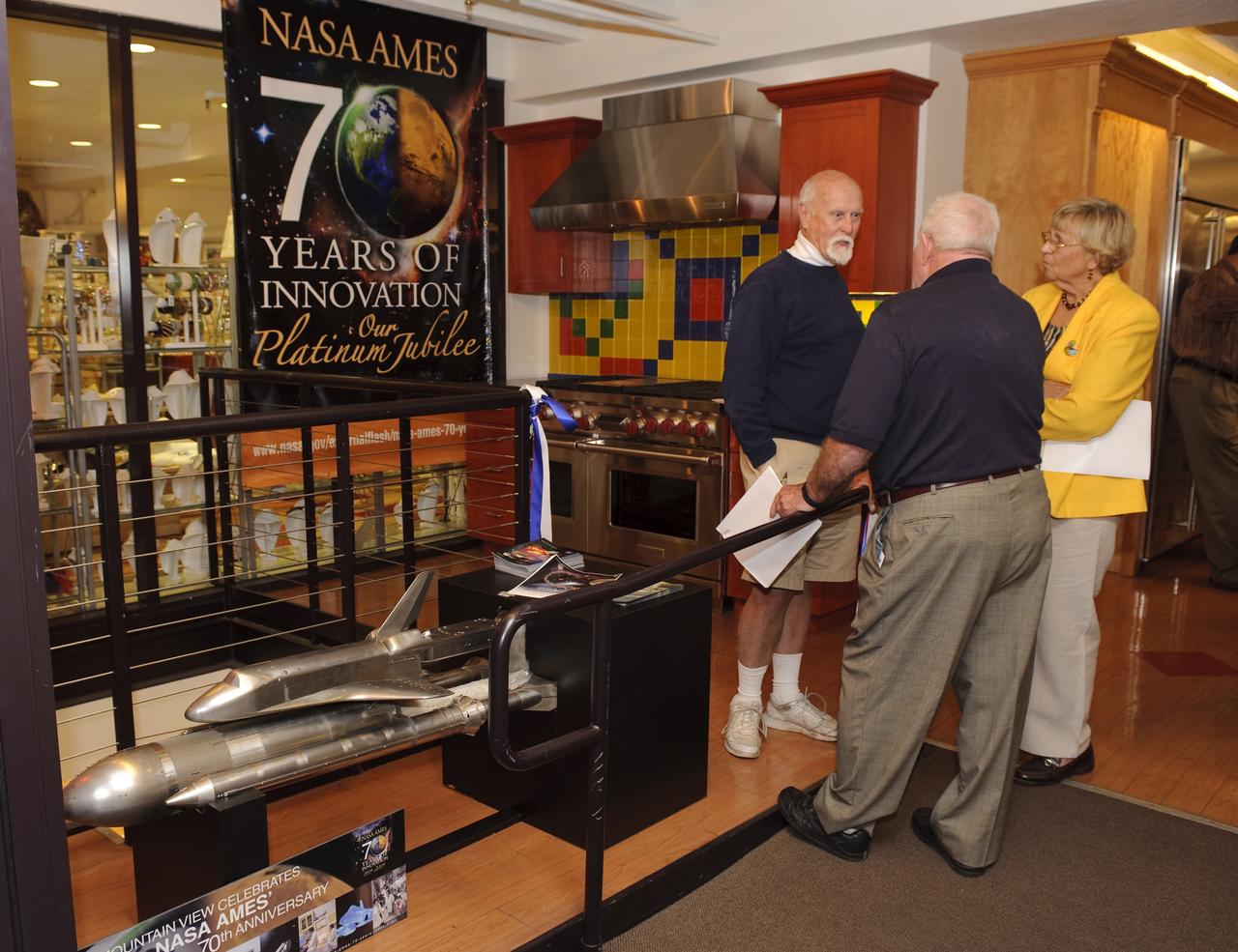
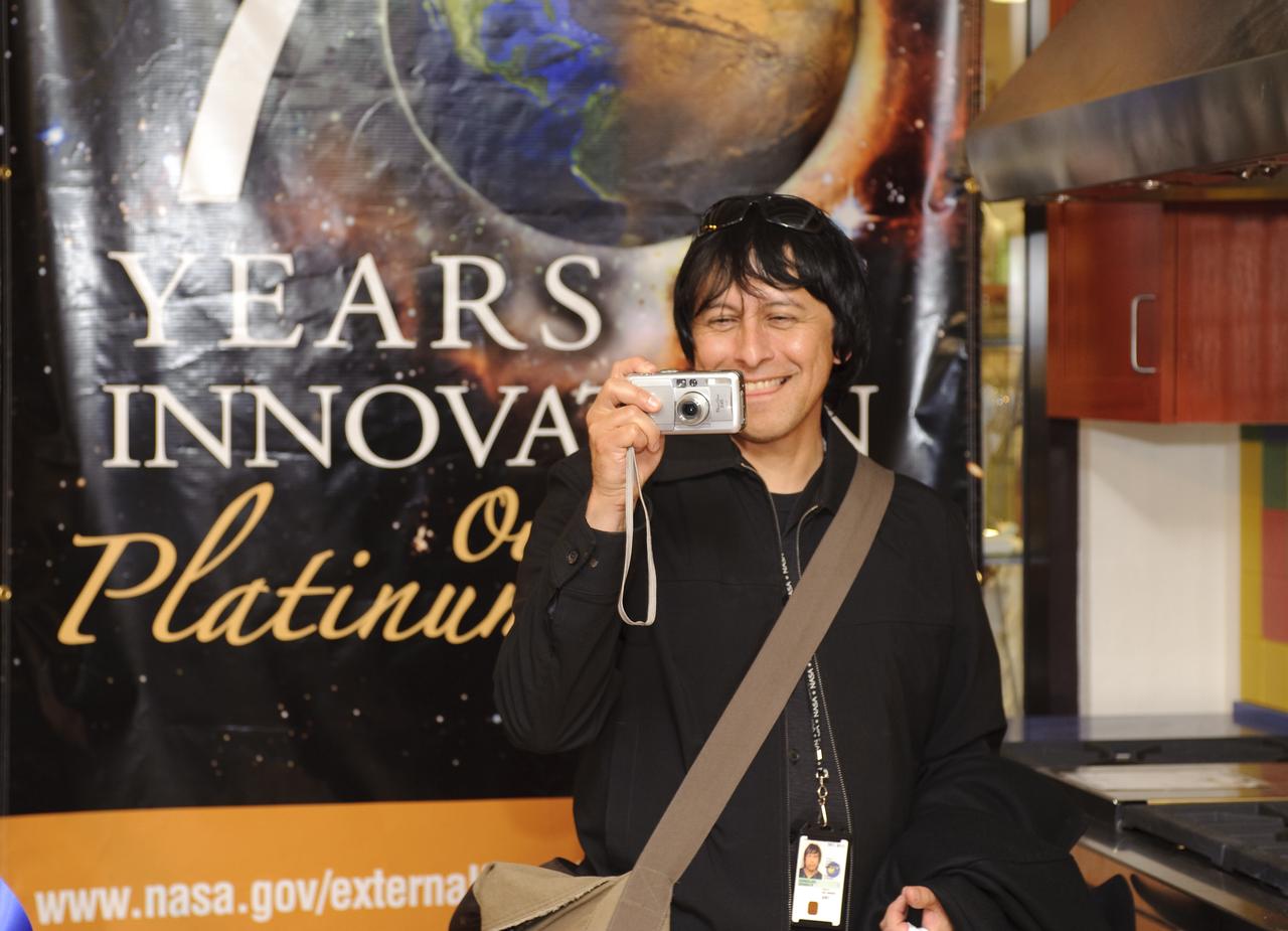
Ames 70 Year Anniversary Exhibit in downtown Mountain View, California. Exhibits
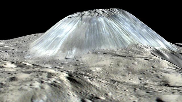
Ceres' lonely mountain, Ahuna Mons, is seen in this simulated perspective view. The elevation has been exaggerated by a factor of two. The view was made using enhanced-color images from NASA's Dawn mission. Images taken using blue (440 nanometers), green (750 nanometers) and infrared (960 nanometers) spectral filters were combined to create the view. The spacecraft's framing camera took the images from Dawn's low-altitude mapping orbit, from an altitude of 240 miles (385 kilometers) in August 2016. The resolution of the component images is 120 feet (35 meters) per pixel. http://photojournal.jpl.nasa.gov/catalog/PIA20915
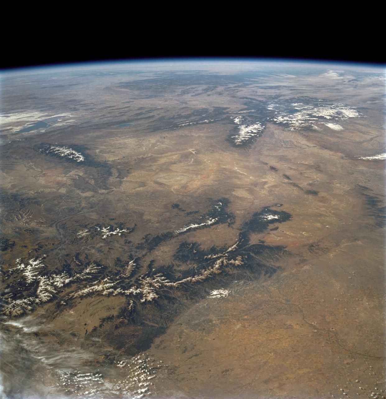
STS112-708-002 (7-18 October 2002) --- This image, photographed from the Earth-orbiting Space Shuttle Atlantis, covers parts of Utah, Colorado, Wyoming and Idaho. The Front Range of the Rockies is the dark range crossing the bottom of the view, with Denver and neighboring cities (grays) situated in the gentle embayment of the mountains (bottom center of the view). Great Salt Lake in Utah appears as two colors of blue top left, with the snow-covered Uinta Mountains just below, in this northwesterly view. Most of the view encompasses the brown plains of western Wyoming (center) and the cluster of mountains around Yellowstone (top center, top right, with snow). Beyond the brown Snake River Plain, black rocks of the Sawtooth Mountains and neighboring ranges of central Idaho appear top center.
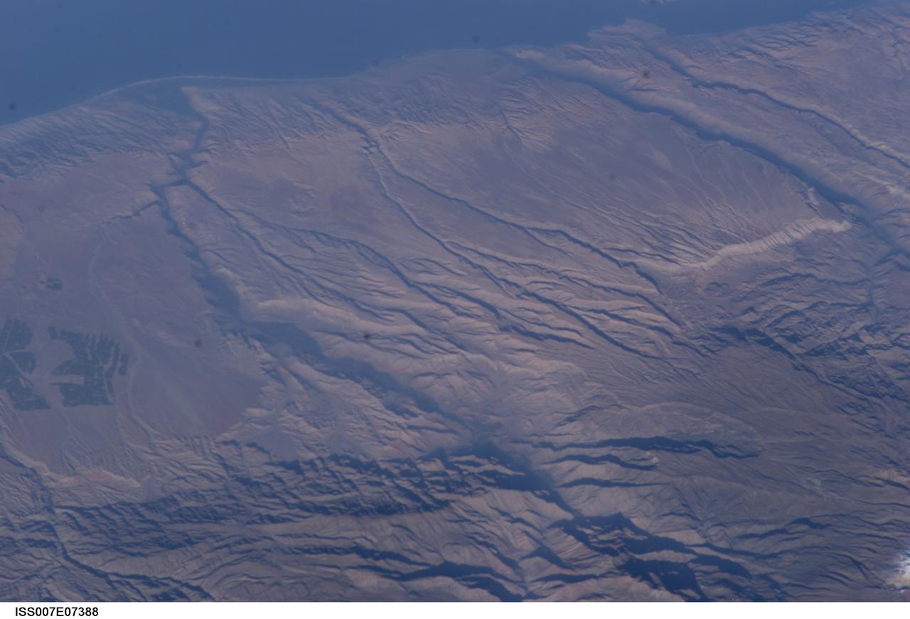
ISS007-E-07388 (14 June 2003) --- Some of the deepest canyons in the world cut west to the Pacific from the high crest of the Andes Mountains in Peru. This view taken by an Expedition 7 crewmember onboard the International Space Station (ISS) provides a birds-eye view down the canyons of the Rio Camana (center left) and the Rio Ocona (upper right). The low early morning sun highlights the extreme topography created by rapidly uplifting mountains and powerful water erosion by water dropping nearly 10,000 feet in this view. At the edge of the image are the snowy flanks of Nevado Coropuna, the highest mountain in the Cordillera Occidental (6613 meters). The coastal city of Camana is visible in the upper left.

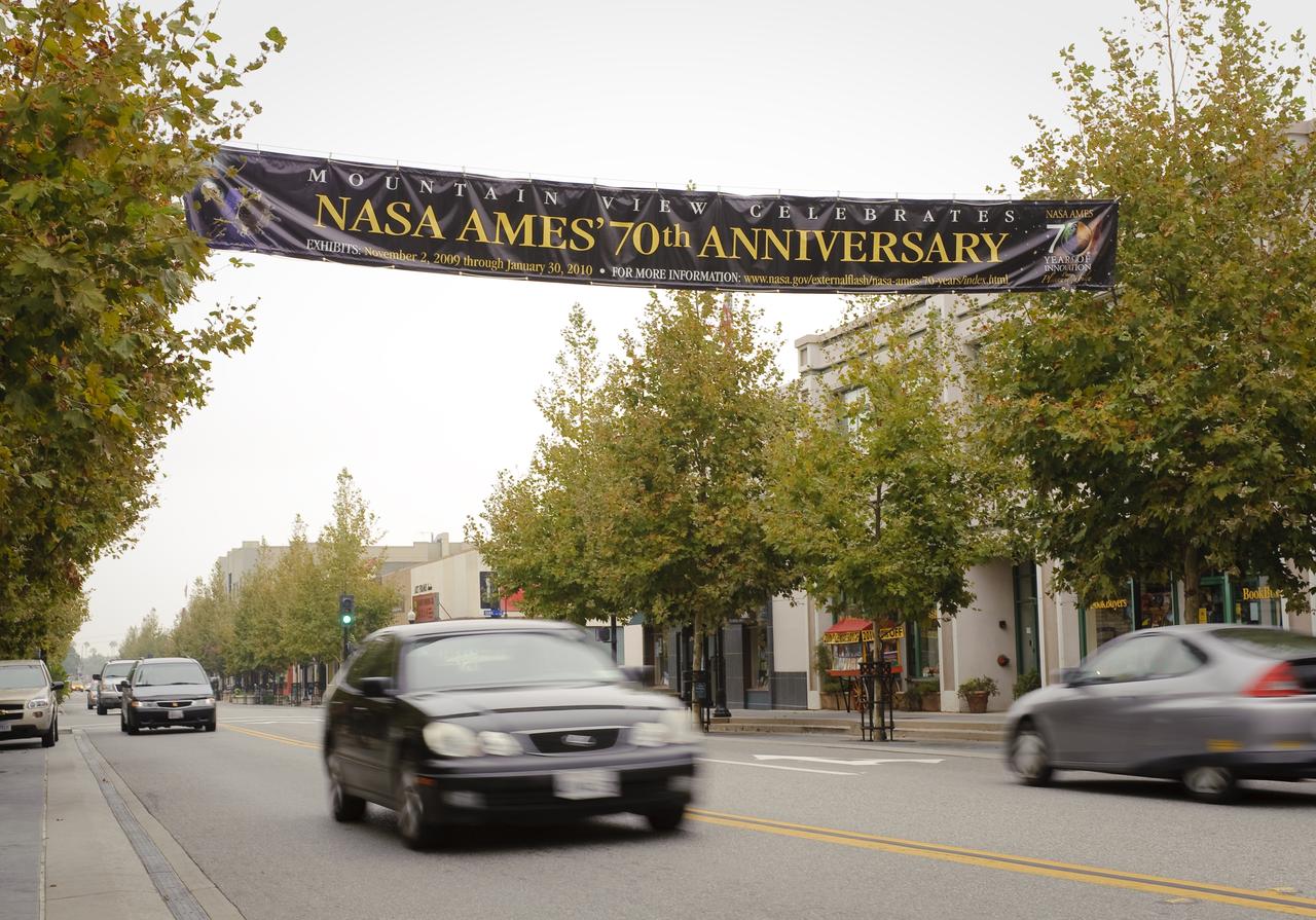
Ames 70 Year Anniversary Exhibit in downtown Mountain View, California. The banner across Castro Street.

Ames 70 Year Anniversary Exhibit in downtown Mountain View, California. Grand Opening at Meyer Appliance, Castro Street.

Singularity University 2009 NASA ISU signage on Castro Street, Mountain View, Calif. Questions seeking answers.

Ames 70 Year Anniversary Exhibit in downtown Mountain View, California. The banner across Castro Street.
Ames 70 Year Anniversary Exhibit in downtown Mountain View, California. Grand Opening at Meyer Appliance, Castro Street.
Ames 70 Year Anniversary Exhibit in downtown Mountain View, California. The banner across Castro Street.

Ames 70 Year Anniversary Exhibit in downtown Mountain View, California. Exhibits at the Red Rock Cafe on Castro Street.
Ames 70 Year Anniversary Exhibit in downtown Mountain View, California. Grand Opening at Meyer Appliance, Castro Street.

Ames 70 Year Anniversary Exhibit in downtown Mountain View, California. The banner across Castro Street.
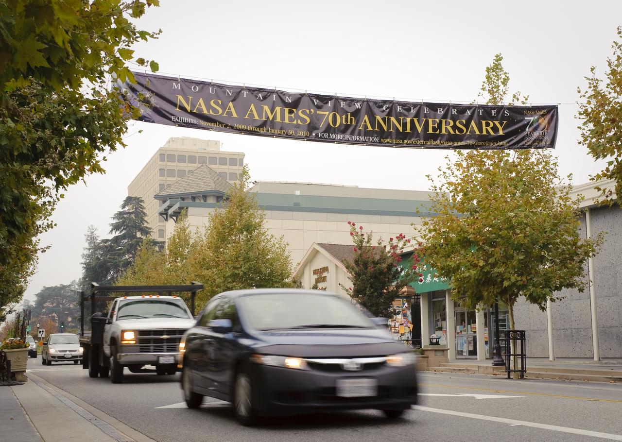
Ames 70 Year Anniversary Exhibit in downtown Mountain View, California. The banner across Castro Street.

Ames 70 Year Anniversary Exhibit in downtown Mountain View, California. Exhibits at The Boutique 4.

Ames 70 Year Anniversary Exhibit in downtown Mountain View, California. Grand Opening at Meyer Appliance, Castro Street.
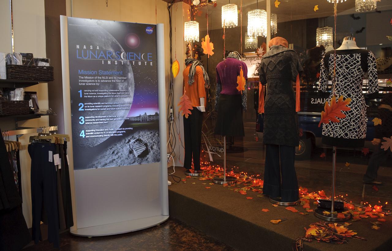
Ames 70 Year Anniversary Exhibit in downtown Mountain View, California. Exhibits at The Boutique 4.

Ames 70 Year Anniversary Exhibit in downtown Mountain View, California. Exhibits at The Boutique 4.

Ames 70 Year Anniversary Exhibit in downtown Mountain View, California. The banner across Castro Street.

Ames 70 Year Anniversary Exhibit in downtown Mountain View, California. Grand Opening at Meyer Appliance, Castro Street.
Ames 70 Year Anniversary Exhibit in downtown Mountain View, California. Grand Opening at Meyer Appliance, Castro Street.
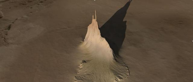
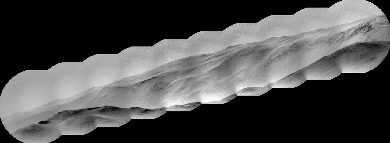
Created using data collected by the JunoCam imager aboard NASA's Juno spacecraft, this animation is an artist's concept that shows a view of a mountain on the Jovian moon Io. The data was recorded during close flybys of the moon in December 2023 and February 2024. The mountain, which the Juno science team has nicknamed "Steeple Mountain," is between 3 and 4.3 miles (5 and 7 kilometers) in height. One side of Steeple Mountain is in shade in the animation because only one side of the mountain was illuminated when imaged by JunoCam. Animation available at https://photojournal.jpl.nasa.gov/catalog/PIA26294
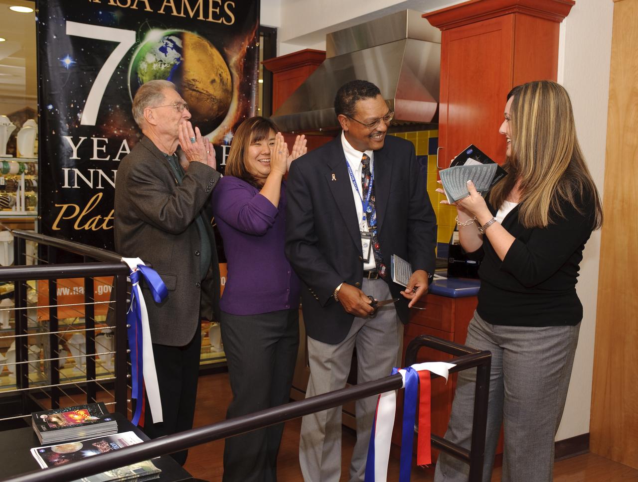
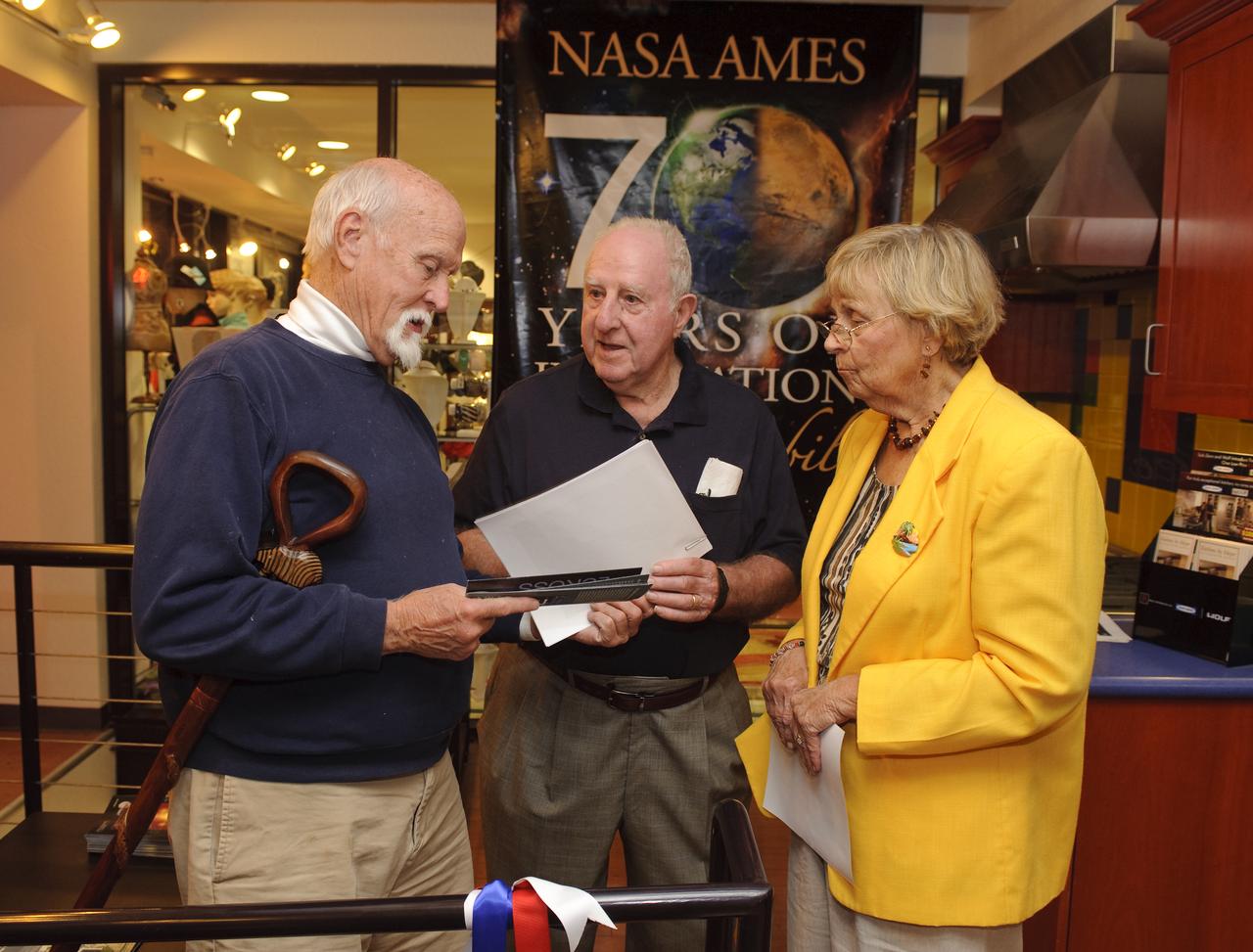
Ames 70 Year Anniversary Exhibit in downtown Mountain View, California. Grand Opening at Meyer Appliance, Castro Street. Ribbon Cutting ceremony for exhibit, With Jack Boyd, Mt View Mayor, Lewis Braxton III and

Ames 70 Year Anniversary Exhibit in downtown Mountain View, California. Grand Opening at Meyer Appliance, Castro Street. Ribbon Cutting ceremony for exhibit, With Jack Boyd, Mt View Mayor, Lewis Braxton III and

Ames 70 Year Anniversary Exhibit in downtown Mountain View, California. Grand Opening at Meyer Appliance, Castro Street. Ribbon Cutting ceremony for exhibit, With Jack Boyd, Mt View Mayor, Lewis Braxton III and
This view from the Mastcam on NASA Curiosity Mars rover shows dramatic buttes and layers on the lower flank of Mount Sharp. It was taken on Sept. 7, 2013, from near the waypoint called Darwin on the route toward an entry point to the mountain.

NASA Hubble Space Telescope captures the chaotic activity atop a three-light-year-tall pillar of gas and dust that is being eaten away by the brilliant light from nearby bright stars in a tempestuous stellar nursery called the Carina Nebula.
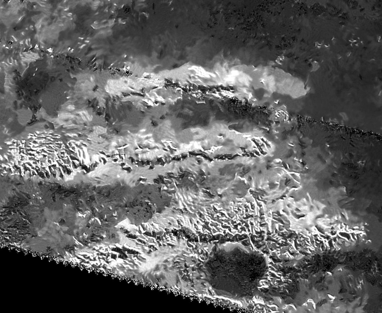
The trio of ridges on Titan known as Mithrim Montes is home to the hazy Saturnian moon tallest peak. The mountain is located midway along the lower of the three ridges shown in this radar image from NASA Cassini spacecraft.
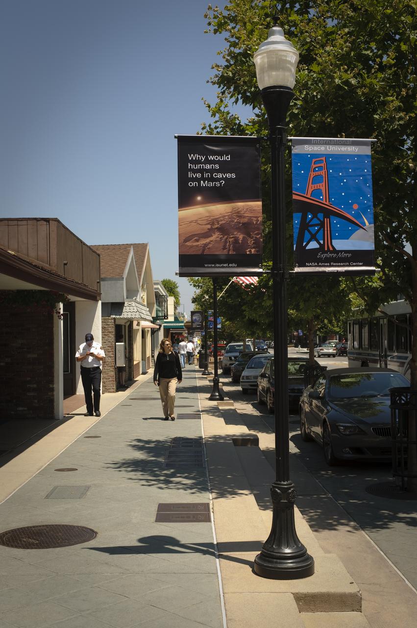
International Space University (ISU) SSP 2009 NASA ISU signage on Castro Street, Mountain View, Calif. Questions seeking answers.
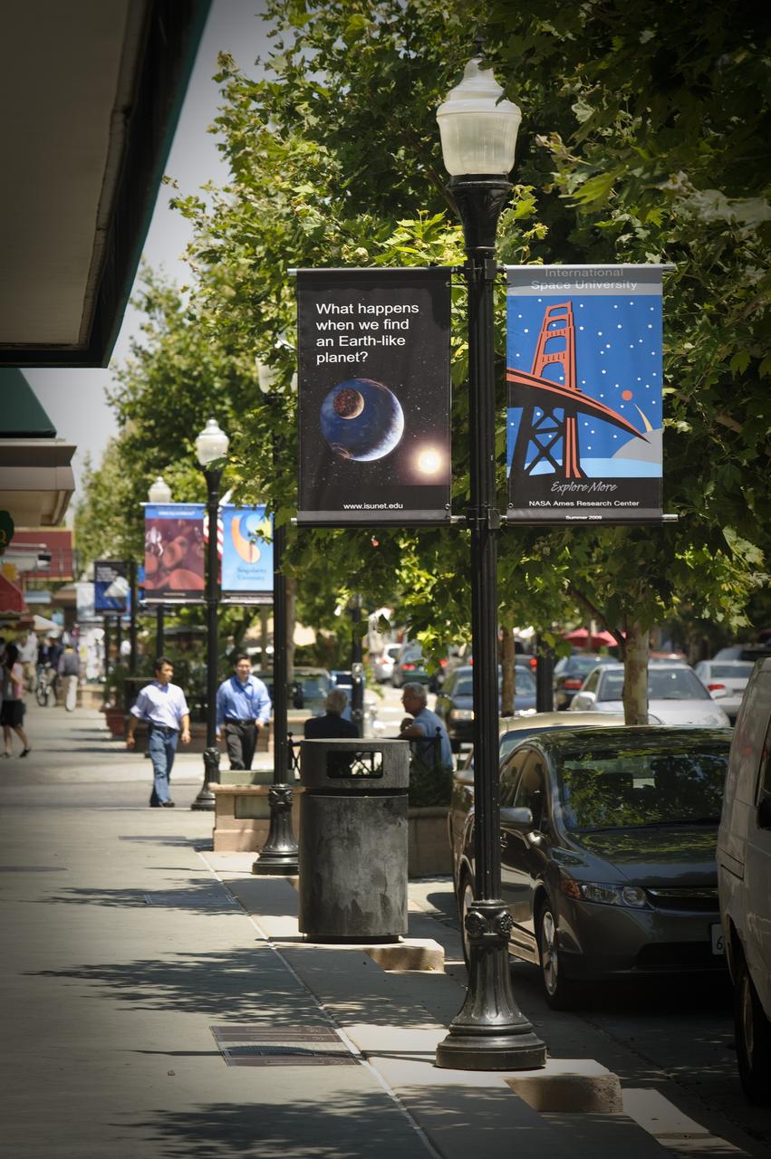
International Space University (ISU) SSP 2009 NASA ISU signage on Castro Street, Mountain View, Calif. Questions seeking answers.

Ames 70 Year Anniversary Exhibit in downtown Mountain View, California. Grand Opening at Meyer Appliance, Castro Street. with Lewis Braxton III
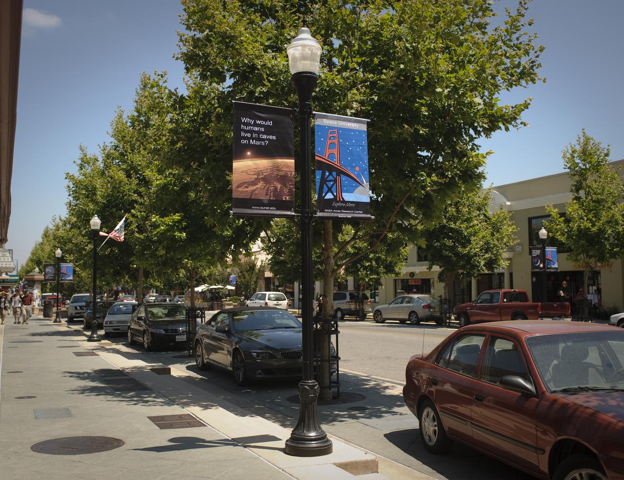
International Space University (ISU) SSP 2009 NASA ISU signage on Castro Street, Mountain View, Calif. Questions seeking answers.

The Special Olympics torch make it's way through the NASA Ames Research Park on it's way to a hand-off in Mountain View, CA

The Special Olympics Torch makes it’s way through NASA Ames Research Park on it’s way to a hand-off in Mountain View, CA.

Ames 70 Year Anniversary Exhibit in downtown Mountain View, California. Grand Opening at Meyer Appliance, Castro Street. with Lewis Braxton III

Ames 70 Year Anniversary Exhibit in downtown Mountain View, California. Exhibit in window at Book Buyers. Pedestrian Robin Croft stops to look.
STS080-706-044 (19 Nov.-7 Dec. 1996) --- This view shows Mount Pinatubo, an active volcano in the Zambales Mountains range of western Luzon, the main island of the Philippines. Mud flows radiate out from the active volcano, which has erupted in recent years, coming down the mountain. After the eruption a lot of the vegetation was removed, causing the mountain to erode at a more rapid pace than an older mountain that has its vegetation in place. In two cases the flows reach the South China Sea, and flow down three valleys to the east. The now abandoned Clark Air Force Base is to the upper left corner. Pinatubo is about 80 miles northwest of Manila.
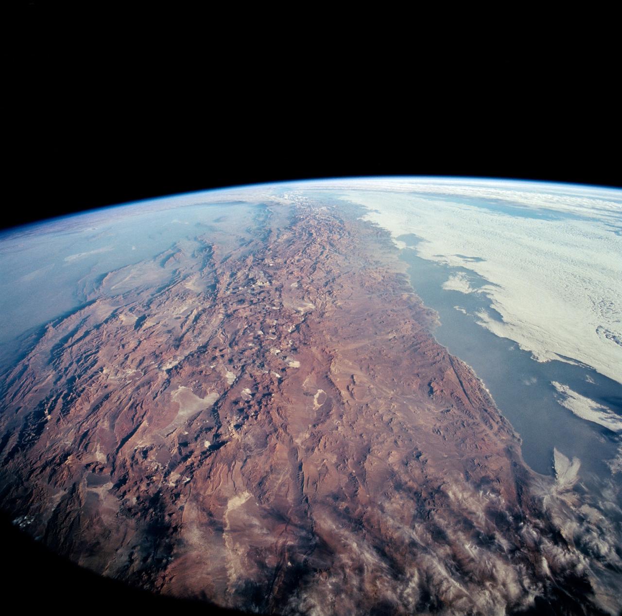
STS-65 Earth observation taken aboard Columbia, Orbiter Vehicle (OV) 102, shows Northern Chile and the Andes Mountains. This color photograph is a panoramic (southern view) that features Chile and the Andes Mountains of South America. The Atacama Desert, one of the driest regions on Earth, is clearly visible along the Chilean coast. In the near left foreground is the Salar de Arizaro. Salar Punta Negra in the center foreground appears to be partially filled with water. On the right side of the view, a coastal plateau rises from the Pacific Ocean and meets the Andes Mountains that appear as a backbone running north to south along the border of Chile and Argentina. In the distant left portion of the view can be seen the hazy Chaco Plains and Pampas.
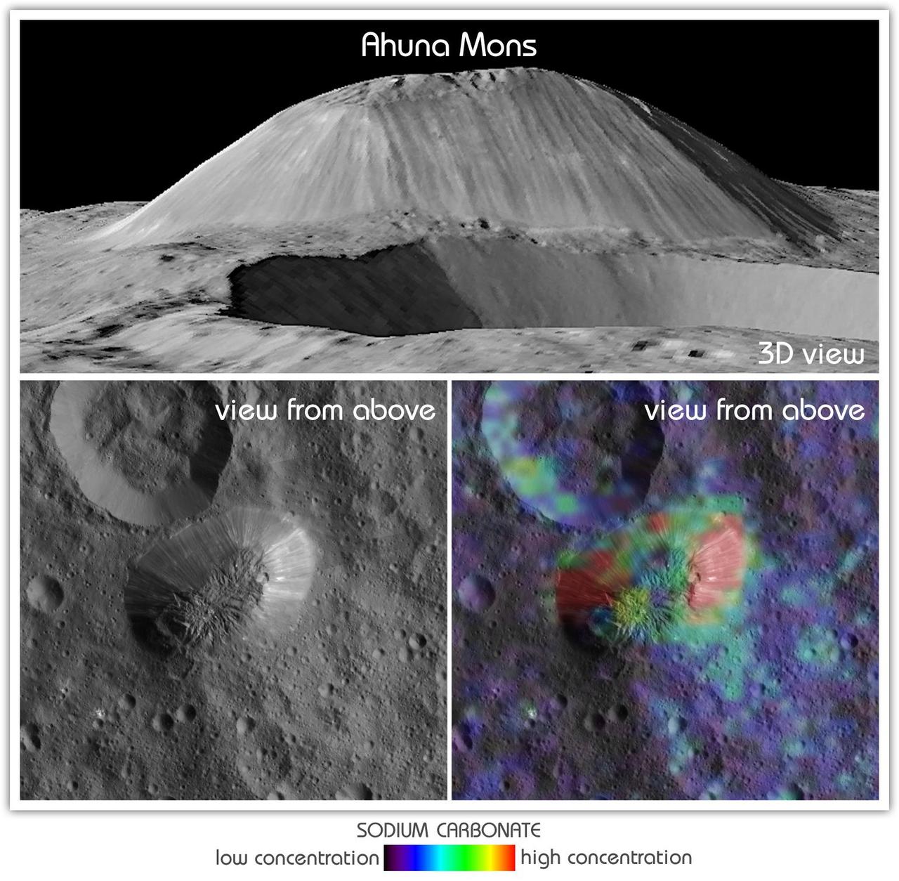
This view from NASA's Dawn mission shows Ceres' tallest mountain, Ahuna Mons, 2.5 miles (4 kilometers) high and 11 miles (17 kilometers) wide. This is one of the few sites on Ceres at which a significant amount of sodium carbonate has been found, shown in green and red colors in the lower right image. The top and lower left images were collected by Dawn's framing camera. The top image is a 3D view reconstructed with the help of topography data. A non-annotated version is available at https://photojournal.jpl.nasa.gov/catalog/PIA21919