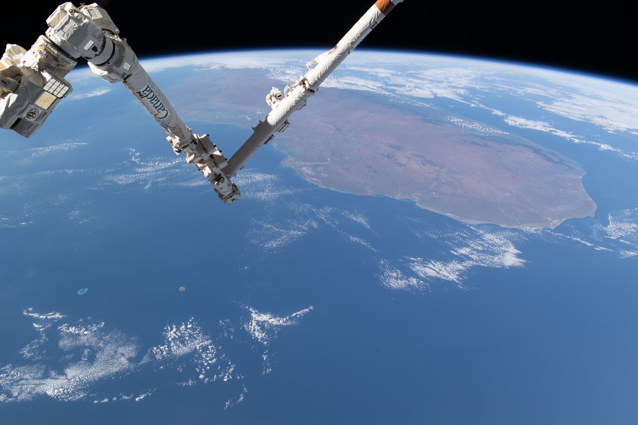
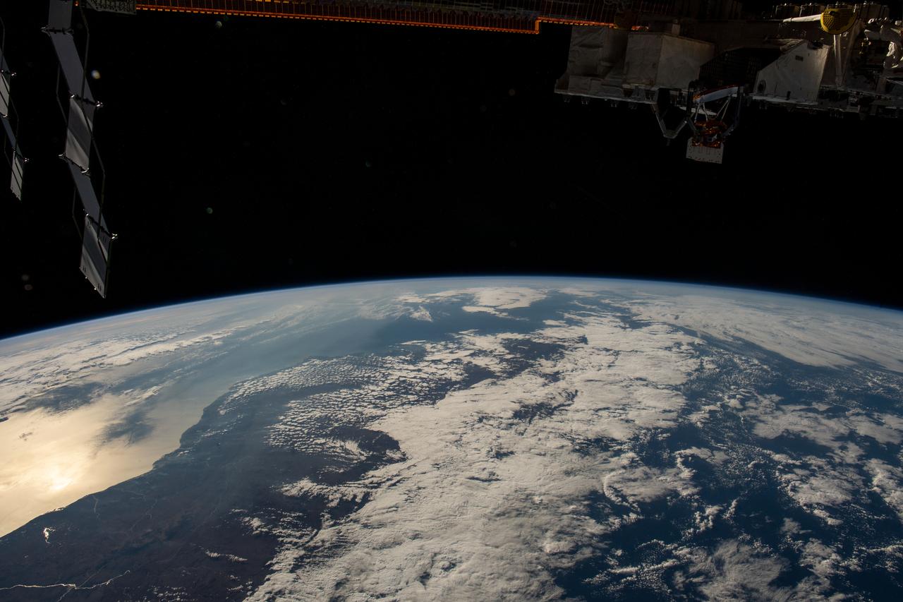
iss071e361950 (July 15, 2024) --- The International Space Station's 57.7-foot-long Canadarm2 robotic arm crosses the foreground as the orbital outpost soared 265 miles above the Mozambique Channel south of the African island nation of Madagascar.
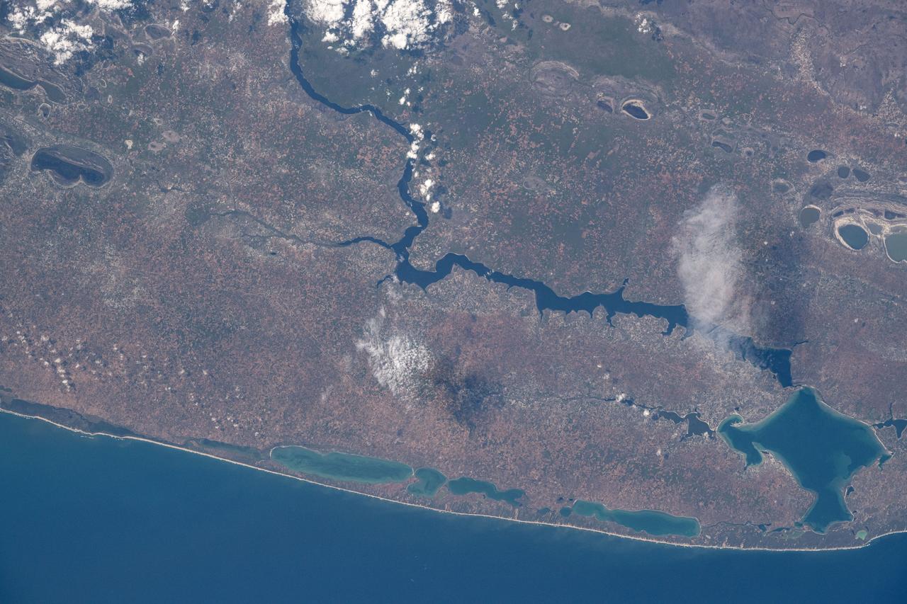
iss072e095378 (Oct. 20, 2024) --- Lake Poelela (lower right) in Mozambique's tropical climate on the coast of the Mozambique Channel is pictured from the International Space Station as it orbited 265 miles above the African nation.
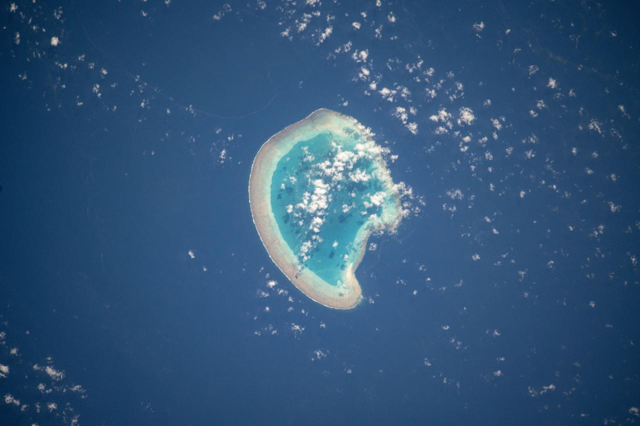
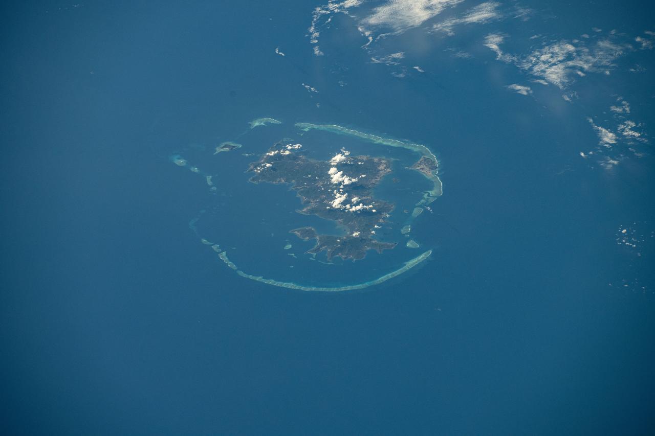
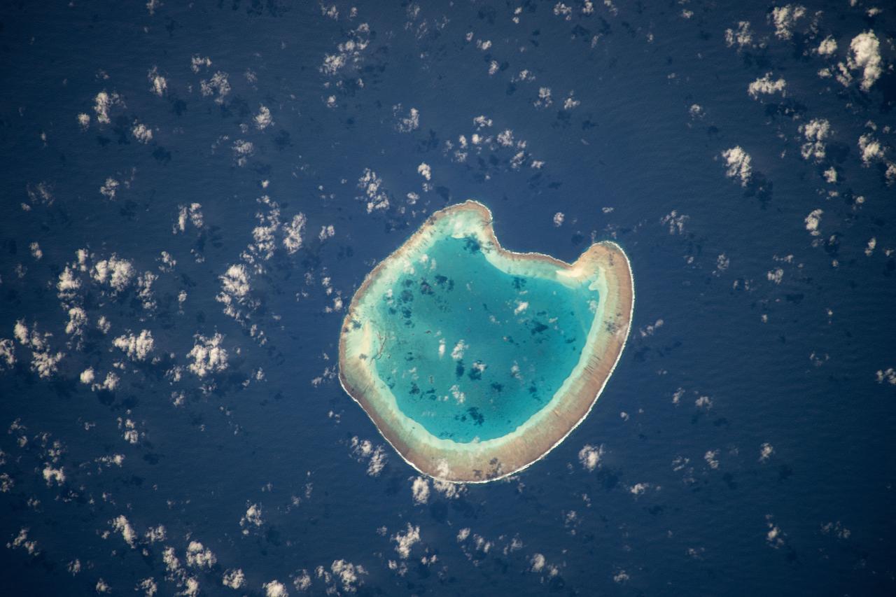
iss072e094988 (Oct. 21, 2024) --- The French atoll of Bassas da India in the Mozambique Channel, halfway beween the African nations of Mozambiue and Madagascar, is pictured from the International Space Station as it orbited 264 miles above.
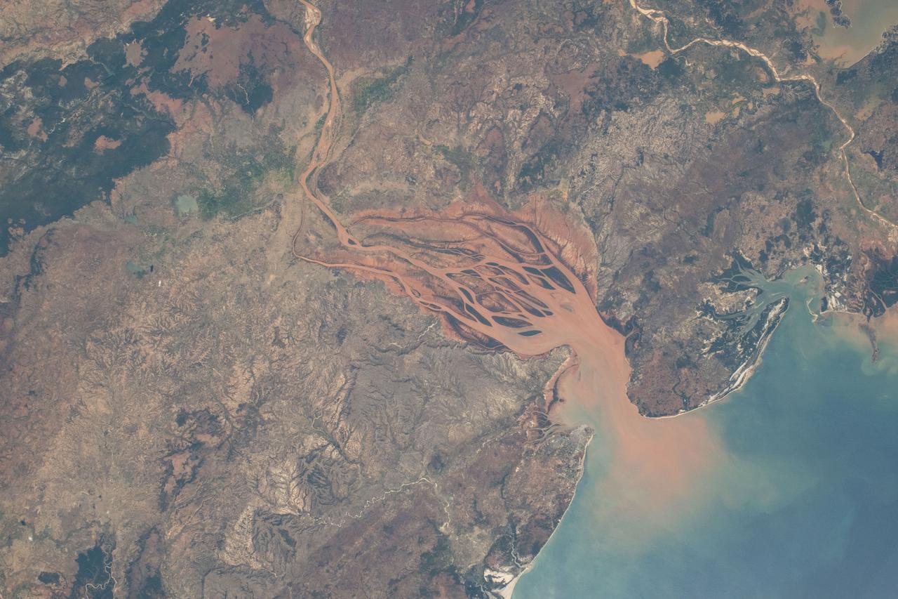
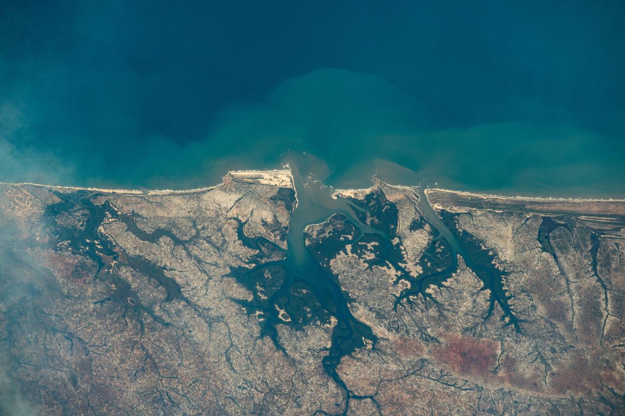
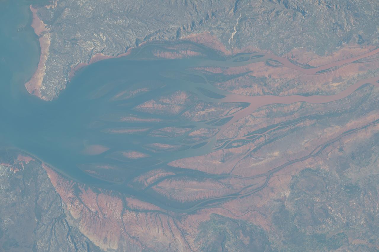
iss071e218069 (June 26, 2024) -- On Madagascar's northwestern coast, the Mozambique Channel flows inland to the Betsiboka River, forming Bombetoka Bay. The reddish-brown color is the result of iron-rich sediment transporting through, creating a striking visual marker for astronauts aboard the International Space Station. This photograph was taken as the orbiting laboratory soared 266 miles above Earth.
iss071e345427 (July 15, 2024) --- The Mayotte archipelago, a French overseas department and region, in the Mozambique Channel and in between Madagascar and Mozambique is pictured from the International Space Station as it orbited 263 miles above.
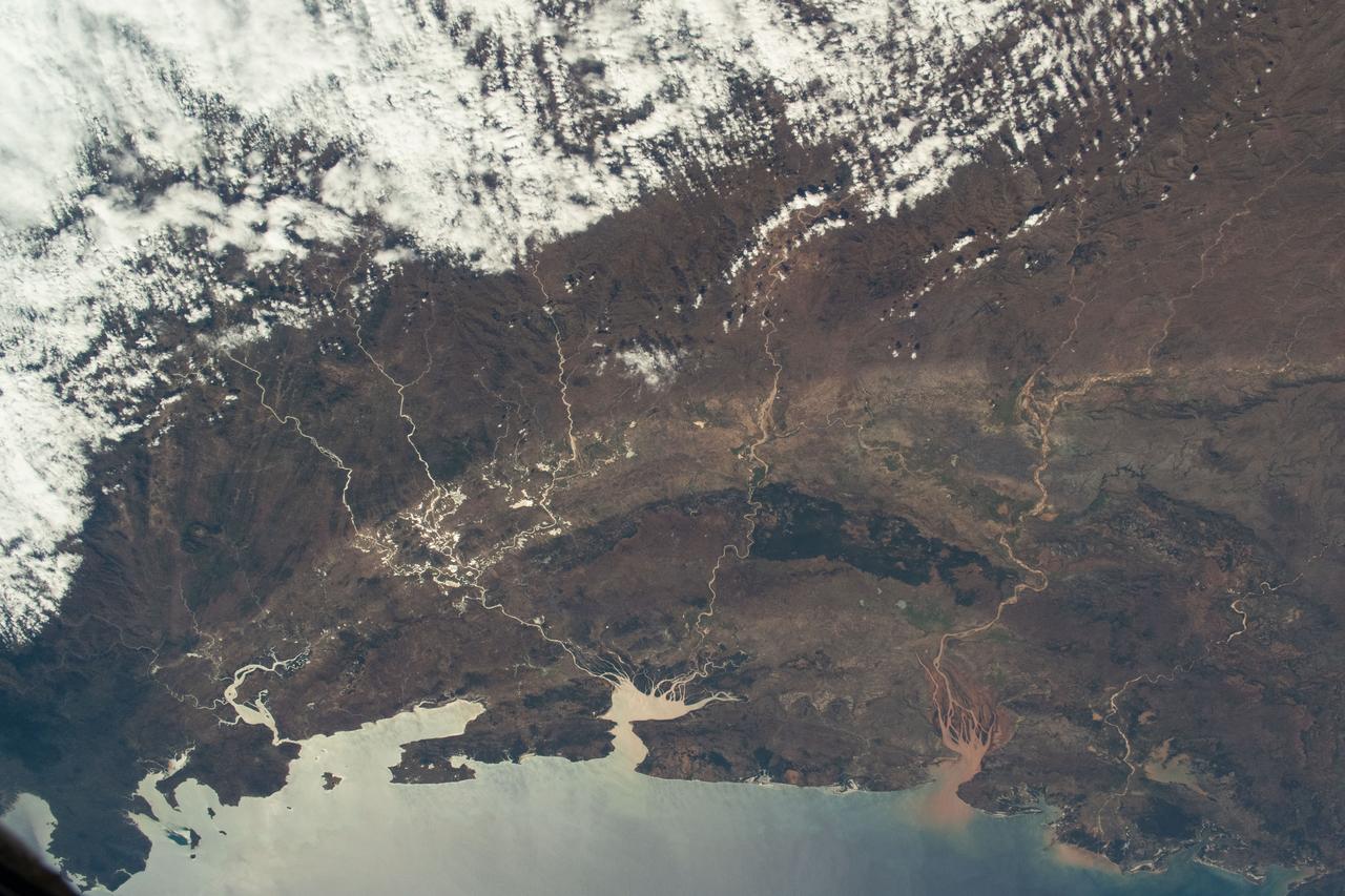
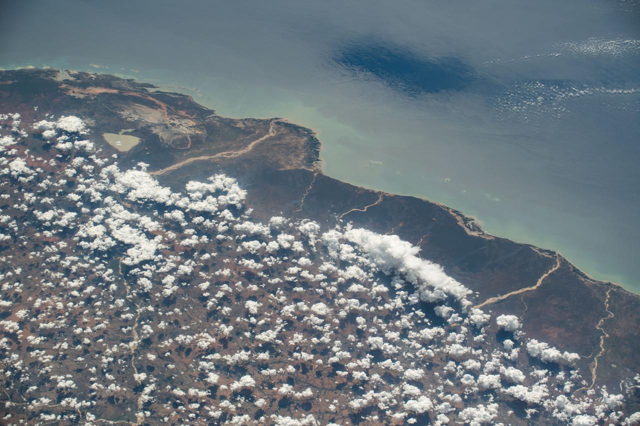
iss070e013997 (Oct. 25, 2023) --- The coast of Mozambique on the Mozambique Channel is pictured from the International Space Station as it orbited 263 miles above the African nation.
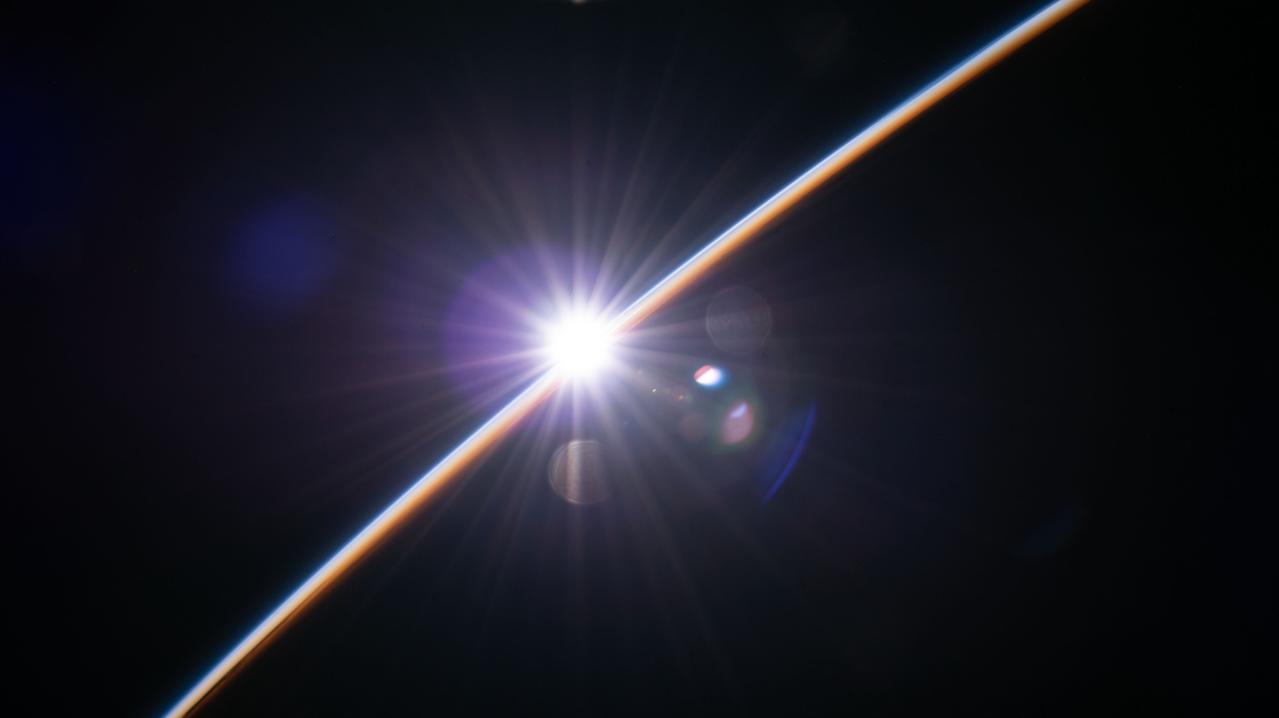
iss067e124188 (June 15, 2022) --- The first rays of an orbital sunrise illuminate the Earth's atmosphere as the International Space Station orbited 263 miles above southern Mozambique near the coast of the Mozambique channel.
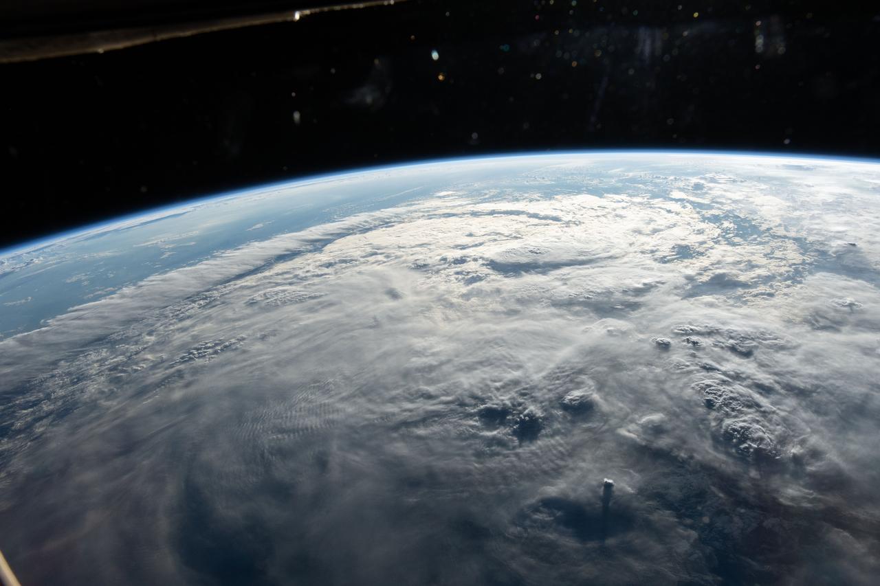
iss059e000515 (March 16, 2019) --- Tropical Cyclone Idai is pictured from the International Space Station as the orbital complex flew 261 miles above the southeast coast of Africa. Idai's track took it over the Mozambique Channel and portions of the nations of Madagascar, Mozambique, Malawi and Zimbabwe creating devastation and casualties in the southeast portion of the African continent.

iss056e084625 (July 7, 2018) --- The island nation of Madagascar was photographed by an Expedition 56 crew member as the International Space Station orbited about 255 miles above the Mozambique Channel which separates Madagascar from the African nation of Mozambique.

iss059e000502 (March 16, 2019) --- Tropical Cyclone Idai is pictured from the International Space Station as the orbital complex flew 261 miles above the southeast coast of Africa. Idai's track took it over the Mozambique Channel and portions of the nations of Madagascar, Mozambique, Malawi and Zimbabwe creating devastation and casualties in the southeast portion of the African continent.
iss071e111610 (May 23, 2024) -- Nearly halfway between Madagascar and Mozambique lies the Bassas da India atoll in the Mozambique Channel. The uninhabited ring-shaped island spans roughly 330 feet (~100 meters) around a shallow lagoon. The International Space Station was soaring 260 miles above as this photo was taken.
iss069e032071 (July 15, 2023) --- The Bombetoka Bay leads into the Mozambique Channel from the island nation of Madagascar in this photograph from the International Space Station as it orbited 262 miles above.
iss071e218076 (June 26, 2024) --- The northwest coast of Madagascar on the Mozambique Channel is pictured from the International Space Station as it orbited 267 miles above the East African island nation.
iss067e189040 (July 16, 2022) --- The sun's glint beams off the Mozambique Channel in this photograph of Madagascar's coast as the International Space Station orbited 262 miles above the Indian Ocean.
iss070e025919 (Nov. 16, 2023) --- The partly cloudy coast of southwestern Madagascar on the Mozambique Channel is pictured from the International Space Station as it orbited 264 miles above the island nation.
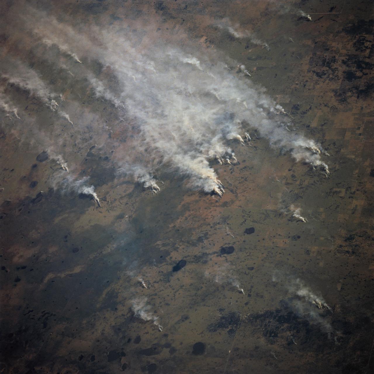
STS070-717-027 (13-22 JULY 1995) --- Easterly winds from the Mozambique Channel blow the smoke from many large fires in southern Mozambique inland. Neighboring views showed the smoke moving over and around the Chimanimani Mountains, into Zimbabwe on the African plateau. Winter is the dry season in southern Africa and fires are set to hasten the greening of the grass shoots for cattle grazing.
iss071e673801 (Sept. 15, 2024) --- Ankarana Special Reserve, formed about 150 million years ago during the Jurassic period, on the northwest coast of Madagascar near the Mozambique Channel is pictured from the International Space Station as it orbited 260 miles above.

ISS047e141619 (06/06/2016) --- This Earth observation image captured by Expedition 47 members aboard the International Space Station is of Juan de Nova Island, also known as Saint-Christophe. The small French tropical island is in the narrowest part of the Mozambique Channel, about one-third of the way between Madagascar and Mozambique. The Island is 3.7 miles long and 1 mile at its widest. It is a nature reserve surrounded by reefs. Forests cover about half the island and sea turtles nest on the beaches. It is largely uninhabited but the French maintain a weather station on the Island.
41G-120-079 (5-13 Oct 1984) --- This oblique view, photographed from the Space Shuttle Challenger, shows the south tip of the island of Madagascar. Sunglint reflects on the surface of the Mozambique Channel. The crew consisted of astronauts Robert L. Crippen, commander; Jon A. McBride, pilot; mission specialist's Kathryn D. Sullivan, Sally K. Ride, and David D. Leestma; Canadian astronaut Marc Garneau; and Paul D. Scully-Power, payload specialist. EDITOR'S NOTE: The STS-41G mission had the first American female EVA (Sullivan); first seven-person crew; first orbital fuel transfer; and the first Canadian (Garneau).
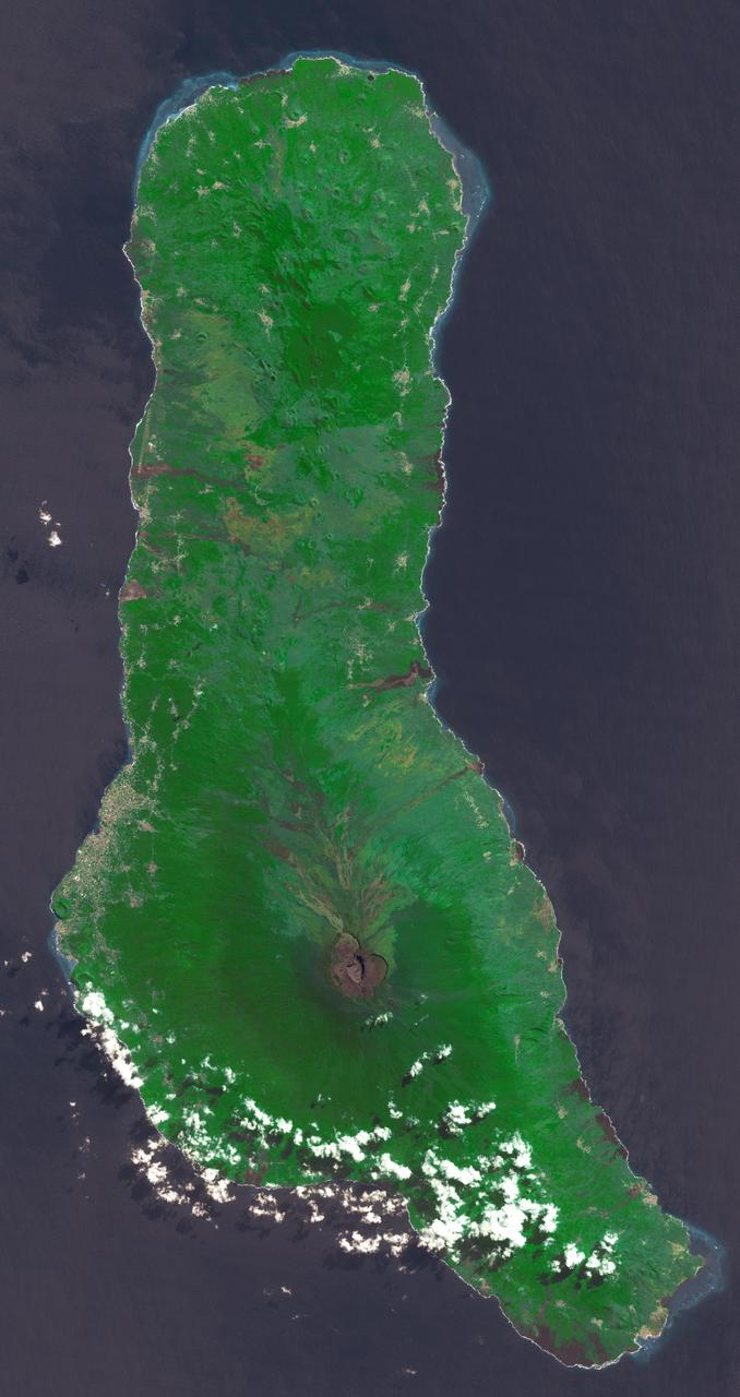
Grande Comore is the largest island of the Union of the Comoros, an island nation located in the Mozambique Channel northwest of Madagascar. The nation was granted independence from France in 1975, and became the Federated Islamic Republic of the Comoro Islands. In 2001, the government reformed as the Union of the Comoros. The three islands making up the country are all of volcanic origin, and Grande Comore is still volcanically active. The image was acquired June 22, 2022, covers an area of 25.7 by 67.4 km, and is located at 11.7 degrees south, 43.3 degrees east. With its 14 spectral bands from the visible to the thermal infrared wavelength region and its high spatial resolution of about 50 to 300 feet (15 to 90 meters), ASTER images Earth to map and monitor the changing surface of our planet. ASTER is one of five Earth-observing instruments launched Dec. 18, 1999, on Terra. The instrument was built by Japan's Ministry of Economy, Trade and Industry. A joint U.S./Japan science team is responsible for validation and calibration of the instrument and data products. The broad spectral coverage and high spectral resolution of ASTER provides scientists in numerous disciplines with critical information for surface mapping and monitoring of dynamic conditions and temporal change. Example applications are monitoring glacial advances and retreats; monitoring potentially active volcanoes; identifying crop stress; determining cloud morphology and physical properties; wetlands evaluation; thermal pollution monitoring; coral reef degradation; surface temperature mapping of soils and geology; and measuring surface heat balance. https://photojournal.jpl.nasa.gov/catalog/PIA25444
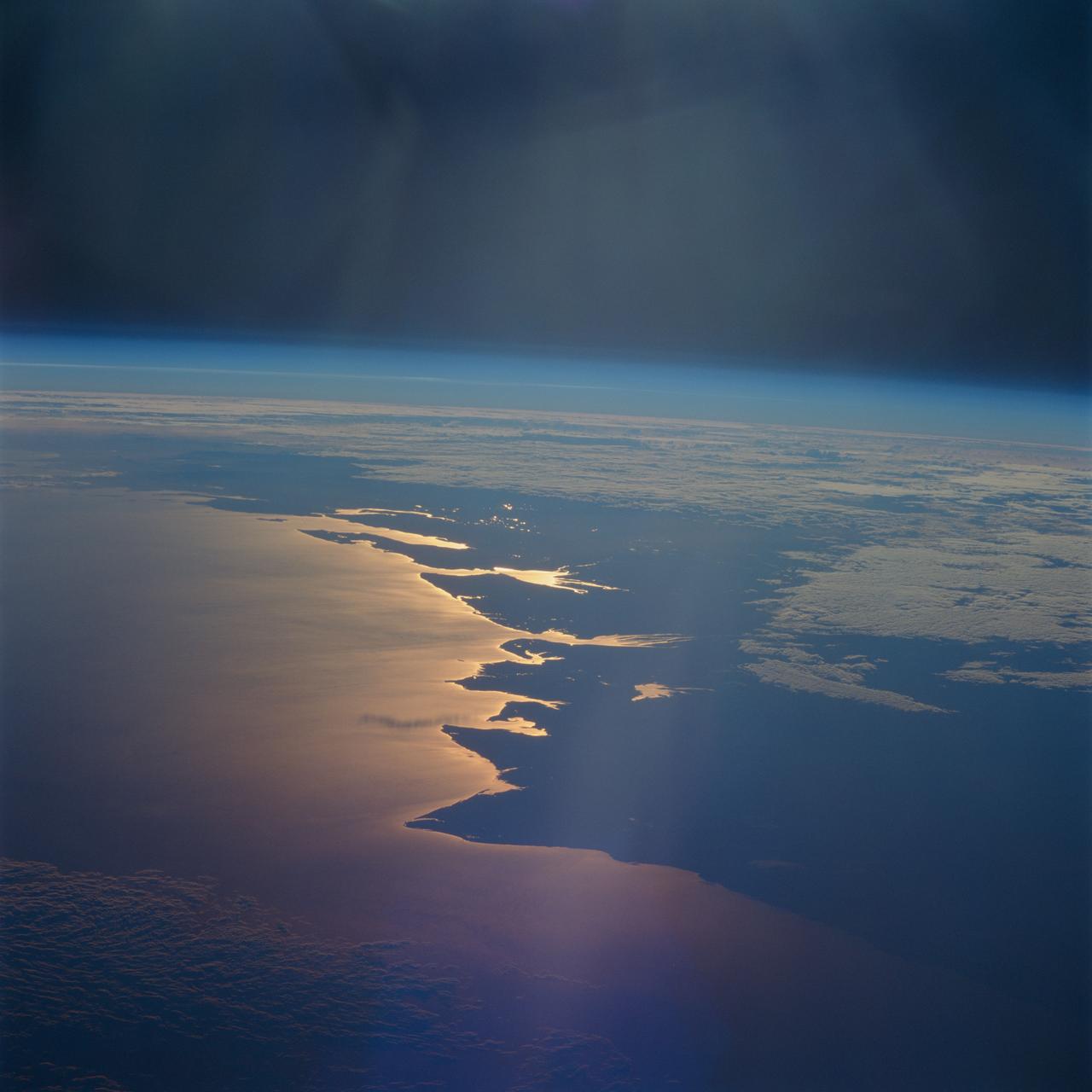
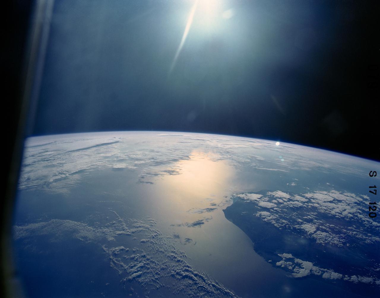
STS093-716-065 (23-27 July 1999) --- The STS-93 astronauts aboard the Space Shuttle Columbia took this picture of a sunrise on the Mozambique Channel along the coast of Madagascar. The nearest point of land is Cape Saint Andre, which forms the northwest corner of the island. Sunglint highlights the land-water boundary along a series of dynamic estuaries. The fifth inlet from the bottom just above the small lake is the Betsiboka Estuary. When the photo was taken, the shuttle was flying over a point located at 18.7 degrees south latitude and 36.1 degrees east longitude. Data back information on the 70mm film listed the time and date as 03:40:43 GMT, July 26, 1999 (orbit 48).
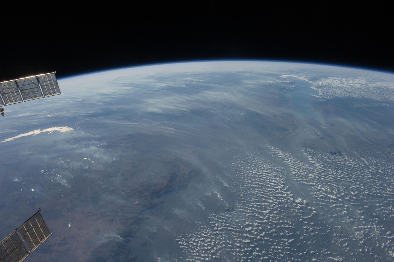
ISS028-E-018675 (23 July 2011) --- Biomass burning in southern Africa is featured in this image photographed by an Expedition 28 crew member on the International Space Station. A smoke pall of subcontinental proportions dominates this view of tropical southern Africa. In what has been described as the most fire-prone part of the world, numerous fires give rise to regional smoke palls every dry season. Fires are both natural and set by local people to clear woodland for agricultural fields. This recent, oblique, northwest-looking view taken in July 2011 at the end of the dry season shows the extent of the smoke on the African plateau?from central Zimbabwe (lower left) to northern Malawi more than 1,000 kilometers away (top right)?and in the wide coastal plains of the lower Zambezi River valley of Mozambique (lower right). Here smoke can be seen blowing inland (left to right), channeled up the Zambezi River valley and contributing to the pall on the plateau. The light gray smoke plumes contrast with higher altitude, brighter patchy cloud cover at lower right. The smoke palls obscure much surface detail, so that Lake Malawi, one of Africa?s Great Lakes, is barely visible, as is Lake Cahora Bassa, Africa?s fourth largest reservoir, in the Zambezi valley. The sun?s reflection off its surface (sunglint) makes Lake Kariba most prominent in the view at left. Kariba is the world?s largest artificial reservoir by volume, and is 220 kilometers long, giving a sense of the scale of the view. The steep, shadowed, mid-afternoon faces of the Inyanga Mountains on the Mozambique-Zimbabwe border protrude above the smoke layer at lower left. Solar panels extending from Russian spacecraft docked at the International Space Station are visible in the foreground at left.
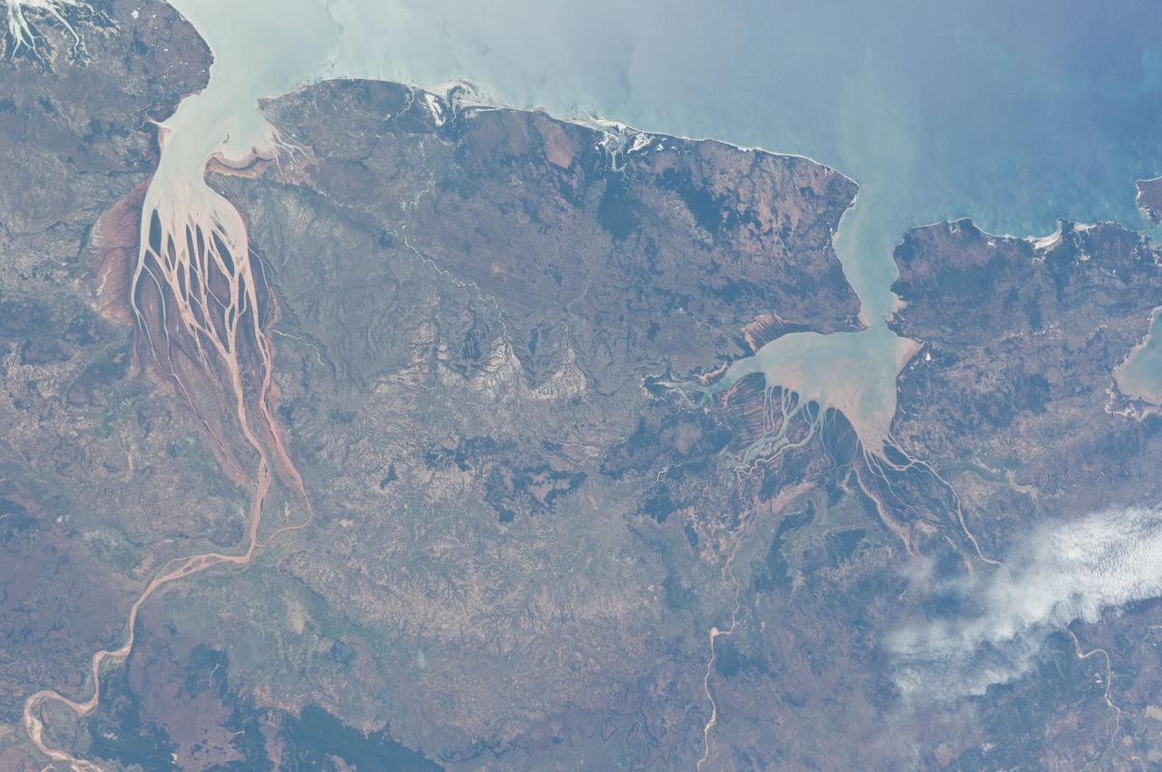
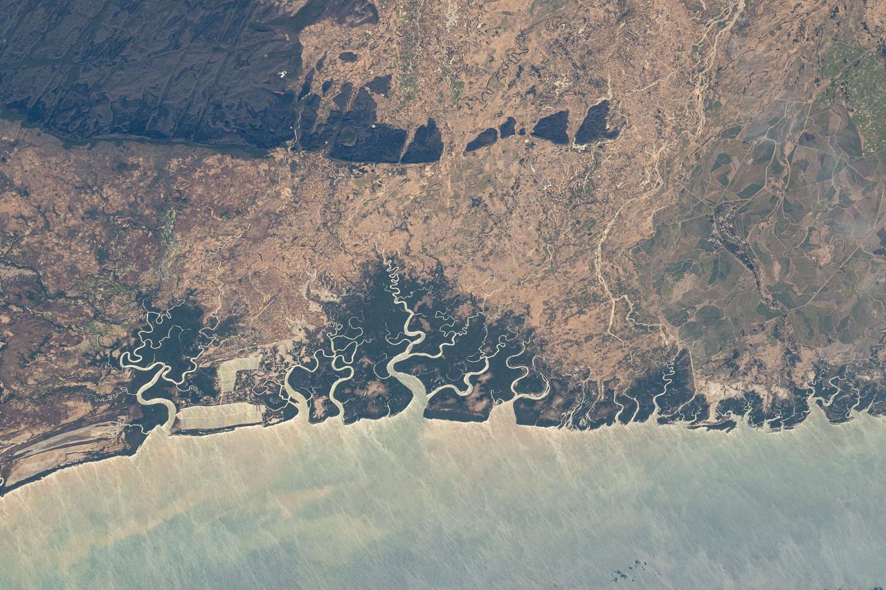
ISS028-E-006687 (2 June 2011) --- Estuaries on the northwestern coast of Madagascar are featured in this image photographed by an Expedition 28 crew member on the International Space Station. Regions where fresh water flowing in rivers and salt water from the seas and oceans mix are called estuaries, and they are among the most biologically productive ecosystems on Earth. This photograph highlights two estuaries located along the northwestern coastline of the island of Madagascar. The Mozambique Channel (top) separates Madagascar from the southeastern coast of Africa. Bombetoka Bay (upper left) is fed by the Betsiboka River and is a frequent subject of astronaut photography due to its striking red floodplain sediments. Mahajamba Bay (right) is fed by several rivers including the Mahajamba and Sofia Rivers; like the Betsiboka, the floodplains of these rivers also contain reddish sediments eroded from their basins upstream. The brackish (mix of fresh and salty water) conditions found in most estuaries host unique plant and animal species adapted to live in such environments. Mangroves in particular are a common plant species found in and around Madagascar estuaries, and Bombetoka Bay contains some of the largest remaining stands. Estuaries also host abundant fish and shellfish species ? many of which need access to freshwater for a portion of their life cycles ? and these in turn support local and migratory bird species that prey on them. However, human activities such as urban development, overfishing, and increased sediment loading from erosion of upriver highlands threaten the ecosystem health of the estuaries. In particular, the silt deposits in Bombetoka Bay at the mouth of the Betsiboka River have been filling in the bay.