Astronaut Daniel W. Bursch, Expedition Four flight engineer, was delighted in capturing this image of Mt. Everest in the Himalayan Range from aboard the International Space Station (ISS). The mountain is near frame center. Because the photo was taken close to orbital sunrise, the low sun angle gave tremendous relief to the mountains. Named for Sir George Everest, the British surveyor-general of India, Mount Everest is the tallest point on earth. Standing 29,028 feet tall, it is 5 1/2 miles above sea level. Mount Everest is located half in Nepal and half in Tibet.
STS068-259-009 (30 September-11 October 1994) --- This south-looking, summer-time view of Mt. Everest (center) - with strong sense of three dimension because of reduced amount of snow - and neighboring peaks of the Himalayas. Clouds cover lower slopes in India.
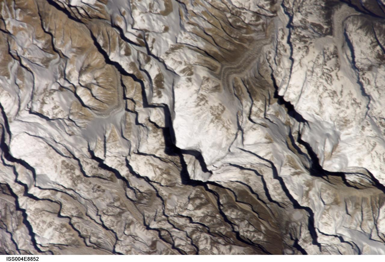
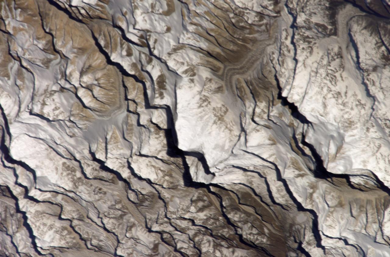
ISS004-E-8852 (20 March 2002) --- Astronaut Daniel W. Bursch, flight engineer for Expedition Four aboard the International Space Station, used a digital still camera to capture this image of Mt. Everest in the Himalayan Range. The mountain is near frame center. Here are the notes Bursch added in one of his reports to ground controllers: "One morning I happened to be up early. I glanced at our world map and saw that we’d be passing near Mt Everest soon. I checked the computer, realized that we were in an attitude that would allow me to open the window shutter and there was Mt Everest! It almost seemed to jump out at me. The low sun angle (it was close to orbital sunrise) gave tremendous relief to the mountains. It was just one of those sights that will be forever burned into my brain!"
Olympus Mons, imaged here by NASA Mars Odyssey spacecraft, stands 26 km above the surrounding plains, which is three times taller than Mt. Everest, and is the tallest volcano in the solar system.

This anaglyph shows the central complex in asteroid Vesta Rheasilvia impact basin. The central complex about two and a half times taller than Mt. Everest. You need 3-D glasses to view this image.

iss066e141209 (Feb. 12, 2022) --- Mt. Everest (at center right) peaks in the Himalayas in this photograph from the International Space Station as it orbited 258 miles above southwest China.
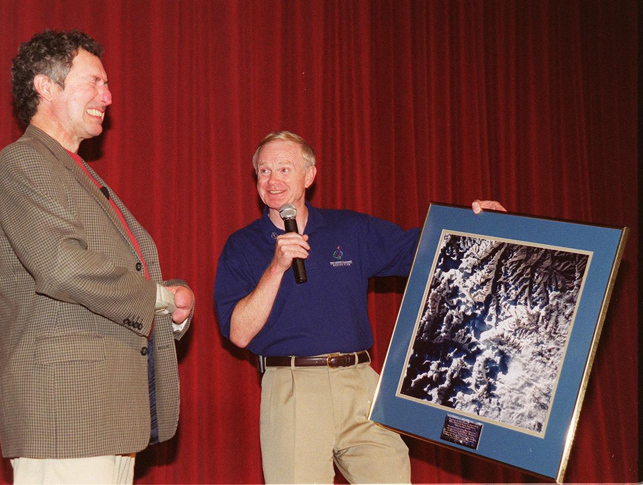
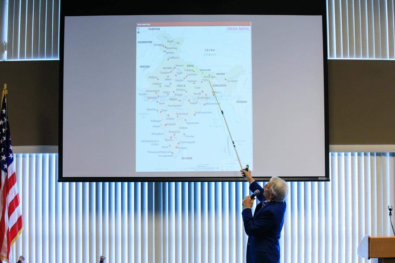
During Super Safety and Health Day at KSC, keynote speaker Dr. Beck Weathers grimaces over the satellite photo of Mt. Everest being presented by Center Director Roy Bridges. Weathers spoke about his ordeal of surviving the 1996 Mt. Everest disaster and the lessons learned from the experience. Safety Day is a full day of NASA-sponsored, KSC and 45th Space Wing events involving a number of health and safety related activities: Displays, vendors, technical paper sessions, panel discussions, a keynote speaker, etc. The entire Center and Wing stand down to participate in the planned events. Safety Day is held annually to proactively increase awareness in safety and health among the government and contractor workforce population. The first guiding principle at KSC is “Safety and Health First.” KSC’s number one goal is to “Assure sound, safe and efficient practices and processes are in place for privatized/commercialized launch site processing.

During Super Safety and Health Day at KSC, keynote speaker Dr. Beck Weathers grimaces over the satellite photo of Mt. Everest being presented by Center Director Roy Bridges. Weathers spoke about his ordeal of surviving the 1996 Mt. Everest disaster and the lessons learned from the experience. Safety Day is a full day of NASA-sponsored, KSC and 45th Space Wing events involving a number of health and safety related activities: Displays, vendors, technical paper sessions, panel discussions, a keynote speaker, etc. The entire Center and Wing stand down to participate in the planned events. Safety Day is held annually to proactively increase awareness in safety and health among the government and contractor workforce population. The first guiding principle at KSC is “Safety and Health First.” KSC’s number one goal is to “Assure sound, safe and efficient practices and processes are in place for privatized/commercialized launch site processing.

Arthur Muir, a retired Chicago attorney and America’s oldest Mt. Everest summiteer, attends the inaugural Cross-Program Connection event at NASA Kennedy Space Center’s Space Station Processing Facility on March 8, 2023. Muir, 75, was the speaker at the Florida spaceport function titled “Explorers Doing the Impossible.” He toured Kennedy before sharing his experiences in overcoming incredible challenges during his journey to the top of Earth’s highest mountain.
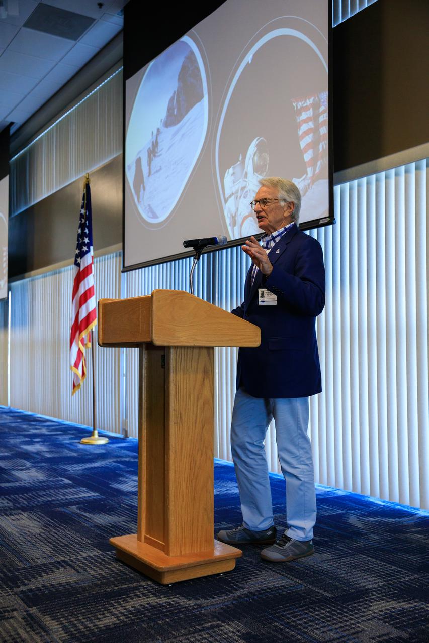
Arthur Muir, a retired Chicago attorney and America’s oldest Mt. Everest summiteer, addresses the audience during the inaugural Cross-Program Connection event at NASA Kennedy Space Center’s Space Station Processing Facility on March 8, 2023. Muir, 75, was the speaker at the Florida spaceport function titled “Explorers Doing the Impossible.” He toured Kennedy before sharing his experiences in overcoming incredible challenges during his journey to the top of Earth’s highest mountain.
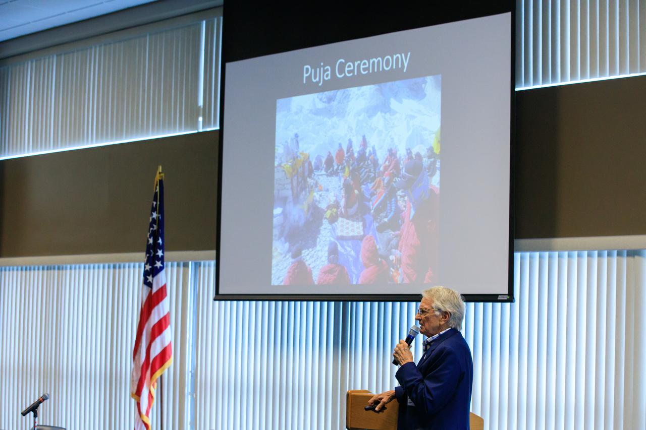
Arthur Muir, a retired Chicago attorney and America’s oldest Mt. Everest summiteer, addresses the audience during the inaugural Cross-Program Connection event at NASA Kennedy Space Center’s Space Station Processing Facility on March 8, 2023. Muir, 75, was the speaker at the Florida spaceport function titled “Explorers Doing the Impossible.” He toured Kennedy before sharing his experiences in overcoming incredible challenges during his journey to the top of Earth’s highest mountain.
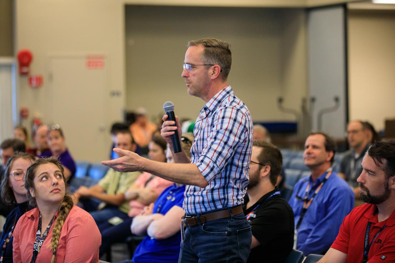
An audience member asks a question during the inaugural Cross-Program Connection event at NASA Kennedy Space Center’s Space Station Processing Facility on March 8, 2023. Arthur Muir, a retired Chicago attorney and America’s oldest Mt. Everest summiteer, was the speaker at the Florida spaceport function titled “Explorers Doing the Impossible.” He toured Kennedy before sharing his experiences in overcoming incredible challenges during his journey to the top of Earth’s highest mountain.
Arthur Muir, a retired Chicago attorney and America’s oldest Mt. Everest summiteer, delivers his presentation during the inaugural Cross-Program Connection event at NASA Kennedy Space Center’s Space Station Processing Facility on March 8, 2023. Muir, 75, was the speaker at the Florida spaceport function titled “Explorers Doing the Impossible.” He toured Kennedy before sharing his experiences in overcoming incredible challenges during his journey to the top of Earth’s highest mountain.
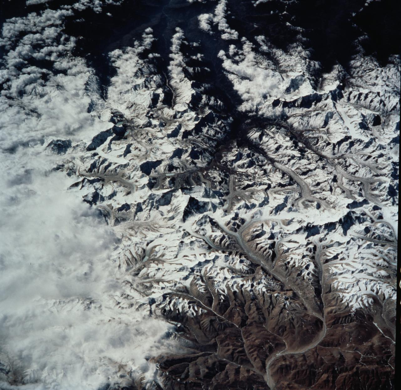
STS099-735-046 (11-22 February 2000) ---Mt. Everest (29,028 feet or 8,848 meters), is featured in the center of this 70mm frame photographed by one of the STS-99 crew members. Everest, also called Qomolangma Feng, is just north of the border between Nepal and China. The Himalayas and the Tibetan Plateau are products of the collision of the Indian and Eurasian tectonic plates. With the continuing northward march of India, the crust of the Earth has become thicker and the Tibetan Plateau has been uplifted to an average elevation of about 15,000 feet. According to NASA scientists studying the STS-99 imagery, fossil-bearing limestones are at the summit of the mountain. The scientists say that these limestones were deposited beneath the sea around 510 million years ago (Cambrian to Ordovician time). Glaciers, moraines, and outwash plains are spectacularly displayed. Glacial meltwaters in this area feed the Arun River, eventually reaching the Ganges on the plains of India.
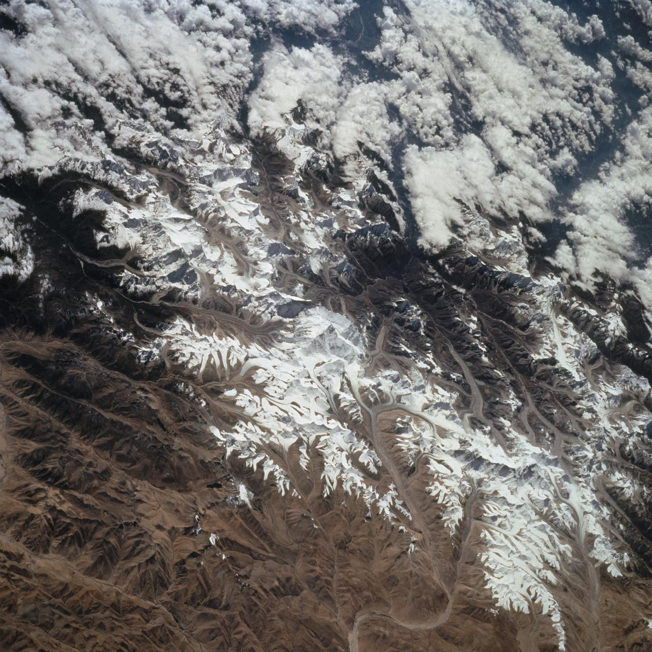
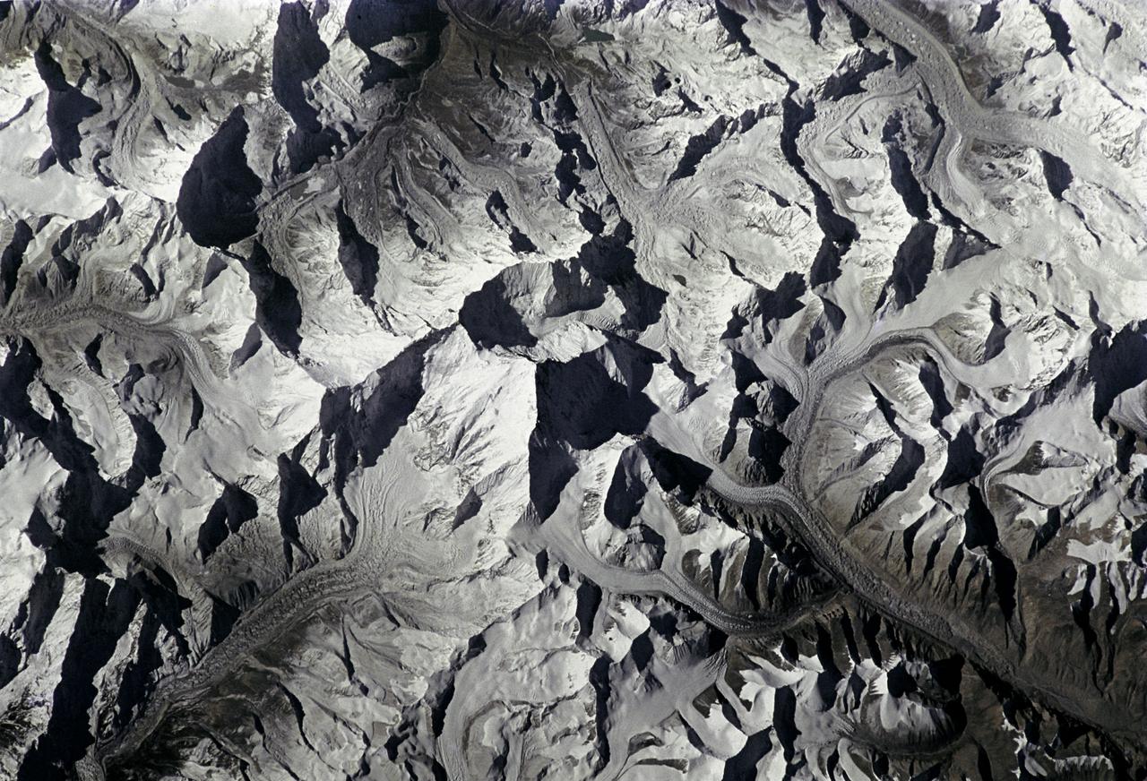
![ISS008-E-13304 (28 January 2004) --- This image featuring Mt. Everest and Makalu was taken by an Expedition 8 crewmember on the International Space Station (ISS). Crewmembers on board the Station have a unique view of the world because of their position in a low orbit (200 nautical miles, 360 kilometers) relative to satellites and their ability to look at any angle out the windows of the spacecraft. ISS crewmembers recently took advantage of their vantage point to photograph this oblique view of the Himalayas looking south from over the Tibetan Plateau. At first glance, one might think that the image looks like a picture taken from an airplane; until you remember that the summits of Makalu [left (8,462 meters: 27,765 feet)] and Everest [right (8,850 meters; 29,035 feet)] are at the heights typically flown by commercial aircraft, and could never be seen this way from an airplane.](https://images-assets.nasa.gov/image/iss008e13304/iss008e13304~medium.jpg)
ISS008-E-13304 (28 January 2004) --- This image featuring Mt. Everest and Makalu was taken by an Expedition 8 crewmember on the International Space Station (ISS). Crewmembers on board the Station have a unique view of the world because of their position in a low orbit (200 nautical miles, 360 kilometers) relative to satellites and their ability to look at any angle out the windows of the spacecraft. ISS crewmembers recently took advantage of their vantage point to photograph this oblique view of the Himalayas looking south from over the Tibetan Plateau. At first glance, one might think that the image looks like a picture taken from an airplane; until you remember that the summits of Makalu [left (8,462 meters: 27,765 feet)] and Everest [right (8,850 meters; 29,035 feet)] are at the heights typically flown by commercial aircraft, and could never be seen this way from an airplane.

NASA’s Exploration Ground Systems Manager Shawn Quinn, right, moderates the inaugural Cross-Program Connection event at NASA Kennedy Space Center’s Space Station Processing Facility in Florida on March 8, 2023. Other participants, from left, are: Stacie Turner, Kennedy’s Deep Space Logistics; Dana Hutcherson, NASA’s Commercial Crew Program deputy program manager; and Arthur Muir, a retired Chicago attorney and America’s oldest Mt. Everest summiteer. Muir, 75, was the speaker at the event titled “Explorers Doing the Impossible.” He toured Kennedy before sharing his experiences in overcoming incredible challenges during his journey to the top of Earth’s highest mountain.
STS066-208-025 (3-14 Nov. 1994) --- Mount Everest, the highest mountain in the world at 8,848 meters, was photographed by the crew members aboard the Space Shuttle Atlantis from 165 nautical miles above Earth. Also seen are Cho Oyu (8,153 meters) northwest of Everest, and other peaks in what has been called the "Roof of the World". Abundant details of glacier surfaces, including moraines, crevasse fields and ice falls are displayed for study. Crew members onboard Atlantis were astronauts Donald R. McMonagle, Curtis L. Brown, Jr., Ellen Ochoa, Scott E. Parazynski and Joseph R. Tanner, along with Jean-François Clervoy of the European Space Agency (ESA). The six astronauts spent 11-days in Earth-orbit in support of the Atmospheric Laboratory for Applications and Science (ATLAS-3) mission.
During Super Safety and Health Day at KSC, keynote speaker Dr. Beck Weathers is given a memento of his visit by Center Director Roy Bridges. Weathers spoke about his ordeal of surviving the 1996 Mt. Everest disaster and the lessons learned from the experience. Safety Day is a full day of NASA-sponsored, KSC and 45th Space Wing events involving a number of health and safety related activities: Displays, vendors, technical paper sessions, panel discussions, a keynote speaker, etc. The entire Center and Wing stand down to participate in the planned events. Safety Day is held annually to proactively increase awareness in safety and health among the government and contractor workforce population. The first guiding principle at KSC is “Safety and Health First.” KSC’s number one goal is to “Assure sound, safe and efficient practices and processes are in place for privatized/commercialized launch site processing.
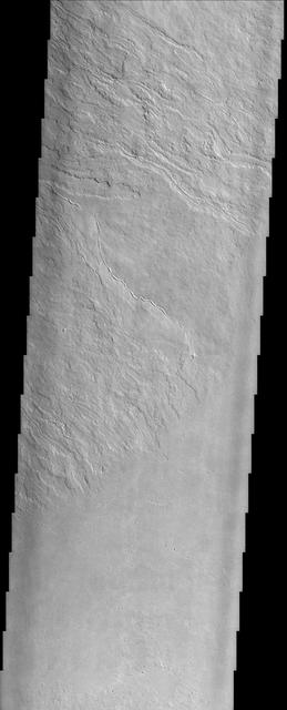
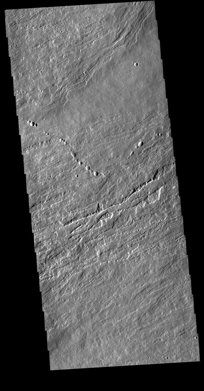
Today's VIS image shows part of the lower flank of Olympus Mons. The bright band in the image is an escarpment, where there is a large elevation change over a very short linear range – a cliff. This escarpment is called Olympus Rupes. In 2-D images it is very difficult to interpret the height component. In this case, the elevation change from the highest point (bottom of image) to the lowest point (top of image) is 7757m (25,449 feet). Olympus Mons is 21.9km (13.6 miles, 72,000 feet) tall. For comparison, Mt Everest is only 29,032 feet tall. Orbit Number: 94579 Latitude: 22.7256 Longitude: 229.336 Instrument: VIS Captured: 2023-04-10 22:38 https://photojournal.jpl.nasa.gov/catalog/PIA26055

During Super Safety and Health Day at KSC, keynote speaker Dr. Beck Weathers is given a memento of his visit by Center Director Roy Bridges. Weathers spoke about his ordeal of surviving the 1996 Mt. Everest disaster and the lessons learned from the experience. Safety Day is a full day of NASA-sponsored, KSC and 45th Space Wing events involving a number of health and safety related activities: Displays, vendors, technical paper sessions, panel discussions, a keynote speaker, etc. The entire Center and Wing stand down to participate in the planned events. Safety Day is held annually to proactively increase awareness in safety and health among the government and contractor workforce population. The first guiding principle at KSC is “Safety and Health First.” KSC’s number one goal is to “Assure sound, safe and efficient practices and processes are in place for privatized/commercialized launch site processing.
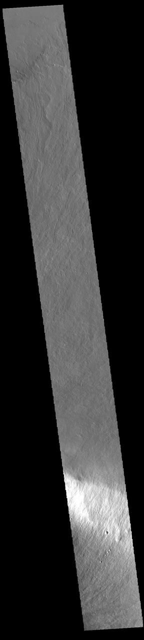
Today's VIS image shows flank flows on the east side of Olympus Mons. Olympus Mons stands 26 km (16 miles) above the surrounding plains, which is three times taller than Mt. Everest, and is the tallest volcano in the solar system. Olympus Mons is also wider (585 km, 363 miles) than the state of Arizona. Although these are impressive dimensions an astronaut would find walking these slopes easy, as they are typically only 2 to 5 degrees. This image contains numerous lava flows, leveed lava channels, and a series of round depressions thought to be where the roof of a lava tube has collapsed into the underlying void. Orbit Number: 81077 Latitude: 19.9207 Longitude: 231.287 Instrument: VIS Captured: 2020-03-25 04:51 https://photojournal.jpl.nasa.gov/catalog/PIA23928
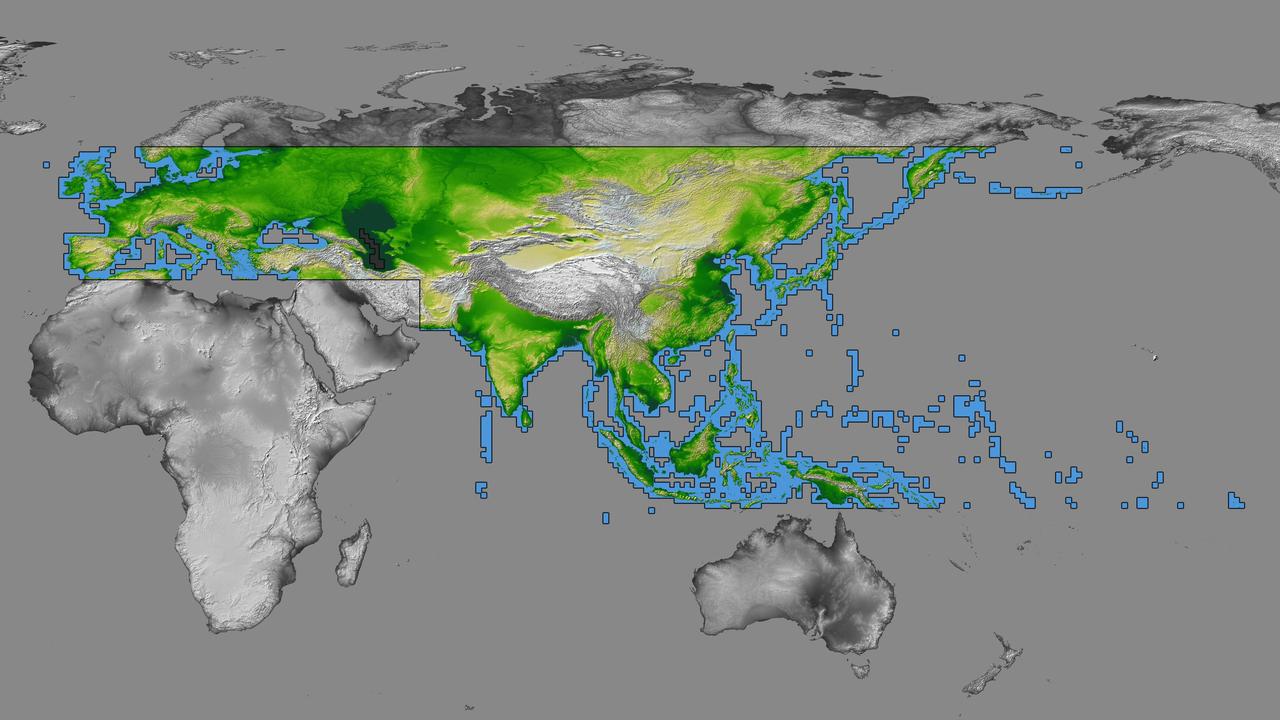
inal Caption Released with Image: The colored regions of this map show the extent of digital elevation data recently released by the Shuttle Radar Topography Mission (SRTM). This release includes data for most of Europe and Asia plus numerous islands in the Indian and Pacific Oceans. SRTM flew on board the Space Shuttle Endeavour in February 2000 and used an interferometric radar system to map the topography of Earth's landmass between latitudes 56 degrees south and 60 degrees north. The data were processed into geographic "tiles," each of which represents one by one degree of latitude and longitude. A degree of latitude measures 111 kilometers (69 miles) north-south, and a degree of longitude measures 111 kilometers or less east-west, decreasing away from the equator. The data are being released to the public on a continent-by-continent basis. This Eurasia segment includes 5,940 tiles, more than a third of the total data set. Previous releases covered North America and South America. Forthcoming releases will include Africa-Arabia and Australia plus an "Islands" release for those islands not included in the continental releases. Together these data releases constitute the world's first high-resolution, near-global elevation model. The resolution of the publicly released data is three arcseconds (1/1,200 of a degree of latitude and longitude), which is about 90 meters (295 feet). European coverage in the current data release stretches eastward from the British Isles and the Iberian Peninsula in the west, across the Alps and Carpathian Mountains, as well as the Northern European Plain, to the Ural and Caucasus Mountains bordering Asia. The Asian coverage includes a great diversity of landforms, including the Tibetan Plateau, Tarin Basin, Mongolian Plateau, and the mountains surrounding Lake Baikal, the world's deepest lake. Mt. Everest in the Himalayas, at 8,848 meters (29,029 feet) is the world's highest mountain. From India's Deccan Plateau, to Southeast Asia, coastal China, and Korea, various landforms place constraints upon land use planning for a great population. Volcanoes in the East Indies, the Philippines, Japan, and the Kamchatka Peninsula form the western part of the "Ring of Fire" around the Pacific Ocean. Many of these regions were previously very poorly mapped due to persistent cloud cover or the inaccessibility of the terrain. Digital elevation data, such as provided by SRTM, are particularly in high demand by scientists studying earthquakes, volcanism, and erosion patterns for use in mapping and modeling hazards to human habitation. But the shape of Earth's surface affects nearly every natural process and human endeavor that occurs there, so elevation data are used in a wide range of applications. In this index map color-coding is directly related to topographic height, with green at the lower elevations, rising through yellow and tan, to white at the highest elevations. The large, very dark green feature in western Asia is the Caspian Sea, which is below sea level. Blue areas on the map represent water within the mapped tiles, each of which includes shorelines or islands. http://photojournal.jpl.nasa.gov/catalog/PIA03398