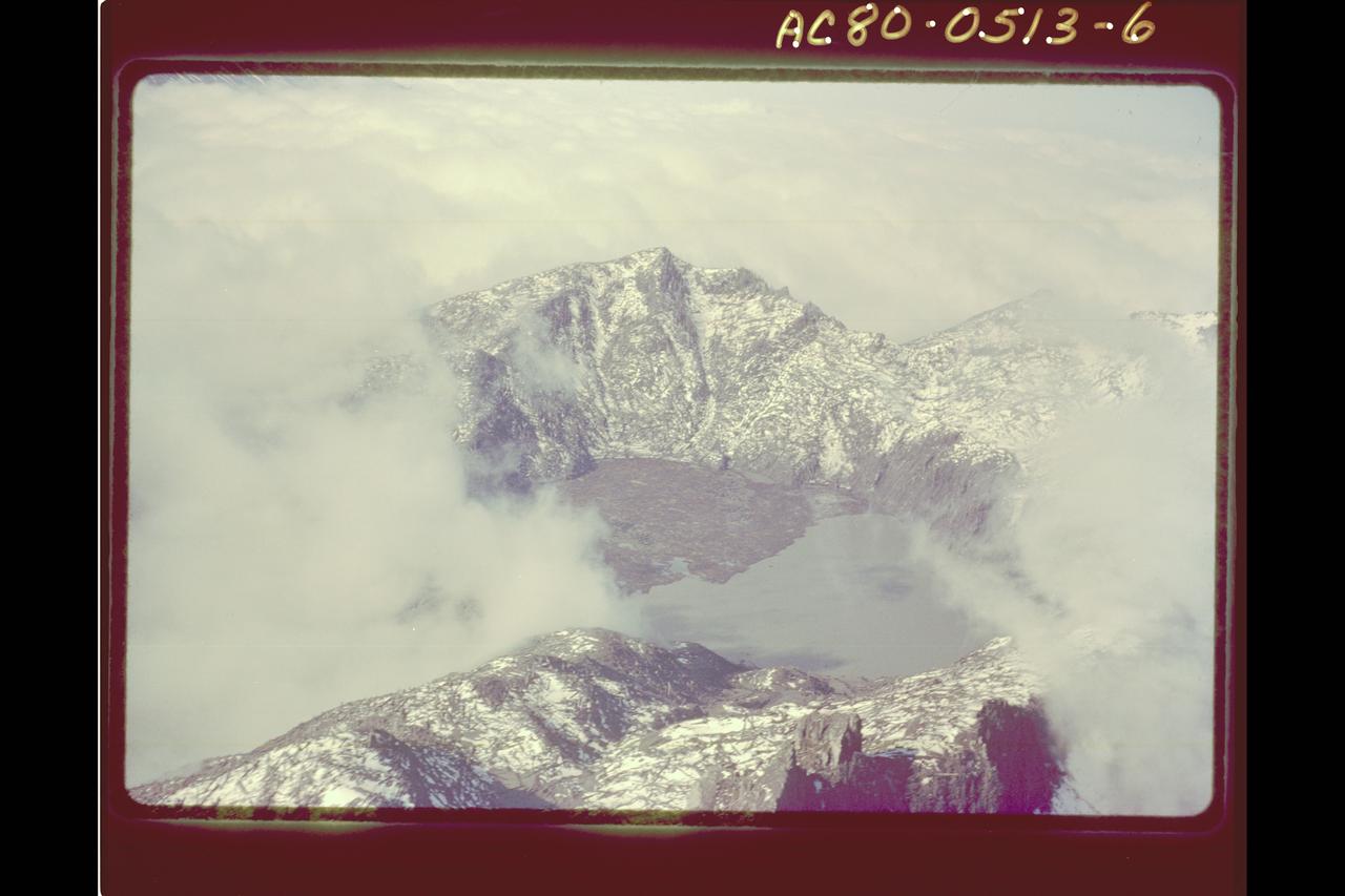
Mt. St. Helens Volcano - post eruption
Mt. St. Helens Volcano - post eruption
Mt. St. Helens Volcano - post eruption
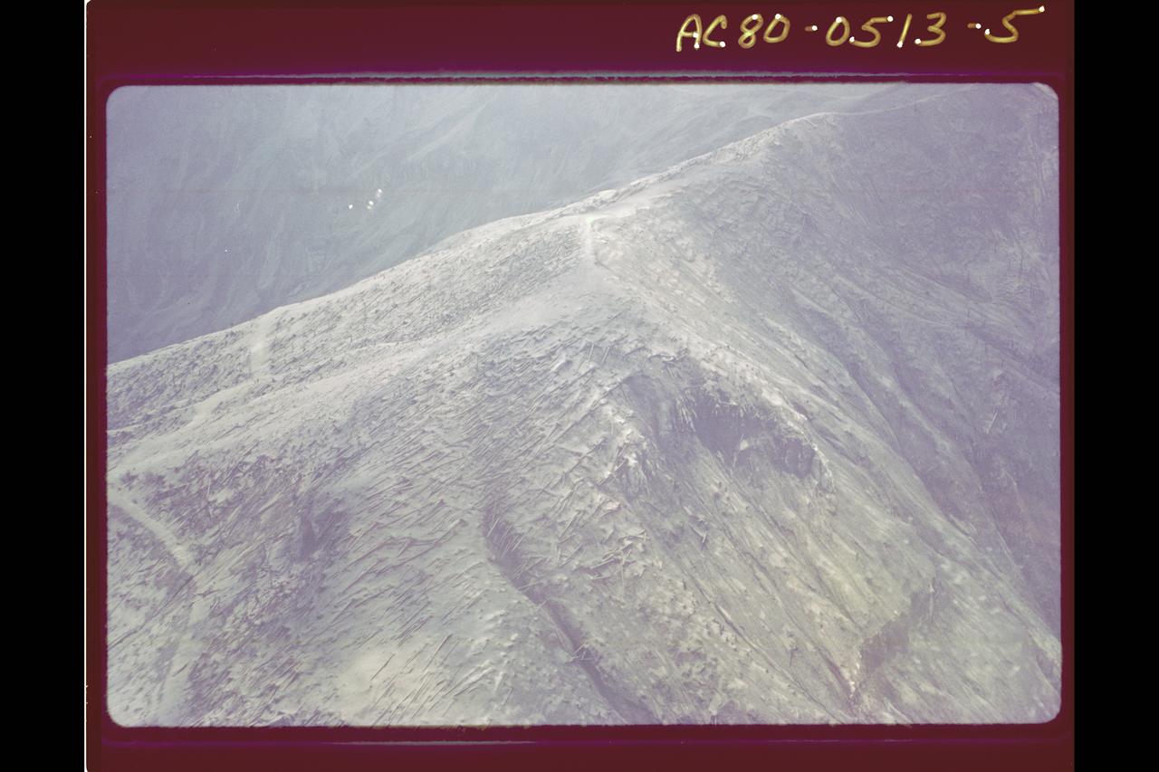
Mt. St. Helens Volcano - post eruption, forest damage
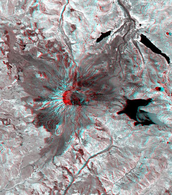
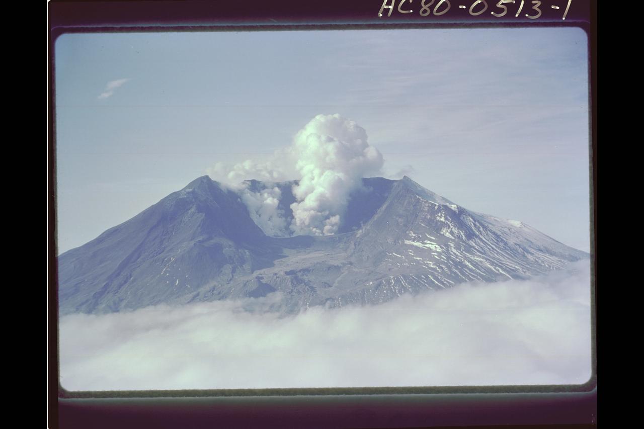
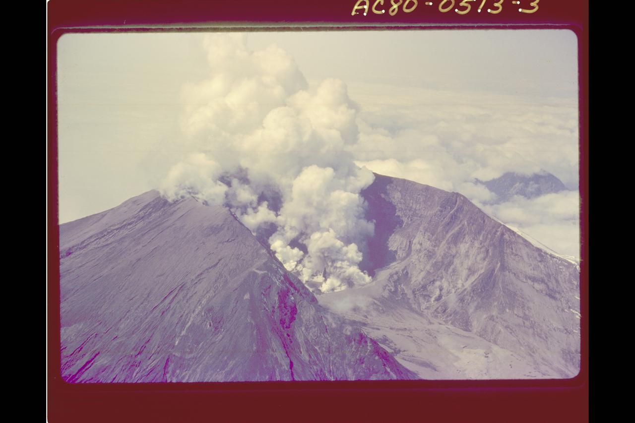
This 3-D anaglyph image of Mt. St. Helens volcano combines the nadir-looking and back-looking band 3 images of ASTER. To view the image in stereo, you will need blue-red glasses. Make sure to look through the red lens with your left eye. This ASTER image of Mt. St. Helens volcano in Washington was acquired on August 8, 2000 and covers an area of 37 by 51 km. Mount Saint Helens, a volcano in the Cascade Range of southwestern Washington that had been dormant since 1857, began to show signs of renewed activity in early 1980. On 18 May 1980, it erupted with such violence that the top of the mountain was blown off, spewing a cloud of ash and gases that rose to an altitude of 19 kilometers. The blast killed about 60 people and destroyed all life in an area of some 180 square kilometers (some 70 square miles), while a much larger area was covered with ash and debris. It continues to spit forth ash and steam intermittently. As a result of the eruption, the mountain's elevation decreased from 2,950 meters to 2,549 meters. The image is centered at 46.2 degrees north latitude, 122.2 degrees west longitude. http://photojournal.jpl.nasa.gov/catalog/PIA11160
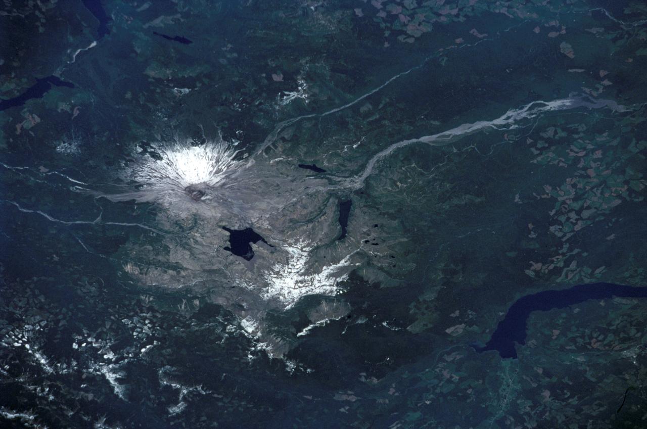
STS111-371-003 (5-19 June 2002) --- This photo, showing Mt. St. Helens in the state of Washington, was taken by the STS-111 crewmembers aboard the Space Shuttle Endeavour. The scars from the May 18, 1980 eruption are still visible near Mt. St. Helens. Before the 1980 eruption the volcano had been dormant since 1857. The Gateway to Astronaut Photography of Earth (link to http://eol.jsc.nasa.gov/sseop/) provides searchable access to other photographs of Earth taken by astronauts.
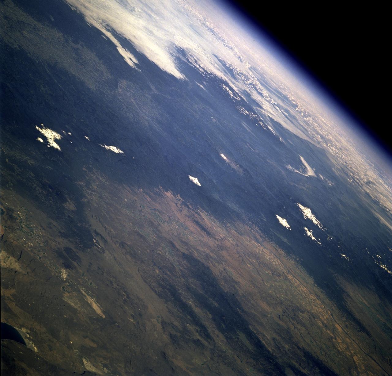
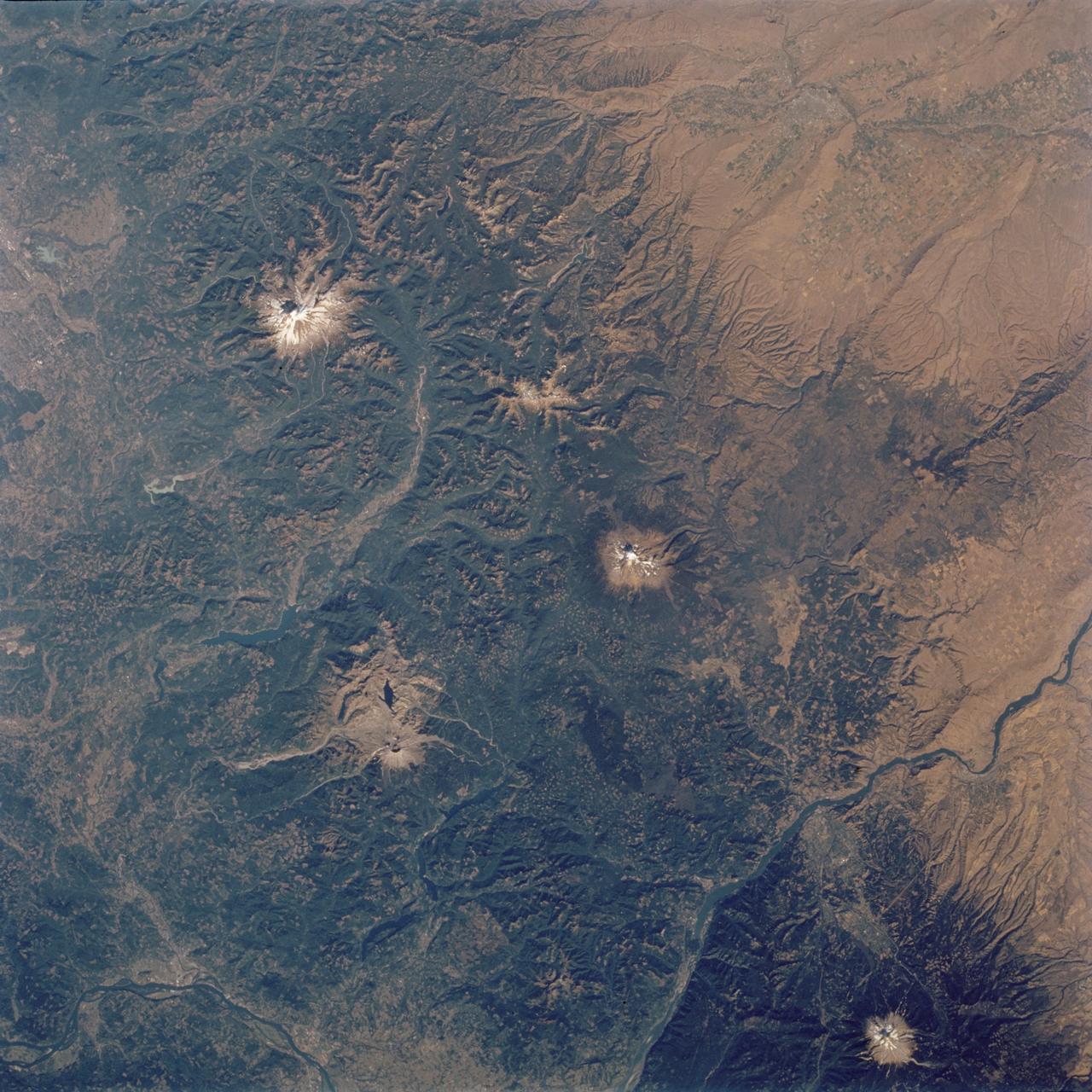
STS078-742-004 (20 June - 7 July 1996) --- This is a north-looking perspective of the major volcanoes of the Cascade Mountains of southern Washington and northern Oregon. With the Earth limb in the upper left corner of the photo, the large mountain at the top right, or northern part of the photo, is Mt. Rainier. The next snow covered area to the south east of Mt. Rainier is Gilbert Point. Mt. Adams is the larger peak, south-southeast of Mt. Rainier, Mt. St. Helens is the gray patch in the center of the photo, west of Mt. Adams. Mt. St. Helens erupted on May 18, 1980, removing 1,300 feet of the 9,677-ft. volcano. The eruption toppled trees with a searing, stone-filled 275-mile-per-hour wind over an area of more than 150 square miles. This area, now referred to as the "blast zone", can be easily spotted in this view. NASA scientists say that natural regrowth of vegetation within the blast zone is progressing at a rapid rate, especially on the outer fringes and in the protected valleys. Many fir trees have grown to heights exceeding 20 feet in a little over 12 years. A large lava dome within the crater of the volcano has grown to a height of over 1,000 feet since the 1980 eruption. The next three snow covered peaks are Mt. Hood, Mt. Jefferson and the Three Sisters all located in Oregon.
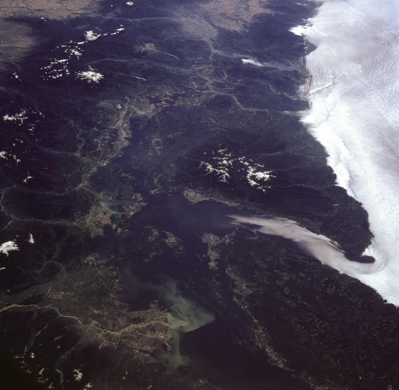
STS085-716-081 (7-19 August 1997) --- This photograph provides a southerly view from Vancouver, B. C. in the foreground, to Portland, Oregon near the top. Coastal stratus, a common occurrence, hugs the Pacific coastline and laps into Puget sound. The silty Fraser River cuts through Vancouver and empties into Puget Sound with a large, milky plume of sediment (bottom). Near the top of the image, the Columbia River runs across the Cascades (between Mt. Adams and Mt. Hood) and the Coast Ranges to the Pacific Ocean. Snow caps the highest peaks of the Olympic Mountains (near center), and the Cascade volcanoes of Rainier (closest to Seattle), Adams and Hood (top). The smaller, gray mountain just south (above and right) of Rainier is Mt. St. Helens.
STS112-704-142 (7-18 October 2002) --- (For orientation purposes, north is toward the top left corner). Green colors of the forests of the Cascade Mountains dominate this view, photographed from the Earth-orbiting Space Shuttle Atlantis. Browner colors (top right) are the semiarid plains of the Columbia Basin, in the rain shadow of the Cascades. The highest peaks in this part of the Cascades are four volcanoes. The amount of snow is a good indication of their altitude. The highest is Mt. Rainier (14,410 feet) with the greatest amount of white snow (top left). Seattle lies immediately downslope (top left margin). Mt. Adams (12,276) lies due south in the middle of the view. Mt. Hood (11,235 feet) in the lower right corner, lies south of the great gorge of the Columbia River (which crosses the lower right and then the lower left corners of the view). The river flows broadly west (left) to the Pacific Ocean (out of the picture left). Mt. St Helens (8,364 feet), the snow-free brown patch lower left, was too low to retain snow after the recent fall. According to geologists studying the STS-112 photography, even from the altitude of the Space Shuttle, the intact south half of the cone can be discerned. The geologists point out that the famous blast of 1980 not only destroyed the north side of the cone but blew down the green forest for many square miles on the north side (brown signature).