
This 1970 photograph shows Skylab's Multispectral Scanner, one of the major components of an Earth Resources Experiment Package (EREP). It was designed to evaluate the on-orbit use of multispectral scanning of Earth resources. Investigators could evaluate the usefulness of spacecraft multispectral data for crop identification, vegetation mapping, soil moisture measurements, identification of contaminated areas in large bodies of water, and surface temperature mapping. The overall purpose of the EREP was to test the use of sensors that operated in the visible, infrared, and microwave portions of the electromagnetic spectrum to monitor and study Earth resources. The Marshall Space Flight Center had program management responsibility for the development of Skylab hardware and experiments.
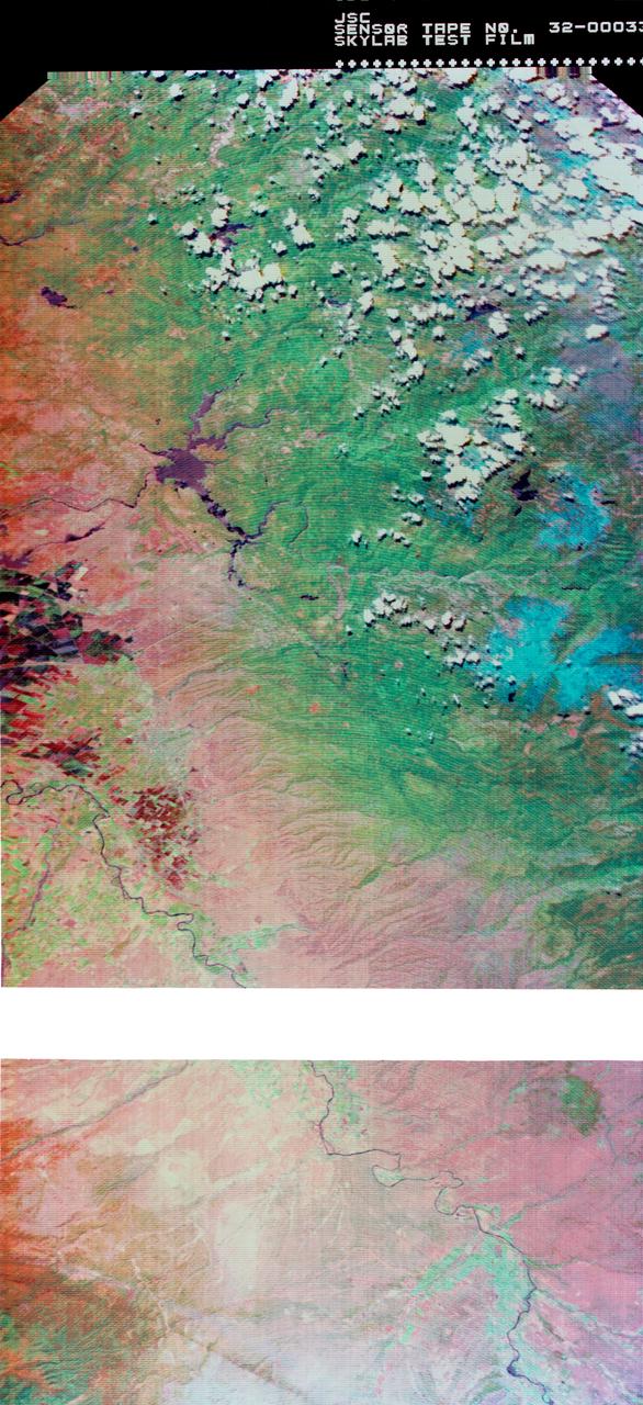
S73-34295B (June 1973) --- A vertical view of a portion of northern California reproduced from data taken from the Skylab Multispectral Scanner, experiment S192, in the Skylab space station in Earth orbit. This view is the most westerly one-third of Frame No. 001, Roll No. 518, S192, Skylab 2. Frame No. 001 extends from the Pacific coast at the Eureka area southeasterly 175 nautical miles to the Feather River drainage basin. Included in this view are Lake Shasta, Sacramento River Valley, Redding and Red Bluff. This non-photographic image is a color composite of channels 2 (visible), 7, and 12 (infrared) from the Earth Resources Experiments Package (EREP) S192 scanner. The scanner techniques assist with spectral signature identification and mapping of ground truth targets in agriculture, forestry, geology, hydrology and oceanography. Photo credit: NASA
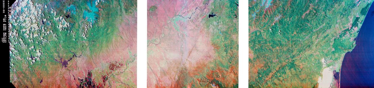
S73-34295 (June 1973) --- A vertical view of a portion of northern California reproduced from data taken from the Skylab Multispectral Scanner, experiment S192, in the Skylab space station in Earth orbit. This view is the most westerly one-third of Frame No. 001, Roll No. 518, S192, Skylab 2. Frame No. 001 extends from the Pacific coast at the Eureka area southeasterly 175 nautical miles to the Feather River drainage basin. Included in this view are Eureka, Trinidad, Klamath & Trinity Rivers and the Coastal Range mountains. This non-photographic image is a color composite of channels 2 (visible), 7, and 12 (infrared) from the Earth Resources Experiments Package (EREP) S192 scanner. The scanner techniques assist with spectral signature identification and mapping of ground truth targets in agriculture, forestry, geology, hydrology and oceanography. Photo credit: NASA
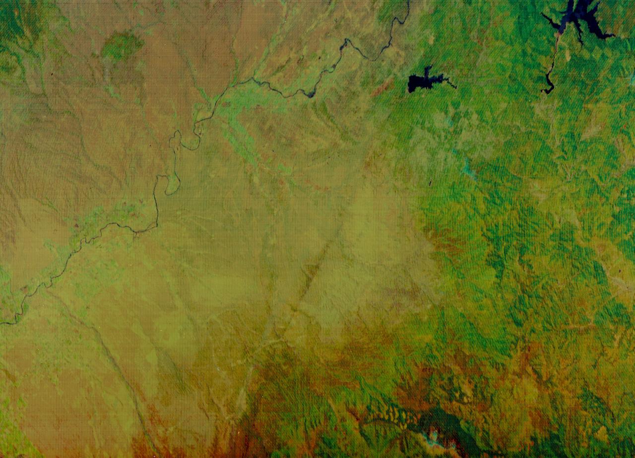
S73-34295A (June 1973) --- A vertical view of a portion of northern California reproduced from data taken from the Skylab Multispectral Scanner, experiment S192, in the Skylab space station in Earth orbit. This view is the most westerly one-third of Frame No. 001, Roll No. 518, S192, Skylab 2. Frame No. 001 extends from the Pacific coast at the Eureka area southeasterly 175 nautical miles to the Feather River drainage basin. Included in this view are Sacramento River Valley, Oroville Reservoir, Oroville and Chico. This non-photographic image is a color composite of channels 2 (visible), 7 and 12 (infrared) from the Earth Resources Experiments Package (EREP) S192 scanner. The scanner techniques assist with spectral signature identification and mapping of ground truth targets in agriculture, forestry, geology, hydrology and oceanography. Photo credit: NASA
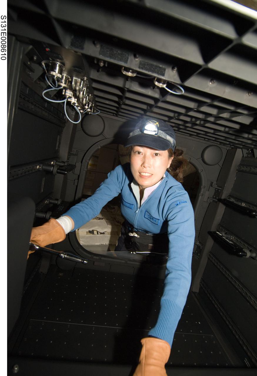
S131-E-008610 (10 April 2010) --- Japan Aerospace Exploration Agency (JAXA) astronaut Naoko Yamazaki, STS-131 mission specialist, works in the Window Observational Research Facility (WORF) in the Destiny laboratory of the International Space Station while space shuttle Discovery remains docked with the station. WORF will provide cameras, multispectral and hyperspectral scanners, camcorders and other instruments to capture Earth imagery through Destiny?s nadir window.

S131-E-008497 (10 April 2010) --- Japan Aerospace Exploration Agency (JAXA) astronaut Naoko Yamazaki, STS-131 mission specialist, works with the Window Observational Research Facility (WORF) in the Destiny laboratory of the International Space Station while space shuttle Discovery remains docked with the station. WORF will provide cameras, multispectral and hyperspectral scanners, camcorders and other instruments to capture Earth imagery through Destiny?s nadir window.
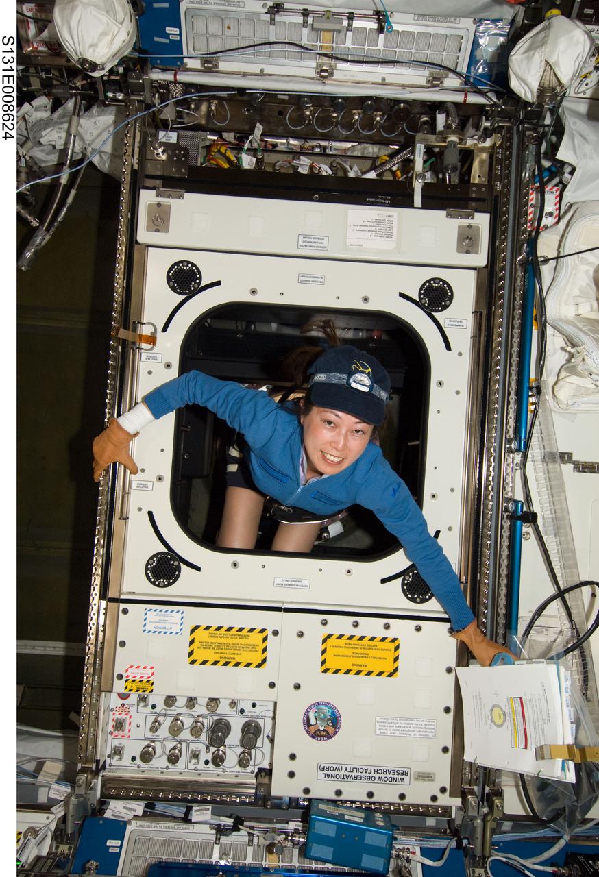
S131-E-008624 (10 April 2010) --- Japan Aerospace Exploration Agency (JAXA) astronaut Naoko Yamazaki, STS-131 mission specialist, works with the Window Observational Research Facility (WORF) in the Destiny laboratory of the International Space Station while space shuttle Discovery remains docked with the station. WORF will provide cameras, multispectral and hyperspectral scanners, camcorders and other instruments to capture Earth imagery through Destiny?s nadir window.
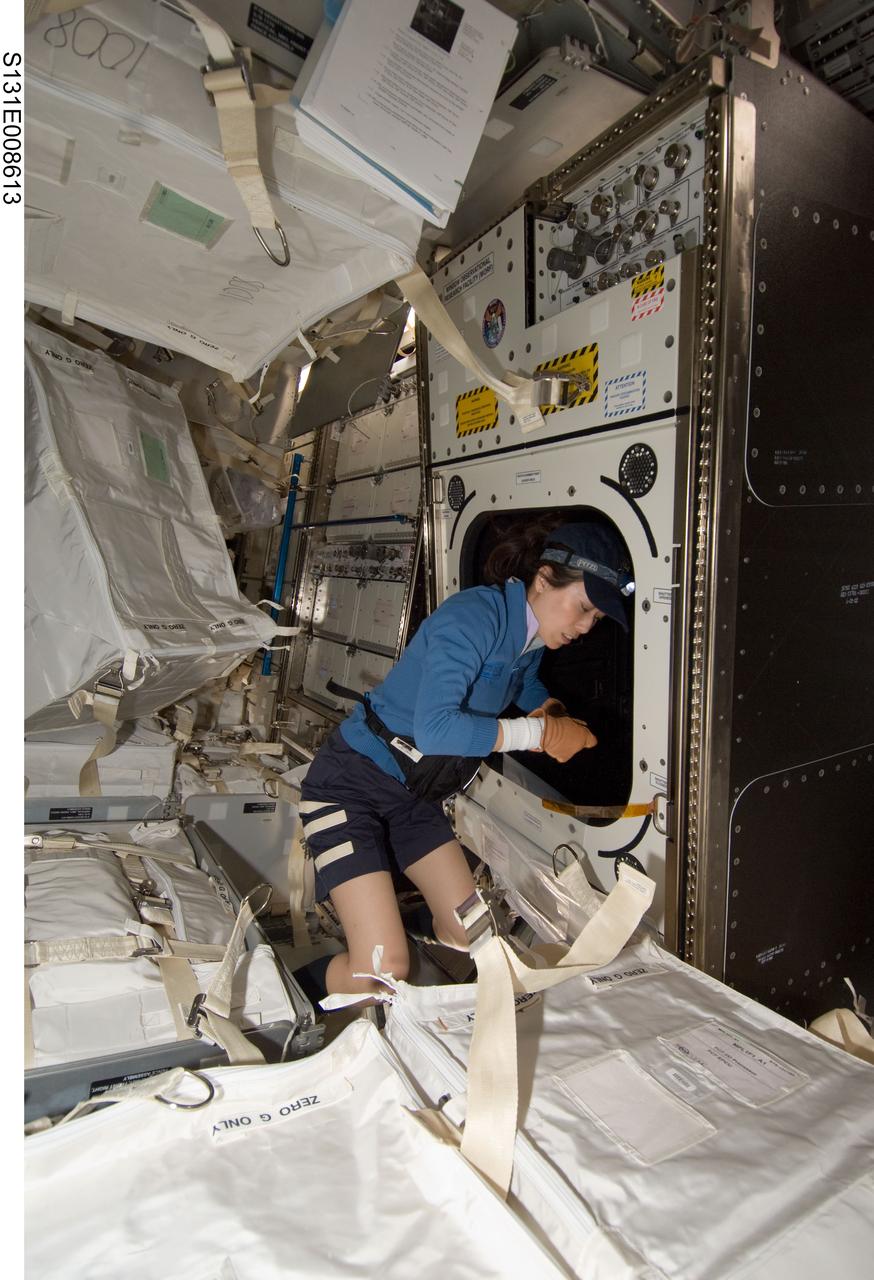
S131-E-008613 (10 April 2010) --- Japan Aerospace Exploration Agency (JAXA) astronaut Naoko Yamazaki, STS-131 mission specialist, works with the Window Observational Research Facility (WORF) in the Destiny laboratory of the International Space Station while space shuttle Discovery remains docked with the station. WORF will provide cameras, multispectral and hyperspectral scanners, camcorders and other instruments to capture Earth imagery through Destiny?s nadir window.
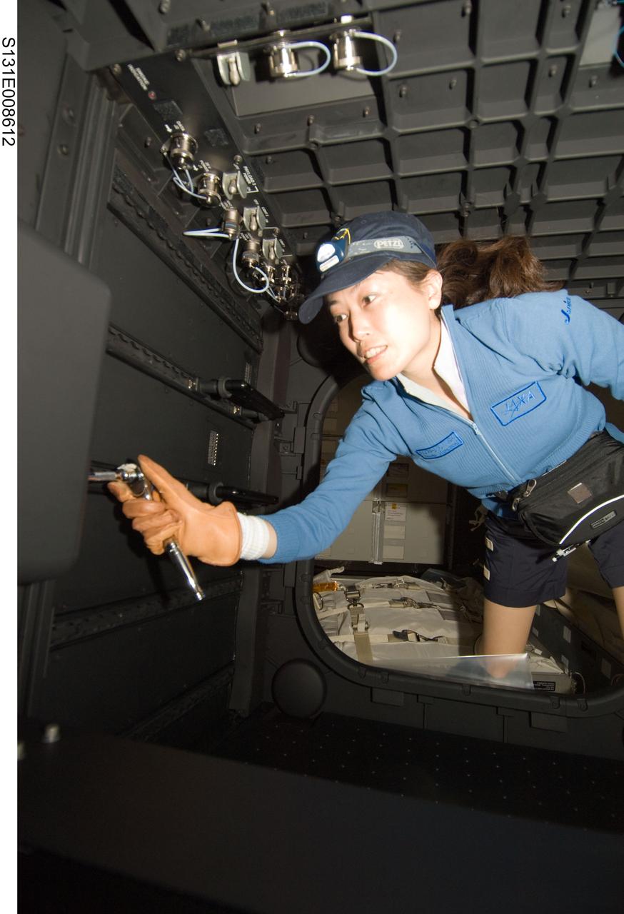
S131-E-008612 (10 April 2010) --- Japan Aerospace Exploration Agency (JAXA) astronaut Naoko Yamazaki, STS-131 mission specialist, works in the Window Observational Research Facility (WORF) in the Destiny laboratory of the International Space Station while space shuttle Discovery remains docked with the station. WORF will provide cameras, multispectral and hyperspectral scanners, camcorders and other instruments to capture Earth imagery through Destiny?s nadir window.
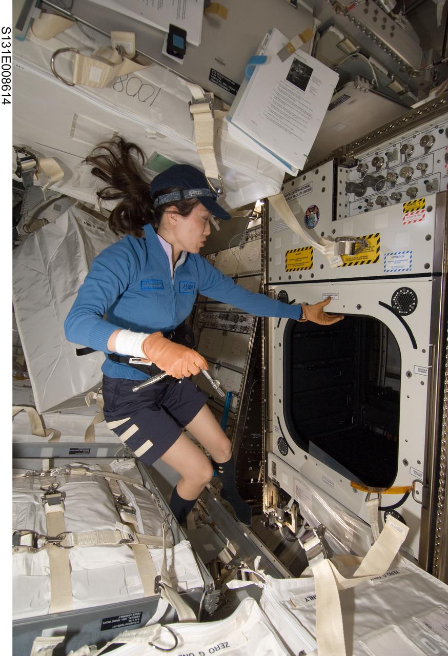
S131-E-008614 (10 April 2010) --- Japan Aerospace Exploration Agency (JAXA) astronaut Naoko Yamazaki, STS-131 mission specialist, works with the Window Observational Research Facility (WORF) in the Destiny laboratory of the International Space Station while space shuttle Discovery remains docked with the station. WORF will provide cameras, multispectral and hyperspectral scanners, camcorders and other instruments to capture Earth imagery through Destiny?s nadir window.
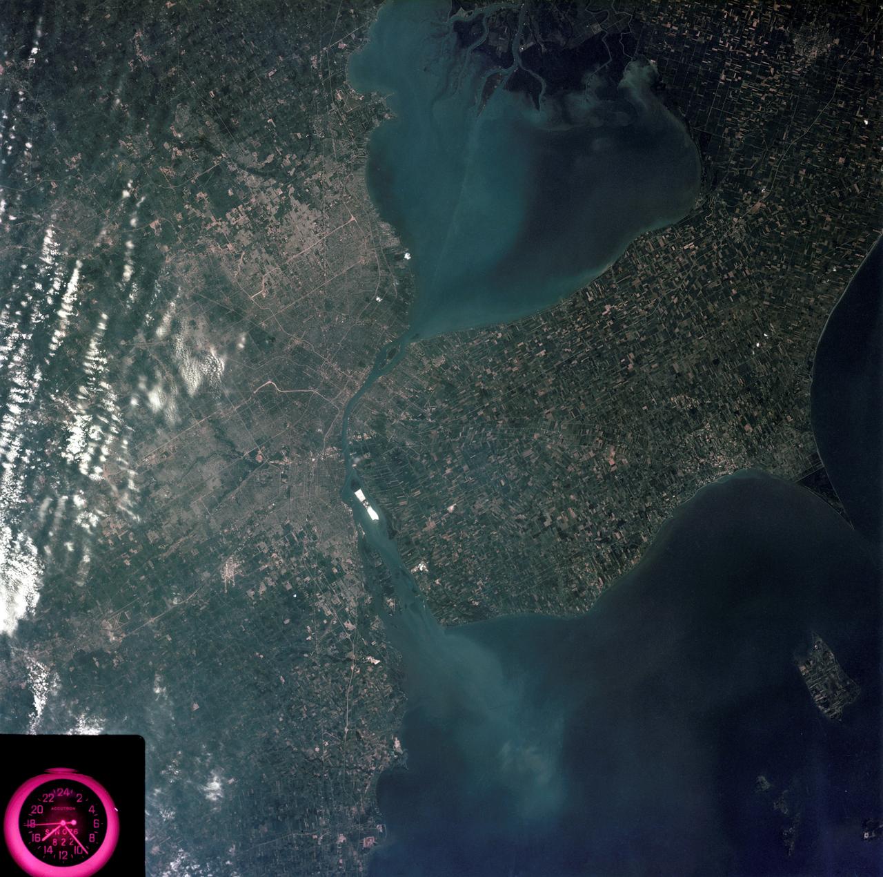
SL3-83-0152 (July-September 1973) --- A near vertical view of the metropolitan Detroit, Michigan area is seen in this Skylab 3 Earth Resources Experiments Package S190-B (five-inch Earth terrain camera) photograph taken from the Skylab space station in Earth orbit. The 25-mile long Detroit River drains the smaller body of water (Lake St. Clair) and flows southwestward separating Detroit from Windsor, Ontario, and empties into Lake Erie. The Detroit River handles a great deal of Great Lakes barge and ship traffic. Major streets and thoroughfares radiating from the city are clearly visible. Fighting Island is the highly reflective, white area located almost in the center of the picture. This high reflectivity is caused by the functional use of the island-disposal ponds for chemical salts. Sedimentation and/or pollution patterns in the area provide interesting visual phenomena for speculation and analysis. Distinct and rather unique cultivated field patterns can be observed south and east of Windsor, Ontario. This is a direct result of an English survey and land tenure system which was utilized when the area was settled. New areas of residential development are fairly easy to differentiate from older, established residential areas. Vegetation and extent of area coverage can be determined. The Oakland County Planning Commission and the Federal Bureau of Outdoor Recreation working closely with Irv Sattinger of the Environmental Research Institute of Michigan (University of Michigan) are presently processing and analyzing photographic and Multispectral scanner data to determine its usefulness for recreation and open space site studies for this area. Photo credit: NASA