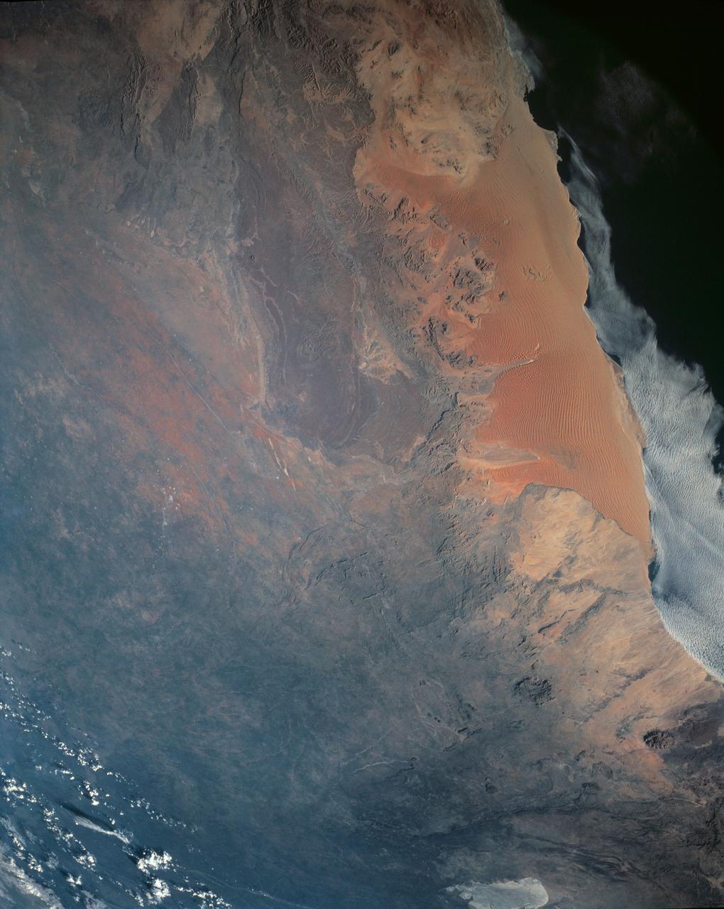
One of the driest regions on Earth, the Namib Desert, Namibia, Africa (23.0N, 15.0E) lies adjacent to the Atlantic coast but the upwelling oceanic water causes a very stable rainless atmosphere. The few local inland rivers do not reach the sea but instead, appear as long indentations where they penetrate the dune fields and end as small dry lakes. The vast dune fields are the result of sands deposited over millions of years by the stream flow.

This image from NASA Terra spacecraft shows Northern Namibia, known for its widespread bare and sinuous parallel dunes, most of them red.
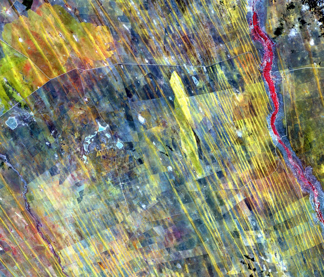
In central Namibia are long straight dunes along the western edge of the Kalahari Desert. Farmers and ranchers wage a constant losing battle with the sand dunes that cover once fertile lands. The image was acquired January 4, 2012, covers an area of 43.2 by 50.1 km, and is located at 23.5 degrees south, 18.7 degrees east. https://photojournal.jpl.nasa.gov/catalog/PIA24551
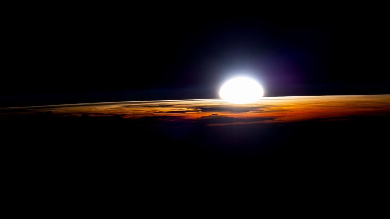
An orbital sunrise illuminates the cloud tops in this photograph from the International Space Station as it soared 262 miles above Namibia near the Atlantic coast.
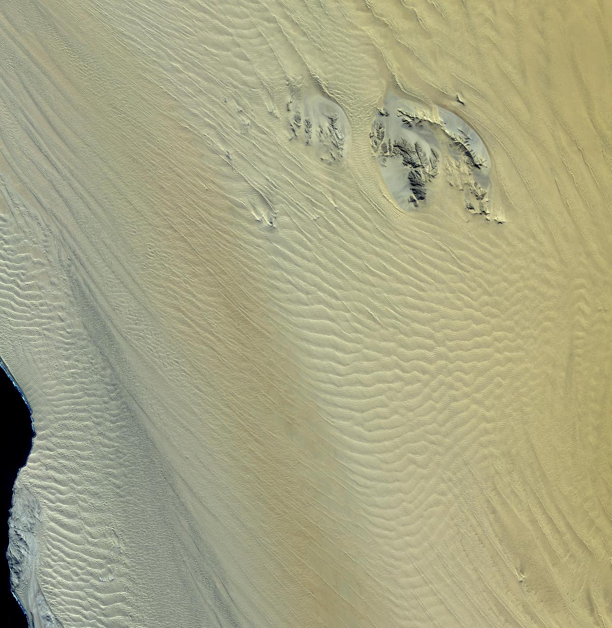
This image, acquired by NASA Terra spacecraft, shows the Namib Desert, a coastal desert in southern Africa. This portion in central Namibia consists entirely of linear and longitudinal sand dunes.
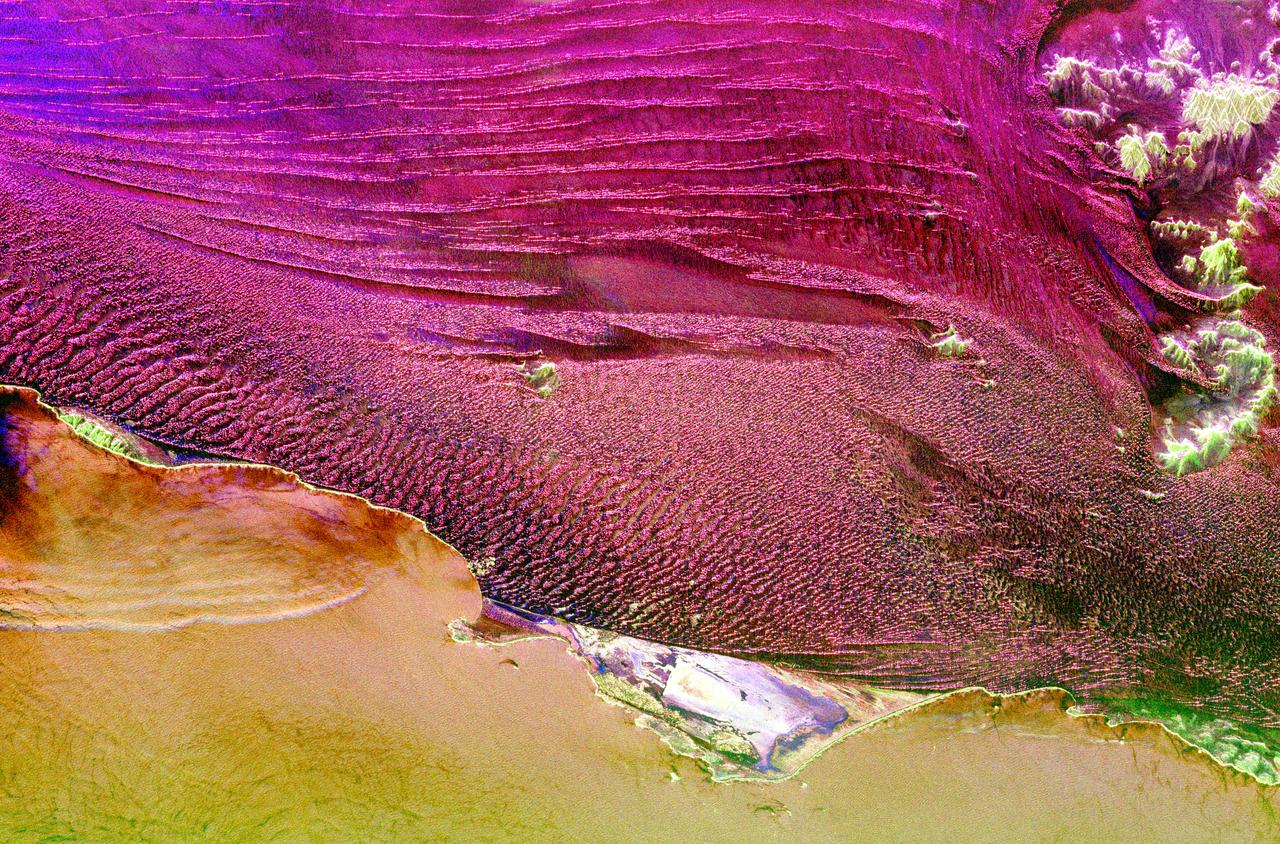
This spaceborne radar image shows part of the vast Namib Sand Sea on the west coast of southern Africa, just northeast of the city of Luderitz, Namibia.
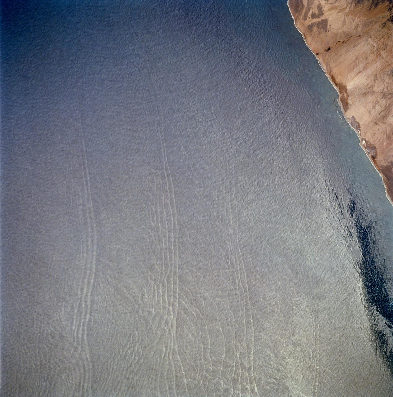
These open ocean Internal Waves were seen off the Namibia Coast, Africa (23.0S, 14.0E). The periodic and regularly spaced sets of internal waves most likely coincide with tidal periods about 12 hours apart. The wave length (distance from crest to crest) varies between 1.5 and 5.0 miles and the crest lengths stretch across and beyond the distance of the photo. The waves are intersecting the Namibia coastline at about a 30 degree angle.
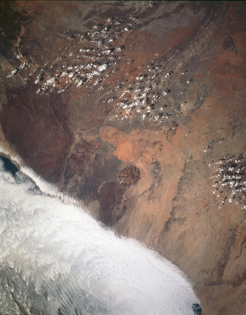
STS054-151-009 (13-19 Jan 1993) --- This large format camera's view shows the circular volcanic structure of the Brandberg mountain, which at 2630 meters (8,550 feet) is the highest point in the new nation of Namibia. The Brandberg is a major feature in the very arid Namib Desert on Africa's southwest coast. Coastal fog brings some moisture to the driest parts of the desert.
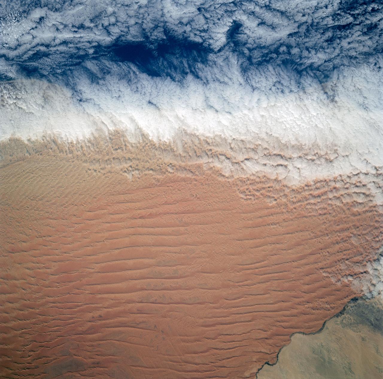
Fog is the only source of moisture for desert dwelling animals and plants living in the Namib Desert sand dune field, Namibia (23.5N, 15.0E). Coastal stratus clouds provide most of the life supporting moisture as fog droplets in this arid land where the usual annual rainfall is less than a quarter of an inch for decades at a time. In this view, the stratus clouds over the coast conform to the dune pattern proving that the fog is in ground contact.
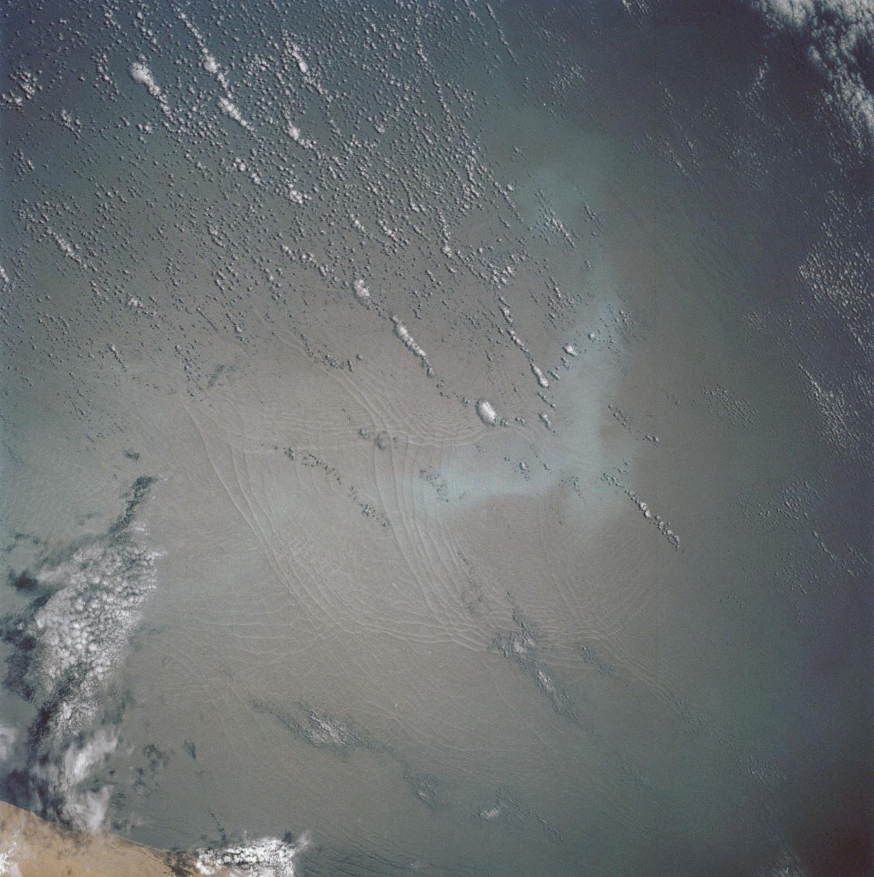
These open ocean Internal Waves were seen off the Namibia Coast, Africa (19.5S, 11.5E). The periodic and regularly spaced sets of incoming internal appear to be diffracting against the coastline and recombining to form a network of interference patterns. They seem to coincide with tidal periods about 12 hours apart and wave length (distance from crest to crest) varies between 1.5 and 5.0 miles and the crest lengths stretch beyond the image.
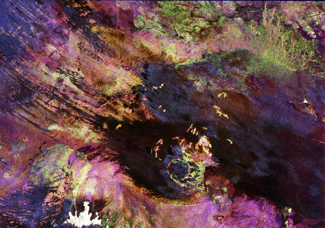
This space radar image shows the Roter Kamm impact crater in southwest Namibia. The crater rim is seen in the lower center of the image as a radar-bright, circular feature. Geologists believe the crater was formed by a meteorite that collided with Earth approximately 5 million years ago. The data were acquired by the Spaceborne Imaging Radar-C/X-Band Synthetic Aperture Radar (SIR-C/X-SAR) instrument onboard space shuttle Endeavour on April 14, 1994. The area is located at 27.8 degrees south latitude and 16.2 degrees east longitude in southern Africa. The colors in this image were obtained using the following radar channels: red represents the L-band (horizontally transmitted and received); green represents the L-band (horizontally transmitted and vertically received); and blue represents the C-band (horizontally transmitted and vertically received). The area shown is approximately 25.5 kilometers (15.8 miles) by 36.4 kilometers (22.5 miles), with north toward the lower right. The bright white irregular feature in the lower left corner is a small hill of exposed rock outcrop. Roter Kamm is a moderate sized impact crater, 2.5 kilometers (1.5 miles) in diameter rim to rim, and is 130 meters (400 feet) deep. However, its original floor is covered by sand deposits at least 100 meters (300 feet) thick. In a conventional aerial photograph, the brightly colored surfaces immediately surrounding the crater cannot be seen because they are covered by sand. The faint blue surfaces adjacent to the rim may indicate the presence of a layer of rocks ejected from the crater during the impact. The darkest areas are thick windblown sand deposits which form dunes and sand sheets. The sand surface is smooth relative to the surrounding granite and limestone rock outcrops and appears dark in radar image. The green tones are related primarily to larger vegetation growing on sand soil, and the reddish tones are associated with thinly mantled limestone outcrops. Studies of impact craters on the surface of the Earth help geologists understand the role of the impact process in the Earth's evolution, including effects on the atmosphere and on biological evolution. http://photojournal.jpl.nasa.gov/catalog/PIA00503
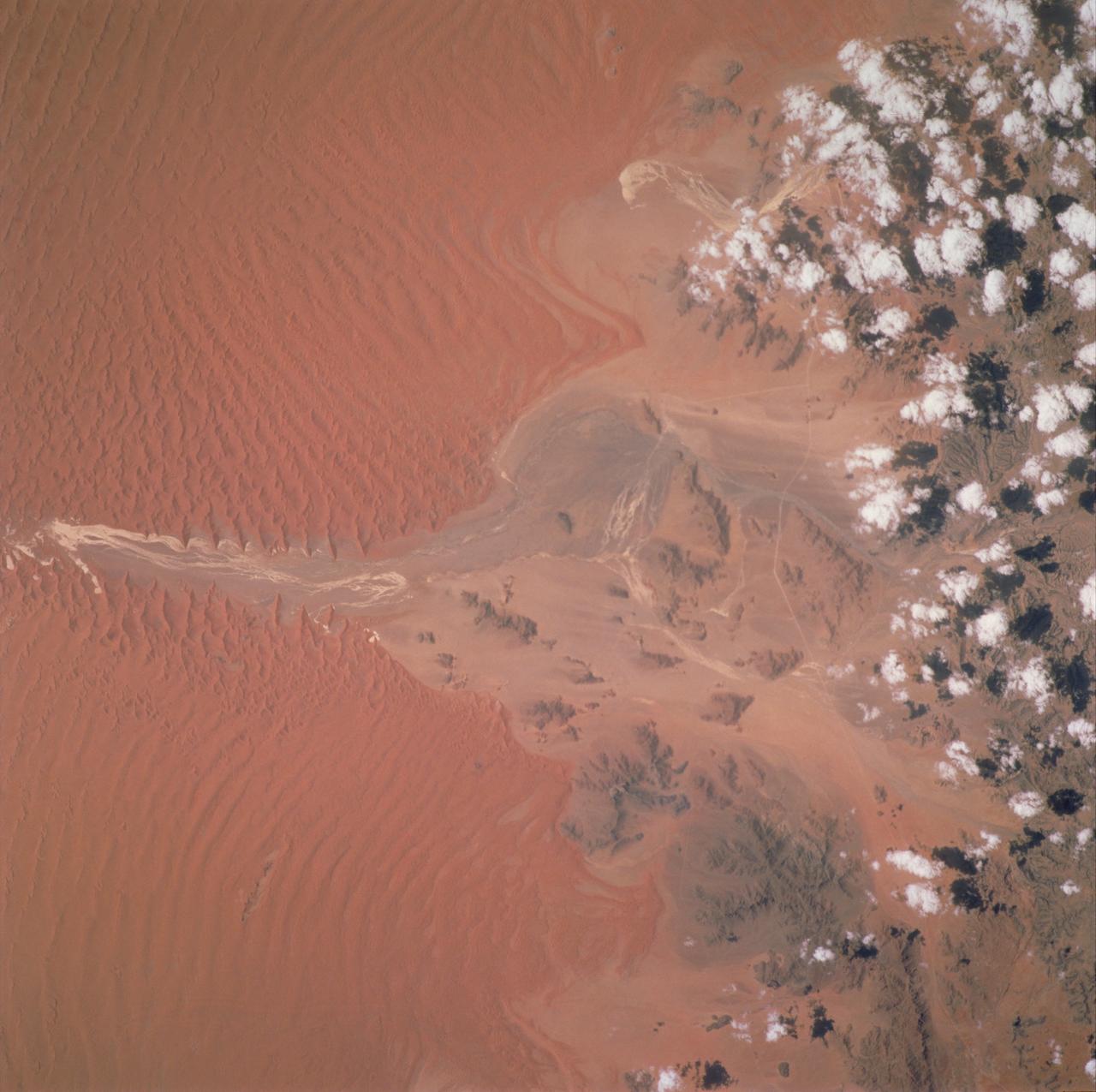
STS097-717-089 (December 2000) --- Sossus Vlei, Namibia, was photographed by one the STS-97 astronauts using a handheld 70mm camera. The long, parallel, deep red dunes at Sossus Vlei ("vlei" is Dutch for marsh), central Namibia, are constructed by the prevailing winds moving northward up the coast, according to NASA scientists studying the STS-97 photo collection. Along the course of the ephemeral stream (white strands at center), the ground-water table is at or near the land surface, and the damp sand disrupts or prevents dune formation. Where winds are deflected around bedrock outliers, smaller and less continuous dunes result. Similar aeolian features can be seen in images of the floor of Hebes Chasma, Herschel impact basin, and the north polar region of Mars, taken with the Mars Orbital Camera.
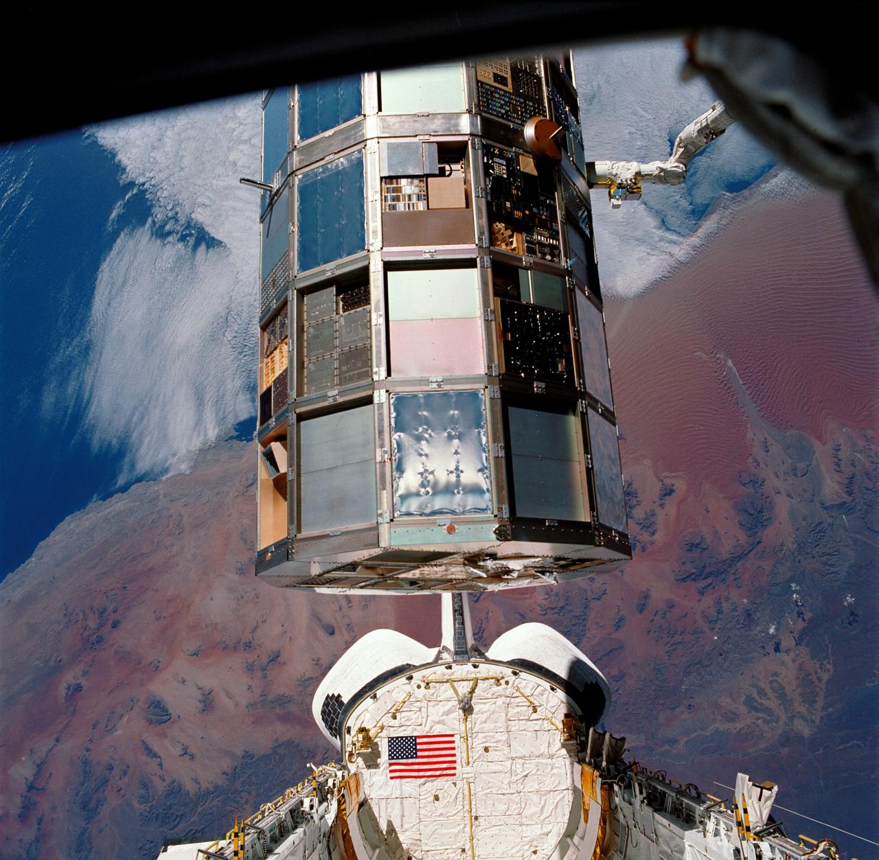
STS032-85-029 (12 Jan. 1990) --- (ORIENT PHOTO WITH COLUMBIA'S CARGO BAY IN LOWER CENTER). This 70mm frame was taken during a battery of documentary photographs of the recently-recaptured Long Duration Exposure Facility (LEDF). The Atlantic Coast of Namibia serves as a backdrop for the colorful scene. After five-and-one half years orbiting Earth, LDEF was retrieved by STS-32 crewmembers and brought back home at the end of the eleven-day mission for scientific observation. The bus-sized spacecraft was held in the grasp of Columbia's remote manipulator system (RMS) end effector during the survey.
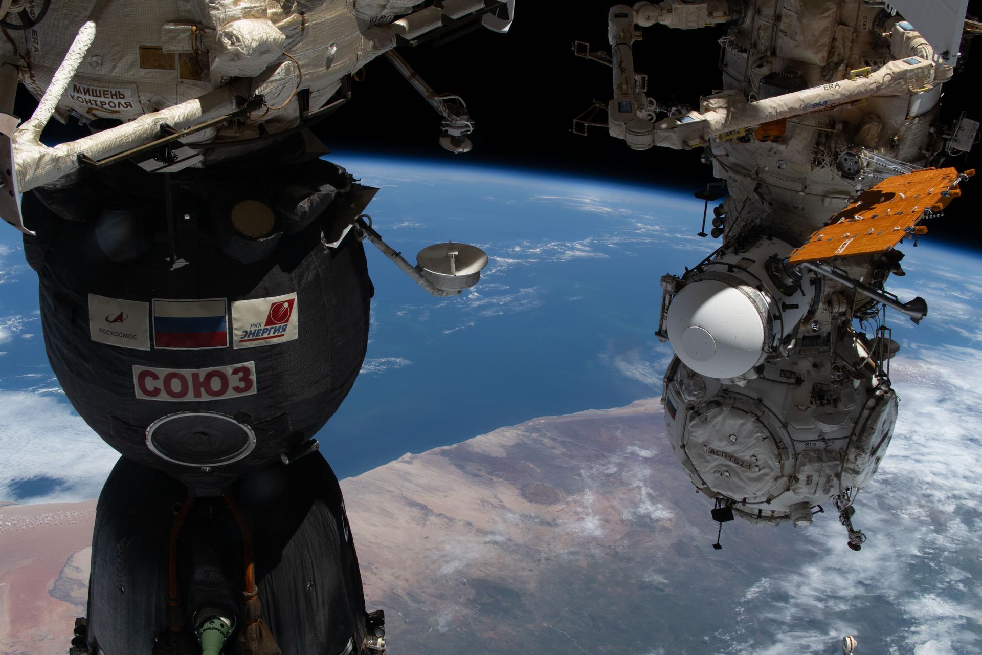
iss074e0325203 (Feb. 24, 2026) --- Namibia's Brandberg Massif, near the center of the photograph, appears as a nearly perfect circular formation just inland from the Atlantic coast, and easy to mistake for a meteorite impact crater when seen from space. At left, is the Soyuz MS-28 crew spacecraft docked to the Rassvet module. At right, the Prichal docking module is attached to the Nauka science module. The International Space Station was orbiting 266 miles above southern Africa at the time of this photograph. Credit: NASA/Jessica Meir
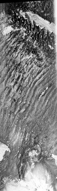
This is a C-band, VV polarization radar image of the Namib desert in southern Namibia, near the coast of South West Africa. The image is centered at about 25 degrees South latitude, 15.5 degrees East longitude. This image was one of the first acquired by the Spaceborne Imaging Radar-C/X-Band Synthetic Aperture Radar (SIR-C/X-SAR) when it was taken on orbit 4 from the shuttle Endeavour on April 9, 1994. The area shown is approximately 78 kilometers by 20 kilometers. The dominant features in the image are complex sand dune patterns formed by the prevailing winds in this part of the Namib desert. The Namib desert is an extremely dry area formed largely because of the influence of the cold Benguela ocean current that flows northward along the coast of Namibia. The bright areas at the bottom of the image are exposed outcrops of Precambrian rocks. This extremely barren area is a region rich in diamonds that through the centuries have washed down from the mountains. The town of Luderitz is located just to the south of the area shown. http://photojournal.jpl.nasa.gov/catalog/PIA01720
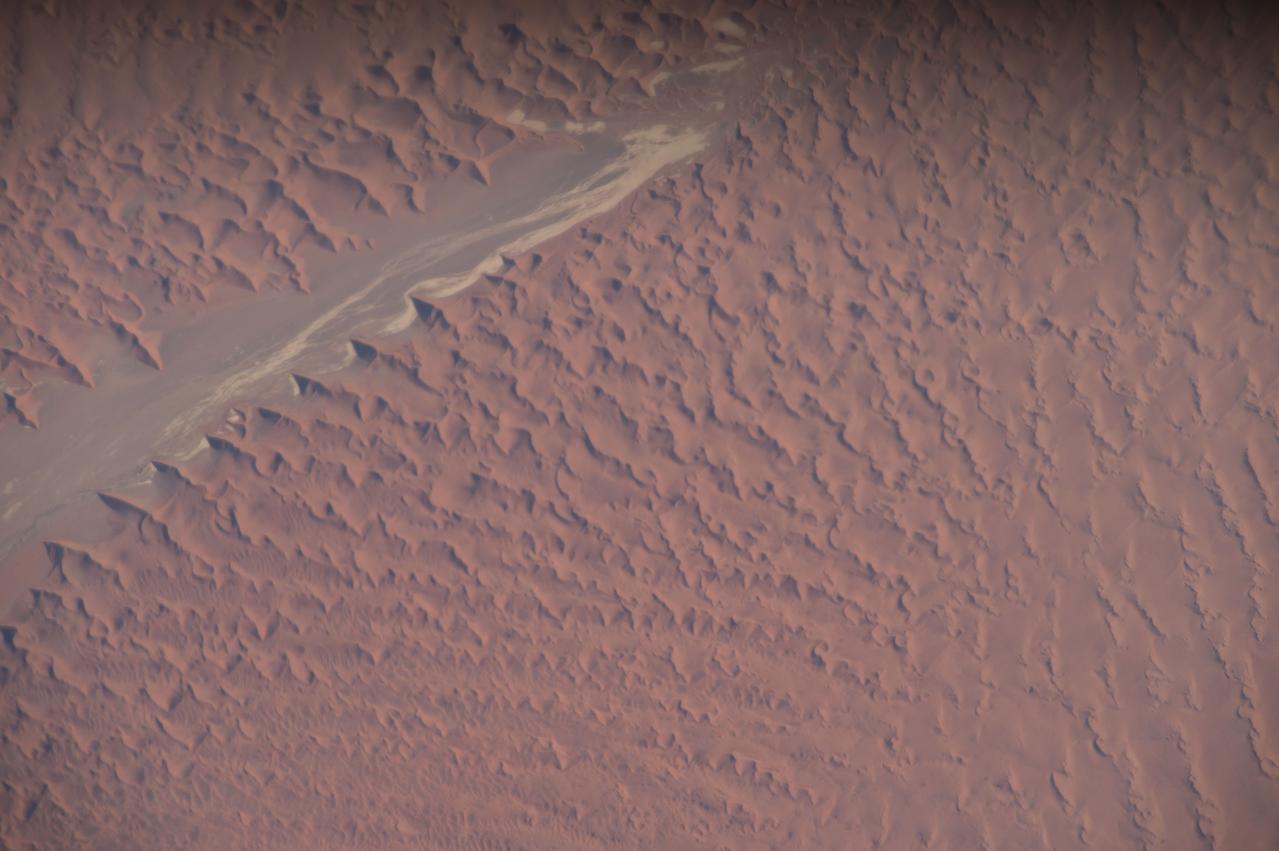
Earth observation taken during day pass by the Expedition 43 crew aboard the International Space Station (ISS). Folder lists this as Namibia sand dunes.
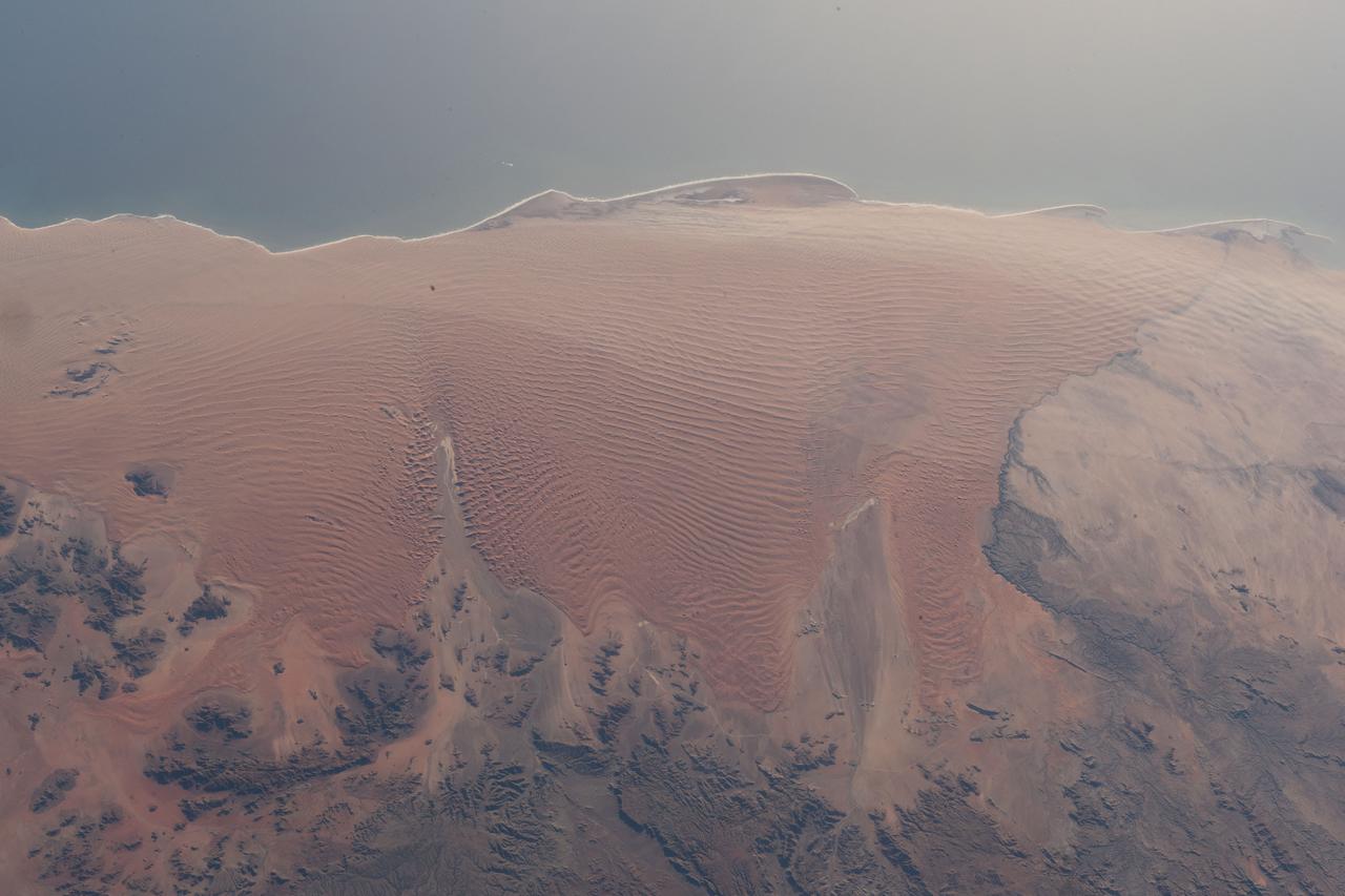
iss069e086612 (Sept. 11, 2023) --- The Namib Desert on the Atlantic coast of Namibia on the African continent is pictured from the International Space Station as it orbited 263 miles above.
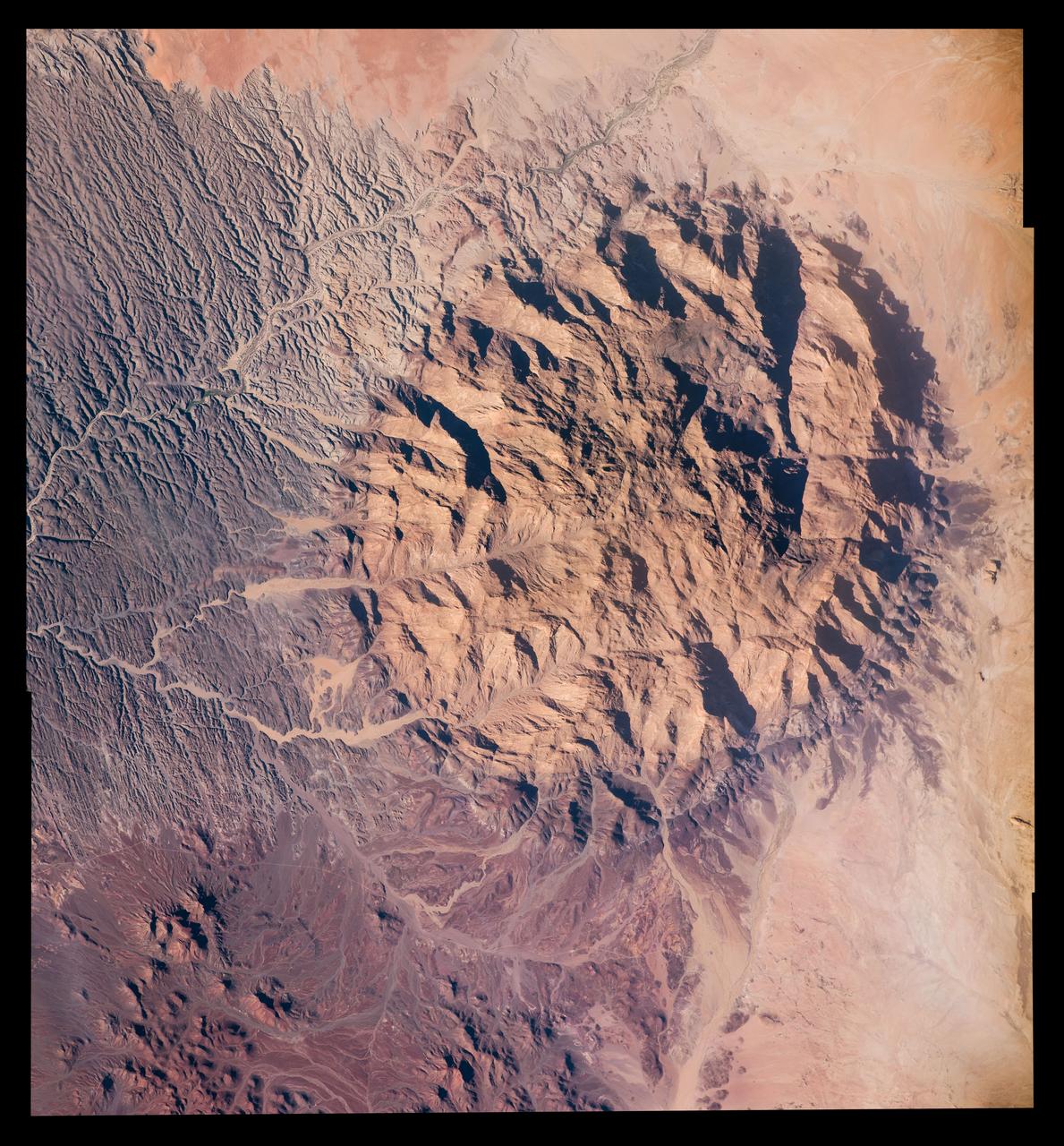
Expedition 47 Earth observation composite created with iss047e028742 - iss047e028744 135A2099 – 135A2101 Unique structure in Namibia Mt Brandberg Nature Reserve
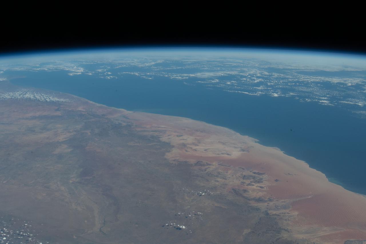
iss067e033271 (April 24, 2022) --- The Namib Desert on the Atlantic coast of the African nation of Namibia is pictured from the International Space Station as it orbited 264 miles above.
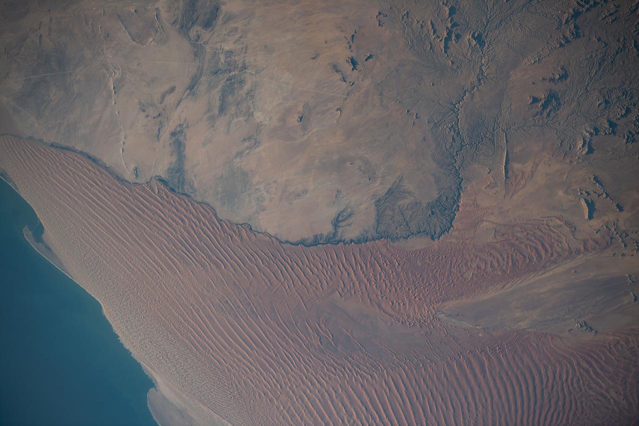
iss067e187073 (July 14, 2022) --- The Namib Desert on Namibia's Atlantic coast is pictured from the International Space Station as it orbited 261 miles above the African nation.
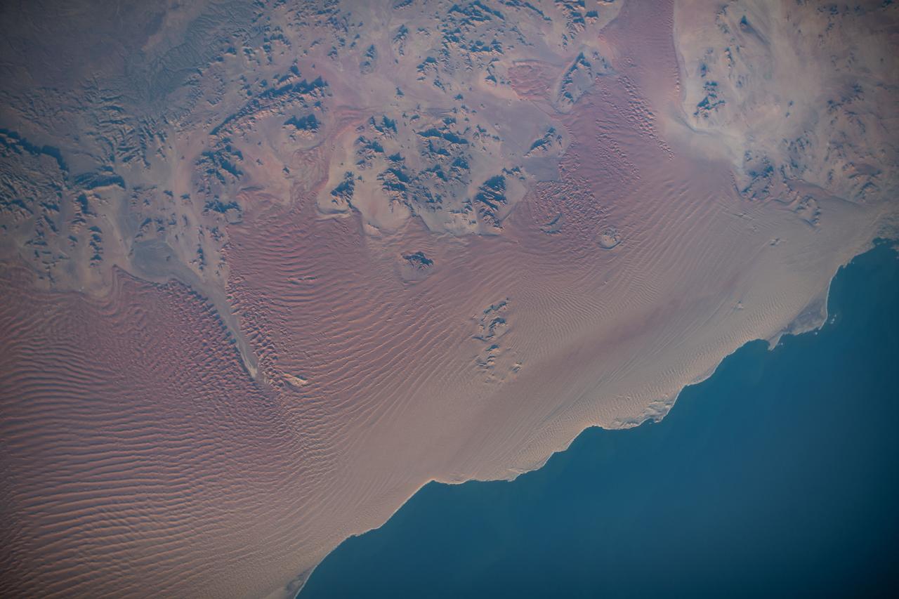
iss067e187067 (July 14, 2022) --- The Namib Desert on Namibia's Atlantic coast is pictured from the International Space Station as it orbited 261 miles above the African nation.

iss059e061447 (May 13, 2019) --- The Namib Desert on the Atlantic Coast of Namibia is photographed from an altitude of 259 miles as the International Space Station orbited off the coast of the southwestern Africa nation.
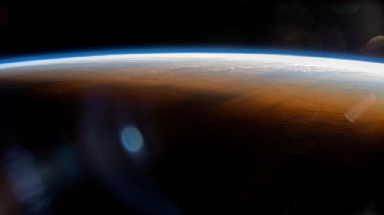
iss068e068975 (March 6, 2023) --- The International Space Station orbits 264 miles above the Atlantic Ocean off the coast of Namibia and into an orbital sunset marked by the terminator, or the line separating day from night on Earth.
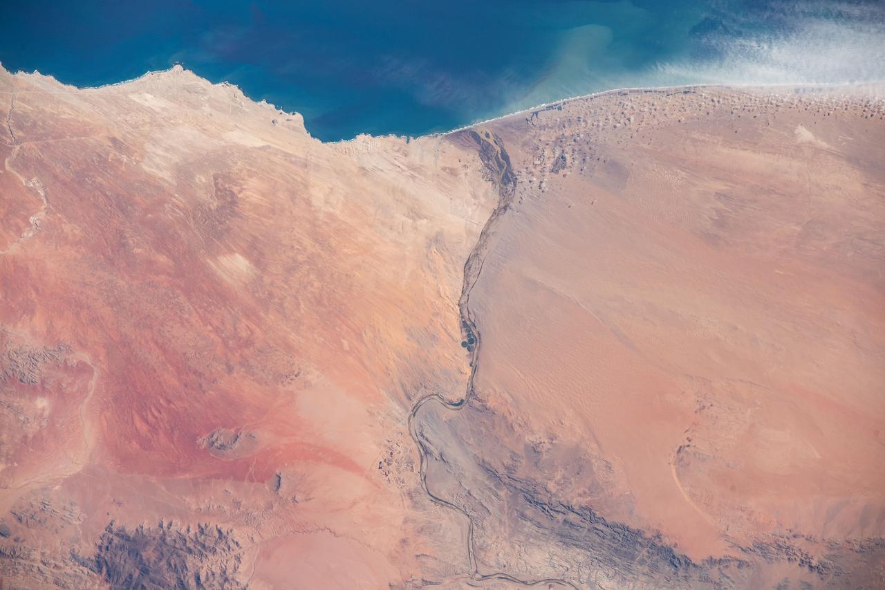
iss062e103100 (March 20, 2020) --- The Orange River empties into the Atlantic Ocean and separates the nations of Namibia and South Africa. The International Space Station was orbiting 265 miles above the African continent when this photograph was taken.
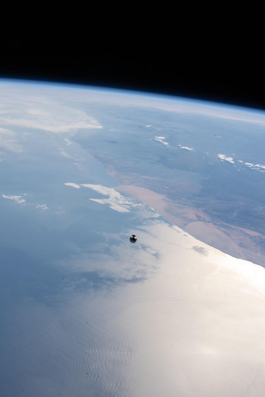
iss065e094357 (June 5, 2021) --- The SpaceX Cargo Dragon vehicle, on the SpaceX CRS-22 mission, approaches the International Space Station 265 miles above the Atlantic Ocean off the coast of Namibia on the African continent.

iss055e009959 (April 4, 2018) --- The SpaceX Dragon resupply ship approaches the International Space Station before its capture as both spacecraft begin an orbital pass off the southern coast of Namibia then northwest across the continent of Africa.
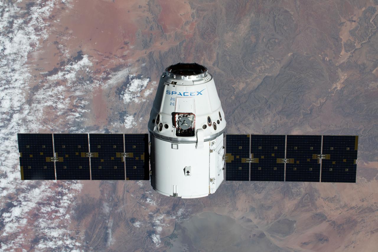
iss062e085678 (March 9, 2020) --- The SpaceX Dragon resupply ship is pictured approaching the International Space Station as both spacecraft were soaring 267 miles above the African nation of Namibia.
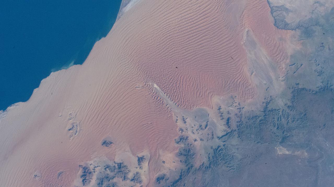
iss067e003783 (April 6, 2022) --- The Namib Desert is pictured from the International Space Station as it orbited 262 miles above the Atlantic Ocean just off the coast of the African nation of Namibia.
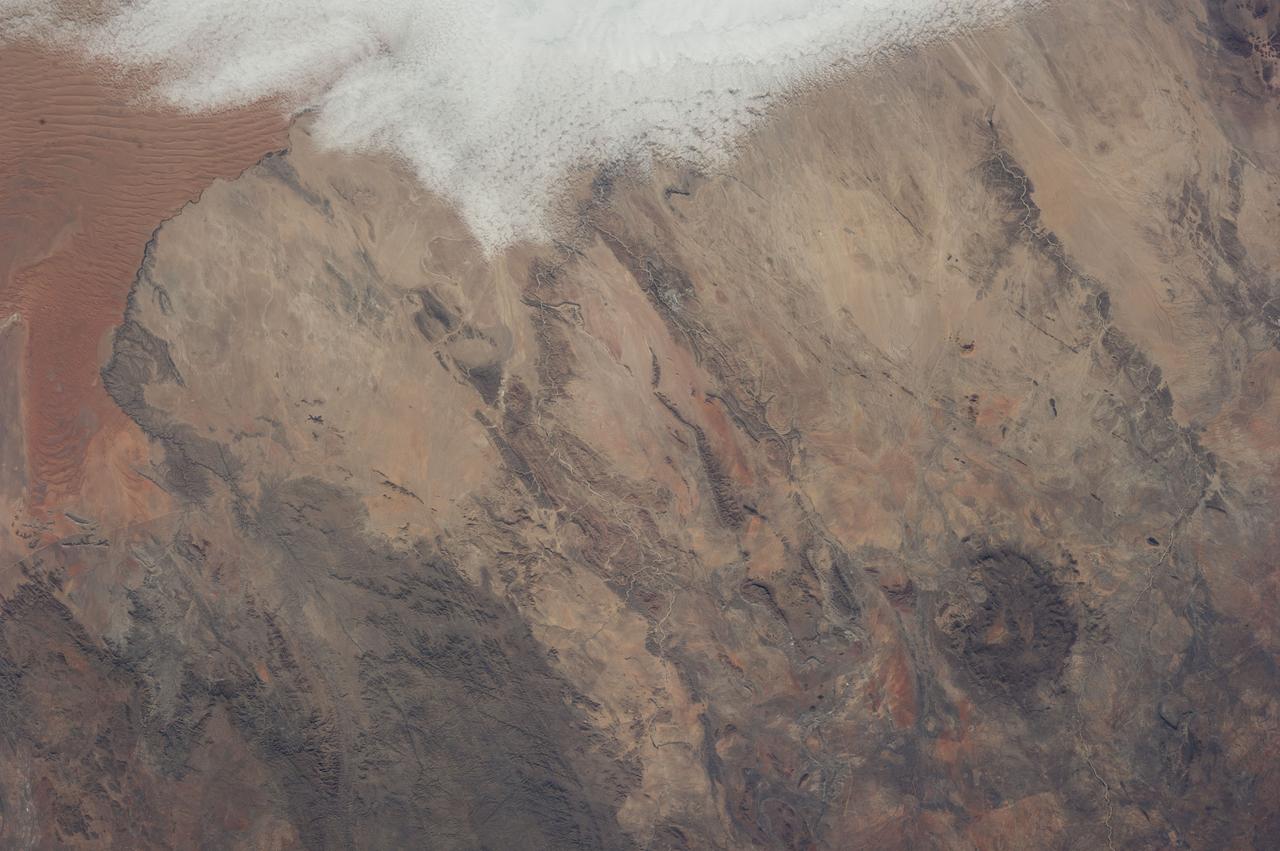
Earth observation taken during a day pass by an Expedition 37 crew member on board the International Space Station (ISS). Identified via Twitter message as west central coast of Namibia.

iss067e036275 (May 7, 2022) --- The last rays of an orbital sunset illuminate Earth's horizon in this photograph from the International Space Station as it orbited 265 miles above southern Namibia on the African continent.
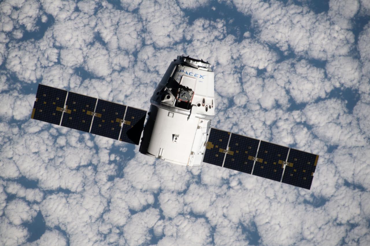
iss060e015838 (July 27, 2019) --- The SpaceX Dragon space freighter approaches the International Space Station as both spacecraft were orbiting 265 miles above the Atlantic Ocean off the west coast of Namibia.
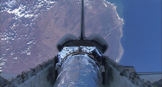
99-E-10024 (23 July 1999) --- This pre-deployment view of the Chandra X-Ray observatory backdropped against part of Namibia was recorded with the HDTV Camcorder from inside Columbia's crew cabin.

iss069e029091 (July 5, 2023) --- The waxing gibbous Moon is pictured above Earth's horizon in this photograph from the International Space Station as it orbited 261 miles above the Atlantic Ocean off the coast of Namibia.
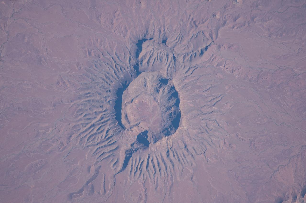
ISS047e022293 (03/26/2016) --- This Earth Observation image from the International Space Station is of a large extinct volcano in the lower southwest African Brukkaros Mountain in the country of Namibia.
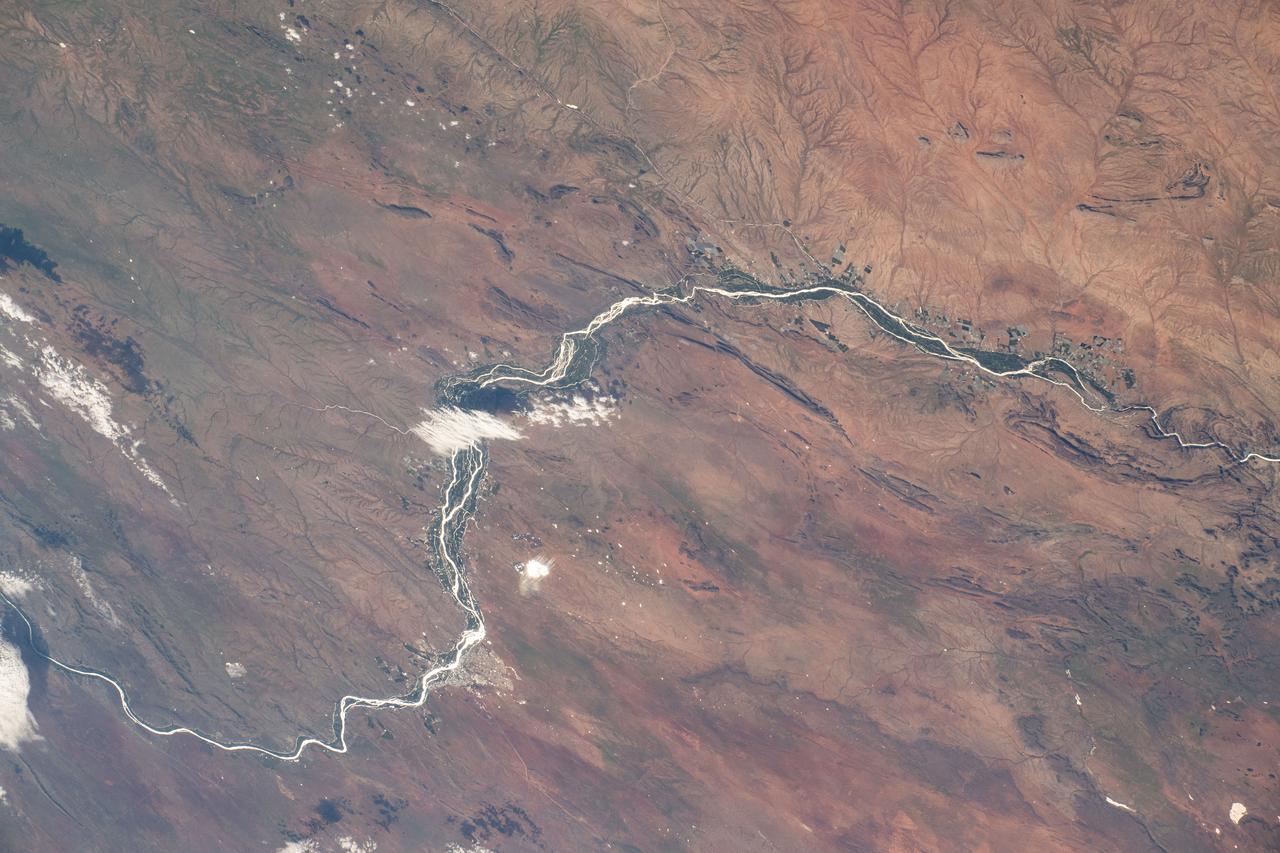
iss072e862232 (March 28, 2025) --- This portion of the Orange River, South Africa's longest river, east of Namibia's southern border and beaming under the sun's glint is pictured from the International Space Station as it orbited 264 miles above.
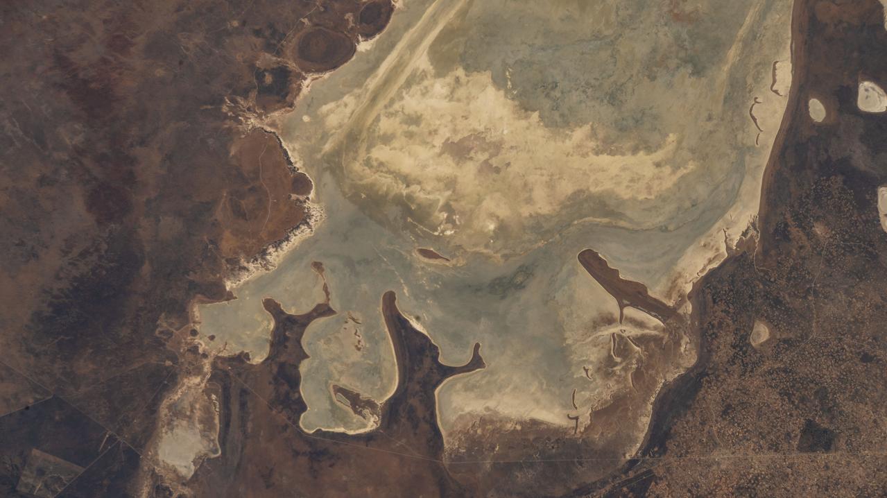
iss067e149386 (June 24, 2022) --- Etosha National Park in northern Namibia, home to a variety of wildlife including elephants, lions, and giraffes, is pictured from the International Space Station as it orbited 262 miles above the African nation.
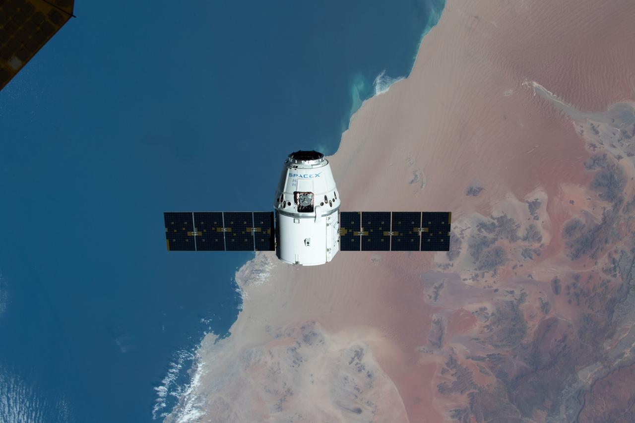
iss062e085660 (March 9, 2020) --- The SpaceX Dragon resupply ship is pictured approaching the International Space Station as both spacecraft were soaring on a southeastern orbital track 267 miles above the Atlantic coast of Namibia .
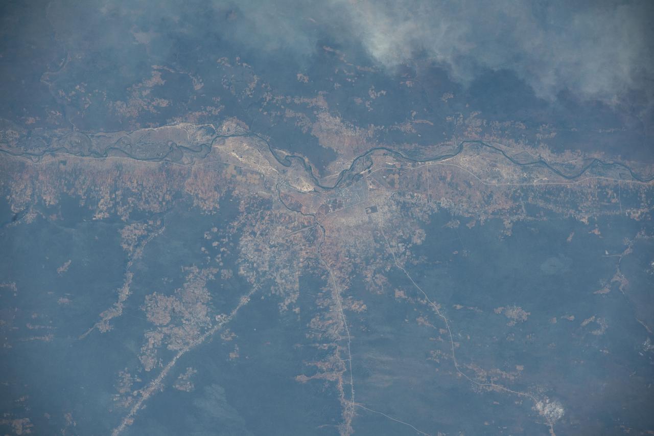
iss067e187075 (July 14, 2022) --- The Cubango River separates the African nations of Angola and Namibia in this photograph from the International Space Station as it orbited 260 miles above. The Namibian cities along the Cubango include Kasote, Sauyemwa, and Rundu.
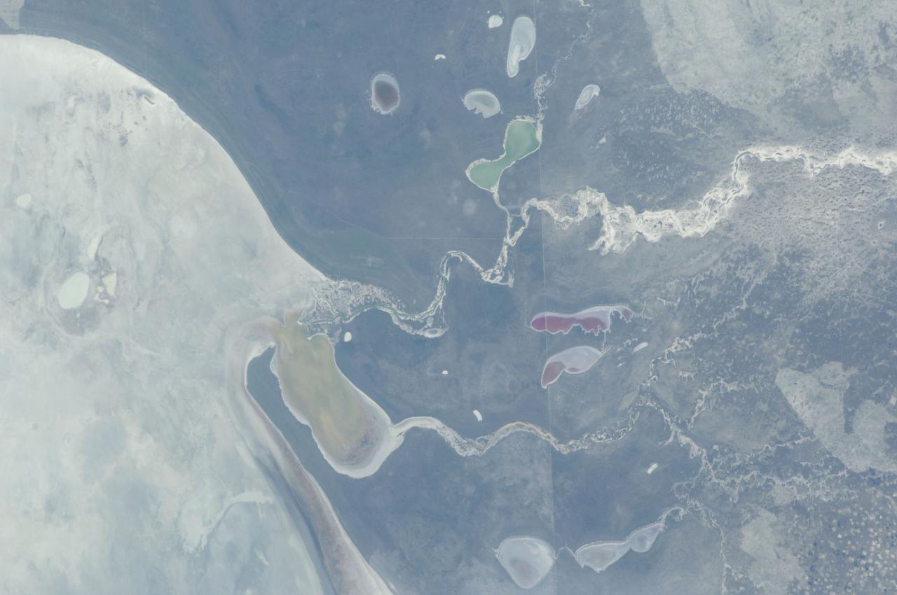
ISS030-E-234965 (30 Dec. 2011) --- The Etosha Pan in Namibia is featured in this image photographed by an Expedition 30 crew member on the International Space Station. This photograph shows the white, salt-covered floor of the northwest corner of the great dry lake in northern Namibia known as the Etosha Pan (left margin). Two rivers, the Ekuma and Oshigambo, transport water from the north down to the Etosha Pan proper. In a relatively rare event, water from recent rains has flowed down the larger Ekuma River?in which it appears as a thin blue line within the generally light grey-green floodplain?and fills a lobe of the lake with light green water (lower right quarter of image). Water has also flowed into a small offshoot dry lake where it appears a brighter green (upper right quarter of image). Other smaller lakes at center and top center show red and brown water colors. The different colors of lake water are determined by the interplay of water depth and resident organisms such as algae; the algae color varies depending on water temperature and salinity. A similar process is observed in pink and red floodwaters ponded in Lake Eyre, a usually dry lake in Australia?s arid center. In this case it is known that the coloration is indeed due to algae growth. Typically, little river water or sediment reaches the floor of the Etosha dry lake because water seeps into the riverbeds along their courses. The floor of the pan itself is seldom seen with even a thin sheet of water. In this image, there was enough surface flow to reach the pan, but too little to flow beyond the inlet bay. A prior flood event, when water entered the pan via the Oshigambo River, was documented in astronaut imagery in 2006. The straight line that crosses the image from top center to bottom is the northern fence line of Namibia?s Etosha National Park. This straight, three-meter-high fence keeps wildlife from crossing into the numerous small farms of the relatively densely populated Owambo region of Namibia, north of the pan. The large Etosha dry lakebed (120 kilometers or 75 miles long) is the center of Namibia?s largest wildlife park, a major tourist attraction.
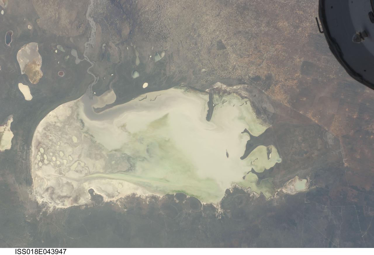
ISS018-E-043947 (26 March 2009) --- Etosha Pan in Namibia is featured in this image photographed by an Expedition 18 crewmember on the International Space Station. Etosha Pan is a large dry lake about 130 kilometers long that dominates Namibia?s Etosha National Park (the sharp edge of the park fence can be seen at right). Small related dry lake beds appear as bright shapes top left, a portion of the International Space Station appears at top right. This view shows the pan as it appeared almost ten years ago. The pan is the low point in a major inland basin in northern Namibia. During occasional flood events, such those experienced in the last nine months, rivers from Angola (the Namibia?Angola boundary lies just outside the top of the image) deliver large quantities of water to the pan. In this image flood water in the Oshigambo River, resulting from recent heavy rains in Angola, appears as a gray stream entering the northwest corner of the pan (top left). The floodwater becomes a thin sheet on the vast salt flat of the pan floor. Algae blooms in the warm water have produced a light-green tinge. Another image of the Oshigambo River mouth in flood can be seen here. Reports on the ground, augmented with orbital unmanned satellite imagery acquired subsequent to this photograph, show that the plains north of the pan are now flooded, causing damage to homesteads, crops and roads. More than 340,000 people have been affected in northern Namibia and approximately 250,000 in southern Angola.
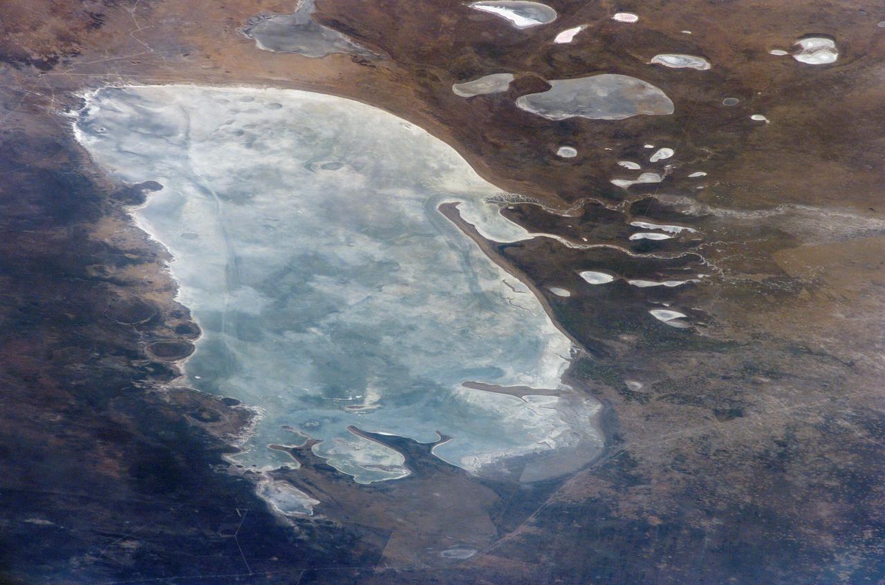
ISS011-E-09504 (24 June 2005) --- Ekuma River and Etosha Pan, Namibia are featured in this image photographed by an Expedition 11 crewmember on the International Space Station. Etosha Pan, northern Namibia, is a large (120 kilometers or 75 mile long) dry lakebed in the Kalahari Desert. The lake and surrounds are protected today as one of Namibia’s largest wildlife parks. Herds of elephants occupy the dense mopane woodland on the south side of the lake. Mopane trees are common throughout south-central Africa, and host the mopane worm (the larval form of the Mopane Emperor Moth)–an important source of protein for rural communities. According to scientists, about 16,000 years ago, when ice sheets were melting across Northern Hemisphere land masses, a wet climate phase in southern Africa filled Etosha Lake. Today, Etosha Pan is seldom seen with even a thin sheet of water covering the salt pan. Typically, little river water or sediment reaches the dry lake because water seeps into the riverbed along its 250 kilometers (155 miles) course, reducing discharge along the way.
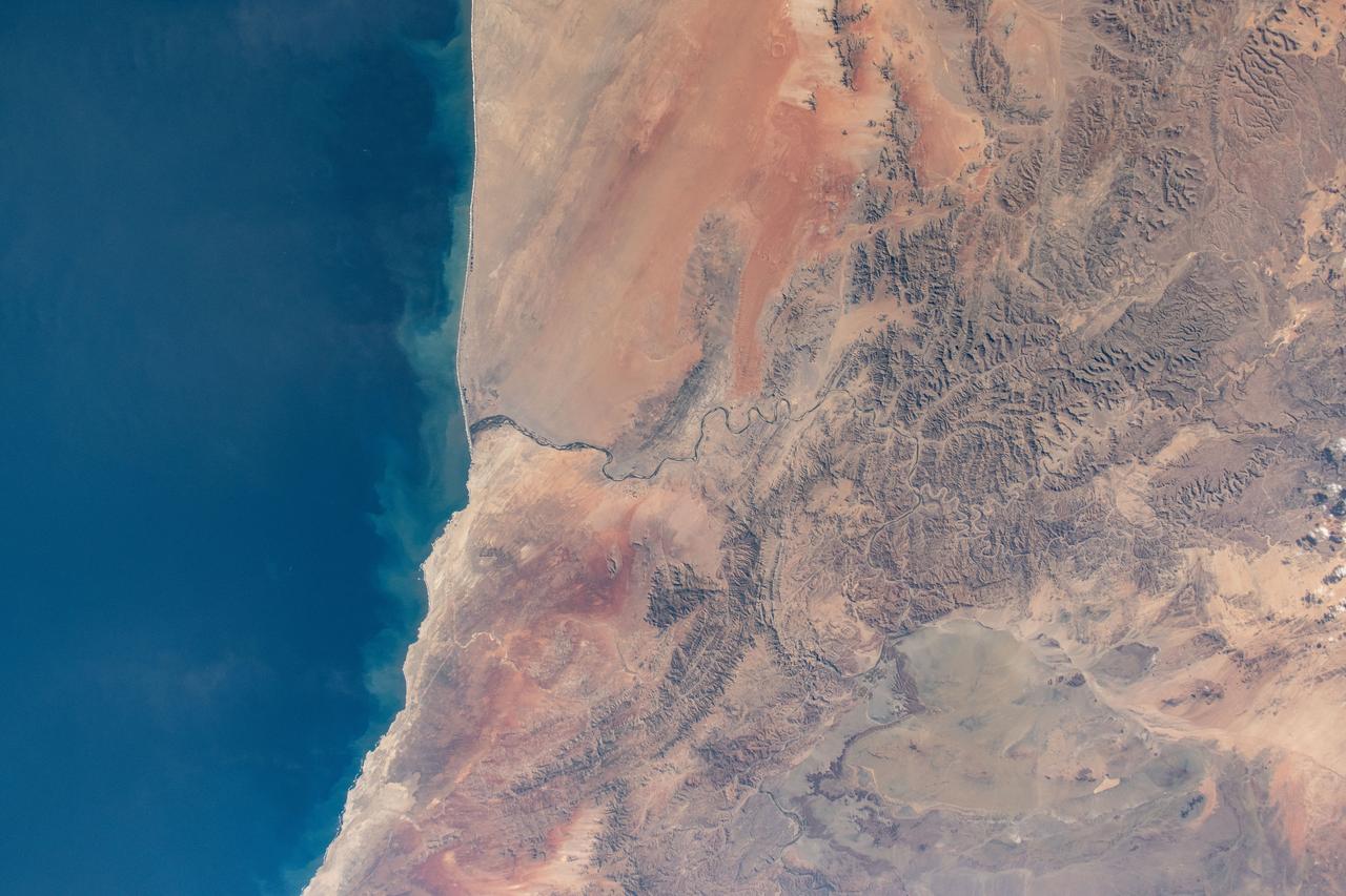
iss071e230735 (June 27, 2024) --- Orange River is the border between South Africa and Namibia on the Atlantic coast and is the termination point of the Namib desert to the north and the desert landscape of Richtersveld to the south. The International Space Station was orbiting 268 miles above at the time of this photograph
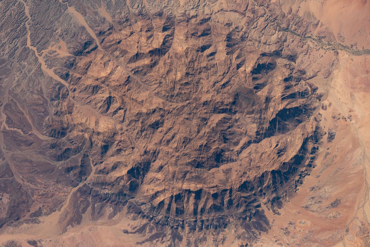
iss071e522460 (Aug. 20, 2024) --- The dome-shaped Brandburg Massif, near the Atlantic coast of central Namibia, containing Brandberg Mountain, the African nation's highest peak and ancient rock paintings going back at least 2,000 years, is pictured from the International Space Station as it orbited 261 miles above.
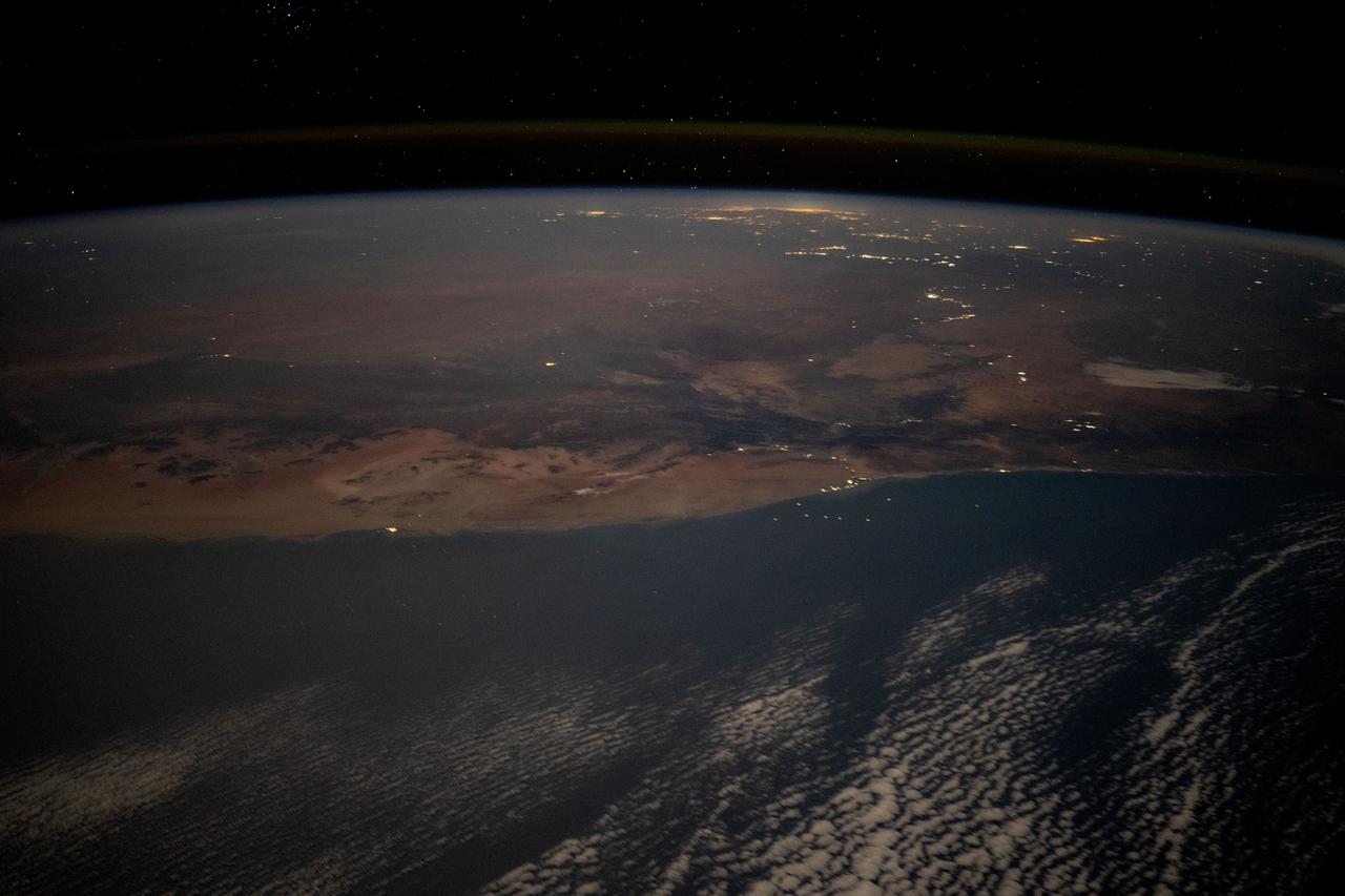
iss071e523401 (Aug. 21, 2024) --- The desert coast of Namibia and the city lights of Johannesburg, South Africa, and surrounding areas on Earth's horizon are pictured from the International Space Station as it soared 263 miles above the Atlantic Ocean in this nighttime photograph.
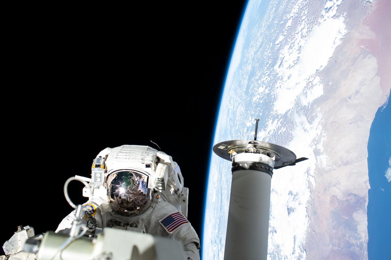
iss068e032186 (Dec. 22, 2022) --- Expedition 68 Flight Engineer and NASA spacewalker Josh Cassada prepares a roll-out solar array for its deployment on the International Space Station's Port-4 truss segment as the orbiting lab flew 262 miles above the Atlantic Ocean off the coast of Namibia.
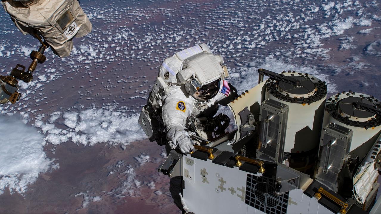
iss068e031766 (Dec. 22, 2022) --- Expedition 68 Flight Engineer and NASA spacewalker Josh Cassada prepares a roll-out solar array for its deployment on the International Space Station's Port-4 truss segment as the orbiting lab flew 262 miles above the Atlantic Ocean off the coast of Namibia.

iss071e230722 (June 27, 2024) --- The NamibRand Nature Reserve, located in the Namib Desert and hosting some of the tallest dunes in the world, is pictured from the International Space Station as it orbited 268 miles above the Atlantic Ocean off the coast of Namibia.

iss068e031765 (Dec. 22, 2022) --- Expedition 68 Flight Engineer and NASA spacewalker Josh Cassada prepares a roll-out solar array for its deployment on the International Space Station's Port-4 truss segment as the orbiting lab flew 261 miles above the Atlantic Ocean off the coast of Namibia.
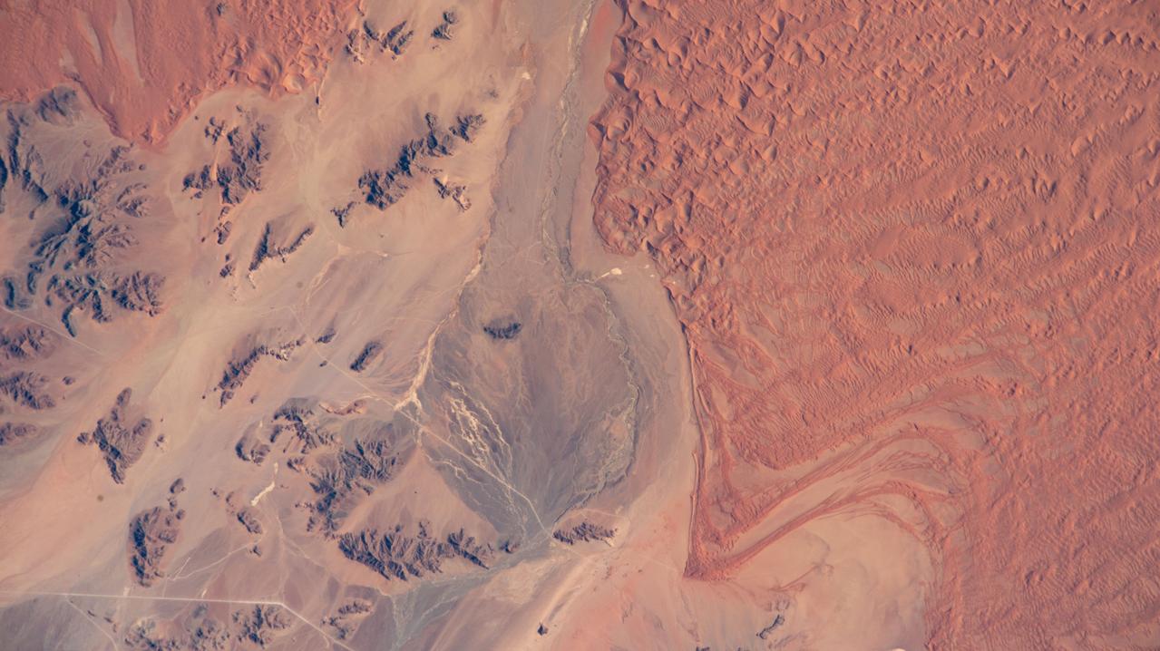
iss073e0511487 (Aug. 20, 2025) --- A portion of the hot, arid Namib Desert near the Atlantic coast, with its sand dunes created by strong onshore winds close to the NamibRand Nature Reserve, is pictured from the International Space Station as it orbited 262 miles above Namibia.
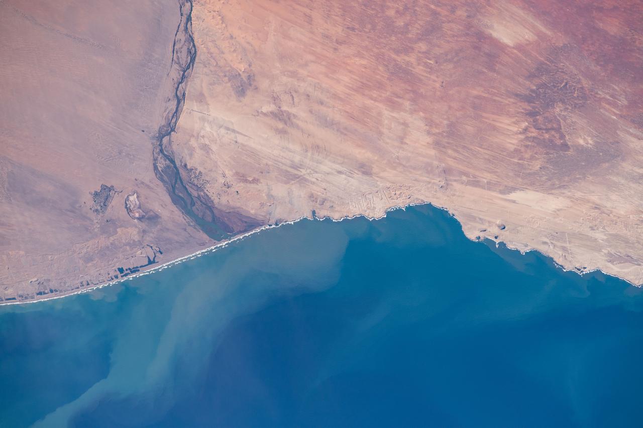
iss060e006420 (July 10, 2019) --- The Orange River separates the nations of Namibia and South Africa as it flows into Alexander Bay on the edge of the Atlantic Ocean. The International Space Station was on a southeastern orbital trek 262 miles above the African continent when an Expedition 60 crewmember captured this Earth observation.
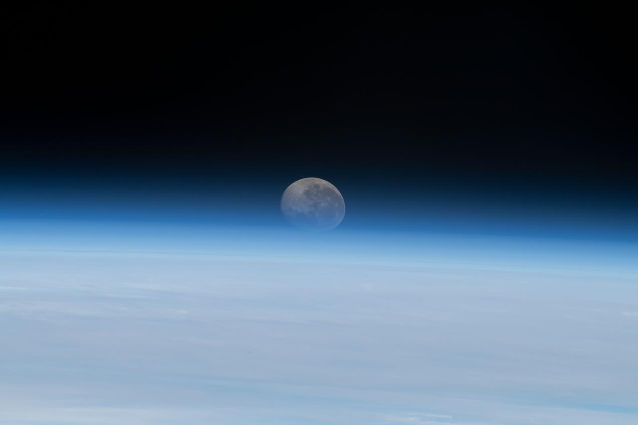
iss069e029100 (July 5, 2023) --- The Moon begins setting below Earth's horizon the atmosphere refracting, or bending, its light making it appear flatter in this photograph taken from the International Space Station as it orbited 262 miles above the Atlantic Ocean off the coast of Namibia.
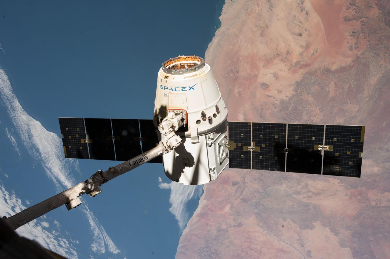
iss055e057155 (May 5, 2018) --- The SpaceX Dragon cargo craft is pictured in the grips of the Canadarm2 robotic arm as the International Space Station was orbiting across the central coast of Namibia. Dragon was later released for its splashdown in the Pacific Ocean off the coast of California on May 5, 2018 ending the SpaceX CRS-14 mission.

iss067e035805 (May 7, 2022) --- This portion of the Namib Desert in southern Namibia boasts some of the tallest dunes in the world attracting the attention of geologists for further study. The International Space Station was orbiting 266 miles above the Atlantic Ocean at the time this photograph was taken.
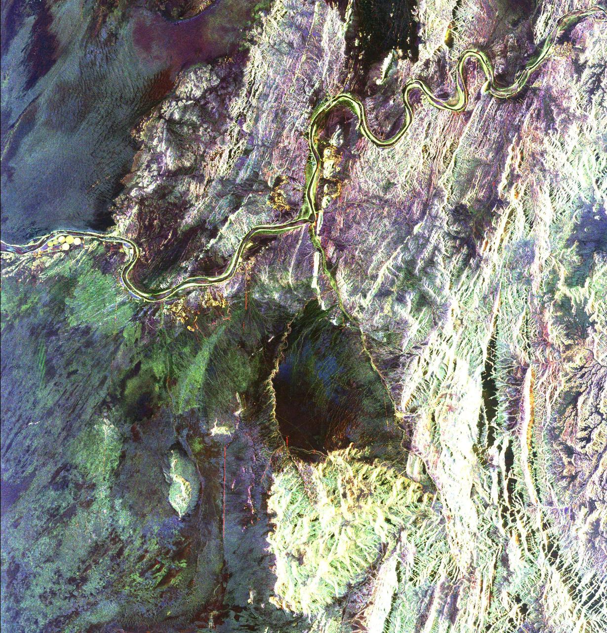
This radar image covers a portion of the Richtersveld National Park and Orange River top of image in the Northern Cape Province of the Republic of South Africa.
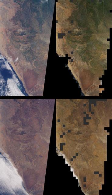
Brightness variations in the terrain along a portion of southwestern Africa are displayed in these views from NASA Terra spacecraft.
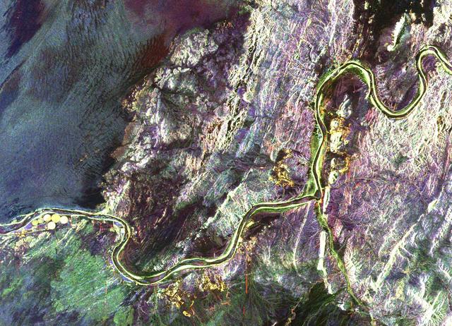
This radar image shows a close up view of a portion of the Richtersveld National Park and Orange River top of image in the Northern Cape Province of the Republic of South Africa.
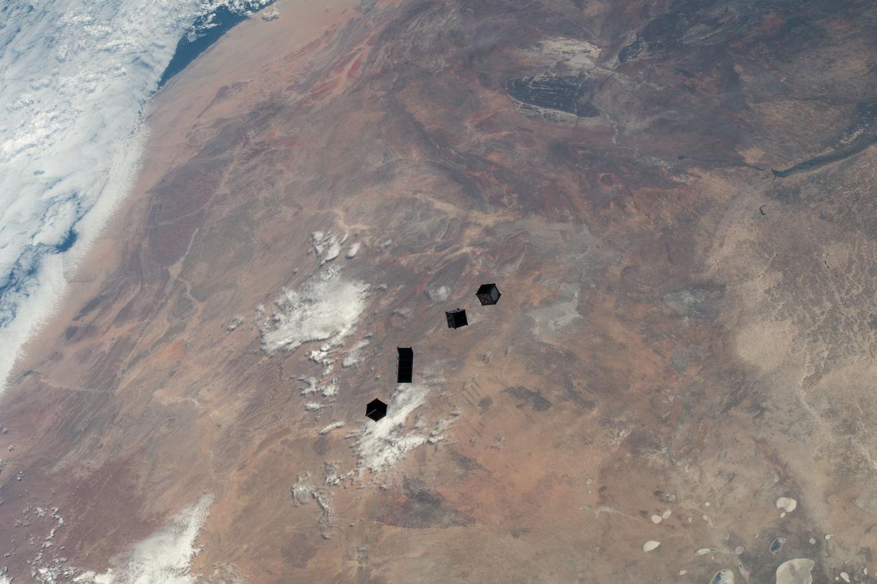
iss068e025834 (Dec. 2, 2022) --- A set of four CubeSats are photographed after being released from a small satellite deployer on the outside of the Kibo laboratory module as the International Space Station orbited 264 miles above Namibia on the African continent. The four tiny satellites, two from Japan, and one each from Uganda and Zimbabwe, were deployed into Earth orbit for a variety scientific studies and technology demonstrations.
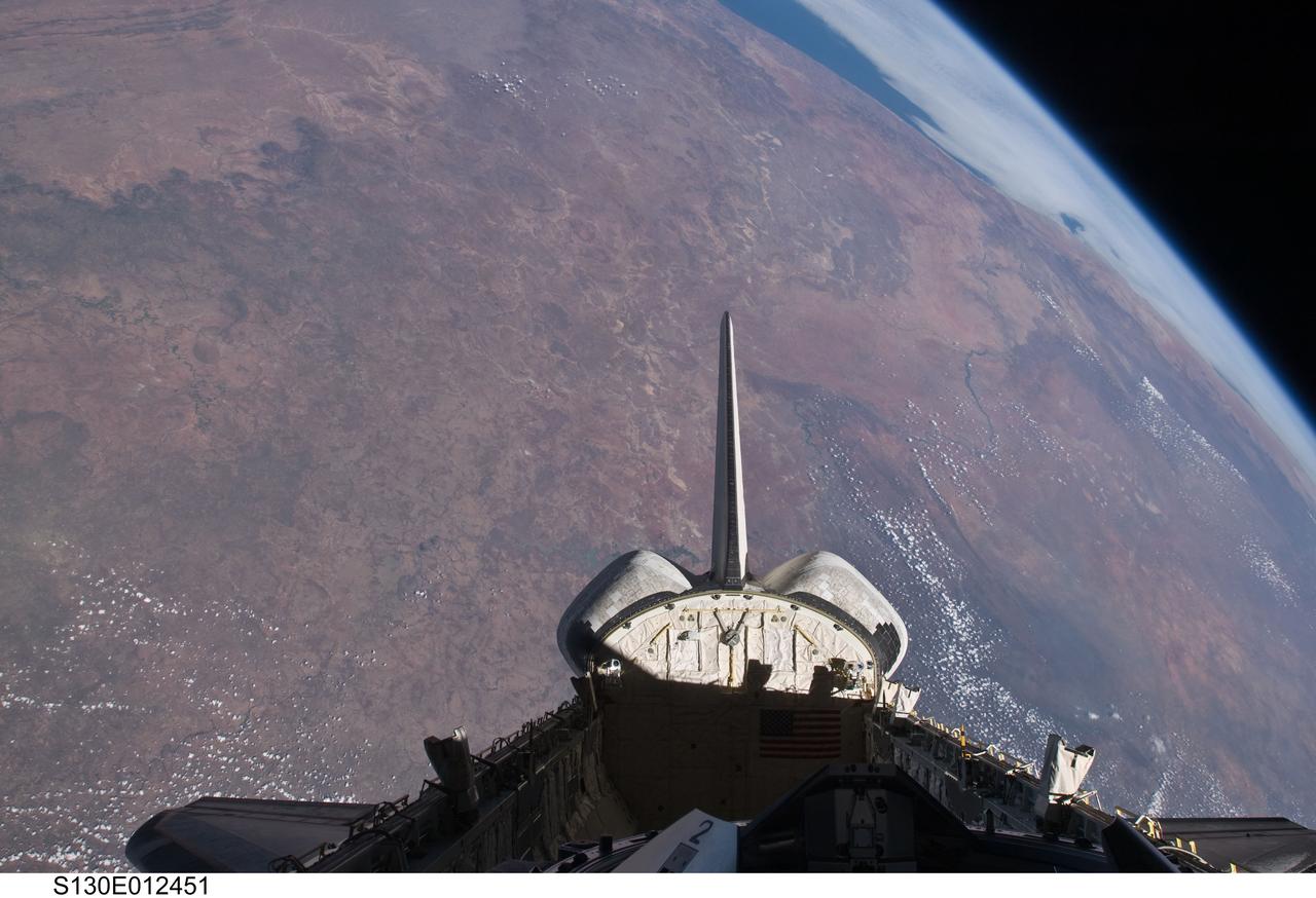
S130-E-012451 (20 Feb. 2010) --- The empty cargo bay and the aft portion of the Earth-orbiting space shuttle Endeavour are featured in this image photographed by an STS-130 crew member from inside the spacecraft?s crew cabin. The view is toward the west across southern Africa to the Atlantic ocean. The view follows along the Orange River, which also serves as the border between Namibia (to the right of the river) and South Africa (to the left of the river) nearer to the coast.
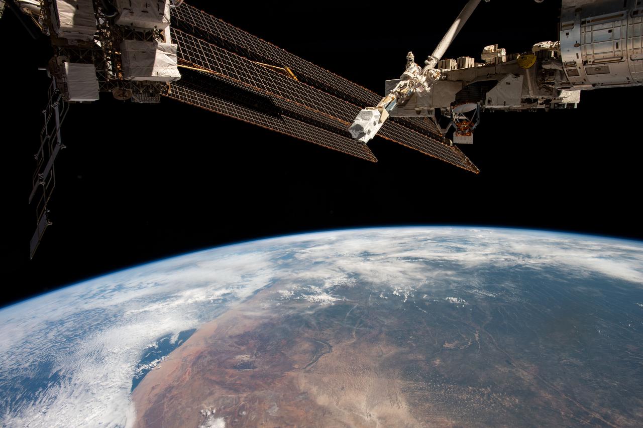
iss068e026073 (Dec. 2, 2022) --- A pair of the International Space Station's solar arrays, a roll-out solar array, and a small satellite orbital deployer attached to the Japanese robotic arm seemingly criss-cross each other in this photograph as the orbiting lab soared 265 miles above the African nation of Namibia. At far right, is a portion of the Kibo laboratory module with its exposed facility that houses space station hardware and external research experiments.
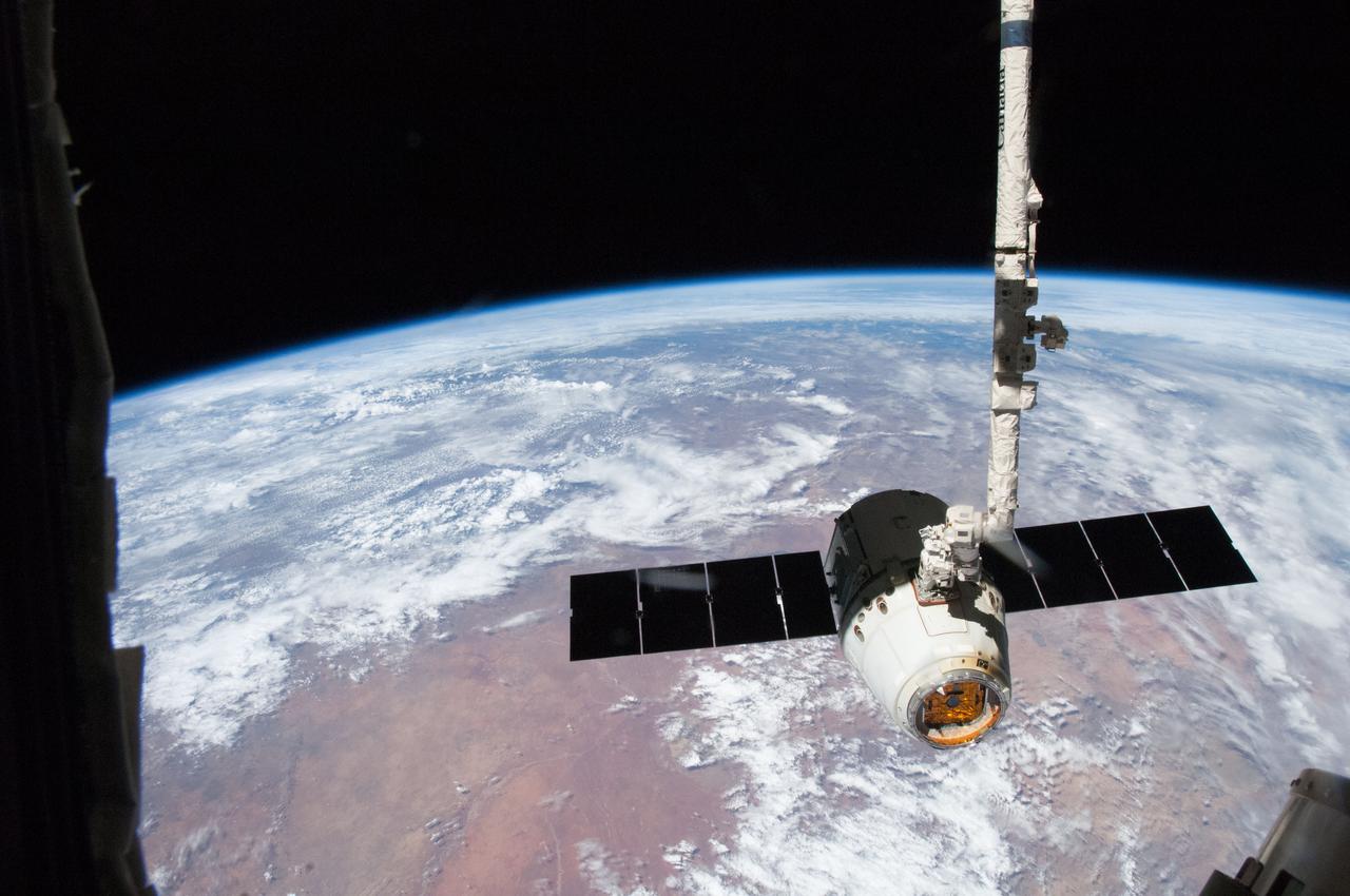
ISS035-E-008904 (26 March 2013) ---This image is one of a series of still photos documenting the process to release the SpaceX Dragon-2 spacecraft from the International Space Station on March 26. The spacecraft, filled with experiments and old supplies, can be seen in the grasp of the Space Station Remote Manipulator System’s robot arm or CanadArm2 after it was undocked from the orbital outpost. Forming the backdrop for this image is western Namibia. The Dragon was scheduled to make a landing in the Pacific Ocean, off the coast of California later in the day.
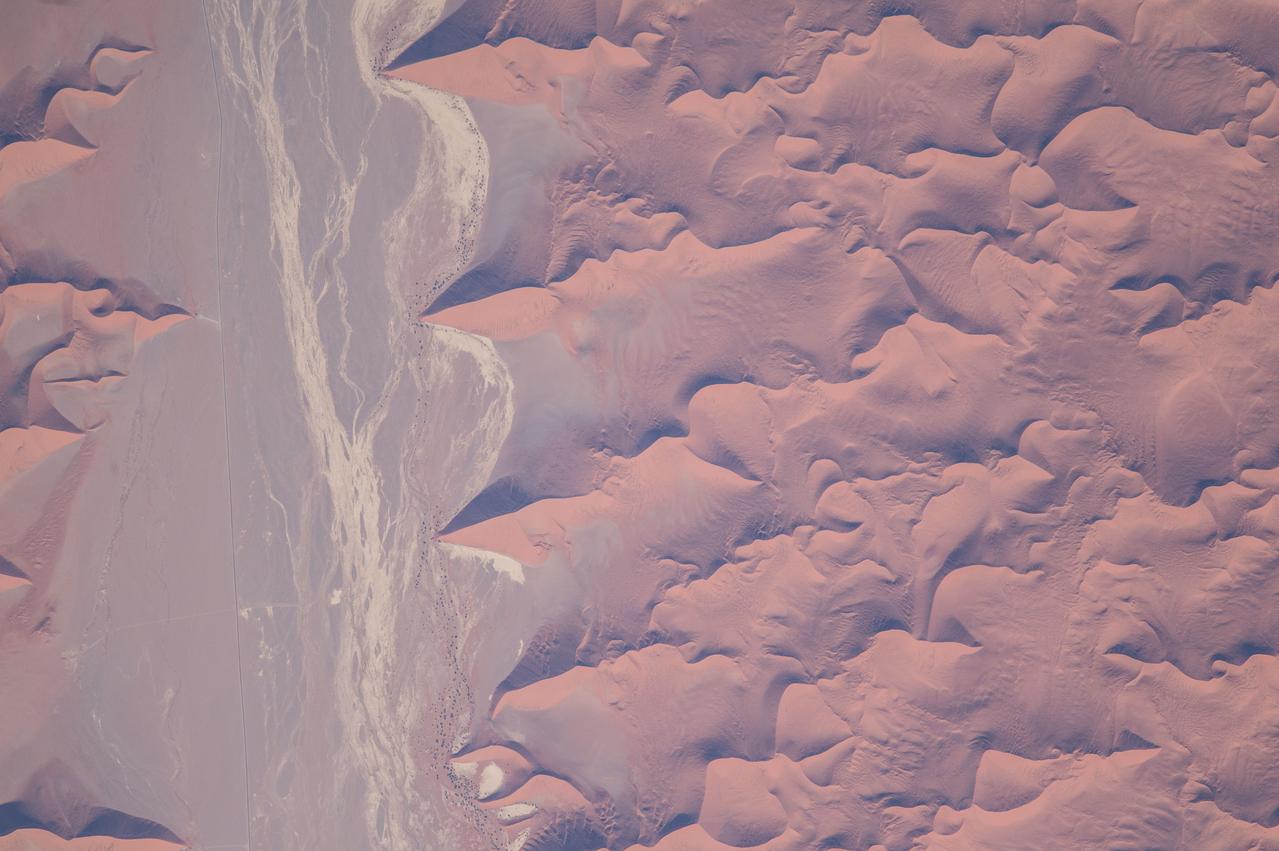
ISS047e022280 (03/26/2016) --- This interesting Earth observation image from the International Space Station seems an abstract painting but is really the outskirts of the Namib Desert in southwest Africa. One of the oldest and largest deserts in the world, the Namib stretches inland from the Atlantic Ocean, covering large swathes of Namibia and parts of Angola and South Africa. This arid hotspot surprisingly supports a diverse number of plants and animals, some of which are found nowhere else in the world.
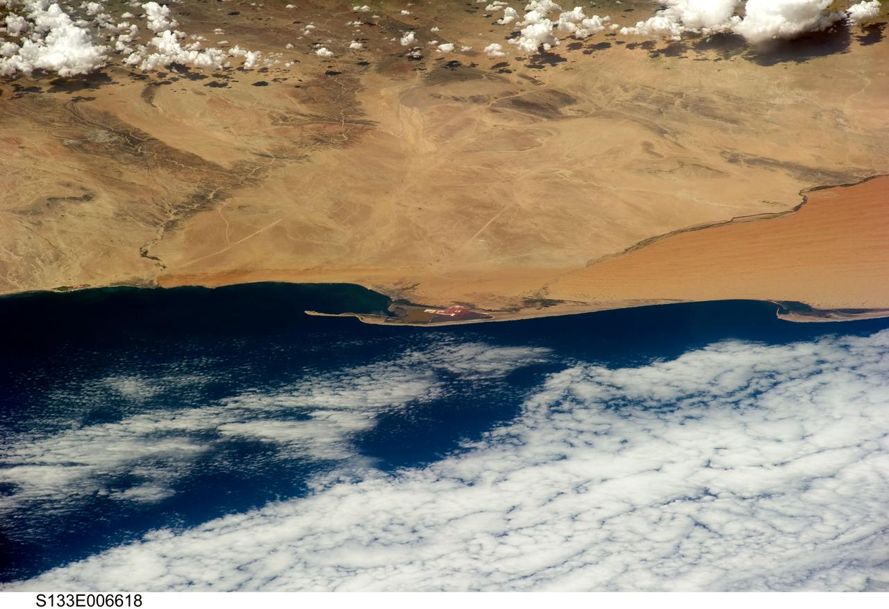
S133-E-006618 (26 Feb. 2011) --- An oblique view of Walvis Bay, Namibia, in the South Atlantic Ocean, was provided by an STS-133 crew member onboard Discovery using a digital still camera. Approximate center coordinates of the area pictured are 23.0 degrees south latitude and 14.5 degrees east longitude. Seen also are parts of the Namibian Desert, Pelican Point (sand spit), and Kuiseb River on the edge of the dune field. Photo credit: NASA or National Aeronautics and Space Administration
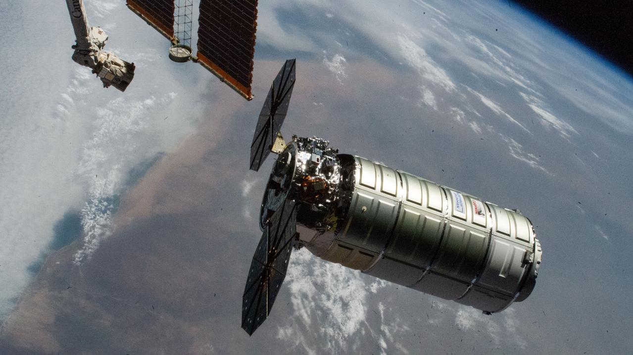
iss073e0703407 (Sept. 18, 2025) --- Northrop Grumman's Cygnus XL cargo craft, carrying over 11,000 pounds of new science and supplies for the Expedition 73 crew, is pictiured moments before its capture with the International Space Station's Canadarm2 robotic arm. Both spacecraft were orbiting 257 miles above Namibia. Cygnus XL is Northrop Grumman's expanded version of its previous Cygnus cargo craft increasing its payload capacity and pressurized cargo volume.
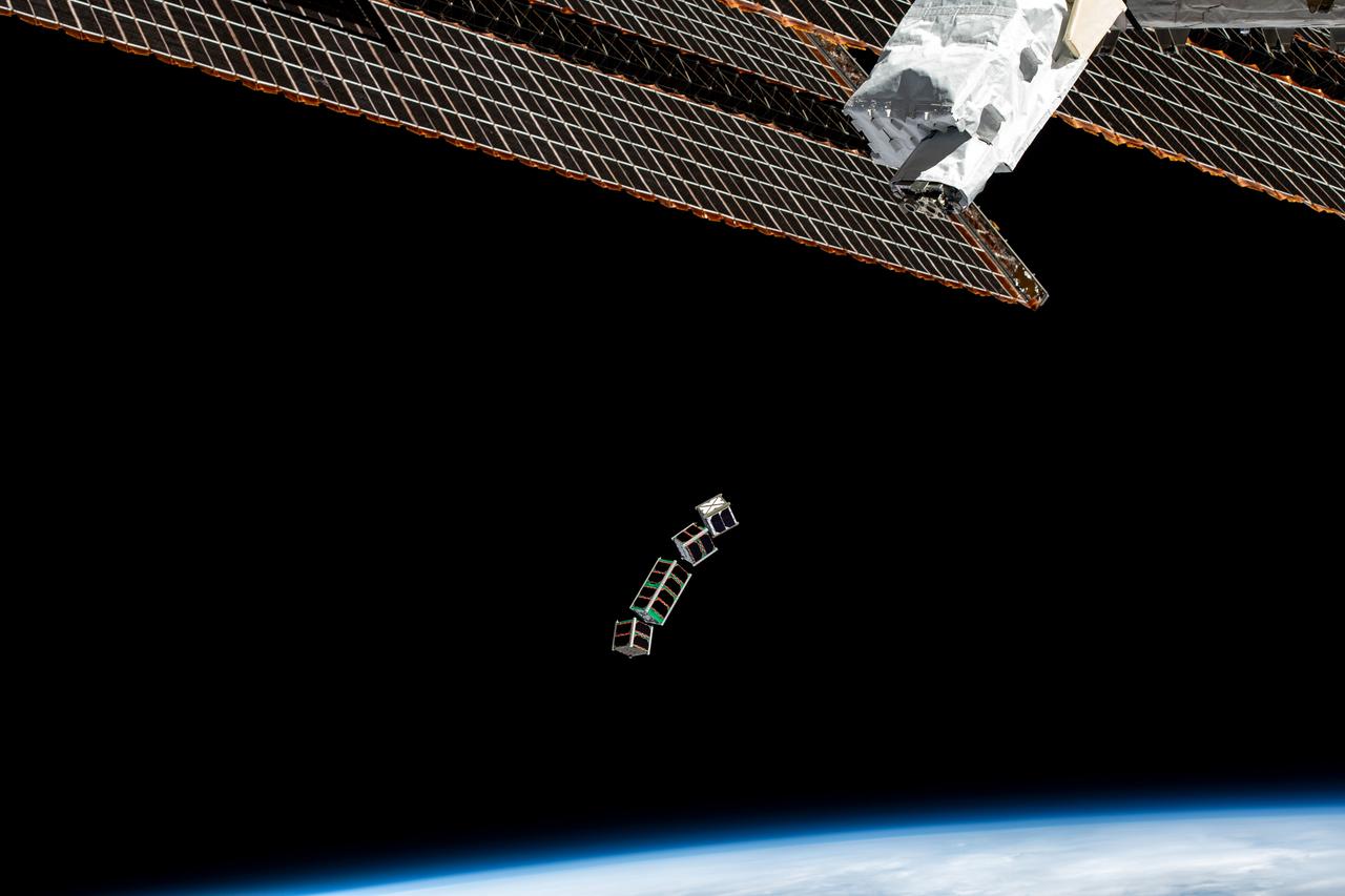
iss068e025794 (Dec. 2, 2022) --- A set of four CubeSats are photographed after being released from a small satellite deployer on the outside of the Kibo laboratory module as the International Space Station orbited 264 miles above Namibia on the African continent. The four tiny satellites, two from Japan, and one each from Uganda and Zimbabwe, were deployed into Earth orbit for a variety scientific studies and technology demonstrations.
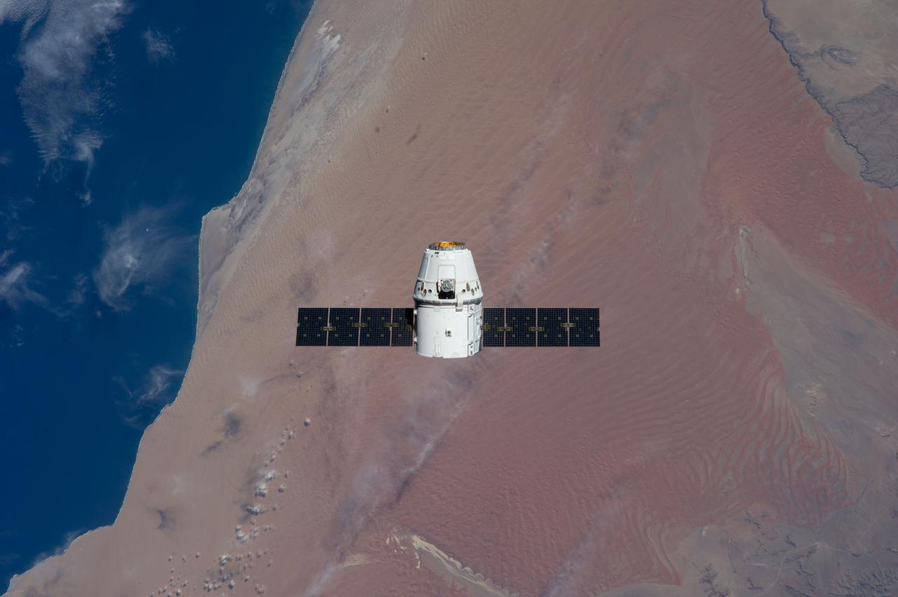
ISS031-E-070943 (25 May 2012) --- Backdropped against the Namib Desert on the Atlantic coast of Namibia, the SpaceX Dragon commercial cargo craft approaches the International Space Station on May 25, 2012 for grapple and berthing. Expedition 31 Flight Engineers Don Pettit and Andre Kuipers grappled Dragon at 9:56 a.m. (EDT) with the Canadarm2 robotic arm and used the robotic arm to berth Dragon to the Earth-facing side of the station's Harmony node at 12:02 p.m.
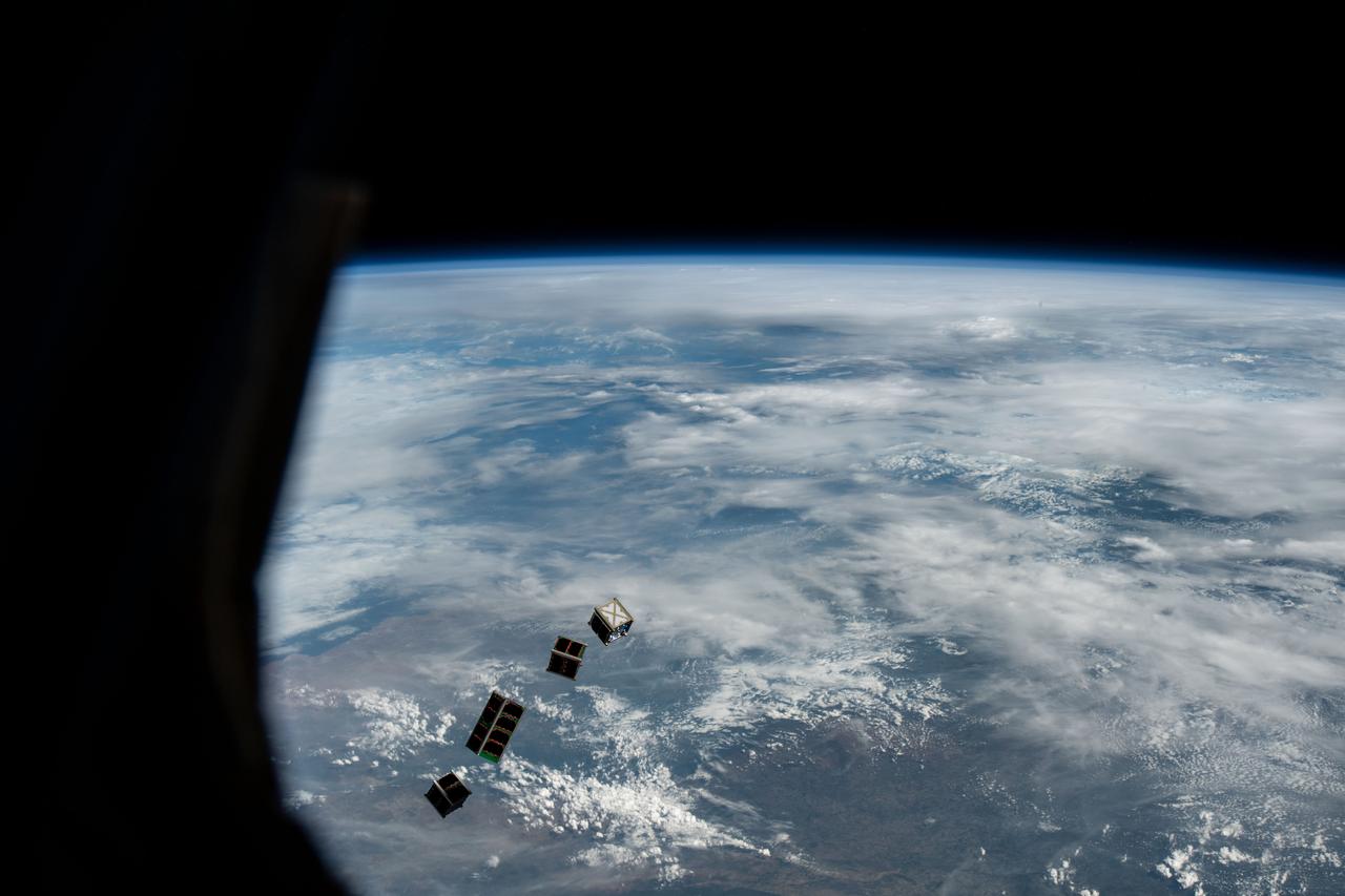
iss068e025819 (Dec. 2, 2022) --- A set of four CubeSats are photographed after being released from a small satellite deployer on the outside of the Kibo laboratory module as the International Space Station orbited 264 miles above Namibia on the African continent. The four tiny satellites, two from Japan, and one each from Uganda and Zimbabwe, were deployed into Earth orbit for a variety scientific studies and technology demonstrations.

STS073-736-018 (29 October 1995) --- The Kalahari Desert in Namibia, Africa, forms the backdrop for this scene. Five NASA astronauts and two guest researchers spent almost 16 days of research in this science module affixed in the payload bay of the Space Shuttle Columbia in Earth-orbit. The tunnel in bottom foreground served as the busy passageway for the seven crew members, who split their forces into two shifts. The Nosob and Olifants Rivers can be delineated in the terrain below.
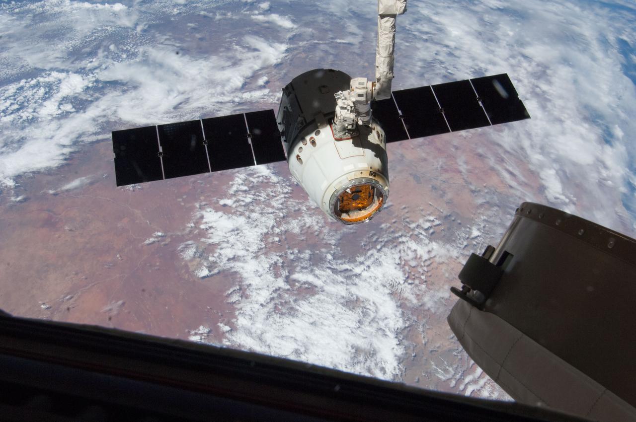
ISS035-E-010128 (26 March 2013) --- Backdropped over part of Namibia, this image is one of a series of still photos documenting the process to release the SpaceX Dragon-2 spacecraft from the International Space Station on March 26. The spacecraft, filled with experiments and old supplies, can be seen in the grasp of the Space Station Remote Manipulator System’s robot arm or CanadArm2 after it was undocked from the orbital outpost. The Dragon was scheduled to make a landing in the Pacific Ocean, off the coast of California, later in the day.
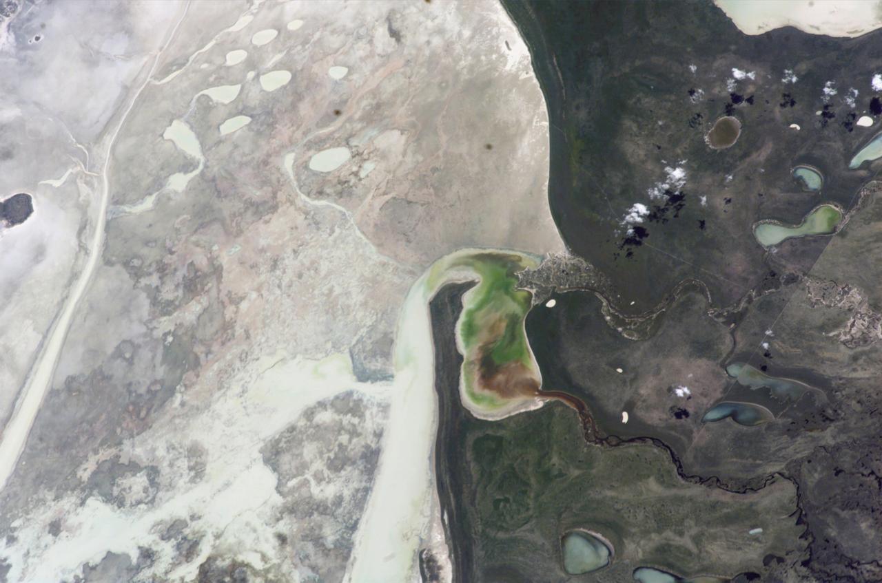
ISS012-E-23057 (2 March 2006) --- Ekuma River and Etosha Pan, Namibia are featured in this close-up image photographed by an Expedition 12 crewmember on the International Space Station. Etosha Pan, northern Namibia, is a large (120 kilometers or 75 mile long) dry lakebed in the Kalahari Desert. The lake and surrounds are protected today as one of Namibia’s largest wildlife parks. Herds of elephant occupy the dense mopane woodland on the south side of the lake. Mopane trees are common throughout south-central Africa, and host the mopane worm (the larval form of the Mopane Emperor Moth)–an important source of protein for rural communities. According to scientists, about 16,000 years ago, when ice sheets were melting across Northern Hemisphere land masses, a wet climate phase in southern Africa filled Etosha Lake. Today, Etosha Pan is seldom seen with even a thin sheet of water covering the salt pan. This view shows the point where the Ekuma River flows into the salt lake. The Ekuma River is almost never seen with water, but in early 2006 rainfall twice the average amount in the river’s catchment generated flow. Greens and browns show vegetation and algae growing in different depths of water where the river enters the dry lake. Typically, little river water or sediment reaches the dry lake because water seeps into the riverbed along its 250 kilometers (155 miles) course, reducing discharge along the way. In this image, there was enough surface flow to reach the Pan, but too little water reached the mouth of the river to flow beyond the inlet bay. The unusual levels of precipitation also filled several small, usually dry lakes to the north of Etosha Pan.

ISS035-E-008901 (26 March 2013) ---This image is one of a series of still photos documenting the process to release the SpaceX Dragon-2 spacecraft from the International Space Station on March 26. The spacecraft, filled with experiments and old supplies, can be seen in the grasp of the Space Station Remote Manipulator System’s robot arm or CanadArm2 after it was undocked from the orbital outpost. Forming the backdrop for this image is western Namibia, as the viewer's perspective is generally south-southeastward with the South Atlantic on the right. The Dragon was scheduled to make a landing in the Pacific Ocean, off the coast of California later in the day.
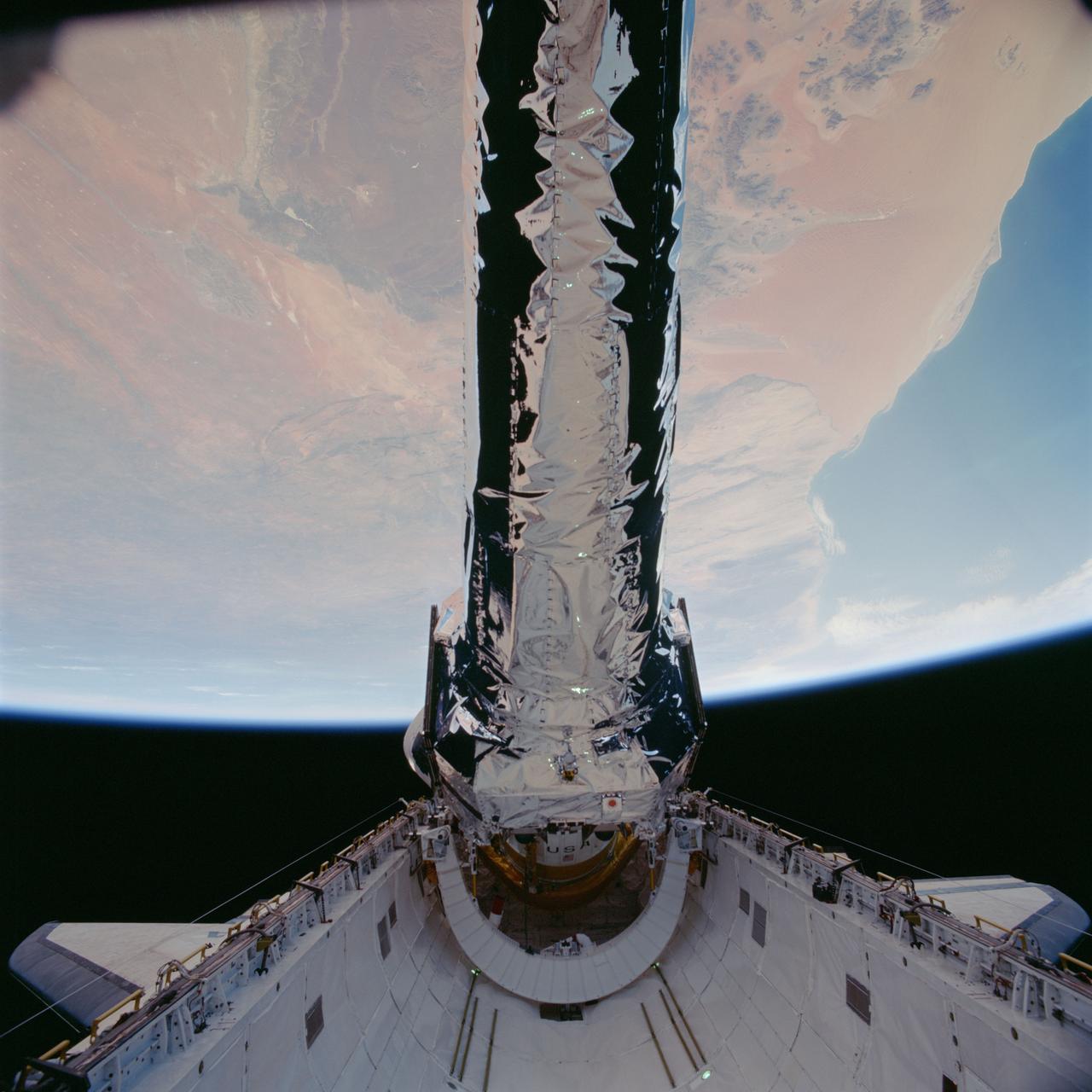
STS093-702-048 (23 July 1999)--- This 70mm frame shows the Chandra X-Ray observatory, backdropped against a desert area in Namibia, just before its release from Columbia's payload bay. The primary duty of the STS-93 crew was to deploy the world's most powerful X-Ray telescope. It was also one of the first actions of the astronauts, occurring just a few hours following the shuttle's arrival in Earth orbit. This scene is one of a series of still photos recorded by the crew before and during the deployment of the 50,162 pound observatory.
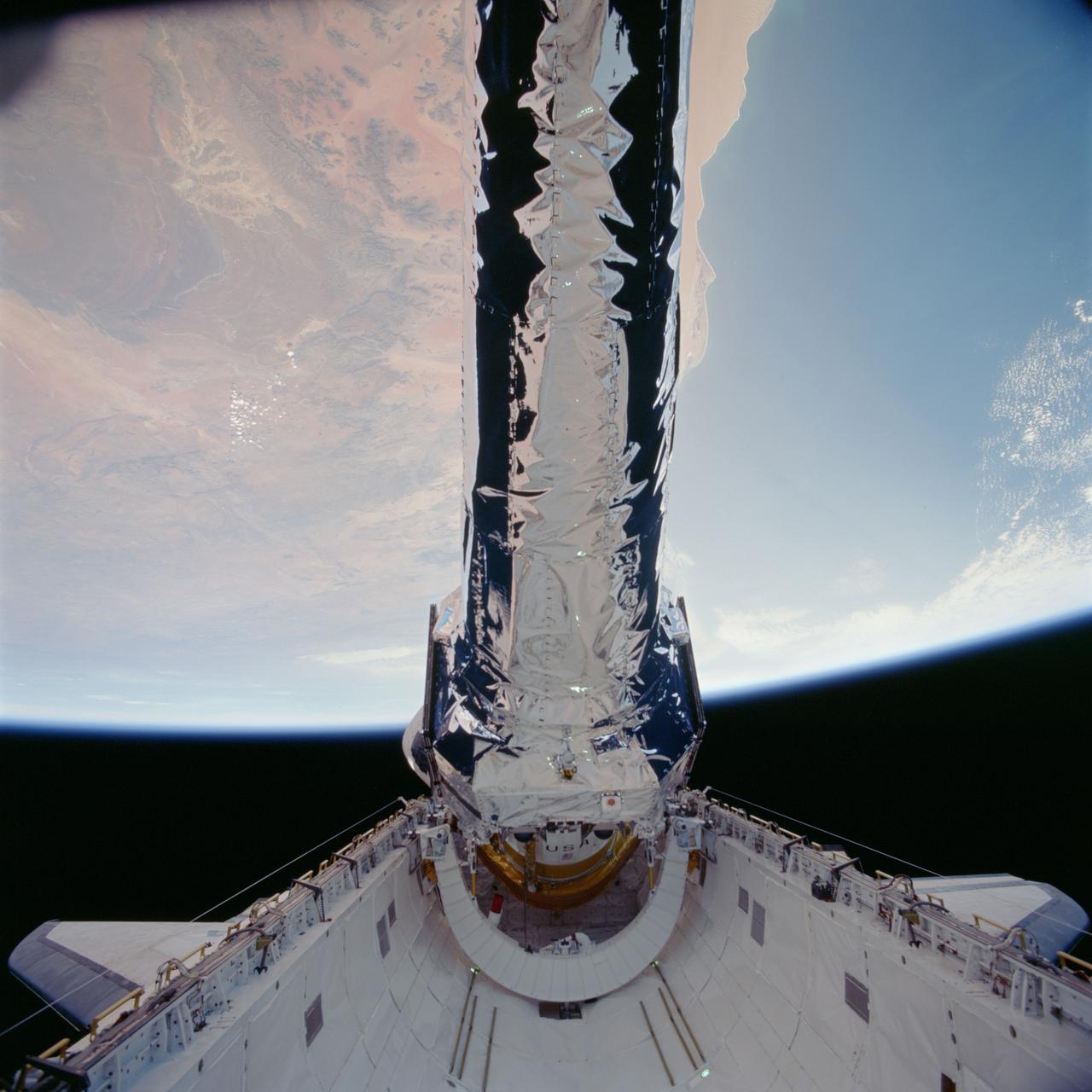
STS093-702-041 (23 July 1999)--- This 70mm frame shows the Chandra X-Ray observatory, backdropped against a desert area in Namibia, just before its release from Columbia's payload bay. The primary duty of the STS-93 crew was to deploy the world's most powerful X-Ray telescope. It was also one of the first actions of the astronauts, occurring just a few hours following the shuttle's arrival in Earth orbit. This scene is one of a series of still photos recorded by the crew before and during the deployment of the 50,162 pound observatory.
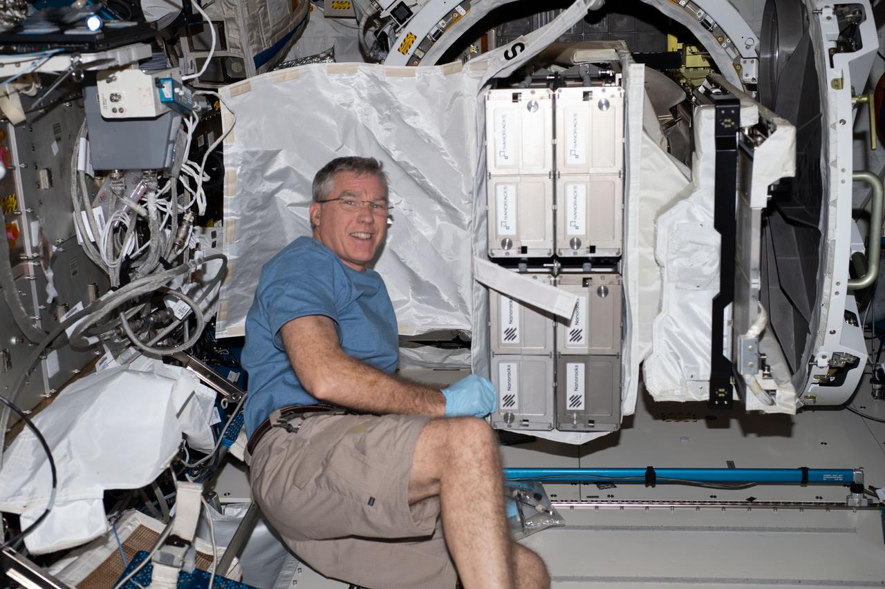
iss069e025742 (June 28, 2023) --- NASA astronaut and Expedition 69 Flight Engineer Stephen Bowen with CubeSats to be deployed from the space station for the 26th NanoRacks CubeSat Deployer (NRCSD-26) mission. The satellites included Nanoracks-RADSAT-SK, which tests a radiation detection system; Nanoracks-SC-ODIN that captures data on dust in storms in Argentina and Namibia; Nanoracks-ESSENCE, to monitor solar storms, arctic ice, permafrost thaw, and forests in the Canadian Arctic region; Nanoracks-Iris, an observation of space weathering of geological samples; and Nanoracks-Ukpik-1, which uses a VR camera to capture 360-degree images and video of Northern Canada.
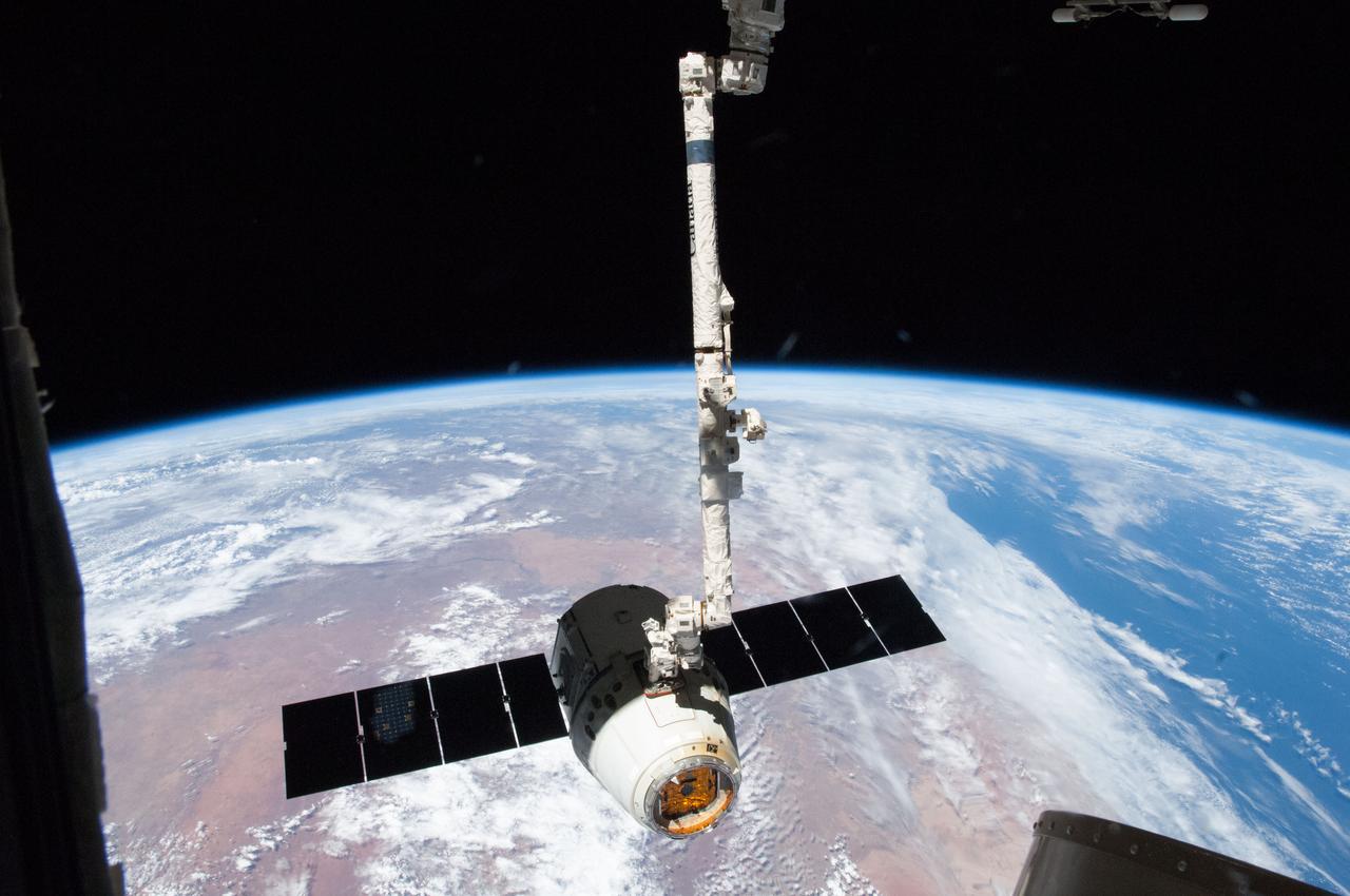
ISS035-E-008900 (26 March 2013) ---This image is one of a series of still photos documenting the process to release the SpaceX Dragon-2 spacecraft from the International Space Station on March 26. The spacecraft, filled with experiments and old supplies, can be seen in the grasp of the Space Station Remote Manipulator System’s robot arm or CanadArm2 after it was undocked from the orbital outpost. Forming the backdrop for this image is western Namibia, as the viewer's perspective is generally south-southeastward with the South Atlantic on the right. The Dragon was scheduled to make a landing in the Pacific Ocean, off the coast of California, later in the day.
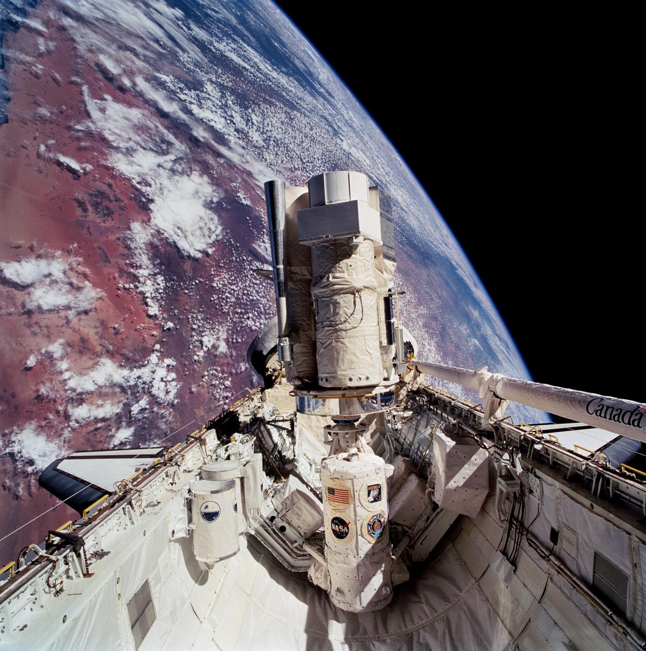
STS067-713-072 (2-18 March 1995) --- This 70mm cargo bay scene, backdropped against a desert area of Namibia, typifies the view that daily greeted the Astro-2 crew members during their almost 17-days aboard the Space Shuttle Endeavour. Positioned on the Spacelab pallet amidst other hardware, the Astro-2 payload is in its operational mode. Visible here are the Instrument Pointing System (IPS), Hopkins Ultraviolet Telescope (HUT), Star Tracker (ST), Ultraviolet Imaging Telescope (UIT), Wisconsin Ultraviolet Photo-Polarimeter Experiment (WUPPE), and Integrated Radiator System (IRS). At this angle, the Optical Sensor Package (OPS) is not seen. The Igloo, which supports the package of experiments, is in center foreground. Two Get-Away Special (GAS) canisters are in lower left foreground. The Extended Duration Orbiter (EDO) pallet, located aft of the cargo bay, is obscured by the Astro-2 payload. The Endeavour was 190 nautical miles above Earth.
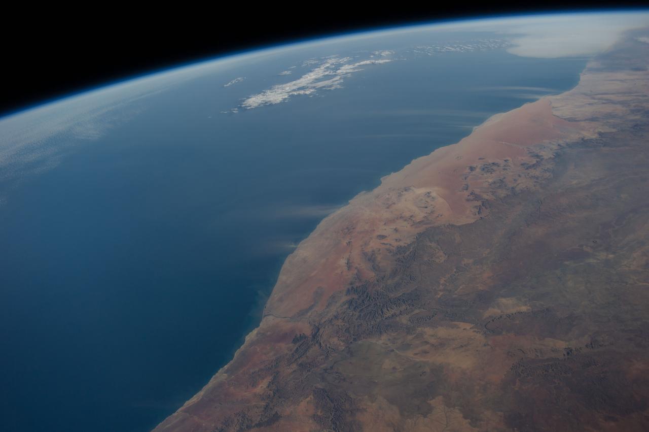
ISS040-E-016513 (21 June 2014) --- Dust plumes and the Namib Desert coast are featured in this image photographed by an Expedition 40 crew member on the International Space Station. Strong, hot winds known as “berg” (mountain) winds are lofting plumes of dust directly out into the Atlantic Ocean in this panoramic image. The southern African equivalent of Santa Ana winds in California, berg winds blow on a few occasions in fall and winter, off all coasts of southern Africa. Other images from the space station have captured these dust plumes. Namibia’s great Sand Sea appears here as a reddish zone along part of the coast (center). The Sand Sea is more than 350 kilometers long, giving a sense of the length of the visible dust plumes. A light-toned sediment plume enters the sea at the mouth of the Orange River (lower left), southern Africa’s largest river.
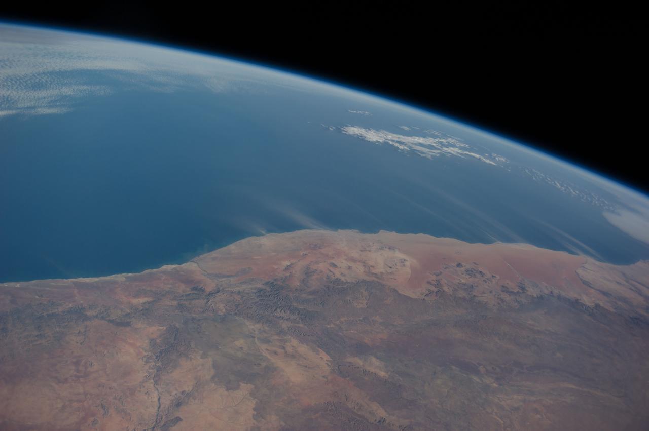
ISS040-E-016514 (21 June 2014) --- Dust plumes and the Namib Desert coast are featured in this image photographed by an Expedition 40 crew member on the International Space Station. Strong, hot winds known as “berg” (mountain) winds are lofting plumes of dust directly out into the Atlantic Ocean in this panoramic image. The southern African equivalent of Santa Ana winds in California, berg winds blow on a few occasions in fall and winter, off all coasts of southern Africa. Other images from the space station have captured these dust plumes. Namibia’s great Sand Sea appears here as a reddish zone along part of the coast (center). The Sand Sea is more than 350 kilometers long, giving a sense of the length of the visible dust plumes. A light-toned sediment plume enters the sea at the mouth of the Orange River (lower left), southern Africa’s largest river.
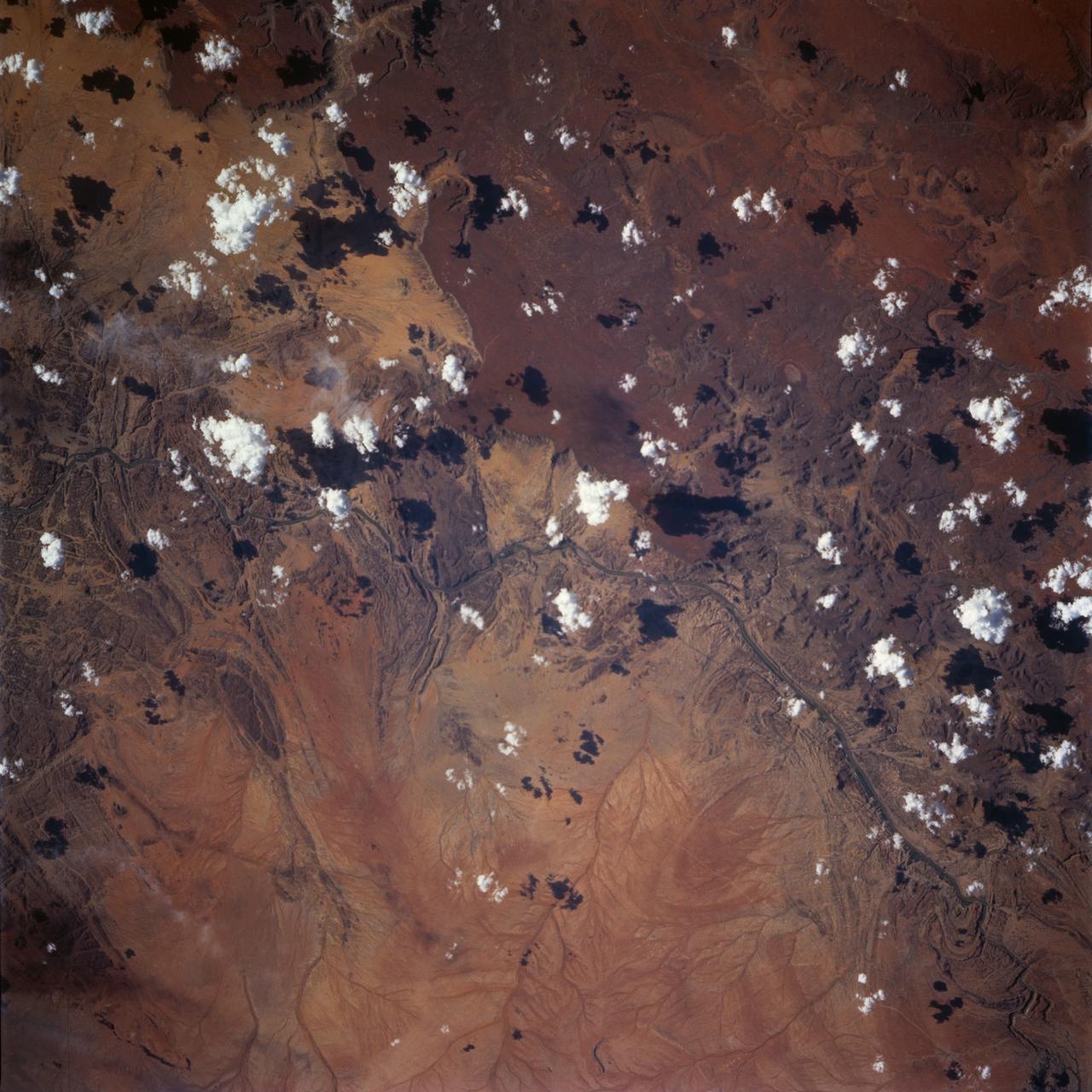
STS072-738-036 (11-20 Jan. 1996) --- The astronauts used a 70mm handheld camera to expose this frame of the west-flowing Orange River, which constitutes the international boundary between Namibia and the Republic of South Africa. The railroad and highway connecting the two countries is seen as a ribbon crossing the corner of the view. The broad color difference between strong browns/reds in the northern half of the view and lighter yellows in the southern corresponds to two land surfaces. The darker is a higher, flat land surface developed on horizontal Nama Sandstone’s, with rock surfaces widely coated with a dark manganese stain, typical of desert regions. This region is known as Namaqualand and borders the Namib Desert. Where rivers have cut down into this surface, the lighter underlying rock and soil colors show up.
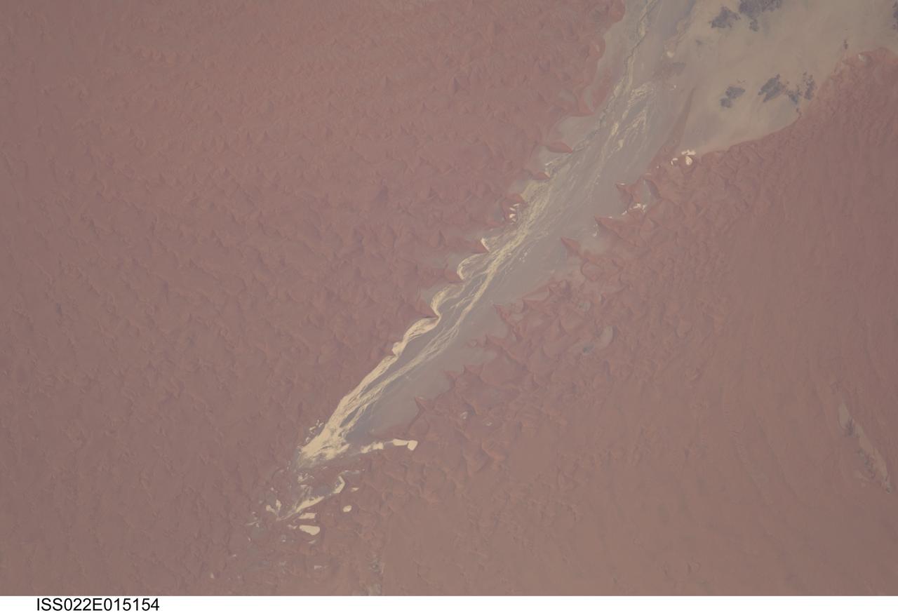
ISS022-E-015154 (24 Dec. 2009) --- Tsauchab River and Sossus Vlei Lakebed, Namibia are featured in this image photographed by an Expedition 22 crew member on the International Space Station. Taken on Christmas Eve of 2009, this image shows the lower 45 kilometers of the Tsauchab River, a famous landmark for Namibians, tourists, and for orbiting astronauts. The Tsauchab River bed is seen jutting into the sea of red dunes near Namibia?s hyper arid coast, where it ends in a series of light-toned silty muds of the dry lake floor, known locally as Sossus Vlei (small lake). Because of the present arid climate, few people have ever seen the Tsauchab River with flowing water or a lake in Sossus Vlei. In times past, however, the Tsauchab appears to have reached the Atlantic coast, another 55 kilometers further west. Like several other rivers of the coastal Namib Desert, the Tsauchab brings sediment down from the hinterland to the coastal lowland. According the scientists, this sediment is then blown from the river beds, and over probably tens of millions of years, has accumulated as the red dunes of the impressive Namib Sand Sea. In this view the sand is heaped up in the form of numerous ?star dunes,? each characterized by long arms extending in several directions. These compare with the better-known barchan dunes (not present in image) that display two horns pointing downwind, which form in areas where winds generally blow from one direction only. By contrast, star dunes are apparently generated in a variable wind regime. In this part of the Sand Sea, winds are mainly from the south, but easterly winds, channeled along the Tsauchab valley, provide another component. And warm dry winter winds?similar to the Santa Ana winds of California, which can cause the hottest annual temperatures to occur briefly on winter days?blow from the northeast. These northeasterly winds are likely responsible for the regular dune arms that point into the valley from both sides. These large dunes facing the river valley are promoted as the highest dunes in the world. Although continuous dune slopes allow hikers to gain more than 300 meters of altitude from the river bottom, this could be misleading since the main base of the dunes lies on a terrace 180 meters above the river.
![On June 26, 2016, the Moderate Resolution Imaging Spectroradiometer (MODIS) on NASA’s Terra satellite acquired this natural-color image of cloud gravity waves off the coast of Angola and Namibia. “I [regularly] look at this area on Worldview because you quite often have these gravity waves,” said Bastiaan Van Diedenhoven, a researcher for Columbia University and NASA's Goddard Institute for Space Studies interested in cloud formations. “On this day, there was so much going on—so many different waves from different directions—that they really started interfering.” A distinctive criss-cross pattern formed in unbroken stretches hundreds of kilometers long. Similar to a boat’s wake, which forms as the water is pushed upward by the boat and pulled downward again by gravity, these clouds are formed by the rise and fall of colliding air columns. Off of west Africa, dry air coming off the Namib desert—after being cooled by the night—moves out under the balmy, moist air over the ocean and bumps it upwards. As the humid air rises to a higher altitude, the moisture condenses into droplets, forming clouds. Gravity rolls these newly formed clouds into a wave-like shape. When moist air goes up, it cools, and then gravity pushes it down again. As it plummets toward the earth, the moist air is pushed up again by the dry air. Repeated again and again, this process creates gravity waves. Clouds occur at the upward wave motions, while they evaporate at the downward motions. Such waves will often propagate in the morning and early afternoon, said Van Diedenhoven. During the course of the day, the clouds move out to sea and stretch out, as the dry air flowing off the land pushes the moist ocean air westward. NASA Earth Observatory image by Jesse Allen, using data from the Land Atmosphere Near real-time Capability for EOS (LANCE). via @NASAEarth <a href="http://go.nasa.gov/29Btxcy" rel="nofollow">go.nasa.gov/29Btxcy</a> <b><a href="http://go.nasa.gov/29BtHR6" rel="nofollow">NASA image use policy.</a></b> <b><a href="http://go.nasa.gov/29BtDku" rel="nofollow">NASA Goddard Space Flight Center</a></b> enables NASA’s mission through four scientific endeavors: Earth Science, Heliophysics, Solar System Exploration, and Astrophysics. Goddard plays a leading role in NASA’s accomplishments by contributing compelling scientific knowledge to advance the Agency’s mission. <b>Follow us on <a href="http://go.nasa.gov/29BtVrn" rel="nofollow">Twitter</a></b> <b>Like us on <a href="http://go.nasa.gov/29BtygK" rel="nofollow">Facebook</a></b> <b>Find us on <a href="http://go.nasa.gov/29Bu0vu" rel="nofollow">Instagram</a></b>](https://images-assets.nasa.gov/image/GSFC_20171208_Archive_e000269/GSFC_20171208_Archive_e000269~medium.jpg)
On June 26, 2016, the Moderate Resolution Imaging Spectroradiometer (MODIS) on NASA’s Terra satellite acquired this natural-color image of cloud gravity waves off the coast of Angola and Namibia. “I [regularly] look at this area on Worldview because you quite often have these gravity waves,” said Bastiaan Van Diedenhoven, a researcher for Columbia University and NASA's Goddard Institute for Space Studies interested in cloud formations. “On this day, there was so much going on—so many different waves from different directions—that they really started interfering.” A distinctive criss-cross pattern formed in unbroken stretches hundreds of kilometers long. Similar to a boat’s wake, which forms as the water is pushed upward by the boat and pulled downward again by gravity, these clouds are formed by the rise and fall of colliding air columns. Off of west Africa, dry air coming off the Namib desert—after being cooled by the night—moves out under the balmy, moist air over the ocean and bumps it upwards. As the humid air rises to a higher altitude, the moisture condenses into droplets, forming clouds. Gravity rolls these newly formed clouds into a wave-like shape. When moist air goes up, it cools, and then gravity pushes it down again. As it plummets toward the earth, the moist air is pushed up again by the dry air. Repeated again and again, this process creates gravity waves. Clouds occur at the upward wave motions, while they evaporate at the downward motions. Such waves will often propagate in the morning and early afternoon, said Van Diedenhoven. During the course of the day, the clouds move out to sea and stretch out, as the dry air flowing off the land pushes the moist ocean air westward. NASA Earth Observatory image by Jesse Allen, using data from the Land Atmosphere Near real-time Capability for EOS (LANCE). via @NASAEarth <a href="http://go.nasa.gov/29Btxcy" rel="nofollow">go.nasa.gov/29Btxcy</a> <b><a href="http://go.nasa.gov/29BtHR6" rel="nofollow">NASA image use policy.</a></b> <b><a href="http://go.nasa.gov/29BtDku" rel="nofollow">NASA Goddard Space Flight Center</a></b> enables NASA’s mission through four scientific endeavors: Earth Science, Heliophysics, Solar System Exploration, and Astrophysics. Goddard plays a leading role in NASA’s accomplishments by contributing compelling scientific knowledge to advance the Agency’s mission. <b>Follow us on <a href="http://go.nasa.gov/29BtVrn" rel="nofollow">Twitter</a></b> <b>Like us on <a href="http://go.nasa.gov/29BtygK" rel="nofollow">Facebook</a></b> <b>Find us on <a href="http://go.nasa.gov/29Bu0vu" rel="nofollow">Instagram</a></b>