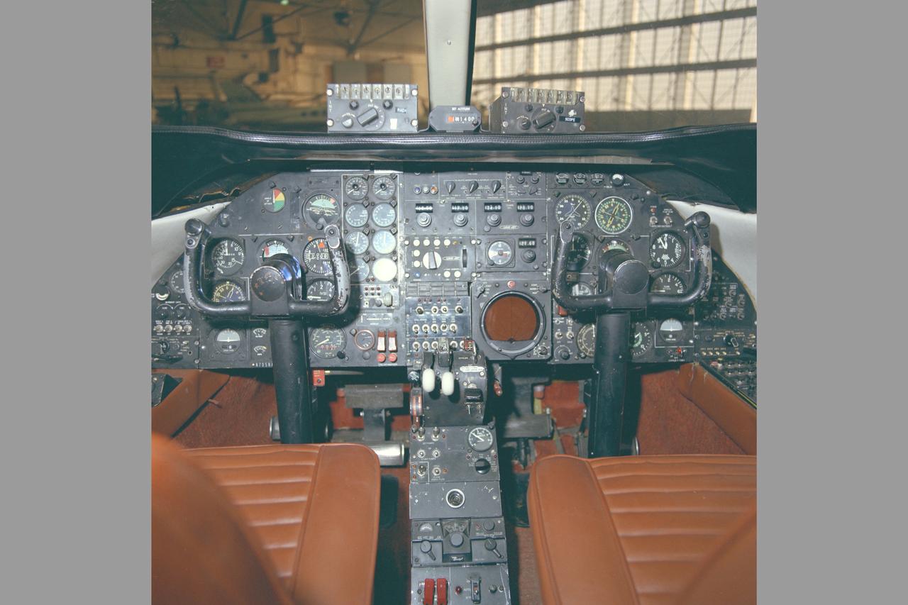
Lear Jet (NASA-705) cockpit

Lear Jet (NASA-705) in flight

Lear Jet (NASA-705) in flight
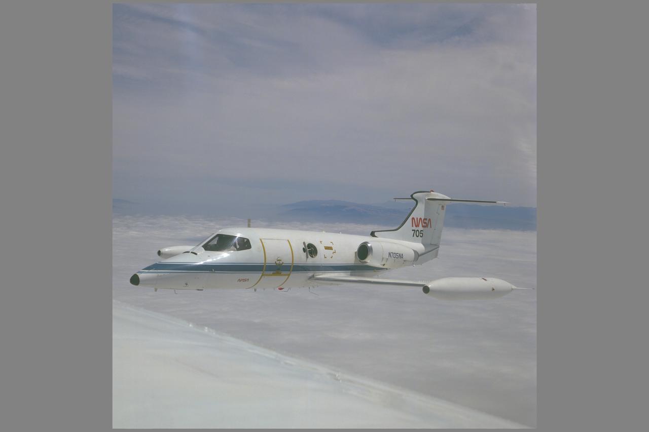
Lear Jet (NASA-705) in flight
Lear Jet (NASA-705) in flight
Lear Jet (NASA-705) in flight
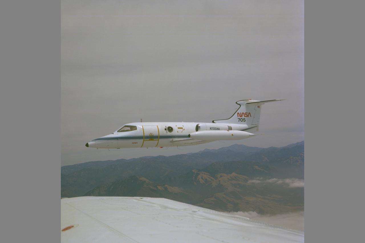
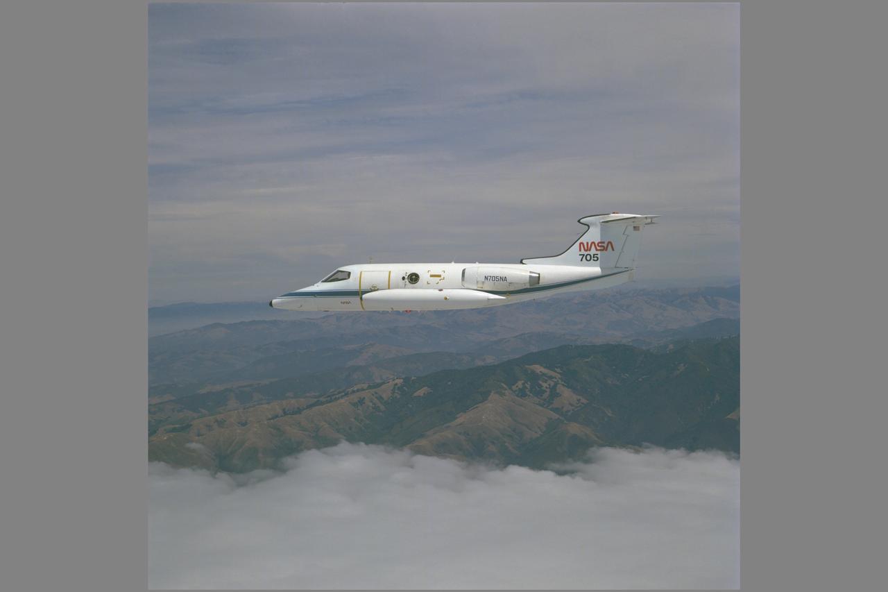
Lear Jet (NASA 705) in flight over Central CA.
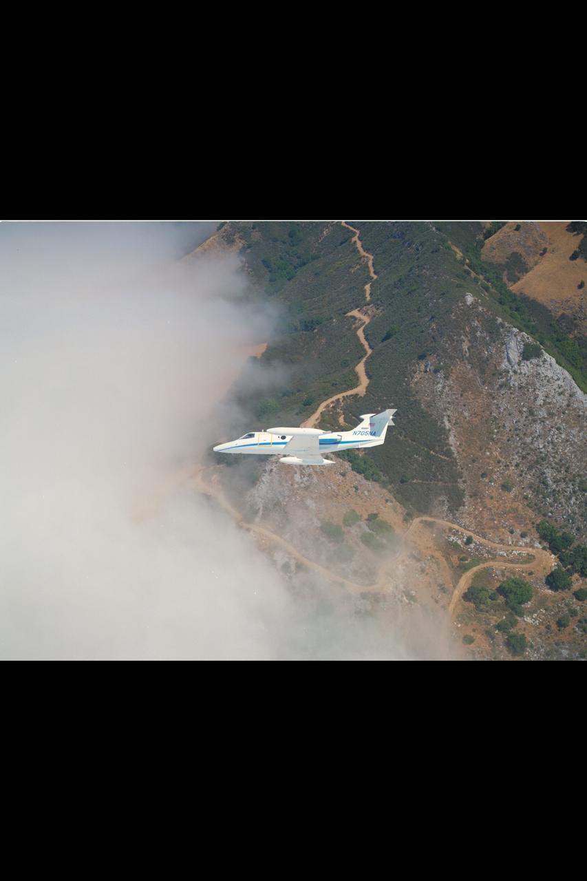
Lear Jet (NASA 705) in flight over Central CA.

Lear Jet (NASA 705) in flight over Central CA.

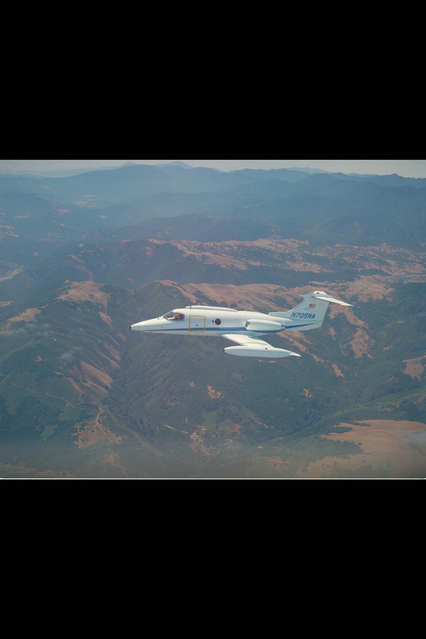
Lear Jet 24B (NASA-705) in flight along California coast is used primarily as a high altitude observation platform carrying a 12' telescope with a special hatch on the starboard side for upward viewing. The hatch has a maximum circular clear aperture of 37.6 cm and can contain a 30 cm aperture open-port gyro-stabilized telescope designed especially for infrared astronomical research.

Ames Science & Applications Aircraft composite: U-2, ER-2, Lear Jet (NASA-705), C-141, CV-990 & C-130

Aircraft Platform for Light Research Composite: Ames North U-2, ER-2, Learjet (NASA-705), C-141, CV-990 and C-130
The main map shows landforms near NASA Curiosity Mars rover as the rover second anniversary of landing on Mars nears. The gold traverse line ends at Curiosity position as of July 31, 2014 Sol 705.
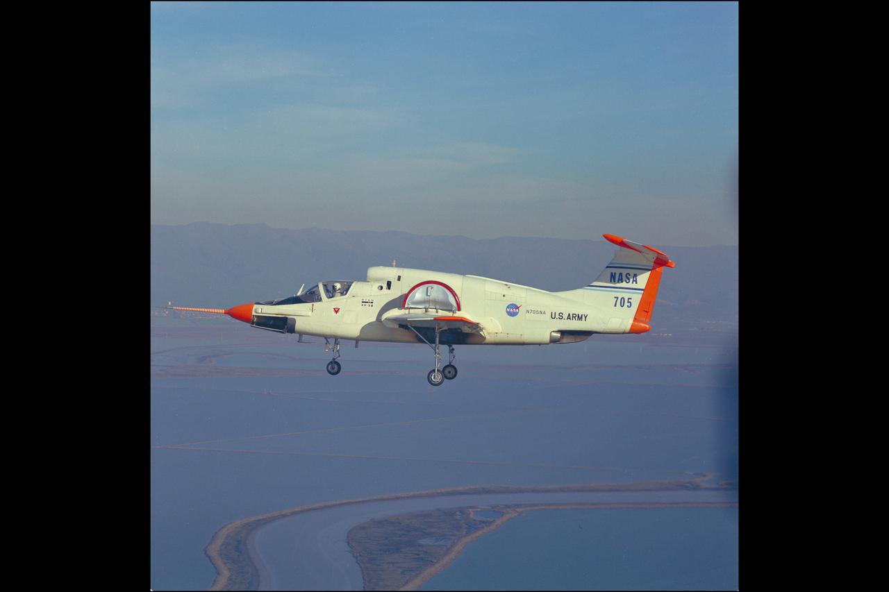
XV-5B (NASA 705) fan in wing airplane in flight
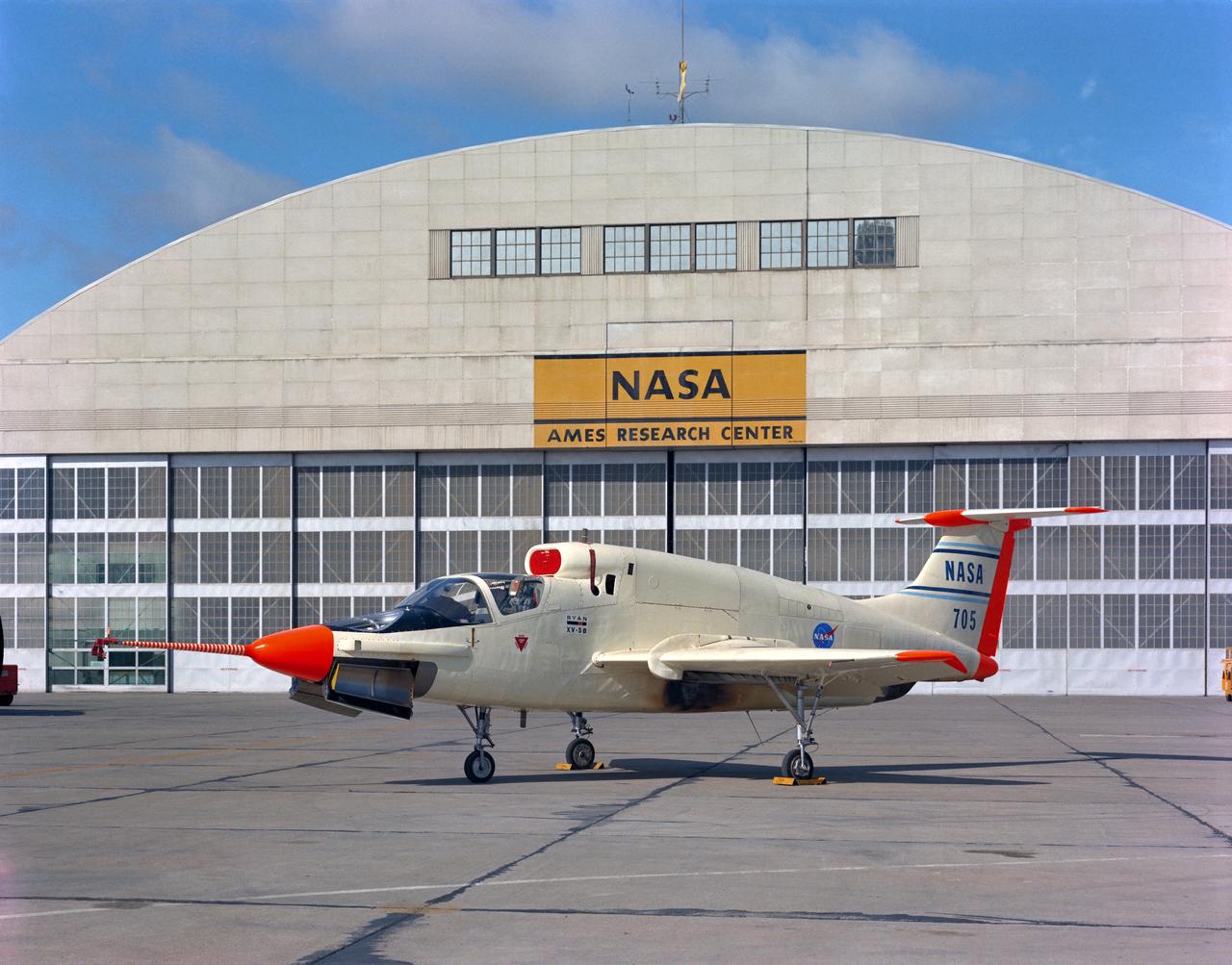
XV-5B (NASA-705) on Flight Line at Ames Research Center with hangar in the background.
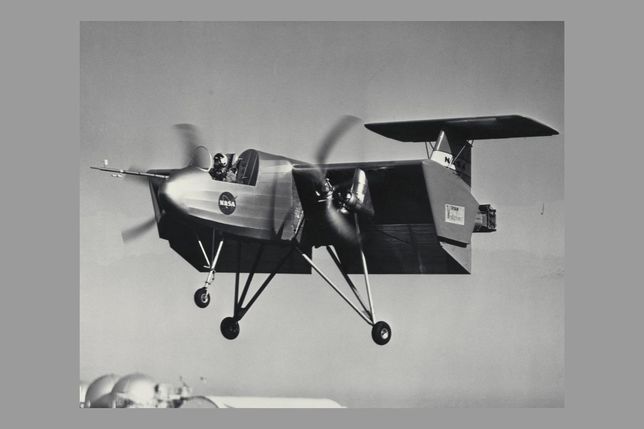
VZ-3RY (AF 56-6941, NASA 235, NASA 705) Vertiplane - Level flight 25 knots, flaps deflection 60 degrees. Flight investigation o f the flying qualities of a deflected slipstream VTOL aircraft. Note: Used in publication in Flight Research at Ames; 57 Years of Development and Validation of Aeronautical Technology NASA SP-1998-3300 fig. 115
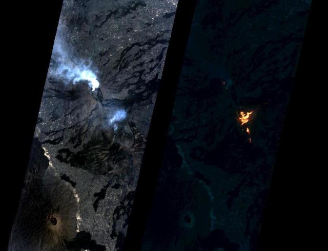
On Jan. 24, 2017, the Hyperion Imager on NASA's Earth Observing 1 (EO-1) spacecraft observed a new eruption at Erta'Ale volcano, Ethiopia, from an altitude of 438 miles (705 kilometers). Data were collected at a resolution of 98 feet (30 meters) per pixel at different visible and infrared wavelengths and were combined to create these images. A visible-wavelength image is on the left. An infrared image is shown on the right. The infrared image emphasizes the hottest areas and reveals a spectacular rift eruption, where a crack opens and lava gushes forth, fountaining into the air. The lava flows spread away from the crack. Erta'Ale is the location of a long-lived lava lake, and it remains to be seen if this survives this new eruption. The observation was scheduled via the Volcano Sensor Web, a network of sensors linked by artificial intelligence software to create an autonomous global monitoring program of satellite observations of volcanoes. The Volcano Sensor Web was alerted to this new activity by data from another spacecraft. http://photojournal.jpl.nasa.gov/catalog/PIA11239
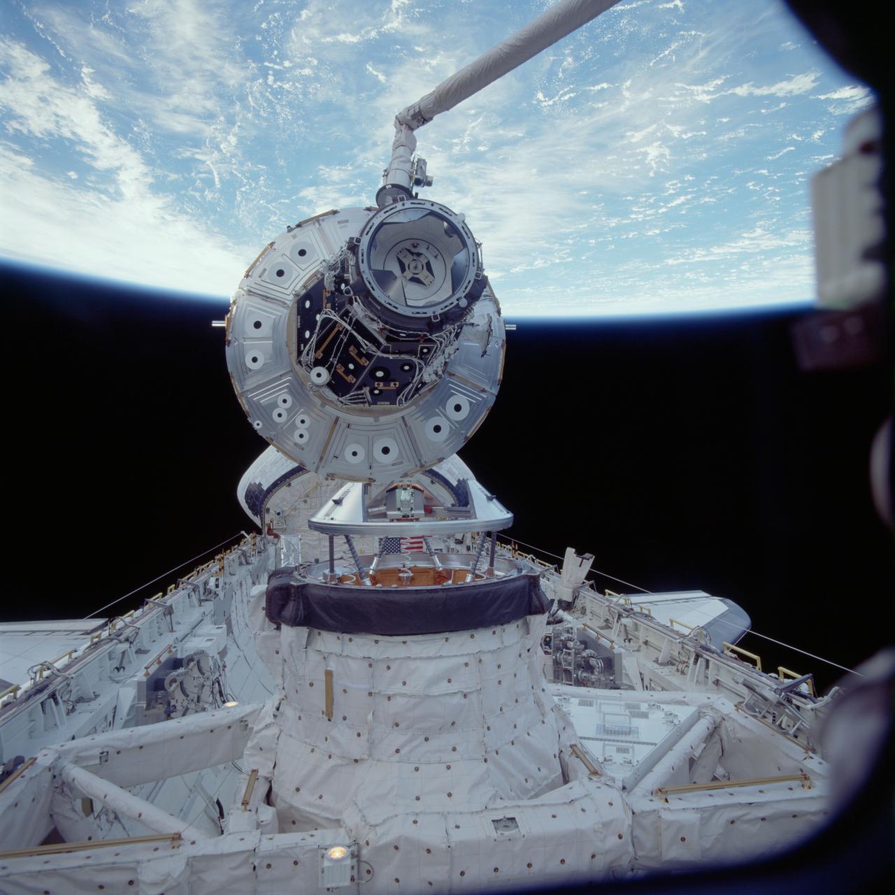
STS088-705-070 (5 Dec. 1998) --- One of the STS-88 astronauts aimed a 70mm camera through Endeavour's aft flight deck windows to record this Dec. 5 image of the Unity connecting module as it was being put into position to be mated to Endeavour's docking system in the cargo bay. The mating was the first link in a long chain of events that led up to the eventual deployment in Earth orbit of the connected Unity and Zarya modules later in the 11-day mission. Photo credit: NASA
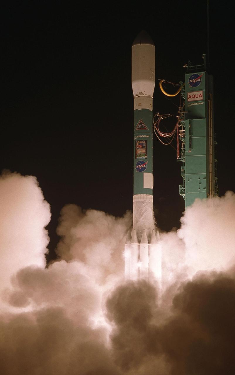
VANDENBERG AIR FORCE BASE, CALIF. -- NASA's latest Earth observing satellite, Aqua, successfully launches aboard a Delta II rocket at 2:55 a.m. PDT. Aqua is dedicated to advancing our understanding of Earth's water cycle and our environment. Launching the Aqua spacecraft marks a major milestone in support of NASA's mission to help us better understand and protect our planet. The Aqua spacecraft lifted off from the Western Test Range of Vandenberg Air Force Base, Calif. Spacecraft separation occurred at 3:54 a.m. PDT. inserting Aqua into a 438-mile (705-kilometer) orbit. [Photo by Bill Ingalls
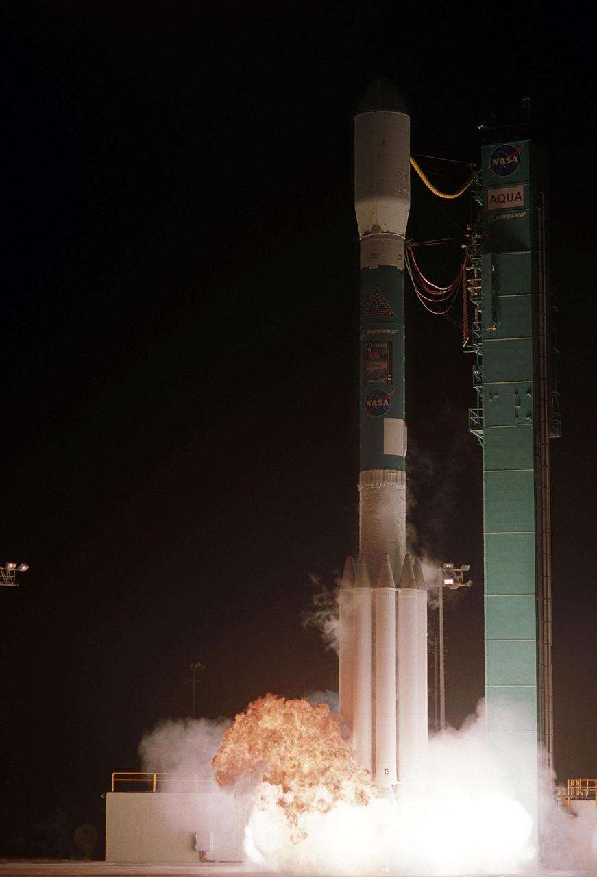
VANDENBERG AIR FORCE BASE, CALIF. -- NASA's latest Earth observing satellite, Aqua, lifts off from the Western Test Range of Vandenberg Air Force Base, Calif., aboard a Delta II rocket at 2:55 a.m. PDT. Aqua is dedicated to advancing our understanding of Earth's water cycle and our environment. Launching the Aqua spacecraft marks a major milestone in support of NASA's mission to help us better understand and protect our planet. Spacecraft separation occurred at 3:54 a.m. PDT, inserting Aqua into a 438-mile (705-kilometer) orbit. [Photo by Bill Ingalls
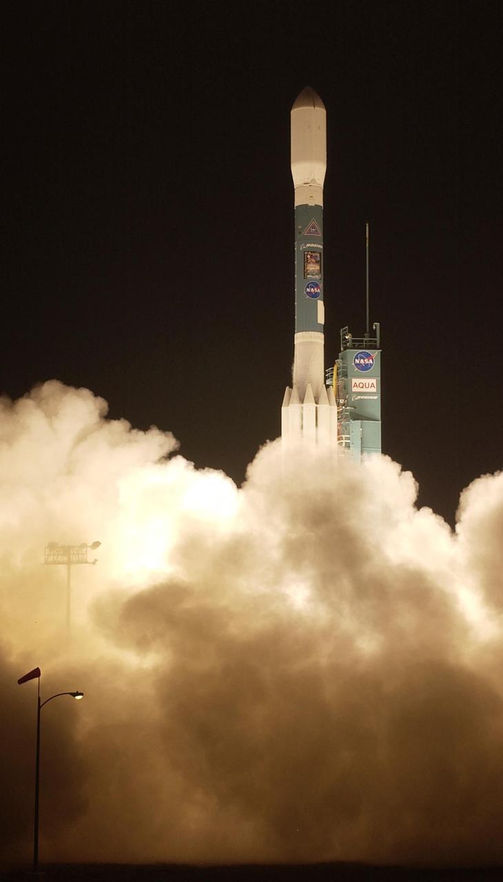
VANDENBERG AIR FORCE BASE, CALIF. -- NASA's latest Earth observing satellite, Aqua, successfully launches aboard a Delta II rocket at 2:55 a.m. PDT. Aqua is dedicated to advancing our understanding of Earth's water cycle and our environment. Launching the Aqua spacecraft marks a major milestone in support of NASA's mission to help us better understand and protect our planet. The Aqua spacecraft lifted off from the Western Test Range of Vandenberg Air Force Base, Calif. Spacecraft separation occurred at 3:54 a.m. PDT. inserting Aqua into a 438-mile (705-kilometer) orbit. [Photo by Bill Ingalls
Momotombo volcano, Nicaragua, began erupting on Dec. 1, 2015, after more than a century of inactivity. On Dec. 4, 2015, the Advanced Land Imager (ALI) on NASA's Earth Observing 1 (EO-1) spacecraft observed the new eruption. This image is created from infrared data, and shows the incandescent active vent at the summit of the volcano and lava flowing down the side of the volcano. These data are being examined by scientists to determine where lava will flow, allowing assessment of possible threats to local infrastructure. The EO-1 data were obtained at an altitude of 438 miles (705 kilometers) and at a resolution of 98 feet (30 meters) per pixel at different visible and infrared wavelengths. The ALI image is 23 miles (37 kilometers) wide. http://photojournal.jpl.nasa.gov/catalog/PIA20203

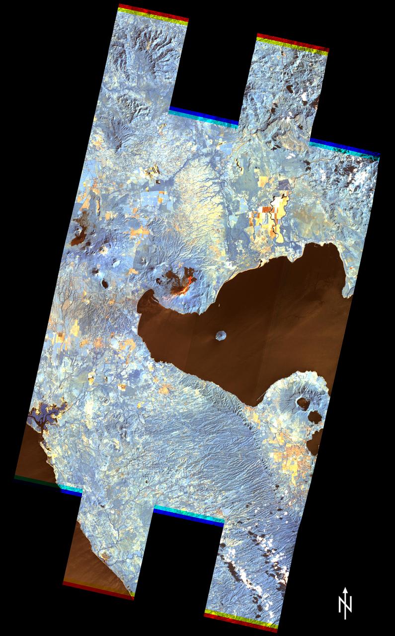
Anchorage, Alaska and Cook Inlet are seen in this 30 by 30 km (19 by 19 miles) sub-image, acquired May 12, 2000 by the Advanced Spaceborne Thermal Emission and Reflection Radiometer (ASTER). Orbiting at an altitude of 705 km (430 miles) on board NASA's Terra satellite, ASTER provides data at a resolution of 15 m (47 feet) and allows creation of this simulated natural color image. At the center of the image is the Ted Stevens Anchorage International Airport; in the upper right corner is Elmendorf Air Force Base. Dark green coniferous forests are seen in the northwest part of the image. A golf course, with its lush green fairways, is just south of the Air Force Base. The image covers an area of 30 by 30 km, was acquired May 12, 2000, and is located at 61.2 degrees north latitude and 149.9 degrees west longitude. http://photojournal.jpl.nasa.gov/catalog/PIA02675
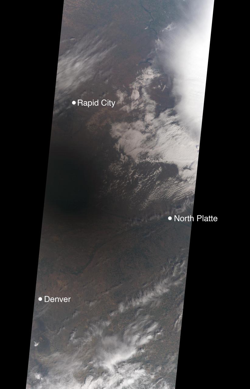
On Aug. 21, 2017, a total solar eclipse swept across the United States -- the first such eclipse in the contiguous 48 states since 1979, and the first cross-country eclipse since 1918. A partial eclipse was visible in all 50 states, and initial estimates suggest that upwards of 20 million people observed the Moon completely obscuring the Sun in the 70-mile-wide (113-kilometer-wide) path of totality. While viewing a total solar eclipse from the ground is an amazing experience, satellites orbiting Earth see the eclipse from a unique perspective. As the Moon's shadow passed through the United States, the Multi-angle Imaging SpectroRadiometer (MISR) instrument aboard NASA's Terra satellite was capturing images of eastern Wyoming and western Nebraska from its altitude of 438 miles (705 kilometers) above the surface. MISR gathers images on a strip about 249 miles (400 kilometers) wide directly below the path of the satellite. Incredibly, given that the shadow of the Moon took only 90 minutes to cross the entire United States, and Terra itself moves at a brisk 16,700 miles per hour from north to south, MISR happened to be in exactly the right place at the right time to capture totality. From the ground, the moment of totality appears suddenly, sweeping over the sky in just a few seconds. "I was unprepared for just how dark it actually was," says Mika Tosca, a researcher who works with MISR data and who observed the eclipse in Nebraska. "The streetlights even turned on. Everything fell silent, and I swear the temperature dropped." From the vantage point of space, however, it’s possible to see the entire shadow of the Moon, with the completely dark, circular umbra and the more diffuse penumbra. MISR contains nine cameras oriented at different angles, viewing forward, downward, and backward along the flight path, resulting in an approximate seven-minute interval for all nine cameras to image a single location on Earth's surface. This animation combines these nine images into a movie showing the motion of the Moon's shadow during this seven-minute period. In the first image, captured by the camera pointing farthest ahead of the satellite, totality has not quite begun in the area seen by MISR. From the second camera onward, totality sweeps across the image area from west to east, beginning just west of the town of Jay Em, Wyoming, and proceeding about halfway across the MISR swath to the town of Alliance, Nebraska. The motion of the lunar shadow in different pairs of images leads to estimates of the local ground speed ranging between 1,480 and 1,820 miles per hour (2,382 and 2,929 kilometers per hour). The spread in values is a measure of the uncertainty of the estimate. At this location, the predicted speed of the eclipse calculated from lunar orbital motion is about 1,658 miles per hour (2,668 kilometers per hour), which falls in the middle of the range estimated from the MISR images. Tosca's observation that the temperature dropped during the eclipse is a well-known phenomenon. The GLOBE Observer, a phone application dedicated to citizen science and sponsored by NASA, encouraged eclipse-goers to record the local air temperature at regular intervals. Data collected by nearby observers in the path of totality show that, on average, temperatures dropped by 9.3 degrees Fahrenheit (5.2 degrees Celsius) during the eclipse. This compares to an average of 5.4 degrees Fahrenheit drop measured at several Nebraska Mesonet weather stations within the path of totality. The decrease in the amount of sunlight reaching Earth affected more than temperatures. Areas that get a large portion of their power from solar energy were naturally concerned about shortages during the eclipse -- the state of California, though not in the path of totality, estimated that 6,000 megawatts of solar power would be lost during the eclipse. An animation is available at https://photojournal.jpl.nasa.gov/catalog/PIA21957

STS071-705-055 (27 June-7 July 1995) --- This vertical view over the central Andes Mountains was photographed from the Earth-orbiting space shuttle Atlantis during the ten-day STS-71 mission. It is one of many still visuals shown by the returning crew during its post-flight press briefing on July 18, 1995. Views of Earth from orbit often make landscapes seem flat, but this view taken with the Sun near the horizon and with a 250mm lens able to pick up detail reveals the conical peaks of numerous volcanoes. The dusting of snow makes the view more vivid as the peaks cast black shadows. The snow is a few days old in this view since several roads can be seen crossing dry lake beds (smooth white areas between mountains, top right), indicating that vehicles have crushed and melted the thin snow. According to NASA scientists observing the STS-71 photography, some volcanoes are not yet mapped. They believe that most of the snow-covered peaks reach more than 16,000 feet in altitude.