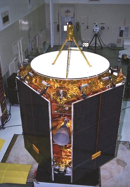
The Near Earth Asteroid Rendezvous (NEAR) spacecraft undergoing preflight preparation in the Spacecraft Assembly Encapsulation Facility-2 (SAEF-2) at Kennedy Space Center (KSC). NEAR will perform two critical mission events - Mathilde flyby and the Deep-Space maneuver. NEAR will fly-by Mathilde, a 38-mile (61-km) diameter C-type asteroid, making use of its imaging system to obtain useful optical navigation images. The primary science instrument will be the camera, but measurements of magnetic fields and mass also will be made. The Deep-Space Maneuver (DSM) will be executed about a week after the Mathilde fly-by. The DSM represents the first of two major burns during the NEAR mission of the 100-pound bi-propellant (Hydrazine/nitrogen tetroxide) thruster. This maneuver is necessary to lower the perihelion distance of NEAR's trajectory. The DSM will be conducted in two segments to minimize the possibility of an overburn situation.
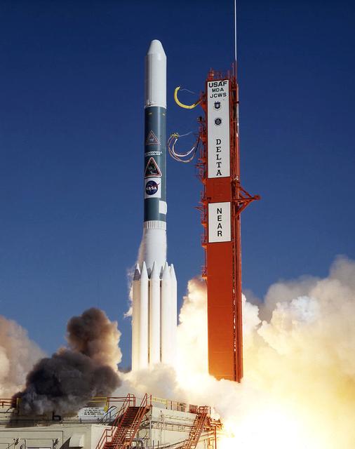
The Near Earth Asteroid Rendezvous (NEAR) spacecraft embarks on a journey that will culminate in a close encounter with an asteroid. The launch of NEAR inaugurates NASA's irnovative Discovery program of small-scale planetary missions with rapid, lower-cost development cycles and focused science objectives. NEAR will rendezvous in 1999 with the asteroid 433 Eros to begin the first long-term, close-up look at an asteroid's surface composition and physical properties. NEAR's science payload includes an x-ray/gamma ray spectrometer, an near-infrared spectrograph, a laser rangefinder, a magnetometer, a radio science experiment and a multi-spectral imager.
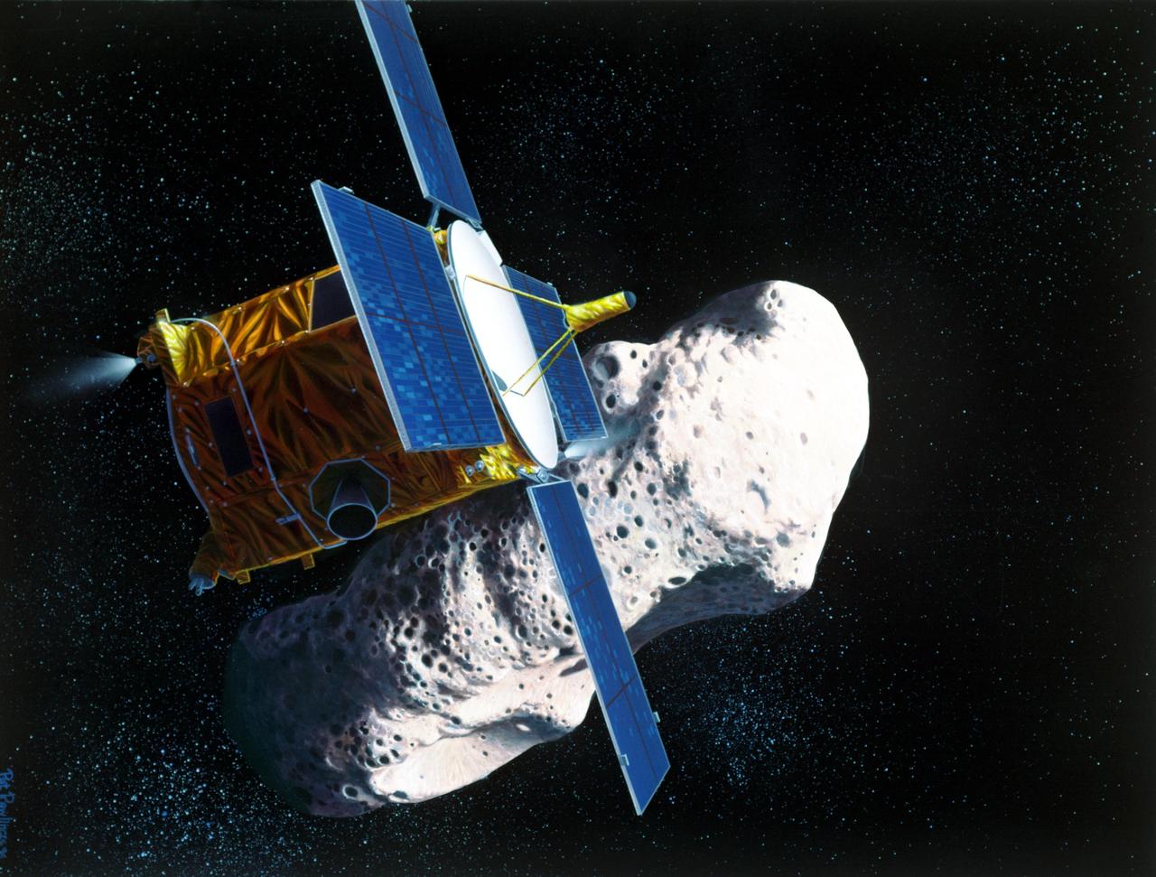
Artist rendering of the the Near Earth Asteroid Rendezvous NEAR spacecraft rendezvous with the asteroid Eros.

iss072e488176 (Jan. 16, 2025) --- NASA astronaut and Expedition 72 Commander Suni Williams (center) is dwarfed near the SpaceX Dragon crew spacecraft as she replaces a planar reflector, advanced navigational hardware visiting vehicles use when approaching the International Space Station. Dragon is docked to the Harmony module's space-facing port which rests in between the Kibo and Columbus laboratory modules. 263 miles below is the Atlantic Ocean near the coast of Brazil.

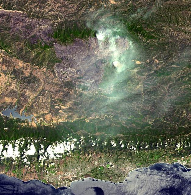
The Soberanes fire, in Central California near Big Sur, had grown to more than 67,000 acres when the Advanced Spaceborne Thermal Emission and Reflection Radiometer (ASTER) instrument on NASA's Terra spacecraft captured this image on Aug. 6, 2016. More than 4,800 personnel are battling the blaze, which is now 50 percent contained. The fire has destroyed 57 homes and 11 outbuildings and caused one fatality. Evacuation orders are still in effect for a number of nearby communities. The fire was caused by an illegal unattended campfire. Vegetation is depicted in red colors; burned areas are dark grey; clouds are white; smoke and ash are light grey. Yellow indicates active fires, detected on ASTER's thermal infrared channels. The image covers an area of 19 by 26 miles (30 by 42 kilometers), and is located at 36.4 degrees north, 121.8 degrees west. http://photojournal.jpl.nasa.gov/catalog/PIA20725
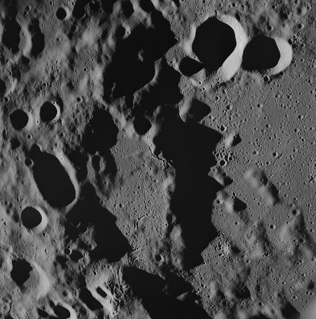
AS08-17-2670 (21-27 Dec. 1968) --- Near vertical view of the lunar farside as photographed from the Apollo 8 spacecraft. The center of the picture is located approximately at 162 degrees west longitude and 6 degrees south latitude.

iss072e488017 (Jan. 16, 2025) --- NASA astronaut and Expedition 72 Commander Suni Williams (center) is dwarfed near the SpaceX Dragon crew spacecraft as she replaces a planar reflector, advanced navigational hardware visiting vehicles use when approaching the International Space Station. Dragon is docked to the Harmony module's space-facing port which rests in between the Kibo and Columbus laboratory modules. 267 miles below is the Pacific Ocean east of New Zealand.
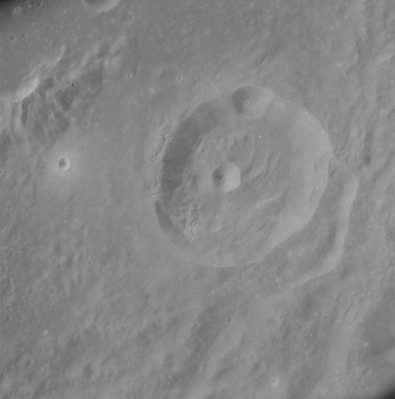
AS8-17-2704 (21-27 Dec. 1968) --- Near vertical view of the lunar farside as photographed from the Apollo 8 spacecraft. This crater, which is about 22 statute miles in diameter, is located at 167 degrees east longitude and 11 degrees south latitude. This crater is located on the eastern edge of a much larger unnamed crater which is about 90 statute miles in diameter.
The SPHEREx observatory sits in a clean room after environmental testing at BAE Systems in Boulder, Colorado, in late 2024. Short for Spectro-Photometer for the History of the Universe, Epoch of Reionization and Ices Explorer, SPHEREx will create a map of the cosmos like no other. Using a technique called spectroscopy to image the entire sky in 102 wavelengths of infrared light, SPHEREx will gather information about the composition of and distance to millions of galaxies and stars. With this map, scientists will study what happened in the first fraction of a second after the big bang, how galaxies formed and evolved, and the origins of water in planetary systems in our galaxy. https://photojournal.jpl.nasa.gov/catalog/PIA26537

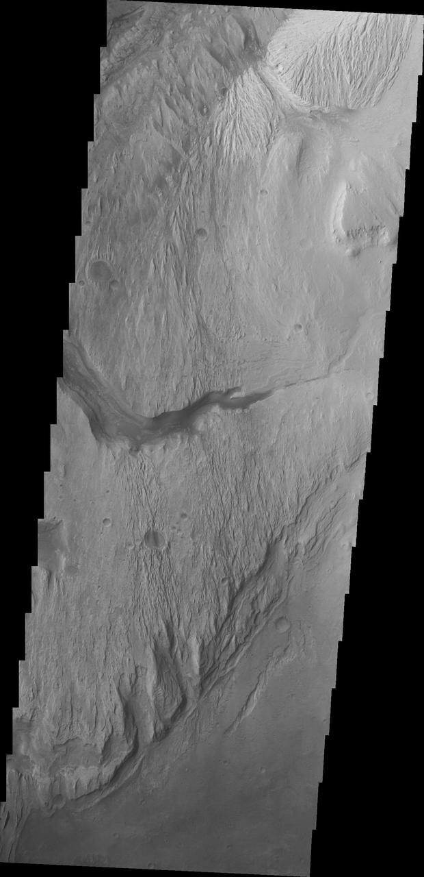
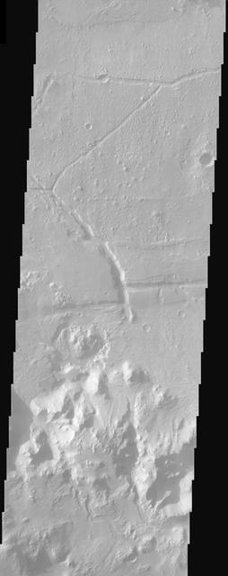
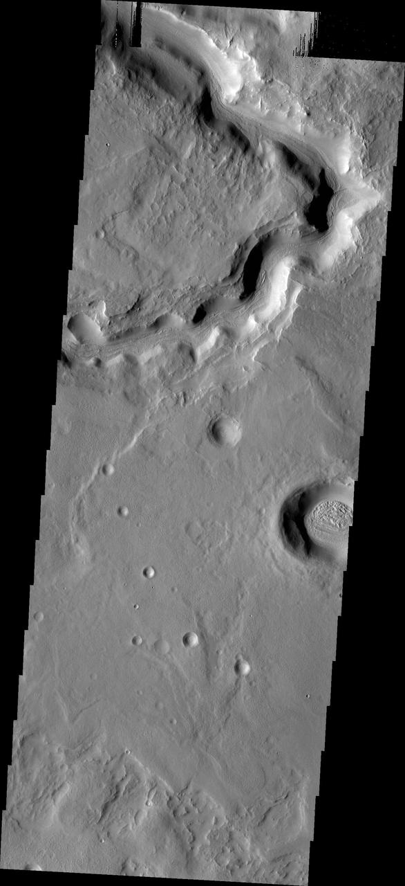
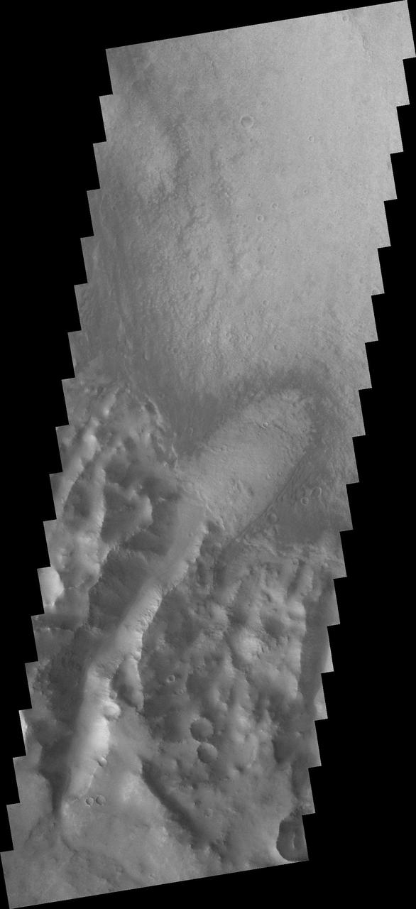
Two channels are visible in this image from NASA 2001 Mars Odyssey spacecraft . The smaller one near the bottom did not carve as deeply as the larger channel at the top. The channel near the top of the image is near the origin of Mamers Valles.
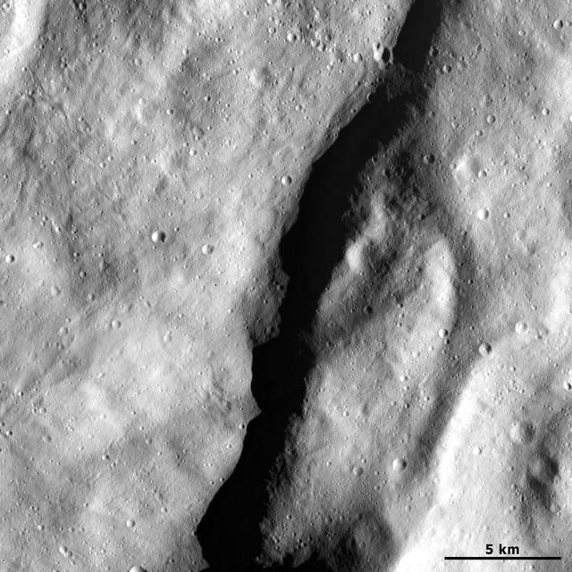
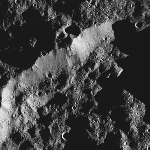
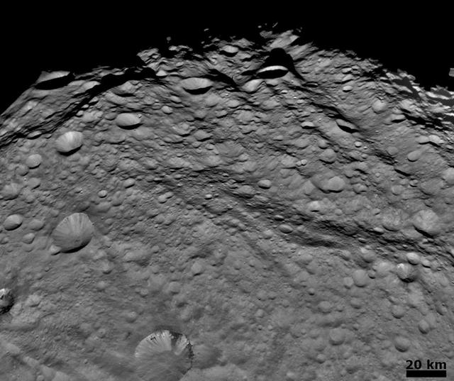
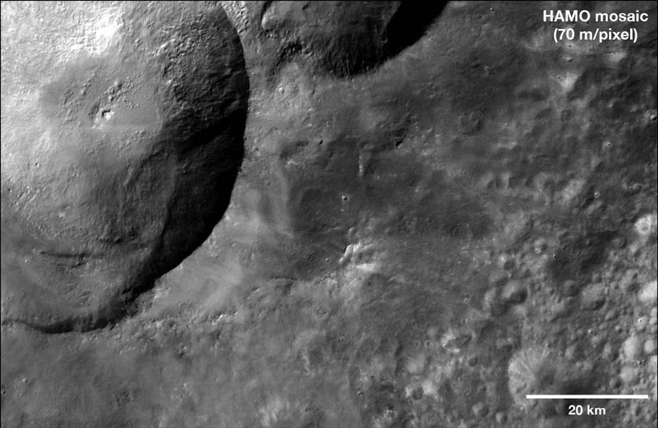
This image from NASA Dawn spacecraft shows an escarpment located in asteroid Vesta near Rheasilvia quadrangle, near Vesta south pole.
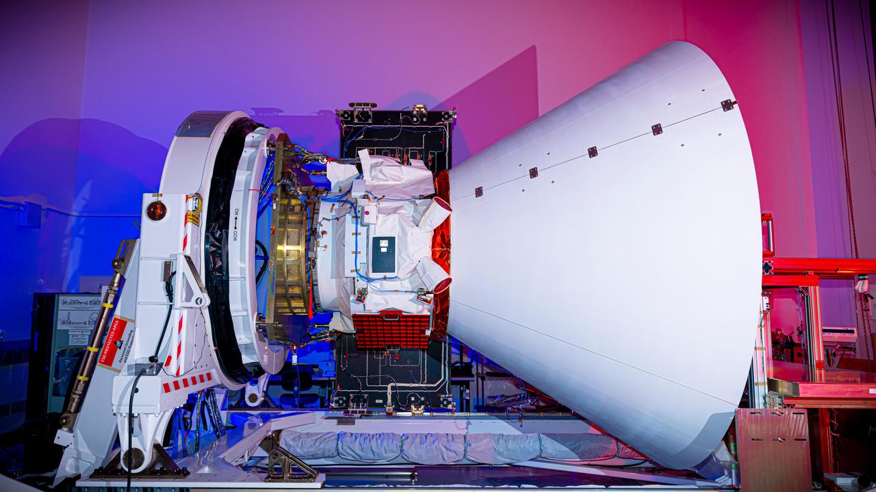
NASA's Lunar Trailblazer sits in a clean room at Lockheed Martin Space in Littleton, Colorado, shortly after being integrated with its second and final science instrument in June 2023. Called the Lunar Thermal Mapper (LTM), the instrument is visible as a black rectangular box in the upper right of the spacecraft's body. Green tape on the spacecraft will be removed before launch. Built by the University of Oxford in England and contributed by the UK Space Agency, LTM joins the High-resolution Volatiles and Minerals Moon Mapper (HVM³) that was integrated with the spacecraft late last year. Together, the instruments will enable scientists to determine the abundance, location, and form of the Moon's water. https://photojournal.jpl.nasa.gov/catalog/PIA25837

This near-infrared photograph of the Earth was taken by the Galileo spacecraft at 6:07 a.m. PST on Dec. 11, 1990, at a range of about 1.32 million miles. South America is prominent near the center. http://photojournal.jpl.nasa.gov/catalog/PIA00226
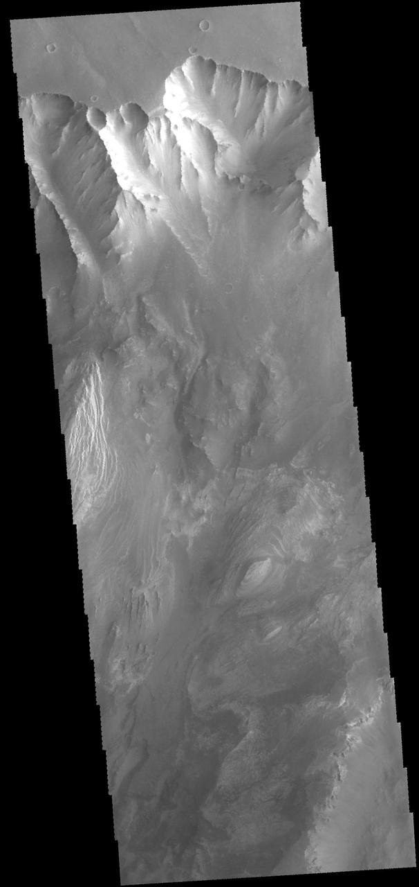
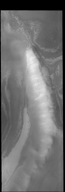
This image from NASA Mars Odyssey spacecraft shows the major channel that started near the top of Mt. Sharp. Near the top of this image is a wide valley that reaches to the crater floor and the nearby dunes.
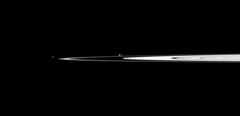
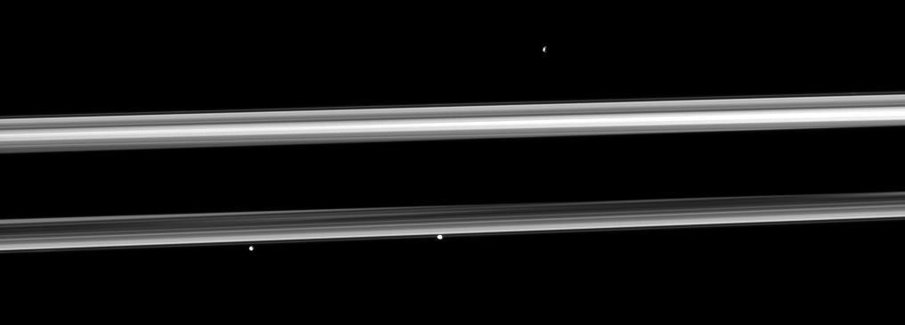
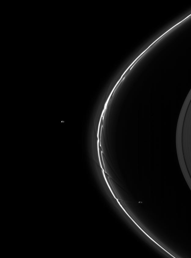
A pair of Saturn small moons orbit near the planet rings, which appear well illuminated in this view captured by NASA Cassini spacecraft. Janus is near the center of the image and Pandora is on the left.
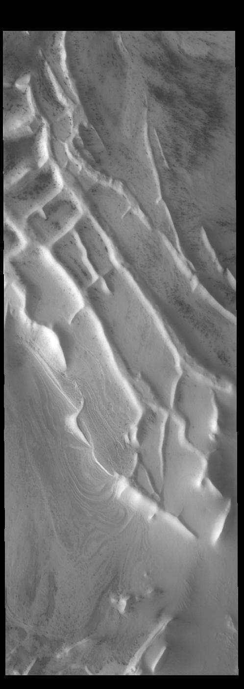
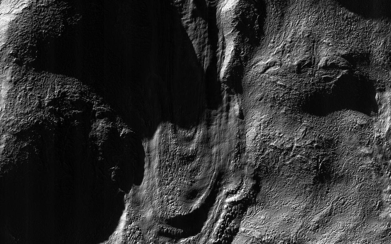
Slumping features and landslides can be clearly seen near the base of the largest scarp in this image from NASA Dawn spacecraft. Some of the hummocky terrain near the scarps is probably due to landsliding.

A moon shadow strikes Saturn rings near bright spokes on the B ring near the center of this image taken by NASA Cassini spacecraft about one month after the planet August 2009 equinox.
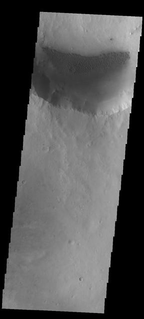
This image from NASA 2001 Mars Odyssey spacecraft shows a small crater near Phlegra Montes.

This artist concept depicts NASA Mars Atmosphere and Volatile EvolutioN MAVEN spacecraft near Mars.
The dissected surface seen in this image from NASA 2001 Mars Odyssey spacecraft is near Warrego Valles.
These ridges near the south polar cap are called Angustus Labyrinthus, as shown in this image captured by NASA 2001 Mars Odyssey spacecraft.
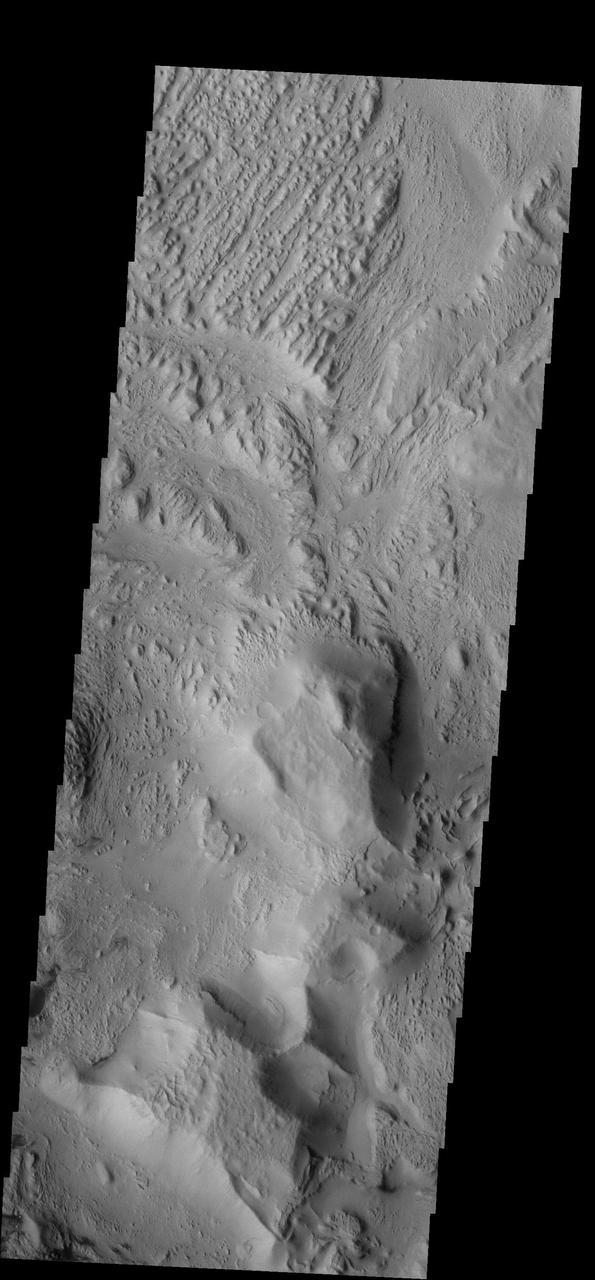
This image captured by NASA 2001 Mars Odyssey spacecraft shows part of the north wall of Valles Marineris near Melas Chasma.
Ripple bedforms fill large fractures near the southern rim of Holden Crater in this image from NASA Mars Odyssey spacecraft.
The orthogonal ridges in this image captured by NASA 2001 Mars Odyssey spacecraft are located near the south polar cap of Mars.
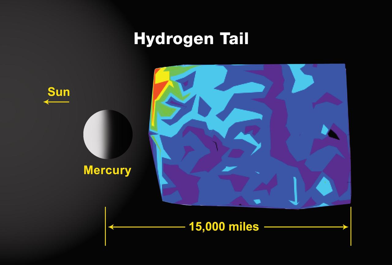
Calcium was detected in the near-Mercury exosphere by NASA MESSENGER spacecraft and has also been observed telescopically from Earth.
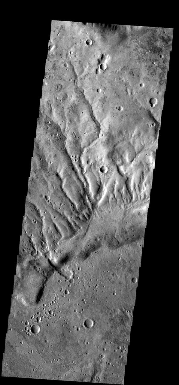
The channels in this image captured by NASA 2001 Mars Odyssey spacecraft are dissecting a slope near Huygens Crater.

This image from NASA 2001 Mars Odyssey spacecraft shows a region of plateaus and depressions near the south polar cap.
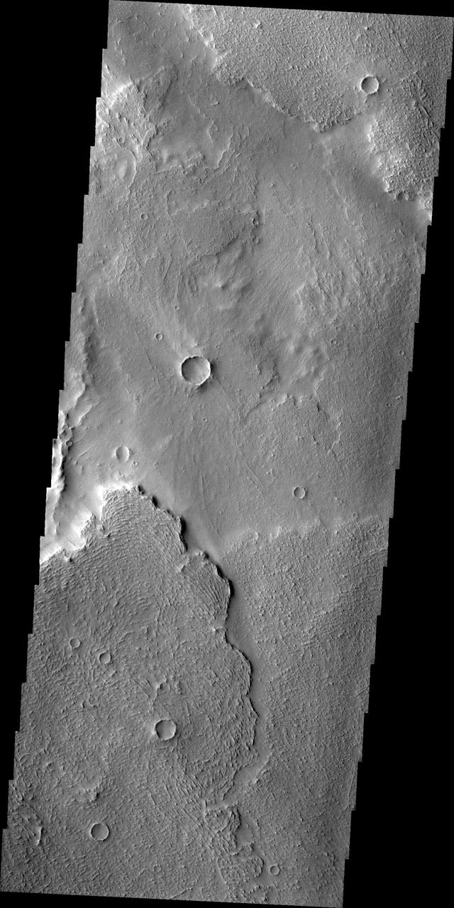
This image captured by NASA 2001 Mars Odyssey spacecraft shows the interior of an unnamed crater near Nili Fossae.
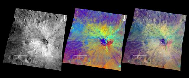
This view from NASA Dawn spacecraft shows the rim of a crater near the south pole of Ceres, taken on Feb. 8, 2016.
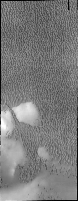
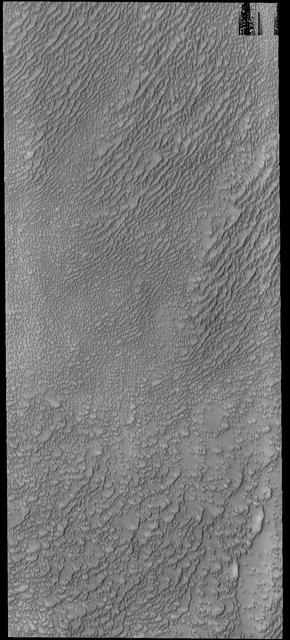
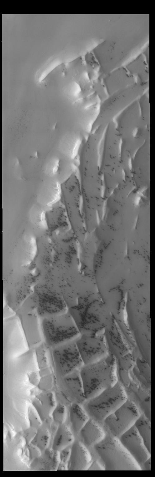
The dunes in this image captured by NASA 2001 Mars Odyssey spacecraft are near the large dune field called Olympia Undae.
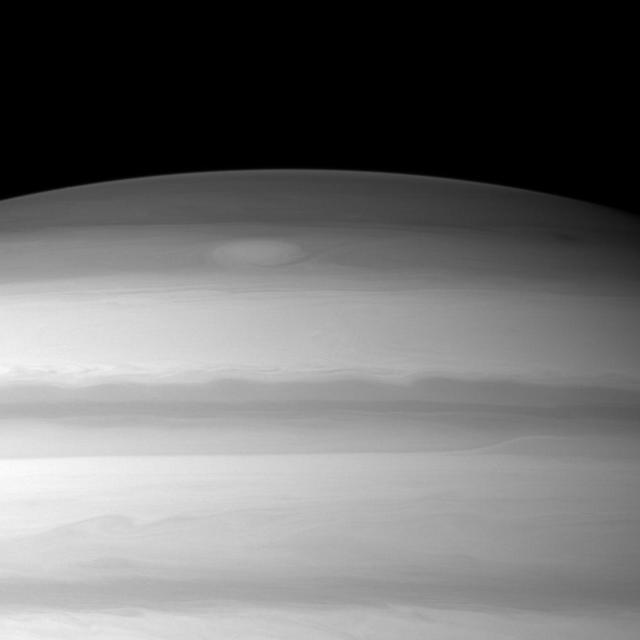
A large cloud formation swirls through the high northern latitudes of Saturn near the top of this image taken by NASA Cassini spacecraft.
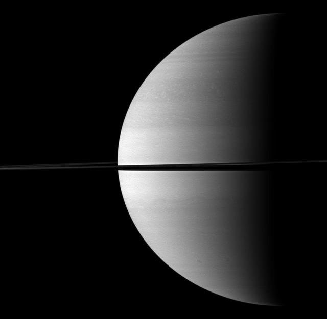
Roughly a quarter of majestic Saturn is illuminated in this view captured while NASA Cassini spacecraft was orbiting near the planet equatorial plane.

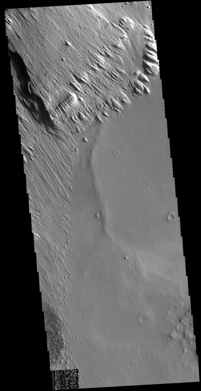
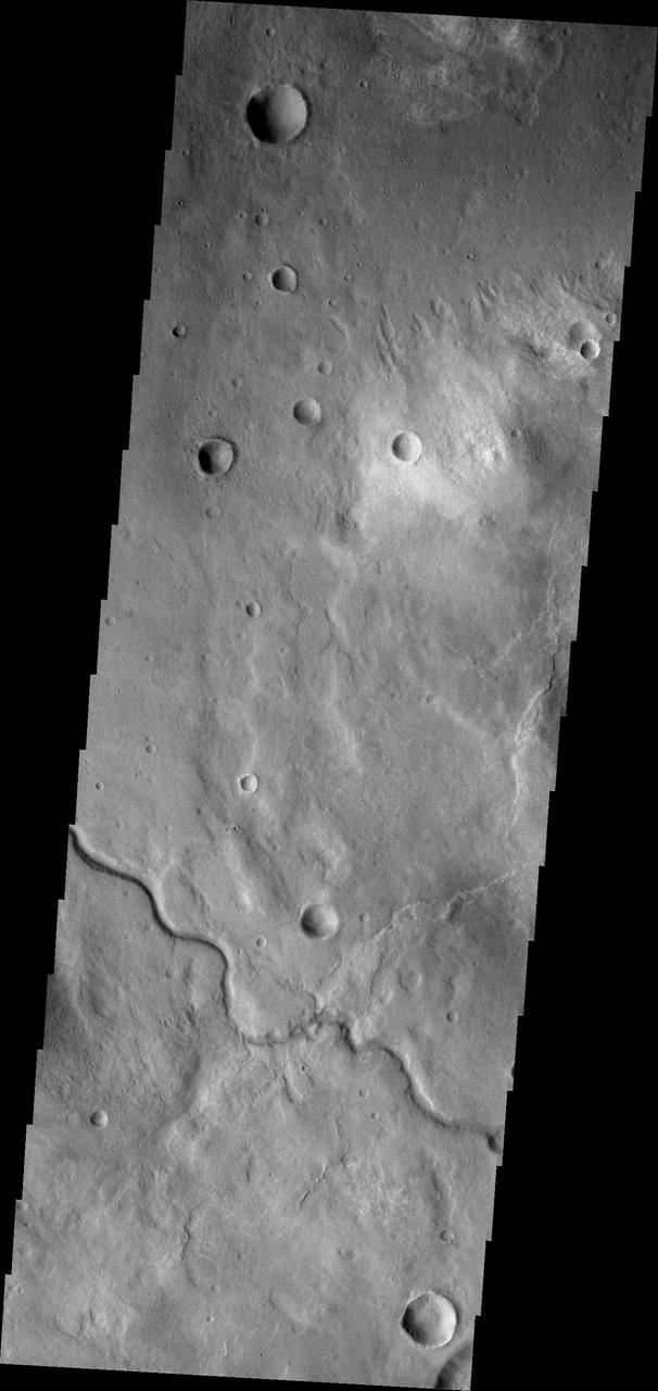
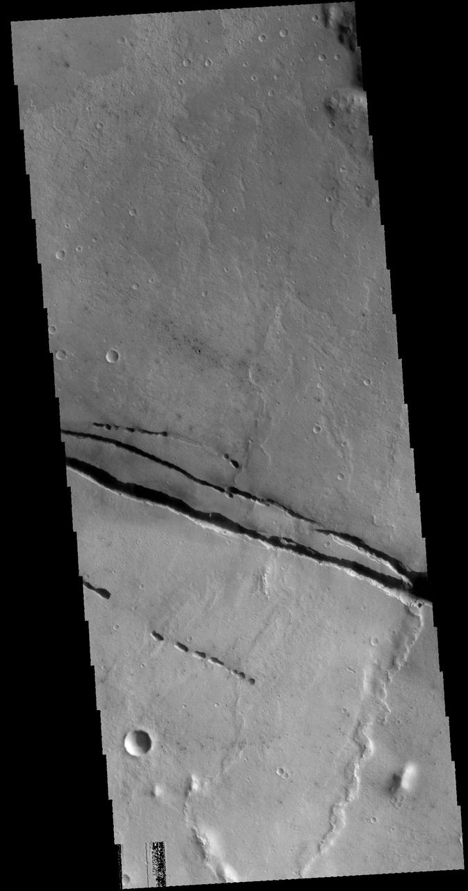
This unnamed channel drains the highland region near Pulawy Crater as seen by NASA 2001 Mars Odyssey spacecraft.
The wind is responsible for the erosion seen in this image captured by NASA 2001 Mars Odyssey spacecraft near Aeolis Planum.
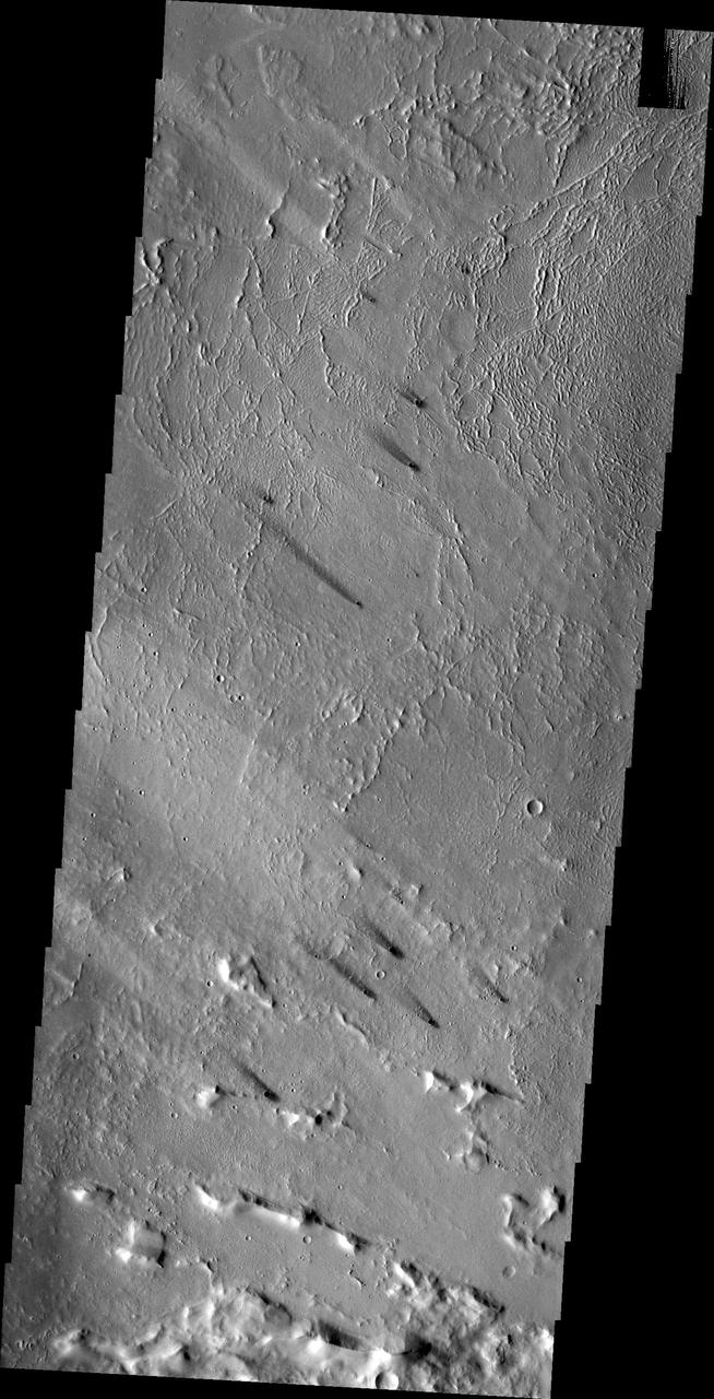
The small dark windstreaks as seen by NASA 2001 Mars Odyssey spacecraft are located near Lycus Sulci.
Lava flows near the margin of Daedalia Planum are seen in this image from NASA 2001 Mars Odyssey spacecraft.
This image captured by NASA 2001 Mars Odyssey spacecraft is located near Memnonia Sulci, on the edge of Lucus Planum.

This image acquired by NASA Terra spacecraft is of the Kingdom of Bahrain, a small island country near the western shore of the Persian Gulf.
The linear ridges in this image captured by NASA 2001 Mars Odyssey spacecraft are located near the south polar cap.
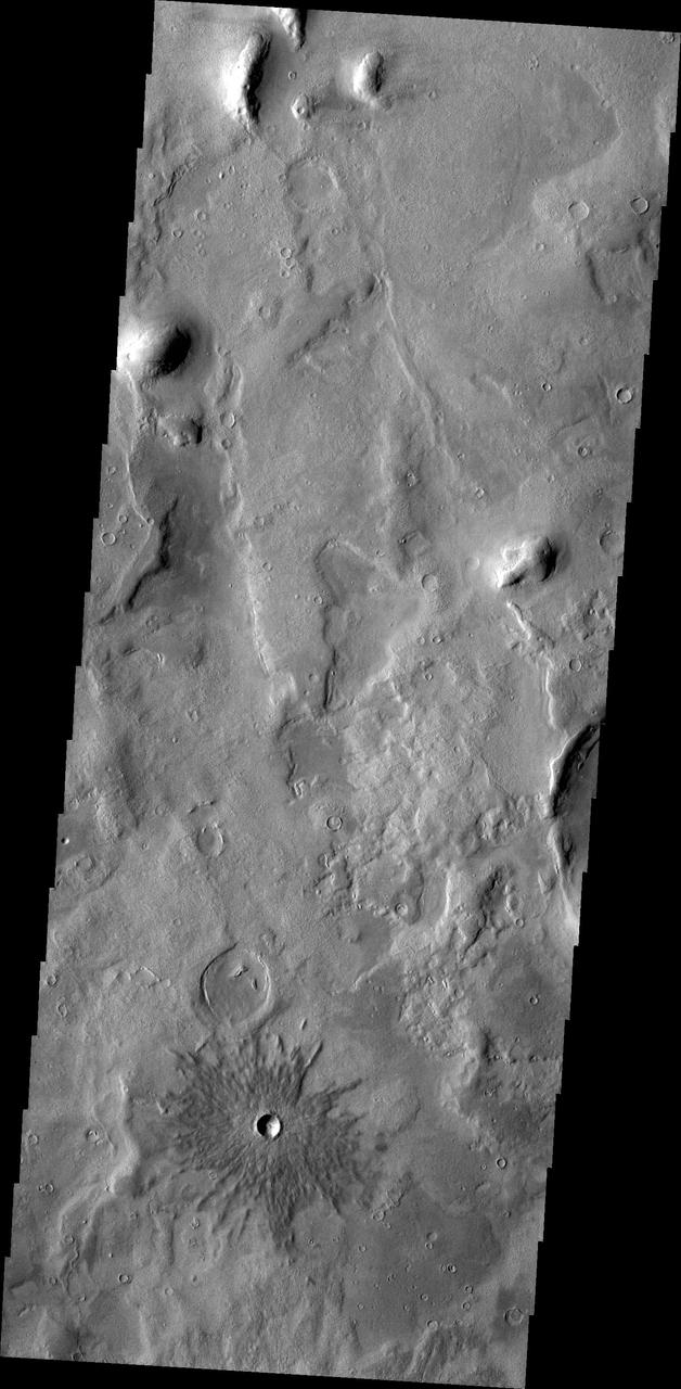
This image from NASA Mars Odyssey spacecraft shows an unnamed channel located in Terra Sabaea, near Hellas Planitia.
The lava flows and collapse features in this image from NASA 2001 Mars Odyssey spacecraft are located near Ascraeus Mons.
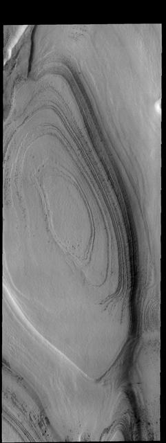
The layers in this image captured by NASA 2001 Mars Odyssey spacecraft are near the margin of the south polar cap.
The ridge in this image captured by NASA 2001 Mars Odyssey spacecraft is the rim of a crater near the south polar cap.
This image from NASA 2001 Mars Odyssey spacecraft shows lava flows near Arsia Mons.
The Cassini spacecraft looks toward Fensal and Aztlan, two dark areas near the equator of Titan.
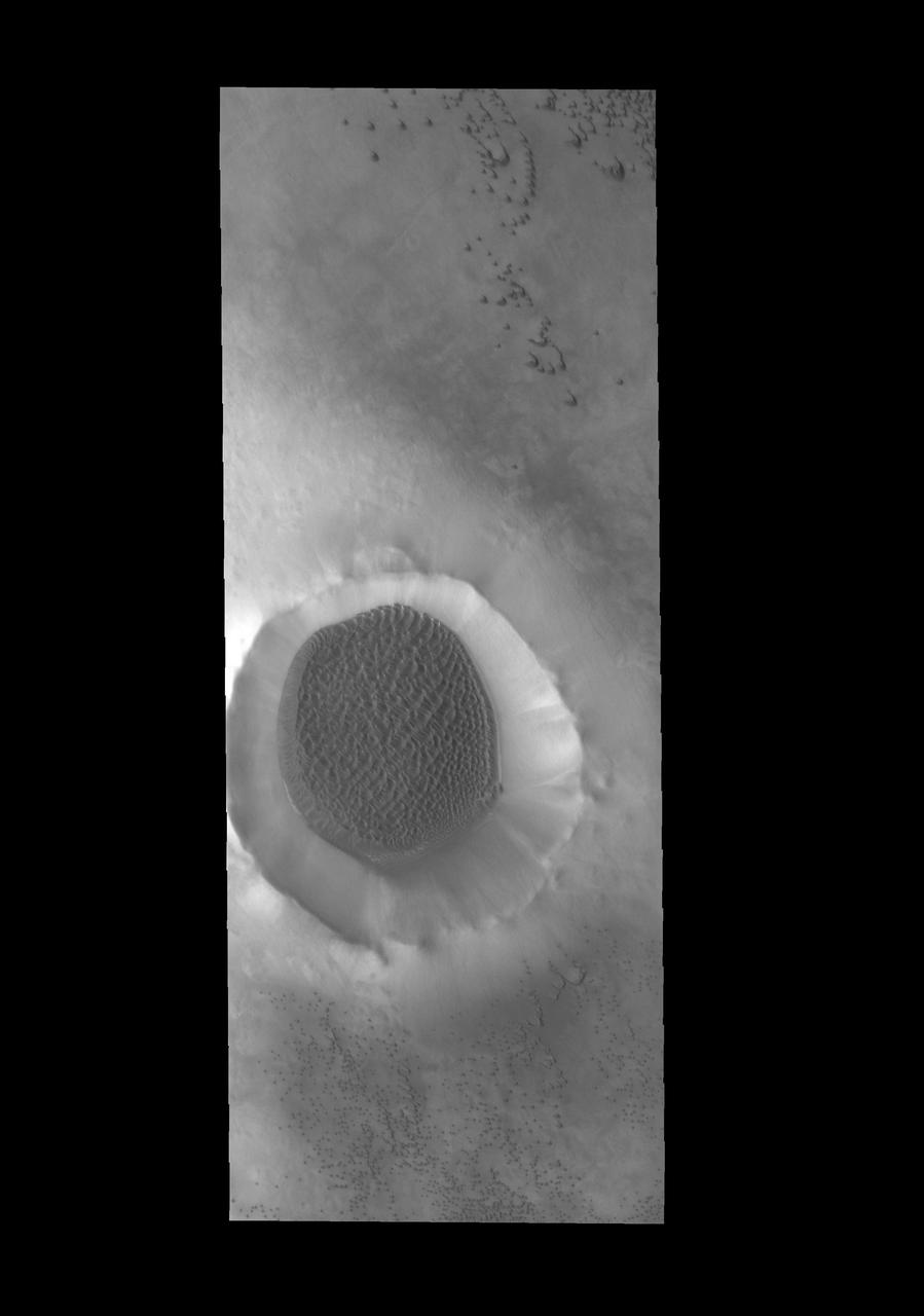
This image from NASA 2001 Mars Odyssey spacecraft shows sand dunes on the floor of an unnamed crater near Meridiani Planum.
This image captured by NASA 2001 Mars Odyssey spacecraft shows a portion of an unnamed channel near Auqakuh Vallis.
This image captured by NASA 2001 Mars Odyssey spacecraft shows another portion of Angustus Labyrinthus near the location of yesterday image.
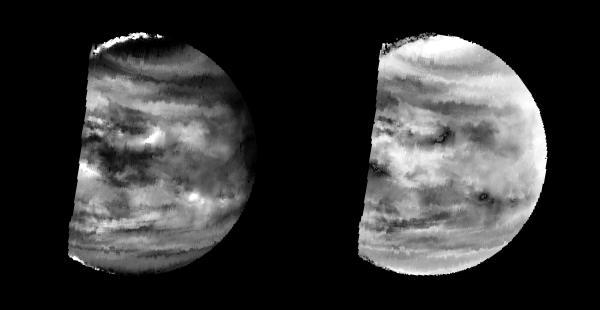
These images are two versions of a near-infrared map of lower-level clouds on the night side of Venus, obtained by the Near Infrared Mapping Spectrometer aboard NASA Galileo spacecraft as it approached the planet February 10, 1990. http://photojournal.jpl.nasa.gov/catalog/PIA00221
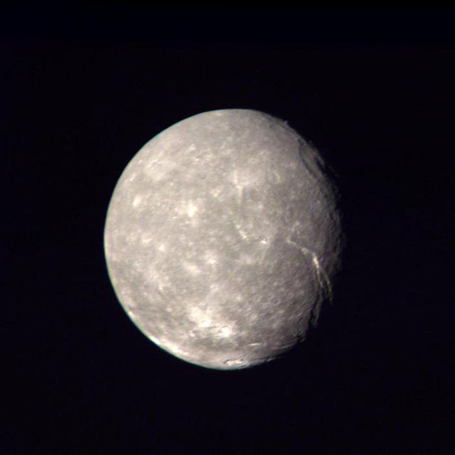
This high-resolution color composite of Titania was made from NASA Voyager 2 images taken Jan. 24, 1986, as the spacecraft neared its closest approach to Uranus. A large, trenchlike feature is seen near the terminator. http://photojournal.jpl.nasa.gov/catalog/PIA00036
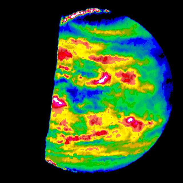
This image is a false color version of a near infrared map of lower level clouds on the night side of Venus, obtained by the Near Infrared Mapping Spectrometer aboard NASA's Galileo spacecraft as it approached the planet Feb. 10, 1990. http://photojournal.jpl.nasa.gov/catalog/PIA00112
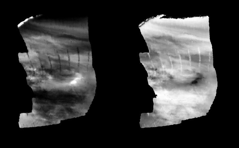
These images are two versions of a near-infrared map of lower-level clouds on the night side of Venus, obtained by the Near Infrared Mapping Spectrometer aboard NASA Galileo spacecraft as it approached the planet February 10, 1990. http://photojournal.jpl.nasa.gov/catalog/PIA00222
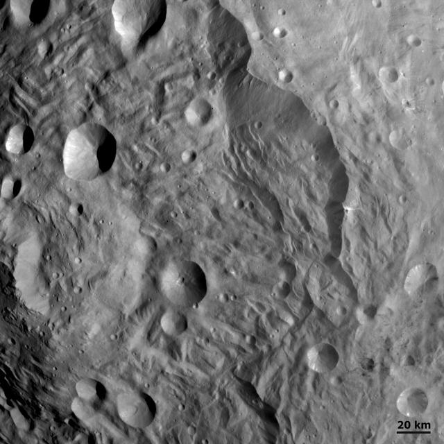
NASA Dawn spacecraft shows densely cratered terrain near Vesta terminator on August 6, 2011. This image was taken through the framing camera clear filter aboard the spacecraft. North is pointing towards the two oclock position.
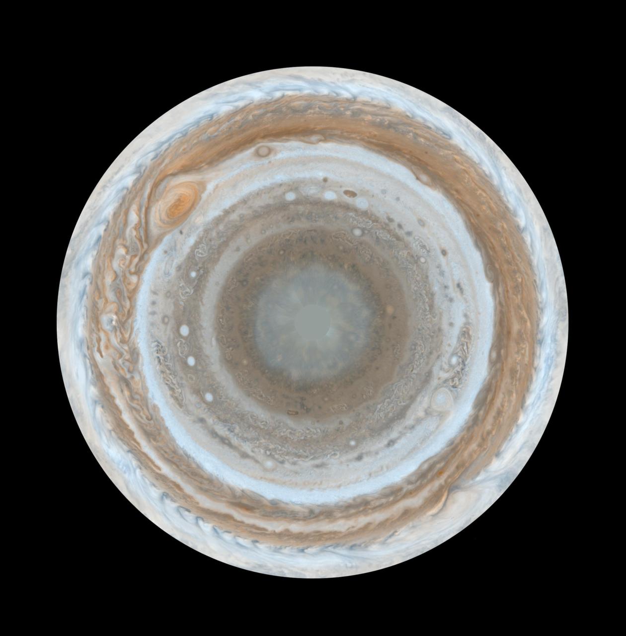
These color maps of Jupiter were constructed from images taken by the narrow-angle camera onboard NASA Cassini spacecraft as the spacecraft neared Jupiter during its flyby of the giant planet.

These color maps of Jupiter were constructed from images taken by the narrow-angle camera onboard NASA Cassini spacecraft as the spacecraft neared Jupiter during its flyby of the giant planet.
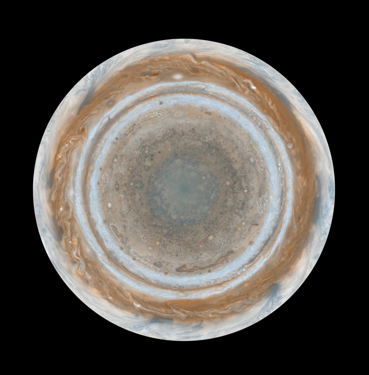
These color maps of Jupiter were constructed from images taken by the narrow-angle camera onboard NASA Cassini spacecraft as the spacecraft neared Jupiter during its flyby of the giant planet.
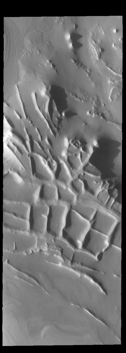
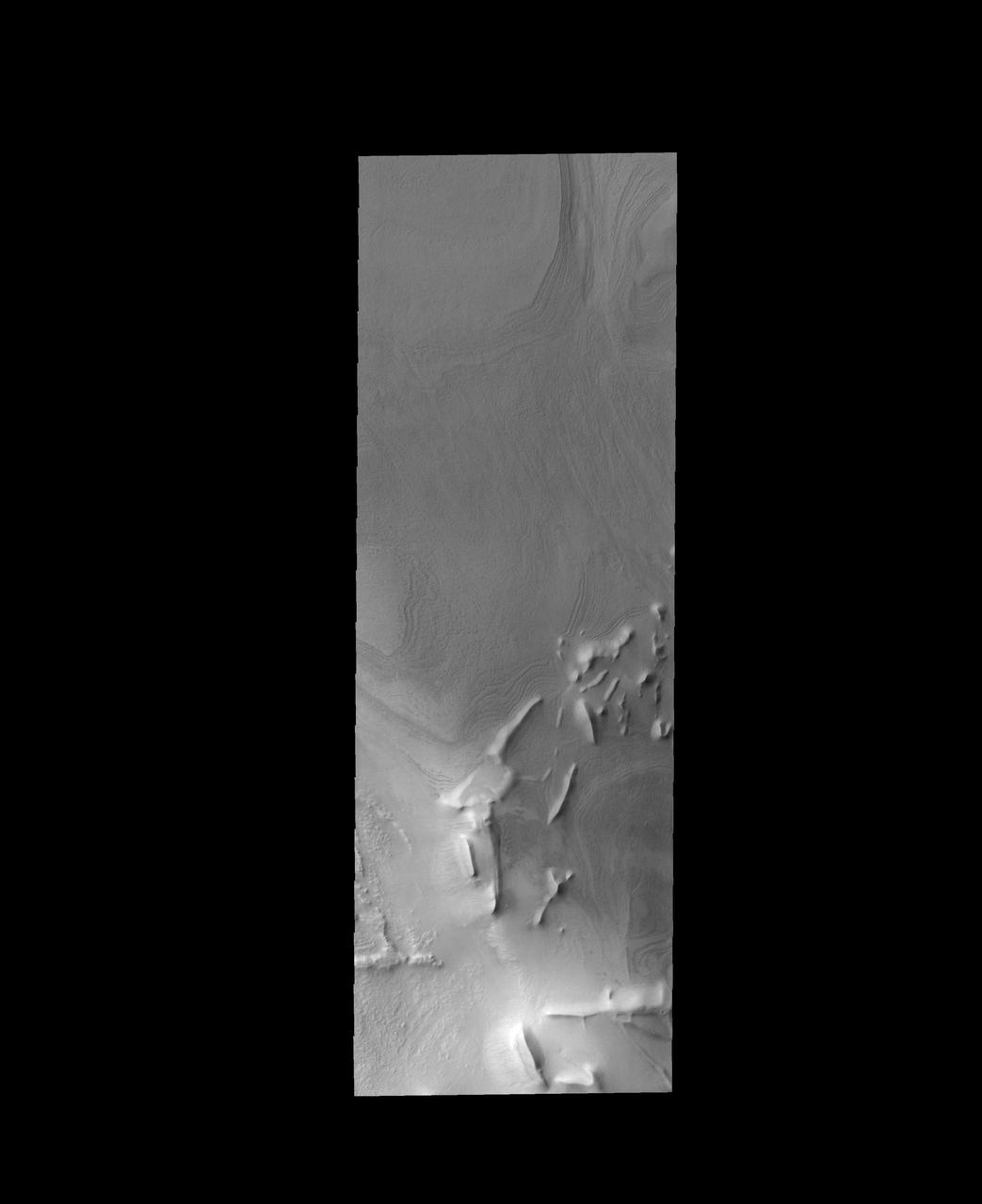
This image captured by NASA 2001 Mars Odyssey spacecraft shows the region near the south polar cap called Angustus Labyrinthus, which is defined by the linear ridges. The Odyssey spacecraft orbit is near the day/night terminator, which means looking at the surface near dawn and dusk. This image was taken in the late afternoon and the low sun angle casts shadows behind the taller peaks. The shadows show the topography of the ridges, which is hard to see from above. Orbit Number: 67658 Latitude: -81.3907 Longitude: 296.204 Instrument: VIS Captured: 2017-03-15 21:34 https://photojournal.jpl.nasa.gov/catalog/PIA21661
This image captured by NASA 2001 Mars Odyssey spacecraft shows a small portion of Olympia Undae, the largest dune field near the north polar cap.
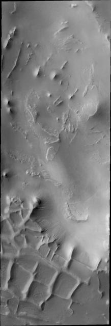
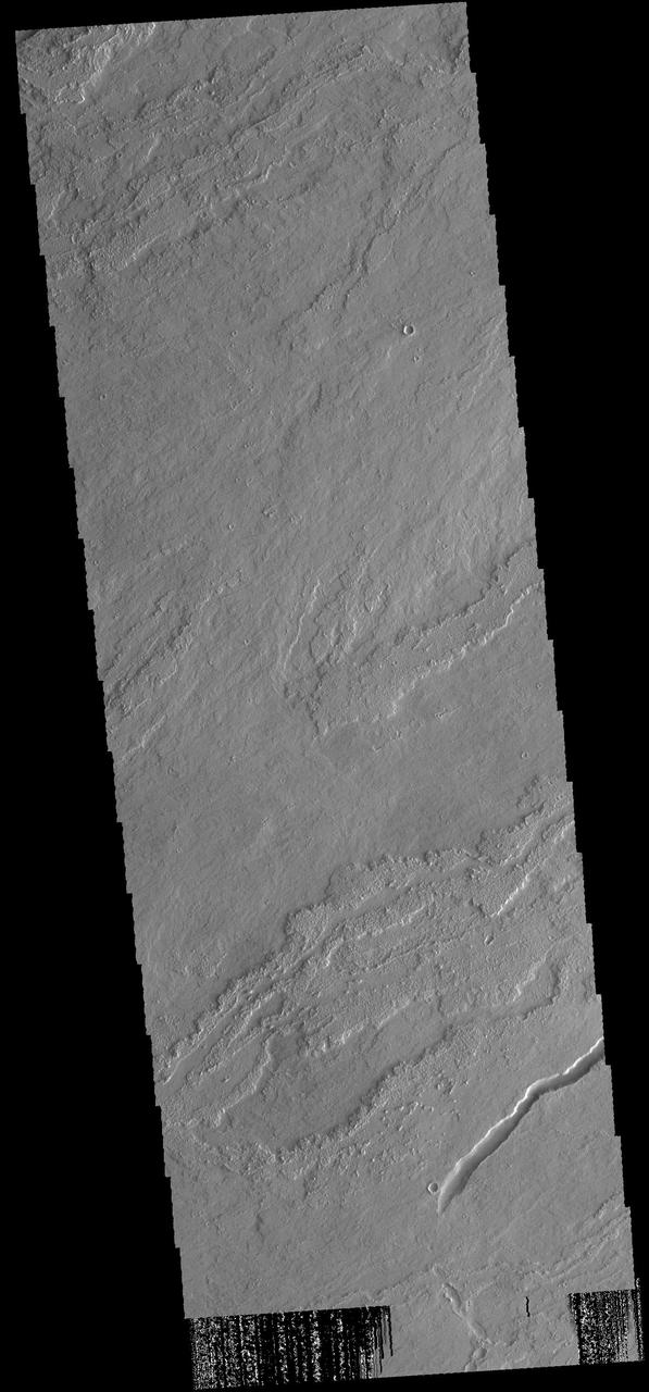
Streamlined channels near Lucus Planum can be seen in this image from NASA Mars Odyssey spacecraft. These features were formed by catastrophic floods in the Martian past.
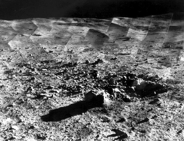
Photomosaic of lunar panorama near the Tycho crater taken by Surveyor 7. The hills on the center horizon are about eight miles away from the spacecraft.

NASA Voyager 2 took this wide-angle image of Uranus rings as the spacecraft neared the plane of the rings less than an hour before closest approach to the planet.
These composite images from NASA Dawn spacecraft show three views of a terrain with ridges and grooves near Aquilia crater in the southern hemisphere of the giant asteroid Vesta.
NASA Terra spacecraft acquired this image of St. Anthony, the world oldest Christian monastery, settled in the remote mountainous area of eastern Egypt near the Red Sea.
These images of Tarpeia crater, near the south pole of the giant asteroid Vesta, were obtained by the visible and infrared mapping spectrometer on NASA Dawn spacecraft.
A sand sheet with surface dune forms covers the floor of this unnamed crater near the north pole. This image was taken by NASA 2001 Mars Odyssey spacecraft.
This image from NASA 2001 Mars Odyssey spacecraft shows a small portion of Olympia Undae, the vast dune field near the north pole.
This image captured by NASA 2001 Mars Odyssey spacecraft shows another unnamed crater near the north pole with dunes on its floor.
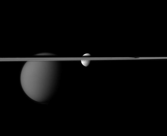
The line of Saturn rings disrupts NASA Cassini spacecraft view of the moons Tethys and Titan. Larger Titan is on the left. Tethys is near the center of the image.

This image captured by NASA 2001 Mars Odyssey spacecraft shows a small portion of Olympia Undae, a large dune field located near the north polar cap.
On August 7, 2007, the Zaca fire continued to burn in the Los Padres National Forest near Santa Barbara, California. This image is from NASA Terra spacecraft.
Three of Saturn small moons straddle the rings in this image captured by NASA Cassini spacecraft. From left to right are Pandora, Prometheus and, near the top right, Epimetheus.
Continuing eastward, this image of Gale captured by NASA 2001 Mars Odyssey spacecraft shows the reappearance of dunes on the crater floor near the margin of Mt. Sharp.
NASA Cassini spacecraft camera looks in near-infrared light at a dramatic view of Saturn, its ringplane and the shadows of a couple of its moons.
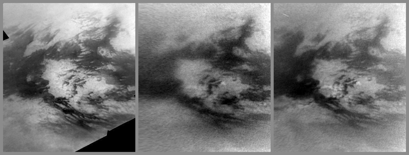
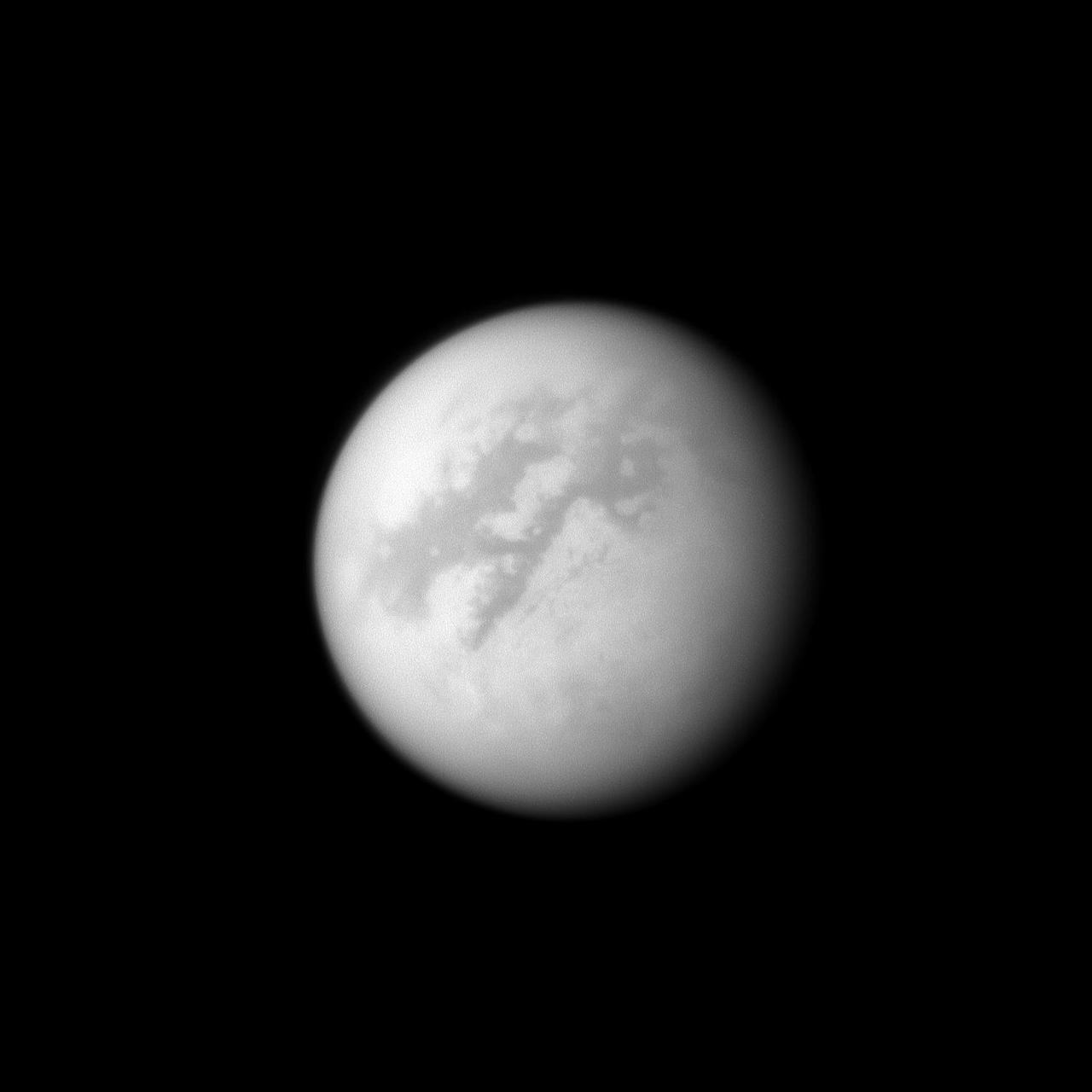
Images from NASA Cassini spacecraft show changes caused by methane rain in the bright Adiri region near the equator of Saturn largest moon, Titan.
This image from NASA Mars Reconnaissance Orbiter spacecraft was acquired near the Martian winter solstice, when the sun was low over the horizon at this location.
This image captured by NASA 2001 Mars Odyssey spacecraft shows Cerberus Fossae, a group of graben located near the southern part of Tartarus Montes.

This low resolution VIS image from NASA 2001 Mars Odyssey spacecraft shows a large portion of etched terrain near the south pole of Mars.
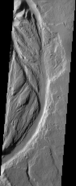
The channels, both large and small, in this image from NASA 2001 Mars Odyssey spacecraft are part of Kasei Valles near its terminus in Chryse Planitia.
This mosaic from NASA Dawn spacecraft shows dark material near a series of craters known as the nowman on asteroid Vesta. That ejected material is a complex mixture of components.
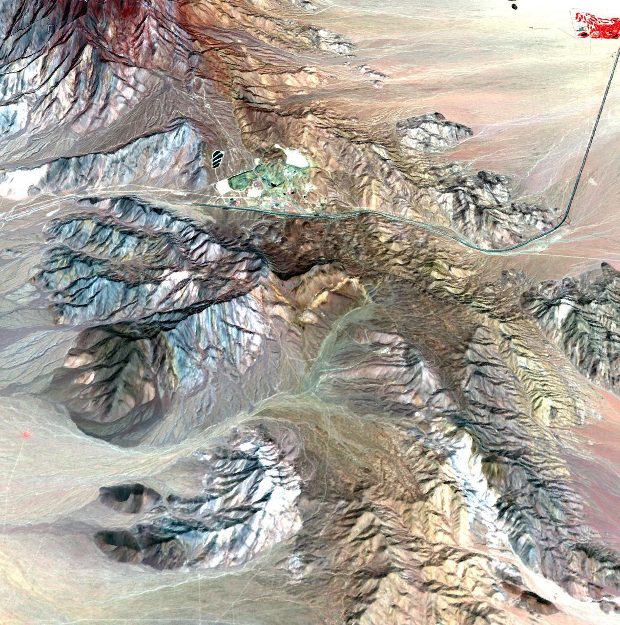
This image of the Mountain Pass rare open-pit earth mine was acquired by NASA Terra spacecraft in southeastern California near the Nevada border.
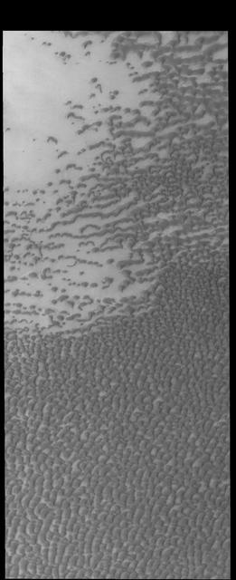
The dunes in this image captured by NASA 2001 Mars Odyssey spacecraft are part of Olympia Undae, a huge dune field near the north polar cap.
This image captured by NASA 2001 Mars Odyssey spacecraft shows part of Siton Undae, a dune field located near Escorial Crater and the north polar cap.
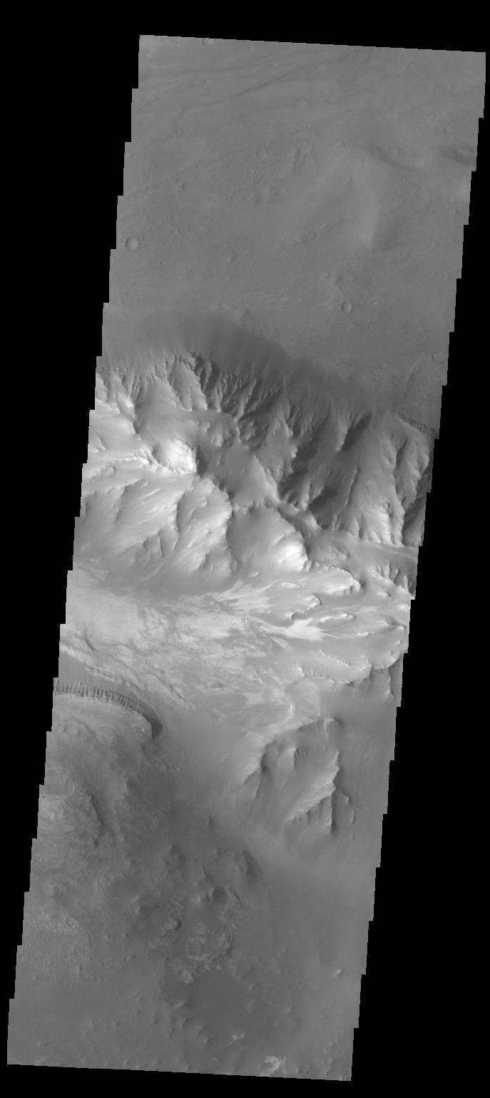
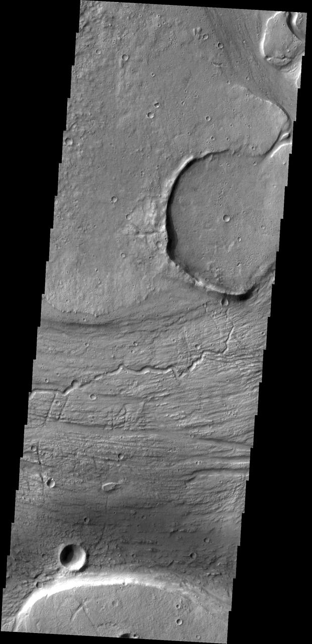
This image captured by NASA 2001 Mars Odyssey spacecraft is further west from yesterday image, near the margin between Coprates Chasma and Melas Chasma.

A bright clump of material within Saturn tenuous F ring stands out near the center top of this NASA Cassini spacecraft image.
This low resolution VIS image from NASA 2001 Mars Odyssey spacecraft shows a large portion of etched terrain near the south pole of Mars.
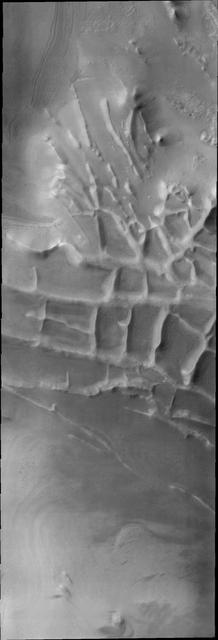
This region of linear, intersecting ridges near the south pole is called Angustus Labyrinthus, as shown in this image captured by NASA 2001 Mars Odyssey spacecraft.
This image captured by NASA 2001 Mars Odyssey spacecraft shows dunes on the margin of Olympia Undae, a large dune field near the north pole.

Near the bottom of this nighttime image captured by NASA 2001 Mars Odyssey spacecraft are several channels. The dusty channel floors are darker colder than the rocky walls.

These two images, taken by NASA Cassini spacecraft, show Jupiter in a near-infrared wavelength, and catch Europa, one of Jupiter largest moons, at different phases.
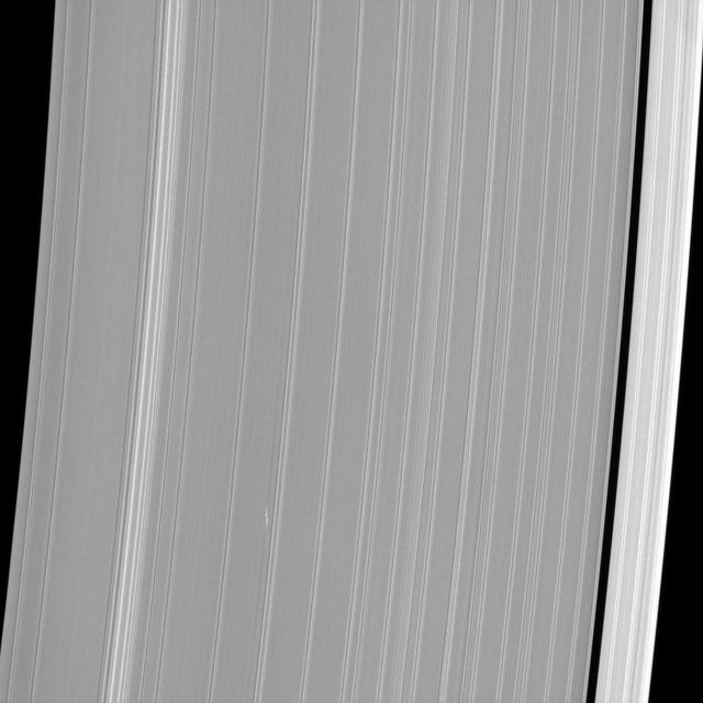
The propeller-shaped white dashes near the bottom of NASA Cassini spacecraft image reveal the location of a small moonlet embedded in Saturn A ring.
The term colles means hills. The hills in this image from NASA 2001 Mars Odyssey spacecraft are located on the northern plains near Phlegra Dorsa.
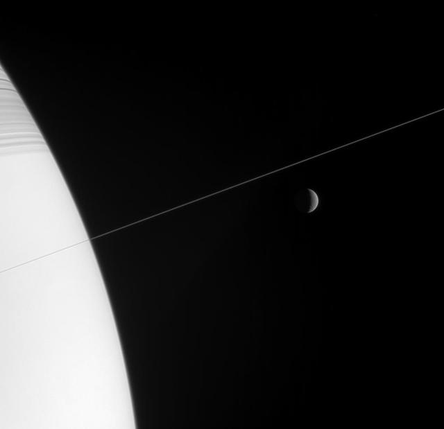
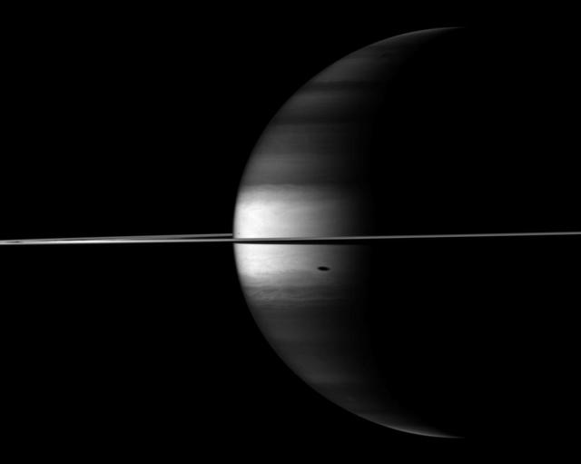
Shadow-striped Saturn and its exquisitely thin rings occupy the near field in this Cassini spacecraft view, while a crescent Rhea hangs in the distance
This image captured by NASA 2001 Mars Odyssey spacecraft shows another portion of the large dune field near the north polar cap.
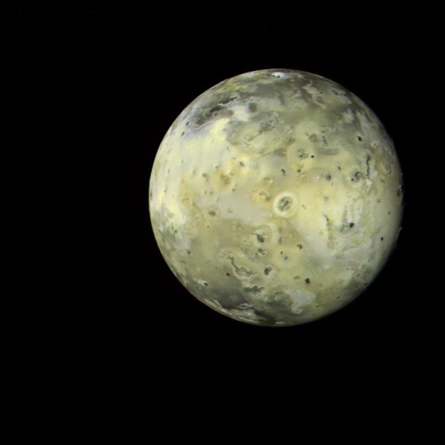
This full-disk image of Jupiter satellite Io was made from several frames taken by NASA Voyager 1 on Mar. 4, 1979, as the spacecraft neared the satellite.
NASA MISR instrument onbard NASA Terra spacecraft captured a stereo view of Mountain Fire near Idyllwild, Calif. in July, 2013.
This image captured by NASA 2001 Mars Odyssey spacecraft shows a small portion of Olympia Undae, an extensive dune field near the north polar cap.
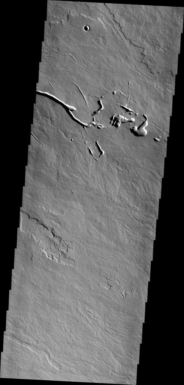
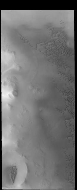
This image captured by NASA 2001 Mars Odyssey spacecraft shows a small portion of Shalbatana Vallis, near the end of the channel where it drains into Chryse Planitia.
This image shows a pair of moons, Pandora and Prometheus, continuing their shepherding duties near Saturn thin F ring as seen by NASA Cassini spacecraft.
Clouds move above the large methane lakes and seas near the north pole of Saturn moon Titan in this image taken by NASA Cassini spacecraft.
This image captured by NASA 2001 Mars Odyssey spacecraft shows more of Olympia Undae, a large dune field located near the north polar cap.