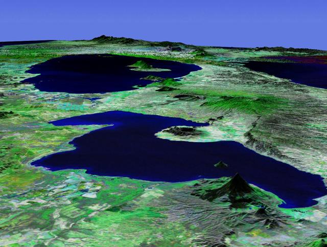
This perspective view acquired by NASA Shuttle Radar Topography Mission SRTM from data collected in the year 2000 shows Lakes Managua and Nicaragua near the Pacific coast of Nicaragua.
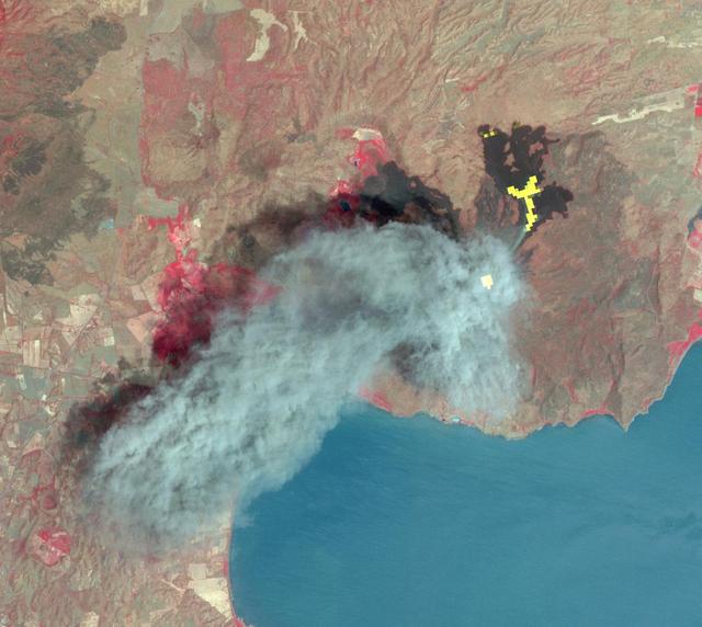
In Dec. 2015, one of Nicaragua largest volcanoes, Momotombo, erupted for the first time since 1905. NASA Terra spacecraft acquired this image showing large ash columns and pyroclasitc flows.
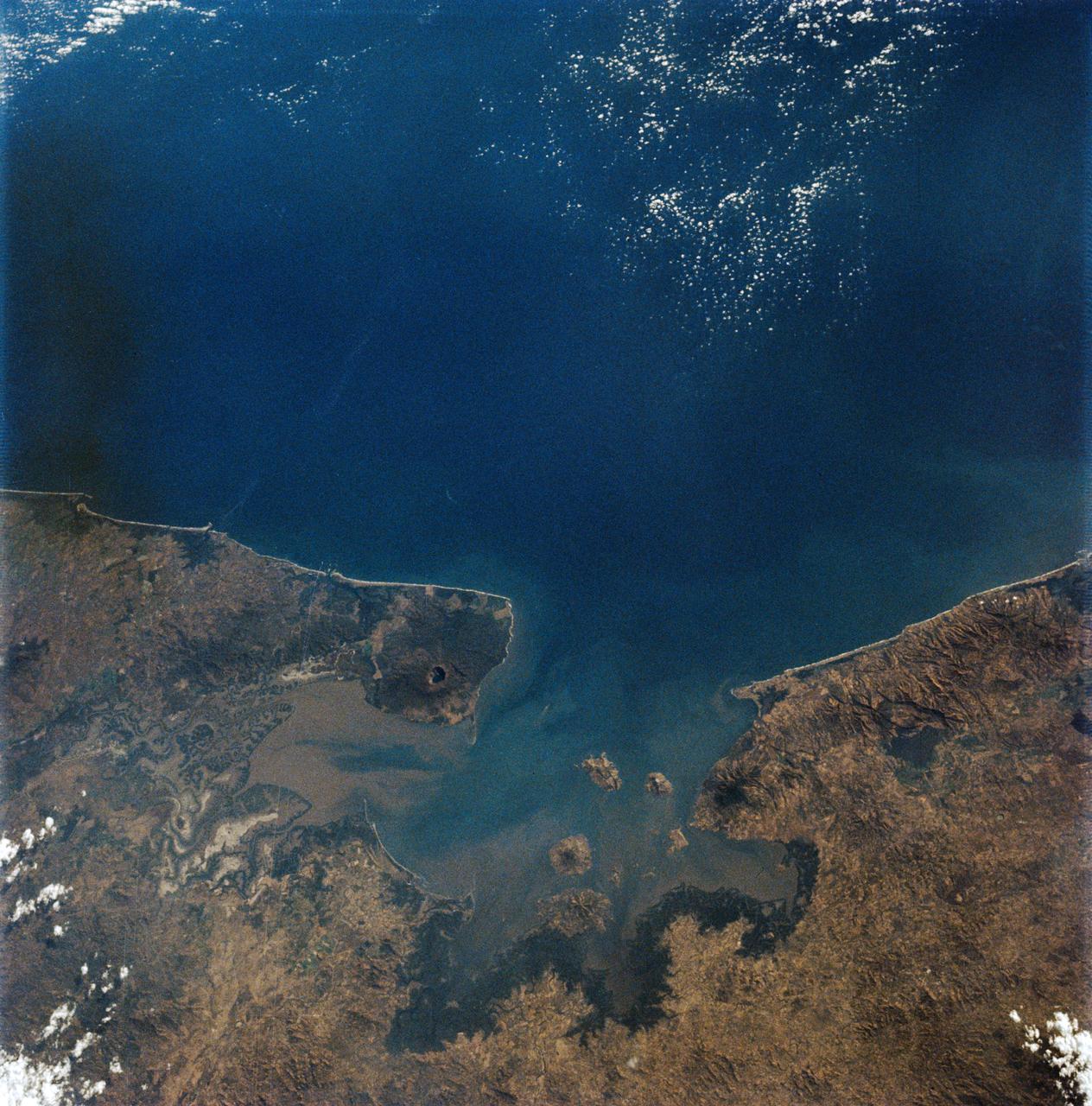
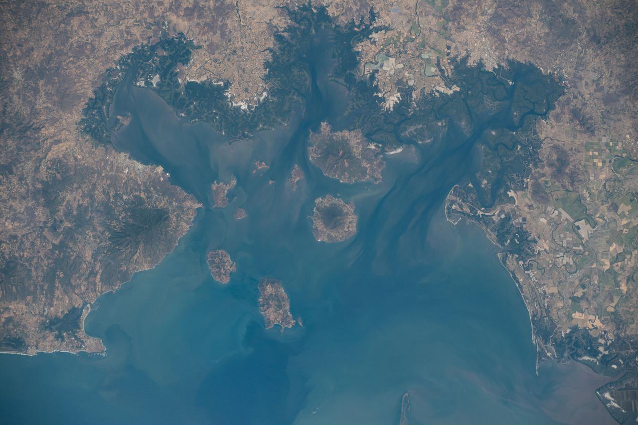
AS09-19-3019 (3-13 March 1969) --- Gulf of Fonseca, on the Pacific coast of Central America, as photographed from the Apollo 9 spacecraft during its Earth-orbital mission. The gulf is shared by the nations of El Salvador, Honduras, and Nicaragua. The prominent volcano on the peninsula in Nicaragua is Volcan Cosiguina.
iss074e0312817 (Feb. 10, 2026) --- Cosigüina Volcano—a geologically young volcano, several thousand years old, with its last major eruption occurring in 1835—sits where the Gulf of Fonseca meets the Pacific Ocean in northwestern Nicaragua. The International Space Station was orbiting 261 miles above Central America when this photograph was taken. Credit: NASA/Chris Williams
iss074e0312836 (Feb. 10, 2026) --- The Apoyeque mountain peak—a dormant stratovolcano with a crater lake—located in the Chiltepe Peninsula Nature Reserve near Managua, Nicaragua, is shown from the International Space Station as it orbited 261 miles above Central America. Credit: NASA/Chris Williams
Momotombo volcano, Nicaragua, began erupting on Dec. 1, 2015, after more than a century of inactivity. On Dec. 4, 2015, the Advanced Land Imager (ALI) on NASA's Earth Observing 1 (EO-1) spacecraft observed the new eruption. This image is created from infrared data, and shows the incandescent active vent at the summit of the volcano and lava flowing down the side of the volcano. These data are being examined by scientists to determine where lava will flow, allowing assessment of possible threats to local infrastructure. The EO-1 data were obtained at an altitude of 438 miles (705 kilometers) and at a resolution of 98 feet (30 meters) per pixel at different visible and infrared wavelengths. The ALI image is 23 miles (37 kilometers) wide. http://photojournal.jpl.nasa.gov/catalog/PIA20203
STS060-85-000AD (3-11 Feb 1994) --- This photograph shows the Central American nations of Nicaragua, Costa Rica and parts of Panama. Lake Nicaragua defines the southern limits of the country of Nicaragua. The cloud-free portion of the photo shows Costa Rica, it's gulf and Peninsula of Nicoya. Agricultural land use is clearly seen around Nicoya and a few islands of tropical forests are seen at the edges. The capital city of San Jose, Costa Rica, is partly cloud-covered in this image.
Panama, Costa Rica, Nicaragua, El Salvador, Honduras, Guatemala, Belize, southern Mexico and parts of Cuba and Jamaica are all seen in this image from NASA Shuttle Radar Topography Mission.
iss070e098305 (Feb. 23, 2023) --- This waterway, comprised of the Bahía de La Unión, Bahía de Chismuyo, Bahía de San Lorenzo, and the Gulf of Fonseca, is surrounded by the Latin American nations of El Salvador, Honduras, and Nicaragua. The International Space Station was orbiting off the coast of Nicaragua and 259 miles above the Pacific Ocean at the time of the photograph.
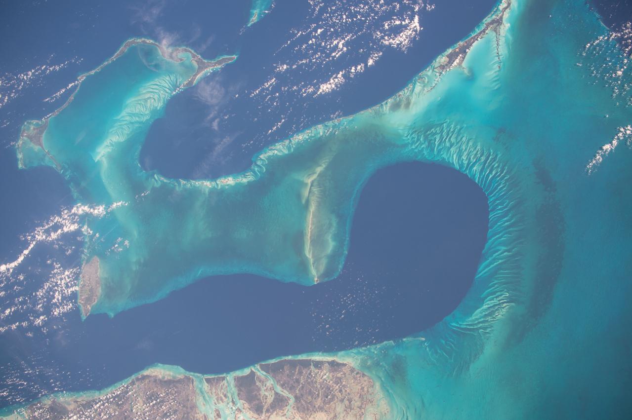
ISS042E070886 (12/23/2014) --- ESA astronaut Samantha Cristoforetti on the International Space Station captured this warm water image of the aquamarine and turquoise waters around the Bahamas down to the central American countries of Honduras and Nicaragua.
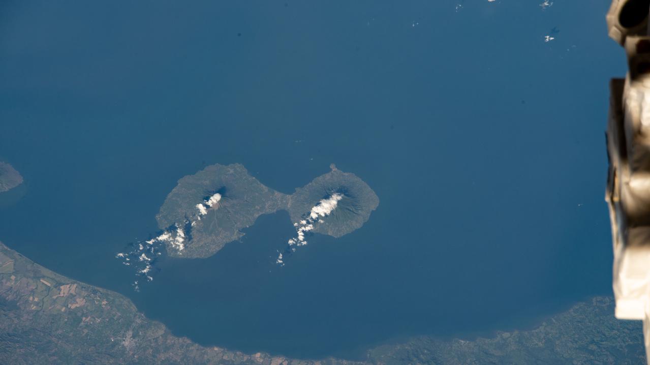
iss068e041033 (Jan. 19, 2023) --- The island of Ometepe, pictured from the International Space Station at an altitude of 258 miles, in Lake Nicaragua is home to two volcanoes, including the active Concepción Volcano and the dormant Maderas Volcano.

iss072e403402 (Dec. 24, 2024) --- NASA astronaut and Expedition 72 Commander Suni Williams assembles research hardware inside the International Space Station's cupola while orbiting 261 miles above the Pacific Ocean west of Nicaragua.
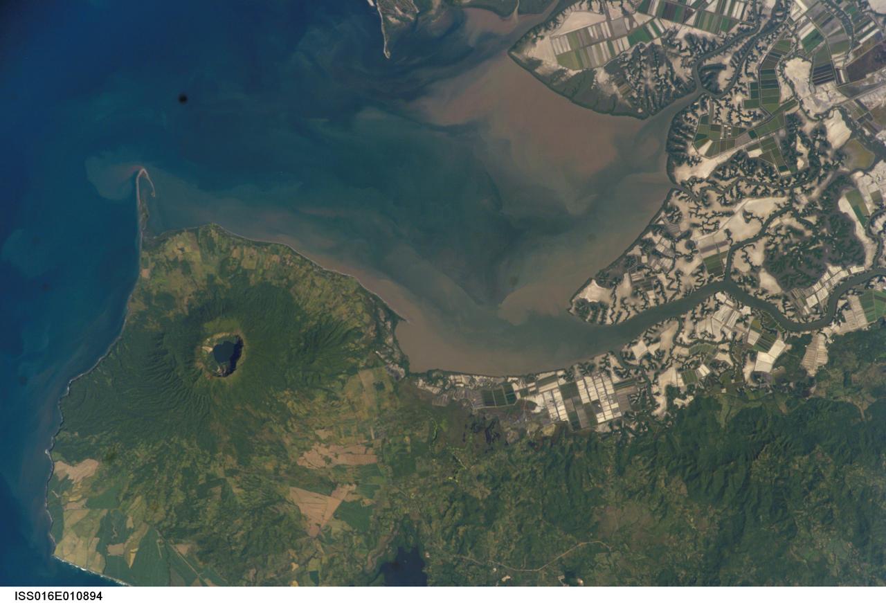
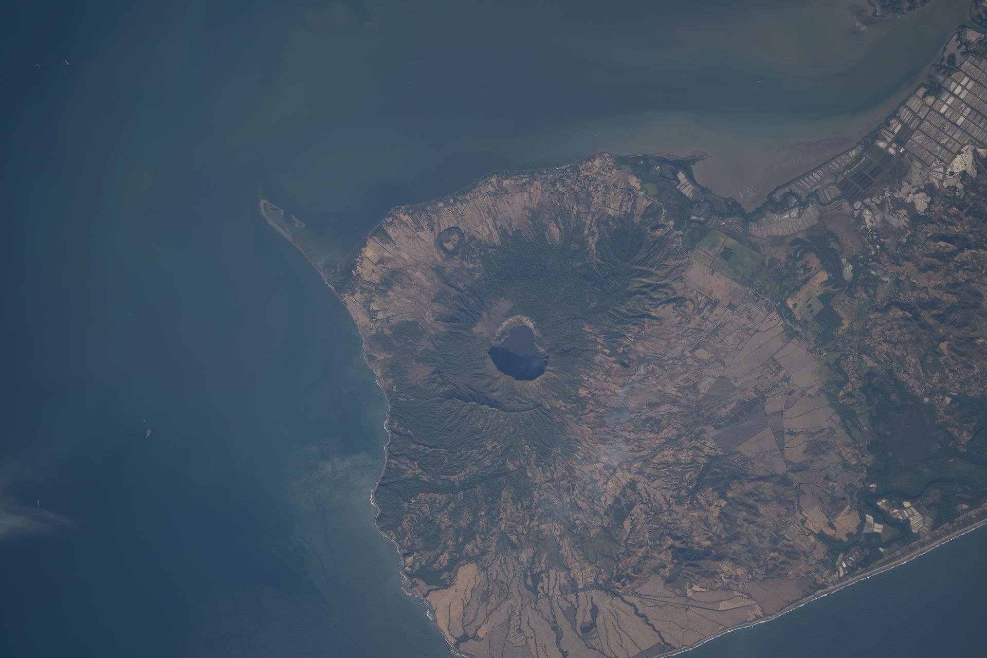
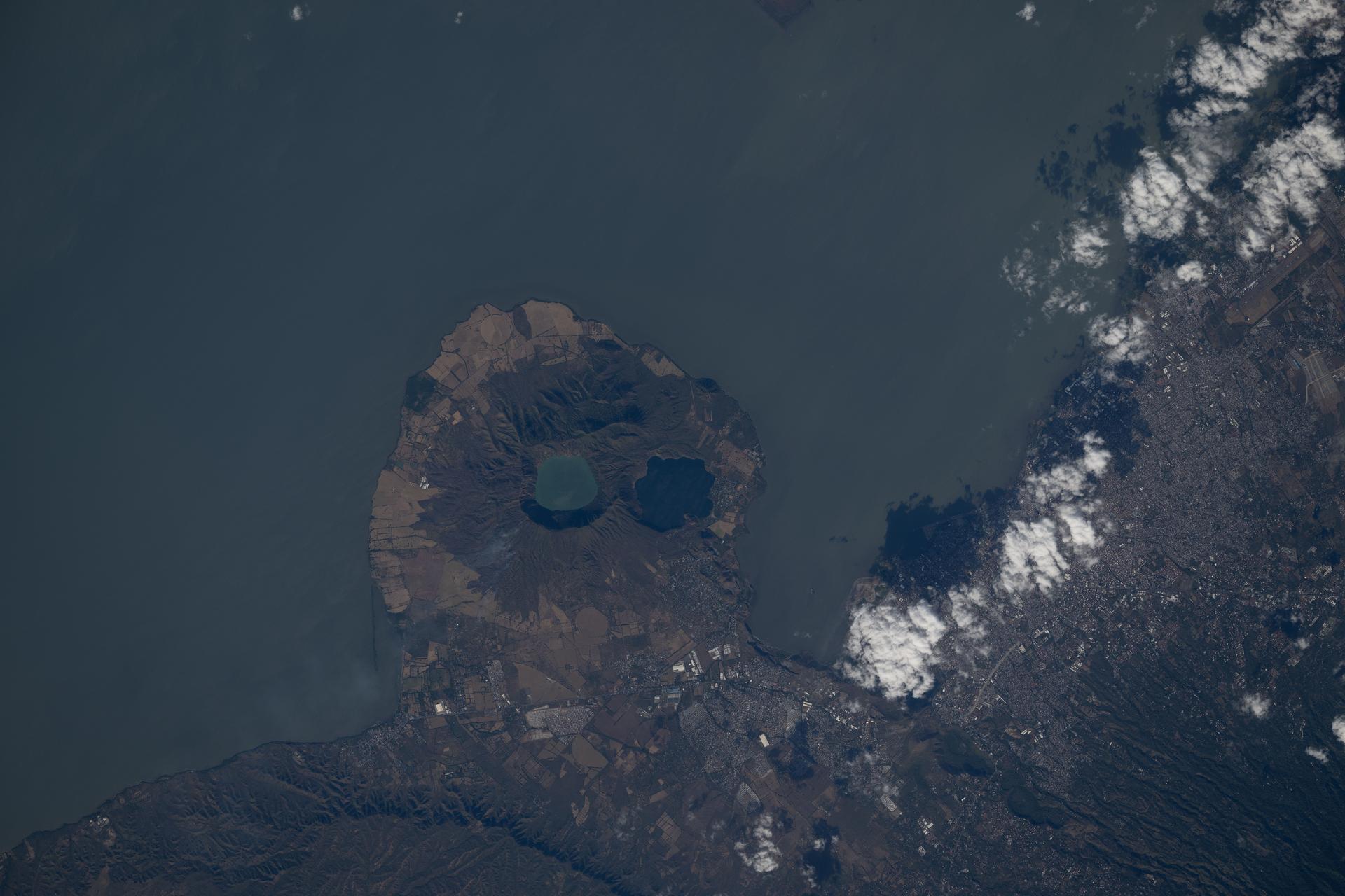
ISS016-E-010894 (17 Nov. 2007) --- Cosiguina Volcano, Nicaragua is featured in this image photographed by an Expedition 16 crewmember on the International Space Station. Three Central American countries (El Salvador, Honduras, and Nicaragua) include coastline along the Gulf of Fonseca that opens into the Pacific Ocean. The southern boundary of the Gulf is a peninsula formed by the Cosiguina volcano illustrated in this view. Cosiguina is a stratovolcano, typically tall cone-shaped structures formed by alternating layers of solidified lava and volcanic rocks (ash, pyroclastic flows, breccias) produced by explosive eruptions. The summit crater is filled with a lake (Laguna Cosiguina). The volcano last erupted in 1859, but its most famous activity occurred in 1835 when it produced the largest historical eruption in Nicaragua. Ash from the 1835 eruption has been found in Mexico, Costa Rica, and Jamaica. The volcano has been quiet since 1859, only an instant in terms of geological time. An earthquake swarm was measured near Cosiguina in 2002, indicating that tectonic forces are still active in the region although the volcano is somewhat isolated from the line of more recently active Central American volcanoes to the northwest and southeast. Intermittently observed gas bubbles in Laguna Cosiguina, and a hot spring along the eastern flank of the volcano are the only indicators of hydrothermal activity at the volcano. The fairly uniform vegetation cover (green) on the volcano's sides also attest to a general lack of gas emissions or "hot spots" on the 872 meter high cone, according to NASA scientists who study the photos downlinked from the orbital outpost.
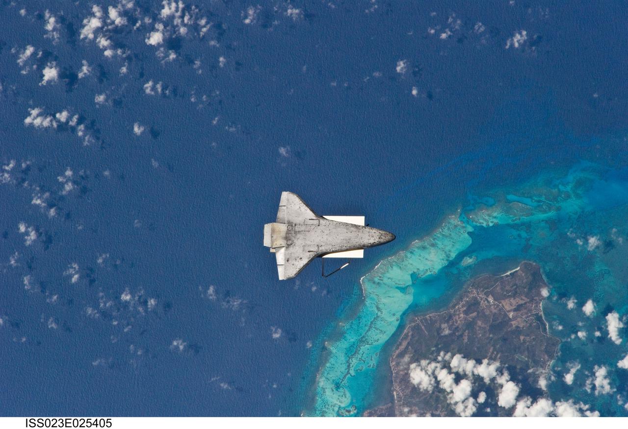
ISS023-E-025405 (17 April 2010) --- The underside of space shuttle Discovery is visible in this image photographed by an Expedition 23 crew member on the International Space Station soon after the shuttle and station began their post-undocking relative separation. Undocking of the two spacecraft occurred at 7:52 a.m. (CDT) on April 17, 2010, ending a stay of 10 days, 5 hours and 8 minutes. The visit included three spacewalks and delivery of more than seven tons of equipment and supplies. The recognizable feature on Earth below is the south end of Isla de Providencia, about 150 miles off the coast of Nicaragua near 13.3 degrees north latitude 81.4 degrees west longitude. The island belongs to Colombia.
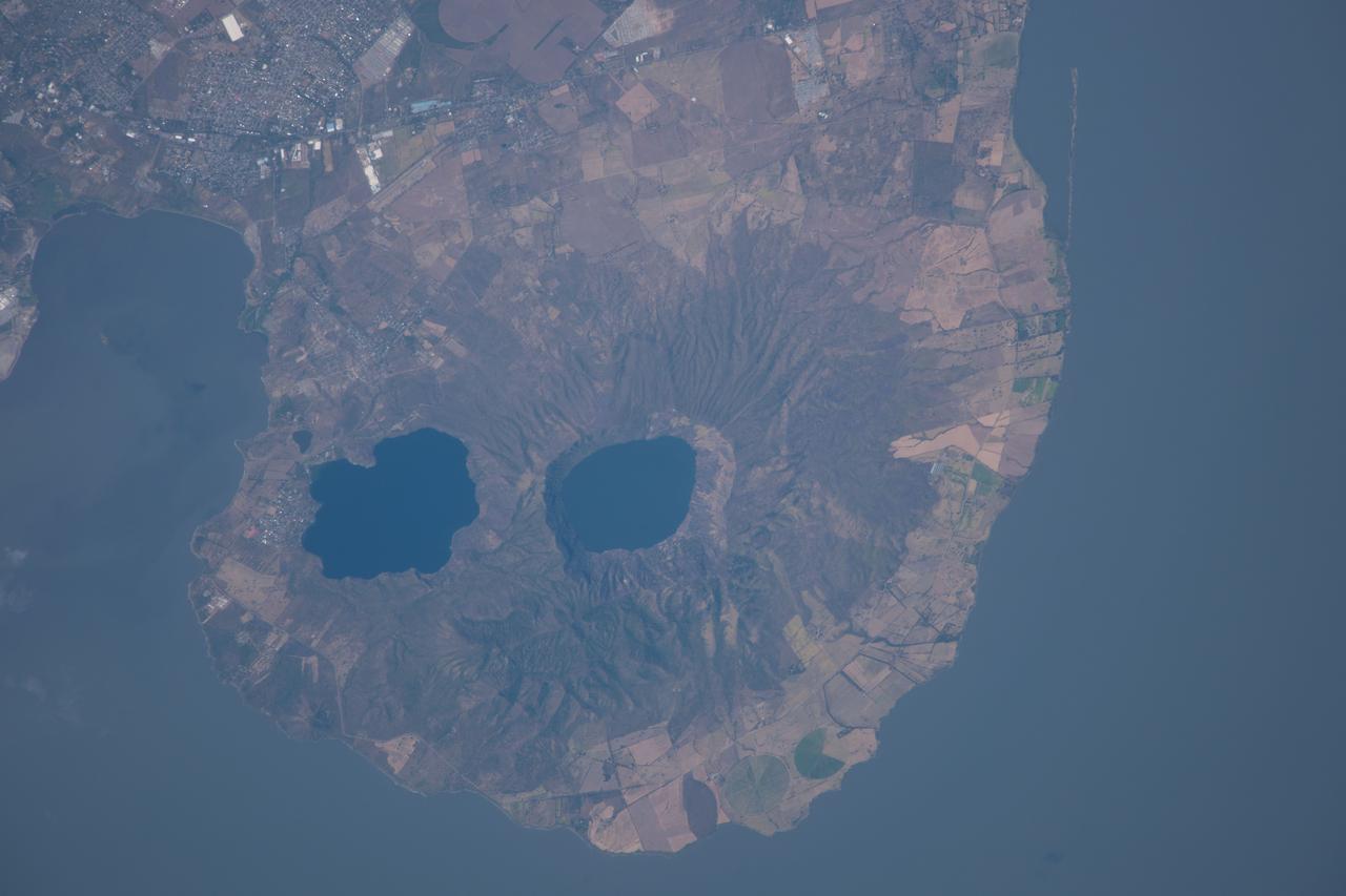
ISS038-E-035123 (21 Jan. 2014) --- Apoyeque Volcano, Nicaragua is featured in this image photographed by an Expedition 38 crew member on the International Space Station. The Chiltepe Peninsula, highlighted in this photograph, extends into Lake Managua in west-central Nicaragua. The peninsula is formed from part of a large ignimbrite shield, a geologic structure created by deposition of primarily low density materials (such as pumice) ejected during violent, explosive eruptive activity. Ignimbrite deposits are most commonly emplaced during large pyroclastic flows - gravity-driven mixtures of rock, ash, and volcanic gases that can cover hundreds of kilometers at speeds of hundreds of kilometers per hour - with ignimbrite shields formed over geologic time by successive flows. The Apoyeque caldera, filled with a 2.8-kilometer-wide and 400-meter-deep lake, dominates the center of the peninsula. Geological evidence indicates that Apoyeque last erupted around 50 BCE (plus or minus 100 years). The Laguna Xiloa maar - a volcanic crater formed by the explosive interaction of magma and groundwater - is located immediately to the southeast of Apoyeque and is also filled with a lake. According to scientists, Laguna Xiloa last erupted approximately 6,100 years ago. More recently, a swarm of small earthquakes was detected near Apoyeque in 2012. These seismic swarms, when detected in volcanically active areas, may indicate movement of magma prior to an eruption. The capital city of Managua, not visible in the image, is located approximately 15 kilometers to the southeast of Apoyeque, while the town of Bosques de Xiloa is considerably closer (approximately four kilometers).
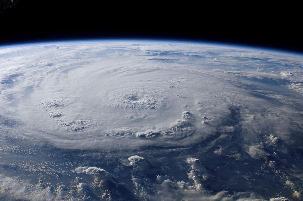
ISS015-E-25049 (3 Sept. 2007) --- This view of Hurricane Felix was taken from the Earth-orbiting International Space Station (ISS) by an Expedition 15 crewmember using a digital still camera equipped with a 28-70 mm lens set at 28 mm focal length on Sept. 3, 2007 at 11:38:46 GMT. The ISS was located at the nadir point of 16.9 degrees north latitude and 83.3 degrees west longitude, over the waters southwest of Grand Cayman Island. At approximately noon GMT, Hurricane Felix was near 14.2 degrees north latitude and 76.9 west longitude, about 260 miles (425 kilometers) south of Kingston Jamaica, and 425 miles (685 kilometers) east of Cabo Gracias a Dios on the Nicaragua/Honduras border, moving west at 21 miles per hour (33 kilometers per hour). The sustained winds were 165 miles per hour with higher gusts making it a category 5 on the Saffir-Simpson scale.
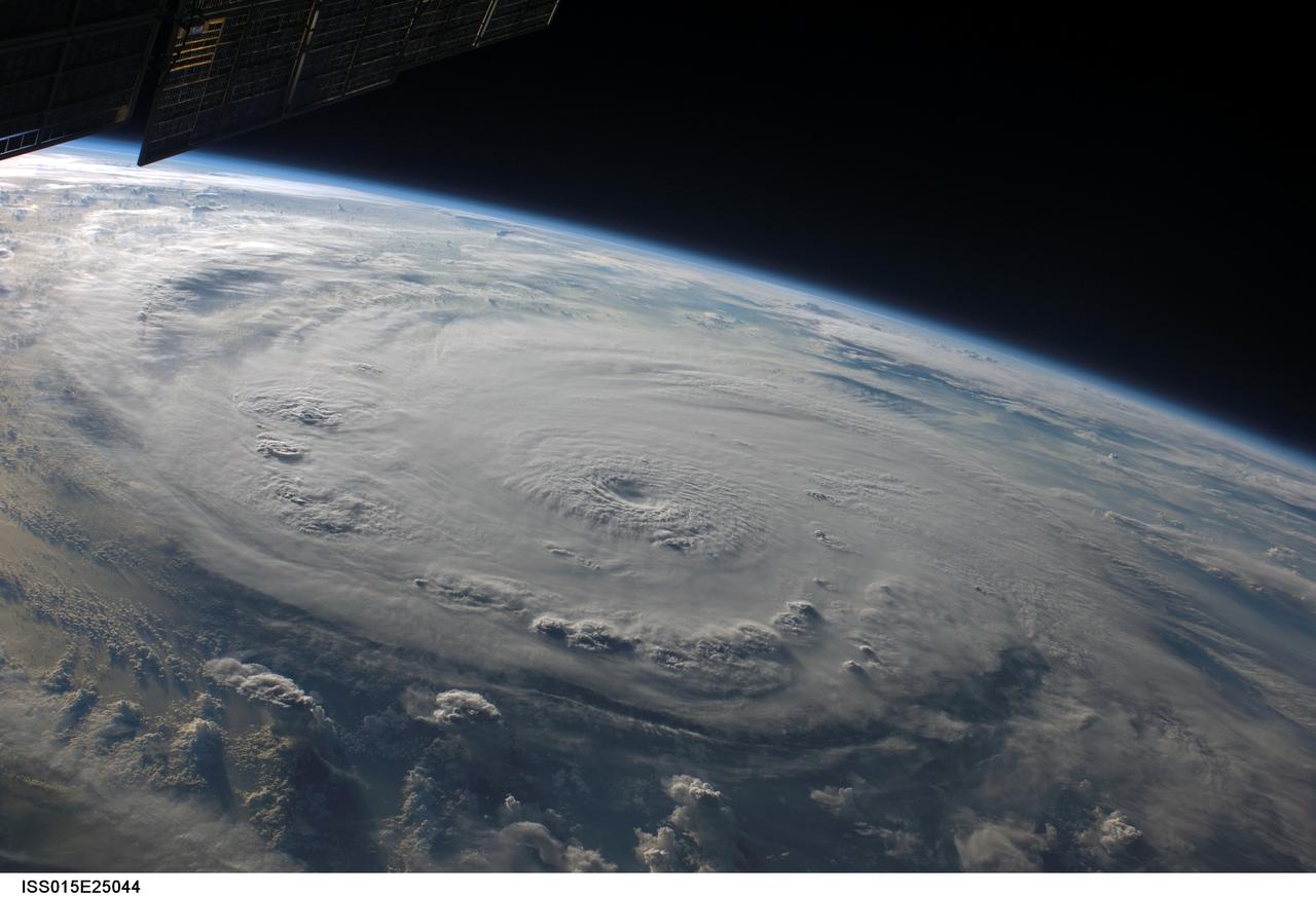
ISS015-E-25044 (3 Sept. 2007) --- This view of Hurricane Felix was taken from the Earth-orbiting International Space Station (ISS) by an Expedition 15 crewmember using a digital still camera equipped with a 28-70 mm lens set at 28 mm focal length on Sept. 3, 2007 at 11:38:29 GMT. The ISS was located at the nadir point of 16.0 degrees north latitude and 84.0 degrees west longitude nearly over the coast of eastern Honduras when this image was taken. At approximately noon GMT, Hurricane Felix was near 14.2 degrees north latitude and 76.9 degrees west longitude, about 260 miles (425 kilometers) south of Kingston Jamaica, and 425 miles (685 kilometers) east of Cabo Gracias a Dios on the Nicaragua/Honduras border, moving west at 21 miles per hour (33 kilometers per hour). The sustained winds were 165 miles per hour with higher gusts making it a category 5 on the Saffir-Simpson scale.
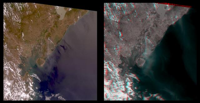
The true-color image at left is a downward-looking (nadir) view of the area around the San Cristobal volcano, which erupted the previous day. This image is oriented with east at the top and north at the left. The right image is a stereo anaglyph of the same area, created from red band multi-angle data taken by the 45.6-degree aftward and 70.5-degree aftward cameras on the Multi-angle Imaging SpectroRadiometer (MISR) instrument on NASA's Terra satellite. View this image through red/blue 3D glasses, with the red filter over the left eye. A plume from San Cristobal (approximately at image center) is much easier to see in the anaglyph, due to 3 effects: the long viewing path through the atmosphere at the oblique angles, the reduced reflection from the underlying water, and the 3D stereoscopic height separation. In this image, the plume floats between the surface and the overlying cumulus clouds. A second plume is also visible in the upper right (southeast of San Cristobal). This very thin plume may originate from the Masaya volcano, which is continually degassing at as low rate. The spatial resolution is 275 meters (300 yards). http://photojournal.jpl.nasa.gov/catalog/PIA02600