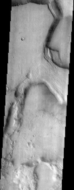
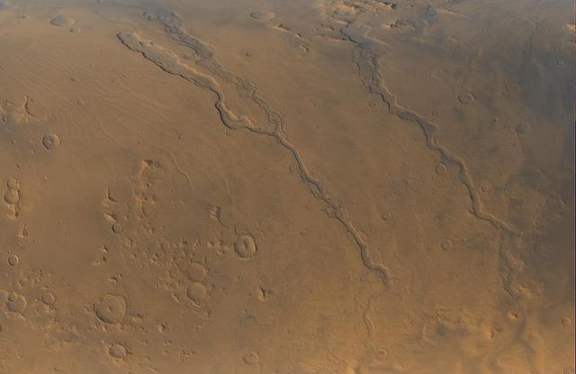
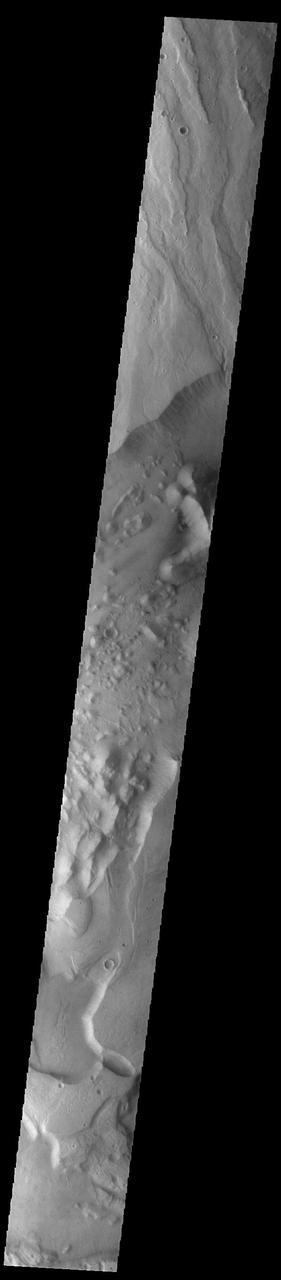
Niger Vallis
This VIS image shows a portion of Niger Vallis. The channel is 333 km (207 miles) long. Arising from the volcano Hadriacus Mons, Niger Vallis merges with Dao Vallis and flows southwestward into Hellas Planitia. The channel is named for the Niger Rivier in Africa. Orbit Number: 83734 Latitude: -36.231 Longitude: 90.9557 Instrument: VIS Captured: 2020-10-29 22:33 https://photojournal.jpl.nasa.gov/catalog/PIA24279
Looking Out Across Dao, Niger, and Harmakhis Valles
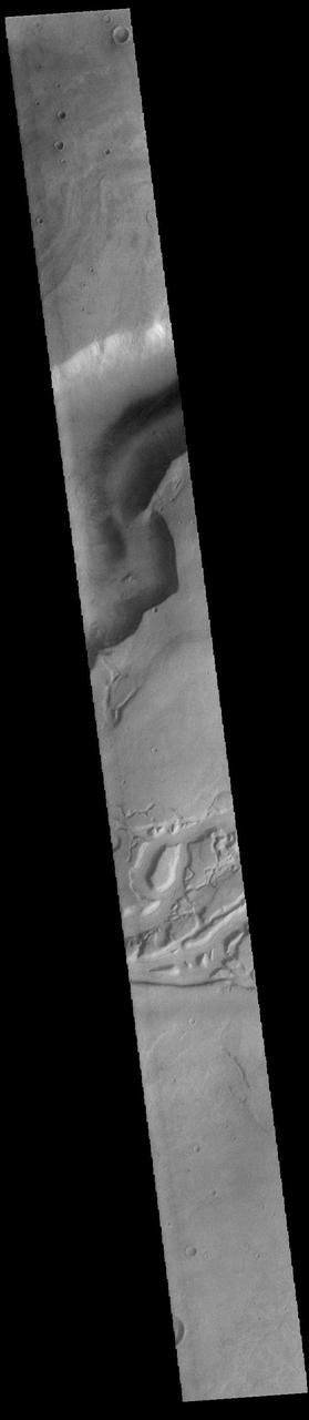
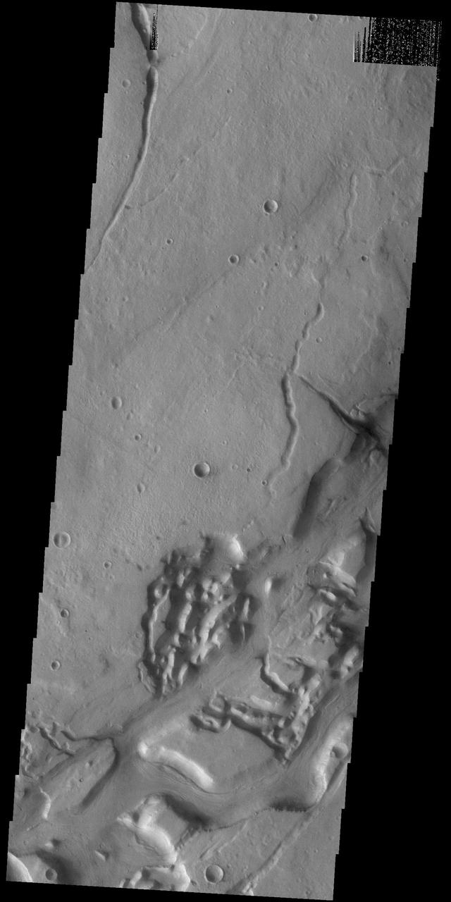
Today's VIS image shows a small portion of both Dao Vallis (top of image) and Niger Vallis (middle of image). Arising from the volcano Hadriacus Mons, Dao Vallis is approximately 1200km (750 miles) long. Niger Vallis is 333 km (207 miles) long. It has been proposed that heating of the region due to volcanic activity melted subsurface ice which was released to the surface to carve the two channels. Niger Vallis merges with Dao Vallis just off the image and then flow southwestward into the Hellas Planitia basin. Orbit Number: 91427 Latitude: -36.3071 Longitude: 90.4526 Instrument: VIS Captured: 2022-07-25 09:32 https://photojournal.jpl.nasa.gov/catalog/PIA25601
Today's VIS image shows a small portion of both Dao Vallis (middle of image) and Niger Vallis (bottom of image). Arising from the volcano Hadriacus Mons (top of image), Dao Vallis is approximately 1200km (750 miles) long. Niger Vallis is 333 km (207 miles) long. It has been proposed that heating of the region due to volcanic activity melted subsurface ice which was released to the surface to carve the two channels. Niger Vallis merges with Dao Vallis south of this image and then flow southwestward into the Hellas Planitia basin. Orbit Number: 93355 Latitude: -33.4749 Longitude: 93.0394 Instrument: VIS Captured: 2022-12-31 02:58 https://photojournal.jpl.nasa.gov/catalog/PIA25852
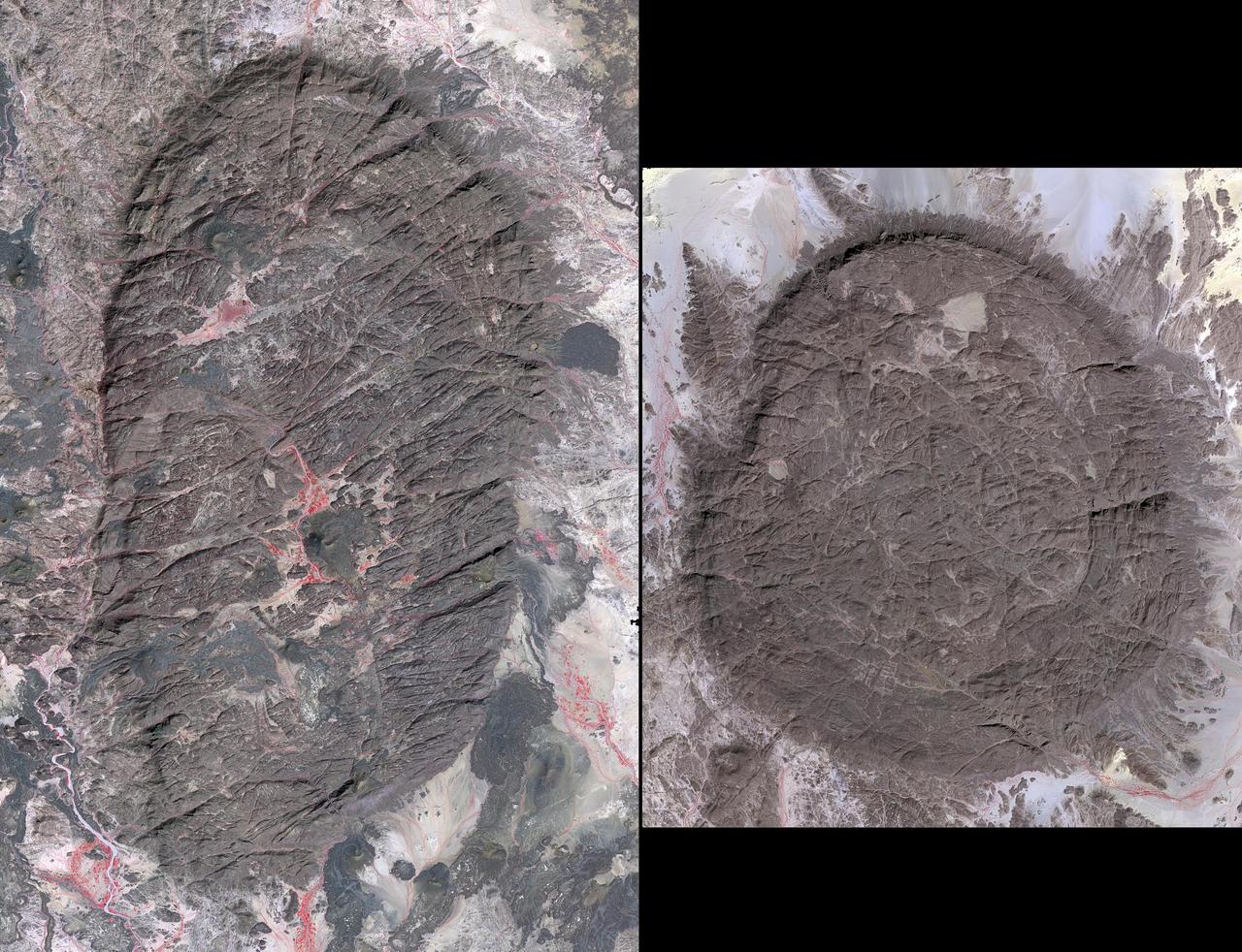
The Air Mountains are located in northern Niger and extend over 84,000 square kilometers within the Sahara Desert. Geologically, the area is notable for its remarkable ring dikes that enclose circular granite massifs. These in turn contain, and are surrounded by, young volcanic features, including cinder cones and lava flows. Two of the massifs are shown here: the oval one includes Mont Idoukal-n-Taghes, Niger's highest point. The montage is made up of images acquired November 5, 2017, covers an area of 45 kilometers north-south, and is located near 18 degrees north, 8.5 degrees east. https://photojournal.jpl.nasa.gov/catalog/PIA22795
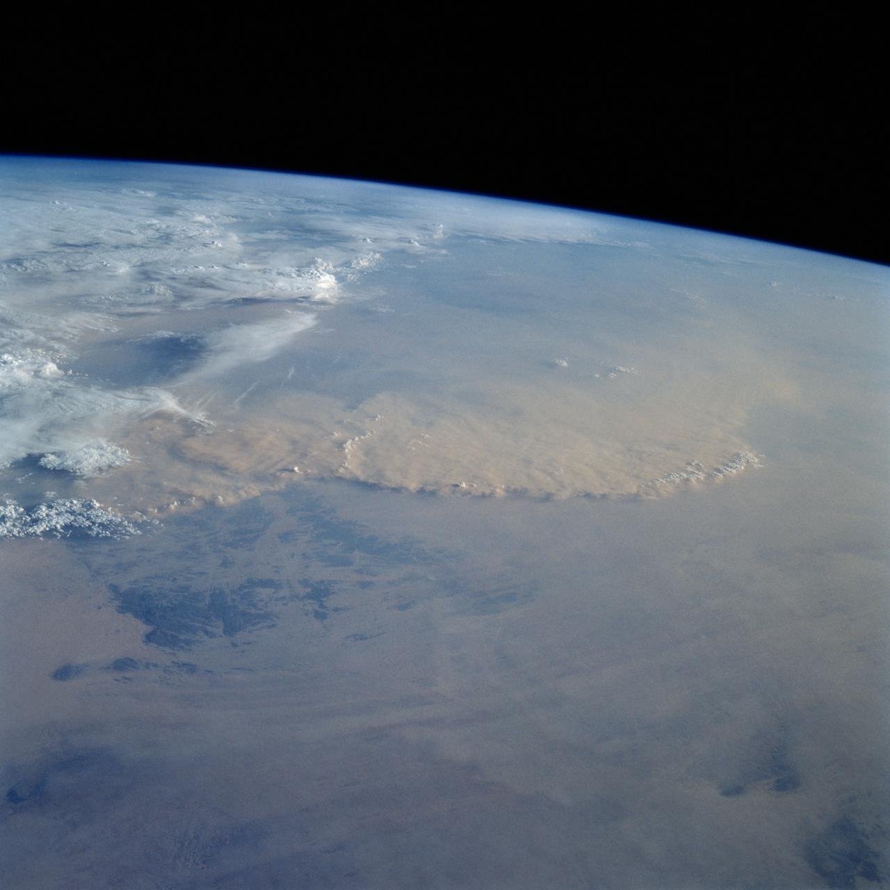
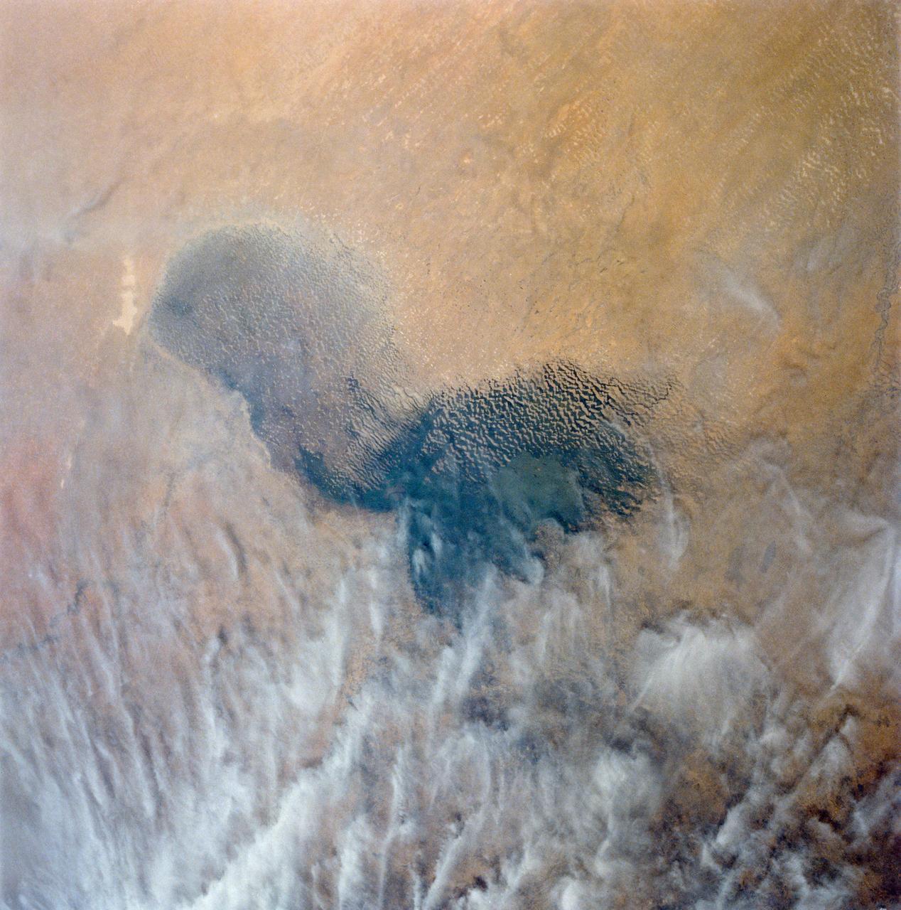
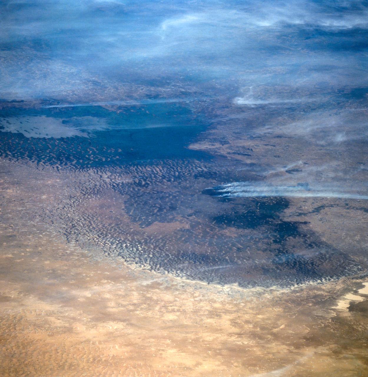
STS049-92-071 (13 May 1992) --- The STS-49 crew aboard the Earth-orbiting Space Shuttle Endeavour captured this Saharan dust storm on the Algeria-Niger border. The south-looking, late-afternoon view shows one of the best examples in the Shuttle photo data base of a dust storm. A series of gust fronts, caused by dissipating thunderstorms have picked up dust along the outflow boundaries. Small cumulus clouds have formed over the most vigorously ascending parts of the dust front, enhancing the visual effect of the front. The storm is moving roughly north-northwest, at right angles to the most typical path for dust storms in this part of the Sahara (shown by lines of sand on the desert surface in the foreground). Storms such as this can move out into the Atlantic, bringing dust even as far as the Americas on some occasions. A crewmember used a 70mm handheld Hasselblad camera with a 100mm lens to record the frame.

iss072e069220 (Oct. 16, 2024) --- The Jebba Dam (lower left) impounds the Niger River creating a reservoir in Nigeria in this photograph from the International Space Station as it orbited 259 miles above the African nation.
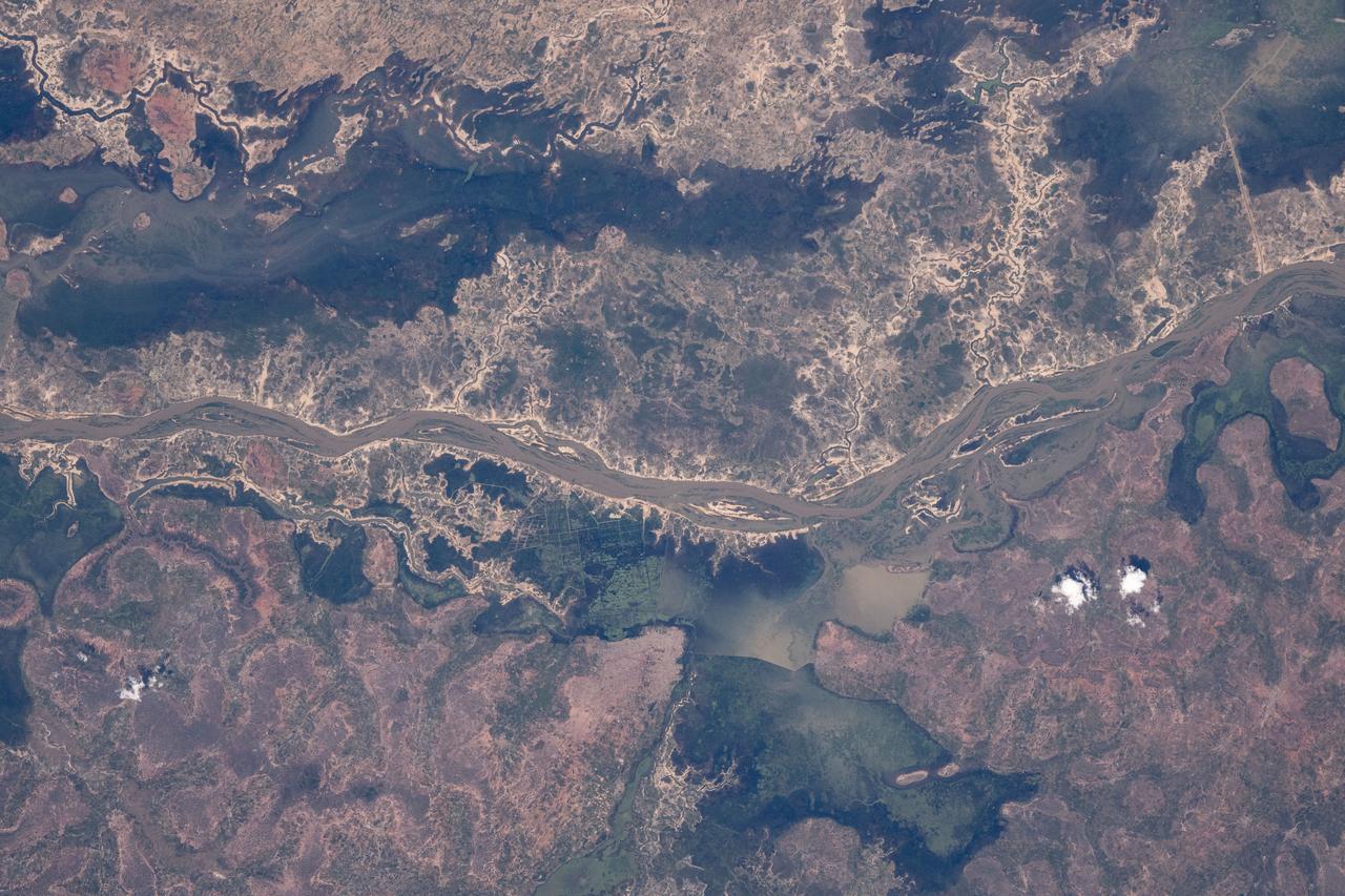
iss072e095268 (Oct. 20, 2024) --- The Niger River splits into its tributary, the Benue River, at the Nigerian city of Lokoja with a population of over 692,00 in this photograph from the International Space Station as it orbited 258 miles above the African nation.
iss072e097231 (Oct. 22, 2024) --- The Bani River, a tributary of the Niger River, in Mali is pictured from the International Space Station as it orbited 257 miles above the African nation.
iss072e095217 (Oct. 20, 2024) --- The Niger River flows through the African nation of Mali near the Sahara Desert in this photograph from the International Space Station as it orbited 257 miles above.
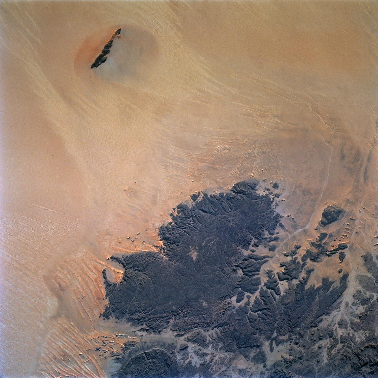
STS072-709-063 (11-20 Jan. 1996) --- The astronauts aboard the Space Shuttle Endeavour exposed this 70mm frame of the Air Mountains, located in the country of Niger. These Sahara Desert structures are granitic intrusions. They are resistant to erosion and are very prominent in the lighter colored sands of the area. According to NASA geologists studying the photo collection, the ring-like structure on the lower left-hand edge of the photograph is probably a Quaternary volcanic feature. The highest peaks in the range approach 1,800 meters (6,000 feet). Deep valleys in the range are used by the Tuaregs for pasturage. Uranium and other minerals are being mined in the massif.
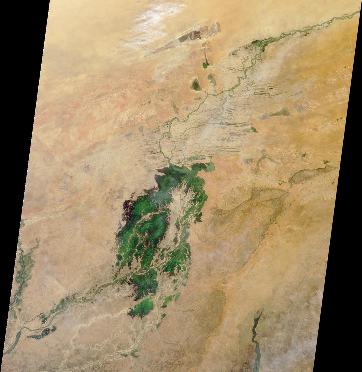
The third largest river in Africa, the Niger, forms an inland delta in central Mali. This image is from NASA Terra satellite is MISR Mystery Image Quiz #3.
NASA Terra spacecraft shows Timbuktu in the West African Nation of Mali, about 15 km north of the Niger River, at the intersection of an east-west and a north-south Trans Saharan trade route across the Sahara.
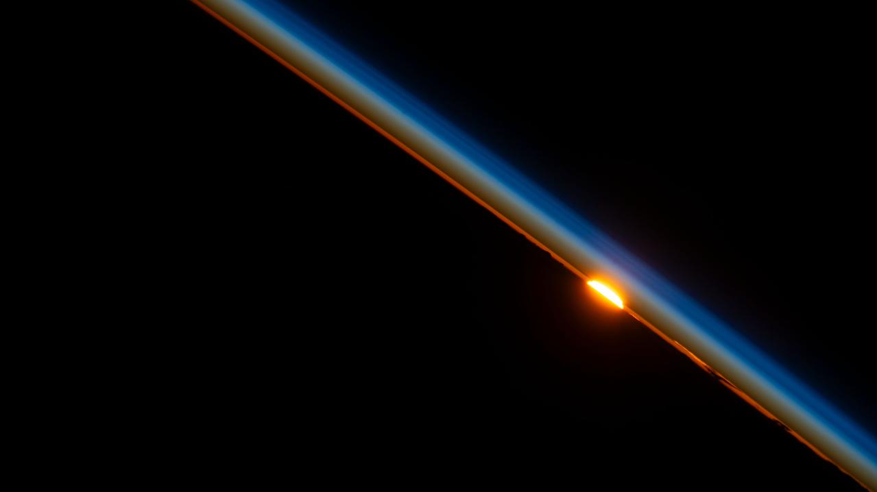
iss069e030598 (July 9, 2023) --- The last rays of an orbital sunset dim in the Earth's atmosphere as the International Space Station orbited above Niger on the African continent.
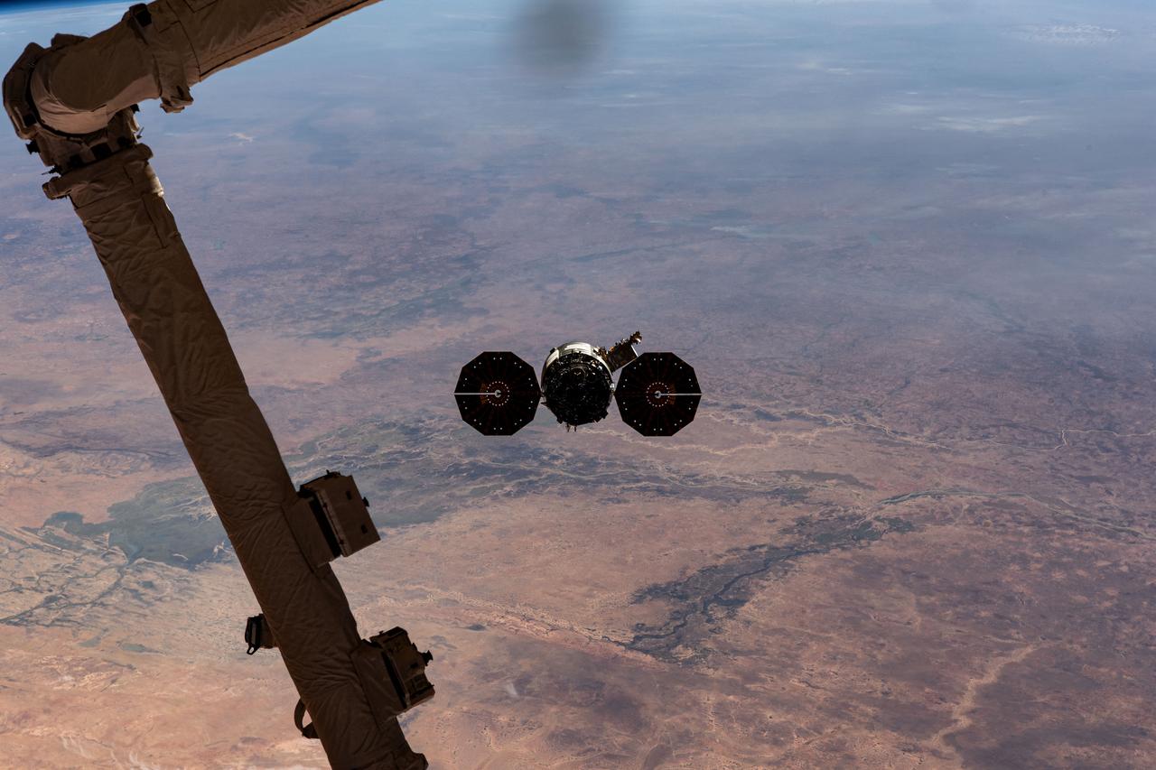
iss070e044314 (Dec. 22, 2023) --- Northrop Grumman's Cygnus space freighter is pictured departing the International Space Station after it was released from the grip of the Canadarm2 robotic arm. The orbital complex was soaring 258 miles above the African nation of Mauritania at the time of this photograph. The major land feature toward the center left, is the Inner Niger Delta, an inland delta created by the Niger River in the central portion of Mali.
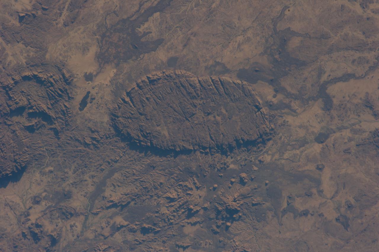
ISS037-E-026753 (4 Nov. 2013) --- One of the Expedition 37 crew members aboard the International Space Station photograph this vertical view of mountainous terrain in Niger, a landlocked country in Africa surrounded by seven other nations.
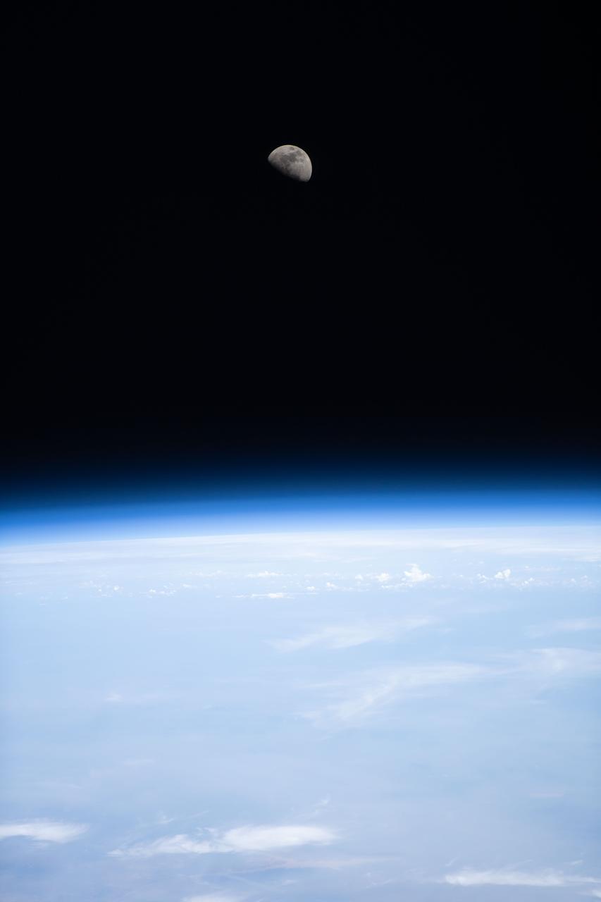
iss070e008520 (Oct. 23, 2023) --- The first quarter Moon is pictured above Earth's horizon from the International Space Station as it orbited 260 miles above the African nation of Niger.
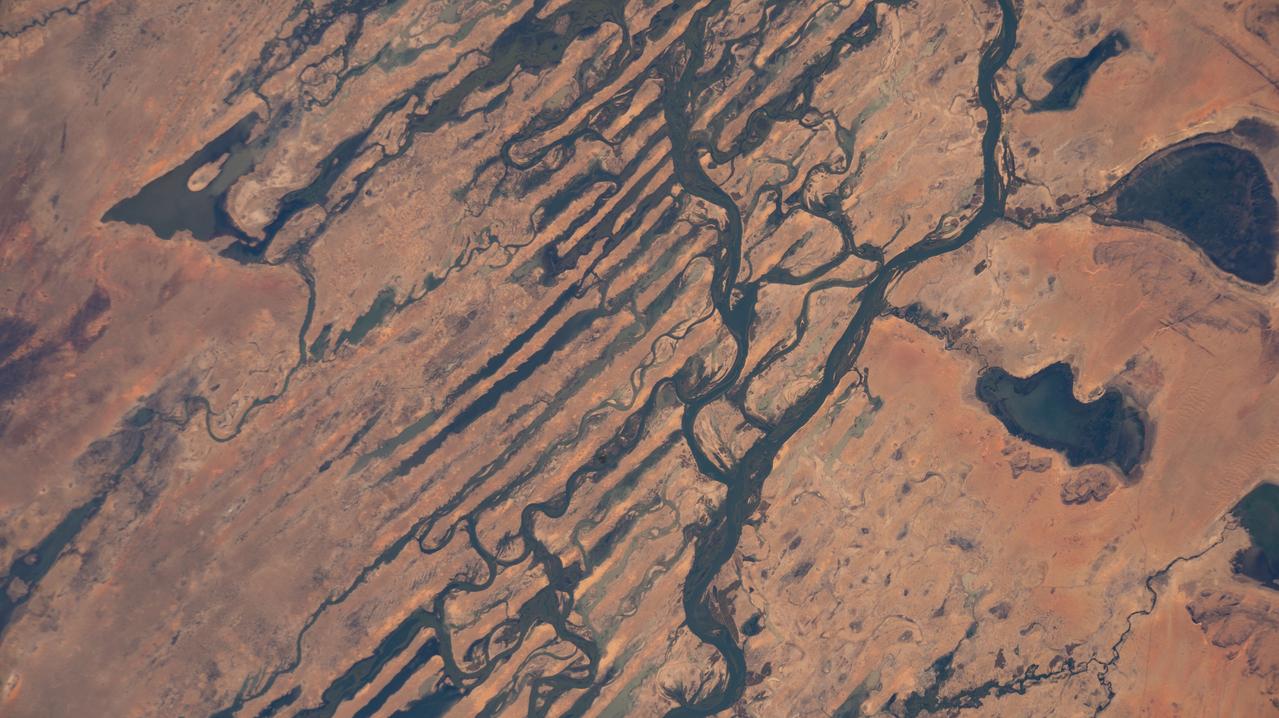
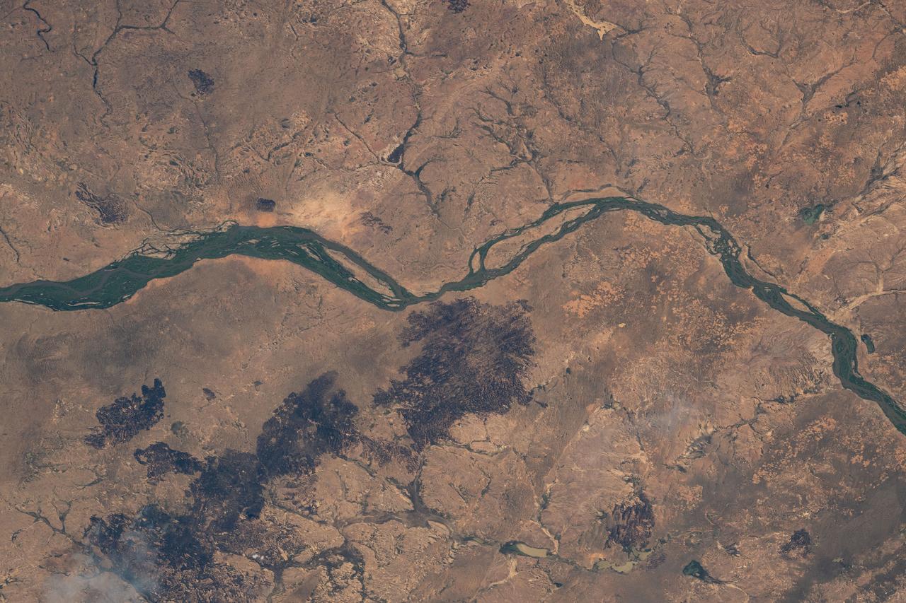
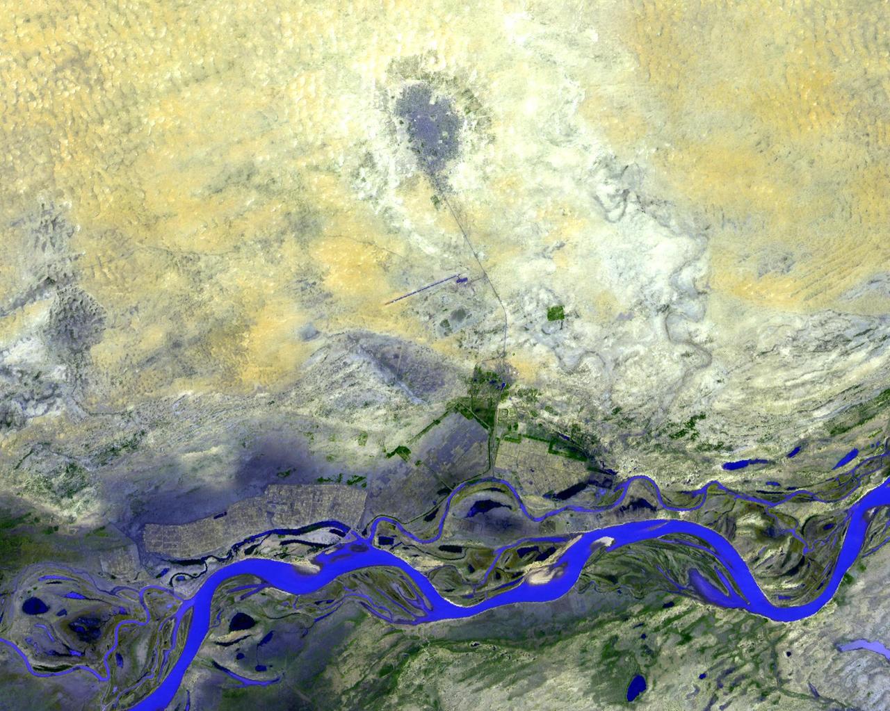
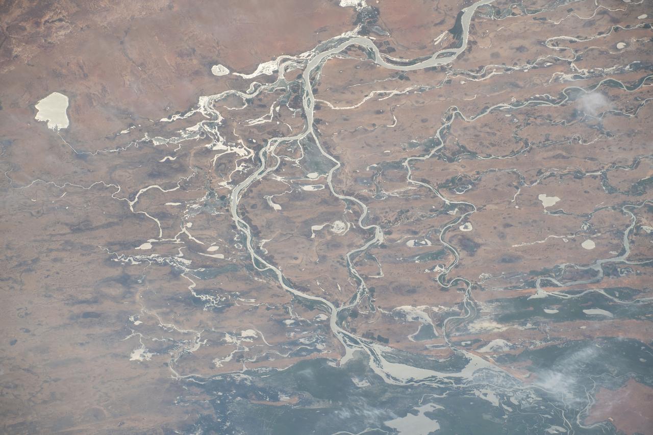
iss068e030991 (Dec. 17, 2022) --- The Niger River, its tributaries, and the Fati and Oro lakes, are pictured from the International Space Station as it orbited 257 miles above the African nation of Mali.
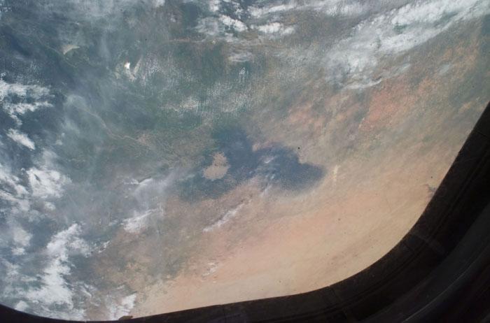
Earth observation taken during day pass by an Expedition 36 crew member on board the International Space Station (ISS). Per Twitter message: Looking southwest over northern Africa. Libya, Algeria, Niger.
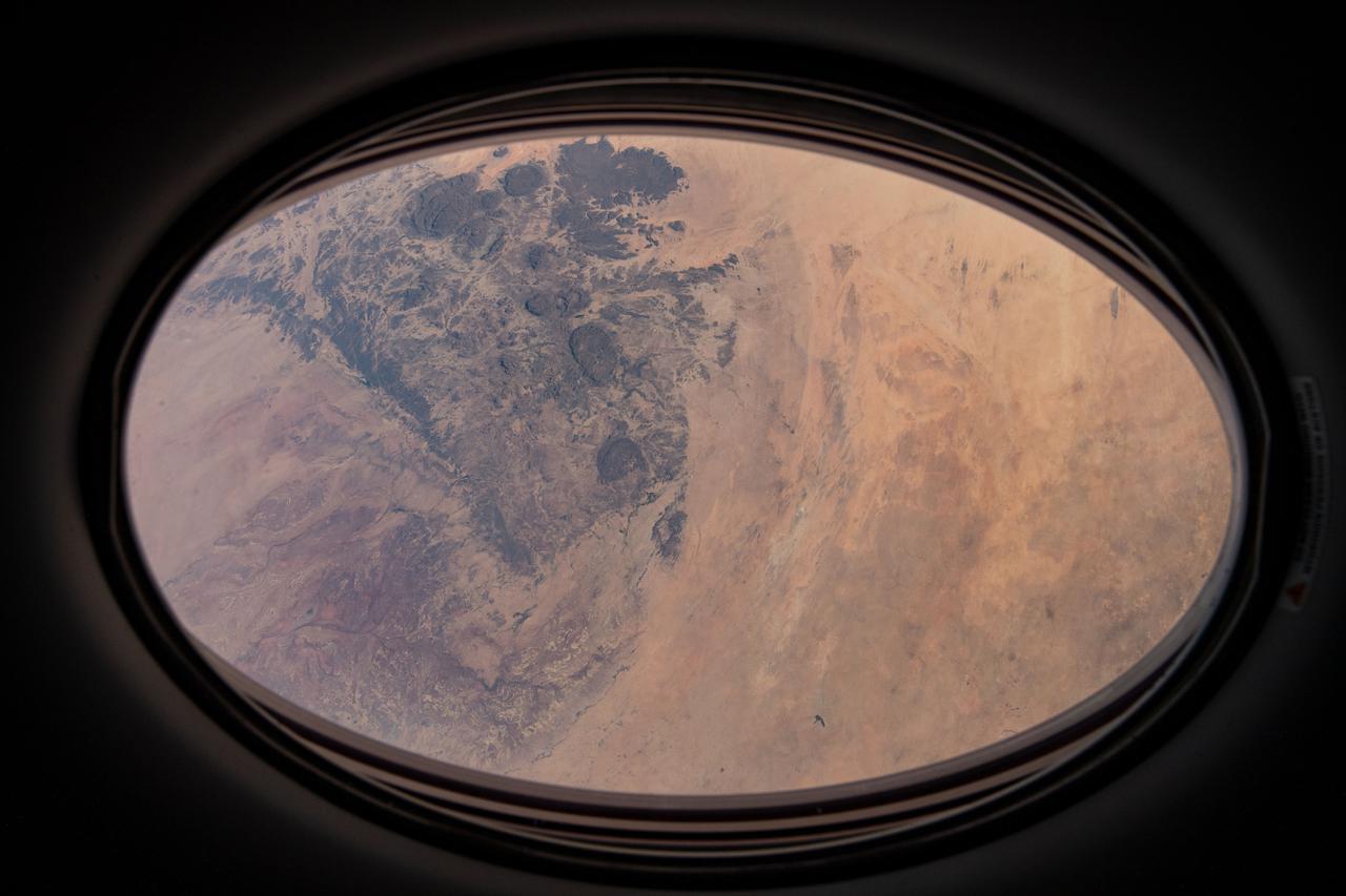
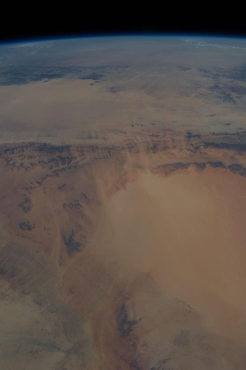
iss064e020109 (Jan. 5, 2021) --- This view from a window on the SpaceX Crew Dragon vehicle docked to the International Space Station looks at a portion of the Sahara Desert in the African nation of Niger 260 miles below.
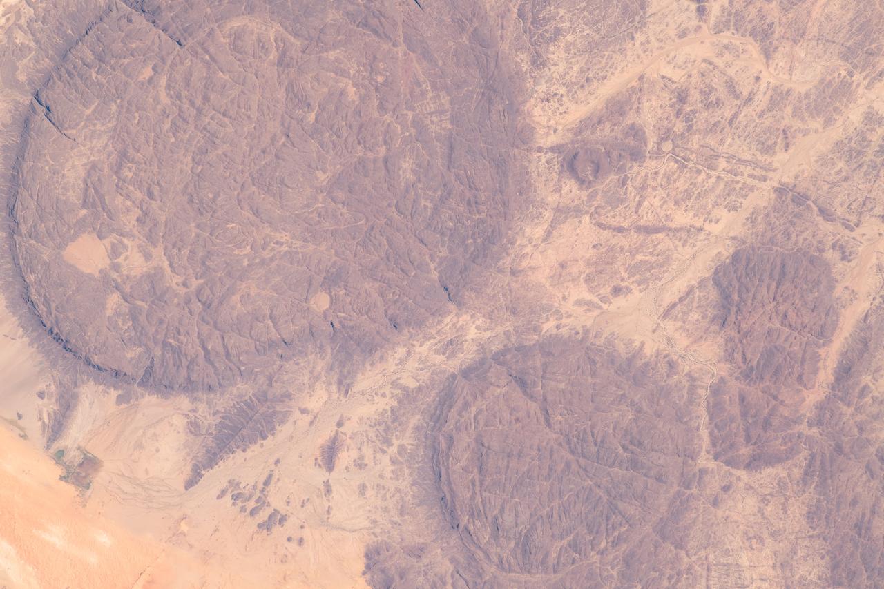
iss062e061341 (Feb. 27, 2020) --- The near-circular massifs of the Aïr Mountains within the Sahara Desert were pictured from the International Space Station as it orbited 263 miles above Niger.
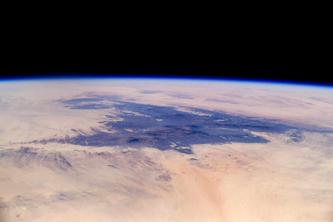
iss064e040726 (March 5, 2021) --- This picture from the International Space Station orbiting 261 miles above Africa looks northeast across Niger to the Tibesti Mountains of Chad. Credit: Roscosmos
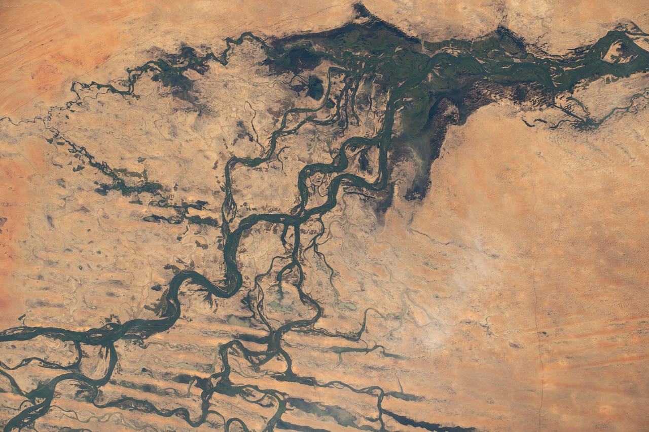
iss070e030773 (Nov. 26, 2023) --- The Niger River flows through Mali creating an inland delta in this photograph from the International Space Station as it orbited 259 miles above the African nation.
iss070e035884 (Dec. 4, 2023) --- The Niger River, near the city of Timbuktu in the African nation of Mali, is pictured from the International Space Station as it orbited 258 miles above.
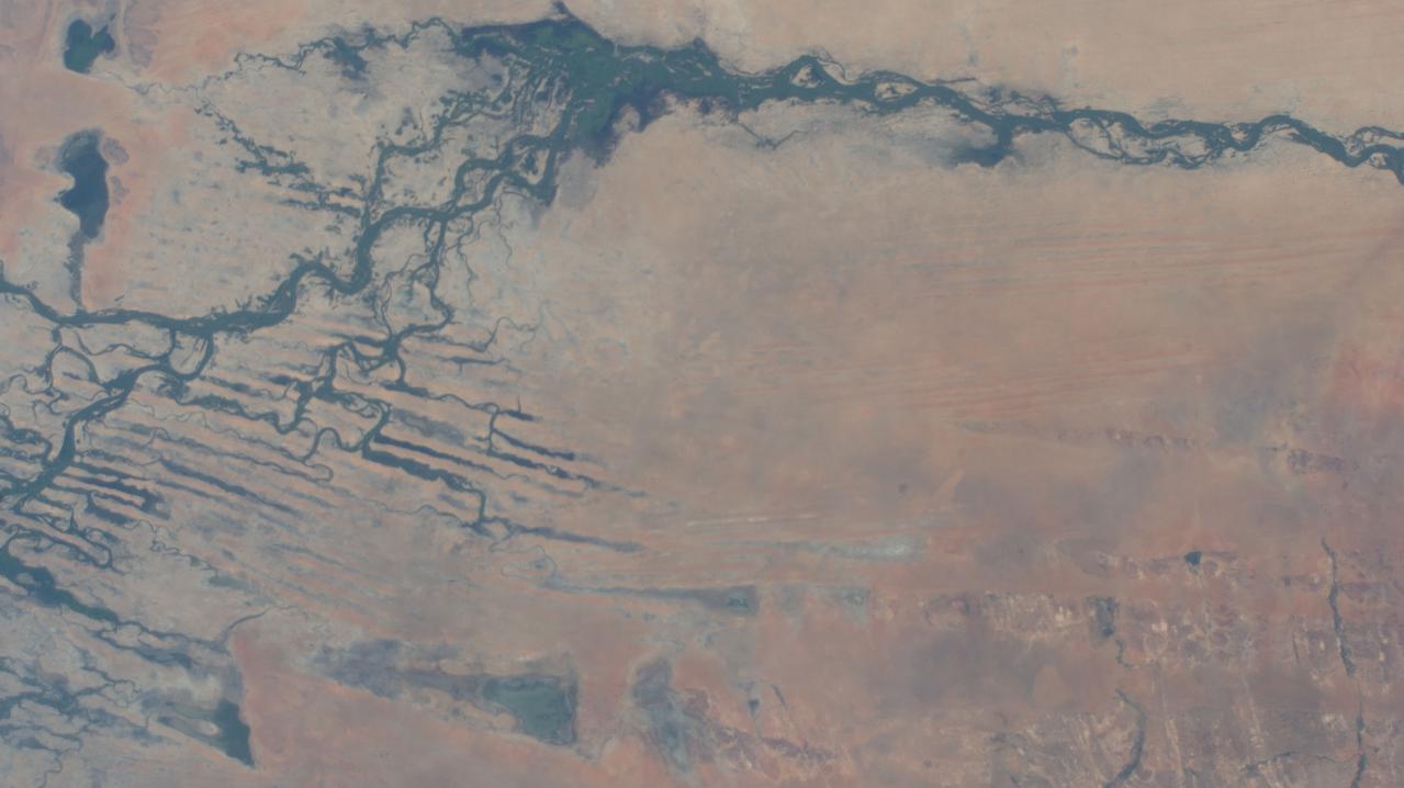
iss066e024016 (Nov. 1, 2021) --- The Niger River in the African nation of Mali is pictured from the International Space Station as it orbited 259 miles above the southwestern Sahara Desert.

iss066e137361 (Feb. 7, 2022) --- The Niger River runs through Mali and leads to Lake Deebo in this picture from the International Space Station as it orbited 259 miles above the African nation. The historical city of Timbuktu (out of frame) is farther to the north and lies near the river.
STS105-E-5434 (21 August 2001) --- Lake Chad and parts of Chad, Niger and Cameroon in Africa are pictured in this digital still camera's image recorded by the STS-105 crew members toward the end of their mission. The scene was captured though one of the overhead windows on the aft flight deck of the Space Shuttle Discovery.
Africa's Lake Chad where the borders of Chad, Niger, Nigeria and Cameroon merge (13.0N, 14.0E) has been undergoing change for the past 25 to 30 years when it was first noticed that the lake is drying up. Since then, astronauts have been photographing it on a regular basis to record the diminishing lake bed. This lake was once the aproximate size of Lake Erie but is now only about half that size and is still receeding.
SL4-138-3756 (28 Dec. 1973) --- The northern half of Mauritania's Atlantic Coast, as photographed from the Skylab space station in Earth orbit by one of the Skylab 4 crewmen. The camera used was a hand-held 70mm Hasselblad, with SO-368 medium-speed Ektachrome. Spanish Sahara is just out of the picture to the north. The linear chains of sand dunes leading to the sea were the objects of study in an effort to better understand deserts and their formations. Photographs such as this were compared with similar ones taken over the drought-stricken areas including Mali and Niger in an attempt to understand the desertification processes which may be occurring there. Photo credit: NASA
This oblique view of Lake Chad was taken by the STS-66 crew in November 1994. This lake lies mainly in the Republic of Chad and partly in Nigeria, Cameroon and Niger. The size of Lake Chad varies seasonally and is actually divided into north and south basins; neither of which is generally more than 25 feet (7.6 meters) deep. In this photograph, all the water appears to be located in the southern basin with the northern and eastern edges of both basins covered with sand dunes which have invaded the area where the water once stood. The prevailing wind direction can be seen from the agriculture burning in both basins to be from the east.

S73-35082 (July-Sept. 1973) --- A near vertical view of a portion of west Africa ravaged by drought for the past five years is seen in this Skylab 3 Earth Resources Experiments Package S190-B (five-inch Earth terrain camera) photograph taken from the Skylab space station in Earth orbit. The semi-desert scene is in southeastern Niger about 200 nautical miles east-northeast of the capital city of Niamey. A polygonal-shaped area (dark) in the lower right corner of the picture represents a range-management ranch. The dry stream beds trending diagonally across the photograph locally contain some water or vegetation (green). The beds are sources of water through shallow drilling and contain soils suitable for production of crops. The variety of tans, browns and grays are typical desert colors that represent barren rocks and soil or sand-filled ancient stream valleys. Absence of vegetation is the singular feature of the area. Dr. G. Stuckmann of the Geographic Institute, University of Technology, Mannover, Federal Republic of Germany, will use this photograph in the study of the hydrologic regime of the region through analysis of fossil drainage patterns, geological structures and accumulations of surface water. Federal agencies participating with NASA on the EREP project are the Departments of Agriculture, Commerce, Interior, the Environmental Protection Agency and the Corps of Engineers. All EREP photography is available to the public through the Department of Interior?s Earth Resources Observations Systems Data Center, Sioux Falls, South Dakota, 57198. (Alternate number SL3-86-166) Photo credit: NASA
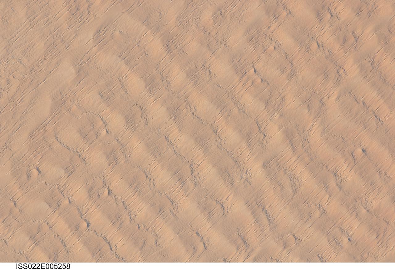
ISS022-E-005258 (1 Dec. 2009) --- This detailed hand-held digital camera?s image recorded from the International Space Station highlights sand dunes in the Fachi-Bilma erg, or sand sea, which is part of the central eastern Tenere Desert. The Tenere occupies much of southeastern Niger and is considered to be part of the larger Sahara Desert that stretches across northern Africa. Much of the Sahara is comprised of ergs ? with an area of approximately 150,000 square kilometers, the Fachi-Bilma is one of the larger sand seas. Two major types of dunes are visible in the image. Large, roughly north-south oriented transverse dunes fill the image frame. This type of dune tends to form at roughly right angles to the dominant northeasterly winds. The dune crests are marked in this image by darker, steeper sand accumulations that cast shadows. The lighter-toned zones between are lower interdune ?flats?. The large dunes appear to be highly symmetrical with regard to their crests. This suggests that the crest sediments are coarser, preventing the formation of a steeper slip face on the downwind side of the dune by wind-driven motion of similarly-sized sand grains. According to NASA scientists, this particular form of transverse dune is known as a zibar, and is thought to form by winnowing of smaller sand grains by the wind, leaving the coarser grains to form dune crests. A second set of thin linear dunes oriented at roughly right angles to the zibar dunes appears to be formed on the larger landforms and is therefore a younger landscape feature. These dunes appear to be forming from finer grains in the same wind field as the larger zibars. The image was taken with digital still camera fitted with a 400 mm lens, and is provided by the ISS Crew Earth Observations experiment and Image Science & Analysis Laboratory, Johnson Space Center.