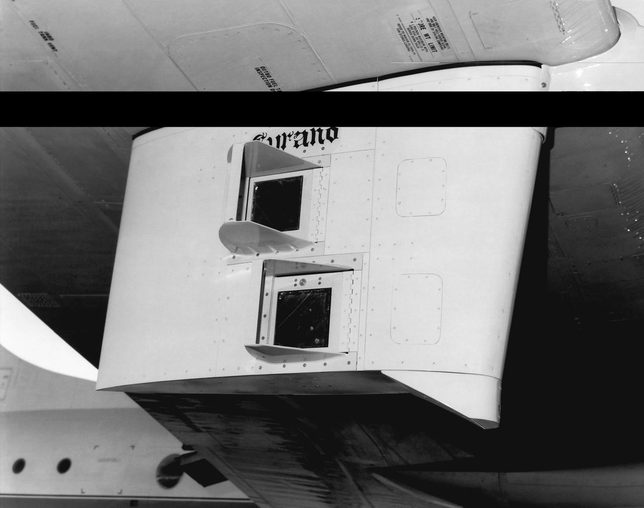
This photo shows the Shuttle tile flight test fixture under the wing of a National Oceanographic and Atmospheric Administration WP-3D aircraft.

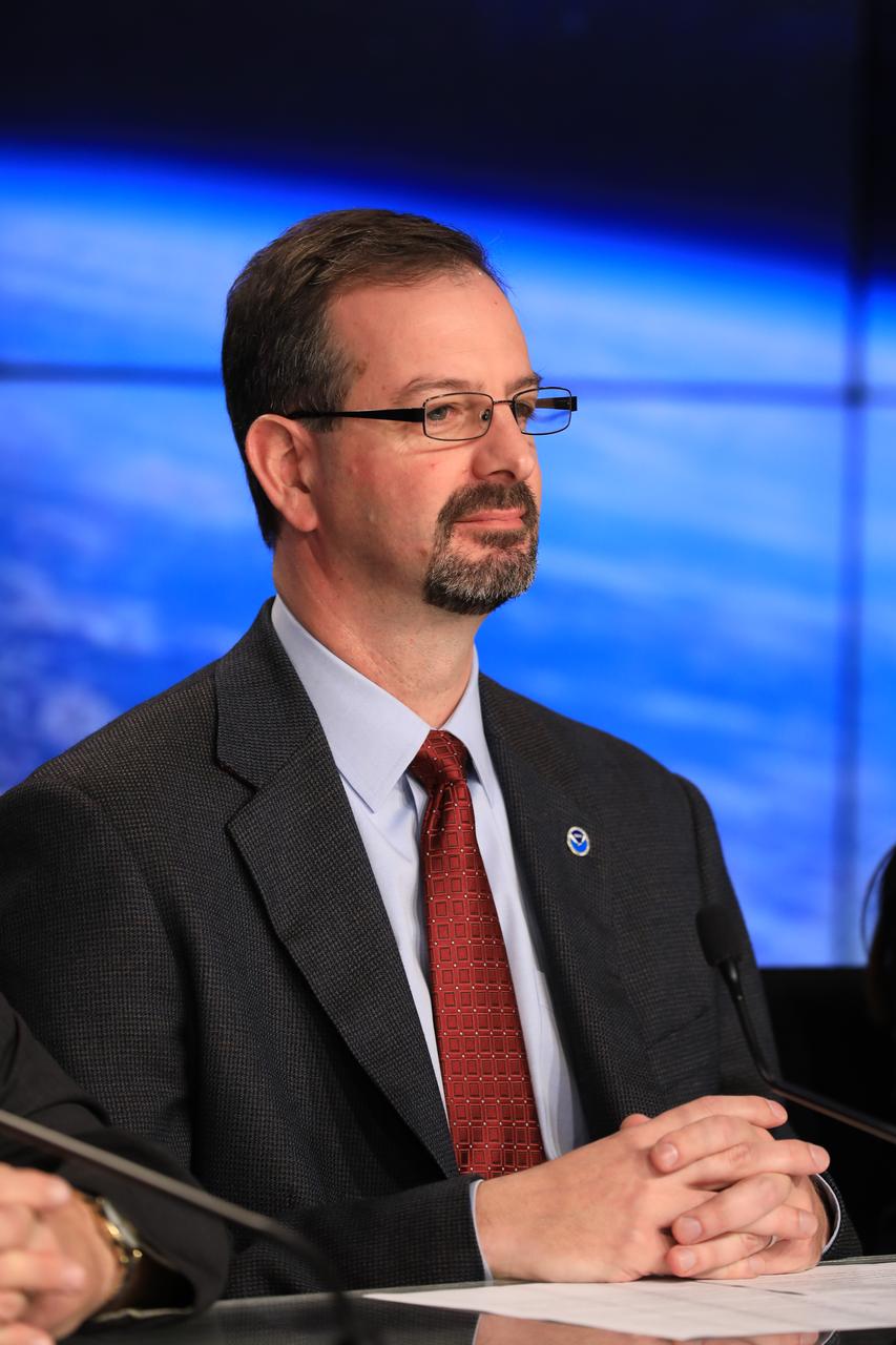
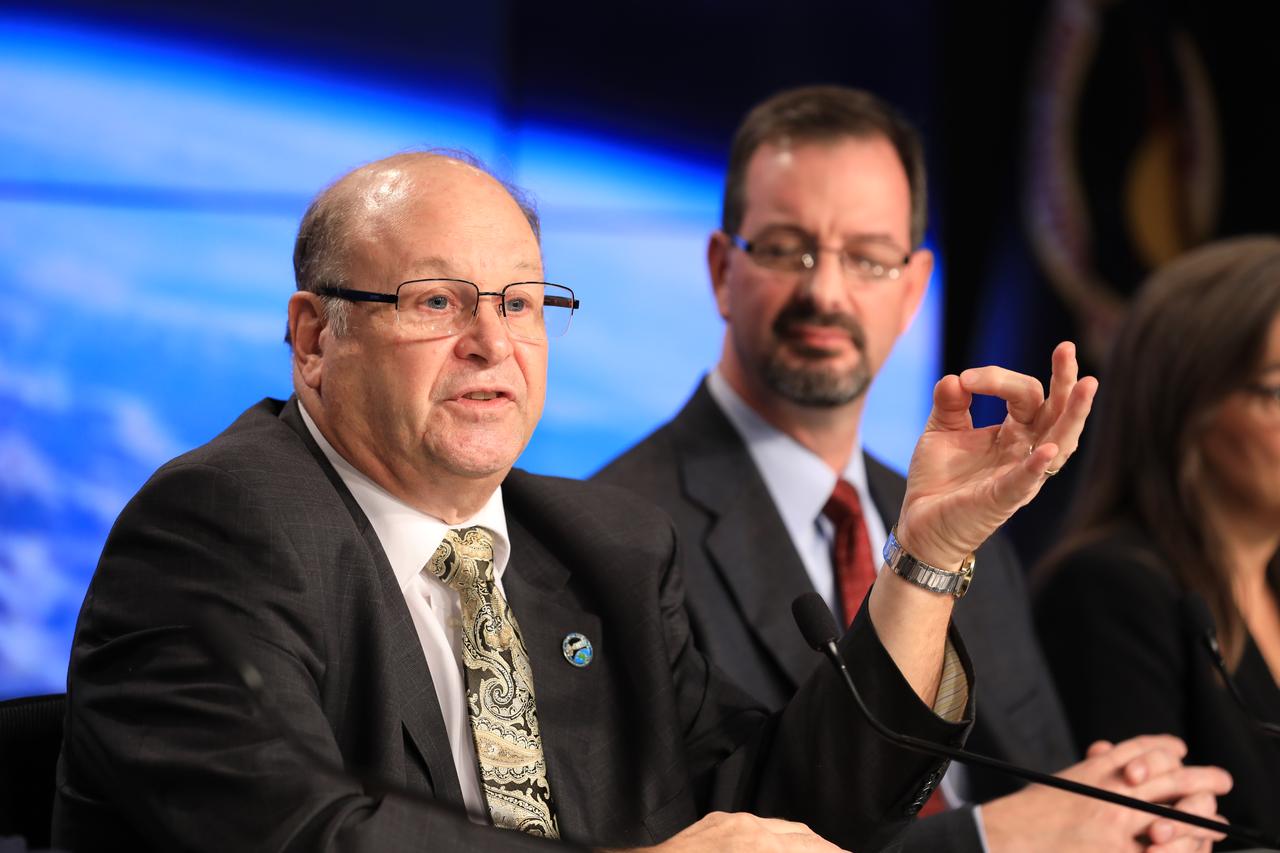
In the Kennedy Space Center's Press Site auditorium, Damon Penn, assistant administrator for response at the Federal Emergency Management Agency, speaks to the media during a mission briefing on the Geostationary Operational Environmental Satellite (GOES-R). GOES-R is the first satellite in a series of next-generation GOES satellites for NOAA, the National Oceanographic and Atmospheric Administration. It will launch to a geostationary orbit over the western hemisphere to provide images of storms and help meteorologists predict severe weather conditionals and develop long-range forecasts.

In the Kennedy Space Center's Press Site auditorium, Damon Penn, assistant administrator for response at the Federal Emergency Management Agency, speaks to the media during a mission briefing on the Geostationary Operational Environmental Satellite (GOES-R). GOES-R is the first satellite in a series of next-generation GOES satellites for NOAA, the National Oceanographic and Atmospheric Administration. It will launch to a geostationary orbit over the western hemisphere to provide images of storms and help meteorologists predict severe weather conditionals and develop long-range forecasts.
In the Kennedy Space Center's Press Site auditorium, Joseph A. Pica, director of the National Weather Service Office of Observations, speaks to the media during a mission briefing on the Geostationary Operational Environmental Satellite (GOES-R). GOES-R is the first satellite in a series of next-generation GOES satellites for NOAA, the National Oceanographic and Atmospheric Administration. It will launch to a geostationary orbit over the western hemisphere to provide images of storms and help meteorologists predict severe weather conditionals and develop long-range forecasts.

In the Kennedy Space Center's Press Site auditorium, Sandra Cauffman, deputy director of NASA's Earth Science Division, speaks to the media during a mission briefing on the Geostationary Operational Environmental Satellite (GOES-R). GOES-R is the first satellite in a series of next-generation GOES satellites for NOAA, the National Oceanographic and Atmospheric Administration. It will launch to a geostationary orbit over the western hemisphere to provide images of storms and help meteorologists predict severe weather conditionals and develop long-range forecasts.
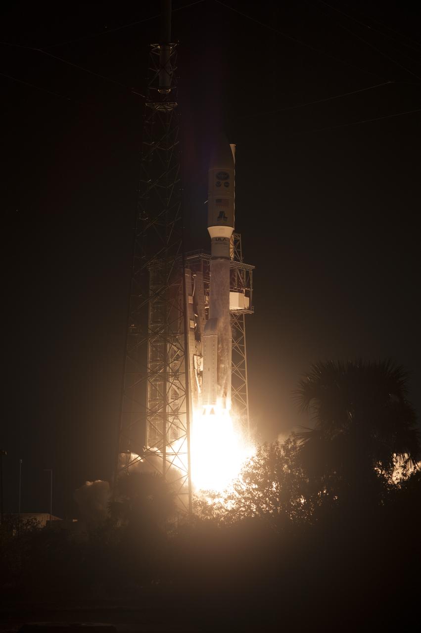
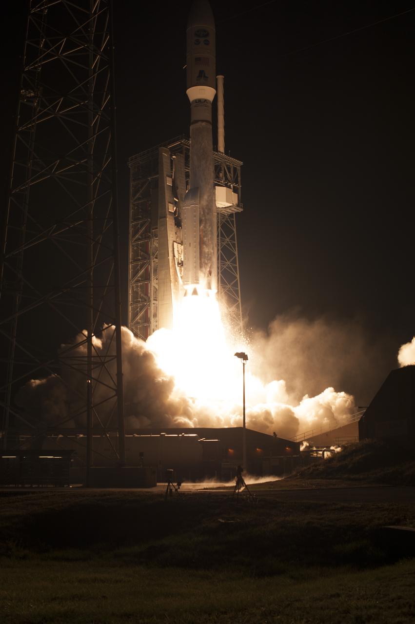
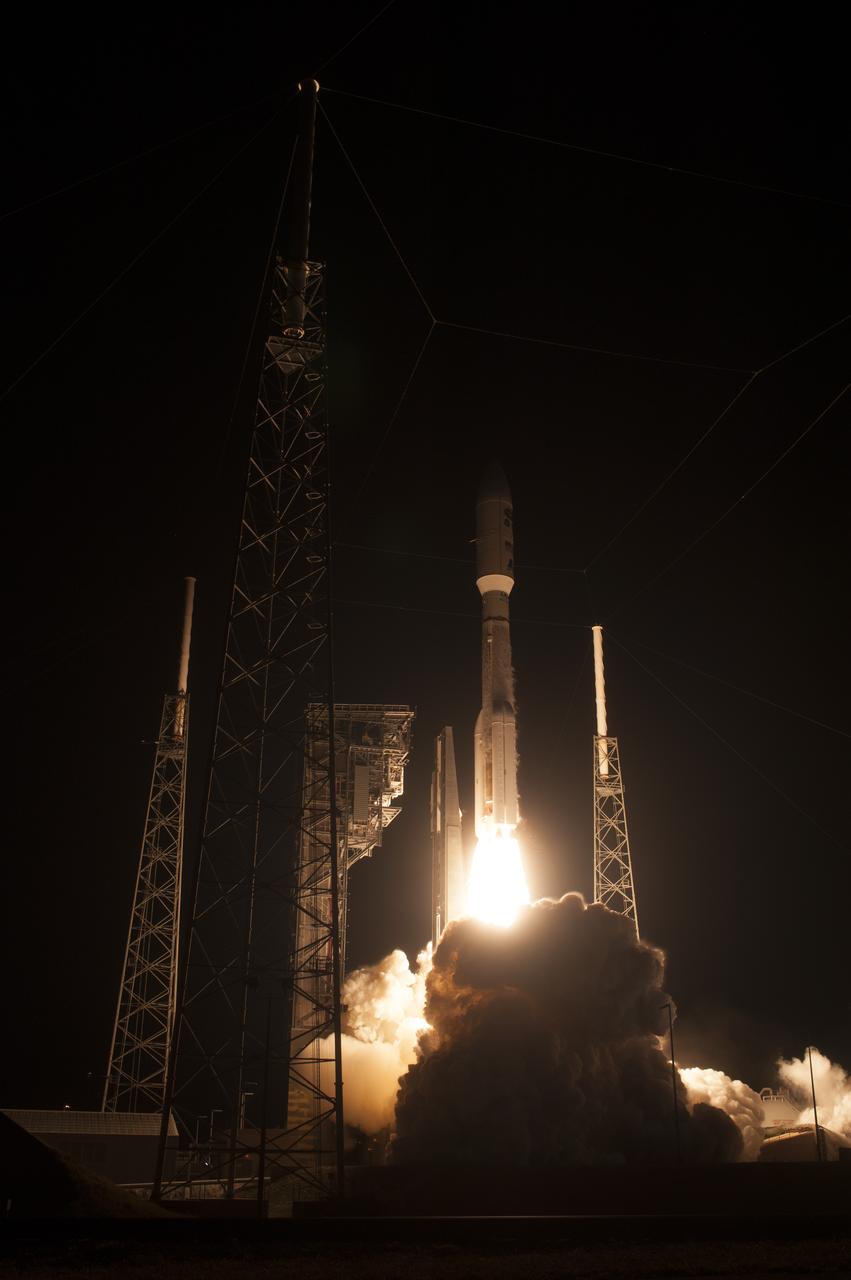
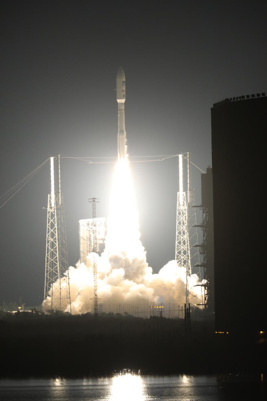
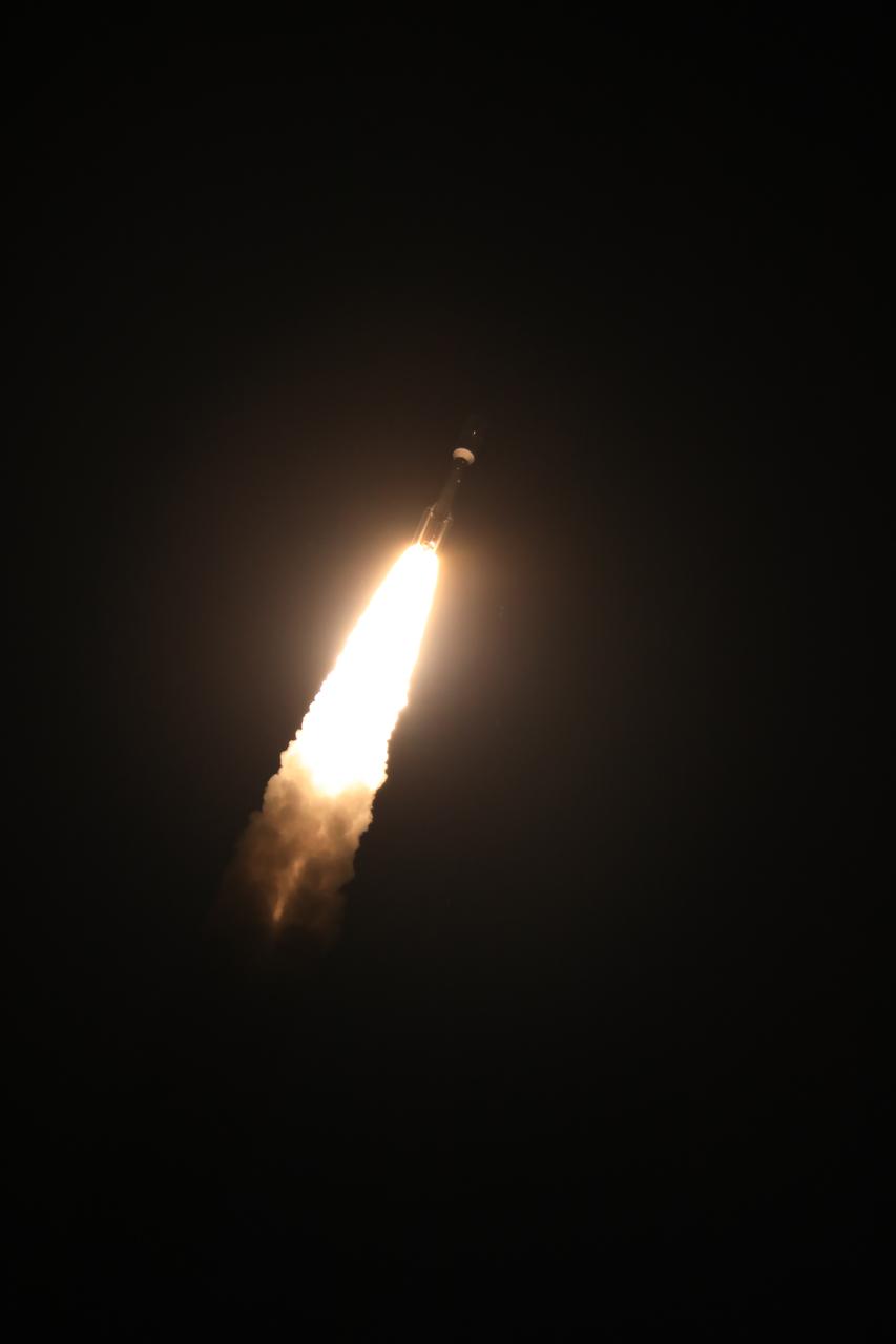
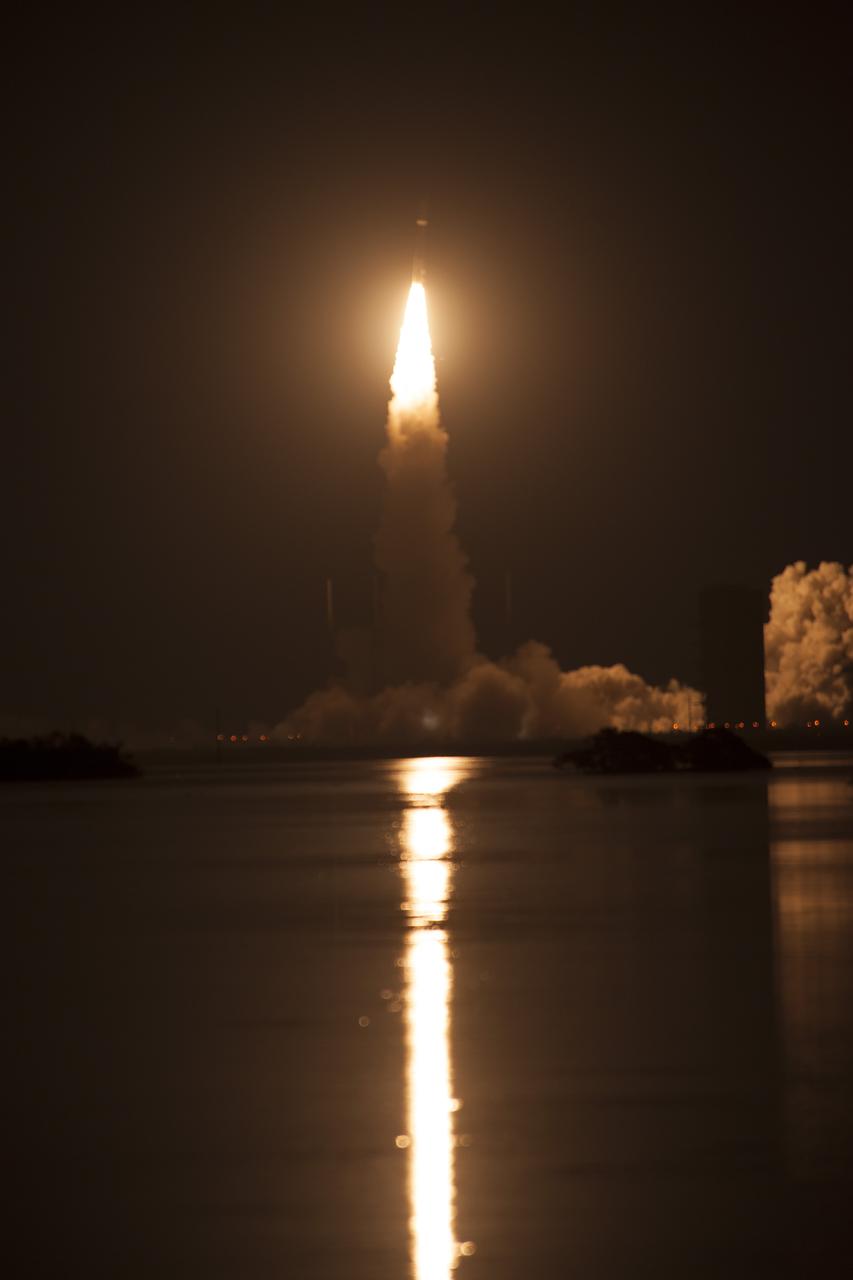
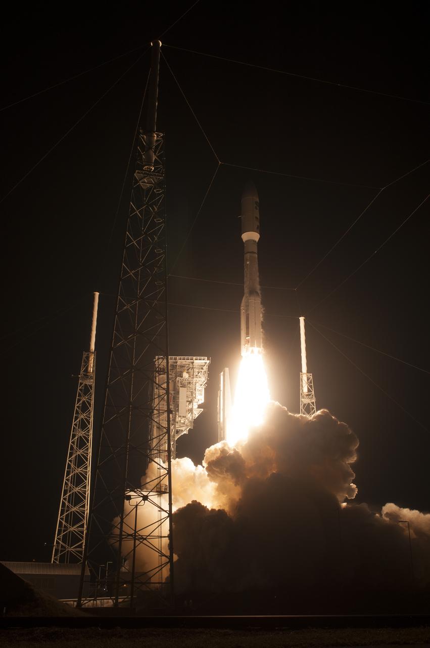
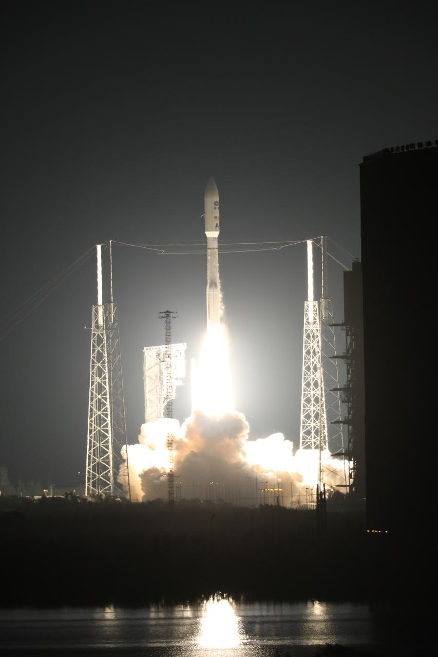
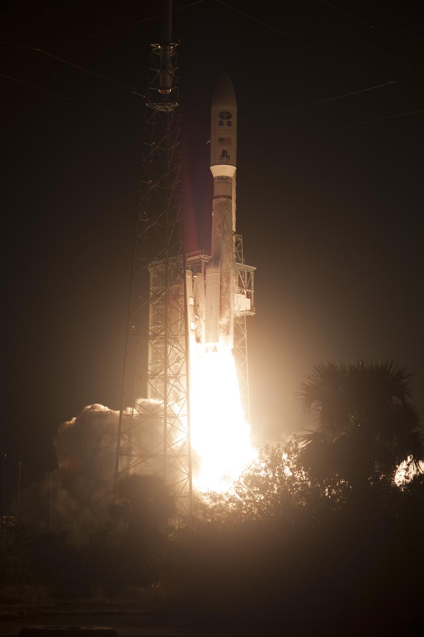
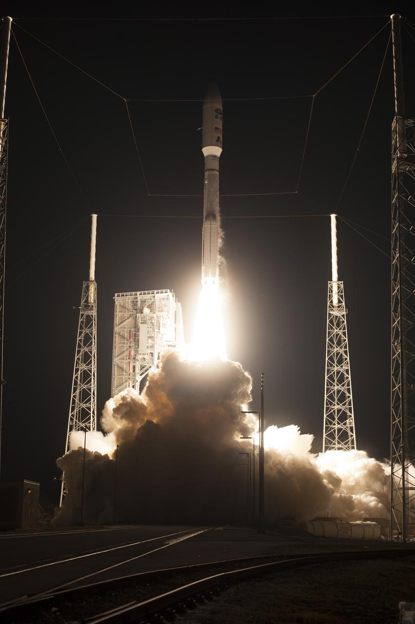
At Cape Canaveral Air Force Station's Space Launch Complex 41, an Atlas V rocket with NOAA's Geostationary Operational Environmental Satellite, or GOES-R, lifts off at 6:42 p.m. EST. GOES-R is the first satellite in a series of next-generation GOES satellites for NOAA, the National Oceanographic and Atmospheric Administration. It will launch to a geostationary orbit over the western hemisphere to provide images of storms and help meteorologists predict severe weather conditionals and develop long-range forecasts.

In the Kennedy Space Center's Press Site auditorium, Sean Potter of NASA Communications, moderates a mission briefing on the Geostationary Operational Environmental Satellite (GOES-R). GOES-R is the first satellite in a series of next-generation GOES satellites for NOAA, the National Oceanographic and Atmospheric Administration. It will launch to a geostationary orbit over the western hemisphere to provide images of storms and help meteorologists predict severe weather conditionals and develop long-range forecasts.
At Cape Canaveral Air Force Station's Space Launch Complex 41, an Atlas V rocket with NOAA's Geostationary Operational Environmental Satellite, or GOES-R, lifts off at 6:42 p.m. EST. GOES-R is the first satellite in a series of next-generation GOES satellites for NOAA, the National Oceanographic and Atmospheric Administration. It will launch to a geostationary orbit over the western hemisphere to provide images of storms and help meteorologists predict severe weather conditionals and develop long-range forecasts.
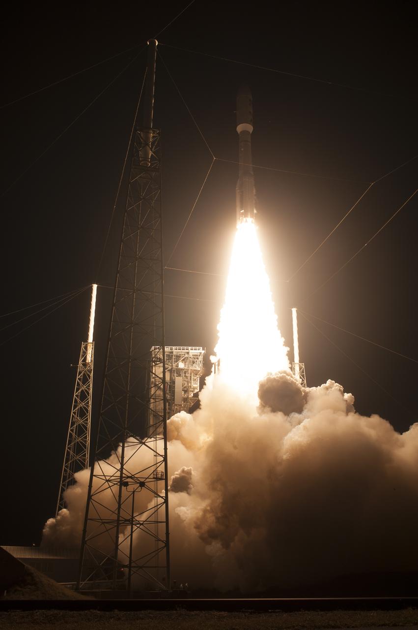
At Cape Canaveral Air Force Station's Space Launch Complex 41, an Atlas V rocket with NOAA's Geostationary Operational Environmental Satellite, or GOES-R, lifts off at 6:42 p.m. EST. GOES-R is the first satellite in a series of next-generation GOES satellites for NOAA, the National Oceanographic and Atmospheric Administration. It will launch to a geostationary orbit over the western hemisphere to provide images of storms and help meteorologists predict severe weather conditionals and develop long-range forecasts.
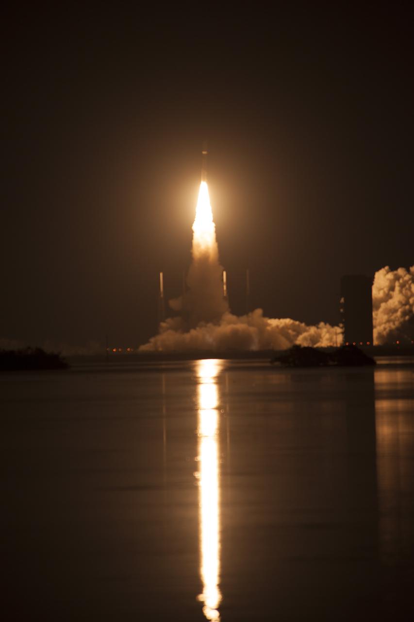
At Cape Canaveral Air Force Station's Space Launch Complex 41, an Atlas V rocket with NOAA's Geostationary Operational Environmental Satellite, or GOES-R, lifts off at 6:42 p.m. EST. GOES-R is the first satellite in a series of next-generation GOES satellites for NOAA, the National Oceanographic and Atmospheric Administration. It will launch to a geostationary orbit over the western hemisphere to provide images of storms and help meteorologists predict severe weather conditionals and develop long-range forecasts.
At Cape Canaveral Air Force Station's Space Launch Complex 41, an Atlas V rocket with NOAA's Geostationary Operational Environmental Satellite, or GOES-R, lifts off at 6:42 p.m. EST. GOES-R is the first satellite in a series of next-generation GOES satellites for NOAA, the National Oceanographic and Atmospheric Administration. It will launch to a geostationary orbit over the western hemisphere to provide images of storms and help meteorologists predict severe weather conditionals and develop long-range forecasts.
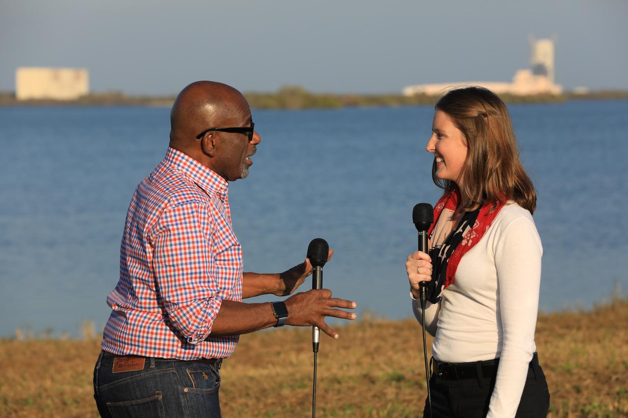
During the countdown for the launch of NOAA's Geostationary Operational Environmental Satellite, or GOES-R, Stephanie Martin of NASA Communications, right, interviews Al Roker, weather forecaster on NBC's "Today Show." GOES-R is the first satellite in a series of next-generation GOES satellites for NOAA, the National Oceanographic and Atmospheric Administration. It will launch to a geostationary orbit over the western hemisphere to provide images of storms and help meteorologists predict severe weather conditionals and develop long-range forecasts.
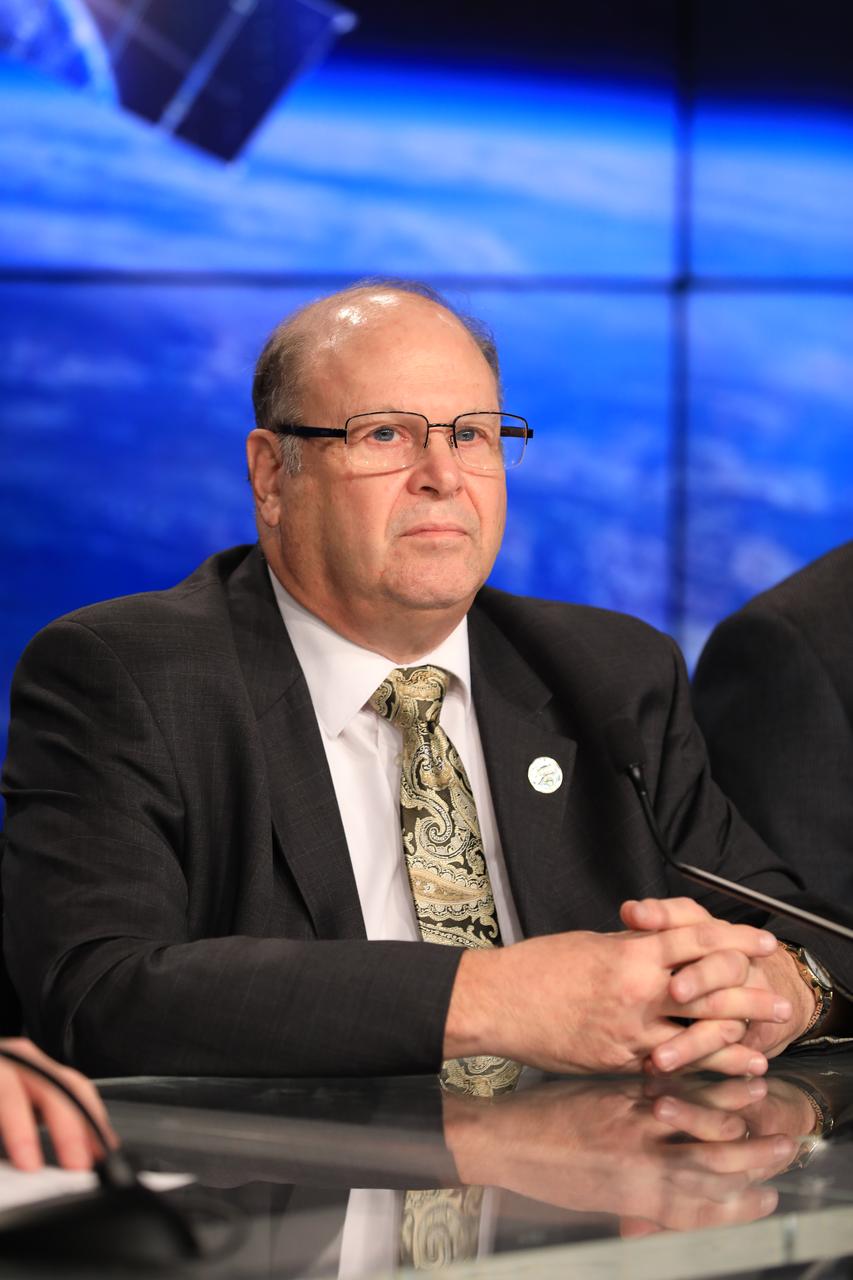
In the Kennedy Space Center's Press Site auditorium, Steven Goodman, NOAA's GOES-R program scientist, speaks to the media during a mission briefing on the Geostationary Operational Environmental Satellite (GOES-R). GOES-R is the first satellite in a series of next-generation GOES satellites for NOAA, the National Oceanographic and Atmospheric Administration. It will launch to a geostationary orbit over the western hemisphere to provide images of storms and help meteorologists predict severe weather conditionals and develop long-range forecasts.
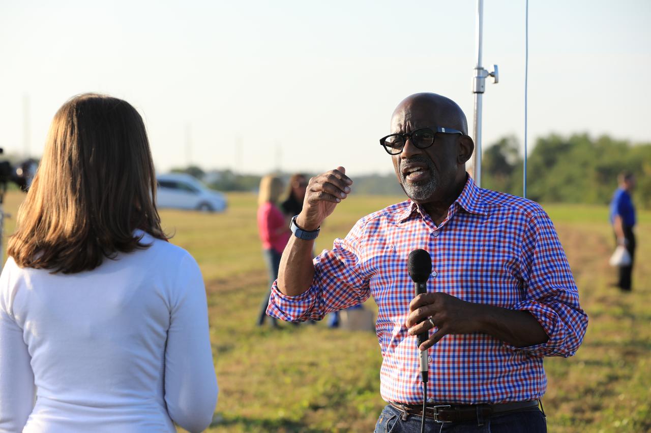
During the countdown for the launch of NOAA's Geostationary Operational Environmental Satellite, or GOES-R, Stephanie Martin of NASA Communications, left, interviews Al Roker, weather forecaster on NBC's "Today Show." GOES-R is the first satellite in a series of next-generation GOES satellites for NOAA, the National Oceanographic and Atmospheric Administration. It will launch to a geostationary orbit over the western hemisphere to provide images of storms and help meteorologists predict severe weather conditionals and develop long-range forecasts.

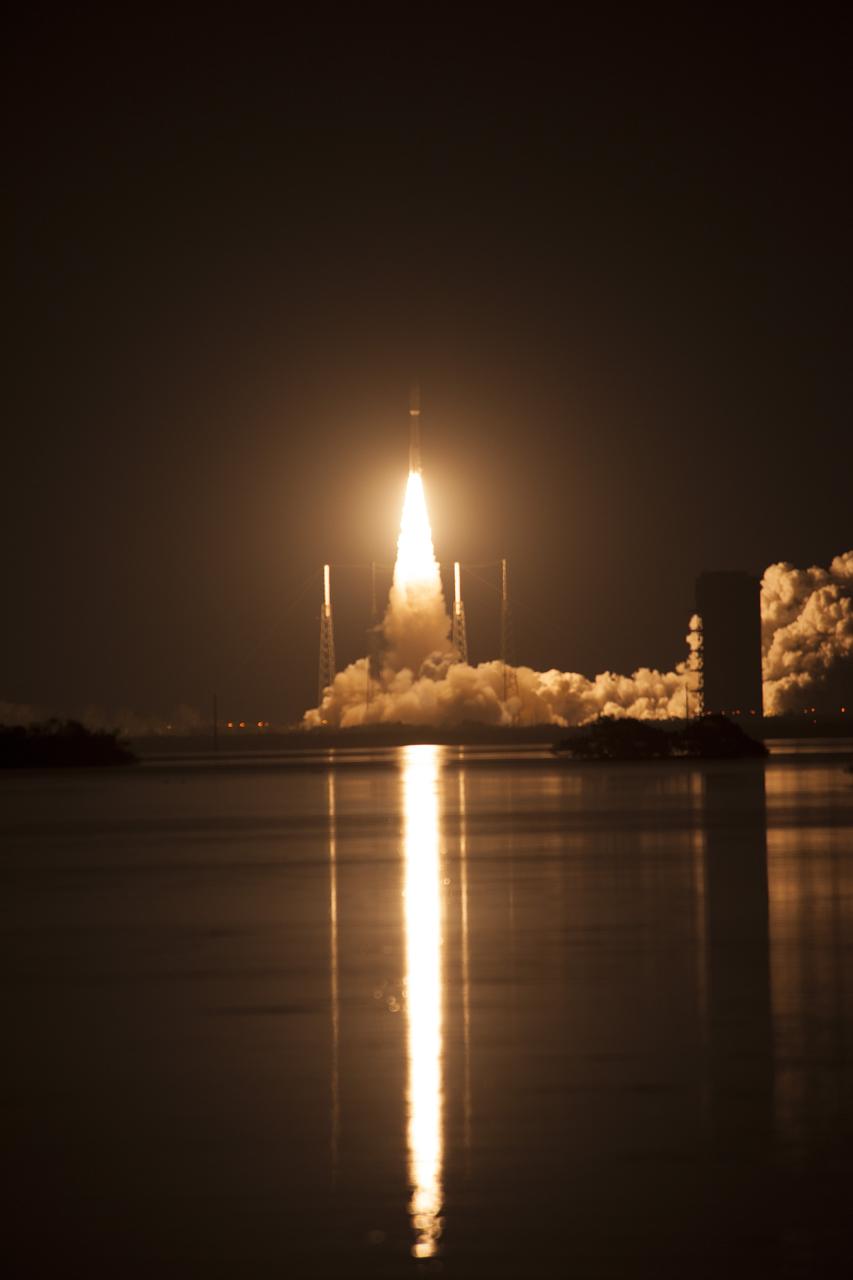
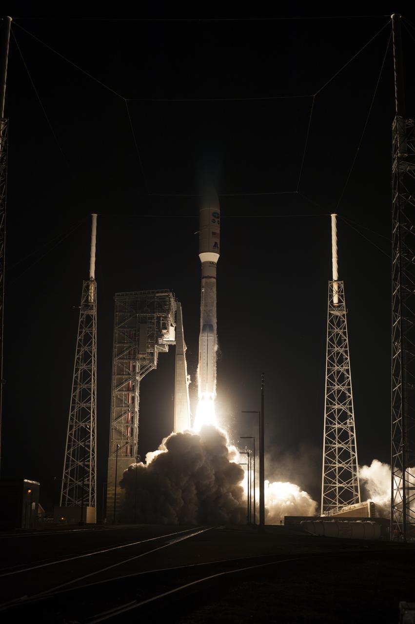
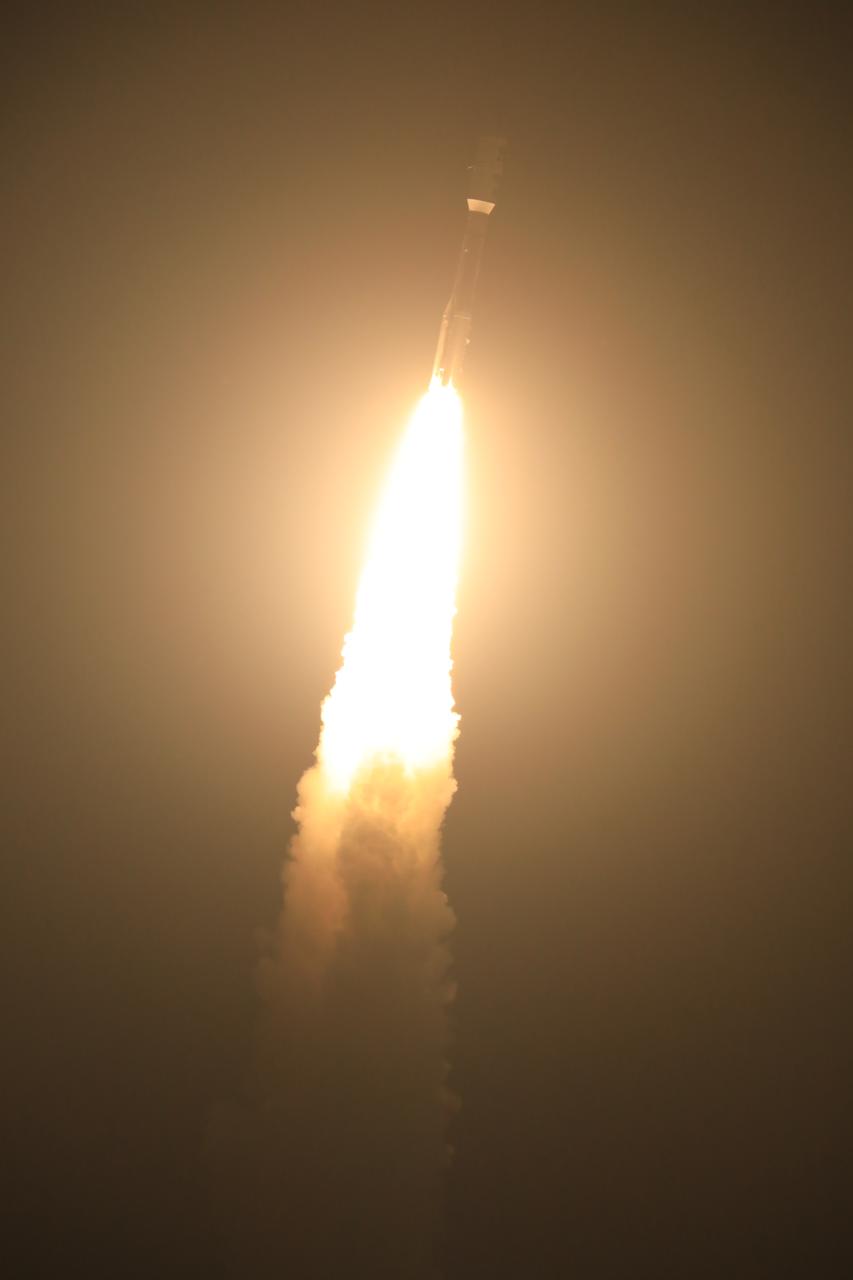
At Cape Canaveral Air Force Station's Space Launch Complex 41, an Atlas V rocket with NOAA's Geostationary Operational Environmental Satellite, or GOES-R, lifts off at 6:42 p.m. EST. GOES-R is the first satellite in a series of next-generation GOES satellites for NOAA, the National Oceanographic and Atmospheric Administration. It will launch to a geostationary orbit over the western hemisphere to provide images of storms and help meteorologists predict severe weather conditionals and develop long-range forecasts.
At Cape Canaveral Air Force Station's Space Launch Complex 41, an Atlas V rocket with NOAA's Geostationary Operational Environmental Satellite, or GOES-R, lifts off at 6:42 p.m. EST. GOES-R is the first satellite in a series of next-generation GOES satellites for NOAA, the National Oceanographic and Atmospheric Administration. It will launch to a geostationary orbit over the western hemisphere to provide images of storms and help meteorologists predict severe weather conditionals and develop long-range forecasts.
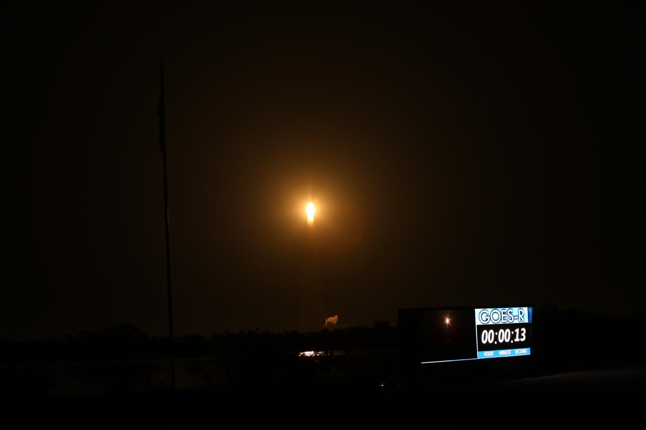
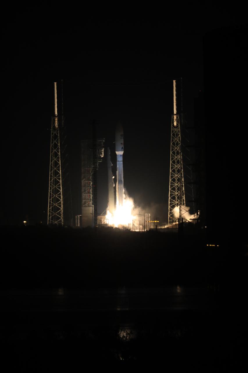
At Cape Canaveral Air Force Station's Space Launch Complex 41, an Atlas V rocket with NOAA's Geostationary Operational Environmental Satellite, or GOES-R, lifts off at 6:42 p.m. EST. GOES-R is the first satellite in a series of next-generation GOES satellites for NOAA, the National Oceanographic and Atmospheric Administration. It will launch to a geostationary orbit over the western hemisphere to provide images of storms and help meteorologists predict severe weather conditionals and develop long-range forecasts.
At Cape Canaveral Air Force Station's Space Launch Complex 41, an Atlas V rocket with NOAA's Geostationary Operational Environmental Satellite, or GOES-R, lifts off at 6:42 p.m. EST. GOES-R is the first satellite in a series of next-generation GOES satellites for NOAA, the National Oceanographic and Atmospheric Administration. It will launch to a geostationary orbit over the western hemisphere to provide images of storms and help meteorologists predict severe weather conditionals and develop long-range forecasts.
At Cape Canaveral Air Force Station's Space Launch Complex 41, an Atlas V rocket with NOAA's Geostationary Operational Environmental Satellite, or GOES-R, lifts off at 6:42 p.m. EST. GOES-R is the first satellite in a series of next-generation GOES satellites for NOAA, the National Oceanographic and Atmospheric Administration. It will launch to a geostationary orbit over the western hemisphere to provide images of storms and help meteorologists predict severe weather conditionals and develop long-range forecasts.
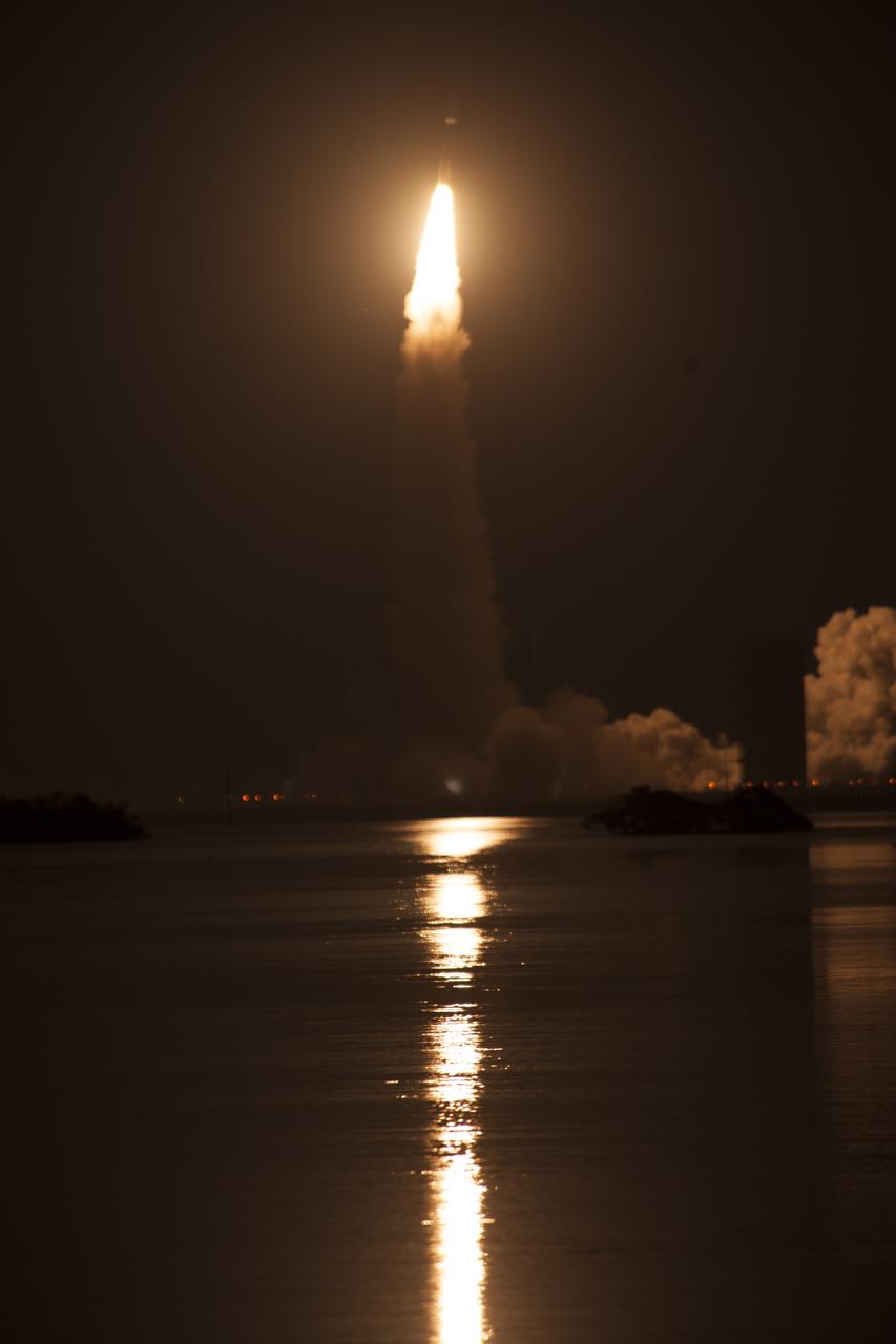
At Cape Canaveral Air Force Station's Space Launch Complex 41, an Atlas V rocket with NOAA's Geostationary Operational Environmental Satellite, or GOES-R, lifts off at 6:42 p.m. EST. GOES-R is the first satellite in a series of next-generation GOES satellites for NOAA, the National Oceanographic and Atmospheric Administration. It will launch to a geostationary orbit over the western hemisphere to provide images of storms and help meteorologists predict severe weather conditionals and develop long-range forecasts.
At Cape Canaveral Air Force Station's Space Launch Complex 41, an Atlas V rocket with NOAA's Geostationary Operational Environmental Satellite, or GOES-R, lifts off at 6:42 p.m. EST. GOES-R is the first satellite in a series of next-generation GOES satellites for NOAA, the National Oceanographic and Atmospheric Administration. It will launch to a geostationary orbit over the western hemisphere to provide images of storms and help meteorologists predict severe weather conditionals and develop long-range forecasts.
At Cape Canaveral Air Force Station's Space Launch Complex 41, an Atlas V rocket with NOAA's Geostationary Operational Environmental Satellite, or GOES-R, lifts off at 6:42 p.m. EST. GOES-R is the first satellite in a series of next-generation GOES satellites for NOAA, the National Oceanographic and Atmospheric Administration. It will launch to a geostationary orbit over the western hemisphere to provide images of storms and help meteorologists predict severe weather conditionals and develop long-range forecasts.
At Cape Canaveral Air Force Station's Space Launch Complex 41, an Atlas V rocket with NOAA's Geostationary Operational Environmental Satellite, or GOES-R, lifts off at 6:42 p.m. EST. GOES-R is the first satellite in a series of next-generation GOES satellites for NOAA, the National Oceanographic and Atmospheric Administration. It will launch to a geostationary orbit over the western hemisphere to provide images of storms and help meteorologists predict severe weather conditionals and develop long-range forecasts.
At Cape Canaveral Air Force Station's Space Launch Complex 41, an Atlas V rocket with NOAA's Geostationary Operational Environmental Satellite, or GOES-R, lifts off at 6:42 p.m. EST. GOES-R is the first satellite in a series of next-generation GOES satellites for NOAA, the National Oceanographic and Atmospheric Administration. It will launch to a geostationary orbit over the western hemisphere to provide images of storms and help meteorologists predict severe weather conditionals and develop long-range forecasts.
At Cape Canaveral Air Force Station's Space Launch Complex 41, an Atlas V rocket with NOAA's Geostationary Operational Environmental Satellite, or GOES-R, lifts off at 6:42 p.m. EST. GOES-R is the first satellite in a series of next-generation GOES satellites for NOAA, the National Oceanographic and Atmospheric Administration. It will launch to a geostationary orbit over the western hemisphere to provide images of storms and help meteorologists predict severe weather conditionals and develop long-range forecasts.
At Cape Canaveral Air Force Station's Space Launch Complex 41, an Atlas V rocket with NOAA's Geostationary Operational Environmental Satellite, or GOES-R, lifts off at 6:42 p.m. EST. GOES-R is the first satellite in a series of next-generation GOES satellites for NOAA, the National Oceanographic and Atmospheric Administration. It will launch to a geostationary orbit over the western hemisphere to provide images of storms and help meteorologists predict severe weather conditionals and develop long-range forecasts.
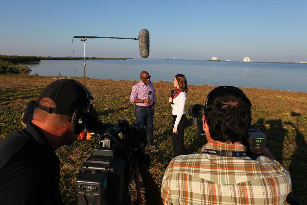
During the countdown for the launch of NOAA's Geostationary Operational Environmental Satellite, or GOES-R, Stephanie Martin of NASA Communications, right, interviews Al Roker, weather forecaster on NBC's "Today Show." GOES-R is the first satellite in a series of next-generation GOES satellites for NOAA, the National Oceanographic and Atmospheric Administration. It will launch to a geostationary orbit over the western hemisphere to provide images of storms and help meteorologists predict severe weather conditionals and develop long-range forecasts.
At Cape Canaveral Air Force Station's Space Launch Complex 41, an Atlas V rocket with NOAA's Geostationary Operational Environmental Satellite, or GOES-R, lifts off at 6:42 p.m. EST. GOES-R is the first satellite in a series of next-generation GOES satellites for NOAA, the National Oceanographic and Atmospheric Administration. It will launch to a geostationary orbit over the western hemisphere to provide images of storms and help meteorologists predict severe weather conditionals and develop long-range forecasts.
At Cape Canaveral Air Force Station's Space Launch Complex 41, an Atlas V rocket with NOAA's Geostationary Operational Environmental Satellite, or GOES-R, lifts off at 6:42 p.m. EST. GOES-R is the first satellite in a series of next-generation GOES satellites for NOAA, the National Oceanographic and Atmospheric Administration. It will launch to a geostationary orbit over the western hemisphere to provide images of storms and help meteorologists predict severe weather conditionals and develop long-range forecasts.
In the Kennedy Space Center's Press Site auditorium, members of the media participate in a mission briefing on the Geostationary Operational Environmental Satellite (GOES-R). Briefing participants included Steven Goodman, NOAA's GOES-R program scientist, and Joseph A. Pica, director of the National Weather Service Office of Observations. GOES-R is the first satellite in a series of next-generation GOES satellites for NOAA, the National Oceanographic and Atmospheric Administration. It will launch to a geostationary orbit over the western hemisphere to provide images of storms and help meteorologists predict severe weather conditionals and develop long-range forecasts.
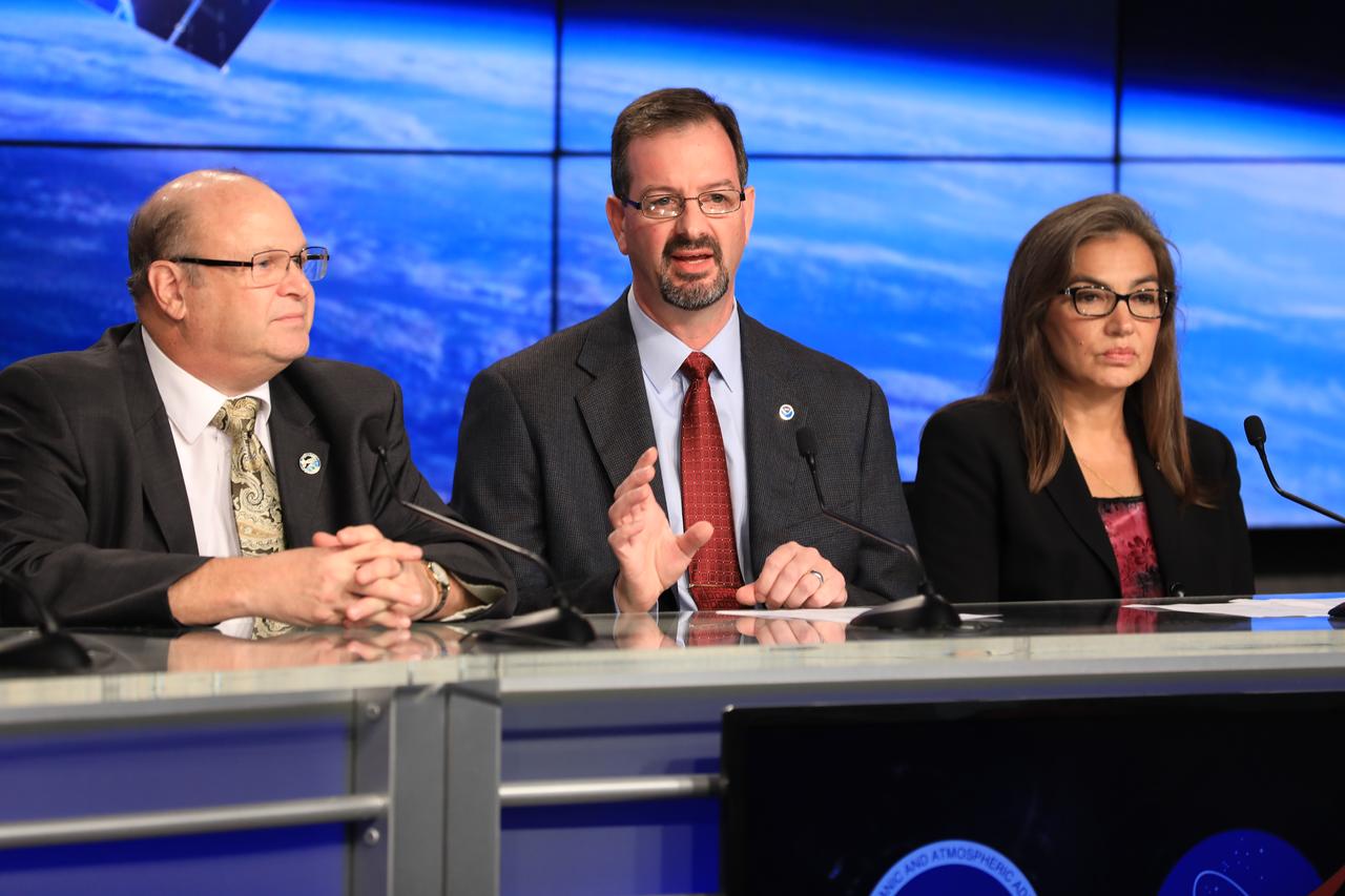
In the Kennedy Space Center's Press Site auditorium, members of the media participate in a mission briefing on the Geostationary Operational Environmental Satellite (GOES-R). Briefing participants from left are: Steven Goodman, NOAA's GOES-R program scientist; Joseph A. Pica, director of the National Weather Service Office of Observations; and Sandra Cauffman, deputy director of NASA's Earth Science Division. GOES-R is the first satellite in a series of next-generation GOES satellites for NOAA, the National Oceanographic and Atmospheric Administration. It will launch to a geostationary orbit over the western hemisphere to provide images of storms and help meteorologists predict severe weather conditionals and develop long-range forecasts.

In the Kennedy Space Center's Press Site auditorium, members of the media participate in a mission briefing on the Geostationary Operational Environmental Satellite (GOES-R). Briefing participants from left are: Steven Goodman, NOAA's GOES-R program scientist; Joseph A. Pica, director of the National Weather Service Office of Observations; Sandra Cauffman, deputy director of NASA's Earth Science Division; and Damon Penn, assistant administrator for response at the Federal Emergency Management Agency. GOES-R is the first satellite in a series of next-generation GOES satellites for NOAA, the National Oceanographic and Atmospheric Administration. It will launch to a geostationary orbit over the western hemisphere to provide images of storms and help meteorologists predict severe weather conditionals and develop long-range forecasts.
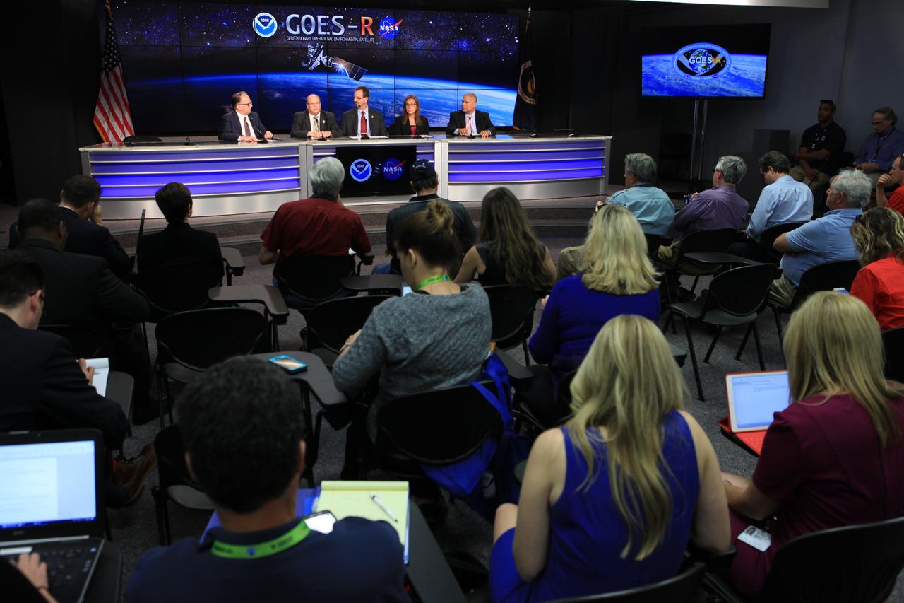
In the Kennedy Space Center's Press Site auditorium, members of the media participate in a mission briefing on the Geostationary Operational Environmental Satellite (GOES-R). Briefing participants from left are: Sean Potter of NASA Communications; Steven Goodman, NOAA's GOES-R program scientist; Joseph A. Pica, director of the National Weather Service Office of Observations; Sandra Cauffman, deputy director of NASA's Earth Science Division; and Damon Penn, assistant administrator for response at the Federal Emergency Management Agency. GOES-R is the first satellite in a series of next-generation GOES satellites for NOAA, the National Oceanographic and Atmospheric Administration. It will launch to a geostationary orbit over the western hemisphere to provide images of storms and help meteorologists predict severe weather conditionals and develop long-range forecasts.
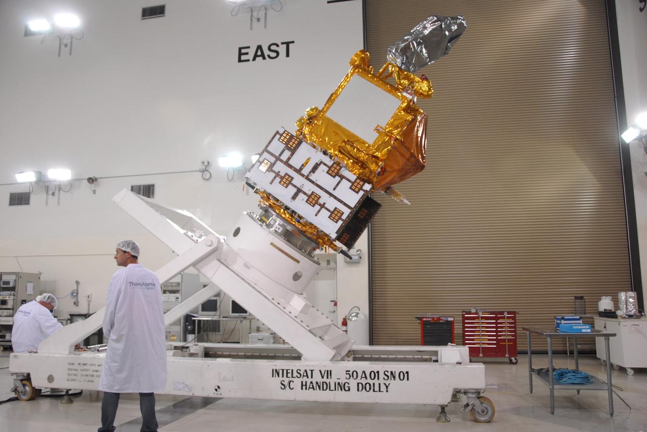
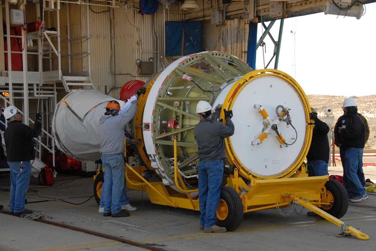
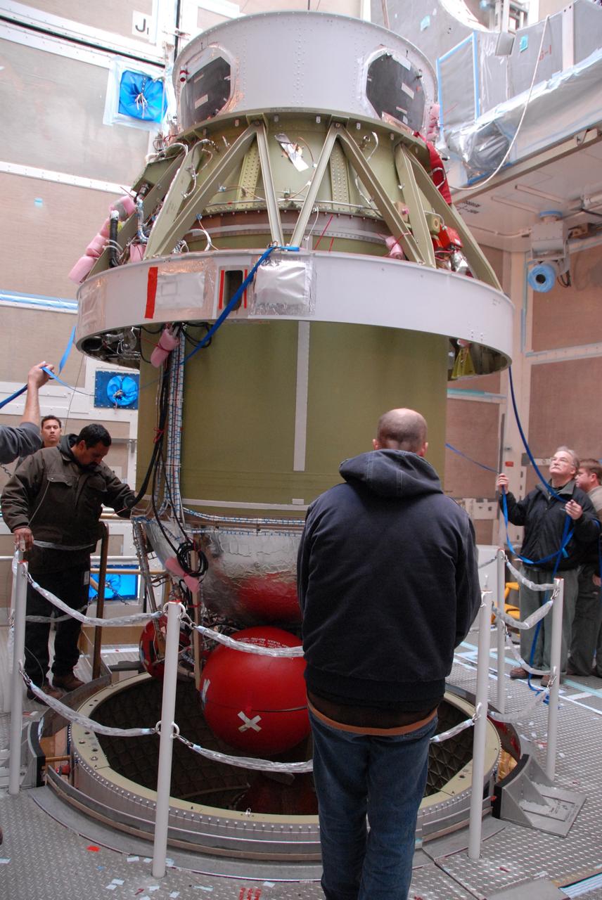
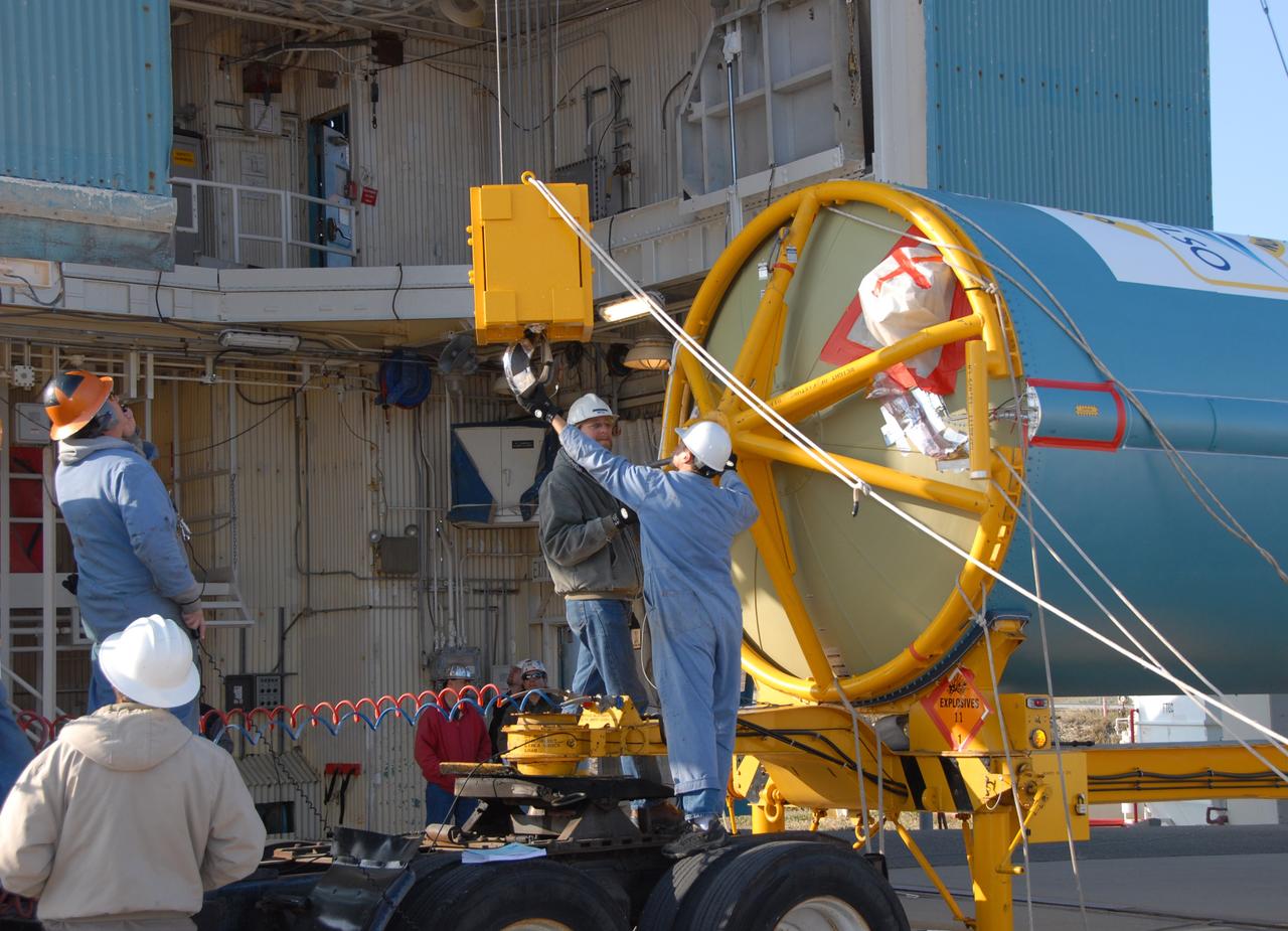
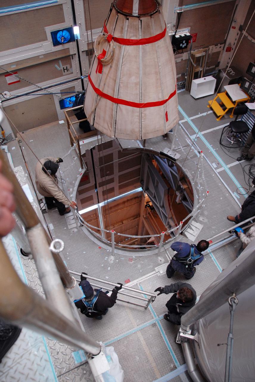
VANDENBERG AIR FORCE BASE, Calif. -- Inside the Astrotech processing facility at Vandenberg Air Force Base, the OSTM/Jason-2 spacecraft is lifted to a near-45-degree angle on the tilt dolly. The OSTM, or Ocean Topography Mission, on the Jason-2 satellite is a follow-on to Jason-1. It will take oceanographic studies of sea surface height into an operational mode for continued climate forecasting research and science and industrial applications. This satellite altimetry data will help determine ocean circulation, climate change and sea-level rise. OSTM is a joint effort by the National Oceanic and Atmospheric Administration, NASA, France’s Centre National d’Etudes Spatiales and the European Meteorological Satellite Organisation. OSTM/Jason-2 will be launched aboard a United Launch Alliance Delta II 7320 from Vandenberg on June 15. Photo credit: NASA/Mark Mackley
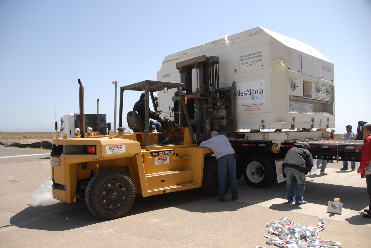
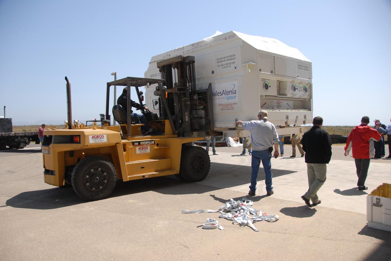
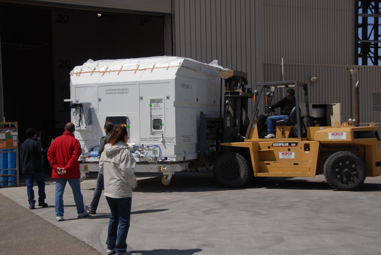
VANDENBERG AIR FORCE BASE, Calif. -- In front of the Astrotech processing facility at Vandenberg Air Force Base, a forklift begins to lift the OSTM/Jason-2 satellite shipping container off the flatbed truck. The OSTM, or Ocean Topography Mission, on the Jason-2 satellite is a follow-on to Jason-1. It will take oceanographic studies of sea surface height into an operational mode for continued climate forecasting research and science and industrial applications. This satellite altimetry data will help determine ocean circulation, climate change and sea-level rise. OSTM is a joint effort by the National Oceanic and Atmospheric Administration, NASA, France’s Centre National d’Etudes Spatiales and the European Meteorological Satellite Organisation. OSTM/Jason-2 will be launched aboard a United Launch Alliance Delta II 7320 from Vandenberg on June 15. Photo credit: NASA/Dan Liberotti
VANDENBERG AIR FORCE BASE, Calif. -- Workers on Space Launch Complex 2 at Vandenberg Air Force Base in California prepare to attach a sling crane onto the Delta II second stage. The sling will lift the second stage into the mobile service tower for installation on the first stage for launch of the OSTM/Jason-2 spacecraft. The OSTM, or Ocean Topography Mission, on the Jason-2 satellite is a follow-on to Jason-1. It will take oceanographic studies of sea surface height into an operational mode for continued climate forecasting research and science and industrial applications. This satellite altimetry data will help determine ocean circulation, climate change and sea-level rise. OSTM is a joint effort by the National Oceanic and Atmospheric Administration, NASA, France’s Centre National d’Etudes Spatiales and the European Meteorological Satellite Organisation. OSTM/Jason-2 will be launched on June 20. Photo credit: NASA
VANDENBERG AIR FORCE BASE, Calif. -- In front of the Astrotech processing facility at Vandenberg Air Force Base, the OSTM/Jason-2 satellite shipping container is on the ground, ready to be moved inside. The OSTM, or Ocean Topography Mission, on the Jason-2 satellite is a follow-on to Jason-1. It will take oceanographic studies of sea surface height into an operational mode for continued climate forecasting research and science and industrial applications. This satellite altimetry data will help determine ocean circulation, climate change and sea-level rise. OSTM is a joint effort by the National Oceanic and Atmospheric Administration, NASA, France’s Centre National d’Etudes Spatiales and the European Meteorological Satellite Organisation. OSTM/Jason-2 will be launched aboard a United Launch Alliance Delta II 7320 from Vandenberg on June 15. Photo credit: NASA/Dan Liberotti
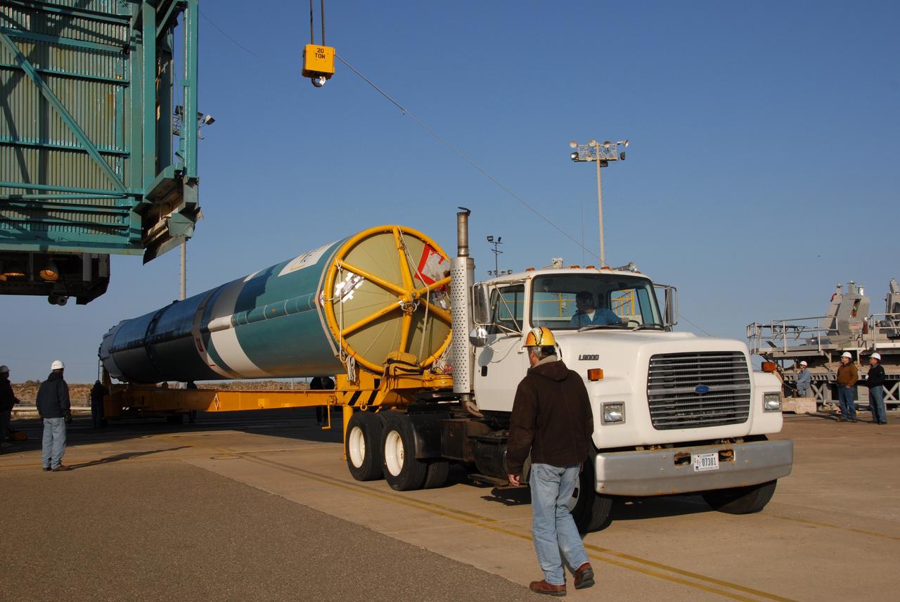
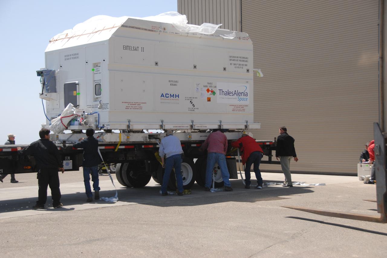
VANDENBERG AIR FORCE BASE, Calif. -- At Vandenberg Air Force Base, the truck carrying the OSTM/Jason-2 satellite is ready to transport the cargo to the Astrotech processing facility. The OSTM, or Ocean Topography Mission, on the Jason-2 satellite is a follow-on to Jason-1. It will take oceanographic studies of sea surface height into an operational mode for continued climate forecasting research and science and industrial applications. This satellite altimetry data will help determine ocean circulation, climate change and sea-level rise. OSTM is a joint effort by the National Oceanic and Atmospheric Administration, NASA, France’s Centre National d’Etudes Spatiales and the European Meteorological Satellite Organisation. OSTM/Jason-2 will be launched aboard a United Launch Alliance Delta II 7320 from Vandenberg on June 15. Photo credit: NASA/Dan Liberotti
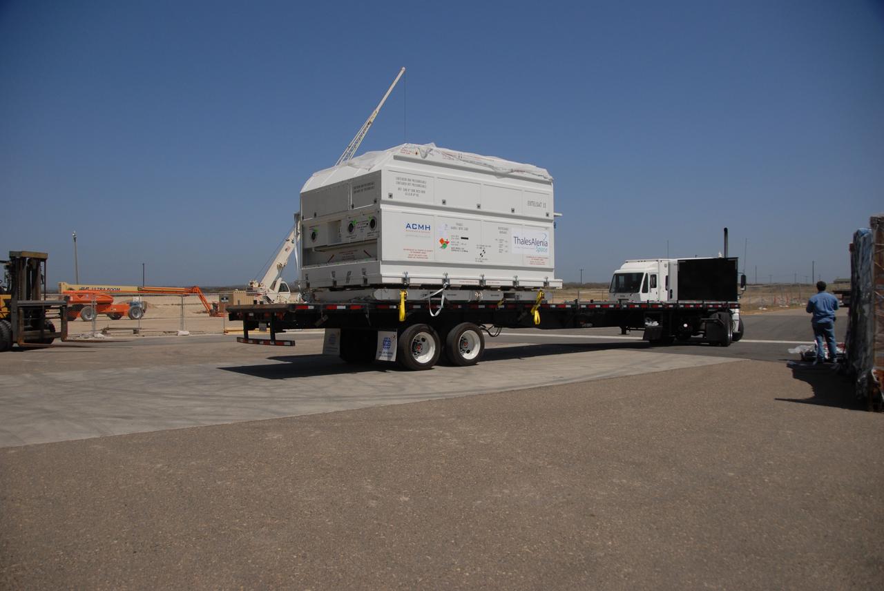
VANDENBERG AIR FORCE BASE, Calif. -- At Vandenberg Air Force Base, the truck carrying the OSTM/Jason-2 satellite arrives at the Astrotech processing facility. The OSTM, or Ocean Topography Mission, on the Jason-2 satellite is a follow-on to Jason-1. It will take oceanographic studies of sea surface height into an operational mode for continued climate forecasting research and science and industrial applications. This satellite altimetry data will help determine ocean circulation, climate change and sea-level rise. OSTM is a joint effort by the National Oceanic and Atmospheric Administration, NASA, France’s Centre National d’Etudes Spatiales and the European Meteorological Satellite Organisation. OSTM/Jason-2 will be launched aboard a United Launch Alliance Delta II 7320 from Vandenberg on June 15. Photo credit: NASA/Dan Liberotti
VANDENBERG AIR FORCE BASE, Calif. -- Workers on Space Launch Complex 2 at Vandenberg Air Force Base in California place protective covers over the engine of the Delta II second stage. It will be lifted into the mobile service tower for installation on the first stage for launch of the OSTM/Jason-2 spacecraft. The OSTM, or Ocean Topography Mission, on the Jason-2 satellite is a follow-on to Jason-1. It will take oceanographic studies of sea surface height into an operational mode for continued climate forecasting research and science and industrial applications. This satellite altimetry data will help determine ocean circulation, climate change and sea-level rise. OSTM is a joint effort by the National Oceanic and Atmospheric Administration, NASA, France’s Centre National d’Etudes Spatiales and the European Meteorological Satellite Organisation. OSTM/Jason-2 will be launched on June 20. Photo credit: NASA
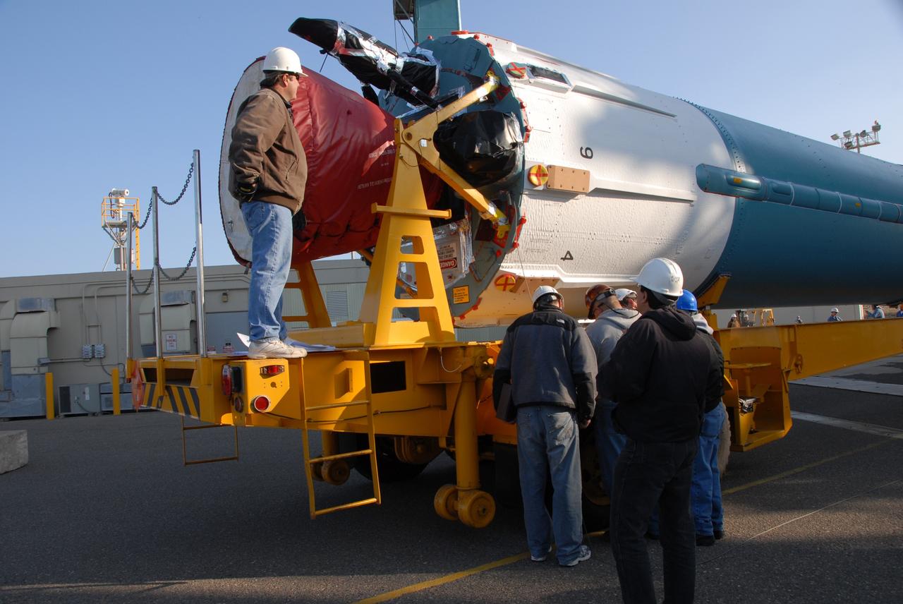
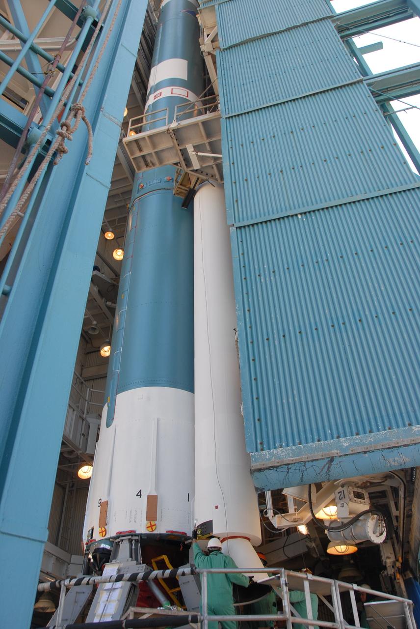
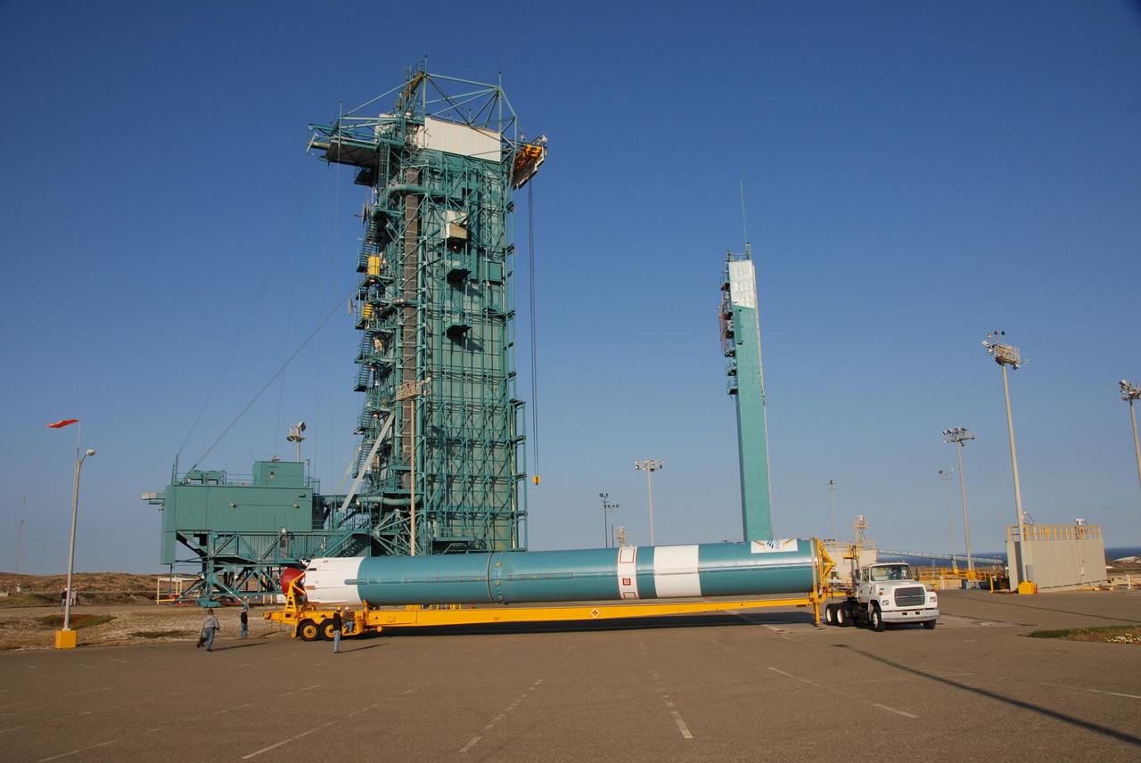
VANDENBERG AIR FORCE BASE, Calif. -- On Space Launch Complex 2 at Vandenberg Air Force Base in California, workers attach the Delta II first stage for the OSTM/Jason-2 spacecraft to the launcher in the umbilical tower. The OSTM, or Ocean Topography Mission, on the Jason-2 satellite is a follow-on to Jason-1. It will take oceanographic studies of sea surface height into an operational mode for continued climate forecasting research and science and industrial applications. This satellite altimetry data will help determine ocean circulation, climate change and sea-level rise. OSTM is a joint effort by the National Oceanic and Atmospheric Administration, NASA, France’s Centre National d’Etudes Spatiales and the European Meteorological Satellite Organisation. OSTM/Jason-2 will be launched aboard a United Launch Alliance Delta II 7320 from Vandenberg on June 15. Photo credit: NASA/Dan Liberotti
VANDENBERG AIR FORCE BASE, Calif. -- Inside the Astrotech processing facility at Vandenberg Air Force Base, the OSTM/Jason-2 spacecraft is viewed from another angle after being lifted to a vertical position on the tilt dolly. The OSTM, or Ocean Topography Mission, on the Jason-2 satellite is a follow-on to Jason-1. It will take oceanographic studies of sea surface height into an operational mode for continued climate forecasting research and science and industrial applications. This satellite altimetry data will help determine ocean circulation, climate change and sea-level rise. OSTM is a joint effort by the National Oceanic and Atmospheric Administration, NASA, France’s Centre National d’Etudes Spatiales and the European Meteorological Satellite Organisation. OSTM/Jason-2 will be launched aboard a United Launch Alliance Delta II 7320 from Vandenberg on June 15. Photo credit: NASA/Mark Mackley
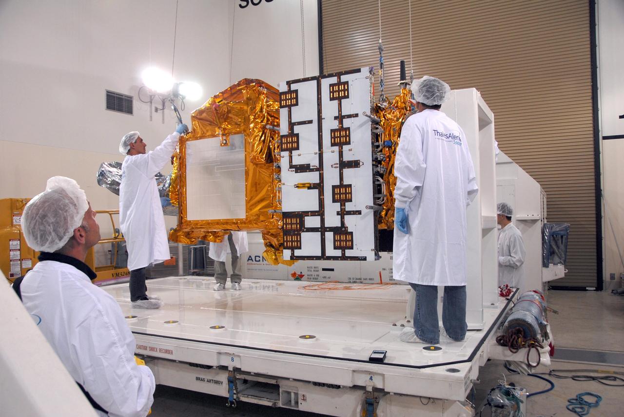
VANDENBERG AIR FORCE BASE, Calif. -- Inside the Astrotech processing facility at Vandenberg Air Force Base, a technician (right) checks the OSTM/Jason-2 spacecraft before it is moved to a tilt dolly. The OSTM, or Ocean Topography Mission, on the Jason-2 satellite is a follow-on to Jason-1. It will take oceanographic studies of sea surface height into an operational mode for continued climate forecasting research and science and industrial applications. This satellite altimetry data will help determine ocean circulation, climate change and sea-level rise. OSTM is a joint effort by the National Oceanic and Atmospheric Administration, NASA, France’s Centre National d’Etudes Spatiales and the European Meteorological Satellite Organisation. OSTM/Jason-2 will be launched aboard a United Launch Alliance Delta II 7320 from Vandenberg on June 15. Photo credit: NASA/Mark Mackley
VANDENBERG AIR FORCE BASE, Calif. -- On Space Launch Complex 2 at Vandenberg Air Force Base in California, the Delta II first stage for the OSTM/Jason-2 spacecraft is moved into place above the launcher in the umbilical tower. The OSTM, or Ocean Topography Mission, on the Jason-2 satellite is a follow-on to Jason-1. It will take oceanographic studies of sea surface height into an operational mode for continued climate forecasting research and science and industrial applications. This satellite altimetry data will help determine ocean circulation, climate change and sea-level rise. OSTM is a joint effort by the National Oceanic and Atmospheric Administration, NASA, France’s Centre National d’Etudes Spatiales and the European Meteorological Satellite Organisation. OSTM/Jason-2 will be launched aboard a United Launch Alliance Delta II 7320 from Vandenberg on June 15. Photo credit: NASA/Dan Liberotti
VANDENBERG AIR FORCE BASE, Calif. -- At Vandenberg Air Force Base, the OSTM/Jason-2 satellite shipping container has been moved inside the Astrotech processing facility. The OSTM, or Ocean Topography Mission, on the Jason-2 satellite is a follow-on to Jason-1. It will take oceanographic studies of sea surface height into an operational mode for continued climate forecasting research and science and industrial applications. This satellite altimetry data will help determine ocean circulation, climate change and sea-level rise. OSTM is a joint effort by the National Oceanic and Atmospheric Administration, NASA, France’s Centre National d’Etudes Spatiales and the European Meteorological Satellite Organisation. OSTM/Jason-2 will be launched aboard a United Launch Alliance Delta II 7320 from Vandenberg on June 15. Photo credit: NASA/Dan Liberotti
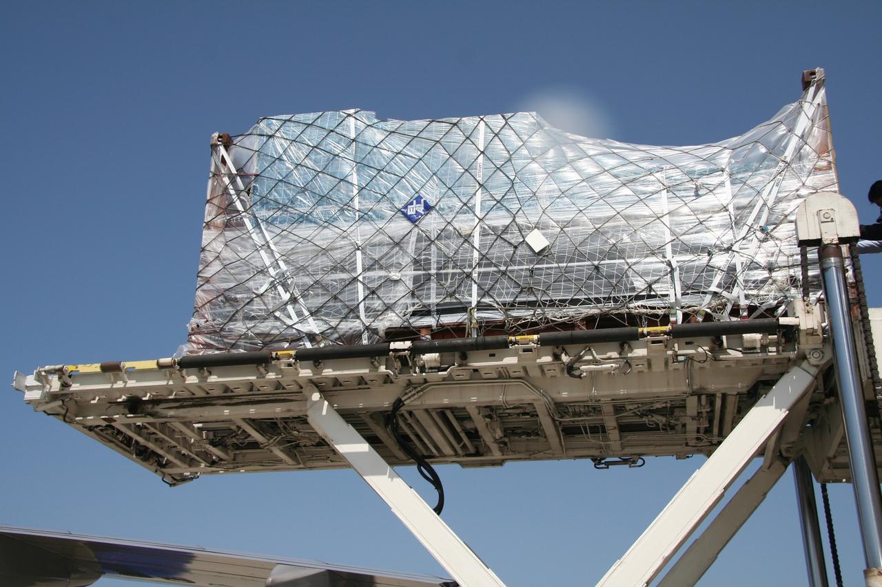
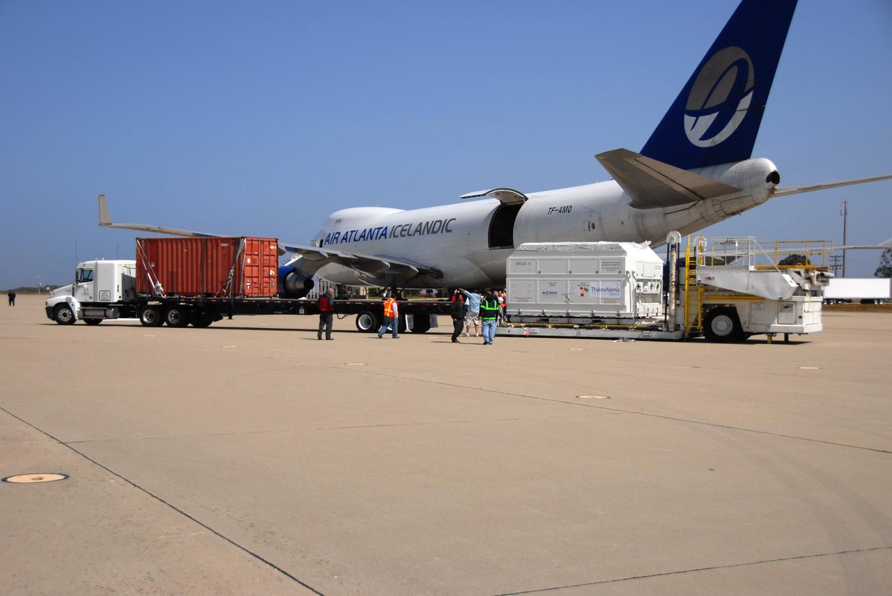
VANDENBERG AIR FORCE BASE, Calif. -- The shipping container with the OSTM/Jason-2 spacecraft inside is offloaded from the aircraft at Vandenberg Air Force Base in California. The OSTM, or Ocean Topography Mission, on the Jason-2 satellite is a follow-on to Jason-1. It will take oceanographic studies of sea surface height into an operational mode for continued climate forecasting research and science and industrial applications. This satellite altimetry data will help determine ocean circulation, climate change and sea-level rise. OSTM is a joint effort by the National Oceanic and Atmospheric Administration, NASA, France’s Centre National d’Etudes Spatiales and the European Meteorological Satellite Organisation. OSTM/Jason-2 will be launched aboard a United Launch Alliance Delta II 7320 from Vandenberg on June 15. Photo credit: NASA/Dan Liberotti
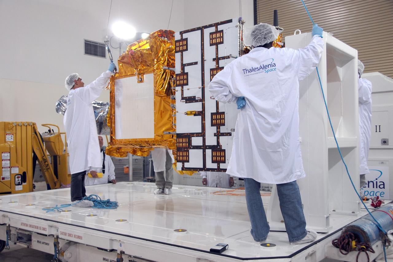
VANDENBERG AIR FORCE BASE, Calif. -- Inside the Astrotech processing facility at Vandenberg Air Force Base, workers attach an overhead crane to the OSTM/Jason-2 spacecraft. The spacecraft will be moved to a tilt dolly. The OSTM, or Ocean Topography Mission, on the Jason-2 satellite is a follow-on to Jason-1. It will take oceanographic studies of sea surface height into an operational mode for continued climate forecasting research and science and industrial applications. This satellite altimetry data will help determine ocean circulation, climate change and sea-level rise. OSTM is a joint effort by the National Oceanic and Atmospheric Administration, NASA, France’s Centre National d’Etudes Spatiales and the European Meteorological Satellite Organisation. OSTM/Jason-2 will be launched aboard a United Launch Alliance Delta II 7320 from Vandenberg on June 15. Photo credit: NASA/Mark Mackley

VANDENBERG AIR FORCE BASE, Calif. -- Inside the Astrotech processing facility at Vandenberg Air Force Base, the OSTM/Jason-2 spacecraft is moved to a tilt dolly. The OSTM, or Ocean Topography Mission, on the Jason-2 satellite is a follow-on to Jason-1. It will take oceanographic studies of sea surface height into an operational mode for continued climate forecasting research and science and industrial applications. This satellite altimetry data will help determine ocean circulation, climate change and sea-level rise. OSTM is a joint effort by the National Oceanic and Atmospheric Administration, NASA, France’s Centre National d’Etudes Spatiales and the European Meteorological Satellite Organisation. OSTM/Jason-2 will be launched aboard a United Launch Alliance Delta II 7320 from Vandenberg on June 15. Photo credit: NASA/Mark Mackley
VANDENBERG AIR FORCE BASE, Calif. -- At Vandenberg Air Force Base in California, the Delta II first stage is ready to be lifted into the mobile service tower on Space Launch Complex 2. The Delta II is the launch vehicle for the OSTM/Jason-2 spacecraft. The OSTM, or Ocean Topography Mission, on the Jason-2 satellite is a follow-on to Jason-1. It will take oceanographic studies of sea surface height into an operational mode for continued climate forecasting research and science and industrial applications. This satellite altimetry data will help determine ocean circulation, climate change and sea-level rise. OSTM is a joint effort by the National Oceanic and Atmospheric Administration, NASA, France’s Centre National d’Etudes Spatiales and the European Meteorological Satellite Organisation. OSTM/Jason-2 will be launched aboard a United Launch Alliance Delta II 7320 from Vandenberg on June 15. Photo credit: NASA/Dan Liberotti
VANDENBERG AIR FORCE BASE, Calif. – A photographer (left) captures the moment after the shipping container holding the OSTM/Jason-2 satellite has been offloaded from the cargo plane at Vandenberg Air Force Base. The satellite will be taken to the Astrotech processing facility. The OSTM, or Ocean Topography Mission, on the Jason-2 satellite is a follow-on to Jason-1. It will take oceanographic studies of sea surface height into an operational mode for continued climate forecasting research and science and industrial applications. This satellite altimetry data will help determine ocean circulation, climate change and sea-level rise. OSTM is a joint effort by the National Oceanic and Atmospheric Administration, NASA, France’s Centre National d’Etudes Spatiales and the European Meteorological Satellite Organisation. OSTM/Jason-2 will be launched aboard a United Launch Alliance Delta II 7320 from Vandenberg on June 15. Photo credit: NASA/Steve Greenberg, JPL
VANDENBERG AIR FORCE BASE, Calif. -- Inside the Astrotech processing facility at Vandenberg Air Force Base, the OSTM/Jason-2 spacecraft is lifted from its stand to be moved to a tilt dolly. The OSTM, or Ocean Topography Mission, on the Jason-2 satellite is a follow-on to Jason-1. It will take oceanographic studies of sea surface height into an operational mode for continued climate forecasting research and science and industrial applications. This satellite altimetry data will help determine ocean circulation, climate change and sea-level rise. OSTM is a joint effort by the National Oceanic and Atmospheric Administration, NASA, France’s Centre National d’Etudes Spatiales and the European Meteorological Satellite Organisation. OSTM/Jason-2 will be launched aboard a United Launch Alliance Delta II 7320 from Vandenberg on June 15. Photo credit: NASA/Mark Mackley
VANDENBERG AIR FORCE BASE, Calif. – Workers check the shipping container holding the OSTM/Jason-2 satellite after its placement on the flatbed truck at Vandenberg Air Force Base. The satellite will be transported to the Astrotech processing facility. The OSTM, or Ocean Topography Mission, on the Jason-2 satellite is a follow-on to Jason-1. It will take oceanographic studies of sea surface height into an operational mode for continued climate forecasting research and science and industrial applications. This satellite altimetry data will help determine ocean circulation, climate change and sea-level rise. OSTM is a joint effort by the National Oceanic and Atmospheric Administration, NASA, France’s Centre National d’Etudes Spatiales and the European Meteorological Satellite Organisation. OSTM/Jason-2 will be launched aboard a United Launch Alliance Delta II 7320 from Vandenberg on June 15. Photo credit: NASA/Steve Greenberg, JPL
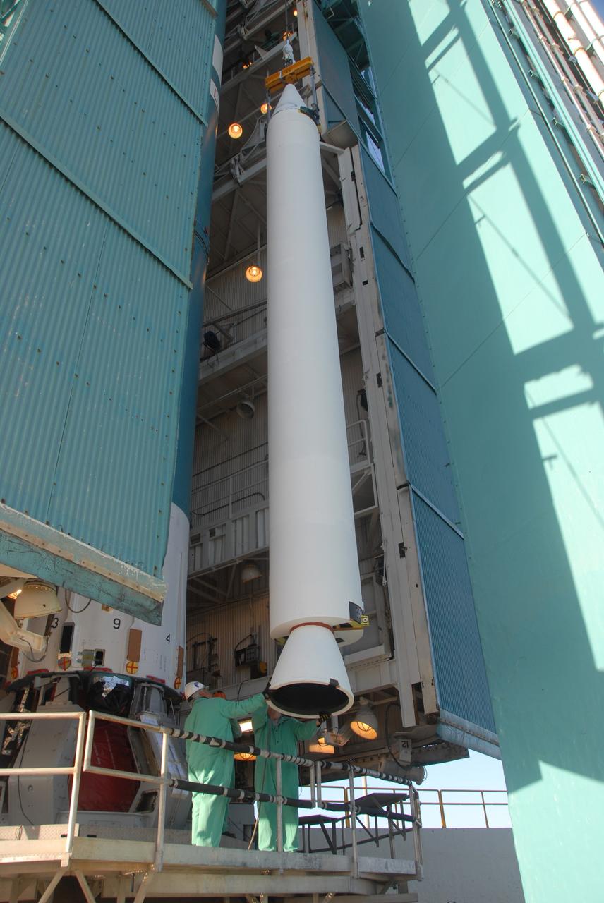
VANDENBERG AIR FORCE BASE, Calif. -- Inside the Astrotech processing facility at Vandenberg Air Force Base, the OSTM/Jason-2 spacecraft has been lifted to a vertical position on the tilt dolly. The OSTM, or Ocean Topography Mission, on the Jason-2 satellite is a follow-on to Jason-1. It will take oceanographic studies of sea surface height into an operational mode for continued climate forecasting research and science and industrial applications. This satellite altimetry data will help determine ocean circulation, climate change and sea-level rise. OSTM is a joint effort by the National Oceanic and Atmospheric Administration, NASA, France’s Centre National d’Etudes Spatiales and the European Meteorological Satellite Organisation. OSTM/Jason-2 will be launched aboard a United Launch Alliance Delta II 7320 from Vandenberg on June 15. Photo credit: NASA/Mark Mackley
VANDENBERG AIR FORCE BASE, Calif. – Ground support equipment associated with the OSTM/Jason-2 satellite is offloaded from the cargo plane at Vandenberg Air Force Base. The equipment will accompany the satellite to the Astrotech processing facility. The OSTM, or Ocean Topography Mission, on the Jason-2 satellite is a follow-on to Jason-1. It will take oceanographic studies of sea surface height into an operational mode for continued climate forecasting research and science and industrial applications. This satellite altimetry data will help determine ocean circulation, climate change and sea-level rise. OSTM is a joint effort by the National Oceanic and Atmospheric Administration, NASA, France’s Centre National d’Etudes Spatiales and the European Meteorological Satellite Organisation. OSTM/Jason-2 will be launched aboard a United Launch Alliance Delta II 7320 from Vandenberg on June 15. Photo credit: NASA/Steve Greenberg, JPL

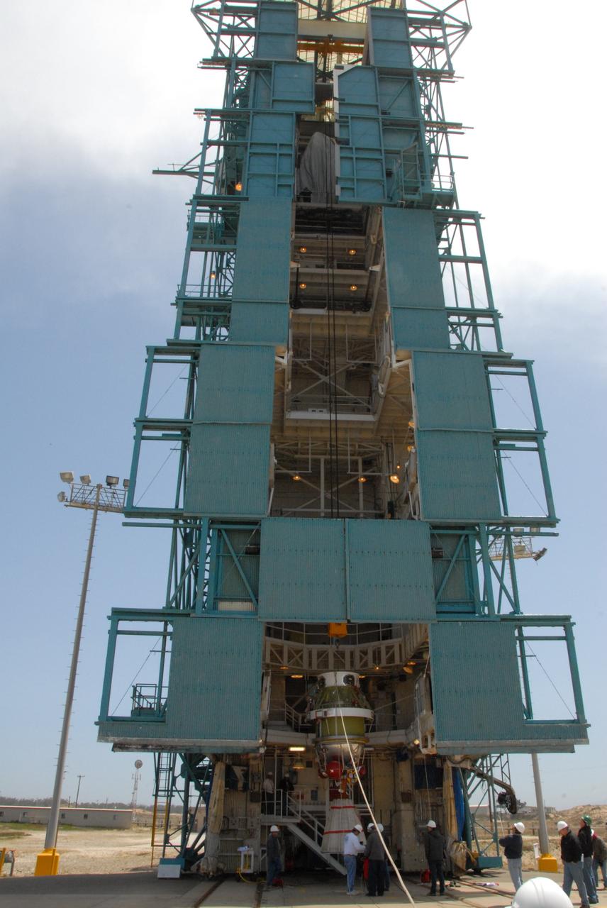
VANDENBERG AIR FORCE BASE, Calif. -- On Space Launch Complex 2 at Vandenberg Air Force Base in California, the Delta II second stage is lowered inside the mobile service tower toward the first stage. The second stage will be mated to the first stage for launch of the OSTM/Jason-2 spacecraft. The OSTM, or Ocean Topography Mission, on the Jason-2 satellite is a follow-on to Jason-1. It will take oceanographic studies of sea surface height into an operational mode for continued climate forecasting research and science and industrial applications. This satellite altimetry data will help determine ocean circulation, climate change and sea-level rise. OSTM is a joint effort by the National Oceanic and Atmospheric Administration, NASA, France’s Centre National d’Etudes Spatiales and the European Meteorological Satellite Organisation. OSTM/Jason-2 will be launched on June 20. Photo credit: NASA
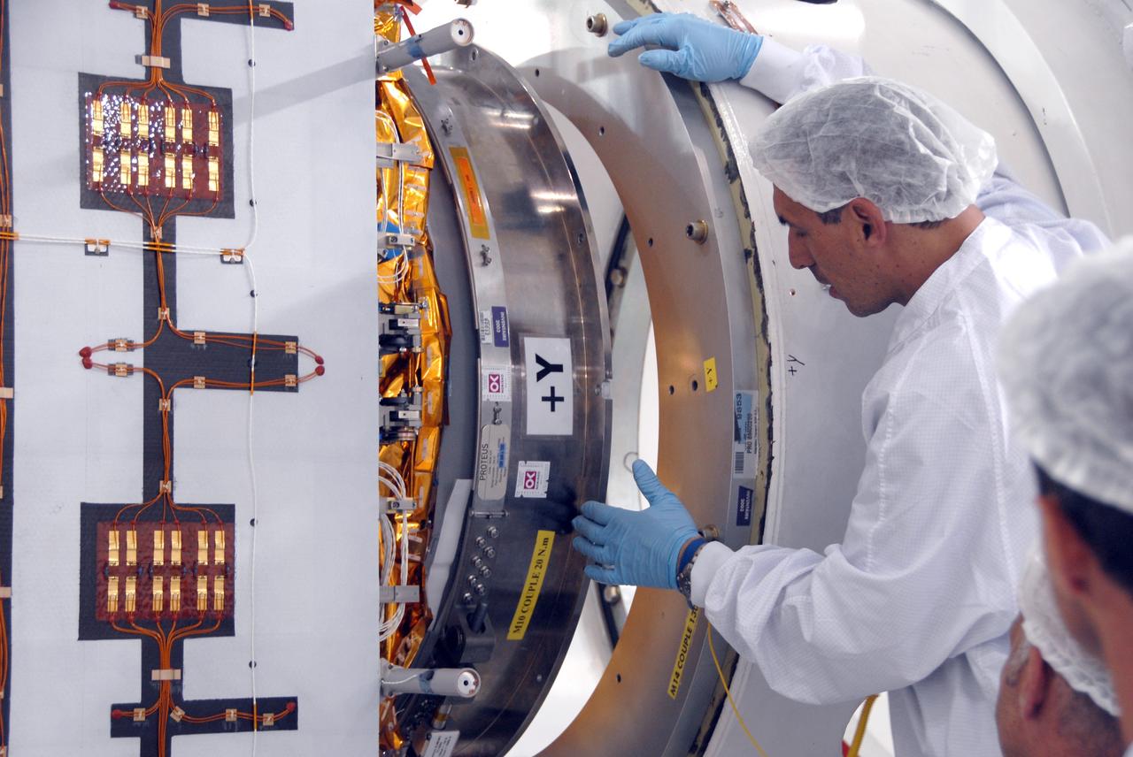
VANDENBERG AIR FORCE BASE, Calif. -- Inside the Astrotech processing facility at Vandenberg Air Force Base, a technician oversees the attaching of the OSTM/Jason-2 spacecraft to a tilt dolly. The OSTM, or Ocean Topography Mission, on the Jason-2 satellite is a follow-on to Jason-1. It will take oceanographic studies of sea surface height into an operational mode for continued climate forecasting research and science and industrial applications. This satellite altimetry data will help determine ocean circulation, climate change and sea-level rise. OSTM is a joint effort by the National Oceanic and Atmospheric Administration, NASA, France’s Centre National d’Etudes Spatiales and the European Meteorological Satellite Organisation. OSTM/Jason-2 will be launched aboard a United Launch Alliance Delta II 7320 from Vandenberg on June 15. Photo credit: NASA/Mark Mackley
VANDENBERG AIR FORCE BASE, Calif. -- In front of the Astrotech processing facility at Vandenberg Air Force Base, a forklift has removed the OSTM/Jason-2 satellite shipping container off the flatbed truck. The OSTM, or Ocean Topography Mission, on the Jason-2 satellite is a follow-on to Jason-1. It will take oceanographic studies of sea surface height into an operational mode for continued climate forecasting research and science and industrial applications. This satellite altimetry data will help determine ocean circulation, climate change and sea-level rise. OSTM is a joint effort by the National Oceanic and Atmospheric Administration, NASA, France’s Centre National d’Etudes Spatiales and the European Meteorological Satellite Organisation. OSTM/Jason-2 will be launched aboard a United Launch Alliance Delta II 7320 from Vandenberg on June 15. Photo credit: NASA/Dan Liberotti
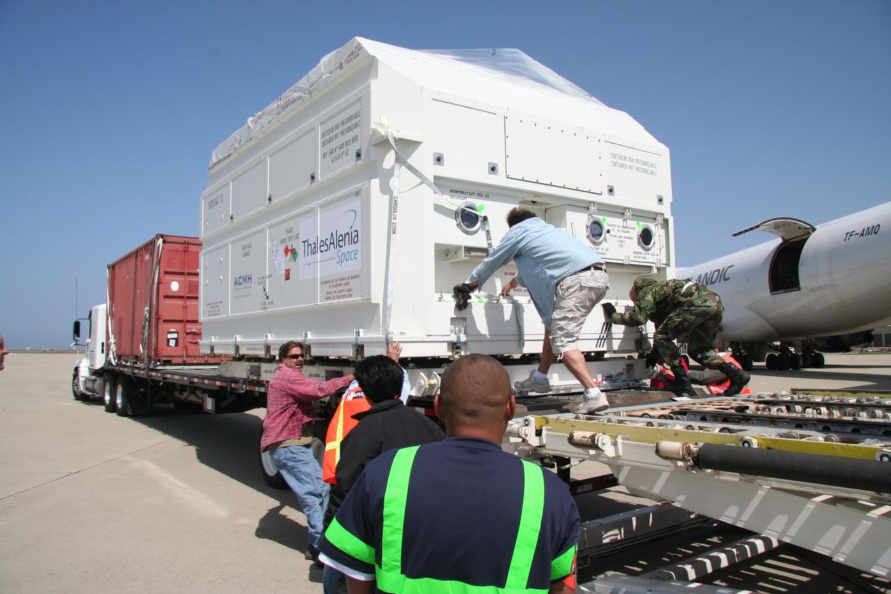
VANDENBERG AIR FORCE BASE, Calif. – After arrival of the cargo plane, the shipping container holding the OSTM/Jason-2 satellite is offloaded at Vandenberg Air Force Base. The satellite will be taken to the Astrotech processing facility. The OSTM, or Ocean Topography Mission, on the Jason-2 satellite is a follow-on to Jason-1. It will take oceanographic studies of sea surface height into an operational mode for continued climate forecasting research and science and industrial applications. This satellite altimetry data will help determine ocean circulation, climate change and sea-level rise. OSTM is a joint effort by the National Oceanic and Atmospheric Administration, NASA, France’s Centre National d’Etudes Spatiales and the European Meteorological Satellite Organisation. OSTM/Jason-2 will be launched aboard a United Launch Alliance Delta II 7320 from Vandenberg on June 15. Photo credit: NASA/Steve Greenberg, JPL
VANDENBERG AIR FORCE BASE, Calif. -- The shipping container with the OSTM/Jason-2 spacecraft inside is offloaded from the aircraft at Vandenberg Air Force Base in California. The OSTM, or Ocean Topography Mission, on the Jason-2 satellite is a follow-on to Jason-1. It will take oceanographic studies of sea surface height into an operational mode for continued climate forecasting research and science and industrial applications. This satellite altimetry data will help determine ocean circulation, climate change and sea-level rise. OSTM is a joint effort by the National Oceanic and Atmospheric Administration, NASA, France’s Centre National d’Etudes Spatiales and the European Meteorological Satellite Organisation. OSTM/Jason-2 will be launched aboard a United Launch Alliance Delta II 7320 from Vandenberg on June 15. Photo credit: NASA/Dan Liberotti
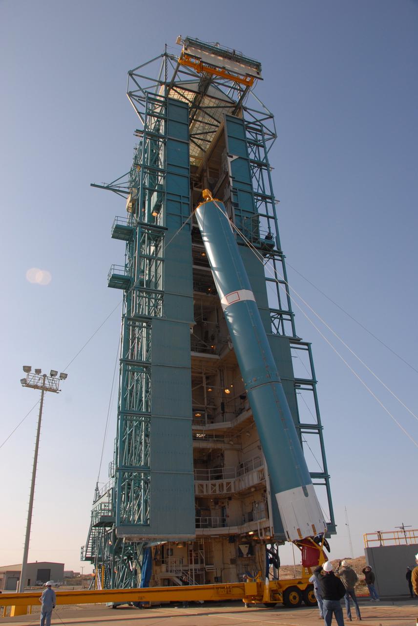
VANDENBERG AIR FORCE BASE, Calif. -- At Vandenberg Air Force Base in California, the Delta II first stage is being raised to a vertical position in front of the mobile service tower on Space Launch Complex 2. Once it is vertical, the first stage will be transferred into the tower. The OSTM, or Ocean Topography Mission, on the Jason-2 satellite is a follow-on to Jason-1. It will take oceanographic studies of sea surface height into an operational mode for continued climate forecasting research and science and industrial applications. This satellite altimetry data will help determine ocean circulation, climate change and sea-level rise. OSTM is a joint effort by the National Oceanic and Atmospheric Administration, NASA, France’s Centre National d’Etudes Spatiales and the European Meteorological Satellite Organisation. OSTM/Jason-2 will be launched aboard a United Launch Alliance Delta II 7320 from Vandenberg on June 15. Photo credit: NASA/Dan Liberotti
VANDENBERG AIR FORCE BASE, Calif. -- On Space Launch Complex 2 at Vandenberg Air Force Base in California, the Delta II second stage is lowered inside the mobile service tower toward the first stage. The second stage will be mated to the first stage for launch of the OSTM/Jason-2 spacecraft. The OSTM, or Ocean Topography Mission, on the Jason-2 satellite is a follow-on to Jason-1. It will take oceanographic studies of sea surface height into an operational mode for continued climate forecasting research and science and industrial applications. This satellite altimetry data will help determine ocean circulation, climate change and sea-level rise. OSTM is a joint effort by the National Oceanic and Atmospheric Administration, NASA, France’s Centre National d’Etudes Spatiales and the European Meteorological Satellite Organisation. OSTM/Jason-2 will be launched on June 20. Photo credit: NASA
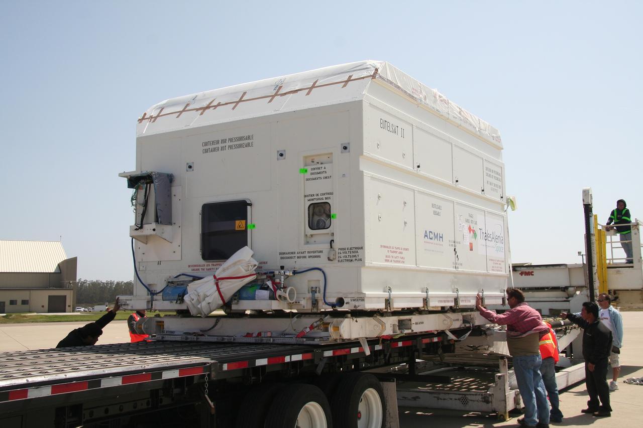
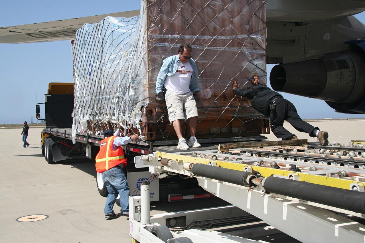
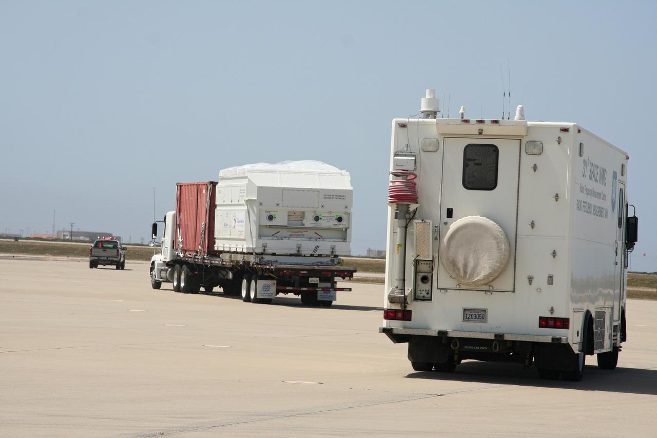
VANDENBERG AIR FORCE BASE, Calif. -- Workers prepare to move the shipping container holding the OSTM/Jason-2 satellite onto a flatbed truck at Vandenberg Air Force Base. The satellite will be transported to the Astrotech processing facility. The OSTM, or Ocean Topography Mission, on the Jason-2 satellite is a follow-on to Jason-1. It will take oceanographic studies of sea surface height into an operational mode for continued climate forecasting research and science and industrial applications. This satellite altimetry data will help determine ocean circulation, climate change and sea-level rise. OSTM is a joint effort by the National Oceanic and Atmospheric Administration, NASA, France’s Centre National d’Etudes Spatiales and the European Meteorological Satellite Organisation. OSTM/Jason-2 will be launched aboard a United Launch Alliance Delta II 7320 from Vandenberg on June 15. Photo credit: NASA/Dan Liberotti
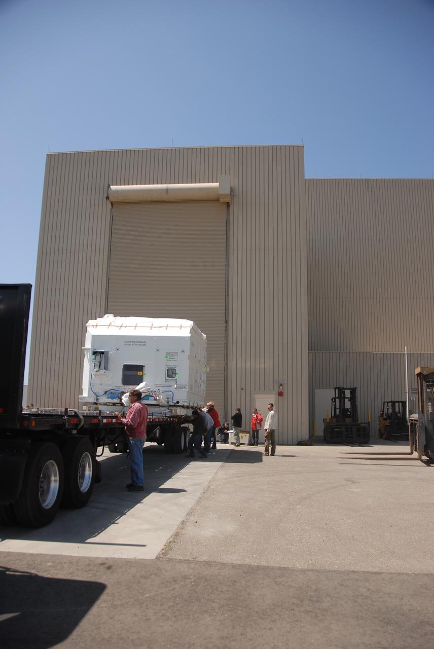
VANDENBERG AIR FORCE BASE, Calif. -- At Vandenberg Air Force Base, the truck carrying the OSTM/Jason-2 satellite arrives at the Astrotech processing facility. The OSTM, or Ocean Topography Mission, on the Jason-2 satellite is a follow-on to Jason-1. It will take oceanographic studies of sea surface height into an operational mode for continued climate forecasting research and science and industrial applications. This satellite altimetry data will help determine ocean circulation, climate change and sea-level rise. OSTM is a joint effort by the National Oceanic and Atmospheric Administration, NASA, France’s Centre National d’Etudes Spatiales and the European Meteorological Satellite Organisation. OSTM/Jason-2 will be launched aboard a United Launch Alliance Delta II 7320 from Vandenberg on June 15. Photo credit: NASA/Dan Liberotti
VANDENBERG AIR FORCE BASE, Calif. -- At Vandenberg Air Force Base, the OSTM/Jason-2 satellite shipping container is being moved inside the Astrotech processing facility. The OSTM, or Ocean Topography Mission, on the Jason-2 satellite is a follow-on to Jason-1. It will take oceanographic studies of sea surface height into an operational mode for continued climate forecasting research and science and industrial applications. This satellite altimetry data will help determine ocean circulation, climate change and sea-level rise. OSTM is a joint effort by the National Oceanic and Atmospheric Administration, NASA, France’s Centre National d’Etudes Spatiales and the European Meteorological Satellite Organisation. OSTM/Jason-2 will be launched aboard a United Launch Alliance Delta II 7320 from Vandenberg on June 15. Photo credit: NASA/Dan Liberotti
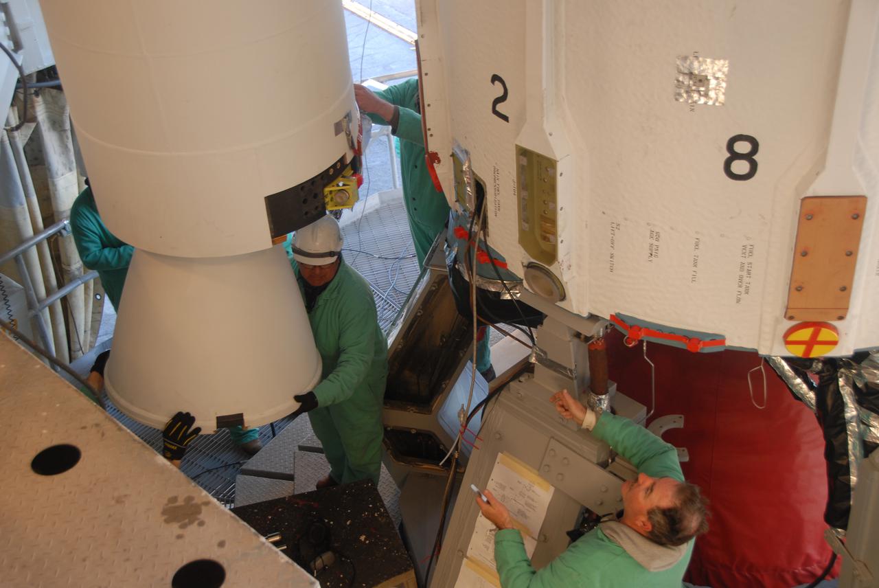
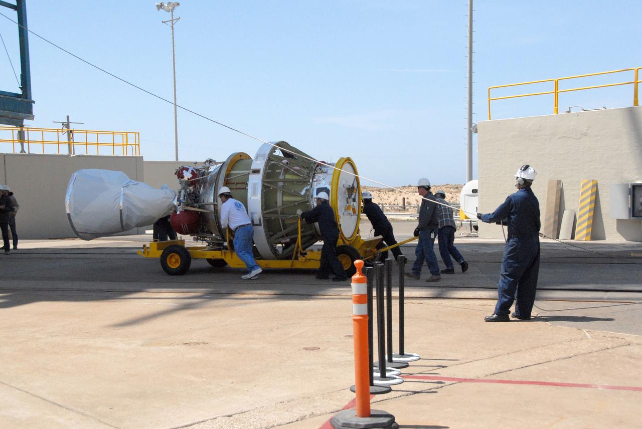
VANDENBERG AIR FORCE BASE, Calif. -- On Space Launch Complex 2 at Vandenberg Air Force Base in California, workers maneuver the solid rocket motor, or SRM, next to the Delta II first stage inside the mobile service tower. The Delta II is the launch vehicle for the OSTM_Jason-2 spacecraft. The OSTM, or Ocean Topography Mission, on the Jason-2 satellite is a follow-on to Jason-1. It will take oceanographic studies of sea surface height into an operational mode for continued climate forecasting research and science and industrial applications. This satellite altimetry data will help determine ocean circulation, climate change and sea-level rise. OSTM is a joint effort by the National Oceanic and Atmospheric Administration, NASA, France’s Centre National d’Etudes Spatiales and the European Meteorological Satellite Organisation. OSTM_Jason-2 will be launched aboard a United Launch Alliance Delta II 7320 from Vandenberg on June 15. Photo credit: NASA_Dan Liberotti
VANDENBERG AIR FORCE BASE, Calif. -- At Vandenberg Air Force Base in California, the Delta II first stage for the OSTM/Jason-2 spacecraft arrives at the base of the mobile service tower on Space Launch Complex 2. The first stage will be raised to vertical and lifted into the tower. The OSTM, or Ocean Topography Mission, on the Jason-2 satellite is a follow-on to Jason-1. It will take oceanographic studies of sea surface height into an operational mode for continued climate forecasting research and science and industrial applications. This satellite altimetry data will help determine ocean circulation, climate change and sea-level rise. OSTM is a joint effort by the National Oceanic and Atmospheric Administration, NASA, France’s Centre National d’Etudes Spatiales and the European Meteorological Satellite Organisation. OSTM/Jason-2 will be launched aboard a United Launch Alliance Delta II 7320 from Vandenberg on June 15. Photo credit: NASA/Dan Liberotti
VANDENBERG AIR FORCE BASE, Calif. -- At Vandenberg Air Force Base in California, workers prepare the equipment on Space Launch Complex 2 to raise the Delta II first stage of the OSTM/Jason-2 spacecraft. Once it is vertical, the first stage will be transferred into the mobile service tower. The OSTM, or Ocean Topography Mission, on the Jason-2 satellite is a follow-on to Jason-1. It will take oceanographic studies of sea surface height into an operational mode for continued climate forecasting research and science and industrial applications. This satellite altimetry data will help determine ocean circulation, climate change and sea-level rise. OSTM is a joint effort by the National Oceanic and Atmospheric Administration, NASA, France’s Centre National d’Etudes Spatiales and the European Meteorological Satellite Organisation. OSTM/Jason-2 will be launched aboard a United Launch Alliance Delta II 7320 from Vandenberg on June 15. Photo credit: NASA/Dan Liberotti
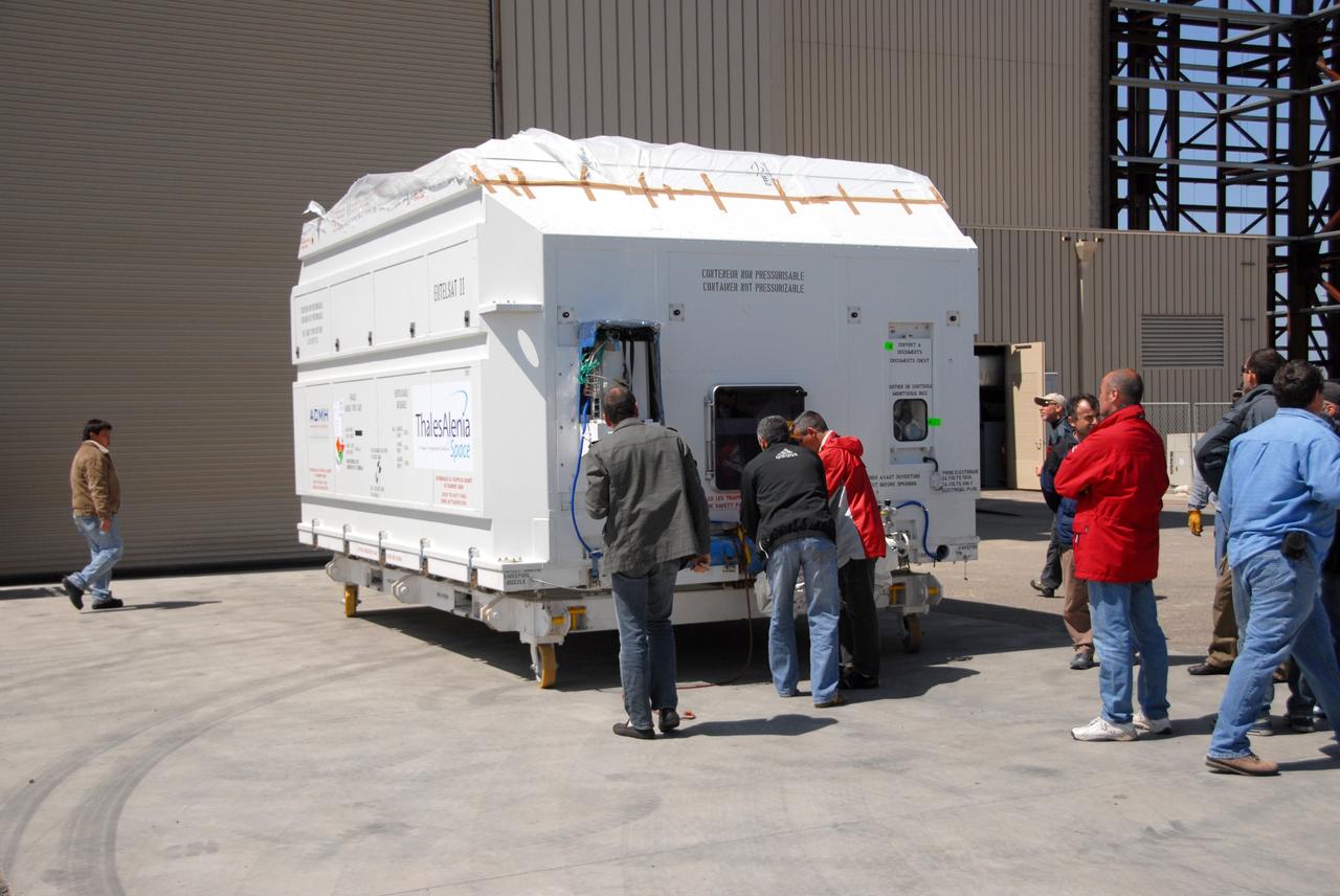
VANDENBERG AIR FORCE BASE, Calif. -- Inside the Astrotech processing facility at Vandenberg Air Force Base, the OSTM/Jason-2 spacecraft is revealed after removal of the shipping container. The OSTM, or Ocean Topography Mission, on the Jason-2 satellite is a follow-on to Jason-1. It will take oceanographic studies of sea surface height into an operational mode for continued climate forecasting research and science and industrial applications. This satellite altimetry data will help determine ocean circulation, climate change and sea-level rise. OSTM is a joint effort by the National Oceanic and Atmospheric Administration, NASA, France’s Centre National d’Etudes Spatiales and the European Meteorological Satellite Organisation. OSTM/Jason-2 will be launched aboard a United Launch Alliance Delta II 7320 from Vandenberg on June 15. Photo credit: NASA/Mark Mackley
VANDENBERG AIR FORCE BASE, Calif. – Workers adjust the shipping container holding the OSTM/Jason-2 satellite after its placement on the flatbed truck at Vandenberg Air Force Base. The satellite will be transported to the Astrotech processing facility. The OSTM, or Ocean Topography Mission, on the Jason-2 satellite is a follow-on to Jason-1. It will take oceanographic studies of sea surface height into an operational mode for continued climate forecasting research and science and industrial applications. This satellite altimetry data will help determine ocean circulation, climate change and sea-level rise. OSTM is a joint effort by the National Oceanic and Atmospheric Administration, NASA, France’s Centre National d’Etudes Spatiales and the European Meteorological Satellite Organisation. OSTM/Jason-2 will be launched aboard a United Launch Alliance Delta II 7320 from Vandenberg on June 15. Photo credit: NASA/Steve Greenberg, JPL

VANDENBERG AIR FORCE BASE, Calif. -- Inside the Astrotech processing facility at Vandenberg Air Force Base, technicians examine the attachment of the OSTM/Jason-2 spacecraft to a tilt dolly. The OSTM, or Ocean Topography Mission, on the Jason-2 satellite is a follow-on to Jason-1. It will take oceanographic studies of sea surface height into an operational mode for continued climate forecasting research and science and industrial applications. This satellite altimetry data will help determine ocean circulation, climate change and sea-level rise. OSTM is a joint effort by the National Oceanic and Atmospheric Administration, NASA, France’s Centre National d’Etudes Spatiales and the European Meteorological Satellite Organisation. OSTM/Jason-2 will be launched aboard a United Launch Alliance Delta II 7320 from Vandenberg on June 15. Photo credit: NASA/Mark Mackley
VANDENBERG AIR FORCE BASE, Calif. – Ground support equipment associated with the OSTM/Jason-2 satellite is placed on a flatbed truck at Vandenberg Air Force Base. The equipment will accompany the satellite to the Astrotech processing facility. The OSTM, or Ocean Topography Mission, on the Jason-2 satellite is a follow-on to Jason-1. It will take oceanographic studies of sea surface height into an operational mode for continued climate forecasting research and science and industrial applications. This satellite altimetry data will help determine ocean circulation, climate change and sea-level rise. OSTM is a joint effort by the National Oceanic and Atmospheric Administration, NASA, France’s Centre National d’Etudes Spatiales and the European Meteorological Satellite Organisation. OSTM/Jason-2 will be launched aboard a United Launch Alliance Delta II 7320 from Vandenberg on June 15. Photo credit: NASA/Steve Greenberg, JPL
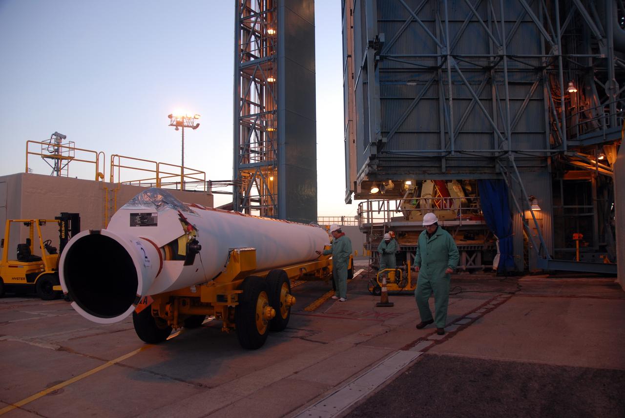
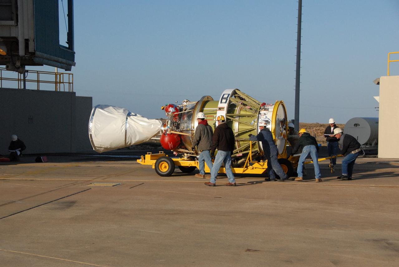
VANDENBERG AIR FORCE BASE, Calif. -- The first solid rocket motor arrives on Space Launch Complex 2 at Vandenberg Air Force Base in California. It will be attached to the Delta II first stage inside the mobile service tower. The Delta II is the launch vehicle for the OSTM/Jason-2 spacecraft. The OSTM, or Ocean Topography Mission, on the Jason-2 satellite is a follow-on to Jason-1. It will take oceanographic studies of sea surface height into an operational mode for continued climate forecasting research and science and industrial applications. This satellite altimetry data will help determine ocean circulation, climate change and sea-level rise. OSTM is a joint effort by the National Oceanic and Atmospheric Administration, NASA, France’s Centre National d’Etudes Spatiales and the European Meteorological Satellite Organisation. OSTM/Jason-2 will be launched aboard a United Launch Alliance Delta II 7320 from Vandenberg on June 15. Photo credit: NASA/Dan Liberotti
VANDENBERG AIR FORCE BASE, Calif. -- On Space Launch Complex 2 at Vandenberg Air Force Base in California, the Delta II second stage is ready to be lifted into the mobile service tower for installation on the first stage for launch of the OSTM/Jason-2 spacecraft. The OSTM, or Ocean Topography Mission, on the Jason-2 satellite is a follow-on to Jason-1. It will take oceanographic studies of sea surface height into an operational mode for continued climate forecasting research and science and industrial applications. This satellite altimetry data will help determine ocean circulation, climate change and sea-level rise. OSTM is a joint effort by the National Oceanic and Atmospheric Administration, NASA, France’s Centre National d’Etudes Spatiales and the European Meteorological Satellite Organisation. OSTM/Jason-2 will be launched on June 20. Photo credit: NASA
VANDENBERG AIR FORCE BASE, Calif. -- On Space Launch Complex 2 at Vandenberg Air Force Base in California, the Delta II second stage is lowered inside the mobile service tower toward the opening above the first stage. The second stage will be mated to the first stage for launch of the OSTM/Jason-2 spacecraft. The OSTM, or Ocean Topography Mission, on the Jason-2 satellite is a follow-on to Jason-1. It will take oceanographic studies of sea surface height into an operational mode for continued climate forecasting research and science and industrial applications. This satellite altimetry data will help determine ocean circulation, climate change and sea-level rise. OSTM is a joint effort by the National Oceanic and Atmospheric Administration, NASA, France’s Centre National d’Etudes Spatiales and the European Meteorological Satellite Organisation. OSTM/Jason-2 will be launched on June 20. Photo credit: NASA
VANDENBERG AIR FORCE BASE, Calif. -- At Vandenberg Air Force Base, the OSTM/Jason-2 satellite shipping container is being moved inside the Astrotech processing facility. The OSTM, or Ocean Topography Mission, on the Jason-2 satellite is a follow-on to Jason-1. It will take oceanographic studies of sea surface height into an operational mode for continued climate forecasting research and science and industrial applications. This satellite altimetry data will help determine ocean circulation, climate change and sea-level rise. OSTM is a joint effort by the National Oceanic and Atmospheric Administration, NASA, France’s Centre National d’Etudes Spatiales and the European Meteorological Satellite Organisation. OSTM/Jason-2 will be launched aboard a United Launch Alliance Delta II 7320 from Vandenberg on June 15. Photo credit: NASA/Dan Liberotti
VANDENBERG AIR FORCE BASE, Calif. -- At Vandenberg Air Force Base in California, workers on Space Launch Complex 2 prepare to raise the Delta II first stage of the OSTM/Jason-2 spacecraft. Once it is vertical, the first stage will be transferred into the mobile service tower. The OSTM, or Ocean Topography Mission, on the Jason-2 satellite is a follow-on to Jason-1. It will take oceanographic studies of sea surface height into an operational mode for continued climate forecasting research and science and industrial applications. This satellite altimetry data will help determine ocean circulation, climate change and sea-level rise. OSTM is a joint effort by the National Oceanic and Atmospheric Administration, NASA, France’s Centre National d’Etudes Spatiales and the European Meteorological Satellite Organisation. OSTM/Jason-2 will be launched aboard a United Launch Alliance Delta II 7320 from Vandenberg on June 15. Photo credit: NASA/Dan Liberotti
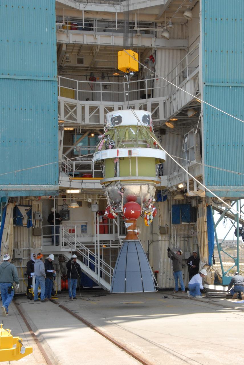
VANDENBERG AIR FORCE BASE, Calif. -- Suspended vertically, the Delta II second stage is ready to be lifted into the mobile service tower on Space Launch Complex 2 at Vandenberg Air Force Base in California. The second stage will be installed on the first stage for launch of the OSTM/Jason-2 spacecraft. The OSTM, or Ocean Topography Mission, on the Jason-2 satellite is a follow-on to Jason-1. It will take oceanographic studies of sea surface height into an operational mode for continued climate forecasting research and science and industrial applications. This satellite altimetry data will help determine ocean circulation, climate change and sea-level rise. OSTM is a joint effort by the National Oceanic and Atmospheric Administration, NASA, France’s Centre National d’Etudes Spatiales and the European Meteorological Satellite Organisation. OSTM/Jason-2 will be launched on June 20. Photo credit: NASA
VANDENBERG AIR FORCE BASE, Calif. -- On Space Launch Complex 2 at Vandenberg Air Force Base in California, the second solid rocket motor, or SRM, is moved into place alongside the Delta II first stage. The Delta II is the launch vehicle for the OSTM/Jason-2 spacecraft. The OSTM, or Ocean Topography Mission, on the Jason-2 satellite is a follow-on to Jason-1. It will take oceanographic studies of sea surface height into an operational mode for continued climate forecasting research and science and industrial applications. This satellite altimetry data will help determine ocean circulation, climate change and sea-level rise. OSTM is a joint effort by the National Oceanic and Atmospheric Administration, NASA, France’s Centre National d’Etudes Spatiales and the European Meteorological Satellite Organisation. OSTM/Jason-2 will be launched aboard a United Launch Alliance Delta II 7320 from Vandenberg on June 15. Photo credit: NASA/Dan Liberotti
VANDENBERG AIR FORCE BASE, Calif. -- Workers on Space Launch Complex 2 at Vandenberg Air Force Base in California maneuver the transporter with the Delta II second stage into place. It will be lifted into the mobile service tower and installed on the first stage for launch of the OSTM/Jason-2 spacecraft. The OSTM, or Ocean Topography Mission, on the Jason-2 satellite is a follow-on to Jason-1. It will take oceanographic studies of sea surface height into an operational mode for continued climate forecasting research and science and industrial applications. This satellite altimetry data will help determine ocean circulation, climate change and sea-level rise. OSTM is a joint effort by the National Oceanic and Atmospheric Administration, NASA, France’s Centre National d’Etudes Spatiales and the European Meteorological Satellite Organisation. OSTM/Jason-2 will be launched on June 20. Photo credit: NASA
VANDENBERG AIR FORCE BASE, Calif. -- At Vandenberg Air Force Base, workers remove the straps holding the OSTM/Jason-2 satellite shipping container on the flatbed truck. The container will be moved inside the Astrotech processing facility at right. The OSTM, or Ocean Topography Mission, on the Jason-2 satellite is a follow-on to Jason-1. It will take oceanographic studies of sea surface height into an operational mode for continued climate forecasting research and science and industrial applications. This satellite altimetry data will help determine ocean circulation, climate change and sea-level rise. OSTM is a joint effort by the National Oceanic and Atmospheric Administration, NASA, France’s Centre National d’Etudes Spatiales and the European Meteorological Satellite Organisation. OSTM/Jason-2 will be launched aboard a United Launch Alliance Delta II 7320 from Vandenberg on June 15. Photo credit: NASA/Dan Liberotti
VANDENBERG AIR FORCE BASE, Calif. -- Workers on Space Launch Complex 2 at Vandenberg Air Force Base in California maneuver the transporter with the Delta II second stage into place. It will be lifted into the mobile service tower and installed on the first stage for launch of the OSTM/Jason-2 spacecraft. The OSTM, or Ocean Topography Mission, on the Jason-2 satellite is a follow-on to Jason-1. It will take oceanographic studies of sea surface height into an operational mode for continued climate forecasting research and science and industrial applications. This satellite altimetry data will help determine ocean circulation, climate change and sea-level rise. OSTM is a joint effort by the National Oceanic and Atmospheric Administration, NASA, France’s Centre National d’Etudes Spatiales and the European Meteorological Satellite Organisation. OSTM/Jason-2 will be launched on June 20. Photo credit: NASA

VANDENBERG AIR FORCE BASE, Calif. -- Inside the Astrotech processing facility at Vandenberg Air Force Base, technicians check the OSTM/Jason-2 spacecraft before it is moved to a tilt dolly. The OSTM, or Ocean Topography Mission, on the Jason-2 satellite is a follow-on to Jason-1. It will take oceanographic studies of sea surface height into an operational mode for continued climate forecasting research and science and industrial applications. This satellite altimetry data will help determine ocean circulation, climate change and sea-level rise. OSTM is a joint effort by the National Oceanic and Atmospheric Administration, NASA, France’s Centre National d’Etudes Spatiales and the European Meteorological Satellite Organisation. OSTM/Jason-2 will be launched aboard a United Launch Alliance Delta II 7320 from Vandenberg on June 15. Photo credit: NASA/Mark Mackley
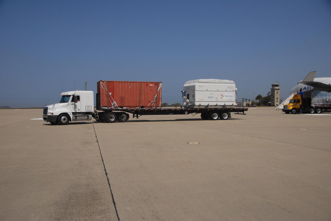
VANDENBERG AIR FORCE BASE, Calif. – The OSTM/Jason-2 satellite is transported from the airstrip at Vandenberg Air Force Base. The satellite will be taken to the Astrotech processing facility. The OSTM, or Ocean Topography Mission, on the Jason-2 satellite is a follow-on to Jason-1. It will take oceanographic studies of sea surface height into an operational mode for continued climate forecasting research and science and industrial applications. This satellite altimetry data will help determine ocean circulation, climate change and sea-level rise. OSTM is a joint effort by the National Oceanic and Atmospheric Administration, NASA, France’s Centre National d’Etudes Spatiales and the European Meteorological Satellite Organisation. OSTM/Jason-2 will be launched aboard a United Launch Alliance Delta II 7320 from Vandenberg on June 15. Photo credit: NASA/Steve Greenberg, JPL
VANDENBERG AIR FORCE BASE, Calif. -- Inside the Astrotech processing facility at Vandenberg Air Force Base, technicians attach an overhead crane to the OSTM/Jason-2 spacecraft. The spacecraft will be moved to a tilt dolly. The OSTM, or Ocean Topography Mission, on the Jason-2 satellite is a follow-on to Jason-1. It will take oceanographic studies of sea surface height into an operational mode for continued climate forecasting research and science and industrial applications. This satellite altimetry data will help determine ocean circulation, climate change and sea-level rise. OSTM is a joint effort by the National Oceanic and Atmospheric Administration, NASA, France’s Centre National d’Etudes Spatiales and the European Meteorological Satellite Organisation. OSTM/Jason-2 will be launched aboard a United Launch Alliance Delta II 7320 from Vandenberg on June 15. Photo credit: NASA/Mark Mackley
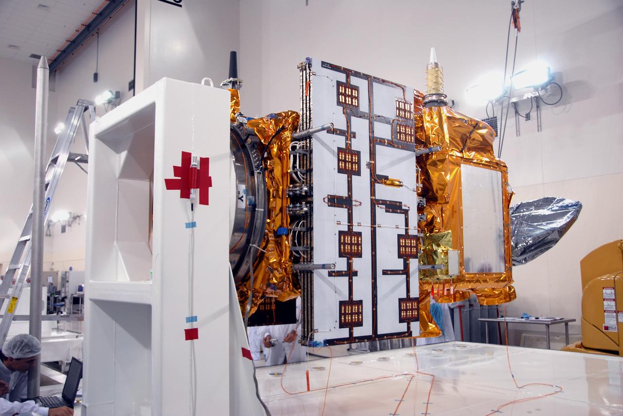
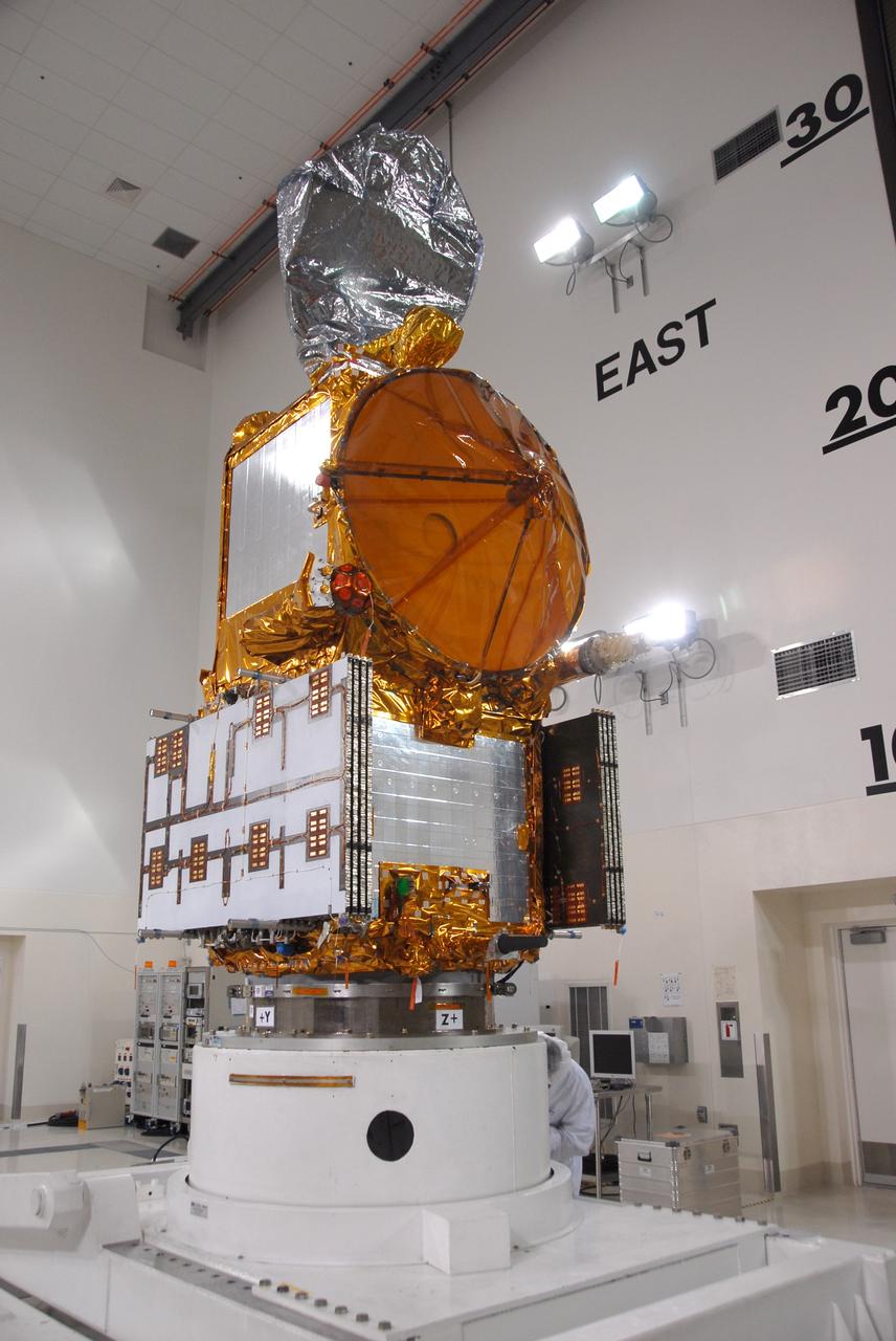
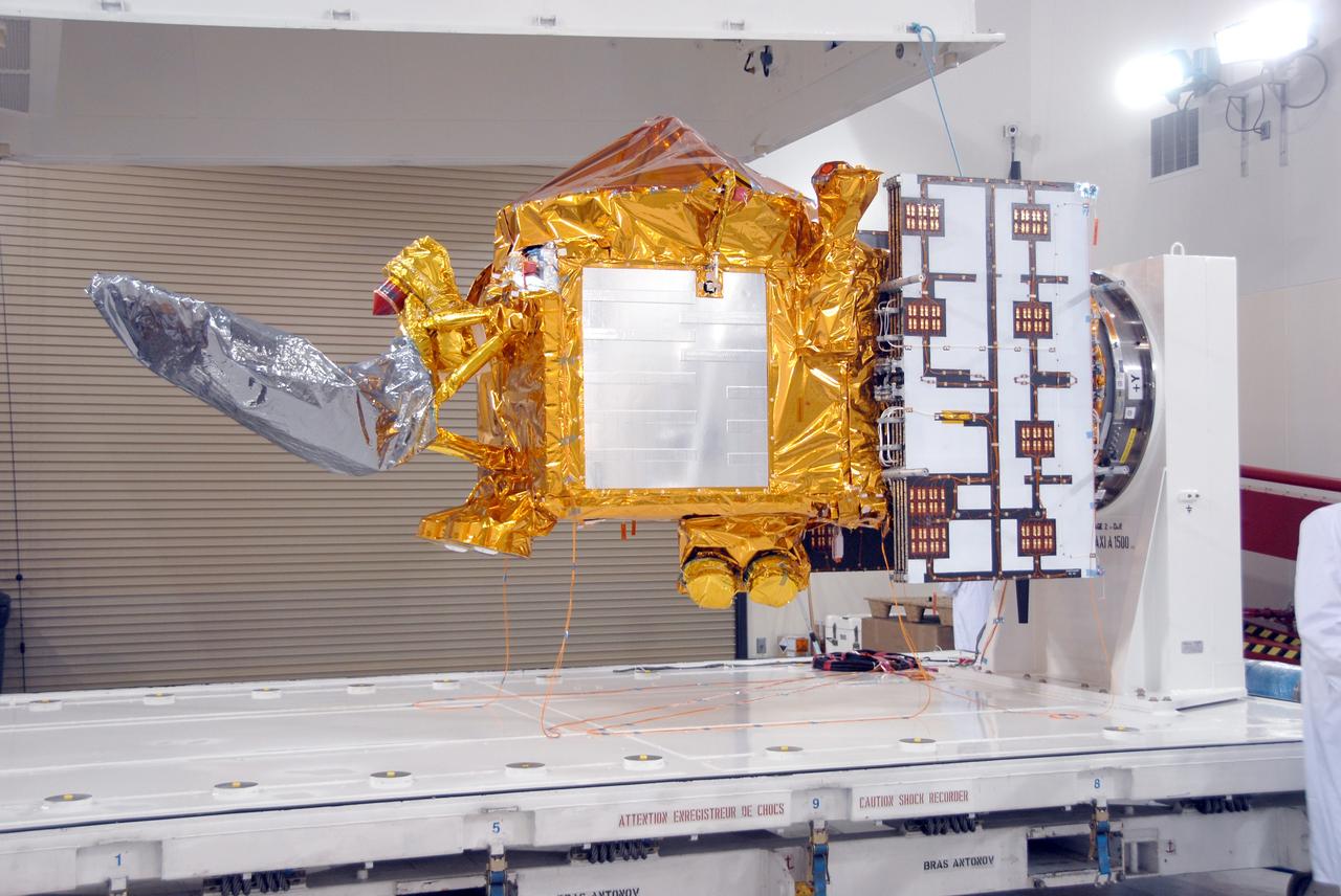
VANDENBERG AIR FORCE BASE, Calif. -- Another view of the OSTM/Jason-2 spacecraft after removal of the shipping container in the Astrotech processing facility at Vandenberg Air Force Base. The OSTM, or Ocean Topography Mission, on the Jason-2 satellite is a follow-on to Jason-1. It will take oceanographic studies of sea surface height into an operational mode for continued climate forecasting research and science and industrial applications. This satellite altimetry data will help determine ocean circulation, climate change and sea-level rise. OSTM is a joint effort by the National Oceanic and Atmospheric Administration, NASA, France’s Centre National d’Etudes Spatiales and the European Meteorological Satellite Organisation. OSTM/Jason-2 will be launched aboard a United Launch Alliance Delta II 7320 from Vandenberg on June 15. Photo credit: NASA/Mark Mackley
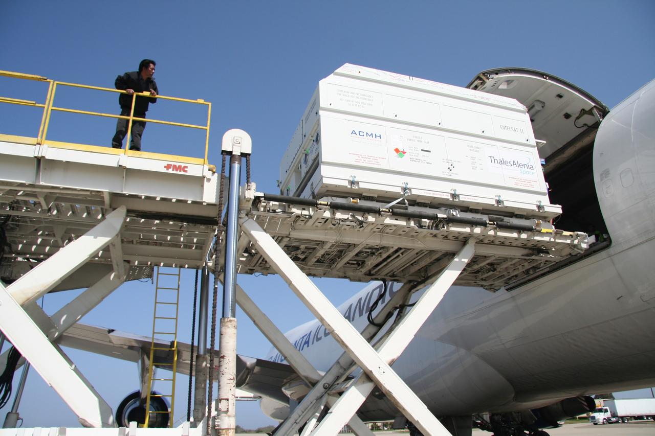
VANDENBERG AIR FORCE BASE, Calif. – The shipping container with the OSTM/Jason-2 spacecraft inside is offloaded from the aircraft at Vandenberg Air Force Base in California. The OSTM, or Ocean Topography Mission, on the Jason-2 satellite is a follow-on to Jason-1. It will take oceanographic studies of sea surface height into an operational mode for continued climate forecasting research and science and industrial applications. This satellite altimetry data will help determine ocean circulation, climate change and sea-level rise. OSTM is a joint effort by the National Oceanic and Atmospheric Administration, NASA, France’s Centre National d’Etudes Spatiales and the European Meteorological Satellite Organisation. OSTM/Jason-2 will be launched aboard a United Launch Alliance Delta II 7320 from Vandenberg on June 15. Photo credit: NASA/Steve Greenberg, JPL
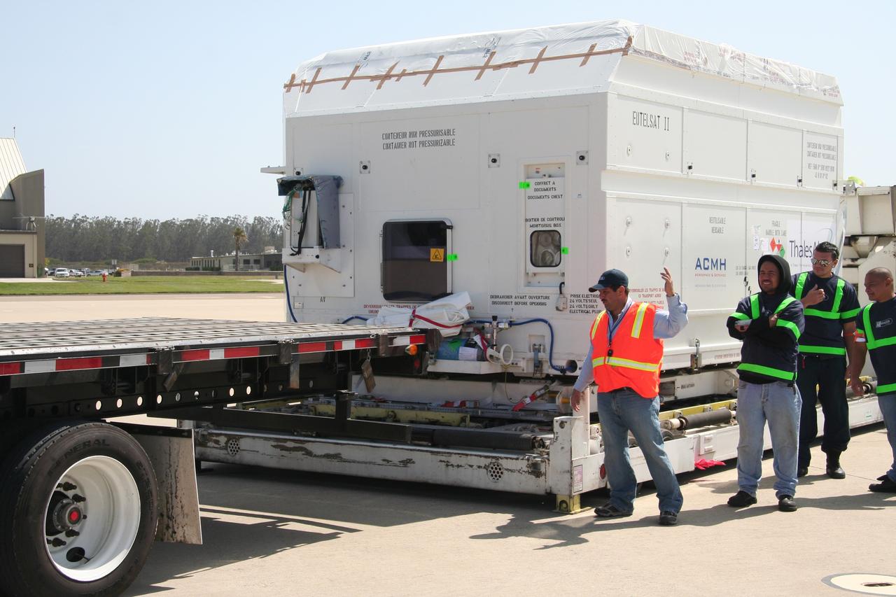
VANDENBERG AIR FORCE BASE, Calif. – Workers prepare to move the shipping container holding the OSTM/Jason-2 satellite onto a flatbed truck at Vandenberg Air Force Base. The satellite will be transported to the Astrotech processing facility. The OSTM, or Ocean Topography Mission, on the Jason-2 satellite is a follow-on to Jason-1. It will take oceanographic studies of sea surface height into an operational mode for continued climate forecasting research and science and industrial applications. This satellite altimetry data will help determine ocean circulation, climate change and sea-level rise. OSTM is a joint effort by the National Oceanic and Atmospheric Administration, NASA, France’s Centre National d’Etudes Spatiales and the European Meteorological Satellite Organisation. OSTM/Jason-2 will be launched aboard a United Launch Alliance Delta II 7320 from Vandenberg on June 15. Photo credit: NASA/Steve Greenberg, JPL
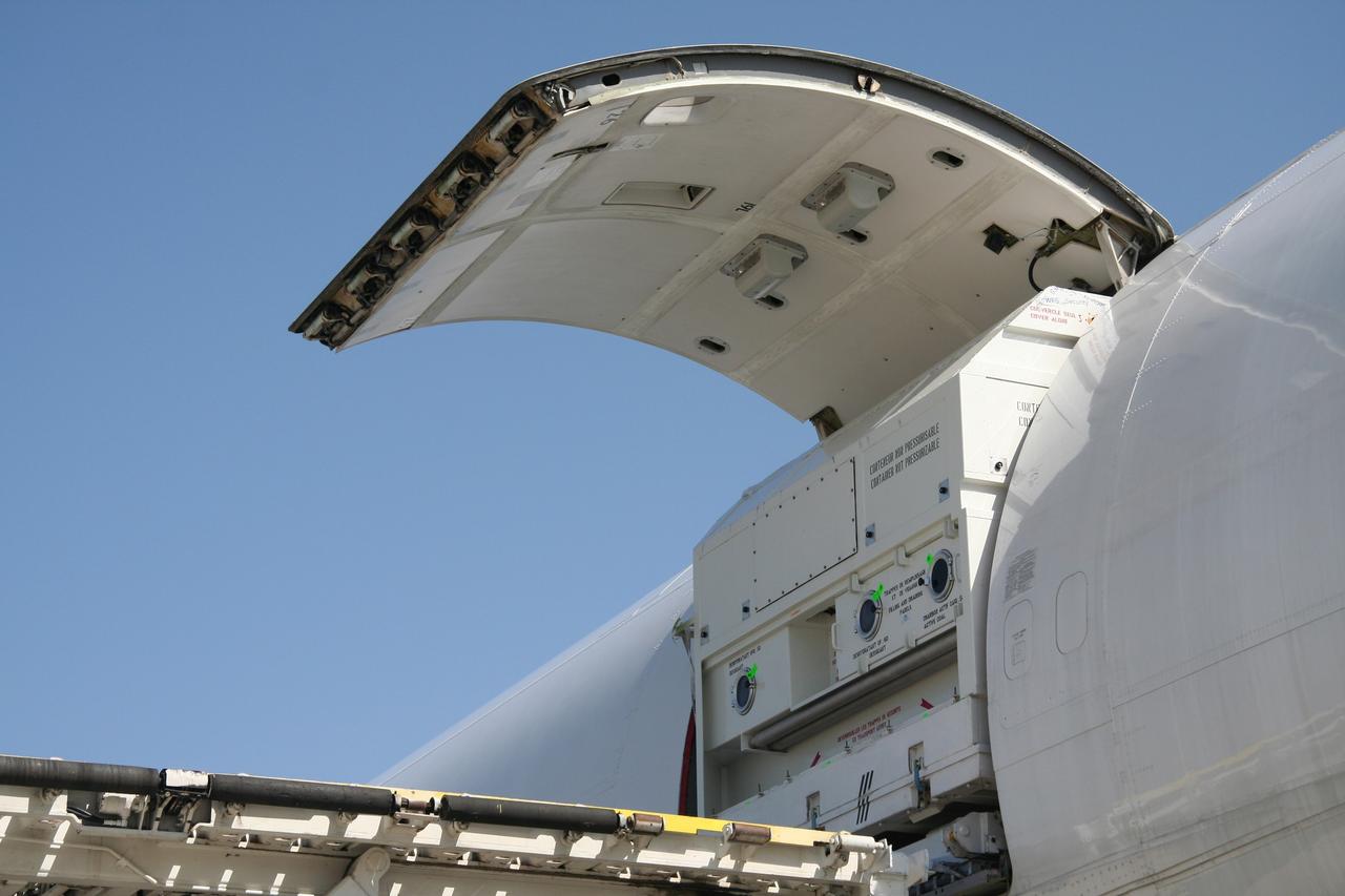
VANDENBERG AIR FORCE BASE, Calif. – The shipping container with the OSTM/Jason-2 spacecraft inside is offloaded from the aircraft at Vandenberg Air Force Base in California. The OSTM, or Ocean Topography Mission, on the Jason-2 satellite is a follow-on to Jason-1. It will take oceanographic studies of sea surface height into an operational mode for continued climate forecasting research and science and industrial applications. This satellite altimetry data will help determine ocean circulation, climate change and sea-level rise. OSTM is a joint effort by the National Oceanic and Atmospheric Administration, NASA, France’s Centre National d’Etudes Spatiales and the European Meteorological Satellite Organisation. OSTM/Jason-2 will be launched aboard a United Launch Alliance Delta II 7320 from Vandenberg on June 15. Photo credit: NASA/Steve Greenberg, JPL
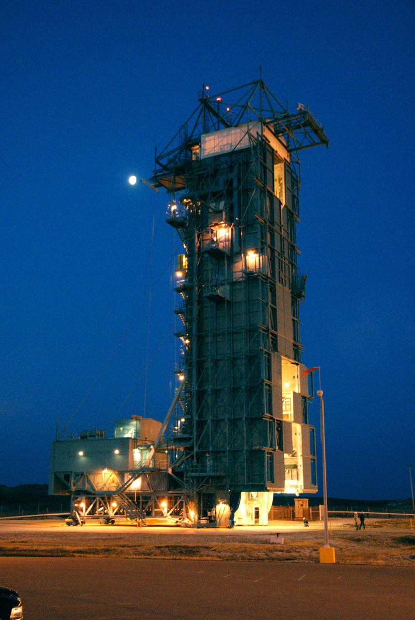
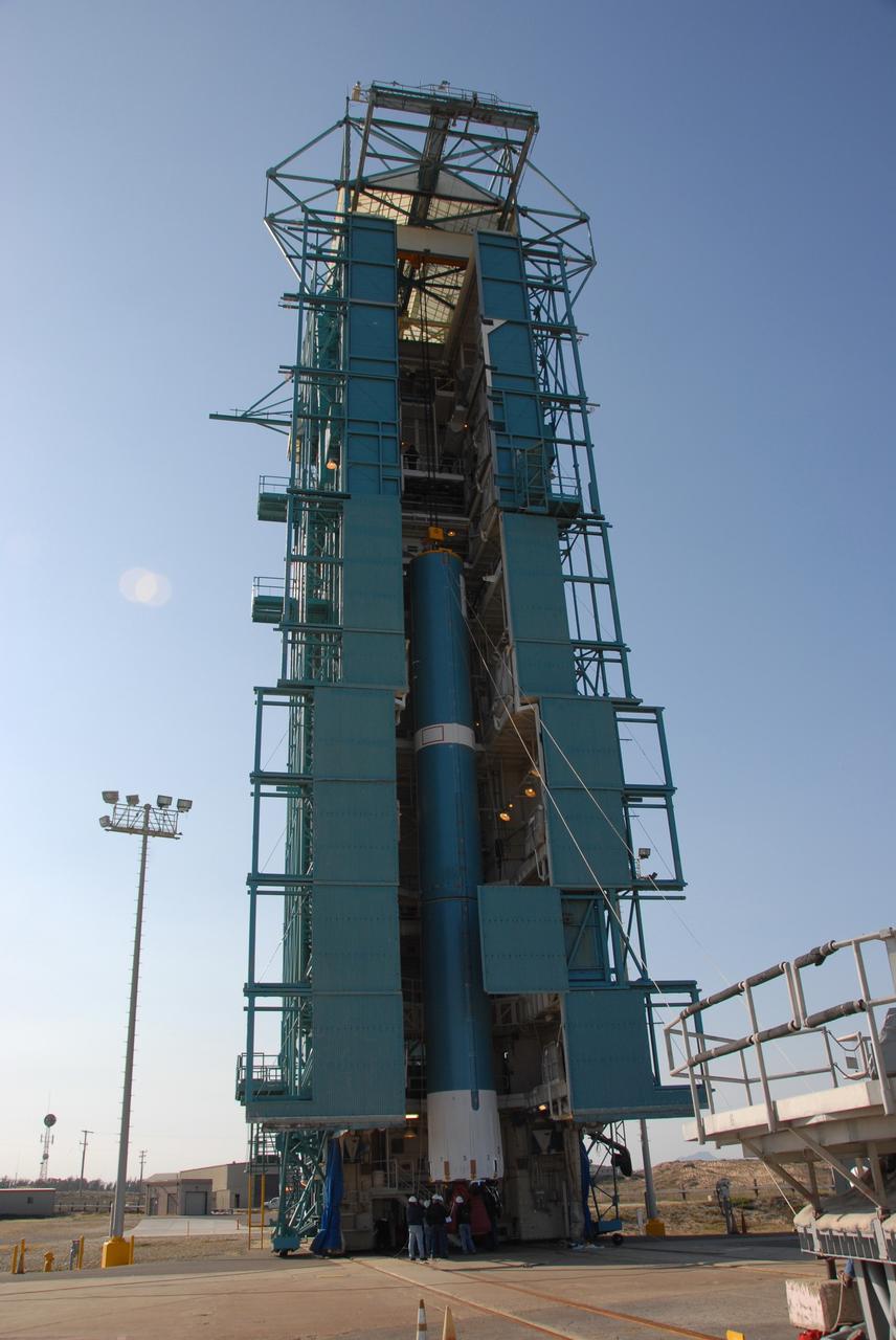
VANDENBERG AIR FORCE BASE, Calif. -- In pre-dawn hours at Vandenberg Air Force Base in California, the mobile service tower/umbilical tower and launcher on Space Launch Complex 2 are being prepared for the arrival of the Delta II first stage for the OSTM/Jason-2 spacecraft. The OSTM, or Ocean Topography Mission, on the Jason-2 satellite is a follow-on to Jason-1. It will take oceanographic studies of sea surface height into an operational mode for continued climate forecasting research and science and industrial applications. This satellite altimetry data will help determine ocean circulation, climate change and sea-level rise. OSTM is a joint effort by the National Oceanic and Atmospheric Administration, NASA, France’s Centre National d’Etudes Spatiales and the European Meteorological Satellite Organisation. OSTM/Jason-2 will be launched aboard a United Launch Alliance Delta II 7320 from Vandenberg on June 15. Photo credit: NASA/Dan Liberotti
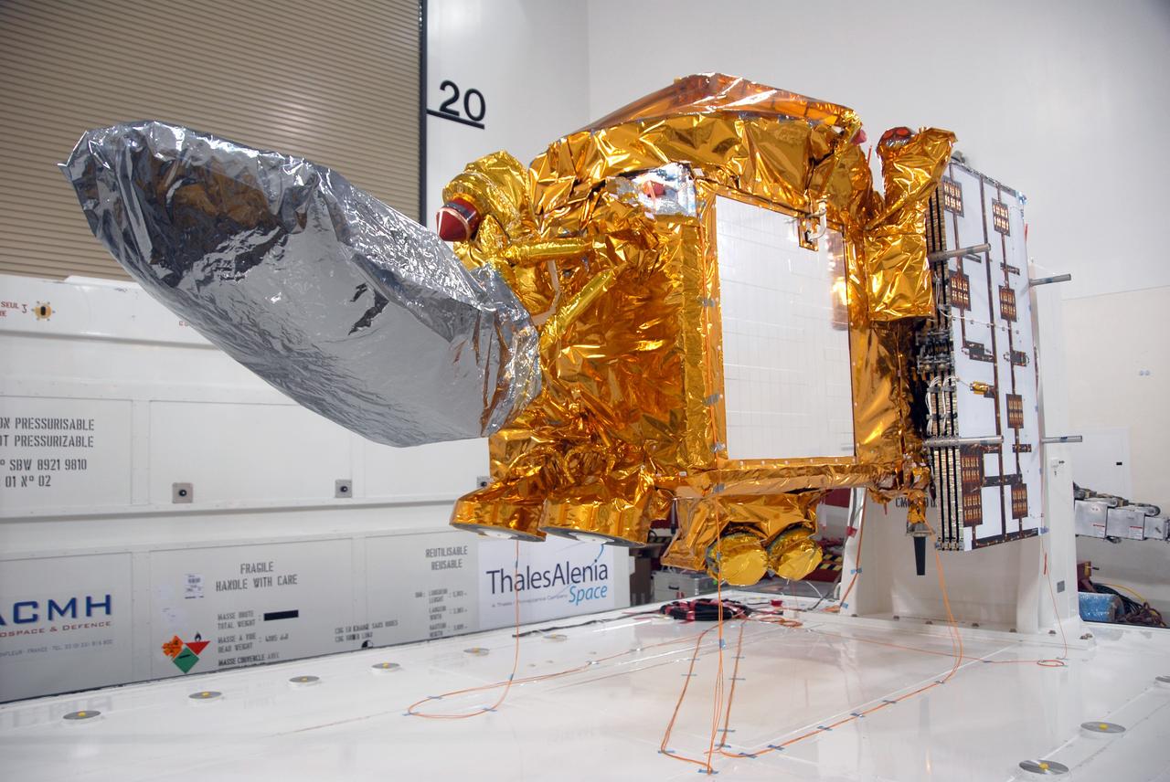
VANDENBERG AIR FORCE BASE, Calif. -- A closeup of the OSTM/Jason-2 spacecraft after removal of the shipping container in the Astrotech processing facility at Vandenberg Air Force Base. The OSTM, or Ocean Topography Mission, on the Jason-2 satellite is a follow-on to Jason-1. It will take oceanographic studies of sea surface height into an operational mode for continued climate forecasting research and science and industrial applications. This satellite altimetry data will help determine ocean circulation, climate change and sea-level rise. OSTM is a joint effort by the National Oceanic and Atmospheric Administration, NASA, France’s Centre National d’Etudes Spatiales and the European Meteorological Satellite Organisation. OSTM/Jason-2 will be launched aboard a United Launch Alliance Delta II 7320 from Vandenberg on June 15. Photo credit: NASA/Mark Mackley
VANDENBERG AIR FORCE BASE, Calif. -- At Vandenberg Air Force Base in California, the Delta II first stage for the OSTM/Jason-2 spacecraft arrives on Space Launch Complex 2. The first stage will be raised to vertical and lifted into the mobile service tower (behind it, at left). The OSTM, or Ocean Topography Mission, on the Jason-2 satellite is a follow-on to Jason-1. It will take oceanographic studies of sea surface height into an operational mode for continued climate forecasting research and science and industrial applications. This satellite altimetry data will help determine ocean circulation, climate change and sea-level rise. OSTM is a joint effort by the National Oceanic and Atmospheric Administration, NASA, France’s Centre National d’Etudes Spatiales and the European Meteorological Satellite Organisation. OSTM/Jason-2 will be launched aboard a United Launch Alliance Delta II 7320 from Vandenberg on June 15. Photo credit: NASA/Dan Liberotti
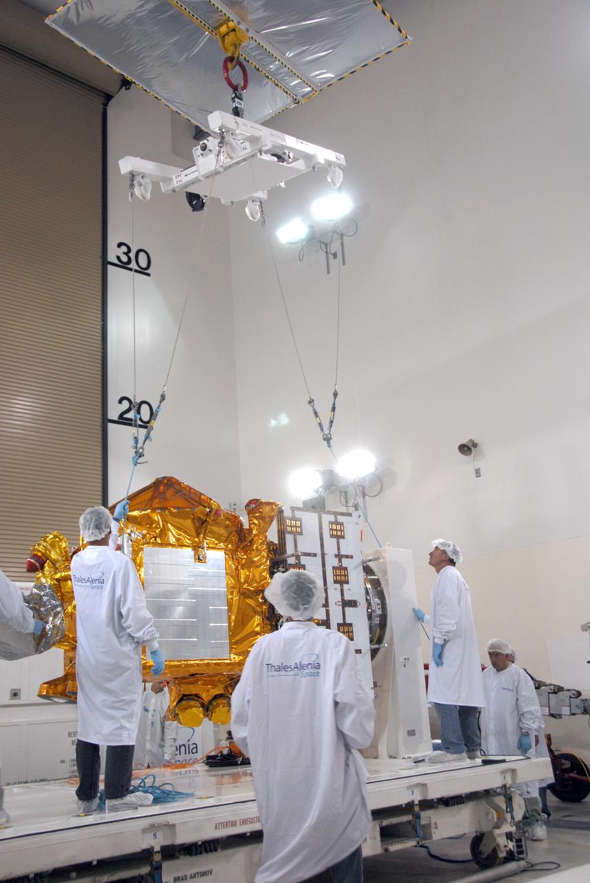
VANDENBERG AIR FORCE BASE, Calif. -- Inside the Astrotech processing facility at Vandenberg Air Force Base, an overhead crane is being attached to the OSTM/Jason-2 spacecraft. The spacecraft will be moved to a tilt dolly. The OSTM, or Ocean Topography Mission, on the Jason-2 satellite is a follow-on to Jason-1. It will take oceanographic studies of sea surface height into an operational mode for continued climate forecasting research and science and industrial applications. This satellite altimetry data will help determine ocean circulation, climate change and sea-level rise. OSTM is a joint effort by the National Oceanic and Atmospheric Administration, NASA, France’s Centre National d’Etudes Spatiales and the European Meteorological Satellite Organisation. OSTM/Jason-2 will be launched aboard a United Launch Alliance Delta II 7320 from Vandenberg on June 15. Photo credit: NASA/Mark Mackley
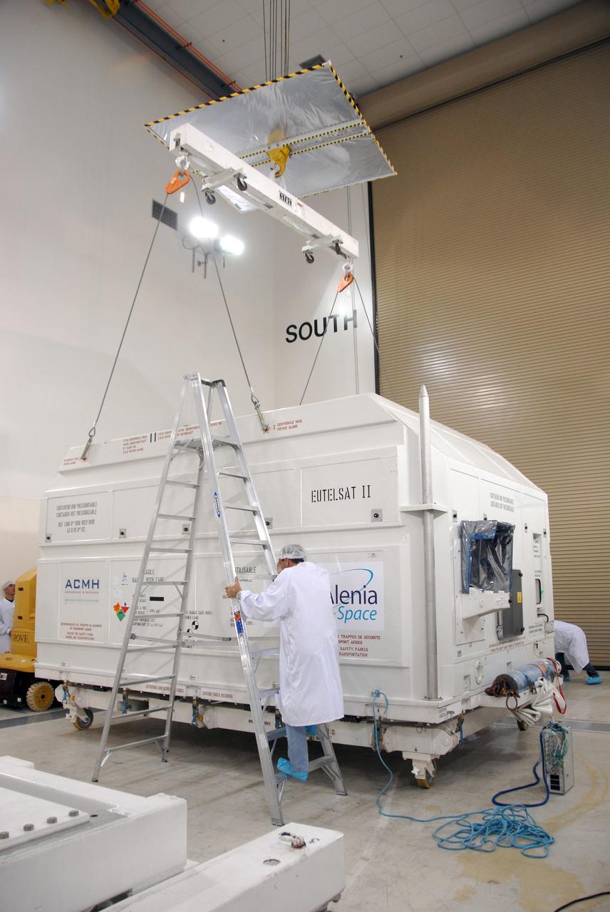
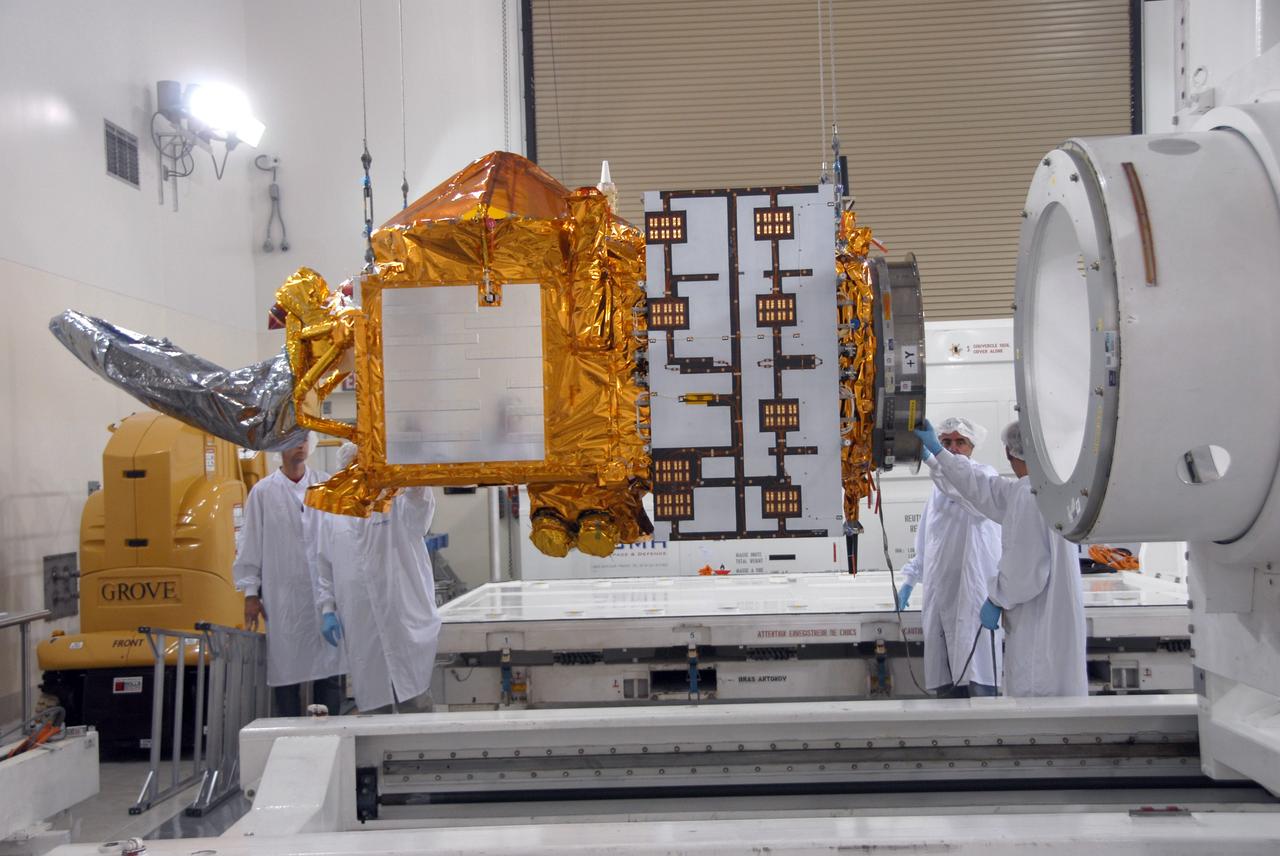
VANDENBERG AIR FORCE BASE, Calif. -- Inside the Astrotech processing facility at Vandenberg Air Force Base, an overhead crane is attached to the OSTM/Jason-2 spacecraft shipping container to remove it. The OSTM, or Ocean Topography Mission, on the Jason-2 satellite is a follow-on to Jason-1. It will take oceanographic studies of sea surface height into an operational mode for continued climate forecasting research and science and industrial applications. This satellite altimetry data will help determine ocean circulation, climate change and sea-level rise. OSTM is a joint effort by the National Oceanic and Atmospheric Administration, NASA, France’s Centre National d’Etudes Spatiales and the European Meteorological Satellite Organisation. OSTM/Jason-2 will be launched aboard a United Launch Alliance Delta II 7320 from Vandenberg on June 15. Photo credit: NASA/Mark Mackley
VANDENBERG AIR FORCE BASE, Calif. -- On Space Launch Complex 2 at Vandenberg Air Force Base in California, a solid rocket motor, or SRM, is lifted alongside the mobile service tower. The SRM will be moved inside the tower and attached to the Delta II first stage, which is the launch vehicle for the OSTM/Jason-2 spacecraft. The OSTM, or Ocean Topography Mission, on the Jason-2 satellite is a follow-on to Jason-1. It will take oceanographic studies of sea surface height into an operational mode for continued climate forecasting research and science and industrial applications. This satellite altimetry data will help determine ocean circulation, climate change and sea-level rise. OSTM is a joint effort by the National Oceanic and Atmospheric Administration, NASA, France’s Centre National d’Etudes Spatiales and the European Meteorological Satellite Organisation. OSTM/Jason-2 will be launched aboard a United Launch Alliance Delta II 7320 from Vandenberg on June 15. Photo credit: NASA/Dan Liberotti
VANDENBERG AIR FORCE BASE, Calif. -- Inside the Astrotech processing facility at Vandenberg Air Force Base, the shipping container is removed from the OSTM/Jason-2 spacecraft. The OSTM, or Ocean Topography Mission, on the Jason-2 satellite is a follow-on to Jason-1. It will take oceanographic studies of sea surface height into an operational mode for continued climate forecasting research and science and industrial applications. This satellite altimetry data will help determine ocean circulation, climate change and sea-level rise. OSTM is a joint effort by the National Oceanic and Atmospheric Administration, NASA, France’s Centre National d’Etudes Spatiales and the European Meteorological Satellite Organisation. OSTM/Jason-2 will be launched aboard a United Launch Alliance Delta II 7320 from Vandenberg on June 15. Photo credit: NASA/Mark Mackley
VANDENBERG AIR FORCE BASE, Calif. -- Workers move the shipping container holding the OSTM/Jason-2 satellite on a flatbed truck at Vandenberg Air Force Base. The satellite will be transported to the Astrotech processing facility. The OSTM, or Ocean Topography Mission, on the Jason-2 satellite is a follow-on to Jason-1. It will take oceanographic studies of sea surface height into an operational mode for continued climate forecasting research and science and industrial applications. This satellite altimetry data will help determine ocean circulation, climate change and sea-level rise. OSTM is a joint effort by the National Oceanic and Atmospheric Administration, NASA, France’s Centre National d’Etudes Spatiales and the European Meteorological Satellite Organisation. OSTM/Jason-2 will be launched aboard a United Launch Alliance Delta II 7320 from Vandenberg on June 15. Photo credit: NASA/Dan Liberotti
VANDENBERG AIR FORCE BASE, Calif. -- Inside the Astrotech processing facility at Vandenberg Air Force Base, the OSTM/Jason-2 spacecraft is lifted to a vertical position on the tilt dolly. The OSTM, or Ocean Topography Mission, on the Jason-2 satellite is a follow-on to Jason-1. It will take oceanographic studies of sea surface height into an operational mode for continued climate forecasting research and science and industrial applications. This satellite altimetry data will help determine ocean circulation, climate change and sea-level rise. OSTM is a joint effort by the National Oceanic and Atmospheric Administration, NASA, France’s Centre National d’Etudes Spatiales and the European Meteorological Satellite Organisation. OSTM/Jason-2 will be launched aboard a United Launch Alliance Delta II 7320 from Vandenberg on June 15. Photo credit: NASA/Mark Mackley
VANDENBERG AIR FORCE BASE, Calif. -- The Delta II second stage is transported onto Space Launch Complex 2 at Vandenberg Air Force Base in California. It will be lifted into the mobile service tower and installed on the first stage for launch of the OSTM/Jason-2 spacecraft. The OSTM, or Ocean Topography Mission, on the Jason-2 satellite is a follow-on to Jason-1. It will take oceanographic studies of sea surface height into an operational mode for continued climate forecasting research and science and industrial applications. This satellite altimetry data will help determine ocean circulation, climate change and sea-level rise. OSTM is a joint effort by the National Oceanic and Atmospheric Administration, NASA, France’s Centre National d’Etudes Spatiales and the European Meteorological Satellite Organisation. OSTM/Jason-2 will be launched on June 20. Photo credit: NASA
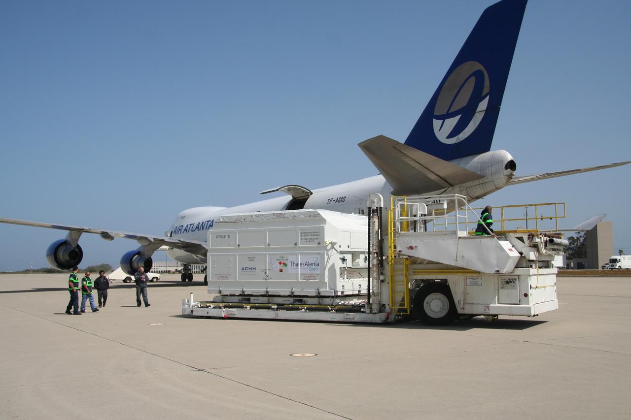
VANDENBERG AIR FORCE BASE, Calif. – After being offloaded from the cargo plane, the shipping container holding the OSTM/Jason-2 satellite is moved away from the plane. The satellite will be taken to the Astrotech processing facility. The OSTM, or Ocean Topography Mission, on the Jason-2 satellite is a follow-on to Jason-1. It will take oceanographic studies of sea surface height into an operational mode for continued climate forecasting research and science and industrial applications. This satellite altimetry data will help determine ocean circulation, climate change and sea-level rise. OSTM is a joint effort by the National Oceanic and Atmospheric Administration, NASA, France’s Centre National d’Etudes Spatiales and the European Meteorological Satellite Organisation. OSTM/Jason-2 will be launched aboard a United Launch Alliance Delta II 7320 from Vandenberg on June 15. Photo credit: NASA/Steve Greenberg, JPL
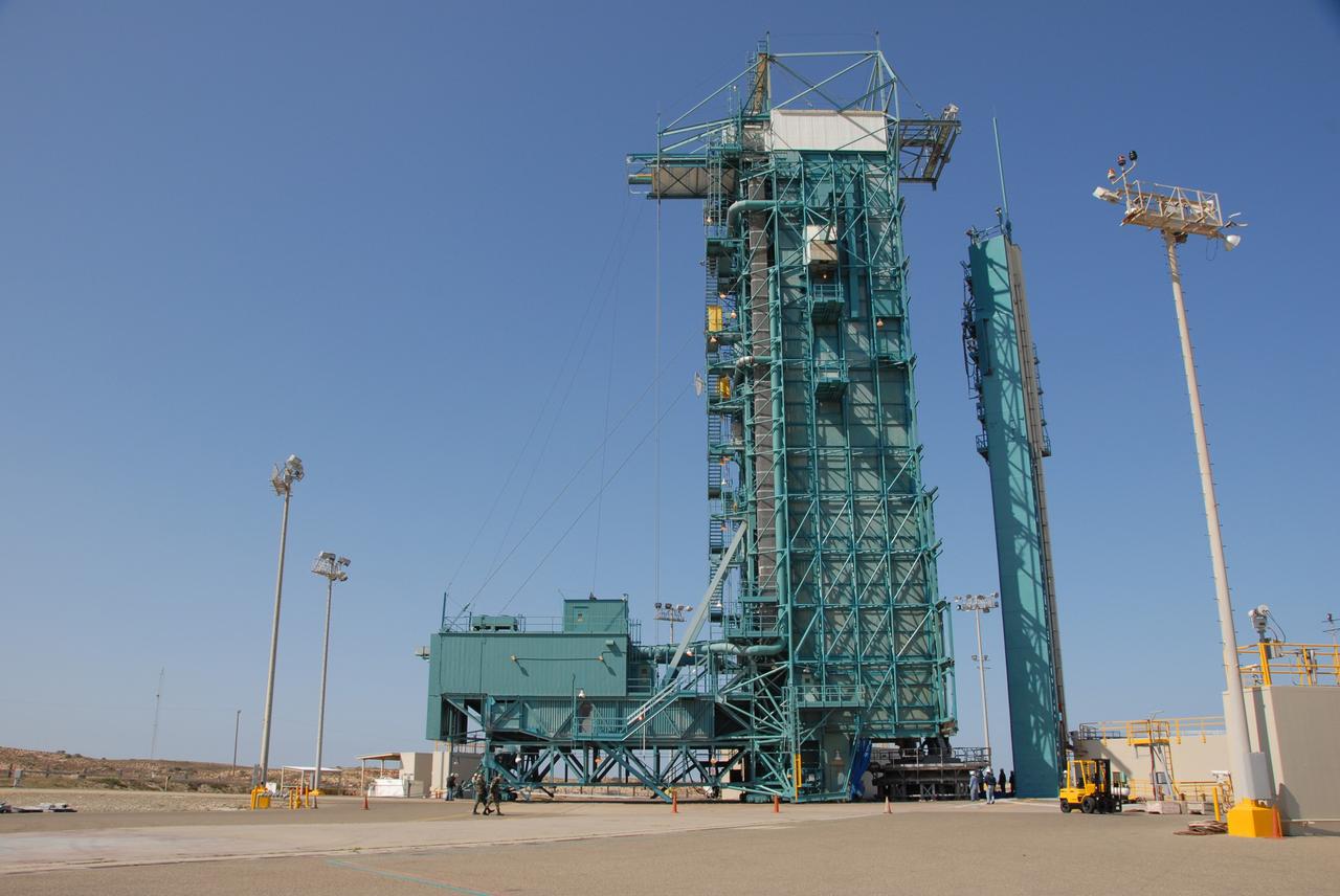
VANDENBERG AIR FORCE BASE, Calif. -- On Space Launch Complex 2 at Vandenberg Air Force Base in California, the mobile service tower with the Delta II first stage moves closer to the umbilical tower/launcher at right. The Delta II is the launch vehicle for the OSTM/Jason-2 spacecraft. The OSTM, or Ocean Topography Mission, on the Jason-2 satellite is a follow-on to Jason-1. It will take oceanographic studies of sea surface height into an operational mode for continued climate forecasting research and science and industrial applications. This satellite altimetry data will help determine ocean circulation, climate change and sea-level rise. OSTM is a joint effort by the National Oceanic and Atmospheric Administration, NASA, France’s Centre National d’Etudes Spatiales and the European Meteorological Satellite Organisation. OSTM/Jason-2 will be launched aboard a United Launch Alliance Delta II 7320 from Vandenberg on June 15. Photo credit: NASA/Dan Liberotti