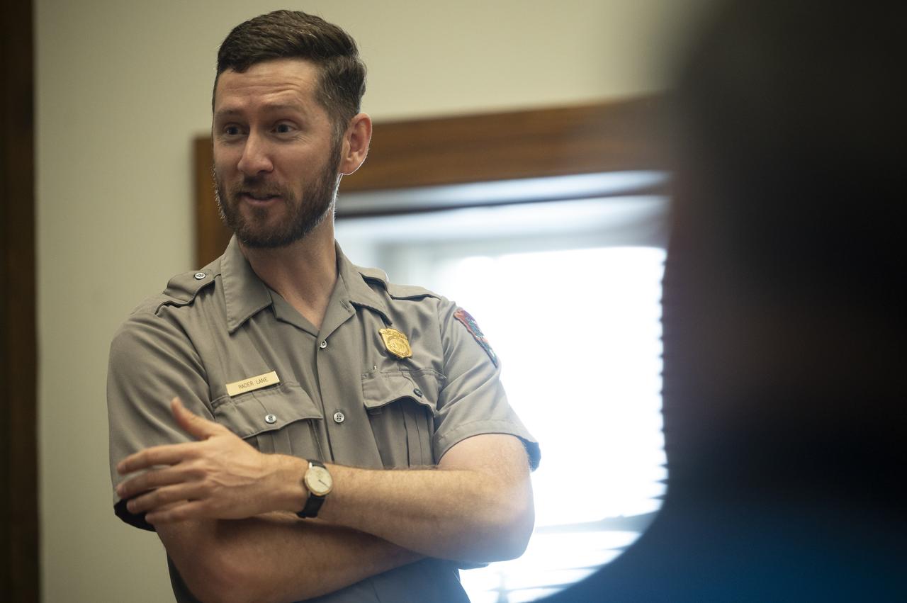
Park ranger Rader Lane speaks on the National Park Service’s astronomy and dark sky programs at Grand Canyon National Park during a visit by NASA’s SpaceX Crew-2 astronauts Megan McArthur and Shane Kimbrough of NASA, and Akihiko Hoshide of the Japan Aerospace Exploration Agency (JAXA), Thursday, June 9, 2022 at the U.S. Department of the Interior in Washington, DC. Kimbrough, McArthur, Hoshide, and ESA (European Space Agency) astronaut Thomas Pesquet completed the second crew rotation mission to the International Space Station as part of the agency’s Commercial Crew Program and spent 198 days aboard the orbiting laboratory as part of Expeditions 65 and 66. Photo Credit: (NASA/Joel Kowsky)

Park ranger Rader Lane speaks on the National Park Service’s astronomy and dark sky programs at Grand Canyon National Park during a visit by NASA’s SpaceX Crew-2 astronauts Megan McArthur and Shane Kimbrough of NASA, and Akihiko Hoshide of the Japan Aerospace Exploration Agency (JAXA), Thursday, June 9, 2022 at the U.S. Department of the Interior in Washington, DC. Kimbrough, McArthur, Hoshide, and ESA (European Space Agency) astronaut Thomas Pesquet completed the second crew rotation mission to the International Space Station as part of the agency’s Commercial Crew Program and spent 198 days aboard the orbiting laboratory as part of Expeditions 65 and 66. Photo Credit: (NASA/Joel Kowsky)
NASA astronaut Megan McArthur shows pictures of National Parks taken from the International Space Station during Expeditions 65 and 66 during a presentation to leadership and rangers who participate in the National Park Service’s astronomy and dark sky programs, Thursday, June 9, 2022 at the U.S. Department of the Interior in Washington, DC. McArthur, NASA astronaut Shane Kimbrough, Japan Aerospace Exploration Agency (JAXA) astronaut Akihiko Hoshide, and ESA (European Space Agency) astronaut Thomas Pesquet, flew on NASA’s SpaceX Crew-2 mission, the second crew rotation mission to the International Space Station as part of the agency’s Commercial Crew Program, and spent 198 days aboard the orbiting laboratory as part of Expeditions 65 and 66. Photo Credit: (NASA/Joel Kowsky)

NASA astronaut Megan McArthur points to the shadow of the Gateway Arch on the Mississippi River in St. Louis while showing images of National Parks taken from the International Space Station during Expeditions 65 and 66 during a presentation to leadership and rangers who participate in the National Park Service’s astronomy and dark sky programs, Thursday, June 9, 2022 at the U.S. Department of the Interior in Washington, DC. McArthur, NASA astronaut Shane Kimbrough, Japan Aerospace Exploration Agency (JAXA) astronaut Akihiko Hoshide, and ESA (European Space Agency) astronaut Thomas Pesquet, flew on NASA’s SpaceX Crew-2 mission, the second crew rotation mission to the International Space Station as part of the agency’s Commercial Crew Program, and spent 198 days aboard the orbiting laboratory as part of Expeditions 65 and 66. Photo Credit: (NASA/Joel Kowsky)
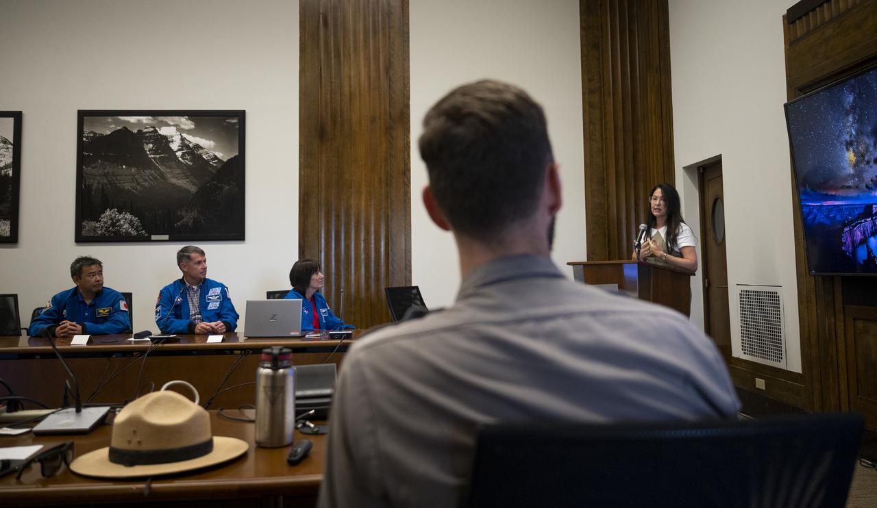
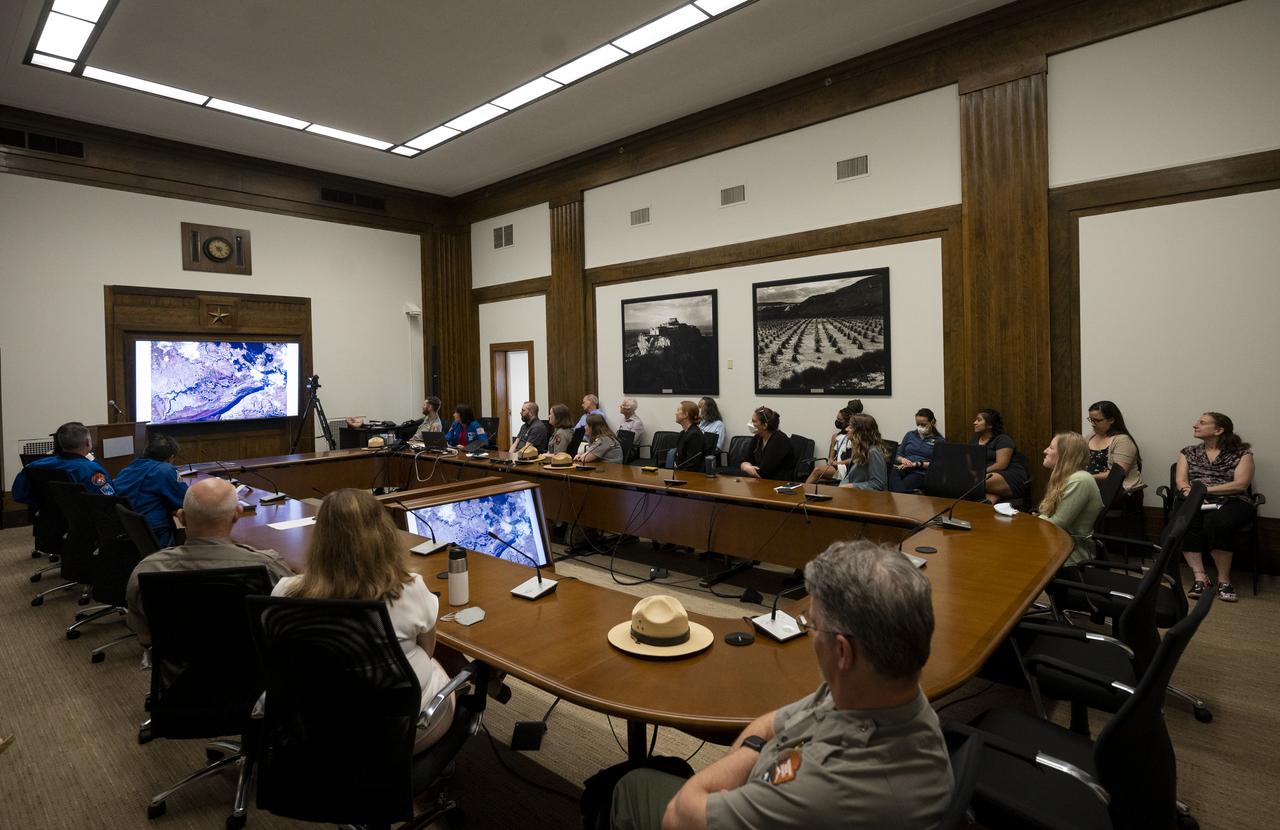
Shannon Estenoz, Assistant Secretary for Fish and Wildlife and Parks at the Department of the Interior, delivers remarks during a visit by NASA’s SpaceX Crew-2 astronauts with leadership and rangers who participate in the National Park Service’s astronomy and dark sky programs, Thursday, June 9, 2022 at the U.S. Department of the Interior in Washington, DC. NASA astronauts Shane Kimbrough and Megan McArthur, Japan Aerospace Exploration Agency (JAXA) astronaut Akihiko Hoshide, and ESA (European Space Agency) astronaut Thomas Pesquet completed the second crew rotation mission to the International Space Station as part of the agency’s Commercial Crew Program and spent 198 days aboard the orbiting laboratory as part of Expeditions 65 and 66. Photo Credit: (NASA/Joel Kowsky)
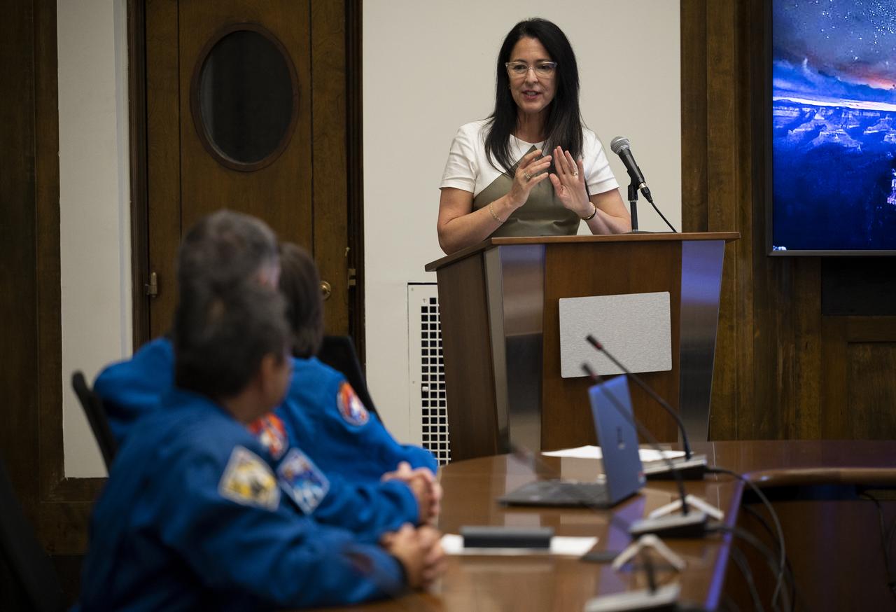
Shannon Estenoz, Assistant Secretary for Fish and Wildlife and Parks at the Department of the Interior, delivers remarks during a visit by NASA’s SpaceX Crew-2 astronauts with leadership and rangers who participate in the National Park Service’s astronomy and dark sky programs, Thursday, June 9, 2022 at the U.S. Department of the Interior in Washington, DC. NASA astronauts Shane Kimbrough and Megan McArthur, Japan Aerospace Exploration Agency (JAXA) astronaut Akihiko Hoshide, and ESA (European Space Agency) astronaut Thomas Pesquet completed the second crew rotation mission to the International Space Station as part of the agency’s Commercial Crew Program and spent 198 days aboard the orbiting laboratory as part of Expeditions 65 and 66. Photo Credit: (NASA/Joel Kowsky)
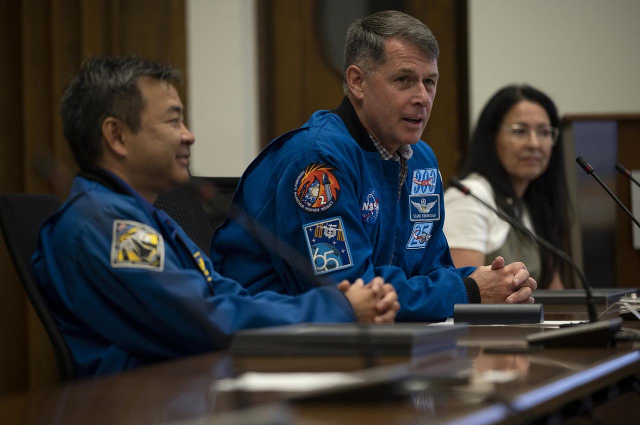
NASA astronaut Shane Kimbrough and Japan Aerospace Exploration Agency (JAXA) astronaut Akihiko Hoshide speak about NASA’s SpaceX Crew-2 mission during a presentation with leadership and rangers who participate in the National Park Service’s astronomy and dark sky programs, Thursday, June 9, 2022 at the U.S. Department of the Interior in Washington, DC. Kimbrough, Hoshide, NASA astronaut Megan McArthur, and ESA (European Space Agency) astronaut Thomas Pesquet completed the second crew rotation mission to the International Space Station as part of the agency’s Commercial Crew Program and spent 198 days aboard the orbiting laboratory as part of Expeditions 65 and 66. Photo Credit: (NASA/Joel Kowsky)
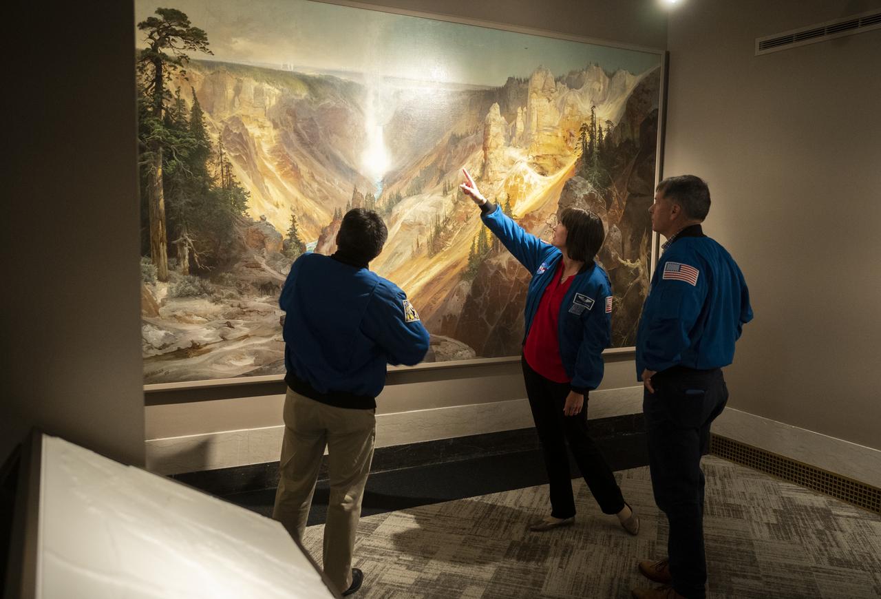
NASA’s SpaceX Crew-2 astronauts Akihiko Hoshide of the Japan Aerospace Exploration Agency (JAXA), left, and NASA astronauts Megan McArthur, center, and Shane Kimbrough, right, look at Thomas Moran’s 1872 painting “The Grand Canyon of Yellowstone,” Thursday, June 9, 2022, during a visit to the National Park Service at the U.S. Department of the Interior in Washington, DC. Kimbrough, McArthur, Hoshide, and ESA (European Space Agency) astronaut Thomas Pesquet completed the second crew rotation mission to the International Space Station as part of the agency’s Commercial Crew Program and spent 198 days aboard the orbiting laboratory as part of Expeditions 65 and 66. Photo Credit: (NASA/Joel Kowsky)
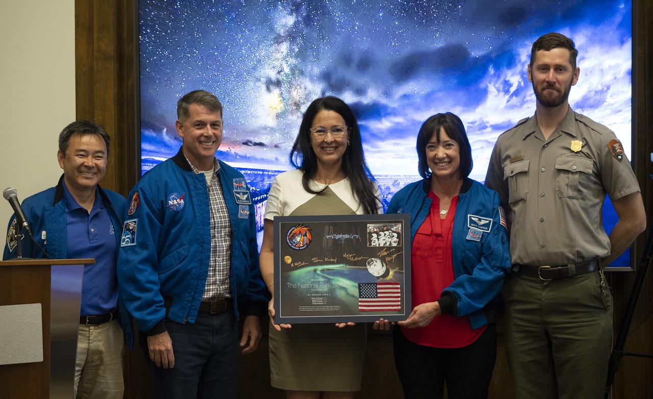
NASA’s SpaceX Crew-2 astronauts Akihiko Hoshide of the Japan Aerospace Exploration Agency (JAXA), left, Shane Kimbrough, second from left, and Megan McArthur, second from right, of NASA, pose for a picture with Shannon Estenoz, Assistant Secretary for Fish and Wildlife and Parks at the Department of the Interior, center, and park ranger Rader Lane, right, after presenting a montage to the National Park Service during a visit to the U.S. Department of the Interior, Thursday, June 9, 2022, Washington, DC. Kimbrough, McArthur, Hoshide, and ESA (European Space Agency) astronaut Thomas Pesquet completed the second crew rotation mission to the International Space Station as part of the agency’s Commercial Crew Program and spent 198 days aboard the orbiting laboratory as part of Expeditions 65 and 66. Photo Credit: (NASA/Joel Kowsky)
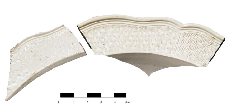
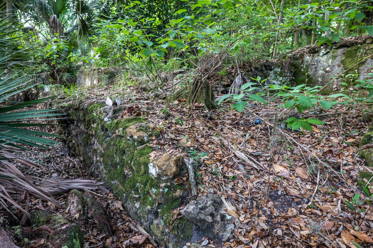
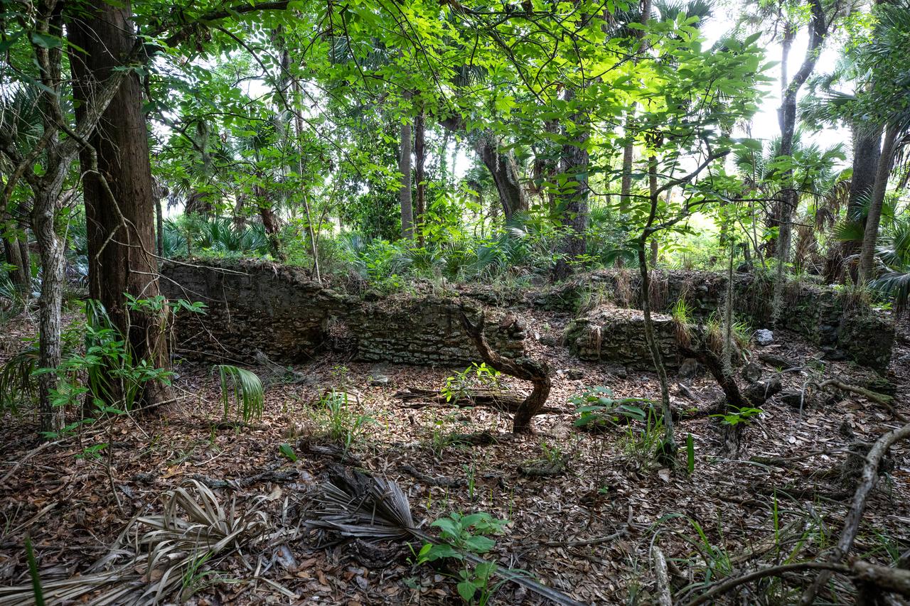
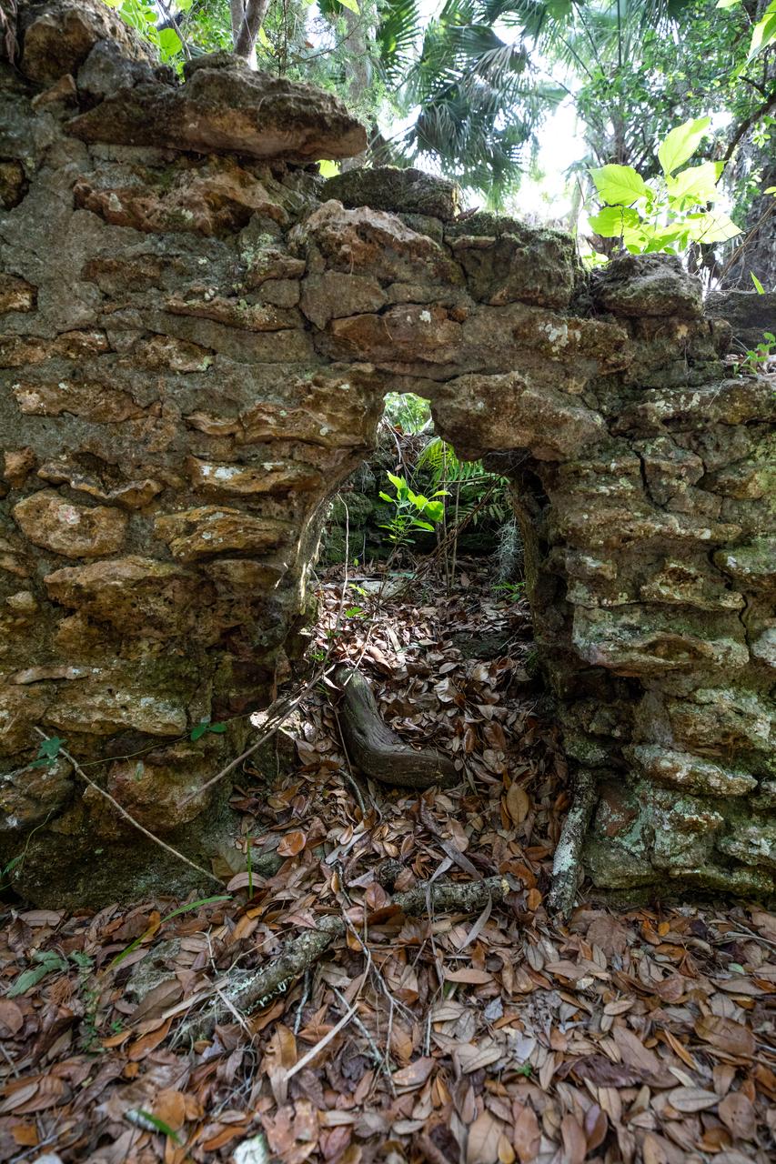
Artifacts retrieved from the ruins of Elliot Plantation on NASA’s Kennedy Space Center in Florida include Spanish majolica fragments, likely produced between the 1730s to the 1750s and imported to the plantation from England. Ceramic fragments of majolica, delftware, and other high-status domestic wares were retrieved from ruins determined to be the dwelling of the plantation overseer. The ruins of Elliot Plantation date from the 1760s and represent the largest, earliest, and southernmost British period sugar plantation in the U.S., as well as one of the most intact and best examples of a completely preserved enslaved landscape. In interagency cooperation between the National Park Service, the U.S. Fish and Wildlife Service, and NASA, and with the assistance of volunteers from the Indian River Anthropological Society, and historic preservation offices of Brevard and Volusia counties, approximately 200 shovel tests and 20 excavation units were completed in three areas of the plantation complex from 2008 to 2009.
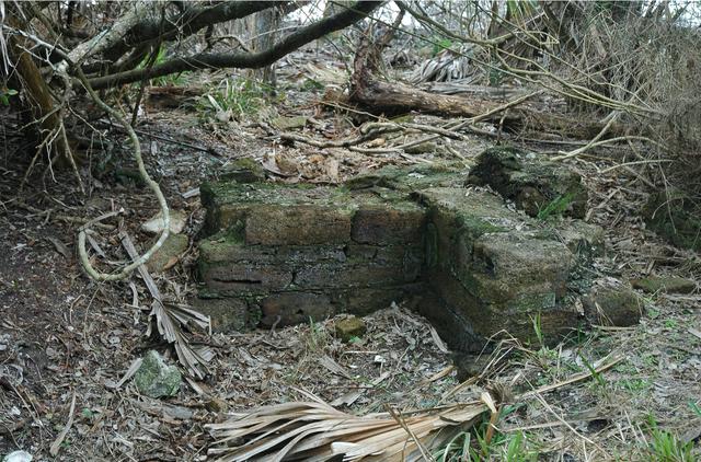
Archeological ruins of Elliot Plantation are revealed through the oak hammock on NASA’s Kennedy Space Center in Florida in 2008. Pictured is a structure composed of coquina blocks from a hearth of a large dwelling, determined to be that of the plantation overseer. The use of coquina is consistent with high-status building materials of the period. The ruins of Elliot Plantation date from the 1760s and represent the largest, earliest, and southernmost British period sugar plantation in the U.S., as well as one of the most intact and best examples of a completely preserved enslaved landscape. In interagency cooperation between the National Park Service, the U.S. Fish and Wildlife Service, and NASA, and with the assistance of volunteers from the Indian River Anthropological Society, and historic preservation offices of Brevard and Volusia counties, approximately 200 shovel tests and 20 excavation units were completed in three areas of the plantation complex from 2008 to 2009.
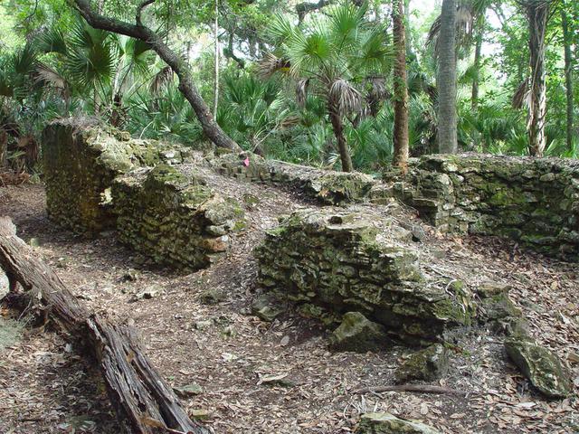
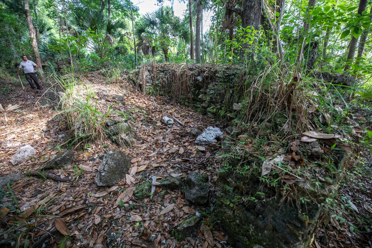
Archeological ruins of the Elliot Plantation sugar factory are revealed through the oak hammock on NASA’s Kennedy Space Center in Florida in 2008. The sugar factory structure, or sugar train, was built from fieldstone and is where sugar cane juice would be boiled during processing in graduated copper kettles until the liquid reduced into a thick syrup. The ruins of Elliot Plantation date from the 1760s and represent the largest, earliest, and southernmost British period sugar plantation in the U.S., as well as one of the most intact and best examples of a completely preserved enslaved landscape. In interagency cooperation between the National Park Service, the U.S. Fish and Wildlife Service, and NASA, and with the assistance of volunteers from the Indian River Anthropological Society, and historic preservation offices of Brevard and Volusia counties, approximately 200 shovel tests and 20 excavation units were completed in three areas of the plantation complex from 2008 to 2009.
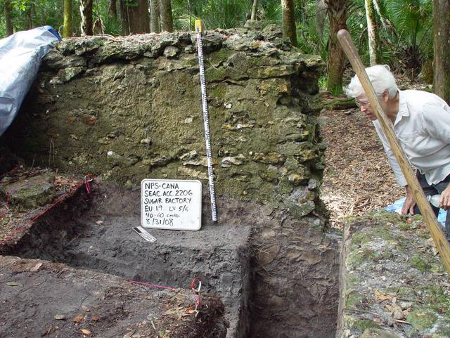
Preservationist Dot Moore views the ruins of Elliot Plantation sugar factory during an excavation in 2008 on NASA’s Kennedy Space Center. The sugar factory structure, or sugar train, was built from fieldstone and is where sugar cane juice would be boiled during processing in graduated copper kettles until the liquid reduced into a thick syrup. The ruins of Elliot Plantation date from the 1760s and represent the largest, earliest, and southernmost British period sugar plantation in the U.S., as well as one of the most intact and best examples of a completely preserved enslaved landscape. In interagency cooperation between the National Park Service, the U.S. Fish and Wildlife Service, and NASA, and with the assistance of volunteers from the Indian River Anthropological Society, and historic preservation offices of Brevard and Volusia counties, approximately 200 shovel tests and 20 excavation units were completed in three areas of the plantation complex from 2008 to 2009.
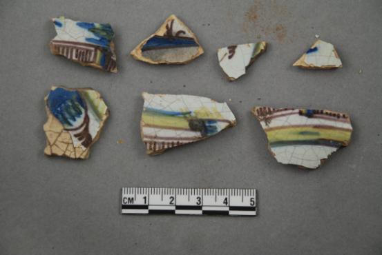
Artifacts retrieved from the ruins of Elliot Plantation on NASA’s Kennedy Space Center in Florida show high-status fine dining wares imported from 18th century England. The white salt-glazed stoneware and creamware dining wares were found scattered near a large structure, determined by archeologists to be the dwelling of the plantation overseer. The dining wares have known dates of time for manufacturing and use during the 1760s through the 1770s and helped archeologists confirm the site was from the same period. The ruins of Elliot Plantation date from the 1760s and represent the largest, earliest, and southernmost British period sugar plantation in the U.S., as well as one of the most intact and best examples of a completely preserved enslaved landscape. In interagency cooperation between the National Park Service, the U.S. Fish and Wildlife Service, and NASA, and with the assistance of volunteers from the Indian River Anthropological Society, and historic preservation offices of Brevard and Volusia counties, approximately 200 shovel tests and 20 excavation units were completed in three areas of the plantation complex from 2008 to 2009.
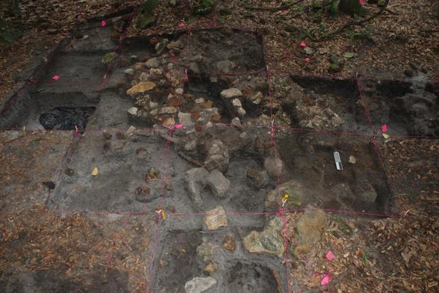
Archeological ruins of Elliot Plantation are revealed through the oak hammock on NASA’s Kennedy Space Center in Florida in 2009. Pictured is a structure composed of coquina blocks from a hearth of a large dwelling, determined to be that of the plantation overseer. The use of coquina is consistent with high-status building materials of the period. Mapped in this photo are the remnants of a chimney collapse from a detached kitchen in the overseer’s house. An enormous scatter of architectural debris, including coquina, fieldstone, brick and mortar, as well as substantial food remains, broken dishes, bottle glass, and other kitchen wares, were recovered and documented during investigations of the ruins. The ruins of Elliot Plantation date from the 1760s and represent the largest, earliest, and southernmost British period sugar plantation in the U.S., as well as one of the most intact and best examples of a completely preserved enslaved landscape. In interagency cooperation between the National Park Service, the U.S. Fish and Wildlife Service, and NASA, and with the assistance of volunteers from the Indian River Anthropological Society, and historic preservation offices of Brevard and Volusia counties, approximately 200 shovel tests and 20 excavation units were completed in three areas of the plantation complex from 2008 to 2009.
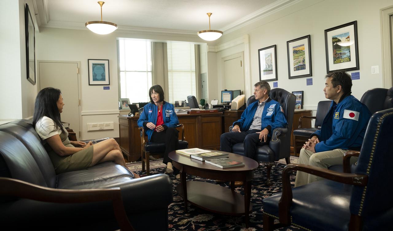
NASA’s SpaceX Crew-2 astronauts Megan McArthur and Shane Kimbrough of NASA, and Japan Aerospace Exploration Agency (JAXA) astronaut Akihiko Hoshide speak with Shannon Estenoz, Assistant Secretary for Fish and Wildlife and Parks, Thursday, June 9, 2022, during a visit to the U.S. Department of the Interior in Washington, DC. Kimbrough, McArthur, Hoshide, and ESA (European Space Agency) astronaut Thomas Pesquet completed the second crew rotation mission to the International Space Station as part of the agency’s Commercial Crew Program and spent 198 days aboard the orbiting laboratory as part of Expeditions 65 and 66. Photo Credit: (NASA/Joel Kowsky)
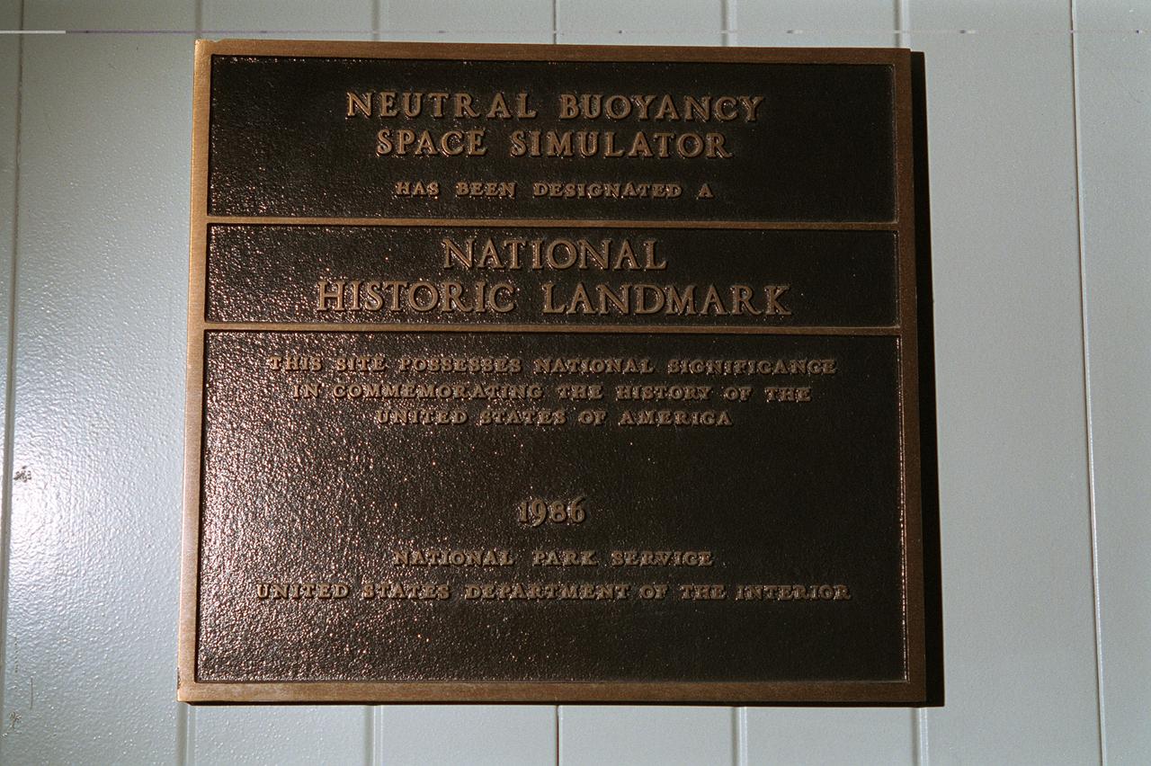
This plaque, displayed on the grounds of Marshall Space Flight Center in Huntsville, Alabama commemorates the Neutral Buoyancy Space Simulator as a National Historic Landmark. The site was designated as such in 1986 by the National Park Service of the United States Department of the Interior.
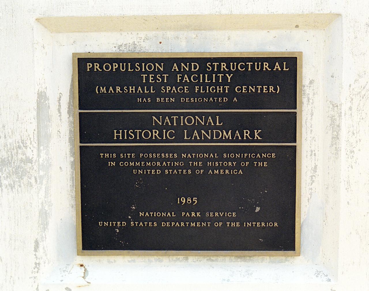
This plaque, displayed on the grounds of Marshall Space Flight Center in Huntsville, Alabama, commemorates the designation of the Propulsion and Structural Test Facility as a National Historic Landmark by the National Park Service of the United States Interior. The site was designated as a landmark in 1985.
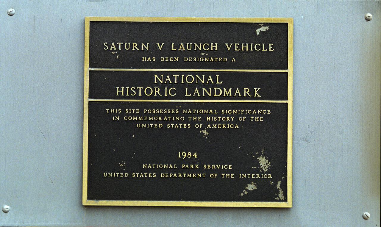
This plaque, displayed on the grounds of Marshall Space Flight Center in Huntsville, Alabama, commemorates the Saturn V Launch Vehicle as a National Historic Landmark. The site was designated as such in 1984 by the National Park Service of the United States Department of the Interior.
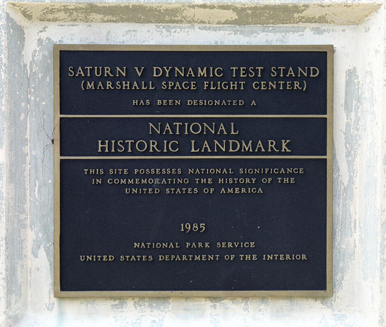
This plaque, displayed on the grounds of Marshall Space Flight Center in Huntsville, Alabama, commemorates the Saturn V Dynamic Test Stand as a National Historic Landmark. The site was designated as such in 1985 by the National Park Service of the United States Department of the Interior.
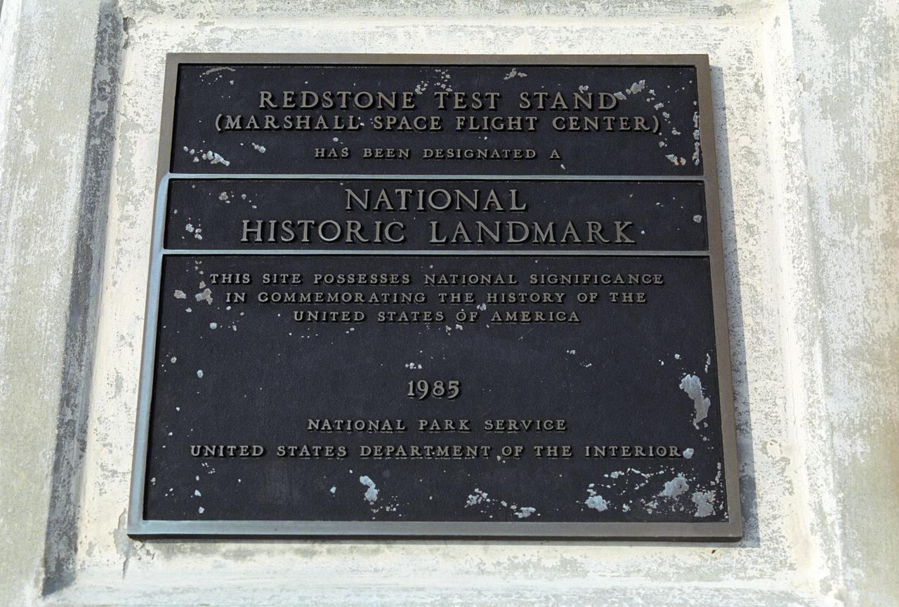
This plaque, displayed on the grounds of Marshall Space Flight Center in Huntsville, Alabama, commemorates the Redstone Test Stand as a National Historic Landmark. The site was designated as such in 1985 by the National Park Service of the United States Department of the Interior.
Just in time for the U.S. National Park Service's Centennial celebration on Aug. 25, NASA's Multiangle Imaging SpectroRadiometer (MISR) instrument aboard NASA's Terra satellite is releasing four new anaglyphs that showcase 33 of our nation's national parks, monuments, historical sites and recreation areas in glorious 3D. Shown in the annotated image are Sequoia National Park, Kings Canyon National Park, Manzanar National Historic Site, Devils Postpile National Monument, Yosemite National Park, and parts of Death Valley National Park. MISR views Earth with nine cameras pointed at different angles, giving it the unique capability to produce anaglyphs, stereoscopic images that allow the viewer to experience the landscape in three dimensions. The anaglyphs were made by combining data from MISR's vertical-viewing and 46-degree forward-pointing camera. You will need red-blue glasses in order to experience the 3D effect; ensure you place the red lens over your left eye. The images have been rotated so that north is to the left in order to enable 3D viewing because the Terra satellite flies from north to south. All of the images are 235 miles (378 kilometers) from west to east. These data were acquired July 7, 2016, Orbit 88051. http://photojournal.jpl.nasa.gov/catalog/PIA20892
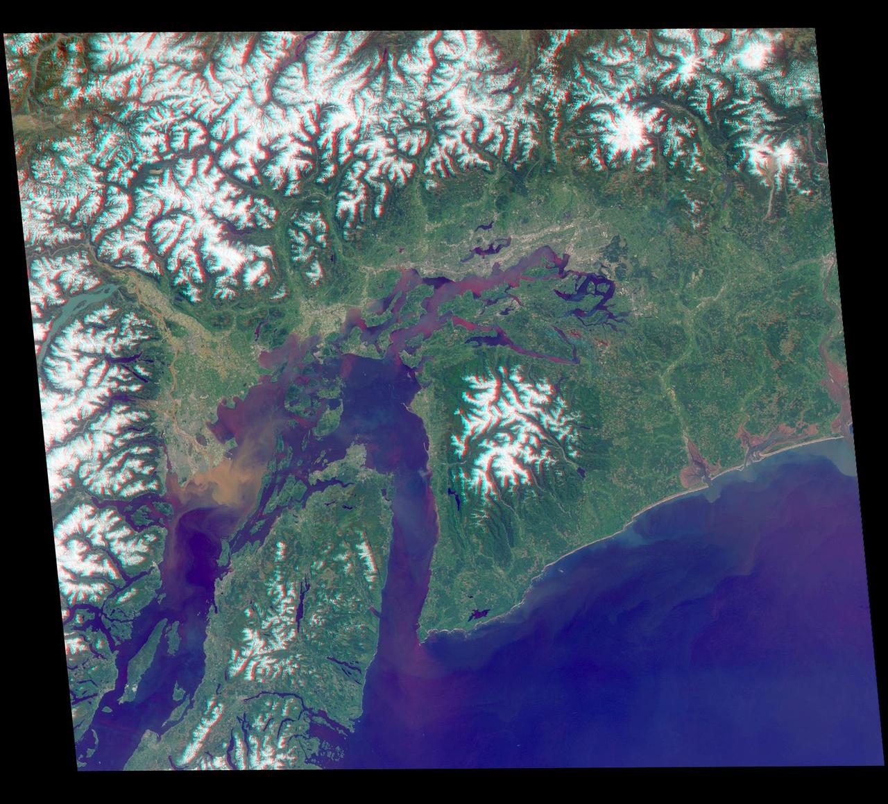
Just in time for the U.S. National Park Service's Centennial celebration on Aug. 25, NASA's Multiangle Imaging SpectroRadiometer (MISR) instrument aboard NASA's Terra satellite is releasing four new anaglyphs that showcase 33 of our nation's national parks, monuments, historical sites and recreation areas in glorious 3D. Shown in the annotated image are Lewis and Clark National Historic Park, Mt. Rainier National Park, Olympic National Park, Ebey's Landing National Historical Reserve, San Juan Island National Historic Park, North Cascades National Park, Lake Chelan National Recreation Area, and Ross Lake National Recreation Area (also Mt. St. Helens National Volcanic Monument, administered by the U.S. Forest Service) MISR views Earth with nine cameras pointed at different angles, giving it the unique capability to produce anaglyphs, stereoscopic images that allow the viewer to experience the landscape in three dimensions. The anaglyphs were made by combining data from MISR's vertical-viewing and 46-degree forward-pointing camera. You will need red-blue glasses in order to experience the 3D effect; ensure you place the red lens over your left eye. The images have been rotated so that north is to the left in order to enable 3D viewing because the Terra satellite flies from north to south. All of the images are 235 miles (378 kilometers) from west to east. These data were acquired May 12, 2012, Orbit 65960. http://photojournal.jpl.nasa.gov/catalog/PIA20891
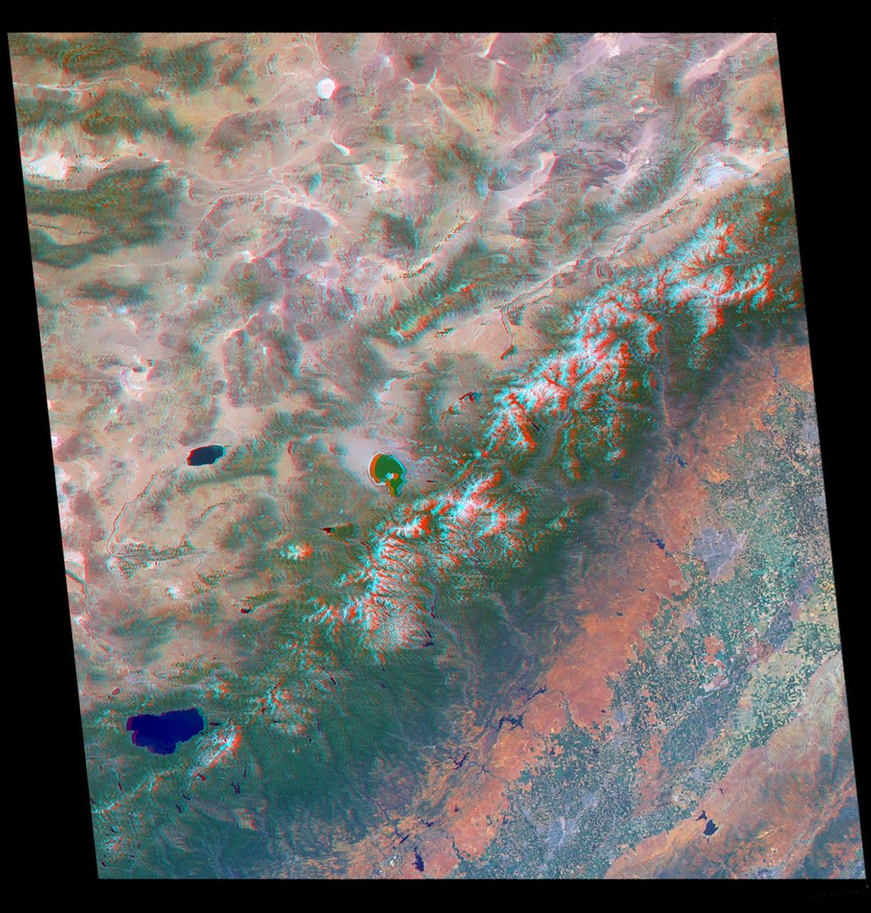
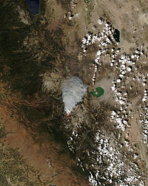
Just in time for the U.S. National Park Service's Centennial celebration on Aug. 25, NASA's Multiangle Imaging SpectroRadiometer (MISR) instrument aboard NASA's Terra satellite is releasing four new anaglyphs that showcase 33 of our nation's national parks, monuments, historical sites and recreation areas in glorious 3D. Shown in the annotated image are Walnut Canyon National Monument, Sunset Crater Volcano National Monument, Wupatki National Monument, Grand Canyon National Park, Pipe Spring National Monument, Zion National Park, Cedar Breaks National Monument, Bryce Canyon National Park, Capitol Reef National Park, Navajo National Monument, Glen Canyon National Recreation Area, Natural Bridges National Monument, Canyonlands National Park, and Arches National Park. MISR views Earth with nine cameras pointed at different angles, giving it the unique capability to produce anaglyphs, stereoscopic images that allow the viewer to experience the landscape in three dimensions. The anaglyphs were made by combining data from MISR's vertical-viewing and 46-degree forward-pointing camera. You will need red-blue glasses in order to experience the 3D effect; ensure you place the red lens over your left eye. The images have been rotated so that north is to the left in order to enable 3D viewing because the Terra satellite flies from north to south. All of the images are 235 miles (378 kilometers) from west to east. These data were acquired June 18, 2016, Orbit 87774. http://photojournal.jpl.nasa.gov/catalog/PIA20889
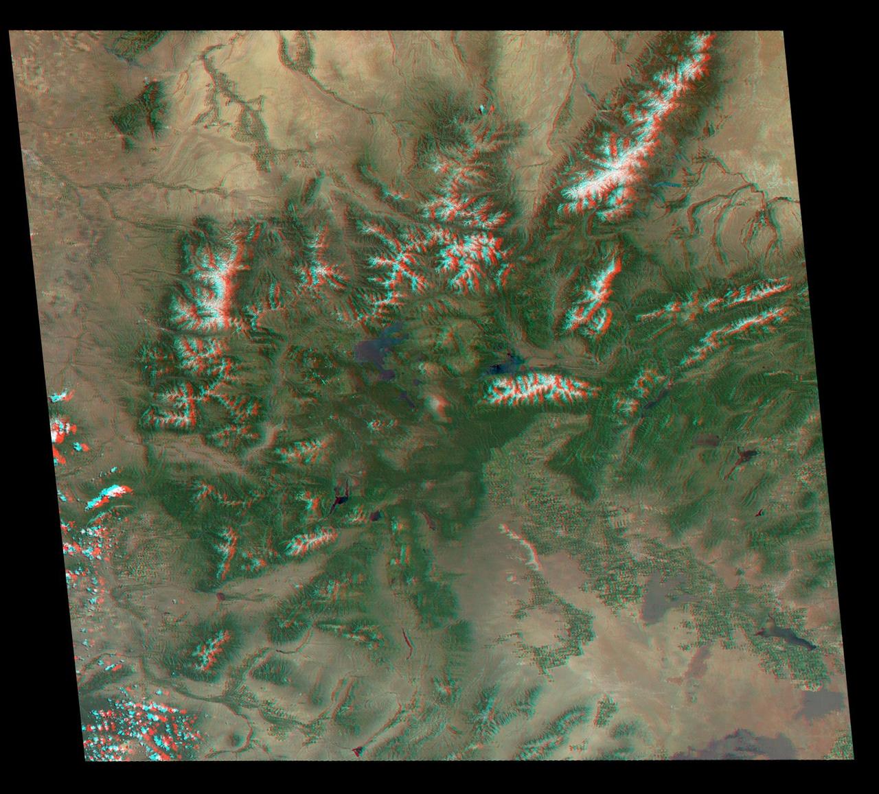
Just in time for the U.S. National Park Service's Centennial celebration on Aug. 25, NASA's Multiangle Imaging SpectroRadiometer (MISR) instrument aboard NASA's Terra satellite is releasing four new anaglyphs that showcase 33 of our nation's national parks, monuments, historical sites and recreation areas in glorious 3D. Shown in the annotated image are Grand Teton National Park, John D. Rockefeller Memorial Parkway, Yellowstone National Park, and parts of Craters of the Moon National Monument. MISR views Earth with nine cameras pointed at different angles, giving it the unique capability to produce anaglyphs, stereoscopic images that allow the viewer to experience the landscape in three dimensions. The anaglyphs were made by combining data from MISR's vertical-viewing and 46-degree forward-pointing camera. You will need red-blue glasses in order to experience the 3D effect; ensure you place the red lens over your left eye. The images have been rotated so that north is to the left in order to enable 3D viewing because the Terra satellite flies from north to south. All of the images are 235 miles (378 kilometers) from west to east. These data were acquired June 25, 2016, Orbit 87876. http://photojournal.jpl.nasa.gov/catalog/PIA20890

The Redstone Test Stand, shown here, was used throughout the 1950s to test the Redstone missionile, including the modified Redstone that launched America's first astronaut, Alan Shepard. The U. S. Department of the Interior's Park Services designated the Test Stand as a National Historic Landmark January 22, 1986.
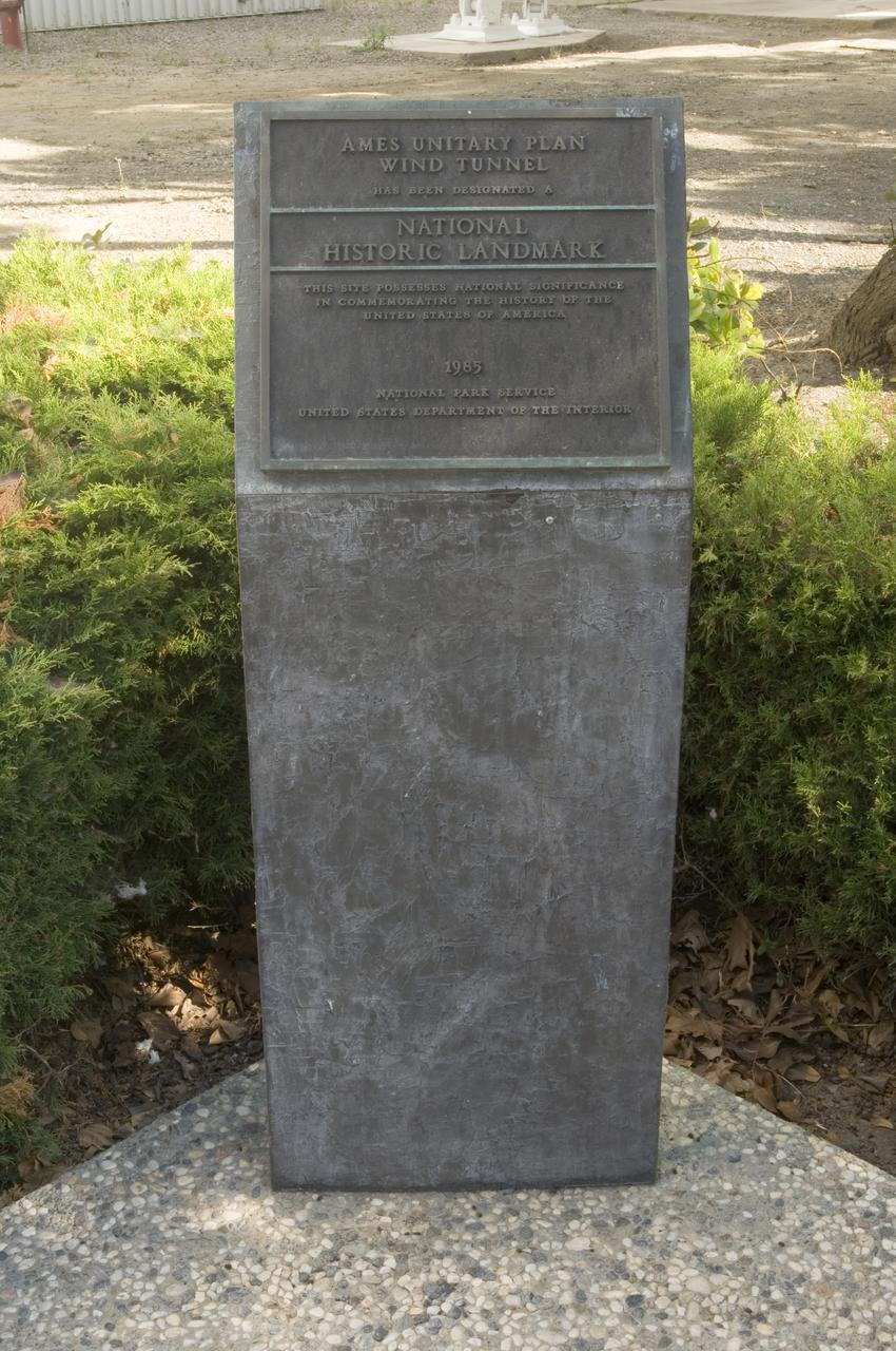
Ames and Moffett Field (MFA) historical sites and memorials Unitary Plan Wind Tunned plaza; display and historical site plaques with the NASA logo on the Wind Tunnel valve as a backdrop. Plaque depicts that Ames Unitary Plan Wind Tunnel has been designated a National Historic Landmark by the National Park Service, United States Department of the Interior 1985 The plaque reads; This site possesses national significance in commemorating the history of the United States of America. That ceremony took place on September 12, 1990
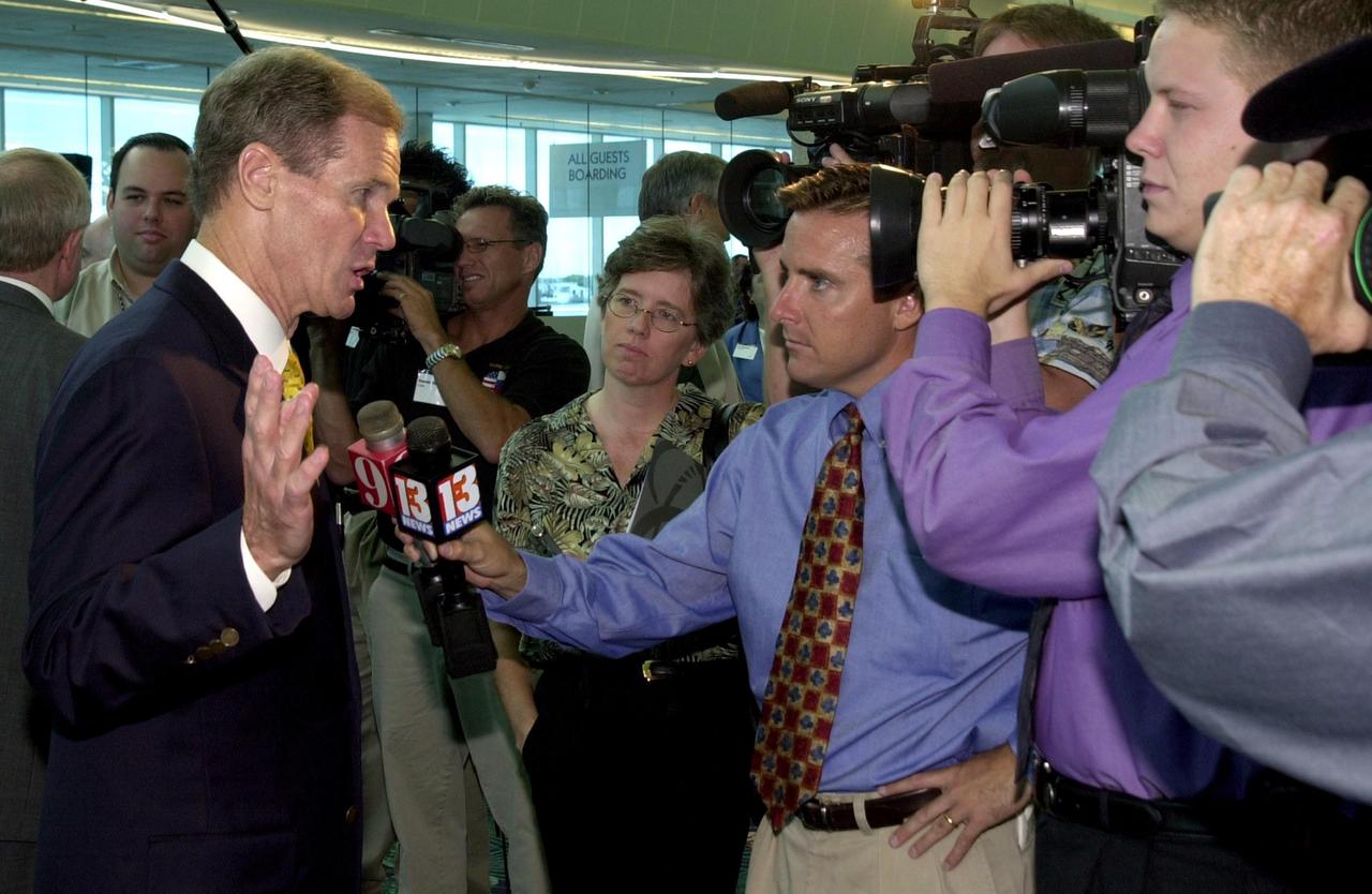
KENNEDY SPACE CENTER, FLA. - U.S. Sen. Bill Nelson talks to the media after the master plan signing ceremony at Port Canaveral Terminal 10. Also attending were Canaveral National Seashore Superintendent Robert Newkirk, Canaveral Port Authority Executive Director Malcolm "Mac" McLouth, KSC Director Roy Bridges Jr., U.S. Rep. Dave Weldon, 45th Space Wing Commander Gregory Pavlovich, U.S. Fish & Wildlife Services Refuge Manager Ron Hight, Naval Ordnance Test Unit Commanding Officer William Borger, and Florida Space Authority Executive Director Ed Gormel. The plan represents interagency cooperation between the leadership group's agencies and the U.S. Fish and Wildlife Service, the National Park Service and U.S. Navy. Joining them in developing a vision of the Spaceport's future have been aerospace educators, researchers, and businesses, along with representatives from local, state and national government.
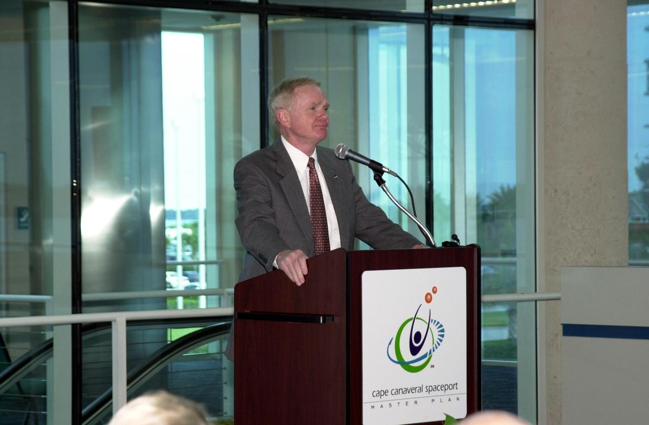
KENNEDY SPACE CENTER, FLA. -- Center Director Roy Bridges addresses guests at the master plan signing ceremony at Port Canaveral Terminal 10. Also attending were Canaveral National Seashore Superintendent Robert Newkirk, Canaveral Port Authority Executive Director Malcolm "Mac" McLouth, KSC Director Roy Bridges Jr., U.S. Rep. Dave Weldon, U.S. Sen. Bill Nelson, 45th Space Wing Commander Gregory Pavlovich, U.S. Fish & Wildlife Services Refuge Manager Ron Hight, Naval Ordnance Test Unit Commanding Officer William Borger, and Florida Space Authority Executive Director Ed Gormel. The plan represents interagency cooperation between the leadership group's agencies and the U.S. Fish and Wildlife Service, the National Park Service and U.S. Navy. Joining them in developing a vision of the Spaceport's future have been aerospace educators, researchers, and businesses, along with representatives from local, state and national government.
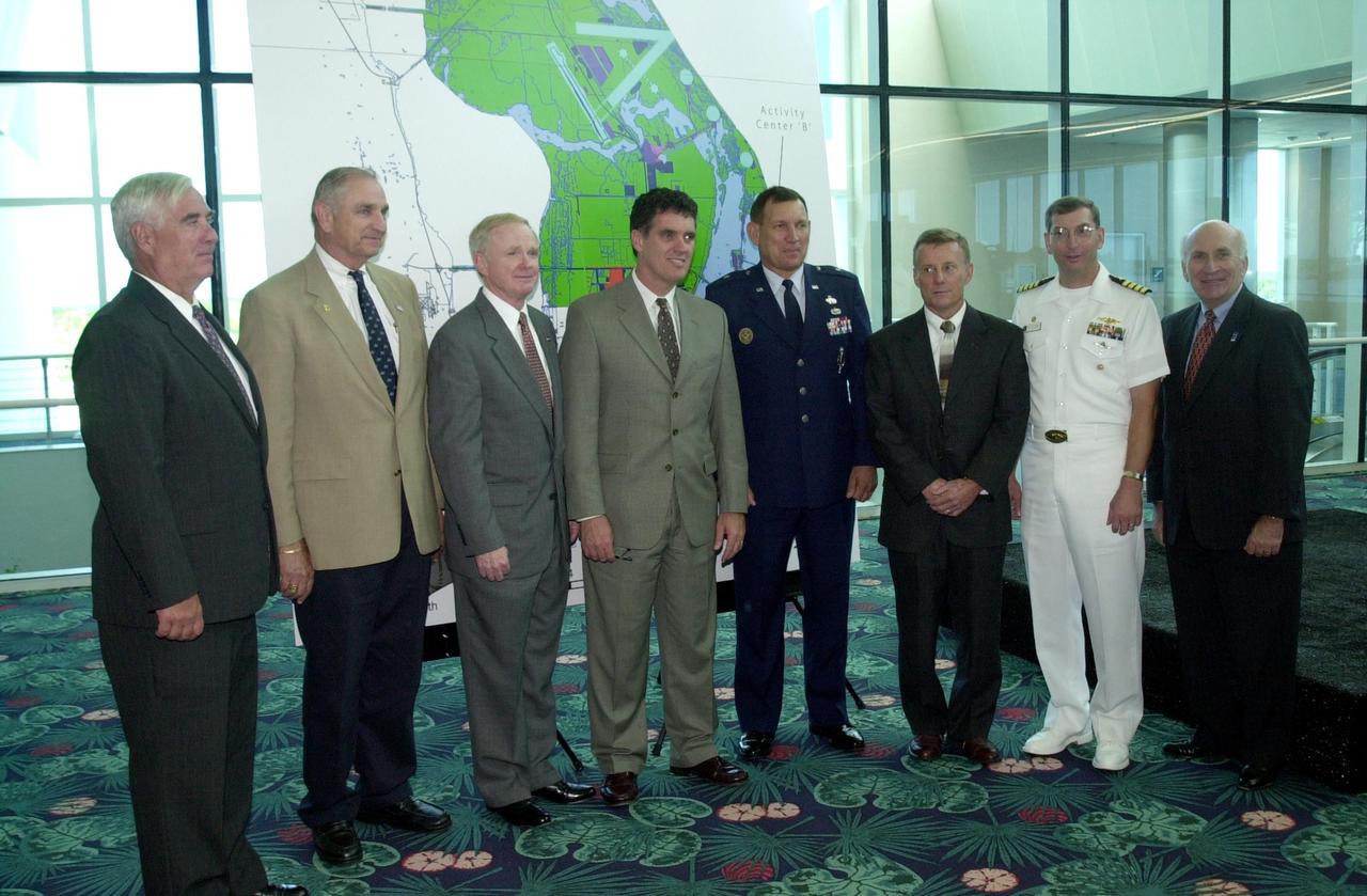
KENNEDY SPACE CENTER, FLA. -- Cape Canaveral Spaceport leaders gather after the master plan signing ceremony at Port Canaveral Terminal 10. From left are Canaveral National Seashore Superintendent Robert Newkirk, Canaveral Port Authority Executive Director Malcolm "Mac" McLouth, KSC Director Roy Bridges Jr., U.S. Rep. Dave Weldon, 45th Space Wing Commander Gregory Pavlovich, U.S. Fish & Wildlife Services Refuge Manager Ron Hight, Naval Ordnance Test Unit Commanding Officer William Borger, and Florida Space Authority Executive Director Ed Gormel. The plan represents interagency cooperation between the leadership group's agencies and the U.S. Fish and Wildlife Service, the National Park Service and U.S. Navy. Joining them in developing a vision of the Spaceport's future have been aerospace educators, researchers, and businesses, along with representatives from local, state and national government.

KENNEDY SPACE CENTER, FLA. -- Cape Canaveral Spaceport leaders gather after the master plan signing ceremony at Port Canaveral Terminal 10. From left are Canaveral National Seashore Superintendent Robert Newkirk, Canaveral Port Authority Executive Director Malcolm "Mac" McLouth, KSC Director Roy Bridges Jr., U.S. Sen. Bill Nelson, 45th Space Wing Commander Gregory Pavlovich, U.S. Fish & Wildlife Services Refuge Manager Ron Hight, Naval Ordnance Test Unit Commanding Officer William Borger, and Florida Space Authority Executive Director Ed Gormel. The plan represents interagency cooperation between the leadership group's agencies and the U.S. Fish and Wildlife Service, the National Park Service and U.S. Navy. Joining them in developing a vision of the Spaceport's future have been aerospace educators, researchers, and businesses, along with representatives from local, state and national government.
Acadia National Park is one of the most visited parks in America, drawing more than 2.5 million visitors per year to the craggy, jagged coast of Maine. The park is celebrating its 100th anniversary in 2016. On September 6, 2015, the Operational Land Imager (OLI) on the Landsat 8 satellite acquired these images of Acadia National Park and its surroundings. Mountains and hills roll right up to the Atlantic Ocean in this rocky landscape carved by glaciers at the end of the last Ice Age. Since the beginning of the 20th Century, the park has been pieced together by donations and acquisitions of once-private lands, and it is still growing. Of the park’s 47,000 acres, more than 12,000 are privately owned lands under conservation agreements, while the rest is held by the National Park Service. Mount Desert Island is the focal point of the park, which also includes lands around a former naval base (Schoodic Peninsula), Isle au Haut, and several smaller islands. Read more: <a href="http://go.nasa.gov/2adyd8J" rel="nofollow">go.nasa.gov/2adyd8J</a> Credit: NASA/Landsat8 <b><a href="http://www.nasa.gov/audience/formedia/features/MP_Photo_Guidelines.html" rel="nofollow">NASA image use policy.</a></b> <b><a href="http://www.nasa.gov/centers/goddard/home/index.html" rel="nofollow">NASA Goddard Space Flight Center</a></b> enables NASA’s mission through four scientific endeavors: Earth Science, Heliophysics, Solar System Exploration, and Astrophysics. Goddard plays a leading role in NASA’s accomplishments by contributing compelling scientific knowledge to advance the Agency’s mission. <b>Follow us on <a href="http://twitter.com/NASAGoddardPix" rel="nofollow">Twitter</a></b> <b>Like us on <a href="http://www.facebook.com/pages/Greenbelt-MD/NASA-Goddard/395013845897?ref=tsd" rel="nofollow">Facebook</a></b> <b>Find us on <a href="http://instagrid.me/nasagoddard/?vm=grid" rel="nofollow">Instagram</a></b>
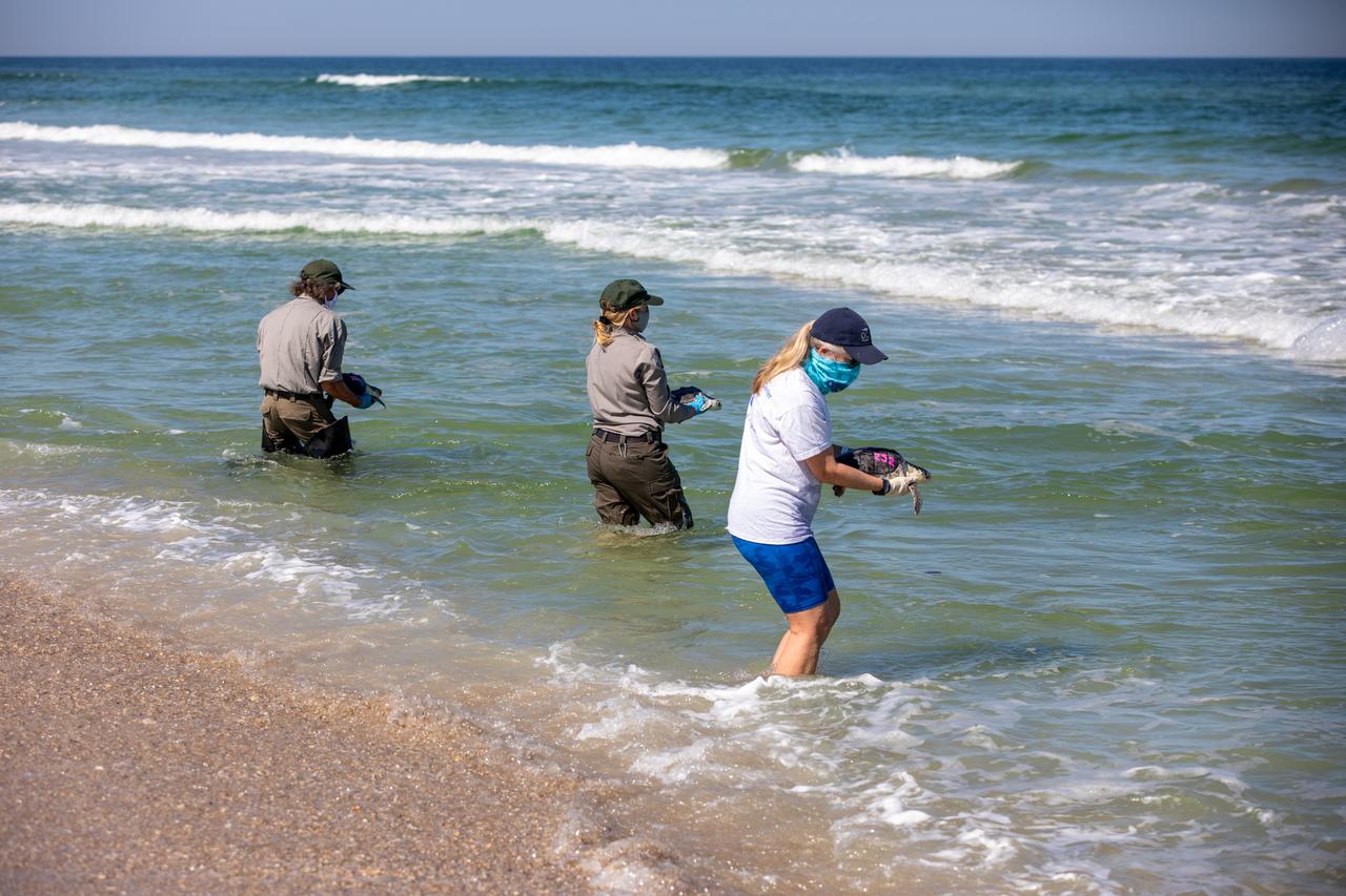
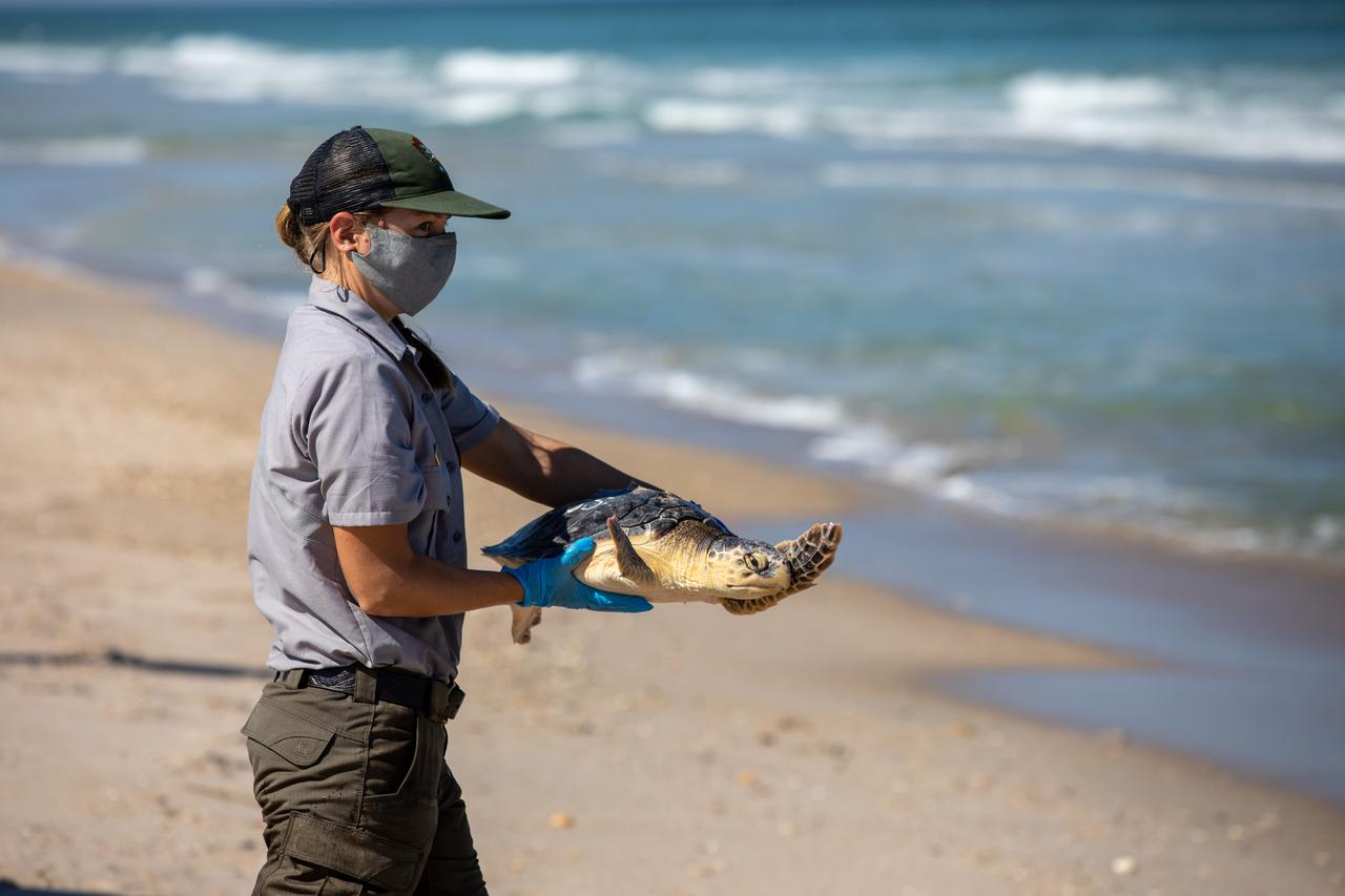
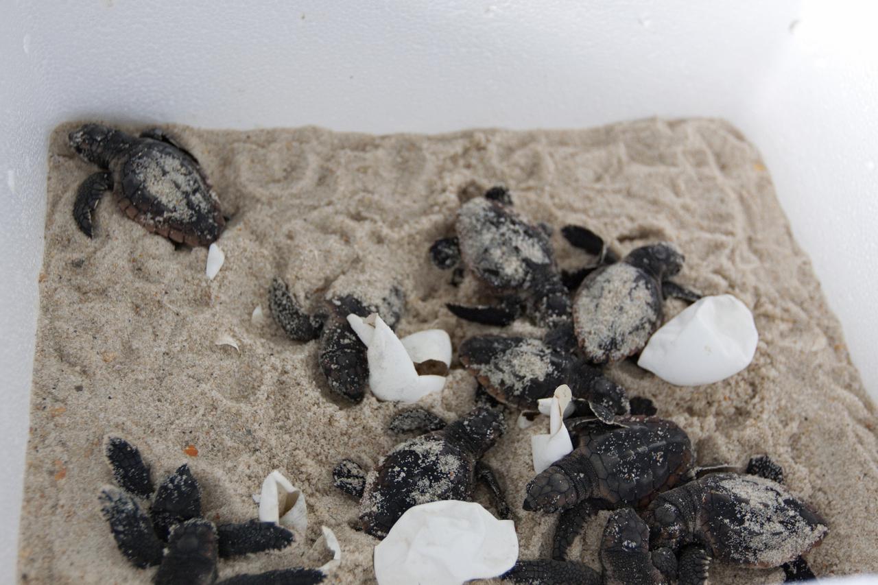
Staff with NASA, the National Park Service, Herndon Solutions Group, the center’s environmental services contractor, and others, prepare to release Kemp’s ridley sea turtles into the Atlantic Ocean at the Canaveral National Seashore near Kennedy Space Center on Feb. 26, 2021. The rescued and rehabilitated turtles were flown from aquatic centers in Massachusetts and New York to the Launch and Landing Facility, managed by Space Florida. NASA, U.S. Fish and Wildlife Service, NOAA Fisheries, Space Florida, and Herndon Solutions Group provided support. The Turtles Fly Too organization provided the flight to Kennedy. All marine turtle footage/images was obtained with the approval of the Florida Fish and Wildlife Conservation Commission (FWC) under conditions not harmful to marine turtles. Footage was acquired while conducting authorized conservation activities pursuant to: FWC 2021 Consent Permit, MTP-21-005 and MTP-21-114.
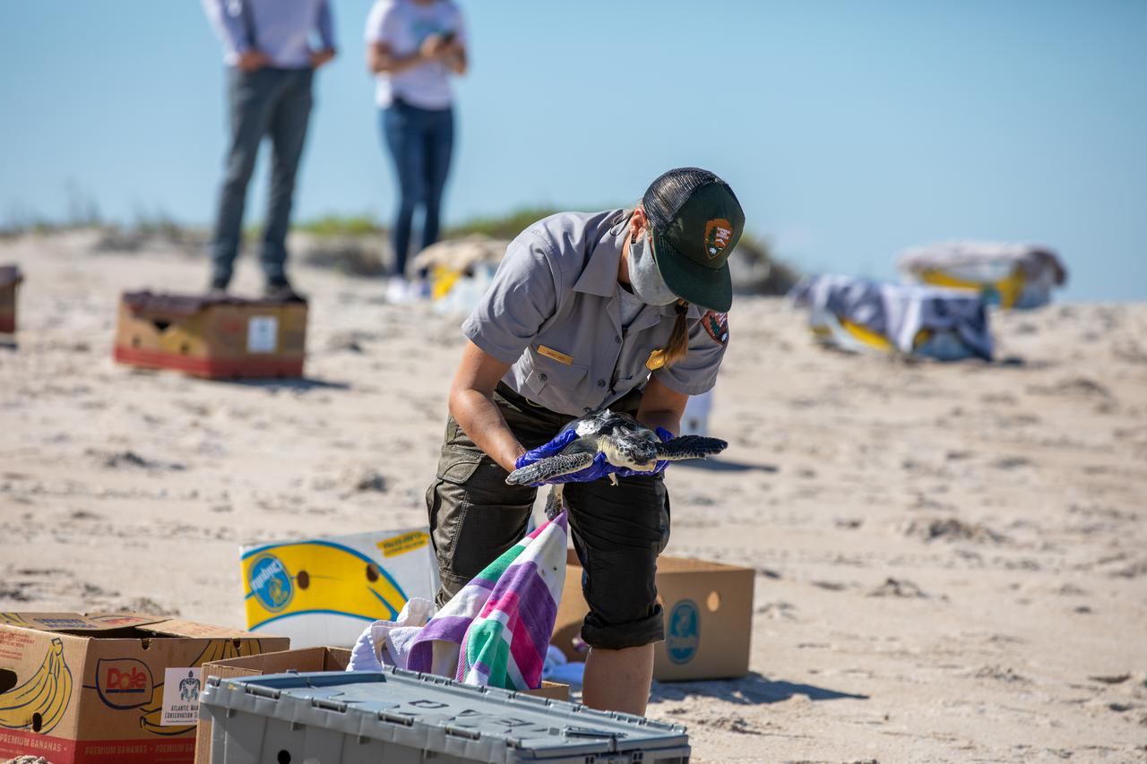
Staff with NASA, the National Park Service, Herndon Solutions Group, the center’s environmental services contractor, and others, prepare to release Kemp’s ridley sea turtles into the Atlantic Ocean at the Canaveral National Seashore near Kennedy Space Center on Feb. 26, 2021. The rescued and rehabilitated turtles were flown from aquatic centers in Massachusetts and New York to the Launch and Landing Facility, managed by Space Florida. NASA, U.S. Fish and Wildlife Service, NOAA Fisheries, Space Florida, and Herndon Solutions Group provided support. The Turtles Fly Too organization provided the flight to Kennedy. All marine turtle footage/images was obtained with the approval of the Florida Fish and Wildlife Conservation Commission (FWC) under conditions not harmful to marine turtles. Footage was acquired while conducting authorized conservation activities pursuant to: FWC 2021 Consent Permit, MTP-21-005 and MTP-21-114.
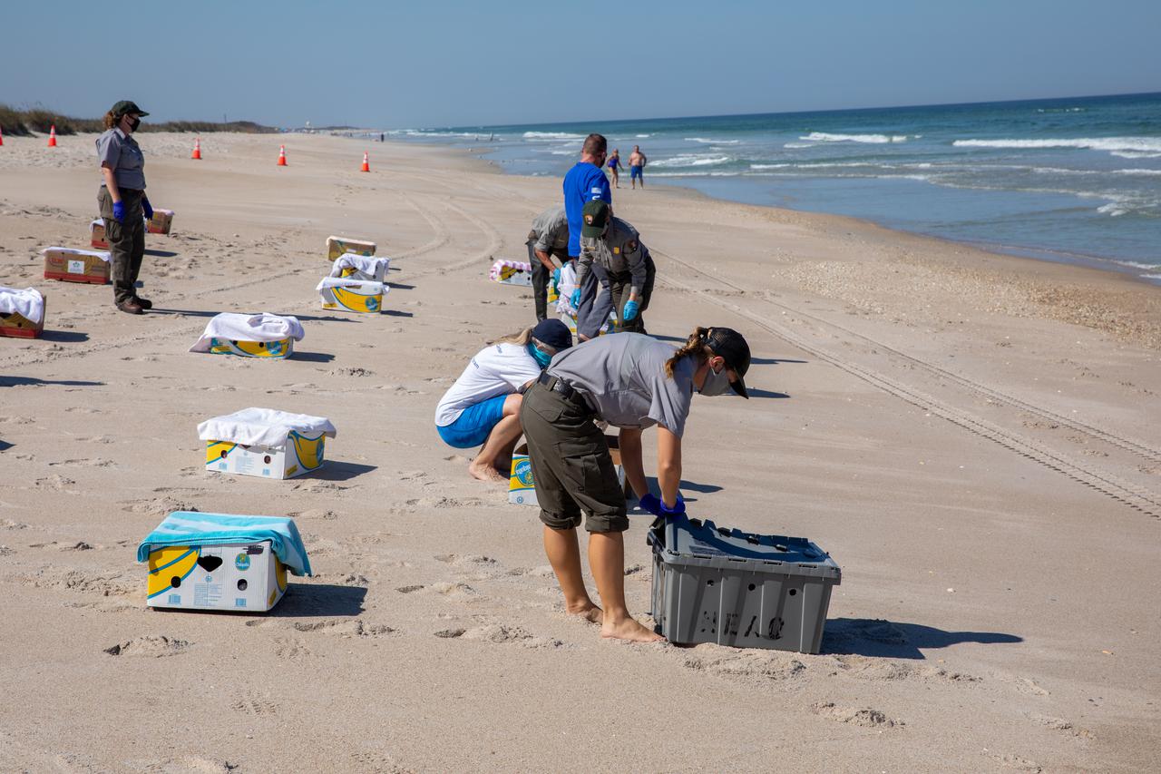
Staff with NASA, the National Park Service, Herndon Solutions Group, the center’s environmental services contractor, and others, prepare to release Kemp’s ridley sea turtles into the Atlantic Ocean at the Canaveral National Seashore near Kennedy Space Center on Feb. 26, 2021. The rescued and rehabilitated turtles were flown from aquatic centers in Massachusetts and New York to the Launch and Landing Facility, managed by Space Florida. NASA, U.S. Fish and Wildlife Service, NOAA Fisheries, Space Florida, and Herndon Solutions Group provided support. The Turtles Fly Too organization provided the flight to Kennedy. All marine turtle footage/images was obtained with the approval of the Florida Fish and Wildlife Conservation Commission (FWC) under conditions not harmful to marine turtles. Footage was acquired while conducting authorized conservation activities pursuant to: FWC 2021 Consent Permit, MTP-21-005 and MTP-21-114.
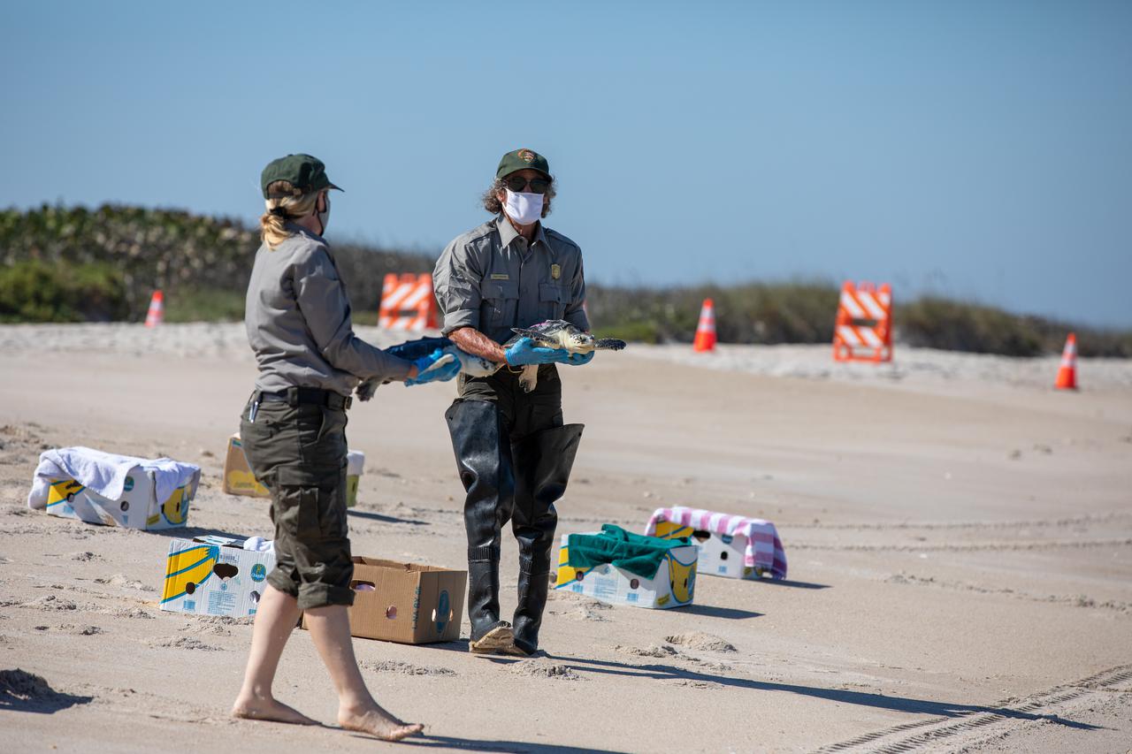
Staff with NASA, the National Park Service, Herndon Solutions Group, the center’s environmental services contractor, and others, prepare to release Kemp’s ridley sea turtles into the Atlantic Ocean at the Canaveral National Seashore near Kennedy Space Center on Feb. 26, 2021. The rescued and rehabilitated turtles were flown from aquatic centers in Massachusetts and New York to the Launch and Landing Facility, managed by Space Florida. NASA, U.S. Fish and Wildlife Service, NOAA Fisheries, Space Florida, and Herndon Solutions Group provided support. The Turtles Fly Too organization provided the flight to Kennedy. All marine turtle footage/images was obtained with the approval of the Florida Fish and Wildlife Conservation Commission (FWC) under conditions not harmful to marine turtles. Footage was acquired while conducting authorized conservation activities pursuant to: FWC 2021 Consent Permit, MTP-21-005 and MTP-21-114.
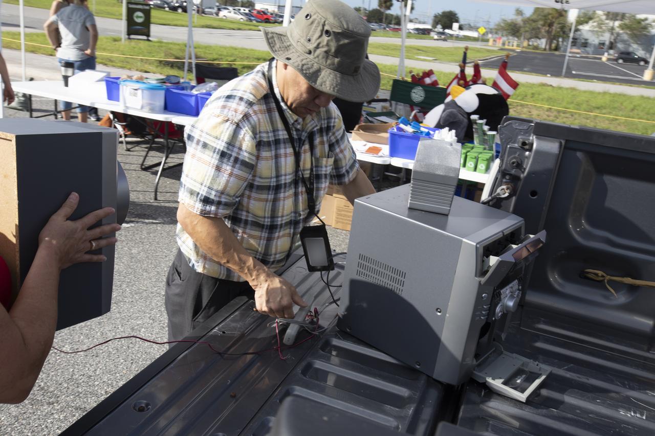
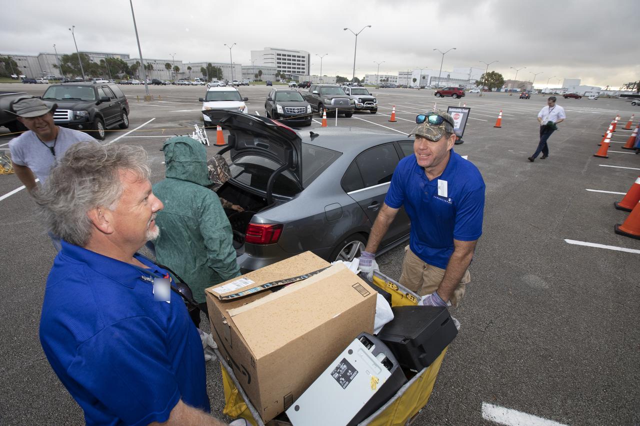
In the parking lot of the Vehicle Assembly Building at NASA's Kennedy Space Center in Florida, employees turn in used household material for recycling as part of America Recycles Day (ARD). The annual event is a nationally recognized initiative dedicated to promoting recycling in the United States. This year, KSC is partnered with Goodwill Industries and several other local organizations to receive donation material from employees such as gently used household items, personal electronic waste, greeting cards and serviceable eyeglasses.
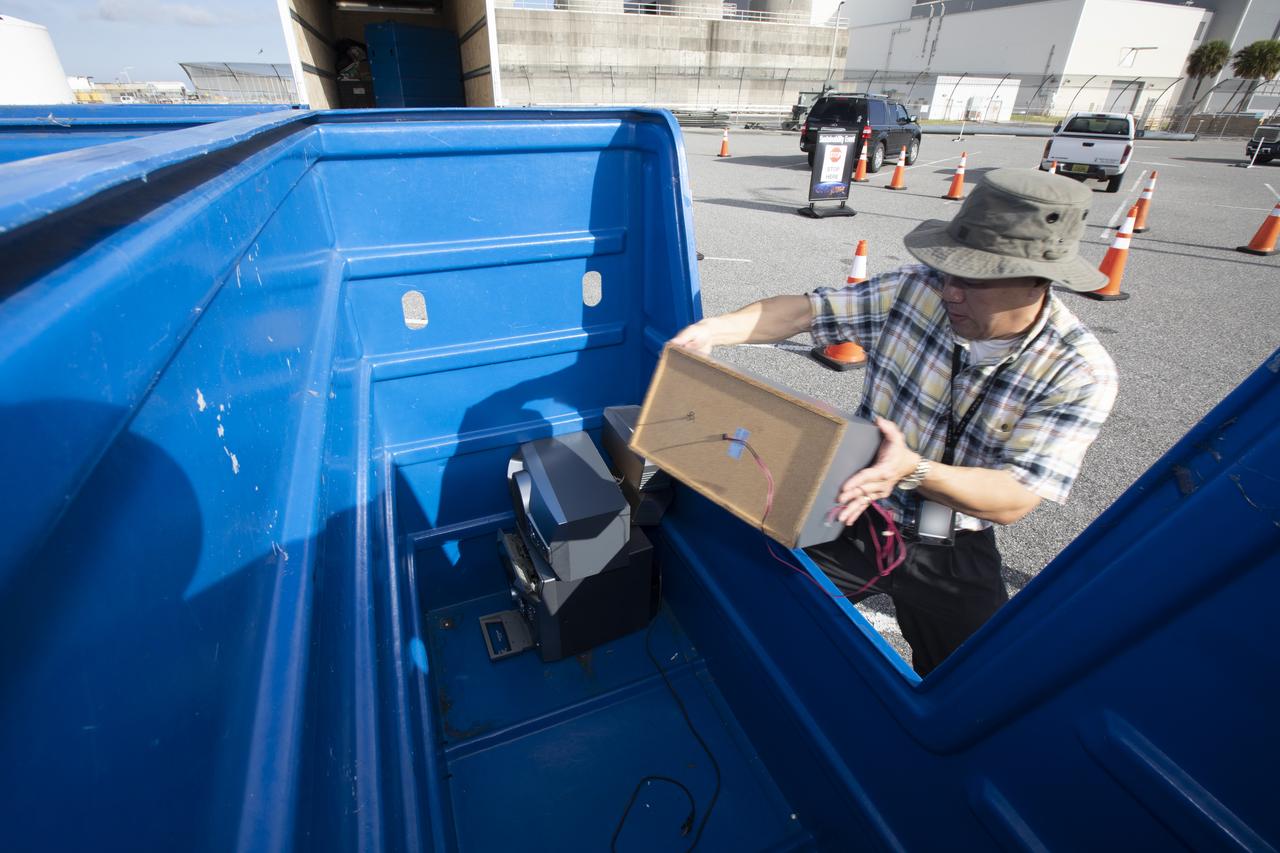
In the parking lot of the Vehicle Assembly Building at NASA's Kennedy Space Center in Florida, employees turn in used household material for recycling as part of America Recycles Day (ARD). The annual event is a nationally recognized initiative dedicated to promoting recycling in the United States. This year, KSC is partnered with Goodwill Industries and several other local organizations to receive donation material from employees such as gently used household items, personal electronic waste, greeting cards and serviceable eyeglasses.
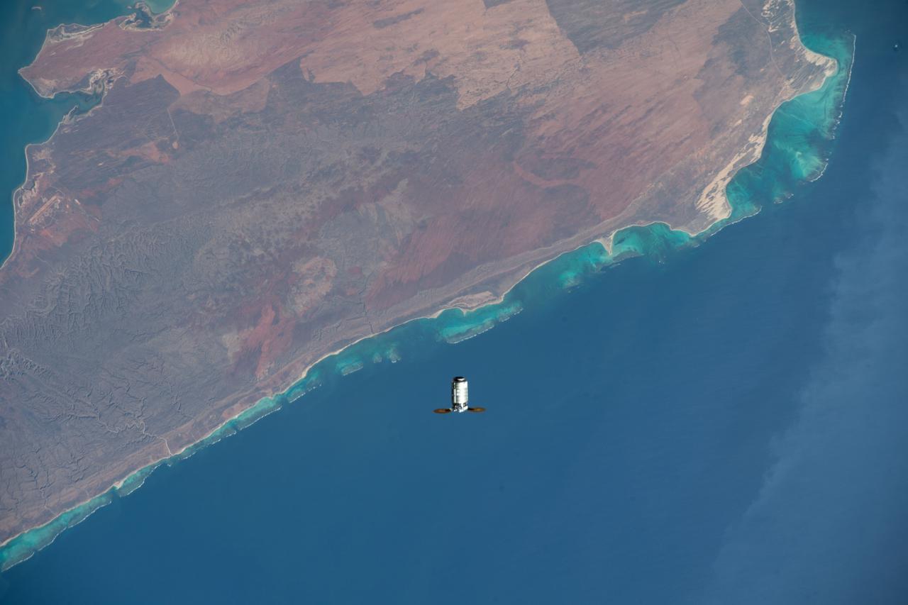
iss066e147492 (Feb. 21, 2022) --- Northrop Grumman's Cygnus space freighter is pictured approaching the International Space Station as both spacecraft orbited 262 miles above Cape Range National Park in Western Australai on the Indian Ocean coast. This is Northrop Grumman’s 17th contracted resupply mission under the second Commercial Resupply Services contract with NASA.
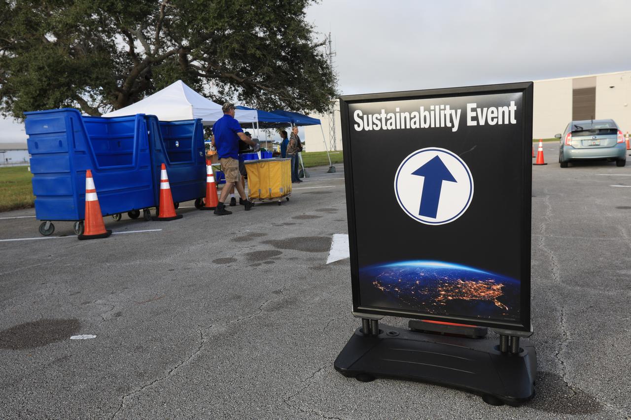
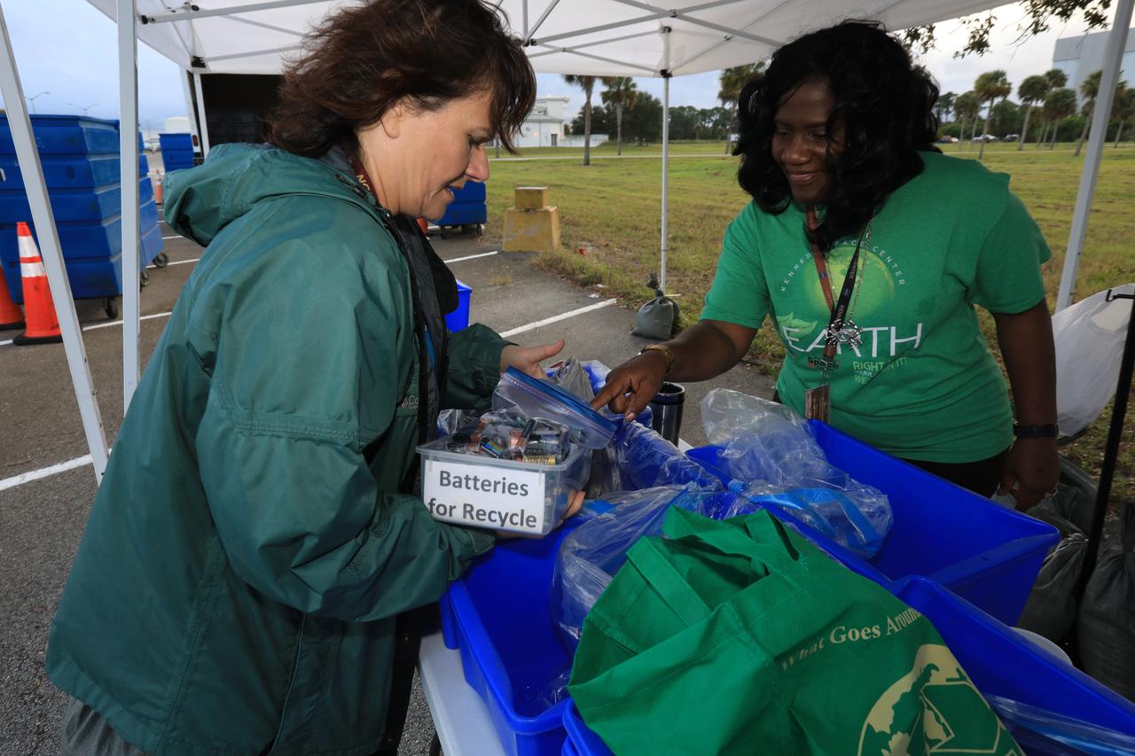
In the parking lot of the Data Center at NASA's Kennedy Space Center in Florida, employees turn in used household material for recycling as part of America Recycles Day (ARD) led by the center's Sustainability organization. The annual event is a nationally recognized initiative dedicated to promoting recycling in the United States. This year, KSC is partnered with Goodwill Industries and several other local organizations to receive donation material from employees such as gently used household items, personal electronic waste, greeting cards and serviceable eyeglasses.
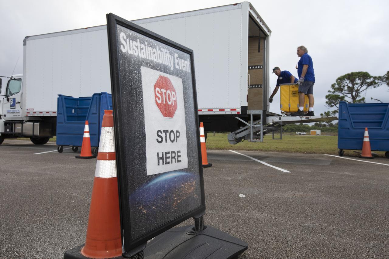
In the parking lot of the Vehicle Assembly Building at NASA's Kennedy Space Center in Florida, employees turn in used household material for recycling as part of America Recycles Day (ARD). The annual event is a nationally recognized initiative dedicated to promoting recycling in the United States. This year, KSC is partnered with Goodwill Industries and several other local organizations to receive donation material from employees such as gently used household items, personal electronic waste, greeting cards and serviceable eyeglasses.
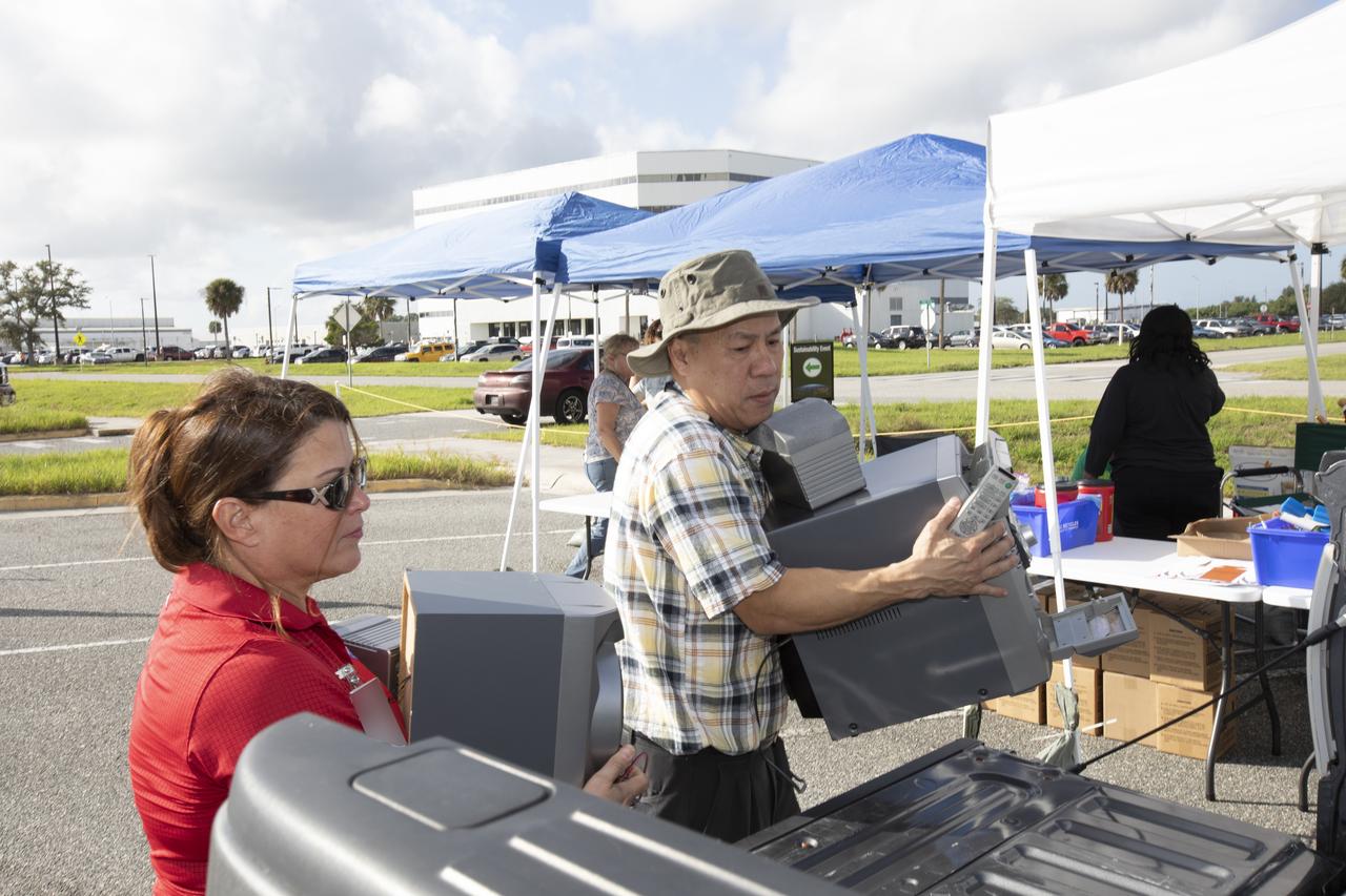
In the parking lot of the Vehicle Assembly Building at NASA's Kennedy Space Center in Florida, employees turn in used household material for recycling as part of America Recycles Day (ARD). The annual event is a nationally recognized initiative dedicated to promoting recycling in the United States. This year, KSC is partnered with Goodwill Industries and several other local organizations to receive donation material from employees such as gently used household items, personal electronic waste, greeting cards and serviceable eyeglasses.
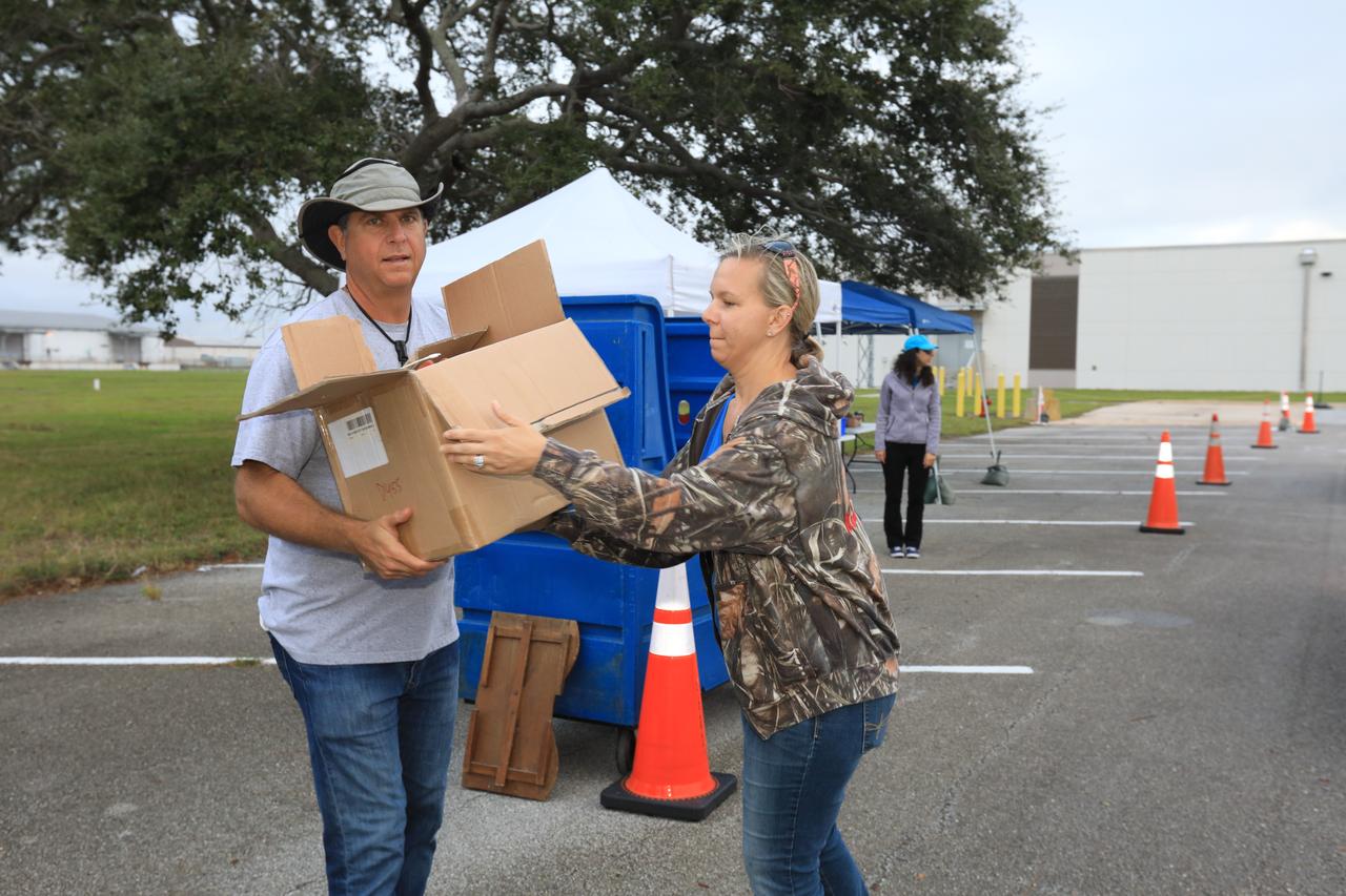
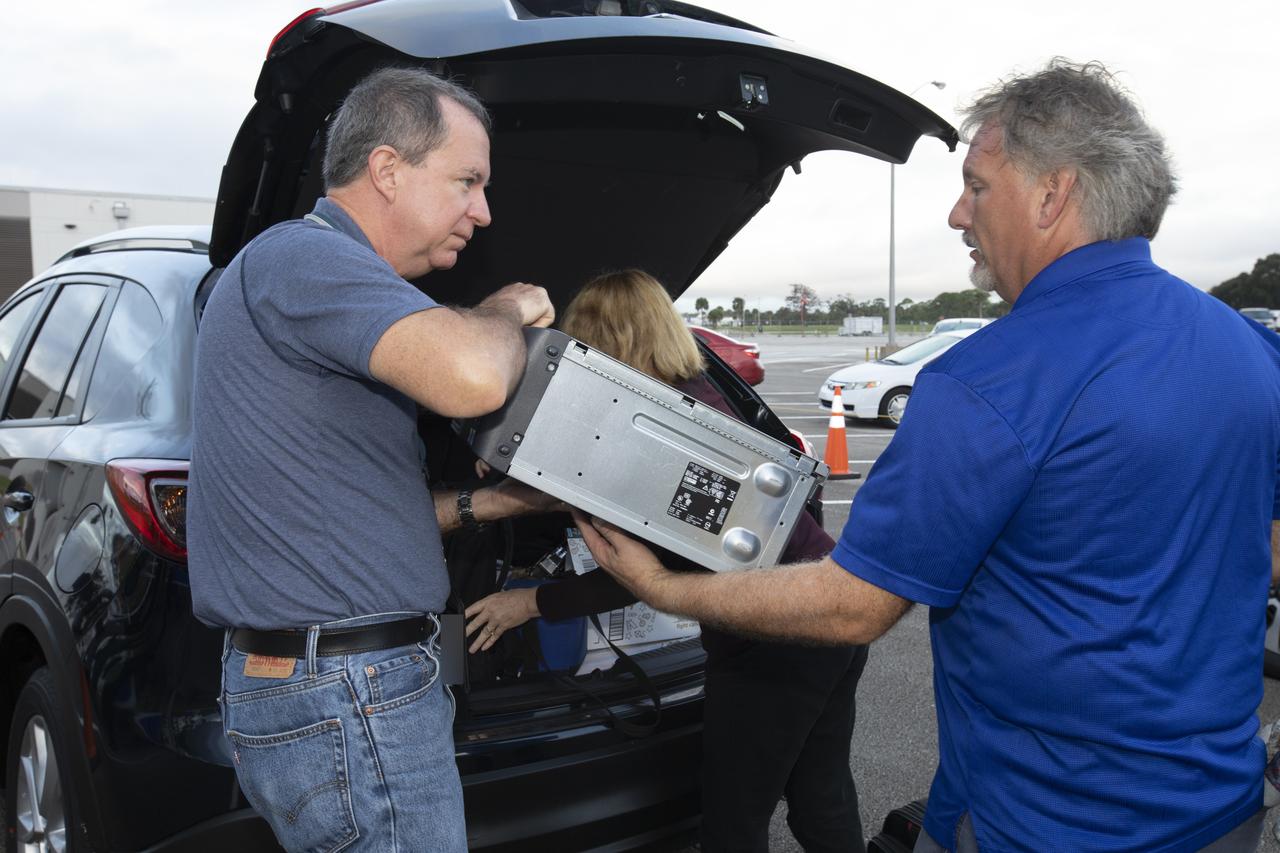
In the parking lot of the Vehicle Assembly Building at NASA's Kennedy Space Center in Florida, employees turn in used household material for recycling as part of America Recycles Day (ARD). The annual event is a nationally recognized initiative dedicated to promoting recycling in the United States. This year, KSC is partnered with Goodwill Industries and several other local organizations to receive donation material from employees such as gently used household items, personal electronic waste, greeting cards and serviceable eyeglasses.
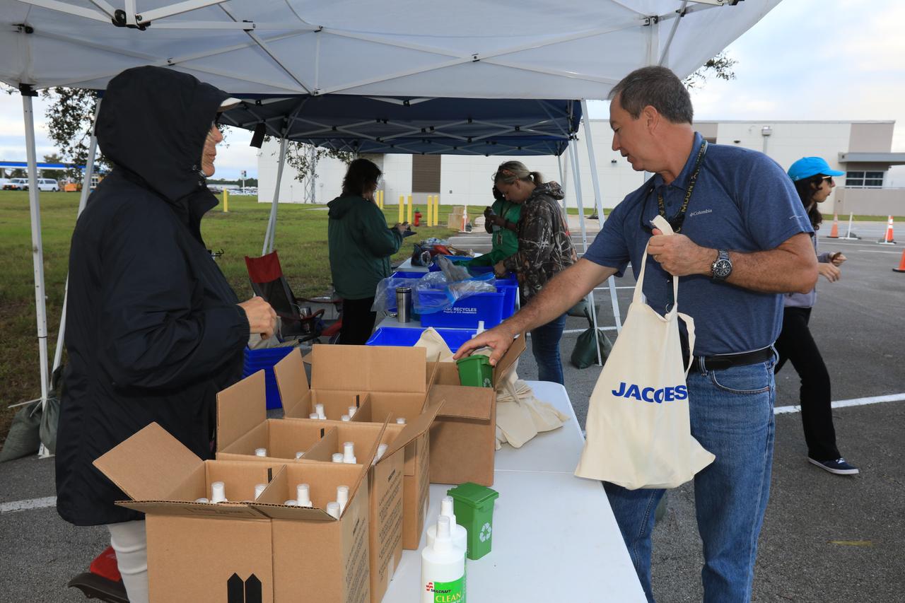
In the parking lot of the Vehicle Assembly Building at NASA's Kennedy Space Center in Florida, employees turn in used household material for recycling as part of America Recycles Day (ARD). The annual event is a nationally recognized initiative dedicated to promoting recycling in the United States. This year, KSC is partnered with Goodwill Industries and several other local organizations to receive donation material from employees such as gently used household items, personal electronic waste, greeting cards and serviceable eyeglasses.
In the parking lot of the Vehicle Assembly Building at NASA's Kennedy Space Center in Florida, employees turn in used household material for recycling as part of America Recycles Day (ARD). The annual event is a nationally recognized initiative dedicated to promoting recycling in the United States. This year, KSC is partnered with Goodwill Industries and several other local organizations to receive donation material from employees such as gently used household items, personal electronic waste, greeting cards and serviceable eyeglasses.
In the parking lot of the Vehicle Assembly Building at NASA's Kennedy Space Center in Florida, employees turn in used household material for recycling as part of America Recycles Day (ARD). The annual event is a nationally recognized initiative dedicated to promoting recycling in the United States. This year, KSC is partnered with Goodwill Industries and several other local organizations to receive donation material from employees such as gently used household items, personal electronic waste, greeting cards and serviceable eyeglasses.
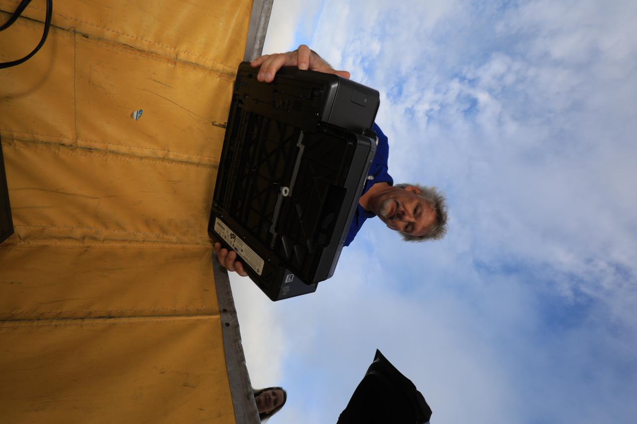
In the parking lot of the Vehicle Assembly Building at NASA's Kennedy Space Center in Florida, employees turn in used household material for recycling as part of America Recycles Day (ARD). The annual event is a nationally recognized initiative dedicated to promoting recycling in the United States. This year, KSC is partnered with Goodwill Industries and several other local organizations to receive donation material from employees such as gently used household items, personal electronic waste, greeting cards and serviceable eyeglasses.
In the parking lot of the Vehicle Assembly Building at NASA's Kennedy Space Center in Florida, employees turn in used household material for recycling as part of America Recycles Day (ARD). The annual event is a nationally recognized initiative dedicated to promoting recycling in the United States. This year, KSC is partnered with Goodwill Industries and several other local organizations to receive donation material from employees such as gently used household items, personal electronic waste, greeting cards and serviceable eyeglasses.
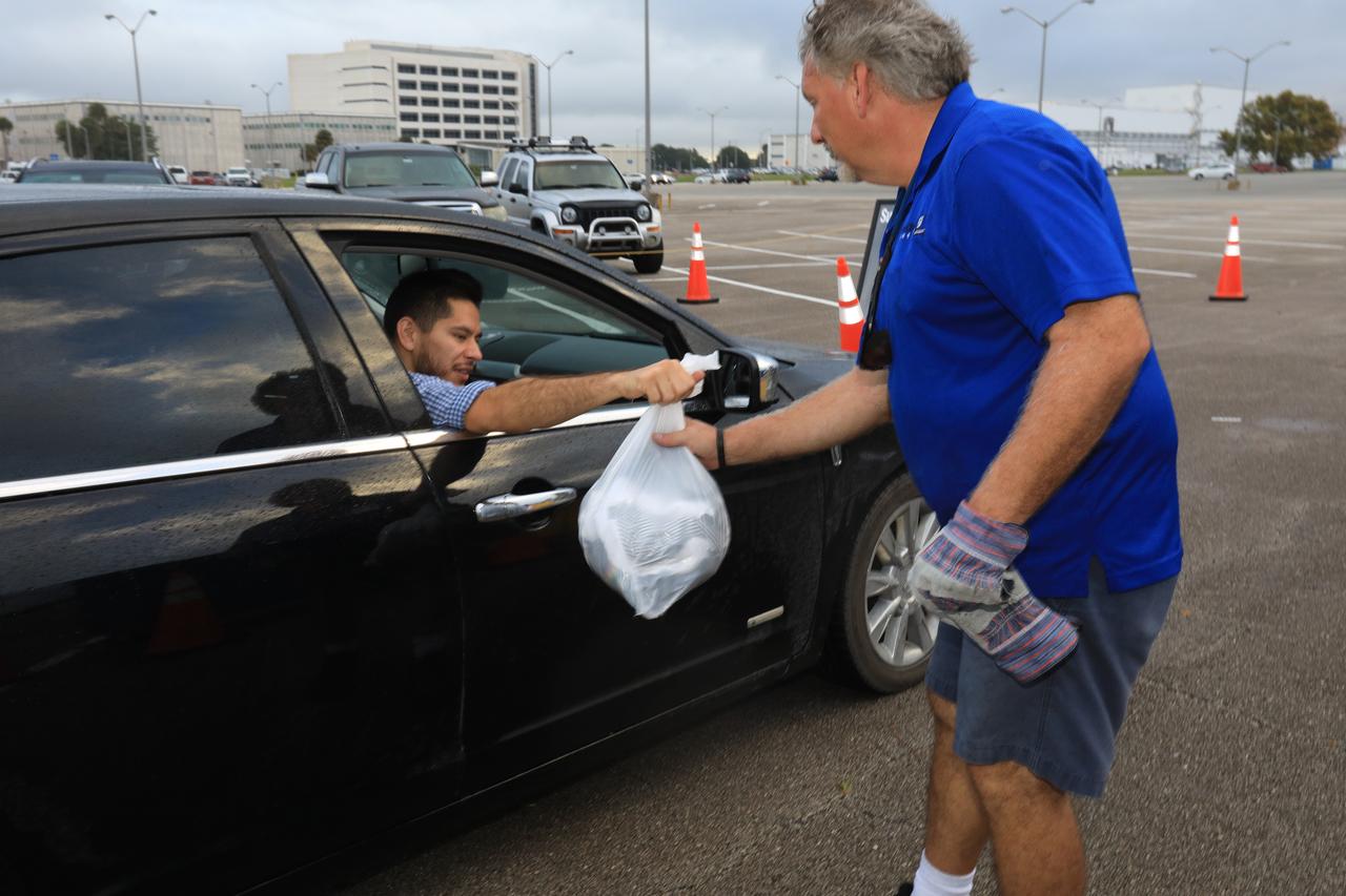
In the parking lot of the Vehicle Assembly Building at NASA's Kennedy Space Center in Florida, employees turn in used household material for recycling as part of America Recycles Day (ARD). The annual event is a nationally recognized initiative dedicated to promoting recycling in the United States. This year, KSC is partnered with Goodwill Industries and several other local organizations to receive donation material from employees such as gently used household items, personal electronic waste, greeting cards and serviceable eyeglasses.
Archeological ruins of the Elliot Plantation sugar mill are revealed through the oak hammock at NASA’s Kennedy Space Center in Florida on May 26, 2022. The plantation’s enslaved community built the sugar mill structure, or sugar train, where sugar cane juice would be boiled during processing in graduated copper kettles until the liquid reduced into a thick syrup. The ruins of Elliot Plantation date from the 1760s and represent the largest, earliest, and southernmost British period sugar plantation in the U.S., as well as one of the most intact and best examples of a completely preserved enslaved landscape. The archeological site is managed through interagency cooperation between the National Park Service, the U.S. Fish and Wildlife Service, and NASA.
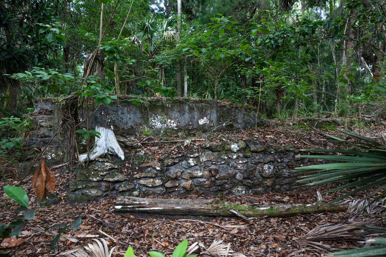
Archeological ruins of the Elliot Plantation sugar mill are revealed through the oak hammock at NASA’s Kennedy Space Center in Florida on May 26, 2022. The plantation’s enslaved community built the sugar mill structure, or sugar train, where sugar cane juice would be boiled during processing in graduated copper kettles until the liquid reduced into a thick syrup. The ruins of Elliot Plantation date from the 1760s and represent the largest, earliest, and southernmost British period sugar plantation in the U.S., as well as one of the most intact and best examples of a completely preserved enslaved landscape. The archeological site is managed through interagency cooperation between the National Park Service, the U.S. Fish and Wildlife Service, and NASA.
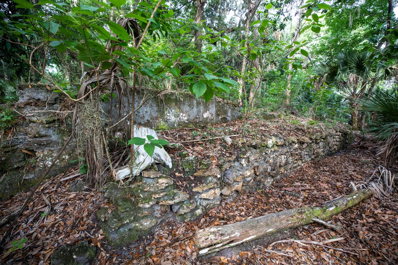
Archeological ruins of the Elliot Plantation sugar mill are revealed through the oak hammock at NASA’s Kennedy Space Center in Florida on May 26, 2022. The plantation’s enslaved community built the sugar mill structure, or sugar train, where sugar cane juice would be boiled during processing in graduated copper kettles until the liquid reduced into a thick syrup. The ruins of Elliot Plantation date from the 1760s and represent the largest, earliest, and southernmost British period sugar plantation in the U.S., as well as one of the most intact and best examples of a completely preserved enslaved landscape. The archeological site is managed through interagency cooperation between the National Park Service, the U.S. Fish and Wildlife Service, and NASA.
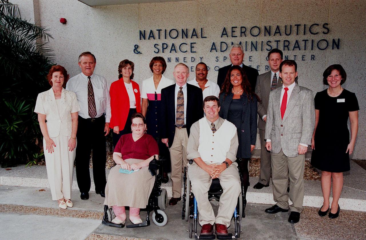
Center Director Roy Bridges (standing, center) poses with members of the Disability Awareness and Action Working Group (DAAWG), which is holding the 1999 Technology Fair Oct. 20-21 at Kennedy Space Center. The Fair is highlighting vendors demonstrating mobility, hearing, vision and silent disability assistive technology. The purpose is to create an awareness of the types of technology currently available to assist people with various disabilities in the workplace. The theme is that of this year's National Disability Employment Awareness Month, "Opening Doors to Ability." Some of the vendors participating are Canine Companions for Independence, Goodwill Industries, Accessible Structures, Division of Blind Services, Space Coast Center for Independent Living, KSC Fitness Center and Delaware North Parks Services
Archeological ruins of the Elliot Plantation sugar mill are revealed through the oak hammock at NASA’s Kennedy Space Center in Florida on May 26, 2022. The plantation’s enslaved community built the sugar mill structure, or sugar train, where sugar cane juice would be boiled during processing in graduated copper kettles until the liquid reduced into a thick syrup. The ruins of Elliot Plantation date from the 1760s and represent the largest, earliest, and southernmost British period sugar plantation in the U.S., as well as one of the most intact and best examples of a completely preserved enslaved landscape. The archeological site is managed through interagency cooperation between the National Park Service, the U.S. Fish and Wildlife Service, and NASA.
Archeological ruins of the Elliot Plantation sugar mill are revealed through the oak hammock at NASA’s Kennedy Space Center in Florida on May 26, 2022. The plantation’s enslaved community built the sugar mill structure, or sugar train, where sugar cane juice would be boiled during processing in graduated copper kettles until the liquid reduced into a thick syrup. The ruins of Elliot Plantation date from the 1760s and represent the largest, earliest, and southernmost British period sugar plantation in the U.S., as well as one of the most intact and best examples of a completely preserved enslaved landscape. The archeological site is managed through interagency cooperation between the National Park Service, the U.S. Fish and Wildlife Service, and NASA.
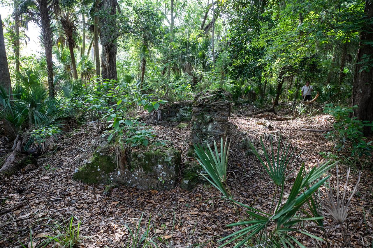
Archeological ruins of the Elliot Plantation sugar mill are revealed through the oak hammock at NASA’s Kennedy Space Center in Florida on May 26, 2022. The plantation’s enslaved community built the sugar mill structure, or sugar train, where sugar cane juice would be boiled during processing in graduated copper kettles until the liquid reduced into a thick syrup. The ruins of Elliot Plantation date from the 1760s and represent the largest, earliest, and southernmost British period sugar plantation in the U.S., as well as one of the most intact and best examples of a completely preserved enslaved landscape. The archeological site is managed through interagency cooperation between the National Park Service, the U.S. Fish and Wildlife Service, and NASA.
The Meadow Fire in Yosemite National Park is a remote, hold-over lightning caused fire which began on September 4 and is located five miles east of Yosemite Valley, CA. The fuel burning is timber and brush. There is active fire behavior with long range spotting. The National Park Service reports that a fire, that may be a spot fire, from the Meadow lightning-caused fire, was discovered at approximately 12:30 PM, Sunday September 7. The fire is approximately 2,582 acres. It is burning within the Little Yosemite Valley on both sides of the Merced River. All trails in the area are closed. Approximately 100 hikers and backpackers were evacuated from the fire area in Little Yosemite Valley. Half-Dome, a popular tourist destination, has been closed. The fire is burning in Yosemite Wilderness. Eighty-five hikers and climbers were also evacuated from the summit of Half Dome by helicopters from the California Highway Patrol, US Department of Agriculture Forest Service, Sequoia Kings Canyon National Park, and CAL Fire. This natural-color satellite image was collected by the Moderate Resolution Imaging Spectroradiometer (MODIS) aboard the Aqua satellite on Sept. 07, 2014. Actively burning areas, detected by MODIS’s thermal bands, are outlined in red. NASA image courtesy Jeff Schmaltz, MODIS Rapid Response Team. Caption: NASA/Goddard, Lynn Jenner with information from the National Park Service and the National Interagency Coordination Center. <b><a href="http://www.nasa.gov/audience/formedia/features/MP_Photo_Guidelines.html" rel="nofollow">NASA image use policy.</a></b> <b><a href="http://www.nasa.gov/centers/goddard/home/index.html" rel="nofollow">NASA Goddard Space Flight Center</a></b> enables NASA’s mission through four scientific endeavors: Earth Science, Heliophysics, Solar System Exploration, and Astrophysics. Goddard plays a leading role in NASA’s accomplishments by contributing compelling scientific knowledge to advance the Agency’s mission. <b>Follow us on <a href="http://twitter.com/NASAGoddardPix" rel="nofollow">Twitter</a></b> <b>Like us on <a href="http://www.facebook.com/pages/Greenbelt-MD/NASA-Goddard/395013845897?ref=tsd" rel="nofollow">Facebook</a></b> <b>Find us on <a href="http://instagram.com/nasagoddard?vm=grid" rel="nofollow">Instagram</a></b>
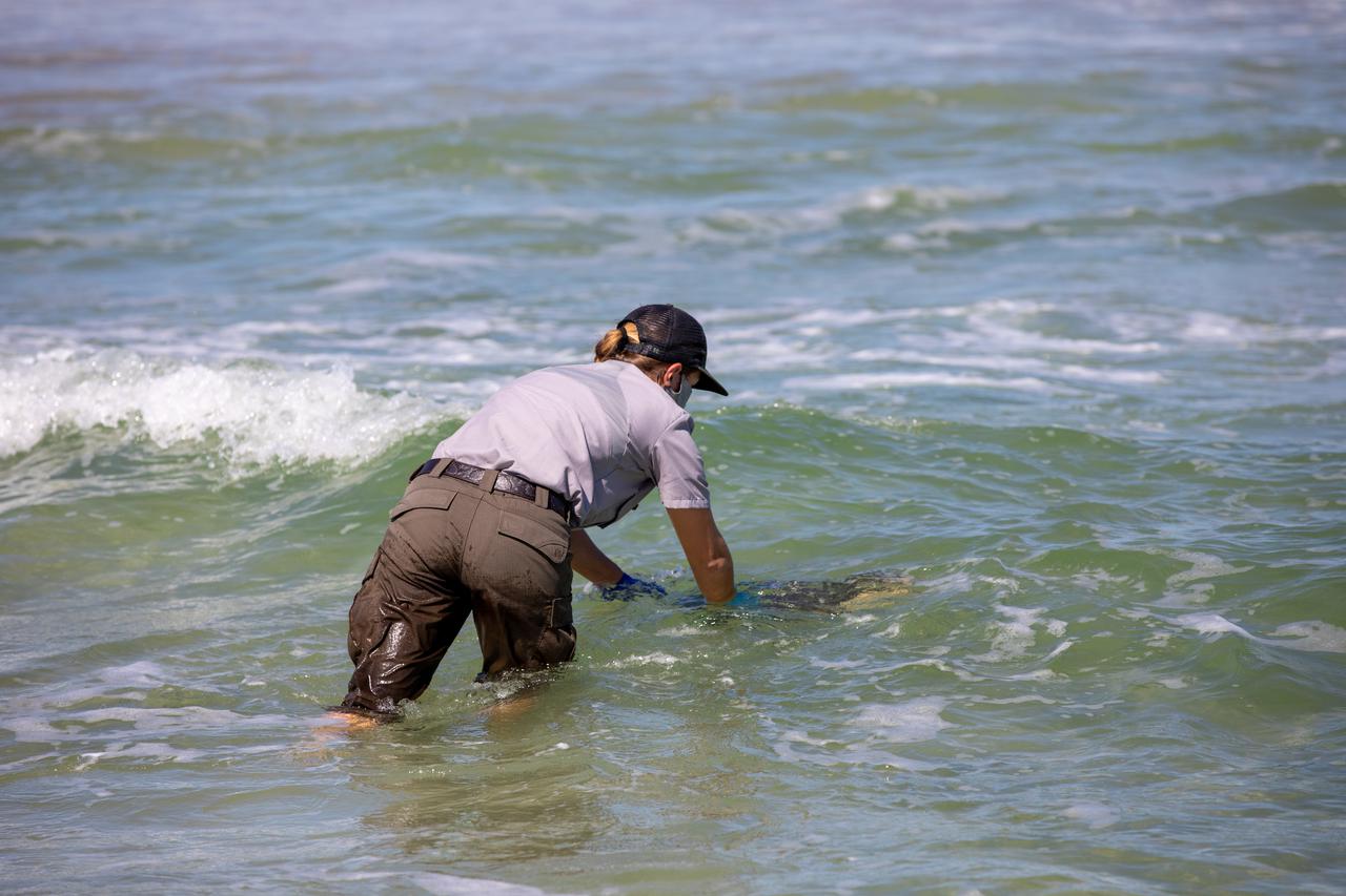
A National Park Service staff member releases a Kemp’s ridley sea turtle into the Atlantic Ocean at the Canaveral National Seashore near Kennedy Space Center on Feb. 26, 2021. The rescued and rehabilitated turtles were flown from aquatic centers in Massachusetts and New York to the Launch and Landing Facility, managed by Space Florida. NASA, U.S. Fish and Wildlife Service, NOAA Fisheries, Space Florida, and Herndon Solutions Group provided support. The Turtles Fly Too organization provided the flight to Kennedy. All marine turtle footage/images was obtained with the approval of the Florida Fish and Wildlife Conservation Commission (FWC) under conditions not harmful to marine turtles. Footage was acquired while conducting authorized conservation activities pursuant to: FWC 2021 Consent Permit, MTP-21-005 and MTP-21-114.
CAPE CANAVERAL, Fla. -- Hatchlings from endangered loggerhead turtle eggs, brought from beaches along the northern U.S. Gulf Coast, are being released into the Atlantic Ocean at Playalinda Beach, adjacent to the Merritt Island National Wildlife Refuge within NASA's Kennedy Space Center in Florida. The release and relocation work is part of an effort by the U.S. Fish and Wildlife Service, the Florida Fish and Wildlife Conservation Commission, the National Park Service, NOAA, FedEx and conservationists to help minimize the risk to this year's sea turtle hatchlings from impacts of the BP Deepwater Horizon oil spill in the Gulf of Mexico. This plan involves carefully moving an anticipated 700 nests deposited on Florida Panhandle and Alabama beaches during the next several months. Note: The photos were shot using an infrared filter to protect the hatchlings. Photo credit: NASA_Dimitri Gerondidakis
A National Park Service staff member prepares to release a Kemp’s ridley sea turtle into the Atlantic Ocean at the Canaveral National Seashore near Kennedy Space Center on Feb. 26, 2021. The rescued and rehabilitated turtles were flown from aquatic centers in Massachusetts and New York to the Launch and Landing Facility, managed by Space Florida. NASA, U.S. Fish and Wildlife Service, NOAA Fisheries, Space Florida, and Herndon Solutions Group provided support. The Turtles Fly Too organization provided the flight to Kennedy. All marine turtle footage/images was obtained with the approval of the Florida Fish and Wildlife Conservation Commission (FWC) under conditions not harmful to marine turtles. Footage was acquired while conducting authorized conservation activities pursuant to: FWC 2021 Consent Permit, MTP-21-005 and MTP-21-114.
CAPE CANAVERAL, Fla. -- In a climate-controlled facility at NASA's Kennedy Space Center in Florida, newly-hatched Loggerhead turtles emerge from their eggs brought from beaches along the northern U.S. Gulf Coast. The eggs will be monitored by biologists and hatchery workers until incubation is complete. The hatchlings will be released at different points along a 100-mile stretch of the Atlantic Ocean shoreline. That includes beaches adjacent to the Merritt Island National Wildlife Refuge, which is located inside Kennedy. The release and relocation work is part of an effort by the U.S. Fish and Wildlife Service, the Florida Fish and Wildlife Conservation Commission, the National Park Service, NOAA, FedEx and conservationists to help minimize the risk to this year's sea turtle hatchlings from impacts of the BP Deepwater Horizon oil spill in the Gulf of Mexico. This plan involves carefully moving an anticipated 700 nests during the next several months. Photo credit: NASA_Troy Cryder
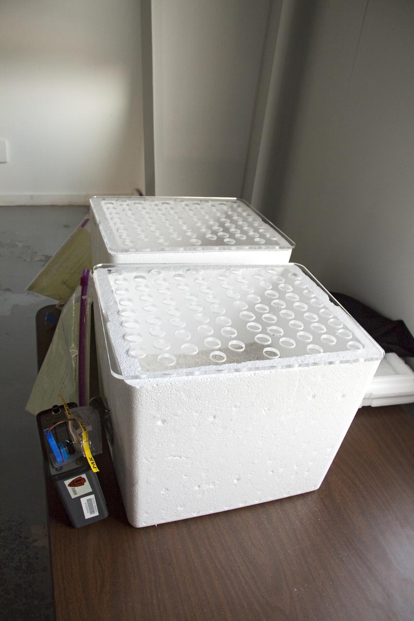
CAPE CANAVERAL, Fla. In a secure facility located at NASA's Kennedy Space Center in Florida, two Styrofoam boxes containing endangered sea turtle eggs brought from beaches along the northern U.S. Gulf Coast are being monitored in a climate-controlled room until incubation is complete. Jane Provancha, lead biologist at the hatchery is heading-up the project at Kennedy. After hatching, the turtles will be set free on a Kennedy Space Center_Canaveral National Seashore beach. The Northern Gulf Rescue Operations relocation and release work effort is supported by the U.S. Fish and Wildlife Service, the Florida Fish and Wildlife Conservation Commission, the National Park Service, NOAA, FedEx and conservationists to help minimize the risk to this year's sea turtle hatchlings from impacts of the BP Deepwater Horizon oil spill in the Gulf of Mexico. Photo credit: NASA_Troy Cryder
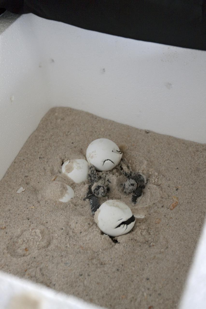
CAPE CANAVERAL, Fla. -- In a secure, climate-controlled facility at NASA's Kennedy Space Center in Florida, newly-hatched Loggerhead turtles emerge from their eggs brought from beaches along the northern U.S. Gulf Coast. The eggs will be monitored by biologists and hatchery workers until incubation is complete. The hatchlings will be released at different points along a 100-mile stretch of the Atlantic Ocean shoreline. That includes beaches adjacent to the Merritt Island National Wildlife Refuge, which is located inside Kennedy. The release and relocation work is part of an effort by the U.S. Fish and Wildlife Service, the Florida Fish and Wildlife Conservation Commission, the National Park Service, NOAA, FedEx and conservationists to help minimize the risk to this year's sea turtle hatchlings from impacts of the BP Deepwater Horizon oil spill in the Gulf of Mexico. This plan involves carefully moving an anticipated 700 nests during the next several months. Photo credit: NASA_Troy Cryder
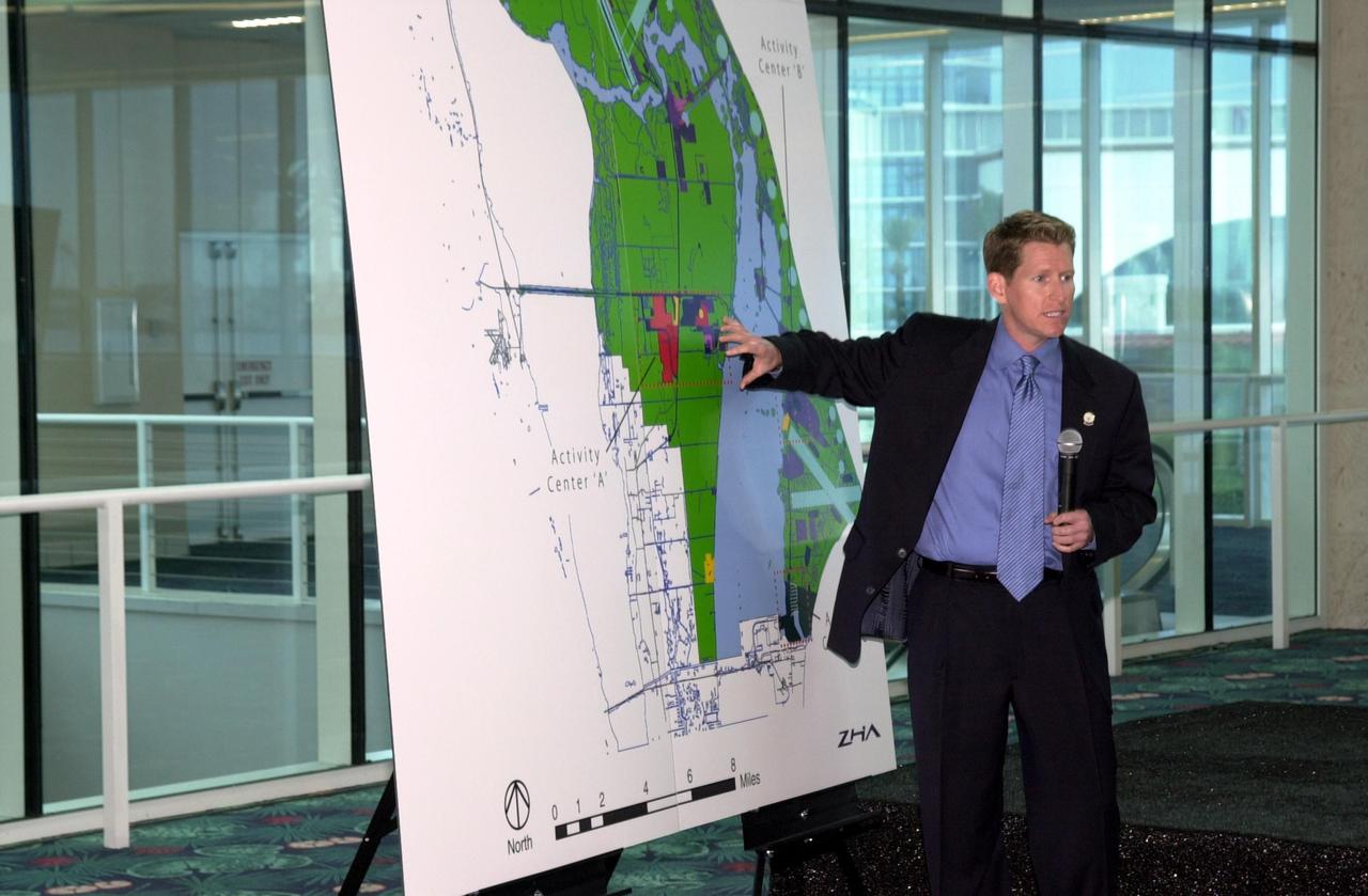
KENNEDY SPACE CENTER, FLA. - During the master plan signing ceremony at Port Canaveral Terminal 10, Matt Taylor gives a presentation to attendees, who included Canaveral National Seashore Superintendent Robert Newkirk, Canaveral Port Authority Executive Director Malcolm "Mac" McLouth, KSC Director Roy Bridges Jr., U.S. Rep. Dave Weldon, 45th Space Wing Commander Gregory Pavlovich, U.S. Fish & Wildlife Services Refuge Manager Ron Hight, Naval Ordnance Test Unit Commanding Officer William Borger, and Florida Space Authority Executive Director Ed Gormel. Taylor is vice president and chief planning officer of ZHA, Inc., which provided consulting services for the plan. The plan represents interagency cooperation between the leadership group's agencies and the U.S. Fish and Wildlife Service, the National Park Service and U.S. Navy. Joining them in developing a vision of the Spaceport's future have been aerospace educators, researchers, and businesses, along with representatives from local, state and national government.
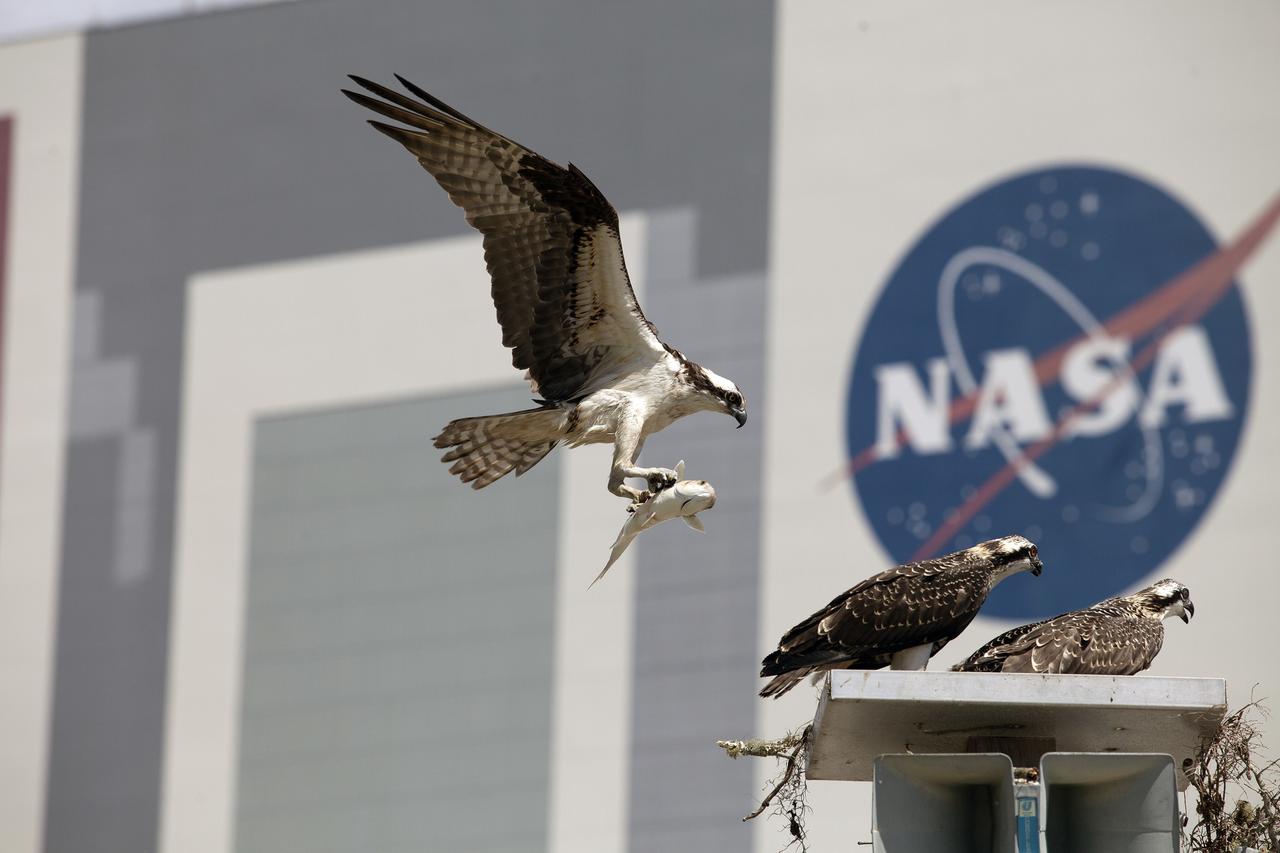
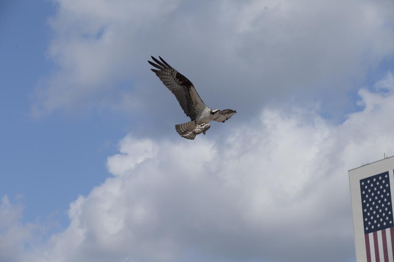
CAPE CANAVERAL, Fla. -- An adult osprey returns home to its nest atop a speaker platform in the Press Site parking lot at NASA's Kennedy Space Center in Florida, carrying a fish in its talons. In the background is a 12,300-square-foot NASA logo painted on the side of the 525-foot-tall Vehicle Assembly Building VAB. The parking lot borders the water of the Launch Complex 39 turn basin, making it an ideal source of food for the osprey. The undeveloped property on Kennedy Space Center is managed by the U.S. Fish and Wildlife Service through the Merritt Island National Wildlife Refuge. The refuge provides a habitat for a plethora of wildlife, including 330 species of birds. For information on the refuge, visit http://www.fws.gov/merrittisland/Index.html. Photo credit: NASA/Daniel Casper
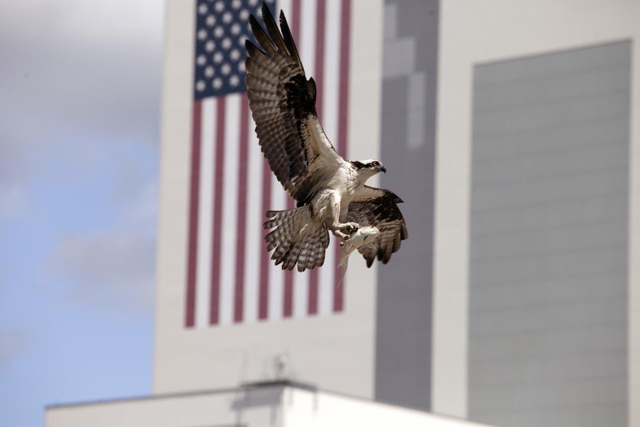
CAPE CANAVERAL, Fla. -- An adult osprey prepares to land in its nest atop a speaker platform in the Press Site parking lot at NASA's Kennedy Space Center in Florida, carrying a fish in its talons. In the background is the 209-foot-tall U.S. flag painted on the side of the 52-story Vehicle Assembly Building VAB. The parking lot borders the water of the Launch Complex 39 turn basin, making it an ideal source of food for the osprey. The undeveloped property on Kennedy Space Center is managed by the U.S. Fish and Wildlife Service through the Merritt Island National Wildlife Refuge. The refuge provides a habitat for a plethora of wildlife, including 330 species of birds. For information on the refuge, visit http://www.fws.gov/merrittisland/Index.html. Photo credit: NASA/Daniel Casper
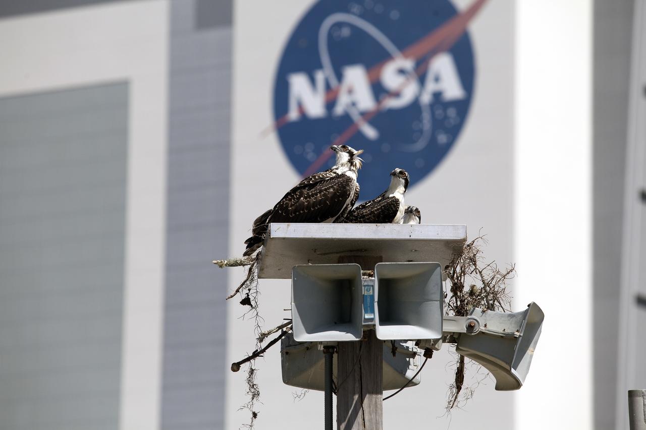
CAPE CANAVERAL, Fla. -- A family of ospreys is at home atop a speaker platform in the Press Site parking lot at NASA's Kennedy Space Center in Florida. In the background is a 12,300-square-foot NASA logo painted on the side of the 525-foot-tall Vehicle Assembly Building VAB. The parking lot borders the water of the Launch Complex 39 turn basin, making it an ideal source of food for the osprey. The undeveloped property on Kennedy Space Center is managed by the U.S. Fish and Wildlife Service through the Merritt Island National Wildlife Refuge. The refuge provides a habitat for a plethora of wildlife, including 330 species of birds. For information on the refuge, visit http://www.fws.gov/merrittisland/Index.html. Photo credit: NASA/Daniel Casper

CAPE CANAVERAL, Fla. -- A family of ospreys almost has outgrown its nest, built on a speaker platform in the Press Site parking lot at NASA's Kennedy Space Center in Florida. In the background is a 12,300-square-foot NASA logo painted on the side of the 525-foot-tall Vehicle Assembly Building VAB. The parking lot borders the water of the Launch Complex 39 turn basin, making it an ideal source of food for the osprey. The undeveloped property on Kennedy Space Center is managed by the U.S. Fish and Wildlife Service through the Merritt Island National Wildlife Refuge. The refuge provides a habitat for a plethora of wildlife, including 330 species of birds. For information on the refuge, visit http://www.fws.gov/merrittisland/Index.html. Photo credit: NASA/Daniel Casper
CAPE CANAVERAL, Fla. -- An adult osprey delivers a fish dinner to its family, nesting atop a speaker platform in the Press Site parking lot at NASA's Kennedy Space Center in Florida. In the background is the 209-foot-tall U.S. flag painted on the side of the 52-story Vehicle Assembly Building VAB. The parking lot borders the water of the Launch Complex 39 turn basin, making it an ideal source of food for the osprey. The undeveloped property on Kennedy Space Center is managed by the U.S. Fish and Wildlife Service through the Merritt Island National Wildlife Refuge. The refuge provides a habitat for a plethora of wildlife, including 330 species of birds. For information on the refuge, visit http://www.fws.gov/merrittisland/Index.html. Photo credit: NASA/Daniel Casper
Michael Legare, of the U.S. Fish and Wildlife Service, stands near the archeological ruins of the Elliot Plantation sugar mill at NASA’s Kennedy Space Center in Florida on May 26, 2022. The plantation’s enslaved community built the sugar mill structure, or sugar train, where sugar cane juice would be boiled during processing in graduated copper kettles until the liquid reduced into a thick syrup. The ruins of Elliot Plantation date from the 1760s and represent the largest, earliest, and southernmost British period sugar plantation in the U.S., as well as one of the most intact and best examples of a completely preserved enslaved landscape. The archeological site is managed through interagency cooperation between the National Park Service, the U.S. Fish and Wildlife Service, and NASA.
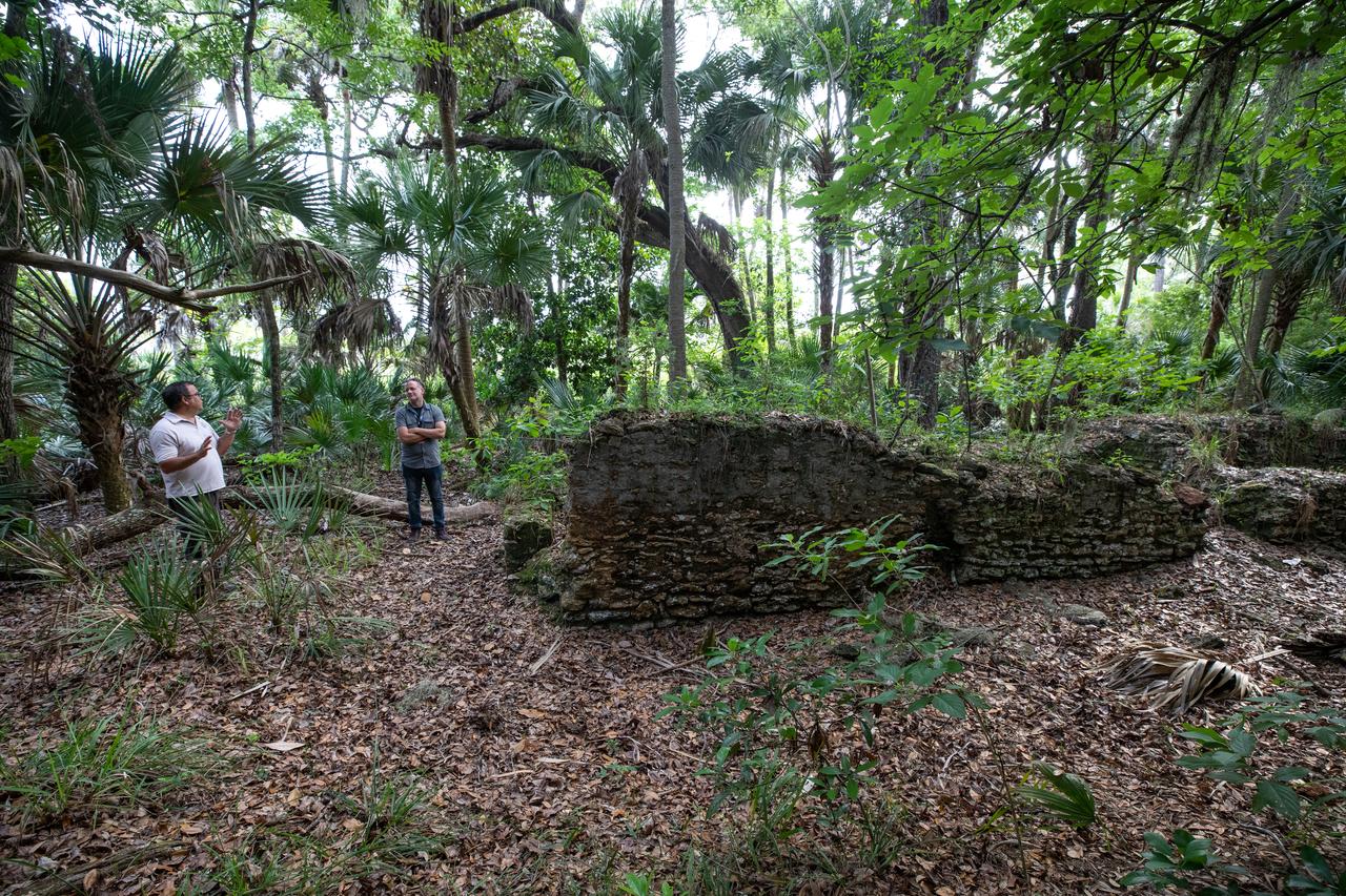
Members of U.S. Fish and Wildlife Service and NASA Communications visit the archeological ruins of the Elliot Plantation sugar mill at NASA’s Kennedy Space Center in Florida on May 26, 2022. The plantation’s enslaved community built the sugar mill structure, or sugar train, where sugar cane juice would be boiled during processing in graduated copper kettles until the liquid reduced into a thick syrup. The ruins of Elliot Plantation date from the 1760s and represent the largest, earliest, and southernmost British period sugar plantation in the U.S., as well as one of the most intact and best examples of a completely preserved enslaved landscape. The archeological site is managed through interagency cooperation between the National Park Service, the U.S. Fish and Wildlife Service, and NASA.
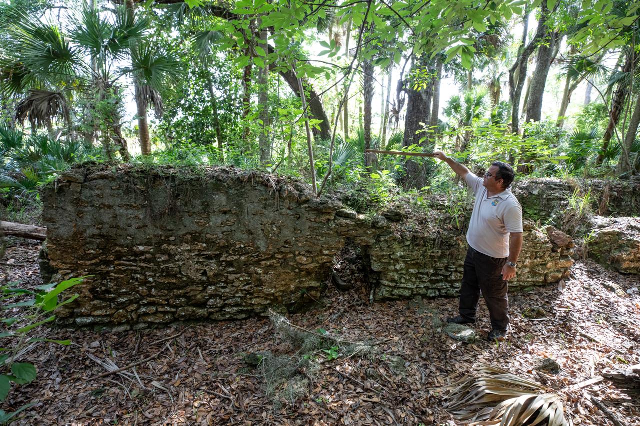
Near the archeological ruins of the Elliot Plantation sugar mill at NASA’s Kennedy Space Center in Florida, Michael Legare, of the U.S. Fish and Wildlife Service, recreates the original wall height of the structure on May 26, 2022. The plantation’s enslaved community built the sugar mill structure, or sugar train, where sugar cane juice would be boiled during processing in graduated copper kettles until the liquid reduced into a thick syrup. The ruins of Elliot Plantation date from the 1760s and represent the largest, earliest, and southernmost British period sugar plantation in the U.S., as well as one of the most intact and best examples of a completely preserved enslaved landscape. The archeological site is managed through interagency cooperation between the National Park Service, the U.S. Fish and Wildlife Service, and NASA.
Center Director Roy Bridges stops to talk to one of the vendors at the Disability Awareness and Action Working Group (DAAWG) Technology Fair being held Oct. 20-21 at Kennedy Space Center. With him at the far left is Sterling Walker, director of Engineering Development at KSC and chairman of DAAWG, and Nancie Strott, a multi-media specialist with Dynacs and chairperson of the Fair; at the right is Carol Cavanaugh, with KSC Public Services. The Fair is highlighting vendors demonstrating mobility, hearing, vision and silent disability assistive technology. The purpose is to create an awareness of the types of technology currently available to assist people with various disabilities in the workplace. The theme is that of this year's National Disability Employment Awareness Month, "Opening Doors to Ability." Some of the vendors participating are Canine Companions for Independence, Goodwill Industries, Accessible Structures, Division of Blind Services, Space Coast Center for Independent Living, KSC Fitness Center and Delaware North Parks Services
K-9 Spike stands alert and ready for the next training exercise with his Handler Officer John McGee at Kennedy Space Center’s Protective Services Office in Florida on July 10, 2019. The center’s specially trained K-9s support the center 24/7, 365 days. Their main goal is to protect the Kennedy workforce and assets. Normal activities include sweeps of designated facilities, parking lots and random vehicle inspections at entrance gates. During rocket launches, they are out and about performing sweeps of facilities and launch site viewing areas. They cover Kennedy and the Merritt Island National Wildlife Refuge.
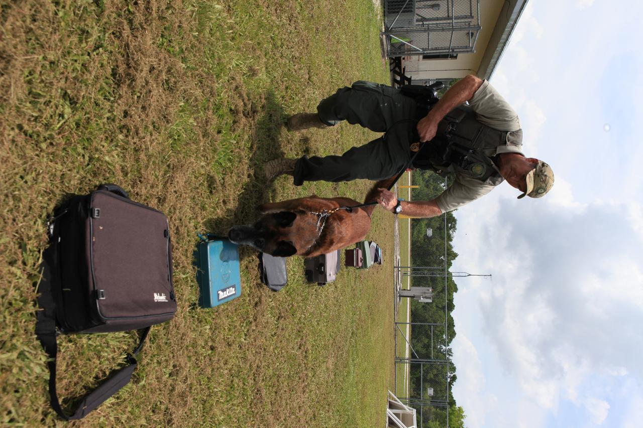
K-9 Handler Officer Scott O’Rourke watches as K-9 LJ works his way through a row of bags and containers to locate one with a suspicious substance during a training exercise on July 10, 2019, at Kennedy Space Center’s Protective Services Office in Florida. The center’s specially trained K-9s support the center 24/7, 365 days. Their main goal is to protect the Kennedy workforce and assets. Normal activities include sweeps of designated facilities, parking lots and random vehicle inspections at entrance gates. During rocket launches, they are out and about performing sweeps of facilities and launch site viewing areas. They cover Kennedy and the Merritt Island National Wildlife Refuge.
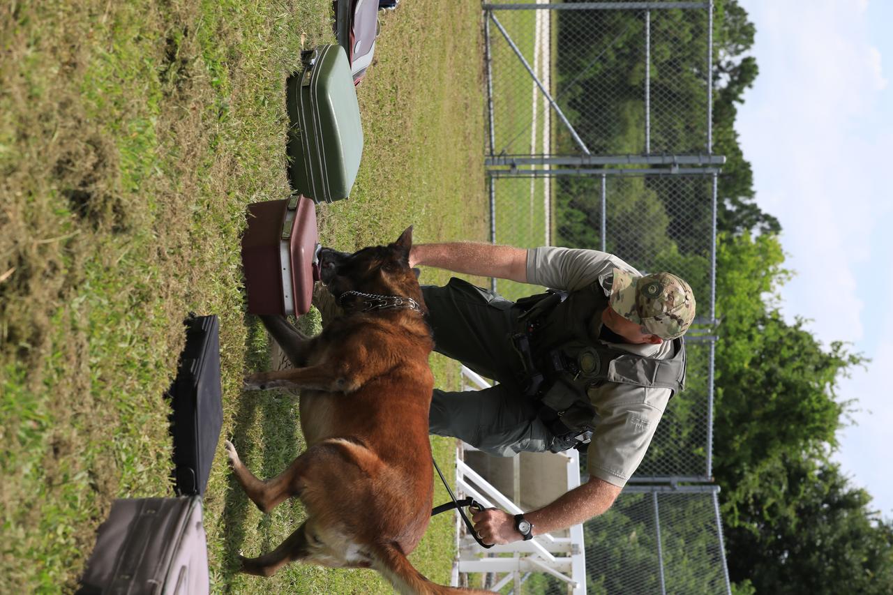
K-9 Handler Officer Scott O’Rourke watches as K-9 LJ selects the container with a suspicious substance during a training exercise on July 10, 2019, at Kennedy Space Center’s Protective Services Office in Florida. The center’s specially trained K-9s support the center 24/7, 365 days. Their main goal is to protect the Kennedy workforce and assets. Normal activities include sweeps of designated facilities, parking lots and random vehicle inspections at entrance gates. During rocket launches, they are out and about performing sweeps of facilities and launch site viewing areas. They cover Kennedy and the Merritt Island National Wildlife Refuge.
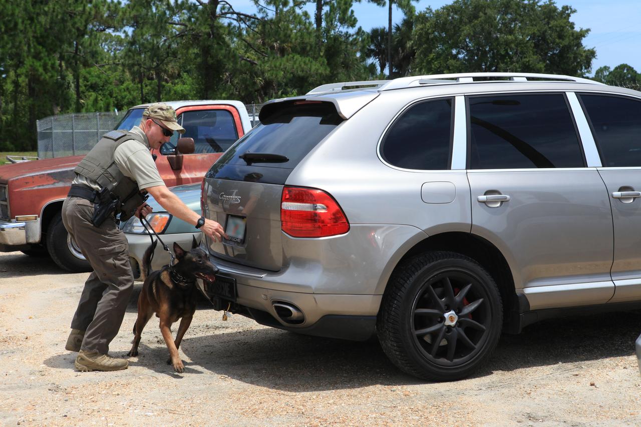
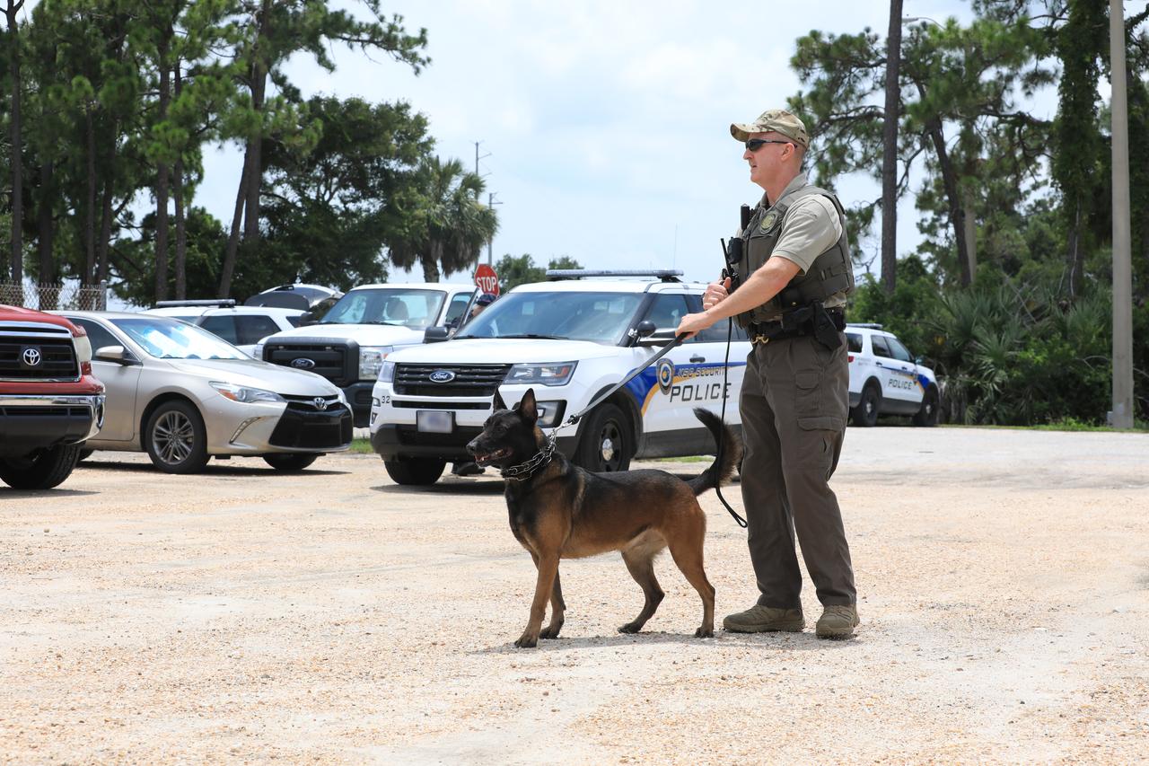
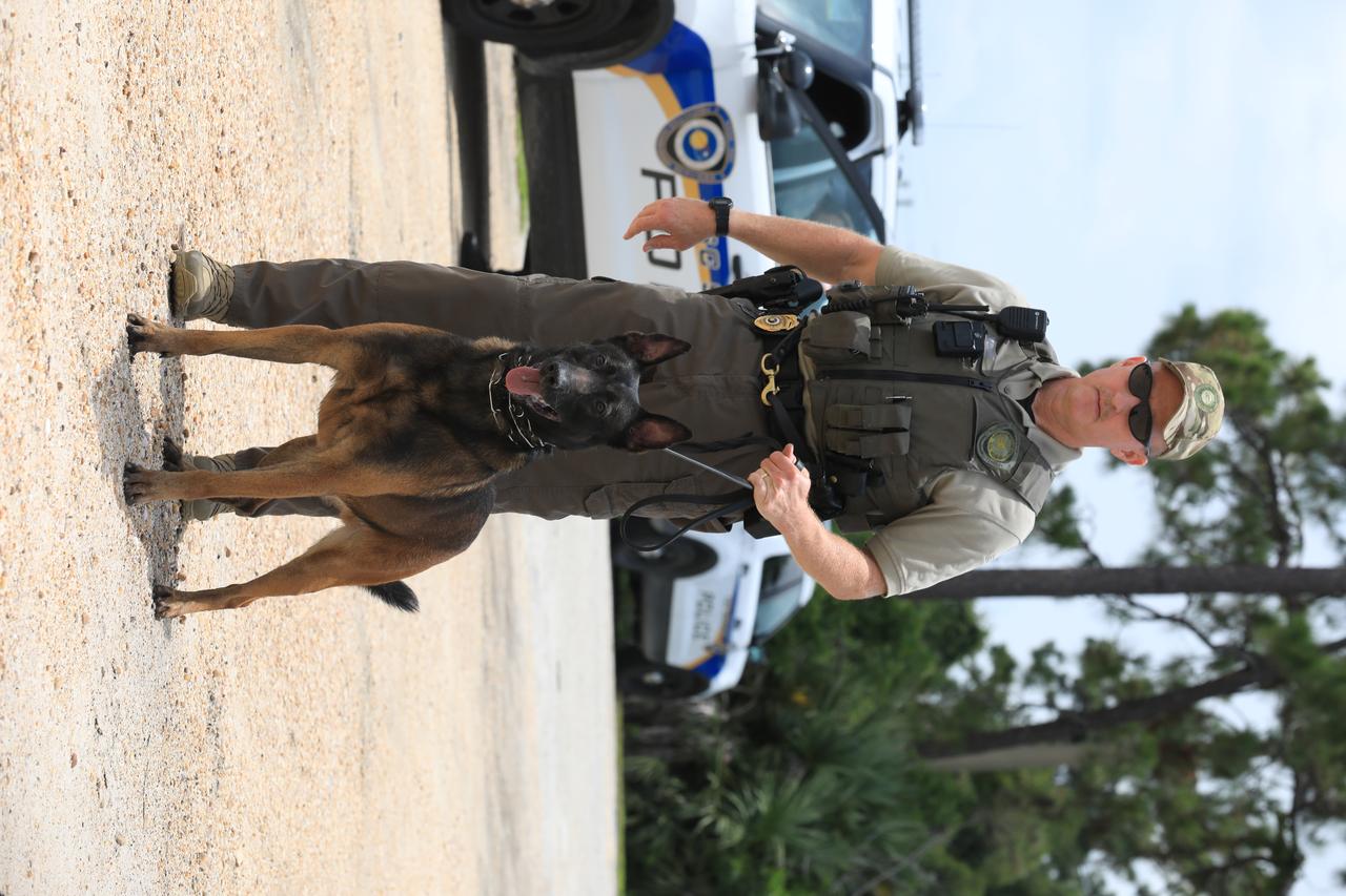
K-9 Handler Officer John McGee watches as K-9 Spike works his way through a row of cars during a training exercise on July 10, 2019, at Kennedy Space Center’s Protective Services Office in Florida. The center’s specially trained K-9s support the center 24/7, 365 days. Their main goal is to protect the Kennedy workforce and assets. Normal activities include sweeps of designated facilities, parking lots and random vehicle inspections at entrance gates. During rocket launches, they are out and about performing sweeps of facilities and launch site viewing areas. They cover Kennedy and the Merritt Island National Wildlife Refuge.
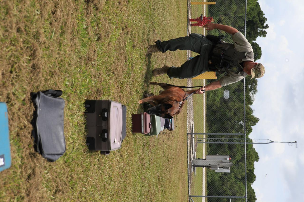
K-9 Handler Officer Scott O’Rourke watches as K-9 LJ works his way through a row of bags and containers to locate one with a suspicious substance during a training exercise on July 10, 2019, at Kennedy Space Center’s Protective Services Office in Florida. The center’s specially trained K-9s support the center 24/7, 365 days. Their main goal is to protect the Kennedy workforce and assets. Normal activities include sweeps of designated facilities, parking lots and random vehicle inspections at entrance gates. During rocket launches, they are out and about performing sweeps of facilities and launch site viewing areas. They cover Kennedy and the Merritt Island National Wildlife Refuge.
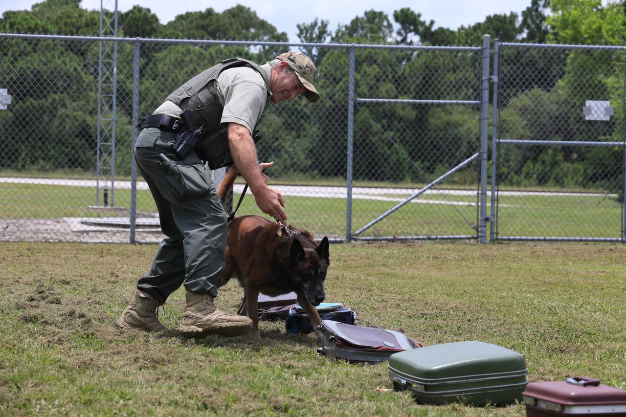
K-9 Handler Officer Scott O’Rourke watches as K-9 LJ works his way through a row of bags and containers to locate one with a suspicious substance during a training exercise on July 10, 2019, at Kennedy Space Center’s Protective Services Office in Florida. The center’s specially trained K-9s support the center 24/7, 365 days. Their main goal is to protect the Kennedy workforce and assets. Normal activities include sweeps of designated facilities, parking lots and random vehicle inspections at entrance gates. During rocket launches, they are out and about performing sweeps of facilities and launch site viewing areas. They cover Kennedy and the Merritt Island National Wildlife Refuge.
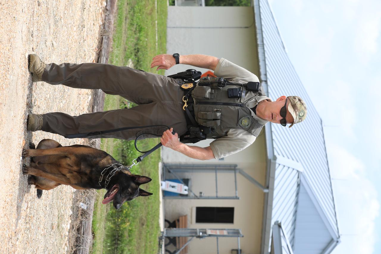
K-9 Spike is ready for the next training exercise with his Handler Officer John McGee at Kennedy Space Center’s Protective Services Office in Florida on July 10, 2019. The center’s specially trained K-9s support the center 24/7, 365 days. Their main goal is to protect the Kennedy workforce and assets. Normal activities include sweeps of designated facilities, parking lots and random vehicle inspections at entrance gates. During rocket launches, they are out and about performing sweeps of facilities and launch site viewing areas. They cover Kennedy and the Merritt Island National Wildlife Refuge.
K-9 Spike stands alert and ready for the next training exercise with his Handler Officer John McGee at Kennedy Space Center’s Protective Services Office in Florida on July 10, 2019. The center’s specially trained K-9s support the center 24/7, 365 days. Their main goal is to protect the Kennedy workforce and assets. Normal activities include sweeps of designated facilities, parking lots and random vehicle inspections at entrance gates. During rocket launches, they are out and about performing sweeps of facilities and launch site viewing areas. They cover Kennedy and the Merritt Island National Wildlife Refuge.
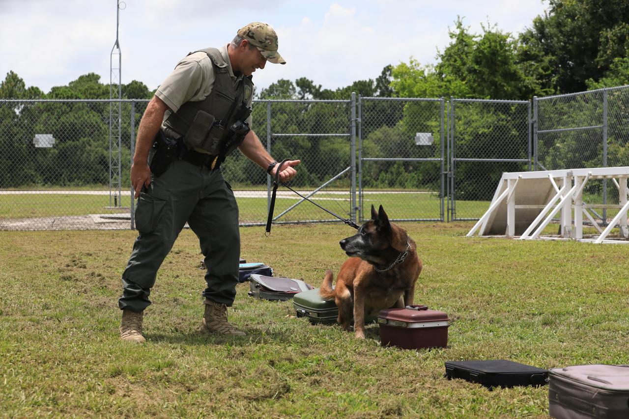
K-9 Handler Officer Scott O’Rourke watches as K-9 LJ stops at the container with a suspicious substance during a training exercise on July 10, 2019, at Kennedy Space Center’s Protective Services Office in Florida. The center’s specially trained K-9s support the center 24/7, 365 days. Their main goal is to protect the Kennedy workforce and assets. Normal activities include sweeps of designated facilities, parking lots and random vehicle inspections at entrance gates. During rocket launches, they are out and about performing sweeps of facilities and launch site viewing areas. They cover Kennedy and the Merritt Island National Wildlife Refuge.
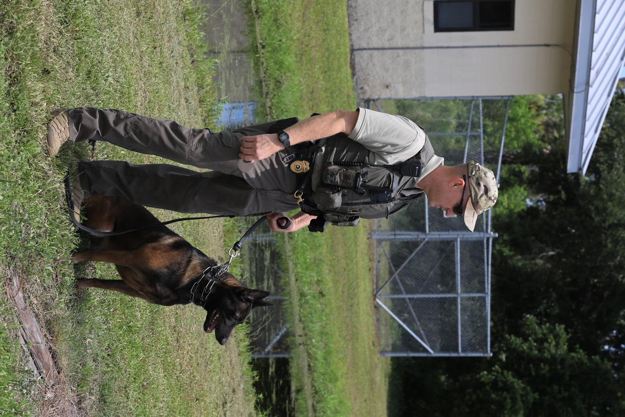
K-9 Spike is ready for the next training exercise with his Handler Officer John McGee at Kennedy Space Center’s Protective Services Office in Florida on July 10, 2019. The center’s specially trained K-9s support the center 24/7, 365 days. Their main goal is to protect the Kennedy workforce and assets. Normal activities include sweeps of designated facilities, parking lots and random vehicle inspections at entrance gates. During rocket launches, they are out and about performing sweeps of facilities and launch site viewing areas. They cover Kennedy and the Merritt Island National Wildlife Refuge.
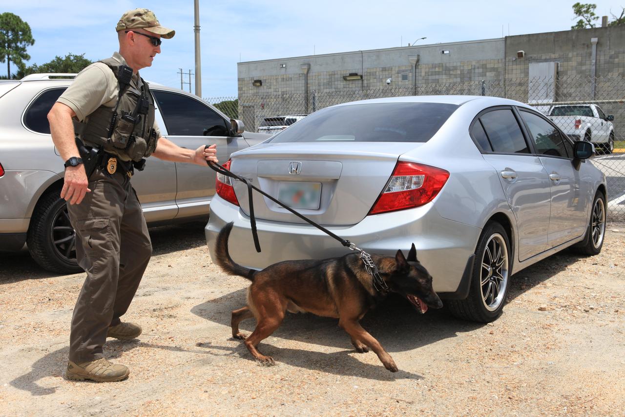
K-9 Handler Officer John McGee watches as K-9 Spike works his way through a row of cars during a training exercise on July 10, 2019, at Kennedy Space Center’s Protective Services Office in Florida. The center’s specially trained K-9s support the center 24/7, 365 days. Their main goal is to protect the Kennedy workforce and assets. Normal activities include sweeps of designated facilities, parking lots and random vehicle inspections at entrance gates. During rocket launches, they are out and about performing sweeps of facilities and launch site viewing areas. They cover Kennedy and the Merritt Island National Wildlife Refuge.
STS060-83-016 (3-11 Feb 1994) --- White Sands National Monument (Park) is easily recognized in the center of this near-vertical color photograph. White Sands is the world's largest gypsum dune field. It represents an alabaster sea that covers nearly 300 square miles. The National Park Service has the responsibility to preserve this unique feature, allowing the dune world to unfold in its natural environment, but without interference from humans. White Sands lies within a spectacular, oblong geological depression called the Tularosa Basin bounded by the Sacramento Mountains on the east and the San Andres Mountains on the west. Climatically the basin is a true desert, averaging less than 10 inches of rainfall per year. In terms of topographic relief the Sacramento Mountains attain elevations greater than 9,000 feet above sea level, while the San Andres Mountains on the west exceed altitudes of 8,000 feet. At the southwest corner of the White Sands is dry lake, Lucero. This lake is the lowest point in the Tularosa Basin at 3,900 feet. In terms of cultural features the city of Alamogordo (over 20,000 population) and Holloman Air Force Base can be seen with great clarity on this photograph. The area is accessible by highways U.S.70 & 82 from Las Cruces, New Mexico, and U.S.54 from El Paso, Texas.
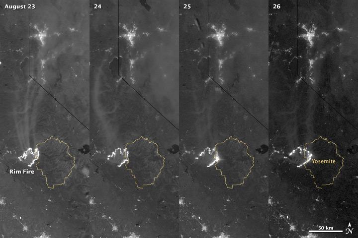
The winter of 2013 was among the driest on record for California, setting the stage for an active fire season. By August 26, the Rim Fire had made its way into the record books. At just 15 percent contained, the fire is now the 13th largest in California since records began in 1932. Apart from being large, the fire is also threatening one of the United States’ greatest natural treasures: Yosemite National Park. The Visible Infrared Imaging Radiometer Suite (VIIRS) on the Suomi NPP satellite tracked the growth of the fire between August 23 and August 26 in this series of nighttime images. The VIIRS day-night band is extremely sensitive to low light, making it possible to see the fire front from space. The brightest, most intense parts of the fire glow white, exceeding the brightness of the lights of Reno, Nevada to the north. Pale gray smoke streams north away from the fire throughout the sequence. The perimeter of the fire grows from day to day along different fronts, depending on winds and fire fighting efforts. On August 24, fire fighters focused their efforts on containing the western edge of the fire to prevent it from burning into Tuolumne City and the populated Highway 108 corridor. They also fought the eastern edge of the fire to protect Yosemite National Park. These efforts are evident in the image: Between August 23 and 24, the eastern edge of the fire held steady, and the western edge receded. The fire grew in the southeast. On the morning of August 25 fire managers reported that the fire was growing in the north and east. In the image, the most intense activity is just inside Yosemite National Park. Fire fighters reported that the Rim Fire continued to be extremely active on its eastern front on the morning of August 26, and this activity is visible in the image. By 8:00 a.m., the fire had burned 149,780 acres. The fire forced firefighters in Yosemite National Park to take measures to protect the Merced and Tuolumne Groves of Giant Sequoias, but the National Park Service reported that the trees were not in imminent danger. While parts of the park are closed, webcams show that most of the park has not been impacted. The Rim Fire started on the afternoon of August 17. It has destroyed 23 structures and threatened 4,500 other buildings. Its cause is under investigation. More details: <a href="http://1.usa.gov/18ilEAA" rel="nofollow">1.usa.gov/18ilEAA</a> NASA Earth Observatory image by Jesse Allen and Robert Simmon, using VIIRS Day Night Band data. Caption by Holli Riebeek. Instrument: Suomi NPP - VIIRS <b><a href="http://www.nasa.gov/audience/formedia/features/MP_Photo_Guidelines.html" rel="nofollow">NASA image use policy.</a></b> <b><a href="http://www.nasa.gov/centers/goddard/home/index.html" rel="nofollow">NASA Goddard Space Flight Center</a></b> enables NASA’s mission through four scientific endeavors: Earth Science, Heliophysics, Solar System Exploration, and Astrophysics. Goddard plays a leading role in NASA’s accomplishments by contributing compelling scientific knowledge to advance the Agency’s mission. <b>Follow us on <a href="http://twitter.com/NASA_GoddardPix" rel="nofollow">Twitter</a></b> <b>Like us on <a href="http://www.facebook.com/pages/Greenbelt-MD/NASA-Goddard/395013845897?ref=tsd" rel="nofollow">Facebook</a></b> <b>Find us on <a href="http://instagram.com/nasagoddard?vm=grid" rel="nofollow">Instagram</a></b>
The winter of 2013 was among the driest on record for California, setting the stage for an active fire season. By August 26, the Rim Fire had made its way into the record books. At just 15 percent contained, the fire is now the 13th largest in California since records began in 1932. Apart from being large, the fire is also threatening one of the United States’ greatest natural treasures: Yosemite National Park. The Visible Infrared Imaging Radiometer Suite (VIIRS) on the Suomi NPP satellite tracked the growth of the fire between August 23 and August 26 in a series of nighttime images. The VIIRS day-night band is extremely sensitive to low light, making it possible to see the fire front from space. The brightest, most intense parts of the fire glow white, exceeding the brightness of the lights of Reno, Nevada to the north. Pale gray smoke streams north away from the fire throughout the sequence. The perimeter of the fire grows from day to day along different fronts, depending on winds and fire fighting efforts. On August 24, fire fighters focused their efforts on containing the western edge of the fire to prevent it from burning into Tuolumne City and the populated Highway 108 corridor. They also fought the eastern edge of the fire to protect Yosemite National Park. These efforts are evident in the image: Between August 23 and 24, the eastern edge of the fire held steady, and the western edge receded. The fire grew in the southeast. On the morning of August 25 fire managers reported that the fire was growing in the north and east. In the image, the most intense activity is just inside Yosemite National Park. Fire fighters reported that the Rim Fire continued to be extremely active on its eastern front on the morning of August 26, and this activity is visible in the image. By 8:00 a.m., the fire had burned 149,780 acres. The fire forced firefighters in Yosemite National Park to take measures to protect the Merced and Tuolumne Groves of Giant Sequoias, but the National Park Service reported that the trees were not in imminent danger. While parts of the park are closed, webcams show that most of the park has not been impacted. The Rim Fire started on the afternoon of August 17. It has destroyed 23 structures and threatened 4,500 other buildings. Its cause is under investigation. More details: <a href="http://1.usa.gov/18ilEAA" rel="nofollow">1.usa.gov/18ilEAA</a> NASA Earth Observatory image by Jesse Allen and Robert Simmon, using VIIRS Day Night Band data. Caption by Holli Riebeek. Instrument: Suomi NPP - VIIRS <b><a href="http://www.nasa.gov/audience/formedia/features/MP_Photo_Guidelines.html" rel="nofollow">NASA image use policy.</a></b> <b><a href="http://www.nasa.gov/centers/goddard/home/index.html" rel="nofollow">NASA Goddard Space Flight Center</a></b> enables NASA’s mission through four scientific endeavors: Earth Science, Heliophysics, Solar System Exploration, and Astrophysics. Goddard plays a leading role in NASA’s accomplishments by contributing compelling scientific knowledge to advance the Agency’s mission. <b>Follow us on <a href="http://twitter.com/NASA_GoddardPix" rel="nofollow">Twitter</a></b> <b>Like us on <a href="http://www.facebook.com/pages/Greenbelt-MD/NASA-Goddard/395013845897?ref=tsd" rel="nofollow">Facebook</a></b> <b>Find us on <a href="http://instagram.com/nasagoddard?vm=grid" rel="nofollow">Instagram</a></b>
Center Director Roy Bridges stops at the Stewart Eye Institute table at the Disability Awareness and Action Working Group (DAAWG) 1999 Technology Fair being held Oct. 20-21 at Kennedy Space Center. Behind Bridges is Sterling Walker, director of Engineering Development at KSC and chairman of DAAWG. At the near right are George and Marian Hall, who are with the Institute. At the left is Nancie Strott, a multi-media specialist with Dynacs and chairperson of the Fair. The Fair is highlighting vendors demonstrating mobility, hearing, vision and silent disability assistive technology. The purpose is to create an awareness of the types of technology currently available to assist people with various disabilities in the workplace. The theme is that of this year's National Disability Employment Awareness Month, "Opening Doors to Ability." Some of the vendors participating are Canine Companions for Independence, Goodwill Industries, Accessible Structures, Division of Blind Services, Space Coast Center for Independent Living, KSC Fitness Center and Delaware North Parks Services
CAPE CANAVERAL, Fla. -- A new batch of endangered sea turtle eggs brought from beaches along the northern U.S. Gulf Coast arrive at NASA's Kennedy Space Center in Florida. Nests of Kemp’s ridley and Loggerhead turtle eggs from Gulf Shores, Ala., and various Florida Gulf Coast beaches are being transported by a specially equipped FedEx truck to a secure, climate-controlled facility at Kennedy. They will be monitored by biologists and hatchery workers until incubation is complete. The hatchlings will be released at different points along a 100-mile stretch of the Atlantic Ocean shoreline. That includes beaches adjacent to the Merritt Island National Wildlife Refuge, which is located inside Kennedy. The release and relocation work is part of an effort by the U.S. Fish and Wildlife Service, the Florida Fish and Wildlife Conservation Commission, the National Park Service, NOAA, FedEx and conservationists to help minimize the risk to this year’s sea turtle hatchlings from impacts of the BP Deepwater Horizon oil spill in the Gulf of Mexico. This plan involves carefully moving an anticipated 700 nests during the next several months. Photo credit: NASA_Ben Smegelsky
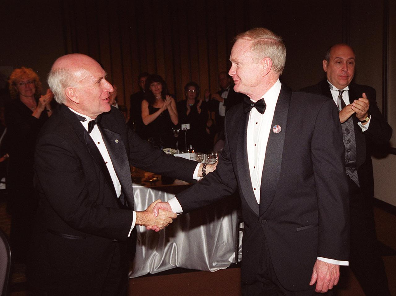
Center Director Roy Bridges (center) is congratulated by Spaceport Florida Authority Executive Director Ed Gormel (left) at the 12th annual Dr. Kurt H. Debus Award Dinner held at the KSC Visitor Complex’s Debus Conference Facility. At right is Rick Abramson, president of Delaware North Parks Services of Spaceport, Inc. Bridges was presented with the 2001 Dr. Kurt H. Debus Award honoring his progressive, visionary leadership and contributions to space technology and exploration. The Florida Committee of the National Space Club presented the award. The Debus Award was first given in 1980. Created to recognize significant achievements and contributions made in Florida to the American aerospace effort, the award is named for the KSC’s first Director, Dr. Kurt H. Debus

Kennedy Space Center Visitor Complex: Facilities on Merritt Island were sufficiently advanced by November 1964 to permit Sunday drive-through tours. The center set up a modest collection of model rockets and pictures in a warehouse for visitors to view. Based on a study by the U.S. National Park Service for a permanent facility, NASA selected the site on its own property and contracted with a commercial firm to operate the new center and bus tours. The Kennedy Space Center Visitor Complex has been expanded many times in the years since to better serve the increasing number of guests, provide new displays and tell the NASA story to the public. Poster designed by Kennedy Space Center Graphics Department/Greg Lee. Credit: NASA

Center Director Roy Bridges (center) is congratulated by Spaceport Florida Authority Executive Director Ed Gormel (left) at the 12th annual Dr. Kurt H. Debus Award Dinner held at the KSC Visitor Complex’s Debus Conference Facility. At right is Rick Abramson, president of Delaware North Parks Services of Spaceport, Inc. Bridges was presented with the 2001 Dr. Kurt H. Debus Award honoring his progressive, visionary leadership and contributions to space technology and exploration. The Florida Committee of the National Space Club presented the award. The Debus Award was first given in 1980. Created to recognize significant achievements and contributions made in Florida to the American aerospace effort, the award is named for the KSC’s first Director, Dr. Kurt H. Debus
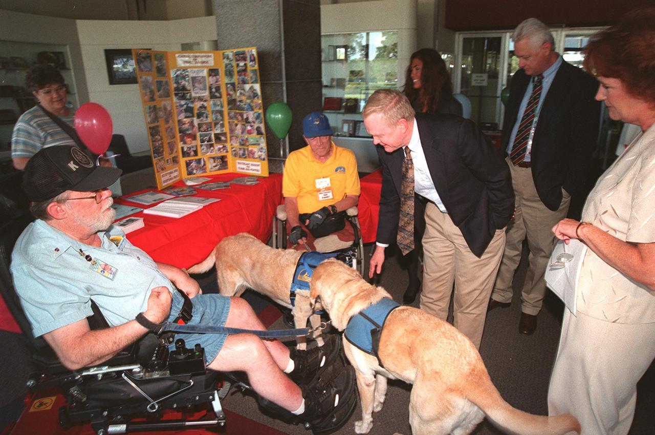
Center Director Roy Bridges stops to pet one of the dogs that serves with Canine Companions for Independence, a vendor displaying its capabilities at the Disability Awareness and Action Working Group (DAAWG) 1999 Technology Fair being held Oct. 20-21 at Kennedy Space Center. Standing at the right is Carol Cavanaugh, with KSC Public Services; behind Bridges is Nancie Strott (left), a multi-media specialist with Dynacs and chairperson of the Fair, and Sterling Walker (right), director of Engineering Development and chairman of DAAWG. The Fair is highlighting vendors demonstrating mobility, hearing, vision and silent disability assistive technology. The purpose is to create an awareness of the types of technology currently available to assist people with various disabilities in the workplace. The theme is that of this year's National Disability Employment Awareness Month, "Opening Doors to Ability." Some of the other vendors participating are Goodwill Industries, Accessible Structures, Division of Blind Services, Space Coast Center for Independent Living, KSC Fitness Center and Delaware North Parks Services
This is a Hygrochron sensor. Sensors were buried at different depths, to see how the temperature and moisture levels in the ground changed close to and farther from the surface. Special permission from the National Park Service is needed to dig at Racetrack Playa. Photo credit: NASA/GSFC/Maggie McAdam To read a feature story on the Racetrack Playa go to: <a href="http://www.nasa.gov/topics/earth/features/roving-rocks.html" rel="nofollow">www.nasa.gov/topics/earth/features/roving-rocks.html</a> <b><a href="http://www.nasa.gov/centers/goddard/home/index.html" rel="nofollow">NASA Goddard Space Flight Center</a></b> is home to the nation's largest organization of combined scientists, engineers and technologists that build spacecraft, instruments and new technology to study the Earth, the sun, our solar system, and the universe. <b>Follow us on <a href="http://twitter.com/NASA_GoddardPix" rel="nofollow">Twitter</a></b> <b>Join us on <a href="http://www.facebook.com/pages/Greenbelt-MD/NASA-Goddard/395013845897?ref=tsd" rel="nofollow">Facebook</a><b></b></b>
ISS013-E-54243 (19 July 2006) --- Crater Lake, Oregon is featured in this image photographed by an Expedition 13 crewmember on the International Space Station. Crater Lake is formed from the caldera (collapsed magma chamber) of a former volcano known as Mount Mazama. Part of the Cascades volcanic chain, Mount Mazama is situated between the Three Sisters volcanoes to the north and Mount Shasta to the south. While considered a dormant volcano, Crater Lake is part of the United States Geological Survey Cascades Volcano Observatory seismic monitoring network. The dark blue water coloration is typical of the 592 meter (1943 feet) deep Crater Lake; light blue-green areas to the southeast of Wizard Island (along the southern crater rim) most probably correspond to particulates either on or just below the water surface. A light dusting of snow fills the summit cone of Wizard Island. Some of the older lava flows in the area are associated with Mount Scott to the east-southeast of the Lake. Water is lost only by evaporation and seepage, and is only replenished by rainwater and snowmelt from the surrounding crater walls. These processes help maintain minimal sediment input into the lake and exceptional water clarity. The Crater Lake ecosystem is of particular interest to ecologists because of its isolation from the regional landscape, and its overall pristine quality is important to recreational users of Crater Lake National Park (447,240 visitors in 2005). The United States National Park Service maintains programs to monitor changes (both natural and human impacts) to Crater Lake.
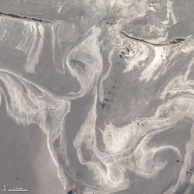
NASA image acquired June 26, 2010 As of June 27, 2010, the entire gulf-facing beachfront of several barrier islands in eastern Mississippi (offshore of Pascagoula) had received a designation of at least “lightly oiled” by the interagency Shoreline Cleanup Assessment Team that is responding to the disaster in the Gulf of Mexico. A few small stretches of Petit Bois Island had been labeled heavily or moderately oiled. (To view this image without a description go to: This high-resolution image shows Petit Bois Island (top right) and the eastern end of Horn Island (top left) on June 26. In general, oil-covered waters are silvery and cleaner waters are blue-gray. This pattern is especially consistent farther from the islands. The intensely bright patches of water directly offshore of the barrier islands, however, may be from a combination of factors, including sediment and organic material, coastal currents and surf, and oil. The islands provide a sense of scale for the ribbons of oil swirling into the area from the south. Petit Bois Island is about 10 kilometers (6 miles) long. It is one of seven barrier islands that, along with some mainland areas of Mississippi and Florida, make up the Gulf Islands National Seashore. According to the National Park Service Gulf Islands National Seashore Website, all the islands remained open to the public as of June 28, 2010, and clean-up crews were on hand to respond to any oil coming ashore. The large version of this image, which was captured by the Advanced Land Imager on NASA’s Earth Observing-1 (EO-1) satellite, shows a larger area, including the Mississippi Sound and parts of mainland Mississippi. Although oil has been observed in the Sound, it is unlikely that all the bright patches of water in that area are thickly oil-covered. Differences in brightness in coastal area waters may be due to other factors, including freshwater runoff, strong currents, and water depth and clarity. NASA Earth Observatory image created by Jesse Allen and Robert Simmon, using EO-1 ALI data provided courtesy of the NASA EO-1 team. Caption by Rebecca Lindsey. Instrument: EO-1 - ALI To see more images go to: <a href="http://earthobservatory.nasa.gov/" rel="nofollow">earthobservatory.nasa.gov/</a> <b><a href="http://www.nasa.gov/centers/goddard/home/index.html" rel="nofollow">NASA Goddard Space Flight Center</a></b> is home to the nation's largest organization of combined scientists, engineers and technologists that build spacecraft, instruments and new technology to study the Earth, the sun, our solar system, and the universe.
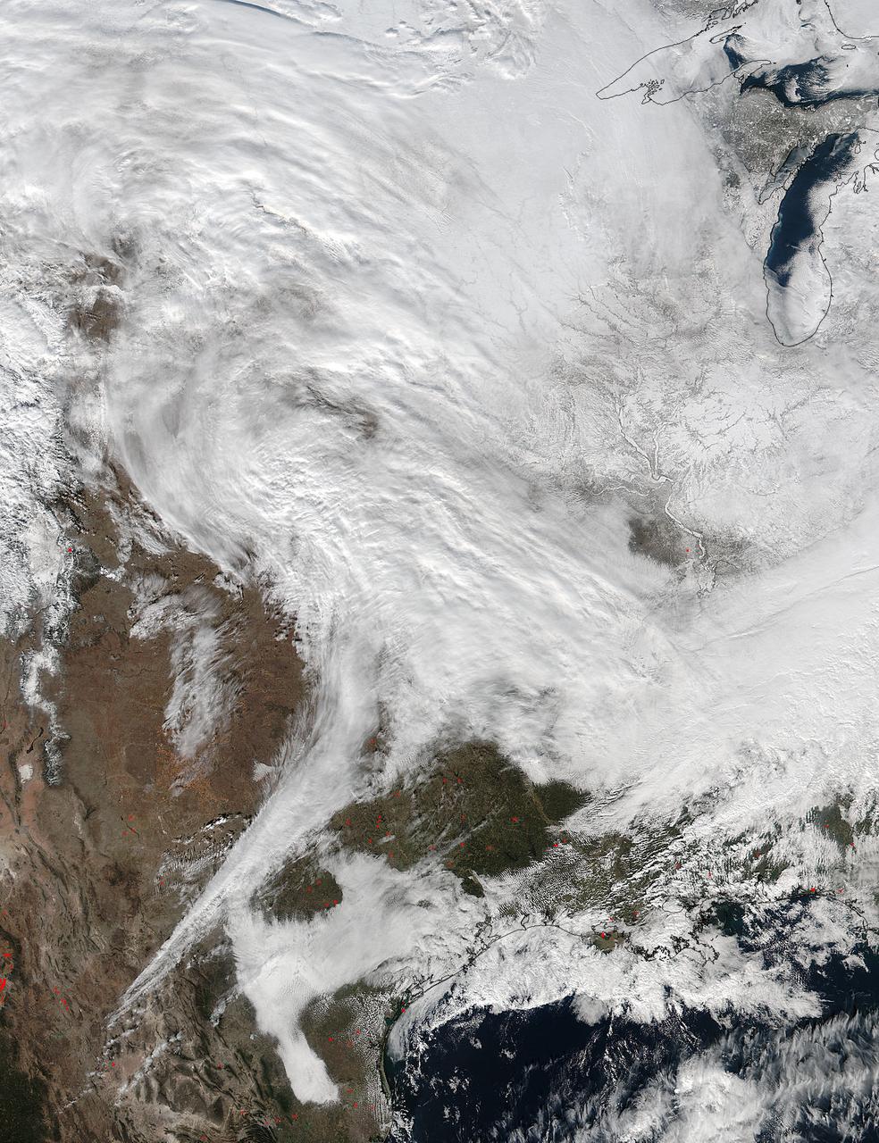
On Jan. 20 at 2:30 p.m. EST the VIIRS instrument aboard NASA-NOAA's Suomi NPP captured this image of the winter storm moving through the central U.S. Credits: NASA Goddard Rapid Response The low pressure area from the Eastern Pacific Ocean moved into the western U.S. and tracked across the four corners region into Texas where NASA-NOAA's Suomi NPP satellite observed the clouds associated with the storm. The Visible Infrared Imaging Radiometer Suite (VIIRS) instrument aboard Suomi NPP satellite captured the visible image on January 20, 2016 at 19:30 UTC (2:30 p.m. EST) when the storm was over the central U.S. In the image, snow cover is visible in the Rockies and southern Great Lakes states. VIIRS collects visible and infrared imagery and global observations of land, atmosphere, cryosphere and oceans. That low pressure system located over the south central United States on Jan. 21 is expected to track east across the Tennessee Valley and will give way to a deepening coastal low pressure area. The National Weather Service said "This latter feature takes over and becomes a dominant force in setting up heavy snow bands over the Mid-Atlantic and very gusty winds." The storm system is expected to bring an increased risk of severe weather from far southeastern Texas across southern Louisiana/Mississippi, and into the far western Florida Panhandle on Thursday, Jan. 21. That threat for severe weather will move east as the low pressure area continues heading in that direction. The National Weather Service Weather Prediction Center in College Park, Maryland said "A potentially crippling winter storm is anticipated for portions of the mid-Atlantic Friday into early Saturday. Snowfall may approach two feet for some locations, including the Baltimore and Washington, D.C. metro areas. Farther north, there is uncertainty in snowfall for the New York City-to-Boston corridor. Farther south, significant icing is likely for portions of Kentucky and North Carolina." <b><a href="http://www.nasa.gov/audience/formedia/features/MP_Photo_Guidelines.html" rel="nofollow">NASA image use policy.</a></b> <b><a href="http://www.nasa.gov/centers/goddard/home/index.html" rel="nofollow">NASA Goddard Space Flight Center</a></b> enables NASA’s mission through four scientific endeavors: Earth Science, Heliophysics, Solar System Exploration, and Astrophysics. Goddard plays a leading role in NASA’s accomplishments by contributing compelling scientific knowledge to advance the Agency’s mission. <b>Follow us on <a href="http://twitter.com/NASAGoddardPix" rel="nofollow">Twitter</a></b> <b>Like us on <a href="http://www.facebook.com/pages/Greenbelt-MD/NASA-Goddard/395013845897?ref=tsd" rel="nofollow">Facebook</a></b> <b>Find us on <a href="http://instagram.com/nasagoddard?vm=grid" rel="nofollow">Instagram</a></b>

A major winter storm is poised to wallop the Mid-Atlantic and bring large amounts of snow to cities including Baltimore, Md., Washington, D.C. area on March 2 and 3, according to NOAA's National Weather Service. NOAA's GOES-East satellite captured this image of the clouds associated with the winter storm as it continued moving east toward those cities. On March 2, the National Weather Prediction Center in College Park, Md. noted that there is a slight risk for severe thunderstorms over parts of the western Gulf Coast and the Lower Mississippi Valley as a result of the southern portion of the system. The update at 7 a.m. EST noted that freezing rain/sleet is possible over parts of the lower Mississippi Valley and parts of the central Appalachians, while eastern Texas and the lower Mississippi Valley into the Ohio Valley are expected to experience heavy rain. The NWS Short Range Forecast Discussion stated "A strong storm over the Southern Plains/Lower Mississippi Valley will advance northeastward along a quasi-stationary front to off the Southern Mid-Atlantic Coast by Monday evening. Moisture from the Gulf of Mexico will overrun and pool along the associated front producing an area of snow extending from the Central Plains into the Northeast." The clouds are associated with a cold from that stretches from eastern Maine through Maryland and west into the Tennessee Valley. The low pressure center associated with the front was located over Arkansas. At NASA/NOAA's GOES Project at NASA's Goddard Space Flight Center in Greenbelt, Md. the cloud data from NOAA's GOES-East satellite were overlaid on a true-color image of land and ocean created by data from the Moderate Resolution Imaging Spectroradiometer or MODIS instrument that flies aboard NASA's Aqua and Terra satellites. Together, those data created the entire picture of the position of this major winter storm. GOES satellites provide the kind of continuous monitoring necessary for intensive data analysis. Geostationary describes an orbit in which a satellite is always in the same position with respect to the rotating Earth. This allows GOES to hover continuously over one position on Earth's surface, appearing stationary. As a result, GOES provide a constant vigil for the atmospheric "triggers" for severe weather conditions such as tornadoes, flash floods, hail storms and hurricanes. For updated information about the storm system, visit NOAA's NWS website: <a href="http://www.weather.gov" rel="nofollow">www.weather.gov</a> For more information about GOES satellites, visit: <a href="http://www.goes.noaa.gov/" rel="nofollow">www.goes.noaa.gov/</a> or <a href="http://goes.gsfc.nasa.gov/" rel="nofollow">goes.gsfc.nasa.gov/</a> Rob Gutro NASA Goddard Space Flight Center, Greenbelt, Md. <b><a href="http://www.nasa.gov/audience/formedia/features/MP_Photo_Guidelines.html" rel="nofollow">NASA image use policy.</a></b> <b><a href="http://www.nasa.gov/centers/goddard/home/index.html" rel="nofollow">NASA Goddard Space Flight Center</a></b> enables NASA’s mission through four scientific endeavors: Earth Science, Heliophysics, Solar System Exploration, and Astrophysics. Goddard plays a leading role in NASA’s accomplishments by contributing compelling scientific knowledge to advance the Agency’s mission. <b>Follow us on <a href="http://twitter.com/NASAGoddardPix" rel="nofollow">Twitter</a></b> <b>Like us on <a href="http://www.facebook.com/pages/Greenbelt-MD/NASA-Goddard/395013845897?ref=tsd" rel="nofollow">Facebook</a></b> <b>Find us on <a href="http://instagram.com/nasagoddard?vm=grid" rel="nofollow">Instagram</a></b>
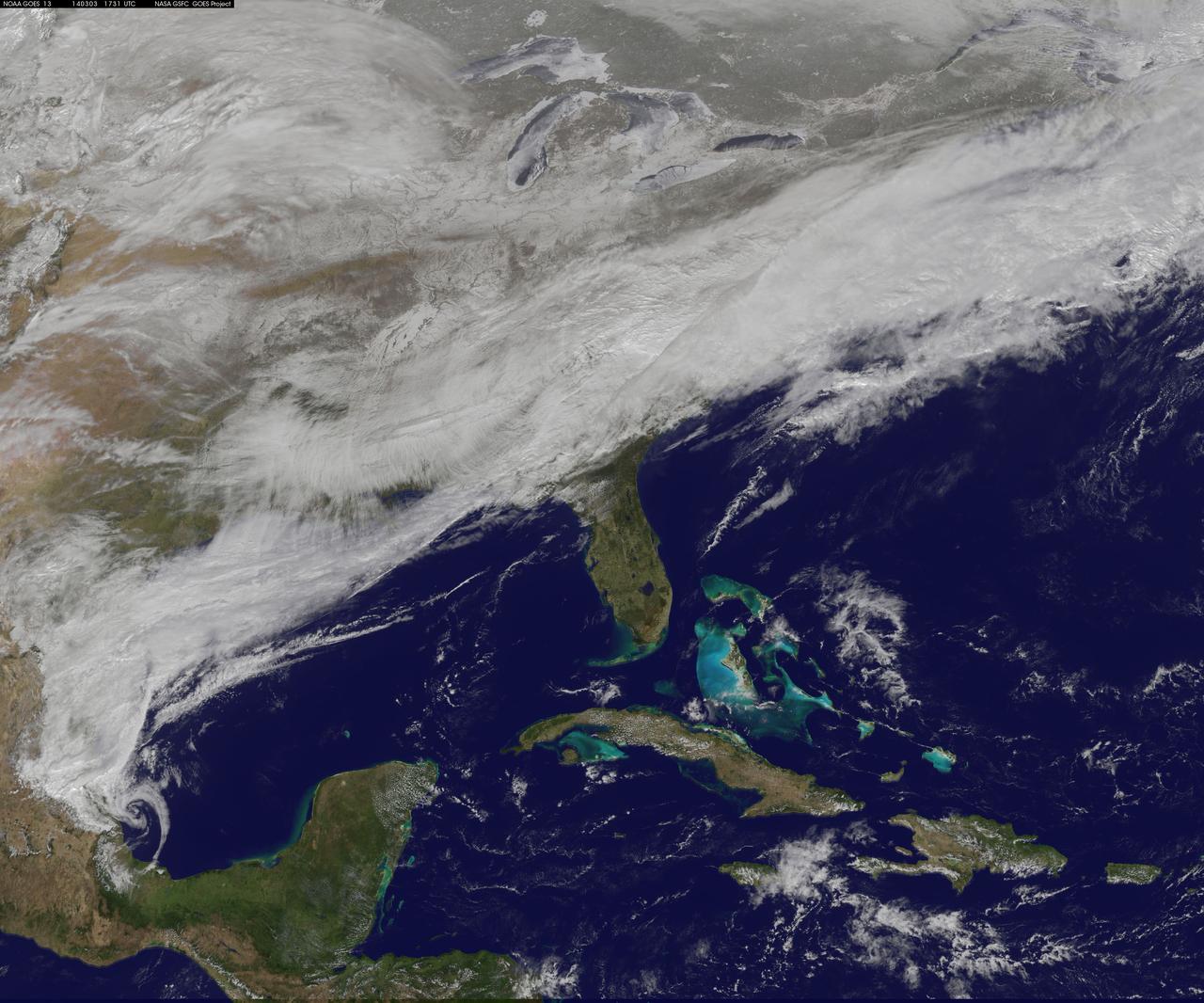
On March 3, a major winter storm brought snow to the mid-Atlantic, freezing rain to the Carolinas and rain and some freezing rain to the Gulf Coast states. NOAA's GOES-East satellite captured an image of the clouds associated with the winter storm on March 3 at 12:45 p.m. EST (1745 UTC)/ as it continued on its march over the mid-Atlantic. Bands of snow and sometimes heavy snow affected the Washington, D.C., region, Delaware and central Virginia, stretching west into West Virginia and eastern Kentucky. Snow also stretched back into the Ohio and Tennessee valleys while rain and freezing rain affected the Carolinas, and while the Gulf Coast states received rain. National Weather Service Winter Storm Warnings remained in effect until 6 p.m. EST on March 3 for Washington, D.C., and Baltimore, Md. In Richmond and Norfolk, Va., the Winter Storm warnings were in effect for six additional hours ending at midnight. On March 3, NOAA's National Weather Prediction Center in College Park, Md., noted the late-season winter storm will continue to shift eastward through the Tennessee Valley and the mid-Atlantic today, making for hazardous travel conditions. NOAA noted that unseasonably cold temperatures more typical of January will prevail east of the Rocky Mountains for the next few days keeping winter around for a while longer. The clouds are associated with a cold front that stretched from eastern Maine through Maryland and west into the Tennessee Valley. At NASA/NOAA's GOES Project at NASA's Goddard Space Flight Center in Greenbelt, Md., the cloud data from NOAA's GOES-East satellite were overlaid on a true-color image of land and ocean created by data from the Moderate Resolution Imaging Spectroradiometer, or MODIS, instrument that flies aboard NASA's Aqua and Terra satellites. Together, those data created the entire picture of the position of this major winter storm. GOES satellites provide the kind of continuous monitoring necessary for intensive data analysis. Geostationary describes an orbit in which a satellite is always in the same position with respect to the rotating Earth. This allows GOES to hover continuously over one position on Earth's surface, appearing stationary. As a result, GOES provide a constant vigil for the atmospheric "triggers" for severe weather conditions such as tornadoes, flash floods, hail storms and hurricanes. For updated information about the storm system, visit NOAA's NWS website: <a href="http://www.weather.gov" rel="nofollow">www.weather.gov</a> For more information about GOES satellites, visit: <a href="http://www.goes.noaa.gov/" rel="nofollow">www.goes.noaa.gov/</a> or goes.gsfc.nasa.gov/ Rob Gutro NASA's Goddard Space Flight Center, Greenbelt, Md. <b><a href="http://www.nasa.gov/audience/formedia/features/MP_Photo_Guidelines.html" rel="nofollow">NASA image use policy.</a></b> <b><a href="http://www.nasa.gov/centers/goddard/home/index.html" rel="nofollow">NASA Goddard Space Flight Center</a></b> enables NASA’s mission through four scientific endeavors: Earth Science, Heliophysics, Solar System Exploration, and Astrophysics. Goddard plays a leading role in NASA’s accomplishments by contributing compelling scientific knowledge to advance the Agency’s mission. <b>Follow us on <a href="http://twitter.com/NASAGoddardPix" rel="nofollow">Twitter</a></b> <b>Like us on <a href="http://www.facebook.com/pages/Greenbelt-MD/NASA-Goddard/395013845897?ref=tsd" rel="nofollow">Facebook</a></b> <b>Find us on <a href="http://instagram.com/nasagoddard?vm=grid" rel="nofollow">Instagram</a></b>
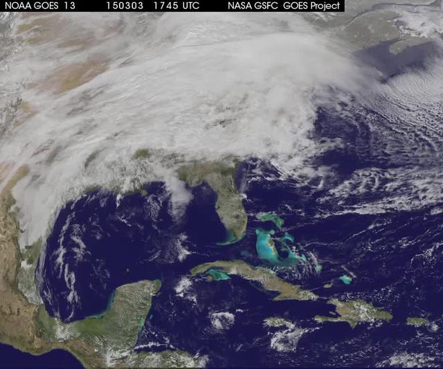
A winter storm was bringing snow, sleet and freezing rain from lower Mississippi Valley to Northeastern U.S. on Thursday, March 5, 2015. A new NASA animation of NOAA's GOES-East satellite imagery showed the progression of the clouds associated with the storm system that triggered winter storm warnings and winter weather advisories from the southern Plains eastward through the Mid-Atlantic and southern New England coast. The system also triggered flood warnings along and to the west of the central Appalachians. An animation of GOES satellite visible and infrared imagery from March 3 through March 5 showed clouds associated with a cold front push over U.S. East coast. Behind the front, Arctic air is expected to drop low temperatures into the single numbers from Washington, D.C. to Minnesota overnight. Temperatures in the Carolinas and Tennessee are expected to drop to the low 20s. NOAA's National Weather Service Weather Prediction Center (NWS NPC) in College Park, Maryland noted "a strong cold front moving across the eastern U.S. will bring heavy snow from parts of the Ohio Valley to the Northeast today (March 5) with rain, freezing rain and sleet possible from parts of the lower Mississippi Valley across the Southeast to the southern Mid-Atlantic. Snowfall totals of 5 to 10 inches are possible for some areas. Winter Storm Warnings remain in effect from Texas to Nantucket." The animation ends at 17:45 UTC (12:45 p.m. EST). Before the end of the animation, the low pressure center along an arctic frontal boundary was nearly stationary over western North Carolina at 9 a.m. EST on March 5, according to the NWS NPC. NWS radar and surface observations indicated an extended swath of precipitation from near the Texas Gulf Coast through the interior eastern U.S. into southern New England. NPC's storm summary noted at that time "rain was changing to sleet/freezing rain and to all snow along a band within this swath as colder air continues to filter in from the north. Some areas in Tennessee, the northern mid-Atlantic and southern New England were reporting moderate to heavy snow." To create the video and imagery, NASA/NOAA's GOES Project takes the cloud data from NOAA's GOES-East satellite and overlays it on a true-color image of land and ocean created by data from the Moderate Resolution Imaging Spectroradiometer, or MODIS, instrument that flies aboard NASA's Aqua and Terra satellites. Together, those data created the entire picture of the storm and show its movement. After the storm system passes, the snow on the ground becomes visible. GOES satellites provide the kind of continuous monitoring necessary for intensive data analysis. Geostationary describes an orbit in which a satellite is always in the same position with respect to the rotating Earth. This allows GOES to hover continuously over one position on Earth's surface, appearing stationary. For updated information about the storm system, visit NOAA's NWS website: <a href="http://www.weather.gov" rel="nofollow">www.weather.gov</a> For more information about GOES satellites, visit: <a href="http://www.goes.noaa.gov/" rel="nofollow">www.goes.noaa.gov/</a> or goes.gsfc.nasa.gov/ Rob Gutro NASA's Goddard Space Flight Center <b><a href="http://www.nasa.gov/audience/formedia/features/MP_Photo_Guidelines.html" rel="nofollow">NASA image use policy.</a></b> <b><a href="http://www.nasa.gov/centers/goddard/home/index.html" rel="nofollow">NASA Goddard Space Flight Center</a></b> enables NASA’s mission through four scientific endeavors: Earth Science, Heliophysics, Solar System Exploration, and Astrophysics. Goddard plays a leading role in NASA’s accomplishments by contributing compelling scientific knowledge to advance the Agency’s mission. <b>Follow us on <a href="http://twitter.com/NASAGoddardPix" rel="nofollow">Twitter</a></b> <b>Like us on <a href="http://www.facebook.com/pages/Greenbelt-MD/NASA-Goddard/395013845897?ref=tsd" rel="nofollow">Facebook</a></b> <b>Find us on <a href="http://instagrid.me/nasagoddard/?vm=grid" rel="nofollow">Instagram</a></b>