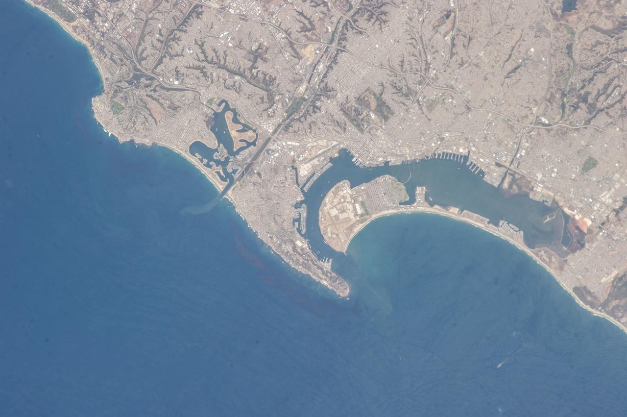
STS073-E-5082 (30 Oct. 1995) --- The United States Naval Air Station at San Diego is near left center in this Electronic Still Camera (ESC) view. Also seen are the nearby United States Naval Reservation and the Coronado Amphibious Base. The United States - Mexico border is just out of view at bottom right edge of the frame.
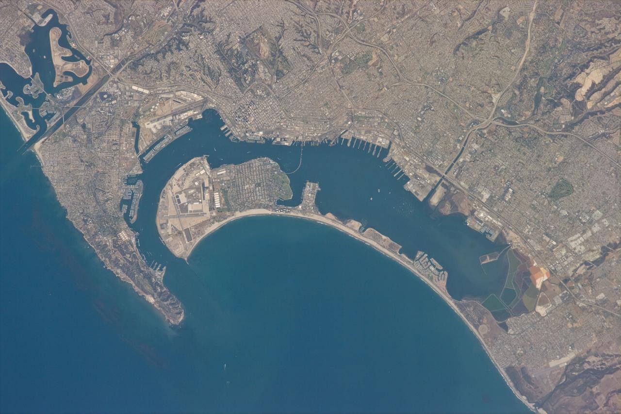
ISS035-E-027264 (22 April 2013) --- One of the Expedition 35 crew members aboard the Earth-orbiting International Space Station took this vertical image covering most of San Diego County, the most southwestern county in the 48 contiguous United States. Its county seat and largest city is San Diego. According to the 2010 U.S. Census, San Diego County had a population of 3,095,313 people, making it the second most populous county in California, with the first being Los Angeles County. The United States Naval Air Station at San Diego is visible, as are the nearby United States Naval Reservation and the Coronado Amphibious Base. The United States - Mexico border is just out of view at the right edge of the frame.
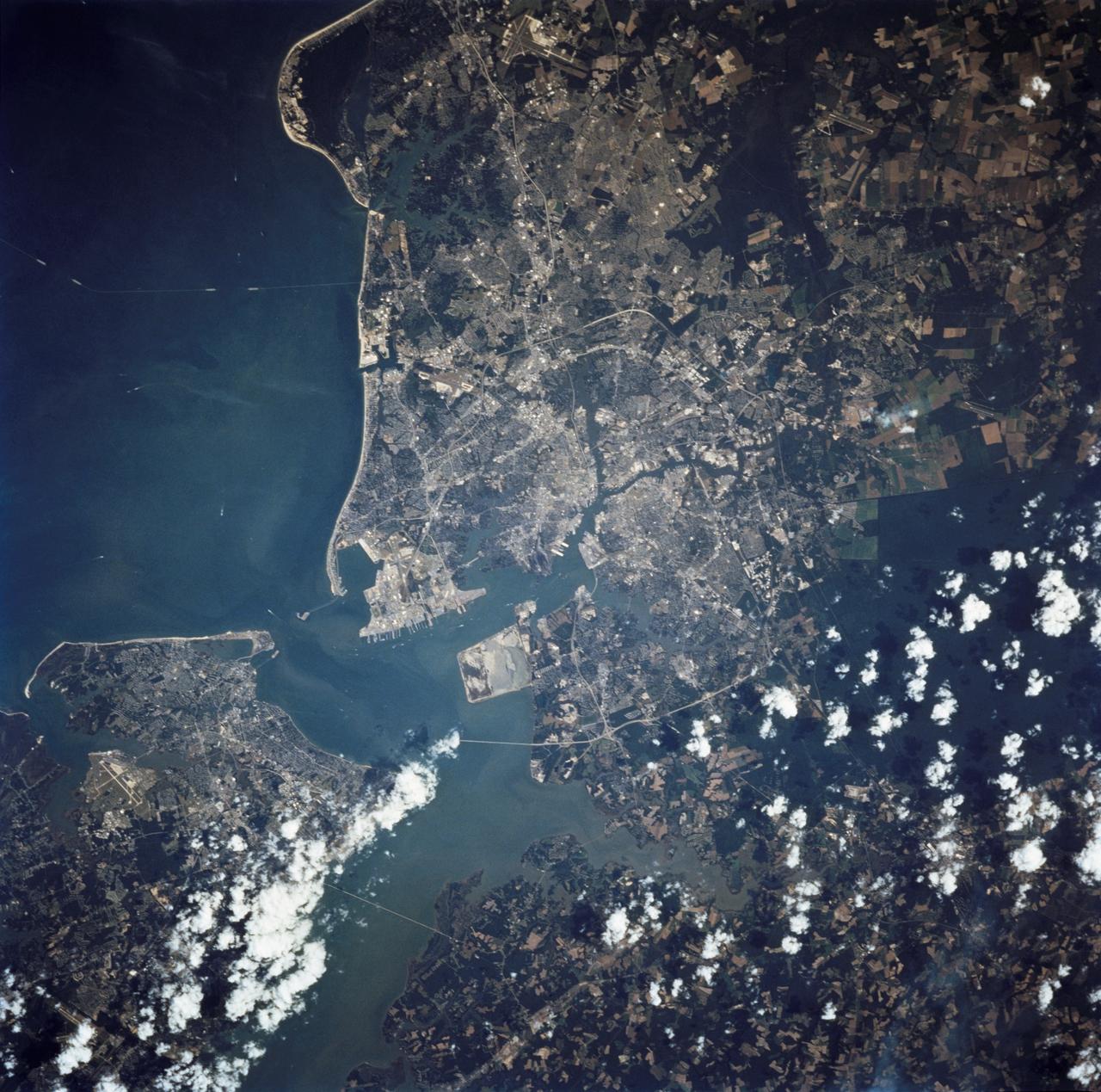
STS068-237-055 (30 September - 11 October 1994) --- This coastal area, considered home by astronaut Peter J. K. (Jeff) Wisoff, was photographed from the Space Shuttle Endeavour during the Space Radar Laboratory (SRL-2) mission. Wisoff, a native of Norfolk, talked about this area during a post-flight crew awards and presentation event at the Johnson Space Center (JSC). He pointed out that the waterways are heavily used for commercial, recreational and military purposes. Piers near the mouth of the Elizabeth River are associated with the U. S. Naval Base and those down river support the activities of the city of Norfolk. Seashore State Park and the Ft. Story Military Reservation are visible at the mouth of the Chesapeake.
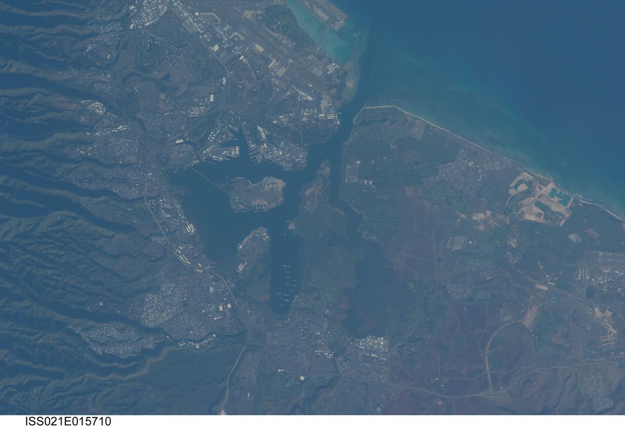
ISS021-E-015710 (27 Oct. 2009) --- Pearl Harbor, Hawaii is featured in this image photographed by an Expedition 21 crew member on the International Space Station. This detailed view illustrates the southern coastline of the Hawaiian island of Oahu including Pearl Harbor. On Dec. 7, 1941 ? 68 years ago ? a surprise attack by the Japanese Navy on Pearl Harbor and other targets on the island of Oahu precipitated the entry of the United States into World War II. Today, Pearl Harbor is still in use as a major United States Navy installation, and with Honolulu is one of the most heavily developed parts of the Island. Comparison between this image and a detailed astronaut photograph of Pearl Harbor taken in 2003 suggests that little observable land use or land cover change has occurred in the area over the past six years. The most significant change is the addition of more naval vessels to the Reserve Fleet anchorage in Middle Loch (center). The urban areas of Waipahu, Pearl City, and Aliamanu border the Harbor to the northwest, north, and east. The built-up areas, recognized by linear streets and white rooftops, contrast sharply with the reddish volcanic soils and green vegetated hillslopes of the surrounding areas.
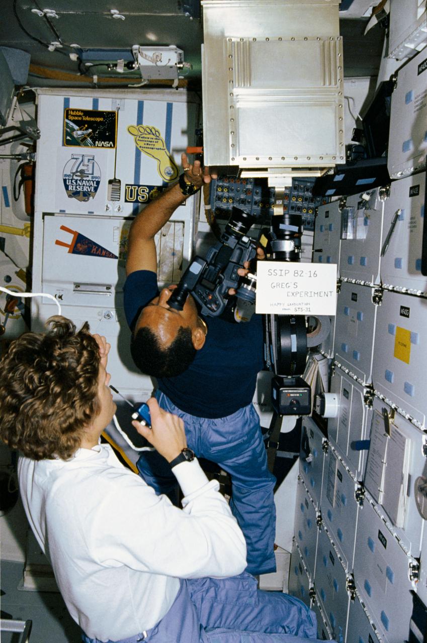
STS-31 Mission Specialist (MS) Kathryn D. Sullivan monitors and advises ground controllers of the activity inside the Student Experiment (SE) 82-16, Ion arc - studies of the effects of microgravity and a magnetic field on an electric arc, mounted in front of the middeck lockers aboard Discovery, Orbiter Vehicle (OV) 103. Pilot Charles F. Bolden uses a video camera and an ARRIFLEX motion picture camera to record the activity inside the special chamber. A sign in front of the experiment reads "SSIP 82-16 Greg's Experiment Happy Graduation from STS-31." SSIP stands for Shuttle Student Involvement Program. Gregory S. Peterson who developed the experiment (Greg's Experiment) is a student at Utah State University and monitored the experiment's operation from JSC's Mission Control Center (MCC) during the flight. Decals displayed in the background on the orbiter galley represent the Hubble Space Telescope (HST), the United States (U.S.) Naval Reserve, Navy Oceanographers, U.S. Navy, and University of Kansas.

From December 10, 1966, until his retirement on February 27, 1976, Stanley P. Butchart served as Chief (later, Director) of Flight Operations at NASA's Flight Research Center (renamed on March 26, 1976, the Hugh L. Dryden Flight Research Center). Initially, his responsibilities in this position included the Research Pilots Branch, a Maintenance and Manufacturing Branch, and an Operations Engineering Branch, the last of which not only included propulsion and electrical/electronic sections but project engineers for the X-15 and lifting bodies. During his tenure, however, the responsibilities of his directorate came to include not only Flight Test Engineering Support but Flight Systems and Loads laboratories. Before becoming Chief of Flight Operations, Butchart had served since June of 1966 as head of the Research Pilots Branch (Chief Pilot) and then as acting chief of Flight Operations. He had joined the Center (then known as the National Advisory Committee for Aeronautics' High-Speed Flight Research Station) as a research pilot on May 10, 1951. During his career as a research pilot, he flew a great variety of research and air-launch aircraft including the D-558-I, D-558-II, B-29 (plus its Navy version, the P2B), X-4, X-5, KC-135, CV-880, CV-990, B-47, B-52, B-747, F-100A, F-101, F-102, F-104, PA-30 Twin Comanche, JetStar, F-111, R4D, B-720, and B-47. Although previously a single-engine pilot, he became the Center's principal multi-engine pilot during a period of air-launches in which the pilot of the air-launch aircraft (B-29 or P2B) basically directed the operations. It was he who called for the chase planes before each drop, directed the positioning of fire rescue vehicles, and released the experimental aircraft after ensuring that all was ready for the drop. As pilot of the B-29 and P2B, Butchart launched the X-1A once, the X-1B 13 times, the X-1E 22 times, and the D-558-II 102 times. In addition, he towed the M2-F1 lightweight lifting body 14 times behind an R4
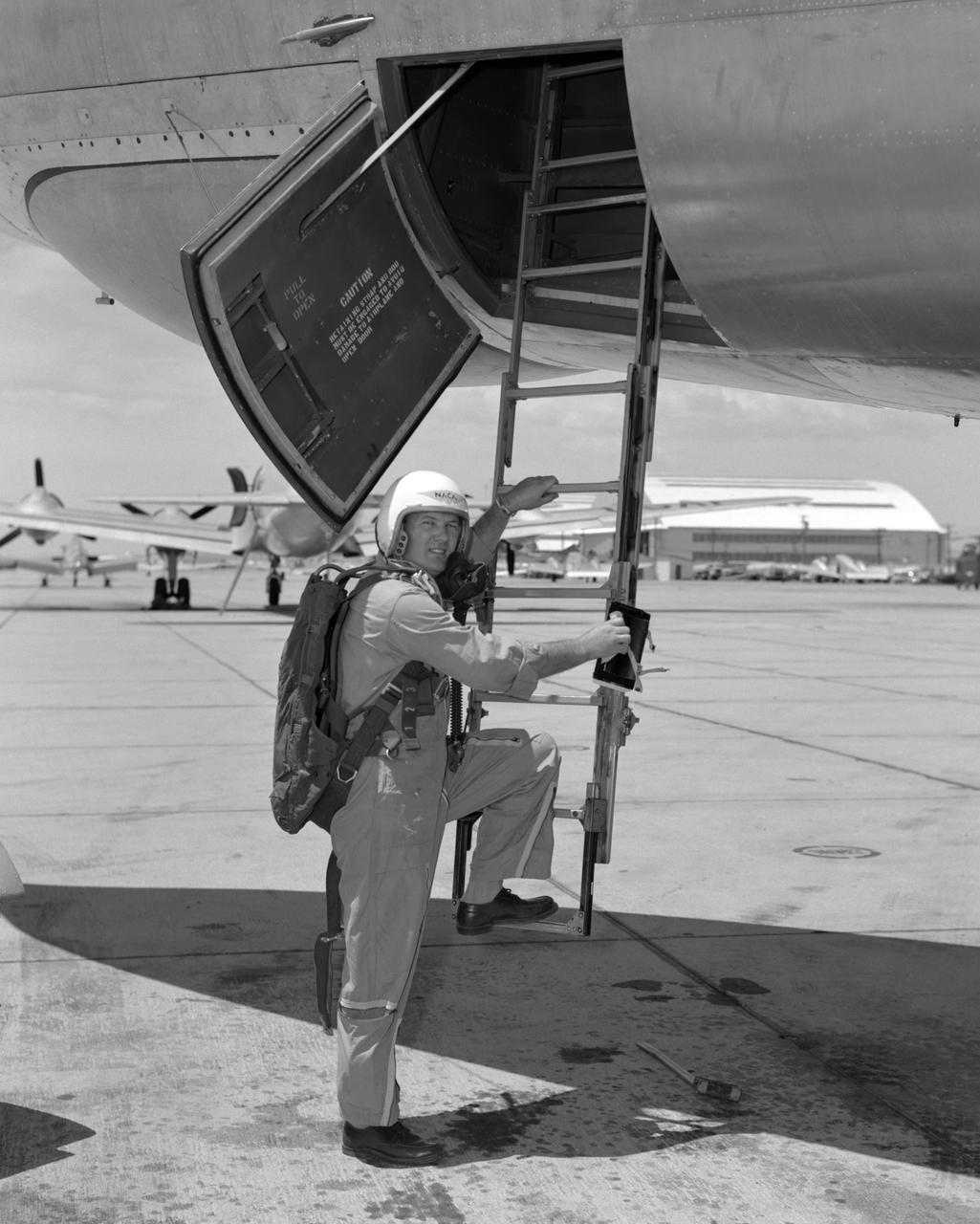
Stan Butchart climbing into B-47.