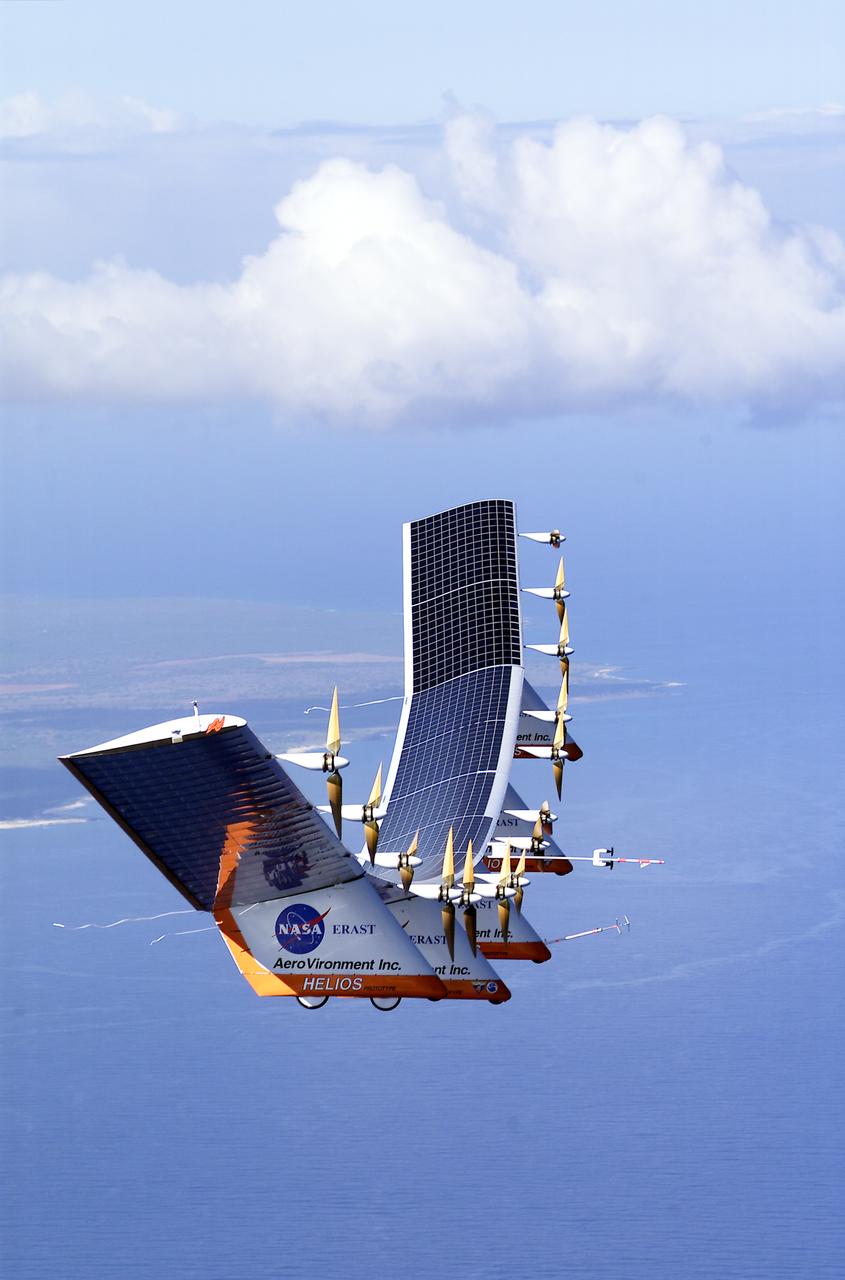
The solar-electric Helios Prototype flying wing is shown near the Hawaiian island of Niihau during its first test flight on solar power from the U.S. Navy's Pacific Missile Range Facility on Kauai, Hawaii, July 14, 2001. The 18-hour flight was a functional checkout of the aircraft's systems and performance in preparation for an attempt to reach sustained flight at 100,000 feet altitude later this summer.
The solar-electric Helios Prototype flying wing is shown near the Hawaiian island of Niihau during its first test flight on solar power from the U.S. Navy's Pacific Missile Range Facility on Kauai, Hawaii, July 14, 2001. The 18-hour flight was a functional checkout of the aircraft's systems and performance in preparation for an attempt to reach sustained flight at 100,000 feet altitude later this summer.
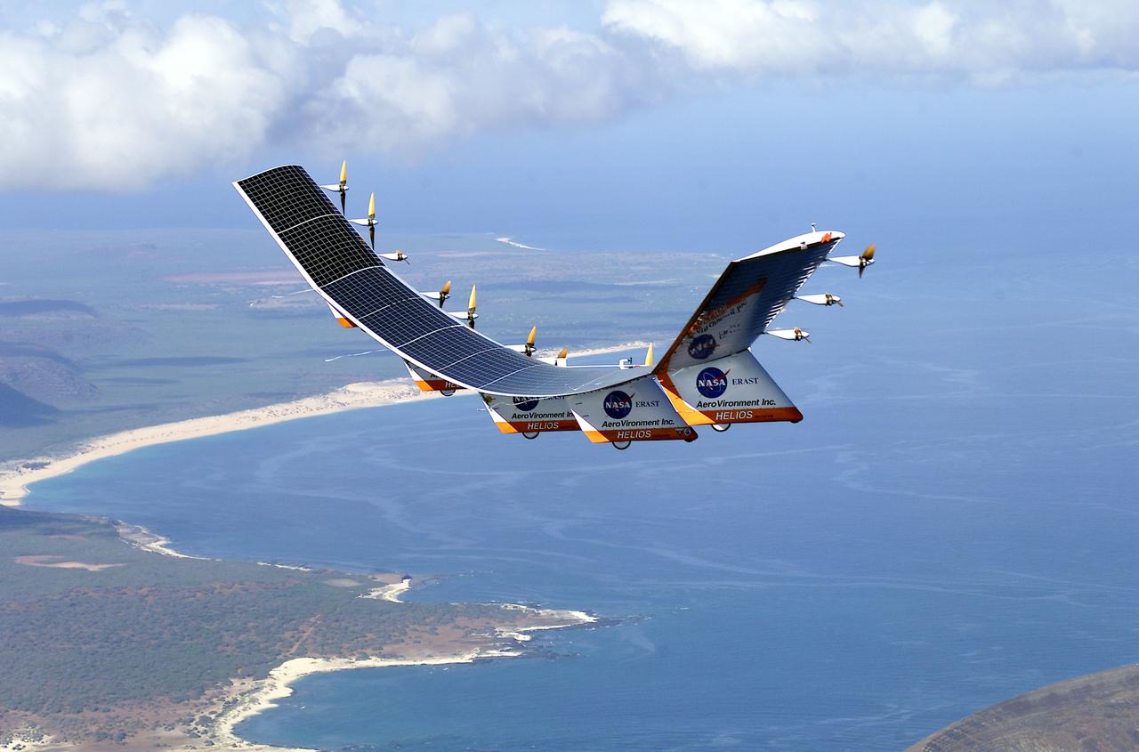
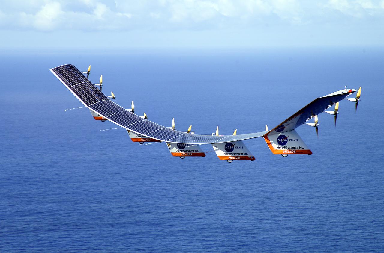
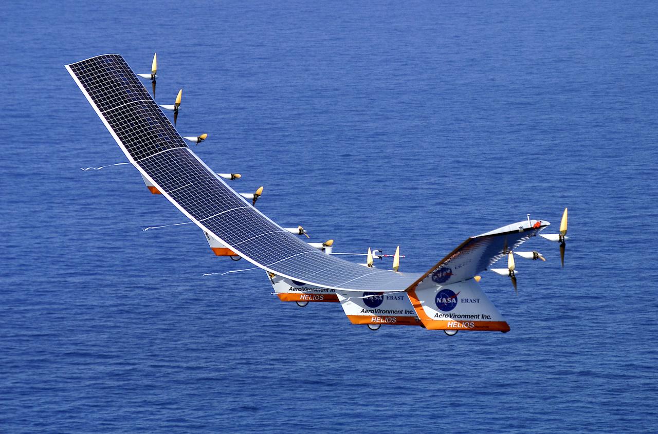
The solar-electric Helios Prototype flying wing is shown near the Hawaiian islands of Niihau and Lehua during its first test flight on solar power from the U.S. Navy's Pacific Missile Range Facility on Kauai, Hawaii, July 14, 2001. The 18-hour flight was a functional checkout of the aircraft's systems and performance in preparation for an attempt to reach sustained flight at 100,000 feet altitude later this summer.
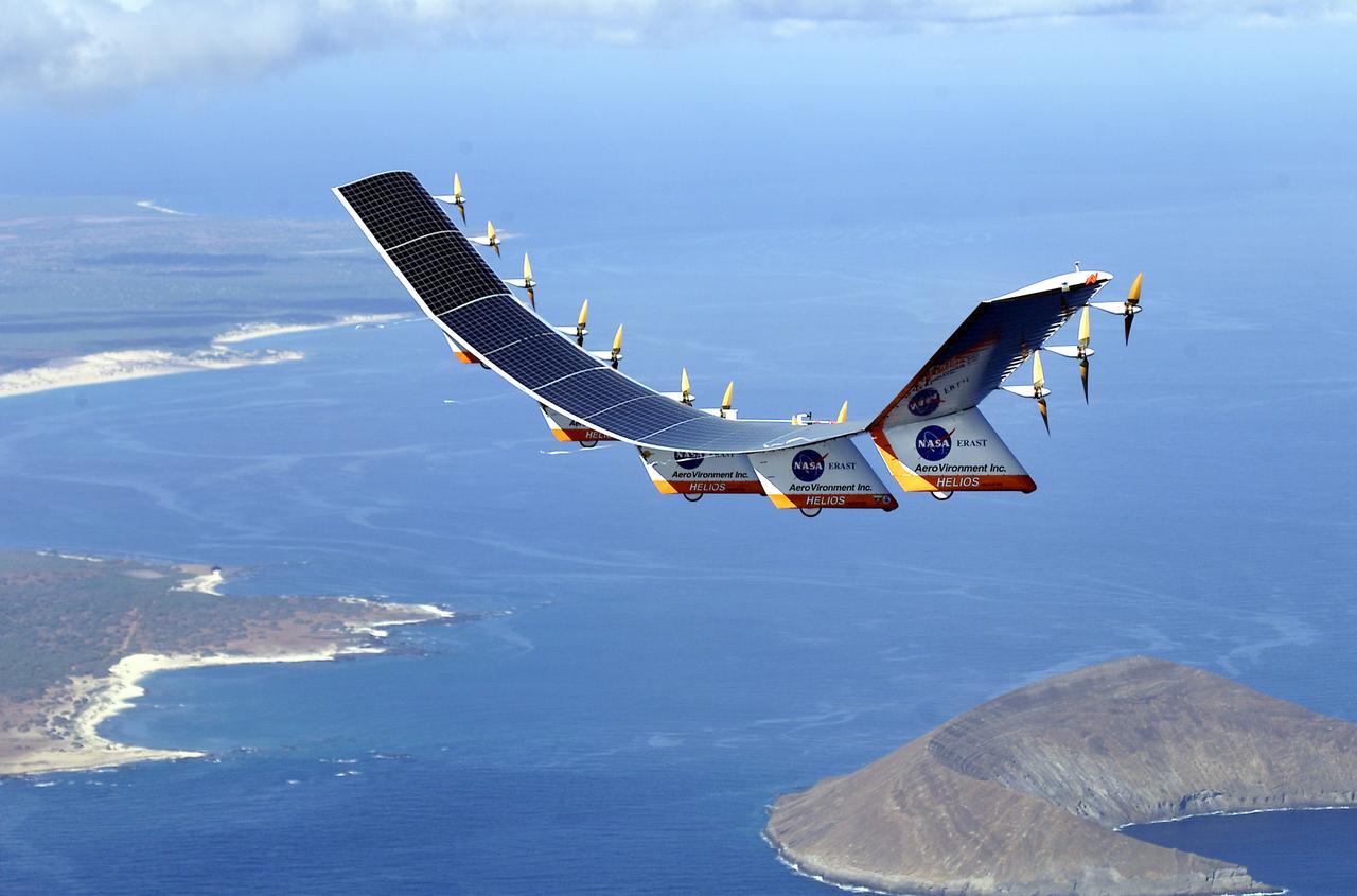
The solar-electric Helios Prototype flying wing is shown near the Hawaiian islands of Niihau and Lehua during its first test flight on solar power from the U.S. Navy's Pacific Missile Range Facility on Kauai, Hawaii, July 14, 2001. The 18-hour flight was a functional checkout of the aircraft's systems and performance in preparation for an attempt to reach sustained flight at 100,000 feet altitude later this summer.
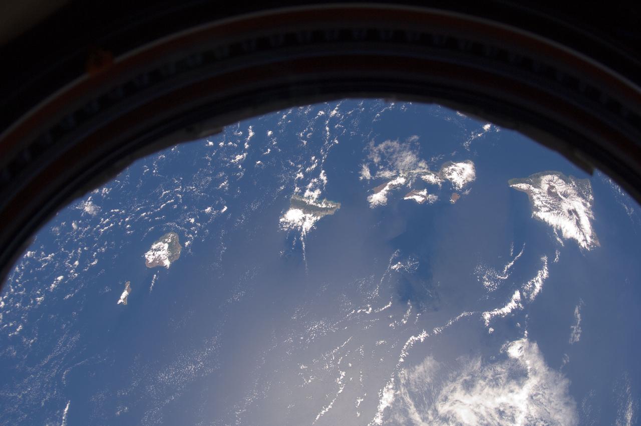
ISS032-E-008931 (20 July 2012) --- This picture of the Hawaiian Island chain was photographed by one the Expedition 32 crew members aboard the International Space Station, flying approximately 240 miles above Earth on July 20. The islands are, from the left to right, Niihau, Kauai, Oahu, the cluster of Molokai, Lanai and Kahoolawe, Maui and the Big Island.
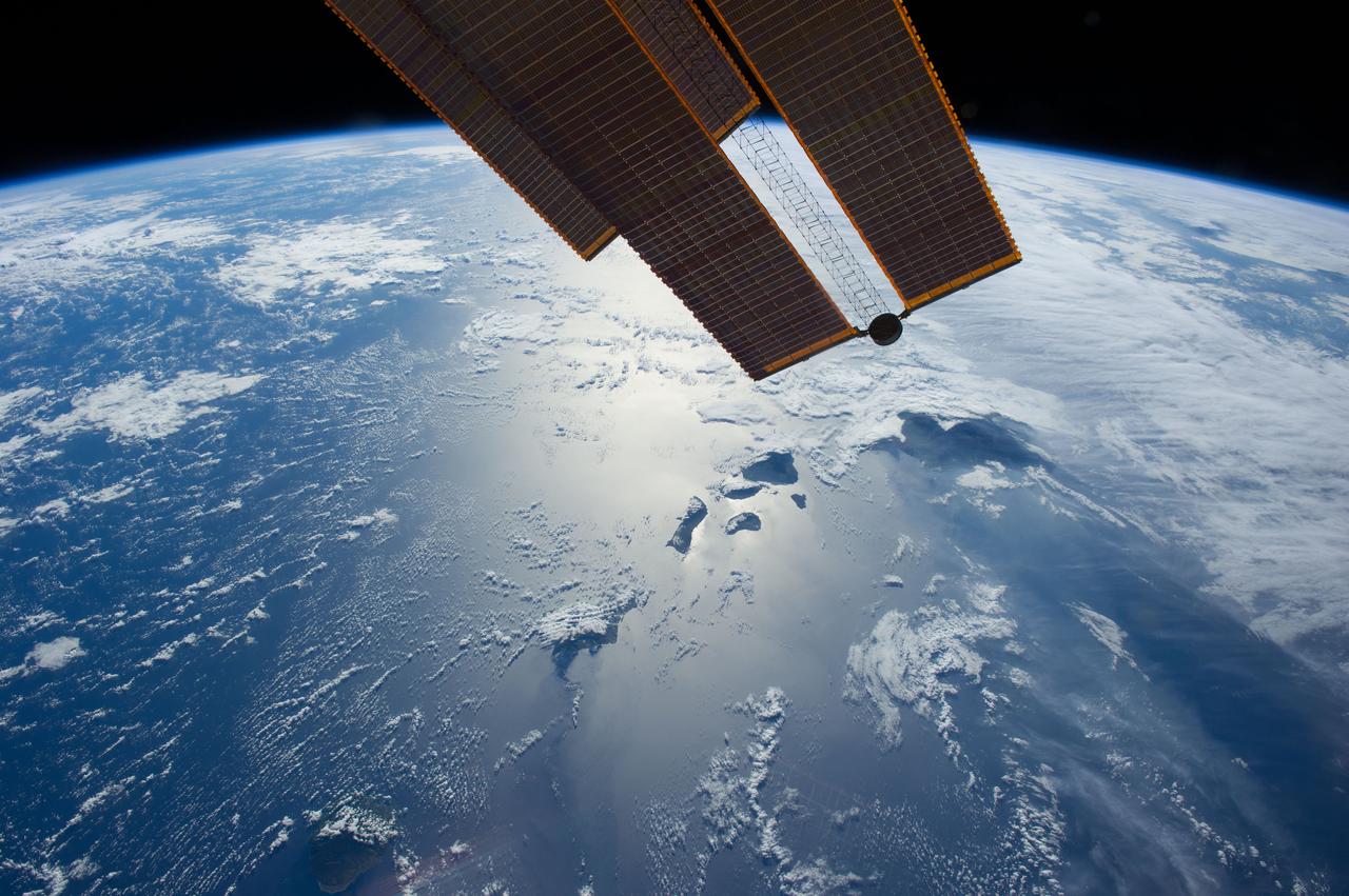
ISS040-E-083662 (28 July 2014) --- Flying 225 nautical miles above the Hawaiian Ridge in the North Pacific Ocean, one of the Expedition 40 crew members on the International Space Station photographed this oblique panorama showing many of the islands in the Hawaiian chain, some of them highlighted by sun glint. Hawaii or the "Big Island" is largely covered by clouds at right center. Maui, Kahoolawe, Lanai and Molokai are more easily spotted because of the sun glint near frame center. Oahu is almost totally hidden by clouds at bottom center, and Niihau and Kauai are out of the frame. Part of one of the orbital outpost's solar panels is obvious at top center.
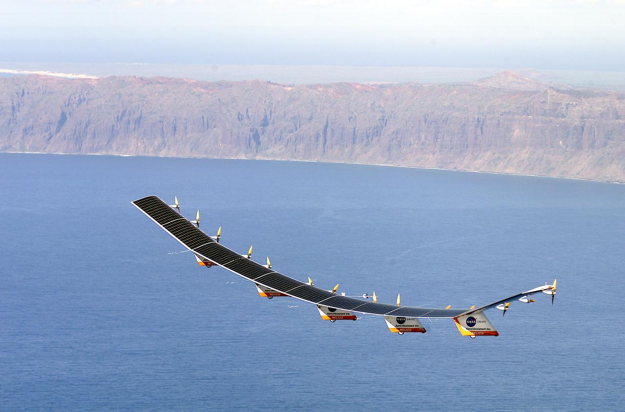
The solar-electric Helios Prototype flying wing is shown over the Pacific Ocean during its first test flight on solar power from the U.S. Navy's Pacific Missile Range Facility on Kauai, Hawaii, July 14, 2001. The 18-hour flight was a functional checkout of the aircraft's systems and performance in preparation for an attempt to reach sustained flight at 100,000 feet altitude later this summer.
The solar-electric Helios Prototype flying wing is shown over the Pacific Ocean during its first test flight on solar power from the U.S. Navy's Pacific Missile Range Facility on Kauai, Hawaii, July 14, 2001. The 18-hour flight was a functional checkout of the aircraft's systems and performance in preparation for an attempt to reach sustained flight at 100,000 feet altitude later this summer.
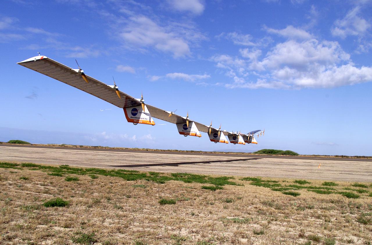
The solar-electric Helios Prototype flying wing is shown moments after takeoff, beginning its first test flight on solar power from the U.S. Navy's Pacific Missile Range Facility on Kauai, Hawaii, July 14, 2001. The 18-hour flight was a functional checkout of the aircraft's systems and performance in preparation for an attempt to reach sustained flight at 100,000 feet altitude later this summer.