
Nili Fossae
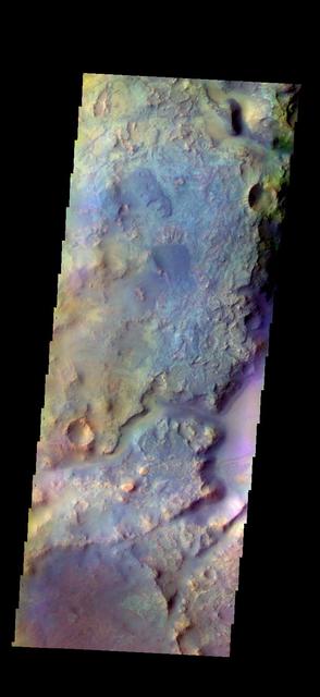
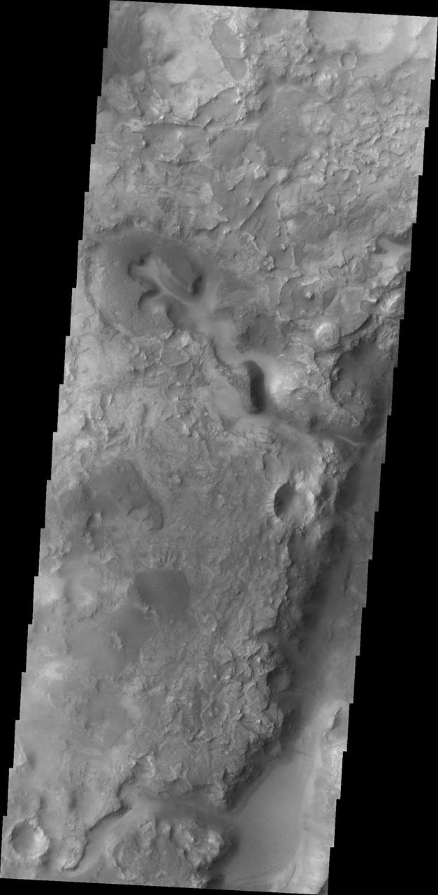
The THEMIS VIS camera contains 5 filters. The data from different filters can be combined in multiple ways to create a false color image. These false color images may reveal subtle variations of the surface not easily identified in a single band image. Today's false color image shows part Nili Fossae. Orbit Number: 45861 Latitude: 21.8183 Longitude: 77.0538 Instrument: VIS Captured: 2012-04-16 10:30 http://photojournal.jpl.nasa.gov/catalog/PIA21172

The THEMIS camera contains 5 filters. The data from different filters can be combined in multiple ways to create a false color image. These flase color images may reveal subtle variations of the surface not easily identified in a single band image. Today's false color image shows part of Nili Fossae. Orbit Number: 43177 Latitude: 22.1864 Longitude: 77.2742 Instrument: VIS Captured: 2011-09-08 12:28 http://photojournal.jpl.nasa.gov/catalog/PIA20982

Olivine & Phyllosilicates in Nili Fossae

Nili Fossae Crater

Clay at Nili Fossae
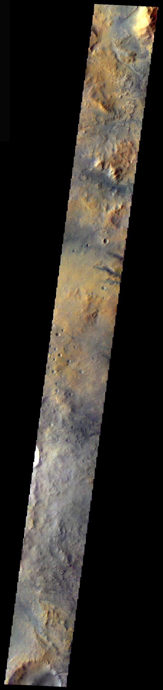
Nili Fossae in Color
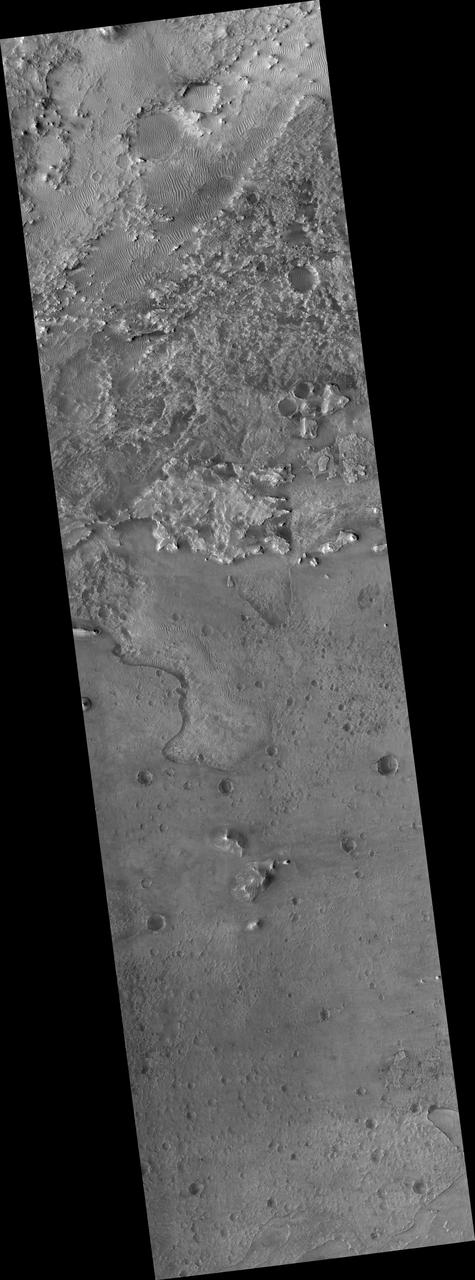
Proposed MSL Site in Nili Fossae Crater

Mineral Spectra from Nili Fossae, Mars

Phyllosilicate and Olivine around a Fracture in Nili Fossae

Olivine-Rich Bedrock Around Nili Fossae

Nili Fossae in Natural Color and Across the Spectrum
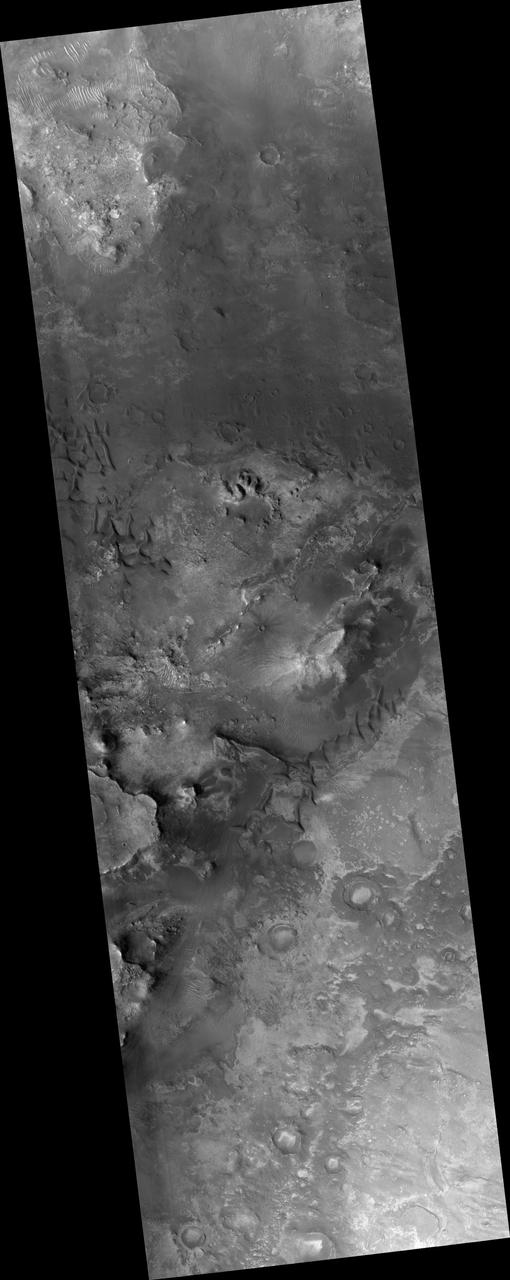
Proposed MSL Site in Nili Fossae Trough
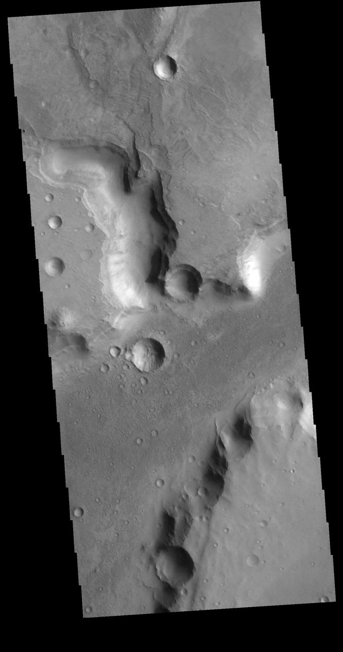
The channels in this VIS image are part of Nili Fossae. Nili Fossae is a collection of curved faults and down-dropped blocks of crust between the faults (called graben). The graben lie northeast of the large volcano Syrtis Major and northwest of the ancient impact basin Isidis Planitia. The graben make concentric curves that follow the outline of Isidis Planitia; the faults likely formed as the crust sagged under the weight of lava flows filling the Isidis basin. Orbit Number: 79485 Latitude: 25.7316 Longitude: 78.4041 Instrument: VIS Captured: 2019-11-15 02:51 https://photojournal.jpl.nasa.gov/catalog/PIA23662
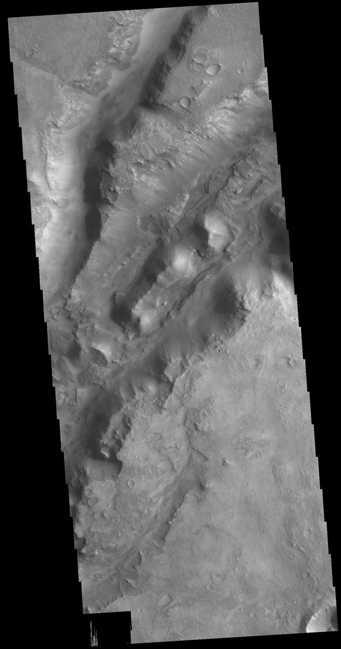
The linear depressions in today's VIS image are part of Nili Fossae. Nili Fossae is a collection of curved faults and down-dropped blocks of crust between the faults called graben. The graben lie northeast of the large volcano Syrtis Major and northwest of the ancient impact basin Isidis Planitia. Orbit Number: 79510 Latitude: 22.3452 Longitude: 77.6366 Instrument: VIS Captured: 2019-11-17 04:15 https://photojournal.jpl.nasa.gov/catalog/PIA23664
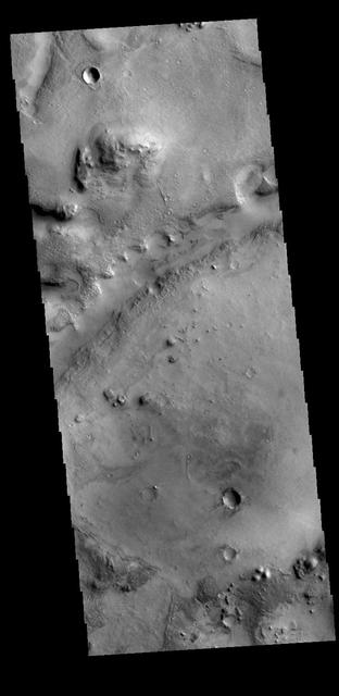
Today's VIS image shows one of the linear depressions that form Nili Fossae. Nili Fossae is a collection of curved faults and down-dropped blocks of crust between the faults called graben. The graben lie northeast of the large volcano Syrtis Major and northwest of the ancient impact basin Isidis Planitia. Orbit Number: 78911 Latitude: 22.6314 Longitude: 78.9859 Instrument: VIS Captured: 2019-09-28 20:29 https://photojournal.jpl.nasa.gov/catalog/PIA23524

What appears to be a channel in this image captured by NASA 2001 Mars Odyssey spacecraft is actually one of the fractures that make up Nili Fossae.
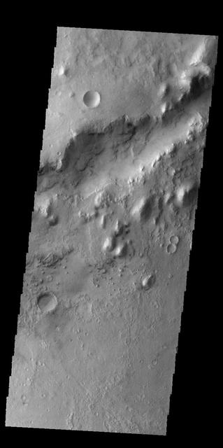
The linear depression in today's VIS image is part of Nili Fossae. Orbit Number: 60318 Latitude: 24.7944 Longitude: 80.7404 Instrument: VIS Captured: 2015-07-20 08:53 http://photojournal.jpl.nasa.gov/catalog/PIA19763
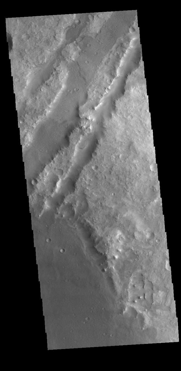
Today's VIS image shows some of the linear depressions that comprise Nili Fossae. Nili Fossae is the name of a collection of curved faults and down-dropped blocks of crust between the faults. The "fossae," or graben, lie northeast of the large volcano Syrtis Major and northwest of the ancient impact basin Isidis Planitia. The troughs, which can be almost 500 meters (1,600 feet) deep , make concentric curves that follow the outline of Isidis Planitia. The graben likely formed as the crust sagged under the weight of lava flows filling the Isidis Planitia impact basin. Orbit Number: 88158 Latitude: 20.507 Longitude: 72.6076 Instrument: VIS Captured: 2021-10-29 05:43 https://photojournal.jpl.nasa.gov/catalog/PIA25129
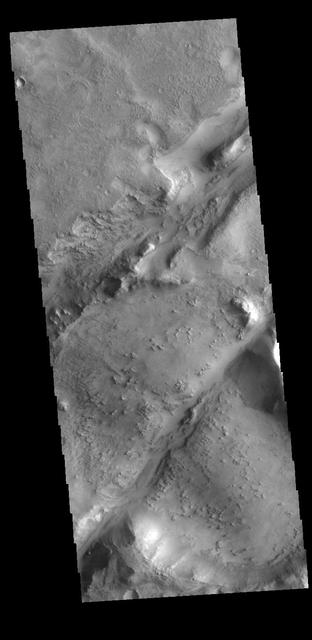
The two linear depressions in this VIS image are part of the Nili Fossae fracture system. Nili Fossae is the name of a collection of curved faults and down-dropped blocks of crust between the faults (called graben). The grabens lie northeast of the large volcano Syrtis Major and northwest of the ancient impact basin Isidis. The grabens make concentric curves that follow the outline of Isidis Planitia. The faults likely formed as the crust sagged under the weight of lava flows filling Isidis. Orbit Number: 77813 Latitude: 22.0638 Longitude: 78.198 Instrument: VIS Captured: 2019-06-30 10:29 https://photojournal.jpl.nasa.gov/catalog/PIA23390
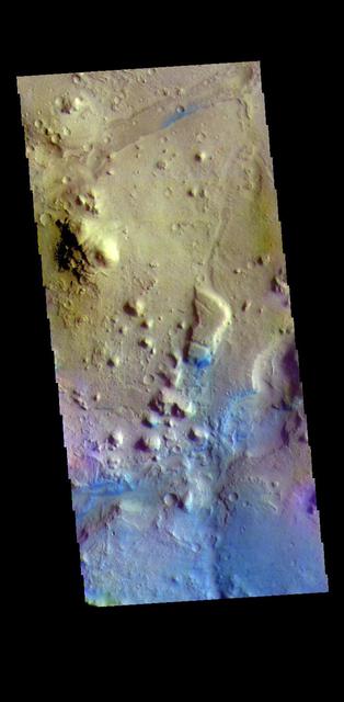
The THEMIS VIS camera contains 5 filters. The data from different filters can be combined in multiple ways to create a false color image. These false color images may reveal subtle variations of the surface not easily identified in a single band image. Today's false color image shows a small section of Nili Fossae. The linear depression at the top of the image is one of the Nili Fossae graben. Dark blue in this filter combination indicates basaltic sand. Orbit Number: 69580 Latitude: 25.2782 Longitude: 80.2868 Instrument: VIS Captured: 2017-08-21 06:55 https://photojournal.jpl.nasa.gov/catalog/PIA24452
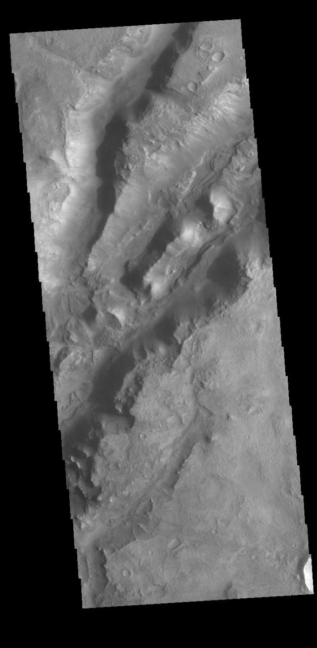
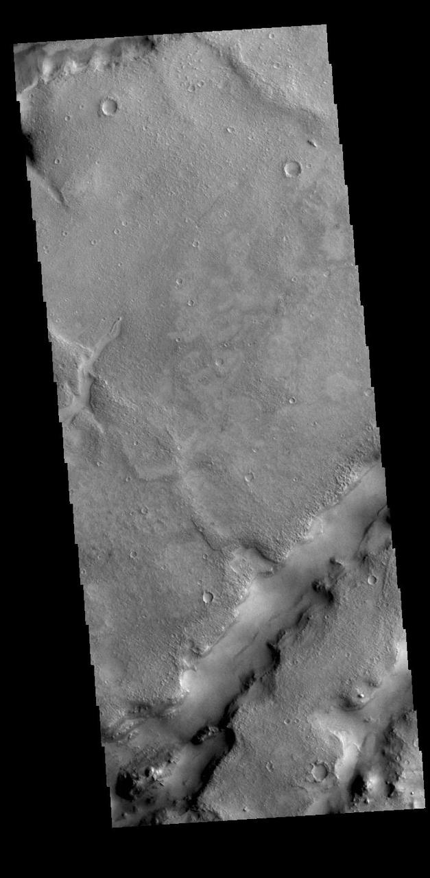
The linear depressions in today's VIS image are part of Nili Fossae. Nili Fossae is a collection of curved faults and down-dropped blocks of crust between the faults called graben. The graben lie northeast of the large volcano Syrtis Major and northwest of the ancient impact basin Isidis Planitia. Graben are formed by extension of the crust and faulting. When large amounts of pressure or tension are applied to rocks on timescales that are fast enough that the rock cannot respond by deforming, the rock breaks along faults. In the case of a graben, two parallel faults are formed by extension of the crust and the rock in between the faults drops downward into the space created by the extension. The crustal deformation in this region was in response to the basin forming event that created Isidis Planitia. The Nili Fossae graben arc around the northwestern edge of the planitia. The graben occur in many different widths. Orbit Number: 88919 Latitude: 22.3384 Longitude: 77.6092 Instrument: VIS Captured: 2021-12-30 21:37 https://photojournal.jpl.nasa.gov/catalog/PIA25343
The linear depressions in today's VIS image are part of Nili Fossae. Nili Fossae is a collection of curved faults and down-dropped blocks of crust between the faults called graben. The graben lie northeast of the large volcano Syrtis Major and northwest of the ancient impact basin Isidis Planitia. Graben are formed by extension of the crust and faulting. When large amounts of pressure or tension are applied to rocks on timescales that are fast enough that the rock cannot respond by deforming, the rock breaks along faults. In the case of a graben, two parallel faults are formed by extension of the crust and the rock in between the faults drops downward into the space created by the extension. The crustal deformation in this region was in response to the basin forming event that created Isidis Planitia. The Nili Fossae graben arc around the northwestern edge of the planitia. The graben occur in many different widths. Orbit Number: 88033 Latitude: 22.7248 Longitude: 78.5195 Instrument: VIS Captured: 2021-10-18 22:43 https://photojournal.jpl.nasa.gov/catalog/PIA25114
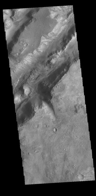
Today's VIS image shows some of the linear depressions that comprise Nili Fossae. Nili Fossae is the name of a collection of curved faults and down-dropped blocks of crust between the faults. The "fossae," or graben, lie northeast of the large volcano Syrtis Major and northwest of the ancient impact basin Isidis Planitia. The troughs, which can be almost 500 meters (1,600 feet) deep , make concentric curves that follow the outline of Isidis Planitia. The graben likely formed as the crust sagged under the weight of lava flows filling the Isidis Planitia impact basin. Orbit Number: 80970 Latitude: 22.4569 Longitude: 77.804 Instrument: VIS Captured: 2020-03-16 09:25 https://photojournal.jpl.nasa.gov/catalog/PIA23908
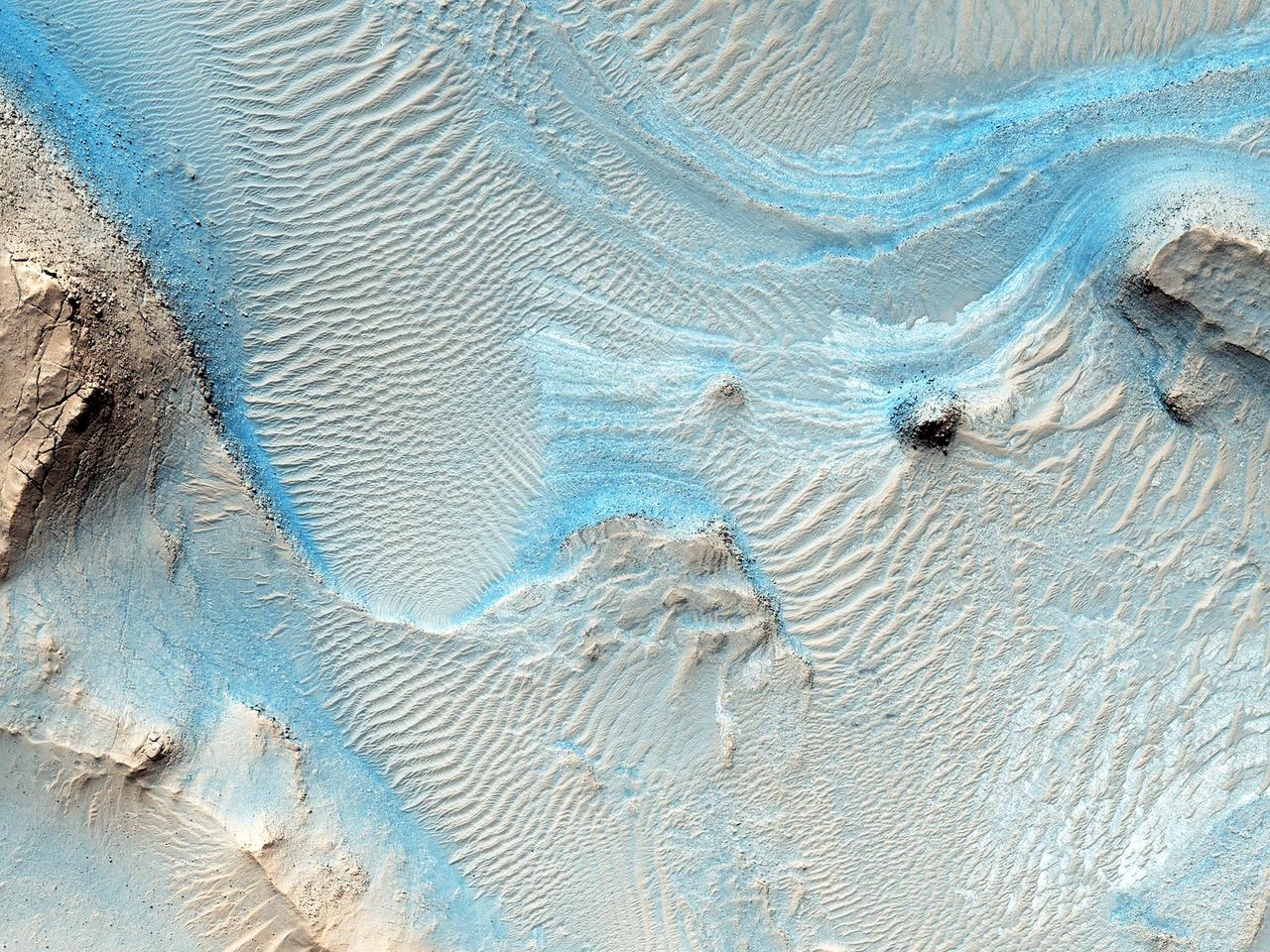
Nothing gets a geologist more excited than layered bedrock, except perhaps finding a fossil or holding a meteorite in your hand. All of these things create a profound feeling of history, the sense of a story that took place ages ago, long before we came appeared. Layered bedrock in particular tells a story that was set out chapter by chapter as each new layer was deposited on top of older, previously deposited layers. Here in Nili Fossae, we see layered bedrock as horizontal striations in the light toned sediments in the floor of a canyon near Syrtis Major. (Note: illumination is from the top of the picture) The ancient layered rocks appear in pale whitish and bluish tones. They are partially covered by much younger ripples made up of dust and other wind blown sediments. The rock of the nearby canyon wall is severely fractured and appears to have shed sand and rocks and boulders onto the floor. This canyon did not form by fluvial erosion: it is part of a system of faults that formed a series of graben like this one, but water probably flowed through Nili Fossae in the distant past. Orbital spectral measurements by the OMEGA instrument on Mars Express and CRISM on MRO detected an abundance of clay minerals of different types in the layered sediments inside Nili Fossae, along with other minerals that are typical of sediments that were deposited by water. The various colors and tones of the layered rocks record changes in the composition of the sediments, details that can tell us about changes in the Martian environment eons ago. Nili Fossae is a candidate site for a future landed robotic mission that could traverse across these layers and make measurements that could be used to unravel a part of the early history of Mars. Nili Fossae is a history book that is waiting to be read. http://photojournal.jpl.nasa.gov/catalog/PIA21206

The linear depressions in today's VIS image are part of Nili Fossae. Nili Fossae is a collection of curved faults and down-dropped blocks of crust between the faults called graben. Graben are formed by extension of the crust and faulting. When large amounts of pressure or tension are applied to rocks on timescales that are fast enough that the rock cannot respond by deforming, the rock breaks along faults. In the case of a graben, two parallel faults are formed by extension of the crust and the rock in between the faults drops downward into the space created by the extension. The Nili Fossae graben lie northeast of the large volcano Syrtis Major and northwest of the ancient impact basin Isidis Planitia. The troughs, which can be almost 500 meters (1,600 feet) deep , make concentric curves that follow the outline of Isidis Planitia. The graben likely formed as the crust sagged under the weight of lava flows filling the Isidis Planitia impact basin. Orbit Number: 94784 Latitude: 18.0574 Longitude: 75.9545 Instrument: VIS Captured: 2023-04-27 19:43 https://photojournal.jpl.nasa.gov/catalog/PIA26157
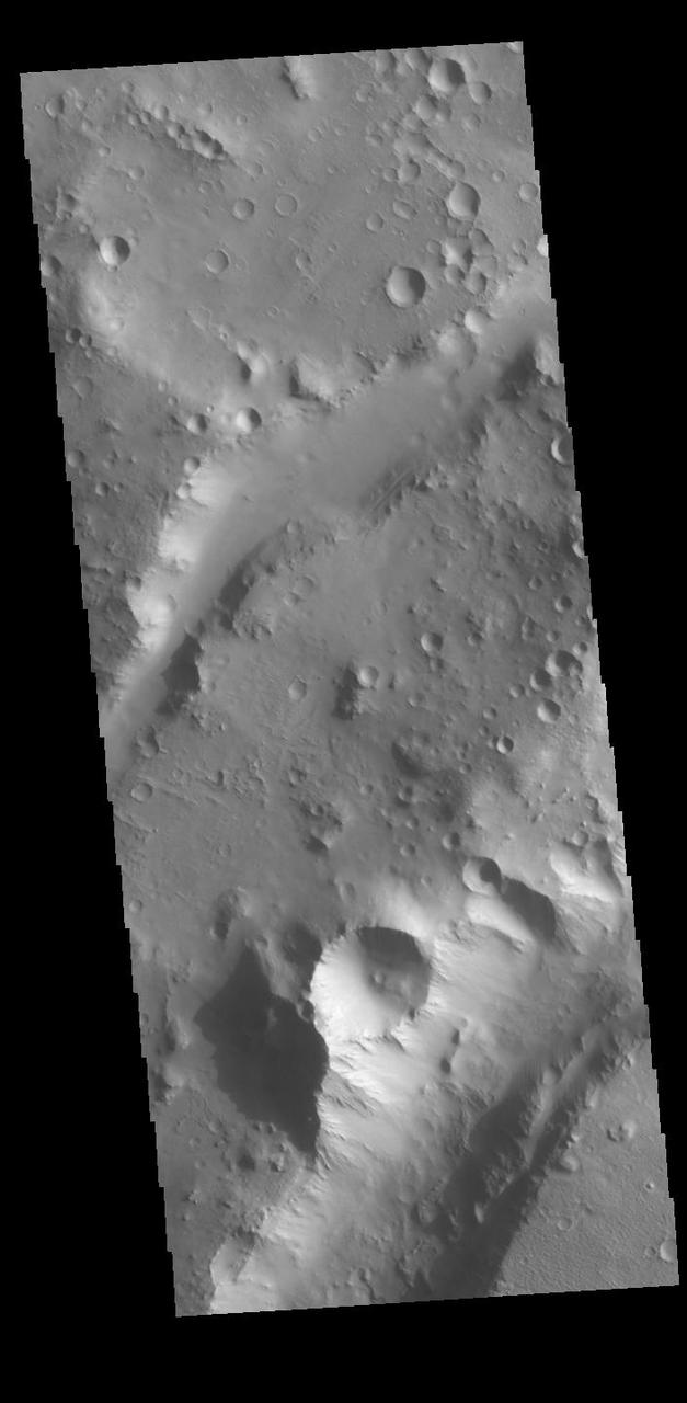
The linear depressions in today's VIS image are part of Nili Fossae. Nili Fossae is a collection of curved faults and down-dropped blocks of crust between the faults called graben. The graben lie northeast of the large volcano Syrtis Major and northwest of the ancient impact basin Isidis Planitia. Graben are formed by extension of the crust and faulting. When large amounts of pressure or tension are applied to rocks on timescales that are fast enough that the rock cannot respond by deforming, the rock breaks along faults. In the case of a graben, two parallel faults are formed by extension of the crust and the rock in between the faults drops downward into the space created by the extension. The crustal deformation in this region was in response to the basin forming event that created Isidis Planitia. The Nili Fossae graben arc around the northwestern edge of the planitia. The graben occur in many different widths. Orbit Number: 94996 Latitude: 24.3161 Longitude: 79.084 Instrument: VIS Captured: 2023-05-15 06:42 https://photojournal.jpl.nasa.gov/catalog/PIA26228
Nili Fossae, a series of tectonic fractures, is the low region on the right side of this image captured by NASA Mars Odyssey. A small channel is visible draining into the large tectonic depression.
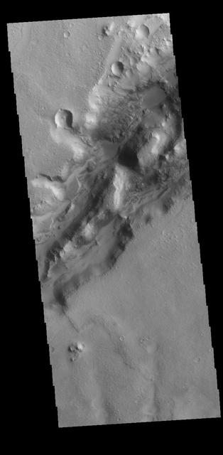
Today's VIS image shows a section of a graben that is part of Nili Fossae. Graben are formed when a block of material drops downward between paired tectonic faults. Graben usually have straight sides with little sinuosity, whereas fluvial channels typically have large amounts of sinuosity along the length of the depression. Nili Fossae is located northeast of the large volcano Syrtis Major and northwest of the ancient impact basin Isidis Planitia. The graben, which can be about 500 meters (1,600 feet) deep, make concentric curves that follow the outline of Isidis Planitia. The faults likely formed as the crust sagged under the weight of lava flows filling Isidis Planitia. Orbit Number: 79198 Latitude: 23.3881 Longitude: 78.7422 Instrument: VIS Captured: 2019-10-22 11:40 https://photojournal.jpl.nasa.gov/catalog/PIA23632
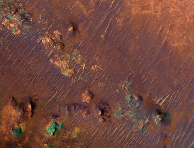
Color Image of Nili Fossae Trough, a Candidate MSL Landing Site
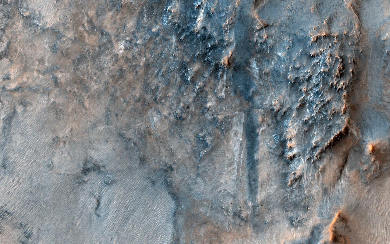
This image of the Nili Fossae region, to the west of the great Isidis basin, shows layered bedrock with many impact craters. Nili Fossae is one of the most mineralogically important sites on Mars. Remote observations by the infrared spectrometer onboard MRO (called CRISM) suggest the layers in the ancient craters contain clays, carbonates, and iron oxides, perhaps due to hydrothermal alteration of the crust. However, the impact craters have been degraded by many millions of years of erosion so the original sedimentary, impact ejecta, or lava flows are hard to distinguish. The bright linear features are sand dunes, also known as "transverse aeolian dunes," because the wind direction is at ninety degrees to their elongated orientation. This shows that the erosion of Nili Fossae continues to the present day with sand-sized particles broken off from the local rocks mobilized within the dunes. https://photojournal.jpl.nasa.gov/catalog/PIA23452
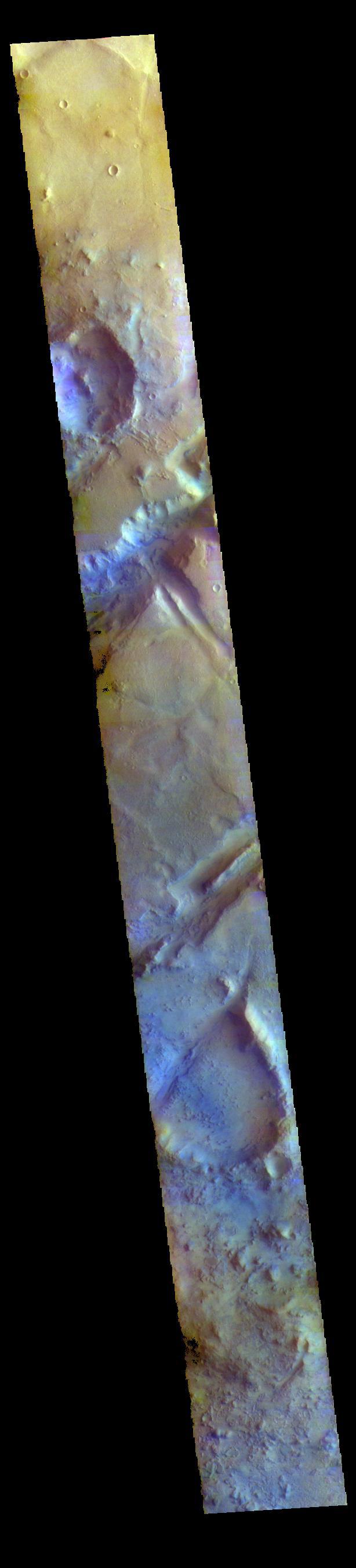
The THEMIS VIS camera contains 5 filters. The data from different filters can be combined in multiple ways to create a false color image. These false color images may reveal subtle variations of the surface not easily identified in a single band image. Today's false color image shows part of Nili Fossae. Nili Fossae is a collection of curved faults and down-dropped blocks of crust between the faults called graben. The graben lie northeast of the large volcano Syrtis Major and northwest of the ancient impact basin Isidis Planitia. The graben are concentric to the Isidis impact basin and extend for 727km (452 miles). Orbit Number: 77264 Latitude: 22.4987 Longitude: 78.2175 Instrument: VIS Captured: 2019-05-16 05:27 https://photojournal.jpl.nasa.gov/catalog/PIA24607
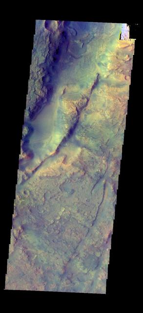
The THEMIS camera contains 5 filters. The data from different filters can be combined in multiple ways to create a false color image. This image from NASA 2001 Mars Odyssey spacecraft shows part of Nili Fossae.
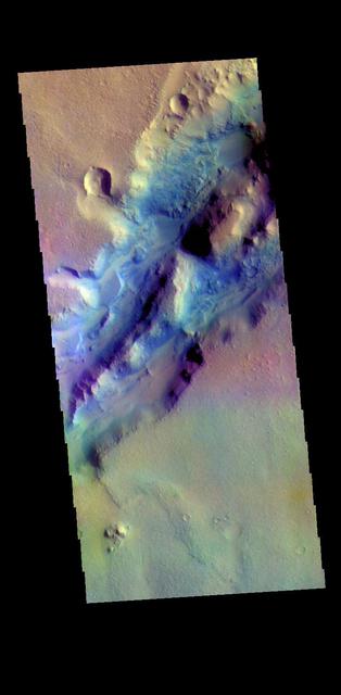
The THEMIS VIS camera contains 5 filters. The data from different filters can be combined in multiple ways to create a false color image. These false color images may reveal subtle variations of the surface not easily identified in a single band image. The linear depressions in today's false color image are part of Nili Fossae. Nili Fossae is a collection of curved faults and down-dropped blocks of crust between the faults called graben. The "fossae," or graben, lie northeast of the large volcano Syrtis Major and northwest of the ancient impact basin Isidis Planitia. The graben, which can be almost 500 meters (1,600 feet) deep, make concentric curves that follow the outline of Isidis Planitia. The graben likely formed as the crust sagged under the weight of lava flows filling the Isidis Planitia impact basin. Orbit Number: 79198 Latitude: 23.3867 Longitude: 78.7424 Instrument: VIS Captured: 2019-10-22 11:40 https://photojournal.jpl.nasa.gov/catalog/PIA24658

The THEMIS VIS camera contains 5 filters. The data from different filters can be combined in multiple ways to create a false color image. These false color images may reveal subtle variations of the surface not easily identified in a single band image. The linear depressions in today's false color image are part of Nili Fossae. Nili Fossae is a collection of curved faults and down-dropped blocks of crust between the faults. The "fossae," or graben, lie northeast of the large volcano Syrtis Major and northwest of the ancient impact basin Isidis Planitia. The troughs, which can be almost 500 meters (1,600 feet) deep , make concentric curves that follow the outline of Isidis Planitia. The graben likely formed as the crust sagged under the weight of lava flows filling the Isidis Planitia impact basin. Orbit Number: 80970 Latitude: 22.458 Longitude: 77.8039 Instrument: VIS Captured: 2020-03-16 09:25 https://photojournal.jpl.nasa.gov/catalog/PIA24680
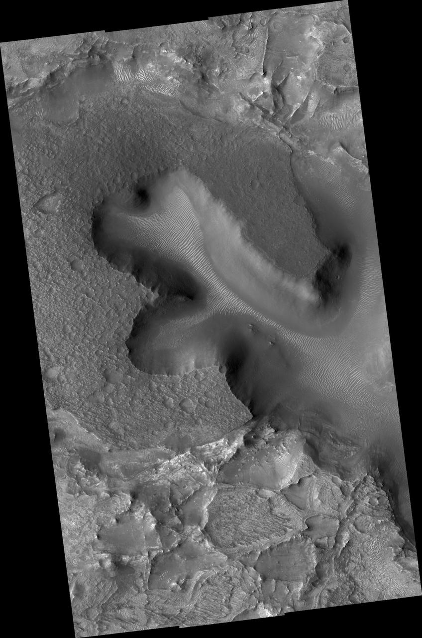
NASA Mars Reconnaissance Orbiter shows densely fractured light-toned rock in the vicinity of the Nili Fossae. The light-toned material is finely layered; these layers can be seen in cross-section along a scarp face at the bottom of the image.
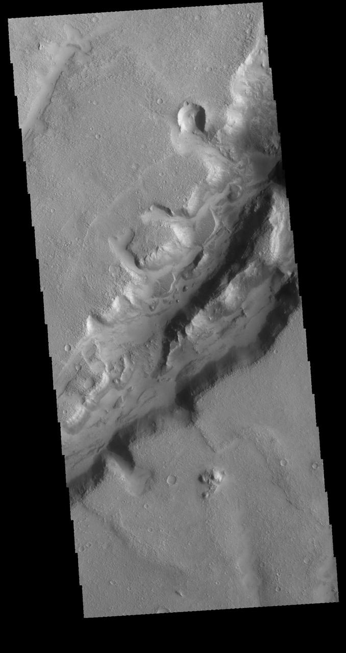
Nili Fossae is a large band of parallel graben located to the northeast of Syrtis Major. The graben in this image from NASA 2001 Mars Odyssey spacecraft were formed by tectonic activity, with faulting that creates the linear depression. Orbit Number: 64105 Latitude: 23.3115 Longitude: 78.6126 Instrument: VIS Captured: 2016-05-27 05:24 http://photojournal.jpl.nasa.gov/catalog/PIA20785
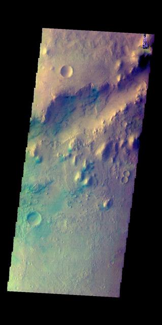
This image shows a small section of Nili Fossae. The darker blue tones are usually indications of basaltic sands. The THEMIS VIS camera contains 5 filters. The data from different filters can be combined in multiple ways to create a false color image. These false color images may reveal subtle variations of the surface not easily identified in a single band image. Orbit Number: 60318 Latitude: 24.7981 Longitude: 80.7408 Instrument: VIS Captured: 2015-07-20 08:53 https://photojournal.jpl.nasa.gov/catalog/PIA22706
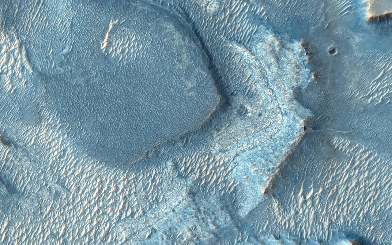
Nili Fossae, once considered a potential landing spot for the Mars Science Laboratory, has one of the largest, most diverse exposures of clay minerals as seen by NASA Mars Reconnaissance Orbiter.
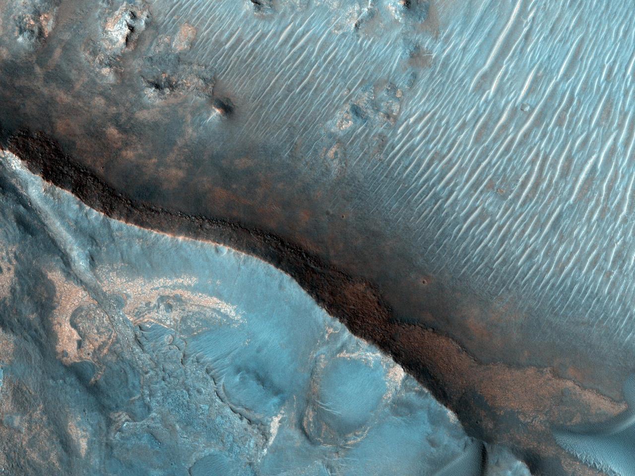
This image from NASA Mars Reconnaissance Orbiter shows Nili Fossae region of Mars, one of the largest exposures of clay minerals, and a prime candidate landing site for Mars Science Laboratory rover, Curiosity.
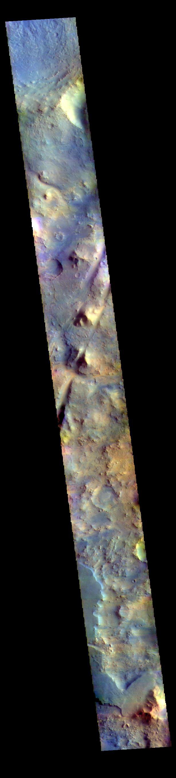
The THEMIS VIS camera contains 5 filters. The data from different filters can be combined in multiple ways to create a false color image. These false color images may reveal subtle variations of the surface not easily identified in a single band image. Today's false color image shows part of Nili Fossae. The linear depressions crossing the center of the image are graben, a landform created by the movement of blocks of material downward between paired faults. Orbit Number: 69867 Latitude: 18.6065 Longitude: 76.3487 Instrument: VIS Captured: 2017-09-13 22:23 https://photojournal.jpl.nasa.gov/catalog/PIA24456
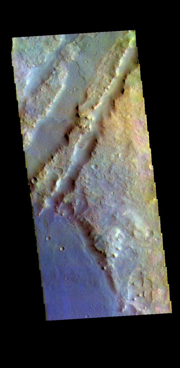
The THEMIS VIS camera contains 5 filters. The data from different filters can be combined in multiple ways to create a false color image. These false color images may reveal subtle variations of the surface not easily identified in a single band image. The linear depressions in today's false color image are part of Nili Fossae. Nili Fossae is a collection of curved faults and down-dropped blocks of crust between the faults. The "fossae," or graben, lie northeast of the large volcano Syrtis Major and northwest of the ancient impact basin Isidis Planitia. The troughs, which can be almost 500 meters (1,600 feet) deep , make concentric curves that follow the outline of Isidis Planitia. The graben likely formed as the crust sagged under the weight of lava flows filling the Isidis Planitia impact basin. The THEMIS VIS camera is capable of capturing color images of the Martian surface using five different color filters. In this mode of operation, the spatial resolution and coverage of the image must be reduced to accommodate the additional data volume produced from using multiple filters. To make a color image, three of the five filter images (each in grayscale) are selected. Each is contrast enhanced and then converted to a red, green, or blue intensity image. These three images are then combined to produce a full color, single image. Because the THEMIS color filters don't span the full range of colors seen by the human eye, a color THEMIS image does not represent true color. Also, because each single-filter image is contrast enhanced before inclusion in the three-color image, the apparent color variation of the scene is exaggerated. Nevertheless, the color variation that does appear is representative of some change in color, however subtle, in the actual scene. Note that the long edges of THEMIS color images typically contain color artifacts that do not represent surface variation. Orbit Number: 88158 Latitude: 20.507 Longitude: 72.6076 Instrument: VIS Captured: 2021-10-29 05:43 https://photojournal.jpl.nasa.gov/catalog/PIA25388
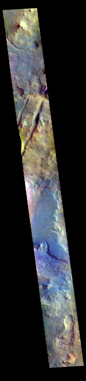
The THEMIS VIS camera contains 5 filters. The data from different filters can be combined in multiple ways to create a false color image. These false color images may reveal subtle variations of the surface not easily identified in a single band image. The linear depressions in today's false color image are part of Nili Fossae. Nili Fossae is a collection of curved faults and down-dropped blocks of crust between the faults. The "fossae," or graben, lie northeast of the large volcano Syrtis Major and northwest of the ancient impact basin Isidis Planitia. The troughs, which can be almost 500 meters (1,600 feet) deep , make concentric curves that follow the outline of Isidis Planitia. The graben likely formed as the crust sagged under the weight of lava flows filling the Isidis Planitia impact basin. The THEMIS VIS camera is capable of capturing color images of the Martian surface using five different color filters. In this mode of operation, the spatial resolution and coverage of the image must be reduced to accommodate the additional data volume produced from using multiple filters. To make a color image, three of the five filter images (each in grayscale) are selected. Each is contrast enhanced and then converted to a red, green, or blue intensity image. These three images are then combined to produce a full color, single image. Because the THEMIS color filters don't span the full range of colors seen by the human eye, a color THEMIS image does not represent true color. Also, because each single-filter image is contrast enhanced before inclusion in the three-color image, the apparent color variation of the scene is exaggerated. Nevertheless, the color variation that does appear is representative of some change in color, however subtle, in the actual scene. Note that the long edges of THEMIS color images typically contain color artifacts that do not represent surface variation. Orbit Number: 95071 Latitude: 17.8666 Longitude: 76.2766 Instrument: VIS Captured: 2023-05-21 10:52 https://photojournal.jpl.nasa.gov/catalog/PIA26151
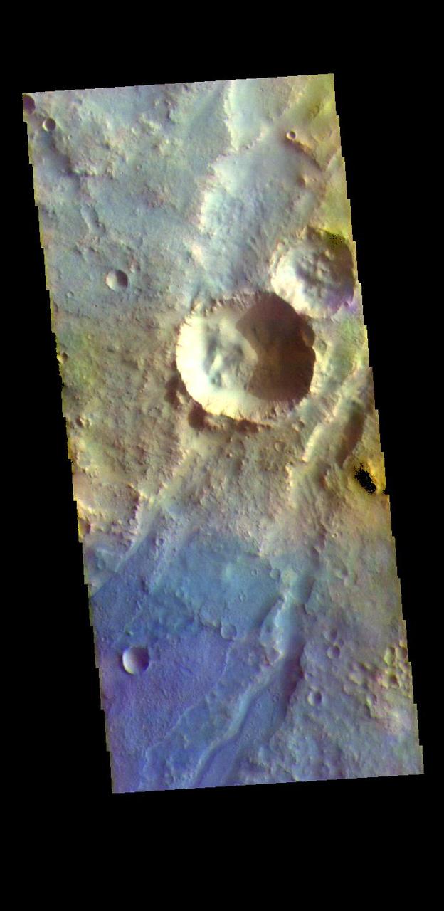
The THEMIS VIS camera contains 5 filters. The data from different filters can be combined in multiple ways to create a false color image. These false color images may reveal subtle variations of the surface not easily identified in a single band image. The linear depressions in today's false color image are part of Nili Fossae. Nili Fossae is a collection of curved faults and down-dropped blocks of crust between the faults. The "fossae," or graben, lie northeast of the large volcano Syrtis Major and northwest of the ancient impact basin Isidis Planitia. The troughs, which can be almost 500 meters (1,600 feet) deep , make concentric curves that follow the outline of Isidis Planitia. The graben likely formed as the crust sagged under the weight of lava flows filling the Isidis Planitia impact basin. The THEMIS VIS camera is capable of capturing color images of the Martian surface using five different color filters. In this mode of operation, the spatial resolution and coverage of the image must be reduced to accommodate the additional data volume produced from using multiple filters. To make a color image, three of the five filter images (each in grayscale) are selected. Each is contrast enhanced and then converted to a red, green, or blue intensity image. These three images are then combined to produce a full color, single image. Because the THEMIS color filters don't span the full range of colors seen by the human eye, a color THEMIS image does not represent true color. Also, because each single-filter image is contrast enhanced before inclusion in the three-color image, the apparent color variation of the scene is exaggerated. Nevertheless, the color variation that does appear is representative of some change in color, however subtle, in the actual scene. Note that the long edges of THEMIS color images typically contain color artifacts that do not represent surface variation. Orbit Number: 94834 Latitude: 21.5829 Longitude: 73.0022 Instrument: VIS Captured: 2023-05-01 22:33 https://photojournal.jpl.nasa.gov/catalog/PIA26136
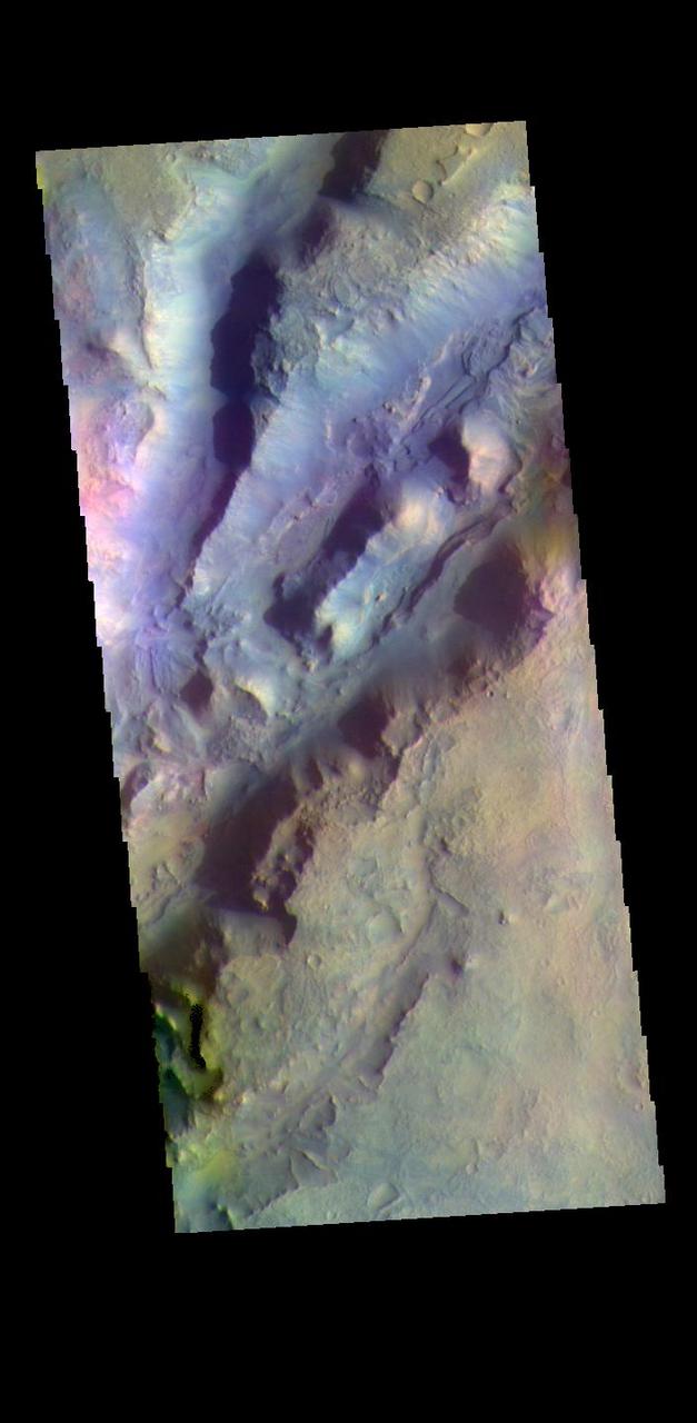
The THEMIS VIS camera contains 5 filters. The data from different filters can be combined in multiple ways to create a false color image. These false color images may reveal subtle variations of the surface not easily identified in a single band image. The linear depressions in today's false color image are part of Nili Fossae. Nili Fossae is a collection of curved faults and down-dropped blocks of crust between the faults. The "fossae," or graben, lie northeast of the large volcano Syrtis Major and northwest of the ancient impact basin Isidis Planitia. The troughs, which can be almost 500 meters (1,600 feet) deep , make concentric curves that follow the outline of Isidis Planitia. The graben likely formed as the crust sagged under the weight of lava flows filling the Isidis Planitia impact basin. The THEMIS VIS camera is capable of capturing color images of the Martian surface using five different color filters. In this mode of operation, the spatial resolution and coverage of the image must be reduced to accommodate the additional data volume produced from using multiple filters. To make a color image, three of the five filter images (each in grayscale) are selected. Each is contrast enhanced and then converted to a red, green, or blue intensity image. These three images are then combined to produce a full color, single image. Because the THEMIS color filters don't span the full range of colors seen by the human eye, a color THEMIS image does not represent true color. Also, because each single-filter image is contrast enhanced before inclusion in the three-color image, the apparent color variation of the scene is exaggerated. Nevertheless, the color variation that does appear is representative of some change in color, however subtle, in the actual scene. Note that the long edges of THEMIS color images typically contain color artifacts that do not represent surface variation. Orbit Number: 88919 Latitude: 22.3384 Longitude: 77.6092 Instrument: VIS Captured: 2021-12-30 21:37 https://photojournal.jpl.nasa.gov/catalog/PIA25390
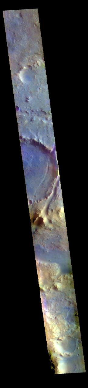
The THEMIS VIS camera contains 5 filters. The data from different filters can be combined in multiple ways to create a false color image. These false color images may reveal subtle variations of the surface not easily identified in a single band image. The linear depressions in the center of today's false color image are part of Nili Fossae. Nili Fossae is a collection of curved faults and down-dropped blocks of crust between the faults. The "fossae," or graben, lie northeast of the large volcano Syrtis Major and northwest of the ancient impact basin Isidis Planitia. The troughs, which can be almost 500 meters (1,600 feet) deep , make concentric curves that follow the outline of Isidis Planitia. The graben likely formed as the crust sagged under the weight of lava flows filling the Isidis Planitia impact basin. The THEMIS VIS camera is capable of capturing color images of the Martian surface using five different color filters. In this mode of operation, the spatial resolution and coverage of the image must be reduced to accommodate the additional data volume produced from using multiple filters. To make a color image, three of the five filter images (each in grayscale) are selected. Each is contrast enhanced and then converted to a red, green, or blue intensity image. These three images are then combined to produce a full color, single image. Because the THEMIS color filters don't span the full range of colors seen by the human eye, a color THEMIS image does not represent true color. Also, because each single-filter image is contrast enhanced before inclusion in the three-color image, the apparent color variation of the scene is exaggerated. Nevertheless, the color variation that does appear is representative of some change in color, however subtle, in the actual scene. Note that the long edges of THEMIS color images typically contain color artifacts that do not represent surface variation. Orbit Number: 94784 Latitude: 18.0574 Longitude: 75.9545 Instrument: VIS Captured: 2023-04-27 19:43 https://photojournal.jpl.nasa.gov/catalog/PIA26132
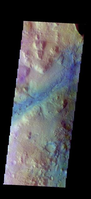
The THEMIS camera contains 5 filters. The data from different filters can be combined in multiple ways to create a false color image. These false color images may reveal subtle variations of the surface not easily identified in a single band image. Today's false color image shows part of Nili Fossae. Dark "blue" is interpreted to be basaltic rock/sand. Orbit Number: 17546 Latitude: 24.4543 Longitude: 79.8833 Instrument: VIS Captured: 2005-11-28 02:22. http://photojournal.jpl.nasa.gov/catalog/PIA20223
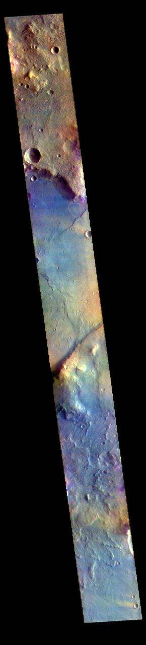
The THEMIS VIS camera contains 5 filters. The data from different filters can be combined in multiple ways to create a false color image. These false color images may reveal subtle variations of the surface not easily identified in a single band image. Today's false color image shows part of Nili Fossae. Nili Fossae is a collection of curved faults and down-dropped blocks of crust between the faults called graben. The graben lie northeast of the large volcano Syrtis Major and northwest of the ancient impact basin Isidis Planitia. The linear ridge in the center of the image is one side of a very large graben. When large amounts of pressure or tension are applied to rocks on timescales that are fast enough that the rock cannot respond by deforming, the rock breaks along faults. In the case of a graben, two parallel faults are formed by extension of the crust and the rock in between the faults drops downward into the space created by the extension. The THEMIS VIS camera is capable of capturing color images of the Martian surface using five different color filters. In this mode of operation, the spatial resolution and coverage of the image must be reduced to accommodate the additional data volume produced from using multiple filters. To make a color image, three of the five filter images (each in grayscale) are selected. Each is contrast enhanced and then converted to a red, green, or blue intensity image. These three images are then combined to produce a full color, single image. Because the THEMIS color filters don't span the full range of colors seen by the human eye, a color THEMIS image does not represent true color. Also, because each single-filter image is contrast enhanced before inclusion in the three-color image, the apparent color variation of the scene is exaggerated. Nevertheless, the color variation that does appear is representative of some change in color, however subtle, in the actual scene. Note that the long edges of THEMIS color images typically contain color artifacts that do not represent surface variation. Orbit Number: 85787 Latitude: 19.3564 Longitude: 73.5306 Instrument: VIS Captured: 2021-04-17 00:20 https://photojournal.jpl.nasa.gov/catalog/PIA25093

This image shows part of the Nili Fossae region
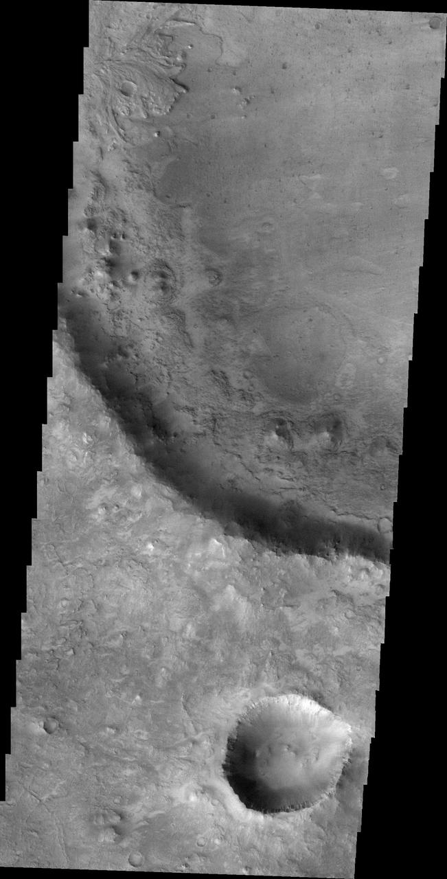
A small delta is located in this unnamed crater near Nili Fossae.
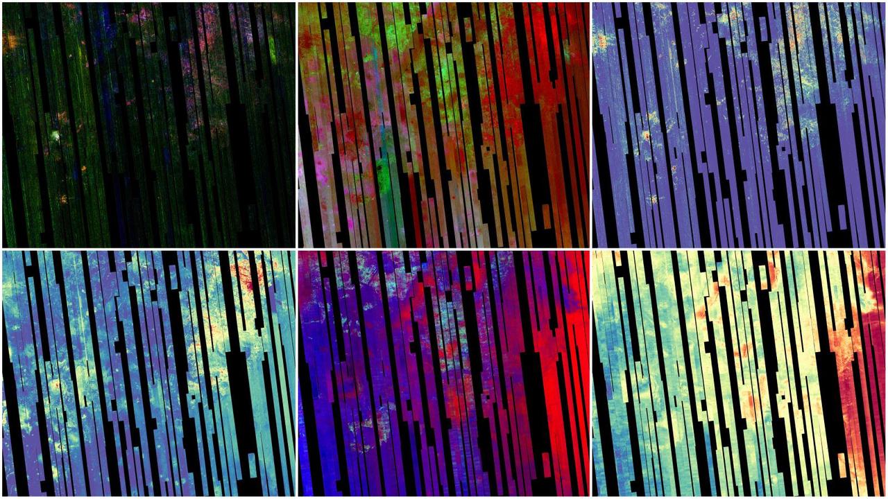
This image shows six views of the Nili Fossae region of Mars captured by the Compact Reconnaissance Imaging Spectrometer for Mars, or CRISM, one of the instruments aboard NASA's Mars Reconnaissance Orbiter. The varying colors represent minerals on the Martian surface seen in different wavelengths of light. Each of these views was produced as part of a near-global map made up of about 1,764 individual segments. The 72-color map is the last major dataset CRISM will ever produce; the instrument will be decommissioned by the end of 2022. Data for the 6.3-gigapixel map was collected over 11 years of CRISM operations. The instrument arrived at Mars with three cryocoolers that allowed it to see in a range of wavelengths, including infrared; in 2017, the last of those cryocoolers stopped working, severely limiting the number of wavelengths CRISM could "see." https://photojournal.jpl.nasa.gov/catalog/PIA25364
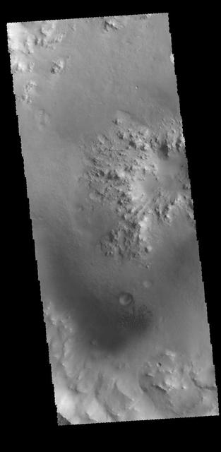
This image captured by NASA 2001 Mars Odyssey spacecraft shows the interior of an unnamed crater near Nili Fossae.
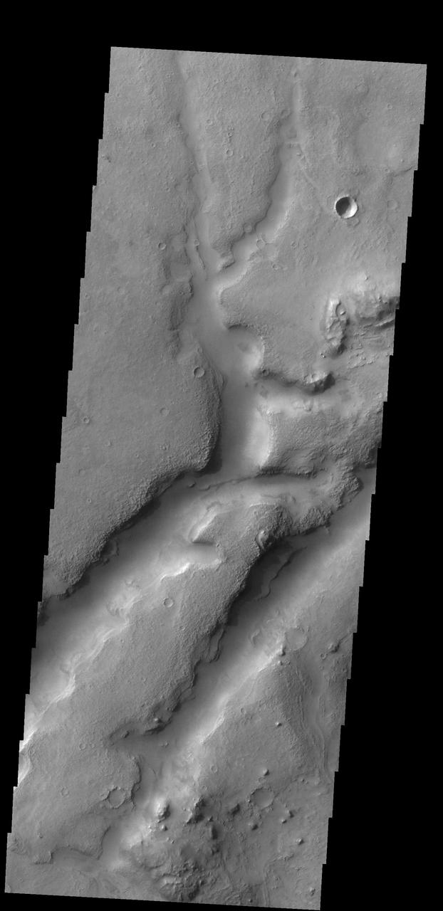
This complex channel is located in the Nili Fossae region as seen by NASA 2001 Mars Odyssey spacecraft.
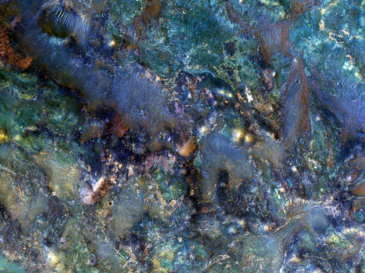
This image from NASA Mars Reconnaissance Orbiter covers a region of Mars near Nili Fossae that contains some of the best exposures of ancient bedrock on Mars.
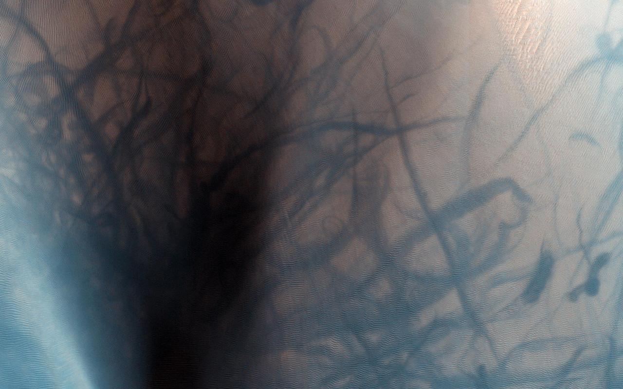
This observation from NASA Mars Reconnaissance Orbiter shows a sand dune field in the Nili Fossae region of Mars. The dark lines swirling over the surface of the dunes are the tracks of dust devils.
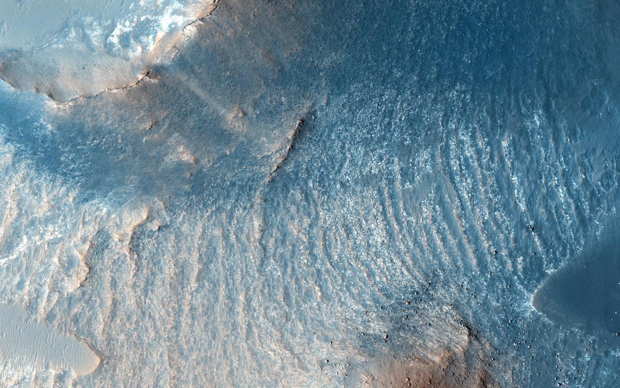
A variety of diverse morphological features are present in this image (21 by 5.5 kilometers) located in the southeastern area of the Nili Fossae region and just northeast of Syrtis Major. This particular region has been studied intensely due to the presence of volcanics from Syrtis Major and impact ejecta from the Isidis Basin. The region is rich in unaltered mafic deposits, in contact with diverse altered deposits rich in clays, carbonates, and sulfates. These deposits make the Nili Fossae region one of the most colorful regions on Mars, which is most distinctive in infrared color composites (IRB). HiRISE IRB color aids in chemical and mineral-type mapping, especially when correlated with other MRO instruments such as CRISM. http://photojournal.jpl.nasa.gov/catalog/PIA19940
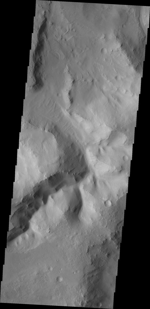
This image from NASA Mars Odyssey shows a channel within a region of chaos NW of Nili Fossae; on Mars, the term chaos terrain is given to regions where areas of the surface are broken up into multiple mesas divided by low valleys.
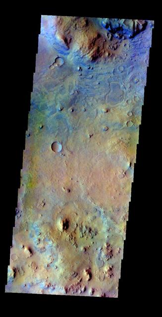
The THEMIS VIS camera contains 5 filters. The data from different filters can be combined in multiple ways to create a false color image. This false color image from NASA 2001 Mars Odyssey spacecraft shows part of the region near Nili Fossae.
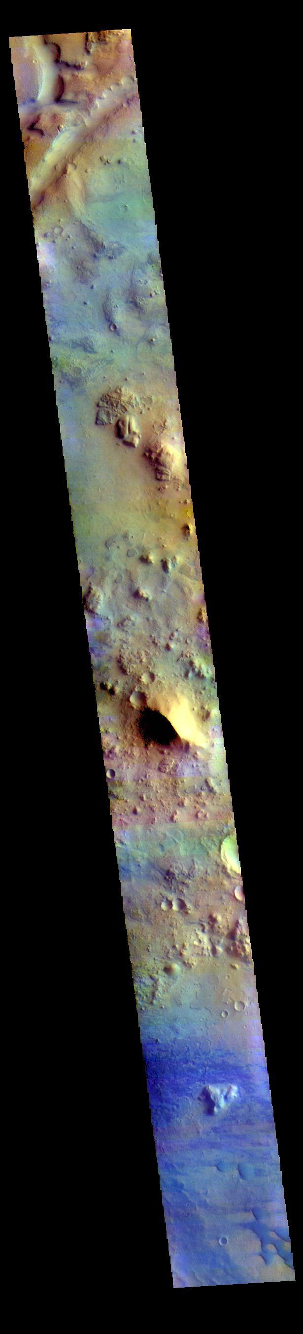
The THEMIS VIS camera contains 5 filters. The data from different filters can be combined in multiple ways to create a false color image. These false color images may reveal subtle variations of the surface not easily identified in a single band image. Today's false color image shows part of Terra Sabaea between the graben of Nili Fossae (depression at the top of the image) and the lowlands of Isidis Planitia. Small sand dunes are visible near the bottom of the image. Dark blue tones in this filter combination indicate basaltic sands. Orbit Number: 78075 Latitude: 21.3155 Longitude: 79.0343 Instrument: VIS Captured: 2019-07-22 00:17 https://photojournal.jpl.nasa.gov/catalog/PIA24640

The THEMIS camera contains 5 filters. The data from different filters can be combined in multiple ways to create a false color image. These false color images may reveal subtle variations of the surface not easily identified in a single band image. Today's false color image shows some of the highlands between the multiple graben of Nili Fossae. Orbit Number: 42840 Latitude: 22.2289 Longitude: 76.8074 Instrument: VIS Captured: 2011-08-11 18:41 http://photojournal.jpl.nasa.gov/catalog/PIA20797

The THEMIS VIS camera contains 5 filters. The data from different filters can be combined in multiple ways to create a false color image. These false color images may reveal subtle variations of the surface not easily identified in a single band image. Today's false color image shows part of the rim of Hargraves Crater. Located between Nili Fossae and Isidis Planitia, Hargraves Crater is 60km (37 miles) in diameter. Orbit Number: 79847 Latitude: 20.2639 Longitude: 75.608 Instrument: VIS Captured: 2019-12-14 22:12 https://photojournal.jpl.nasa.gov/catalog/PIA24673

This VIS image is located on the margin of the Nili Fossae region and Isidis Planitia. At the bottom of the image a channel feature is visible, the branch on the right appears to empty into the surface at the top of the image. The branch to the left does not reach the top of the image, so it is likely flowing from the upper left into the bottom channel. The 90 degree bends of this large channel feature indicated that tectonic forces are affecting the features formed in this region. This is further supported by the series of very small orthogonal ridges just north of the center of the image. These small ridges probably were formed in a multi part process. First tectonic activity created fractures in a preexisting rock, then a new material filled the fractures, finally erosion of the host rock occurred, removing the original materials and leaving just the fracture fill. Both the large and small scale features in this region point to a long period of tectonic activity in this region. Orbit Number: 71850 Latitude: 17.3258 Longitude: 76.8457 Instrument: VIS Captured: 2018-02-24 07:15 https://photojournal.jpl.nasa.gov/catalog/PIA22402
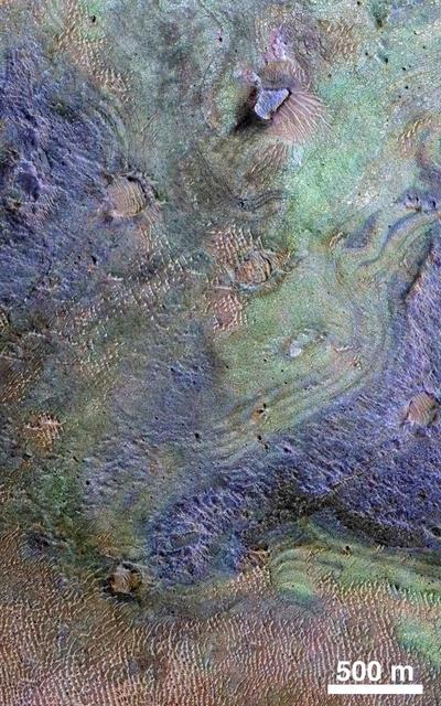
This view combines information from two instruments on NASA's Mars Reconnaissance Orbiter to map color-coded composition over the shape of the ground in a small portion of the Nili Fossae plains region of Mars' northern hemisphere. This site is part of the largest known carbonate-rich deposit on Mars. In the color coding used for this map, green indicates a carbonate-rich composition, brown indicates olivine-rich sands, and purple indicates basaltic composition. Carbon dioxide from the atmosphere on early Mars reacted with surface rocks to form carbonate, thinning the atmosphere by sequestering the carbon in the rocks. An analysis of the amount of carbon contained in Nili Fossae plains estimated the total at no more than twice the amount of carbon in the modern atmosphere of Mars, which is mostly carbon dioxide. That is much more than in all other known carbonate on Mars, but far short of enough to explain how Mars could have had a thick enough atmosphere to keep surface water from freezing during a period when rivers were cutting extensive valley networks on the Red Planet. Other possible explanations for the change from an era with rivers to dry modern Mars are being investigated. This image covers an area approximately 1.4 miles (2.3 kilometers) wide. A scale bar indicates 500 meters (1,640 feet). The full extent of the carbonate-containing deposit in the region is at least as large as Delaware and perhaps as large as Arizona. The color coding is from data acquired by the Compact Reconnaissance Imaging Spectrometer for Mars (CRISM), in observation FRT0000C968 made on Sept. 19, 2008. The base map showing land shapes is from the High Resolution Imaging Science Experiment (HiRISE) camera. It is one product from HiRISE observation ESP_010351_2020, made July 20, 2013. http://photojournal.jpl.nasa.gov/catalog/PIA19817
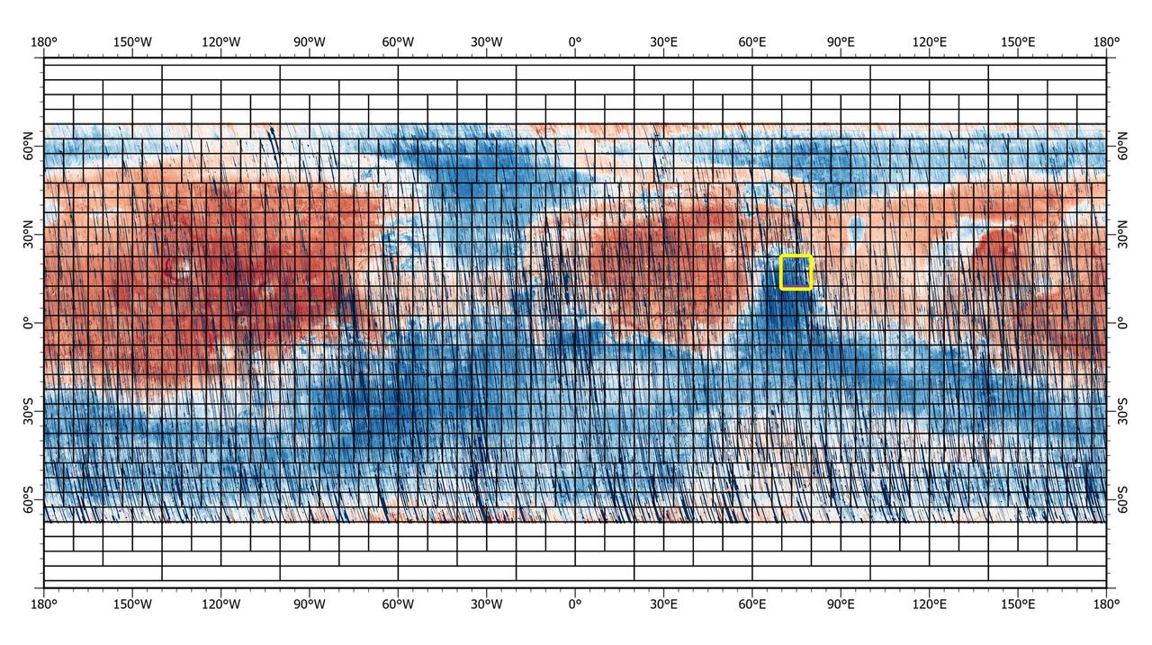
This 72-color near-global map of the Red Planet was captured by NASA's Mars Reconnaissance Orbiter (MRO) using its Compact Reconnaissance Imaging Spectrometer for Mars, or CRISM. The yellow square indicates the Nili Fossae region of Mars, which is highlighted in six views in PIA25364. The map is one of the last major datasets CRISM will ever produce; the instrument will be decommissioned by the end of 2022. Data for the 6.3-gigapixel map was collected over 11 years of CRISM operations. The instrument arrived at Mars with three cryocoolers that allowed it to see in a range of wavelengths, including infrared; in 2017, the last of those cryocoolers stopped working, severely limiting the number of wavelengths CRISM could "see." https://photojournal.jpl.nasa.gov/catalog/PIA25363
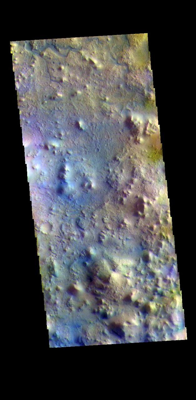
The THEMIS VIS camera contains 5 filters. The data from different filters can be combined in multiple ways to create a false color image. These false color images may reveal subtle variations of the surface not easily identified in a single band image. Today's false color image shows part of Terra Sabaea, in the region between Nili Fossae and Isidis Planitia. This image is located just east of Jezero Crater, the home of the Mars 2020 rover (Perserverance) and its little helicopter buddy (Ingenuity). The THEMIS VIS camera is capable of capturing color images of the Martian surface using five different color filters. In this mode of operation, the spatial resolution and coverage of the image must be reduced to accommodate the additional data volume produced from using multiple filters. To make a color image, three of the five filter images (each in grayscale) are selected. Each is contrast enhanced and then converted to a red, green, or blue intensity image. These three images are then combined to produce a full color, single image. Because the THEMIS color filters don't span the full range of colors seen by the human eye, a color THEMIS image does not represent true color. Also, because each single-filter image is contrast enhanced before inclusion in the three-color image, the apparent color variation of the scene is exaggerated. Nevertheless, the color variation that does appear is representative of some change in color, however subtle, in the actual scene. Note that the long edges of THEMIS color images typically contain color artifacts that do not represent surface variation. Orbit Number: 95021 Latitude: 18.3774 Longitude: 78.6869 Instrument: VIS Captured: 2023-05-17 08:04 https://photojournal.jpl.nasa.gov/catalog/PIA26138
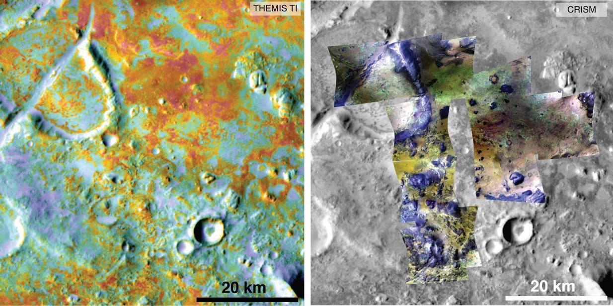
Researchers estimating the amount of carbon held in the ground at the largest known carbonate-containing deposit on Mars utilized data from three different NASA Mars orbiters. Each image in this pair covers the same area about 36 miles (58 kilometers) wide in the Nili Fossae plains region of Mars' northern hemisphere. The tally of carbon content in the rocks of this region is a key piece in solving a puzzle of how the Martian atmosphere has changed over time. Carbon dioxide from the atmosphere on early Mars reacted with surface rocks to form carbonate, thinning the atmosphere. The image on the left presents data from the Thermal Emission Imaging System (THEMIS) instrument on NASA's Mars Odyssey orbiter. The color coding indicates thermal inertia -- the property of how quickly a surface material heats up or cools off. Sand, for example (blue hues), cools off quicker after sundown than bedrock (red hues) does. The color coding in the image on the right presents data from the Compact Reconnaissance Imaging Spectrometer for Mars (CRISM) instrument on NASA's Mars Reconnaissance Orbiter. From the brightness at many different wavelengths, CRISM data can indicate what minerals are present on the surface. In the color coding used here, green hues are consistent with carbonate-bearing materials, while brown or yellow hues are olivine-bearing sands and locations with purple hues are basaltic in composition. The gray scale base map is a mosaic of daytime THEMIS infrared images. Annotations point to areas with different surface compositions. The scale bar indicates 20 kilometers (12.4 miles). http://photojournal.jpl.nasa.gov/catalog/PIA19816
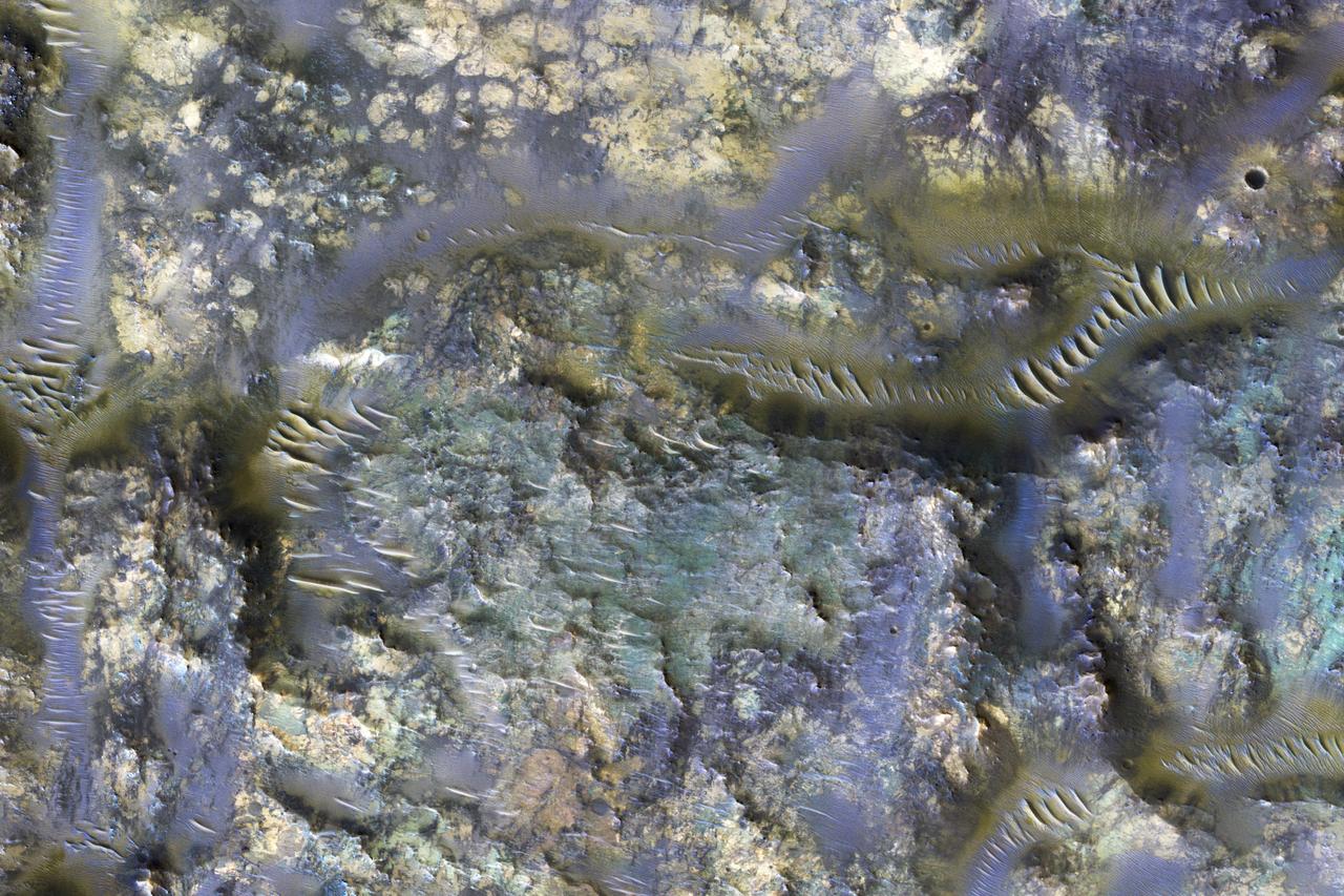
This image from NASA's Mars Reconnaissance Orbiter shows the exposed bedrock of an ejecta blanket of an unnamed crater in the Mare Serpentis region of Mars. Ejecta, when exposed, are truly an eye-opening feature, as they reveal the sometimes exotic subsurface, and materials created by impacts (close-up view). This ejecta shares similarities to others found elsewhere on Mars, which are of particular scientific interest for the extent of exposure and diverse colors. (For example, the Hargraves Crater ejecta, in the Nili Fossae trough region, was once considered as a candidate landing site for the next NASA Mars rover 2020.) The colors observed in this picture represent different rocks and minerals, now exposed on the surface. Blue in HiRISE infrared color images generally depicts iron-rich minerals, like olivine and pyroxene. Lighter colors, such as yellow, indicate the presence of altered rocks. The possible sources of the ejecta is most likely from two unnamed craters. How do we determine which crater deposited the ejecta? A full-scale image shows numerous linear features that are observed trending in an east-west direction. These linear features indicate the flow direction of the ejecta from its unnamed host crater. Therefore, if we follow them, we find that they emanate from the bottom of the two unnamed craters. If the ejecta had originated from the top crater, then we would expect the linear features at the location of our picture to trend northwest to southeast. https://photojournal.jpl.nasa.gov/catalog/PIA21782