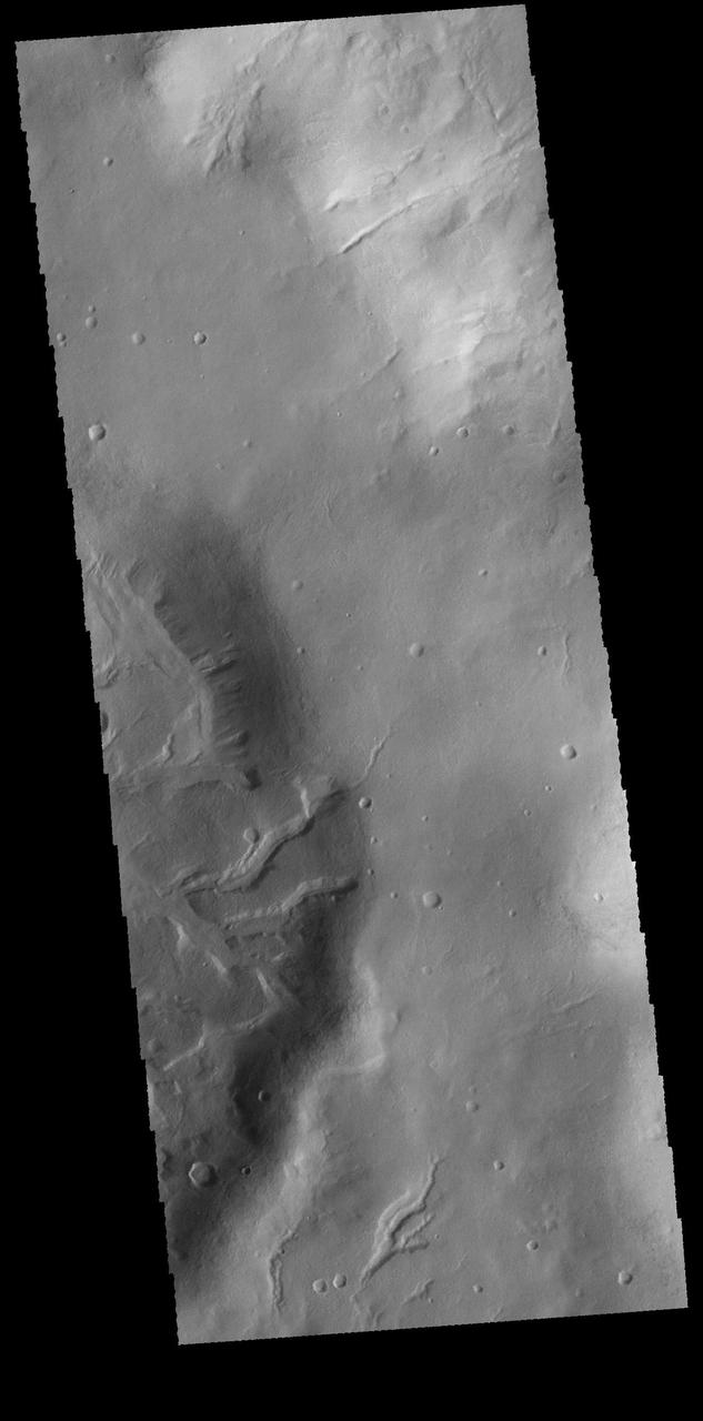
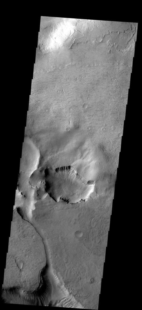
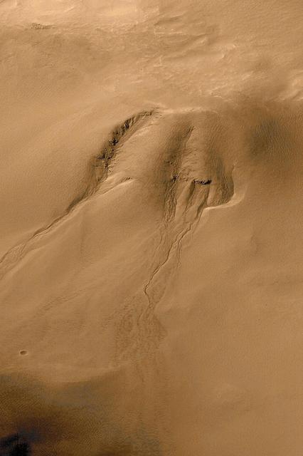
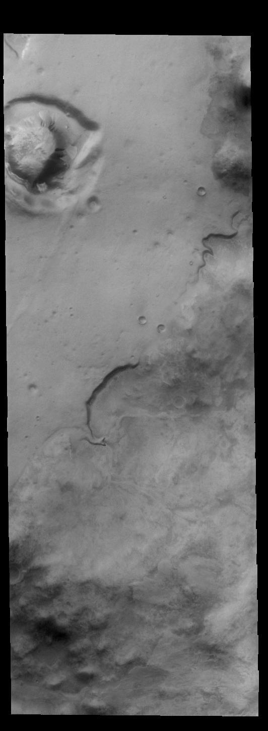
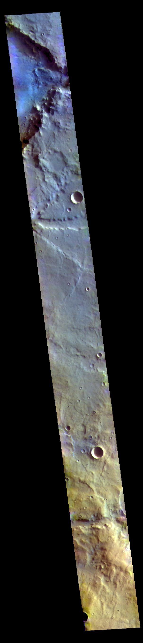
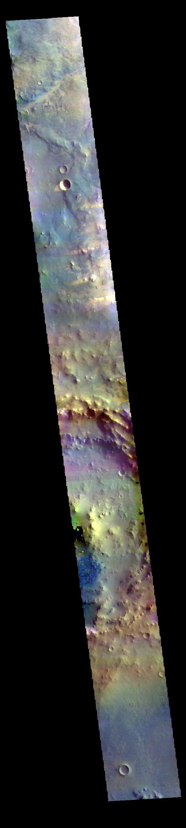
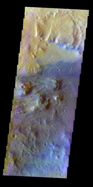
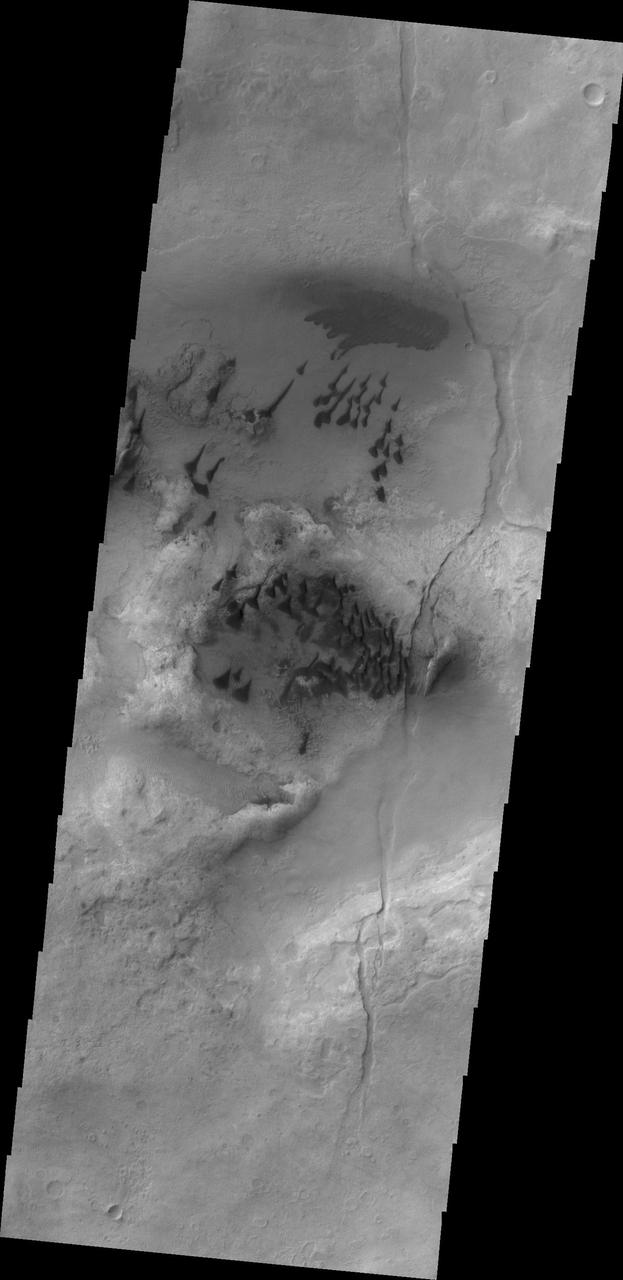
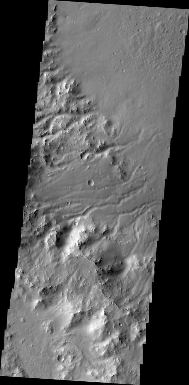
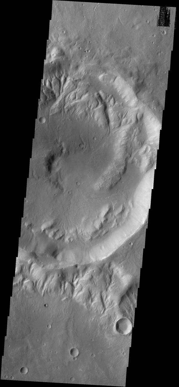
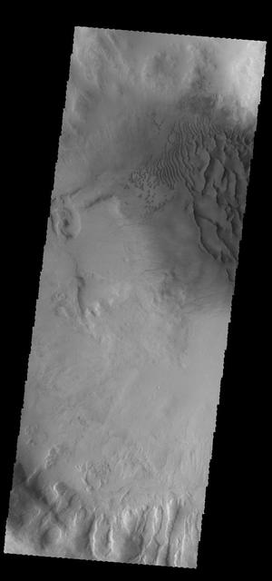
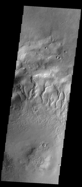
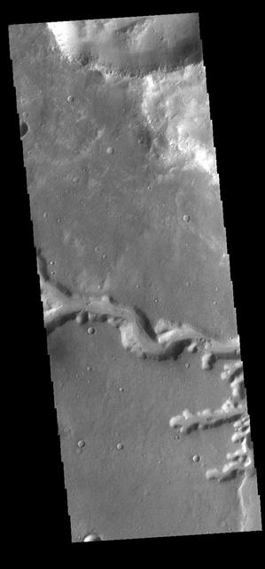
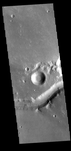
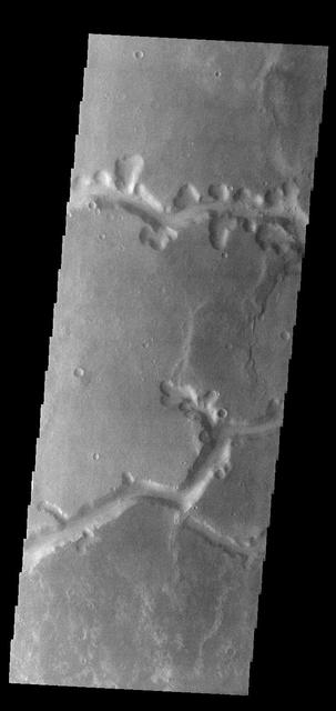
This VIS image shows several channels in and around unnamed craters in Noachis Terra. Orbit Number: 66252 Latitude: -38.0339 Longitude: 40.923 Instrument: VIS Captured: 2016-11-20 01:43 http://photojournal.jpl.nasa.gov/catalog/PIA21286
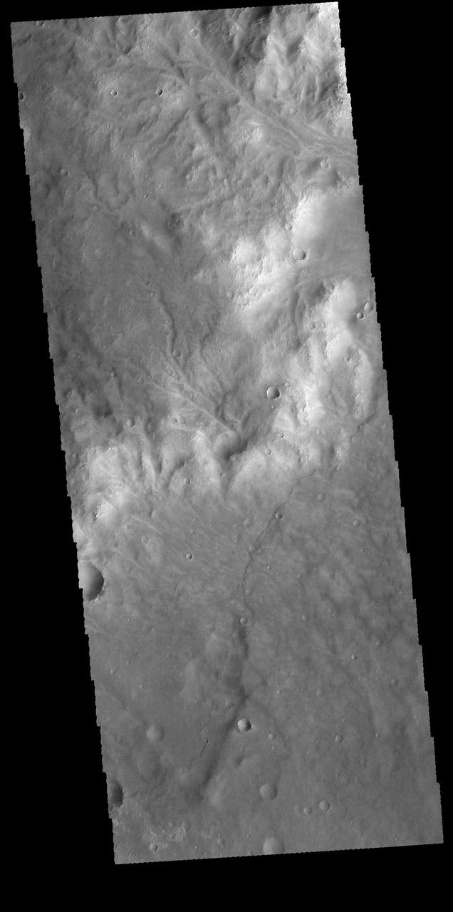
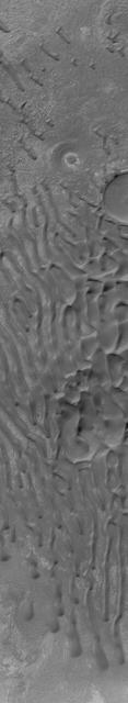
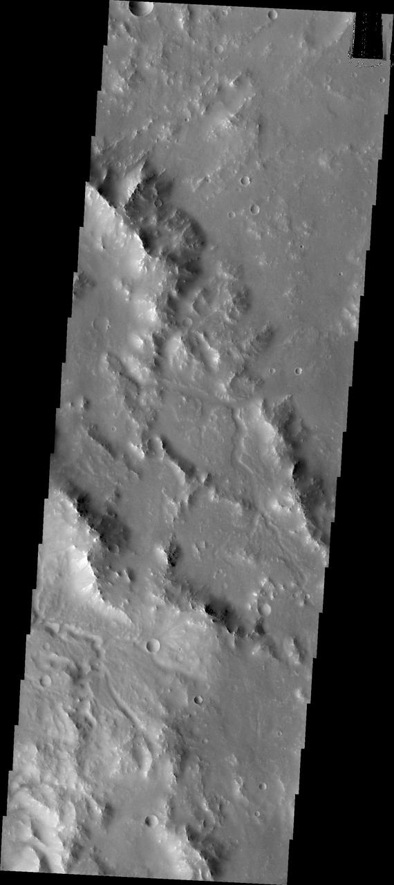
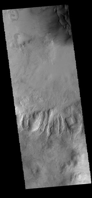
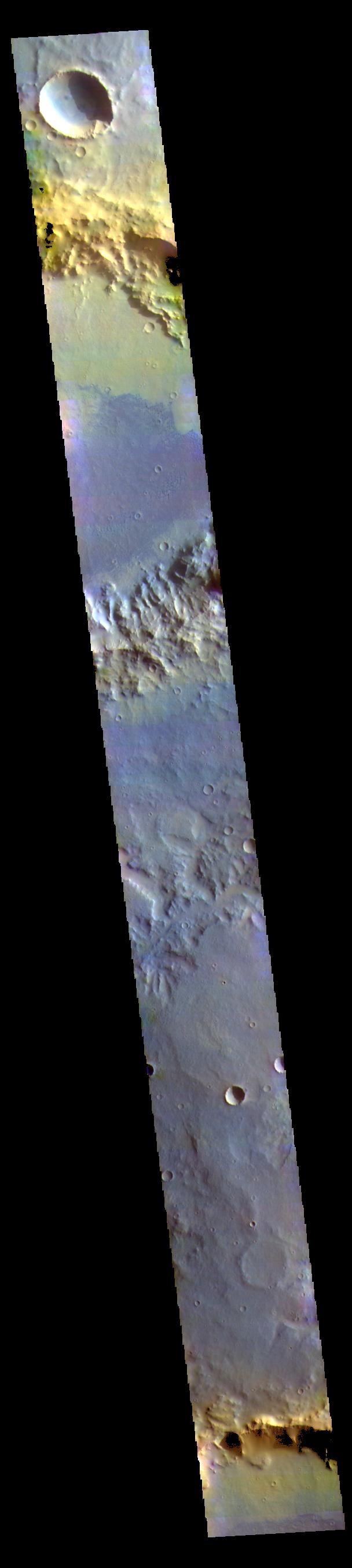
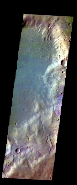
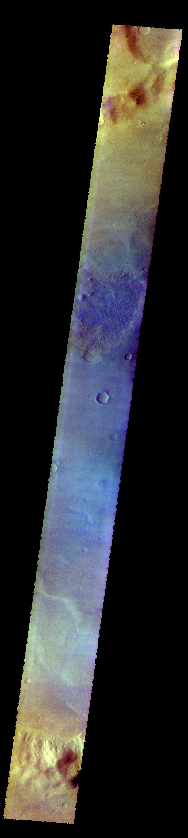
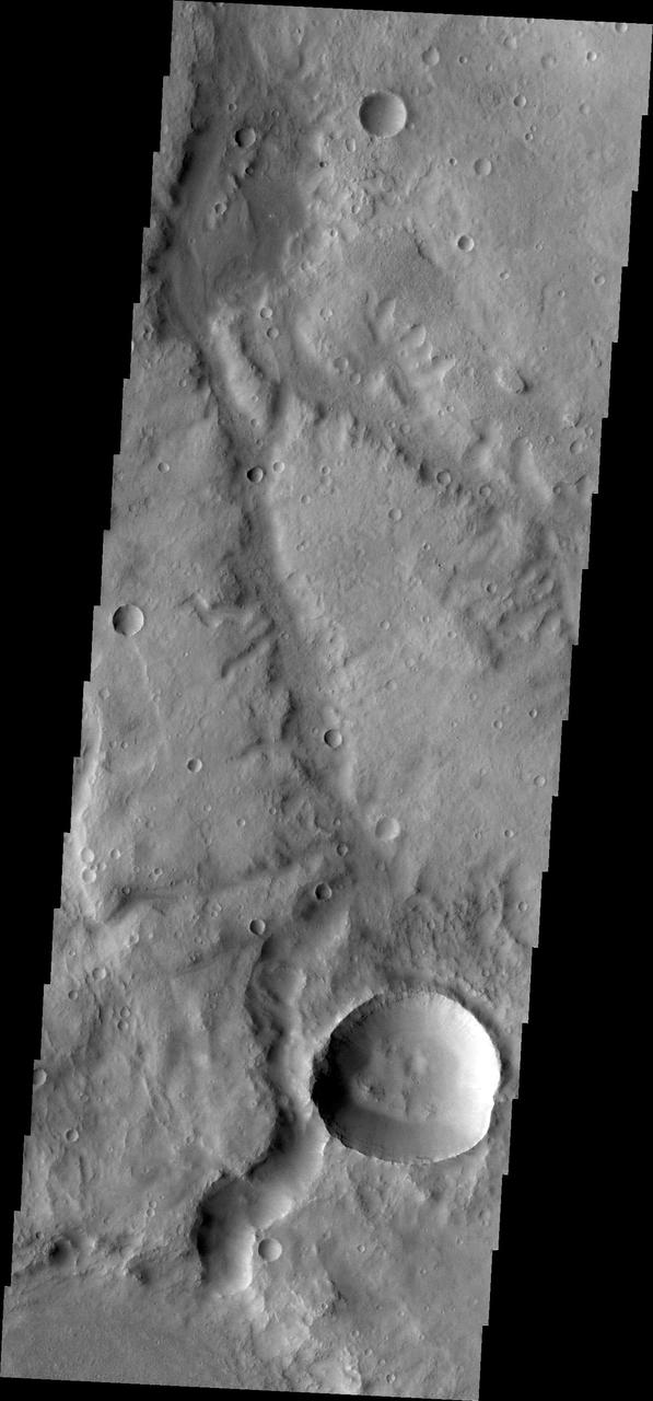
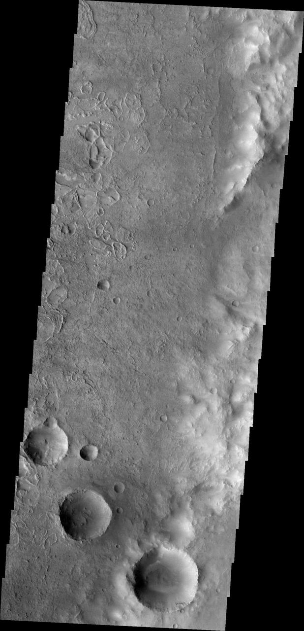
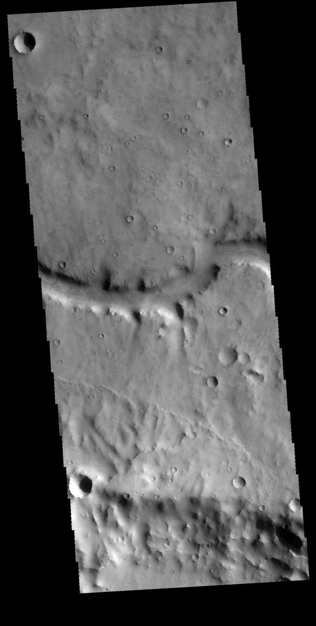
Numerous channels dissect the higher elevation material at the top of this image. This image captured by NASA 2001 Mars Odyssey spacecraft is located in Noachis Terra. Orbit Number: 65679 Latitude: -25.5077 Longitude: 18.2562 Instrument: VIS Captured: 2016-10-03 20:51 http://photojournal.jpl.nasa.gov/catalog/PIA21179
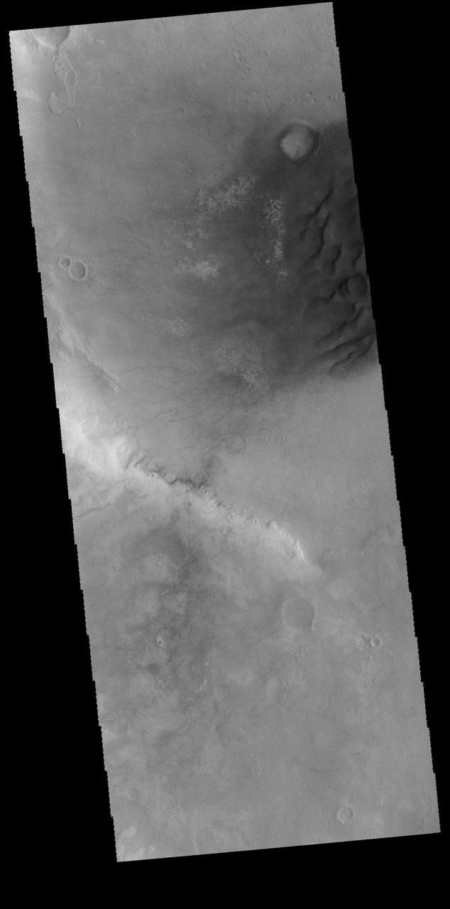
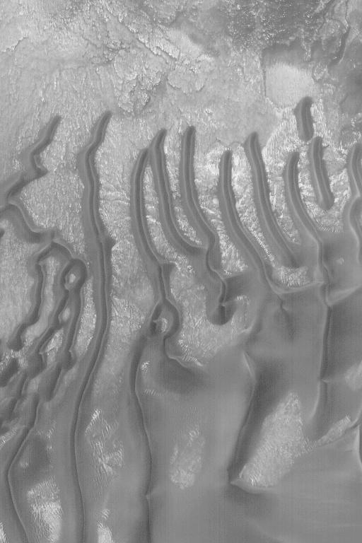
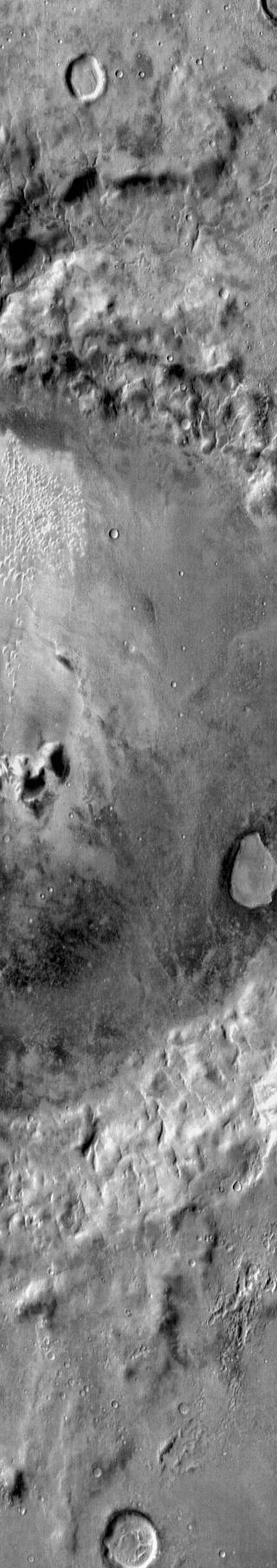
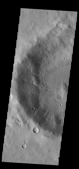
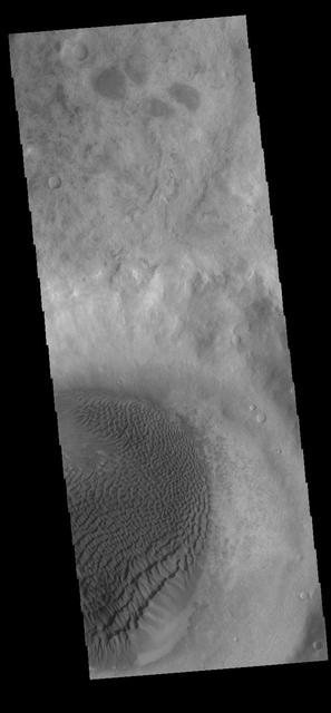
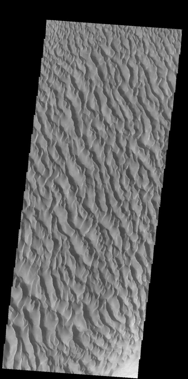
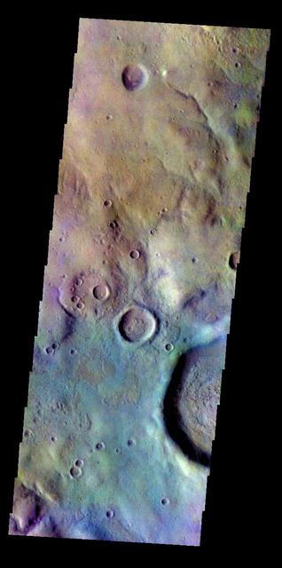
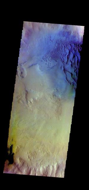
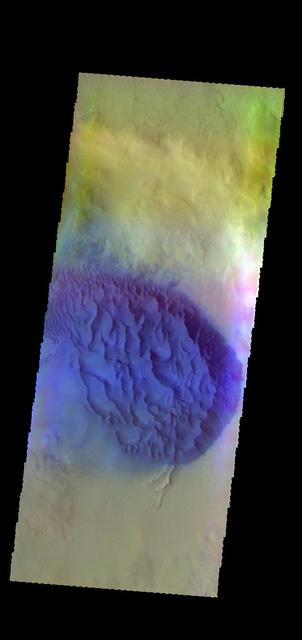
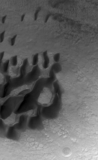
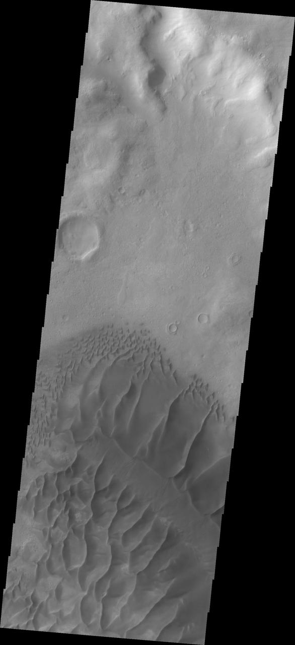
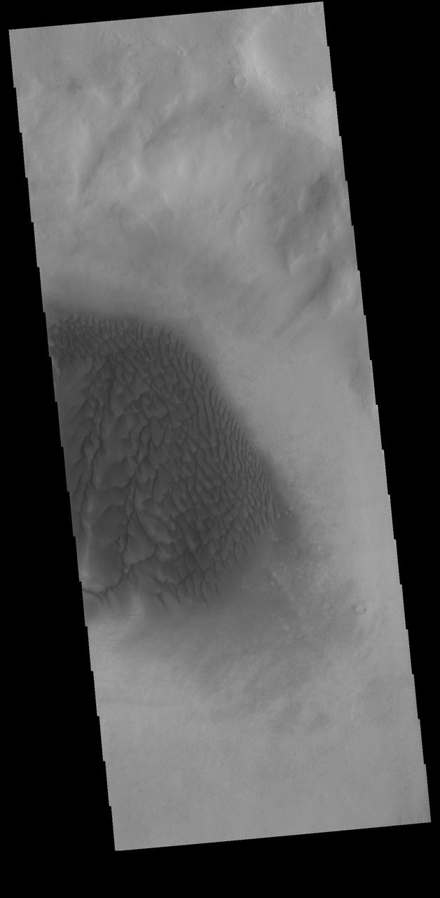
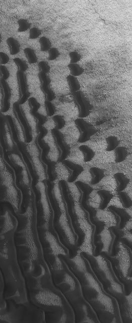
Today's VIS image shows part of Noachis Terra, including several large dunes on the floor of an unnamed crater. Orbit Number: 66203 Latitude: -52.1314 Longitude: 17.9281 Instrument: VIS Captured: 2016-11-16 00:45 http://photojournal.jpl.nasa.gov/catalog/PIA21285
Gullied Trough in Noachis Terra
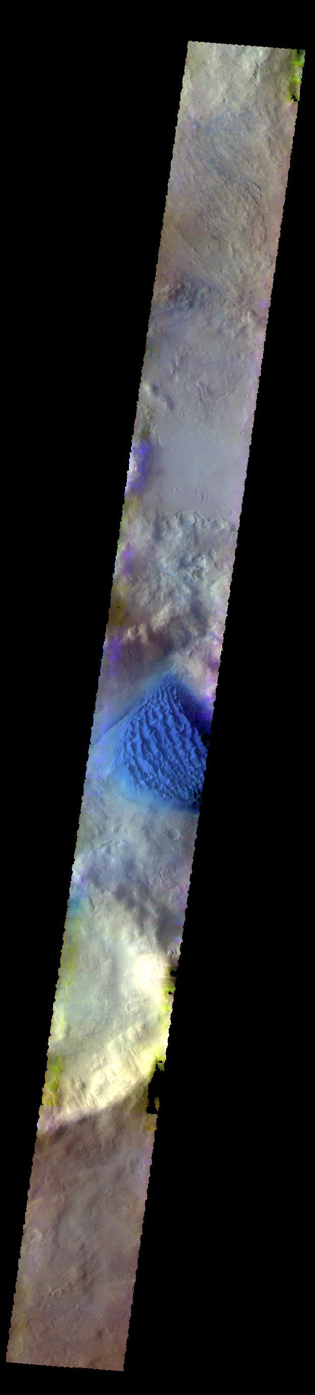
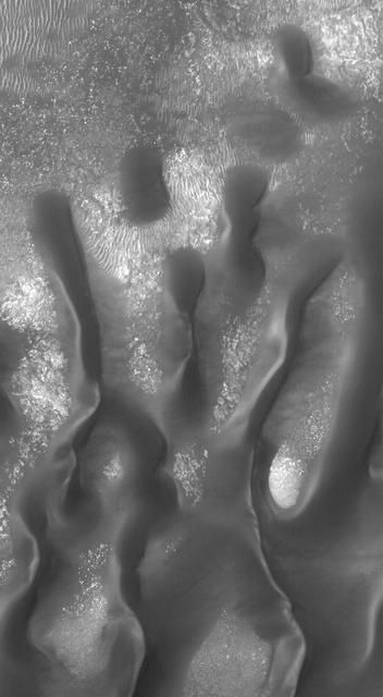
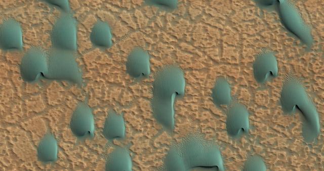
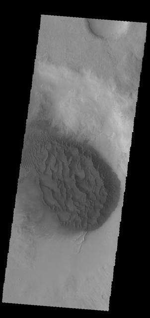
Sand Dunes in Noachis Terra
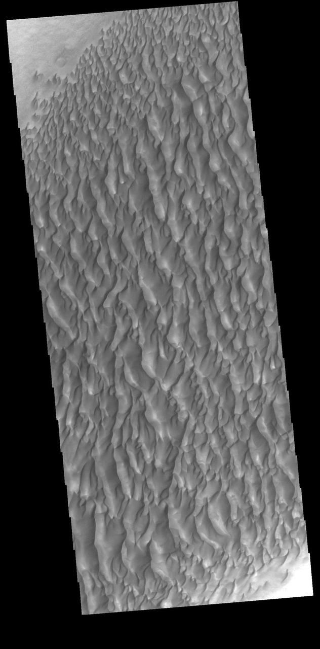
Dunes in Noachis Terra
Dunes in Noachis Terra
The THEMIS camera contains 5 filters. The data from different filters can be combined in multiple ways to create a false color image. These false color images may reveal subtle variations of the surface not easily identified in a single band image. Today's false color image shows part of the plains of Noachis Terra. Orbit Number: 43006 Latitude: -38.3345 Longitude: 349.255 Instrument: VIS Captured: 2011-08-25 09:00 http://photojournal.jpl.nasa.gov/catalog/PIA20976
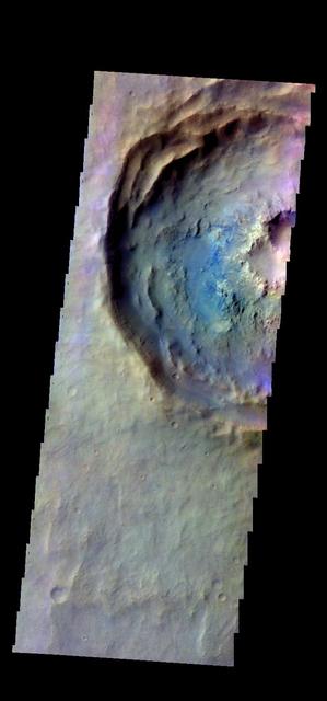
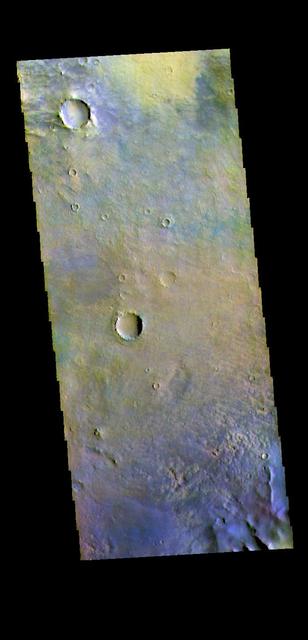
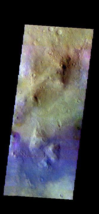
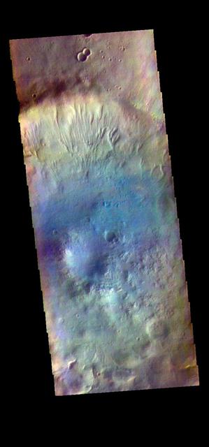
The THEMIS VIS camera contains 5 filters. The data from different filters can be combined in multiple ways to create a false color image. These false color images may reveal subtle variations of the surface not easily identified in a single band image. Today's false color image shows part of a crater in Noachis Terra. Orbit Number: 43794 Latitude: -20.676 Longitude: 306.232 Instrument: VIS Captured: 2011-10-29 05:35 http://photojournal.jpl.nasa.gov/catalog/PIA21017
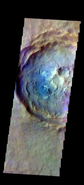
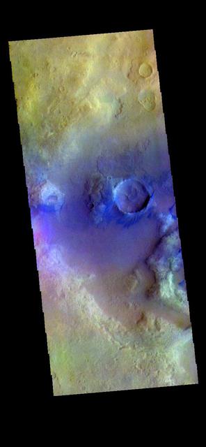
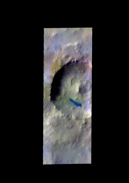
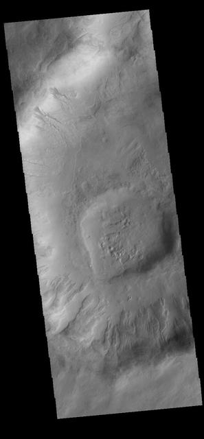
The THEMIS camera contains 5 filters. The data from different filters can be combined in multiple ways to create a false color image. These false color images may reveal subtle variations of the surface not easily identified in a single band image. Today's false color image shows an unnamed crater in Noachis Terra. Orbit Number: 43070 Latitude: -20.6112 Longitude: 306.293 Instrument: VIS Captured: 2011-08-30 15:21 http://photojournal.jpl.nasa.gov/catalog/PIA20979
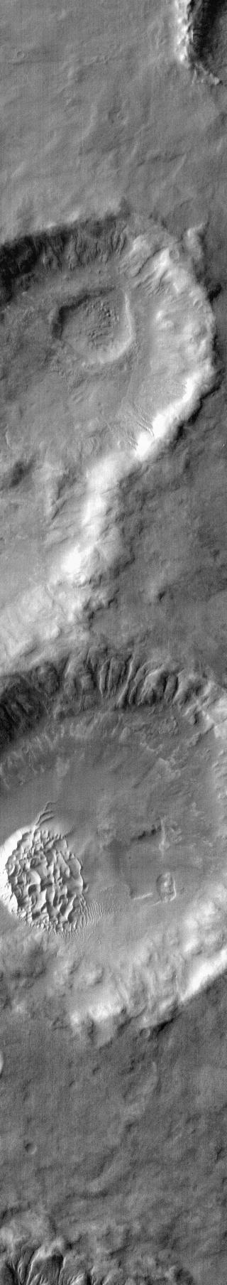
MSIP: Gullies in Craters in Noachis Terra
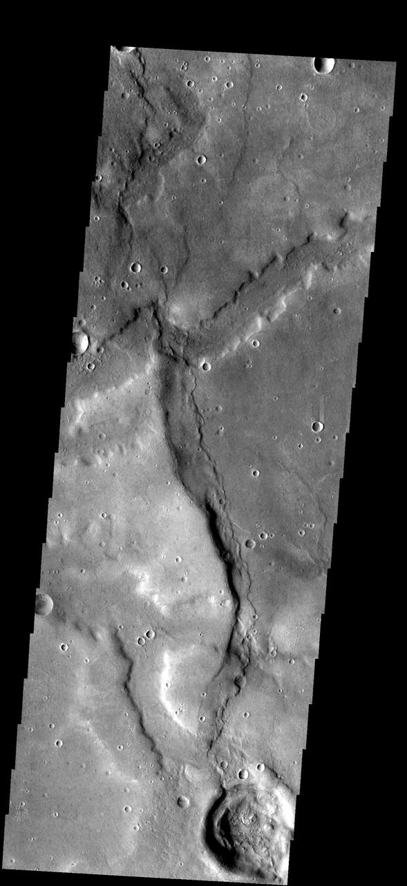
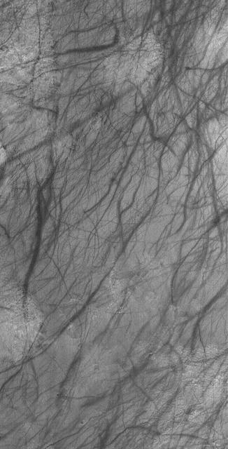
Broad channels appear to cross a substantial wrinkle ridge in the image of part of Noachis Terra
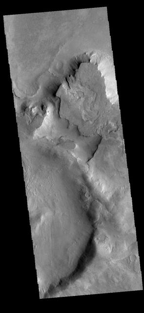
This closed depression is located in Noachis Terra. To the south a channel leads to second region of erosion
Small channels dissect the rim of Bakhuysen Crater in Noachis Terra as seen by NASA 2001 Mars Odyssey.
This 2001 Mars Odyssey image shows small individual dunes located on the floor of this unnamed crater in Noachis Terra.
The dunes in this VIS image are located on the floor of an unnamed crater in Noachis Terra as seen by NASA 2001 Mars Odyssey spacecraft.

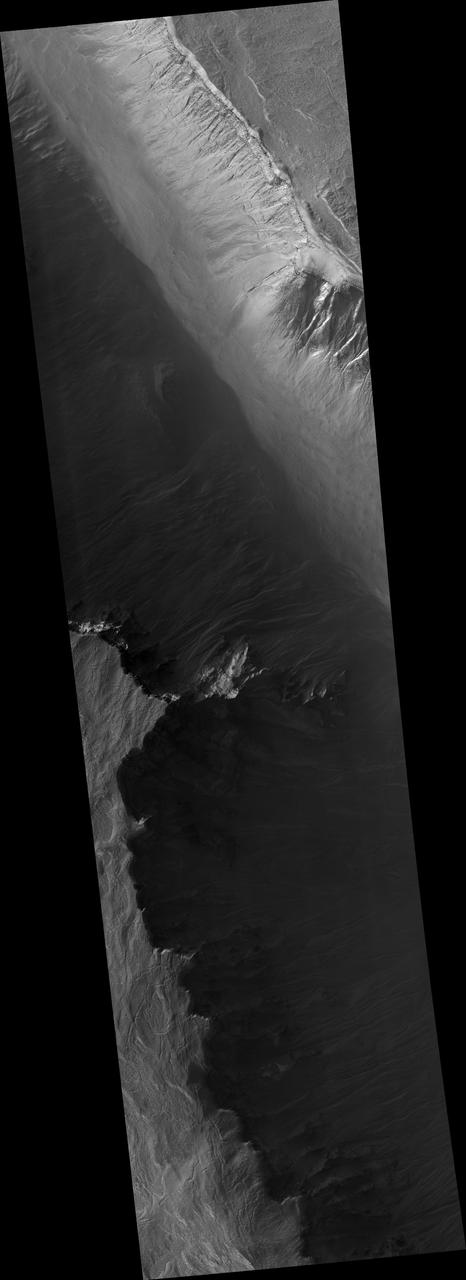
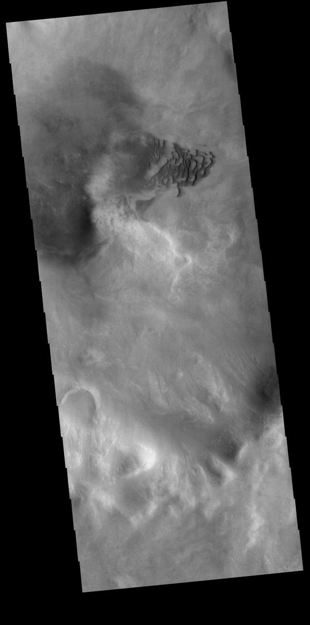
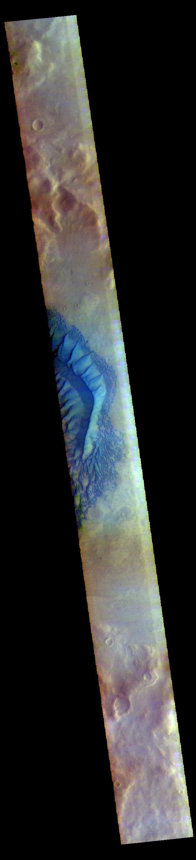
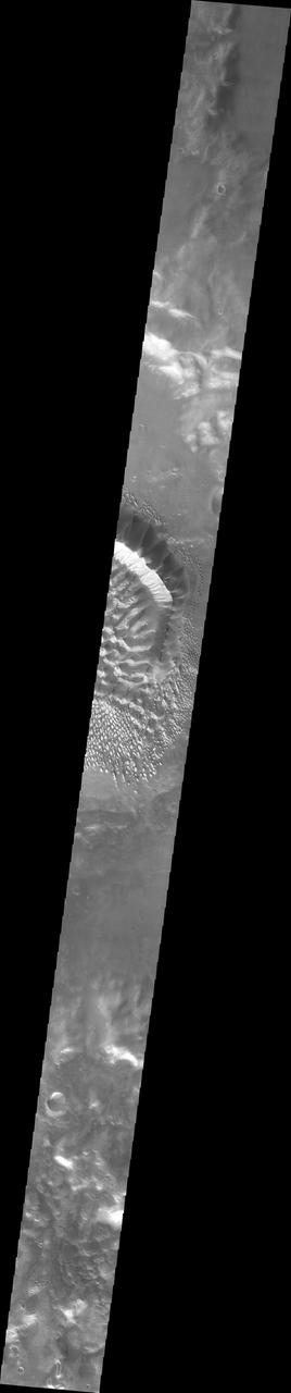
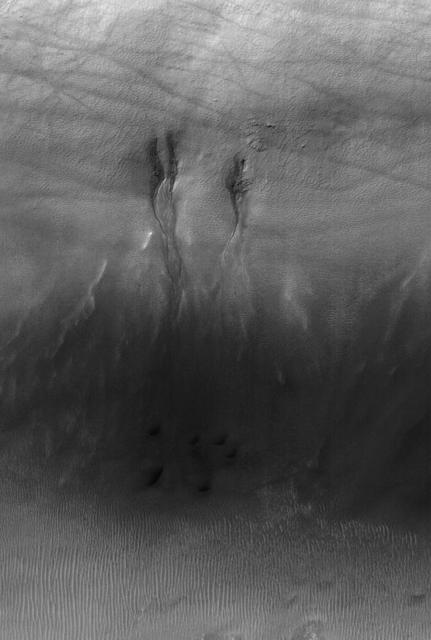
This image taken by NASA Mars Reconnaissance Orbiter shows gullies in a semi-circular trough in Noachis Terra. The gullies are observed to face all directions.
Evidence for Recent Liquid Water on Mars: Gullies in Crater Wall, Noachis Terra
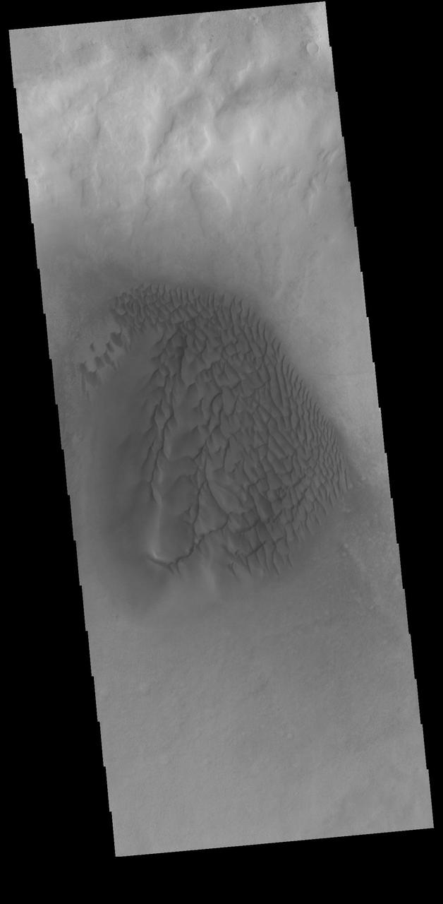
The small dunes in this VIS image are located in an unnamed crater in southern Noachis Terra. Orbit Number: 82059 Latitude: -56.2948 Longitude: 353.028 Instrument: VIS Captured: 2020-06-14 01:00 https://photojournal.jpl.nasa.gov/catalog/PIA24119
This enhanced-color image from NASA Mars Reconnaissance Orbiter shows sand dunes trapped in an impact crater in Noachis Terra, Mars.
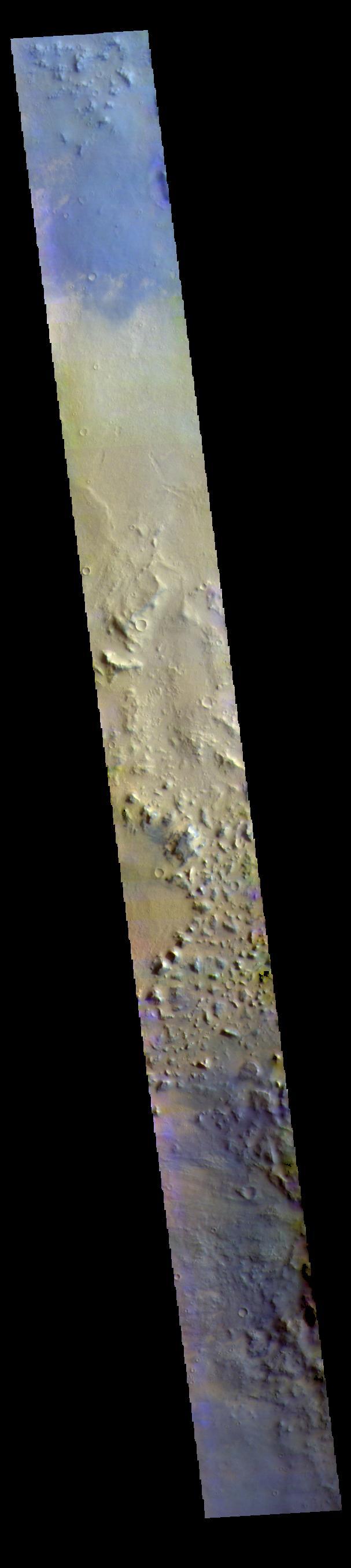
The THEMIS VIS camera contains 5 filters. The data from different filters can be combined in multiple ways to create a false color image. These false color images may reveal subtle variations of the surface not easily identified in a single band image. Today's false color image shows part of Noachis Terra. Orbit Number: 71129 Latitude: -9.19933 Longitude: 11.422 Instrument: VIS Captured: 2017-12-26 21:34 https://photojournal.jpl.nasa.gov/catalog/PIA24506
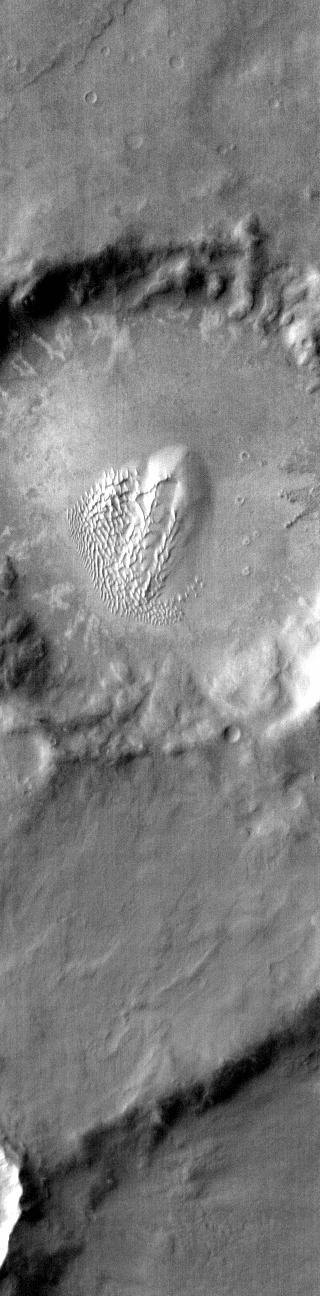
Today's VIS image is located in southern Noachis Terra. There is a crater-like form in the upper left of this image, with an interior mound that appears to be even with the rim of the circular depression. It is not understood how such mounds are created. The side of the mound contains several gullies. Orbit Number: 82271 Latitude: -69.2758 Longitude: 1.34513 Instrument: VIS Captured: 2020-07-01 11:53 https://photojournal.jpl.nasa.gov/catalog/PIA24144
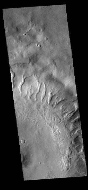
Many gullies dissect the inner rim of this unnamed crater in Noachis Terra. Orbit Number: 67270 Latitude: -40.2335 Longitude: 357.921 Instrument: VIS Captured: 2017-02-11 22:06 https://photojournal.jpl.nasa.gov/catalog/PIA21523
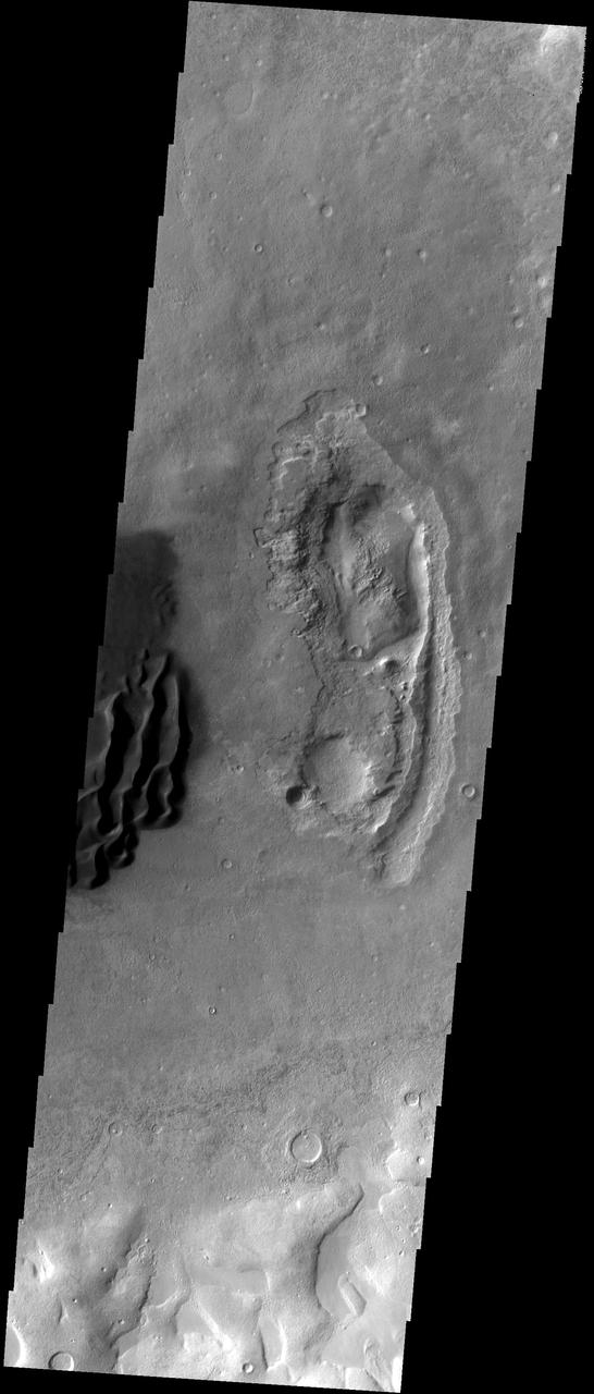
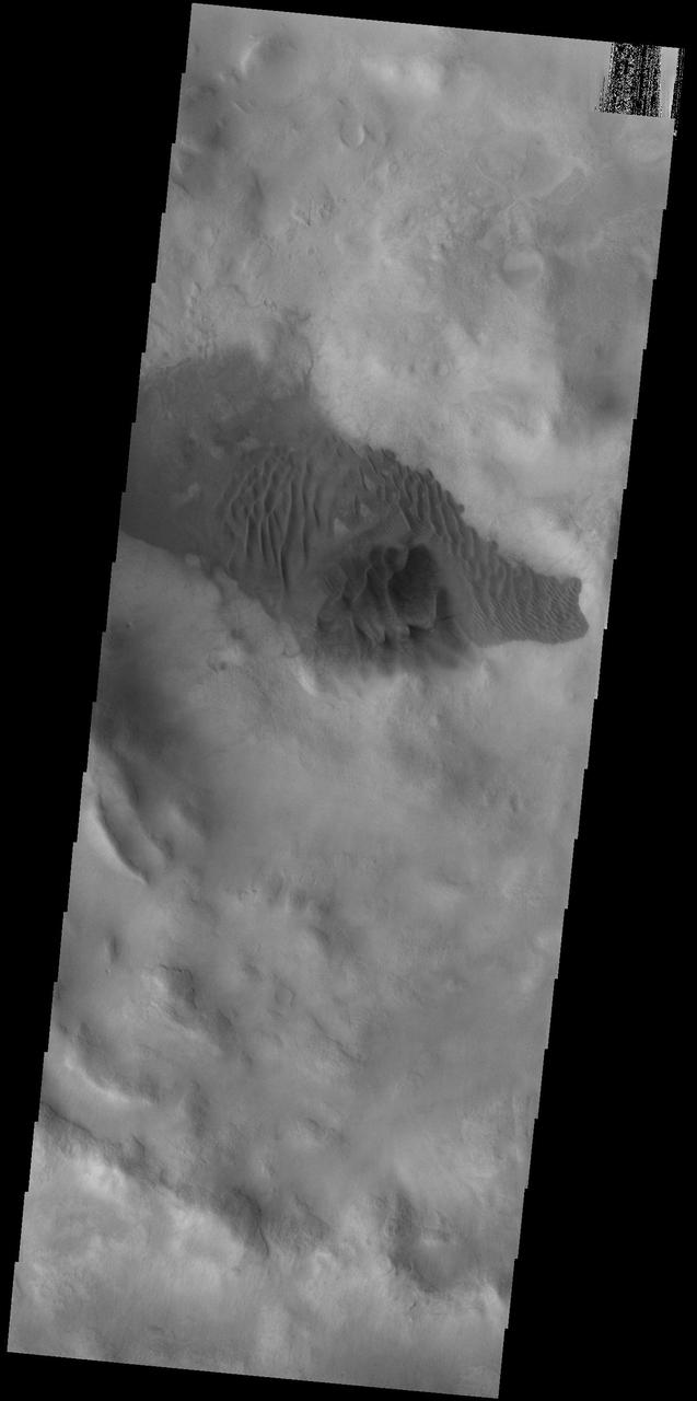
This VIS image shows part of an unnamed crater in Noachis Terra. Large gullies dissect the crater rim and dunes are located on the crater floor. Orbit Number: 66826 Latitude: -49.1576 Longitude: 33.7976 Instrument: VIS Captured: 2017-01-06 08:37 http://photojournal.jpl.nasa.gov/catalog/PIA21319
This image captured by NASA 2001 Mars Odyssey spacecraft shows sand dunes on the floor of an unnamed crater in Noachis Terra. Orbit Number: 66596 Latitude: -58.5214 Longitude: 10.4199 Instrument: VIS Captured: 2016-12-18 09:27 http://photojournal.jpl.nasa.gov/catalog/PIA21302
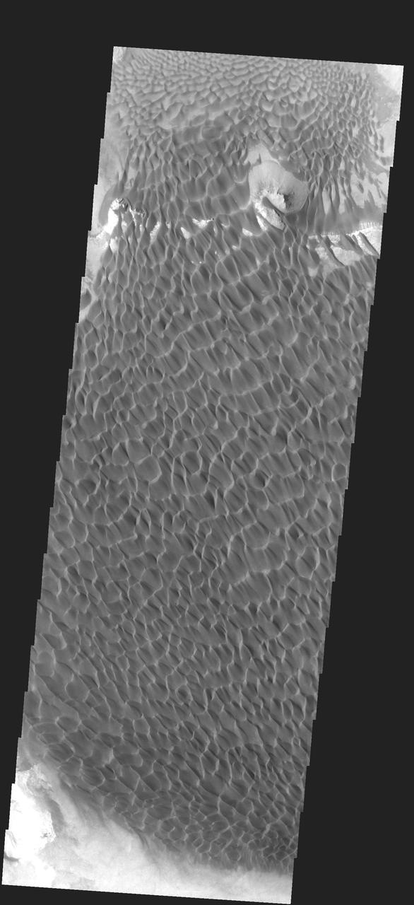
This VIS image shows a portion of a sand sheet with surface dune forms on the floor of an unnamed crater in Noachis Terra. Orbit Number: 67200 Latitude: -45.445 Longitude: 36.7847 Instrument: VIS Captured: 2017-02-06 04:11 https://photojournal.jpl.nasa.gov/catalog/PIA21522
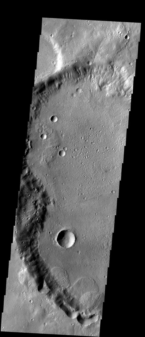
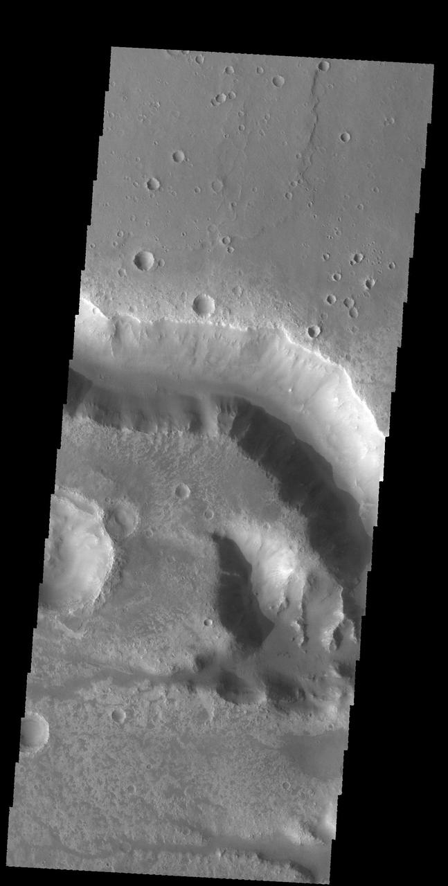
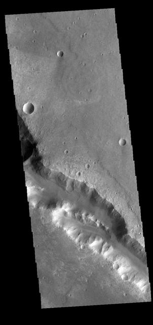
This image from NASA 2001 Mars Odyssey spacecraft shows numerous large gullies dissect the inner rim of this unnamed crater in Noachis Terra. Orbit Number: 65853 Latitude: -34.5477 Longitude: 37.3545 Instrument: VIS Captured: 2016-10-18 04:49 http://photojournal.jpl.nasa.gov/catalog/PIA21186
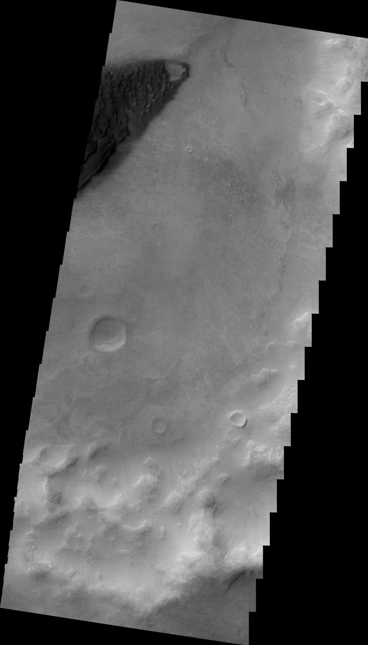
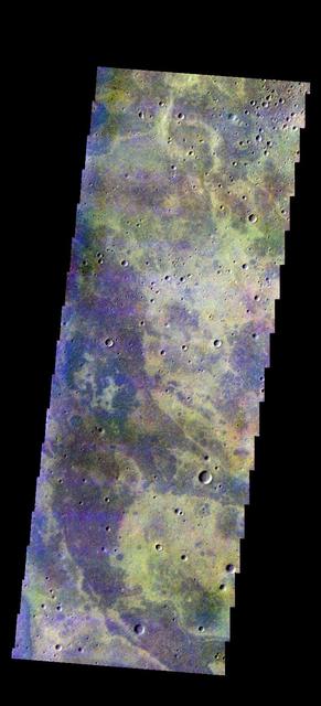
Today's false color image shows part of the plains of Noachis Terra southwest of Schiaparelli Crater. The THEMIS VIS camera contains 5 filters. The data from different filters can be combined in multiple ways to create a false color image. These false color images may reveal subtle variations of the surface not easily identified in a single band image. Orbit Number: 63097 Latitude: -6.20315 Longitude: 11.7459 Instrument: VIS Captured: 2016-03-05 04:38 https://photojournal.jpl.nasa.gov/catalog/PIA23217
Today's image shows the floor of an unnamed crater in Noachis Terra. The THEMIS VIS camera contains 5 filters. The data from different filters can be combined in multiple ways to create a false color image. These false color images may reveal subtle variations of the surface not easily identified in a single band image. Orbit Number: 63534 Latitude: -9.41914 Longitude: 1.30232 Instrument: VIS Captured: 2016-04-10 04:28 https://photojournal.jpl.nasa.gov/catalog/PIA23252
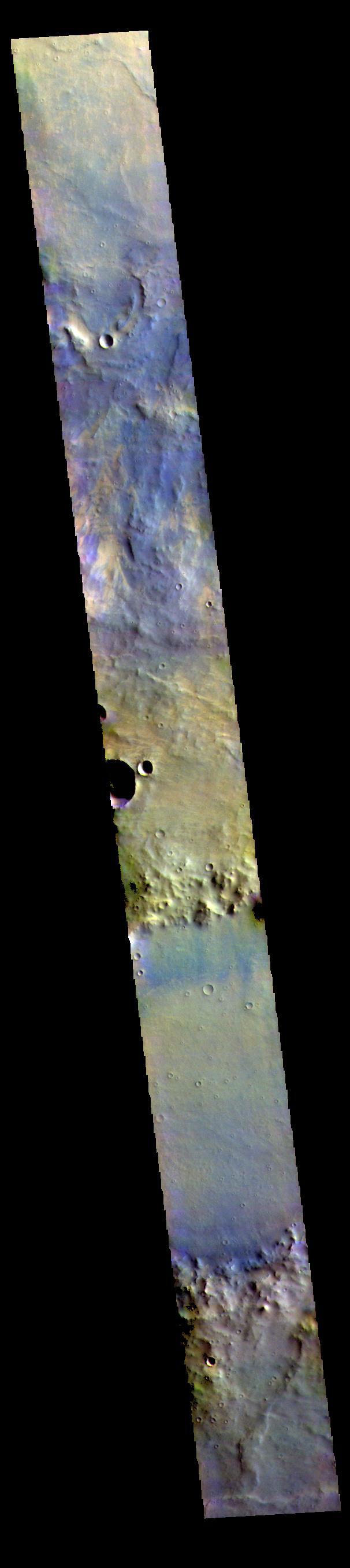
This image is located in northern Noachis Terra. Evros Vallis is located just below the large crater at the top of the image. The THEMIS VIS camera contains 5 filters. The data from different filters can be combined in multiple ways to create a false color image. These false color images may reveal subtle variations of the surface not easily identified in a single band image. Orbit Number: 62336 Latitude: -12.8197 Longitude: 12.5078 Instrument: VIS Captured: 2016-01-02 12:21 https://photojournal.jpl.nasa.gov/catalog/PIA23110
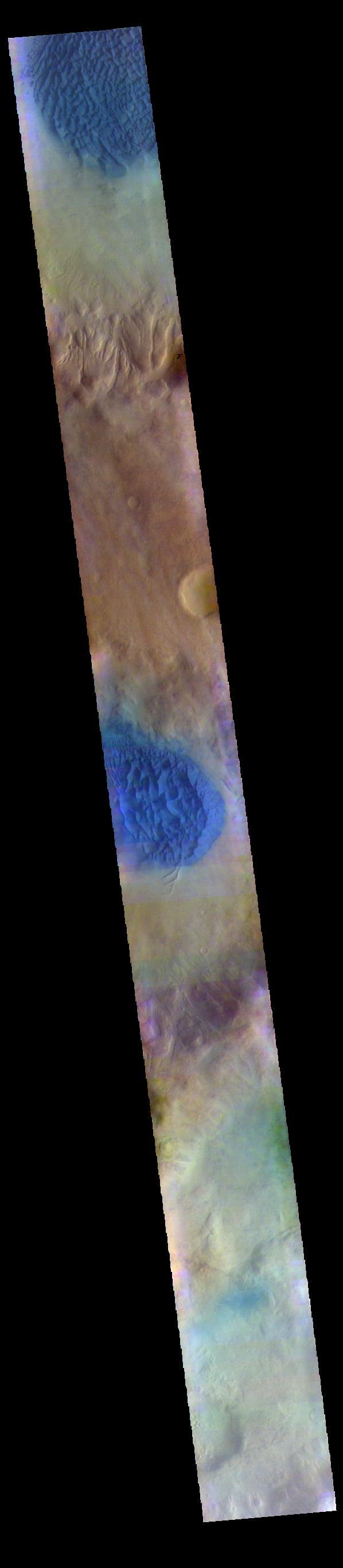
The THEMIS VIS camera contains 5 filters. The data from different filters can be combined in multiple ways to create a false color image. These false color images may reveal subtle variations of the surface not easily identified in a single band image. Today's false color image shows part of Noachis Terra. The large craters are unnamed, as is the channel in the center of the image. Dark blue tones in this false color image indicate basaltic sands. Orbit Number: 63010 Latitude: -5.56102 Longitude: 2.22751 Instrument: VIS Captured: 2016-02-27 00:40 https://photojournal.jpl.nasa.gov/catalog/PIA23199
The THEMIS VIS camera contains 5 filters. The data from different filters can be combined in multiple ways to create a false color image. These false color images may reveal subtle variations of the surface not easily identified in a single band image. Today's false color image shows the floor of an unnamed crater in Noachis Terra. Orbit Number: 75302 Latitude: -45.6155 Longitude: 359.839 Instrument: VIS Captured: 2018-12-05 14:49 https://photojournal.jpl.nasa.gov/catalog/PIA24602
The THEMIS VIS camera contains 5 filters. The data from different filters can be combined in multiple ways to create a false color image. These false color images may reveal subtle variations of the surface not easily identified in a single band image. Today's false color image shows the floor of an unnamed crater in Noachis Terra. Orbit Number: 75046 Latitude: -49.24 Longitude: 6.82778 Instrument: VIS Captured: 2018-11-14 13:15 https://photojournal.jpl.nasa.gov/catalog/PIA24558
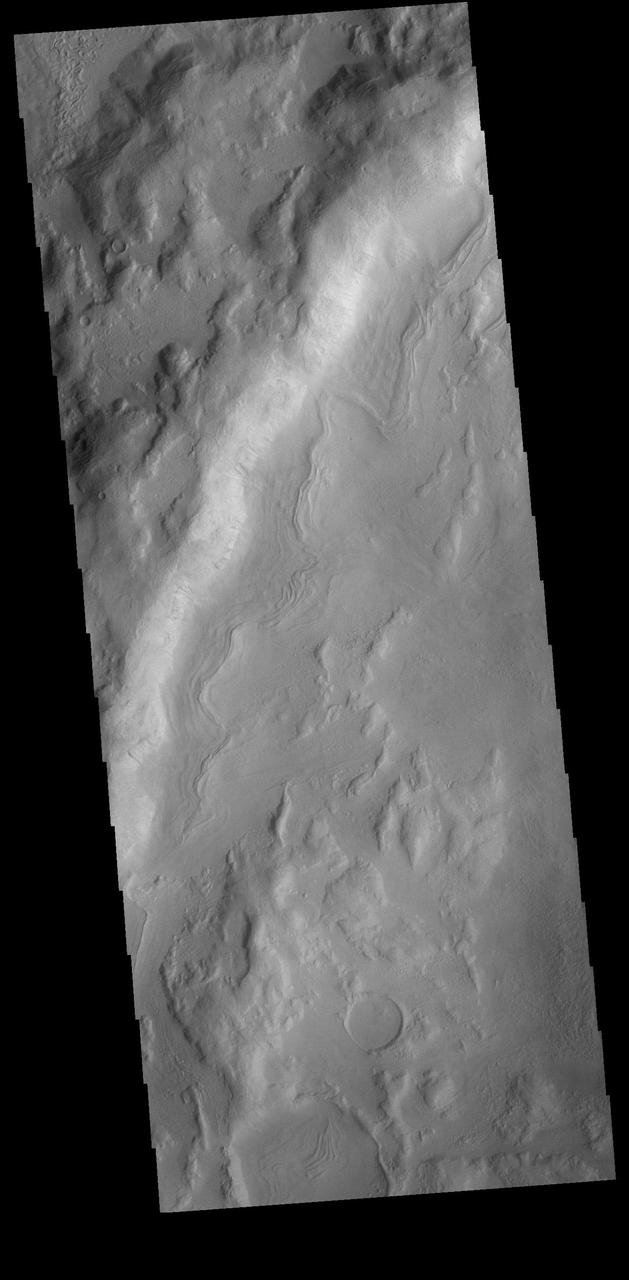
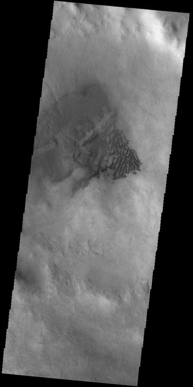
This VIS image is located in an unnamed crater in Noachis Terra. The sinuous feature near the bottom of the crater rim appears to have been caused by down slope movement of materials. The sinuous nature may have been created by inclusion of a volatile material such as ice. Orbit Number: 74447 Latitude: -39.937 Longitude: 11.1296 Instrument: VIS Captured: 2018-09-26 05:13 https://photojournal.jpl.nasa.gov/catalog/PIA22844
This IR image from NASA 2001 Mars Odyssey spacecraft shows a dune field on the floor of an unnamed crater in Noachis Terra. The bright tone indicates the dunes are warmer than most of the material surrounding them. Latitude: -52.0045 Longitude: 33.3379 Instrument: IR Captured: 2015-01-29 09:19 http://photojournal.jpl.nasa.gov/catalog/PIA19233
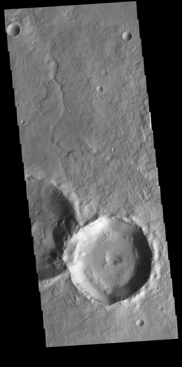
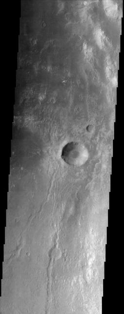
This image captured by NASA 2001 Mars Odyssey spacecraft is located in Noachis Terra. The unnamed crater at the bottom of the image contains a central pit. Central features such as pits and peaks can provide information about both the impacted surface and the size of the meteorite. Orbit Number: 65680 Latitude: -28.4965 Longitude: 349.805 Instrument: VIS Captured: 2016-10-03 22:49 http://photojournal.jpl.nasa.gov/catalog/PIA21180
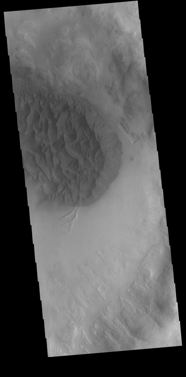
This image captured by NASA 2001 Mars Odyssey spacecraft shows the large dune field located on the floor of Proctor Crater in Noachis Terra. Orbit Number: 66982 Latitude: -47.5876 Longitude: 30.3392 Instrument: VIS Captured: 2017-01-19 04:39 http://photojournal.jpl.nasa.gov/catalog/PIA21503
The THEMIS VIS camera contains 5 filters. The data from different filters can be combined in multiple ways to create a false color image. These false color images may reveal subtle variations of the surface not easily identified in a single band image. Today's false color image shows an unnamed crater in Noachis Terra. Small dunes can be seen in the bottom half of the image. Dark blue tones in this filter combination indicate basaltic sands. Orbit Number: 71104 Latitude: -3.40884 Longitude: 12.2767 Instrument: VIS Captured: 2017-12-24 20:10 https://photojournal.jpl.nasa.gov/catalog/PIA24505
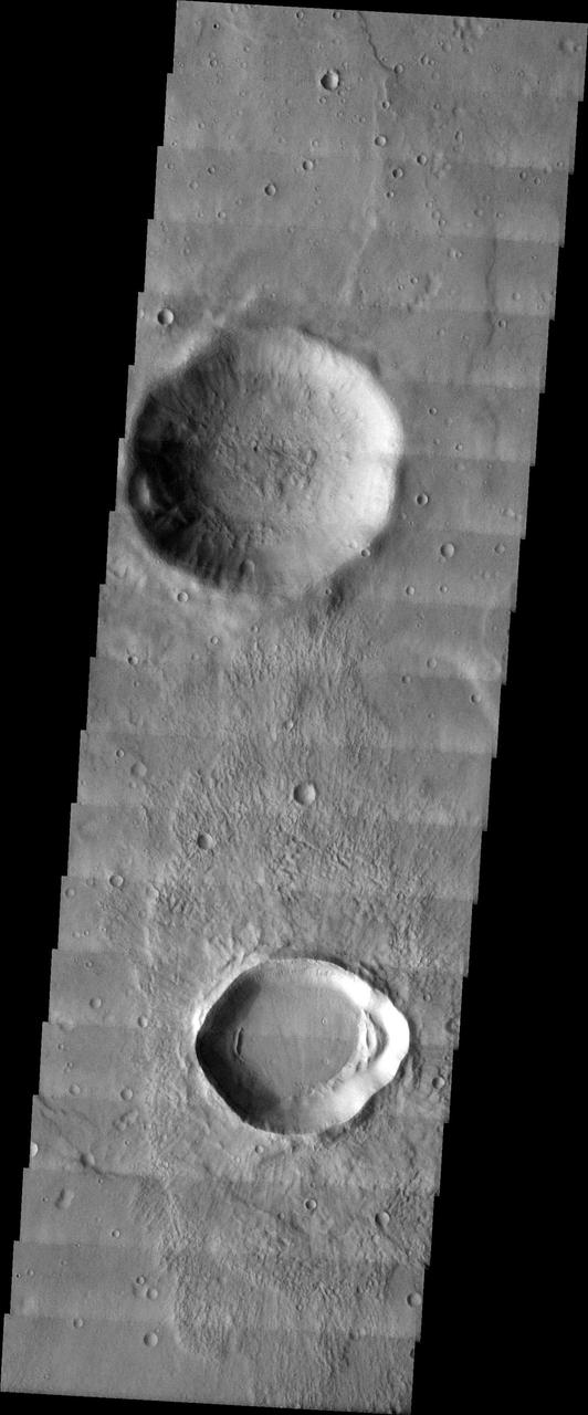
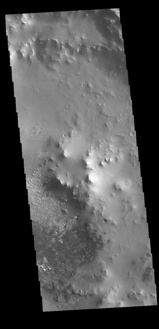
This VIS images shows part of two unnamed craters in Noachis Terra. The younger of the two craters is at the bottom of the image with one side visible in the image. The older and much larger crater has just part of the rim and floor visible towards the top of the image. The overlapping of one crater on top of another allows for relative dating to be done. We don't know the exact ages of each crater, but we can define which came first. Orbit Number: 65804 Latitude: -49.4751 Longitude: 14.2708 Instrument: VIS Captured: 2016-10-14 03:52 http://photojournal.jpl.nasa.gov/catalog/PIA21184
The THEMIS camera contains 5 filters. The data from different filters can be combined in multiple ways to create a false color image. These false color images may reveal subtle variations of the surface not easily identified in a single band image. Today's false color images shows an unnamed crater in Noachis Terra. The "dark blue" material is probably basaltic sands. Orbit Number: 17811 Latitude: -77.9919 Longitude: 0.491743 Instrument: VIS Captured: 2005-12-19 20:35. http://photojournal.jpl.nasa.gov/catalog/PIA20225
The THEMIS VIS camera contains 5 filters. The data from different filters can be combined in multiple ways to create a false color image. These false color images may reveal subtle variations of the surface not easily identified in a single band image. Today's false color image shows an unnamed crater in Noachis Terra. Orbit Number: 58444 Latitude: -34.896 Longitude: 337.007 Instrument: VIS Captured: 2015-02-16 00:19 http://photojournal.jpl.nasa.gov/catalog/PIA19743
The THEMIS VIS camera contains 5 filters. The data from different filters can be combined in multiple ways to create a false color image. This image from NASA 2001 Mars Odyssey spacecraft show part of the floor of an unnamed crater in Noachis Terra. Orbit Number: 6504 Latitude: -11.2333 Longitude: 14.399 Instrument: VIS Captured: 2003-06-02 22:31 http://photojournal.jpl.nasa.gov/catalog/PIA19408
The THEMIS VIS camera contains 5 filters. The data from different filters can be combined in multiple ways to create a false color image. These false color images may reveal subtle variations of the surface not easily identified in a single band image. Today's false color image shows a crater in Noachis Terra. Orbit Number: 10125 Latitude: -32.8453 Longitude: 333.619 Instrument: VIS Captured: 2004-03-27 00:47 http://photojournal.jpl.nasa.gov/catalog/PIA19754
The THEMIS VIS camera contains 5 filters. The data from different filters can be combined in multiple ways to create a false color image. These false color images may reveal subtle variations of the surface not easily identified in a single band image. Today's false color image shows part of the plains of Noachis Terra north of the Argyre basin. Orbit Number: 8079 Latitude: -38.2634 Longitude: 309.074 Instrument: VIS Captured: 2003-10-10 14:13 http://photojournal.jpl.nasa.gov/catalog/PIA19724
The THEMIS VIS camera contains 5 filters. The data from different filters can be combined in multiple ways to create a false color image. These false color images may reveal subtle variations of the surface not easily identified in a single band image. Today's false color image shows the dune field on the floor of Matara Crater in Noachis Terra. Orbit Number: 59846 Latitude: -49.361 Longitude: 34.6114 Instrument: VIS Captured: 2015-06-11 10:29 https://photojournal.jpl.nasa.gov/catalog/PIA21795
The THEMIS VIS camera contains 5 filters. The data from different filters can be combined in multiple ways to create a false color image. These false color images may reveal subtle variations of the surface not easily identified in a single band image. Today's false color image shows dunes on the floor of an unnamed crater in Noachis Terra. Orbit Number: 58960 Latitude: -48.9257 Longitude: 33.7526 Instrument: VIS Captured: 2015-03-30 11:31 https://photojournal.jpl.nasa.gov/catalog/PIA21666
The THEMIS VIS camera contains 5 filters. The data from different filters can be combined in multiple ways to create a false color image. These false color images may reveal subtle variations of the surface not easily identified in a single band image. Today's false color image shows part of Proctor Crater in Noachis Terra. Orbit Number: 59659 Latitude: -47.6015 Longitude: 29.5774 Instrument: VIS Captured: 2015-05-27 00:55 https://photojournal.jpl.nasa.gov/catalog/PIA21675
The THEMIS VIS camera contains 5 filters. The data from different filters can be combined in multiple ways to create a false color image. These false color images may reveal subtle variations of the surface not easily identified in a single band image. Today's false color image shows dunes in an unnamed crater in Noachis Terra. Orbit Number: 58443 Latitude: -55.3606 Longitude: 9.89672 Instrument: VIS Captured: 2015-02-15 22:14 http://photojournal.jpl.nasa.gov/catalog/PIA19742
The THEMIS VIS camera contains 5 filters. The data from different filters can be combined in multiple ways to create a false color image. These false color images may reveal subtle variations of the surface not easily identified in a single band image. Today's false color image shows part of Russell Crater in Noachis Terra. Orbit Number: 59591 Latitude: -54.471 Longitude: 13.1288 Instrument: VIS Captured: 2015-05-21 10:57 https://photojournal.jpl.nasa.gov/catalog/PIA21674
The THEMIS VIS camera contains 5 filters. The data from different filters can be combined in multiple ways to create a false color image. These false color images may reveal subtle variations of the surface not easily identified in a single band image. Today's false color image shows a sand sheet with surface dune forms in an unnamed crater in Noachis Terra. Orbit Number: 58336 Latitude: -48.6161 Longitude: 34.0534 Instrument: VIS Captured: 2015-02-07 02:22 http://photojournal.jpl.nasa.gov/catalog/PIA19734
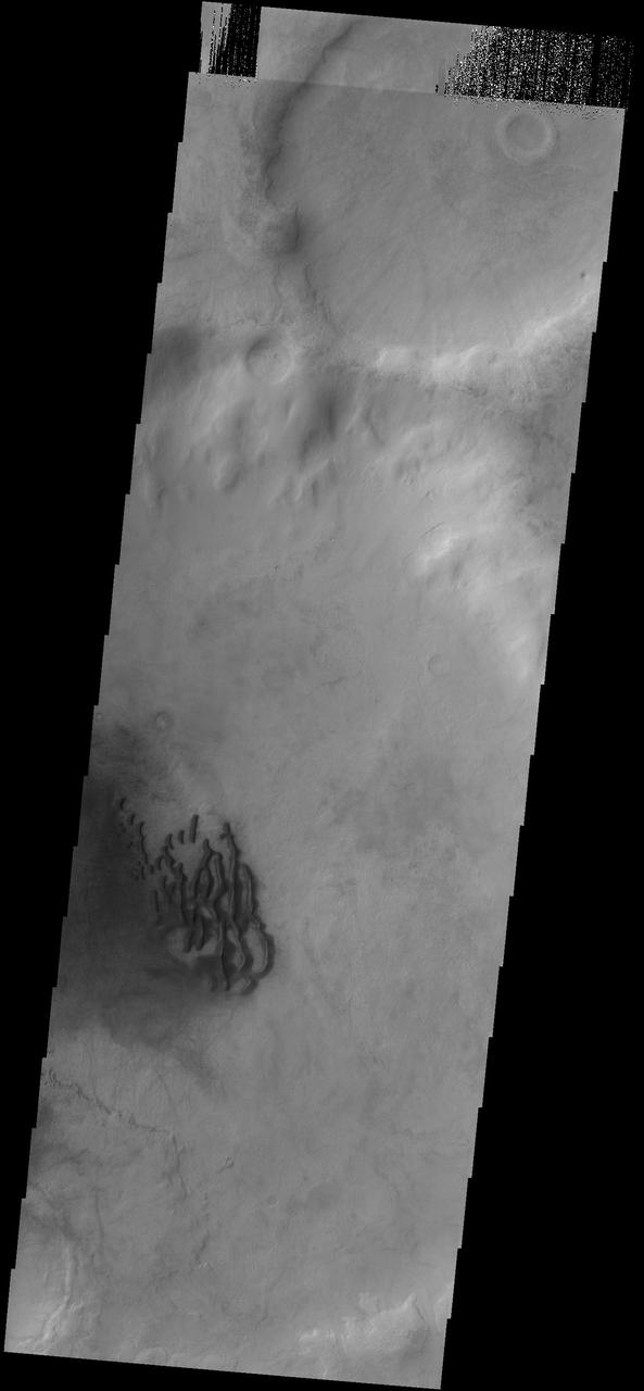
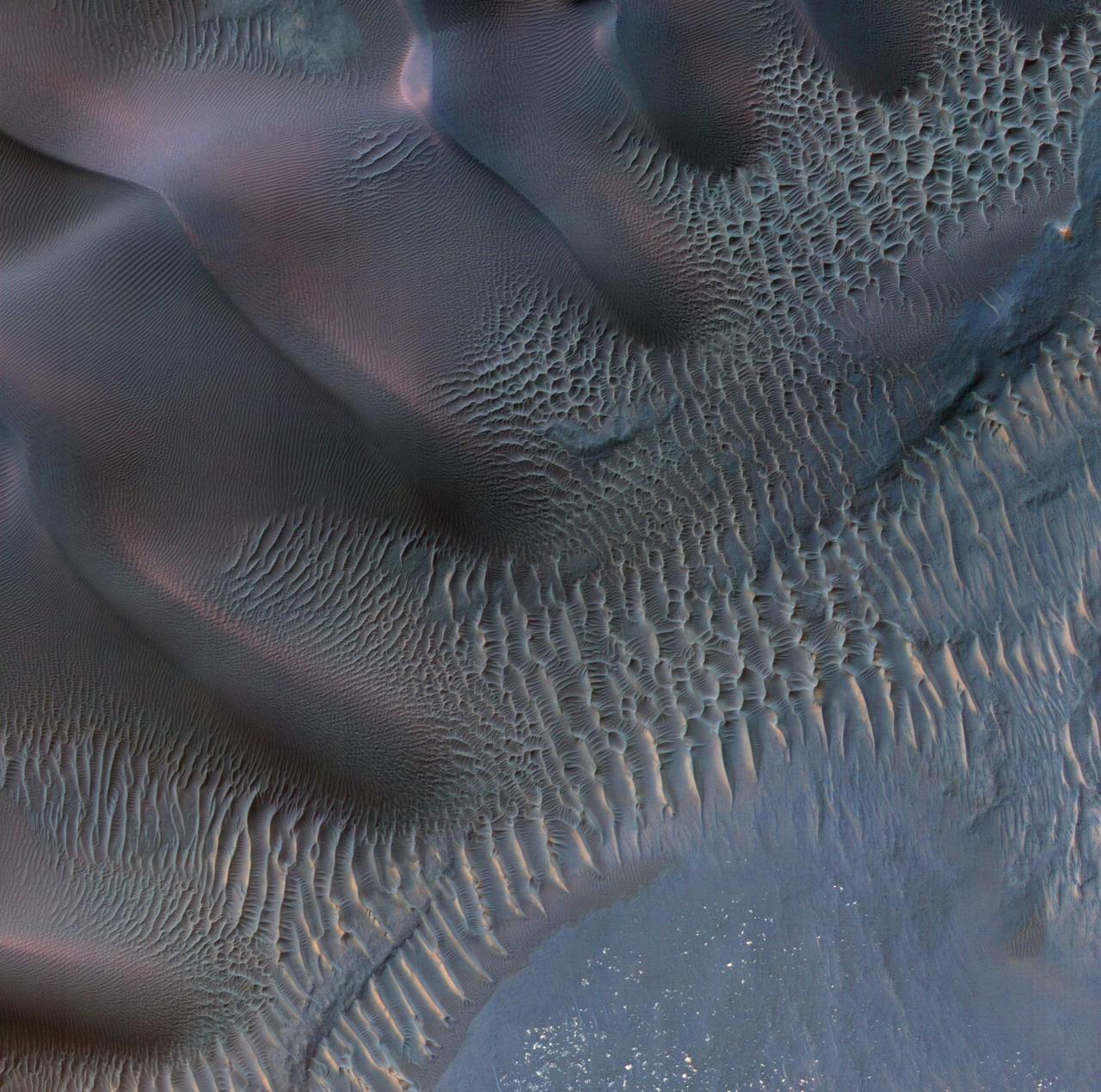
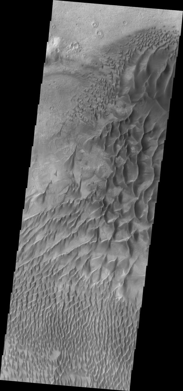
The THEMIS VIS camera contains 5 filters. The data from different filters can be combined in multiple ways to create a false color image. These false color images may reveal subtle variations of the surface not easily identified in a single band image. Today's false color image shows dunes in several craters in Noachis Terra. As with other craters in this region, large mounds of sand dunes are located on the crater floors. Wind directions that blow from east south east to west north west (lower right corner to upper left corner of the image) are arising from Hellas Planitia. Orbit Number: 67462 Latitude: -48.7336 Longitude: 34.0451 Instrument: VIS Captured: 2017-02-27 18:15 https://photojournal.jpl.nasa.gov/catalog/PIA24059
This image shows a slice of the floor of Russell Crater. Russell Crater is located in Noachis Terra. The spectacular dune ridge and other dune forms on the crater floor have caused extensive imaging. The Odyssey spacecraft has spent over 15 years in orbit around Mars, circling the planet more than 69,000 times. It holds the record for longest working spacecraft at Mars. THEMIS, the IR/VIS camera system, has collected data for the entire mission and provides images covering all seasons and lighting conditions. Over the years many features of interest have received repeated imaging, building up a suite of images covering the entire feature. From the deepest chasma to the tallest volcano, individual dunes inside craters and dune fields that encircle the north pole, channels carved by water and lava, and a variety of other feature, THEMIS has imaged them all. For the next several months the image of the day will focus on the Tharsis volcanoes, the various chasmata of Valles Marineris, and the major dunes fields. We hope you enjoy these images! Orbit Number: 6354 Latitude: -54.6188 Longitude: 12.9816 Instrument: VIS Captured: 2003-05-21 14:24 https://photojournal.jpl.nasa.gov/catalog/PIA21798
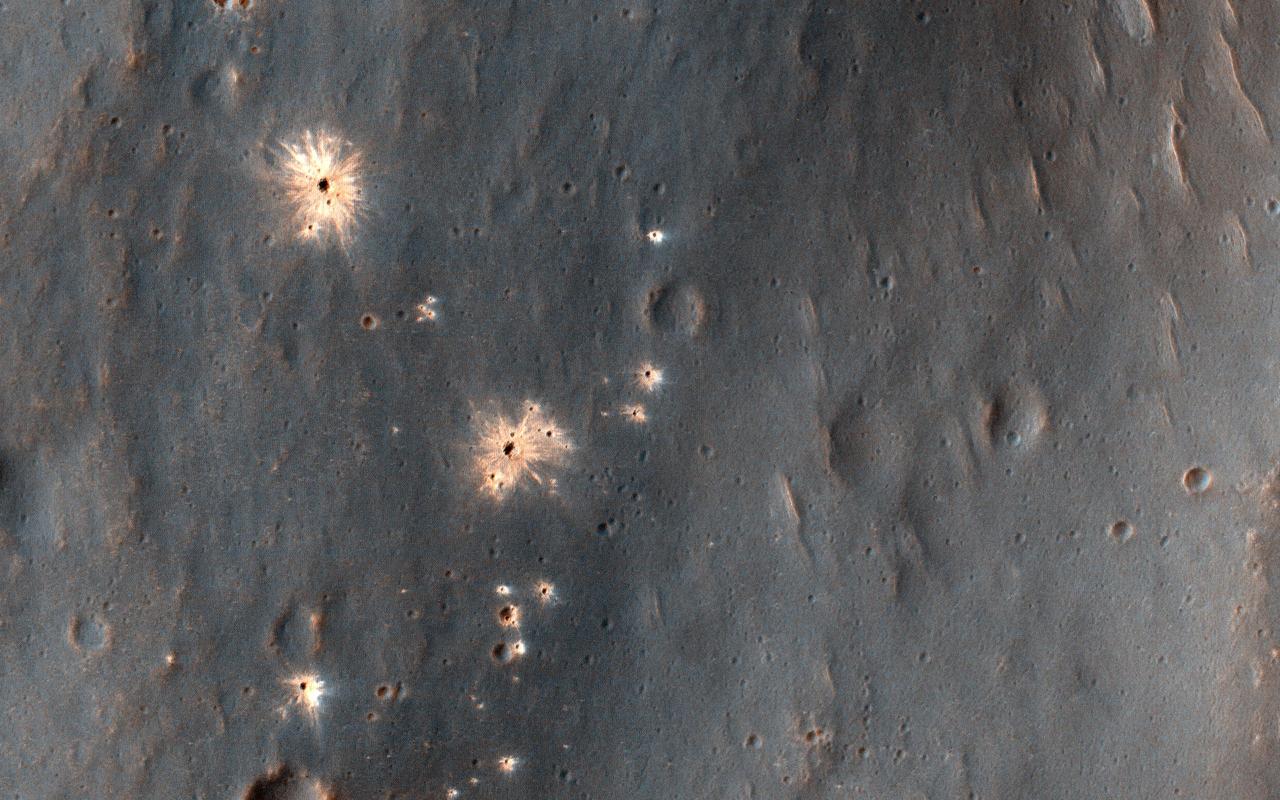
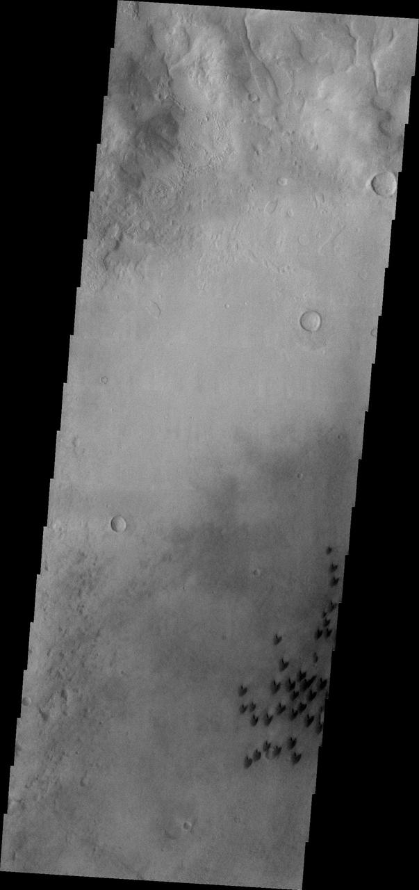
This image shows a recent impact in Noachis Terra in the southern mid-latitudes of Mars. The impact occurred in dark-toned ejecta material from a degraded, 60-kilometer crater to the south. Rather than a single impact crater, we see multiple impacts like a shotgun blast. This suggests that the impactor broke up in the atmosphere on entry. Although the atmosphere of Mars is thinner than Earth's, it still has the capacity to break up small impactors, especially ones comprised of weaker materials, like a stony meteoroid versus a iron-nickel one. Our image depicts 21 distinctive craters ranging in size from 1 to 7 meters in diameter. They are distributed over an area that spans about 305 meters. Most observed recent impacts expose darker-toned materials underlying bright dusty surfaces. However, this impact does the opposite, showing us lighter-toned materials that lie beneath a darker colored surface. The impact was initially discovered in a 2016 Context Camera image, and was not seen in a 2009 picture. This implies that the impact may be only two years old, but certainly no more than nine years. https://photojournal.jpl.nasa.gov/catalog/PIA23061
These dark sand dunes are located in an unnamed crater in Noachis Terra

Dunes with several different forms are found on the floor of this unnamed crater in Noachis Terra.
This extensive dune field in located on the floor of a large unnamed crater in Noachis Terra
The three landslides in this image are located within an unnamed crater in Noachis Terra
This image shows individual dunes on the floor of Russell Crater, as well as larger dunes created by individual dunes coalescing . These dunes are in the western part of the dune field. Russell Crater is located in Noachis Terra. A spectacular dune ridge and other dune forms on the crater floor have caused extensive imaging. The Odyssey spacecraft has spent over 15 years in orbit around Mars, circling the planet more than 69000 times. It holds the record for longest working spacecraft at Mars. THEMIS, the IR/VIS camera system, has collected data for the entire mission and provides images covering all seasons and lighting conditions. Over the years many features of interest have received repeated imaging, building up a suite of images covering the entire feature. From the deepest chasma to the tallest volcano, individual dunes inside craters and dune fields that encircle the north pole, channels carved by water and lava, and a variety of other feature, THEMIS has imaged them all. For the next several months the image of the day will focus on the Tharsis volcanoes, the various chasmata of Valles Marineris, and the major dunes fields. We hope you enjoy these images! Orbit Number: 26372 Latitude: -54.372 Longitude: 12.5481 Instrument: VIS Captured: 2007-11-24 17:16 https://photojournal.jpl.nasa.gov/catalog/PIA21800
This image shows dark sand dunes and relatively small, light-toned, windblown ripples on the floor of a crater in central Noachis Terra

This MOC image shows a steep a field of dark sand dunes in an unnamed crater in the Noachis Terra/Hellespontus region of Mars
This MOC image shows material on the floor of a crater in Noachis Terra, west of Hellas Planitia
The small, individual dunes in this image captured by NASA 2001 Mars Odyssey spacecraft are located in an unnamed crater in Noachis Terra.
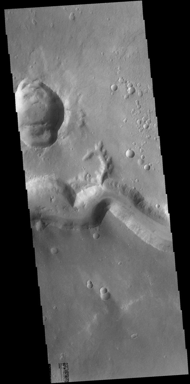
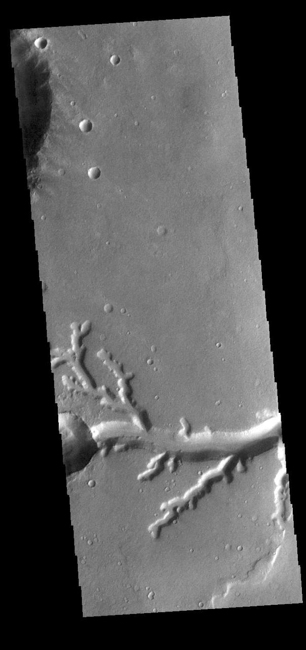
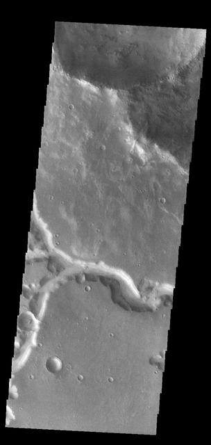
Marikh Vallis is the name given to the channels seen in this image of Noachis Terra as seen by NASA 2001 Mars Odyssey spacecraft.
Multiple channels dissect the rim of Bakhuysen Crater in Noachis Terra in this image captured by NASA 2001 Mars Odyssey spacecraft.
Odd rimmed depressions are located on the floor of this unnamed crater in Noachis Terra in this 2001 Mars Odyssey THEMIS VIS image.
Individual dunes are seen on the floor of Arkhangelsky Crater in Noachis Terra by NASA Mars Odyssey.
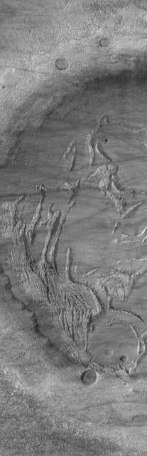
Mars Orbiter Camera MOC image shows complexly-eroded terrain within a partially-filled impact crater in Noachis Terra
Multiple channels dissect the rim of this unnamed crater in Noachis Terra as seen by NASA 2001 Mars Odyssey spacecraft.
This image shows the western section of the large sand ridge on the floor of Russell Crater. This is also the northern extent of the dune field. The crest of the large ridge runs from lower right to upper left. Smaller dune ridges intersect the large ridge perpendicular to the crest. Russell Crater is located in Noachis Terra. A spectacular dune ridge and other dune forms on the crater floor have caused extensive imaging. The Odyssey spacecraft has spent over 15 years in orbit around Mars, circling the planet more than 69000 times. It holds the record for longest working spacecraft at Mars. THEMIS, the IR/VIS camera system, has collected data for the entire mission and provides images covering all seasons and lighting conditions. Over the years many features of interest have received repeated imaging, building up a suite of images covering the entire feature. From the deepest chasma to the tallest volcano, individual dunes inside craters and dune fields that encircle the north pole, channels carved by water and lava, and a variety of other feature, THEMIS has imaged them all. For the next several months the image of the day will focus on the Tharsis volcanoes, the various chasmata of Valles Marineris, and the major dunes fields. We hope you enjoy these images! Orbit Number: 26659 Latitude: -54.0179 Longitude: 12.8638 Instrument: VIS Captured: 2007-12-18 08:26 https://photojournal.jpl.nasa.gov/catalog/PIA21801
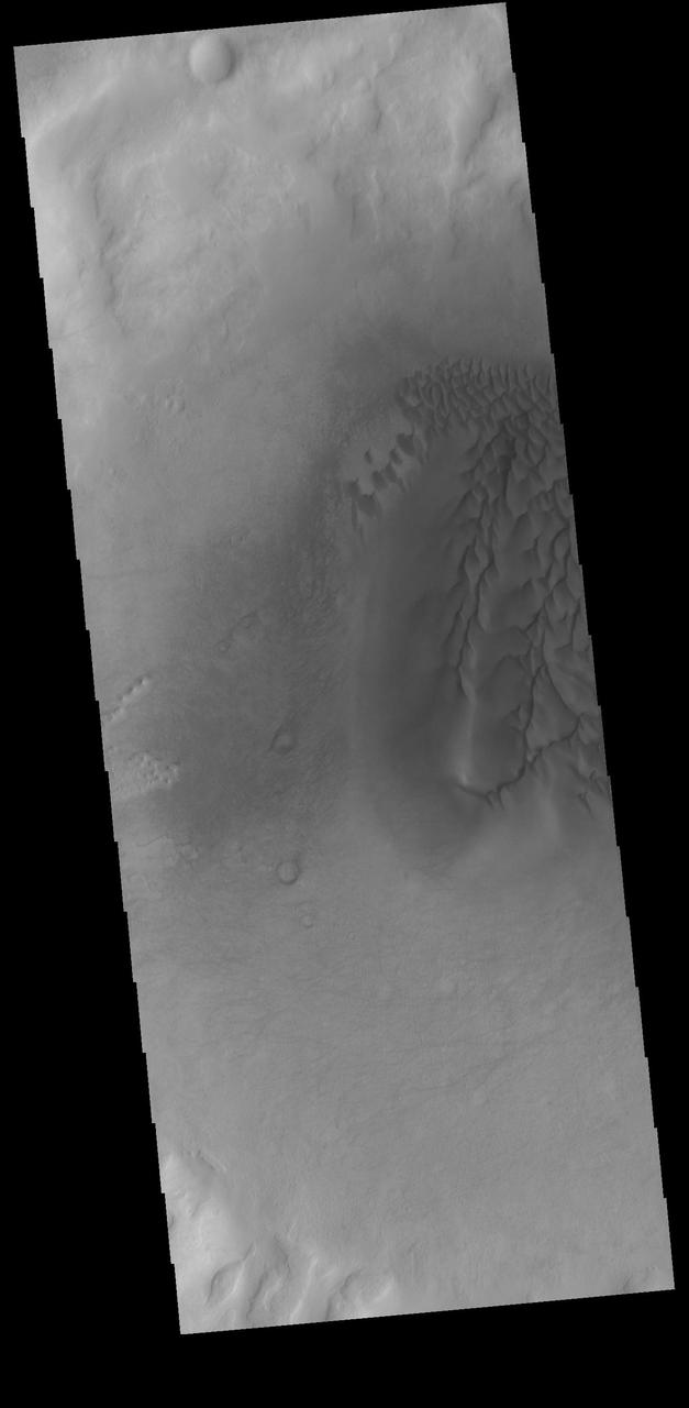
This field of dunes lies on the floor of an old crater in Noachis Terra, one of the oldest places on Mars, as seen by NASA Mars Reconnaissance Orbiter.
Sand dunes cover part of the floor of this unnamed crater in Noachis Terra. Orbit Number: 75357 Latitude: -52.1099 Longitude: 33.1768 Instrument: VIS Captured: 2018-12-10 03:58 https://photojournal.jpl.nasa.gov/catalog/PIA23031

This infrared image captured by NASA 2001 Mars Odyssey spacecraft shows dunes in an unnamed crater in Noachis Terra. Latitude: -49.5174 Longitude: 33.942 Instrument: IR Captured: 2015-01-27 07:56
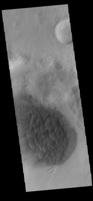
Today's VIS image shows sand dunes on the floor of an unnamed crater in Noachis Terra. Orbit Number: 74840 Latitude: -58.7099 Longitude: 8.80766 Instrument: VIS Captured: 2018-10-28 13:39 https://photojournal.jpl.nasa.gov/catalog/PIA22890
This image captured by NASA 2001 Mars Odyssey spacecraft shows a portion of Her Desher Vallis, located in Noachis Terra. Orbit Number: 58626 Latitude: -25.3889 Longitude: 312.639 Instrument: VIS Captured: 2015-03-02 23:20 http://photojournal.jpl.nasa.gov/catalog/PIA19446
Today's VIS image shows a dune field on the floor of an unnamed crater in Noachis Terra. Orbit Number: 83268 Latitude: -52.0585 Longitude: 33.3902 Instrument: VIS Captured: 2020-09-21 14:11 https://photojournal.jpl.nasa.gov/catalog/PIA24247
This image captured by NASA 2001 Mars Odyssey spacecraft shows dunes cover part of the floor of this unnamed crater in Noachis Terra. Orbit Number: 57556 Latitude: -48.6267 Longitude: 34.009 Instrument: VIS Captured: 2014-12-04 21:28 http://photojournal.jpl.nasa.gov/catalog/PIA19188
This image captured by NASA 2001 Mars Odyssey spacecraft shows dunes on the floor of an unnamed crater in Noachis Terra. Orbit Number: 58960 Latitude: -48.769 Longitude: 33.7843 Instrument: VIS Captured: 2015-03-30 11:31 http://photojournal.jpl.nasa.gov/catalog/PIA19467
This image captured by NASA 2001 Mars Odyssey spacecraft shows gullies on the inner rim of an unnamed crater in Noachis Terra. Orbit Number: 58205 Latitude: -50.2033 Longitude: 34.0703 Instrument: VIS Captured: 2015-01-27 07:56 http://photojournal.jpl.nasa.gov/catalog/PIA19256
Today's VIS image shows a field of dunes on the floor of an unnamed crater near Schiaparelli Crater in Noachis Terra. Orbit Number: 79163 Latitude: -3.81259 Longitude: 12.247 Instrument: VIS Captured: 2019-10-19 14:21 https://photojournal.jpl.nasa.gov/catalog/PIA23580
Today's VIS image shows a small section of Nirgal Vallis. Nirgal Vallis is located in Noachis Terra. Orbit Number: 74561 Latitude: -27.9987 Longitude: 319.355 Instrument: VIS Captured: 2018-10-05 14:39 https://photojournal.jpl.nasa.gov/catalog/PIA22856
Today's VIS image shows a sand sheet with surface dunes forms on the floor of an unnamed crater in Noachis Terra. Orbit Number: 74596 Latitude: -52.0302 Longitude: 33.4965 Instrument: VIS Captured: 2018-10-08 11:42 https://photojournal.jpl.nasa.gov/catalog/PIA22858
This VIS image shows a sand sheet with surface dune forms on the floor of an unnamed crater in Noachis Terra. Orbit Number: 82070 Latitude: -48.8906 Longitude: 34.114 Instrument: VIS Captured: 2020-06-14 22:47 https://photojournal.jpl.nasa.gov/catalog/PIA24121
This VIS image shows a section of Her Desher Vallis. This channel is located in Noachis Terra. Orbit Number: 74923 Latitude: -25.1336 Longitude: 312.258 Instrument: VIS Captured: 2018-11-04 10:15 https://photojournal.jpl.nasa.gov/catalog/PIA22904
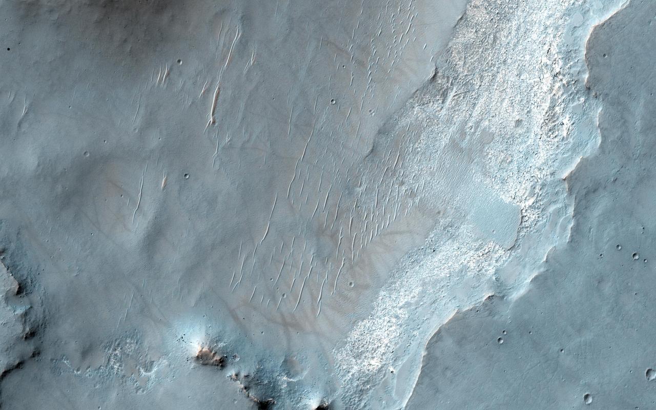
This image from NASA Mars Reconnaissance Orbiter spacecraft shows an exposure of bedrock on the floor of Bakhuysen Crater, an impact crater in Noachis Terra. The bedrock is highly fragmented and fractured.
Many gullies are located on the northern rim of this unnamed crater in Noachis Terra as seen by NASA 2001 Mars Odyssey spacecraft. Small dunes are located on the floor of the crater lower left side of image.
The eastern floor of Holden Crater, which is located in region of the southern hemisphere called Noachis Terra and is 154 km in diameter, is seen in this image from NASA Mars Odyssey spacecraft.
This Mars Global Surveyor MGS Mars Orbiter Camera MOC image shows a dust-mantled plain streaked by spring and summertime dust devils in southern Noachis Terra
This MOC image shows gullies in the north wall of a crater south of Proctor Crater in Noachis Terra. Dark streaks cutting across the scene were formed by passing dust devils
This Mars Global Surveyor MOC image shows dark dunes superposed on the rippled floor of Proctor Crater in Noachis Terra. Winds blowing predominantly from east right to west left were responsible for the formation of these dunes
Today's VIS image shows a small section of Nirgal Valles. Located in Noachis Terra, Nirgal Valles is 610km long (379 miles). Orbit Number: 83308 Latitude: -27.164 Longitude: 315.114 Instrument: VIS Captured: 2020-09-24 21:22 https://photojournal.jpl.nasa.gov/catalog/PIA24255
This image captured by NASA 2001 Mars Odyssey spacecraft shows a small section of Evros Vallis. Evros Vallis is located in the northern part of Noachis Terra. Orbit Number: 63783 Latitude: -12.8208 Longitude: 16.036 Instrument: VIS Captured: 2016-04-30 16:40 http://photojournal.jpl.nasa.gov/catalog/PIA20772
Today's VIS image shows a small section of Nirgal Valles. Located in Noachis Terra, Nirgal Valles is 610km long (379 miles). Orbit Number: 91494 Latitude: -27.1735 Longitude: 316.077 Instrument: VIS Captured: 2022-07-30 21:59 https://photojournal.jpl.nasa.gov/catalog/PIA25574
Today's VIS image shows a small section of Nirgal Valles. Located in Noachis Terra, Nirgal Valles is 610km long (379 miles). Orbit Number: 81773 Latitude: -28.157 Longitude: 318.842 Instrument: VIS Captured: 2020-05-21 11:59 https://photojournal.jpl.nasa.gov/catalog/PIA24015
This image from NASA 2001 Mars Odyssey spacecraft shows warm dunes are brighter than their surroundings in this infrared image of an unnamed crater in Noachis Terra. Latitude: -49.5174 Longitude: 33.942 Instrument: IR Captured: 2015-01-27 07:56 http://photojournal.jpl.nasa.gov/catalog/PIA19252
This image captured by NASA 2001 Mars Odyssey spacecraft shows a large sand sheet with surface dune forms on the floor of an unnamed crater in Noachis Terra. Orbit Number: 58336 Latitude: -48.6161 Longitude: 34.0534 Instrument: VIS Captured: 2015-02-07 02:22 http://photojournal.jpl.nasa.gov/catalog/PIA19275
This VIS image shows part of the extensive dune field on the floor of Proctor Crater. Proctor Crater is located in Noachis Terra. Orbit Number: 74883 Latitude: -47.6285 Longitude: 30.2768 Instrument: VIS Captured: 2018-11-01 03:03 https://photojournal.jpl.nasa.gov/catalog/PIA22891
Today's VIS image shows a small section of Nirgal Valles. Located in Noachis Terra, Nirgal Valles is 610km long (379 miles). Orbit Number: 84500 Latitude: -27.3291 Longitude: 314.675 Instrument: VIS Captured: 2021-01-01 00:11 https://photojournal.jpl.nasa.gov/catalog/PIA24361
This VIS image shows part of the floor of Kaiser Crater, including several sand dunes. Kaiser Crater is located in Noachis Terra. Orbit Number: 74559 Latitude: -46.4271 Longitude: 20.1136 Instrument: VIS Captured: 2018-10-05 10:35 https://photojournal.jpl.nasa.gov/catalog/PIA22855
This VIS image shows part of the floor of Russell Crater, including sand dunes of mulitple sizes. Russell Crater is located in Noachis Terra. Orbit Number: 74472 Latitude: -54.048 Longitude: 12.3835 Instrument: VIS Captured: 2018-09-28 06:34 https://photojournal.jpl.nasa.gov/catalog/PIA22848
Today's VIS image shows a small section of Nirgal Valles. Located in Noachis Terra, Nirgal Valles is 610km long (379 miles). Orbit Number: 83302 Latitude: -27.1434 Longitude: 315.095 Instrument: VIS Captured: 2020-09-24 08:50 https://photojournal.jpl.nasa.gov/catalog/PIA24252