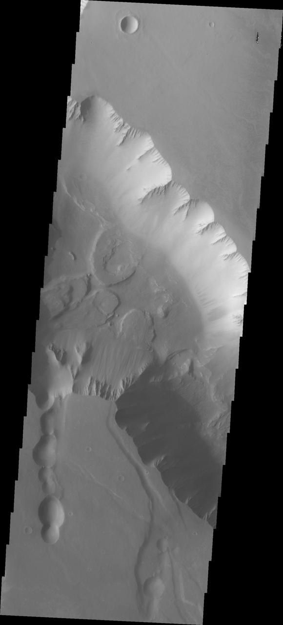
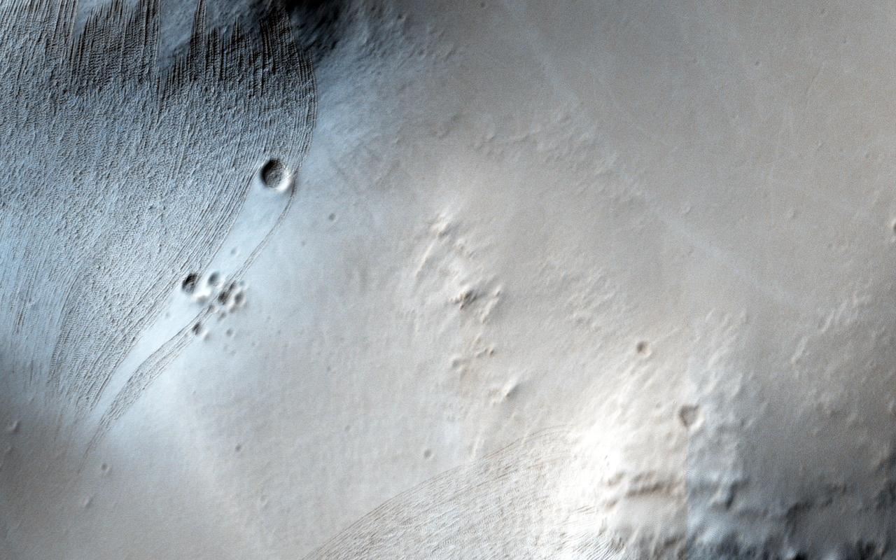
This image captured by NASA 2001 Mars Odyssey spacecraft shows a small portion of Noctis Labyrinthus. Noctis Labyrinthus is a network of tectonic graben and collapse valleys on the western margin of Valles Marineris. Orbit Number: 65633 Latitude: -12.6383 Longitude: 264.142 Instrument: VIS Captured: 2016-09-30 01:59 http://photojournal.jpl.nasa.gov/catalog/PIA21176
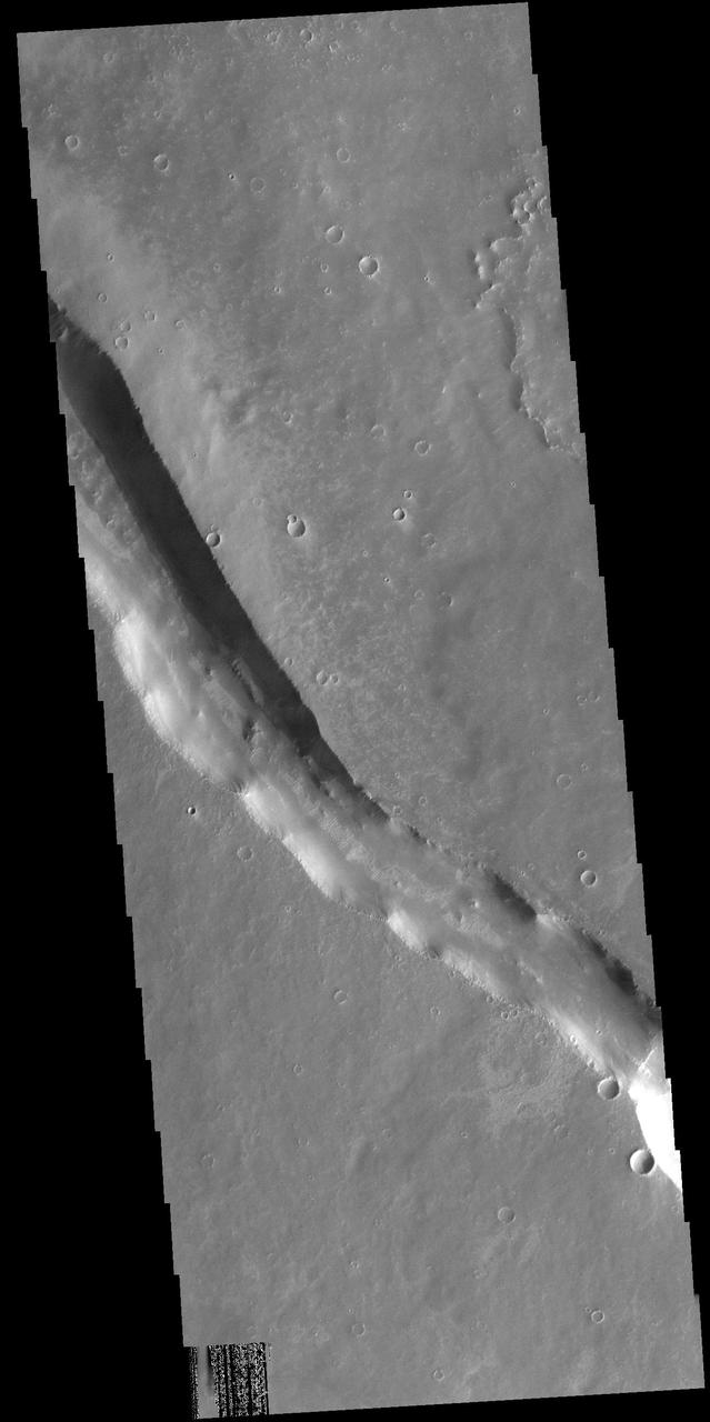
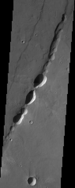
Noctis Labyrinthus
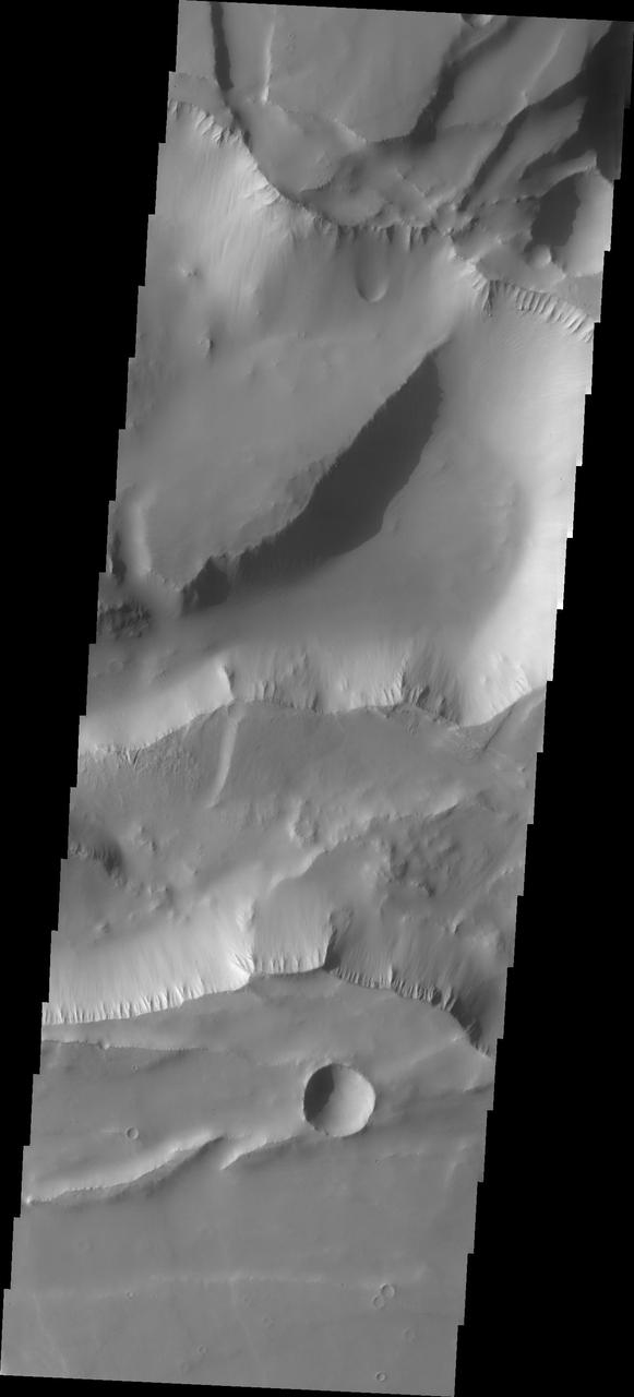
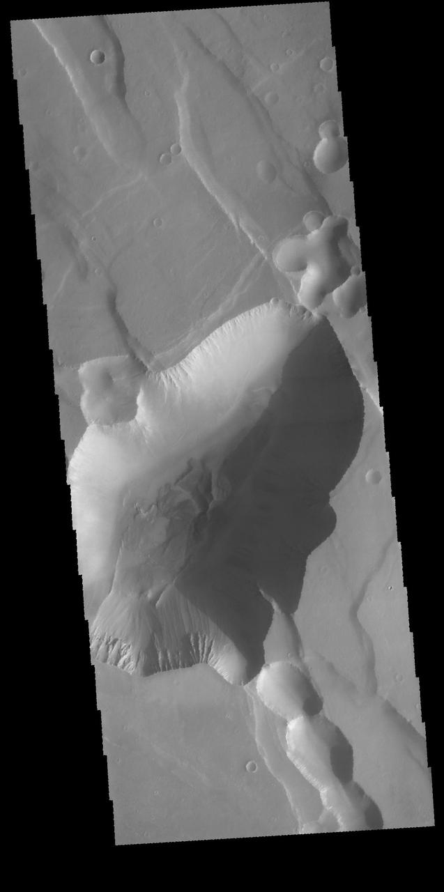
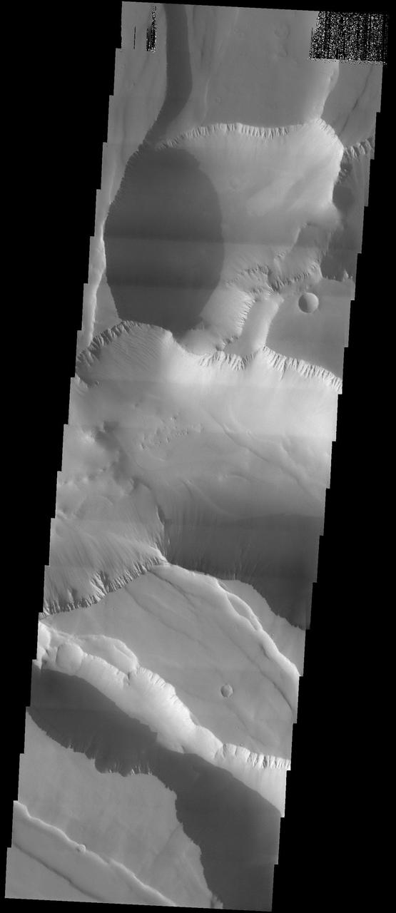
Noctis Labyrinthus
Noctis Labyrinthus

Noctis Labyrinthus
Noctis Labyrinthus
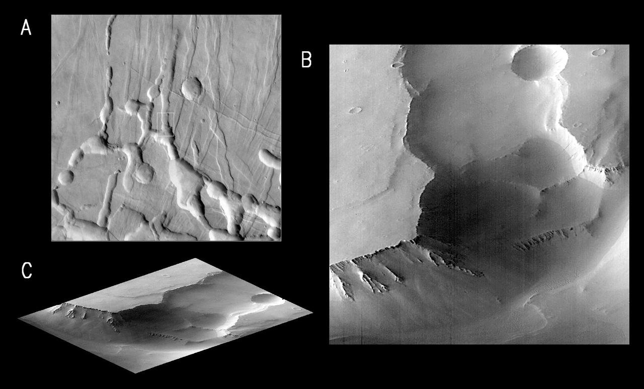
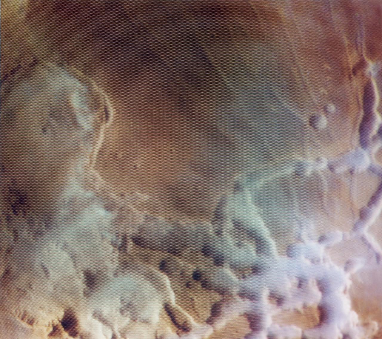
MGS Views of Labyrinthus Noctis
MGS Views of Labyrinthus Noctis
NASA Mars Odyssey shows the location of the complexly fractured region called Noctis Labyrinthus at the westernmost end of Valles Marineris. The canyon systems in Noctis Labyrinthus do not reach the depths of the chasma of Valles Marineris.
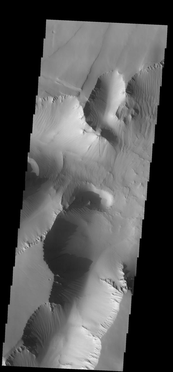
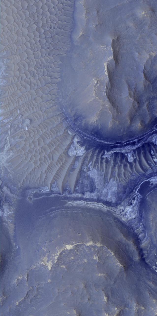
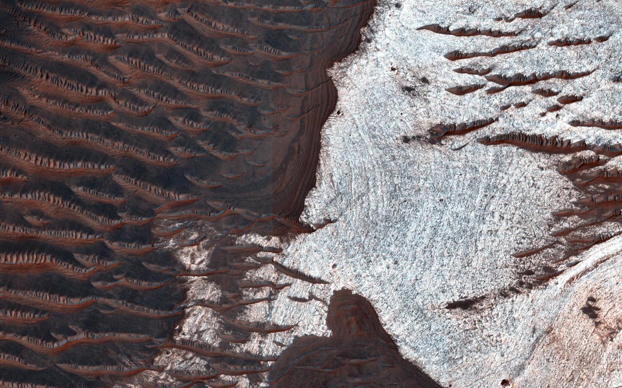
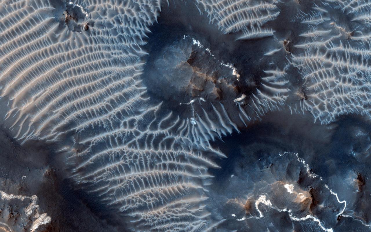
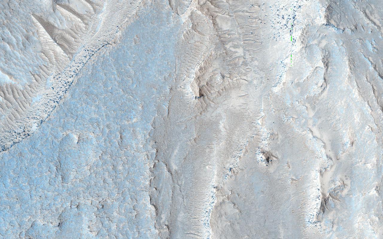
Sand sheets cover most of the walls and floors of this part of Noctis Labyrinthus
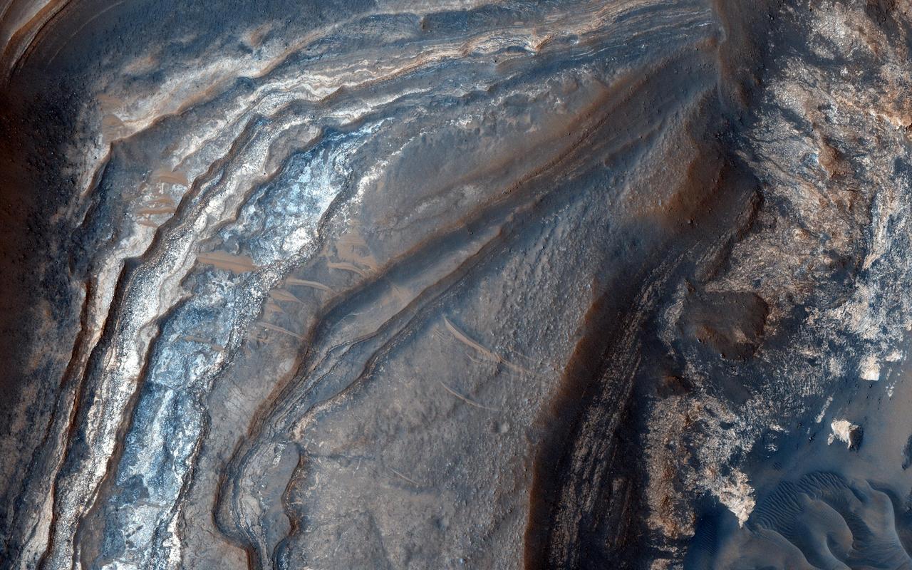
Understanding both the spatial and temporal distribution of hydrated (water-bearing) minerals on Mars is essential for deciphering the aqueous history of the planet. Over 300 meters of layered beds are exposed in this trough of Noctis Labyrinthus, at the western edge of Valles Marineris. The beds are mixtures of light- and dark-toned materials, and include units that contain hydrated minerals, like sulfates and clays. Mapping these minerals and their stratigraphic relationships indicates numerous hydrologic and/or depositional events in localized environments spread over time. The diversity of materials within the trough implies active hydrologic processes and/or changing chemical conditions, perhaps due to influxes of groundwater from nearby Tharsis volcanism. http://photojournal.jpl.nasa.gov/catalog/PIA14455
Dark slope streaks marking the walls in this image of Noctis Labyrinthus captured by NASA 2001 Mars Odyssey spacecraft.
This image captured by NASA 2001 Mars Odyssey spacecraft shows some of the graben which form Noctis Labyrinthus.
Layers in the lower portion of two neighboring buttes within the Noctis Labyrinthus formation on Mars are visible in this image from NASA Mars Reconnaissance Orbiter.
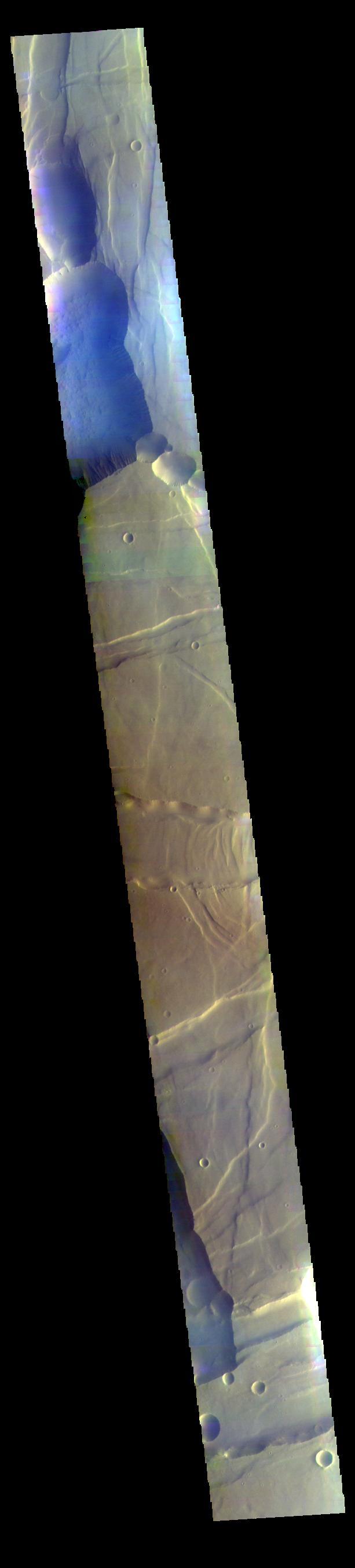
This false color image from NASA 2001 Mars Odyssey spacecraft covers part of Noctis Labyrinthus. The bluish tone in the lower elevation depressions may indicate atmospheric haze.
This image from NASA Mars Odyssey shows Noctis Labyrinthus, a large valley system at the western end of the Valles Marineris canyon system notable for a pattern of intersecting valleys, which give it a maze-like appearance when viewed from above.
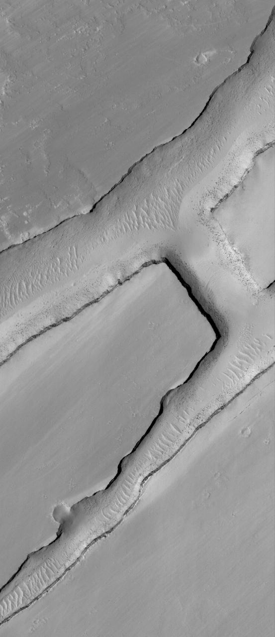
This VIS image is located in Noctis Labyrinthus. There are two directions of faults visible, which intersect at an approximately 90 degree angle. The faults running from bottom right to upper left are the younger set. The change in direction indicates a change in the tectonic stresses in the region. Orbit Number: 74276 Latitude: -6.04595 Longitude: 261.215 Instrument: VIS Captured: 2018-09-12 03:22 https://photojournal.jpl.nasa.gov/catalog/PIA22798
Many of the depressions in Noctis Labyrinthus contain water-bearing minerals, suggesting that water was available and persistent in this region during the Late Hesperian to Amazonian epochs on Mars, as seen by NASA Mars Reconnaissance Orbiter.

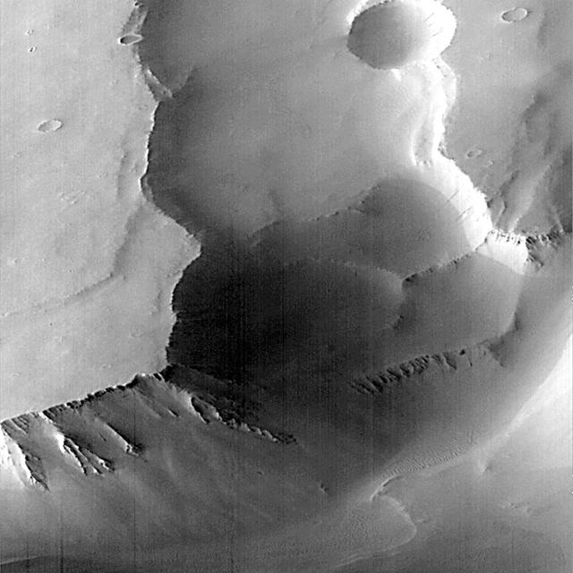
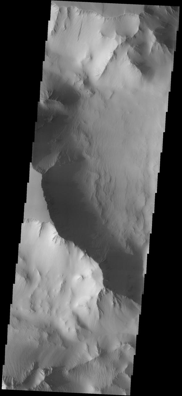
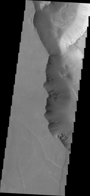
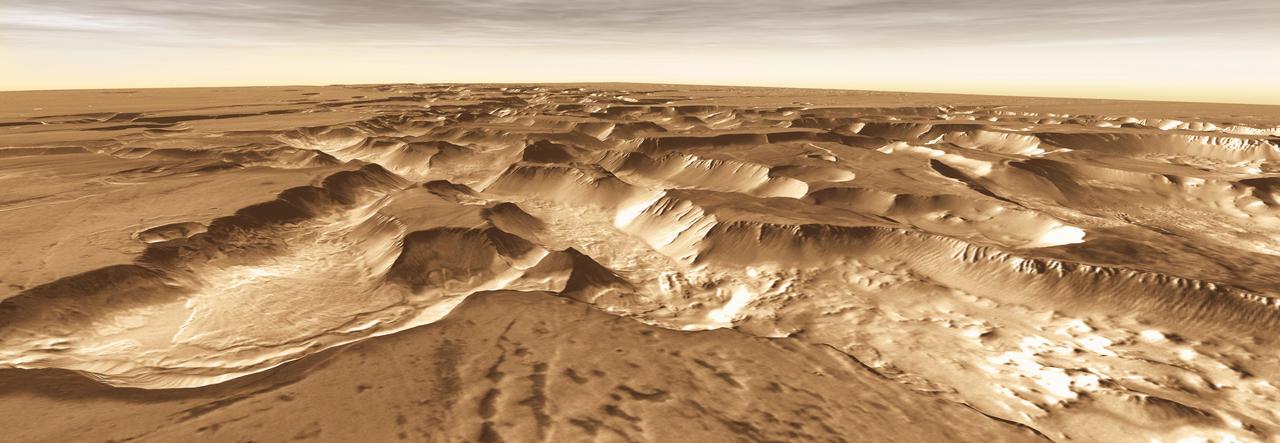
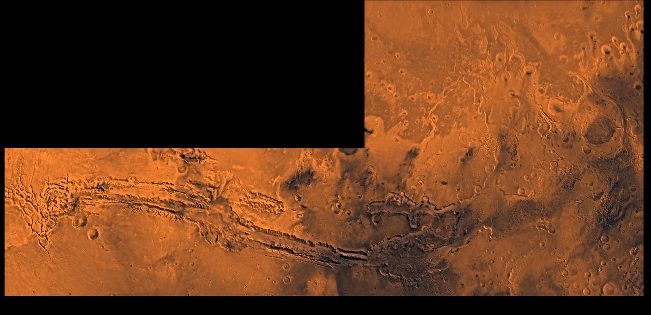
This NASA Mars Odyssey image shows the transition zone between maze-like troughs of Noctis Labyrinthus and the main Valles Marineris canyon system. This huge system of troughs near the equator of Mars was most likely created by tectonic forces.
This dust avalanche is located in part of Noctis Labyrinthus
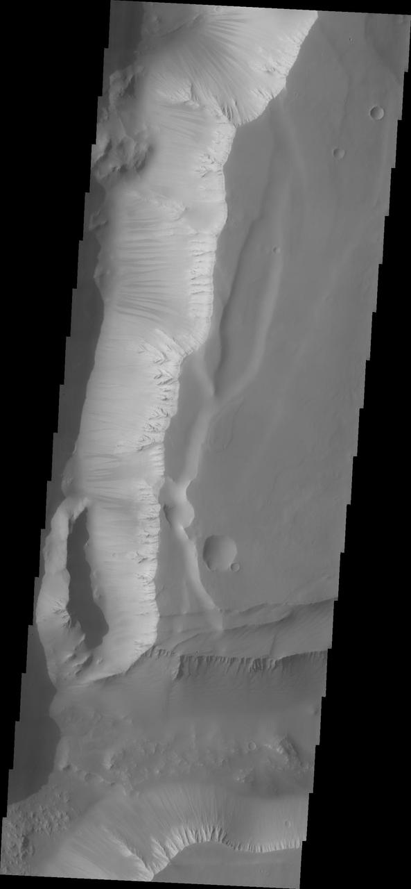
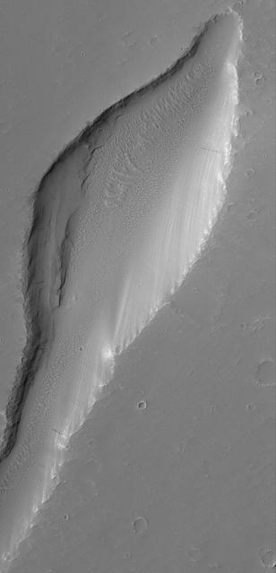
This huge or mega gully is part of Noctis Labyrinthus as seen by NASA Mars Odyssey. Located on the western end of Valles Marineris, Noctis Labyrinthus is a huge region of tectonically controlled valleys.
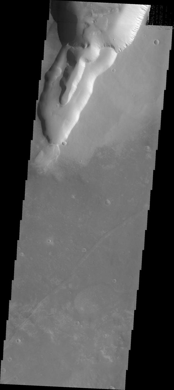
This image captured by NASA 2001 Mars Odyssey spacecraft shows several small landslide deposits in Noctis Labyrinthus.
Dark slope streaks are a common feature in Noctis Labyrinthus as seen in this image captured by NASA 2001 Mars Odyssey spacecraft.
This MOC image shows a small portion of a dust-covered plain directly north of Labyrinthus Noctis which is cut by three linear troughs
This colorful scene is situated in the Noctis Labyrinthus, perched high on the Tharsis rise in the upper reaches of the Valles Marineris canyon system as seen by NASA Mars Reconnaissance Orbiter.
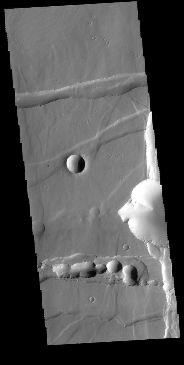
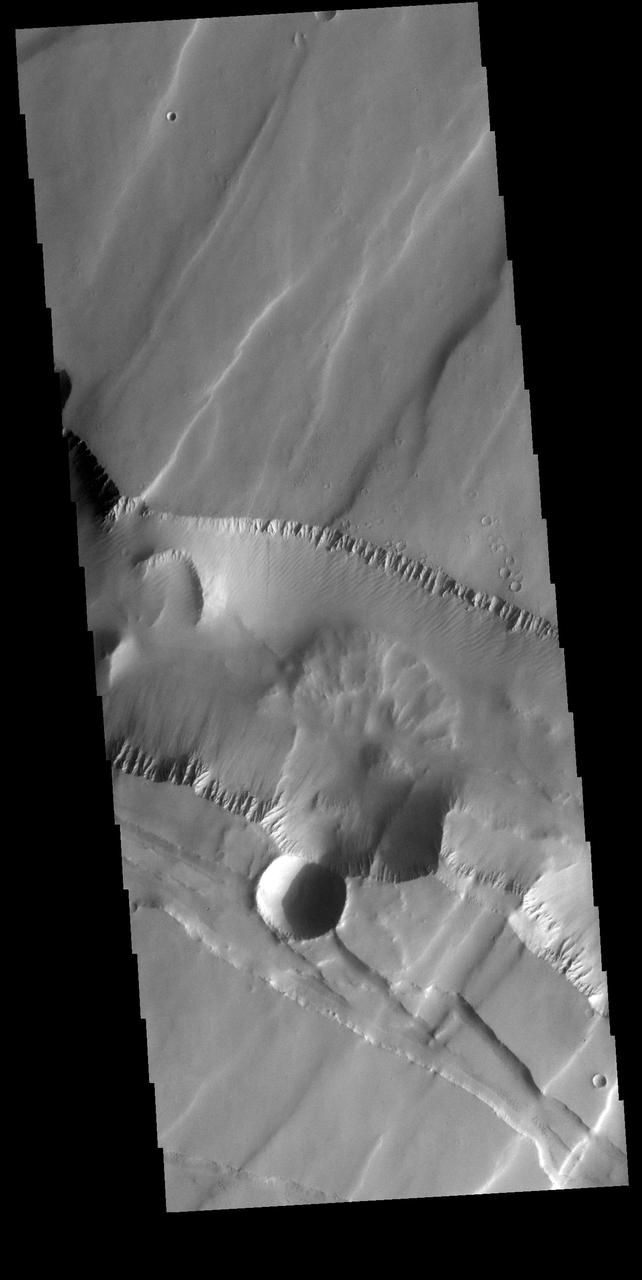
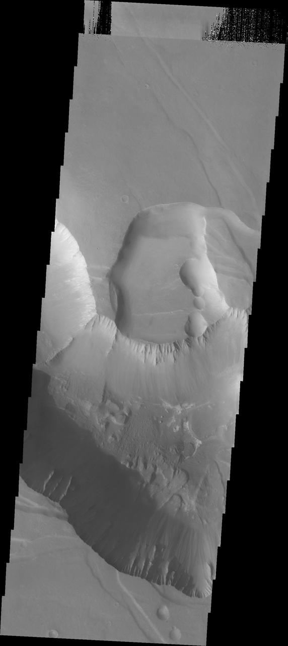
This image shows a relatively fresh crater with dark, rayed ejecta on an upland plain above one of the many depressions in the eastern Labyrinthus Noctis region
The image from NASA Mars Reconnaissance Orbiter is approximately 6 by 6 kilometers and is located east of Noctis Labyrinthus, in a portion the large canyon system Valles Marineris.
9 March 2005 This Mars Global Surveyor (MGS) Mars Orbiter Camera (MOC) image shows a trough in the Labyrinthus Noctis region. Location near: 1.5°S, 92.5°W Image width: ~3 km (~1.9 mi) Illumination from: upper left Season: Southern Winter http://photojournal.jpl.nasa.gov/catalog/PIA07449
West of Valles Marineris lies a checkerboard named Noctis Labyrinthus, which formed when the Martian crust stretched and fractured. This image is from NASA Mars Odyssey, one of an All Star set.
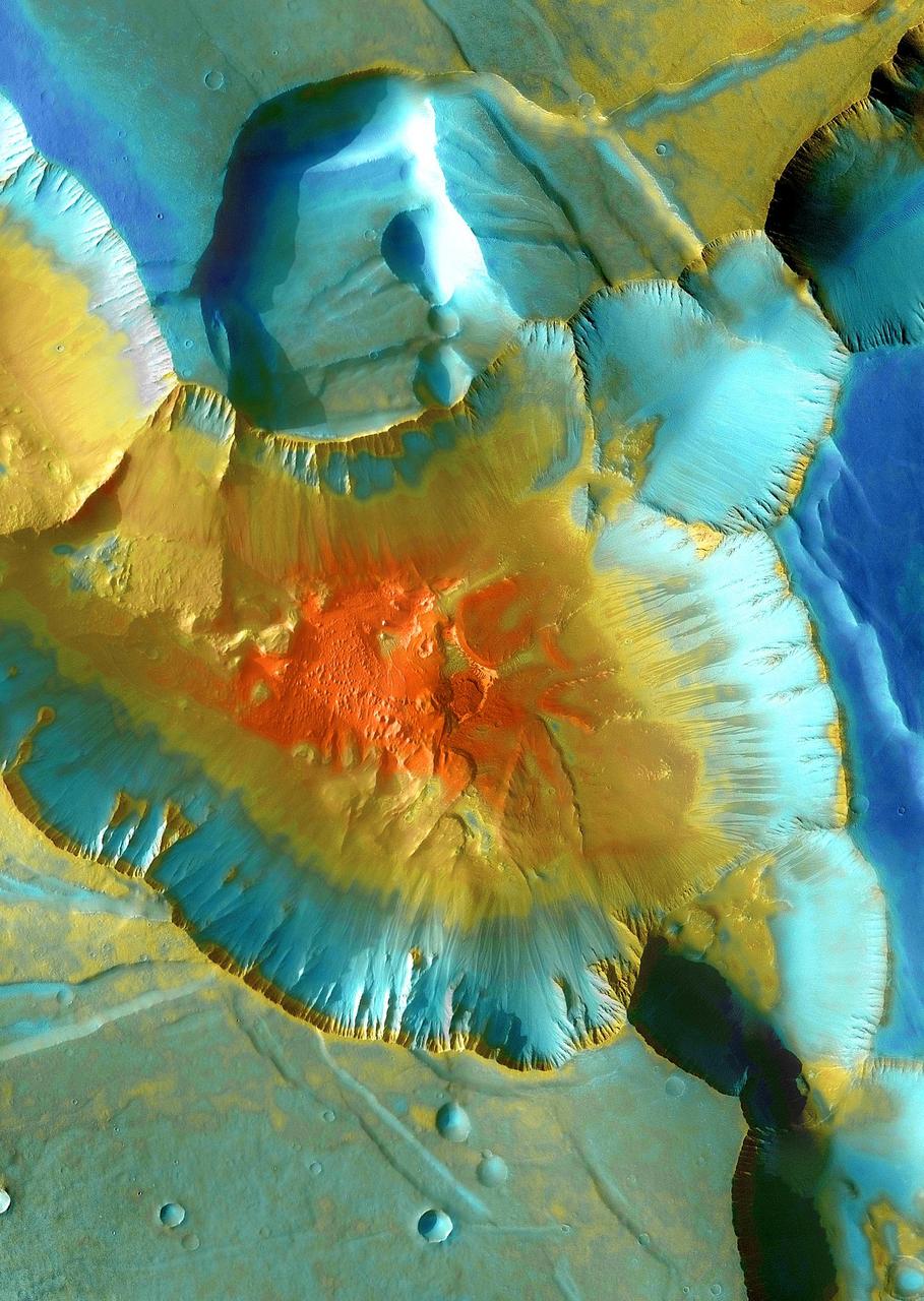
This false-color mosaic focuses on one junction in Noctis Labyrinthus where canyons meet to form a depression 4,000 meters 13,000 feet deep. This image is from NASA Mars Odyssey, one of an All Star set.
Noctis Labyrinthus is a highly tectonized region immediately to the west of Valles Marineris. It formed when Mars' crust stretched itself apart. In this region, the crust first stretched in a north-south direction (as evidenced by the east-west trending scarp) and then in an east-west direction (as evidenced by the north-south trending smaller scarps). This sort of tectonic stretching creates faults in the crust (cracks along with masses of rock slide. This process is totally unrelated to Earth's plate tectonics.). The lower portions between faults are called "grabens" and the interspersed higher portions are called "horsts." The Basin and Range tectonic province of the western United States is a close Earth analog to Noctis Labyrinthus, which is Latin for "labyrinth of the night." http://photojournal.jpl.nasa.gov/catalog/PIA20740
This VIS image shows a linear depression in Syria Planum. Volcanic activity, including broad shield volcanoes and extensive volcanic plains created this region of the Tharsis system south of Noctis Labyrinthus. Linear features, like the one in this image, can be caused by several different processes. In this case a combination of tectonic forces and lava emplacement created the depression. Orbit Number: 74800 Latitude: -14.4492 Longitude: 260.323 Instrument: VIS Captured: 2018-10-25 07:10 https://photojournal.jpl.nasa.gov/catalog/PIA22883
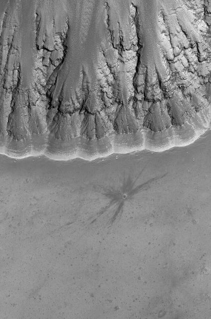
![This image from NASA's Mars Reconnaissance Orbiter shows a small (0.4 kilometer) mesa, one of several surrounded by sand dunes in Noctis Labyrinthyus, an extensively fractured region on the western end of Valles Marineris. Heavily eroded, with clusters of boulders and sand dunes on its surface, this layered mesa is probably comprised of sedimentary deposits that are being exhumed as it erodes. The layers themselves are visible as faint bands along the lower left edge of the mesa. The map is projected here at a scale of 50 centimeters (19.7 inches) per pixel. [The original image scale is 20.7 centimeters (19.6 inches) per pixel (with 2 x 2 binning); objects on the order of 158 centimeters (62.2 inches) across are resolved.] North is up. https://photojournal.jpl.nasa.gov/catalog/PIA21585](https://images-assets.nasa.gov/image/PIA21585/PIA21585~medium.jpg)
This image from NASA's Mars Reconnaissance Orbiter shows a small (0.4 kilometer) mesa, one of several surrounded by sand dunes in Noctis Labyrinthyus, an extensively fractured region on the western end of Valles Marineris. Heavily eroded, with clusters of boulders and sand dunes on its surface, this layered mesa is probably comprised of sedimentary deposits that are being exhumed as it erodes. The layers themselves are visible as faint bands along the lower left edge of the mesa. The map is projected here at a scale of 50 centimeters (19.7 inches) per pixel. [The original image scale is 20.7 centimeters (19.6 inches) per pixel (with 2 x 2 binning); objects on the order of 158 centimeters (62.2 inches) across are resolved.] North is up. https://photojournal.jpl.nasa.gov/catalog/PIA21585
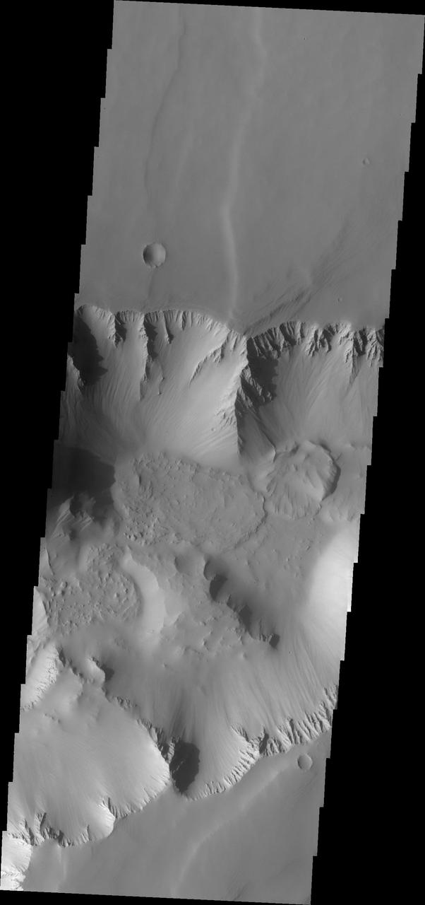
These pit-chain features in this NASA Mars Odyssey image of south Noctis Labryinthus are oriented parallel to grabens in the area, suggesting that tensional stresses may have been responsible for their formation.
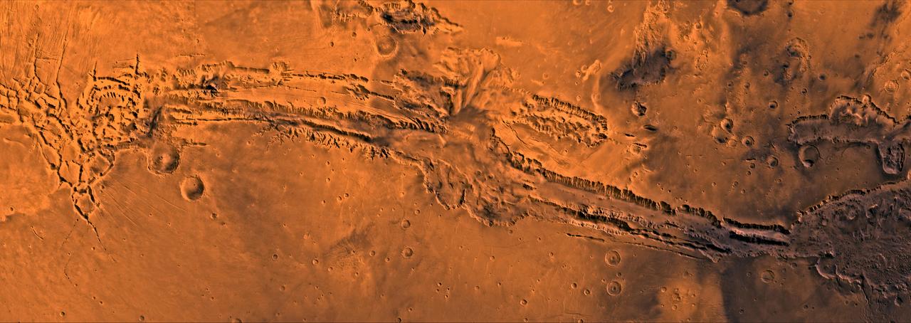
A color image of Valles Marineris, the great canyon of Mars; north toward top. The scene shows the entire canyon system, over 3,000 km long and averaging 8 km deep, extending from Noctis Labyrinthus, the arcuate system of graben to the west, to the chaotic terrain to the east. This image is a composite of Viking medium-resolution images in black and white and low-resolution images in color; Mercator projection. The image extends from latitude 0 degrees to 20 degrees S. and from longitude 45 degrees to 102.5 degrees. The connected chasma or valleys of Valles Marineris may have formed from a combination of erosional collapse and structural activity. Layers of material in the eastern canyons might consist of carbonates deposited in ancient lakes. Huge ancient river channels began from Valles Marineris and from adjacent canyons and ran north. Many of the channels flowed north into Chryse Basin, which contains the site of the Viking 1 Lander and the future site of the Mars Pathfinder Lander. http://photojournal.jpl.nasa.gov/catalog/PIA00422
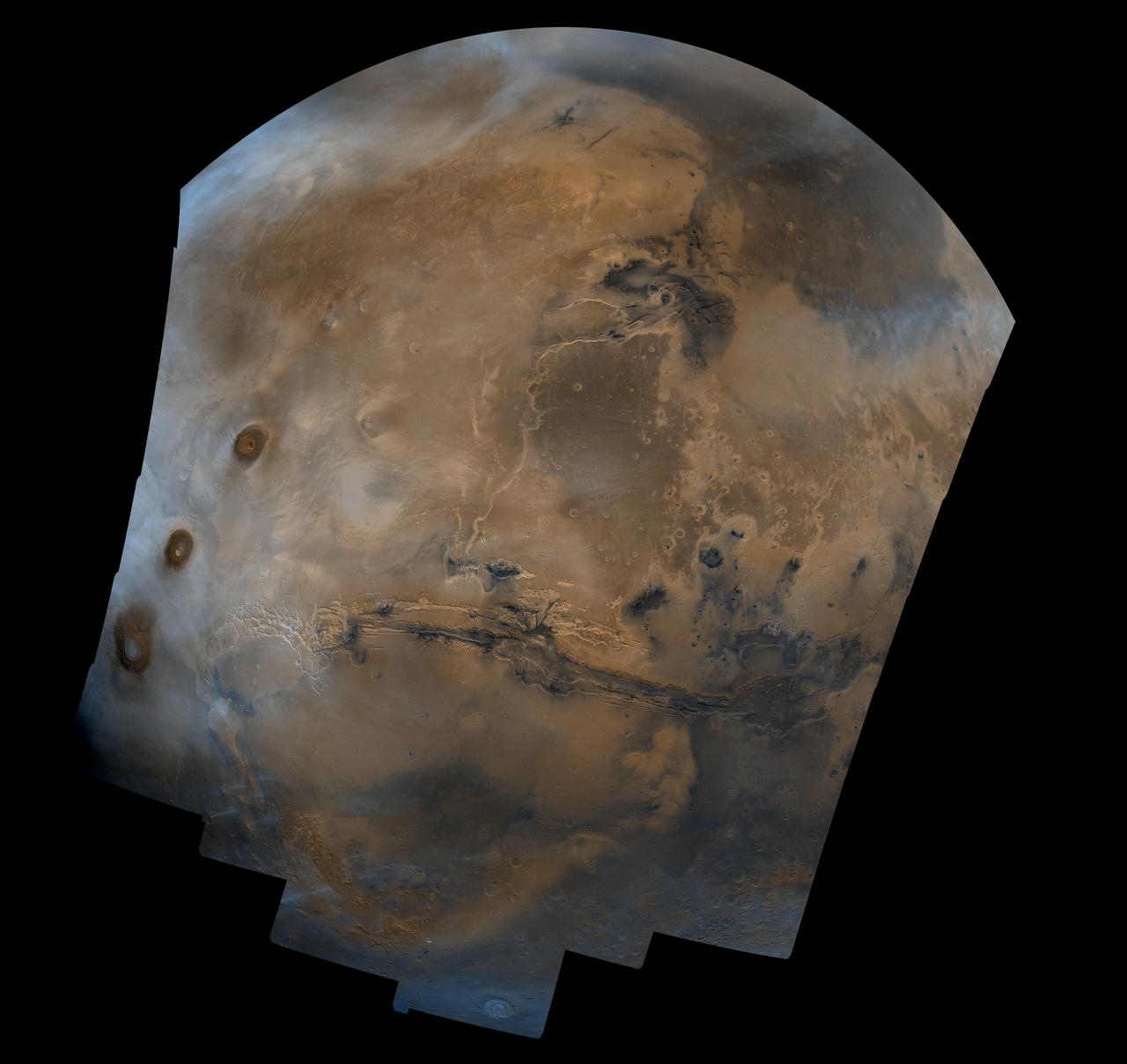
Mosaic composed of 102 Viking Orbiter images of Mars, covering nearly a full hemisphere of the planet (approximate latitude -55 to 60 degrees, longitude 30 to 130 degrees). The mosaic is in a point-perspective projection with a scale of about 1 km/pixel. The color variations have been enhanced by a factor of about two, and the large-scale brightness variations (mostly due to sun-angle variations) have been normalized by large-scale filtering. The center of the scene shows the entire Valles Marineris canyon system, over 3,000 km long and up to 8 km deep, extending from Noctis Labyrinthus, the arcuate system of graben to the west, to the chaotic terrain to the east. Bright white layers of material in the eastern canyons may consist of carbonates deposited in ancient lakes. Huge ancient river channels begin from the chaotic terrain and from north-central canyons and run north. Many of the channels flowed into a basin called Acidalia Planitia, which is the dark area in the extreme north of this picture. The Viking 1 landing site (Mutch Memorial Station) is located in Chryse Planitia, south of Acidalia Planitia. The three Tharsis volcanoes (dark red spots), each about 25 km high, are visible to the west. The large crater with two prominent rings located at the bottom of this image is named Lowell, after the Flagstaff astronomer. The images were acquired by Viking Orbiter 1 in 1980 during early northern summer on Mars (Ls = 70 degrees); the atmosphere was relatively dust-free. A variety of clouds appear as bright blue streaks and hazes, and probably consist of water ice. Long, linear clouds north of central Valles Marineris appear to emanate from impact craters. http://photojournal.jpl.nasa.gov/catalog/PIA00003
A color image of Valles Marineris, the great canyon and the south Chryse basin-Valles Marineris outflow channels of Mars; north toward top. The scene shows the entire Valles Marineris canyon system, over 3,000 km long and averaging 8 km deep, extending from Noctis Labyrinthus, the arcuate system of graben to the west, to the chaotic terrain to the east and related outflow canyons that drain toward the Chryse basin. Eos and Capri Chasmata (south to north) are two canyons connected to Valles Marineris. Ganges Chasma lies directly north. The chaos in the southeast part of the image gives rise to several outflow channels, Shalbatana, Simud, Tiu, and Ares Valles (left to right), that drained north into the Chryse basin. The mouth of Ares Valles is the site of the Mars Pathfinder lander. This image is a composite of Viking medium-resolution images in black and white and low-resolution images in color; Mercator projection. The image roughly extends from latitude 20 degrees S. to 20 degrees N. and from longitude 15 degrees to 102.5 degrees. The connected chasma or valleys of Valles Marineris may have formed from a combination of erosional collapse and structural activity. Layers of material in the eastern canyons might consist of carbonates deposited in ancient lakes, eolian deposits, or volcanic materials. Huge ancient river channels began from Valles Marineris and from adjacent canyons and ran north. Many of the channels flowed north into Chryse Basin. The south Chryse outflow channels are cut an average of 1 km into the cratered highland terrain. This terrain is about 9 km above datum near Valles Marineris and steadily decreases in elevation to 1 km below datum in the Chryse basin. Shalbatana is relatively narrow (10 km wide) but can reach 3 km in depth. The channel begins at a 2- to 3-km-deep circular depression within a large impact crater, whose floor is partly covered by chaotic material, and ends in Simud Valles. Tiu and Simud Valles consist of a complex of connected channel floors and chaotic terrain and extend as far south as and connect to eastern Valles Marineris. Ares Vallis originates from discontinuous patches of chaotic terrain within large craters. In the Chryse basin the Ares channel forks; one branch continues northwest into central Chryse Planitia and the other extends north into eastern Chryse Planitia. http://photojournal.jpl.nasa.gov/catalog/PIA00426