Icy Oasis
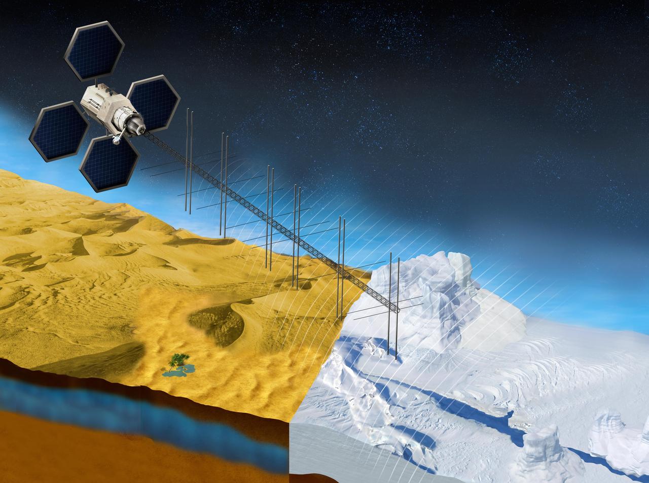
The OASIS project seeks to study fresh water aquifers in the desert as well as ice sheets in places like Greenland. This illustration shows what a satellite with a proposed radar instrument for the mission could look like. https://photojournal.jpl.nasa.gov/catalog/PIA23790

iss047e012491 (03/21/2016) --- NASA astronaut Tim Kopra stows hardware from the OASIS experiment aboard the International Space Station. OASIS, which stands for Observation and Analysis of Smectic Islands In Space, studies the unique behavior of liquid crystals in microgravity.

ISS047e012492 (03/21/2016) --- NASA astronaut Tim Kopra stows hardware from the OASIS experiment aboard the International Space Station. OASIS, which stands for Observation and Analysis of Smectic Islands In Space, studies the unique behavior of liquid crystals in microgravity.

iss047e004376 (3/11/2016) --- A view during the installation and configuration of the Observation and Analysis of Smectic Islands in Space (OASIS) hardware into the Microgravity, in the U.S. Laboratory. OASIS studies the unique behavior of liquid crystals in microgravity, including their overall motion and the merging of crystal layers known as smectic islands. Liquid crystals are used for display screens in televisions and clocks and they also occur in soaps and in cell membranes. The experiment allows detailed studies of the behavior of these structures and how microgravity affects their unique ability to act like both a liquid and a solid crystal.

An Amphitech OASys Ka-band radar was the primary sensor installed on Scaled Composites' Proteus for the second phase of NASA-sponsored unmanned aerial vehicle Detect, See and Avoid flight tests.

S88-37764 (18 April 1988) --- OASIS, instrumentation which will record the environment experienced by Discovery during the STS-26 Space Shuttle mission, is lowered into position for attachment to the orbiter's aft port sill. Instrumentation sensors in the payload bay which are connected to the tape recorder module will document a variety of environmental measurements during various phases of the flight including temperature, pressure, vibration, sounds, acceleration, stress, and strain. OASIS will also record data during the Flight Readiness Firing. NASA is flying OASIS aboard Discovery in support of the Inertial Upper Stage (IUS) program office of the Air Force Space Division. The system was developed by Lockheed under a NASA contract, funded by the Air Force.

iss044e005118 (6/26/2015) --- Cosmonaut Gennady Padalka in the U.S. Laboratory in the process of aligning the Observation Analysis of Smectic Islands in Space (OASIS) Macro Camera. The Observation and Analysis of Smectic Islands In Space (OASIS) studies the unique behavior of liquid crystals in microgravity, including their overall motion and the merging of crystal layers known as smectic islands. Liquid crystals are used for display screens in televisions and clocks, and they also occur in soaps and in cell membranes. The experiment allows detailed studies of the behavior of these structures, and how microgravity affects their unique ability to act like both a liquid and a solid crystal.
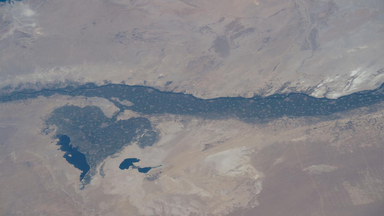
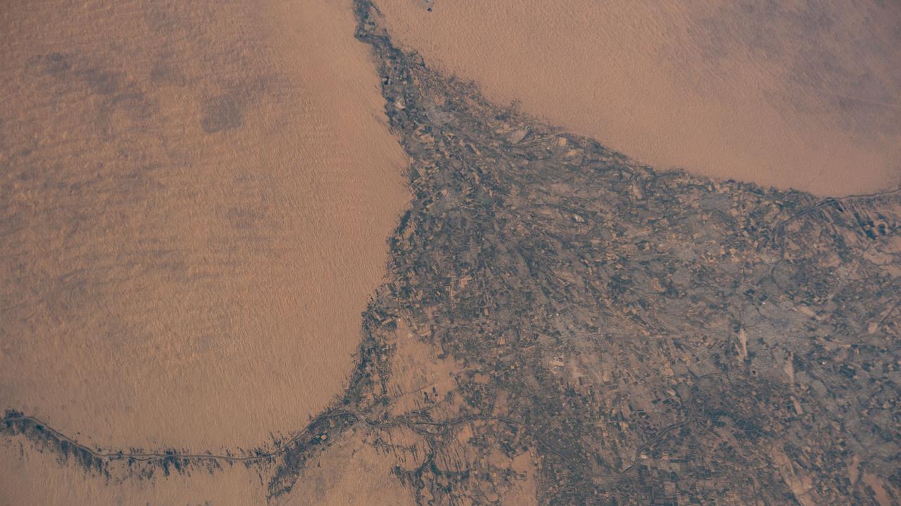
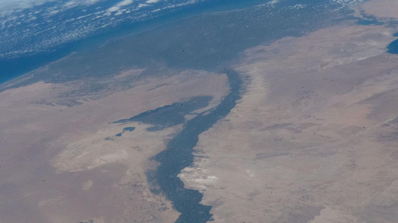
iss073e0178560 (June 14, 2025) --- The leaf-shaped Faiyum Oasis, fed by a channel of the River Nile and bordered on the west by the saltwater Qarum Lake with the Wadi El Rayan nature reserve to its southwest, is pictured from the International Space Station as it orbited 260 miles above the Libya-Egypt border.
This is a false-color image of the uninhabited Safsaf Oasis in southern Egypt near the Egypt/Sudan border.

art002e023575 (April 2, 2026) - A view of Earth taken by an Artemis II astronaut from one of the Orion spacecraft's four windows on April 2, 2026. Credit: NASA
iss064e006313 (Nov. 26, 2020) --- The oasis city of Sakakah in northwestern Saudi Arabia is pictured from the International Space Station as it orbited 261 miles above.
iss067e302507 (Sept. 1, 2022) --- The Karakum Desert oasis in the Mary region of Turkmenistan is pictured from the International Space Station as it orbited 260 miles above Central Asia.
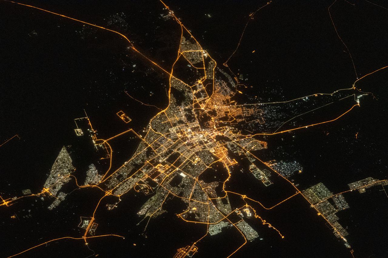
iss069e032977 (July 18, 2023) --- The city lights of the oasis city of Al Ain in the United Arab Emirates are pictured from the International Space Station as it orbited 260 miles above southern Iran near the coast of the Strait of Hormuz.
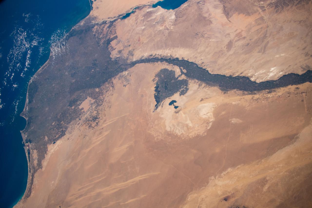
iss061e004613 (Oct. 9, 2019) --- Looking like a leaf on a vine, the Faiyum Oasis extends west of the Nile River and south of Cairo, Egypt. The fertile area at the left of the photograph is the Nile Delta opening up into the Mediterranean Sea.
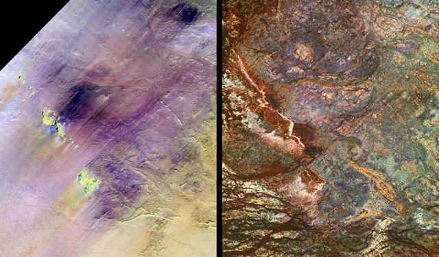
These images show two views of a region of south-central Egypt. On the left is an optical image from NASA Landsat Thematic Mapper, and on the right is a radar image from NASA Spaceborne Imaging Radar-C/X-band Synthetic Aperture Radar SIR-C/X-SAR.

iss069e000819 (April 4, 2023) --- The Faiyum Oasis (upper left) in Egypt, immediately west of the Nile river and south of the nation's capital of Cairo, is pictured from an external high definition camera on the International Space Station as it orbited 262 miles above.
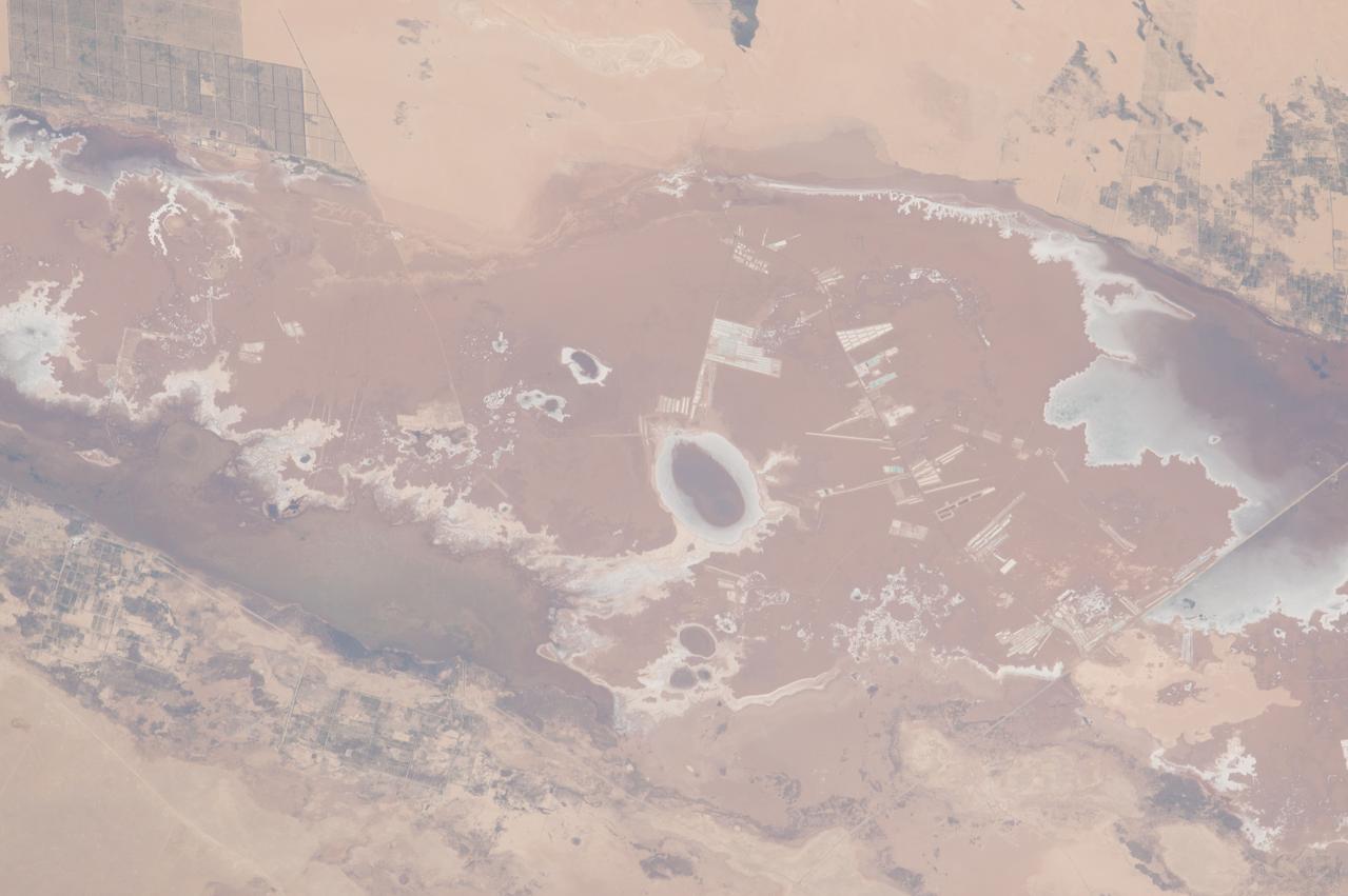
ISS043E182395 (05/08/2015) --- NASA astronaut Scott Kelly took this picture of the water filled Siwa Oasis in the northwestern Egyptian desert. Water is also treasured within the International Space Station where recycling plays an important role in conserving and reusing the precious life giving liquid.
iss069e000237 (April 1, 2023) --- The Faiyum Oasis in Egypt extends to the immediate west of the Nile river which leads to the Mediterranean Sea in this photograph from an external high definition camera on the International Space Station as it orbited 262 miles above.
iss060e000604 (June 26, 2019) --- The Murghab river flows into the oasis city of Mary in the Karakum Desert in Turkmenistan. At left, is the Hanhowuz Reservoir which plays an important role in agriculture in southeastern Turkmenistan. The International Space Station was orbiting 256 miles above the Central Asian nation when this photograph was taken.

iss063e081388 (Aug. 31, 2020) --- This nighttime photograph from the International Space Station looks north across Turkmenistan and Uzbekistan with the Caspian Sea at left towards the Earth's horizon. At bottom left, is the populated oasis area of Turkmenistan near the border with Iran.
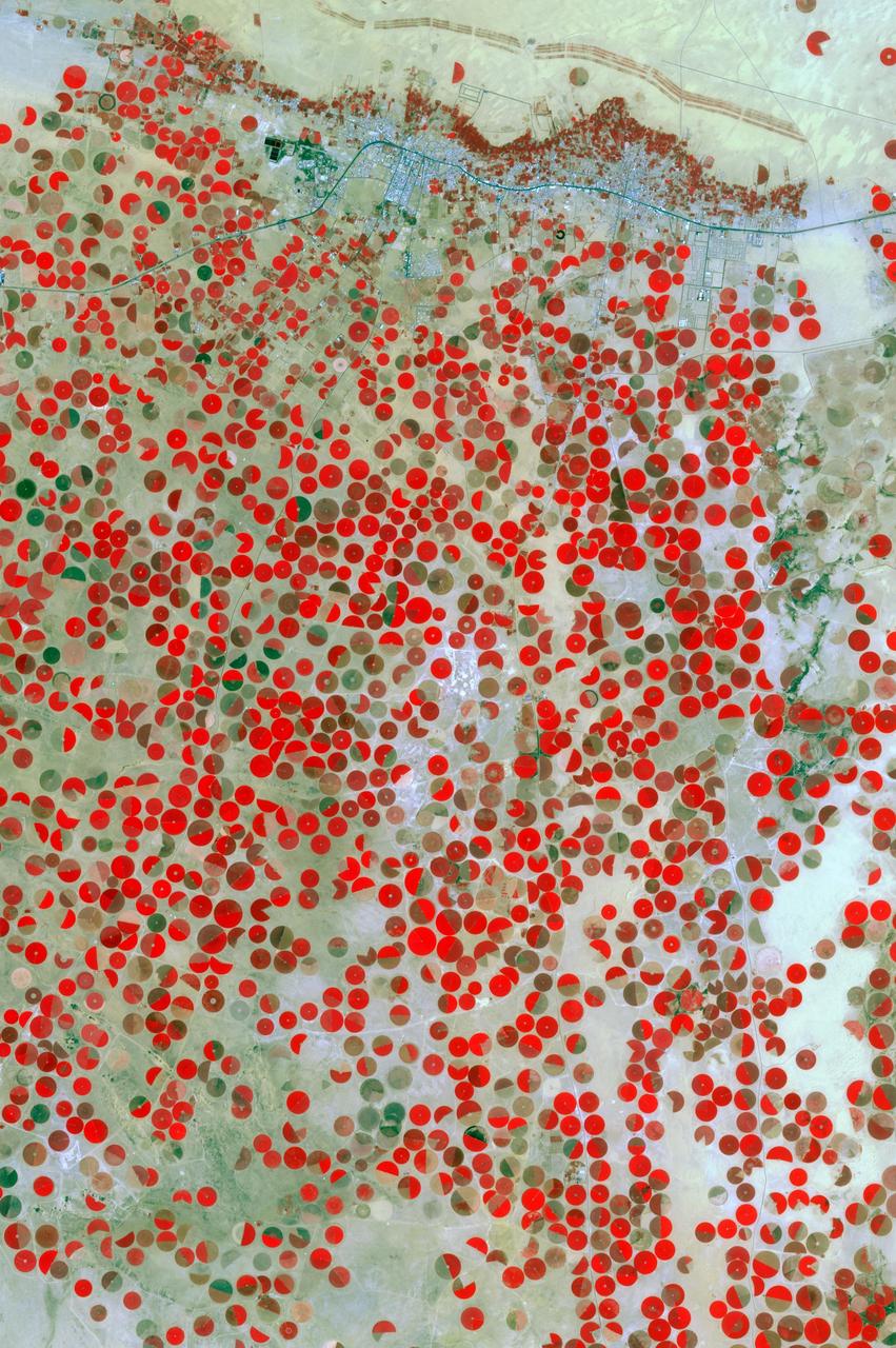
In the middle of the Arabian desert the city Green Oasis Wadi Al Dawasir is being developed as a new urban center for the Wadi Al Dawasir region of Saudi Arabia, as shown in this image from NASA Terra spacecraft. Huge solar fields supply the entire city and the surrounding region with energy. Hundreds of circular agricultural fields are fed by center pivot irrigation apparatus, drawing water from subterranean aquifers. The image was acquired March 30, 2013, covers an area of 30 x 45 km, and is located at 20.2 degrees north, 44.8 degrees east. http://photojournal.jpl.nasa.gov/catalog/PIA20077
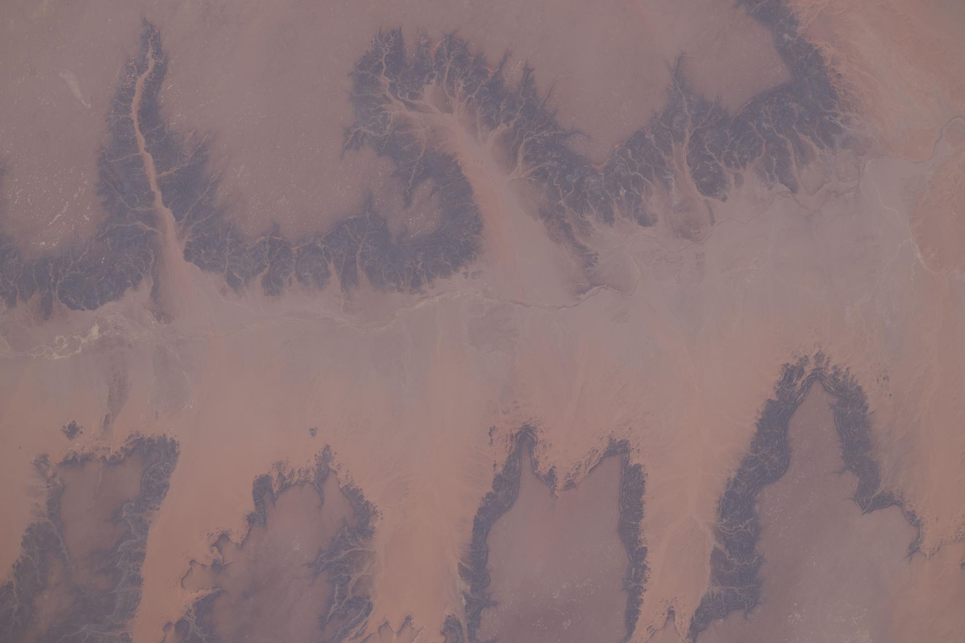
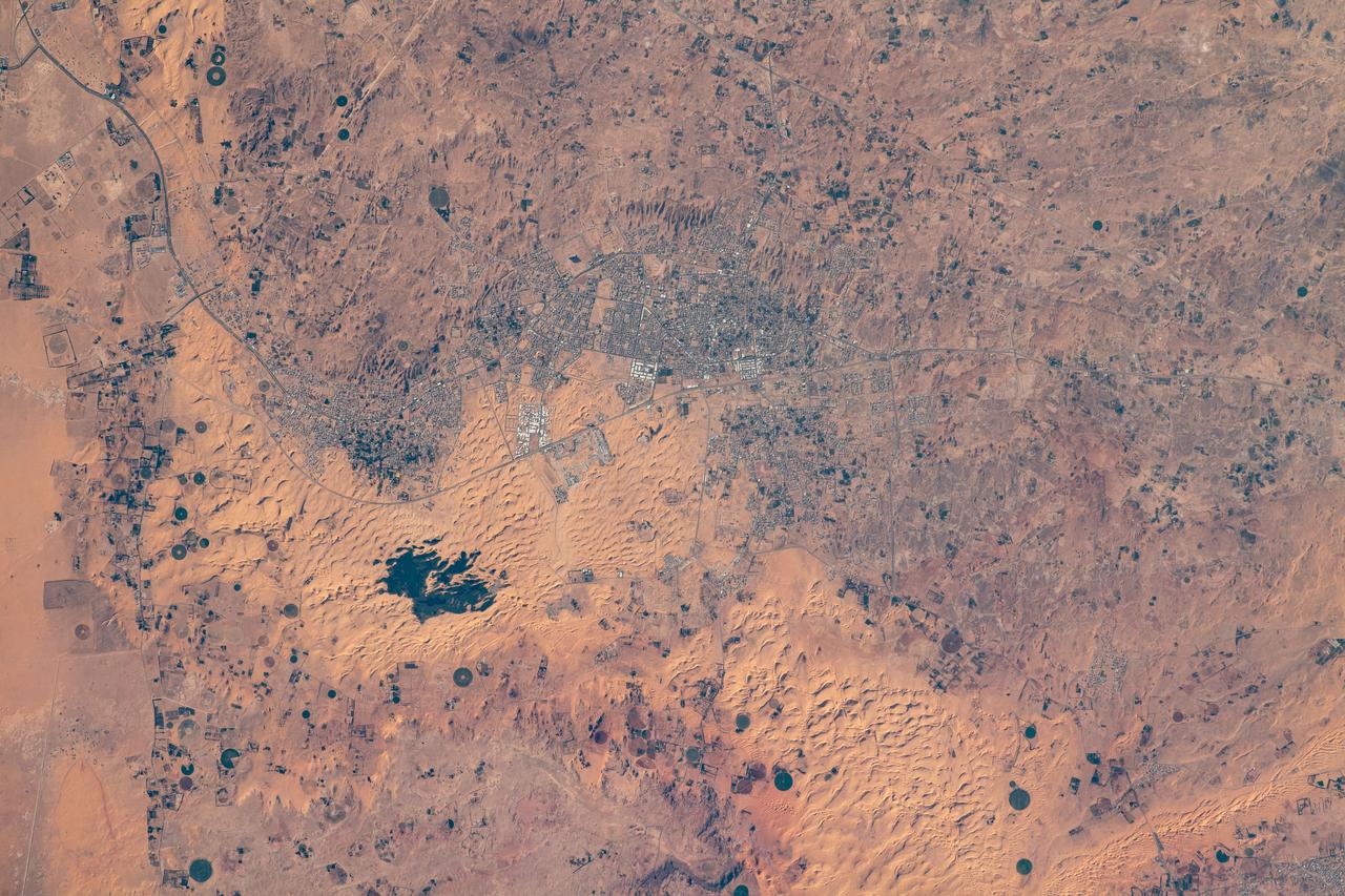
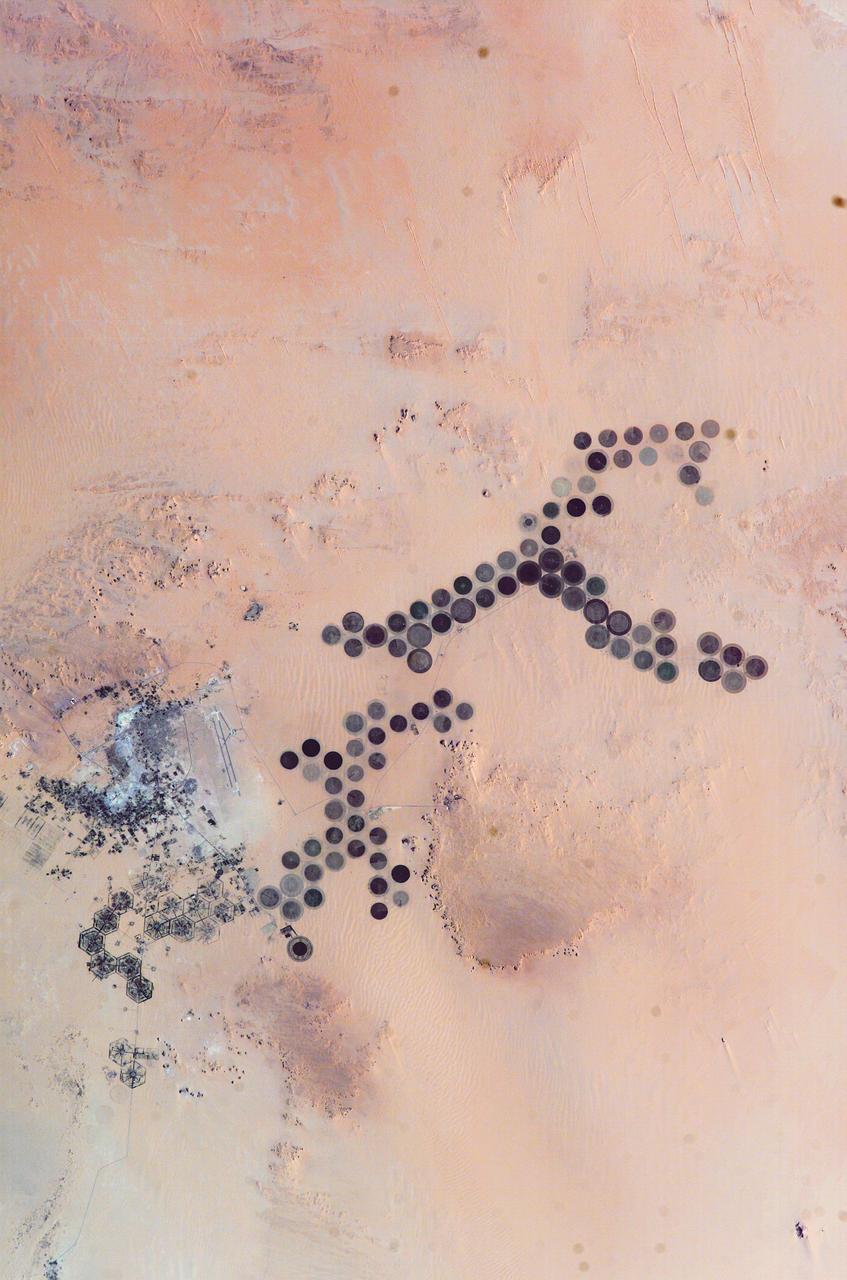
iss074e0417326 (March 27, 2026) --- A portion of the Sahara in the Agadez Region of northeastern Niger is pictured from the International Space Station as it orbited 264 miles above the African continent. Despite the hyper-arid conditions, a groundwater-fed oasis system supports settlements and small-scale agriculture in a narrow north–south corridor of the desert nation. Credit: NASA/Chris Williams
ISS010-E-05266 (28 October 2004) --- The Al Khufrah Oasis is featured in this image photographed by an Expedition 10 crewmember on the International Space Station (ISS). Green circles in the desert frequently indicate tracts of agriculture supported by center-pivot irrigation. The Al Khufrah Oasis in southeastern Libya (near the Egyptian border) is one of Libya’s largest agricultural projects, and is an easy-to-recognize landmark for orbiting crewmembers aboard the Station. The center-pivot irrigation system pumps water under pressure into a gantry or tubular arm from a central source. Anchored by a central pivot, the gantry slowly rotates over the area to be irrigated, thereby producing the circular patterns. Although the field diameters vary, these fields are approximately 0.6 mile (1 kilometer) in diameter. Darker colors indicate fields where such crops as wheat and alfalfa are grown. Lighter colors can indicate a variety of agricultural processes: fields that have been harvested recently; fields that are lying fallow; fields that have just been planted; or fields that have been taken out of production.

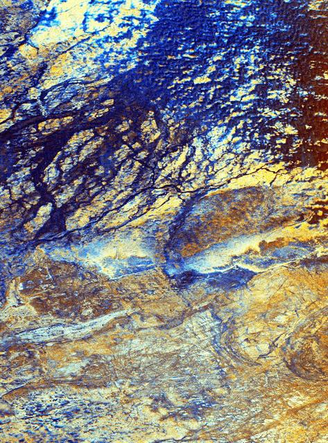
This three-frequency space radar image of south-central Egypt demonstrates the unique capability of imaging radar to penetrate thin sand cover in arid regions to reveal hidden details below the surface.
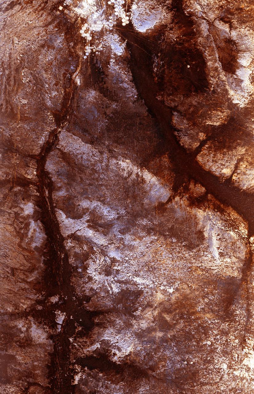
The ability of a sophisticated radar instrument to image large regions of the world from space, using different frequencies that can penetrate dry sand cover, produced the discovery in this image: a previously unknown branch of an ancient river, buried under thousands of years of windblown sand in a region of the Sahara Desert in North Africa. This area is near the Kufra Oasis in southeast Libya, centered at 23.3 degrees north latitude, 22.9 degrees east longitude. The image was acquired by the Spaceborne Imaging Radar-C/X-band Synthetic Aperture (SIR-C/X-SAR) imaging radar when it flew aboard the space shuttle Endeavour on its 60th orbit on October 4, 1994. This SIR-C image reveals a system of old, now inactive stream valleys, called "paleodrainage systems, http://photojournal.jpl.nasa.gov/catalog/PIA01310
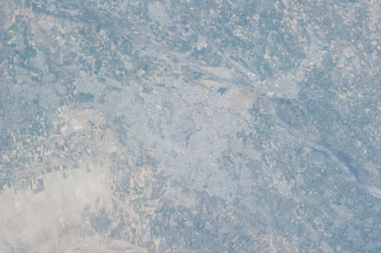
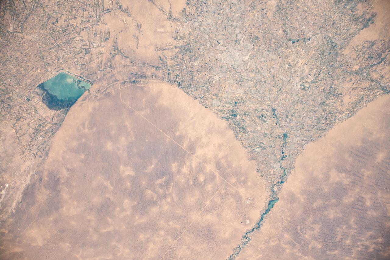
ISS037-E-000719 (13 Sept. 2013) --- Samarkand, Uzbekistan is featured in this image photographed by one of the Expedition 37 crew members aboard the International Space Station. The historical Silk Road provided trade routes between Asia and Europe as far back as 208 BC according to historical accounts. And, parts of the Silk Road are still used for the transport of goods today. The city of Samarkand is one of the oldest and historically most important cities along the road, occupying a central position between China and the western nationas of Europe, Today, Samarkand is the second largest city in the Republic of Uzbekistan (formed in 1991). The urban area (center) is located within a large oasis situated in the Zerafshan River Valley of southeastern Uzbekistan.
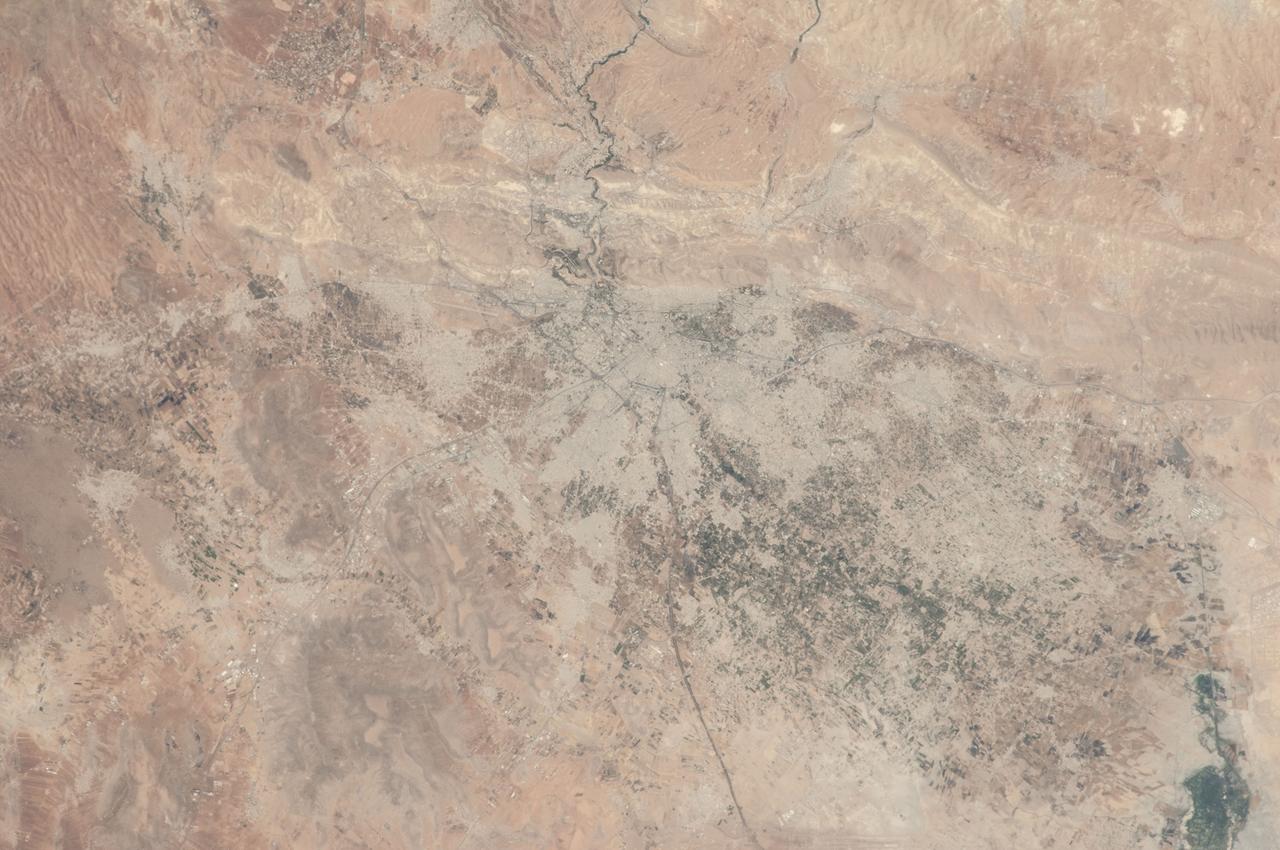
ISS036-E-012047 (26 June 2013) --- Damascus, Syria is featured in this image photographed by an Expedition 36 crew member on the International Space Station. The capital city of the Syrian Arab Republic, Damascus, and its surrounding metropolitan area is highlighted in this photograph from the space station. Damascus is one of the oldest cities in the Middle East, with evidence of human habitation extending back to 8,000-10,000 BC. During medieval times, the city was well known as a craft and trade center specializing in the production of swords and lace; ?Damascus steel? became a watchword for high-quality blades through the 19th century due to its superior properties and characteristic visual appearance. Urban areas are readily recognizable as gray-white regions contrasting with surrounding brown to tan semi-arid landscape. The Barada River runs through Damascus, and is visible entering the metropolitan area at top center. The Ghouta oasis, fed by the Barada River, once encircled Damascus but urban expansion has converted much of the oasis from agricultural to other land uses. A large region of agriculture extends to the southeast of Damascus, visible as extensive green fields at lower right. Today, the city is the center of a metropolitan area with a population of over 2.6 million (based on 2004 information from the Syria Central Bureau of Statistics). Current industries include textiles, food processing, and chemicals, with traditional artisan handcrafts still produced in the old core of Damascus. Most recently, the city has experienced unrest, military conflict, and loss of life stemming from the ongoing Syrian Civil War.

ISS040-S-001 (April 2013) --- The Expedition 40 patch depicts the past, present, and future of human space exploration. The crew wrote the description that follows: The reliable and proven Soyuz, our ride to the International Space Station (ISS), is a part of the past, present, and future. The ISS is the culmination of an enormous effort by many countries partnering to produce a first-class orbiting laboratory, and its image represents the current state of space exploration. The ISS is immensely significant to us as our home away from home and our oasis in the sky. The commercial cargo vehicle is also part of the current human space exploration and is a link to the future. A blend of legacy and future technologies is being used to create the next spacecrafts which will carry humans from our planet to destinations beyond. The sun on Earth?s horizon represents the new achievements and technologies that will come about due to our continued effort in space exploration. The NASA insignia design for shuttle and space station flights is reserved for use by the astronauts and for other official use as the NASA Administrator may authorize. Public availability has been approved only in the form of illustrations by the various news media. When and if there is any change in this policy, which is not anticipated, it will be publicly announced. Photo credit: NASA
![This radar image is of an area thought to contain the ruins of the ancient settlement of Niya. It is located in the southwestern corner of the Taklamakan Desert in China Sinjiang Province. This oasis was part of the famous Silk Road, an ancient trade route from one of China's earliest capitols, Xian, to the West. The image shows a white linear feature trending diagonally from the upper left to the lower right. Scientists believe this newly [sic] discovered feature is a man-made canal which presumably diverted river waters toward the settlement of Niya for irrigation purposes. The image was acquired by the Spaceborne Imaging Radar-C and X-band Synthetic Aperture Radar (SIR-C/X-SAR) aboard the space shuttle Endeavour on its 106th orbit on April 16, 1994, and is centered at 37.78 degrees north latitude and 82.41 degrees east longitude. The false-color radar image was created by displaying the C-band (horizontally transmitted and received) return in red, the L-band (horizontally transmitted and received) return in green, and the L-band (horizontally transmitted and vertically received) return in blue. Areas in mottled white and purple are low-lying floodplains of the Niya River. Dark green and black areas between river courses are higher ridges or dunes confining the water flow. http://photojournal.jpl.nasa.gov/catalog/PIA01725](https://images-assets.nasa.gov/image/PIA01725/PIA01725~thumb.jpg)
This radar image is of an area thought to contain the ruins of the ancient settlement of Niya. It is located in the southwestern corner of the Taklamakan Desert in China Sinjiang Province. This oasis was part of the famous Silk Road, an ancient trade route from one of China's earliest capitols, Xian, to the West. The image shows a white linear feature trending diagonally from the upper left to the lower right. Scientists believe this newly [sic] discovered feature is a man-made canal which presumably diverted river waters toward the settlement of Niya for irrigation purposes. The image was acquired by the Spaceborne Imaging Radar-C and X-band Synthetic Aperture Radar (SIR-C/X-SAR) aboard the space shuttle Endeavour on its 106th orbit on April 16, 1994, and is centered at 37.78 degrees north latitude and 82.41 degrees east longitude. The false-color radar image was created by displaying the C-band (horizontally transmitted and received) return in red, the L-band (horizontally transmitted and received) return in green, and the L-band (horizontally transmitted and vertically received) return in blue. Areas in mottled white and purple are low-lying floodplains of the Niya River. Dark green and black areas between river courses are higher ridges or dunes confining the water flow. http://photojournal.jpl.nasa.gov/catalog/PIA01725
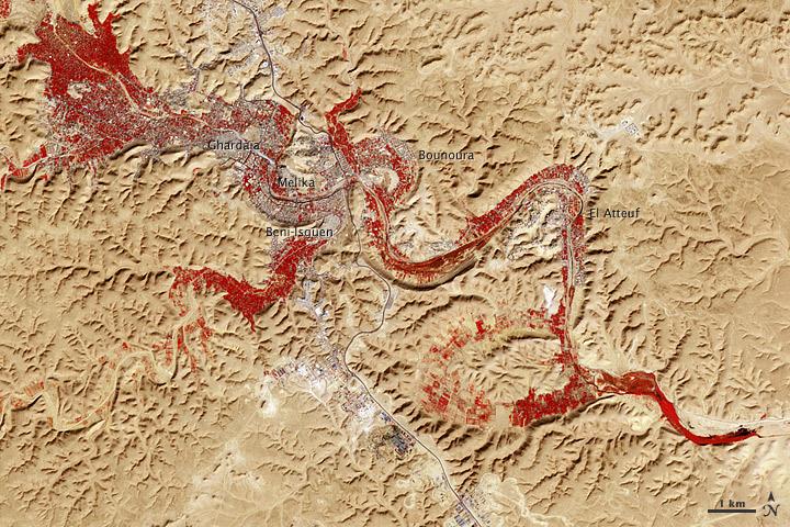
NASA image acquired Feb. 9, 2011 Less than 5 percent of Algeria’s land surface is suitable for growing crops, and most precipitation falls on the Atlas Mountains along the coast. Inland, dust-laden winds blow over rocky plains and sand seas. However, in north central Algeria—off the tip of Grand Erg Occidental and about 450 kilometers (280 miles) south of Algiers—lies a serpentine stretch of vegetation. It is the M’zab Valley, filled with palm groves and dotted with centuries-old settlements. The Advanced Spaceborne Thermal Emission and Reflection Radiometer (ASTER) on NASA’s Terra satellite captured this image of M’zab Valley on February 9, 2011. ASTER combines infrared, red, and green wavelengths of light. Bare rock ranges in color from beige to peach. Buildings and paved surfaces appear gray. Vegetation is red, and brighter shades of red indicate more robust vegetation. This oasis results from water that is otherwise in short supply in the Sahara Desert, thanks to the valley’s approximately 3,000 wells. Chemical analysis of Algerian aquifers, as well studies of topography in Algeria and Tunisia, suggest this region experienced a cooler climate in the late Pleistocene, and potentially heavy monsoon rains earlier in the Holocene. The M’zab region shows evidence of meandering rivers and pinnate drainage patterns. The vegetation lining M’zab Valley highlights this old river valley’s contours. Cool summer temperatures and monsoon rains had long since retreated from the region by eleventh century, but this valley nevertheless supported the establishment of multiple fortified settlements, or ksours. Between 1012 A.D. and 1350 A.D., locals established the ksours of El-Atteuf, Bounoura, Melika, Ghardaïa, and Beni-Isguen. Collectively these cities are now a United Nations Educational, Scientific, and Cultural Organization (UNESCO) World Heritage site. NASA Earth Observatory image by Robert Simmon and Jesse Allen, using data from the GSFC/METI/ERSDAC/JAROS, and U.S./Japan ASTER Science Team. Caption by Michon Scott. Instrument: Terra - ASTER <b>To download the full high res file go <a href="http://earthobservatory.nasa.gov/IOTD/view.php?id=51296" rel="nofollow"> here</a></b>