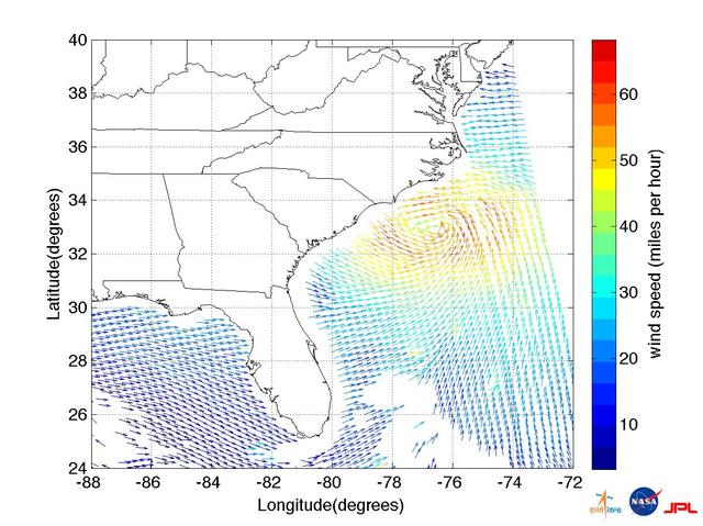
This ISRO-NASA-JPL-Caltech collaborative image shows ocean wind vector data from ISRO OceanSat 2 spacecraft of Hurricane Irene which made landfall early Saturday morning, Aug. 27, just west of Cape Lookout, NC.
Satellite images obtained from NASA Atmospheric Infrared Sounder AIRS instrument aboard NASA Aqua spacecraft provide a glimpse into one of the most powerful storms ever recorded on Earth, Typhoon Haiyan.
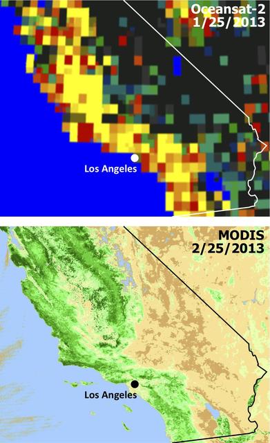
Extensive and persistent rains between Jan. 24 and Jan. 27, 2013, significantly increased soil moisture and enhanced vegetation growth in Southern California based on data from NASA Aqua spacecraft and ISRO Oceansat-2 satellite.